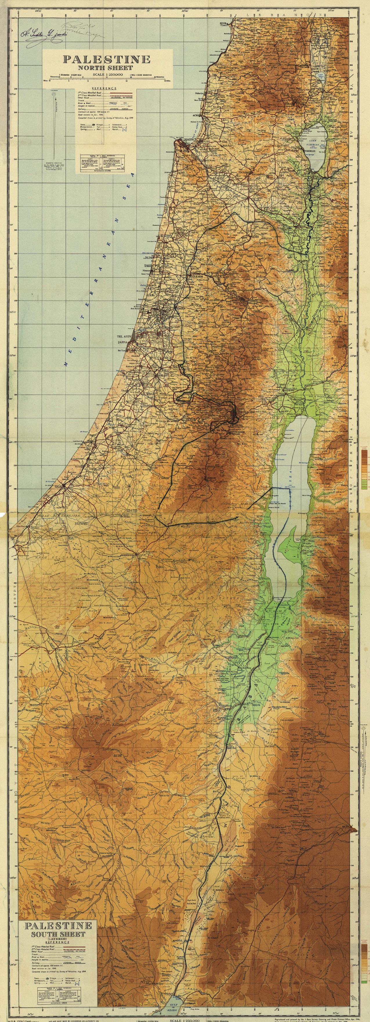
IN BETWEEN GREEN
PAST, PRESENT AND FUTURE OF JERUSALEMS NO-MAN’S LAND
Sharon Sportel Graduation Project Amsterdam Academy for Architecture October 25,
2022
0 200 400 1000
2
In Between Green
The past, present and future of Jerusalem’s No-Man’s Land
Graduation project Sharon Sportel
Amsterdam University of the Arts
Academy of Architecture
MSc in Architecture
25-10-2022
Committee
Bart Bulter(mentor)
Marc Schoonderbeek
Micha de Haas
Added members:
Wouter Kroeze
Daria Naugolnova
3
4
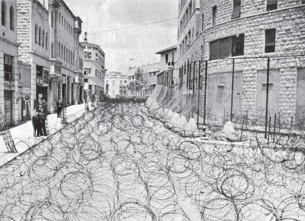
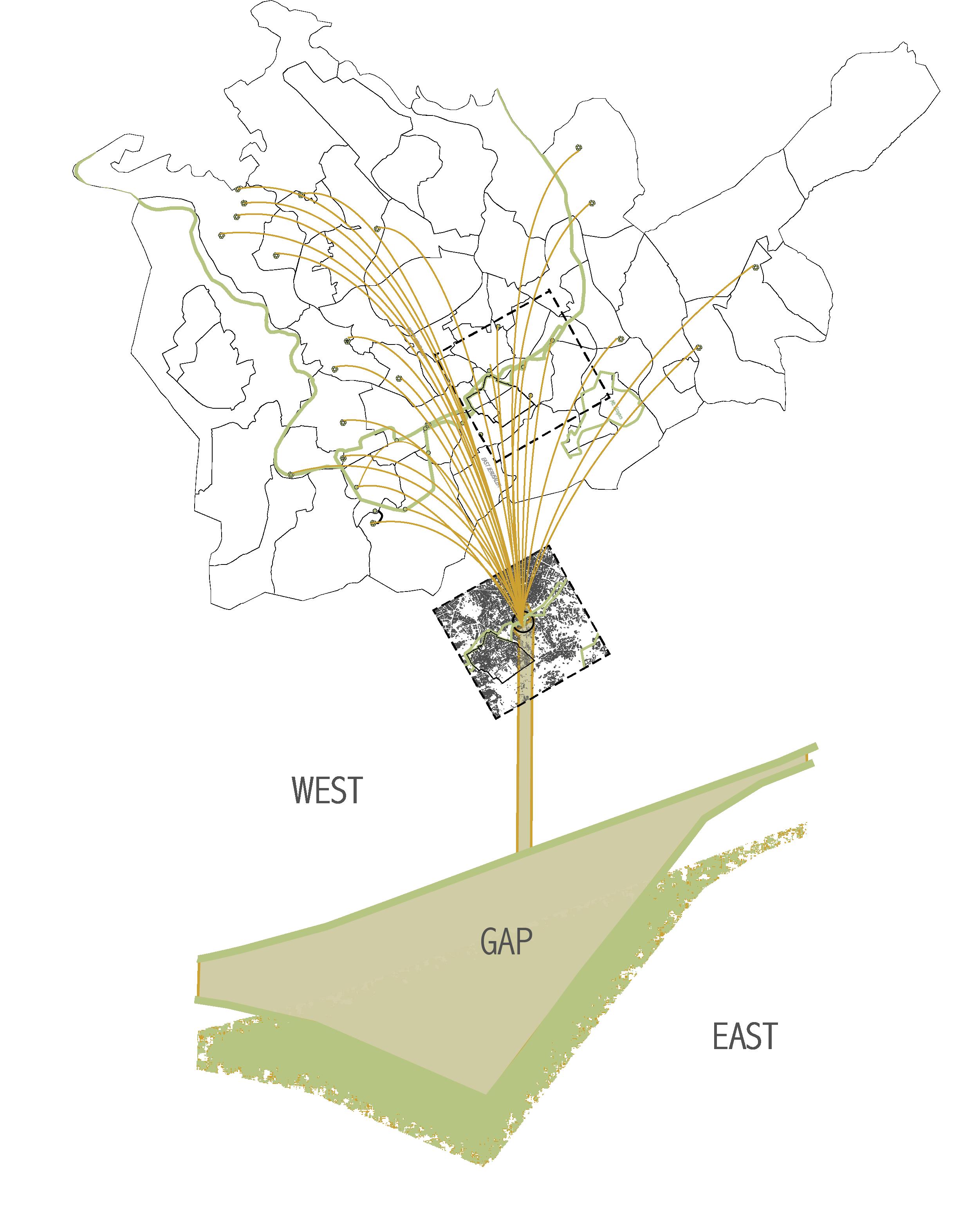
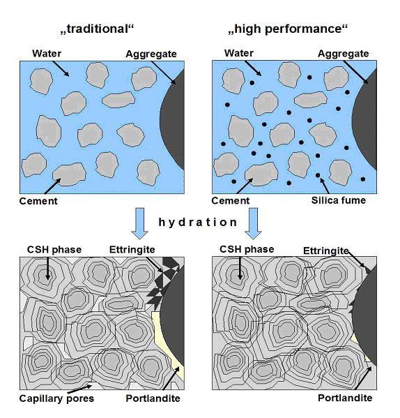
Before 1948, Jerusalem was a shared city between different cultures and religions, controlled and regulated by Great Britain. When the State of Israel was founded in 1948, land was conquered east of the British territory, and between Jordan property and Israeli property of Jerusalem arrised a barrier which was meant to be a buffer zone, when the contracts were signed between Israel and Jordan. This buffer zone quickly turned into a non-owned zone and therefore a complete opposite land as a gap: a broad barrier in the form of emptiness was set and a Westand East-Jerusalem were born. Families were torn and Arabs and Jews fled to ‘the other side’ along with their own communities. This barrier was a militarised area till 1967 (Six Day War) and was known as the No-Man’s Land of Jerusalem. After 1967, when Israel also conquered East-Jerusalem, the United Nations would not recognise the land as property of Israel, so till this day it is called Israel defacto. This No Man’s land with the Green Line around it still has its scars visible in the urban context as well as in municipal regulations for maintenance of streets, sanitation, landscape and other visible city elements which create a healthy and sustainable living environment. Although it is not always a bad place, the difference between East and West Jerusalem is remarkably obvious on a very small scale: where the former Green Line divides a neighborhood, it is already visible in the paving, the waste disposal objects in the street and the vegetation. Also is the west side of the gap higher +sea level than the east side of the gap and is the east side not even figuratively but also literally the drain of the centre of Jerusalem.
How can the former gap as No Man’s Land become a land which provides an equal quality of healthy environments east and wes along the green line, reduce pollution and waste and turn it into a beneficial site
eventually for the whole city?
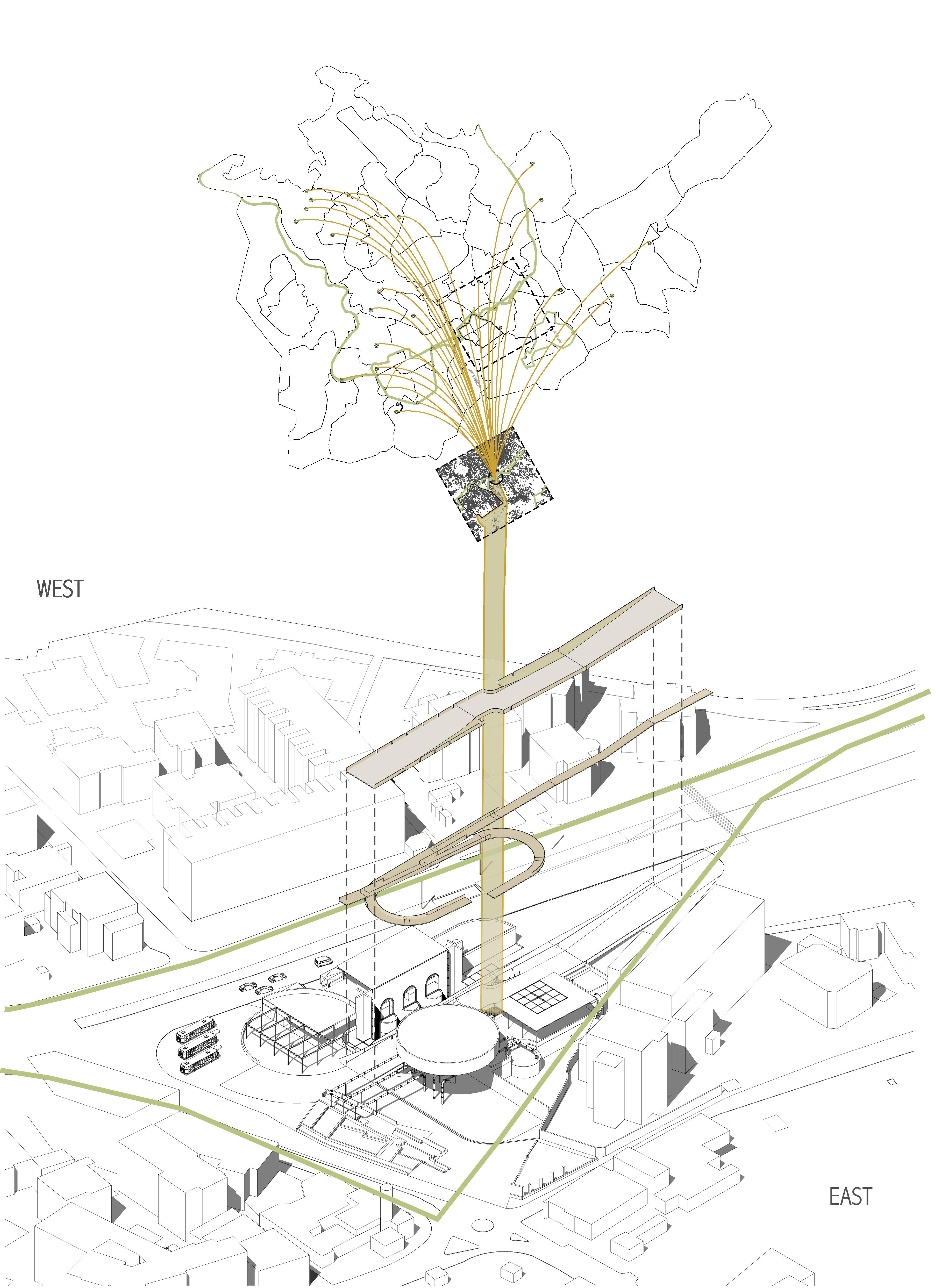
I’m designing a recycling factory which is driven by society and controlled / managed by the munipality of Jerusalem, bringing an equal living environment to east and west Jerusalem.
With the intervention within the old gap of No Man’s Land the gap is filled with a plastic recycling factory which is operated by the municipality (govt) and driven by society. The difference of the land in 1967 is that there is a re shared ownership, the buffer zone is created as the buffer zone and turned from a hole into a gradient from east to west and west to east. The drain is placed within the gap to collect all the water during floods in the winter months which is used by the recycling plant to wash the waste and purify the water afterwards. The purified water is stored for draughts underneath the plant and flows through the whole site to continuously benefit the streams of the plastic waste and the streams of people who use the site continuously for public transport and trespassing from west to east and vice versa.
5
Assignment
6
Topic
To this day, the differences of Arabic and Jewish culture in Jerusalem are very present in the city. Not only the urban tissue is shaped by the history of Israels politics, but also the division on the maps with municipal rules and therefore clear differences in landscape and urban conditions on a small scale.
The current areas as described in the Statistical Yearbooks of Jerusalem have Jewish or Arabic names, coming from the families who excavated the land to become the areas they are now. The way they are devided along the Green Line on the maps is not surprising: Often through the middle of the former No-Man’s Land: every side a piece of it. Nonetheless, once the No-Man’s Land was a gap. Now the gap between the areas is still visible in the context as a residue of those 17 years of external ownership, other than Israel or Jordan.
‘Jerusalem is a mixed city in which population groups with different religious, national, and cultural characteristics reside side-by-side. An examination of Jerusalem as a mixed city requires understanding and addressing the unique needs of its various sectors, with special attention to the points of intersection between these population groups. The city contains physical spaces that function as boundaries between the different communities.
These areas are characterized by neglect and an atmosphere of insecurity, which prevent their optimal use.‘ 2
7
Brief situation
of Jerusalem past and present
Conflicts over Jerusalem go back thousands of years - including biblical times, the Roman Empire and the Crusaders - but the current one is a distinctly 20th-century story, with roots in colonialism, nationalism and anti-Semitism.2 Most Zionist who were intended to create a entirely Jewish state were not driven by religious goals but by concerns of nationalism and a united Israel, while the local Arab population adjusted to the reality of the collapse of the Ottoman Empire, which had ruled the city since 1517.
During the British Empire (1920-1948), the aim was not merely Jerusalem, but most of all Tel Aviv: This was the Western City of Israel, where Jordanian controll was less present than in Jerusalem. But dealing with Tel Aviv, ment dealing with the backbater of interest that was called the Holy City.
‘In the life of individuals and in lives of nations emerge the worst conflicts between two prosecuted people. Only in imaginations the prosecuted solidary unite to battle against their cruel suppressors. In reality two children of the same father not automatically become allies. They often see the threatening face of their father in their brother. Europe abused the Arabs, humiliated them with colonialism and the same Europe prosecuted the Jews. But the Arabs see us as a new arrogant part of European colonialism and extortion. And we see the Arabs not as allies in hard times, but rather like anti-Semites. Disguised nazis.’
Young Arieh in Jerusalem,1948, A Tale of Love and Darkness, 2014
8
LEBANON SYRIA JORDAN EGYPT WEST BANK GAZA LEBANON SYRIA JORDAN EGYPT WEST BANK GAZA LEBANON SYRIA JORDAN EGYPT WEST BANK GAZA GOLAN ( ) Isr ael Land Palestine Land T he Ar mistice Gr een Line 1947 UN Par tition Plan Sou rce: UN Car togr aph c Section VECTORWORKS EDUCATIONAL VERSION
> 1967: Annexation of Jer usalem 1949 - 1967 Ar mistice Agr eements
The Old City in Jerusalem Four quarters
9 P h H 9 12 16 16 13 8 M KK MH A H 5H 21 22 K Aqb A o 0 500 1 00 2000 By exam n ng the conc us ons o he e d esearch the ma n source used to d scover para e ns ghts was he stat s c n o mat on rom The e usa em ns u e or Po cy Research Numbers a e used rom he year 2020 Popu a on schemes are d v ded n percen ages o A abs and ews & others 8 Musrara C ty Center Nach ao Zichrono Mekor Baruch Z chron Moshe Geu a Me a She ar m Mus m Q Chr st an Q Jew sh Q Armen an Q Konom yut (Ta biya), YMCA Compound German Co ony Gonen (O d Katamon) Abu Tor S wan Ras A -'Amud At-Tur Moun o O ves Rehavya 5 Bab Az-Zahara Yem n Moshe
Rehavya
Konomiyut (T YMCA Comp German Colony, Katamo
10 Yeve Na akov P sgat Ne ev No h P gat Ne ev Eas 1 Ramo A on Nor h Ramo A on Sou h Rama Sh omo 4 Har Hot v m Sanhedr a T A Rama Eshko G v a Ham v a Ma a o Da na Shmue Hana G Sh Har No Romema 9 10 12 16 16 11 13 8 Mus ara C y Cen er Na h aot Z hrono Meko Ba uch Z ch on Mo he Geu a Me a She a m Mus m Q Ch s a Q h Q Armen an Q Be Han na Shu afa Shu a a re ugee camp New Ana a saw y a Konom yu (Ta b a) YMCA Compound German Co ony Gonen (O d Ka amon) Ge u m (Baq a) G v a Hananya (Abu Tor Yem n Moshe Abu Tor S wan Ras A - Amud At-Tu Mount o O ves G at Ram K ya Mo he Be t Hake em B y V g Ramat Sha e Rama Denya Bet Za ada Homa Shmue G E t G o Wes ) Gonen K AG a Ha ad Ra sco) G v a Morde hay E n Ke em K r at Hadassah K y H y th K ya Hayove nor h K ya Menahem r Gan m Su Bahe U T bb b M k b Ta p o Amona Meko Ha m Eas Ta p o A H ) Reha ya 5 Wad A - o Bab A -Zaha a G a Shap a (F ench H ) Ta p o M ah Greek Colony 21 22 Kafr Aqb Atarot O d City 0 500 1000 2000 Arab Areas Municipa boundar es uni aterally extended by Israel between 1967-1993 Current statistic areas of Jerusalem By exam ining the conclusions of the fie d research, the m ain source used to d scover paralel ins ghts was the statitistic inform ation from The Jerusalem insitute for Po icy Research Num bers are used from the year 2020 Populat on schem es are d vided in percentages of 'Arabs' and 'Jews & others' Jews & others Areas 4 City
11
Analysis of locations
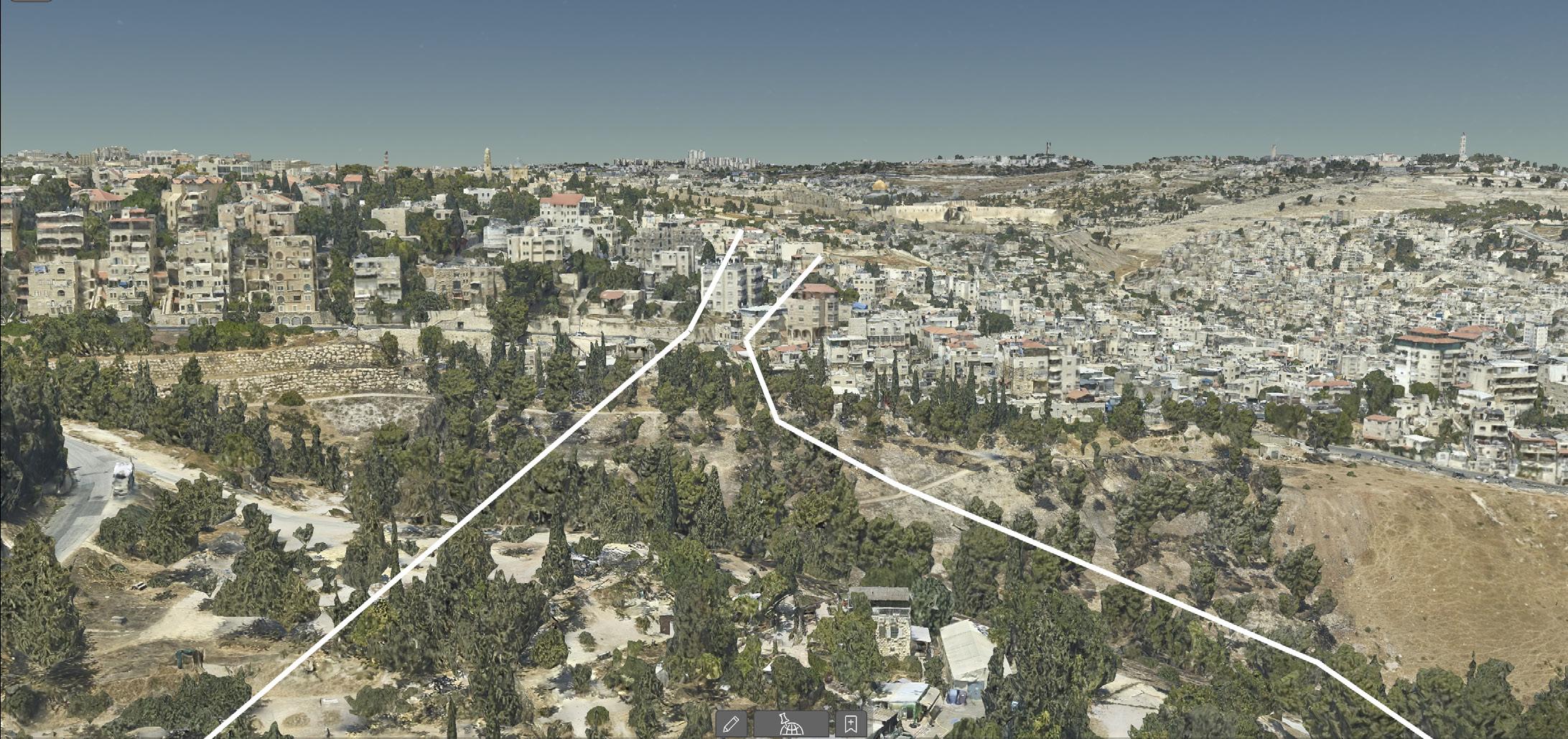
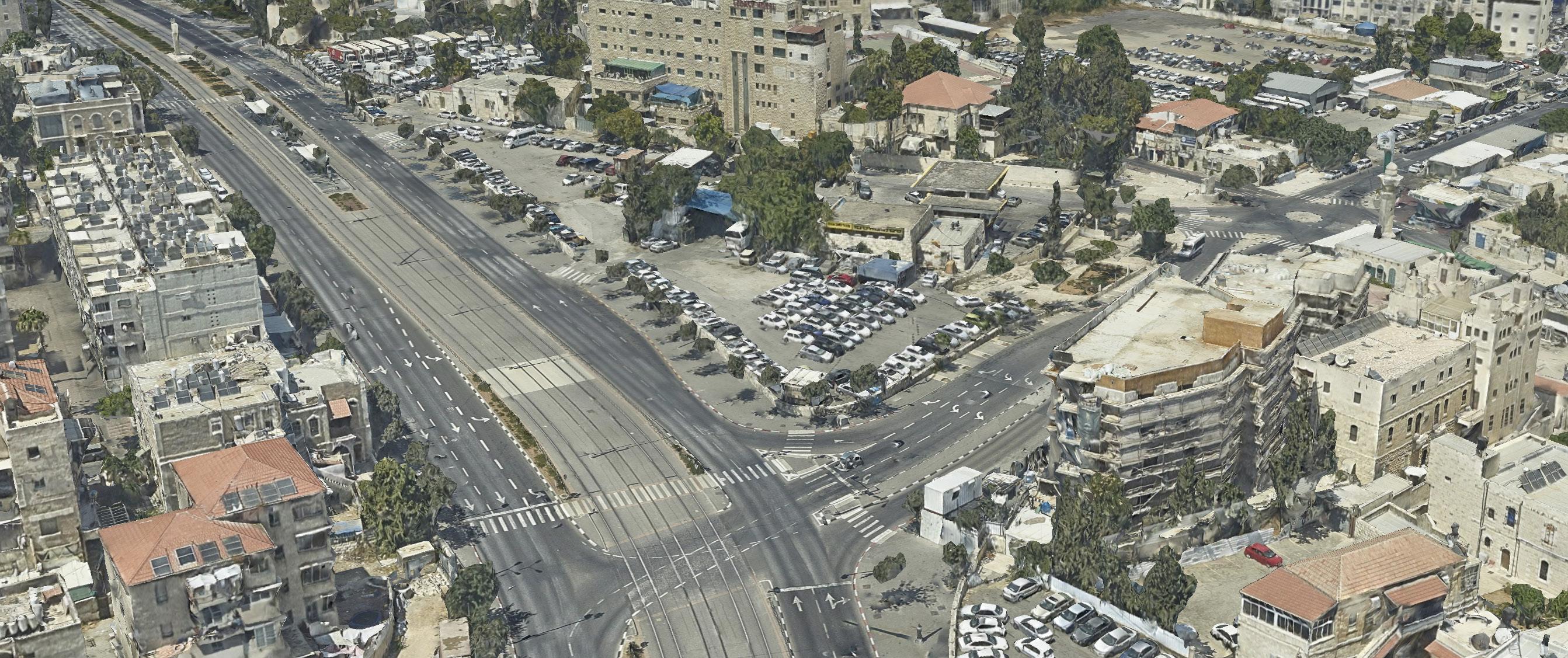
Five locations along the Green Line and the inbetween No-Man’s Land
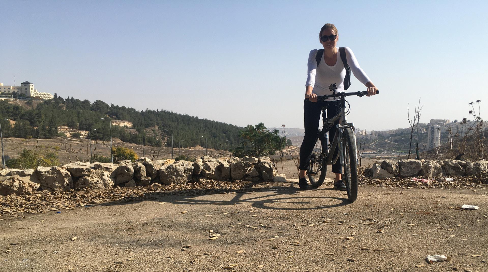
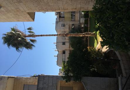
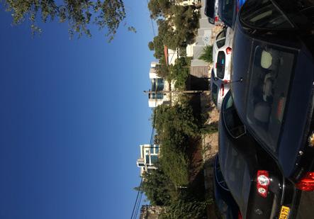
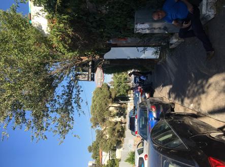
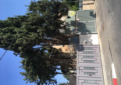
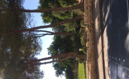
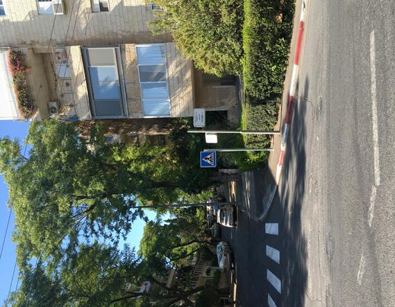
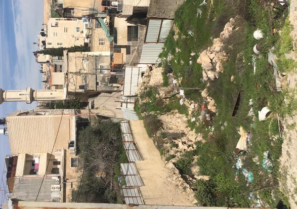
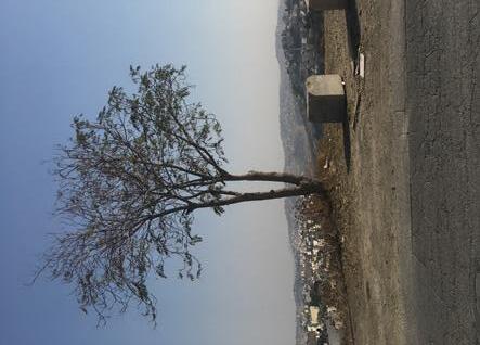
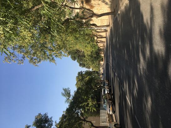
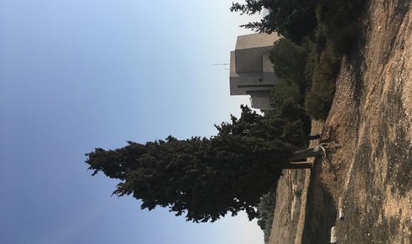
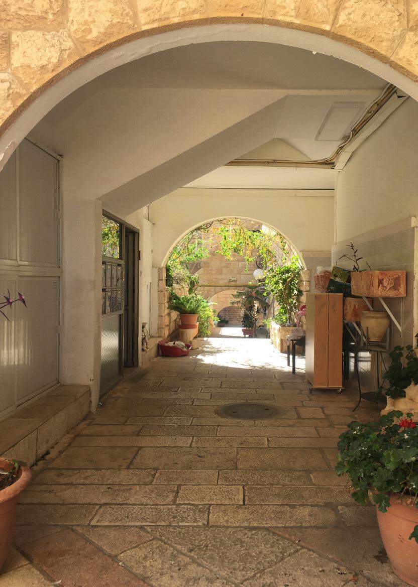
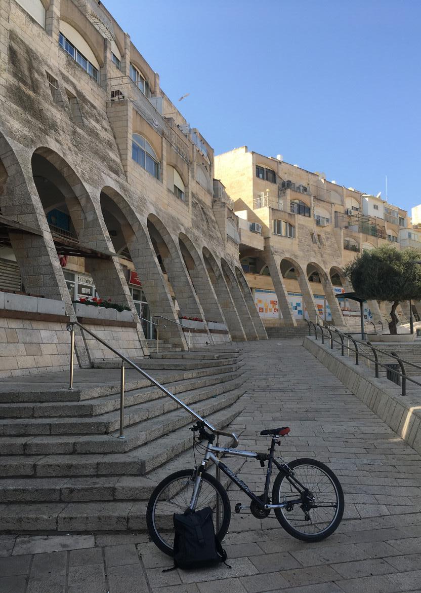
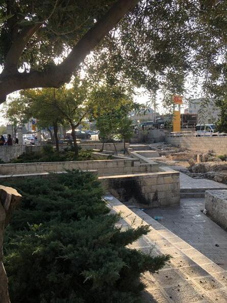
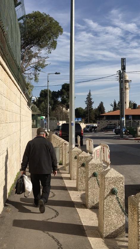
During stays of each one week I walked in several places in Jerusalem where the resources claimed that an Un-united Jerusalem was the most visible. My questions were mostly about the clearity of the ‘border zones’ and why this was the case. The main differences were found at the edges of Jewish and Arab areas and the statististics of the Jerusalem Institute for Policy Research emphasized my feelings about these edges. I would like to refer to gaps instead of borders, because the borders are never one single line: there is always a space inbetween which is used by both communities or even not used at all. The history of the gap is important to form a conclusion of the place when I experience this in field research. I walked an biked 320 km over the hills of Jerusalem and mainly to spot the differences. However, I also visited neighborhoods like Gilo, Kiryat Menahem, Pisgat Ze’Ev and Ramot Polin to experience an anonimous way of living in Jerusalem as individuals and living as a community.
12 0 500 1000 2000
Mt Scopus
FIELD RESEARCH
13
Field research
Five locations along the Green Line and the inbetween No-Man’s Land
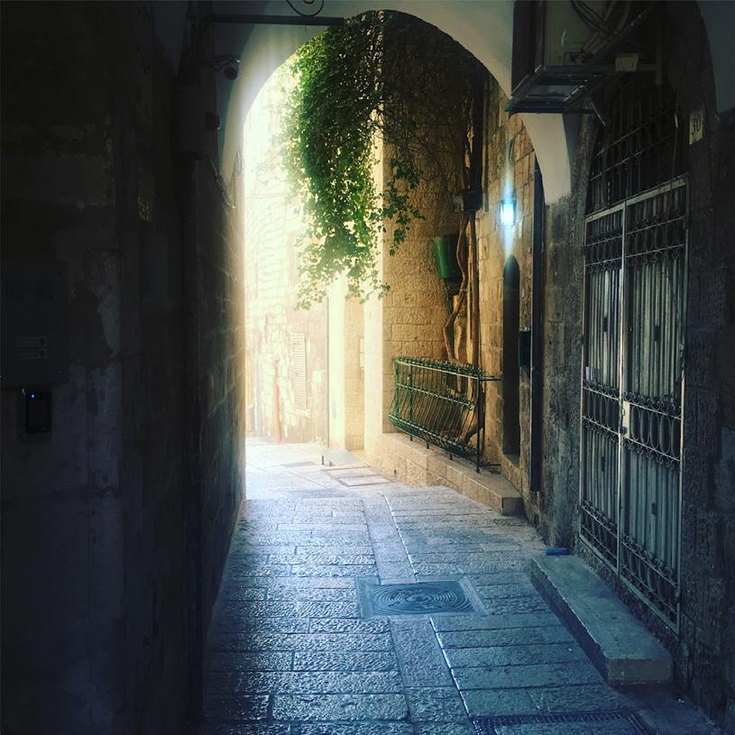
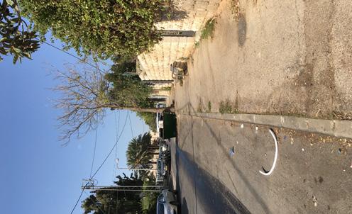
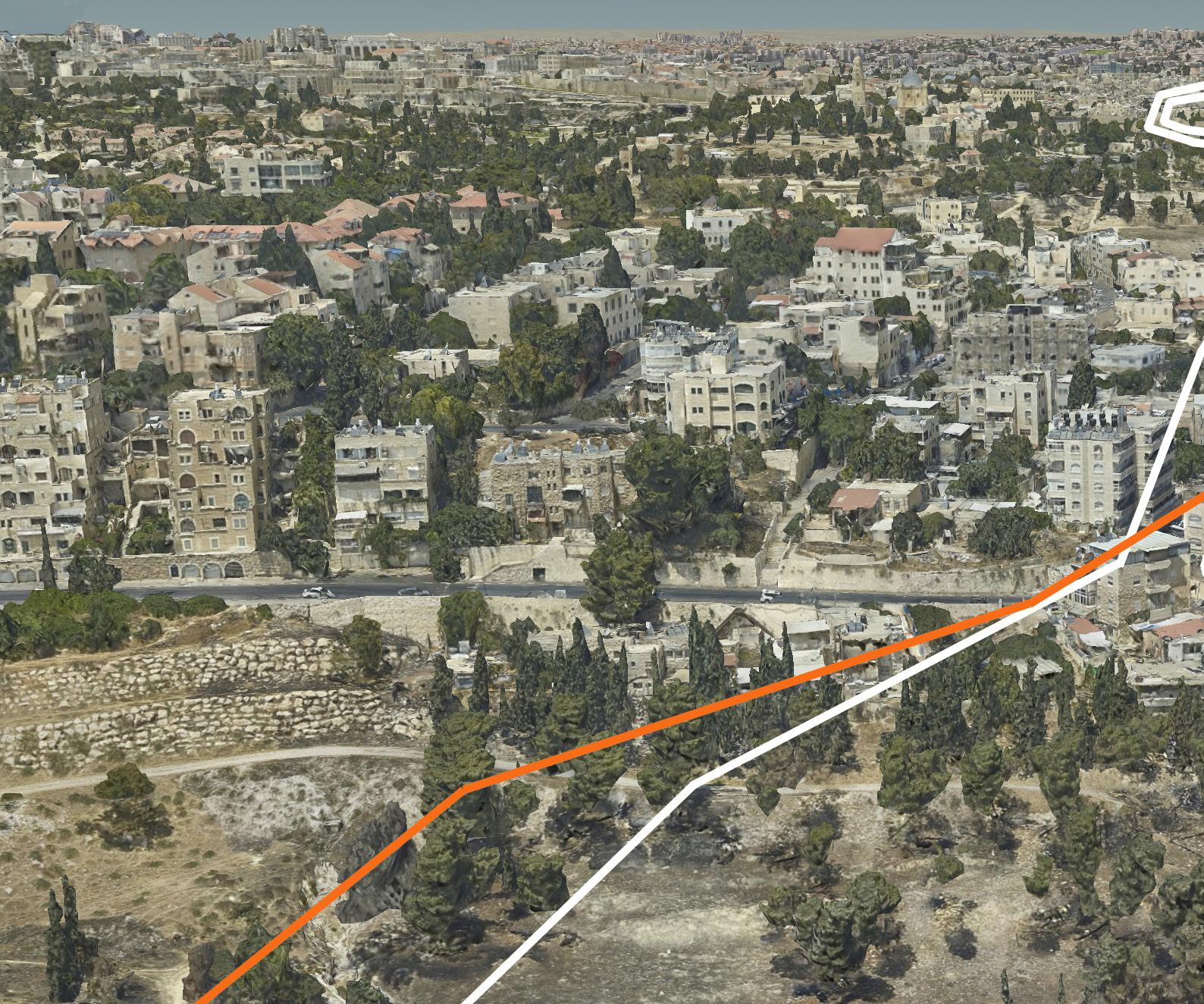
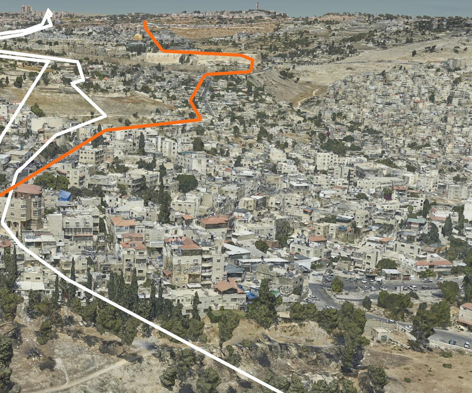
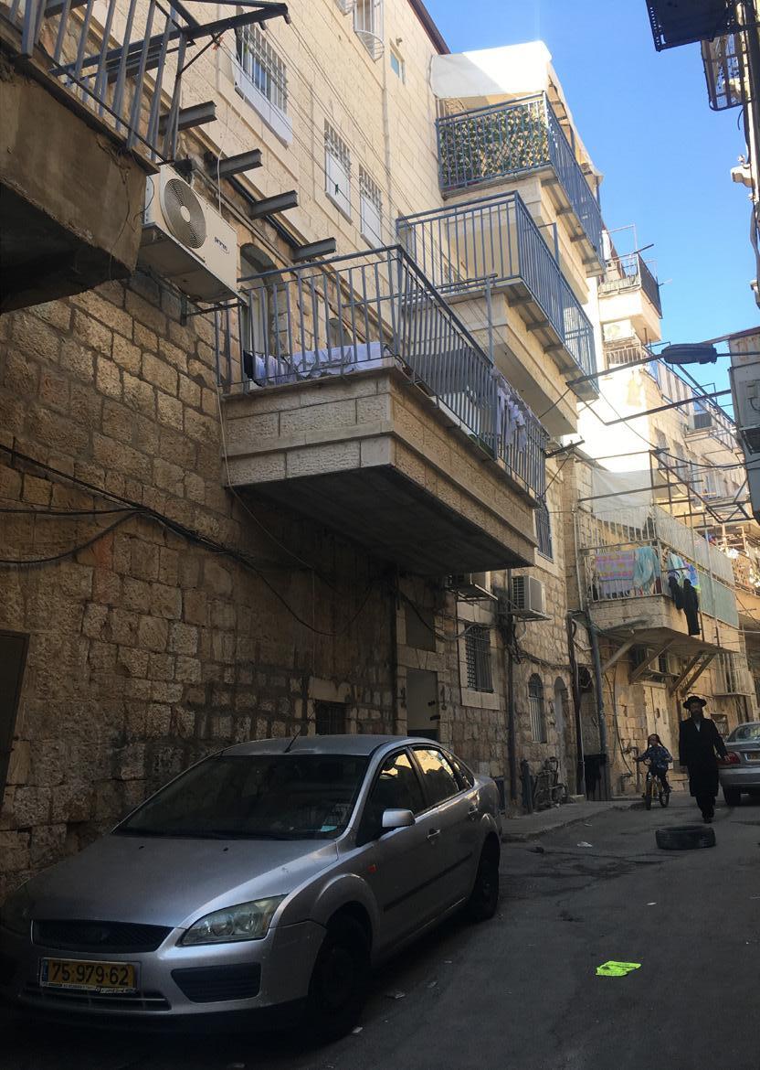
During the field research trips I documented a few biking an walking trails with pictures, hights, speed and environmental conditions as wind and temperature. The main goal was trying to define the biggest differences and the closest visible between cultures, landscape, views, urban conditions, infrastructure and landscape conditions. The biggest differences documented in picture and film are exactly on the border of the Armistice Green Line from 1948 - 1967, on which the UN states nobody owns anything from this land. Because of the whole it bares between East and West Jerusalem areas, I interpreted this land as a gap.
14
15
500 m 50 m 700 m 50 m 500 m 50 m 300 m 50 m Gr een line No Man's-Land Old City 0 200 400 1000 Routes / r esearch tr acks T he amount of differ ences is gr eater at the border of the Ar mistice Gr een Line and the East of Jer usalem: Differ ences in tr ash amount , vegetation conditions , facade conditions and population in the str eets Most tense border lines r elated to the No Man's Land
Mt. Scopus
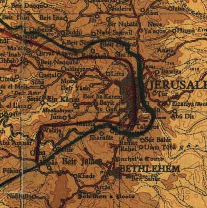
RESEARCH ANALYSIS MA’ALOT DAFNA - SJEIKH JARRAH
Field research
Five locations along the Green Line and the inbetween No-Man’s Land
16
772 m 607 m 630 m 842 m 1077 m 16.58 17.15 17.19 17.05 17.21 17.25 10.35 10.24 10.01 Lightrail tr ack from south to nor th (1052 m distance) Tr ack length in total: 3928 m Ma'Alot Dafna Bab Al Zahar a August 11, '19 November 13, '19 15.40 15.50 17.00 17.10 16.45 10.24 10.35 760 m 770 m 780 m 796,7 m 749 m 1 2 3 4 5 6 7 8 9

17 MA’ALOT DAFNA (J)SHEIKH JARRAH (A)BAB AZ-ZAHARA (A) W aste amount W aste man ag ament 1 2 3 4 5 6 7 8 9 G r een conditions T r ees / plants 1 2 3 4 5 6 7 8 9 P a r ked ca r s T r a f fic 1 2 3 4 5 6 7 8 9 Ma'alot Dafna Sjeikh Ja r r ah B a b Al Zaha r aDamascus Gate
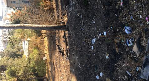
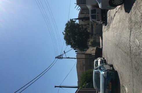
RESEARCH ANALYSIS ABU TOR
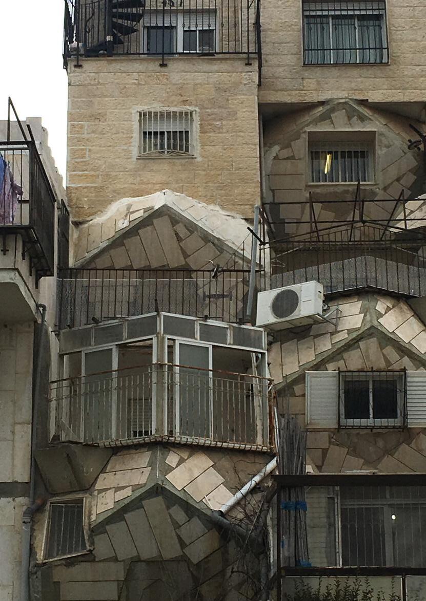
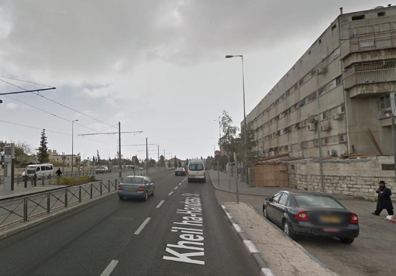
Abu Tor is one one the areas where different communities live together. However: When passing the old Armistice Green Line, the landscape, streets and welfare are literally and figuratively are going down. Jerusalem services do not provide anymore and this is visible in the urban fabric. In mapping the differences of conditions of elements, the maintainance of cars, facades, fences, street and waste is lacking in a very short distance from the eastern border of the Green Line. However this distance is only 20m, the landscape makes the distance grow exponentially by the steep valley when entering the Muslim area.
18 15.40 15.50 16.00 16.10 16.20 695,3m 750m 700m 725m 15.40 15.50 16.08 16.00 Tr ack length in total: 2550m 990 m 872 m 688 m 2 3 1 4 5 6 7 8 9
19 W aste amount W aste man ag ament 1 2 3 5 8 G r een conditions T r ees / plants 1 2 3 4 5 6 7 P a r ked ca r s T r a f fic 1 2 3 4 5 6 7 8 9 ABU TOR (J & A) W aste amount W aste man ag ament 1 2 3 4 5 6 7 8 9 1 2 3 4 5 6 7 8 9 Ma'alot Dafna Sjeikh Ja r r ah B a b Al Zaha r a Damascus Gate
20 5 4 3 2 1 6 7 8 9 1757 m 13.35 1275 m 2075 m 540 m 13.45 13.55 14.05 14.15 14.25 14.29 13.35 13.45 14.05 13.55 760 m 770 m 780 m 784,1 m 14.15 689,1 m 700 m 710 m 720 m 730 m 740 m 750 m 14.25 14.35 690 m Tr ack length in total: 5647 m RESEARCH ANALYSIS JABBAL AL MUKABBER - TALPIOT MIZRAH 5 4 3 2 1 6 7 8 9 1757 m 13.35 1275 m 2075 m 540 m 13.45 13.55 14.05 14.15 14.25 14.29 13.35 13.45 14.05 13.55 760 m 770 m 780 m 784,1 m 14.15 689,1 m 700 m 710 m 720 m 730 m 740 m 750 m 14.25 14.35 690 m Tr ack length in total: 5647 m RESEARCH ANALYSIS JABBAL AL MUKABBER - TALPIOT MIZRAH 5 4 3 2 1 6 7 8 9 1757 m 13.35 1275 m 2075 m 540 m 13.45 13.55 14.05 14.15 14.25 14.29 13.35 13.45 14.05 13.55 760 m 770 m 780 m 784,1 m 14.15 689,1 m 700 m 710 m 720 m 730 m 740 m 750 m 14.25 14 690 m Tr ack length in total: 5647 m
MUKABBER
5 4 3 2 1 6 7 8 9 1757 m 13.35 1275 m 2075 m 540 m 13.45 13.55 14.05 14.15 14.25 14.29 13.35 13.45 14.05 13.55 760 m 770 m 780 m 784,1 m 14.15 689,1 m 700 m 710 m 720 m 730 m 740 m 750 m 14.25 14.35 690 m Tr ack length in total: 5647 m RESEARCH ANALYSIS JABBAL AL MUKABBER - TALPIOT MIZRAH
RESEARCH ANALYSIS JABBAL AL
- TALPIOT MIZRAH
21 W aste amount W aste man ag ament 1 2 3 4 5 6 7 8 9 G r een conditions T r ees / plants 1 2 3 4 5 6 7 8 9 P a r ked ca r s T r a f fic 1 2 3 4 5 6 7 8 9 Ma'alot Dafna Sjeikh Ja r r ah B a b Al Zaha r a Damascus Gate
JABAL AL MUKABER (A)TALPIOT MIZRAH (J)
The Green Line from 1949 - 1967 or since 1949
‘Despite the formal removal of the ‘green line’ boundary over twenty-eight years ago, this line remains strongly imprinted on the mental maps held by both Israelis and Palestinians. For the former, the image of the West Bank as a separate territory has left its mark despite the strong processes of political socialisation discussed above. This has been due to some of the paradoxical outcomes of Israeli government policy, which have resulted in the opposite outcome to that desired by its policy-makers. For the Palestinians, the ‘green line’ represents the realistic boundary of the maximal territorial extent of any future Palestinian autonomous or sovereign territory. It is a territory which has existed in the past and therefore has a concrete image for the future.‘1
The Green Line is established in 1949, after the Arab-Israeli war and set the State of Israel. The Green Line is not subject of discussion within the Israeli Government and is therefore not seen on the municipal maps and GIS provided by the municipality. Though this border is visibly still seen in the urban fabric by changes in the landscape (hills going down, different vegetation) and use of the public space by its inhabitants. When you look at the maps provided by Google, the 1949 Armistice Green Line is the only border you will see when looking at the map of Jerusalem. This has many causes and reasons and will explain why Jerusalem is so important to the world’s politics.
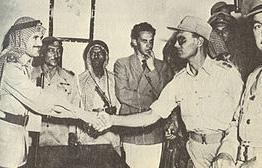
It was originally demarcated as part of the Rhodes Peace Agreements between Israel and Jordan in 1949, following the War of Independence.2 The Green Line is drawn together with the red line by the commanders of Israel, Moshe Dayan, and Jordan, Abullah El Tell. They drew the lines with pencils over a map from august 1944.
As Newman describes in his articles and briefings, they drew it with an intentional overlap: the red line of Jordan crosses the Old City of Jerusalem to the west of Jerusalem and so does the green drawn line of Israel to the eastern part of the Old City.
It means there was there was a shared ownership in this decision. However, the intention was to create a buffer zone across the Old City, the UN Partition Plan created two Green Lines, dividing the zones in three: West Jerusalem (Israel), East Jerusalem (Jordan) and No Man’s Land inbetween them. This No Man’s Land is still visible in city regulations, the streets, the population differences and the face of the urban conditions around the edges of No Man’s Land.
22
THE GREEN LINE
23
25 Mt. Scopus Mt Scopus: Neutral Enclave 5 ,64 km 2,89 km WEST JERUSALEM EAST JERUSALEM Gr een line No Man's-Land Old City 0 200 400 1000 Militarised Ar ea 1949 - 1967 Gr een Line dr awn by Moshe Dayan
Red Line dr awn by
Gr een & Red Pencil Lines dr awn in 1949 after the Ar mistice Agr eements between Isr ael and Jordan
(Isr ael)
Abdullah el-Tell (Jordan)
Militarised Zone
also known as: the No-Man’s Land of Jerusalem between 1948 - 1967
26 Mt. Scopus 5 ,64 km 2,89 km WEST JERUSALEM EAST JERUSALEM Gr een line No Man's-Land Old City 0 200 400 1000 Militarised Ar ea 1949 - 1967 Gr een Line dr awn by
Line dr
Gr een & Red Pencil Lines dr awn in 1949 after the Ar mistice Agr eements between Isr ael and Jordan
Moshe Dayan (Isr ael) Red
awn by Abdullah el-Tell (Jordan)
If Jordan and Israel agreed to the shared land between West and East Jerusalem, this means there would have been an buffer zone where both could make use of. Documents and agreements signed by Levi Eskhol, The first Prime Minister of Israel at the time, show the complete opposite of the agreement: not a shared ownership as a buffer, but a gap, an abyss on the edge of the west or east territory.
27 Gr een line No Man's-Land Old City 0 200 400 1000
Militarised Ar ea 1949 - 1967
Gr een Line dr awn by Moshe Dayan (Isr ael)
Red Line dr awn by Abdullah el-Tell (Jordan)
Gr een & Red Pencil Lines dr awn in 1949 after the Ar mistice Agr eements between Isr ael and Jordan
28
29
Influence of the British Mandate (1920-1948) and further history
30
Gr een line Old City 0 200 400 1000 Municipal Boundaries under the British Mandate (1923-1947)
the West of Jer usalem: this
not r elated to the ar ea of No Man's Land) City Line befor e 1949 Ar ab Municipality under Jordan r ule (1952 -1967) Statistic Ar ea Lines Municipal boundaries unilater ally extended by Isr ael between 1967-1993 Cor pus Separ atum Line
Mt. Scopus
Municipal boundaries from 1923 - 2020 (boundaries from 1949 - 1967 only extended in
was
History neighborhoods & statistic areas Green Line, Green Zone and No-Man’s Land
31
5 , 6 4 k m 1,85 km Ma a ot Da na Wad A - oz Ba b A Zahar a Musr ar a Mam a Ye m n Moshe S wan / S oam Ge u m (Ba q a) Ta p ot M zr ah East Ta p o (Ar mon Ha na z v) Nor h Talp ot Ramat Rache G v at Hananya (Abu Tor) Abu Tor (At- Thur ) Ar nona 1926 1931 1892 1187 1892 -1894 1890 1890 1890 7 h - 9th C BC 1972 1890 1187 1187 1977 1973 Abu Tor 1931 aba A Mukabber 1928 Sheikh ar r ah 1865 Are a Th rd Wa 66 BC Ba b A Zahar a 1890 Me a She ar m 1870 (for mer Jer usa em sw amp) Green line No Man 's-Lan d Old City 0 20 0 40 0 10 00 Ages S tatis tic Ar eas (D ar k > Old / Light > You ng) T he areas with the most differ en ces in society and (urban ) lans ca pe appear to be th e oldest containin g a lar ge h stor y Ar ea ages
Sanitation districts
T he sanitation districts ar e r egulated by the M unicipality of Jer u salem.
T he S an itation Divis ion is r es pon sible for : gar ba ge r em ov al and c leaning in the bu ilt- up ar eas, pur c hase, m aintenance and oper ation of the mu nicipal vehic le system and oper ation of the waste r ecyclin g system It also m an ages the c lear an ce days for pic kup of old fur nitur e / garba ge.
Als o impr ovement of the city (par ks, gr een etc) in handled by this depar tment an d ther efor th is devision ma p applies.
32 San itation D is tricts Green line 0 20 0 40 0 10 00
Old City
Mt. Scopus
T he Ministr y of Interior controlls the way which cultur es inhabit the projected land and which institutions ar e alowed to settle Mostly ther e's only space provided within these boundaries for Jews making aliyah , but in the map it shows that many spaces nor th from the historic city ar e still inhabited by Ar abs and maybe ther efor extr a control boundaries ar e set after 1967 But I never got an answer to this and still it is hard to not notice
(Municipal) Boundaries ar e not always cer tain in Jer usalem
(from the maps of the Municipality, feb 2020)
33
Gr een line No Man's-Land Old City 0 200 400 1000
T he Ministr y of Interior boundaries
Boundaries of the Ministr y of Interior
Infrastructure
Lightrail and roads
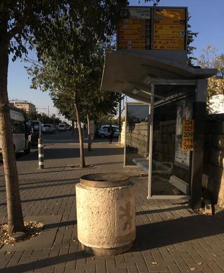
The Light Rail in the city center is one of the connectors between the west and east part of Jerusalem. This map shows the amount of bus lines going north, south and west and almost none going east. The public transport in Jerusalem is spatial politics at the surface. While the Light Rail brings different ethnic groups together in the center of Jerusalem, the bus lines separate because the destinations of the bus lines are 90% west and south Jerusalem.
Also every busticket is 5,90 NIS, but when you enter Area C, you must buy a new ticket of 5,90. Those are the least wealthy areas in (east) Jerusalem, and it doens’t make sense they have to pay the most to work in the city. This already seperates those ethnic groups from the city center (west)of Jerusalem which is generally Jewish.
34
T he main as set in infr astr u ctu re the pas t few year s w as the L ight Rail (P ur ple) r u nnin g from M ount Herzl till Heyl Ha'avir T he pre vious No M an's Lan d and mor e impor tan t th e militarissed ar ea w as ex actly the place this inter vention has been made Th e r ail r ail r u ns with in th e Green L ines around the O ld City and s ther efor a catelys er for Ar a b and Jew ish areas Jus t to make it 'n or mal' to encounter eac h oth er
35 G v at-Ha M v tar (Frenc h H l) Ammun t on H l Sh m on Ha-Tsadik Sh v te Isr ael Damasc us Gate City Ha l
Stat on
Green line No Man 's-Lan d Old City 0 20 0 40 0 10 00 Ligh t R ail and station s Infr astr uctur e
Ha-
Davidka Ja fa Center (K ng George) Mahane Yehuda Ha- Turim (Jaffa- West) Centr al
Mt. Scopus
Bu s lin es
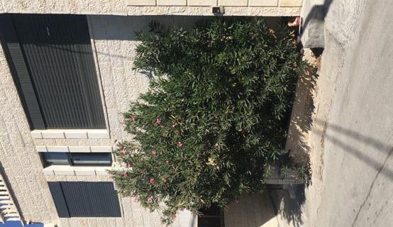
Urban natur e , special tr ees and par ks
Mt. Scopus
WEST JERUSALEM EAST JERUSALEM
Sculptur al tr ee
Symbolic tr ee
Rar e or botanical tr ee
Special ancient tr ee
Ancient tr ee
Dog Gardens maintained by the Municipality
Urban Gardens , maintained by the Municipality
Urban Natur e Sites
Old City
Resource: Jer usalem Municipal GIS and the Master plan 2000
As shown in the ar ea map with their ages , her e the ancient tr ees and 'specials' in landscape ar e all r elat vely new in the Talpiot Mizr ah ar ea ALong the Lightr ail up nor th gardens ar e planted which ar e maintained by the Municipality
36
Relative y 'new' nature area: Less ancient trees and overall planted par ks in the 1970's
een Line No Man's-Land
Gr
0 200 400 1000
WASTE & STATE
37
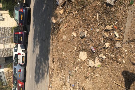
Maintenance & sanitation in Jerusalem
Diverse hygiene observations among the neighborhoods
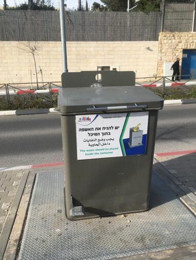
‘A family of four in the Jerusalem Municipal Area produces an average of thirty liters of garbage per day, collected at least three times per week. Most refuse containers are located in public areas, along roads, on sidewalks, or in parkling lots, depending on the population density and land availabiblity. Problems with maintenance and sanitation, which occur when containers overflow and garbage is dumped next to them, are associated with a lack of responsible behavior in public areas.‘
There is a lack of uniformity in the use of the containers, because the export towards trucks or collective disposal areas (dumps) is not as easy as in Europe: the culture is different and the roads are narrow in the collection areas. This is not the real reason why it is seperated. Only in the given districts the garbage is taken from collective disposal units, mostly four or five containers for different seperated sources as glass, plastic, paper, green and other waste. In the Arab district where the garbage disposal maintainance is provided by private contractors, the disposal units do not have seperation options and all waste what is collected here goes to the main waste burner in Atarot, Ma’ale Adumim, or other landfills in Israel or Syria. To include the Arab areas with the possibily to seperate the waste and have the same options as the other Jerusalem areas, the regulations per district must be equaly set and sanitation regulated equally.
38
Cur r ent r ecyc ling an d water tr eatment plants in and for Jer u salem
Waste m anagement at Atarot industrial zon e by Gr eenNet: 1500 tons of w aste /day 40% of th e city's w as te is sent for r ec yclin g, the rest of t is sent to a lan dfill in the Ne ge v
Goals set by the Envir onmental Protection
Min istr y s 30% of the w aste to lan dfills, w hile this is n ow 8 0% T h e main solut on: bu ild more sor ting center s to recyc e w aste an d make it easy for people to se pr ter ate th eir own garba ge
Some of th e plastic is rec ycled in Is rael, bu t most of is goes to plants in Tur key, s o the w aste h as to be tr anspor ted w hich is not sustain able (from: Haaretz: Wh at a w as te: Jer u salem 's U nder us ed Sor ting Cen ter)
Atar ot Recyclin g Plant ( 2019)
Ex is ting r ecyc n g u nits
Atarot Recycling Plant
Water
Sor eq Water Tr eatment P lant
Hezek ia's Tu nnels
Sor eq Water Tr eatment P lant: tr eats 120 000 m3 water / day for 933.000 people (2020)
Atar ot Recyclin g Plant: Recyc les 28% of plastic in Gr eater Jer u salem
39
Green line Old C ty 0 50 0 10 00 20 00
Mu nicipal bou ndar es
extended by Isr ael betw een 1 967-1993
Mt Scopus
Statistic Area Lin es
u nilatera y
40
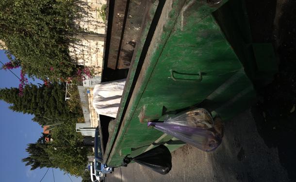
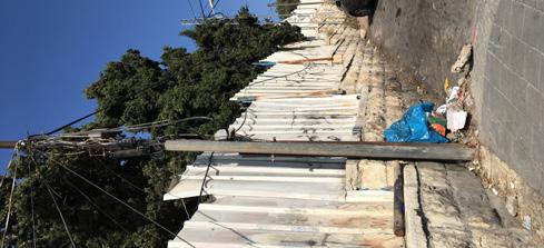
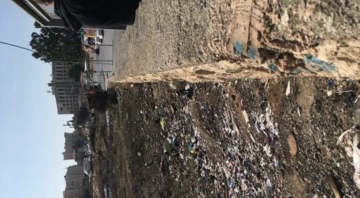
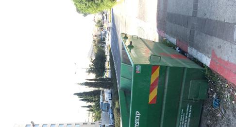
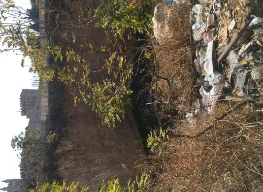
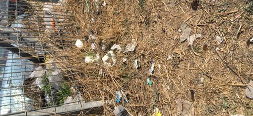
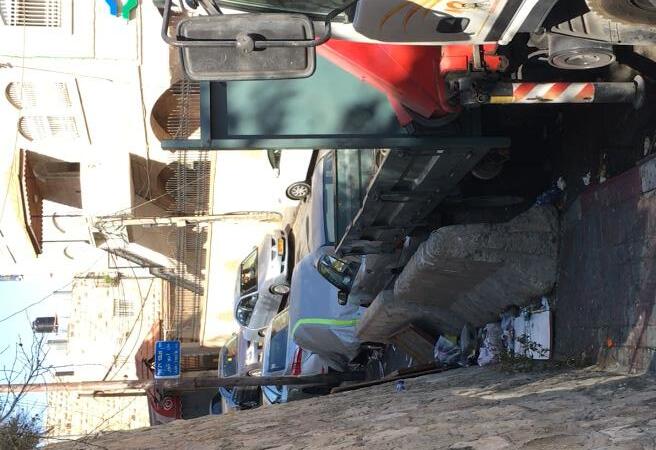
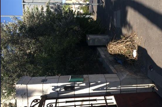
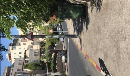
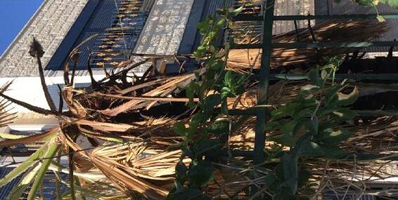
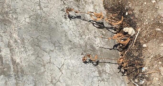
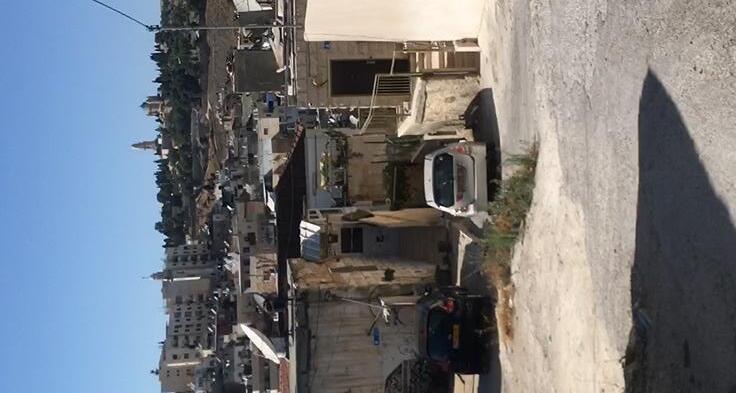
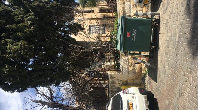
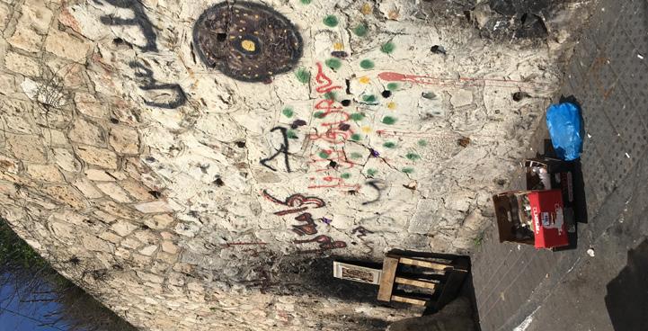
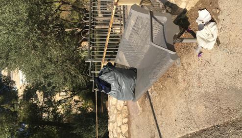
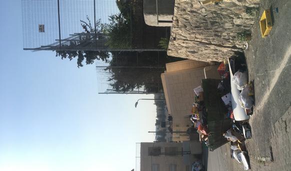
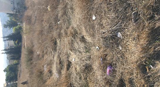
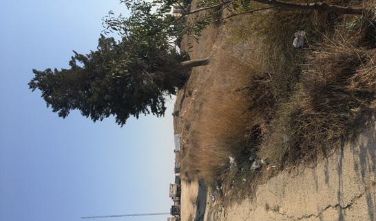
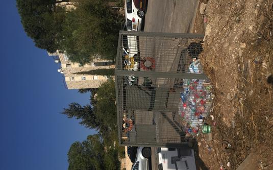
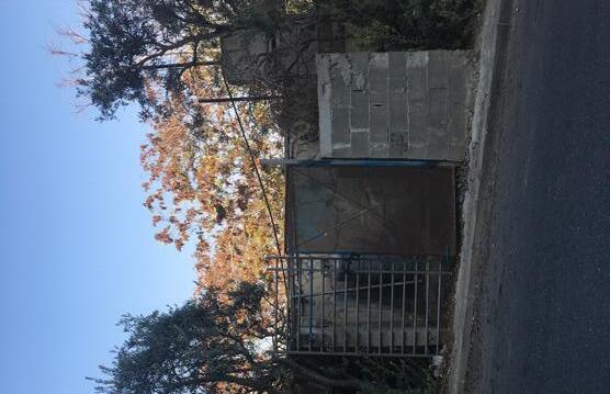
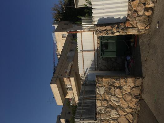
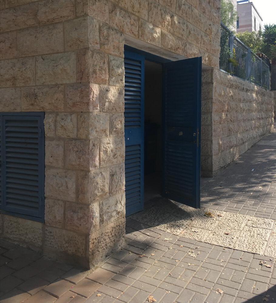
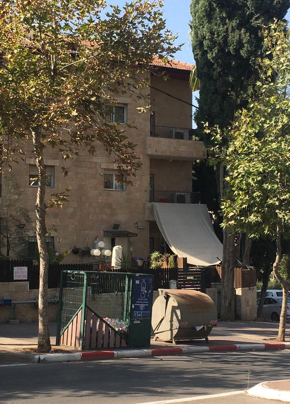
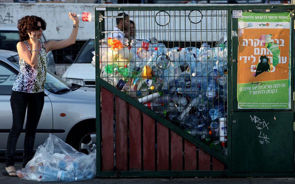
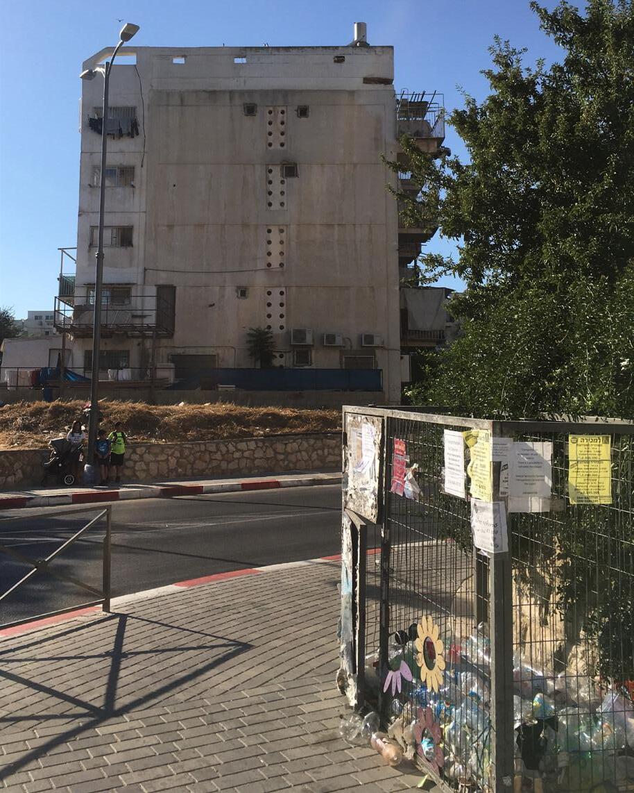
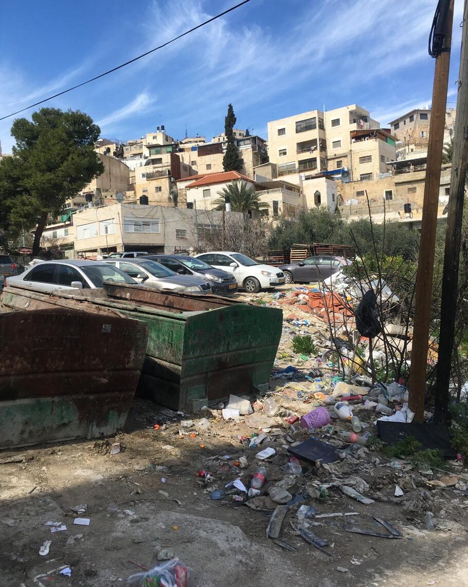
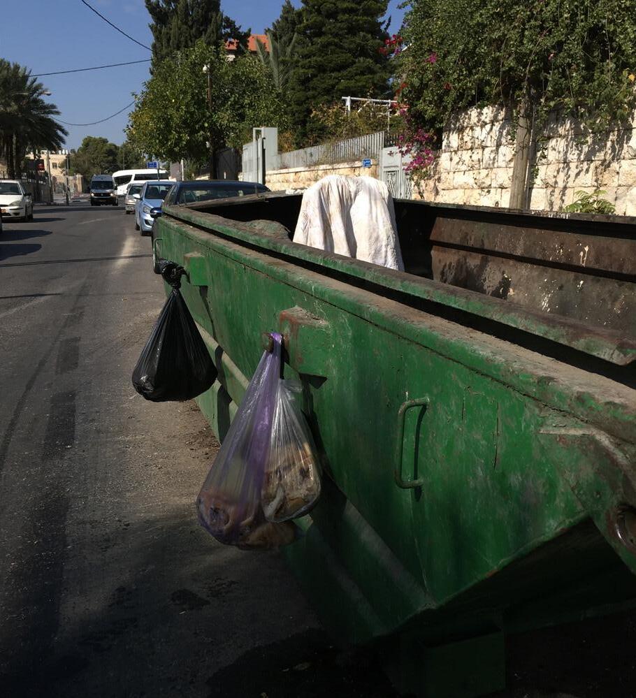
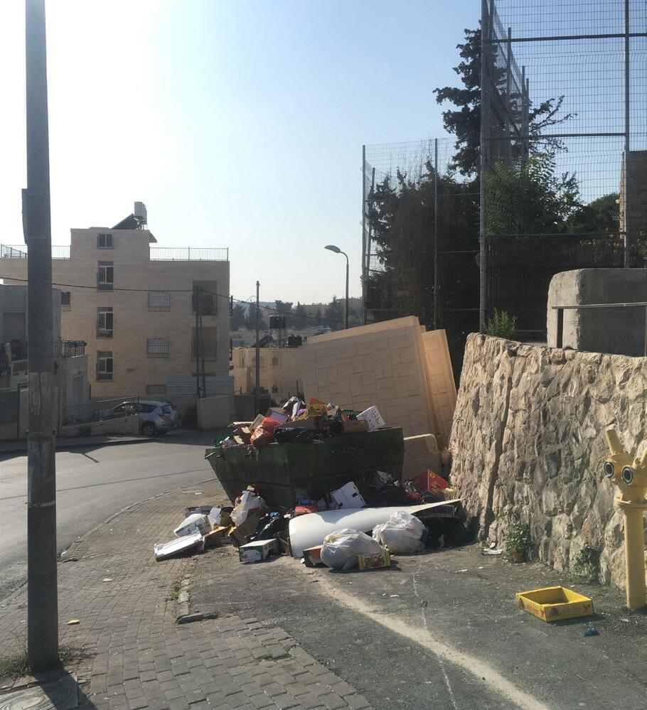
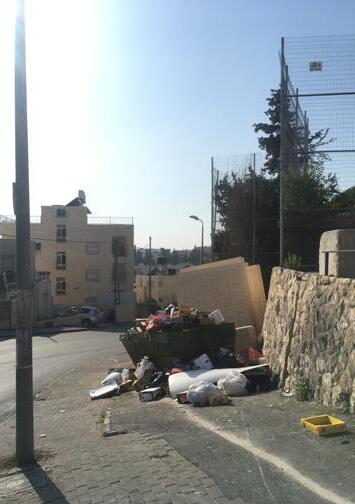
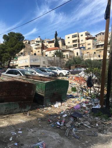
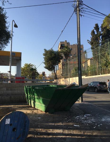
Pictures of Arab and Israeli garbage disposal places Near the former Green Line
Jabal al Mukabber (Arab)
Sheikh Jarrah (Arab)
Abu Tor (Arab)
Ma’alot Dafna (Jewish)
Sanitation districts
The sanitation districts are regulated by the Municipality of Jerusalem
The Sanitation Division is responsible for: garbage removal and cleaning in the built-up areas, purchase, maintenance and operation of the municipal vehicle system and operation of the waste recycling system It also manages the clearance days for pickup of old furniture / garbage
Also improvement of the city (parks, green etc) in handled by this department and therefor this devision map applies
41 Sanitation D istricts Green line 0 200 400 1000
O ld City
Maintenance Lines
Within these districts the cleaning and maintaining duties of the municipality are stated Each district has a different maintainance group assigned who take care of street swiping, landscape condition and such
42
Green line Statistic Areas 0 200 400 1000 O ld City M aintenance
Mt Scopus
districts
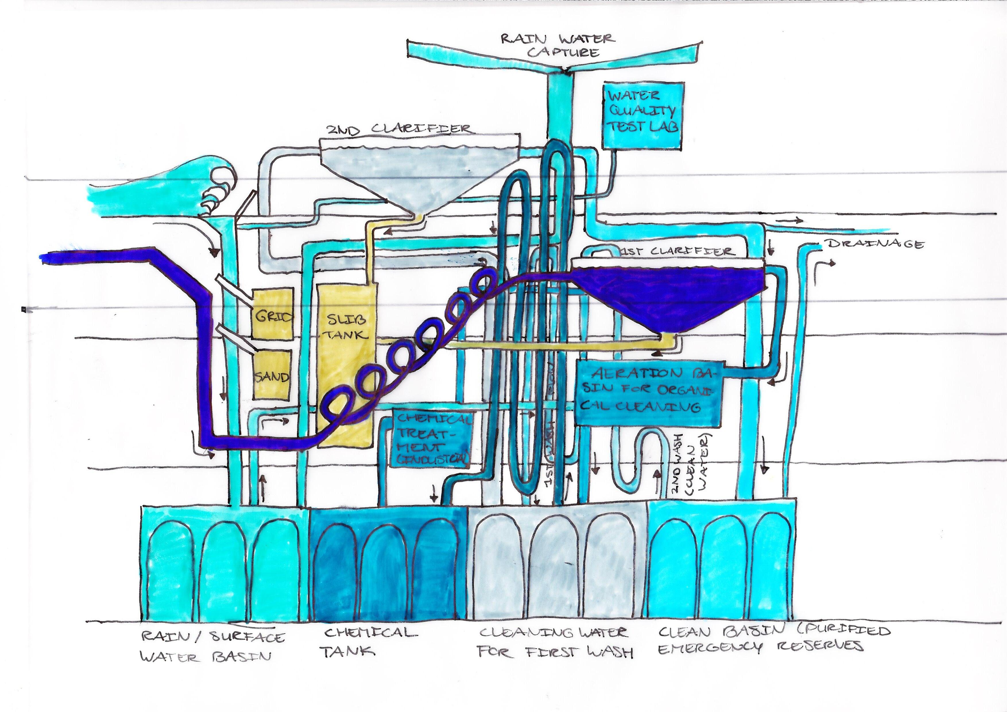
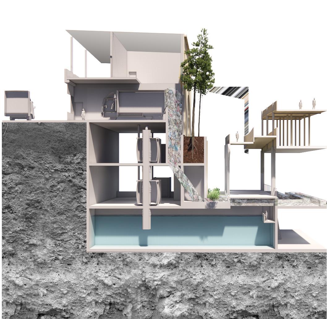
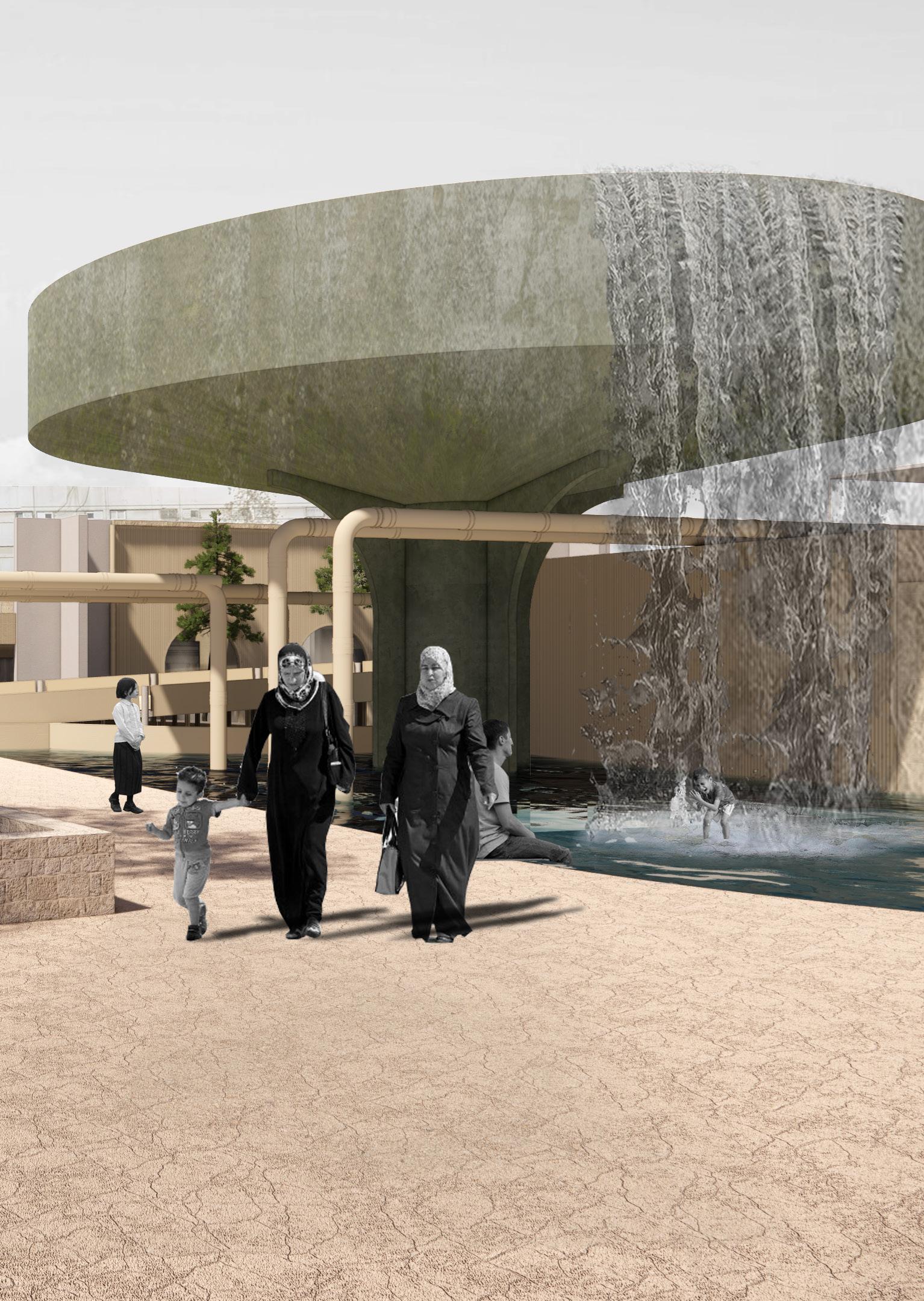
Goal: Plastic recycling supported by water management Storage of water underneath the plant
‘A family of four in the Jerusalem Municipal Area produces an average of thirty liters of garbage per day, collected at least three times per week. Most refuse containers are located in public areas, along roads, on sidewalks, or in parkling lots, depending on the population density and land availabiblity. Problems with maintenance and sanitation, which occur when containers overflow and garbage is dumped next to them, are associated with a lack of responsible behavior in public areas. ‘
Jerusalem: A City and Its Future, Marshall J. Breger, Ora Ahimeir, Syracuse N.Y. : Syracuse University Press, 2002.
EW43
Recycling points
Landscape drainage and watering systems
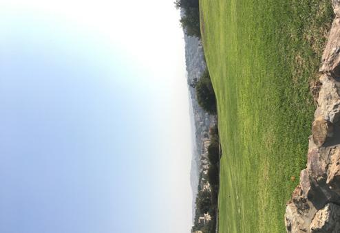
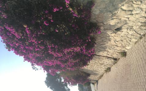
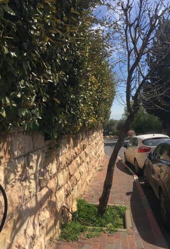
Urban green is maintained better in West-Jerusalem than in East-jerusalem. Within and east from the former Green Line the maintainance is behind and lands and plants are dry.
In West-Jerusalem the recycling oints are sometimes even accomodated within buildings, but mostly it is taken care of by the municipality in the streets. When crossing the Green Line, there seems to be no more municipal gathering of waste. Local companies take the trash and they seem to know the inhabitants of the communities as well. Urban quality and hygienic is therefore very low compared to the West.
44
45
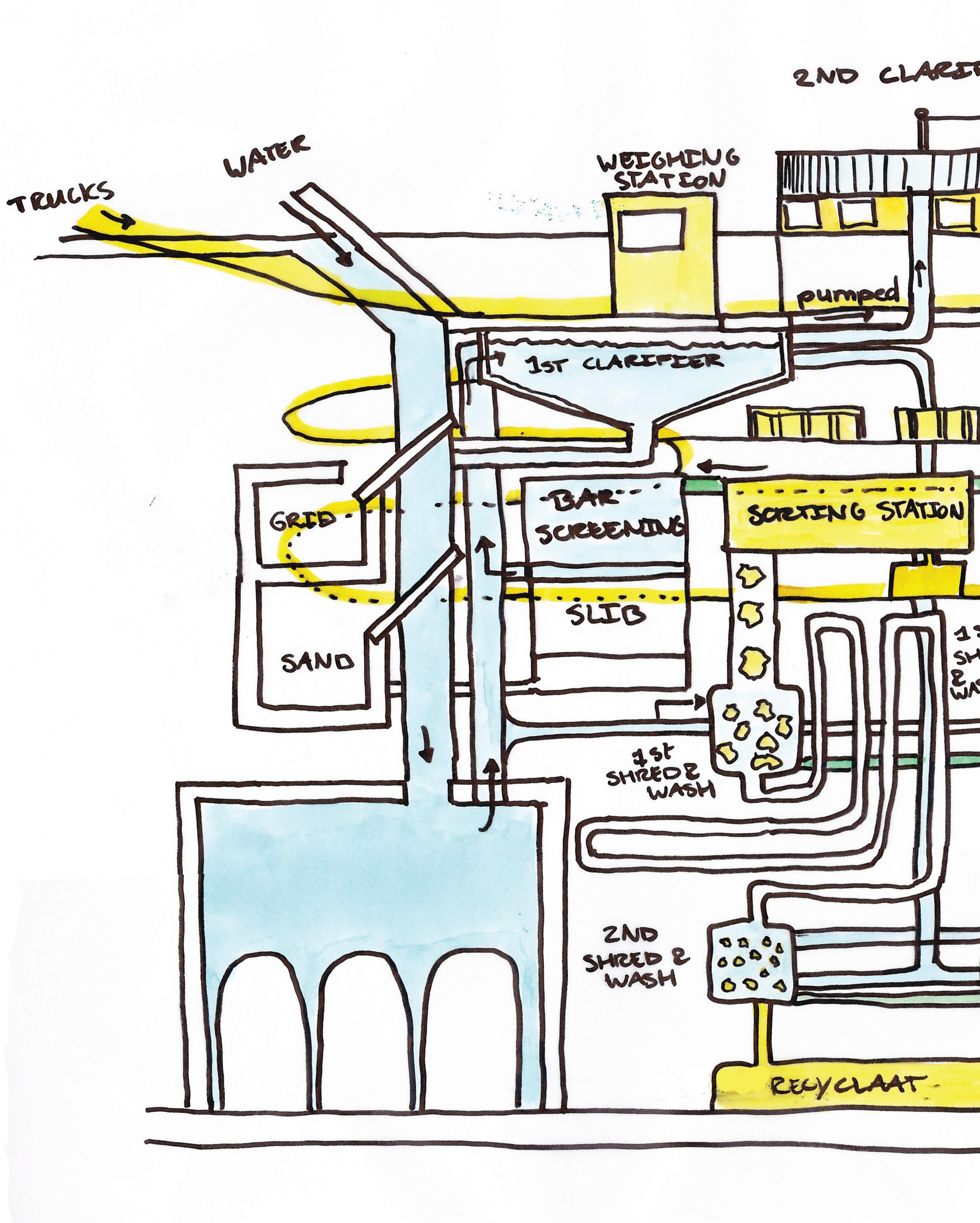
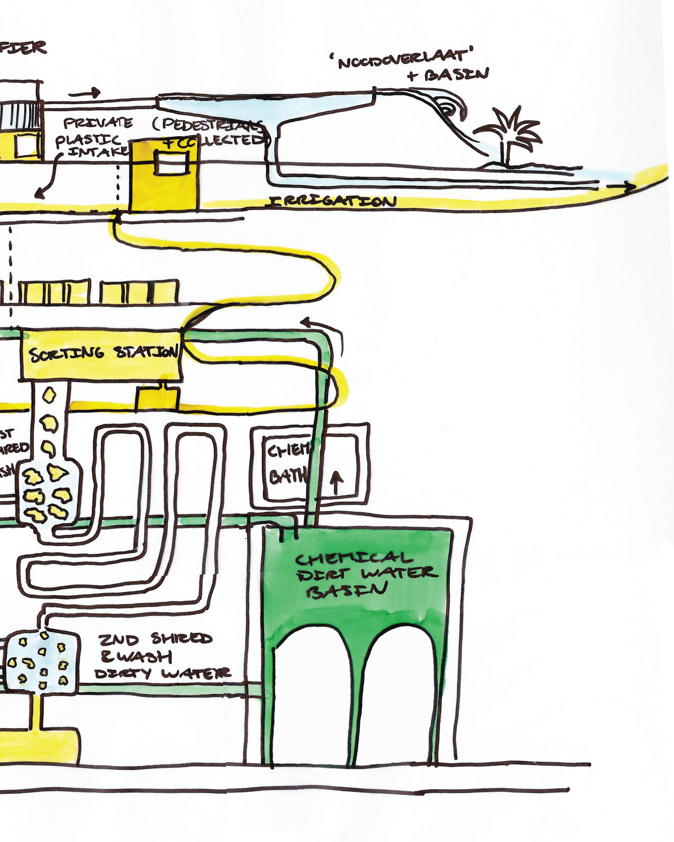
Plastic recycling plant Scheme of the proces
Water purification plant
Scheme of the proces
46
47
Santitation differences
Arab district not being serviced equily
48
WES T JER US AL EM EAS T JERU S AL EM Now WES T JER US AL EM EAS T JERU S AL EM PU RI F I CAT I O N F AC TO RY Future Existing Atarot Waste Plant Spec fied rec yc ng factor y Massudiyah Sma l rec yc ng units National Regiona Loca
Israel and State Architecture Architecture of politics
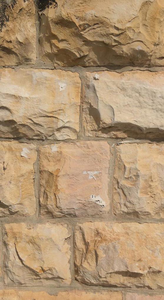
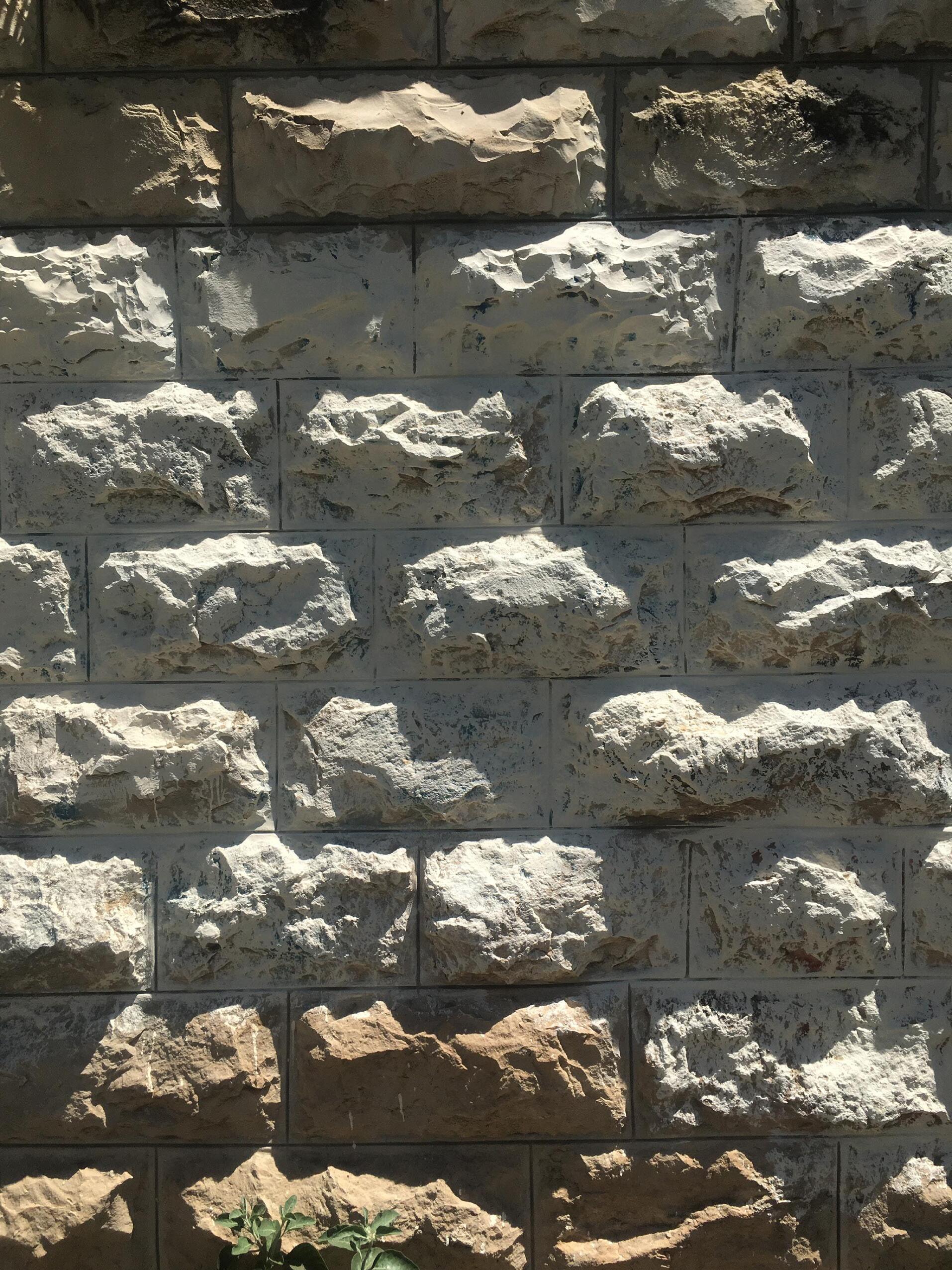
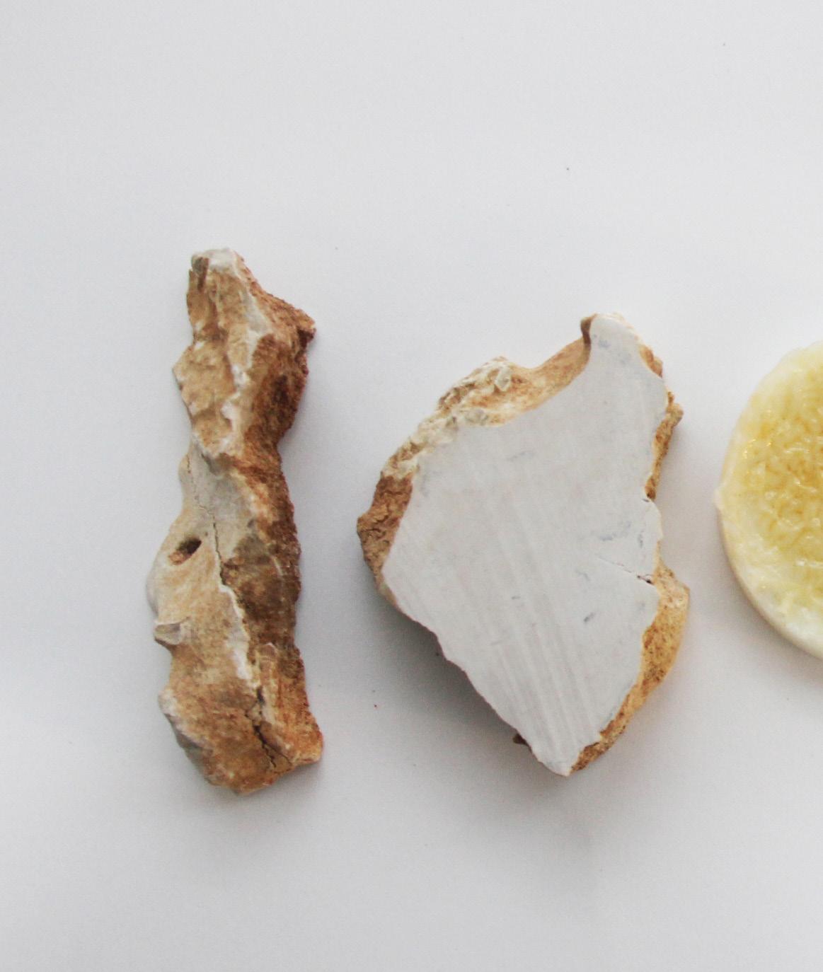
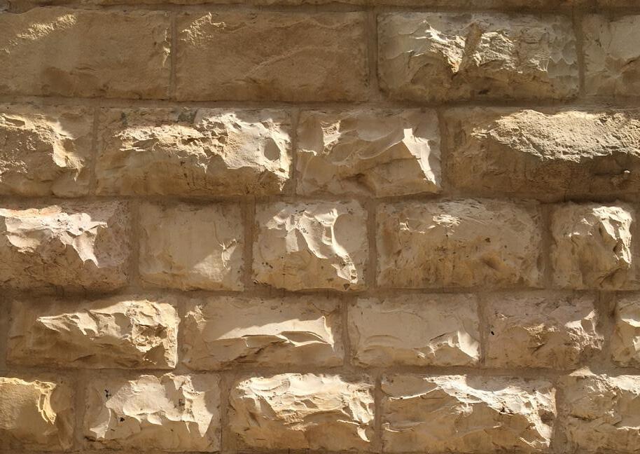
When thinking of Jerusalem and structures, the first thing coming to mind is the face of the Old City. A bright face, referring to the brown yellowish limestone used to build the massive walls of the Old City and its inner structures. The first wall was built of that same material (Hezekiahs Broad Wall). These walls are the beginning of an architecture trend of this local and sustainable material and yet setting a recognisable atmosphere, uneasy to find somewhere else alike.
Over the years the placement, shape and finishing of the stone has been refined, while still using the same constructive principles like the traditional arches.
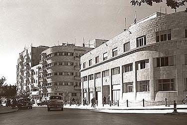
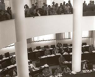
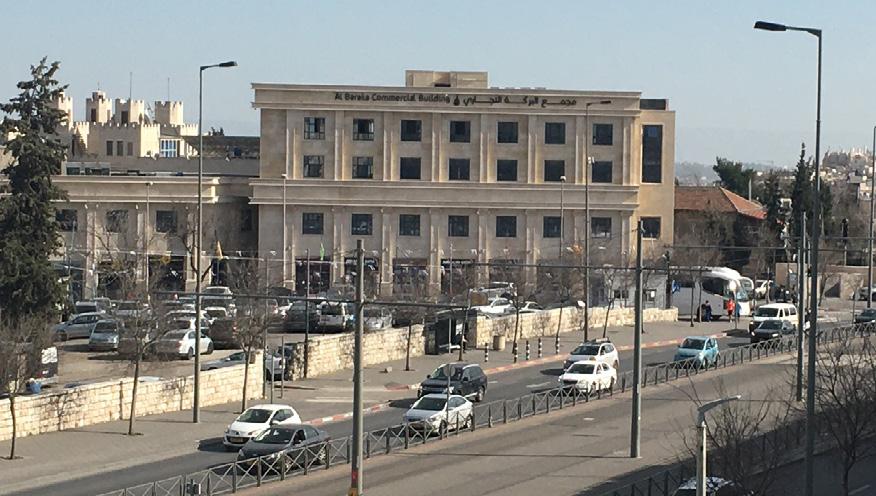
The traditional use of Jerusalem stone as a base began to change since 1948, when the State of Israel was born. Before 1948, there were no traditional ‘State’ buildings, because Israel was ruled by the British Mandate. When Israel became a force as state, this force was expressed in many ways, including the architecture of State buildings. The Knesset, the Israeli Parliament, was at first (19501966) situated at King George Street, in the middle of the modern center of West Jerusalem. It was located in the Fromine House (Beit Frumin) and was a building which was part of the horizontal alignment of the rest of King George St.
The new building was designed by German architect Joseph Klarwein as a rectangular building made from Jerusalem Stone, but with sleek finishes like concrete . It had a symmetrical appearance with a great reservation towards the entrance facade by a 115m long square from road to entrance. This building was placed on a hill in Gi’vat Ram and was criticised as ‘alienating from Jerusalem architecture’ and ‘not biblical’, however the structure of the Tabernacle was als set up in columns. With similar arguments for a modern interpretation of Jerusalem architecture construction started in 1957.
49
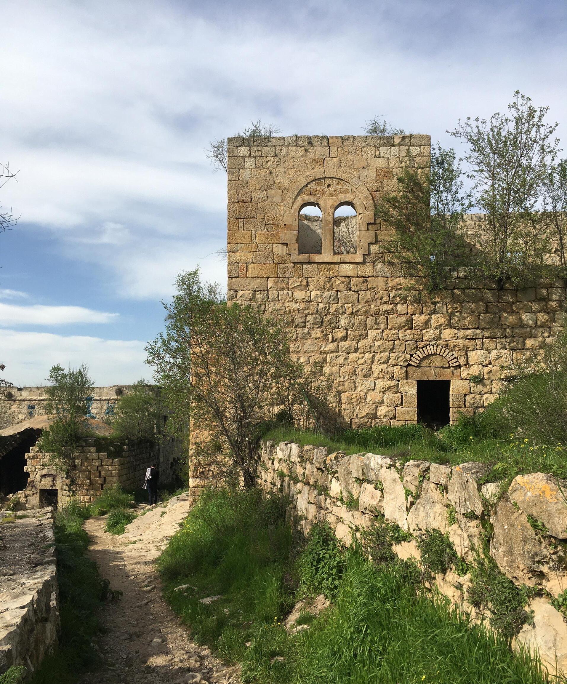
Common oriental architecture, stones and arches: Lifta Ruines of an Arab village in West-Jerusalem, bombed by the Israeli in 1957
50
52
LOCATION
53
54 0 500 100 0 200 0 Mt Scopus
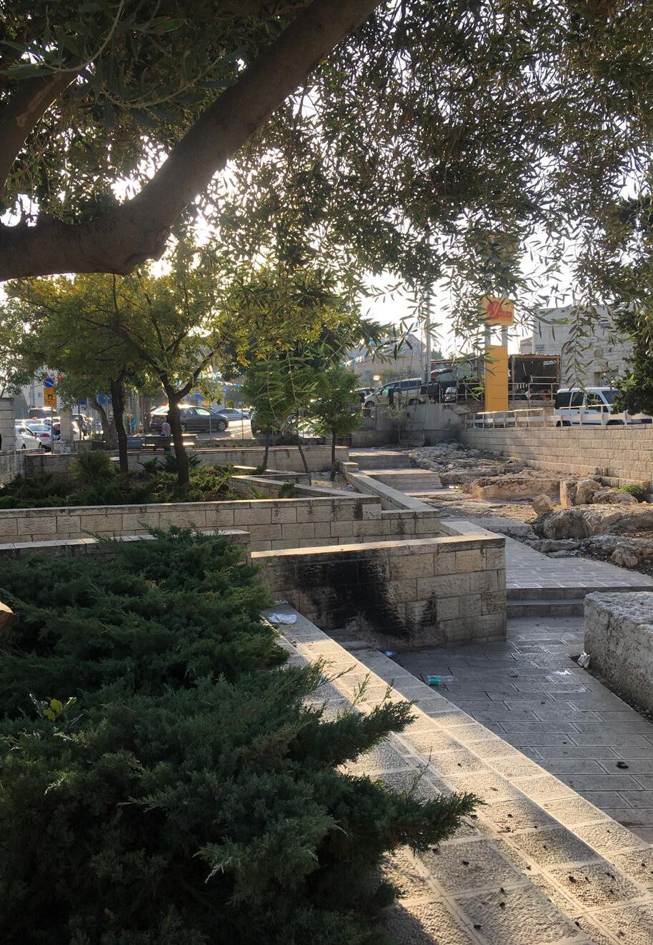
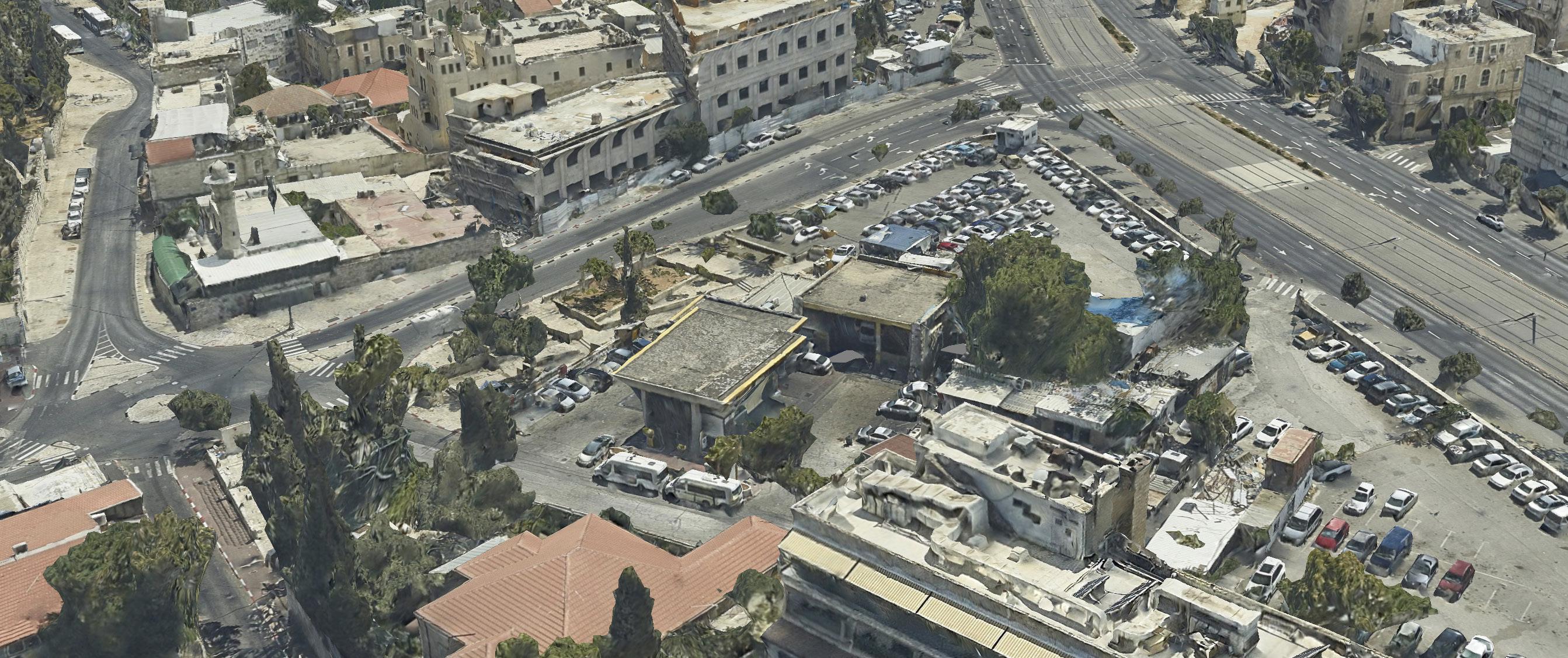
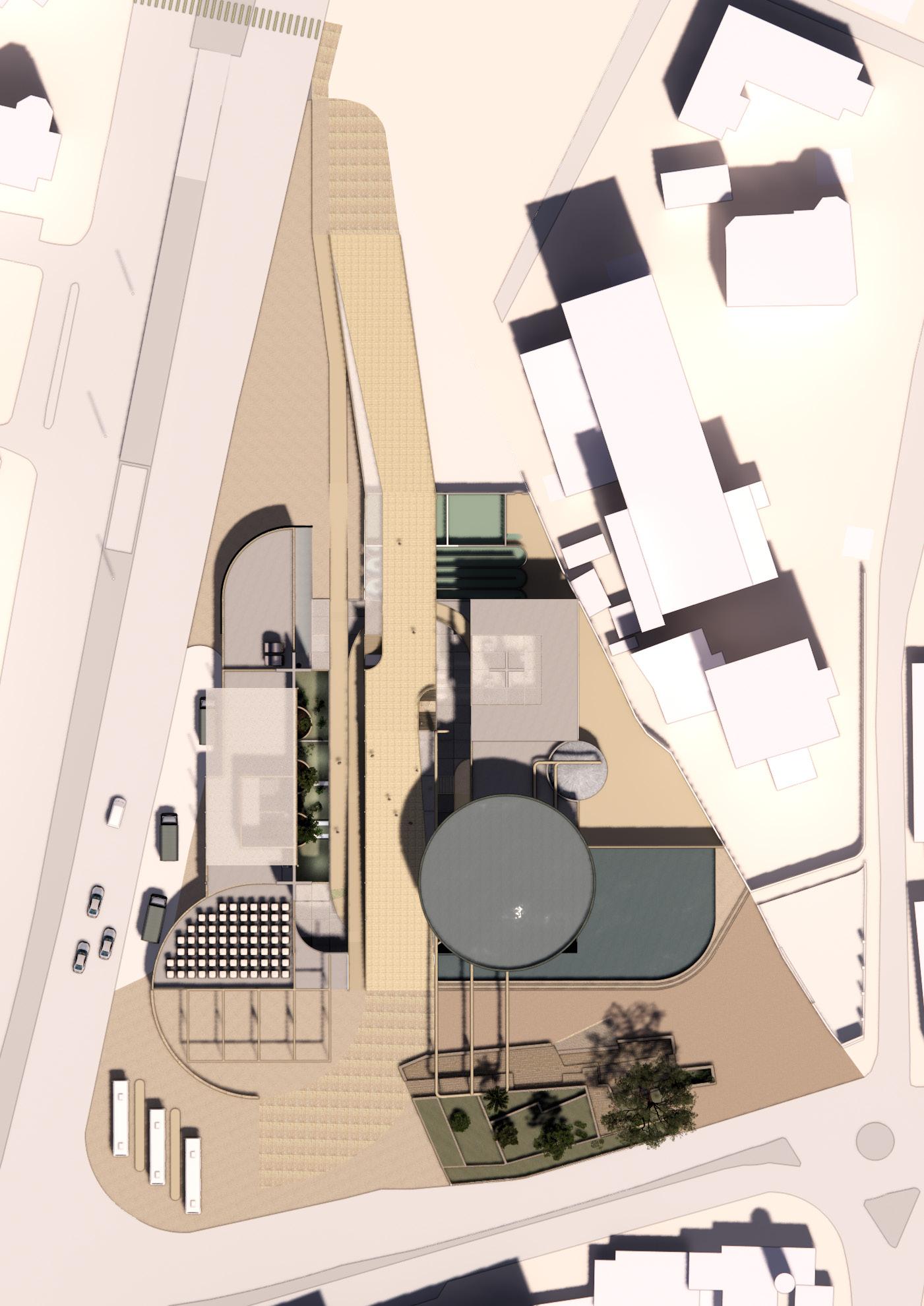
Project Location Mass’udiyyah
55
Project Location Mass’udiyyah
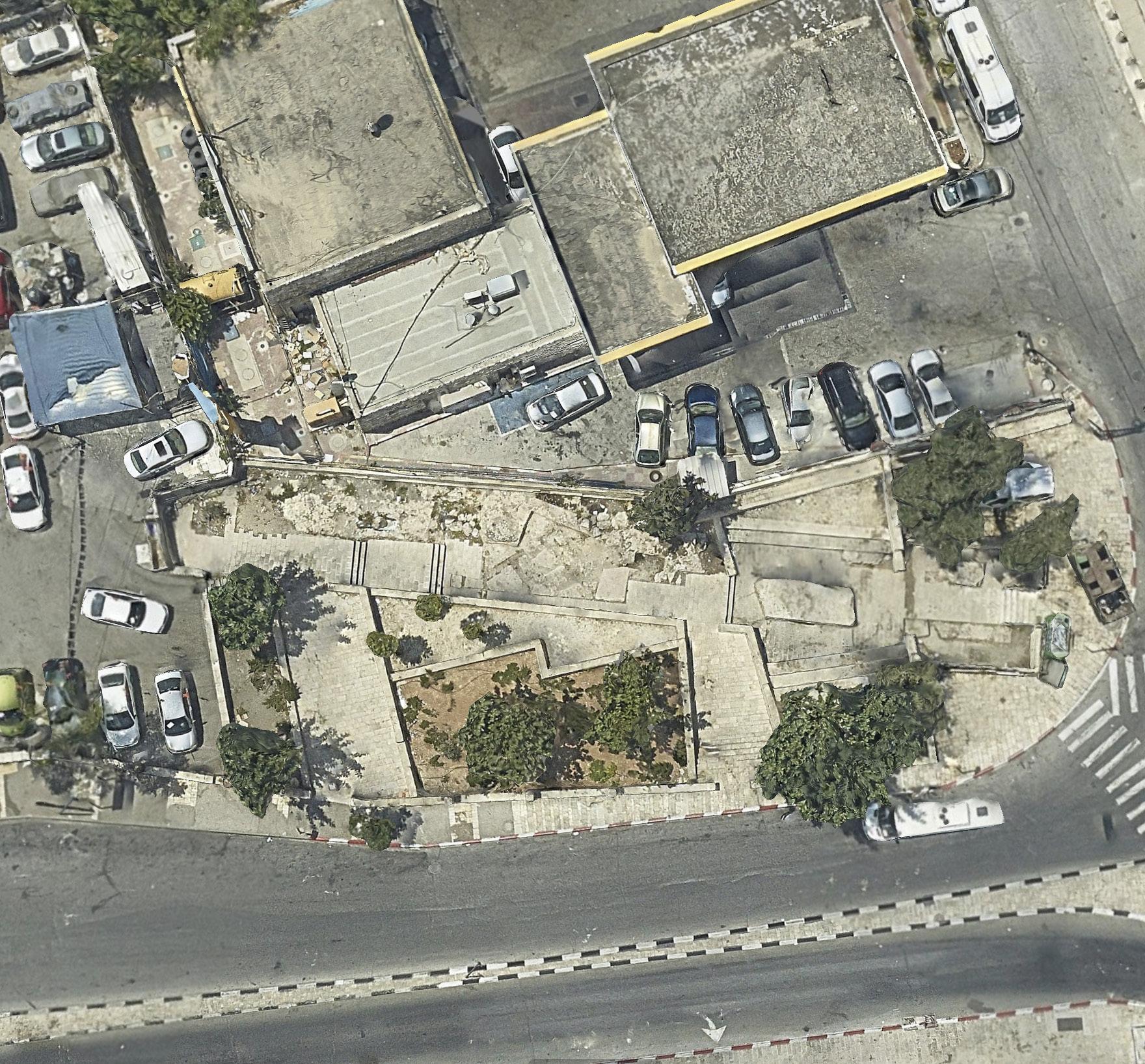
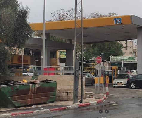
56 Old City U N G reen Lin e Par titio n Plan N ov.1949 P lac e of th e T hir d Wall 34- 37 AD Bo r d er S anitatio n Distr ic ts G r een Lin e > 1967 Existing Petrol station, built 1972 - 1974 Existing excavation
To Atar ot (Waste tr an sfer station and or ganic recycling)
Recyclates
(Rec ycled, w ash ed and grin ded plastics )
Sludge compos t (Res idu e from w ater tr eatm en t)
58
Green line Statistic Areas 0 20 0 40 0 10 00 Ne w r ecyc ling flows ar oun d the Gr een Line Old City P roject location: P lastic r ecyc lin g plant Ex is ting r ecyc lin g u nits New r ecyc ling u nits
Area Mas’udiyya
Musrara was founded by Christian Arabs in the late 19th century but they fled after 1948. The neighborhood was repopulated by Jewish refugees from North Africa but they were exposed to daily attacks from Arabs from the occupied part of the city; today, it is home to many media outlets including Israel Radio, Channel 2, Channel 10, and part of BBC News;
Mas’udiyyah on the south side of Beit Yisrael contains The Museum on the Seam, which explores issues of coexistence through art and is situated on the road dividing the eastern and western parts of Jerusalem.
59
Gr een line Old City Ex sting Atar ot Waste Plant Specified r ec ycling factor y Massudiyah Small r ec ycling units National Regiona Loca
60 Mt Scopus Green line Old City 0 50 0 10 00 20 00 Statistic Area Lin es Mu nicipal bou ndaries u nilaterally extended by Isr ael betw een 1 967-1993 Water str eams and r ec ycling points Jer u salem Sor eq Water Tr eatment P lant Hezek ia's Tu nnels Water Sor eq Water Tr eatment P lant: tr eats 120.000 m3 water / day for 933.000 people (2020)
Site specifications
The two Green Lines & neighborhood line
According to the maps of the Jerusalem Center for Policy Research the line of the two neighborhoods (Me’a Shearim & Bab Az Zahara) is drawn here, exactly over the plot. Theoretically it means this plot is owned by orthodox Jewish neighborhood as well as the entrance to the center of Arabic East-Jerusalem.
Sanitation District Line
The practical differences of picking up the trash, the amount and quality of trash cans and the services for recycling are different left and right of this line. It means the urban quality of the street is different on both sides. By making an intervention which representst the source of the sanitation the quality of the street should stay the same in a large radius of the green line, making it less visible in urban quality of living.
West to east is downhill
At the point of the Green Line the hill runs down from the west to the east, when ending in one of the valleys on the east side of Mount Zion. Going further to the Areas A and B in east Jerusalem (ministered by the Palestinian authorities) the hight runs up again to +800m from sea level.
Backside of the plot
The backside of the area functions as a backbone of the distribution part where the public is no part of. Also on top of this the international zone behind it is seen from the roof of the building and makes the space less secret from the neighbourhood. In this way this backbone also functions as backbone for the new infill of the location.
61
62 A1 A1 B1 B1 B2 B2 C1 C1 C2 C2 A2 A2 U N G r een Lin e Par titio n Plan N ov 1949 P lac e of th e T hir d Wall 34- 37 AD Bo r d er S anitatio n Distr ic ts G r een Lin e > 1967
Analysis current situation - Sections A
63 6280 10845 2275 7820 6335 3695 15285 2845 6120 970 5215 3160 6280 10845 2275 7820 6335 3695 15285 2845 6120 970 5215 3160
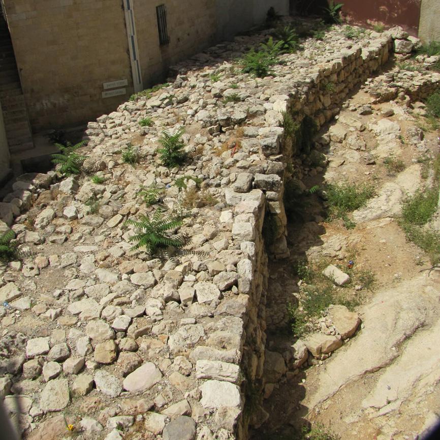
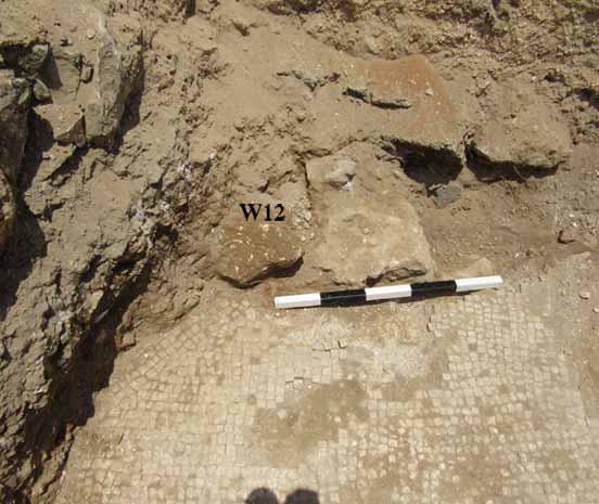
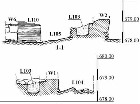
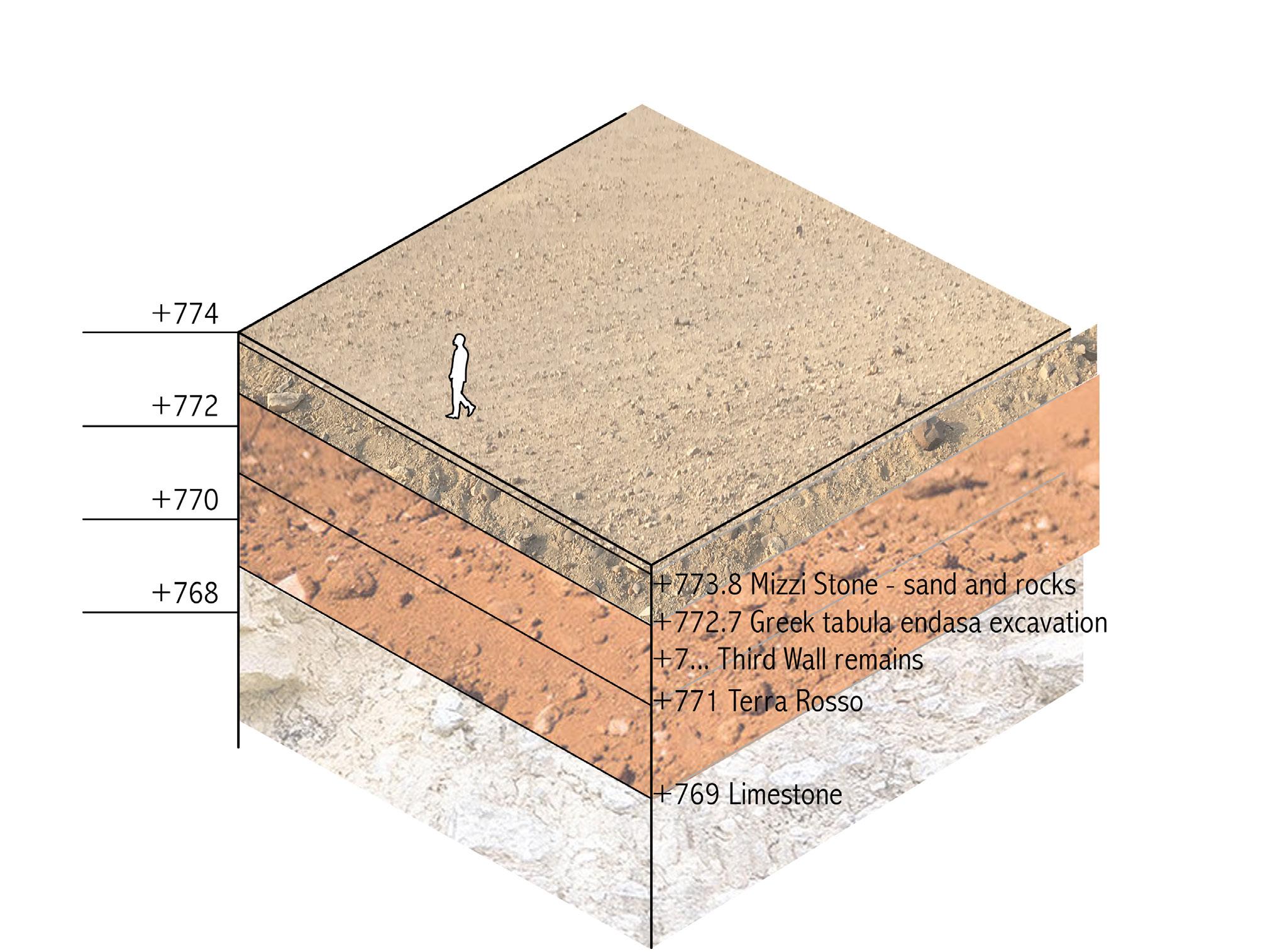
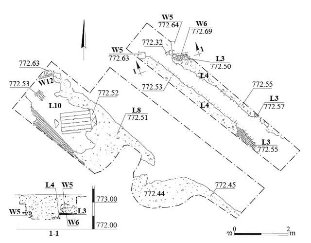
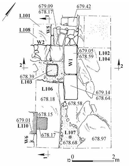
The excavation
The inscriptions in Greek date from the mid-sixth century and so are the walls of this building. The inscriptions in black and white tesserae (mosaic) are placed within a tabula ensata, which means was a votive shape with inscriptions in the Roman empire (550 AD).
The inscription mentions Constantine, who was in charge of the building. The building remains were most likely part of a complex of religious buildings located along the main road, at the entrance to Jerusalem.
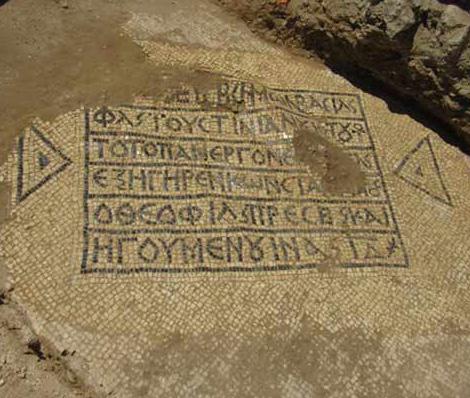
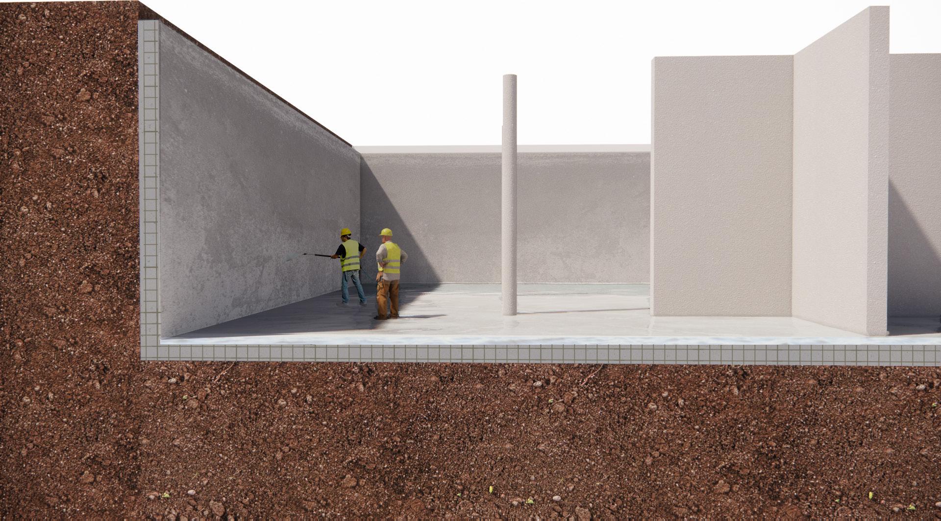
This excavation is made on the corner of Nablus Road and the gas station. The remains of two ancient buildings were found here, likely to be a bathhouse of the ancient monastries and hospices. Underneath the excavation is Terra rosso soil (+678m). Further down you get to the limestone.
64
65
The excavation Expansion of Jerusalem 37-44 AD
66
67
68 A1 A1 B1 B1 B2 B2 C1 C1 C2 C2 A2 A2 U N G r een Lin e Par titio n Plan N ov 1949 P lac e of th e T hir d Wall 34- 37 AD Bo r d er S anitatio n Distr ic ts G r een Lin e > 1967
Analysis current situation - Sections B
69 3750 1770 1320 8785 700 2070 0 1395 6925 700 2085 700 7000 700 11625 7002605 1445 3750 1770 1320 8785 700 2070 0 Sect on B1 1395 6925 700 2085 Sect on B2
70 A1 A1 B1 B1 B2 B2 C1 C1 C2 C2 A2 A2 U N G r een Lin e Par titio n Plan N ov 1949 P lac e of th e T hir d Wall 34- 37 AD Bo r d er S anitatio n Distr ic ts G r een Lin e > 1967
Analysis current situation - Sections C
71 700 7000 700 11625 7002605 1445 Sect on C1 6070 10350 200 2900 2200 2400 700 700 605 Sect on C1 6070 10350 200 2900 2200 2400 700 9325 700 4590 Sect on C2 3750 1770 1320 8785 700 2070 0 Sect on B1 Sect on B2
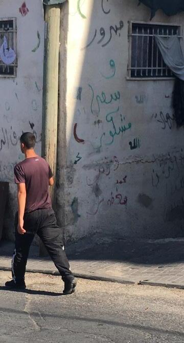
Tiny cultural material use details Mea Shearim (Jewish neihgborhood) and Abu Tor (Arab neighborhood)
72
Typical Jewish use of Jerusalem Stone facades, where Orthodox families do not own TV’s and put bulletins and posters on the walls in the streets.
Typical Arab use of the Jerusalem Stone facades, where Muslim who made a Hadj to Mekka are honoured with a white stuco cladding on their house and the family draws pictograms and texts with green and red on them.
Overlapping location of Jewish and Arab ownership
Mass’udiyyah
73
74 CURRENT USE LOCATION NEW USE LOCATION
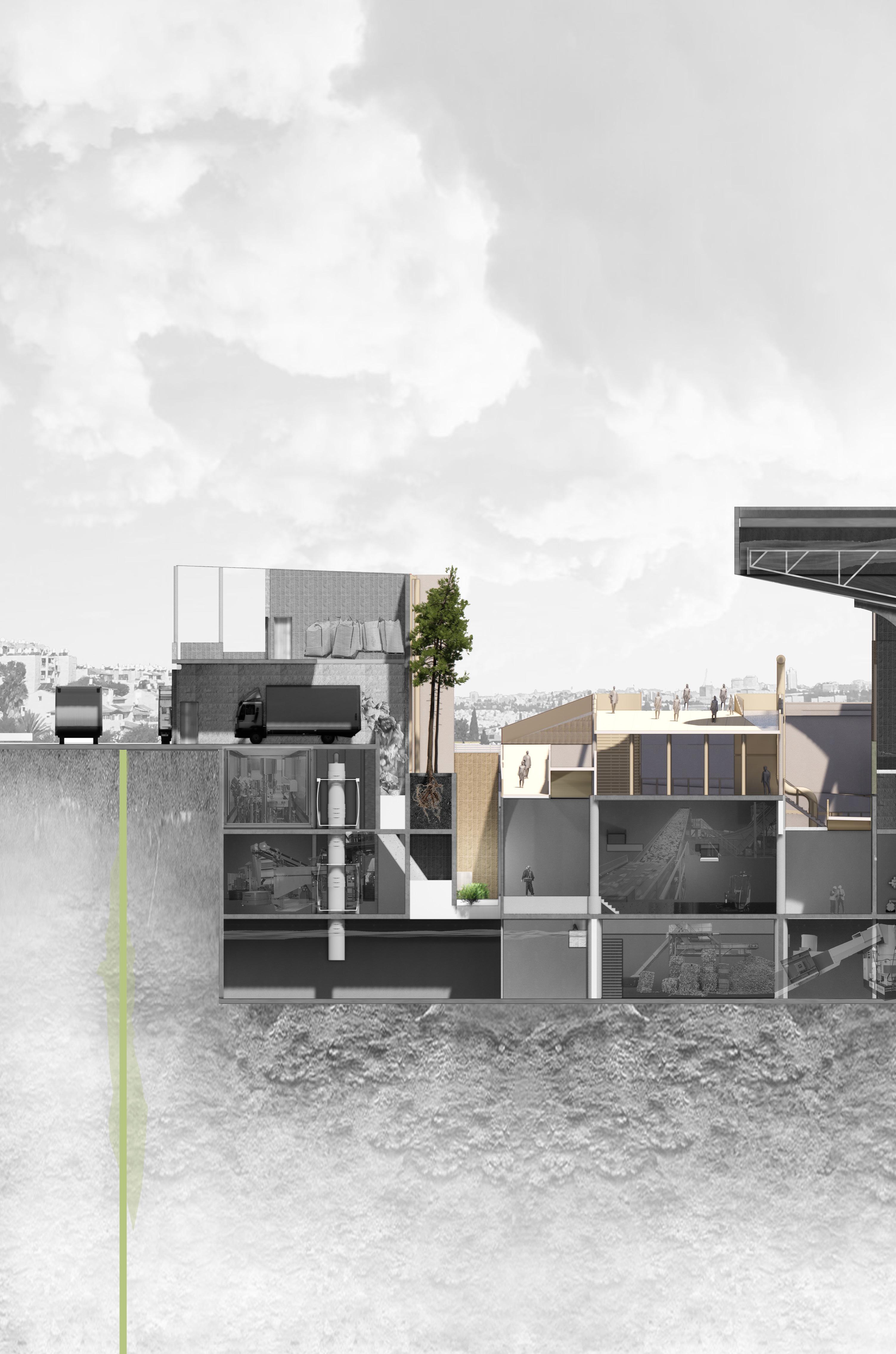
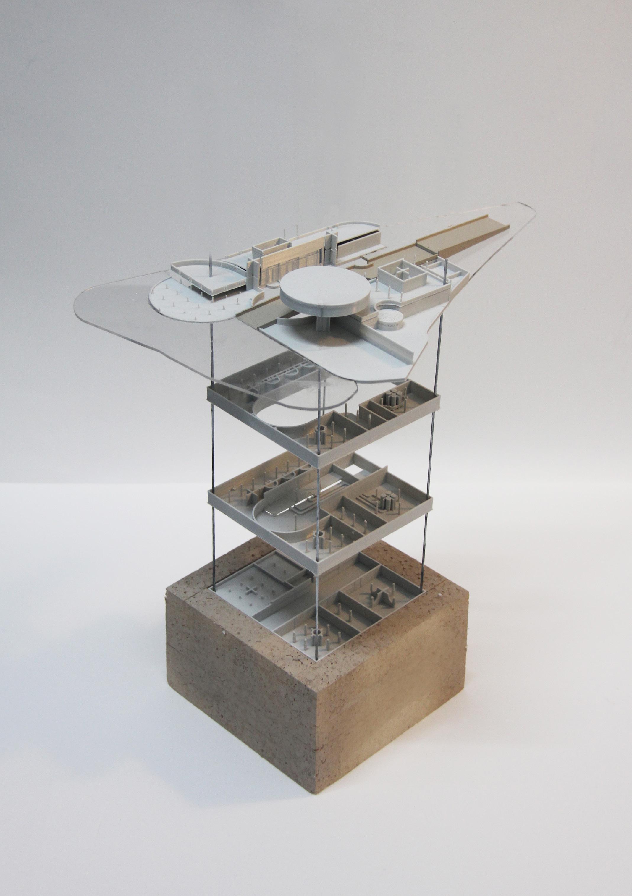
DESIGN
75
76
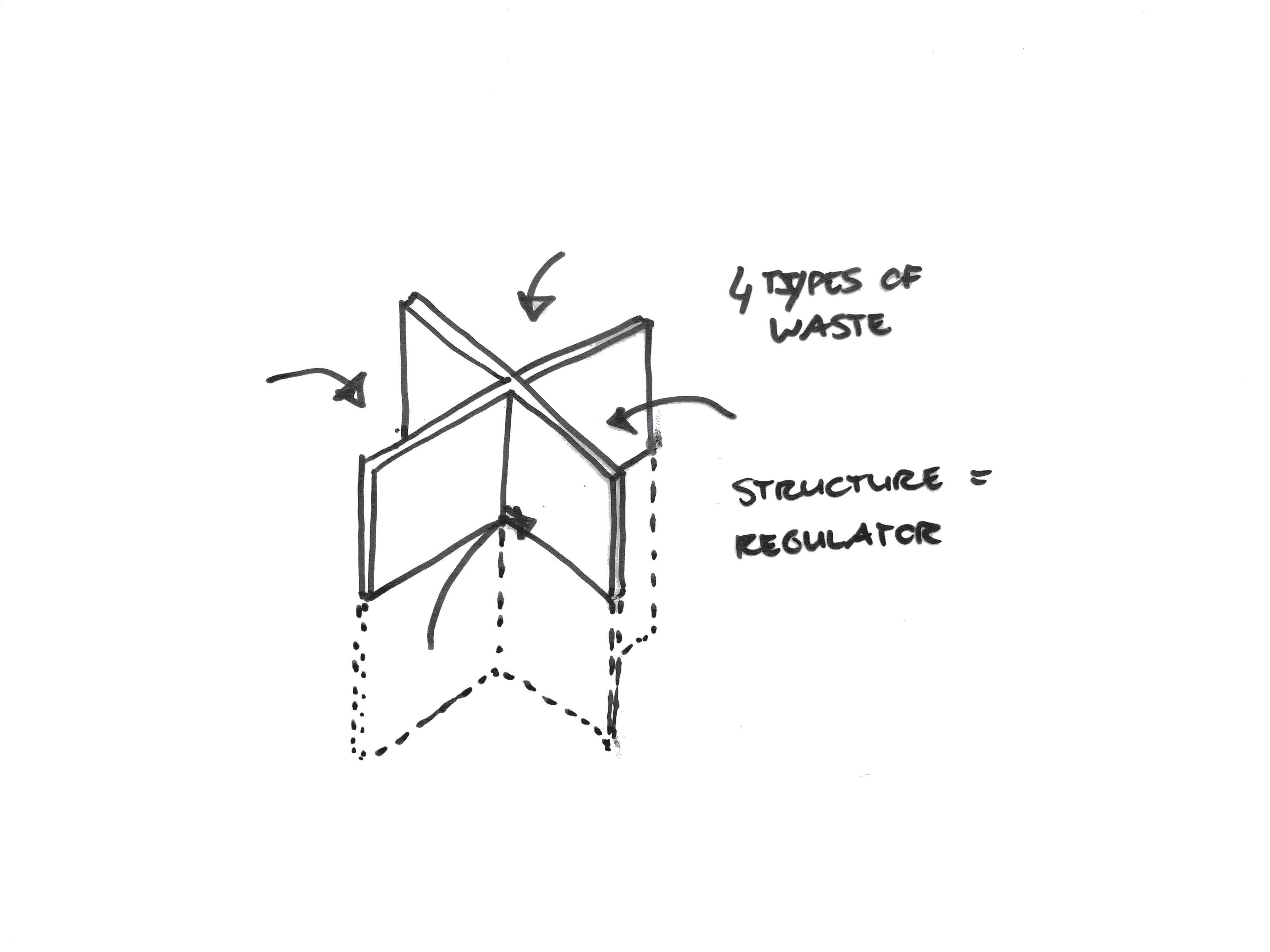
Crosses as separators for waste
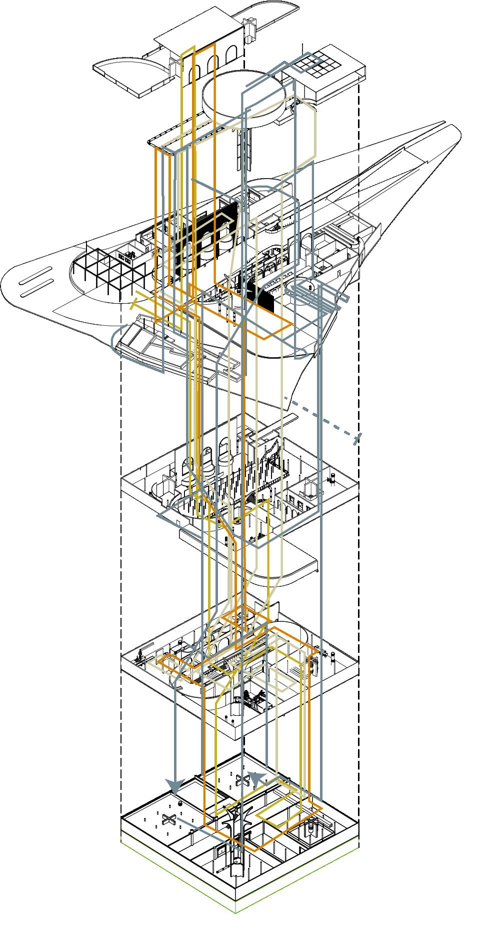
78 Machines / storage Transport, flows & streams Machines / storage Water input Plastic input Recycled plastic pickup Purifed water outpour
Crosses as separators
Crosses as reference and structure points
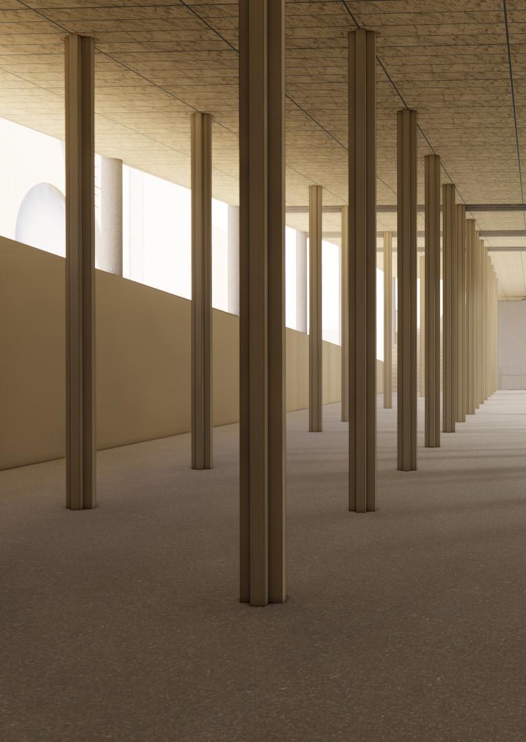
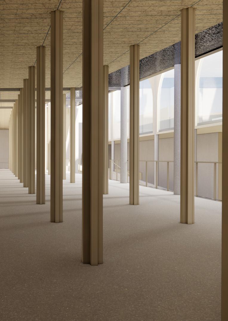
On every floor the concrete crosses are a deviding element for waste, water flows, ventilation shafts and so on. It structures the separation of the dirty and clean flows in an element of 2750x2750 mm. The crosses are also made from recycled concrete and are maximum 4750m high. Only the structural element for the water purification tank is higher and is made from mycrosylica and can therefor be higher, but also for hygenic reasons this material is more suitable than recycled concrete.
79
Clean recyclates OUT
Unclean water IN
Unclean plastic waste IN
Clean water OUT
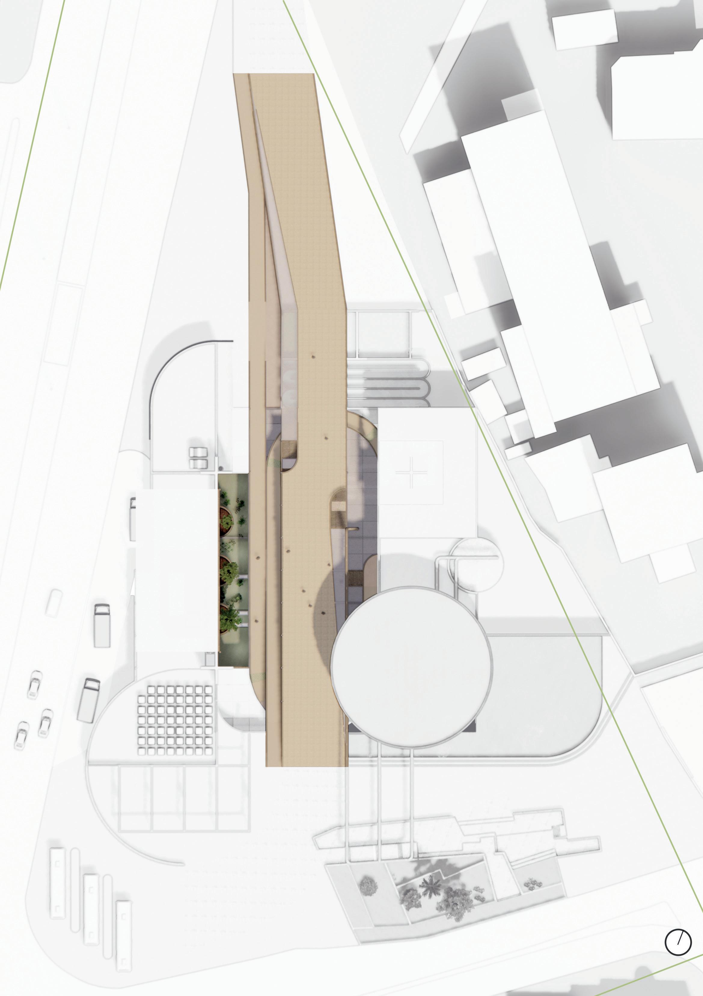
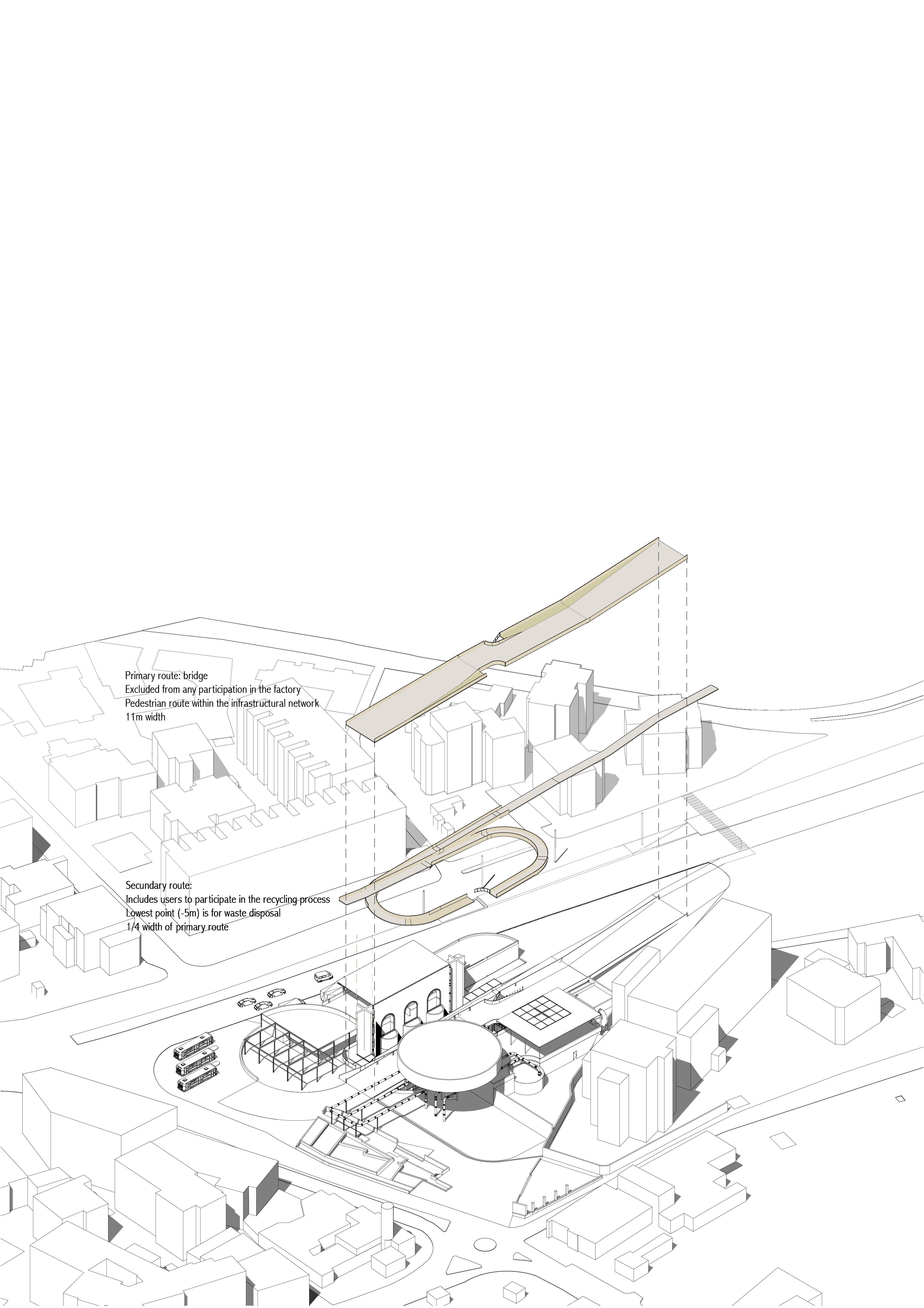
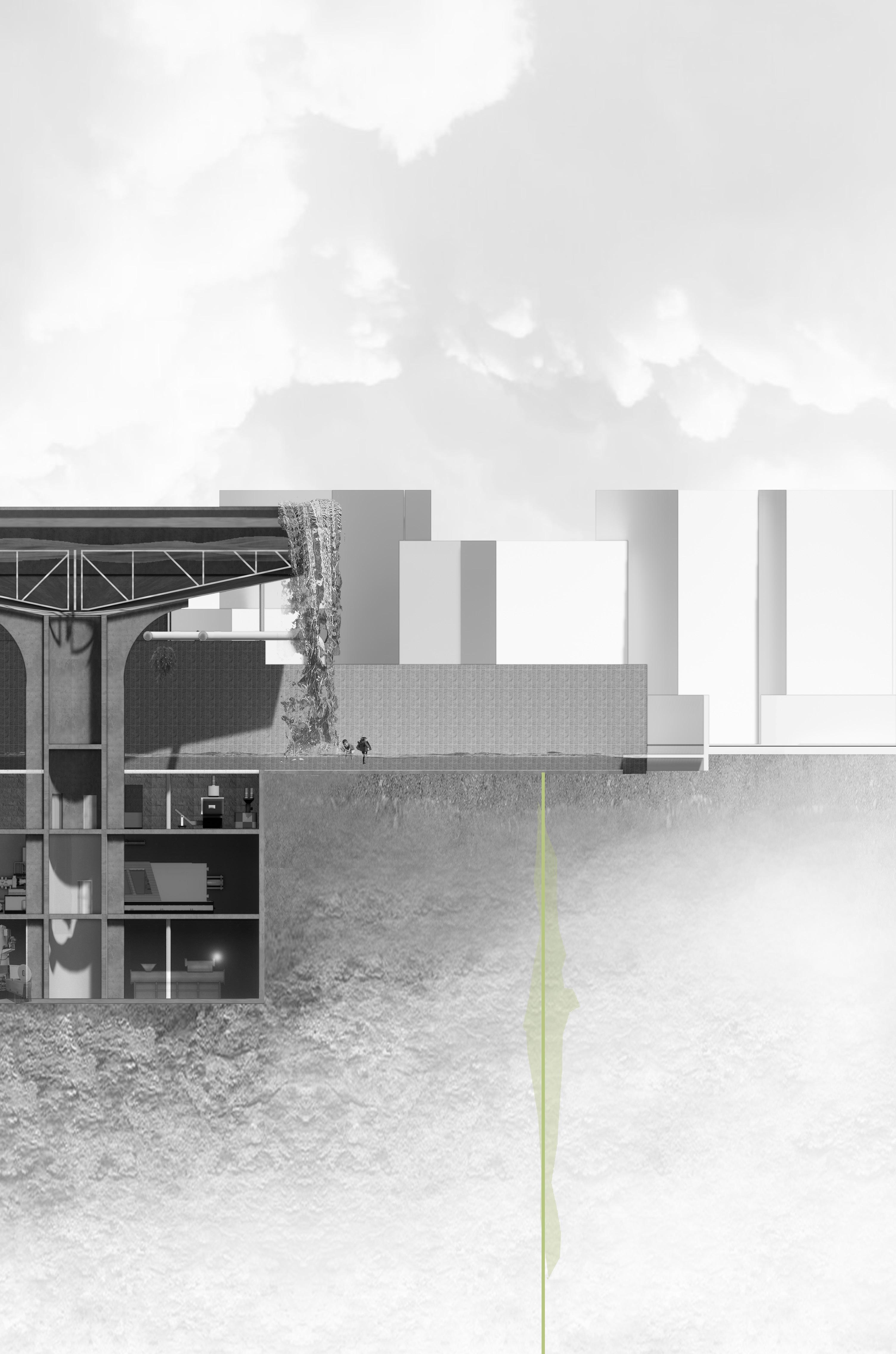
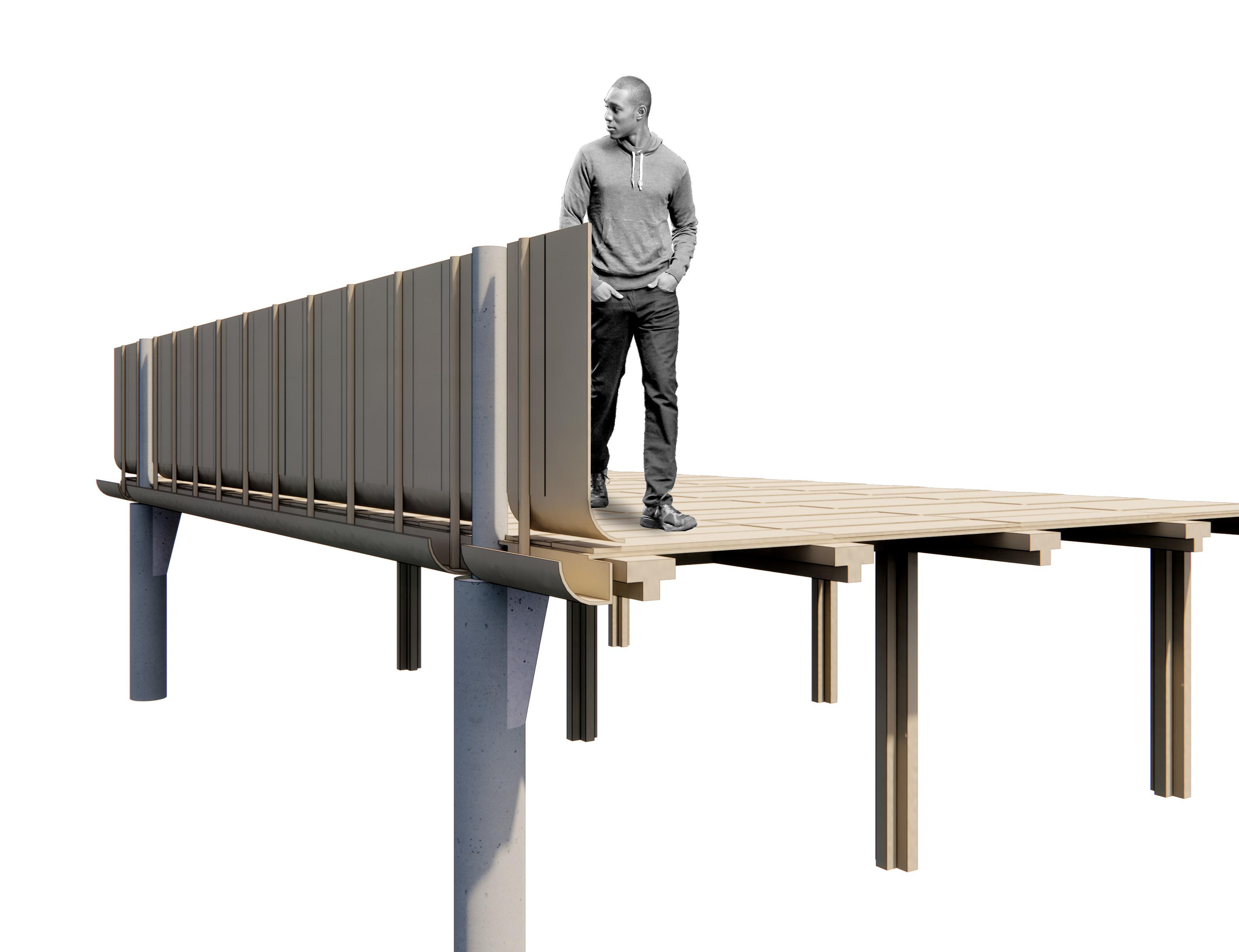
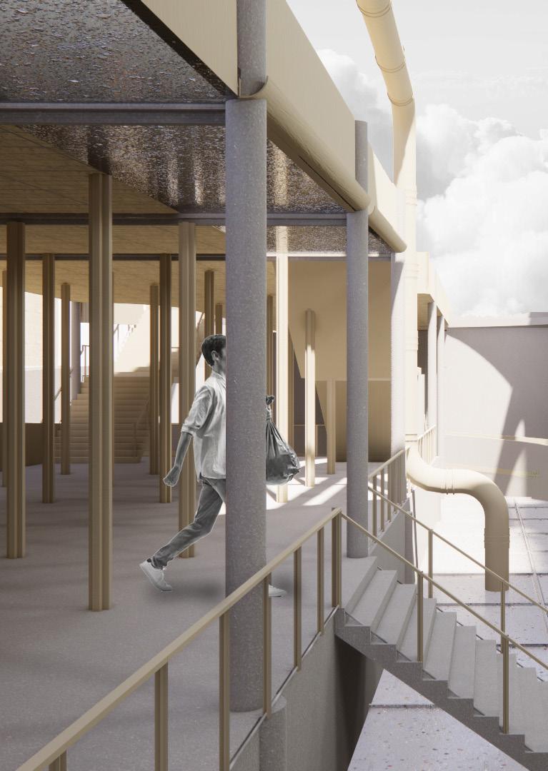
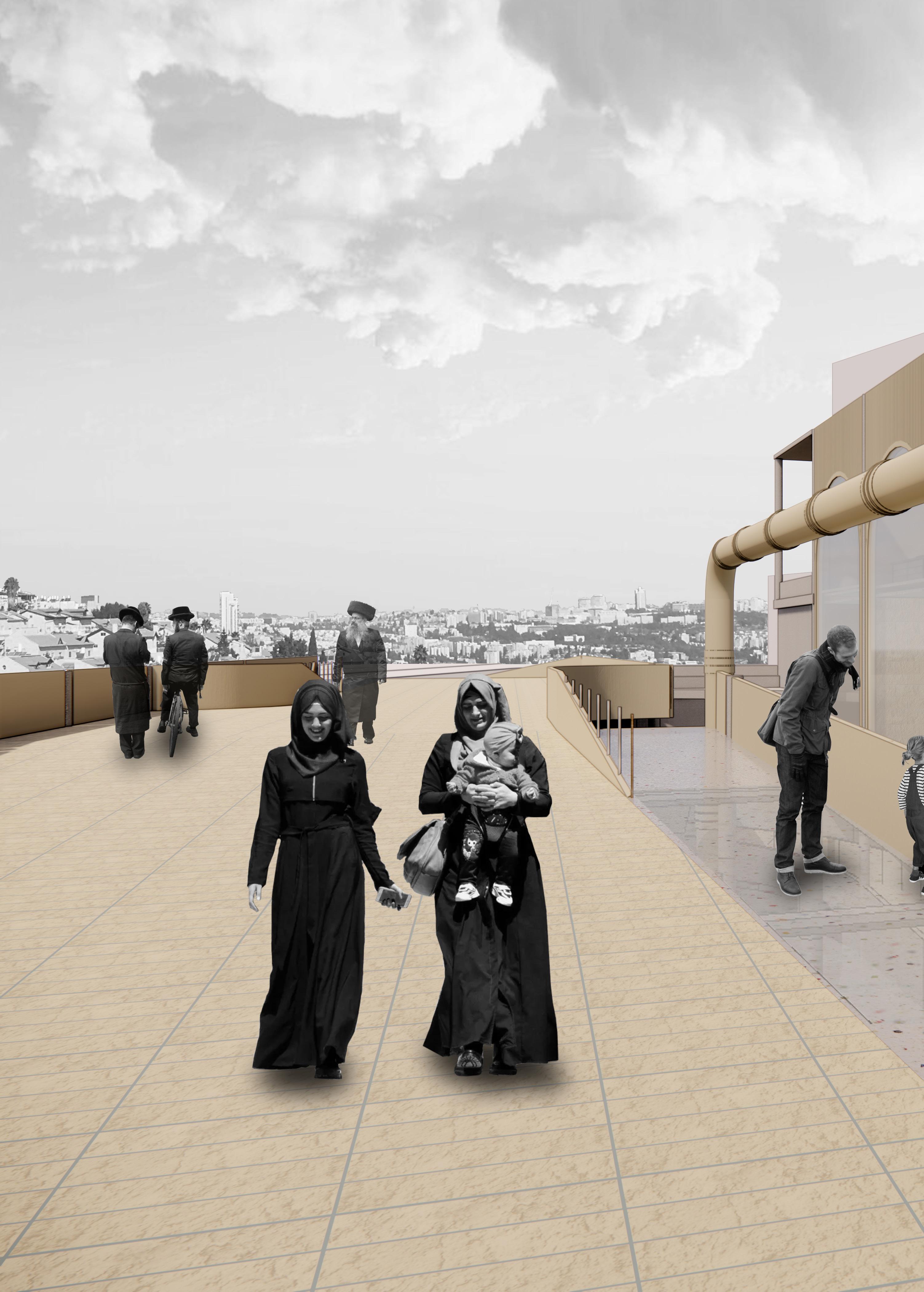
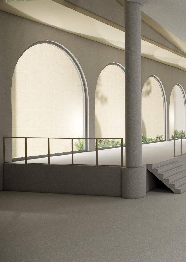
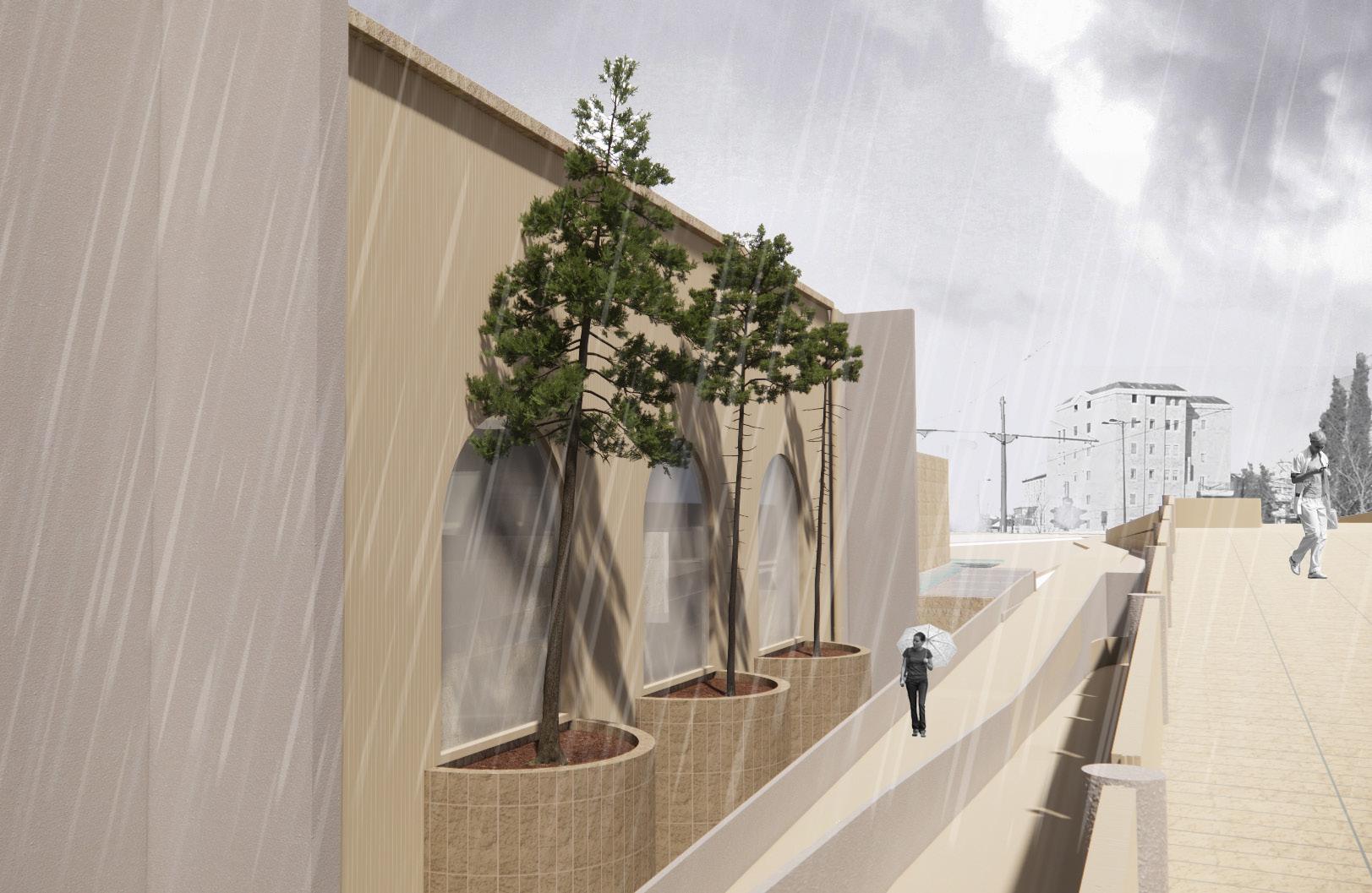
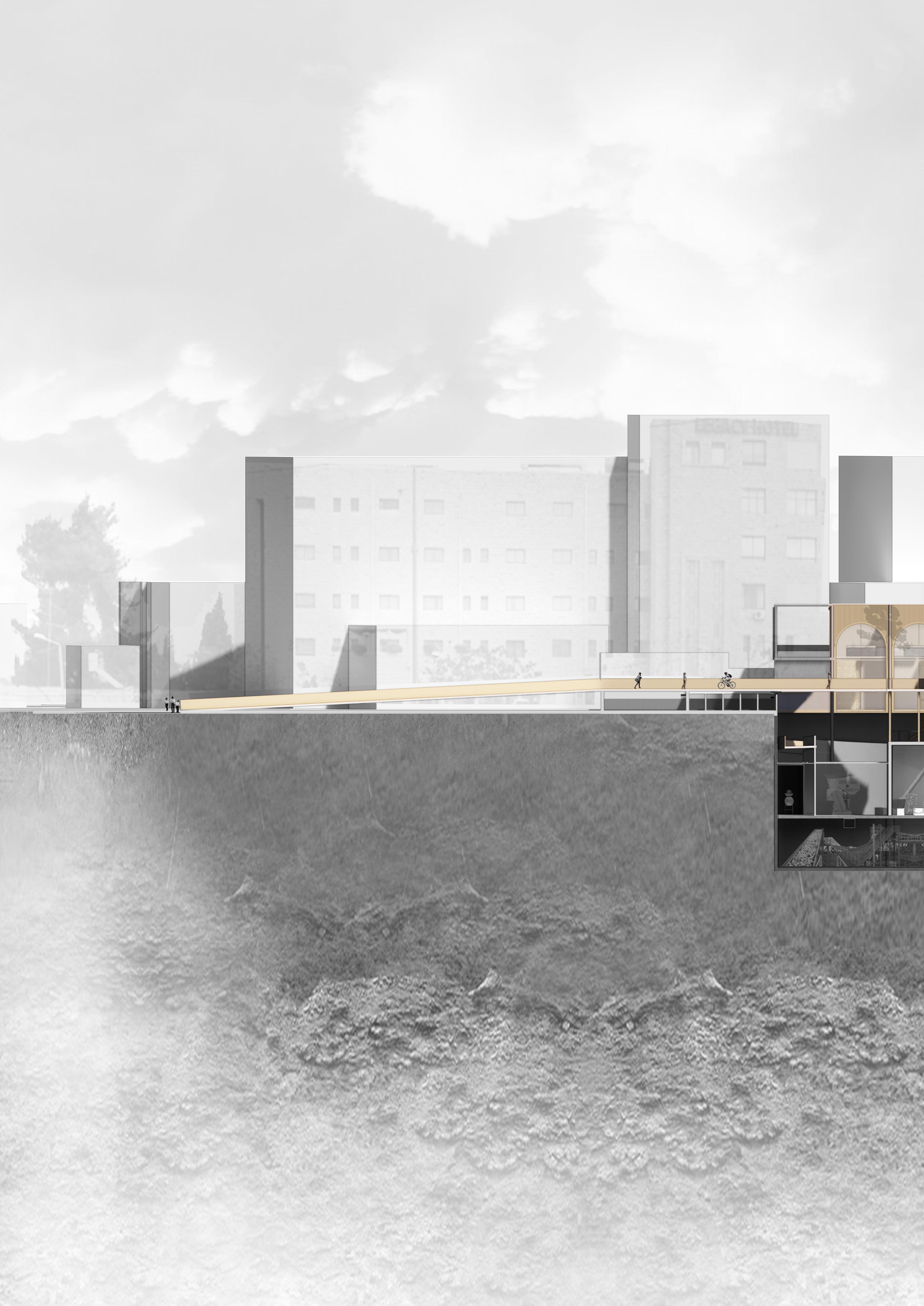
Social routes
Where the edges of the plot were used a lot by passengers taking the bus of r the Light Rail, now tthe edges are attached to the adjacent functions. The left edge is attached to the street for the trucks to enter the plant and the right sight is attached to the back of the international strip between the plot and Nablus Road (Bab Az Zahara). It is mandatory to use the primary bridge to to from Morasha (and Mea Shearim) to the bus staion and for passengers from Bab Az Zahara mandatory to take the prime bridge to the Light rail station.
Primary bridge
Excluded from any participation in the factory
Main pedestrian route within the infrastructural network in the Mass’udiyyah area Connection between Light Rail and bus station >1:20 rising ratio
11m width
Secundary bridge
Includes users in the recycling process of the factory on the route Lowest point is -5m below ground level
1:20 rising ratio and wheelchair friendly accessibily 2,75m width (1/4 of main bridge)
80 GSEducationalVersio
Bus station Light Rail station Mas’udiyyah / Bab Az-Zahara
/ Mea Shearim +
Morasha
Bridges
In a bowl of sand tones
82
83
Mandatory Jerusalem Stone
Collective waste Jerusalem Stone
Collective & public HDPE = public carrier
The bridges are completely constructed from HDPE tiles, constructive elements and

85
Mandatory Jerusalem Stone
Collective waste Jerusalem Stone
Plastic from earth
Every material we have on earth comes from the earth, even plastic. The plastic which is being recycled in the Bab Az Zahara recycling plant is mostly made from petroleum.
Petroleum

In ancient times million of years ago, organic material and plants grew in shallow seas. When the plants died and sank to the bottom of the seas, organic waste material was pressed together under high temperature and are built up as underground reservoirs of maeterial. Now we know these leftovers as fossil fuels: coal, gas and petroleum and are found underneath oceans as well as under land. These leftovers of millions of years ago are now the fuels we use for our ‘synthetic’ products and controlable energy. Almost all plastic that is used for single purposes is made from fossil virgin fuels, where petroleum is the main source for plastics.
When plastic (bakelite) was invented in 1907, it was a chemical reaction of phenol and formalddehyde put under pressure. This was a groundbreaking invention and wasn’t problematic at all: it made it possible to make mass producttion in a short amount of time. The polluion problems began when plastic took so many chemical forms, that recycling became complicated when the point was reached recycling was needed. There is so much plastic, that we even use the waste material that can’t be melted and reused anymore as clothing and such.
Now the point has reached that technology has made it possible to recycle 90% of the plastic by sortation and thurrough cleaning. This process is just as expensive as using virgin plastics. The advantage of virgin plastics is that the colour can be chosen or it can be made transparent. Recycled plastic already has color. This is the biggest problem: easthetics. Also the main reason why often is chosen to use virgin granulate to make products instead of recycled granulate.
Now in 2022 a German company is working on extra sortation systems in the recycling process to sort on colour so the recycled material will be more attractive to purchase.
The next step would be a difference in price of virgin and recycled plastic, but this would also need political interference on European level.
89
Petroleum molecule chain

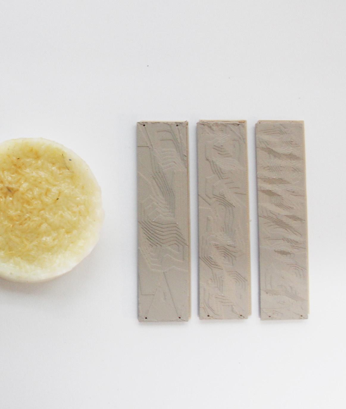
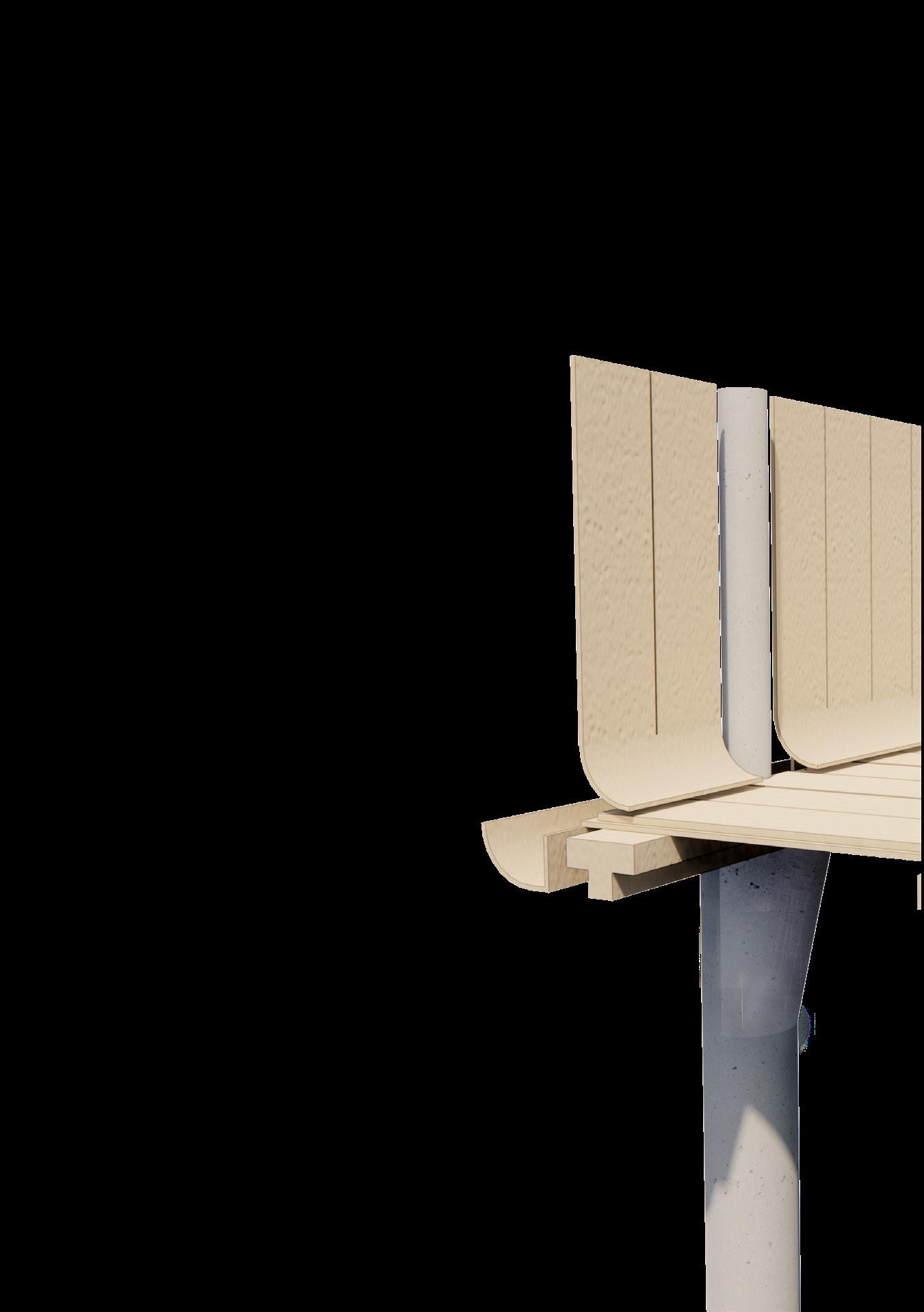
The bridge is constructed out of 1100x275mm recycled HDPE tiles and coloured in a beige tone to refer to the refminucipal rule to use a minimum of 40% ‘Jerusalem Stone’ to the face of the building. The surface structure guides the falling water to the edges of the tiles and into a slope leading it to the gutter attached on the edges of the bridge.
The supporting beams are also made of HDPE and refer to the shape of the overall structure. Also this is the only way to use the material in a stiff way.


94 5 5 0 1 2 6 8 1 1 0 0 1100 275 137 5 200 137 5 2 7 5 2 7 5 2 7 5 2 7 5 2 7 5 2 7 5 2 7 5 2 7 5 5 5 0 5 5 0 5 5 0 5 5 0 1 2 6 8 1 1 0 0 1100 275 137 5 200 137 5
110 55 275
Mandatory Jerusalem Stone

Facade cladding: Bowl of HDPE
95 250 55 13 7 Recyc ed p ast c slabs 1100 x275 Co oured w h be ge Beam recyc ed HDPE + co oured w th be ge a r space Wa recyc ed concrete 300 mm Bridge side Insulated waste disposa trucks de (dB /oUe ) Racks eed ng bed or caper shrubs Caper shrubs 1:10 4 7 5 0 7 0 0 0 5 0 0 0 P=0 -3000 2000 -10000 -15000 Pr mary bridge Factory Factory + storage (water) -500: inbetween & view in factory -5000 -10000 -15000 Recycled concrete Secunda ry bridge 1/4 11000 2750 110 110 250 55 13 7 Recycled p as ic s abs 1100 x275 Co oured w th be ge Beam recyc ed HDPE + co oured w h be ge a r space Wa recyc ed concrete 300 mm Bridge s de Insu ated waste disposal truckside (dB /oUe ) Racks feed ng bed or caper shrubs Caper shrubs 1:10 4 7 5 0 7 0 0 0 5 0 0 0 P=0 -5000 -10000 -15000 110 110
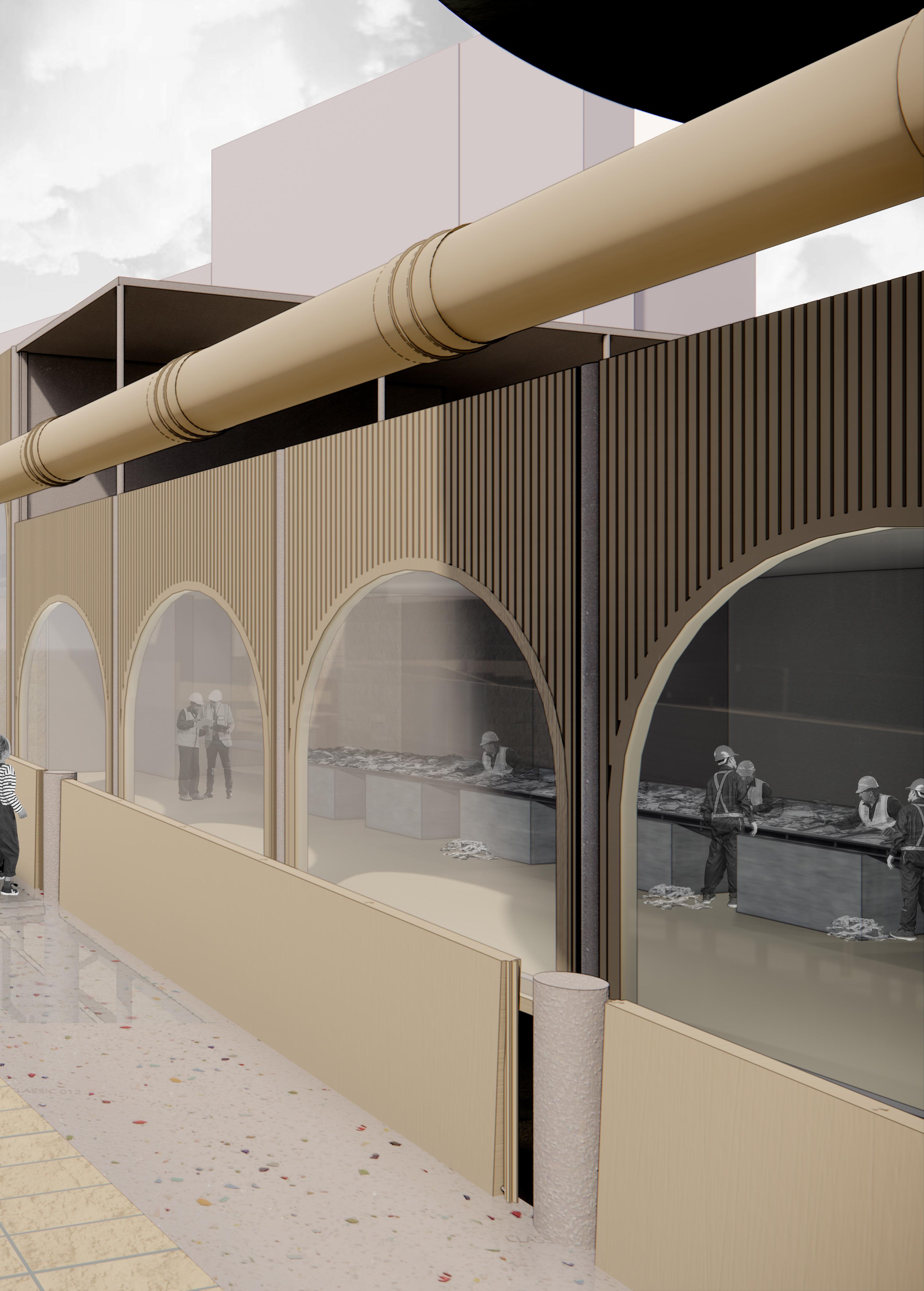
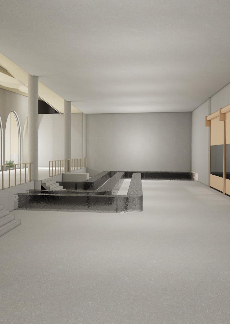
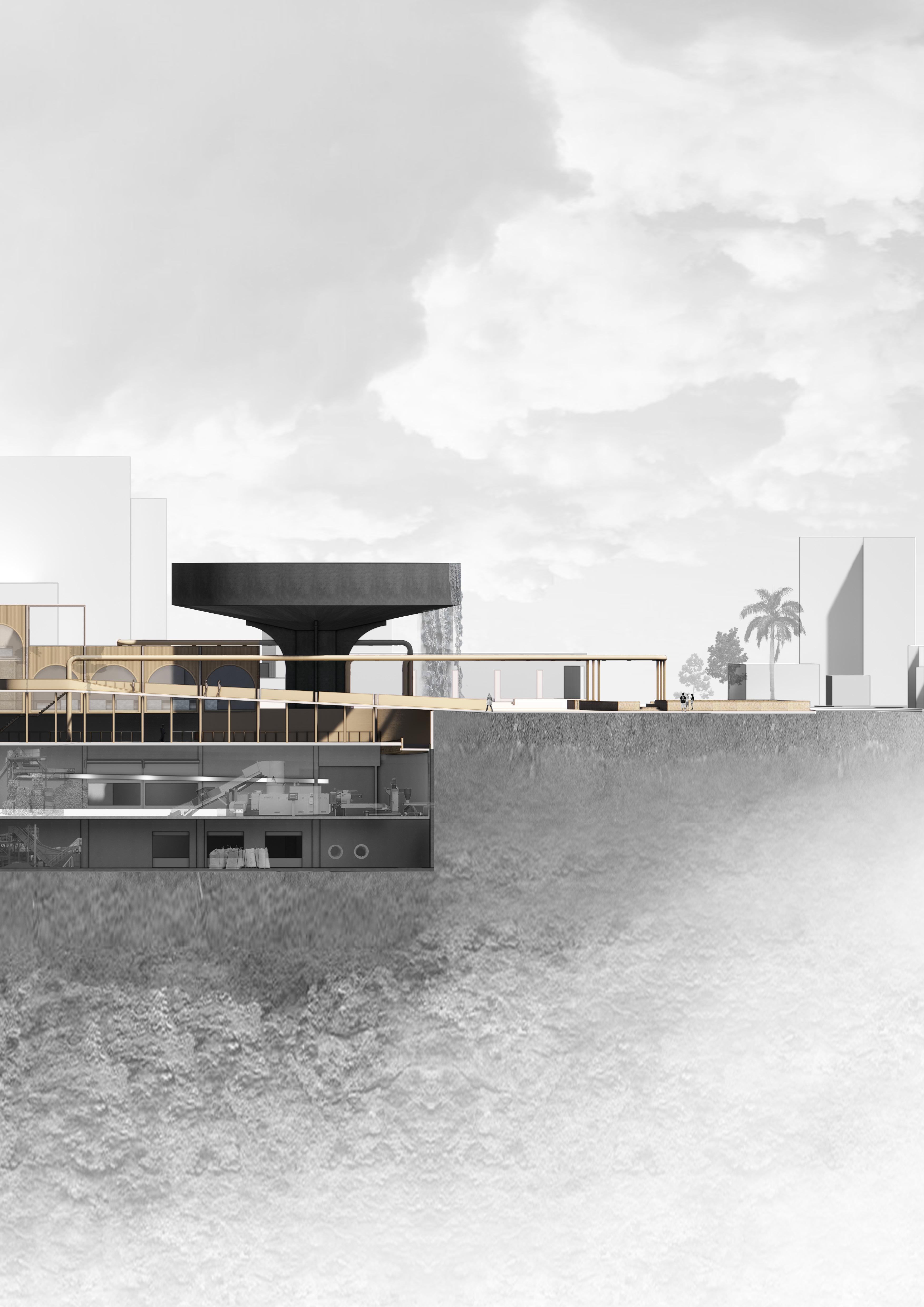
Section in the middle of the plant: Bridge is carried by the linear structure of columns getting smaller from level -3 to ground floor. The bridge has a different height than the plant itself, so men can look into several processes of recycling the plastic.
100 Insulated waste truckside (dB / 4 7 5 0 7 0 0 0 5 0 0 0 P=0 -3000 2000 -10000 -15000 Primary bridge Factory Factory + storage (water) -500: inbetween & view in factory -5000 -10000 -15000 Recycled concrete Secundairy bridge 1/4 11000 2750
Hidden waste intake from all neighborhoods
A bowl of HDPE
101
1:500
Model
Ground floor
106 GSEducationalVersion to remove nitrogen and phospherus from wastewater before entering the purification tank Aerobic IFAS Zone BNR (Biological Nutrient Removal) Anoxic zone / Anaerobic Zone Ramp 1:20 Distribution Opp.: 142 m2 Truck stand export recyclates Opp.: 60 m2 Aeration basin Opp.: 293 m2 Busstation Tickets Opp.: 14 m2 Shared toilets & canteen Opp.: 40 m2 Truck stand PET PS and PP Opp.: 57 m2 Truck stand household plastics (PMD) Opp.: 57 m2 Busstation Tickets Opp.: 28 m2 1:20 1:20 Personel (cafeteria, lockers etc) Opp.: 114 m2 Ground Floor - 220902
107 GSEducationalVersion Grid / surface waste tank Water pump Water pump + first clarifier PET from truck PP, PS from truck Household waste Household plastics PET installation Downpour PMD Downpour PET Downpour PS, PP, PE Plastic disposal cabin Opp.: 249 m2 -1 Floor - 220902 Level -1
108 GSEducationalVersion Bottom of slib tank (sand capture) Downpour PMD Downpour PET Downpour PS PP, PE Grinding machines Opp.: 179 m2 Shredding machines Opp.: 195 m2 -2 Floor - 220902 Level -2
109 GSEducationalVersion Base pumps air ventilation Household plastic Opp.: 58 m2 Household waste Opp.: 114 m2 PET incoming Opp.: 113 m2 Centrifugal Chillers Opp.: 95 m2 Water basin second wash Opp.: 475 m2 PP, PE, PS incoming Opp.: 57 m2 Water basin first wash Opp.: 467 m2 Space to walk / work Opp.: 239 m2 Water pumping systems Opp.: 56 m2 -3 Floor - 220902
-3
Level
110
111 1 500 1 200 Doorsnede A Green between edges #Pln N -15,000 -3 Factory / Storage -10,000 -2 Factory -5,000 -1 Factory / Public 0 0 Begane grond 5,000 1 1e verdieping 10,000 2 2e verdieping 5,500 5,500 5,500 5,500 5,500 27,500 +14,000 23.560
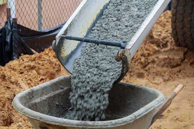
Materialisation Recycled concrete
When the assumption is State - concrete, orientalismJerusalem stone is over the sense of ownership of both Jewish and Arabic inhabitants of Jerusalem, then Jerusalem stone should be the face of the trusted and protecting.
The recycling factory is a State symbol to manage both sides, east and west as an equal reciever of sources and care from the State. Therefor the State is close instead of distant, tranparent instead of closed, soft instead of hard, covering / protecting instead of alienating. State becomes the opposite as it was between 1948 - 1967. Therefore State has shared foundations instead of a foundation of West. Those shared foundations are stacked upon each other.
Materialisation
Microsilica or silica fume for the water tanks and purification clarifier
Microsilica Concrete
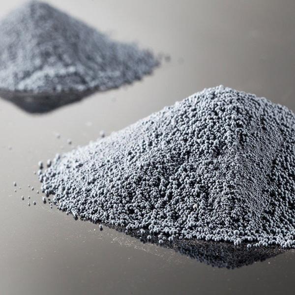
Silica Fume: Byproduct of silicon
Benefits:
1. Because of its fine parts it contributes to the density and coherence of concrete
2. Has a great influence on pressure of the concrete(>1/3 stromger than regular concrete)
3. Reduce of concrete permiability (not affected by water in time)
4. Raises stability of concrete
5. Gives a higher resistantance to chemical damage to concrete
6. No bleeding in texture / look concrete: equal surface: soft looking concrete
Microsilica is known to improve the durability of concrete by making it less permeable, and increasing its compressive strength. Concrete made with silica fumes is specifically used for structures that are exposed to harsh chemicals. Compared to traditional concrete, it is a much eco-friendlier material. Concrete made with silica fumes is specifically used for structures that are exposed to harsh chemicals. Compared to traditional concrete, it is a much eco-friendlier material.
113
116
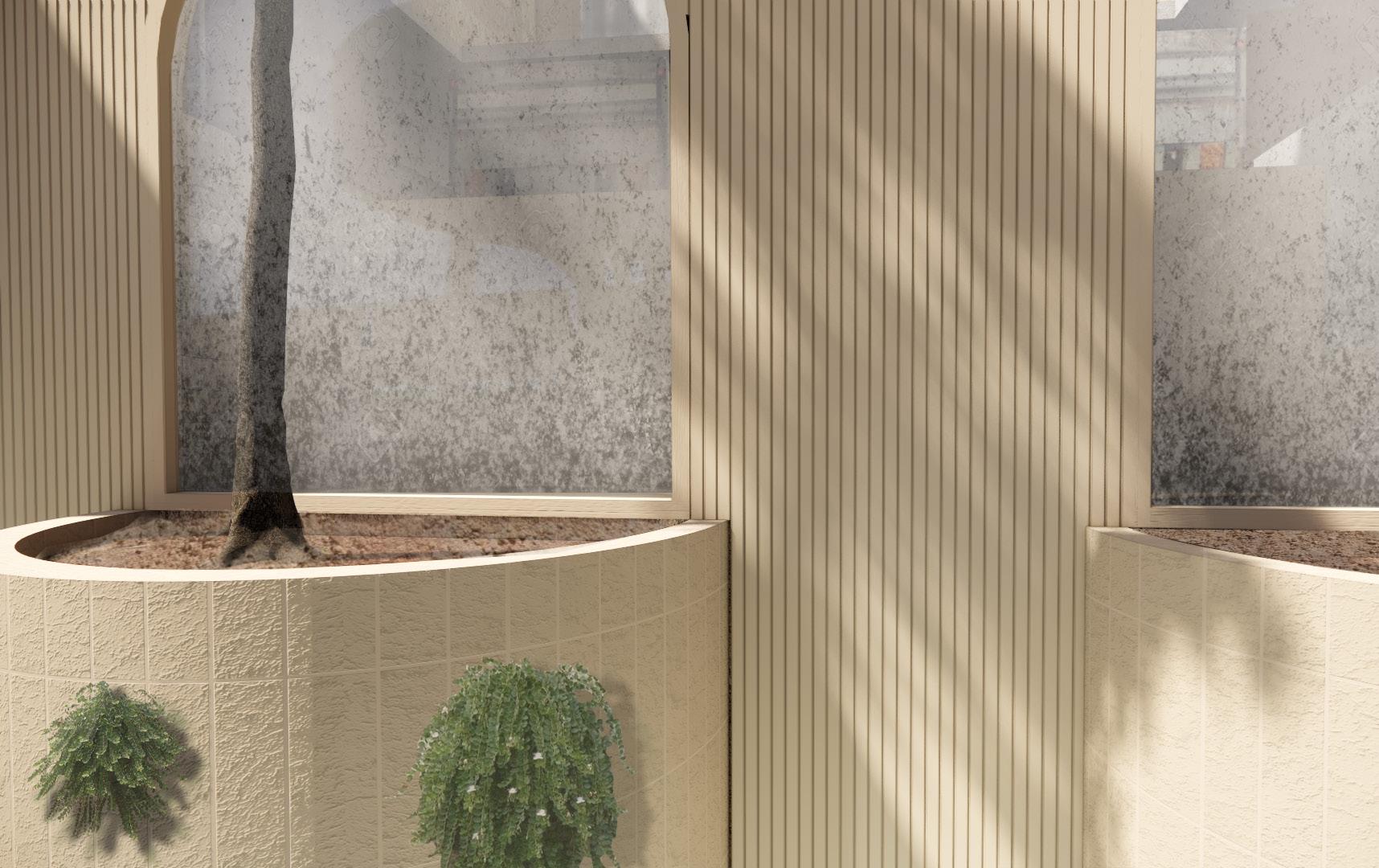
Mandatory Jerusalem Stone
A bowl of HDPE
Walking through a recycling plant. The structure is defined by four crosses. These crosses divide, seperate and organize the complex layout from level -3 to first floor.
They function as the bearers and the function planners of the factory. Thefore as a base to make the plant work.
They also appear in the bearing structures of the bridge, but then made from 110x275mm HDPE columns to refer to the material of the public route at the location.
The cocnrete crosses are also the load bearing structures of floors.

117
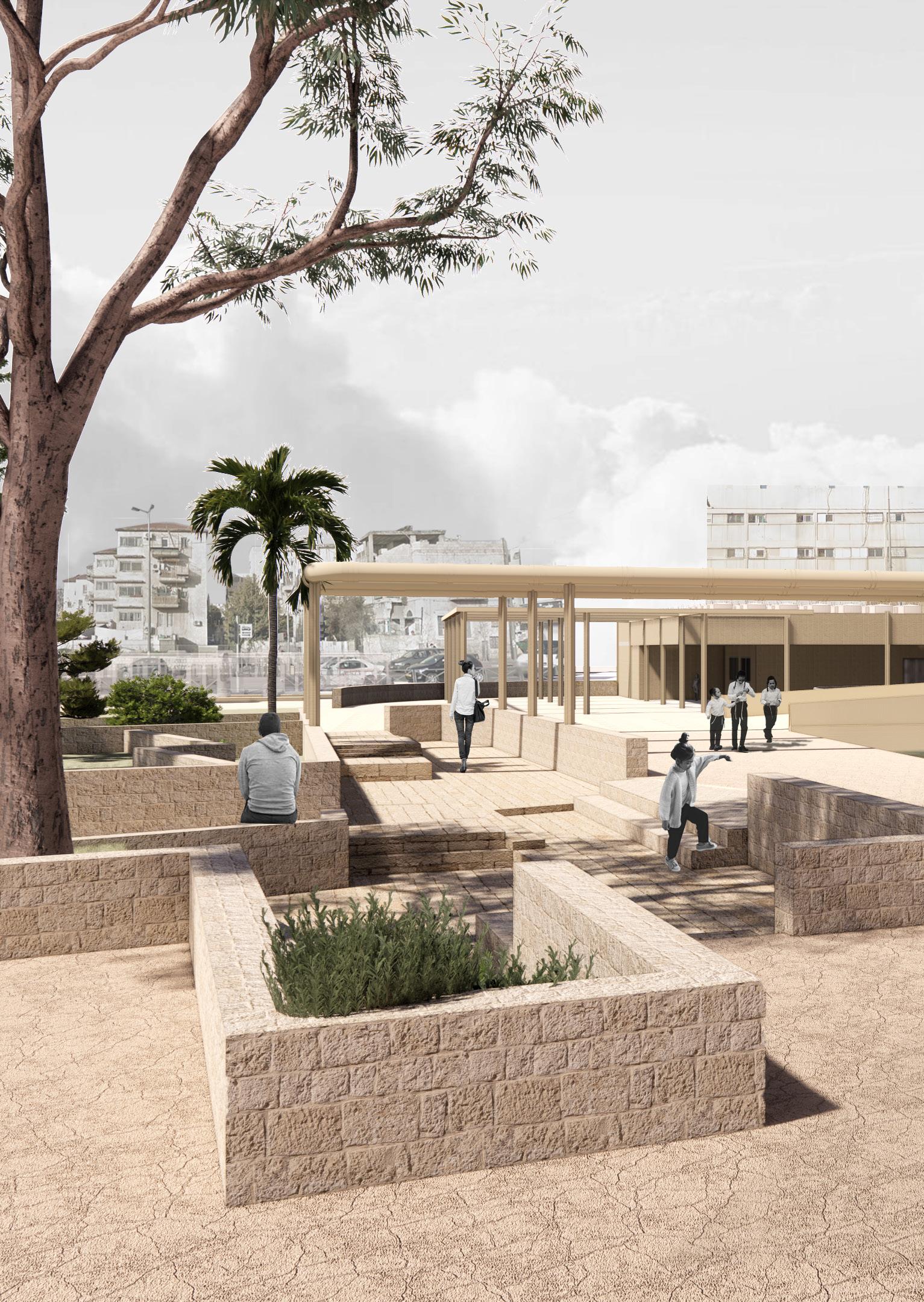
A bowl of sand tones enclosed by the concrete structures of the plant
Acknowledgements
I would like to thank all people who accompanied me in this project and encouraged me and listened to all the stories and doubts I had about the sensibility of the arab-israeli conflict. Also my perspective somehow changed by the stories of Orthodox Jewish families in Jerusalem as well as Nashashibi Arab families who are eventually excavated by colonists on the first location of this project. Looking back I naively dove into the outskirts of Abu Tor and Ramot and me and my sensitive questions were welcome every time. I learned how hard it is to stay neutral when you’re confronted with heart breaking situations. It made me too critical on state and municipal regulations at one point, but also made me sharp on political choices in the Netherlands relevant for social wellbeing and the role of architecture and other spatial interventions.
Especially I would like to thank my committee, Marc Schoonderbeek and Micha de Haas for their professional guidance, patience and encouragement. I never learned more during the Academy time than during this graduation project. I’m grateful they supported my intuitive way of working and guided the process to make it factual with analysis and research to build from.
And last I would like to thank my mentor Bart Bulter, for all the supportive and pleasants talks we had, and always asking the right questions to help me further.
120
Research supporting companies
Israel
Municipality of Jerusalem: GIS Department
Menachem Helman
Yoni Bar-Lavie
Shayna Laban
Jerusalem Institute for Policy Research:
Omer Yaniv
Yair Assaf-Shapira
Bezalel Academy for Architecture Jerusalem: Arch. Ilana Rudashevski
Emek Shaveh: Prof. Yonathan Mizrachi
Matti Rosenshein Architects: Arch. Aryeh Wiseglass
Ministry of Interior: Tomer Heimann
Union Tech Tel Aviv: Oz Bar-Liss
The Netherlands
Van Werven Recycling, Biddinghuizen: Sven Fortuin
Aufderhaar Kunststofrecycling, Vroomshoop: Sebastiaan Kok
RWZI, Zwolle: Menno
ICEJ Jerusalem: Jannie Tolhoek Jacob Keegstra
121
INBETWEEN GREEN
PAST, PRESENT AND FUTURE OF JERUSALEMS NO-MANS LAND
