 Reverse Transformation of Urban River Public Space in Tokyo
Architecture
of Architecture Amsterdam November 2023
Daiki Mabuchi Master Landscape
Academy
Daiki Mabuchi
daikimabuchi89@gmail.com
Master Landscape Architecture Academy of Architecture Amsterdam
November 2023
Committee
Marieke Timmermans (mentor)
Yttje Feddes
Hiroki Matsuura
Expert Yuka Yoshida
Exam Committee
Jana Crepon
Philippe Allignet
Introduction - Motivation Research - The Sumida River in Tokyo - History of the Sumida River - Site visits - Analysis Strategy - Goal - Design methods Design - Connecting the city fabric - Expanding the river space - New river spaces 6 8 14 16 26 36 62 72 76 78 80 82 106 126 Contents
5
Introduction
7
Motivation
Japan, where I came from, is an island country, and therefore, Japan has a rich water landscape. Even though there are many water surfaces in the country, many waterfront spaces are not designed for people to use.
In general, most waterfronts in Japan are covered by concrete walls to protect the land from water disasters, and I do not see many places that consider people’s use. This is because civil engineering still prioritises designing and making a waterfront space, and landscape designers do not involve it so much. The seawalls along the coastline of the Tohoku region (northern part of Japan) are recent examples.
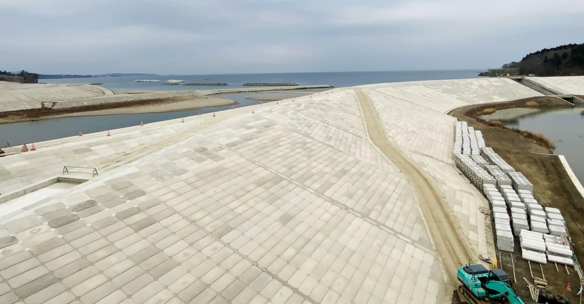
The concrete wall in the picture was made after the 2011 Tohoku earthquake and tsunami in Kesennuma city Miyagi prefecture, near my hometown. Also, my father is a civil engineer who was involved in this project, and my father and I went to see those huge flood wall / dike projects when I went back to my hometown. At this time, I was a landscape architecture student at a university around Tokyo, and every time I went to that area, I saw the coastline was replaced by a massive concrete wall or dike.
If landscape architecture had been more involved, the situation would have improved. As a landscape architecture student, I have wondered about this conventional Japanese way of water protection. I wanted to create a waterfront space where people can appreciate the water in Japan. This was the big motivation why I came to the Netherlands to learn how people live with the water. As a final project for the academy, I tackled how the waterfront in Tokyo could be improved in the future.
8
Seawall in Kesennuma city, 9.8m + ( date: 29 December 2020 )
Water disasters and Concrete Walls
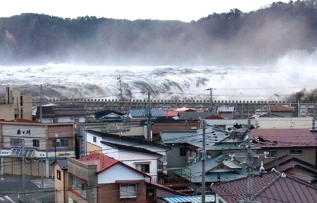
On March 11, 2011, Japan experienced the strongest earthquake in its recorded history. The Tohoku earthquake caused a tsunami. The Tohoku tsunami produced waves over 10 meters high, it braked dikes and many towns along the coastline were damaged by the tsunami. More than 450,000 people became homeless, and over 22000 people died as a result of the tsunami.
After the disaster, massive concrete walls or dikes were created as tsunami protection walls along the coastline of the Tohoku region. However, those seawalls block not only the tsunami but also a view of the sea. The relationship between the sea and the mountains was disconnected, and many residents moved elsewhere.
Earthquake and Tsunami in 11 March 2011 (22200 people dead)
home town
10
Tokyo My
Tohoku area
Tsunami on March 11, 2011
11
Ofunato city seawall 7.5m+ high
Koizumi Beach costal levee 14.7m+ high, 90 m width
Rikuzentakata seawall, 12.5m+ high
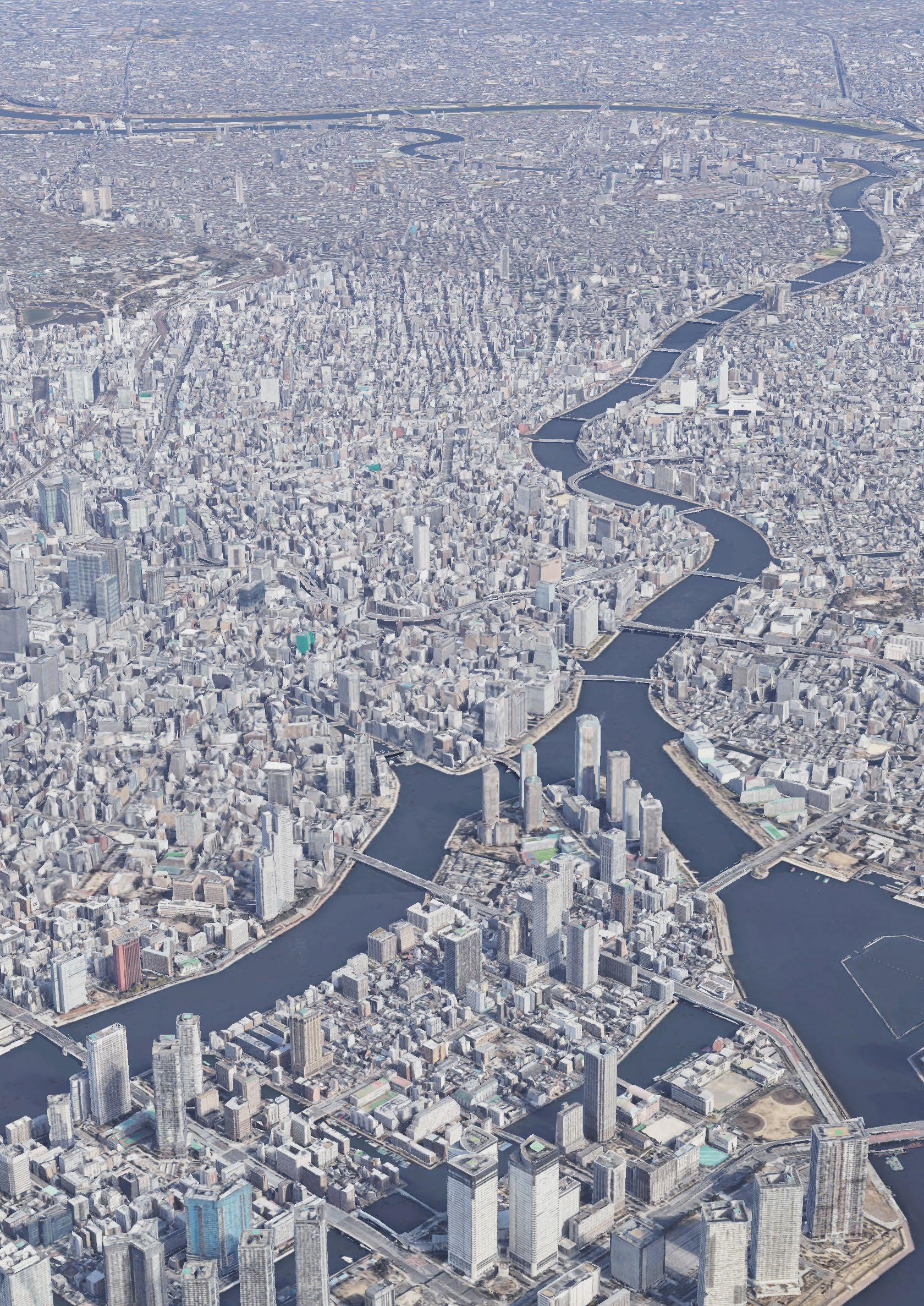
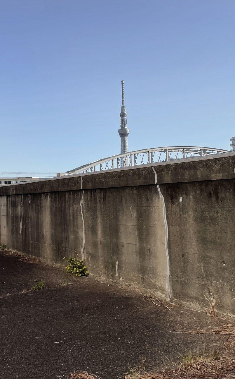
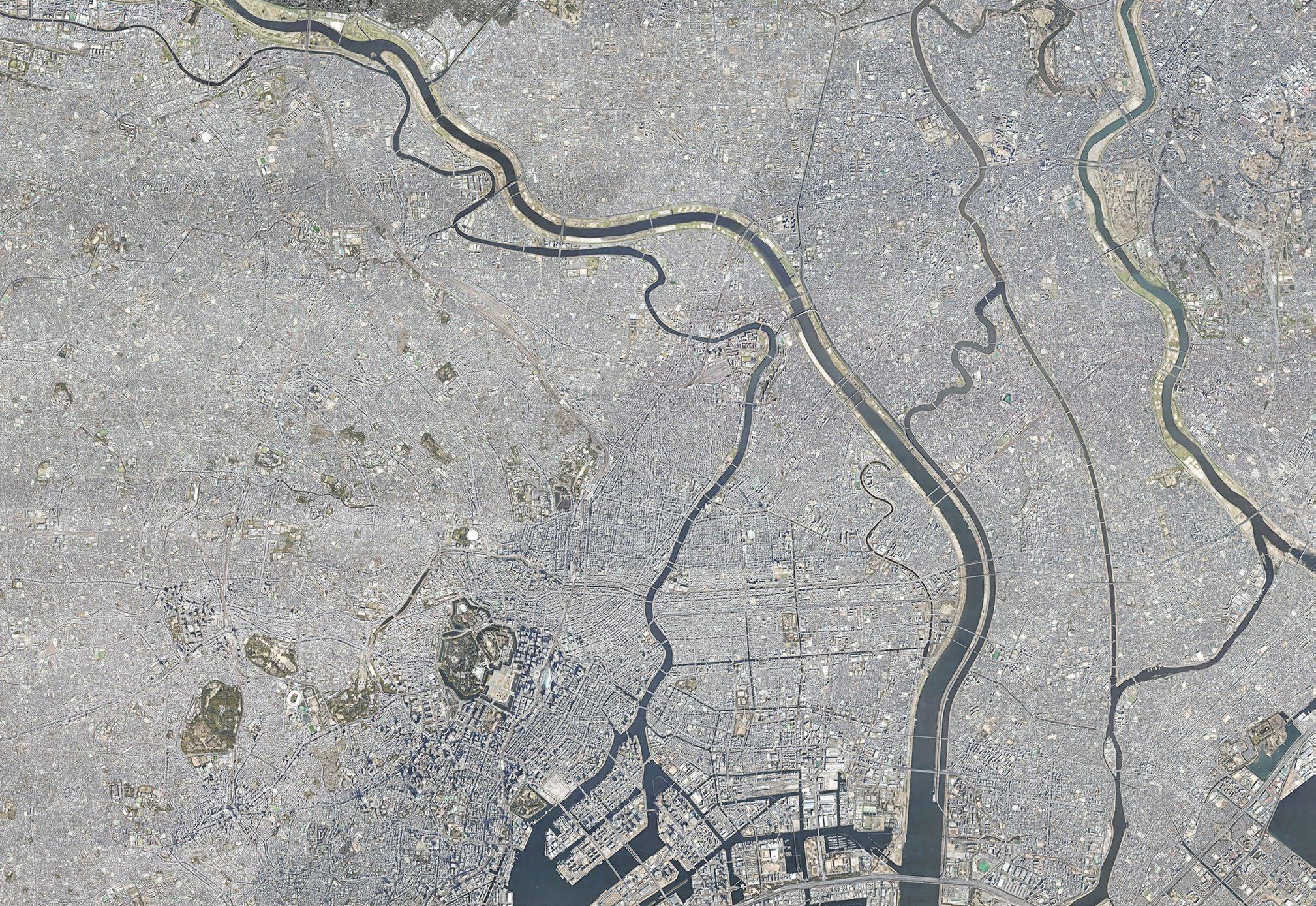
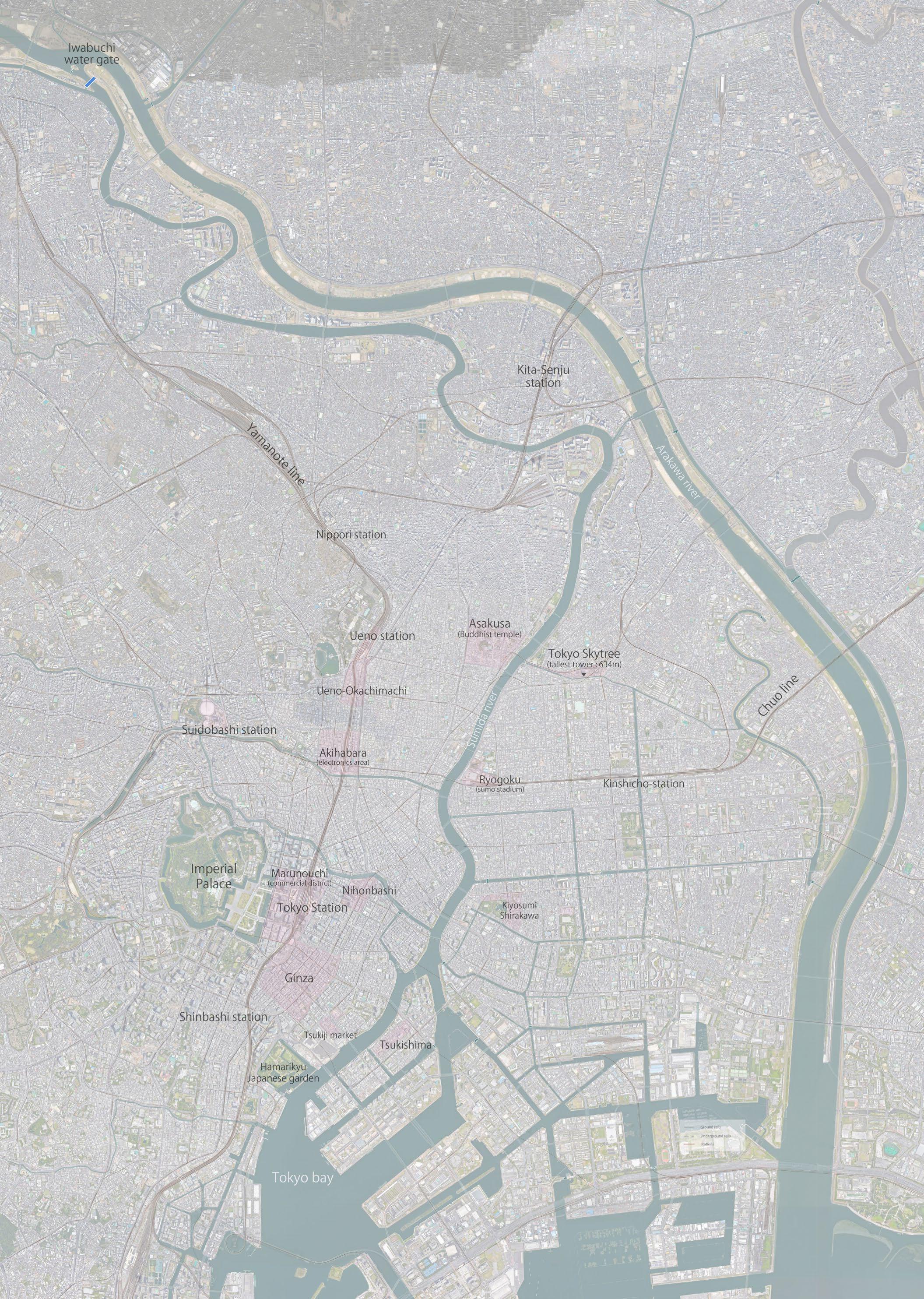
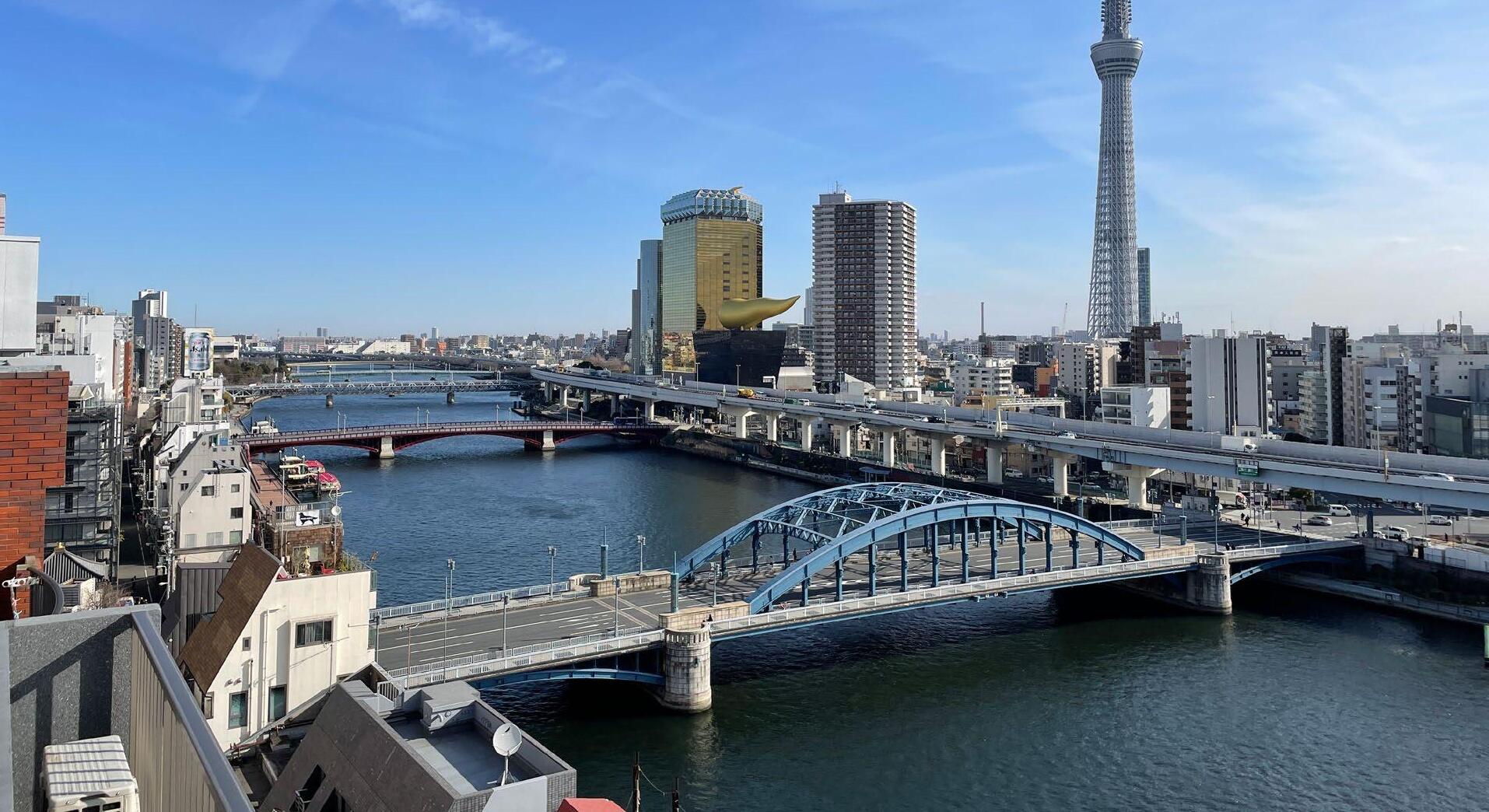
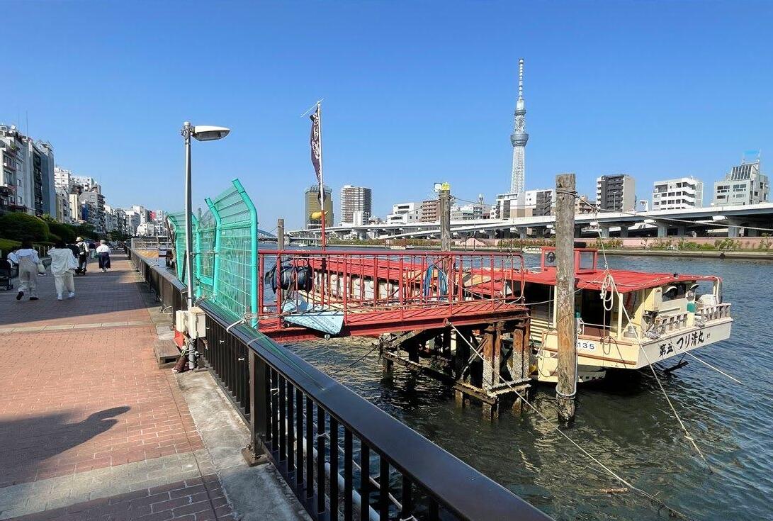
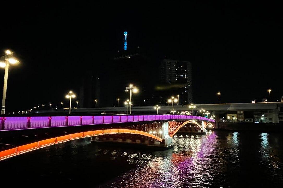
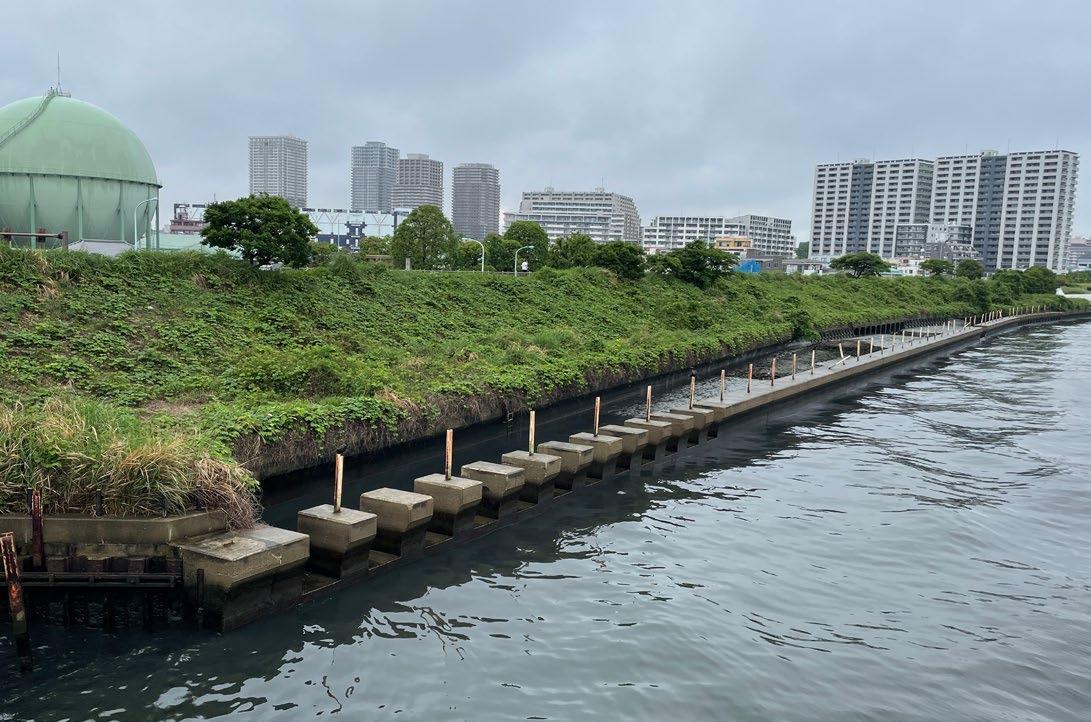
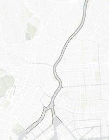
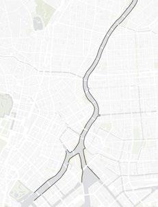
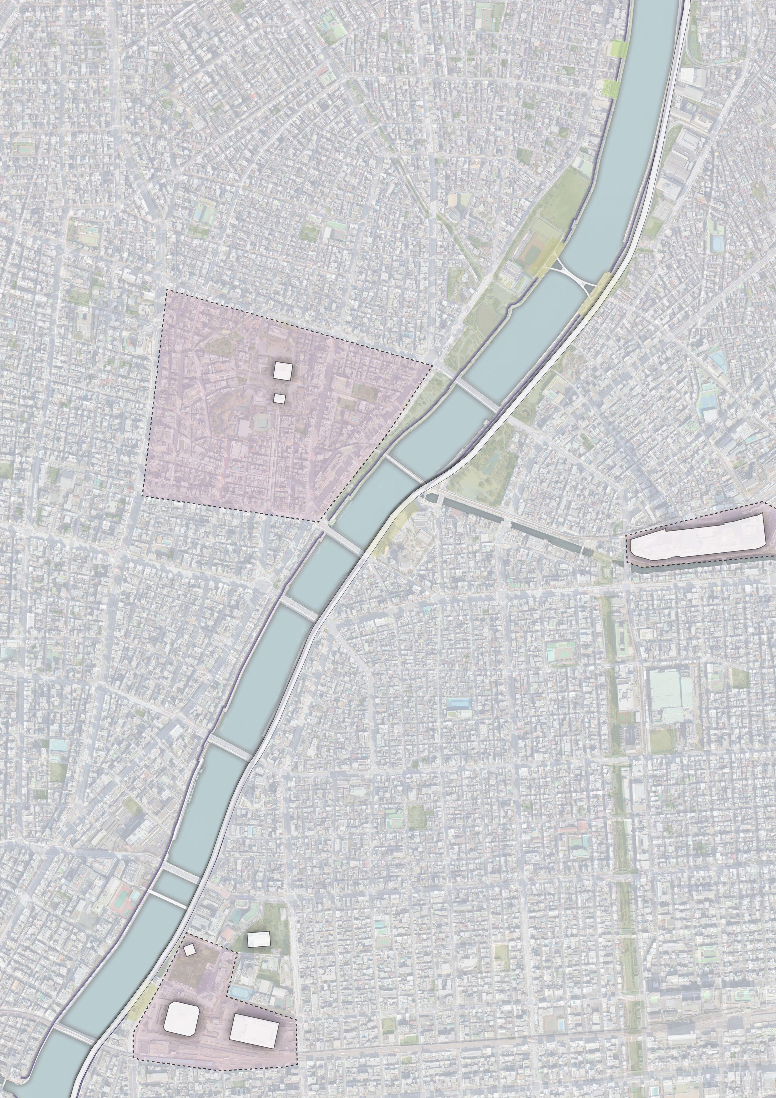
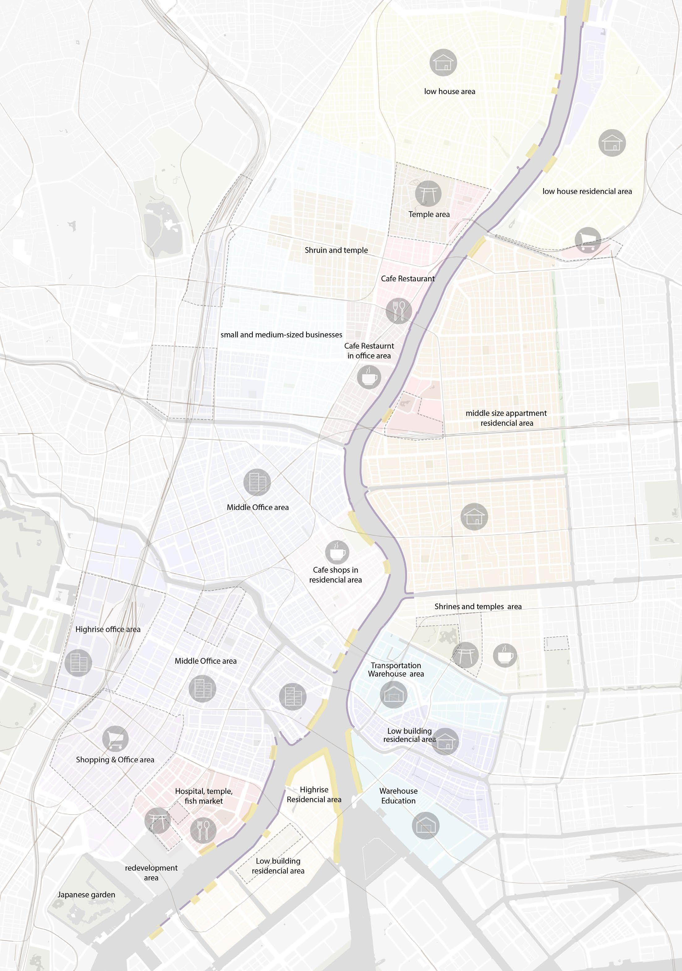
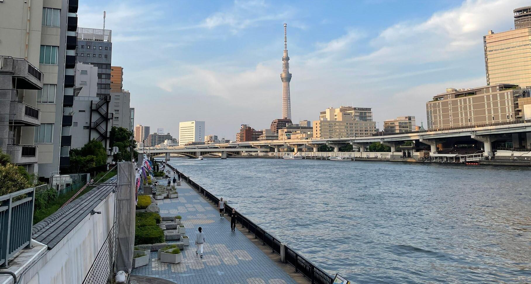
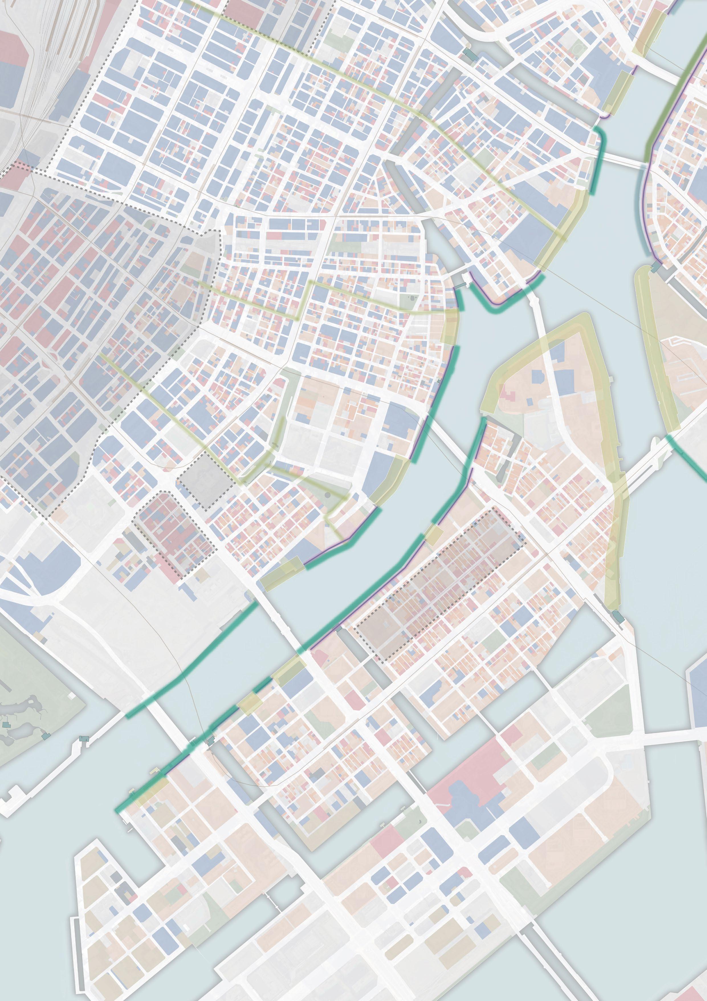
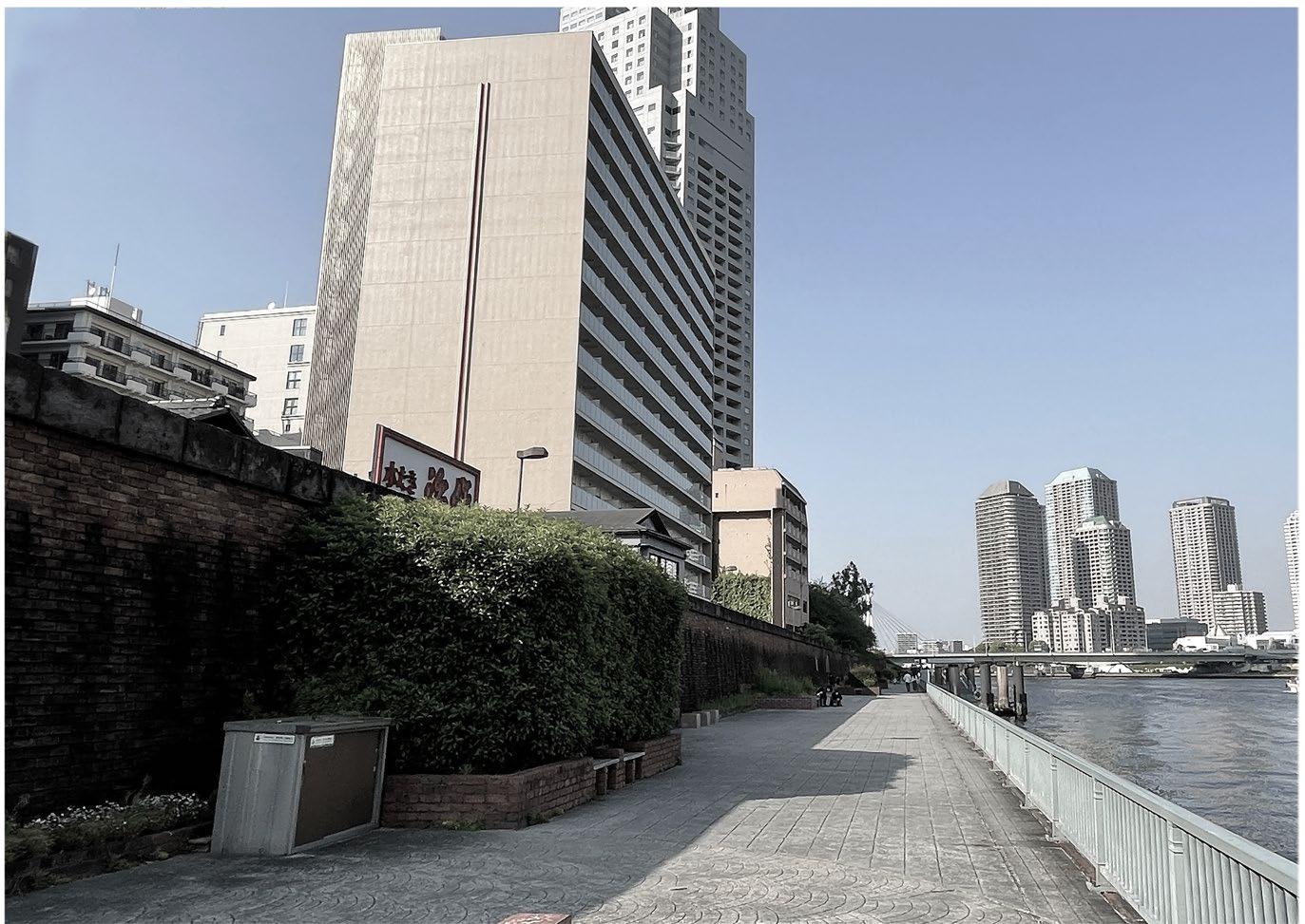
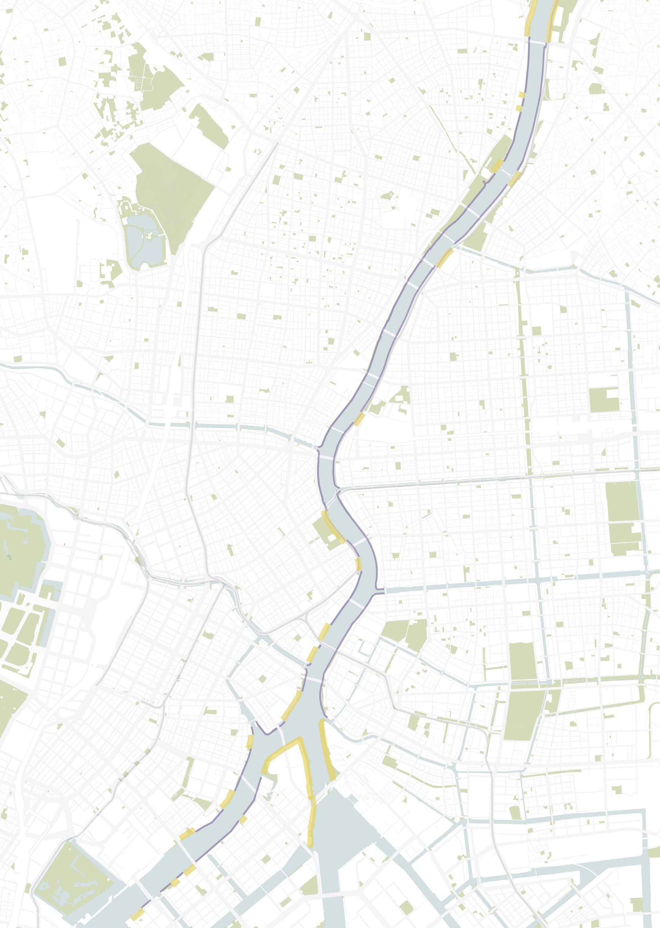
Sumida River in Tokyo
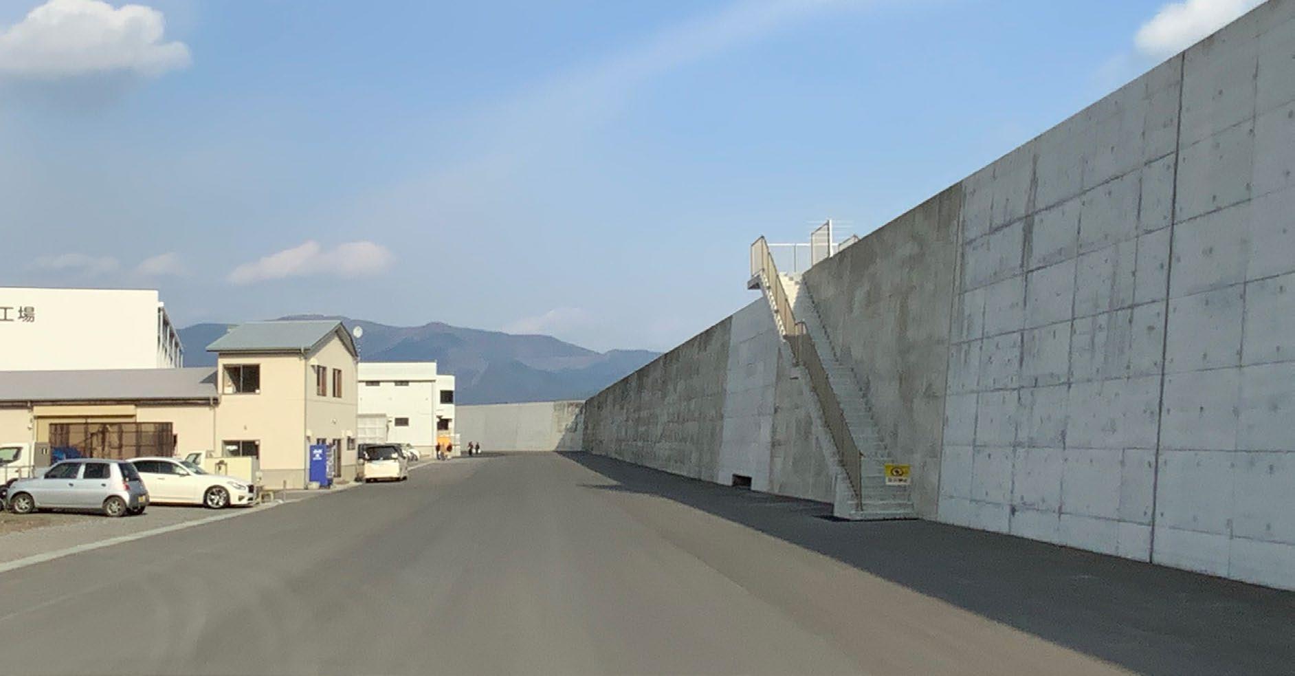
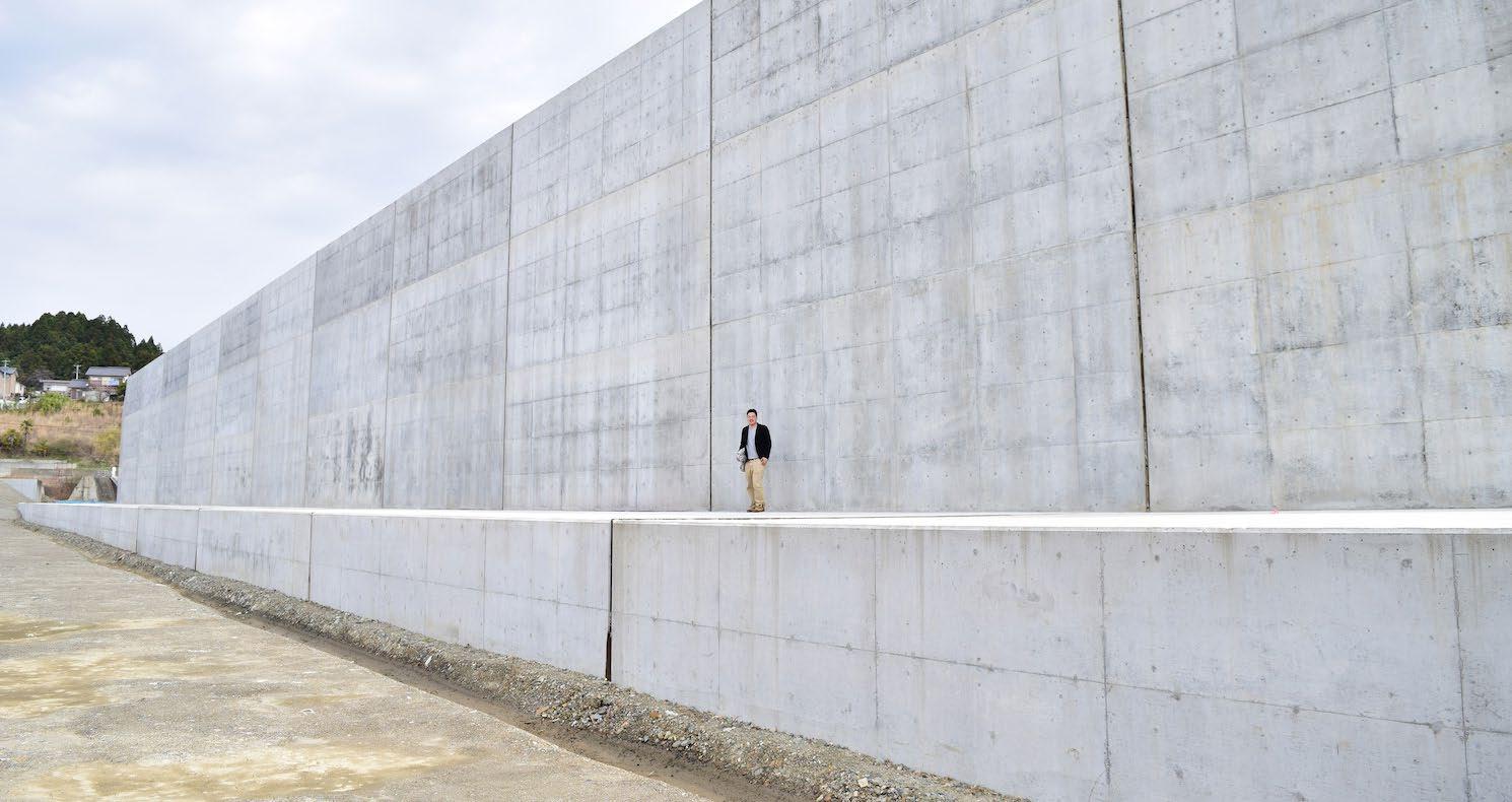
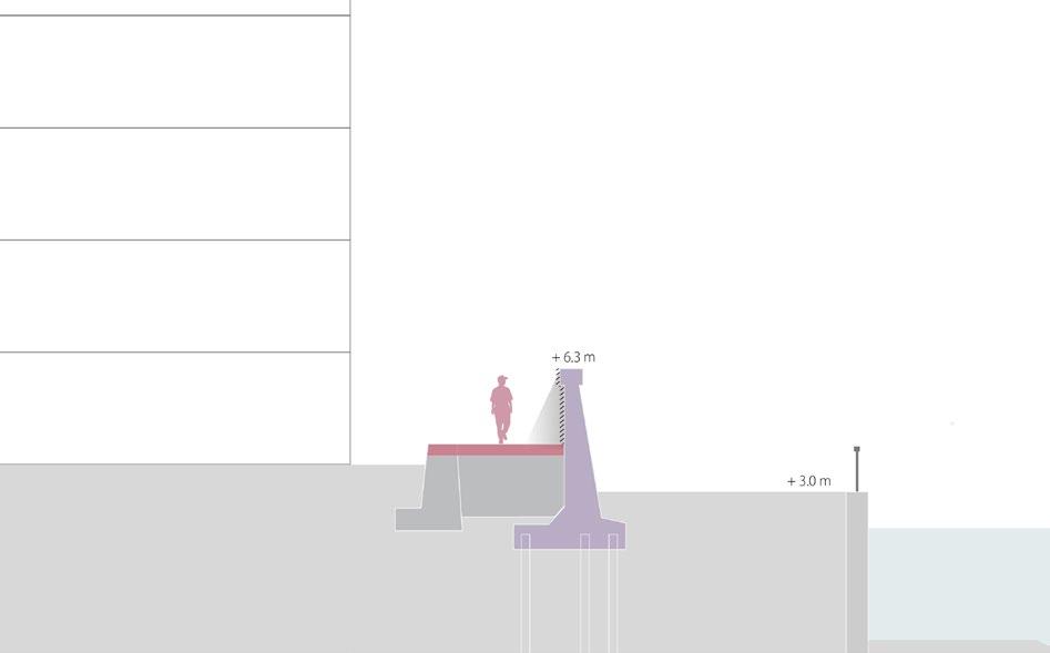
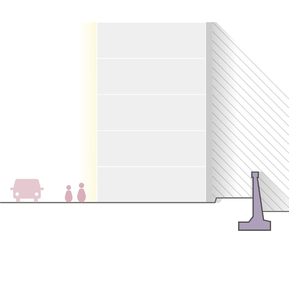
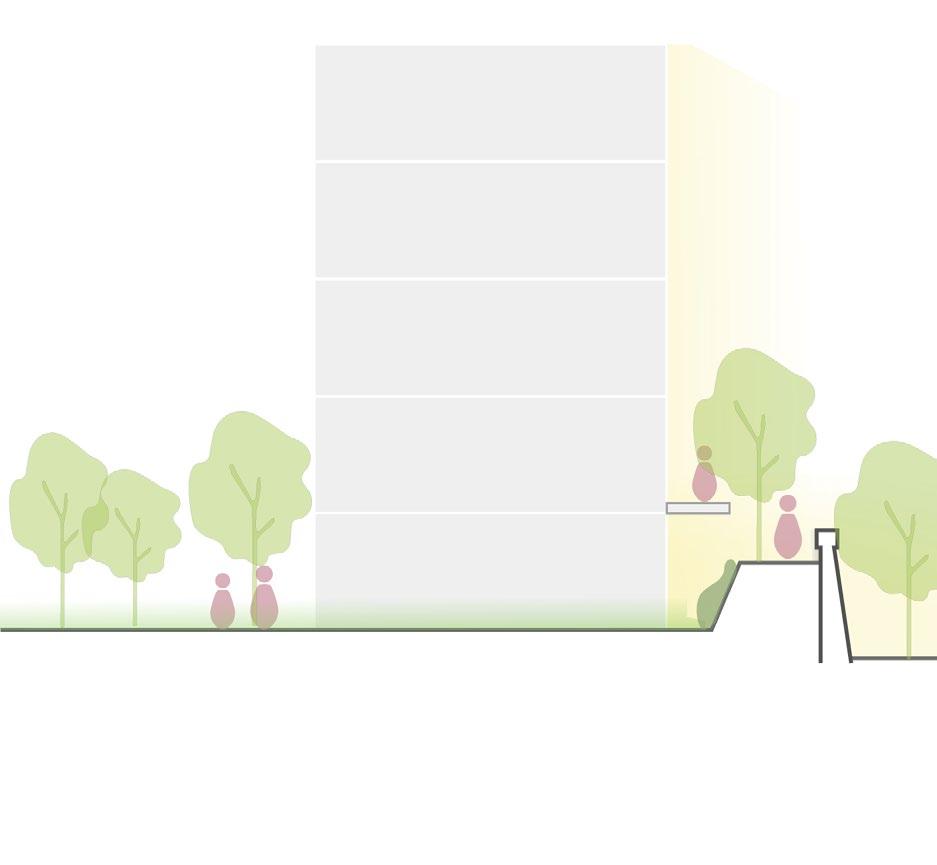
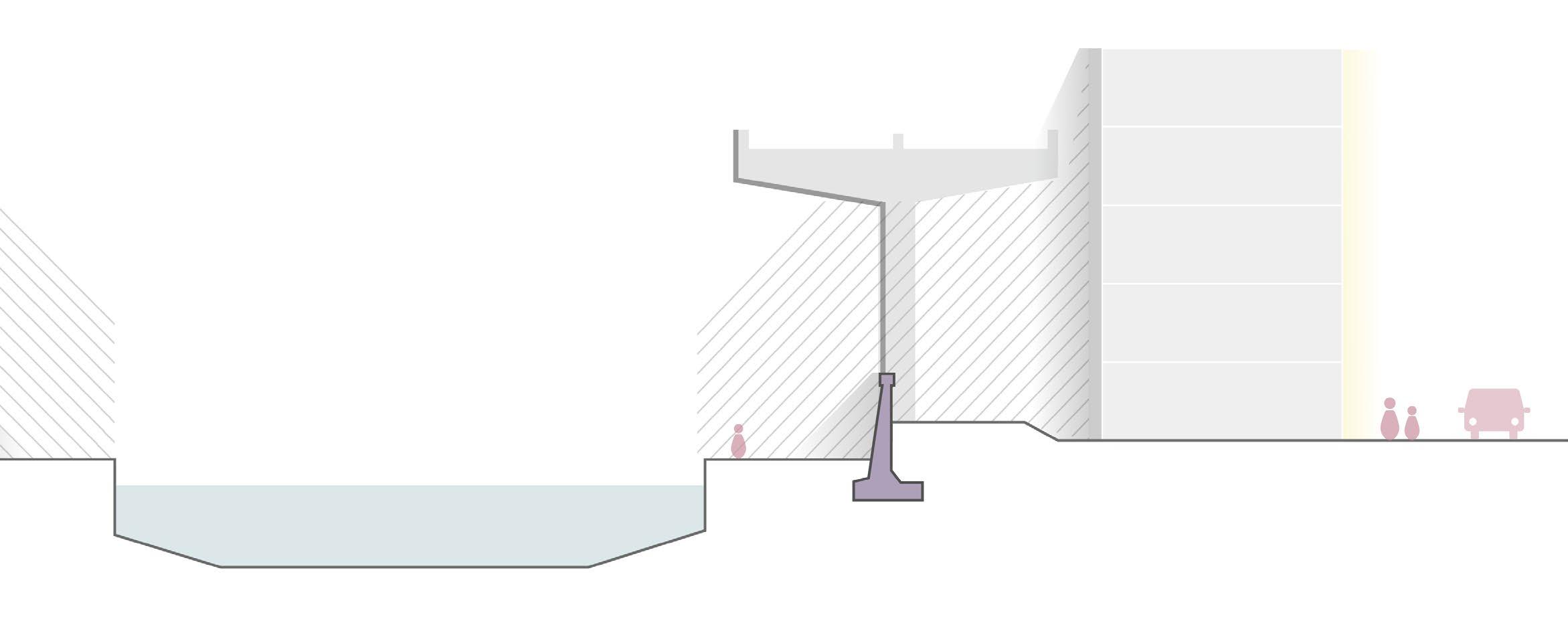
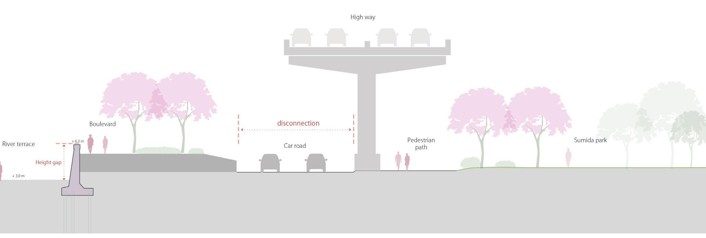
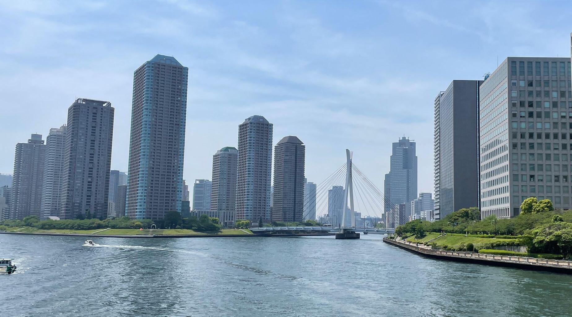
The situation of the waterfront in Tokyo is the same. The Sumida River, one of the huge rivers that flow next to the city centre, is covered by a flood wall, and water cannot be seen from a street. Of course, protecting people from a flood is the most important thing, but improving the quality of the waterfront public space is also important to increase the liveness and quality of life in the city. I believe the balance between flood protection and public space quality is important to make a well-used waterfront space in Tokyo. This project aims to reconnect people to the water in the capital of Tokyo by changing the river public space and its network.
12
13
Research
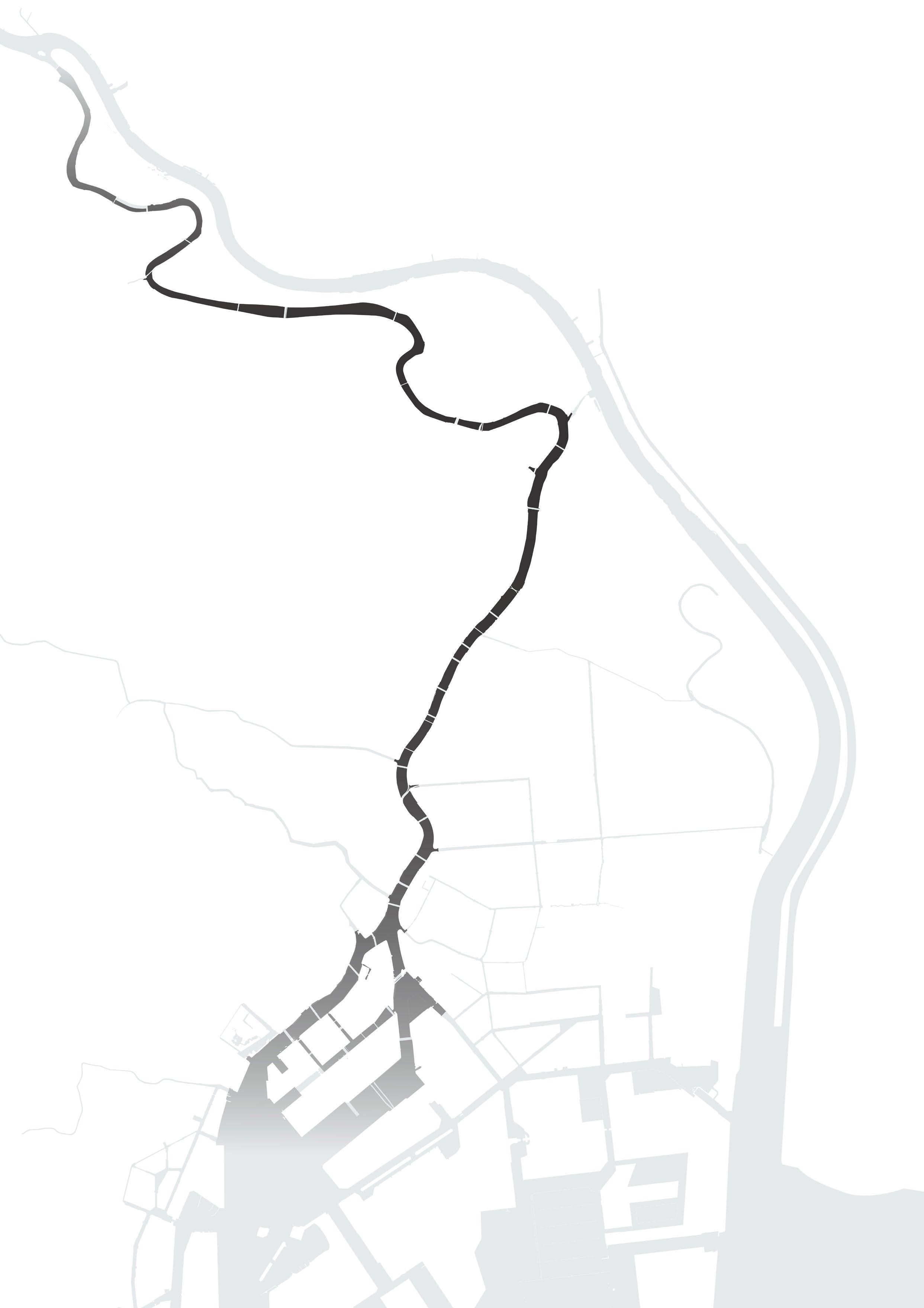
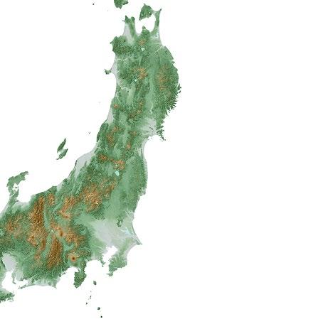
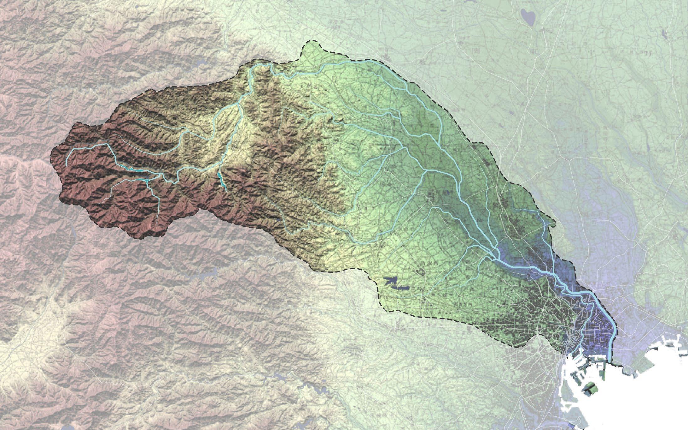
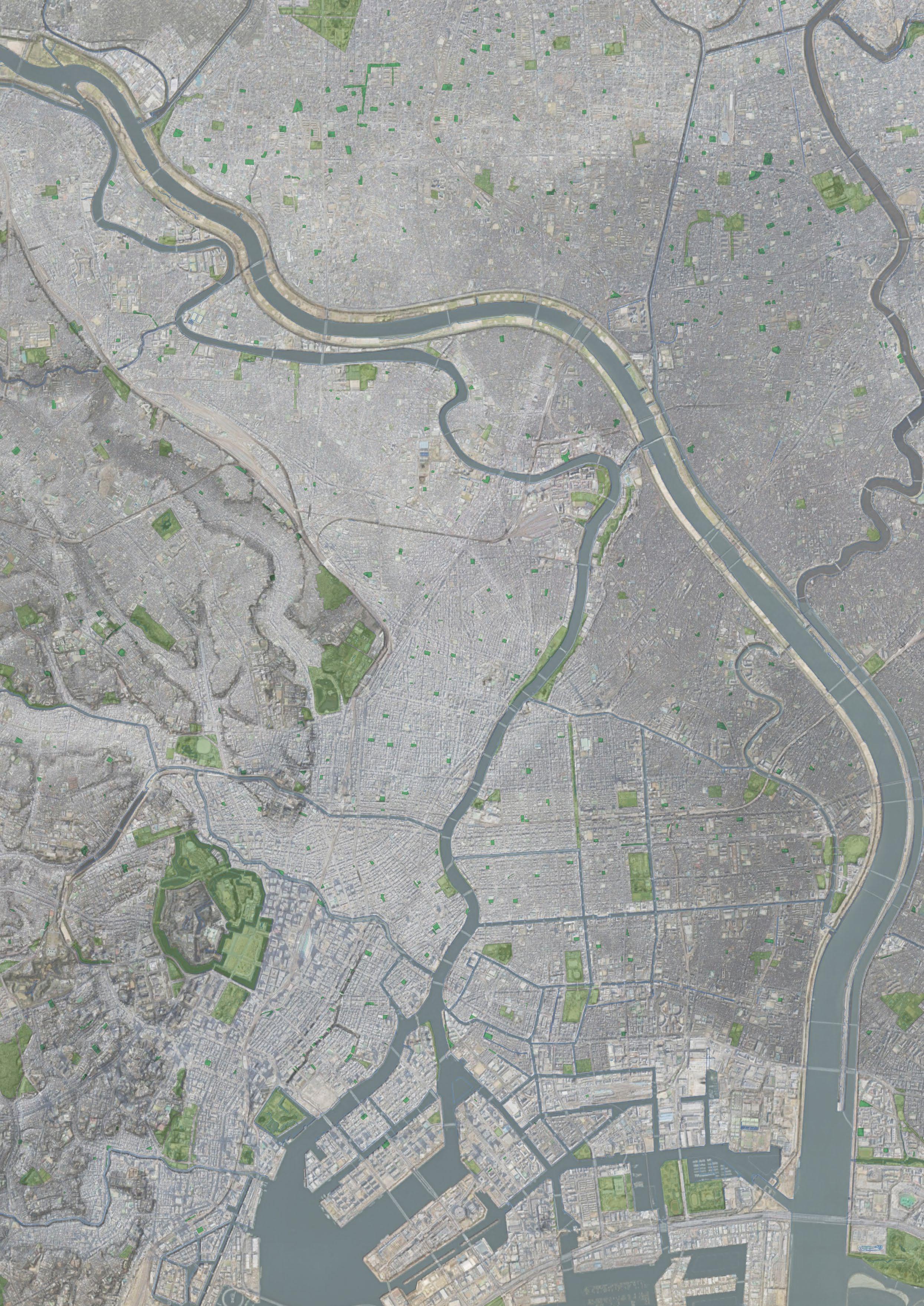
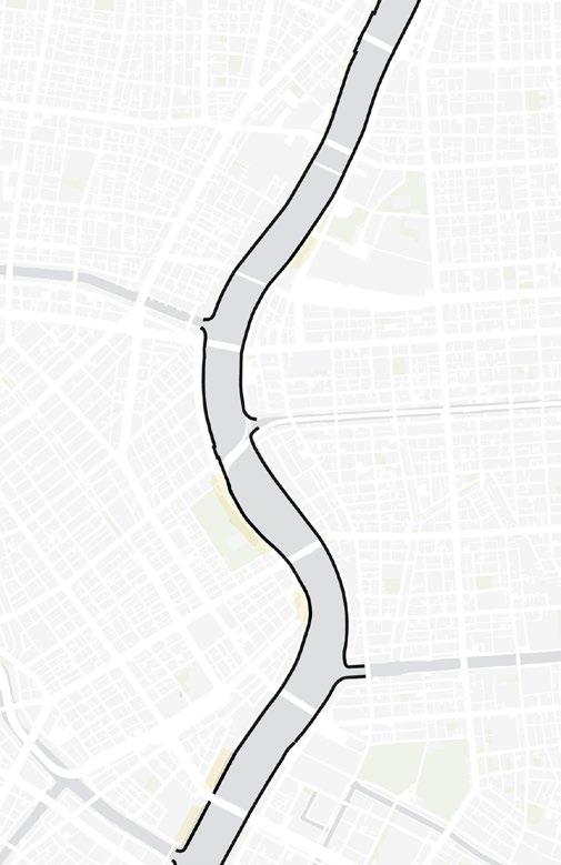
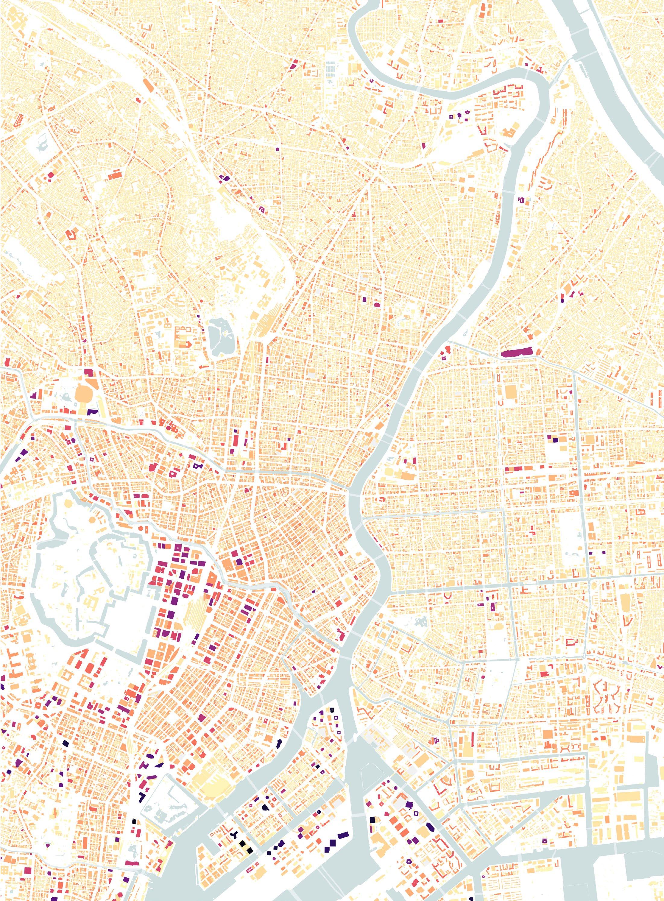
Location: The Sumida River in Tokyo
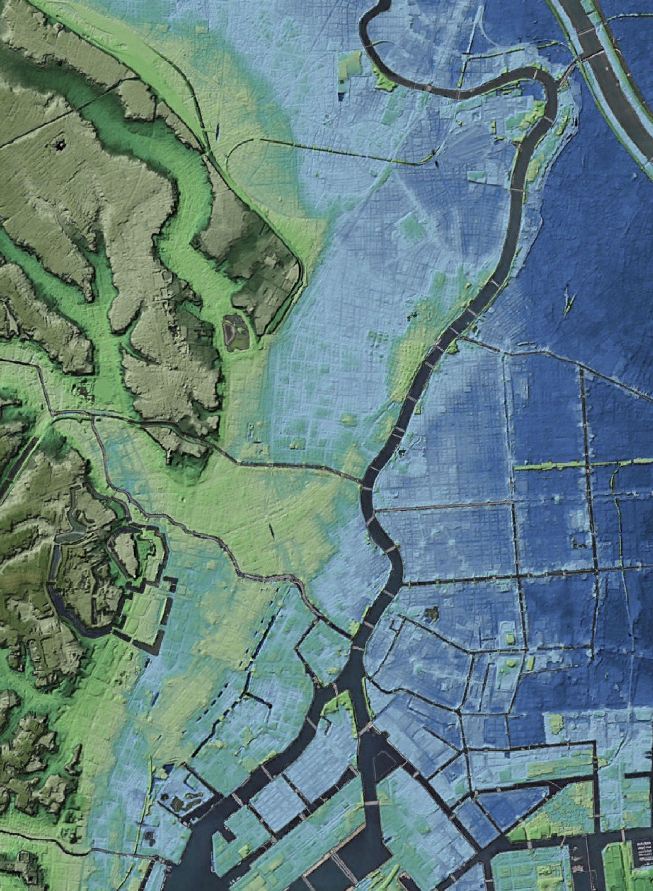
Tokyo is situated in the delta of Kanto Plein. Because of this topological situation, Tokyo has many rivers, canals and harbours. The Sumida River, one of the huge rivers in Tokyo, flows next to the metropolitan area of Tokyo. For my graduation project, I would focus on the Sumida River because it has played an essential role for a long time, both culturally and functionally, and the river represents Tokyo as a city river.
Topographic situation
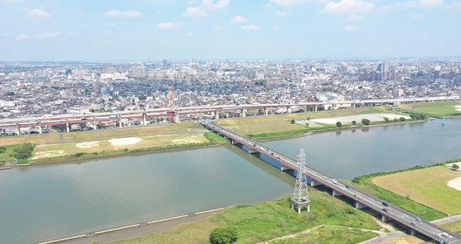
The Sumida River is a part of the Arakawa River system, which is 173 km long and has a height difference of 1,500 m. The Arakawa River system has a 3,000 km2 water basin covering Tokyo and Saitama prefecture. At the lower part of the river, it splits into two parts: the Sumida River and the Arakawa River. Due to the fact that the Sumida River flows through the delta area, its water level is constantly changing with the tides.
Also, the ground level of the eastern part of Tokyo is lower than that of the west side because it was originally a floodplain of the river. Furthermore, the ground sank below sea level because of pumping a large amount of groundwater for industrial use in history. Therefore, the eastern part of the Sumida River has a significant flood risk if the water overflows.
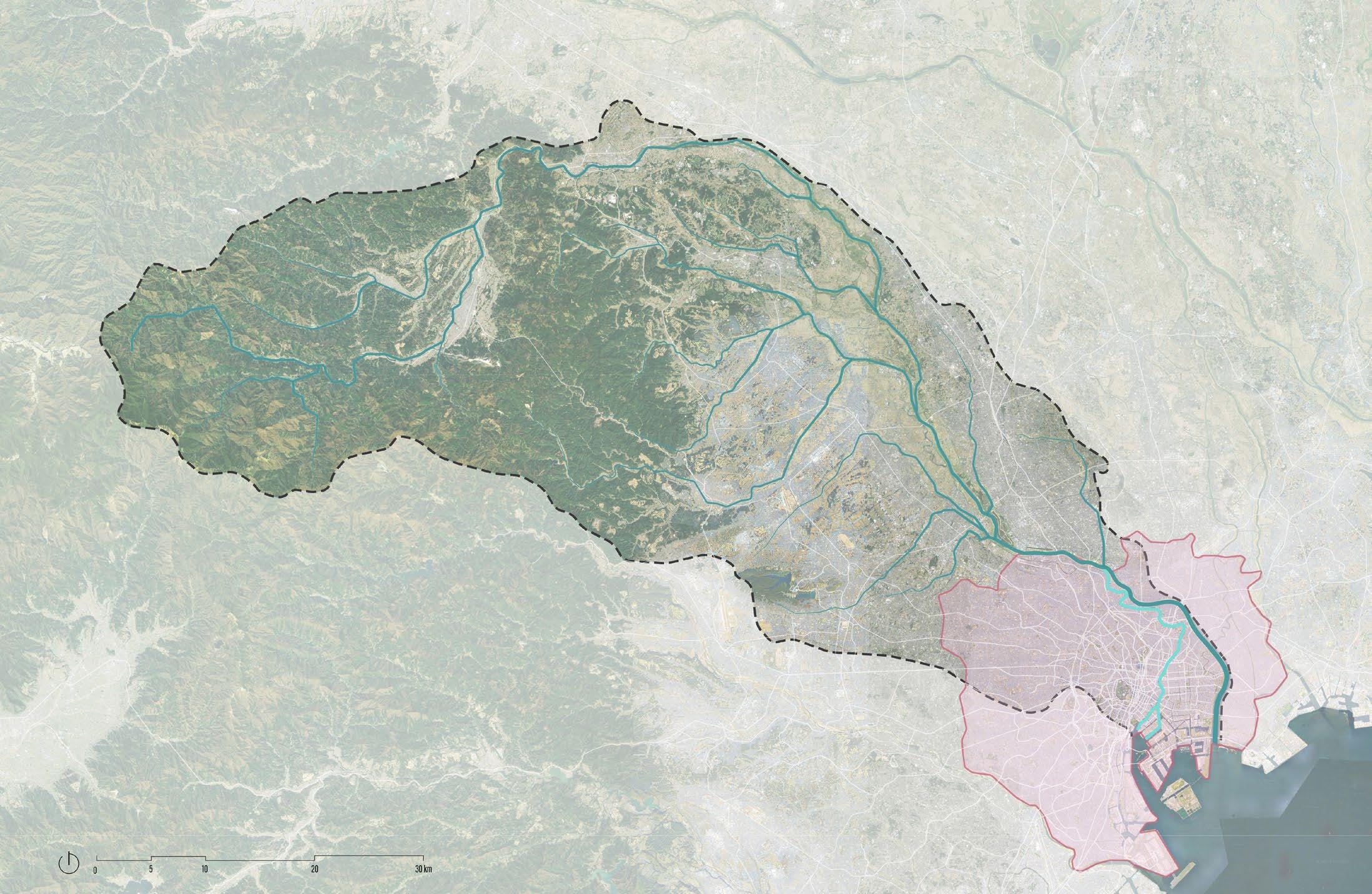
River Basins area : 2,940km2
River Length : 173.0km
16
Catchment area of the Arakawa river system
central area
river
system Sumida river Arakawa river
Tokyo
Arakawa
water

1500m 300m 125m 30 m 10 m 1 m -0.3 m 5 m Tokyo station Musashino Terrace +35m +10m +5m +4m +30m +2m +2m +2m +1m +2m +25m +2m +2m +3m +4m +2m +2m -2m -2m 0m -3m -4m
Sumida river
Arakawa river
17
Edogawa river
Topographic map around Tokyo
Topographic map around the Arakawa River systrem
Flood risk of the Sumida River
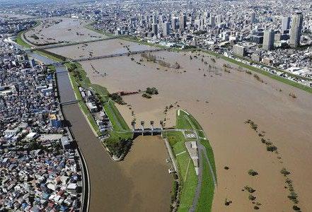
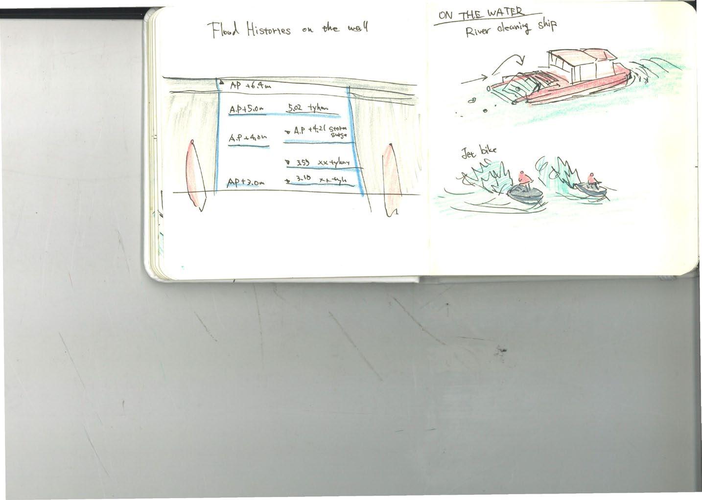
The Sumida River has been facing two significant flood risks. One is flooding after heavy rain in an upper stream from Kanto Plein, and the other is high tides from Tokyo Bay when a typhoon comes.
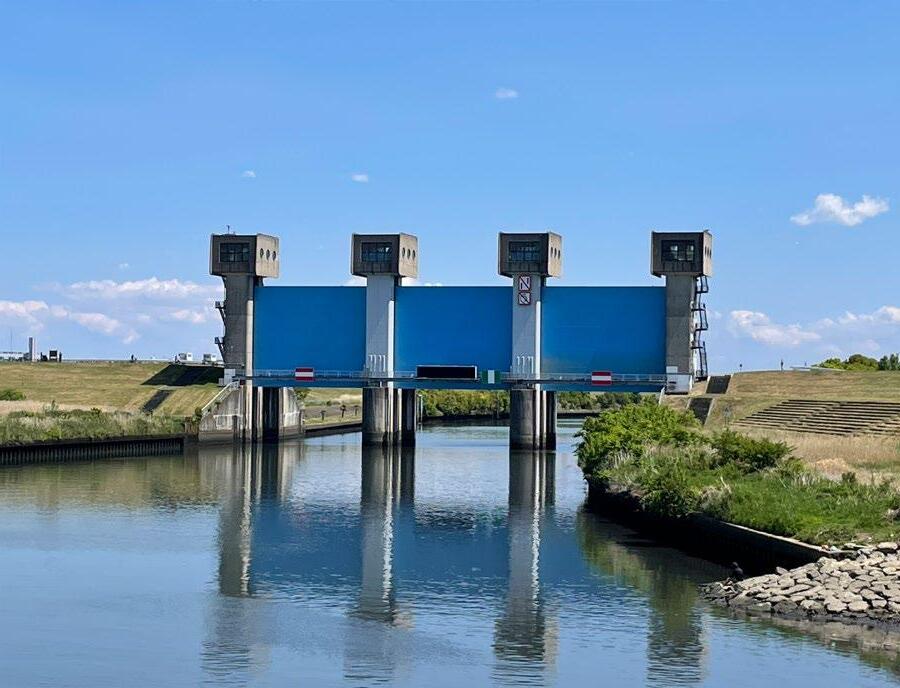
For floods from the upper rain stream, the water level of the Sumida River is controlled by the Iwabuchi watergate. When the water level from the upstream rises, the watergate is closed, and the river water flows into the Arakawa River, which is an artificial river created for a flood bypass. Since these water protection systems were created, the flooding due to heavy rain from the upper stream has decreased.
On the other hand, the downstream areas are still in danger of flooding due to a storm surge caused by a typhoon. Since there is no watergate at the mouth of the Sumida River, the river’s water level is directly affected by storm surges. In typhoons in history, water was sometimes recorded above more than 4 meters. The floodwall of the Sumida River is still 6.3 meters high, but the frequency of massive typhoons is gradually increasing due to climate change, and a significant storm surge may occur in the future.
18
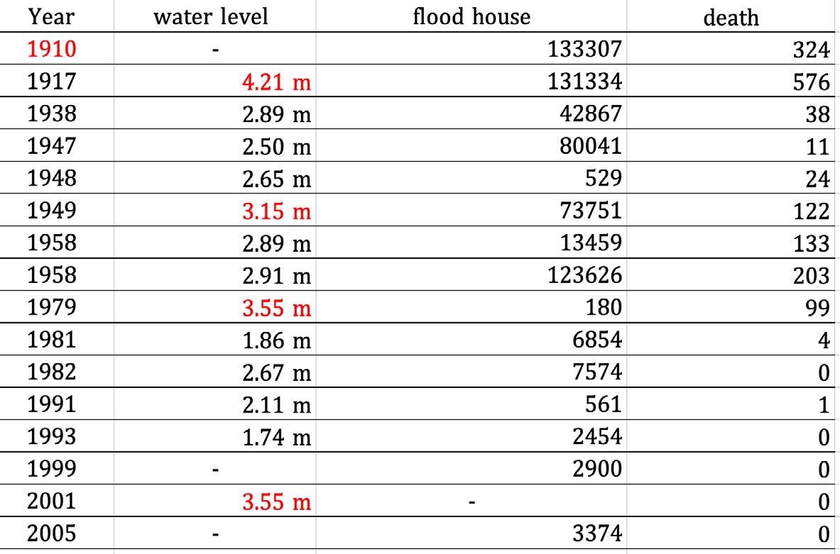
History of major Sumida River flood water levels and damage
Flood upper rain stream
High tide
 Edogawa river
Tokyo station
Sumida river
Arakawa river
Worst case high tide flood risk (if the floodwall break)
Edogawa river
Tokyo station
Sumida river
Arakawa river
Worst case high tide flood risk (if the floodwall break)
19
Iwabuchi water gate
Tyhoon in 2019
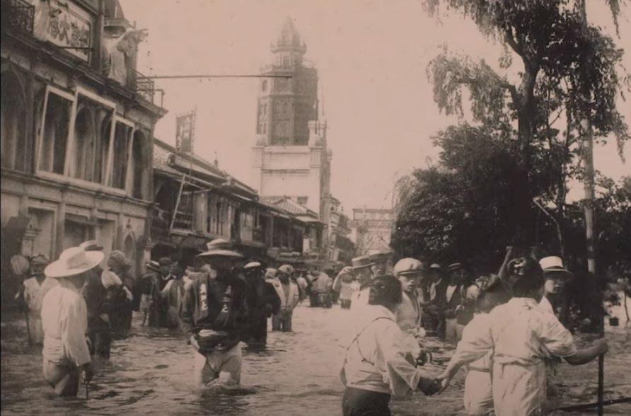
The Tokyo Great Flood of 1910
The Tokyo Great Flood of 1910
The Tokyo Great Flood of 1910
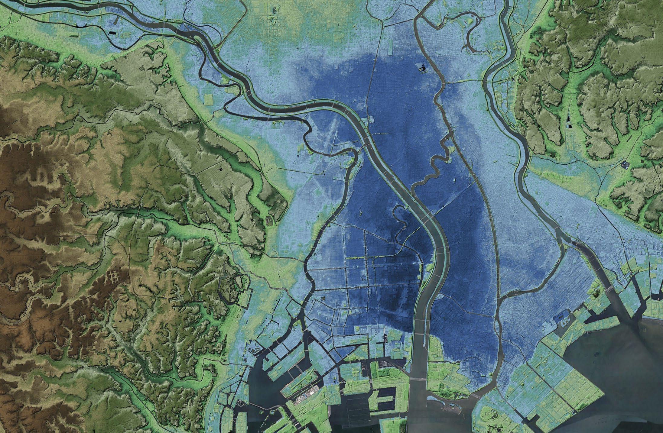
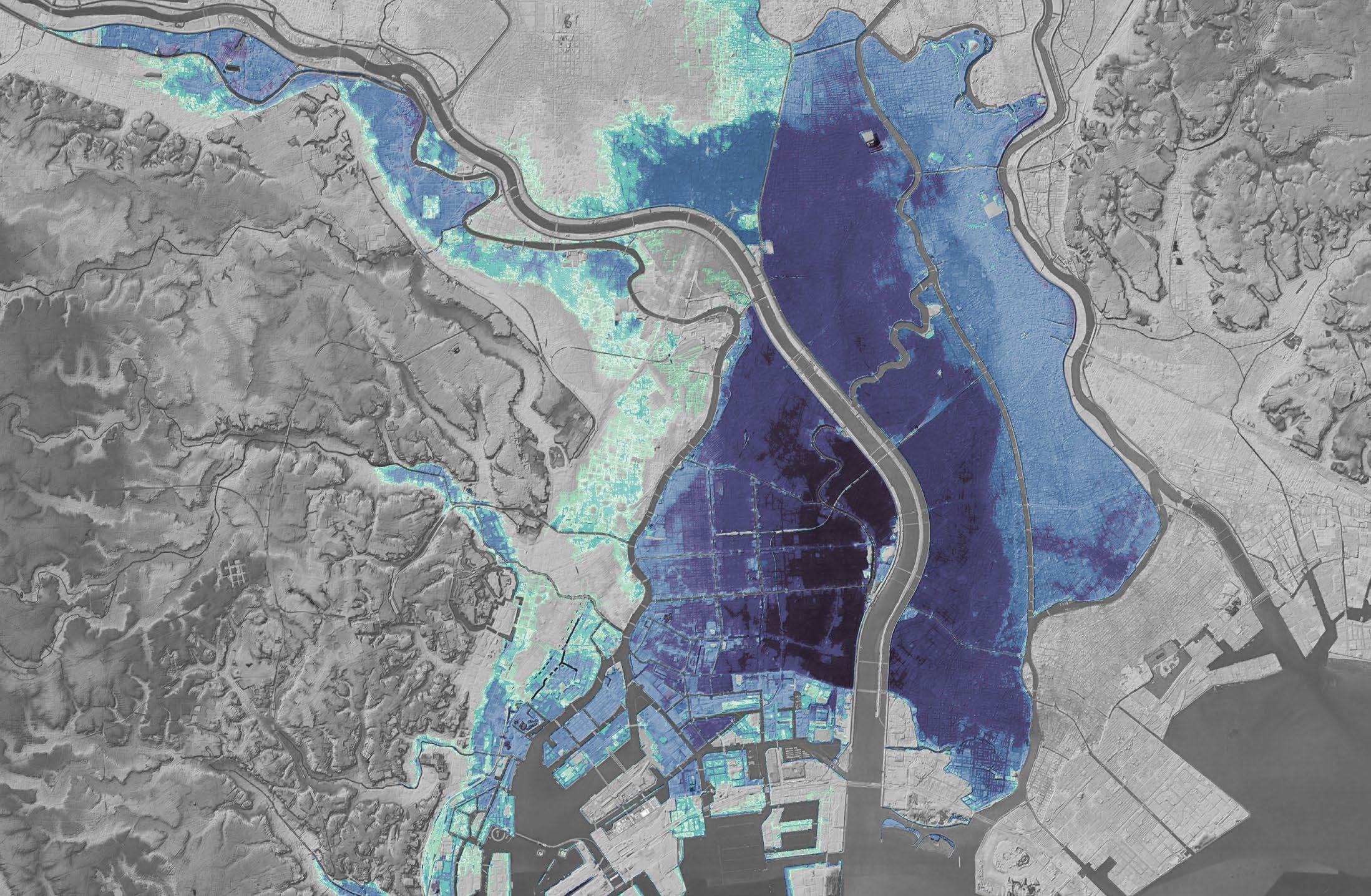
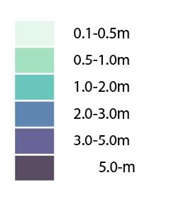
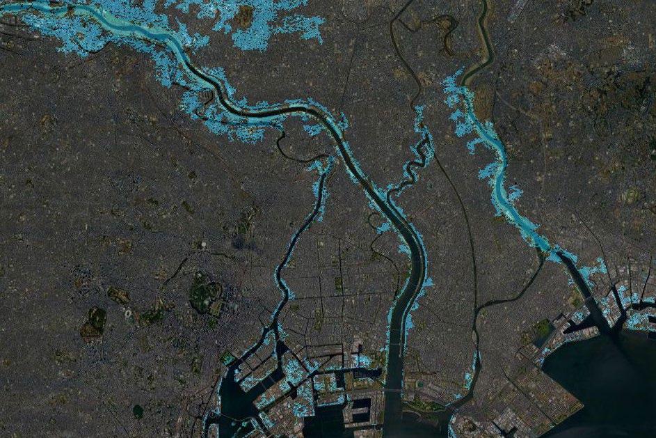
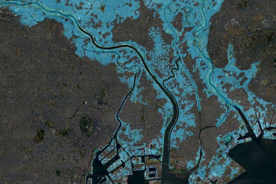
Tokyo’s largest storm surge inundation assumption map (flood depth)
Future flood Risk in Tokyo
Those maps show the flooding area when the sea water levels will increase in the future (flood protection is not included). Because of most of the low land, most of the eastern area of the Sumida River will be flooded. To protect the land, Tokyo needs to continue to have robust flood protections.
 Sumida river
Tokyo station
Sumida river
Tokyo station
20
Arakawa river
1.0 meter rise
1.5 meter rise
21
2.0 meter rise
2.5 meter rise
Transition of the Sumida River and Arakawa river
The Sumida River used to be a single river. However, between 1868 and 1910, more than ten floods occurred, especially the flood of 1910 caused enormous damage around the area. After this huge flood, The Arakawa Flood Bypass project that created an extra artificial river started to prevent the Sumida River from overflowing, and it was completed in 1930. At the same time, the Iwabuchi Watergate was created where the river divides, and it contributed to controlling the water level of the down part of the Sumida River.
1880 1924
Edo castle
22
The Arakawa River flood bypass was constructed in 1913 to 1930.
The Sumida River flowed next to the capital
23
Arakawa River (22 km length, 500m width)
1940
Since the Arakawa River was created, flooding in Tokyo has decreased.
The urban area of Tokyo has expanded significantly, becoming filled with buildings
Current
24
Sumida River and Arakawa river
Arakawa River
Sumida River
 Iwabughi water gate
Arakwa river
Iwabughi water gate
Arakwa river
500m 130 m 25
Sumida river
Iwabuchi watergate
The Arakawa River (Flood Bypass)
The Sumdia River
History of the Sumida River
Over history, the role of the Sumida River and the relationship between the river and people have changed. When Tokyo was known as Edo in the 17th century, the Sumida River played an essential role as a water transport supporting Edo city’s construction (present-day Tokyo), such as being used to transport timber cut from a lumber yard. The area around the Sumida River developed as an agricultural area, and at this time, floods occurred frequently. In the 1860s, many agricultural areas around the Sumida River were replaced by factories with modernisation.
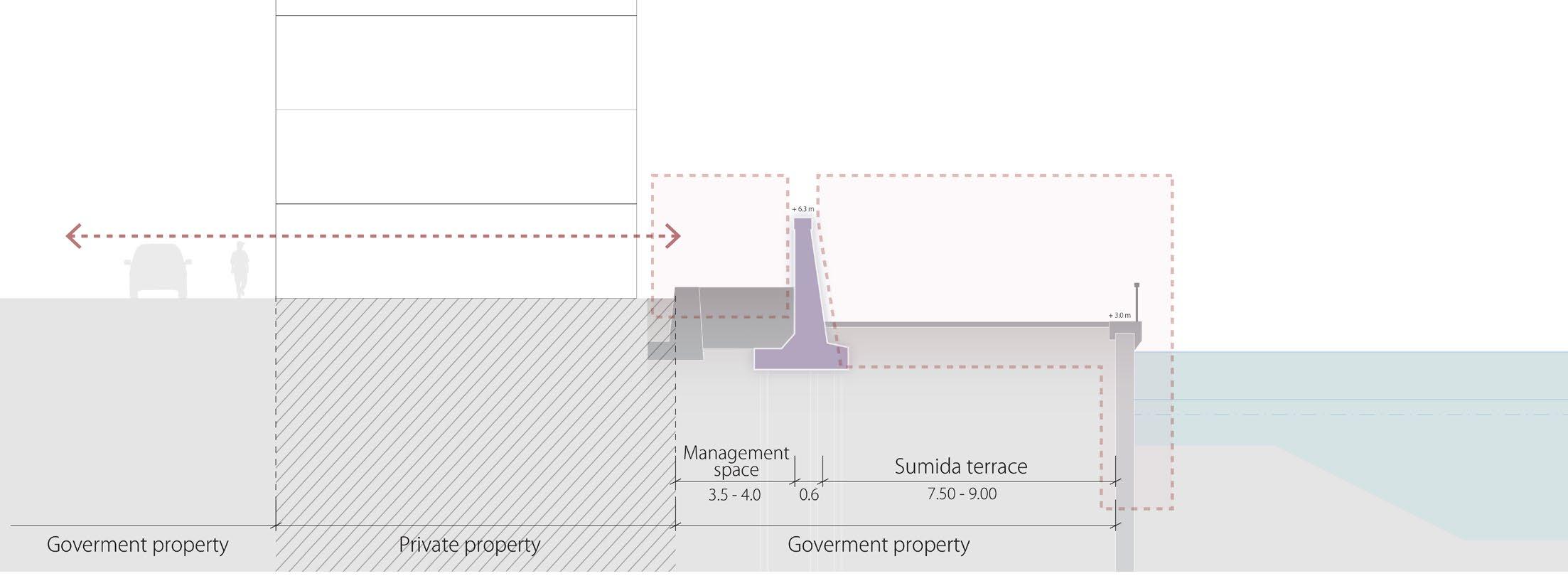
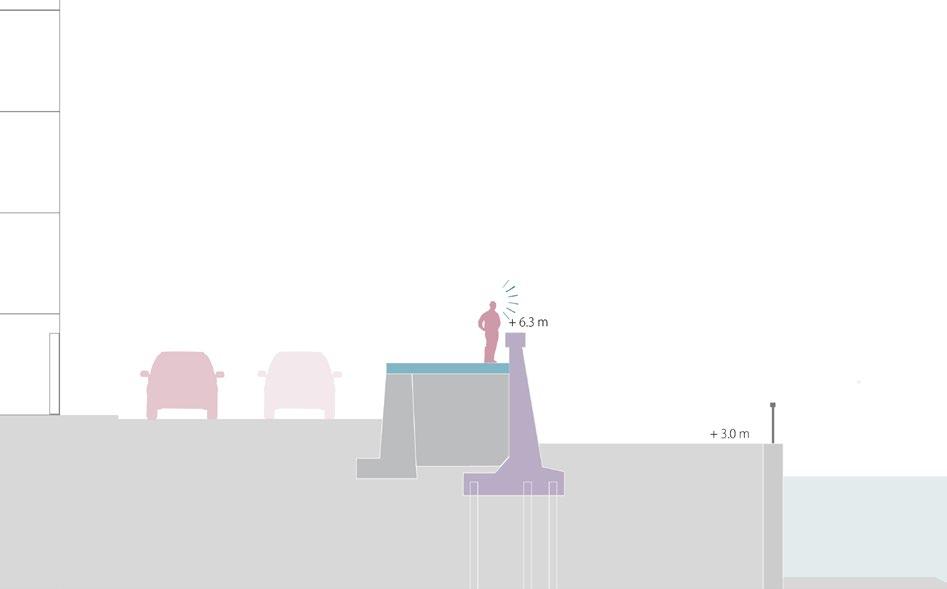
With the completion of the Arakawa River (Flood Bypass), the flood damage on the Sumida River has been reduced. However, the Catherine Typhoon in 1947 and the Isewan Typhoon in 1959 caused heavy rainfall and significant damage around the Sumida River. After that, the government constructed a flood protection wall along the Sumida River. Because it was impossible to build a large dike along the river due to a lack of sufficient space and budget, the high concrete floodwall, 6.3 meters above the average water level, was created outside the existing low revetment in a rush between 1960 and 1980. As a result, it hides the Sumida River view from inland and separates people’s lives from the water.
Around the Edo period (1600-1860)
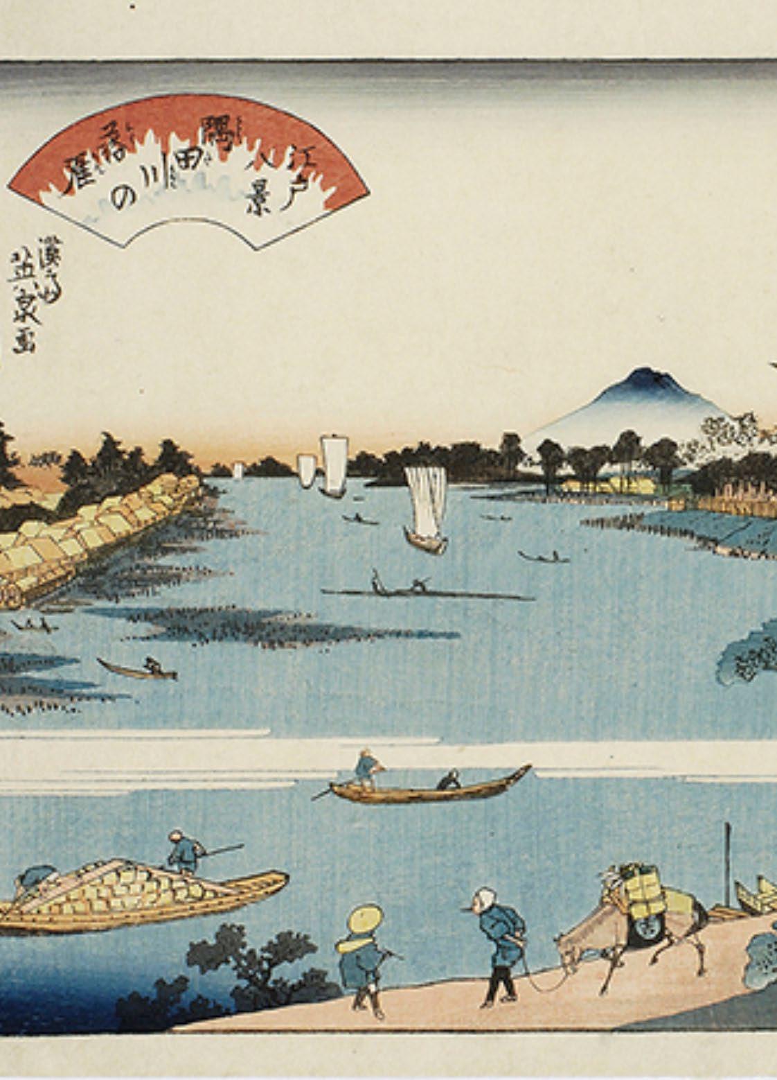
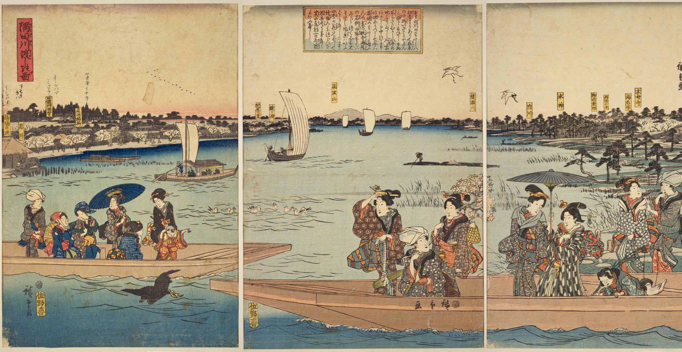
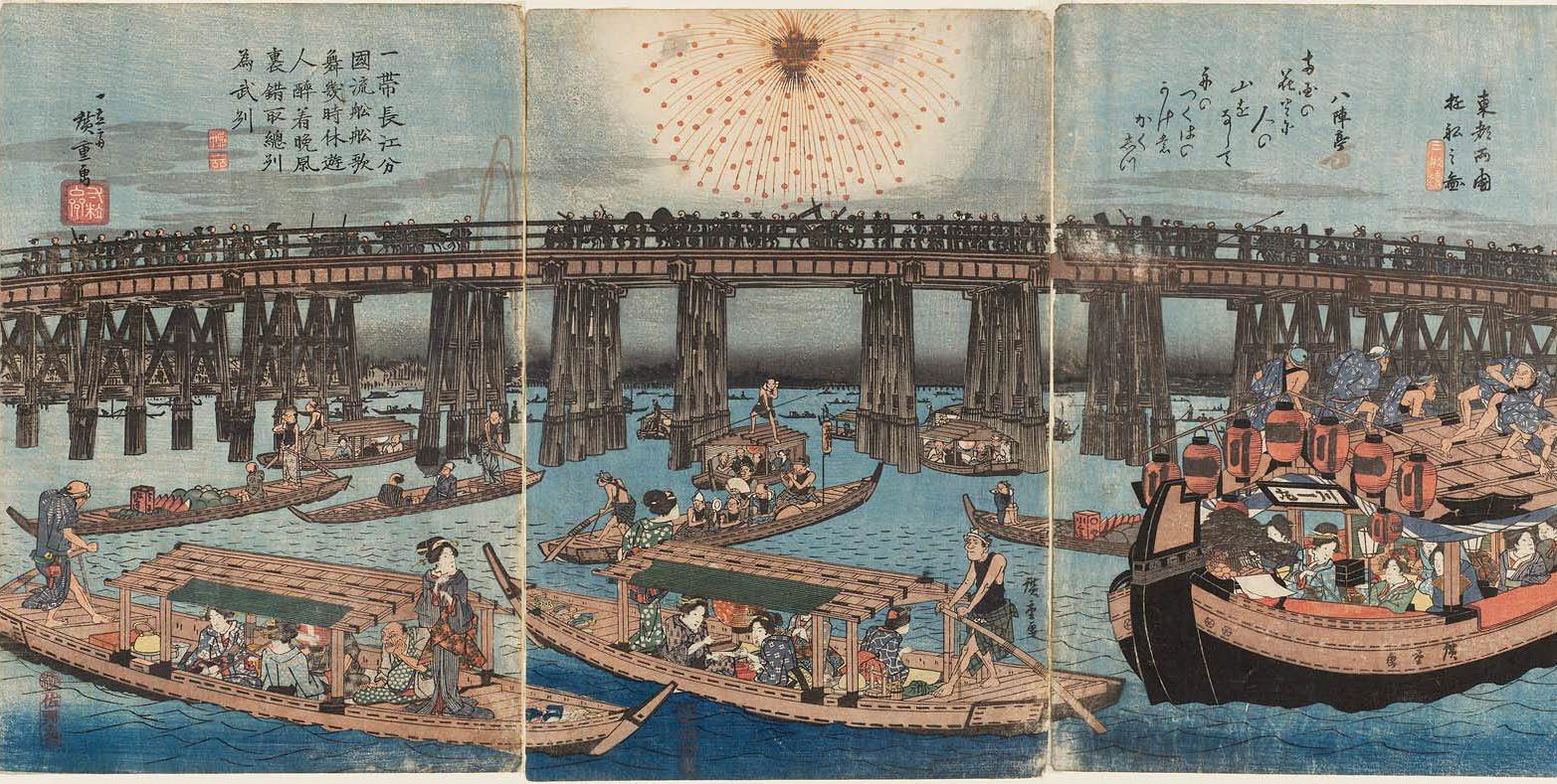
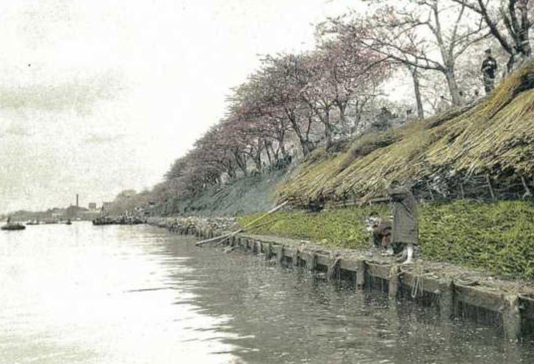
People used to live with the river. The Sumida River has been a major transportation route for the people of Edo. At the same time, the river has been deeply appreciated and familiar to the people of Edo as a famous landmark. For this reason, the Sumida River and the many famous places along the river have been depicted in countless paintings throughout the Edo period.

28

29
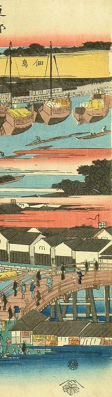
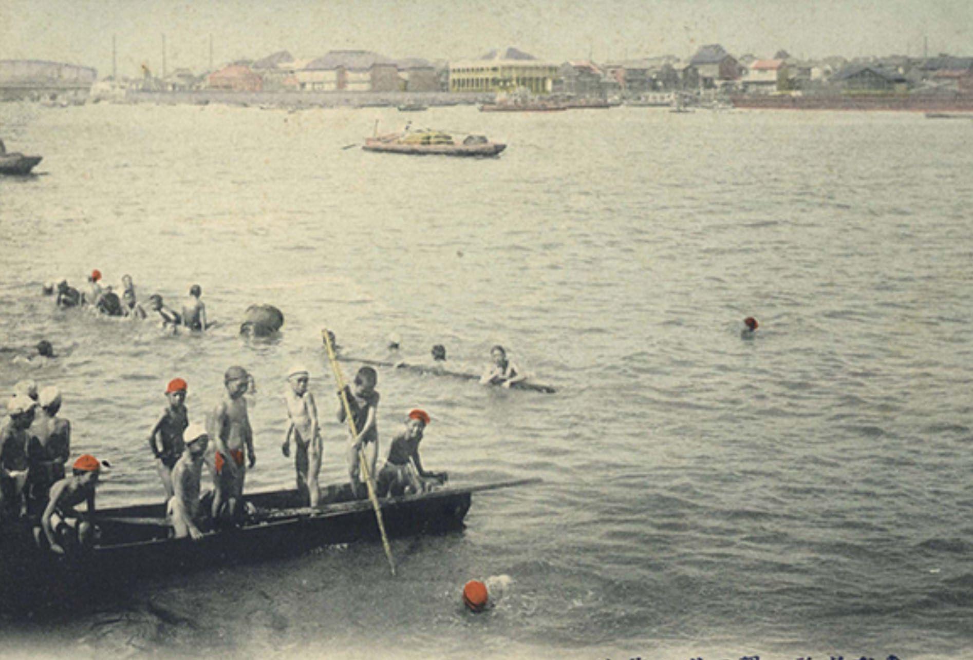
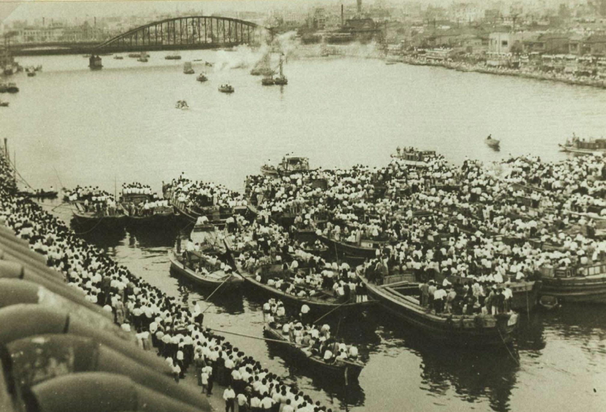
Before the rapid economic growth (1880-1950)
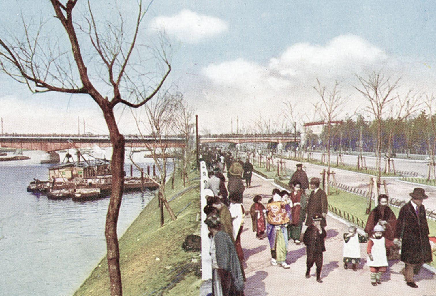
Until 1950, the Sumida River was part of people’s daily lives. The water quality was good enough to swim, and children swam in the river in a school swimming class. The river was a valuable space, especially on the festival day, like a fireworks festival. Sidewalks were also made along the river, so the Sumida River was part of Tokyo’s common scenery of people’s hearts.
30
31
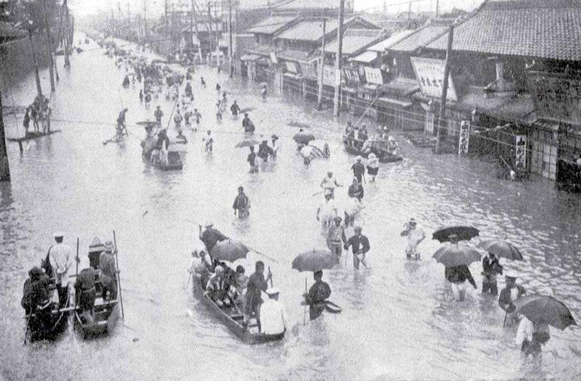
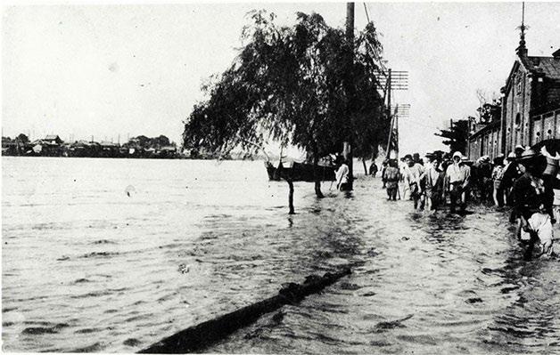
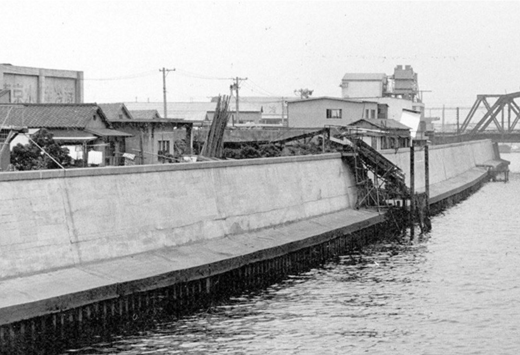
The flood wall was constructed (1950- now)
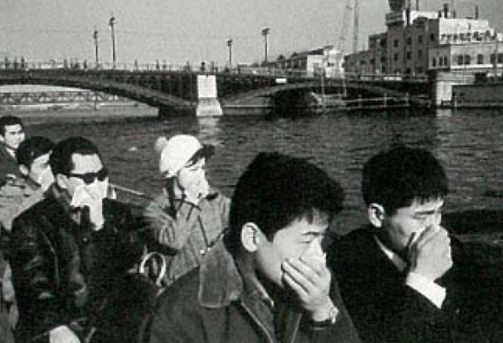
After repeated damages from flooding, the government made the 6.3m high flood wall along the river in a rush between 1960 and 1980. It hides the Sumida River view from inland and separates people’s lives from the water. Due to polluted industrial wastewater, the river smelled bad and became a place where most fish could not live. The bad smell and the invisible river triggered people’s minds away from the river.
32
33
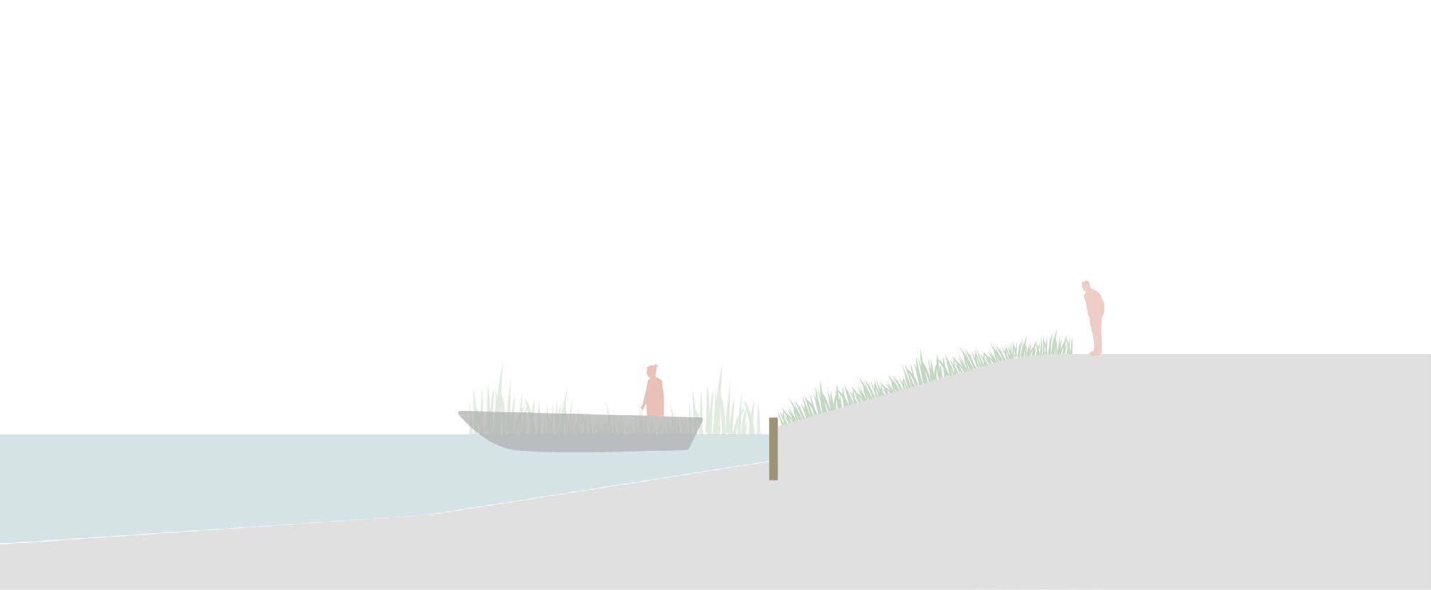
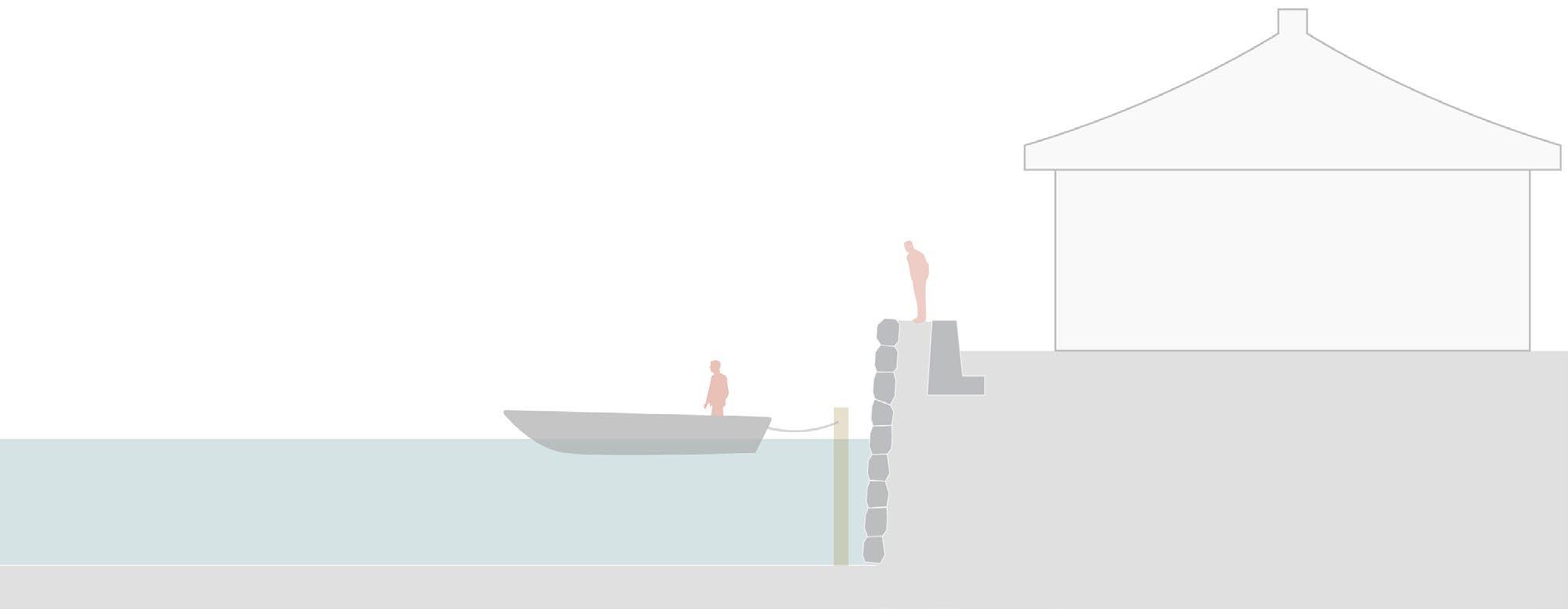
Transition of the water edge of the Sumida River
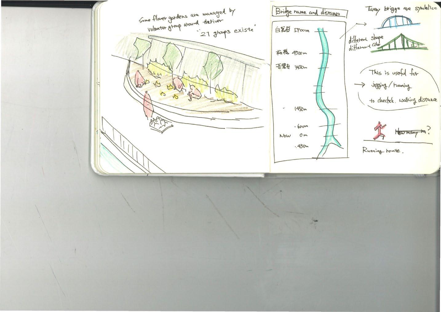
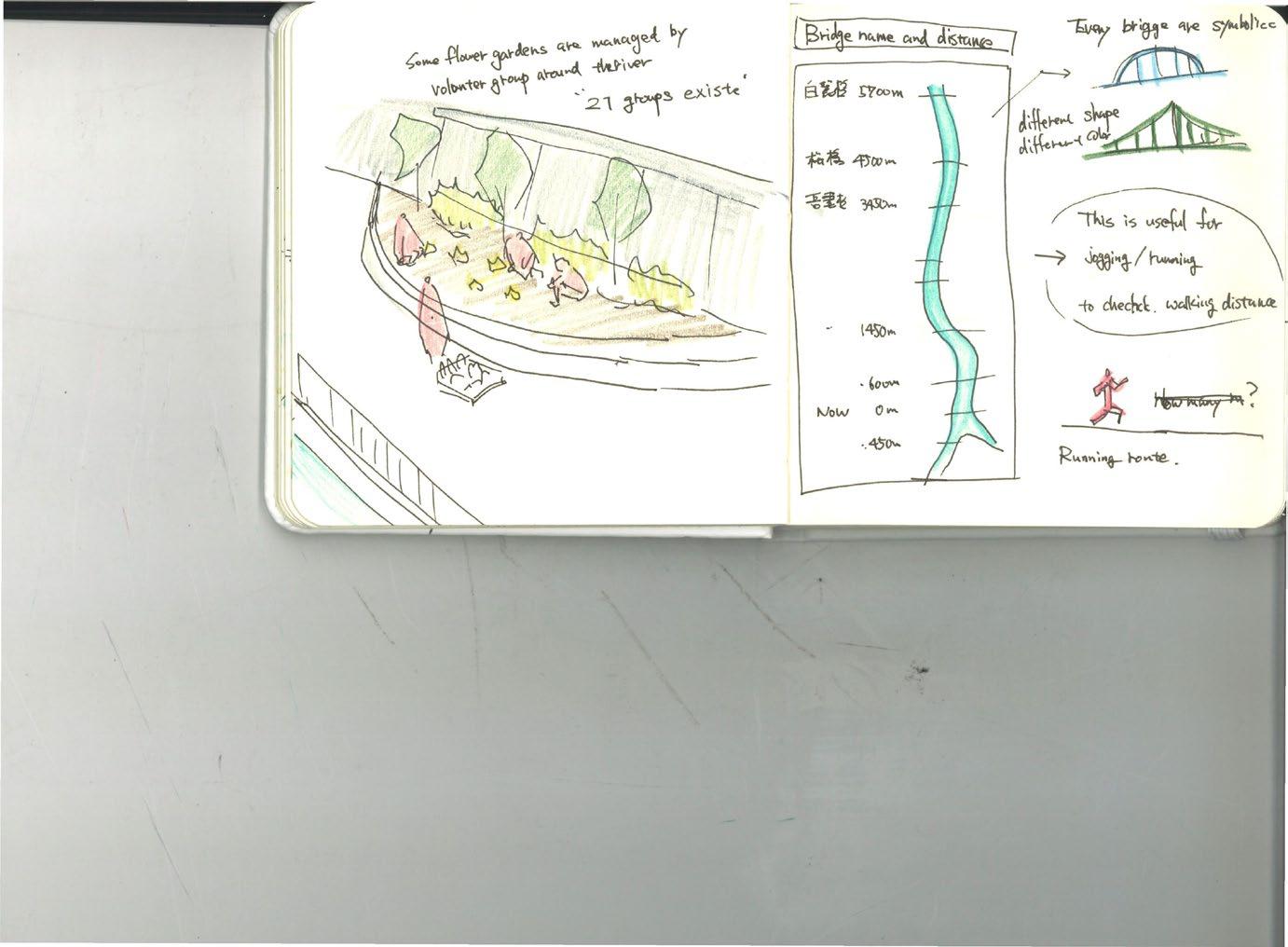
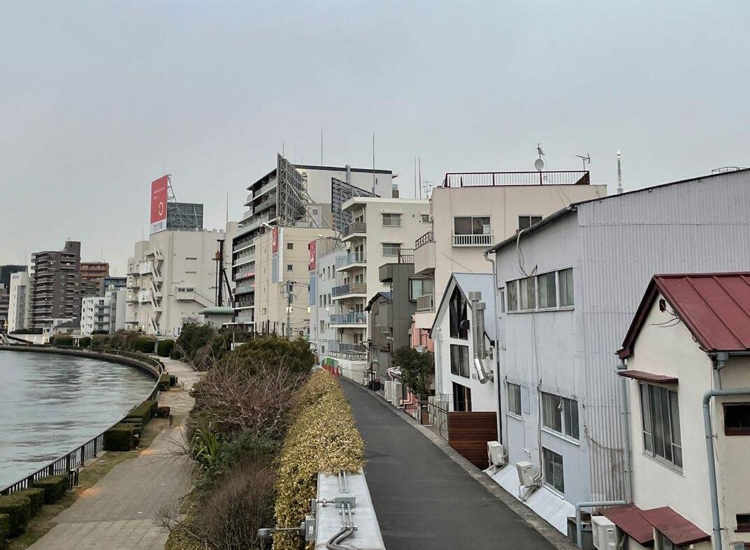
The Sumida River edge has changed over time. Initially, it was a green river bank, but as boat transportation became more popular, small quay walls were built along the river next to houses.
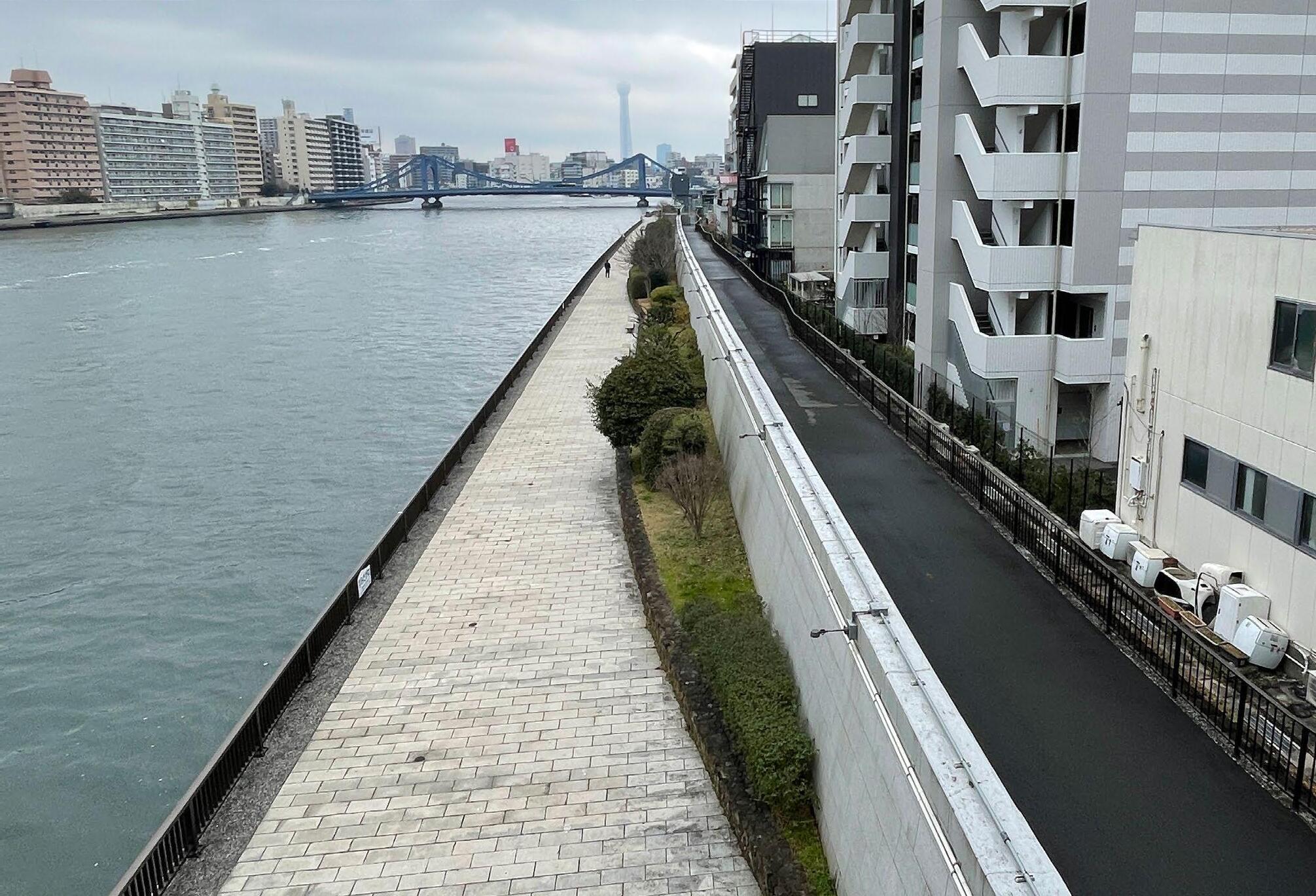
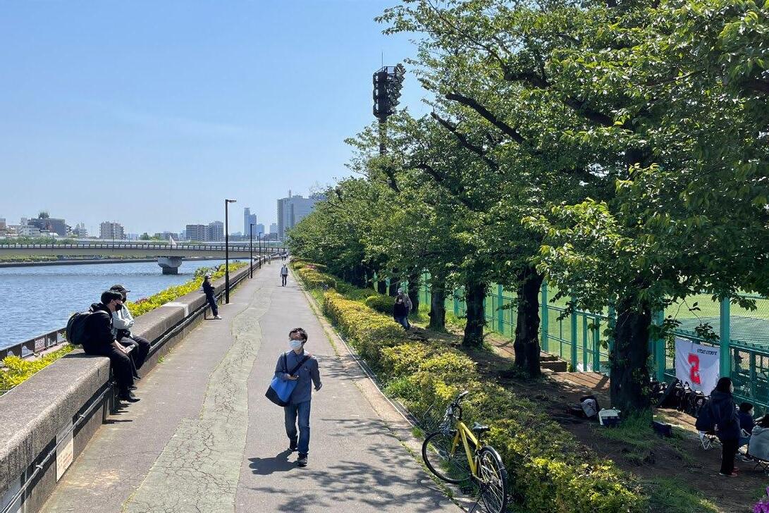
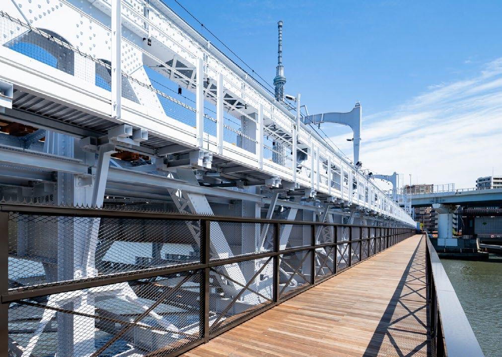
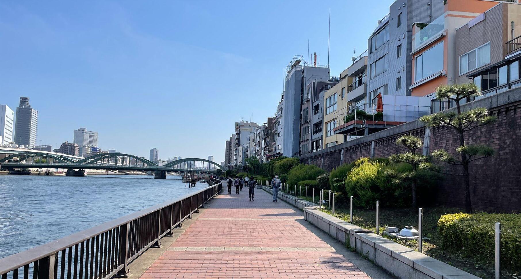
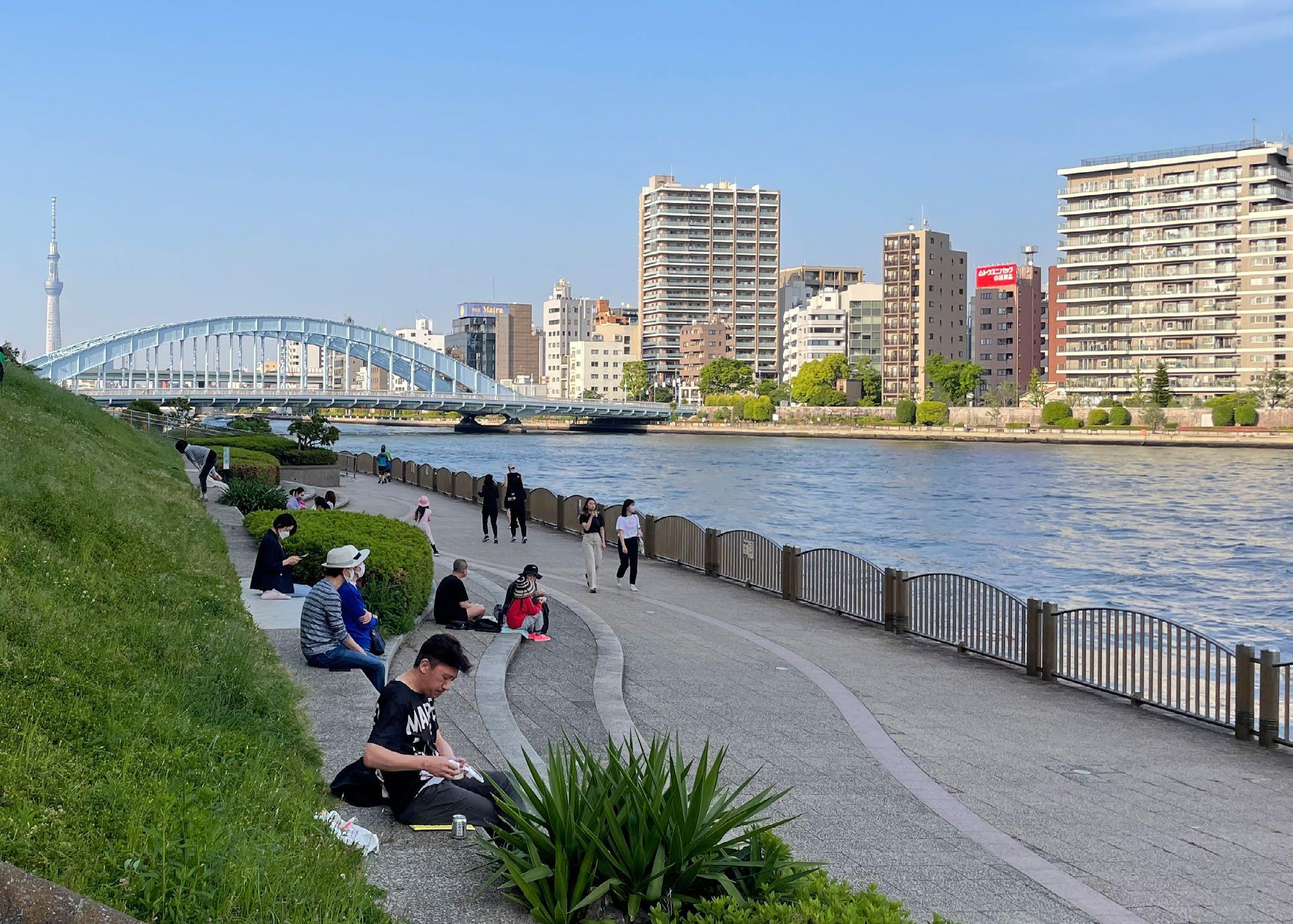
During the rapid economic growth, factories and warehouses lined the river, and a 6.3 m concrete wall was built to protect the land from flooding. After 1980, the Sumida River Terrace was built to reinforce the concrete wall and open up the river space for people, and people can walk along the riverside.
1910
1880
River bank
34
quay wall
 House
1980- curernt
factory
1960ground sinking
Terrace
House
1980- curernt
factory
1960ground sinking
Terrace
35
concrete wall
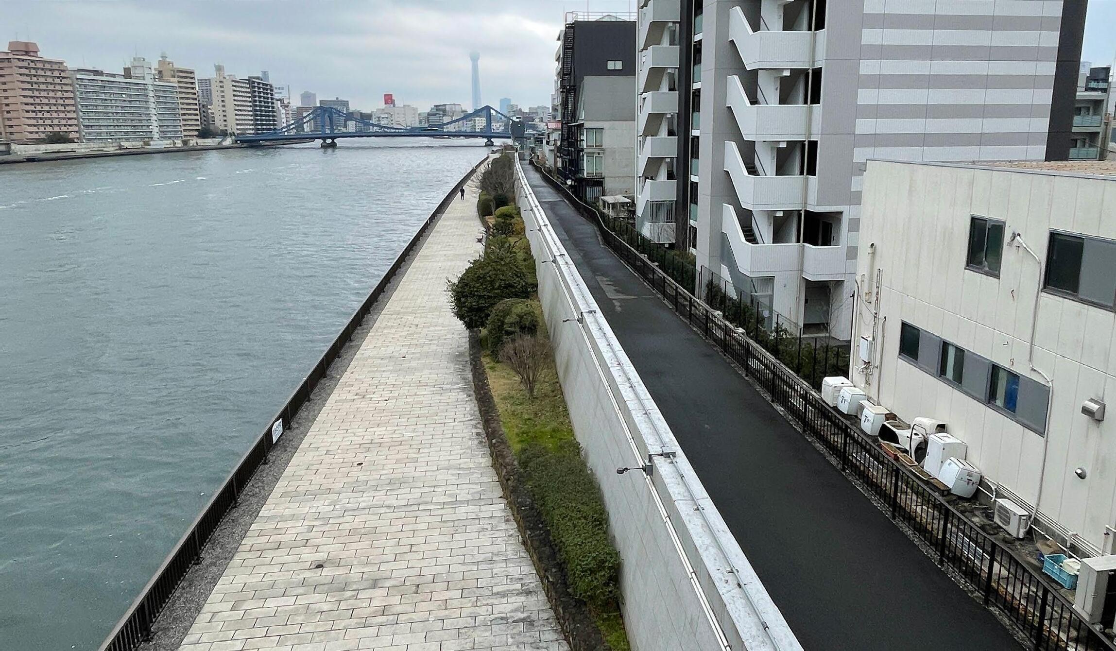
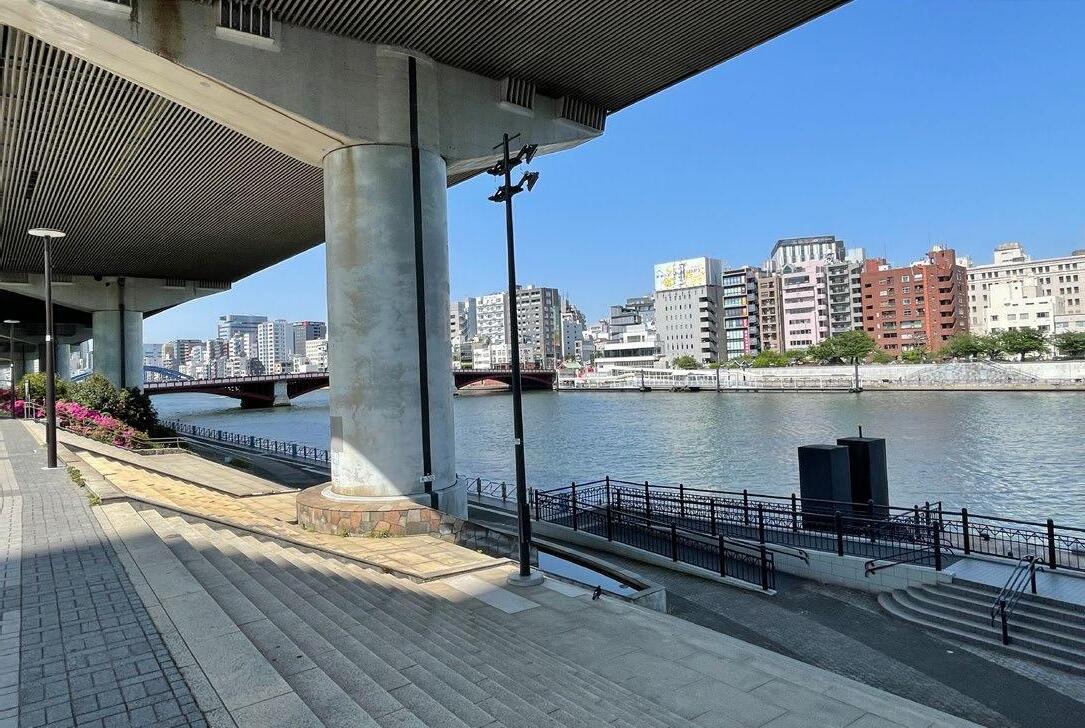
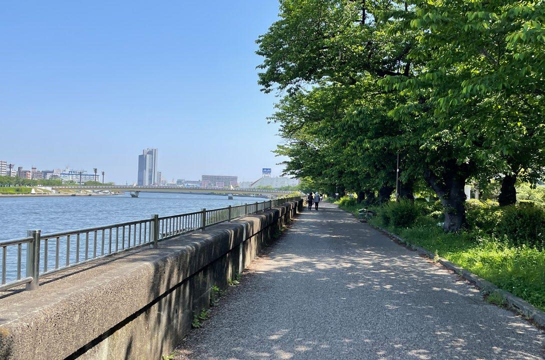
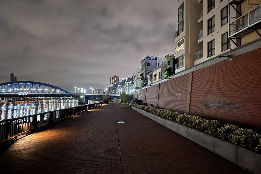
Site Visit
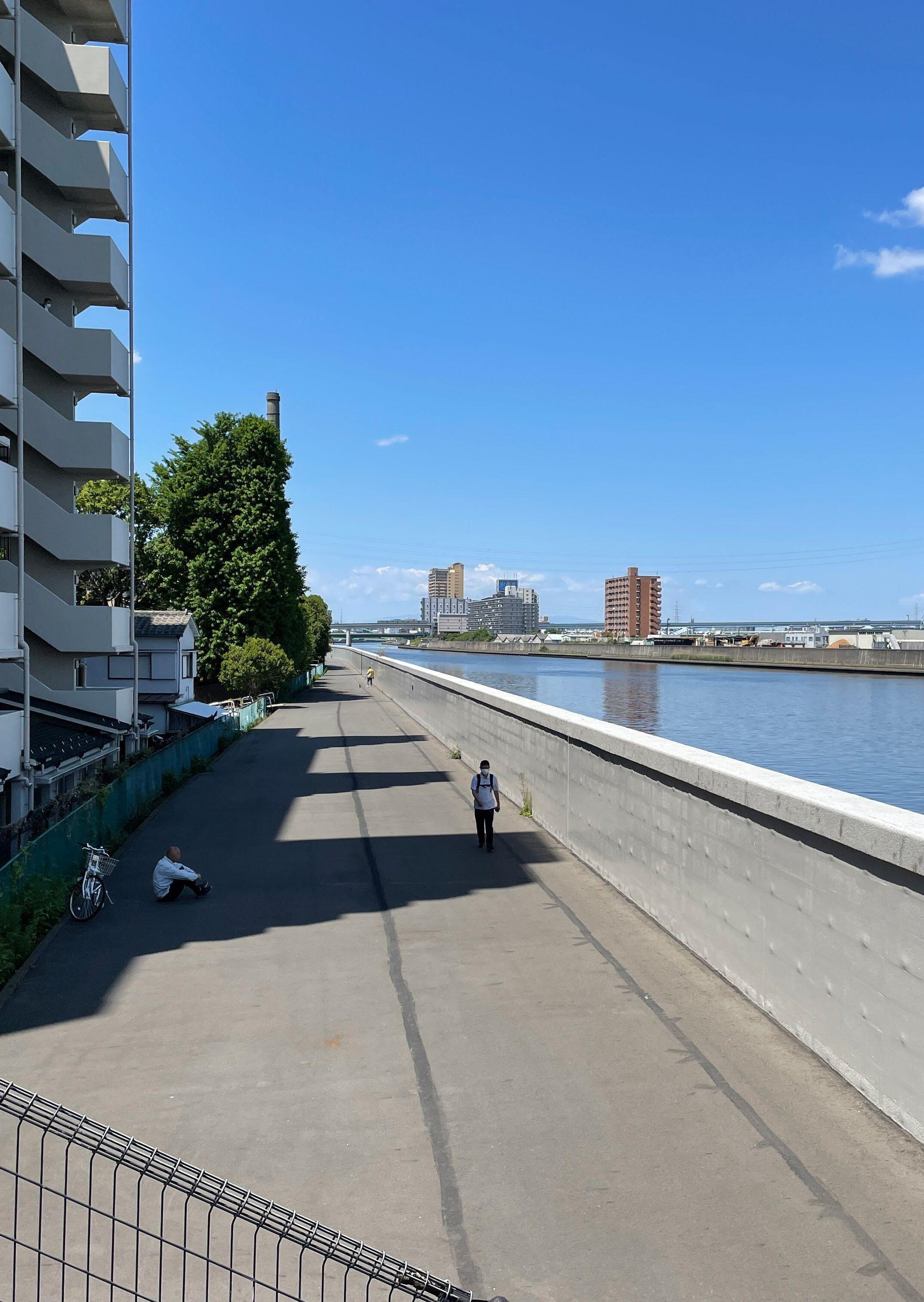
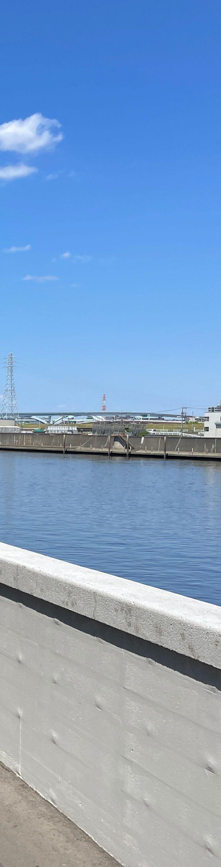
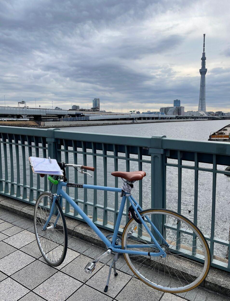
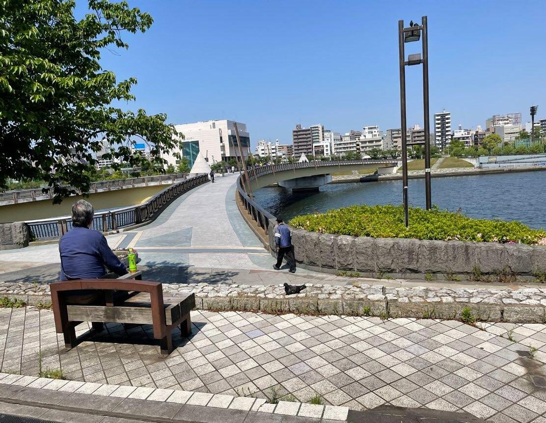
To find out what the situation is right now around the Sumida River, I went on a site visit to Tokyo twice, in May 2022 and January 2023. The first visit is mainly to see and experience the whole Sumida River from top to bottom by bicycle. During the visits, I took photos and sketched around the river. Based on this, profiles of the whole river were created. The second visit was to see the design site in more detail after deciding on the direction of the design.
During the two visits, I also had a chance to have an interview with people in the Tokyo Metropolitan Government River Department and a flood protection expert. Also, I stayed at the hotel next to the river to experience the river like a citizen of Tokyo. This offered me time to run along the river in the morning, have lunch at the river space, and go night walks with friends. This experience deeply connected me to the river, even during these short visits.


38
Views of the Sumida River

39
40
The variation of the flood walls’s facade
41
42
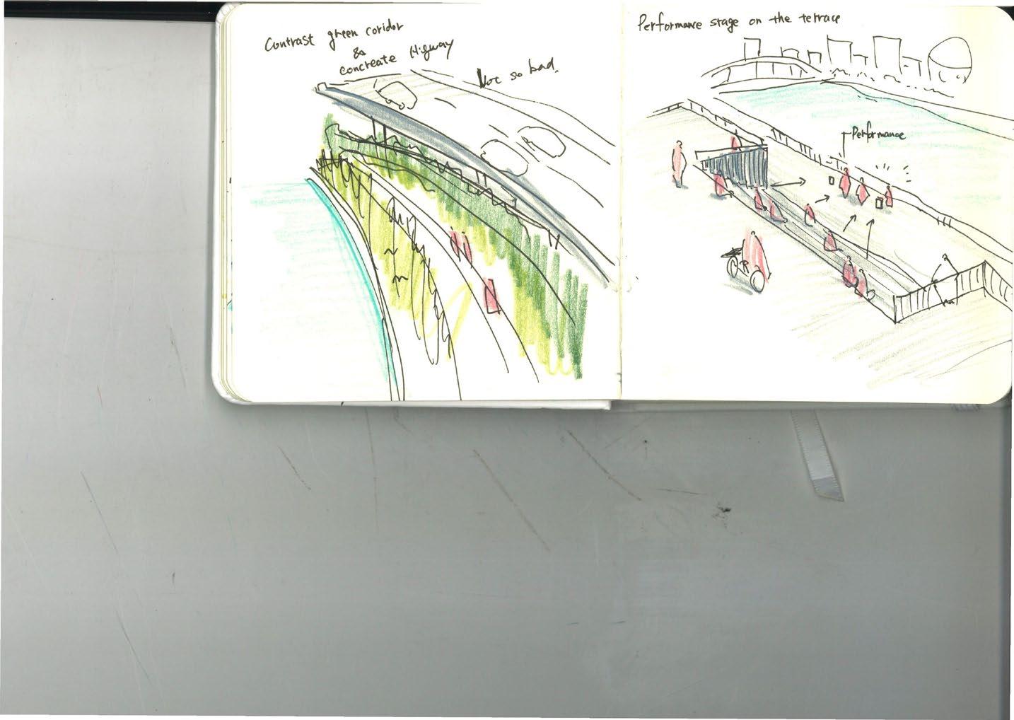
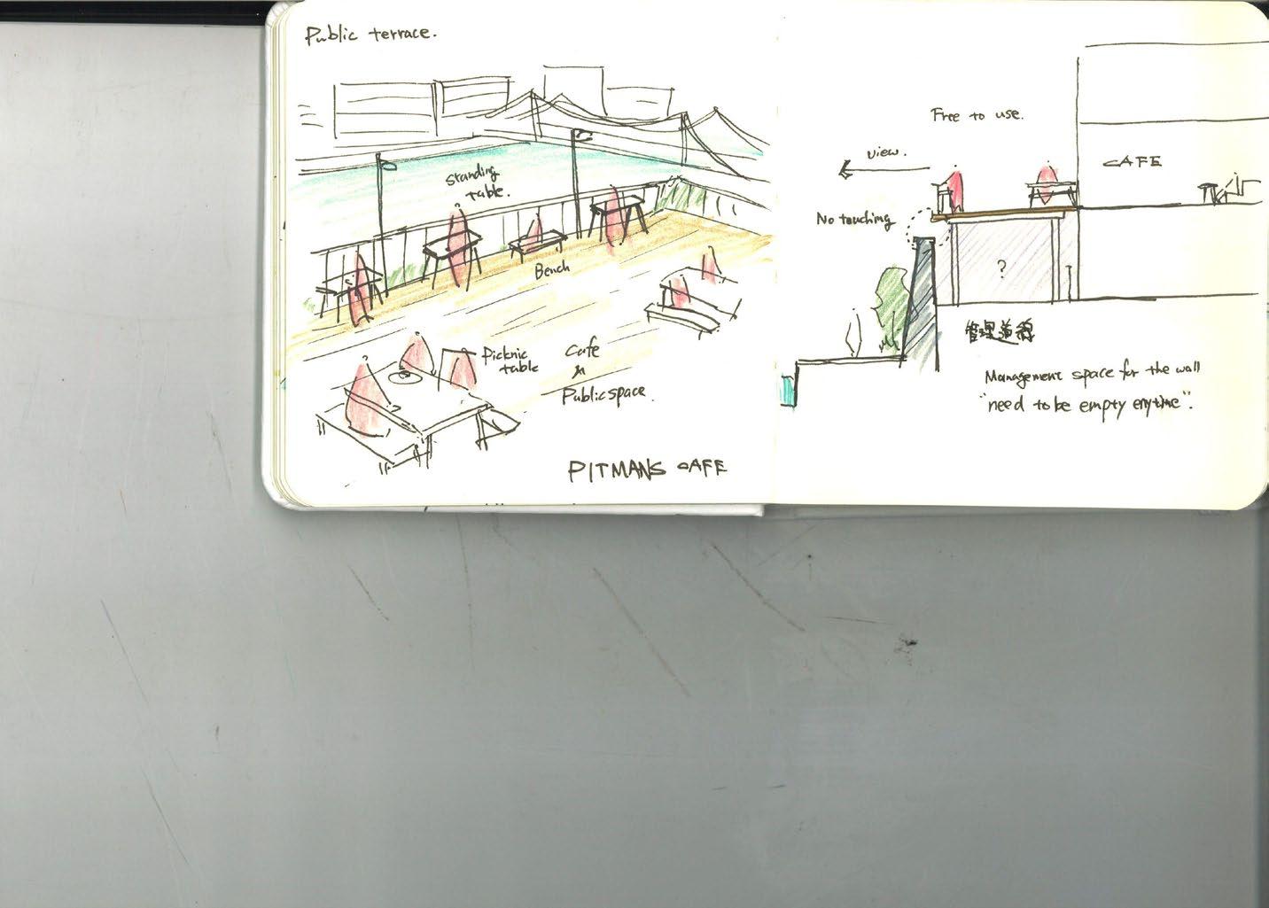
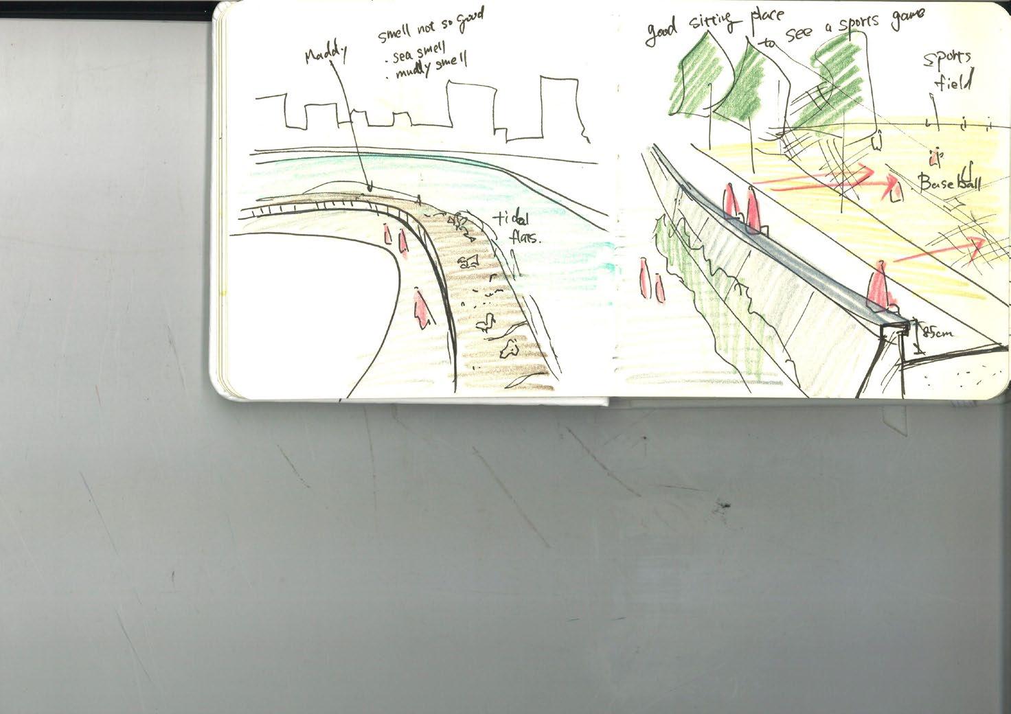
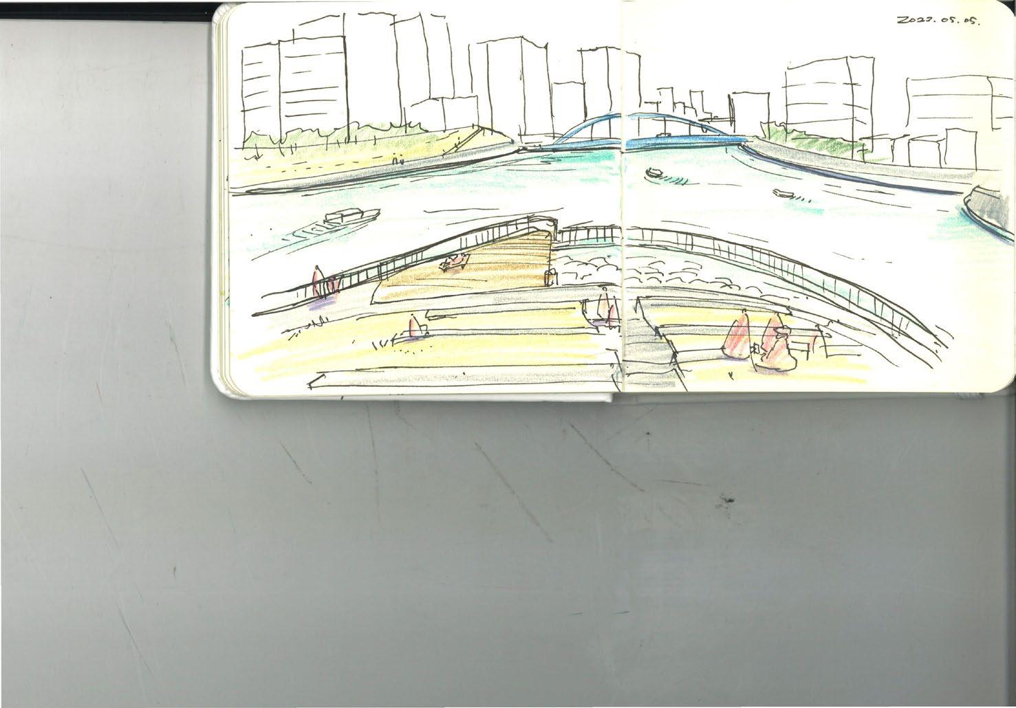
Sketches during the site visits in Tokyo

43
Sumida River section research
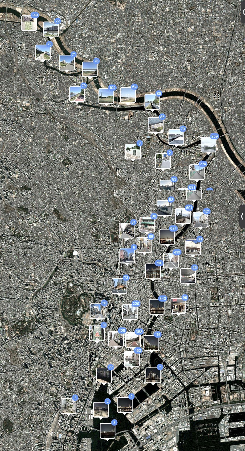
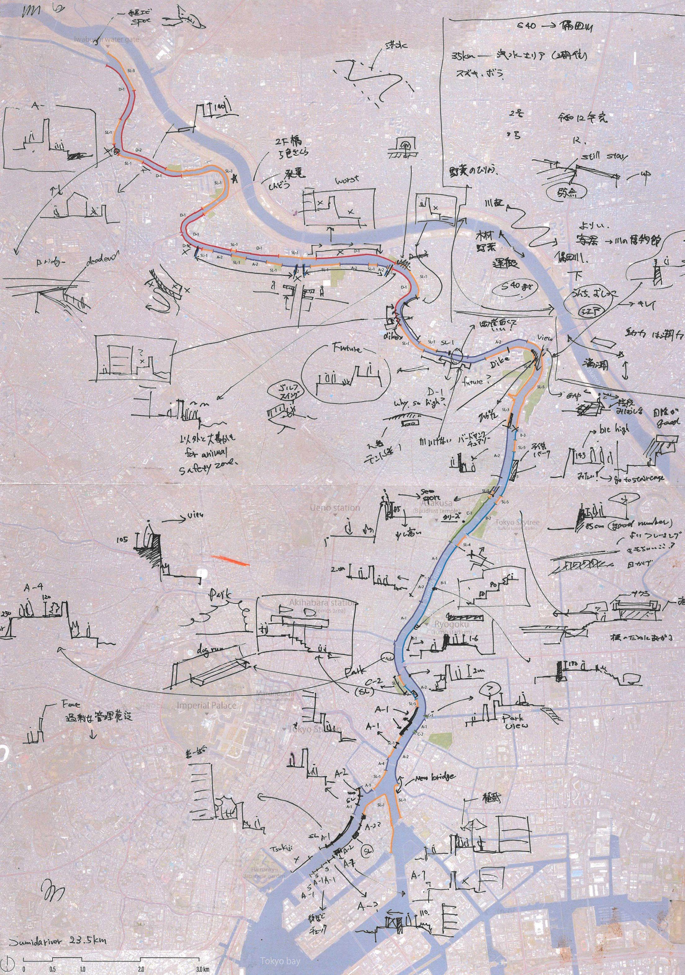
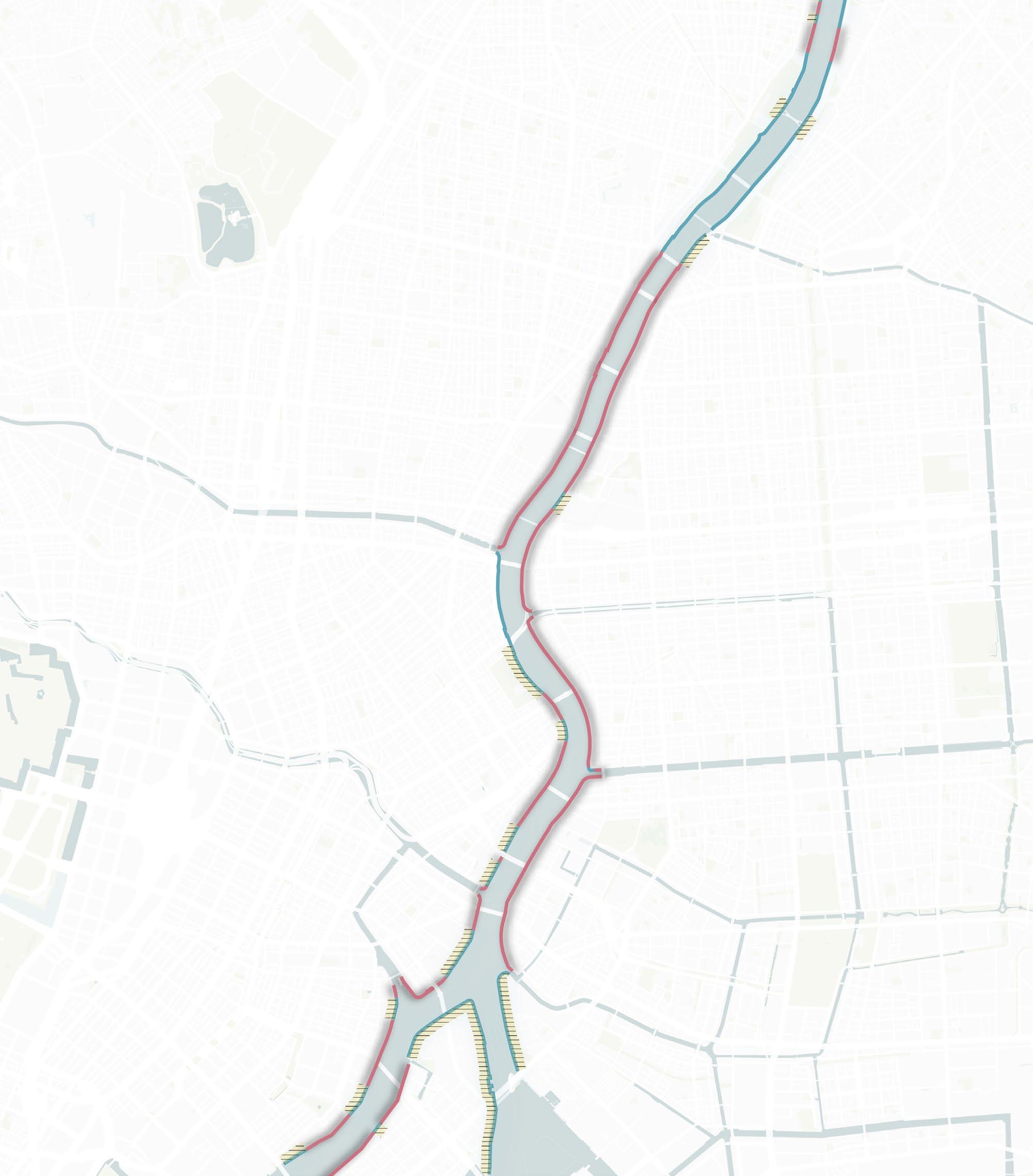
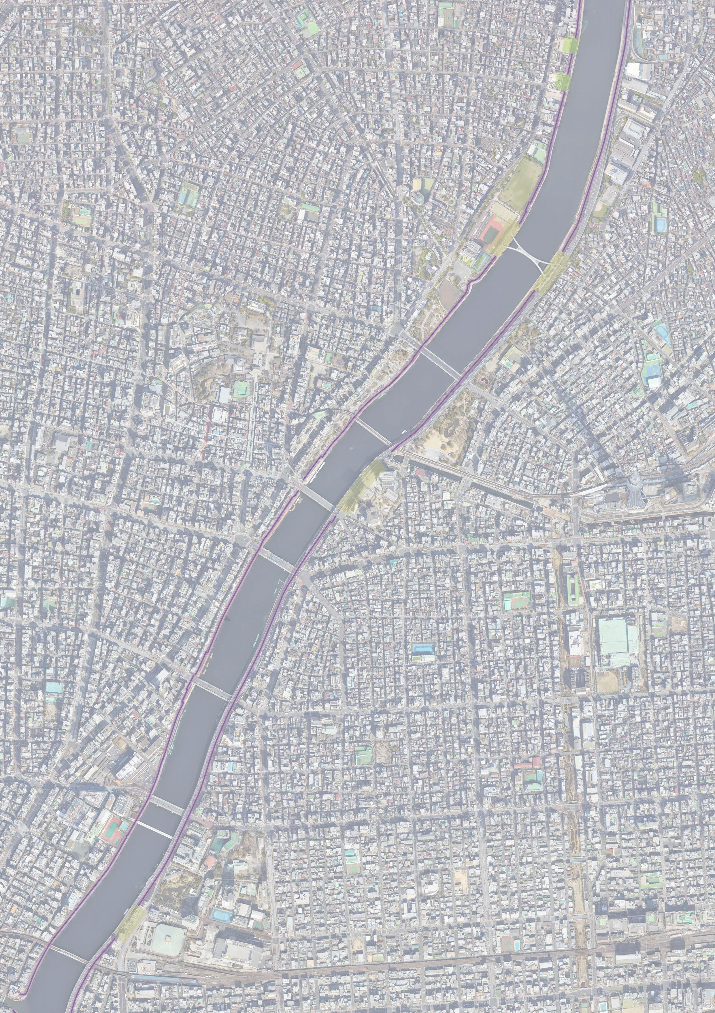
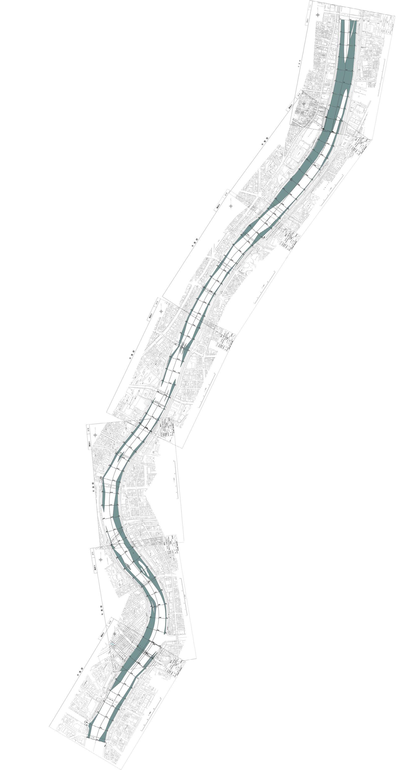
Before visiting Tokyo, I created preliminary profiles of the entire river using Google Maps. During my stay in Tokyo, I cycled around all of the river space (23km for both sides) to check and correct the spatial profiles.
Once all the profiles were completed, I was able to capture the overall characteristics of the river from the individual sections: observing the continuity of the same profile along the river, assessing the accessibility to the river space, and extracting the visibility of the river from the space next to the floodwall.
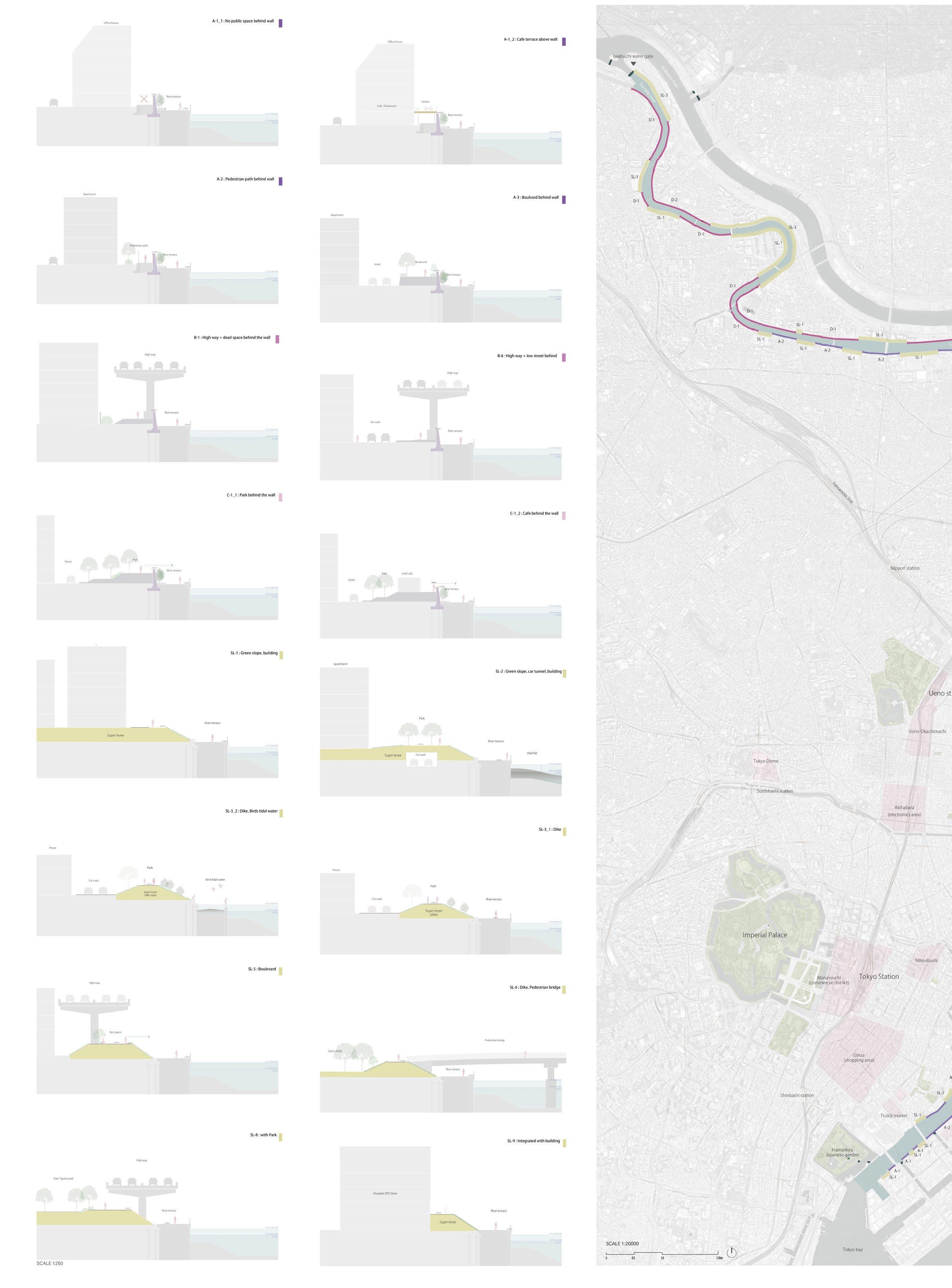
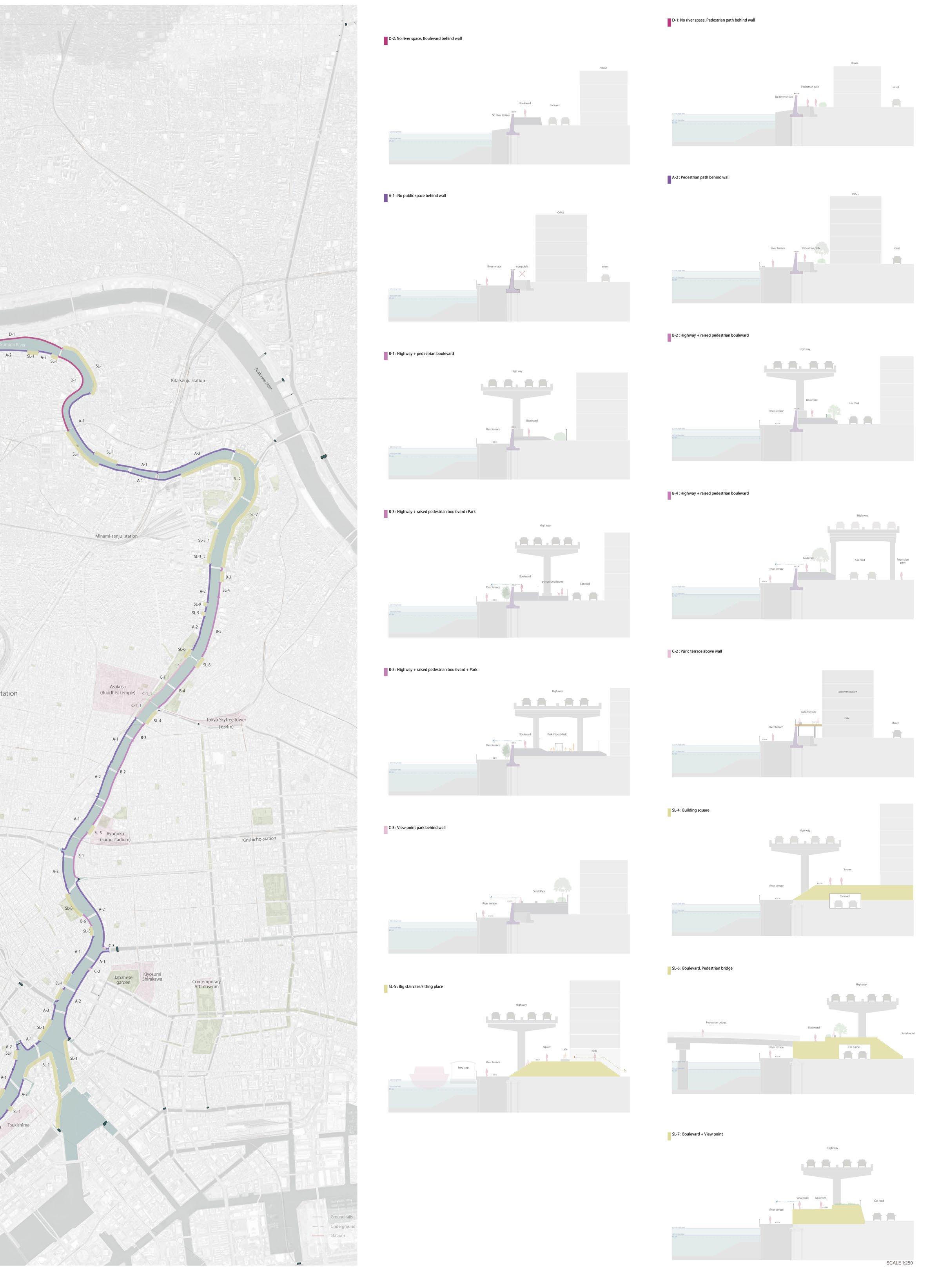
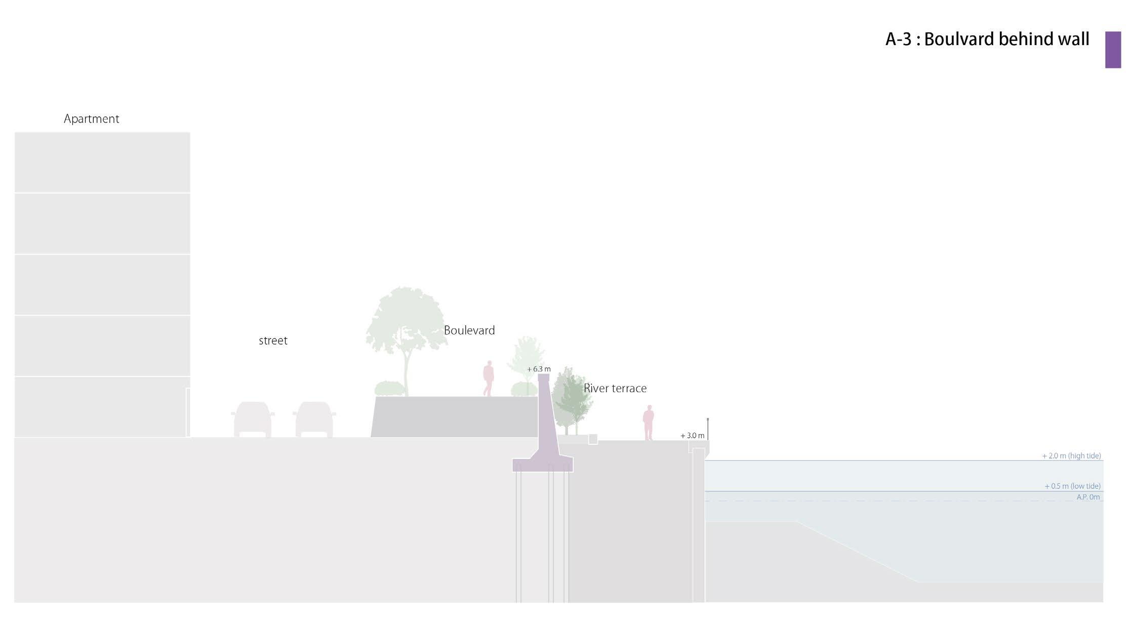
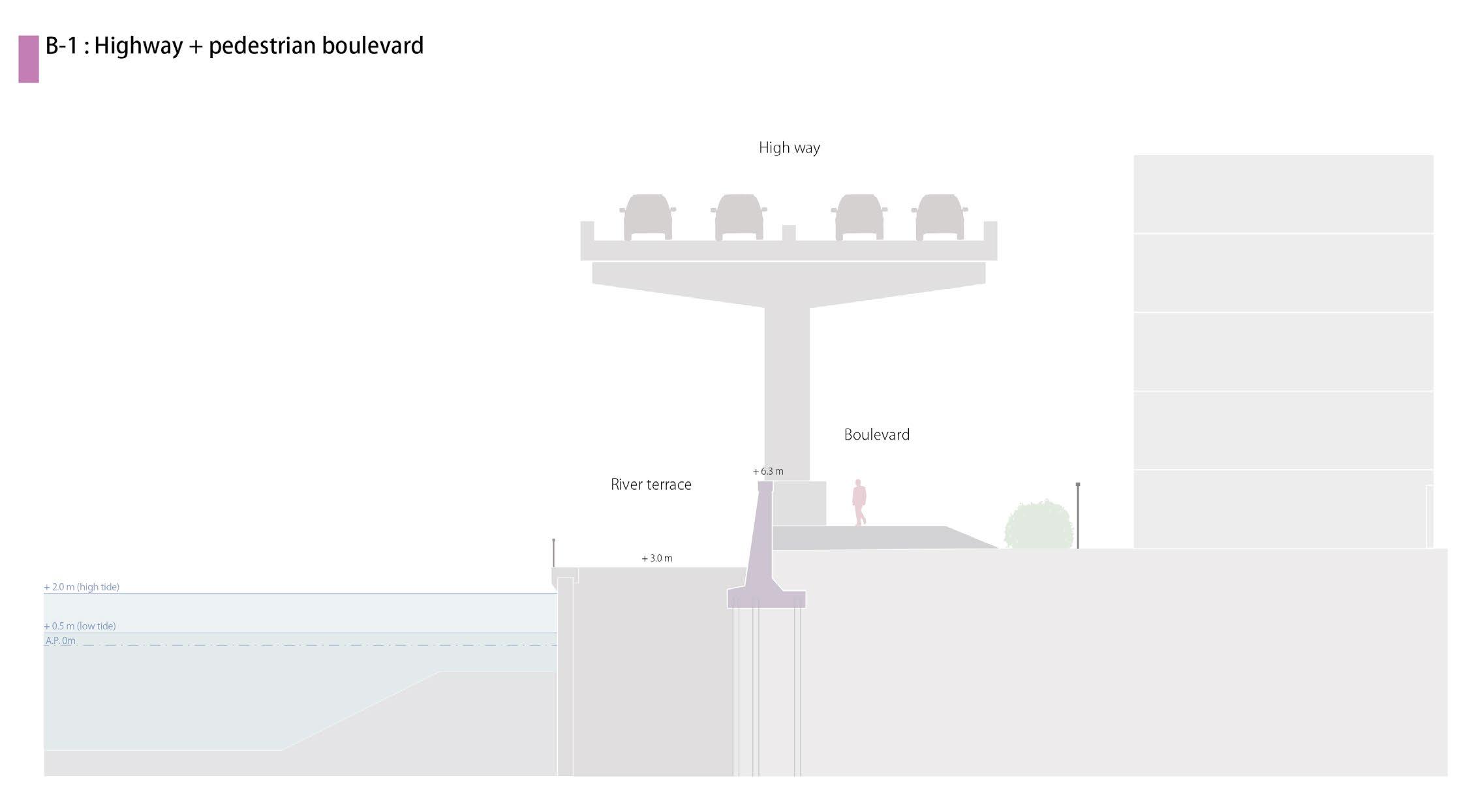
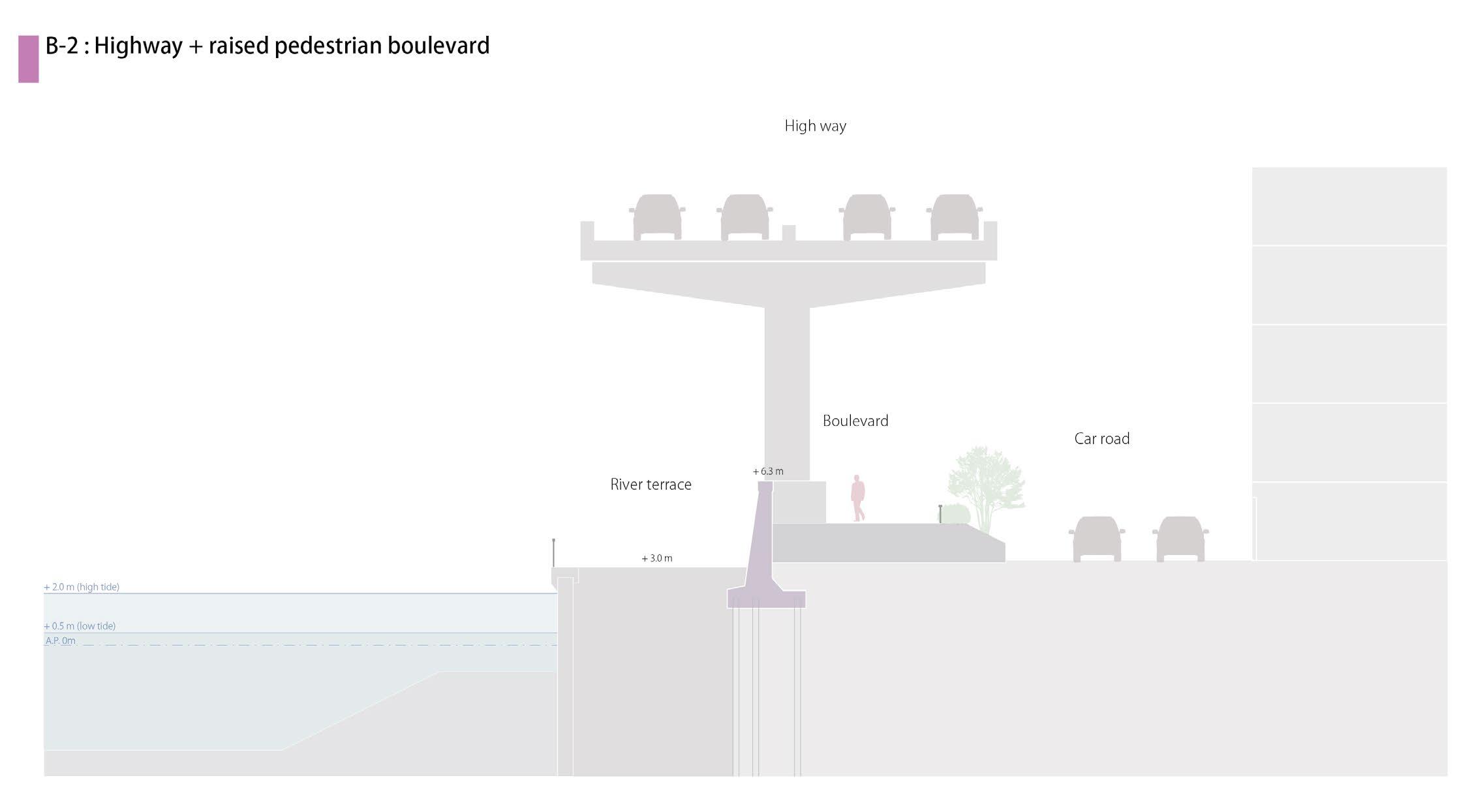
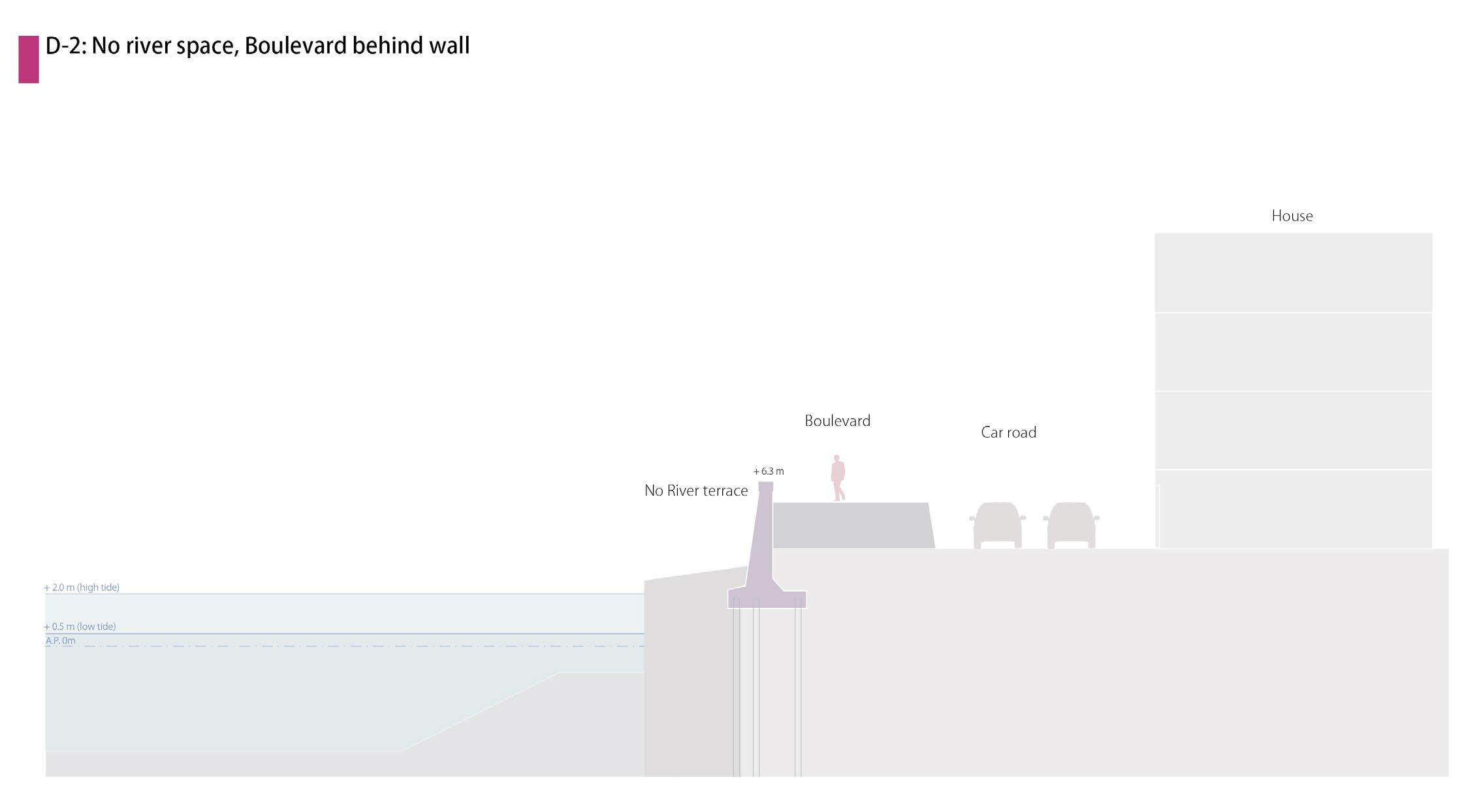
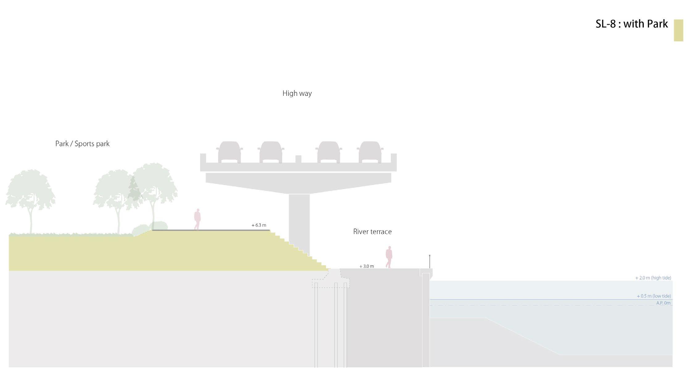
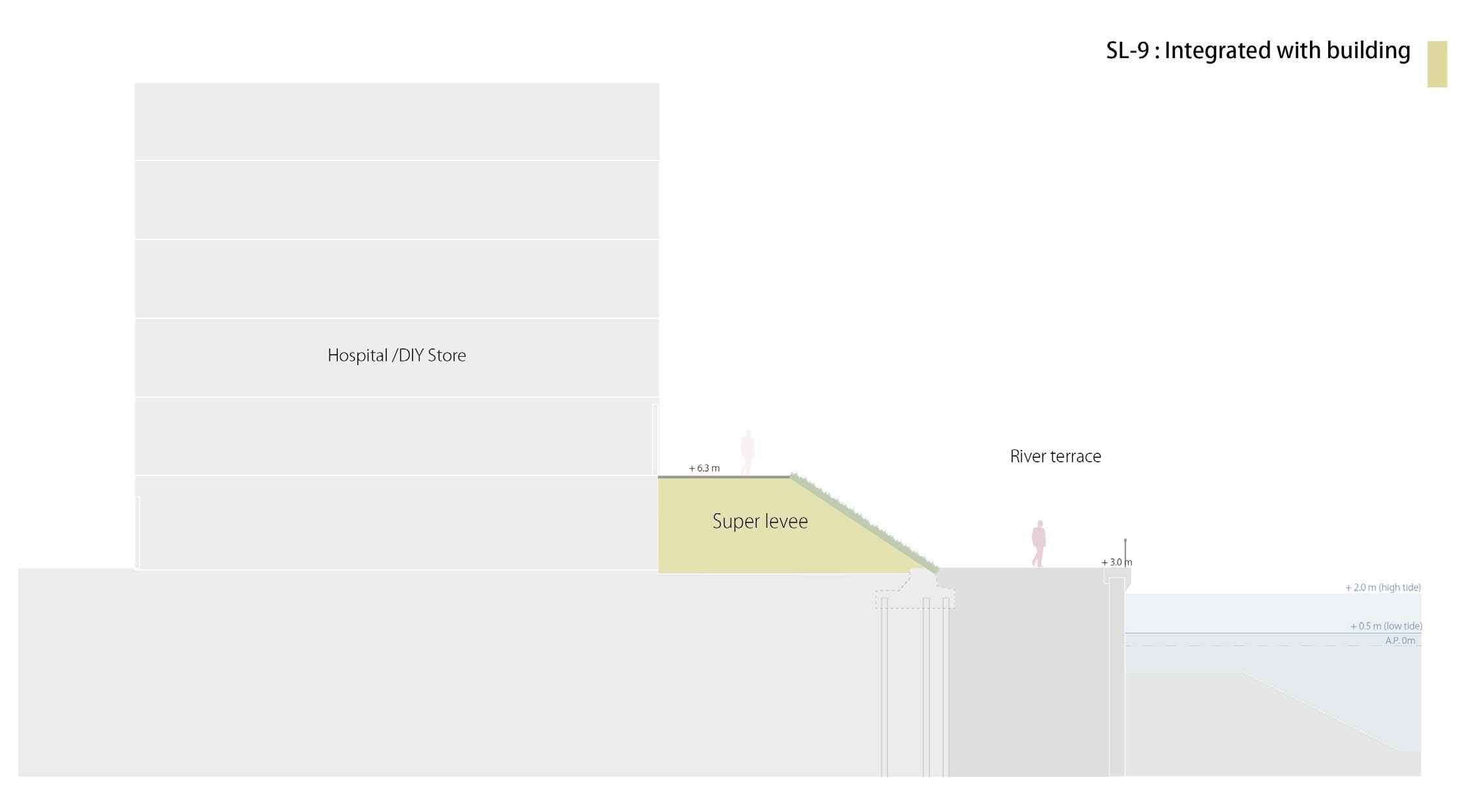
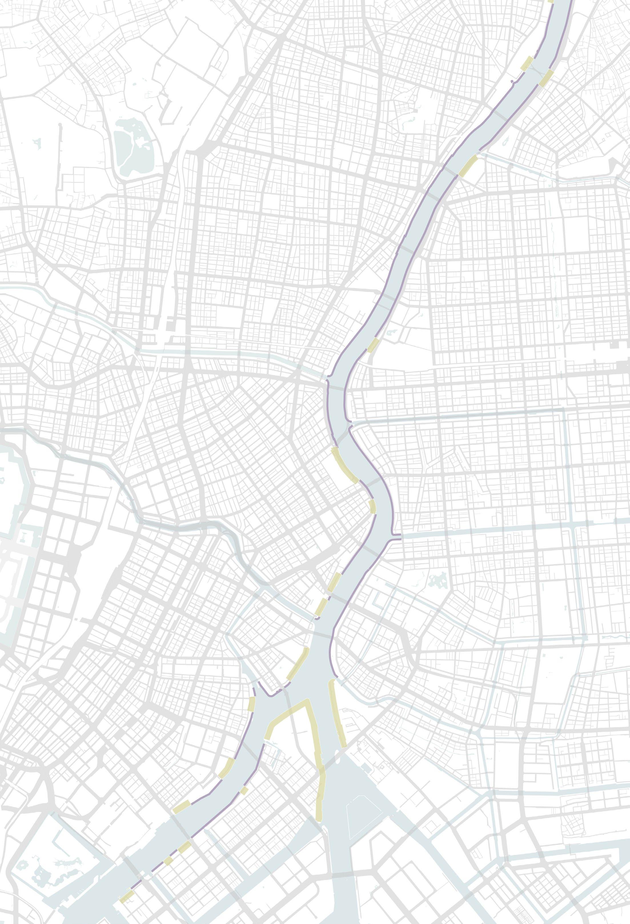
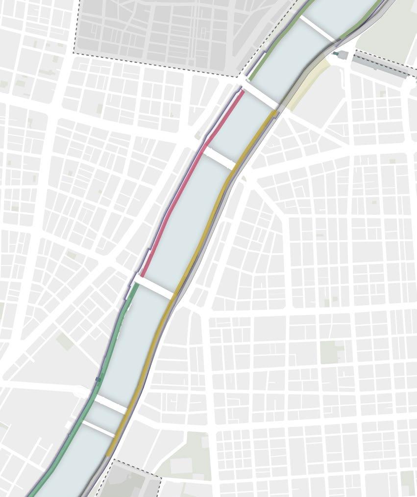
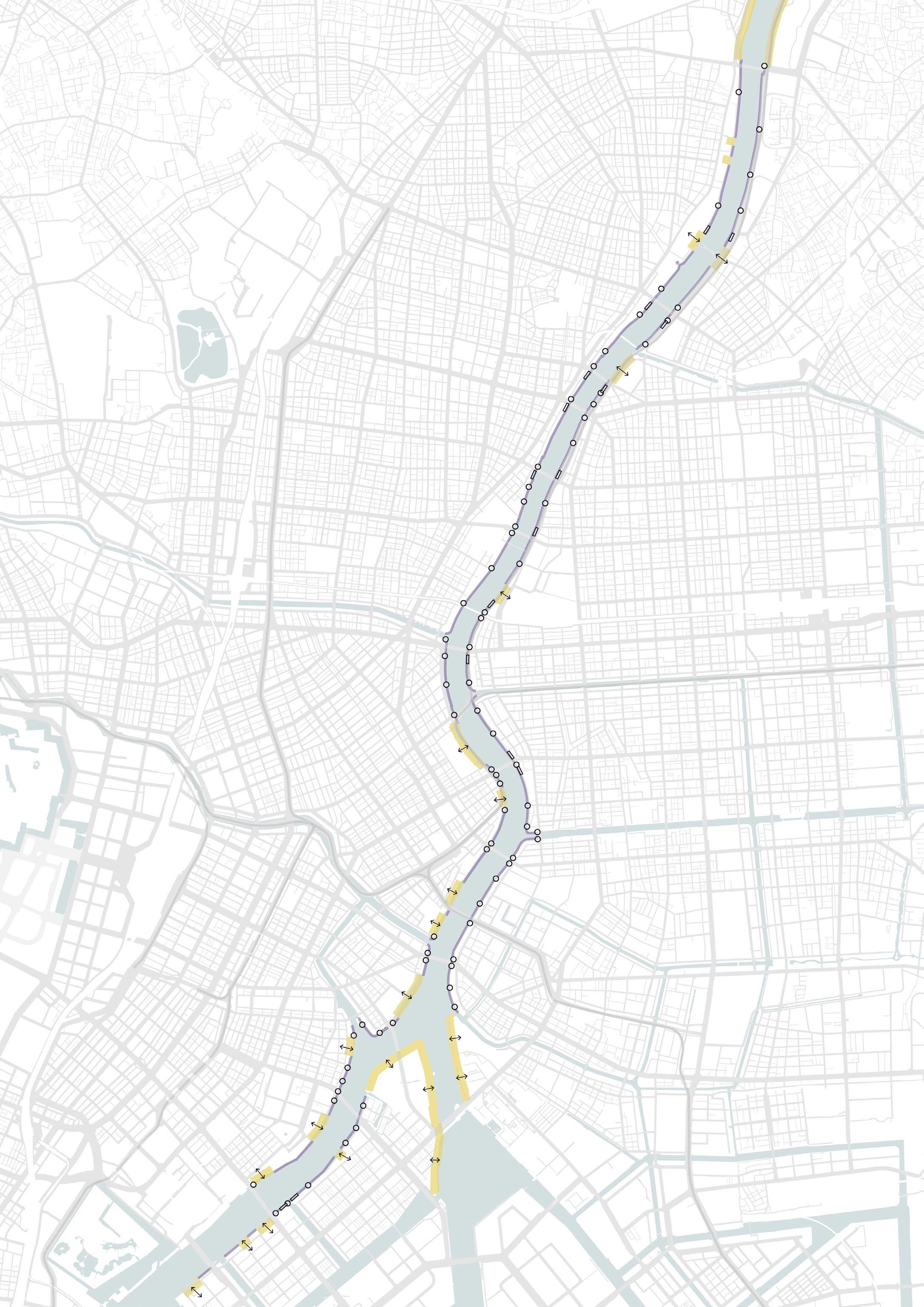
Through analysing these elements, the profiles can be divided 5 different groups: A) Flood wall with river pedestrian space, B) space with floodwall under the elevated highway, C) space integrated with the floodwall, D) No pedestrian space next to the floodwall, E) Super Levee (new dike type protection)
Furthermore, the profiles of the Sumida River can be broadly can be divided into two main types: the flood wall type and the Super Levee type.
44
Bicycle borrowed from a friend in Tokyo
Locations of the photo I took on the first visit
45 Memo for the river edge research at the site
46 Sumida River
47 River all sections
48
49
50
51
52
53
54
55
56
57
58
59
60
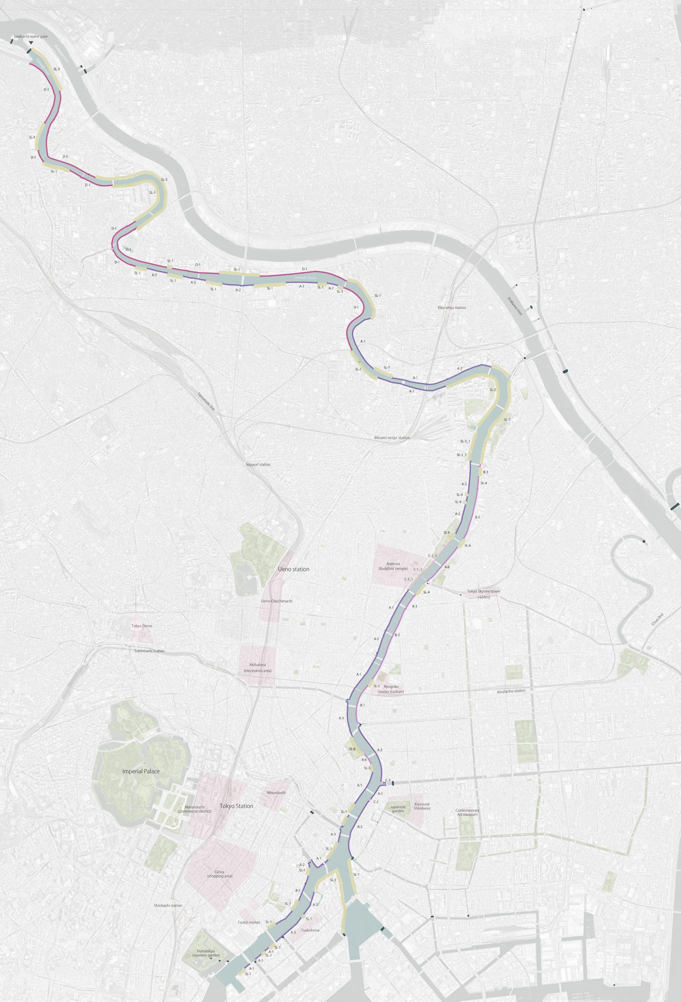
61 Section classification map
Analysis
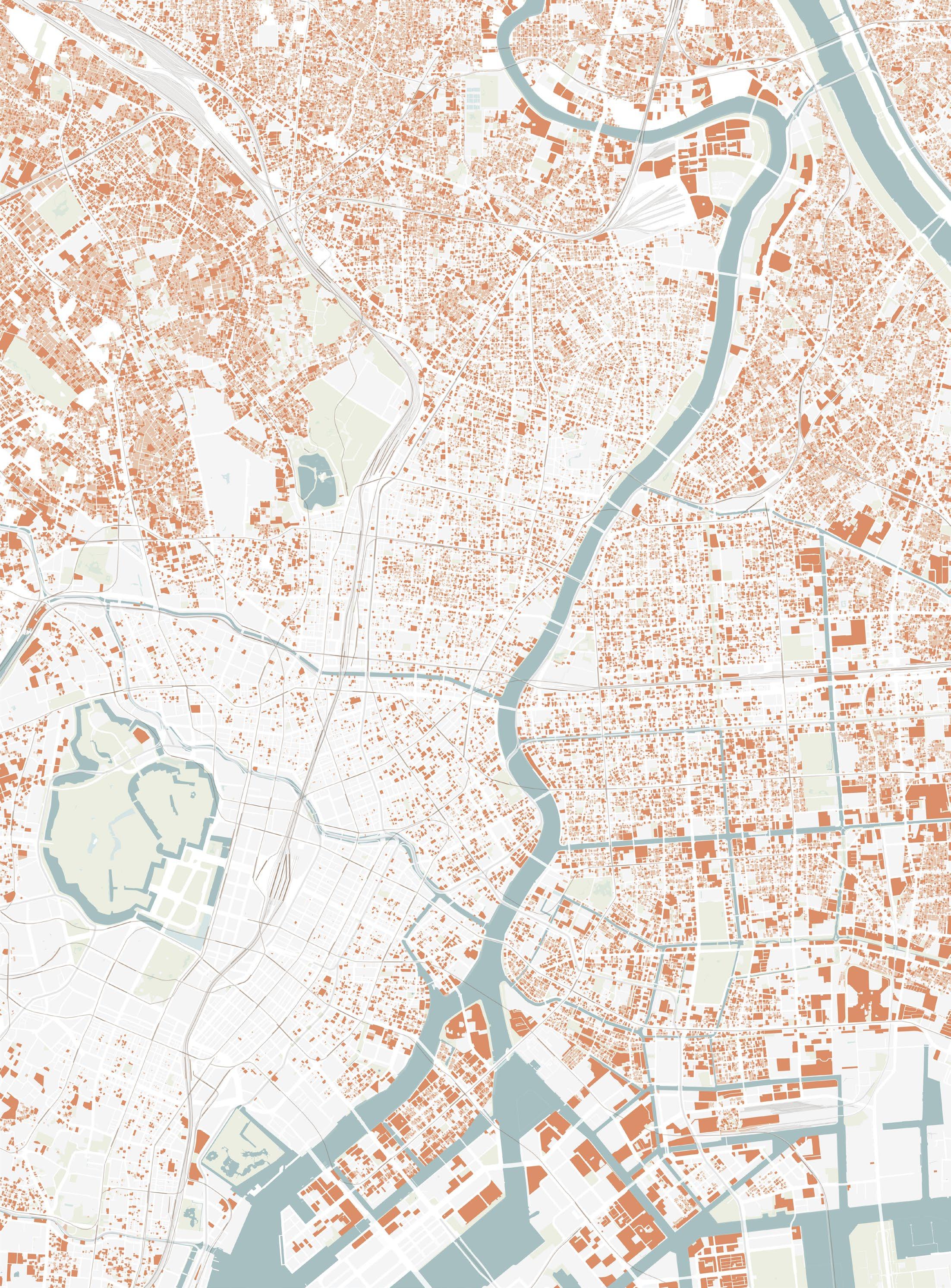
Using the river sections and photos created based on the field survey, as well as new information and map dates, I analysed the actual river space problems.
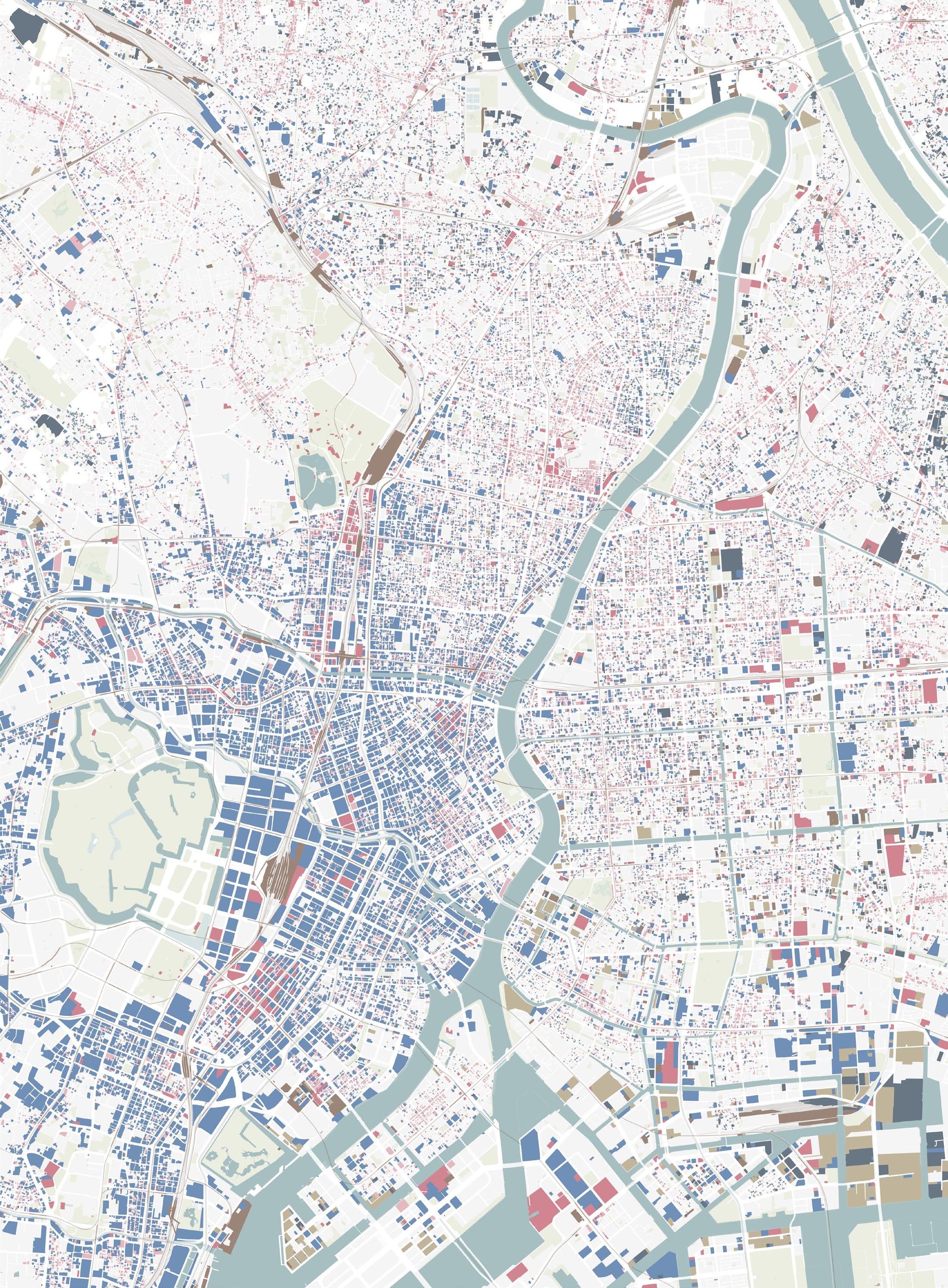
I also received detailed GIS information data from the Tokyo Metropolitan Government, which allowed me to visualise detailed data, such as green spaces, road, rail networks, and building types, that can be applied to an urban scale analysis in Tokyo.
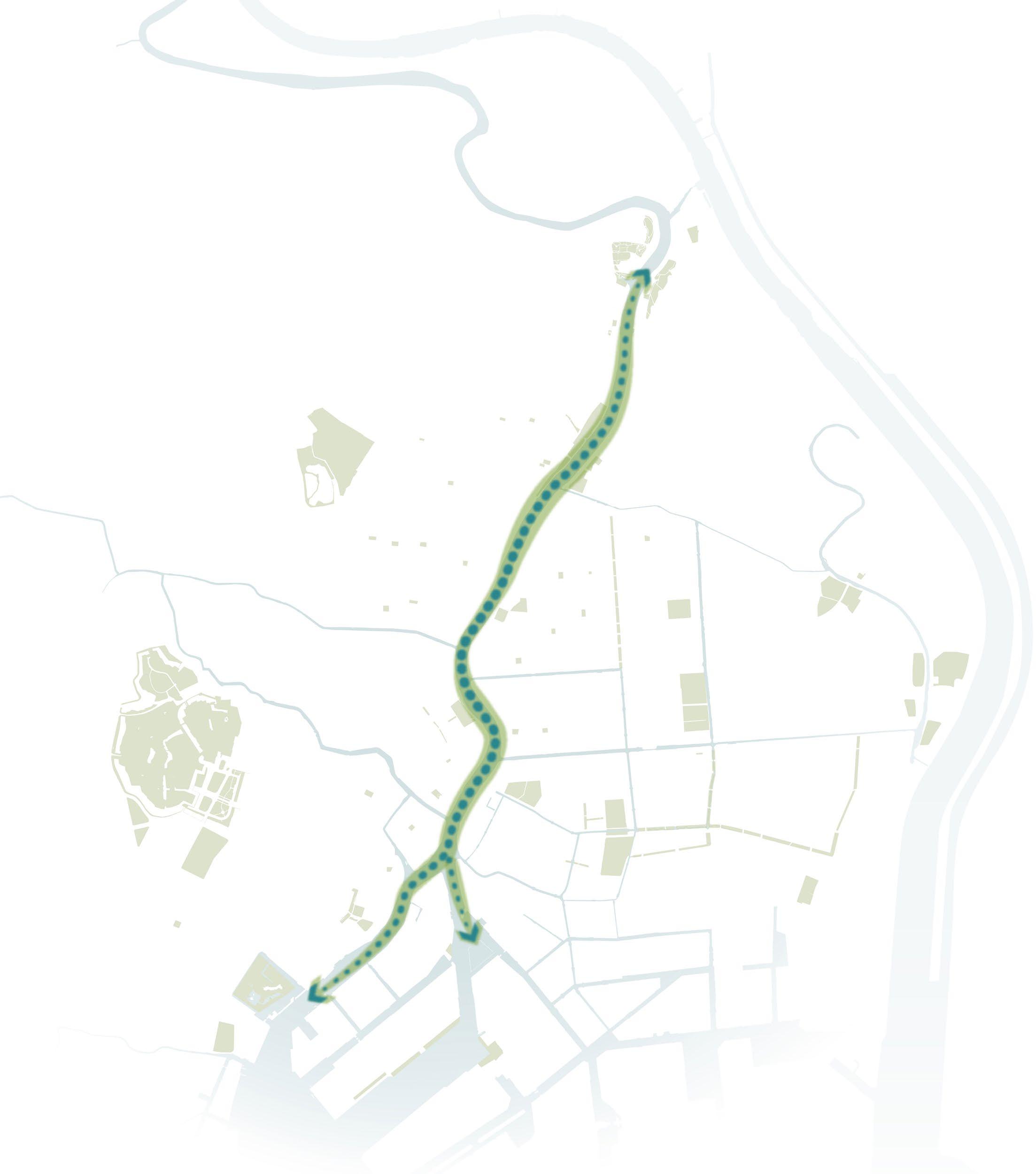
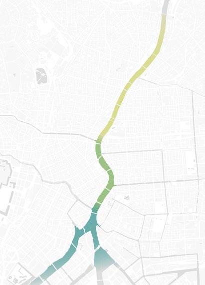
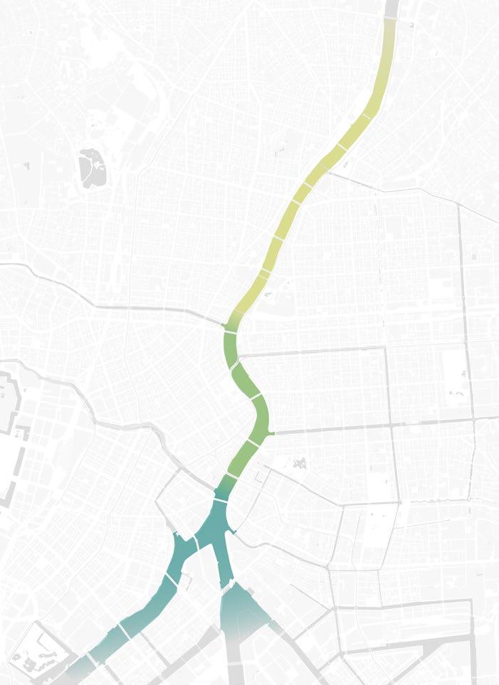
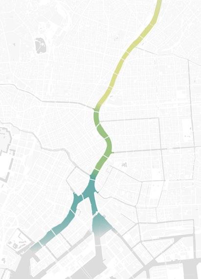
The Sumida River is 23 km long, but the half upstream flows mostly through residential areas. In contrast, the downstream half flows through the centre of Tokyo, with offices, tourist spots, and amusement centres around. Compared to the upper stream, transforming the downstream near the city centre is expected to impact the huge area and wide range of people. Therefore, the project’s design will focus on the development of the downstream region.
The current situation of the Sumida River space
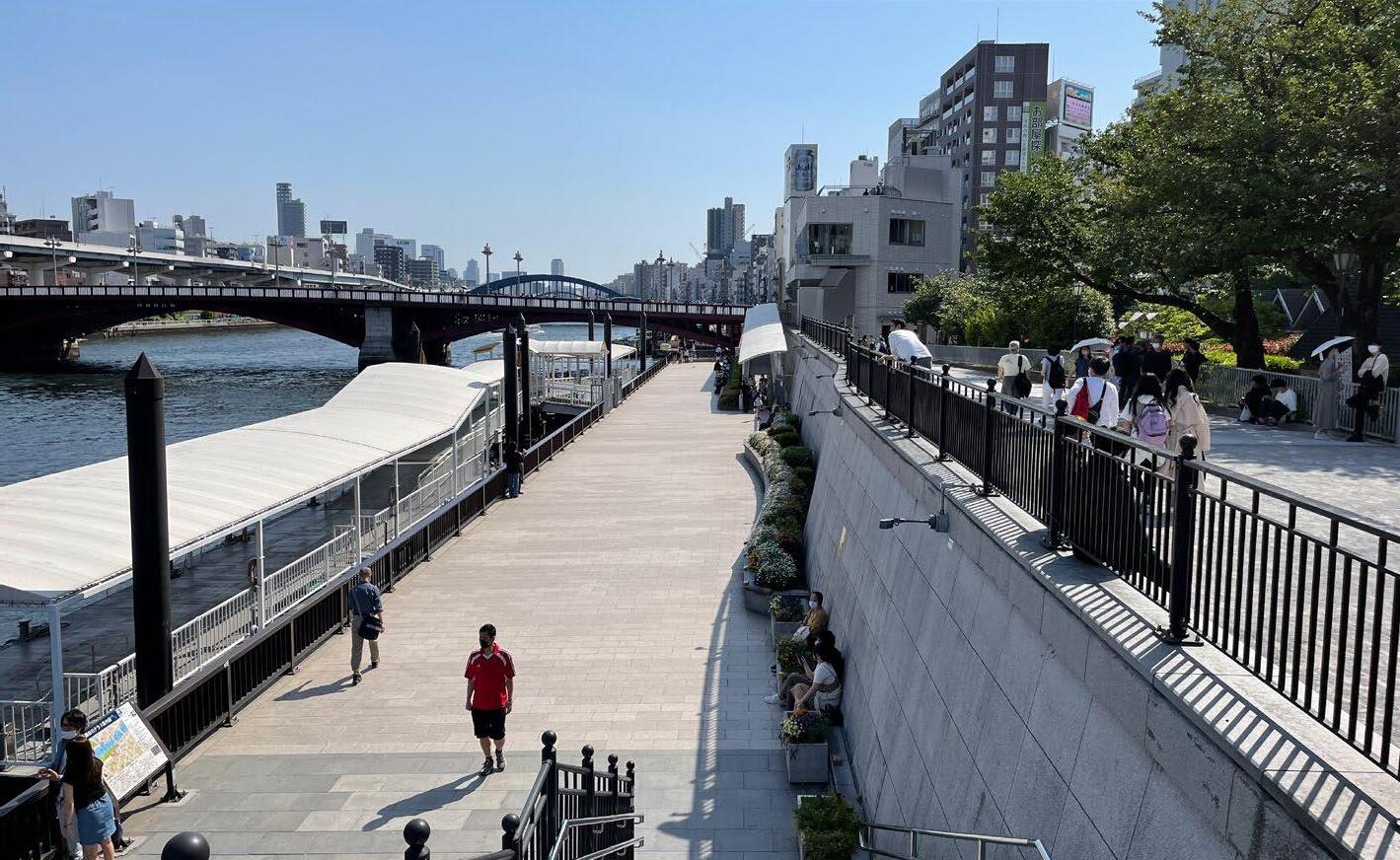
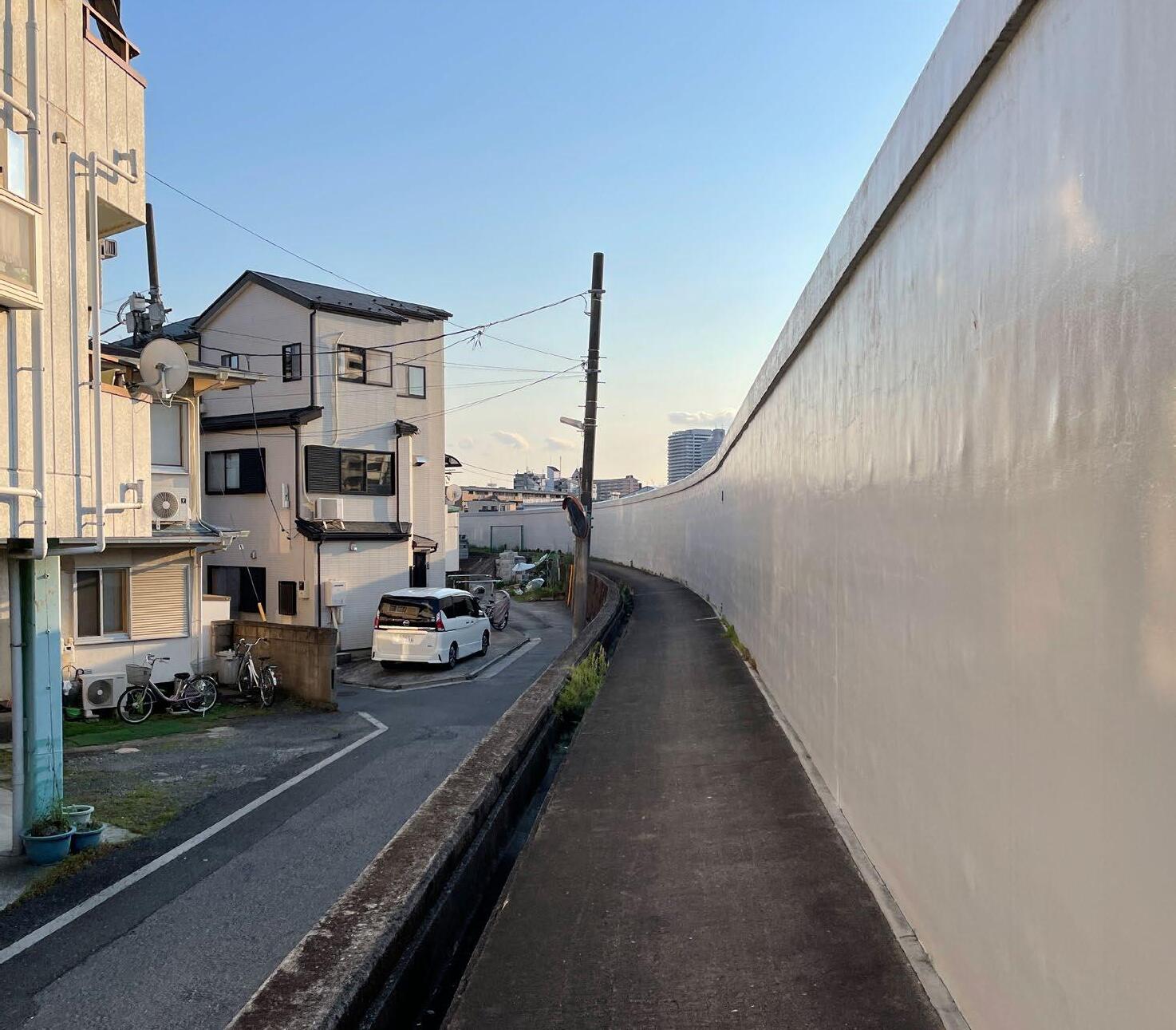
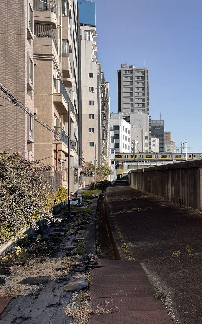
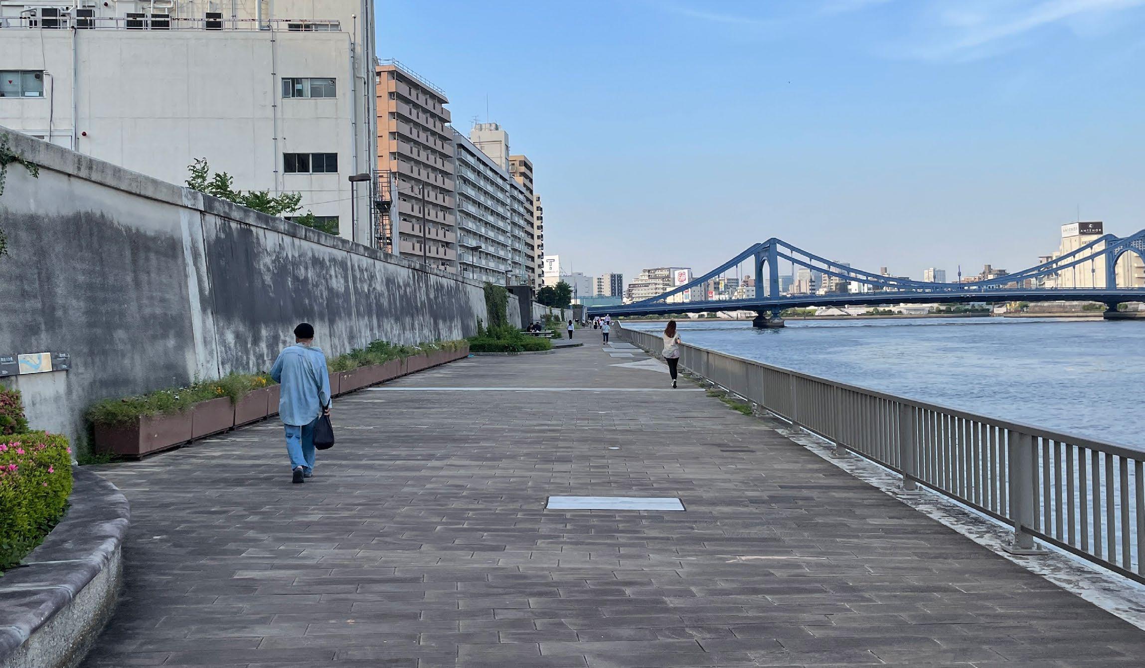
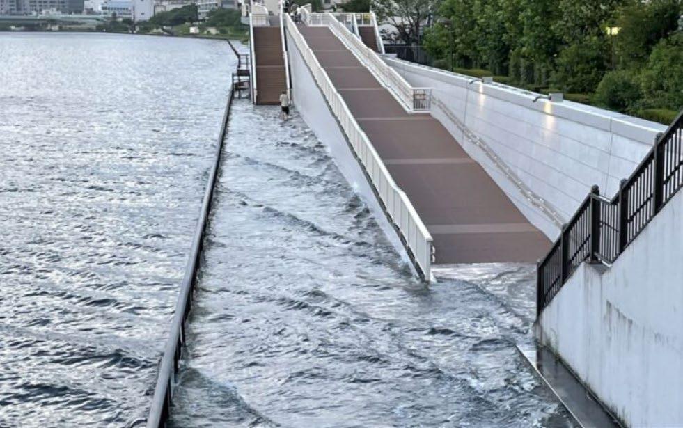
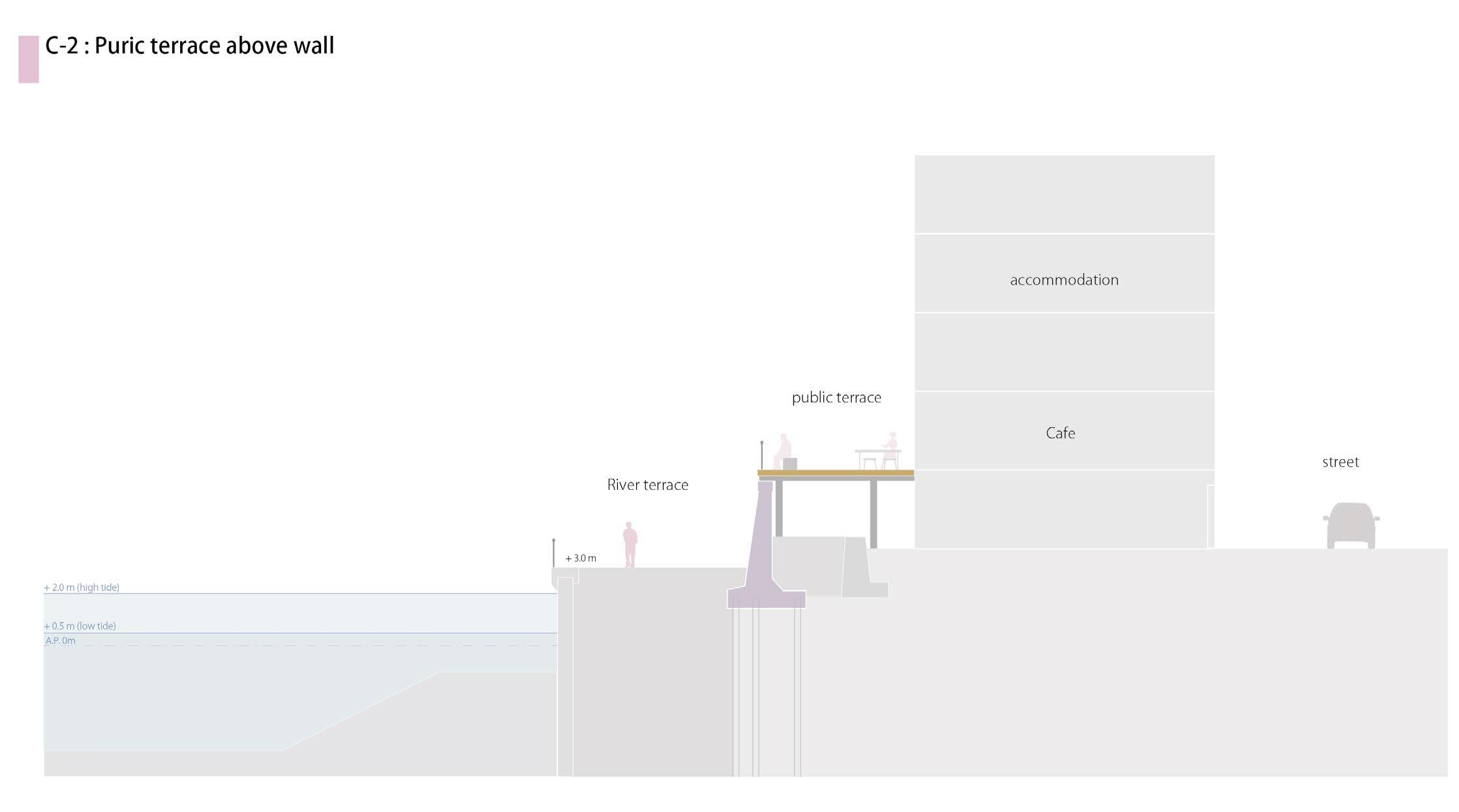
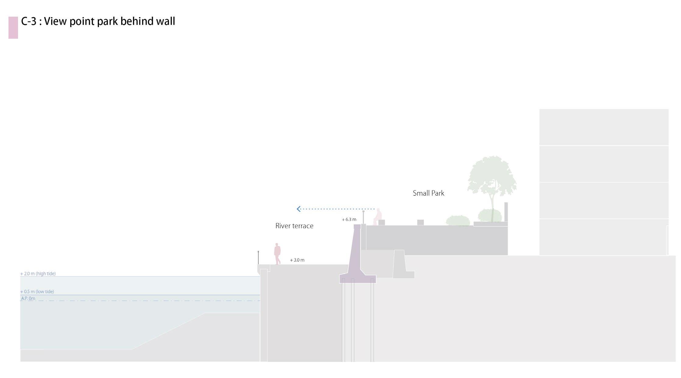
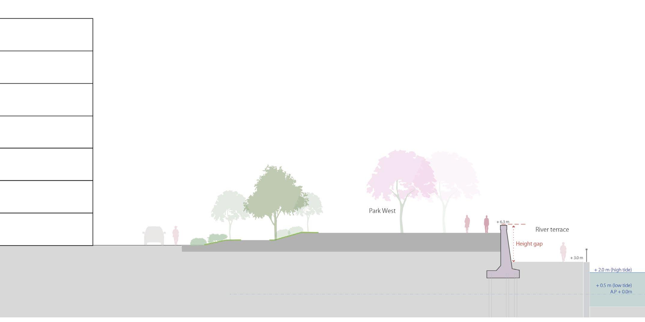
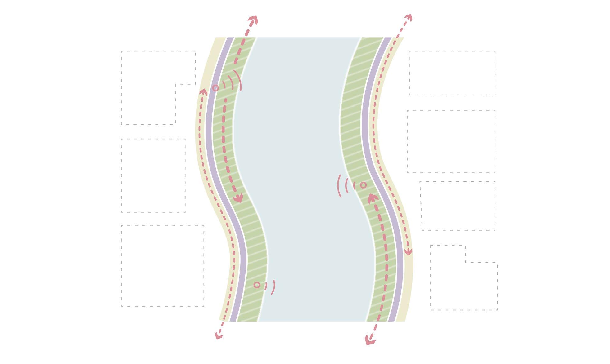
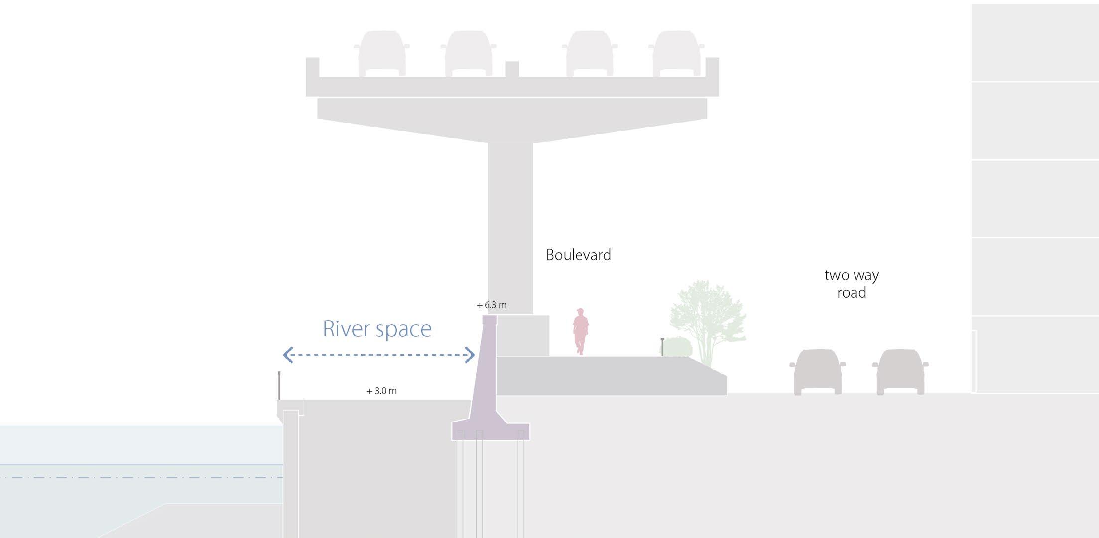
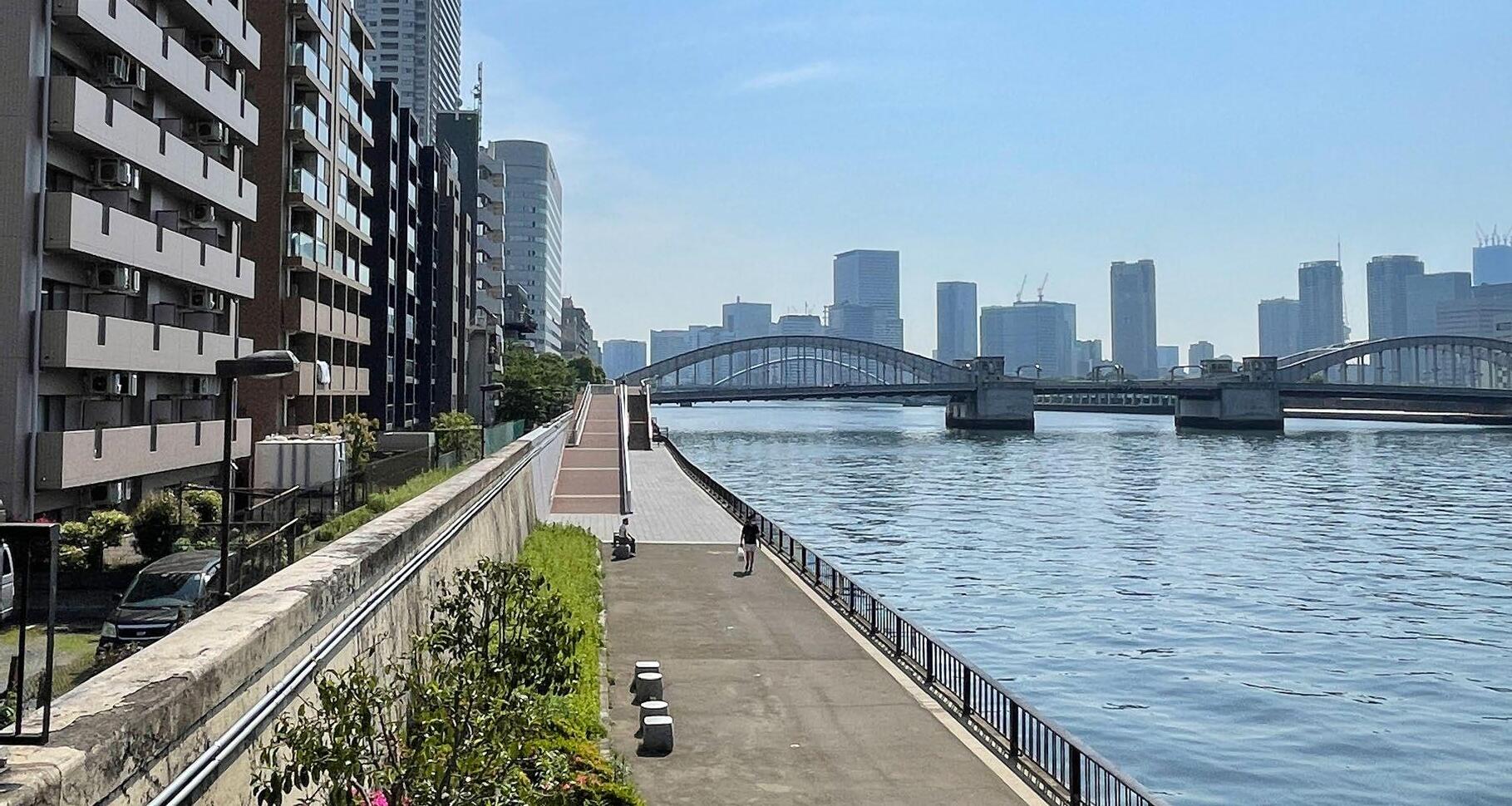
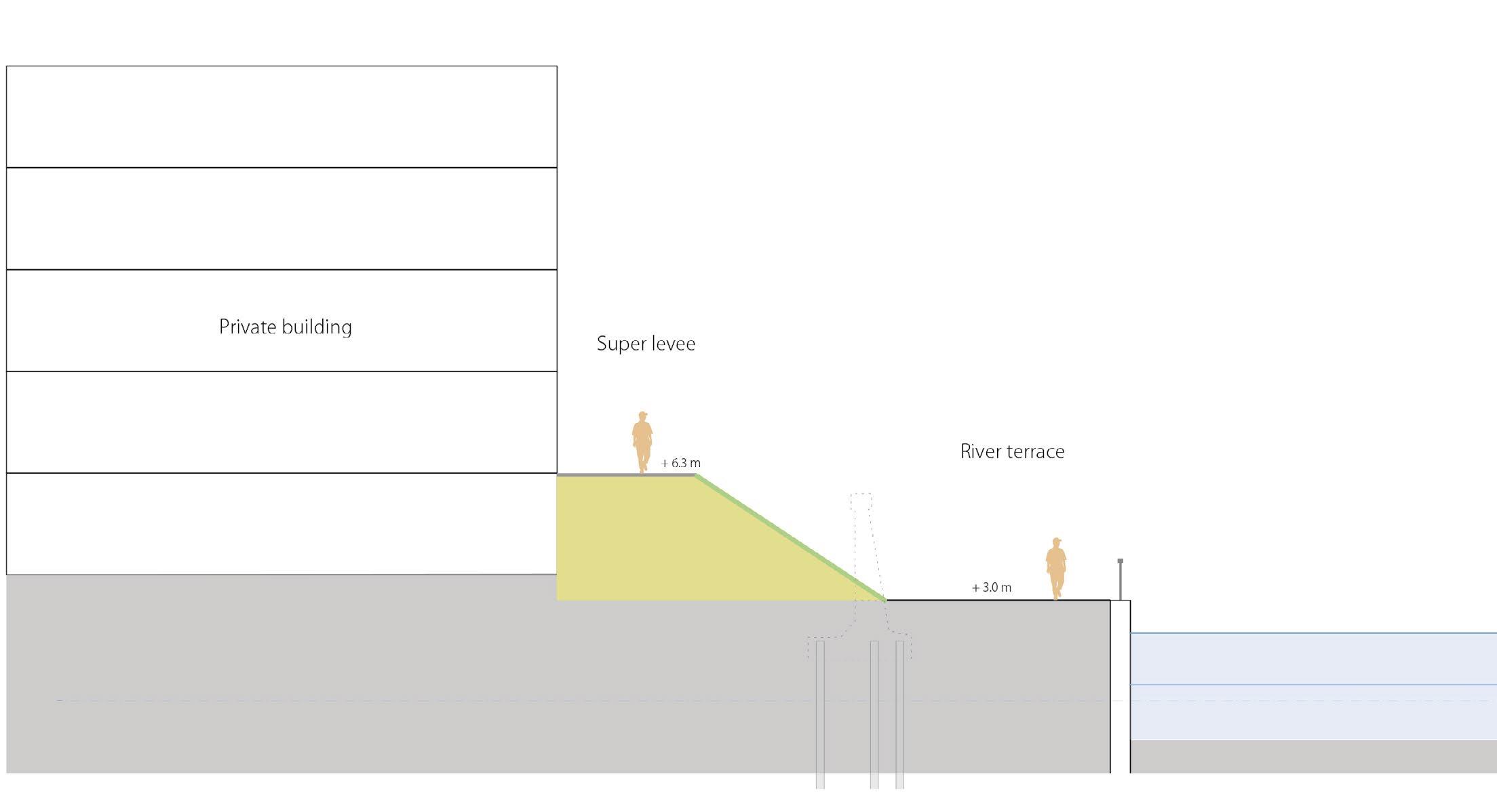
While these 6.3 m flood walls significantly contributed to the protection of the citizens of Tokyo, they separated the river from the city. As a result, people’s interest in the Sumida River gradually diminished. The Tokyo government created two solutions in the 1980s to improve this situation and reinforce flood protection.
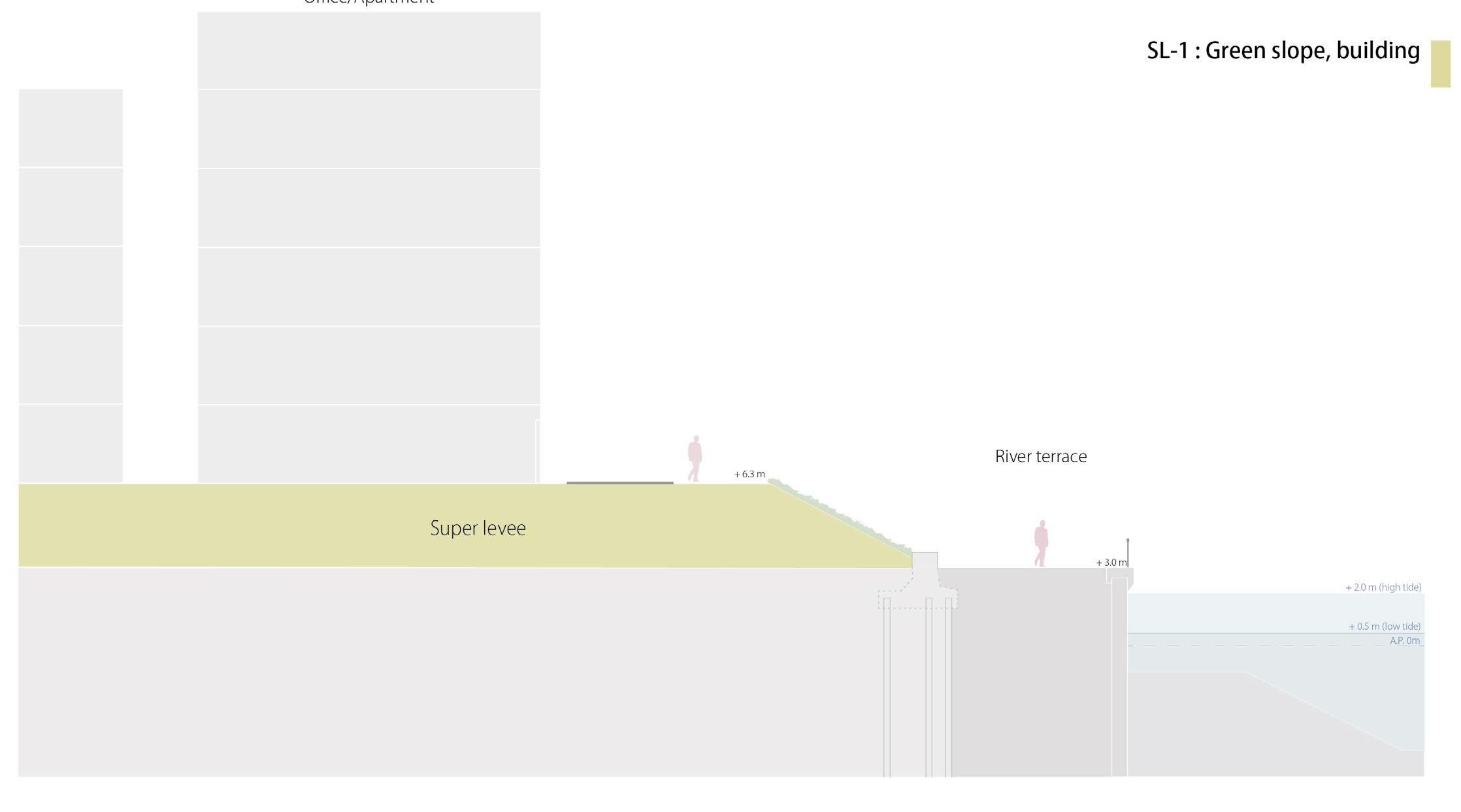
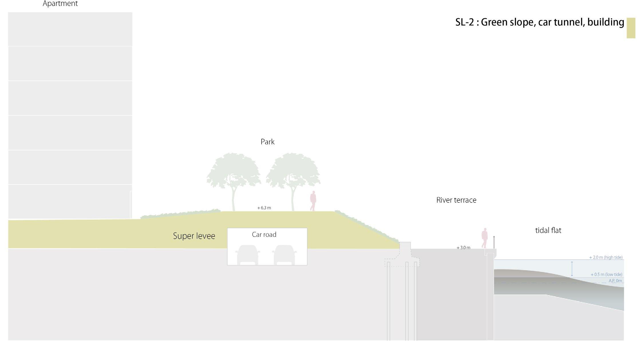
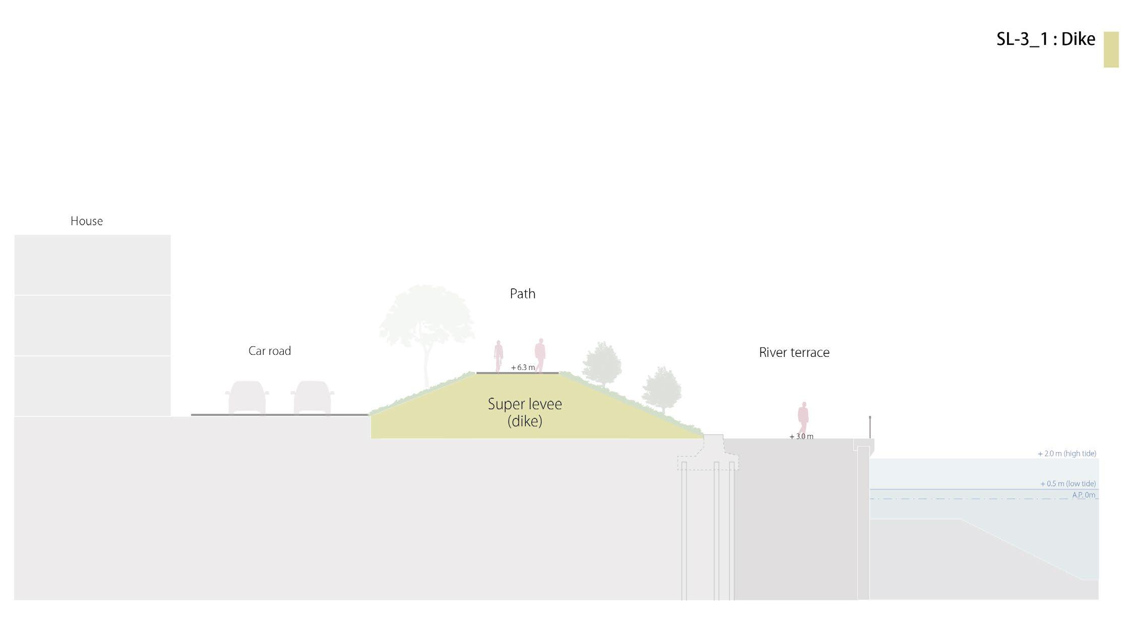
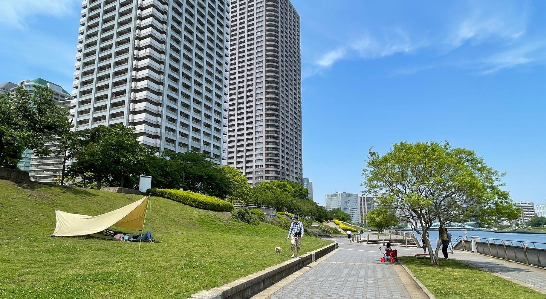
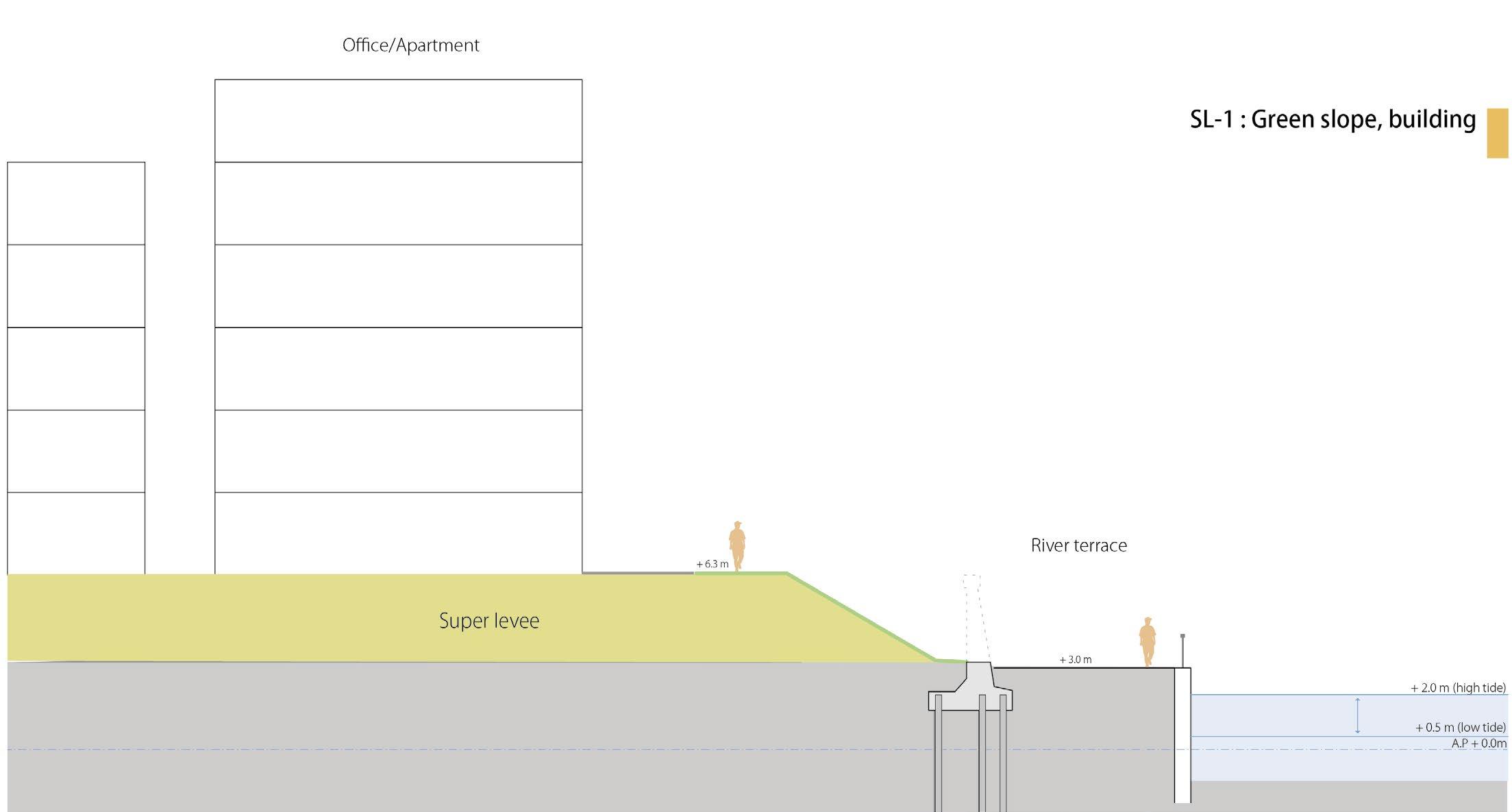
The first solution was to make a river terrace next to the existing flood wall. This creates pedestrian space along the river and reinforces the flood wall construction, especially for earthquakes. The second solution is to make the Super levee a huge dike and combine it with building plots, combined with the terrace.
The section research shows that the river edge can be divided mainly into those two solutions.
70%

Super levee
Super levee
30%
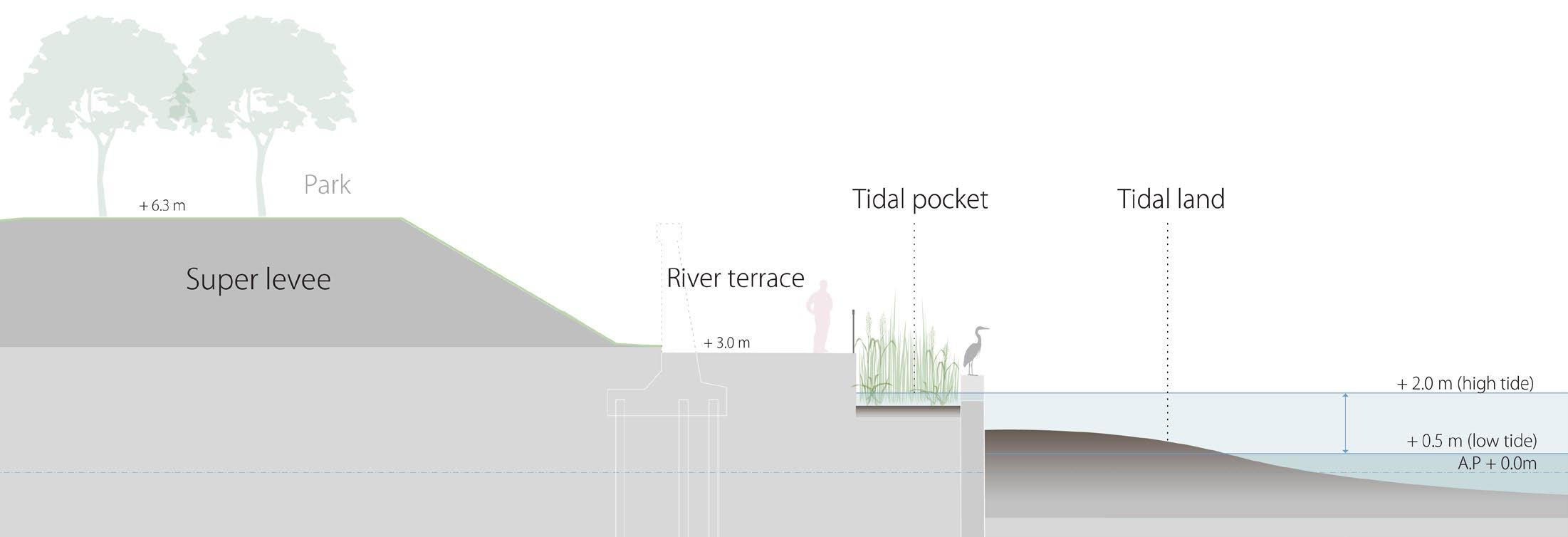
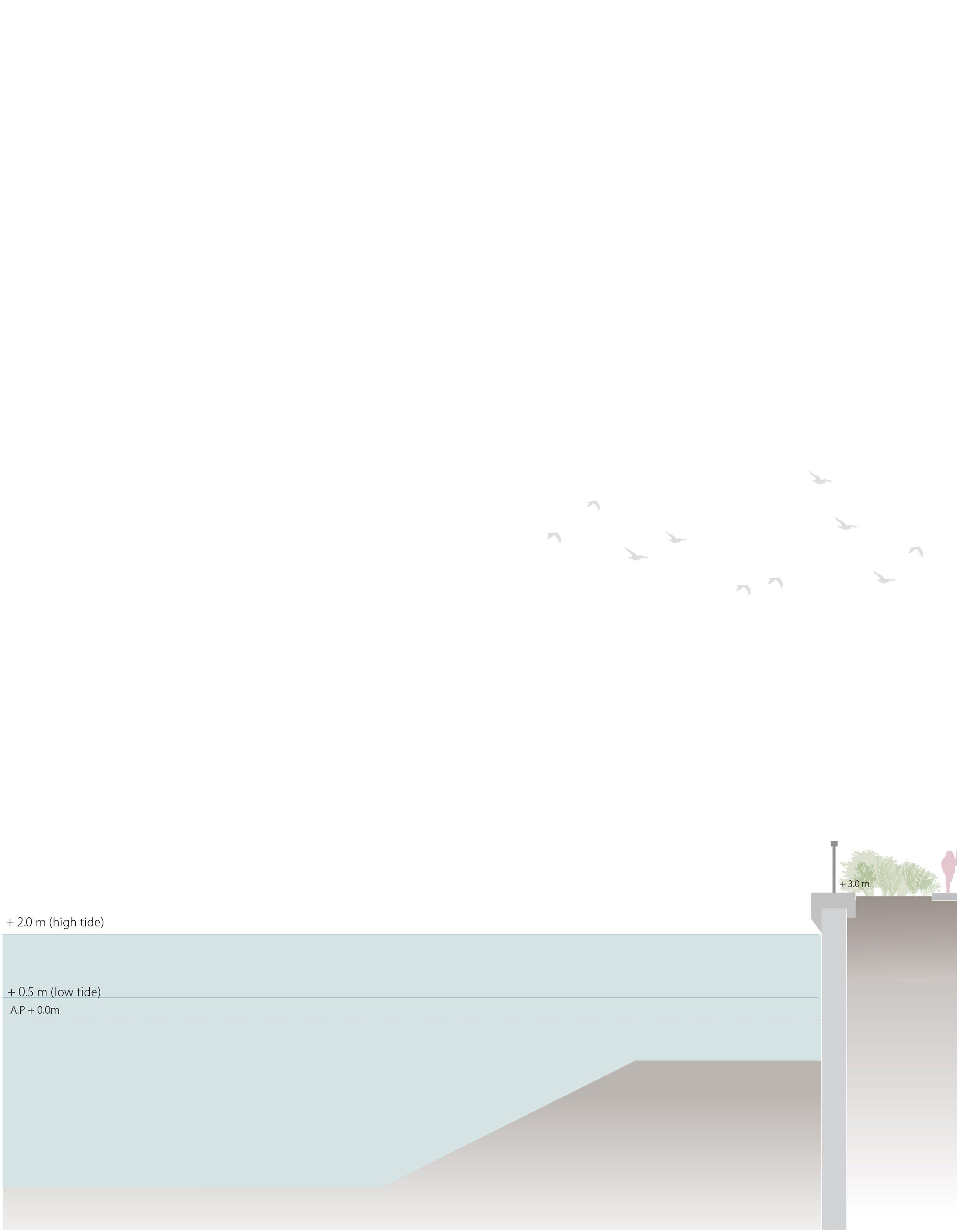
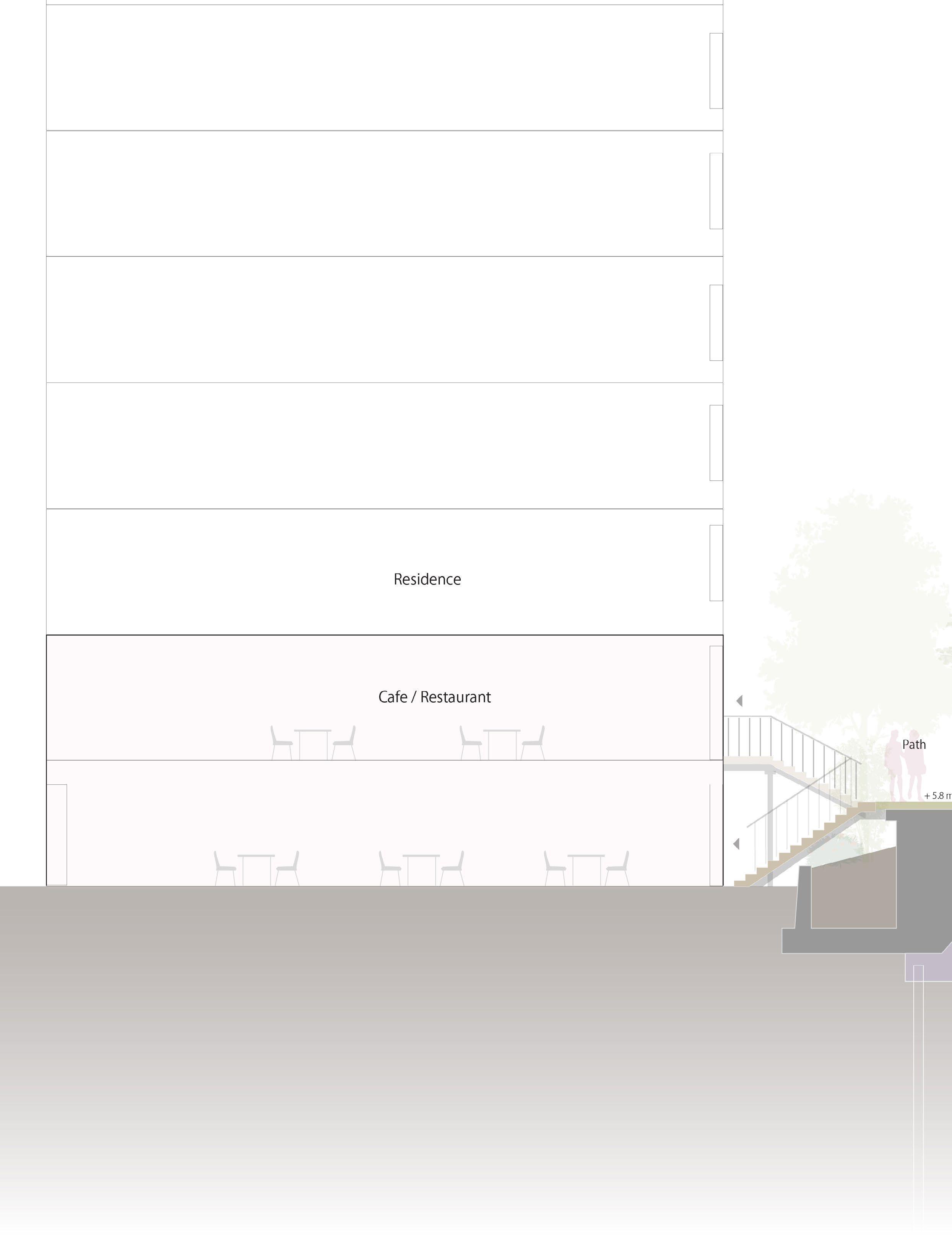
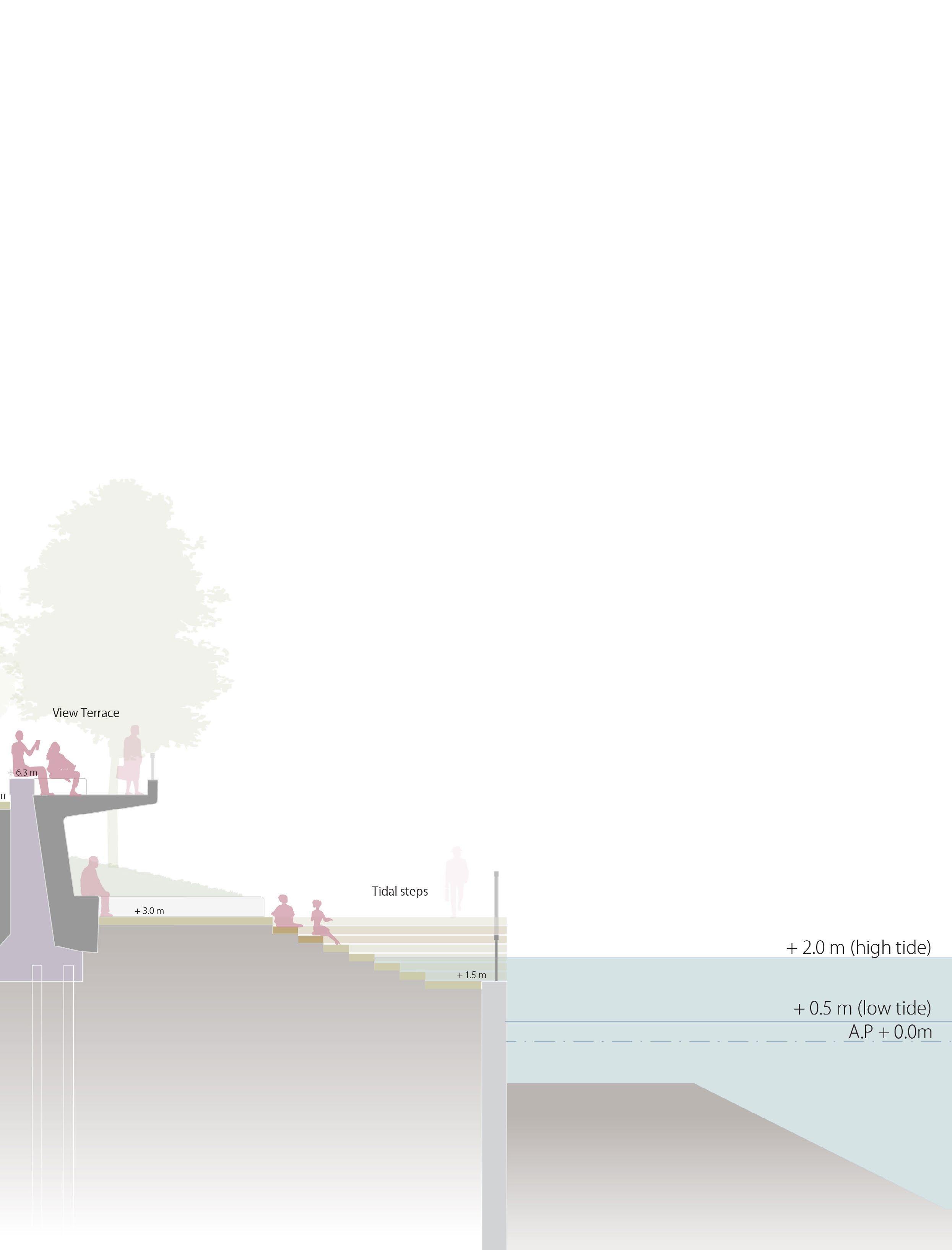
+ 2.0 m (high tide) + 0.5 m (low tide) A.P + 0.0m Office / Residence
Sumida river
river terrace + 5.1m (flood in1959) + 6.3 m + 3.0 m
Path, Park
Super levee
64
Sumida river terrace

 Flood wall
65
Super levee
Current location of the flood wall and super levee
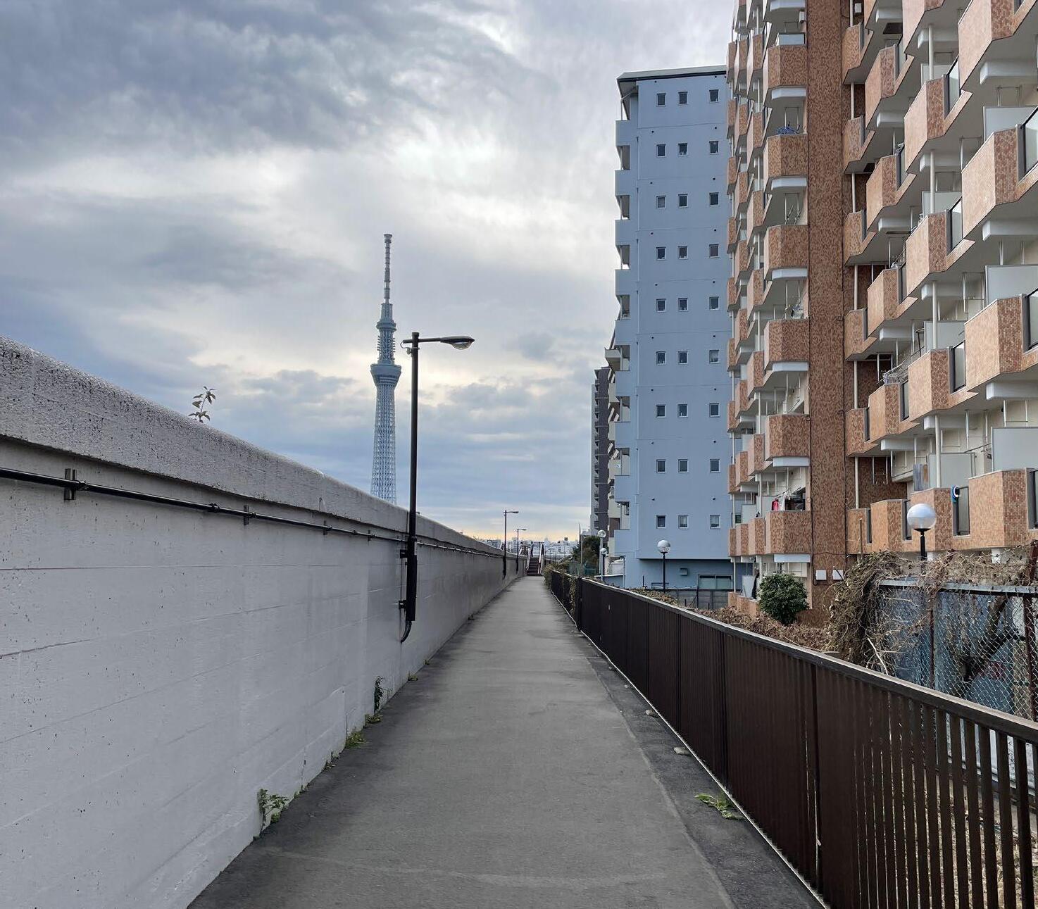
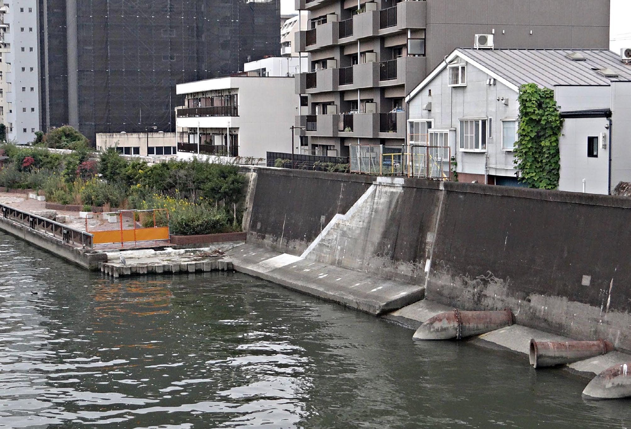
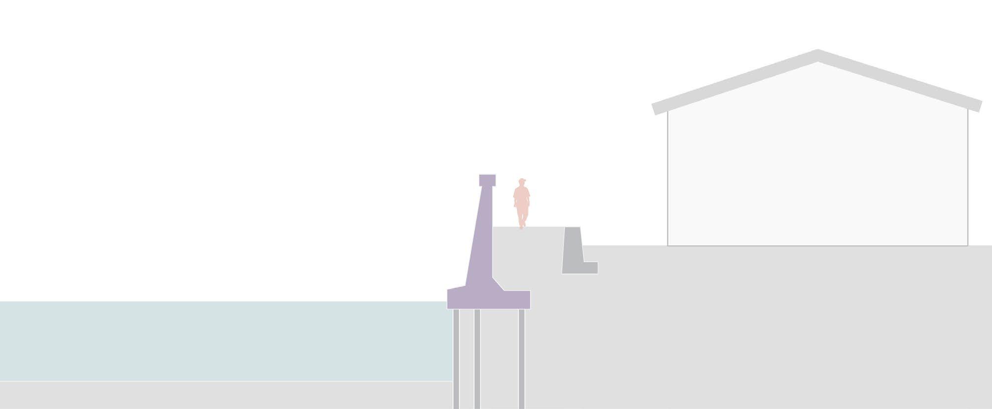
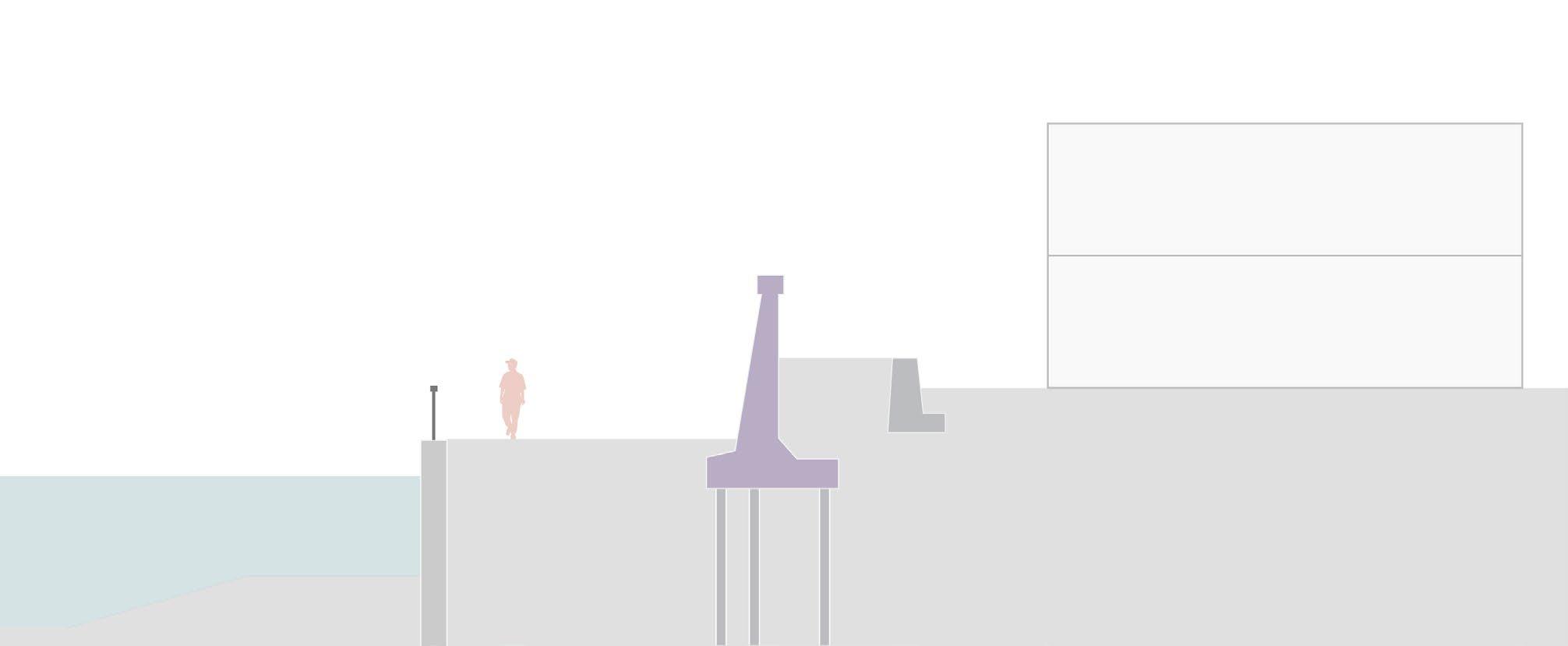
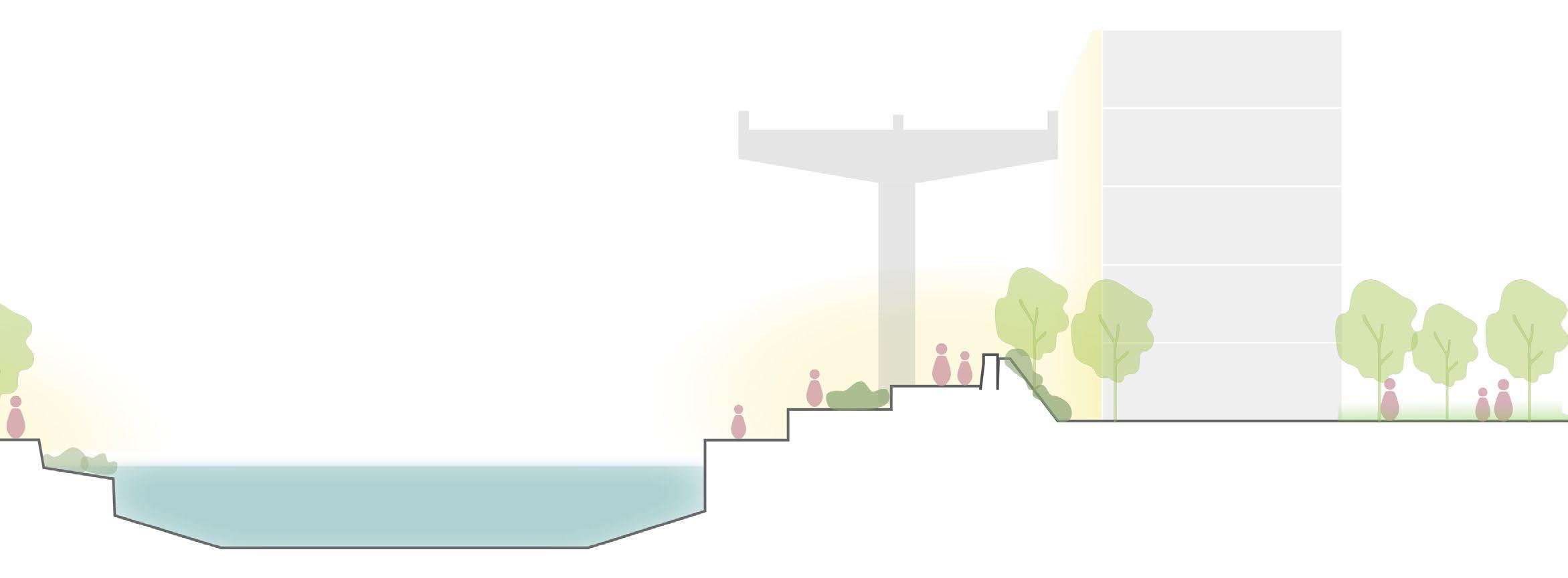
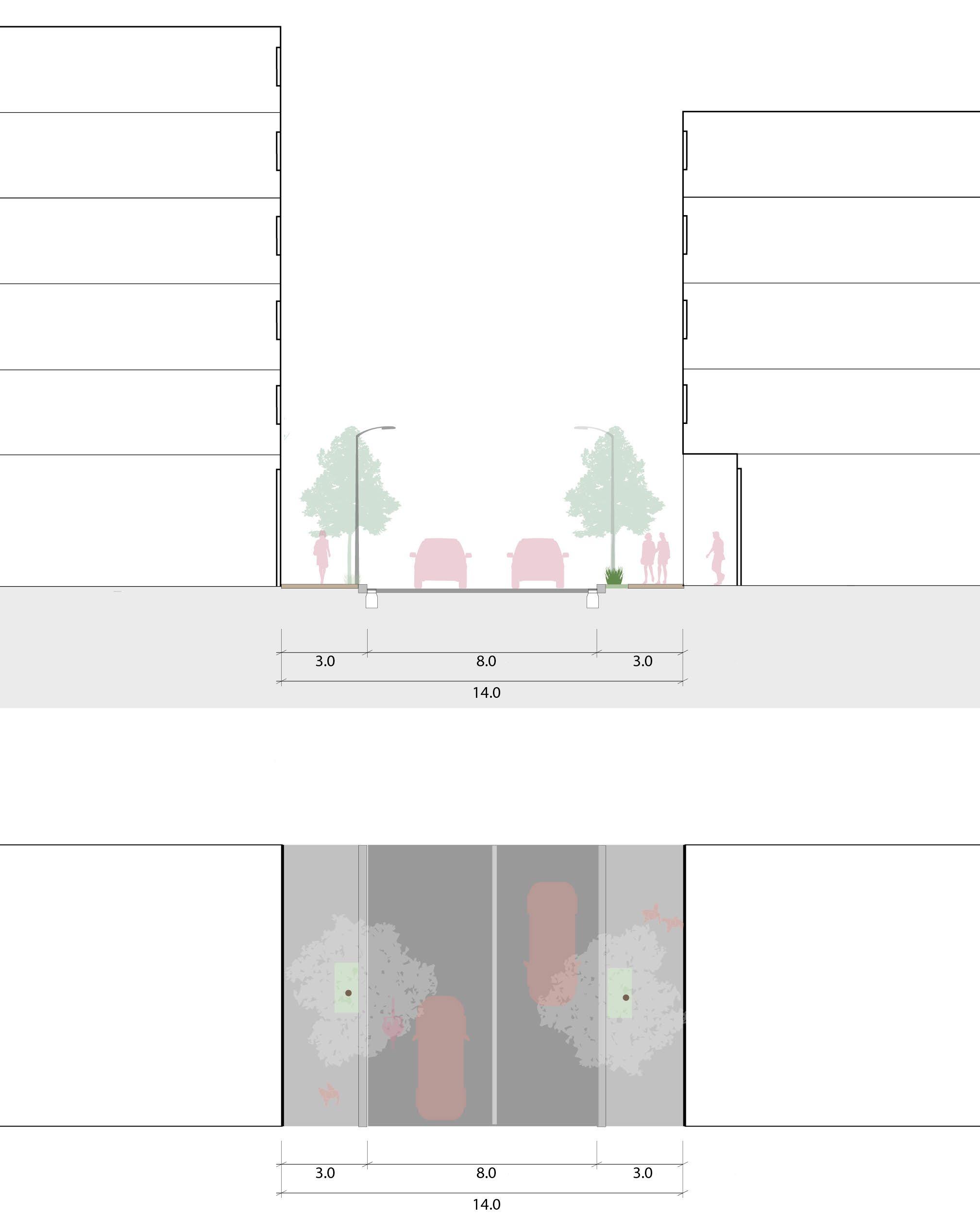
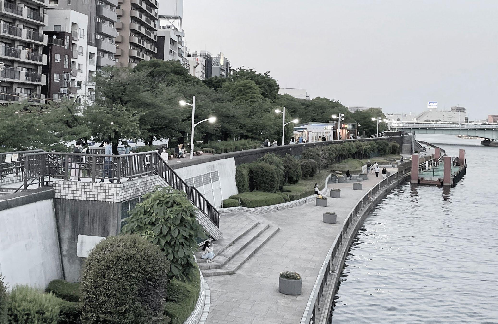
Flood wall + river terrace : spatial problems
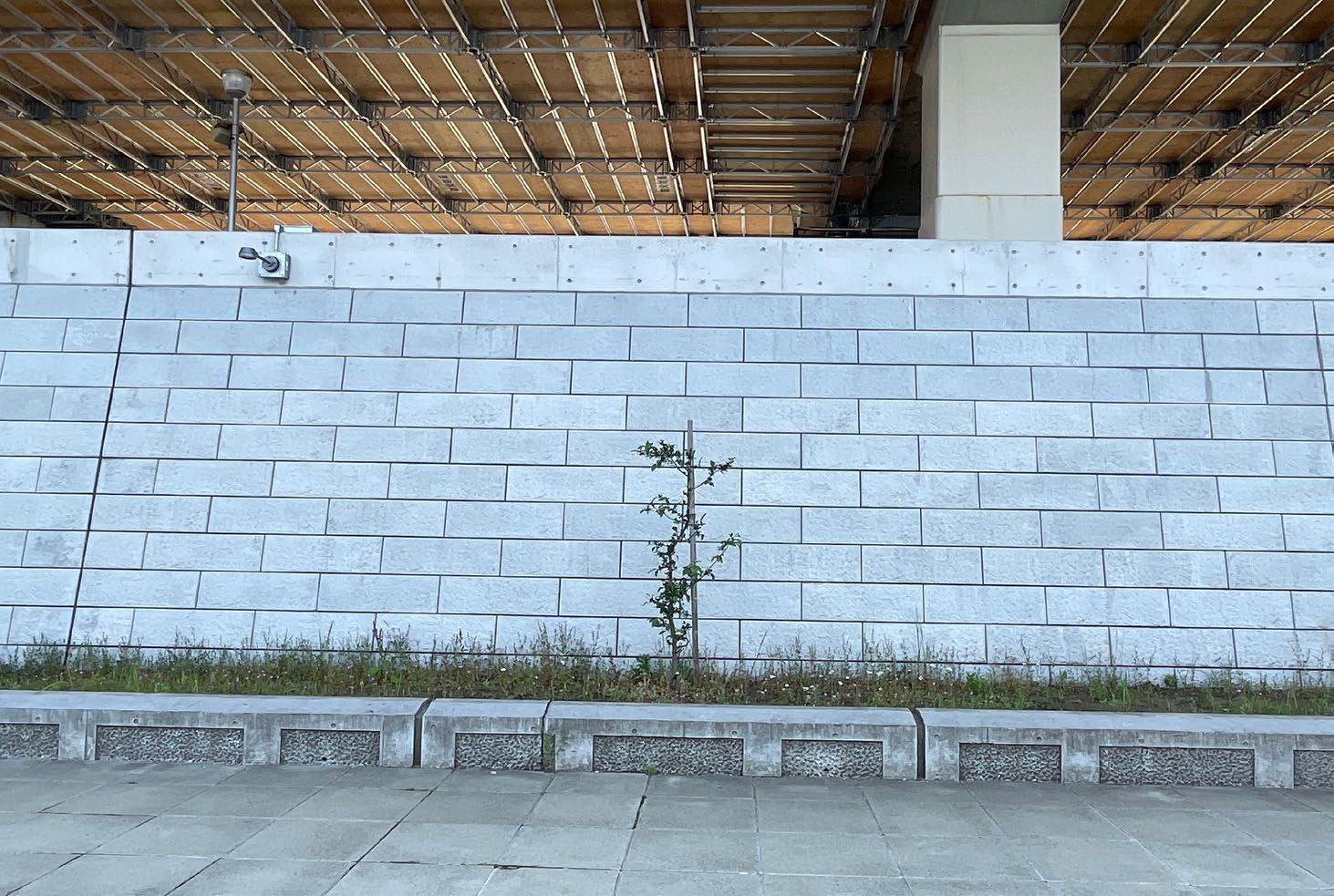
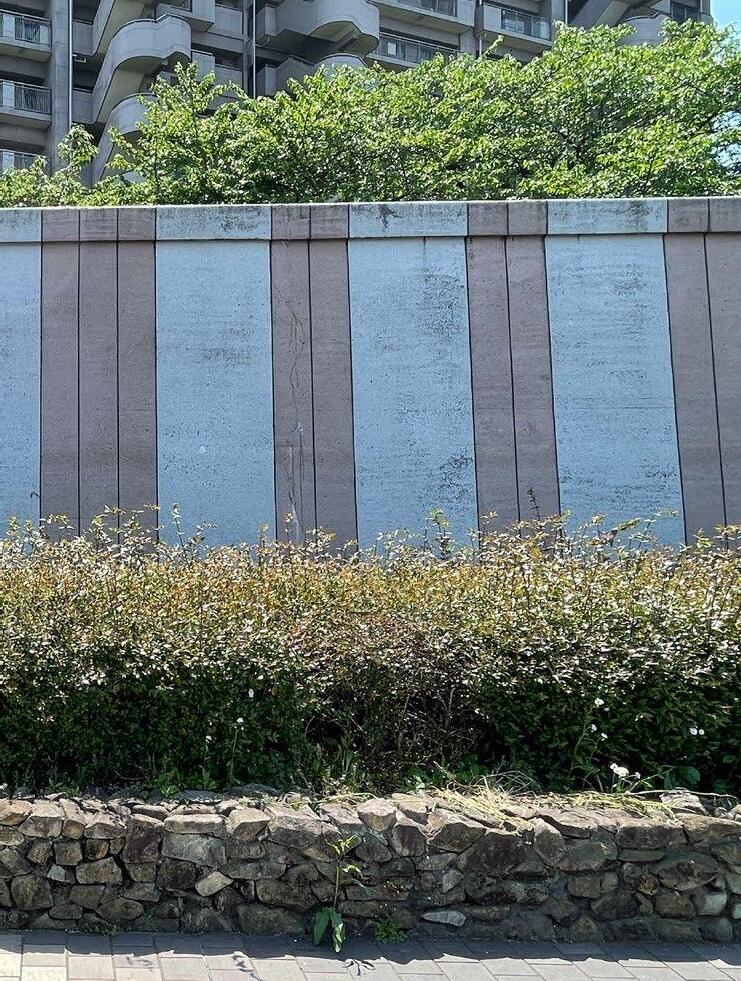
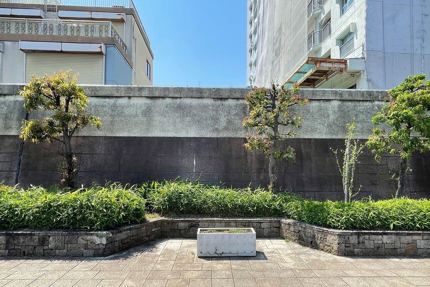
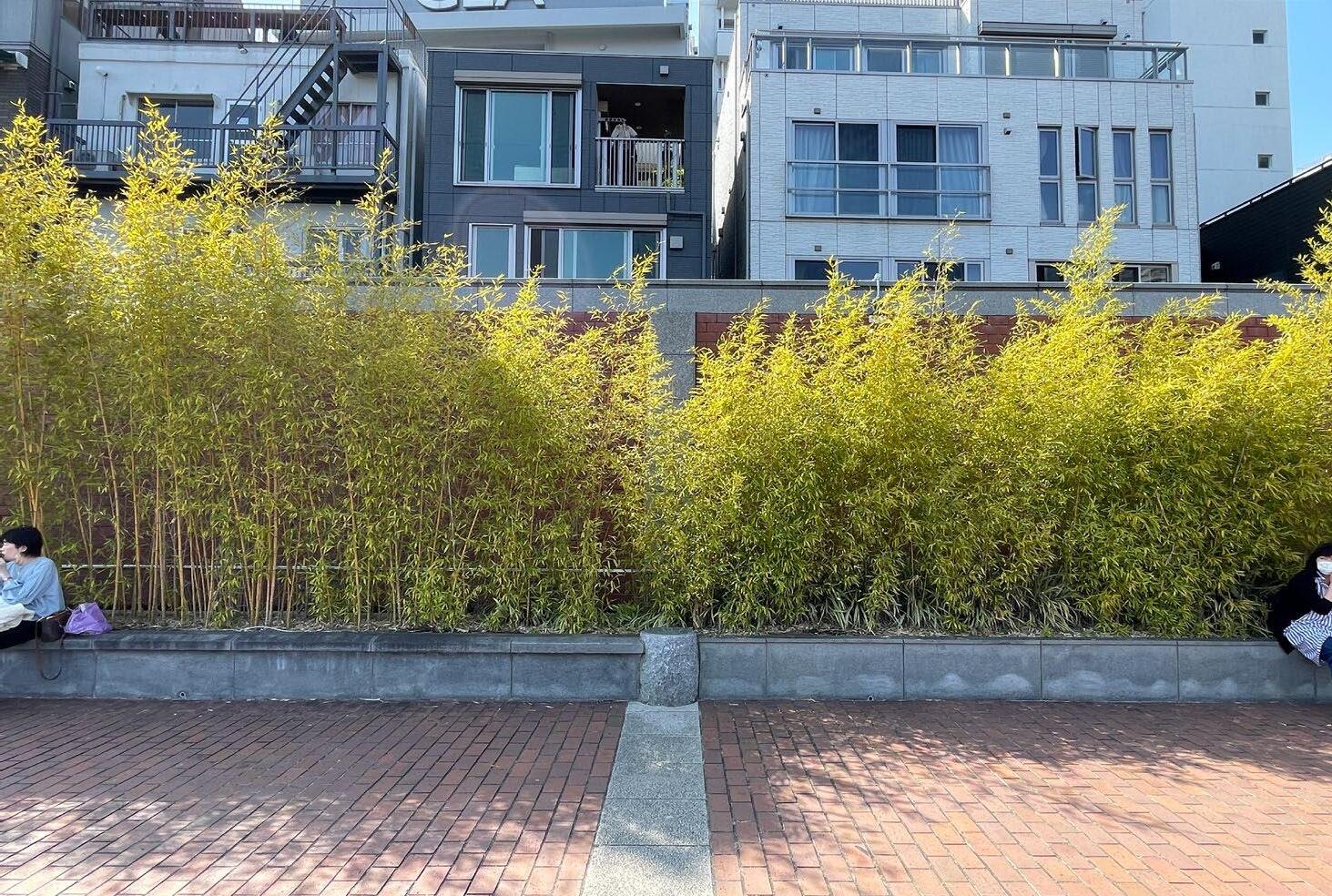
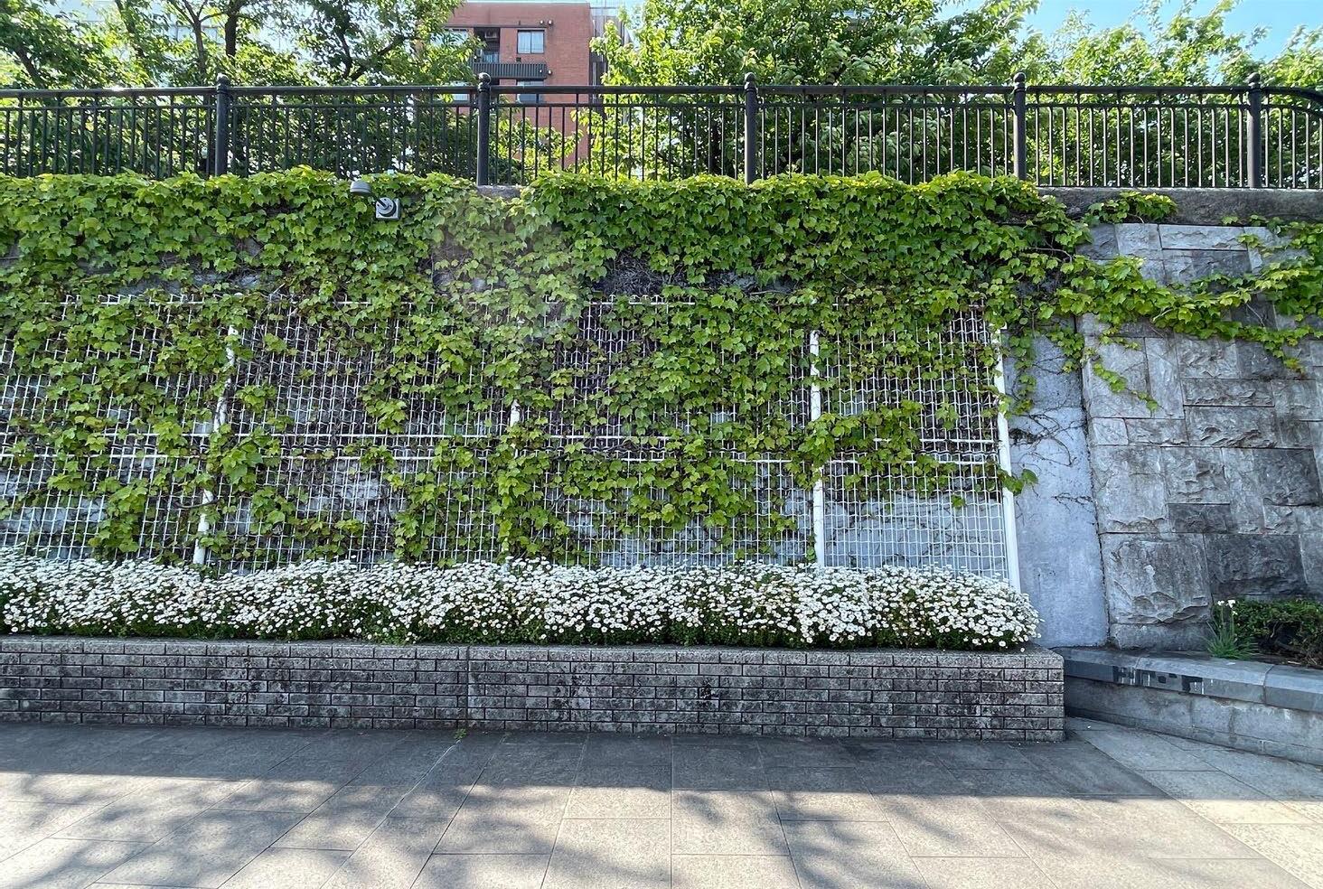
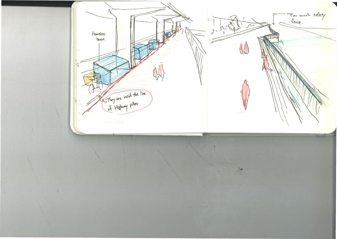
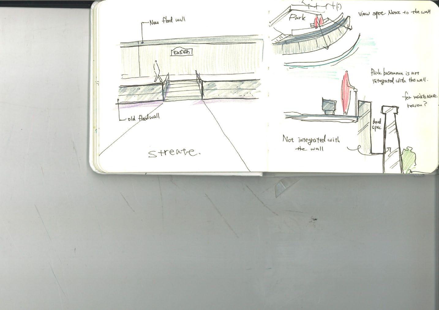
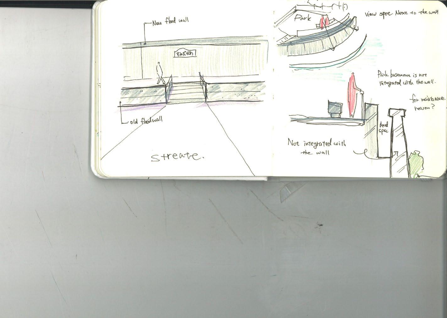
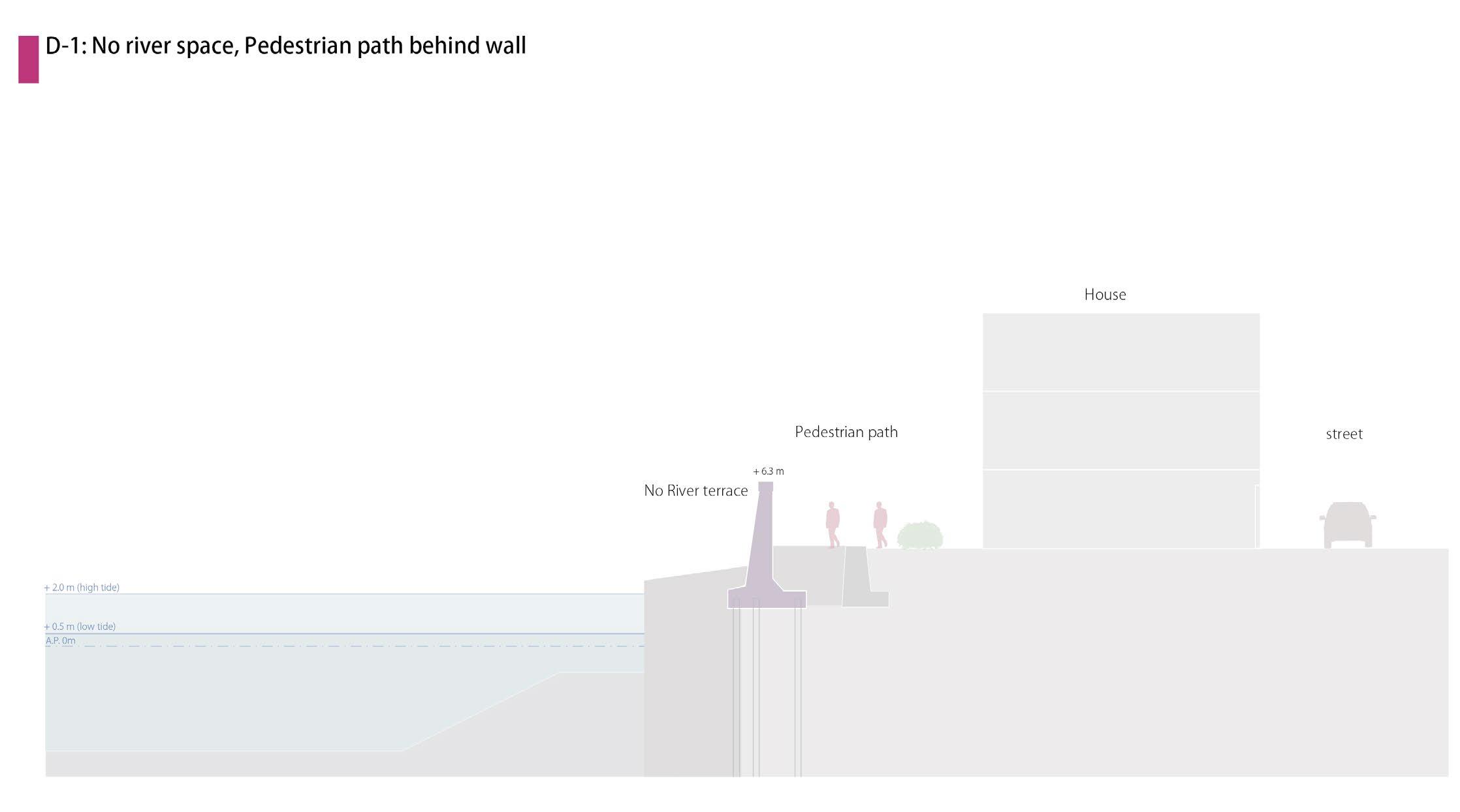
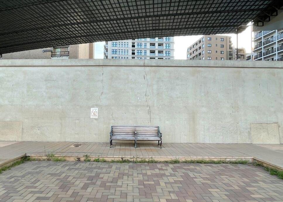
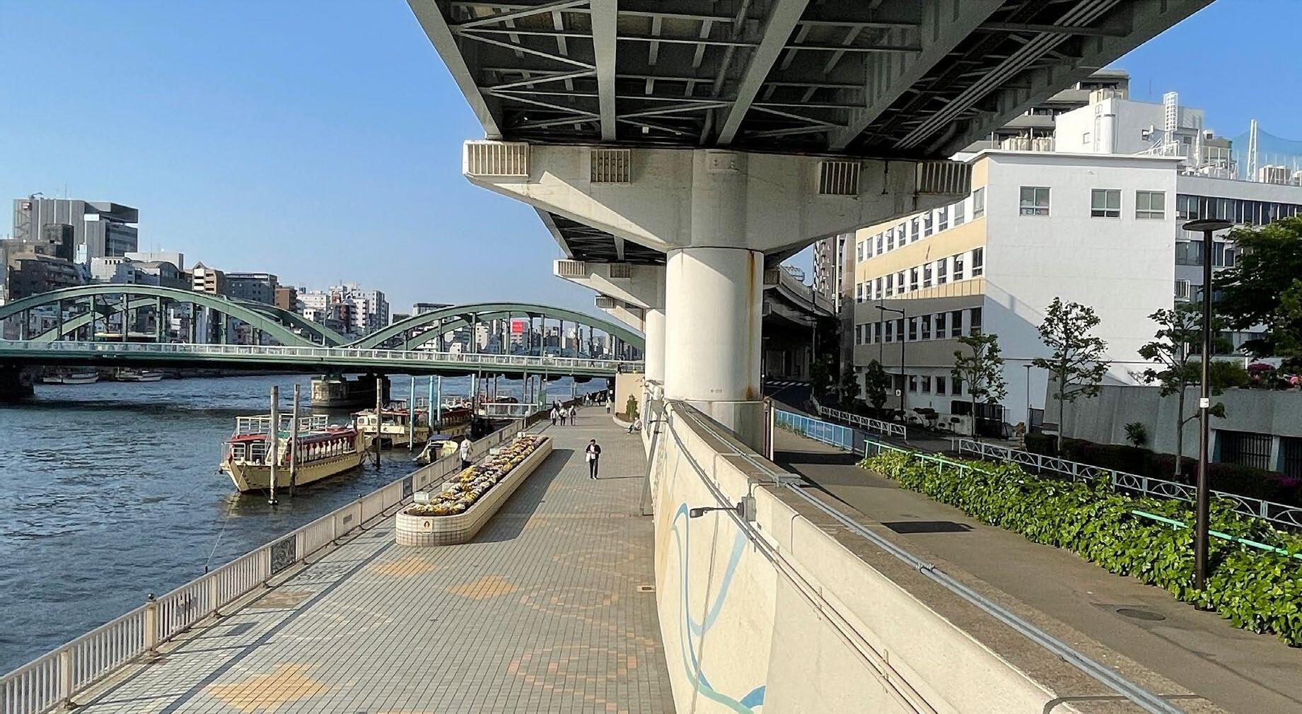
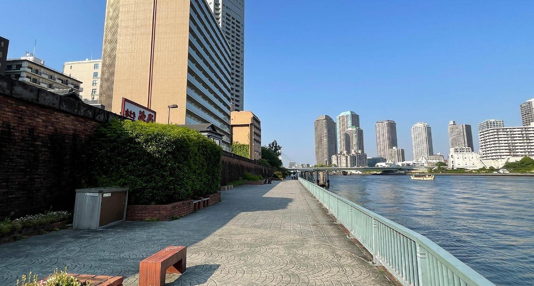
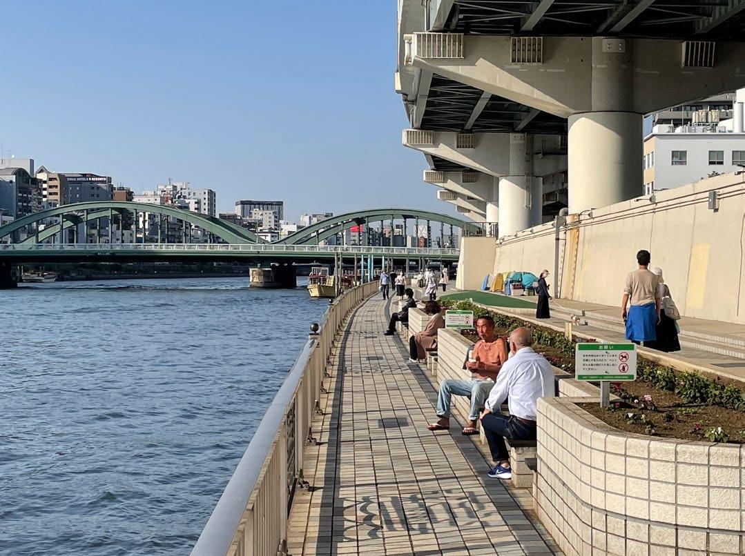
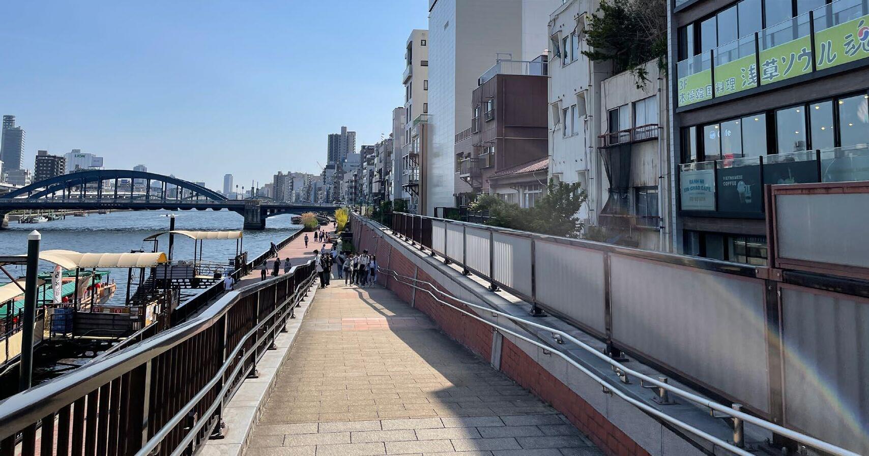
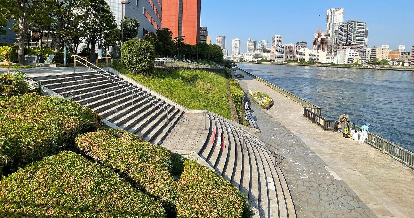
Despite the Tokyo government’s efforts to create the river terrace, I couldn’t see the space was utilised. Site visits and research have revealed the following issues in the river space.
1). Monotonous design of the terrace: Most of the terraces are made of hard pavement and flat surfaces with 8 m width. Some parts have green benches or water features, but the same design continues along the river and doesn’t motivate people to stay.
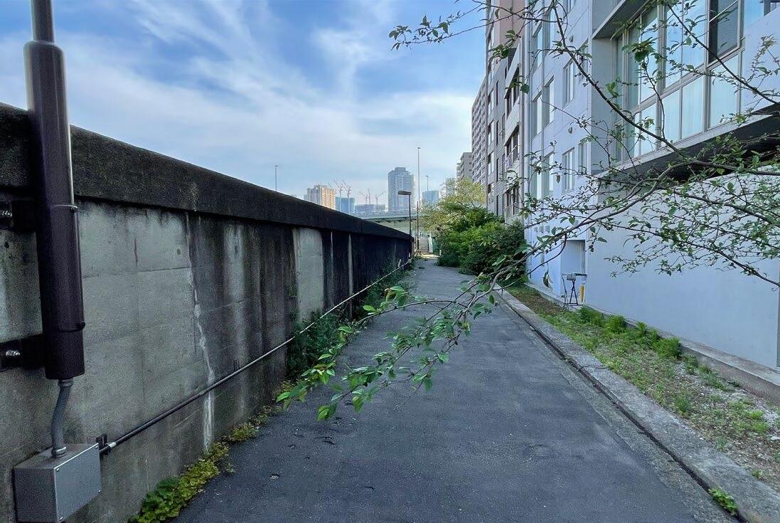
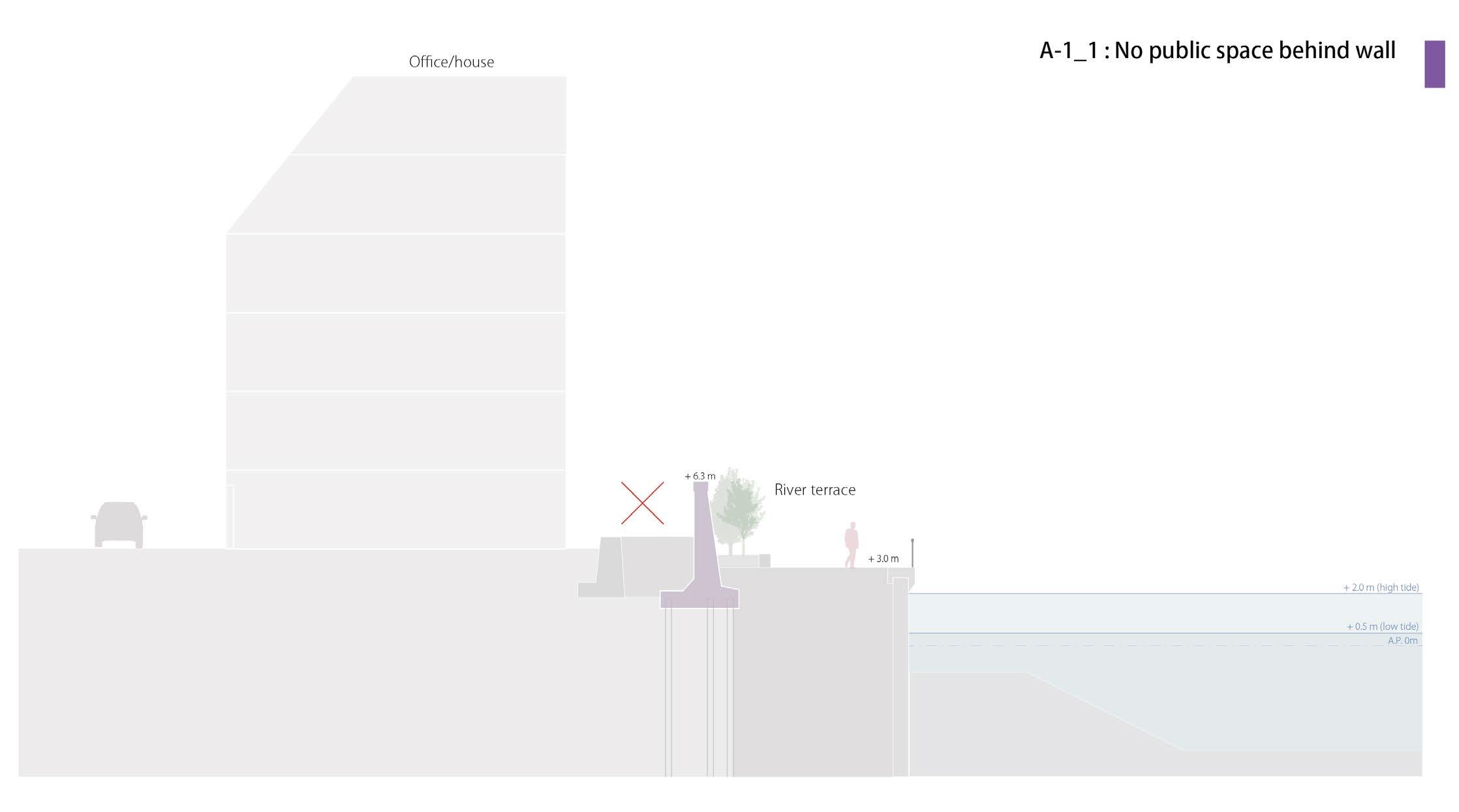
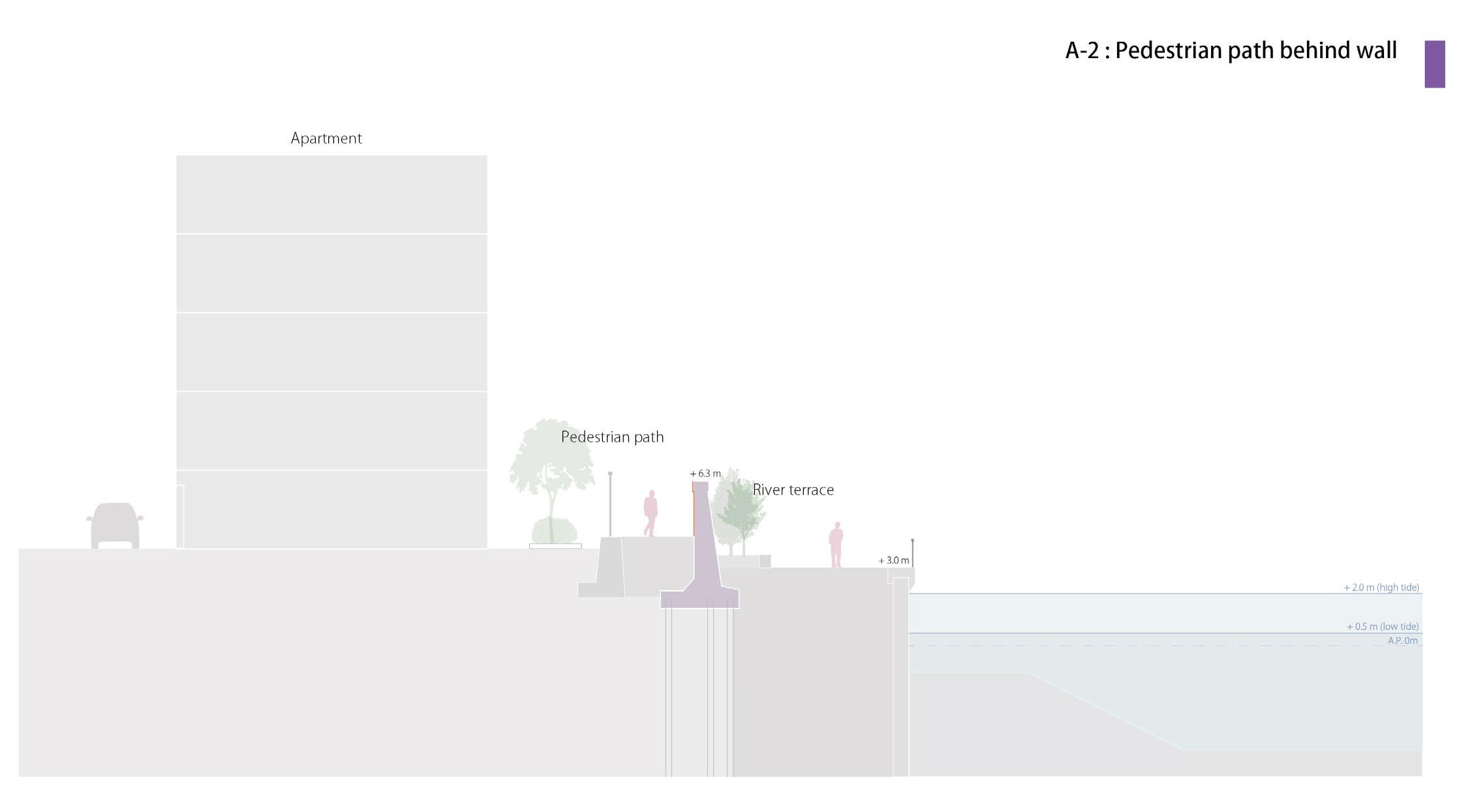
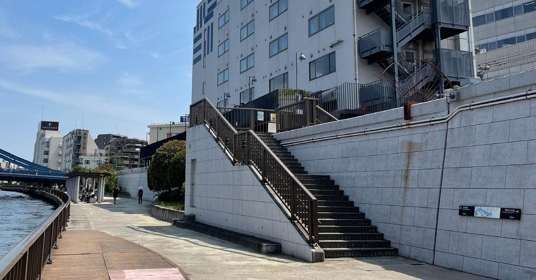
2). Dead space behind the flood wall : A pedestrian path is made behind the wall. In many parts of the path, people can’t see the river. Moreover, some parts are closed and cannot be accessed.
3). No connection to the city fabric : The access points to the river are also limited. Many streets hitting the river are dead ends, and no stairs or slopes can access the river.
 Dead space
 behind the wall
No connection to the city fabric
Dead end from the street
Monotonous design
Monotonous paved surface
Design not well-thought
Hard edge
Dead space
Dead space behind the wall
No connection to the city fabric
Dead end from the street
Monotonous design
Monotonous paved surface
Design not well-thought
Hard edge
66
Flood wall
67
River visible River Invisible Super Levee Legenda
Path overlooking the river
More than half of the space has an no-river view from behind
River invisible path
Goal of the project
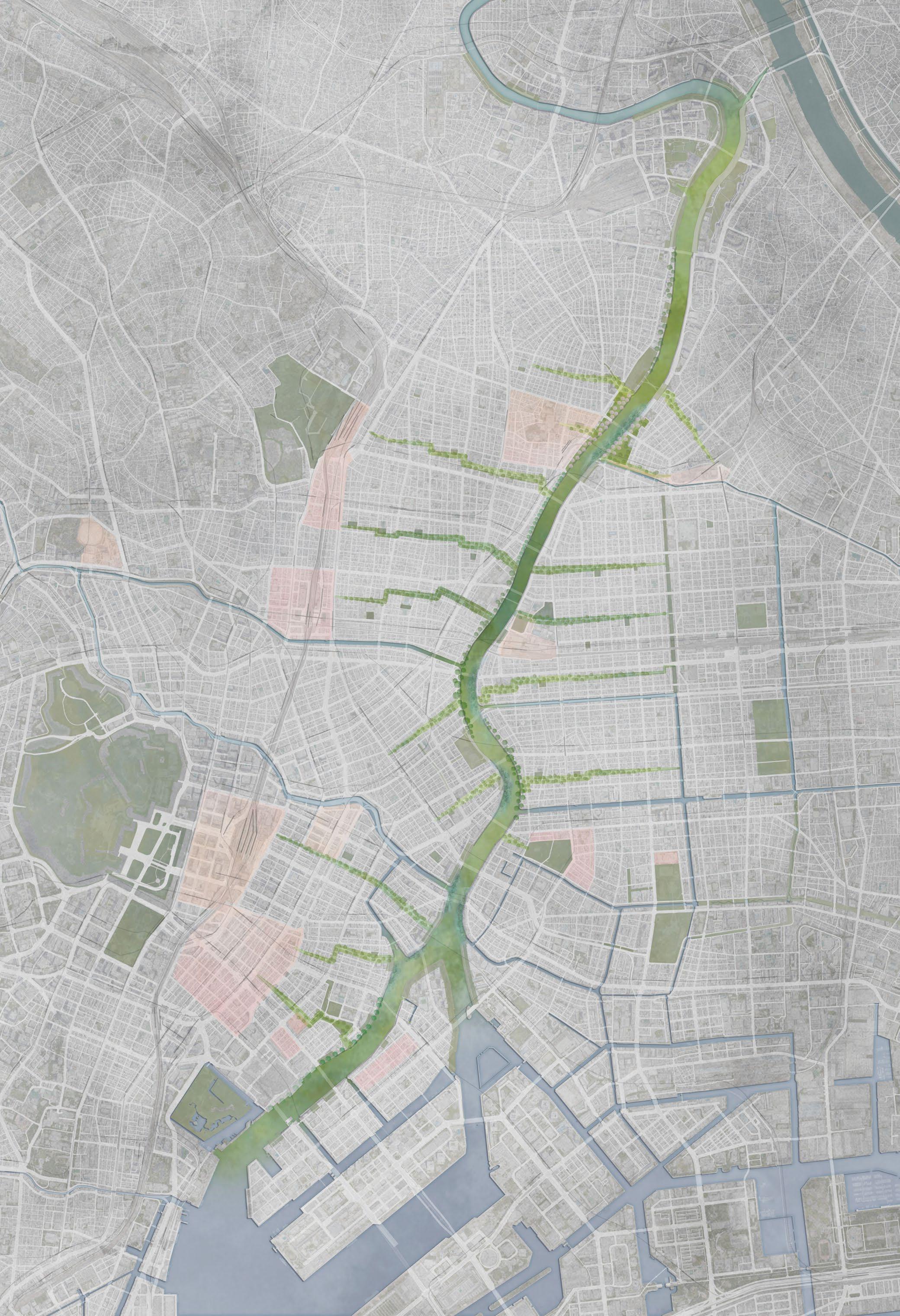
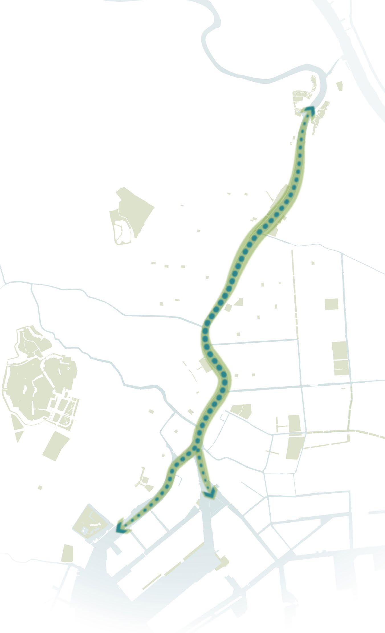
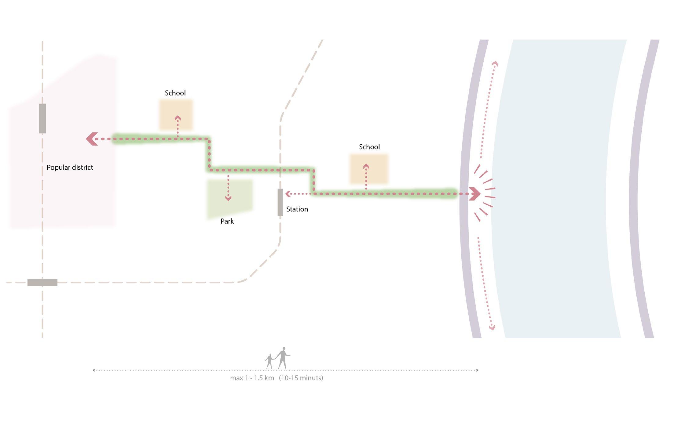
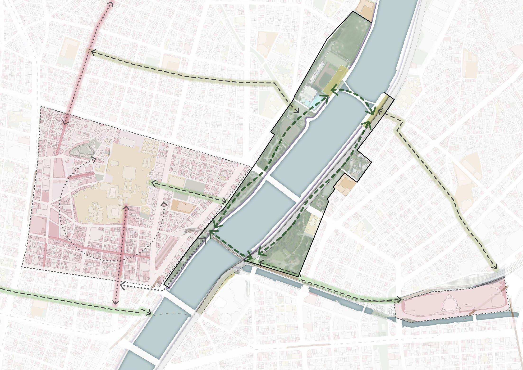
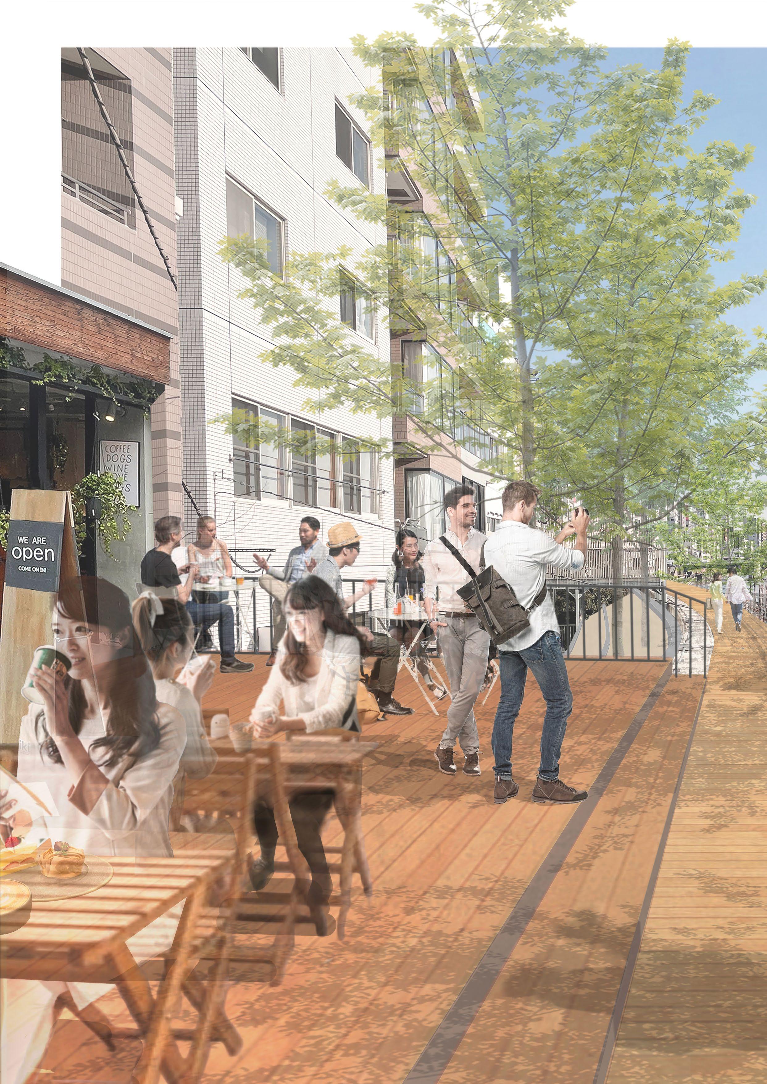
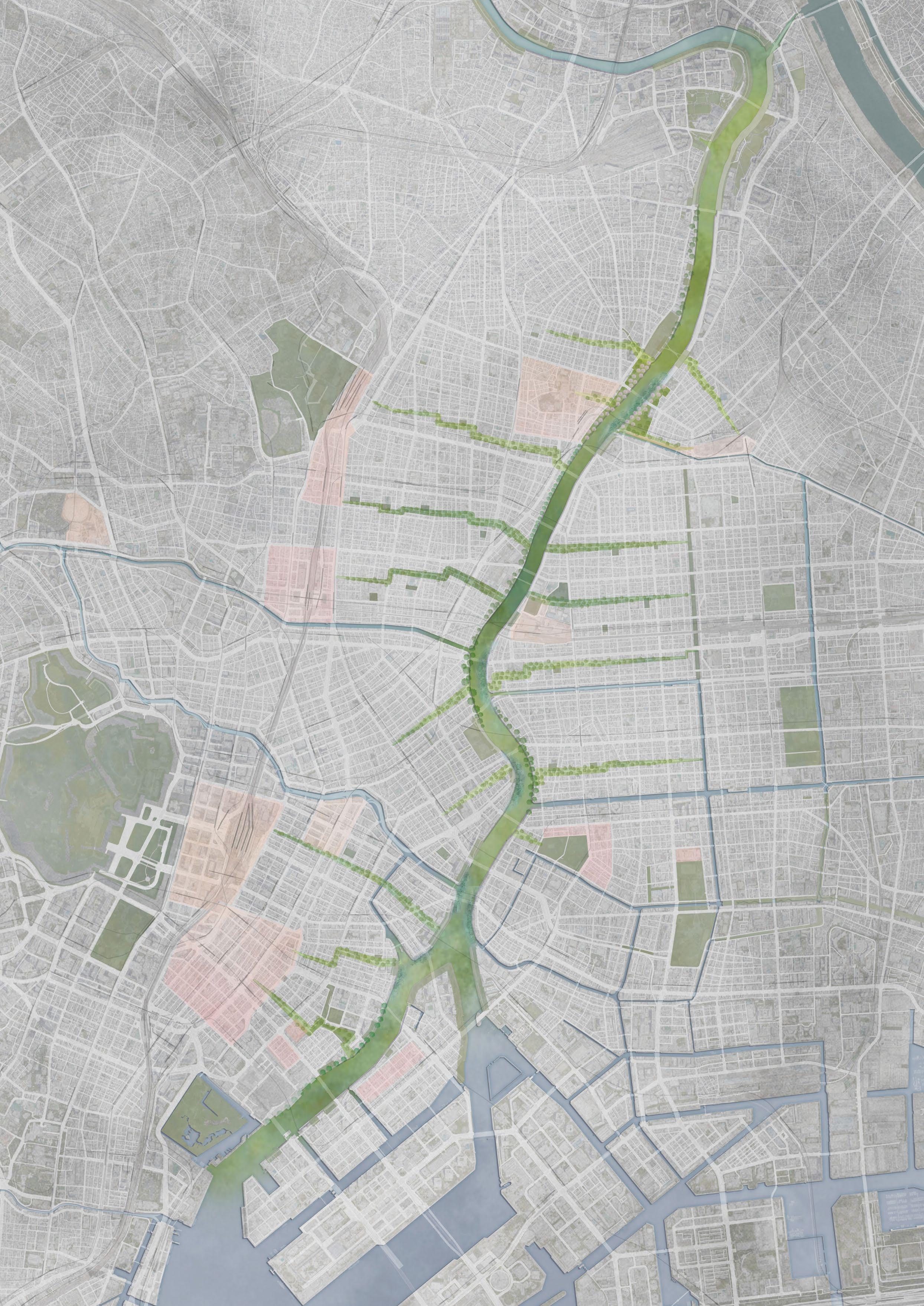
The main goal of this proposal is to reconnect people to the river by enhancing the accessibility and quality of the river space.To achieve that goal, the design solution is to revitalise the river space and connect the river space with surrounding public space or inner city fabrics. By forming a new continuous public spaces network based on the river space, the Sumida River, which has become the city’s backside, could be a main public space axis. So, in the end, this project aims to reverse the Sumida River into a new focal point of the city.
This graduation project consists of three different approaches. The first approach is connecting the city fabric to the river through walkable streets, allowing people to reach the river space from the inner city more recognisable. The second approach is integrating important public spaces into the river space, such as parks or major spots around the river. The third approach is creating new river spaces as continuous public spaces along the river with identities considering the surrounding urban context and the river landscape.
76
77
Design methods
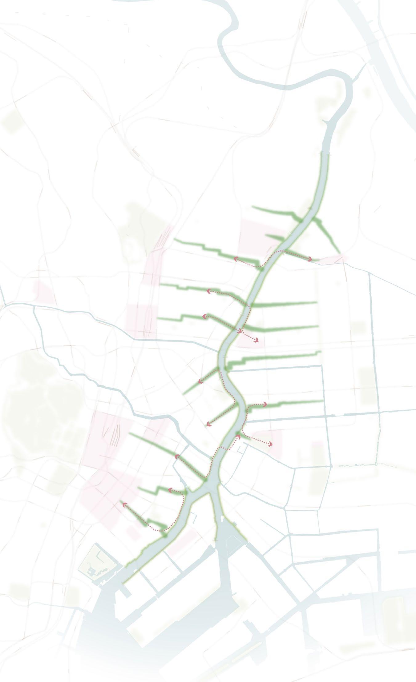
 1. Connecting the city fabric to the river through pedestrian streets
2. Integrating important public
1. Connecting the city fabric to the river through pedestrian streets
2. Integrating important public
spaces into the river space
3. Creating new river spaces as a continuous public space along the river.
Design
82
Goal 1 - Connecting the city fabric to the river space
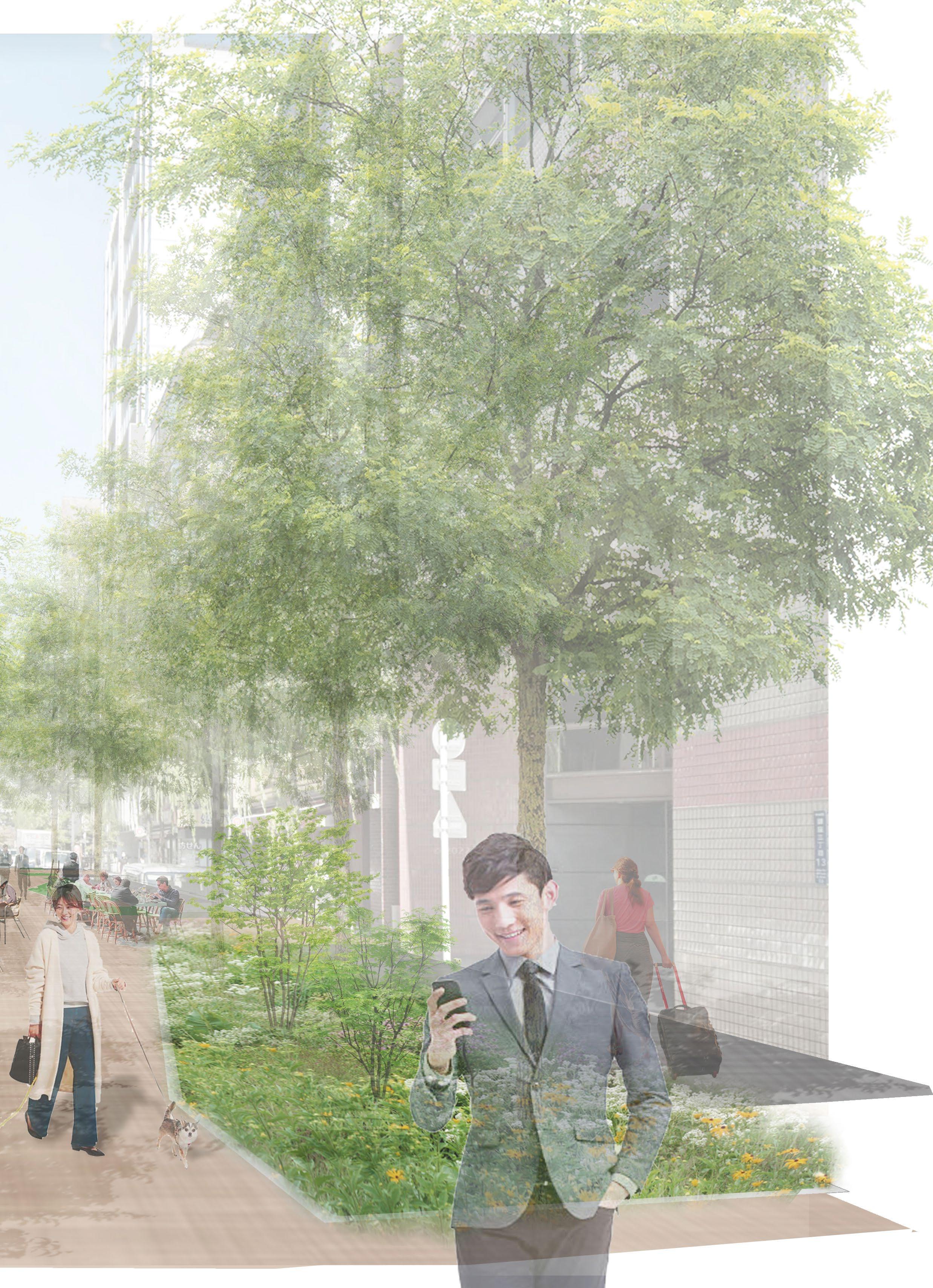
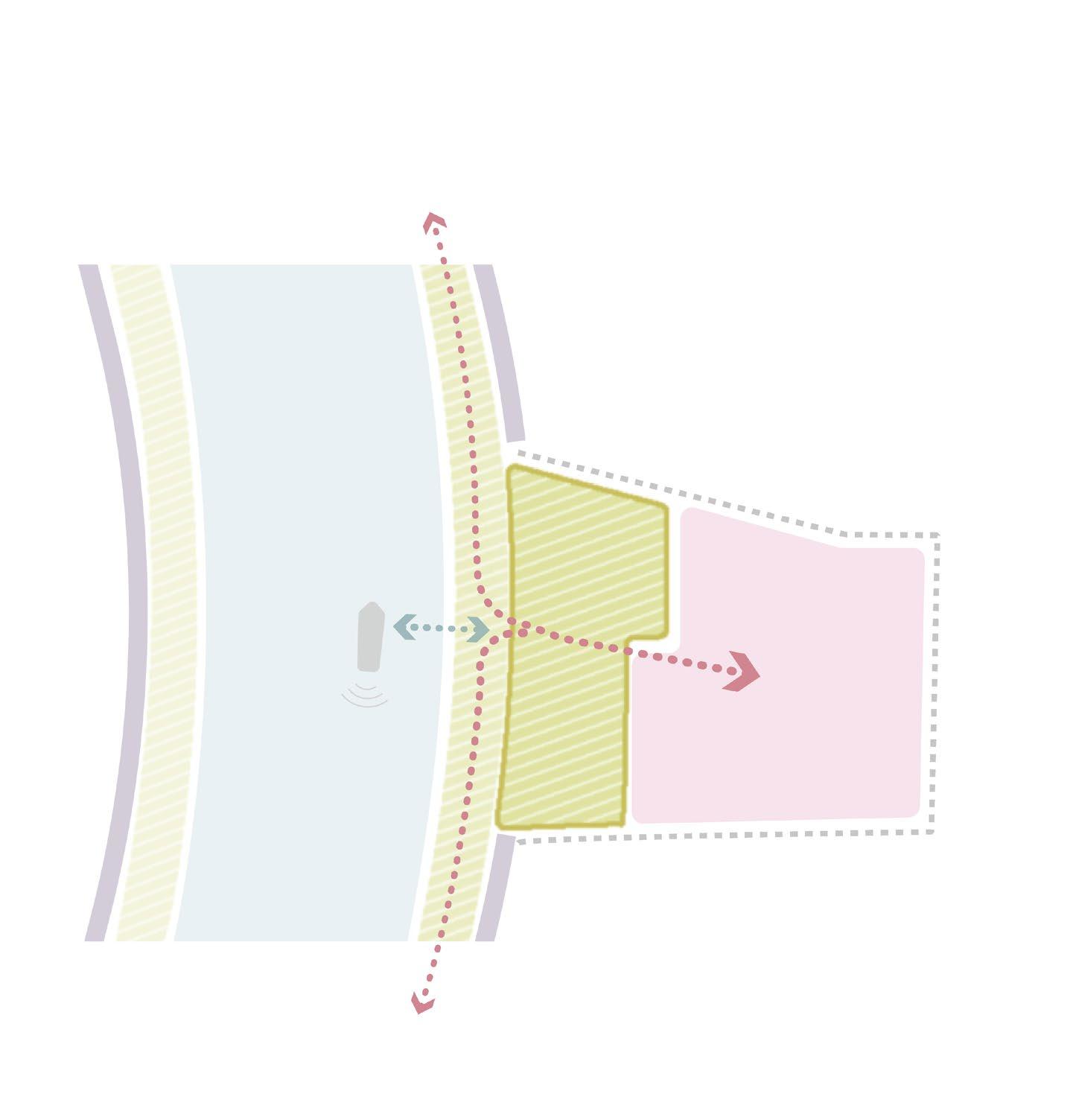
Approach : Transform traffic road to pedestrian friendly street
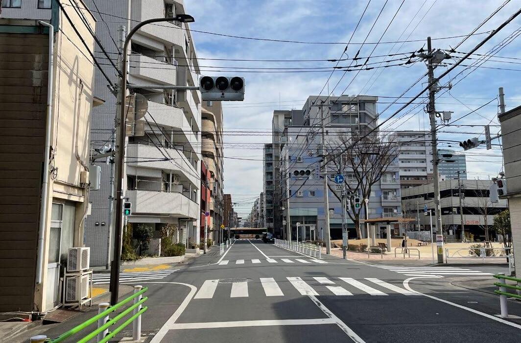
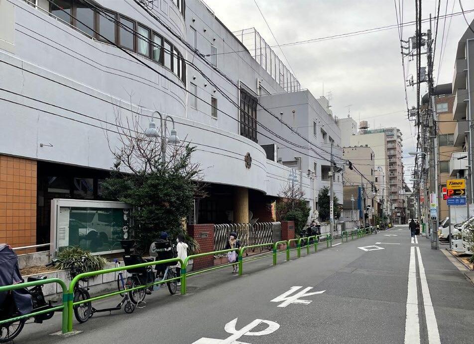
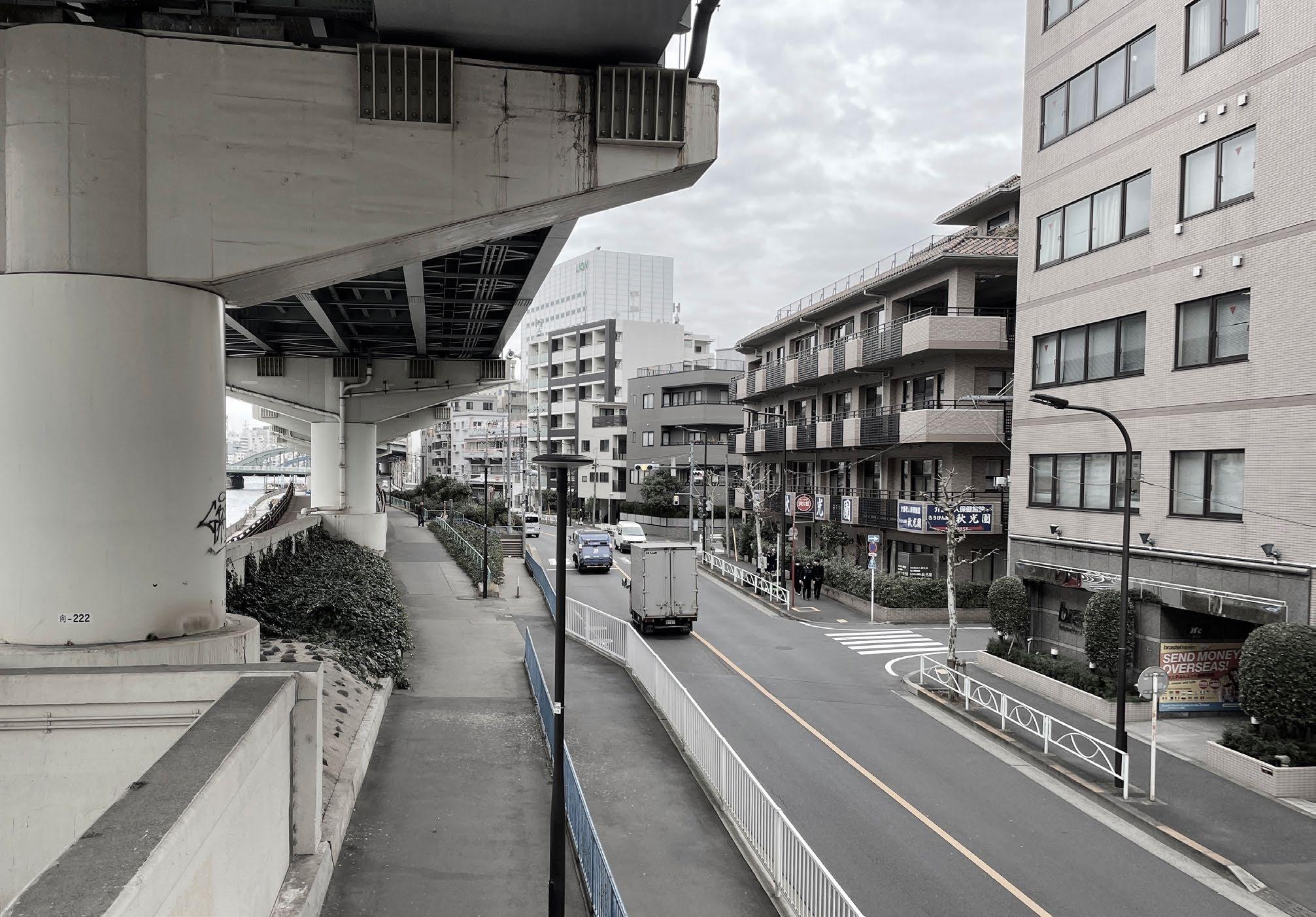
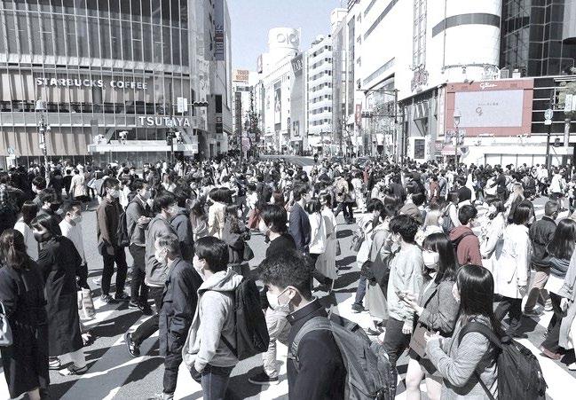
When visiting the site, I found that there is no direct connection between the rivers and the inland city. People’s movement in Tokyo mainly relies on trains or buses, which prevents them from having a practical sense of distance through walking or cycling. During my stay in Tokyo, I mostly used a bicycle for transportation. I found that I could reach most of the major destinations by bike and also that the Sumida River and the main areas were within walking distance.
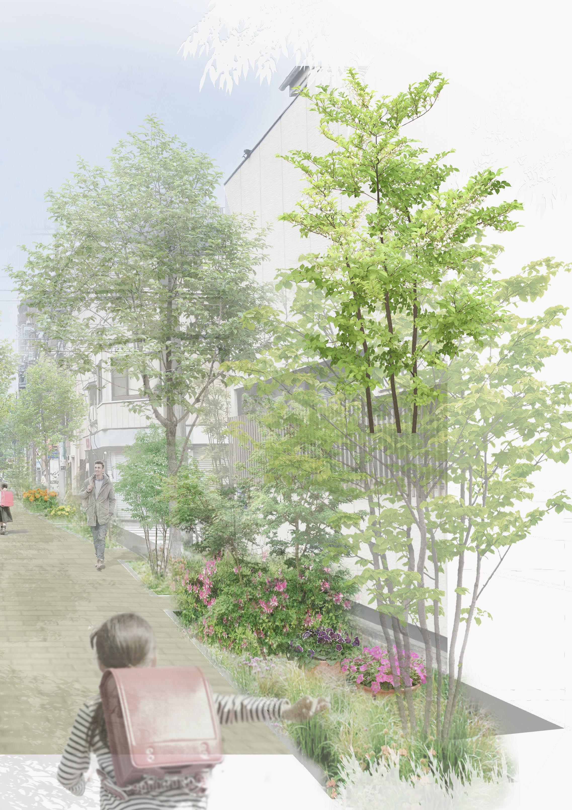
Even if the river space is developed, if there is no clear accessibility from the city, the space will not be activated. Therefore, as Goal 1, I propose people-oriented streets that connect the rivers and major areas of Tokyo. These walkable streets, with green and tree shade, connect schools, stations, and parks, and they will be a main route not only for local residents but also for visitors exploring Tokyo.
83
Road network and street conditions
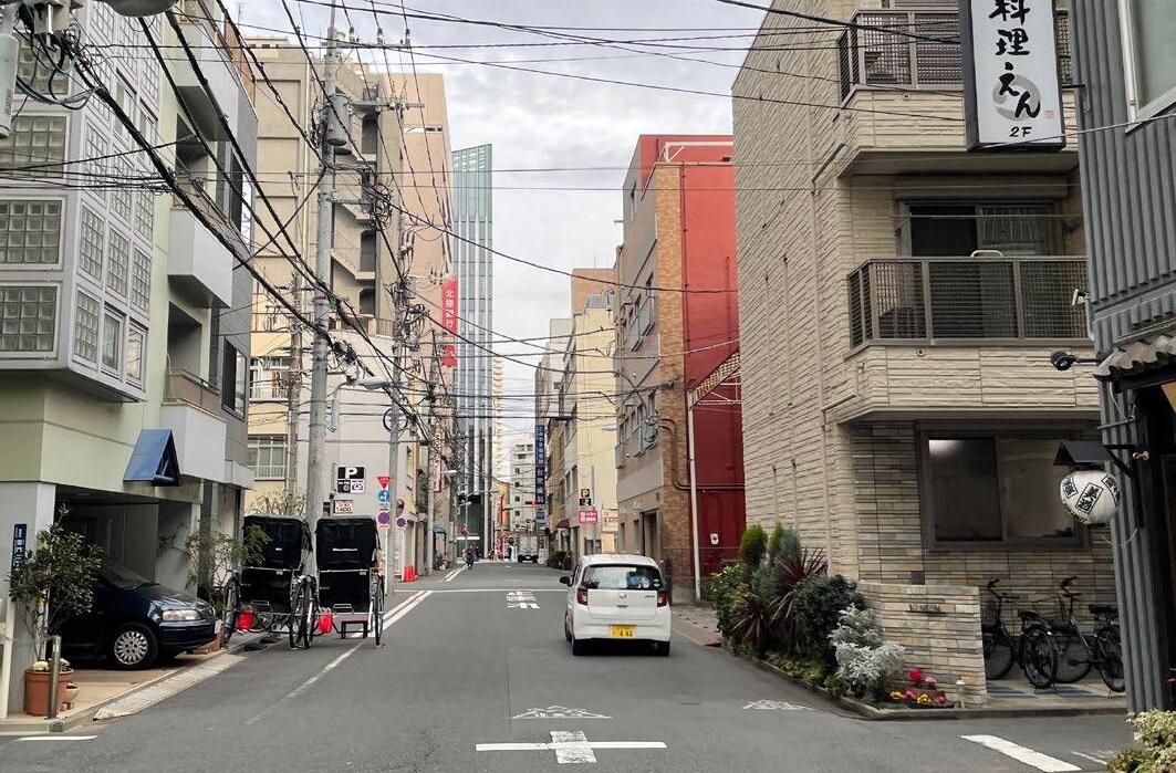
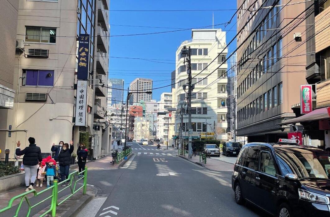
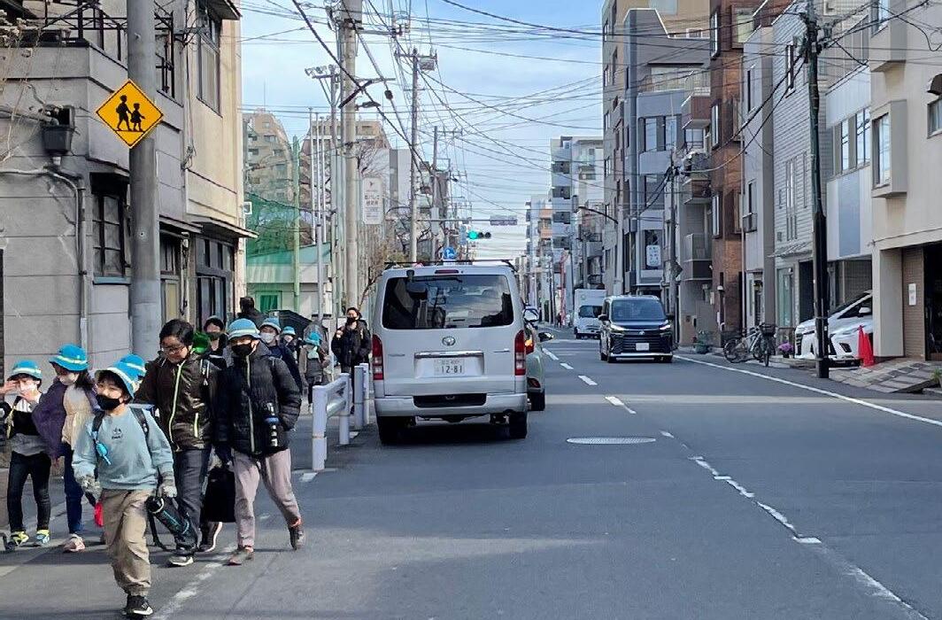
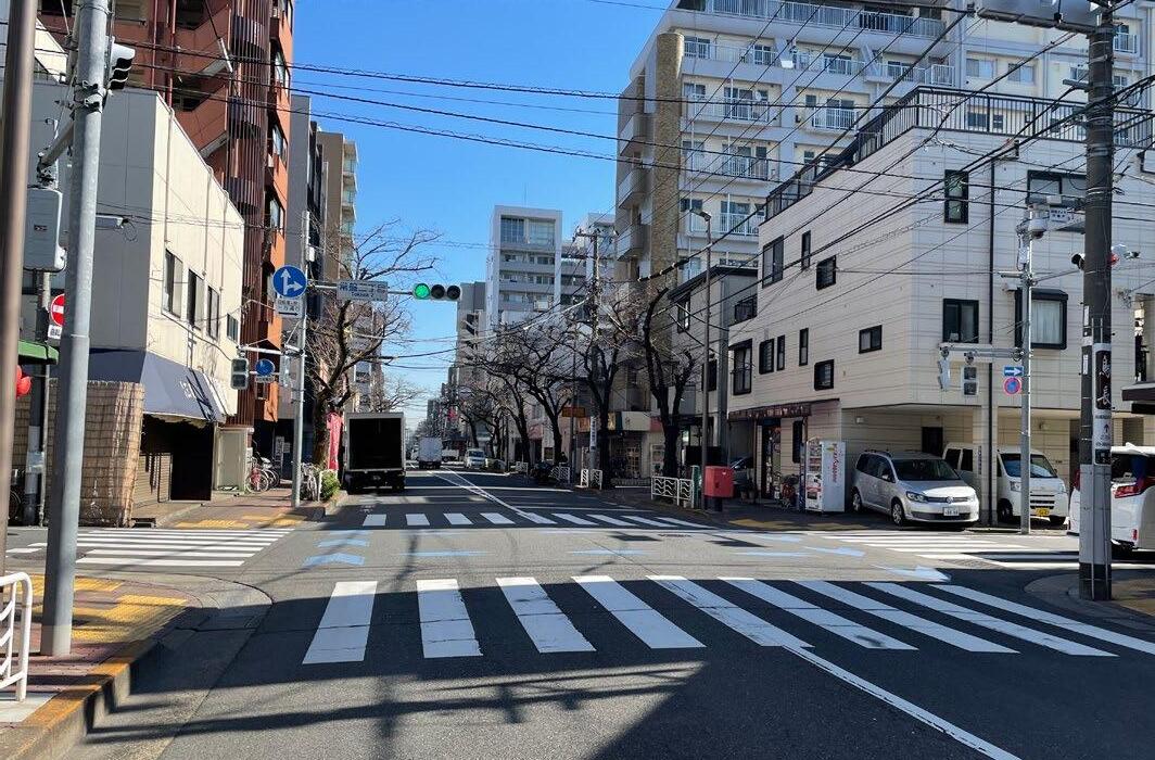
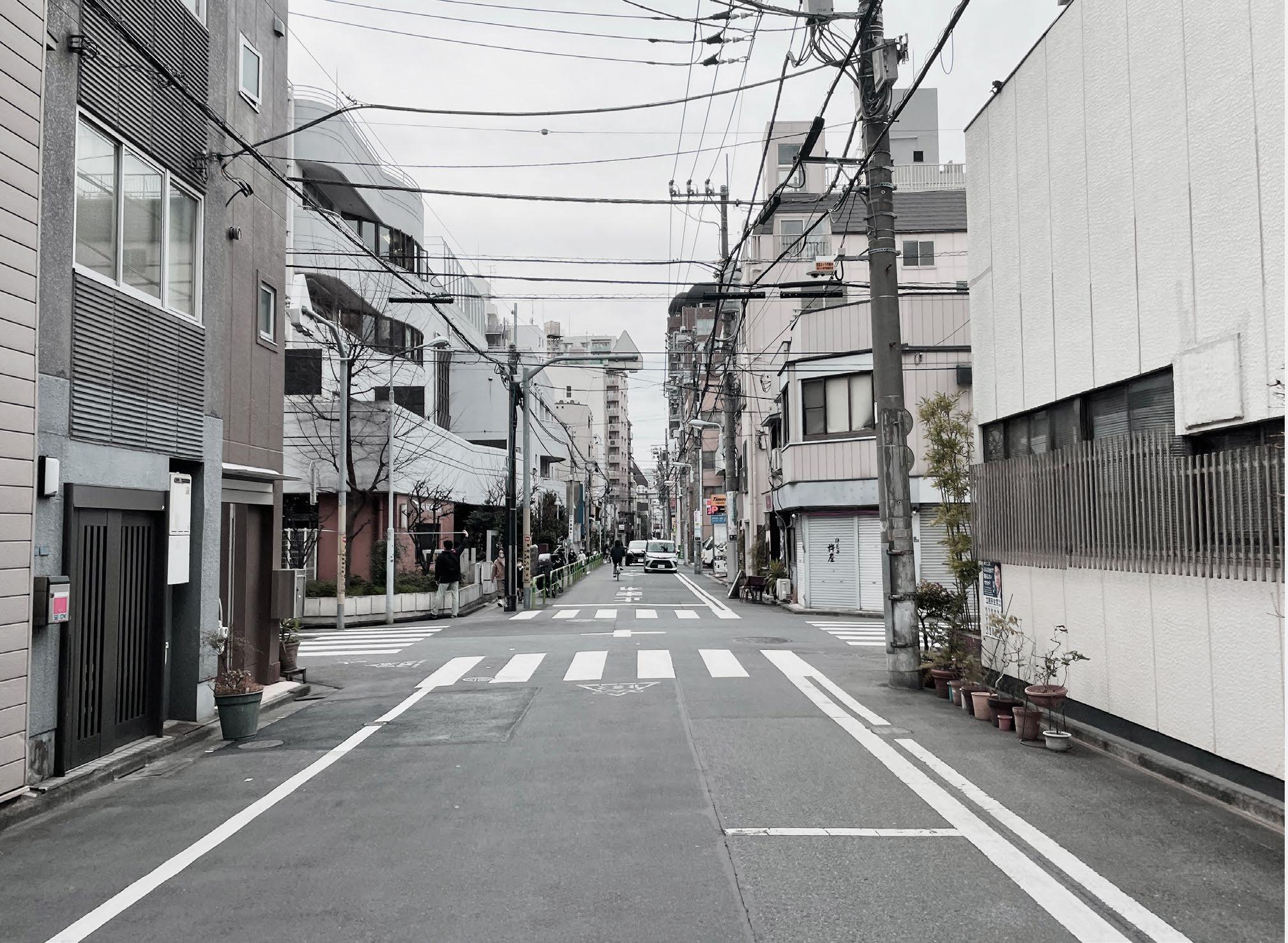
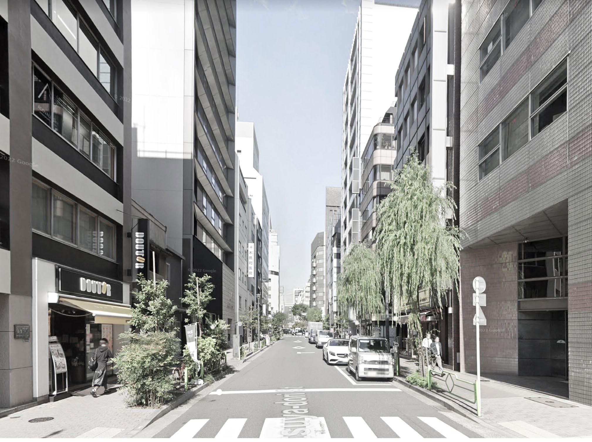
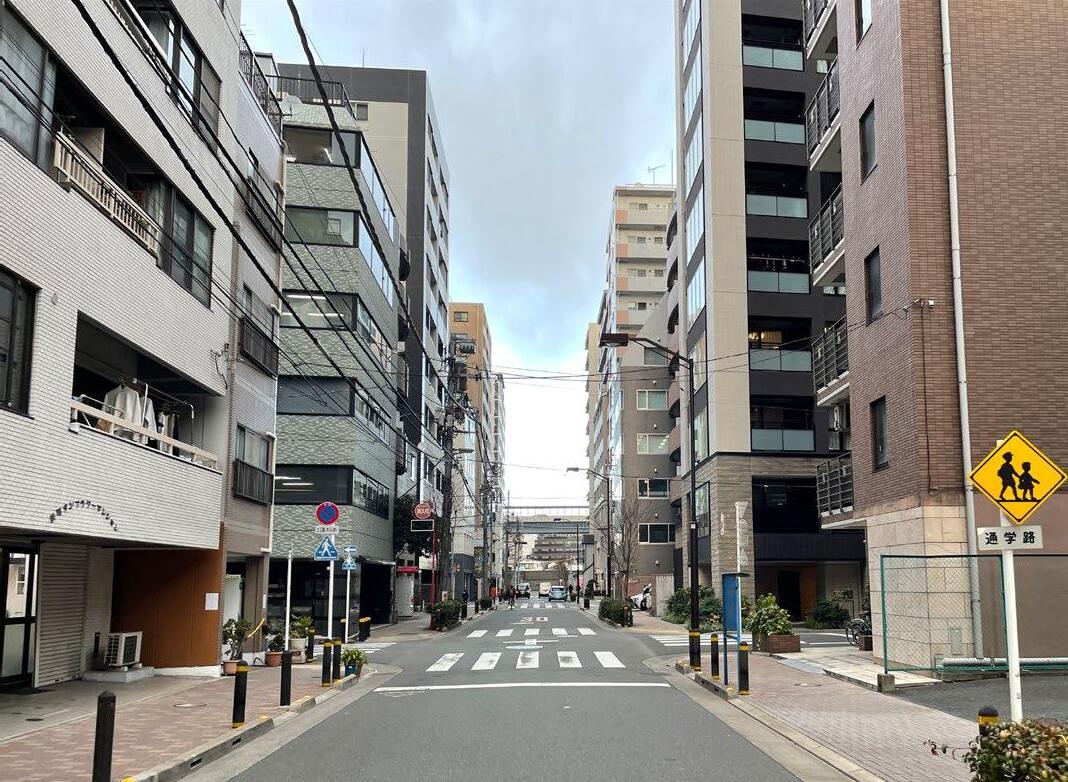
Tokyo has a grit structure road network. Many of these streets still prioritize cars and there are many small streets with no sidewalks. Children in the city use this narrow pedestrian path to go to school.
In addition, most of the small streets are not planted with trees due to the electrical wires and utility poles, and there is only asphalt. Therefore, the streets lack a unique identity, and many people choose a route as the shortest route.


84
85
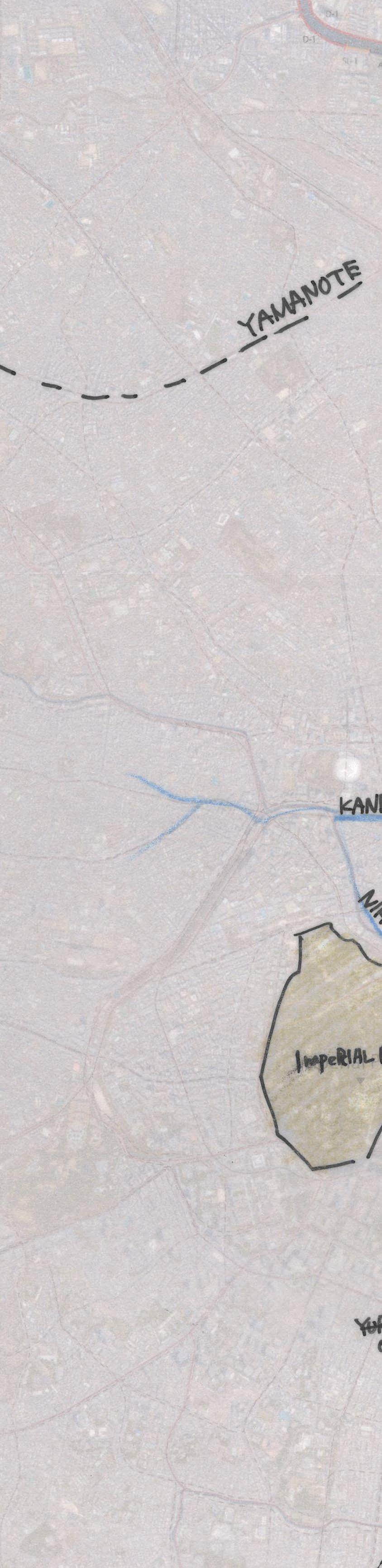
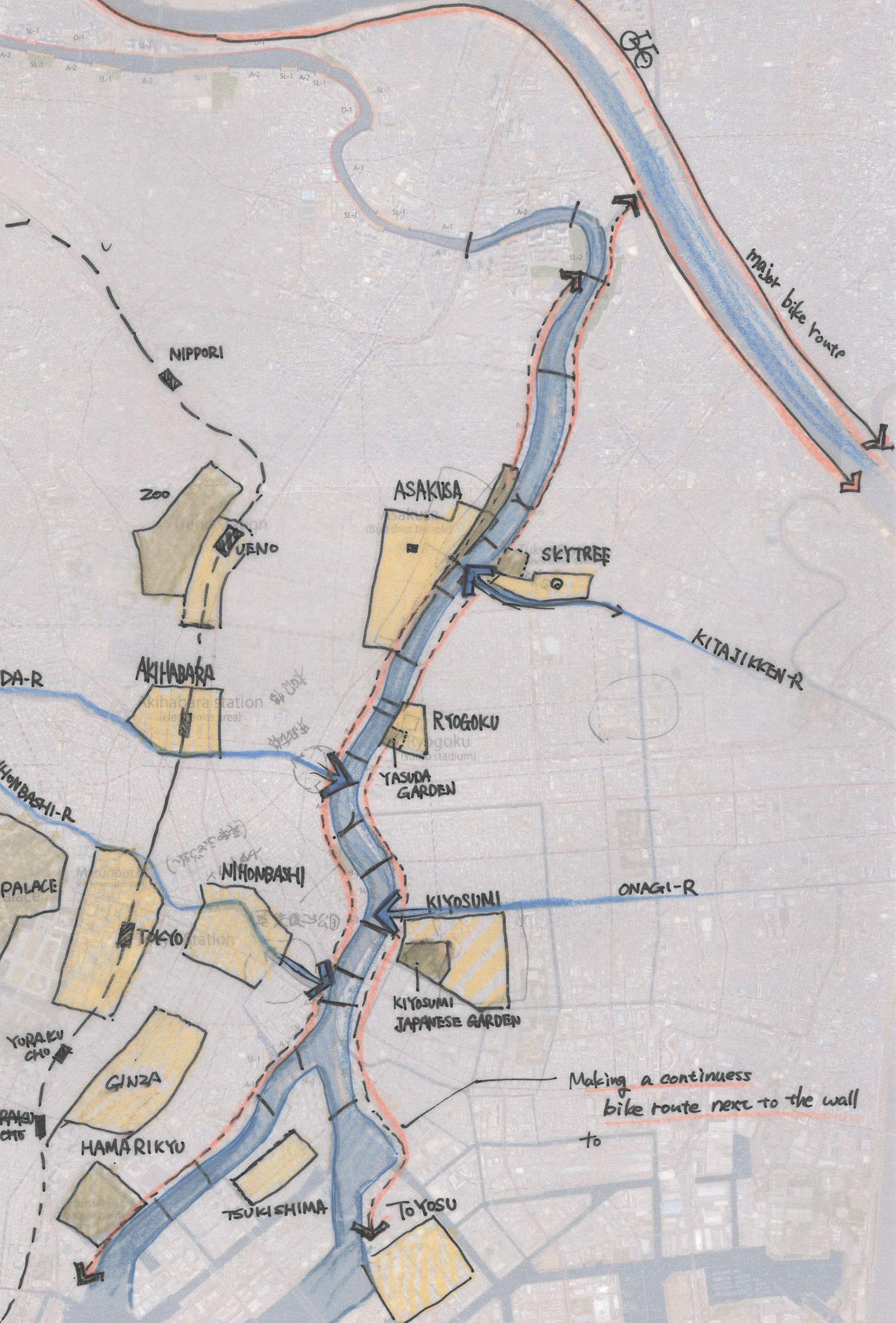
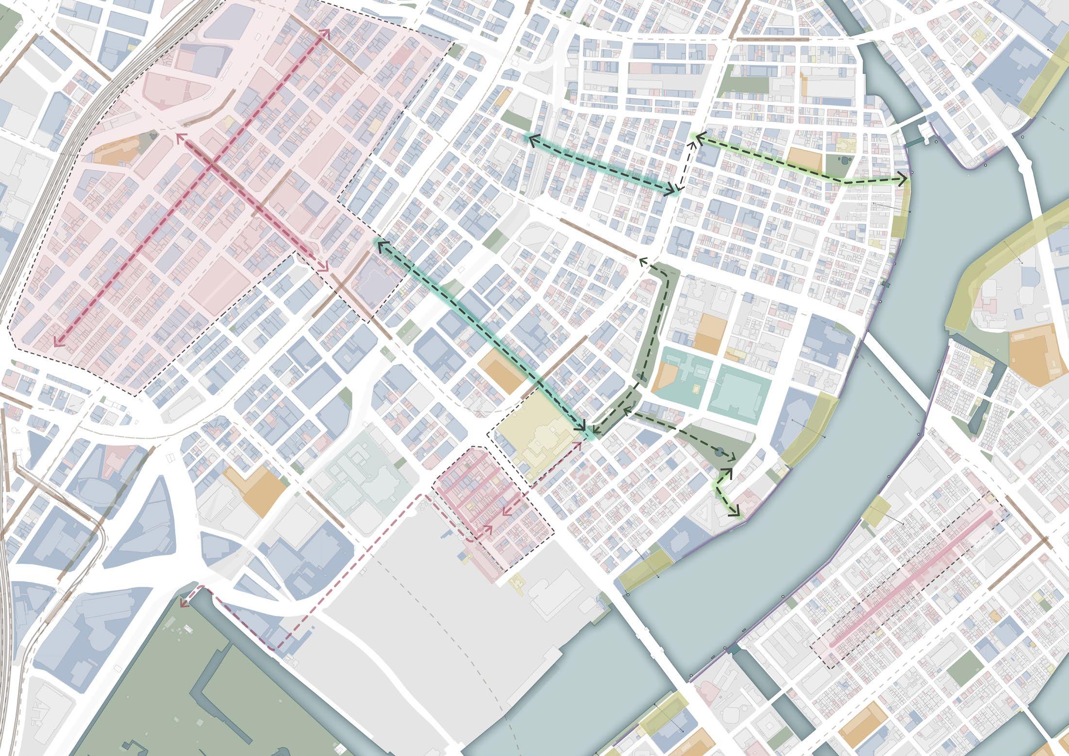
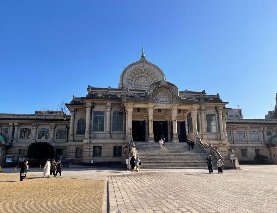
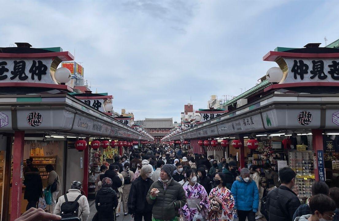
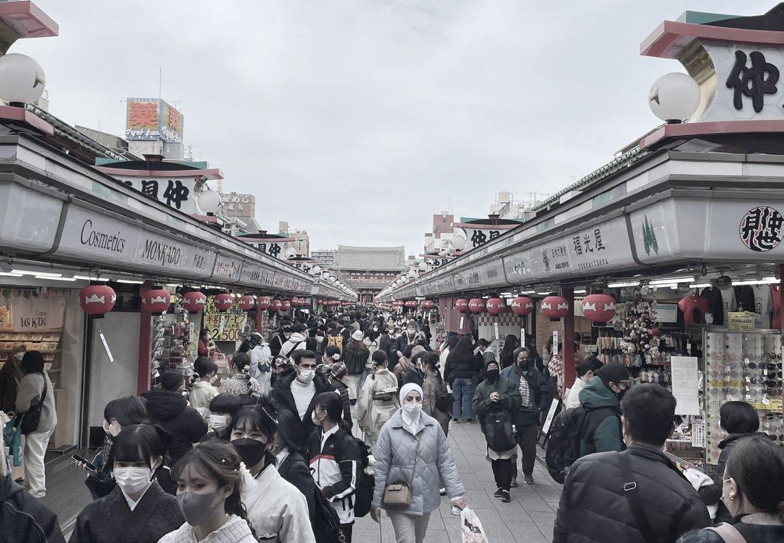
Popular Districts around the river
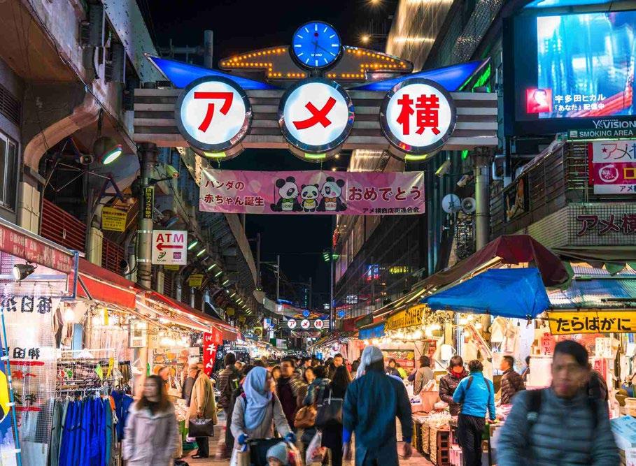
There are many famous spots around the Sumida River. From famous historical sightseeing areas, museums, shopping areas, and Japanese gardens. Even though they are located within walking distance of the river, there is no clear connection between them. And many people, from locals to tourists, visit those areas by train or bus. Connecting those areas to the Sumida River by walkable streets can be one strategy to create a chance for people to meet the river.
 Ueno
Akihabara
Asakusa
Tokyo station
imperial palace
Nihonbashi
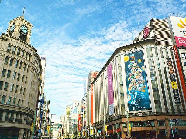
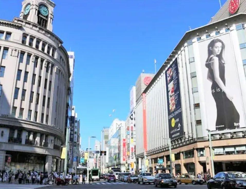
Ginza
Tsukiji Fish market
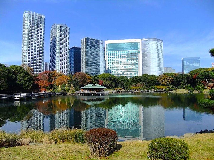
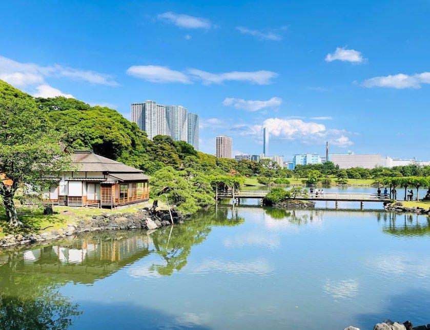
Hama-rikyu Japanese garden
Restaurant street
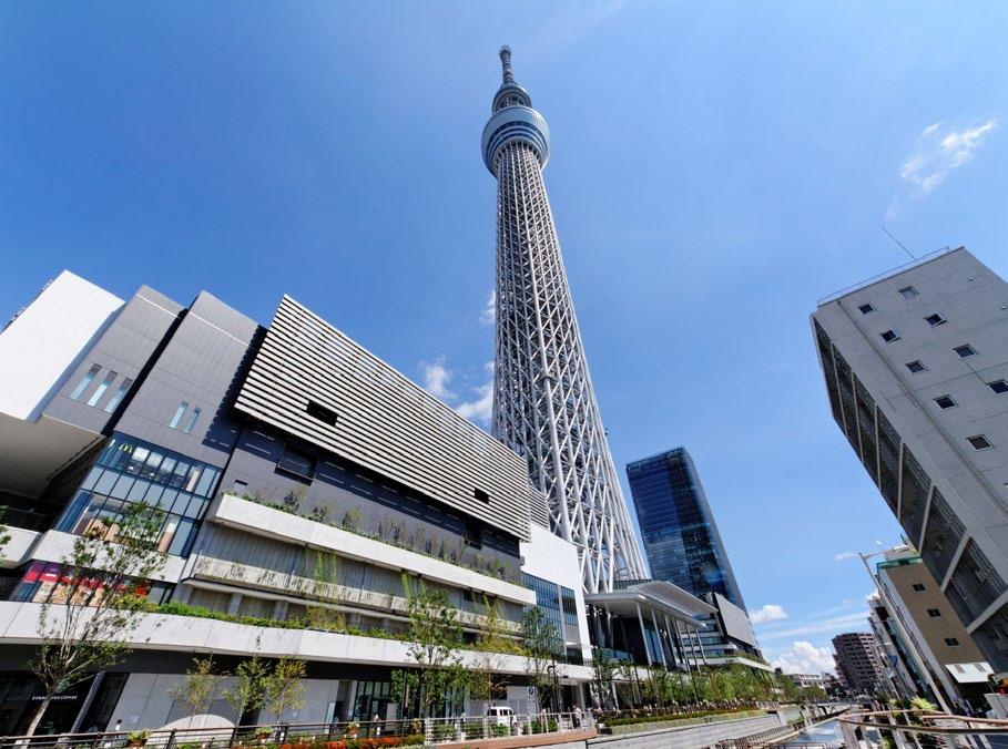
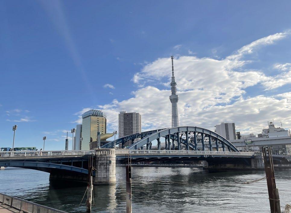
Sky tree
Ryogoku
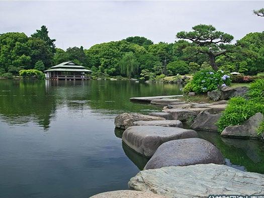
Kiyosumi japanese garden
Ueno
Akihabara
Asakusa
Tokyo station
imperial palace
Nihonbashi
Ginza
Tsukiji Fish market
Hama-rikyu Japanese garden
Restaurant street
Sky tree
Ryogoku
Kiyosumi japanese garden
86
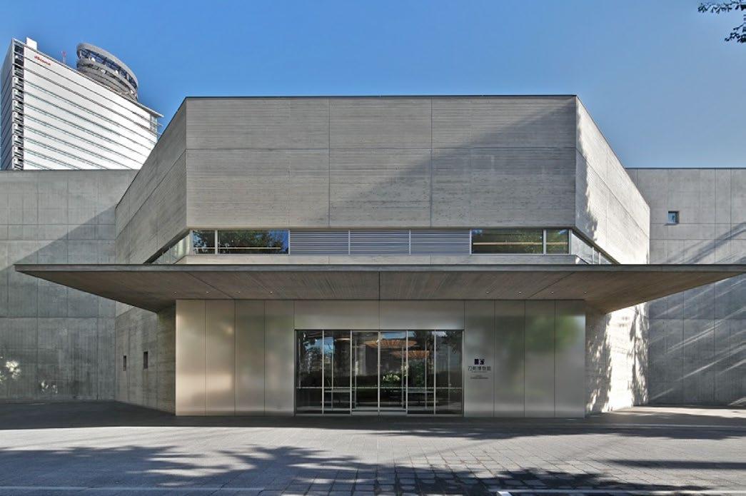
Contemporary Art museum
87
Ueno shopping street
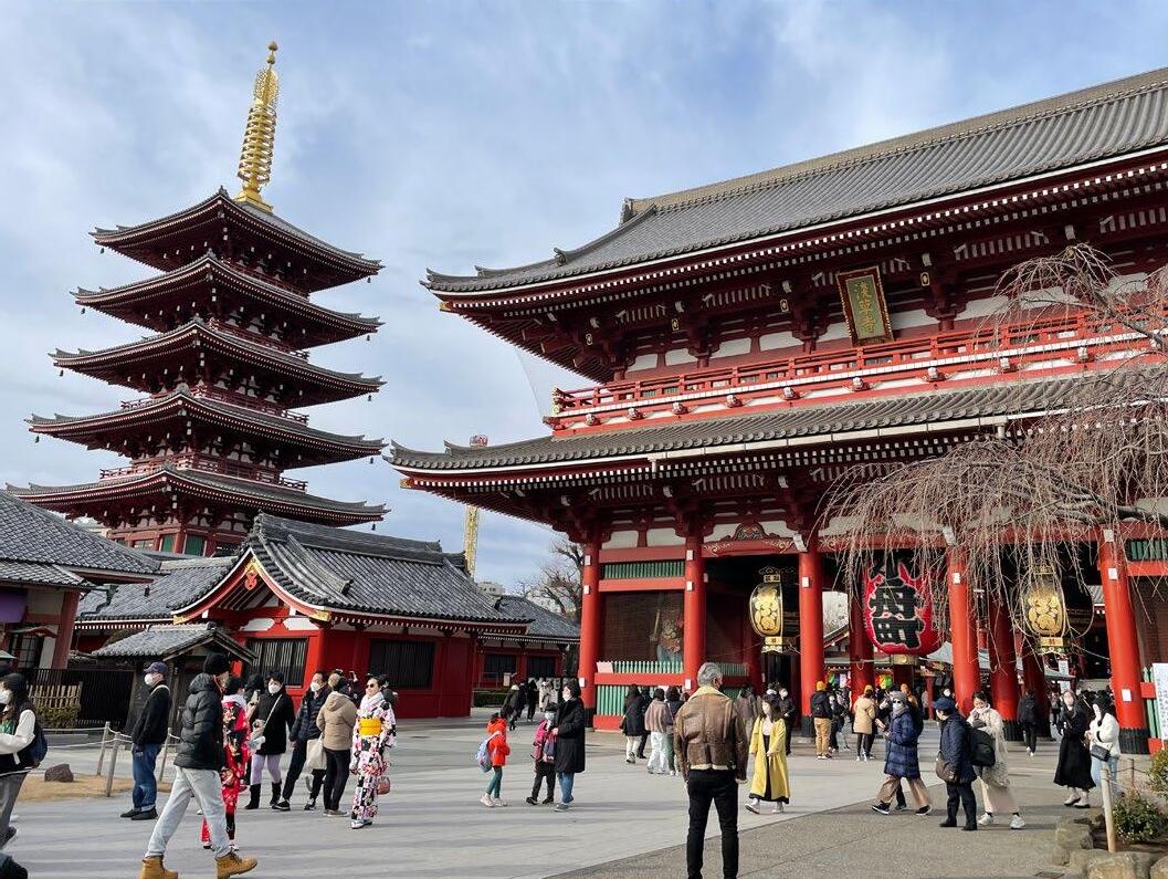
Asakusa Sensoji Temple
Ginza shopping are
Tsukiji Fish market
Sky tree landmark tower
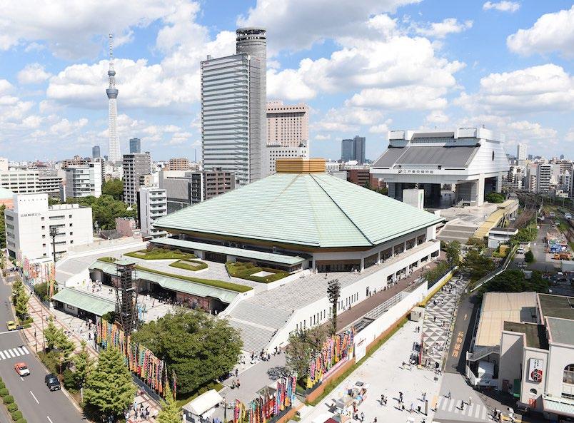
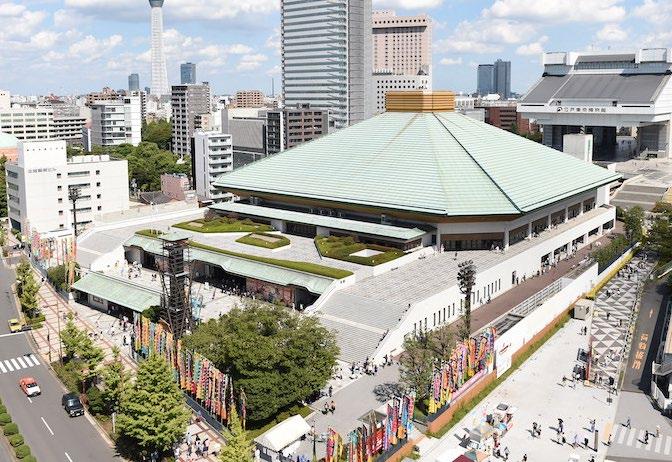
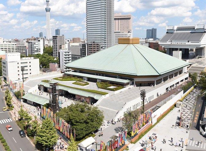
Ryogoku Sumo Arena
Kiyosumi Japanse garden Hamarikyu Japanese garden
Schools and Stations
There are many schools around the Sumida River, from kindergarten to university. To select walkable streets, I consider the routes that connect railways, schools, and parks to ensure that the streets will be functional for both locals and visitors.
Legenda
Famous District
Rail lines
Stations
Park
School Plot
Kinder garden
Elementary school
Middle school
High school
Universities/Technical College
88
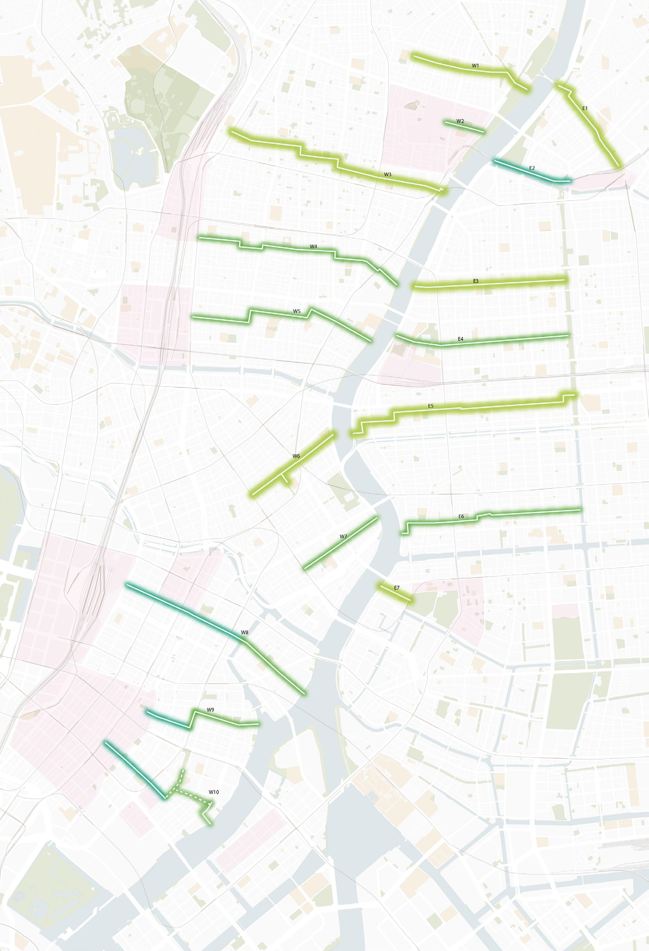
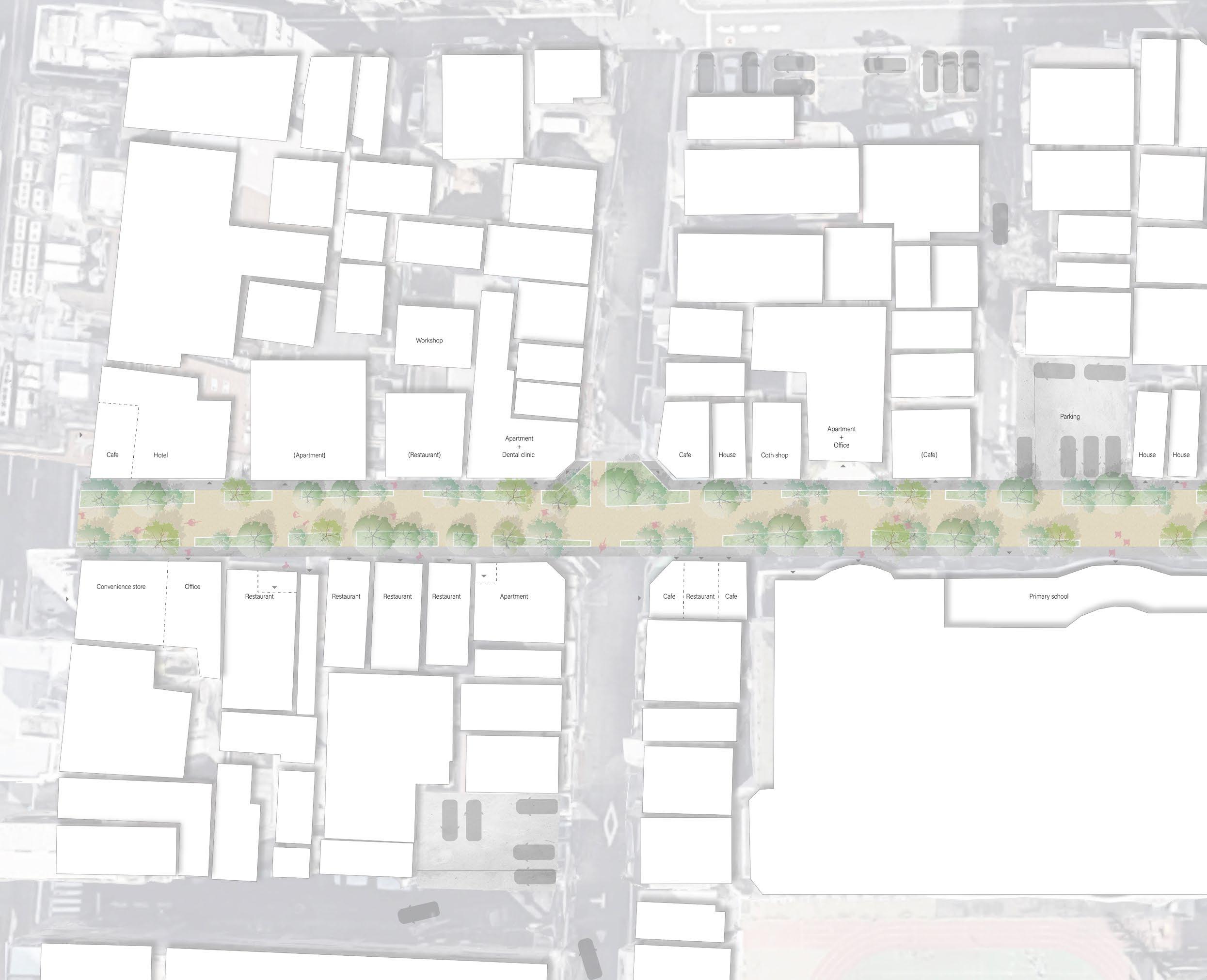
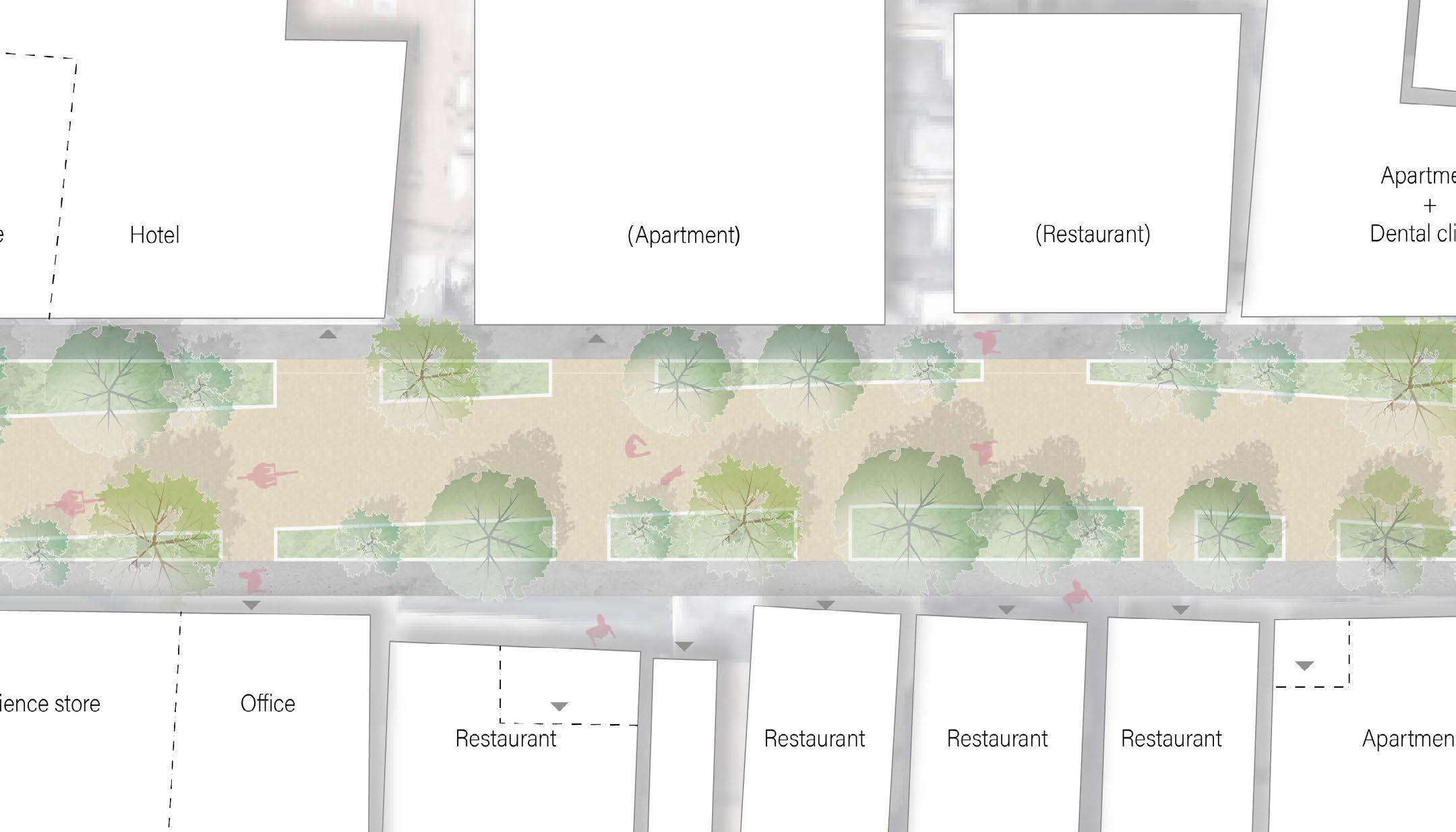
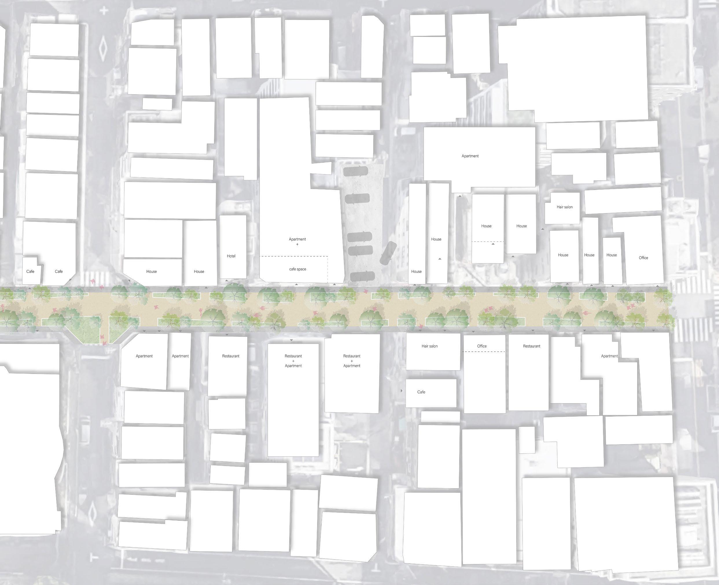
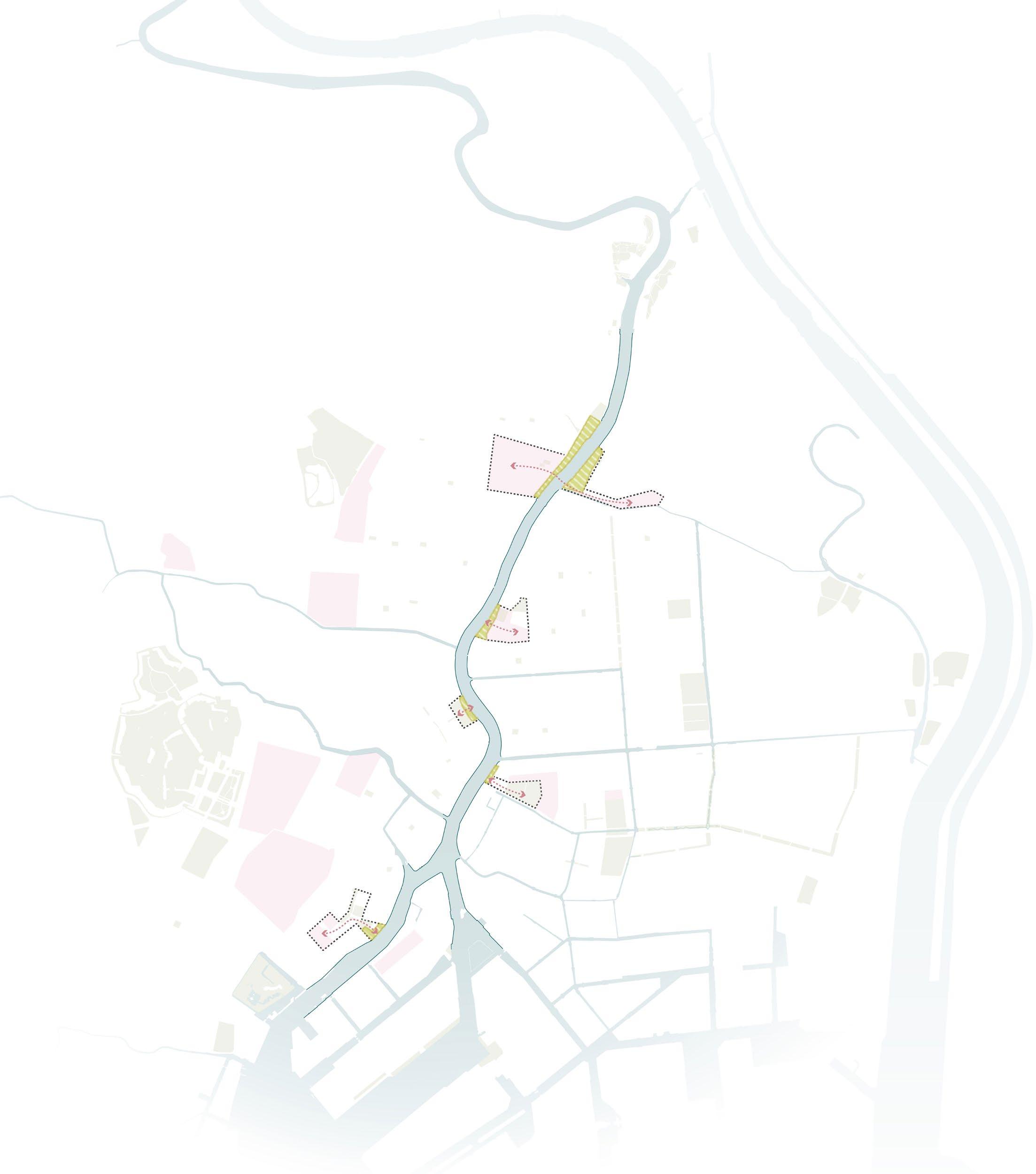
Selected walkable streets
I selected routes from major spots toward the river and made two street design principles: residential streets (medium and small) and office area streets. Each street has a 500m to 700m interval each other and stretches from the river to the inner city. So, from many points in the city, people can reach the pedestrian street. During the 2nd field survey, I visited all the streets and checked for alternative routes if the traffic was limited for each street.
case study 2
case study 1

Residential
Legenda
street small
street medium Office and Restaurant street 89
Residential
Case study 1: Small Residential street
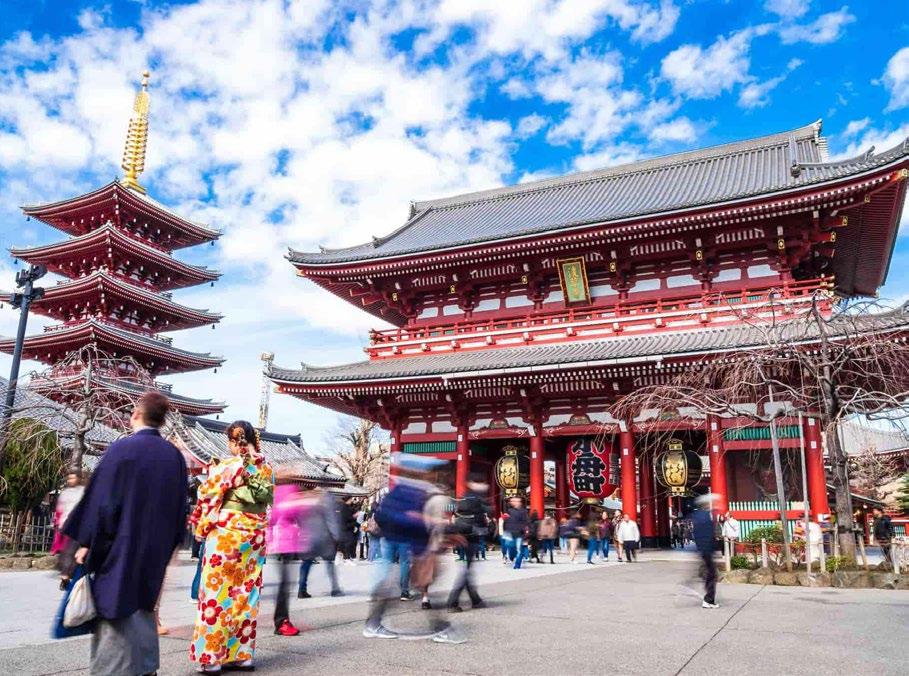
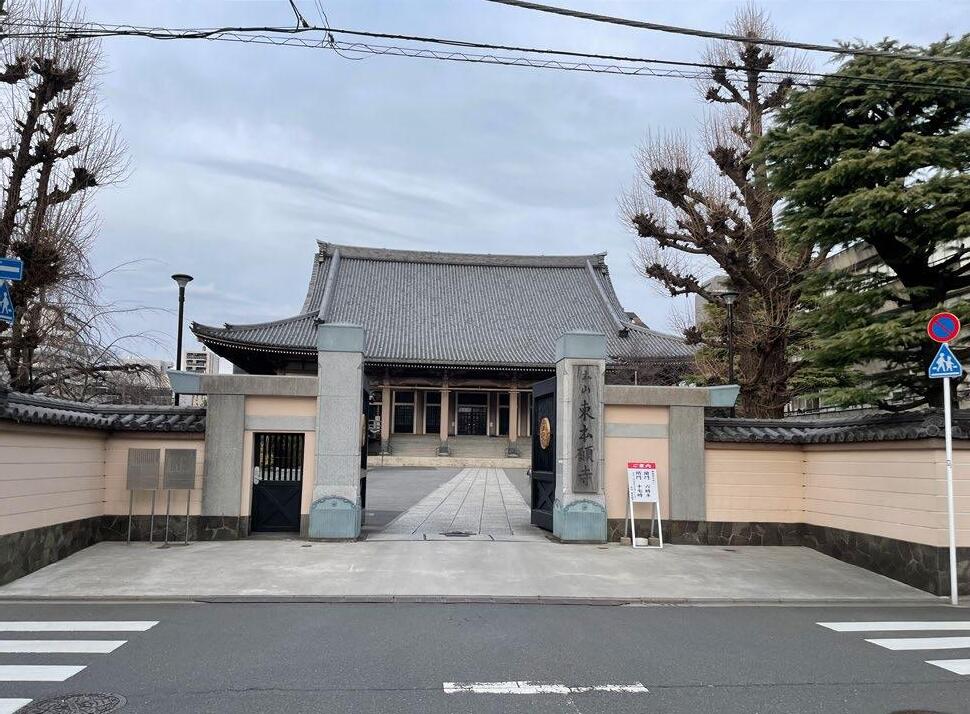
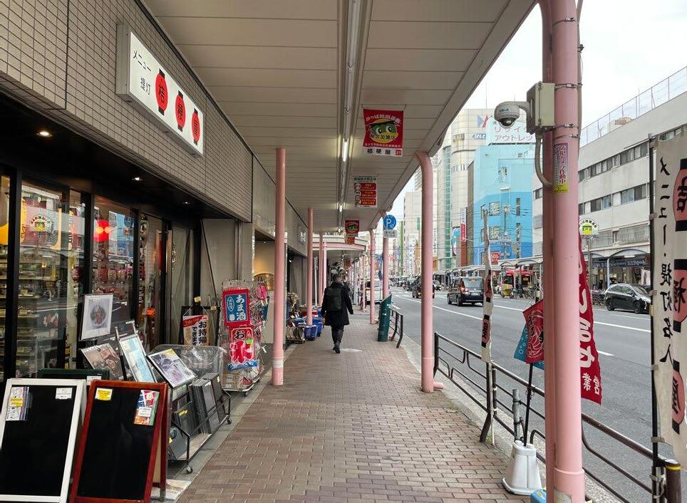
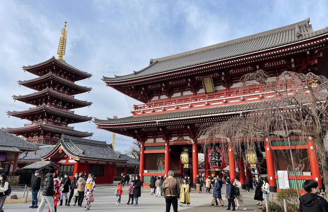
Case Study 1 focuses on the Asakusa area, a well-known tourist destination. This area is rich in historical temples and shrines, providing an opportunity for experiencing Japanese culture for tourists.
Also in this area, small residential houses are clustered together with a few elementary and middle schools around. Therefore, I selected the route extending from Ueno Station, which is one of the main stations, towards the Sumida River in the Asakusa area, connecting with elementary and middle schools, parks, and shopping streets.
Temples Shopping arcade
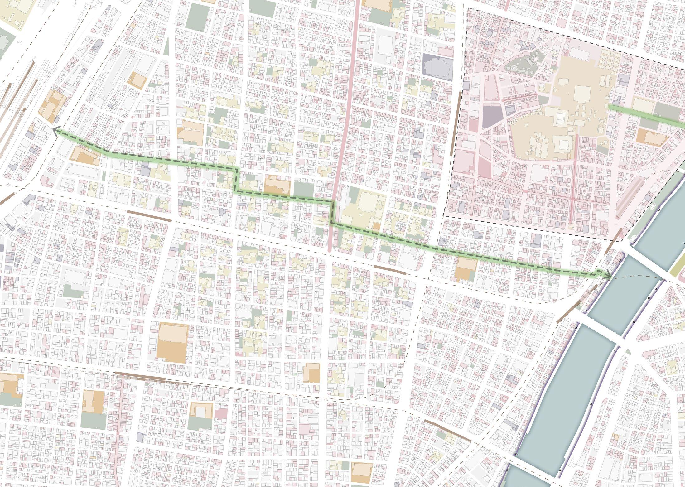
 Ueno station
Sensoji temple
Asakusa area
Ueno station
Sensoji temple
Asakusa area
Commercial building Accommodation Shopping street LEGENDA Park Station Schools Shrine, temple
Asakusa station
90
street view
Elementary school
91
Sumida river
Section transformation : Small Residential street
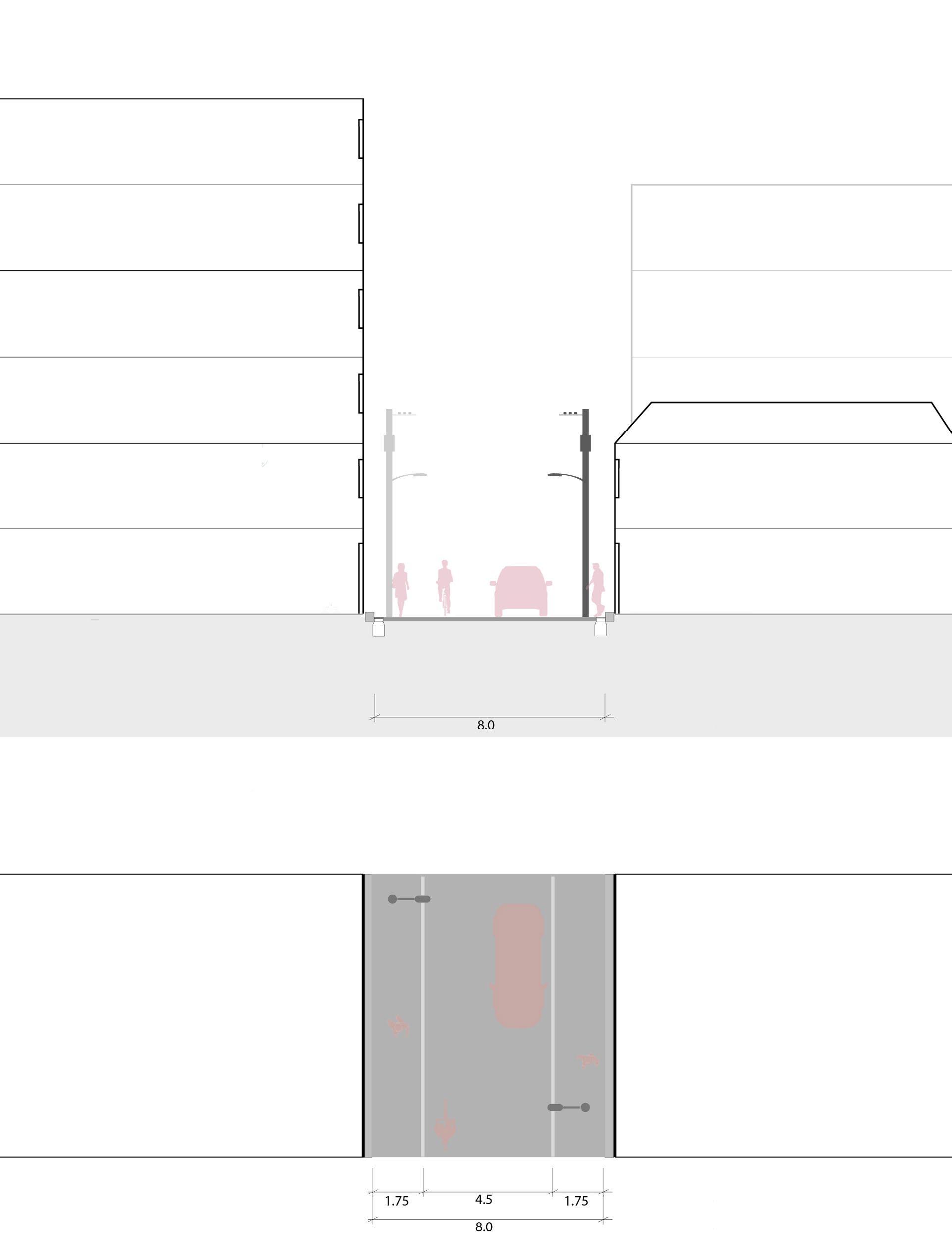
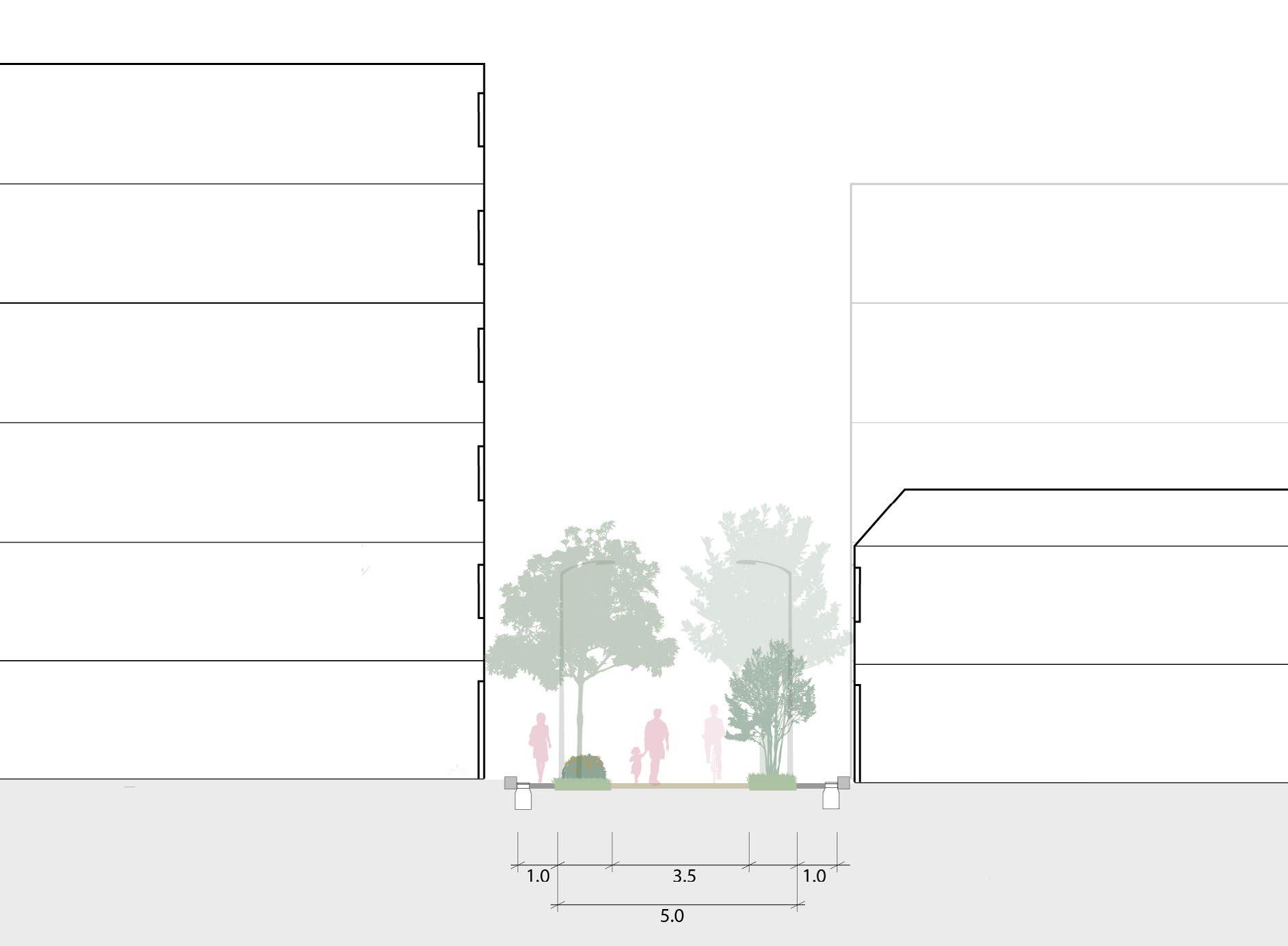
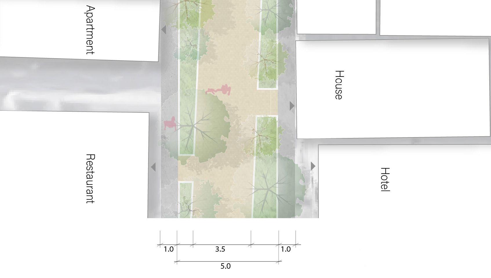
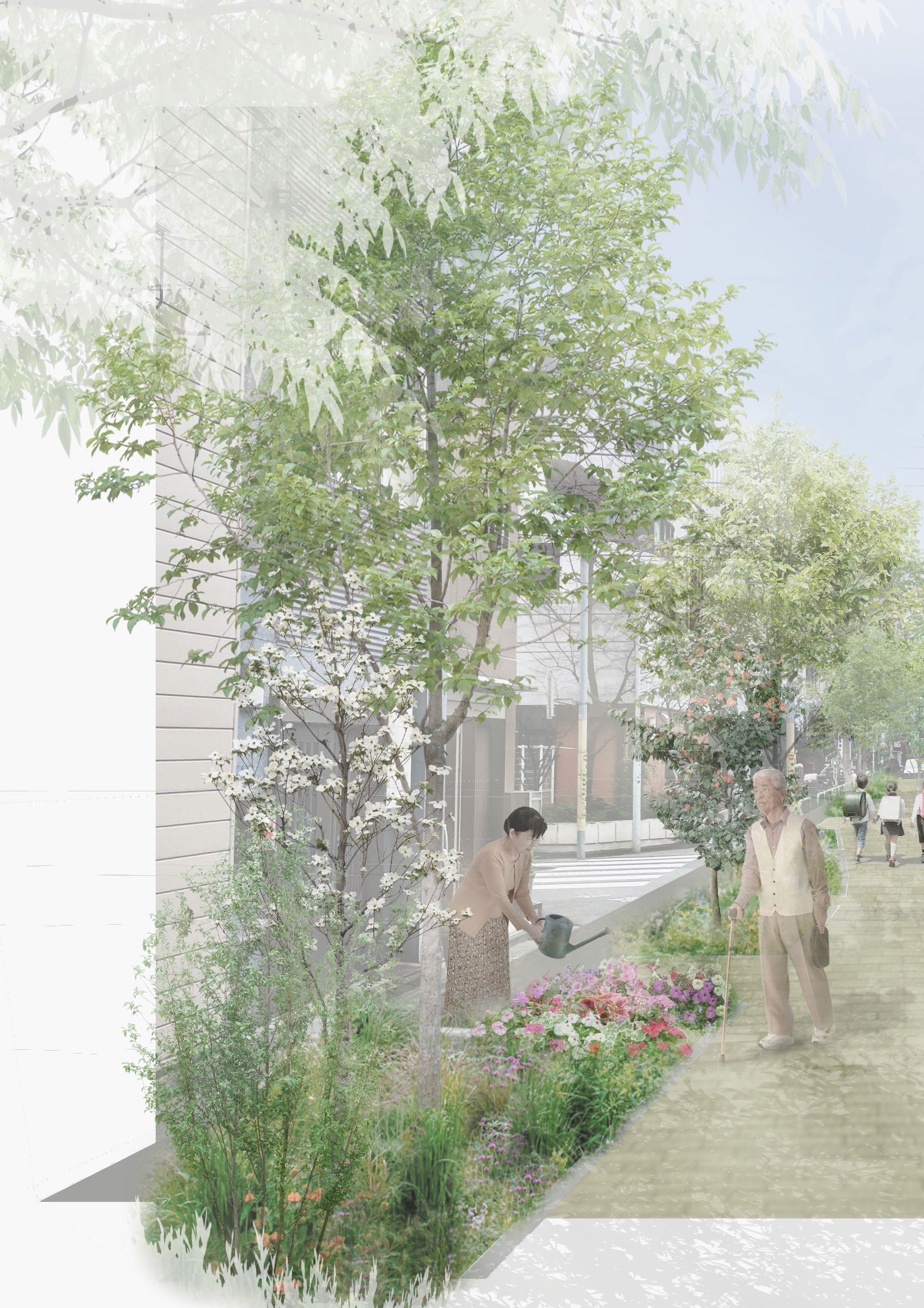
Currently, the street lacks pedestrian space, providing only a narrow walking space of 1.75 meters, and there are no street trees due to the utility poles. Taking advantage of one of the Tokyo government’s initiatives: making an earthquakeresistant city with zero utility poles and underground electricity pipes, this street will be transformed by putting power lines underground and will be redesigned with trees and a low planting area.
Due to limited property space, many residents in this area do not have their own gardens. Instead, they place potted plants on the street. By designing the street’s planters as semi-private green spaces, residents can utilize them as their own gardens. Residents’ awareness of the plant management will also be an eye for safety for children on their way to school on the street.
92
93
94 Plan : Small Residential street
95
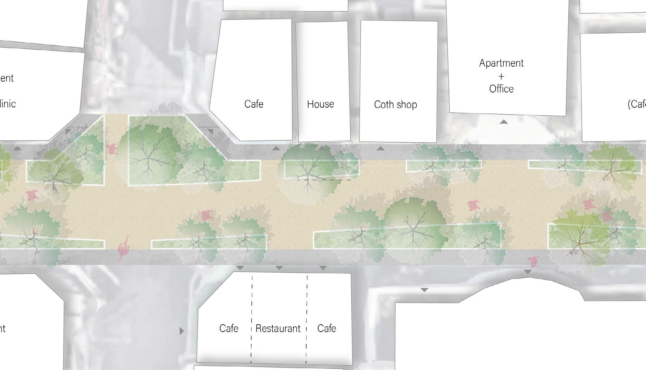
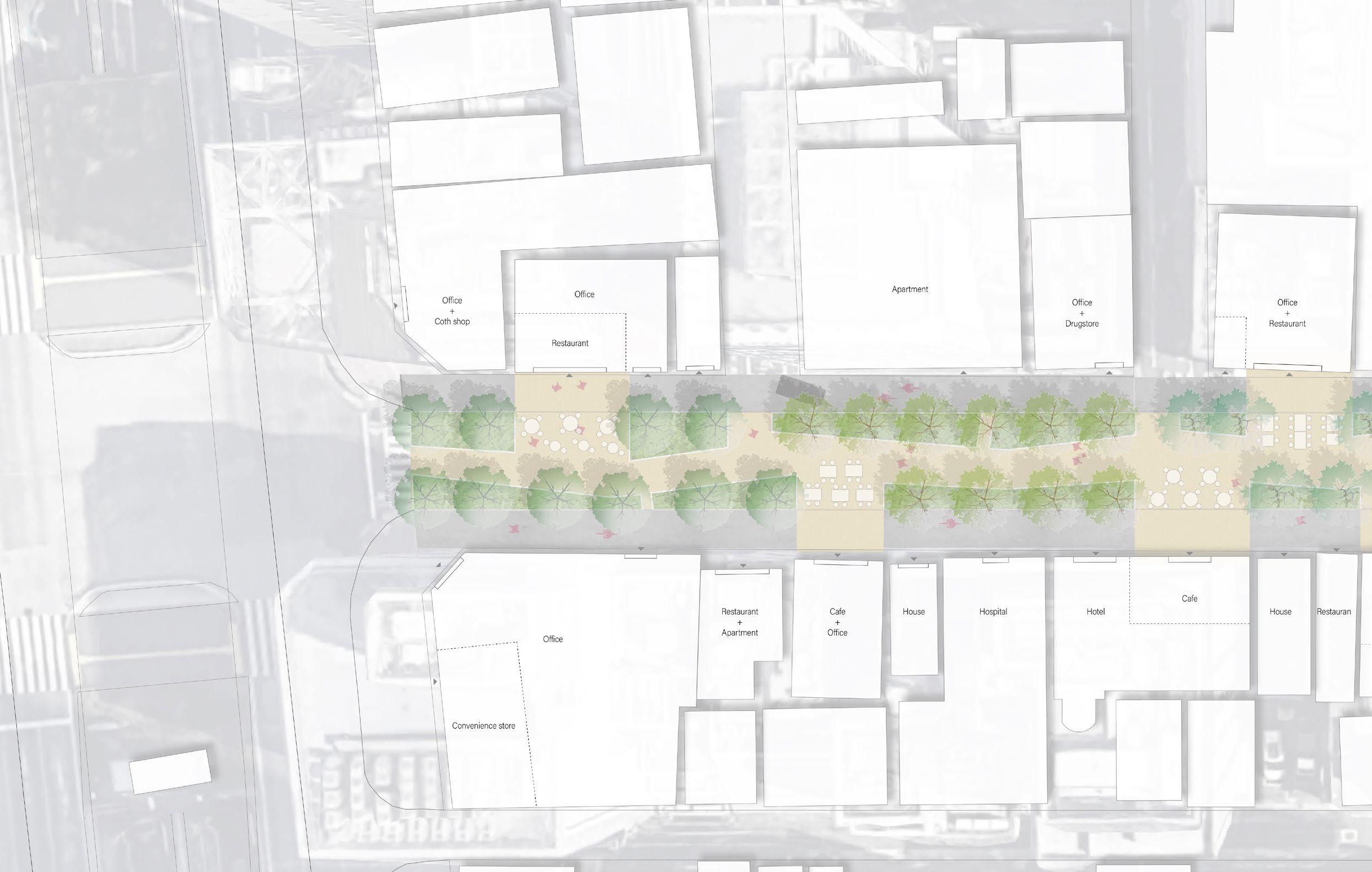
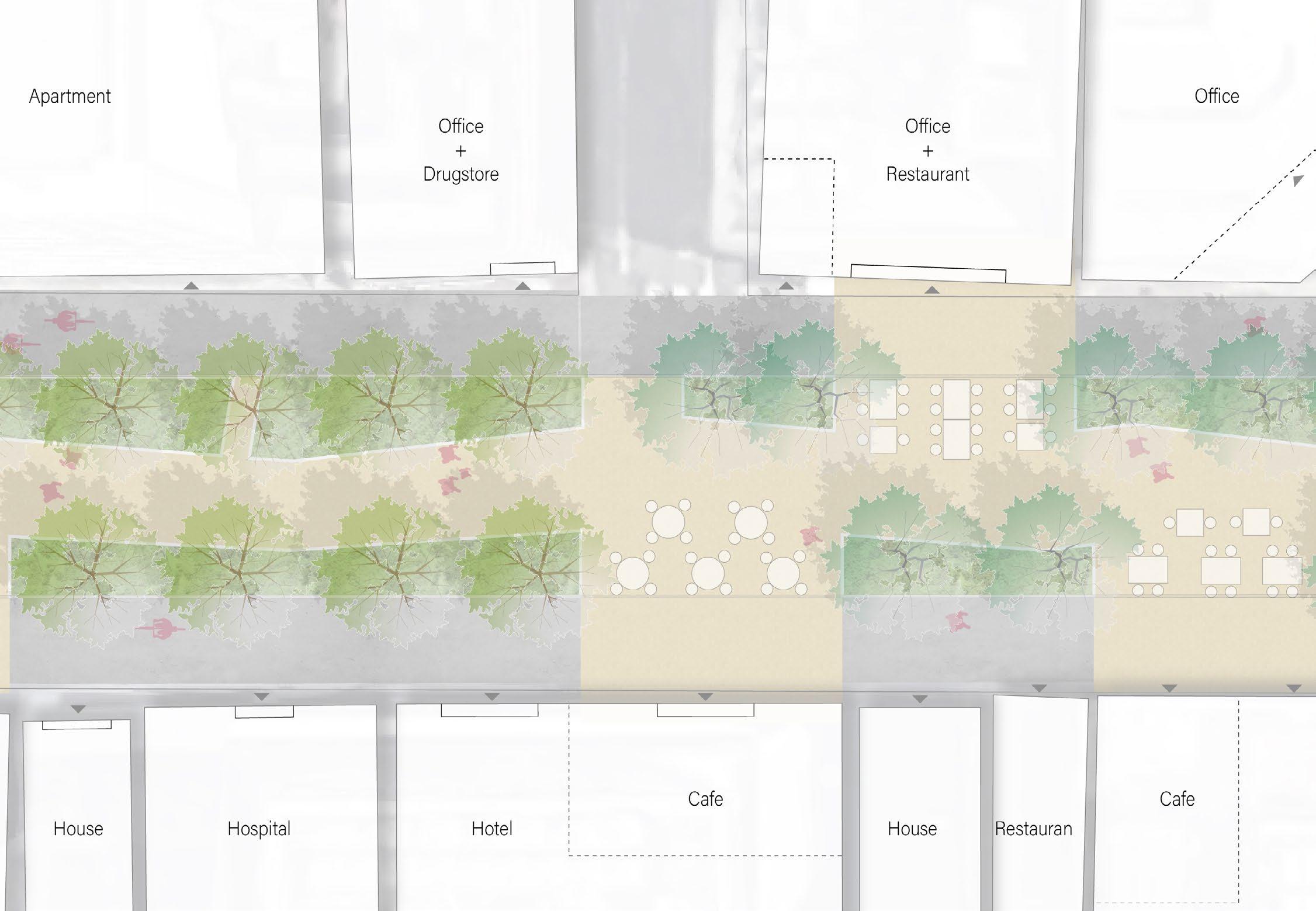
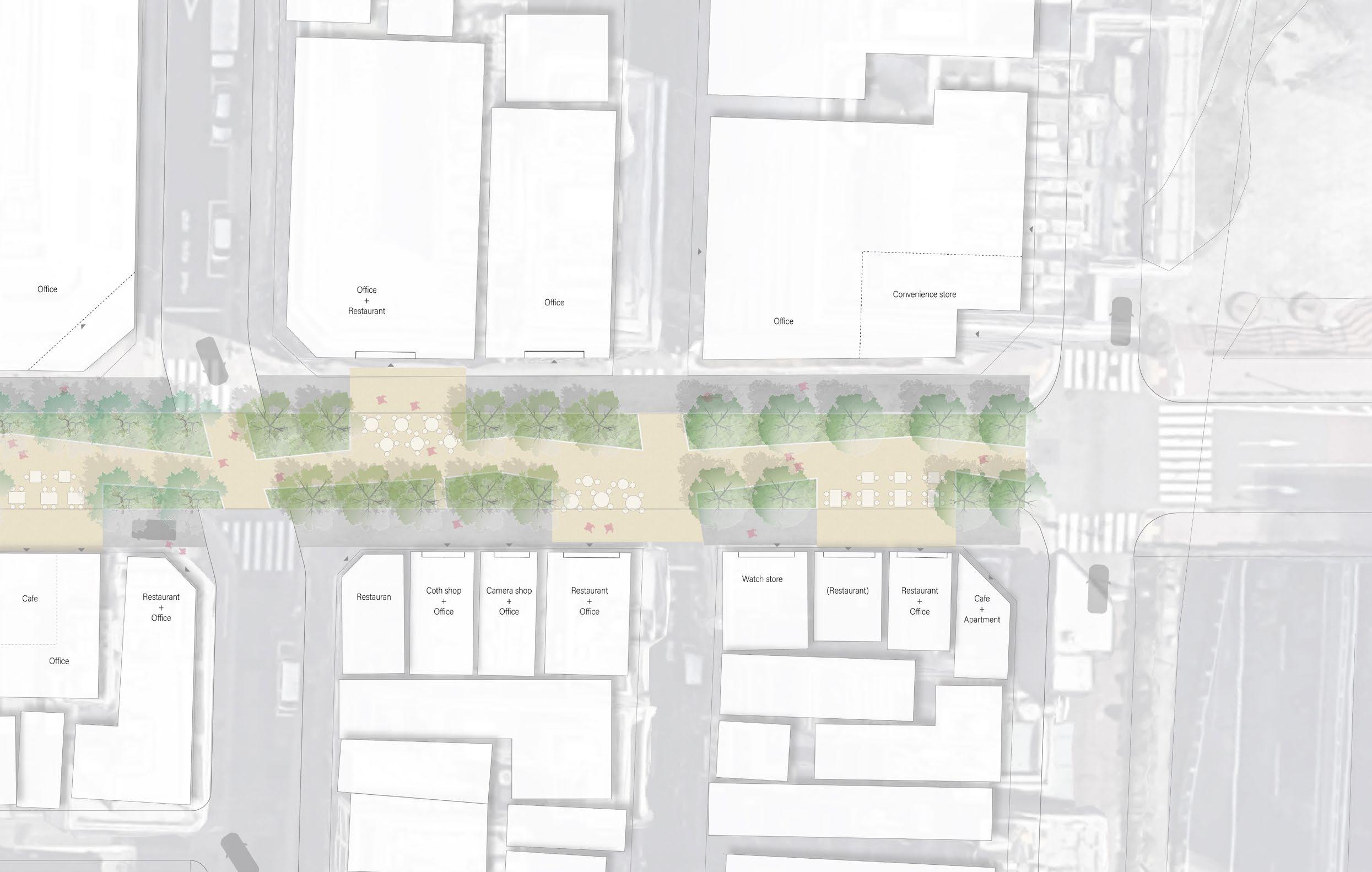
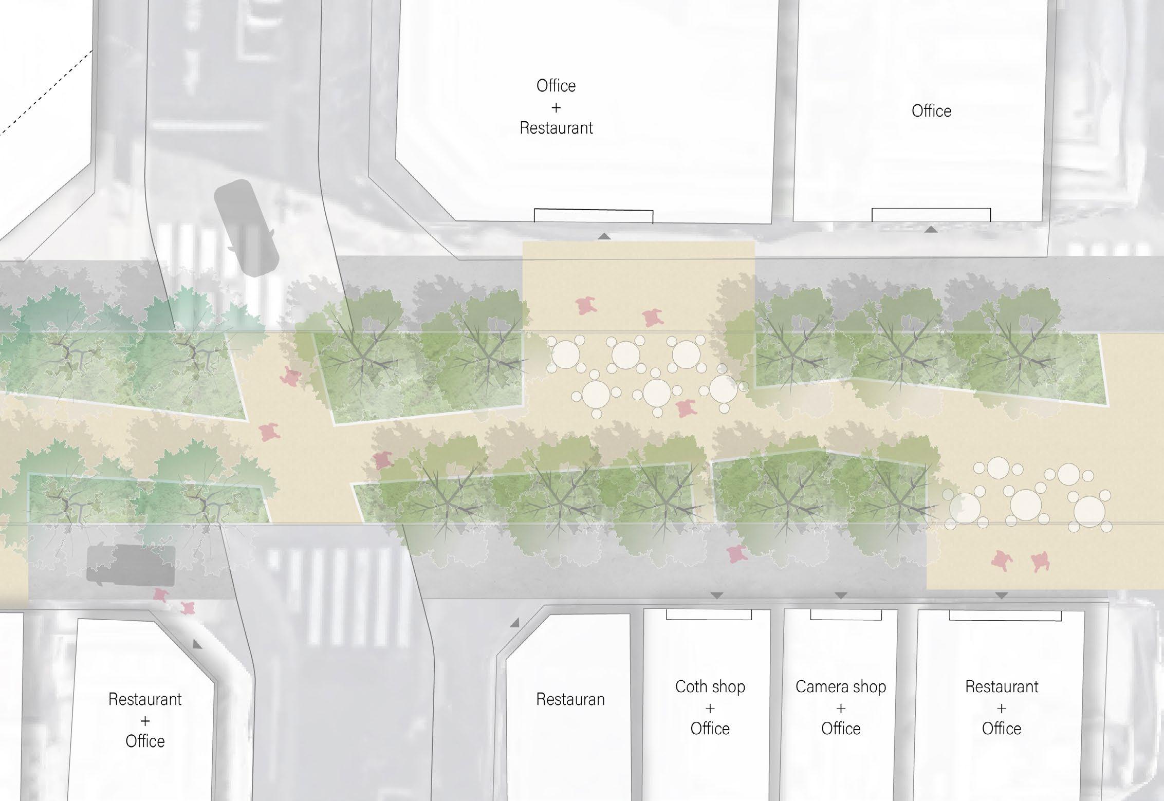
Case study 2 : Office and Shopping area
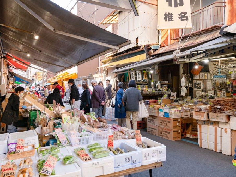
Case Study 2 focuses on connecting Ginza, a famous shopping area in Tokyo, to the Sumida River. The area also consists mainly of a shopping district and an office area, but the Tsukiji Fish Food Market, Hamarikyu Japanese Gardens, and Tsukiji Honganji Buddhist Temple are located in the neighbourhood, attracting many domestic and foreign tourists.
In order to connect these major spots to the river, the street lined with cafes and restaurants was selected for this area. The design aims to create a square like street which has a space where restaurants can set up their terrace seating on the street.
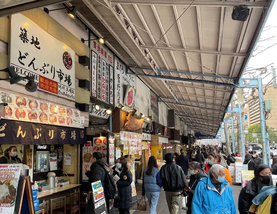
Fish market
Shopping area
shopping area Ginza station Tsukiji Fish market Hamarikyu Japanese Garden New development area (Baseball park) Buddhist temple Commercial building Office building Accommodation Hospital Shopping street LEGENDA Park Station Schools Shrine, temple 98
Tsukiji
Ginza
Ginza
 Tsukiji Honganji Buddhist temple
street view 99
Hamarikyu Japanese garden
Section transformation : Office area street
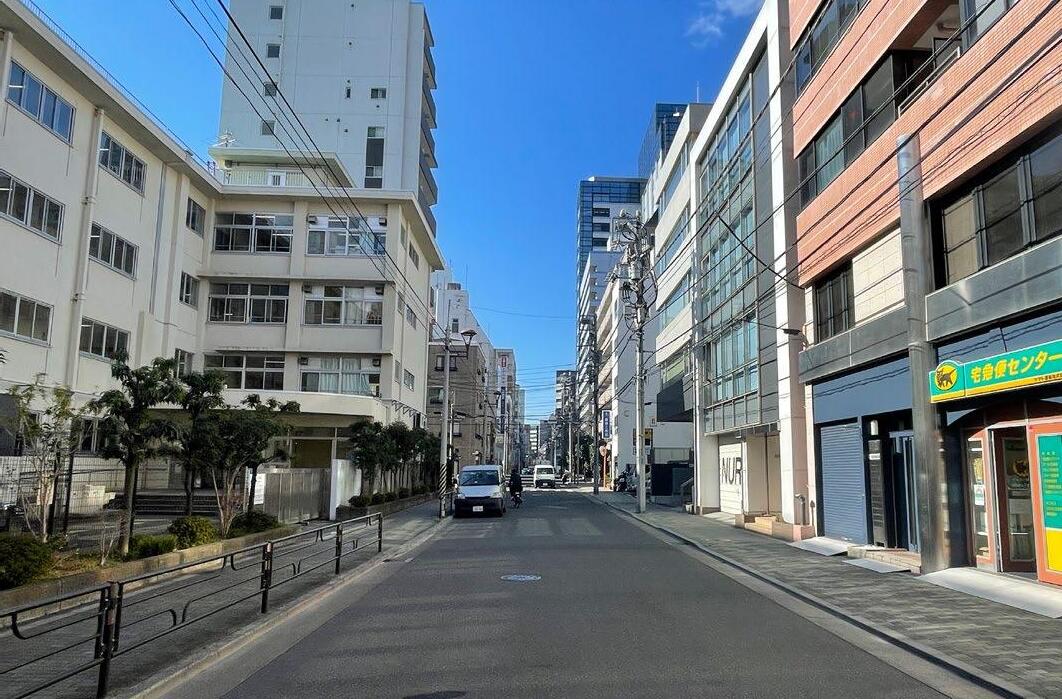
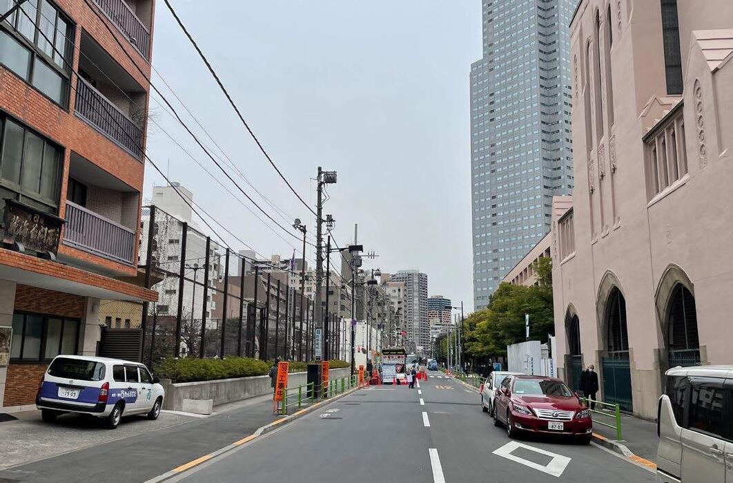
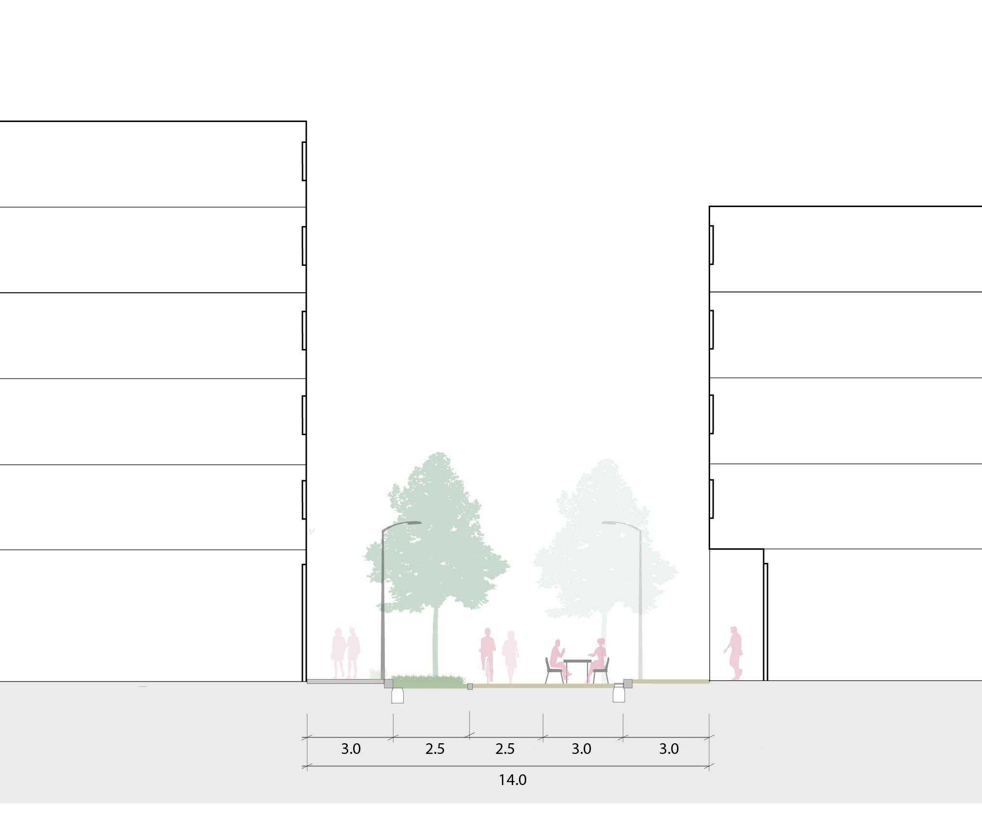
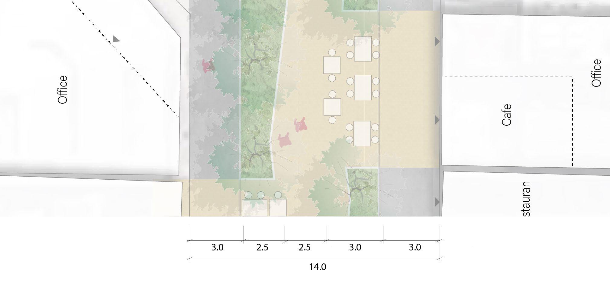
The current street is divided into a roadway and a promenade, with middle trees on both sides of the street. However, the street functions only as a traffic line, with no space or features for people to stay.
The design minimises the entry of cars, for example, only essential functions such as transporting, and transforms the street into a pedestrian-friendly environment where pedestrians can walk in the middle of the street surrounded by greens. The main walking space in the centre of the street has a large rhythm of space that allows the surrounding restaurants to create terrace seating. This creates a lively atmosphere on the street where tourists or local workers gather to take breaks. and also guides people to the Sumida River side.
100
101
102 Plan : Office area street
103
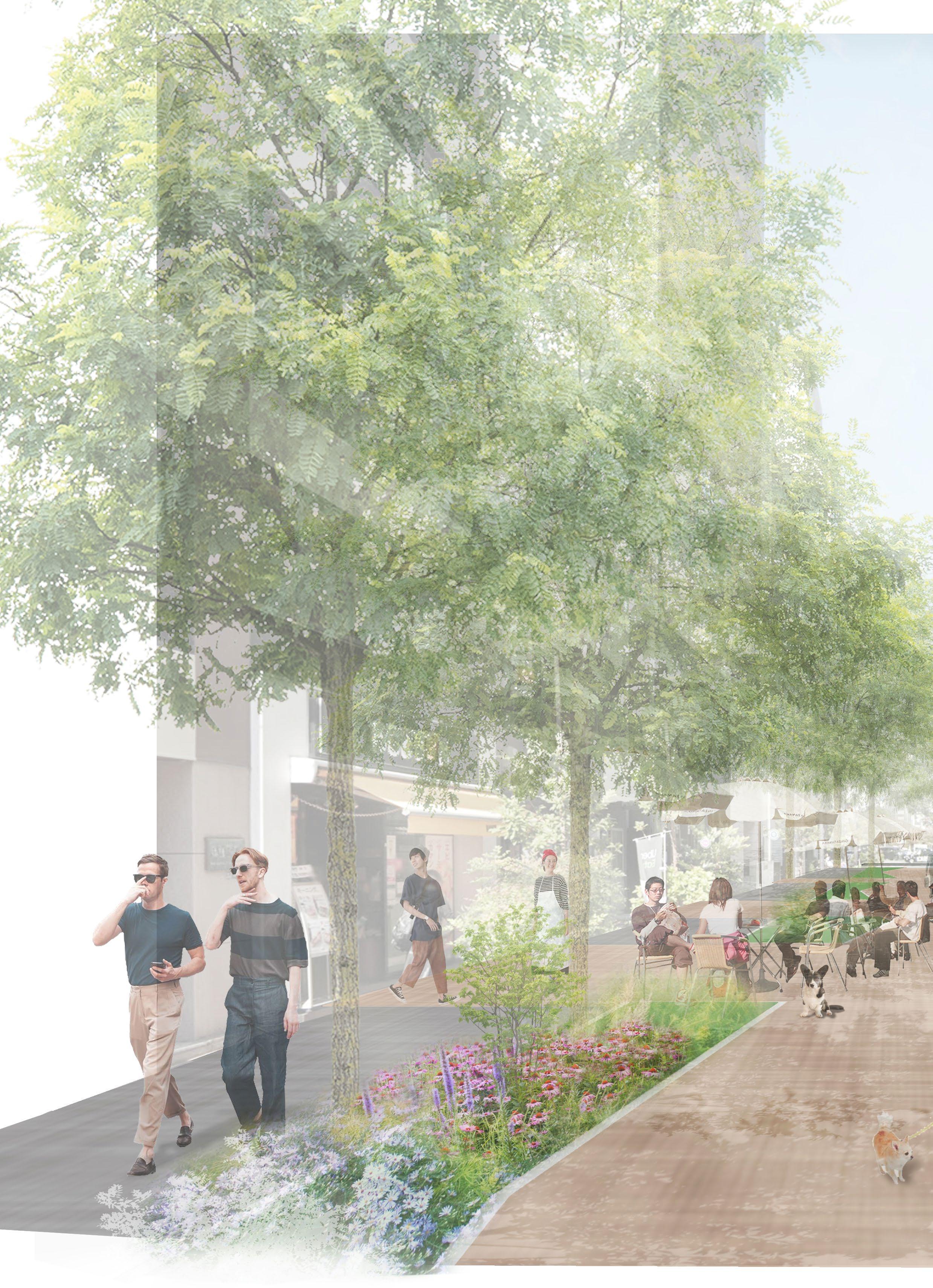
Walkable Office area street impression
106
Goal 2 - Integrating important public spaces to the river space
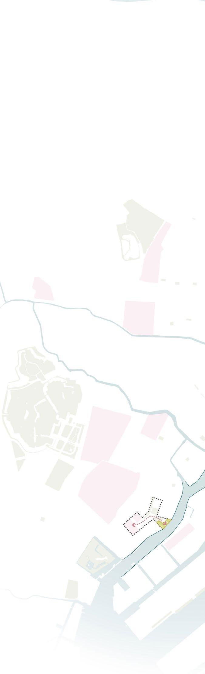
Approach : Expand the river space into the famous place
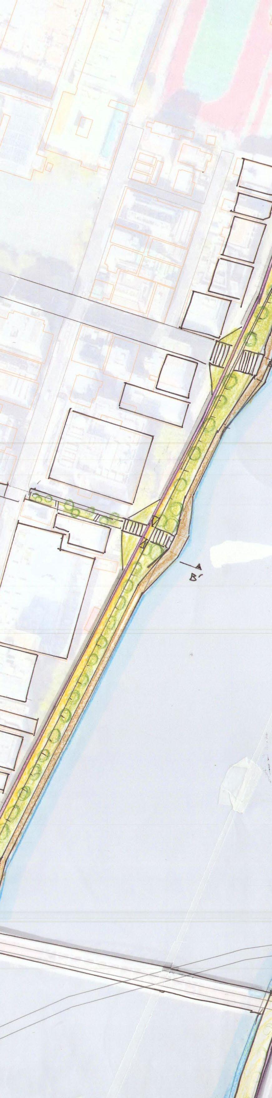
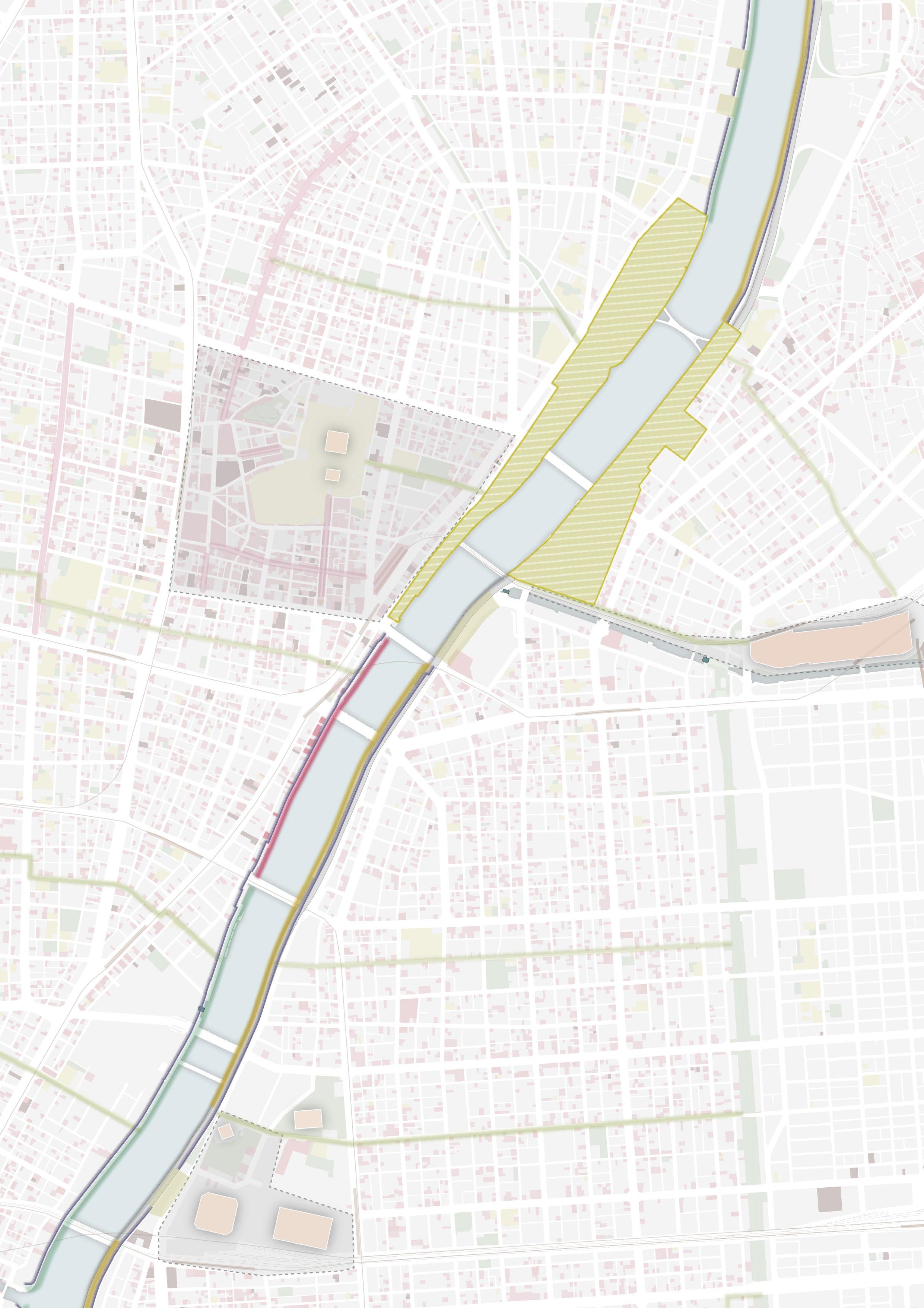
Goal 2 focuses on the significant area along the river space, aiming to create interconnected river spaces between the riverside and the inland areas. The main method is to expand the river space to the space owned by the metropolitan government, such as roads or parks, and to connect the seamless flood protection space that will replace the floodwall to the main tourist spots around the levee.
107
Case study : Two design areas
 Sensoji Temple
Tokyo sky tree tower
Ryogoku Sumo Arena
Calture museums
Sensoji Temple
Tokyo sky tree tower
Ryogoku Sumo Arena
Calture museums
108
Highway
Asakusa area
Sumida park
Sumida park
Ryogoku area
109
Asakusa area
Ryogoku area
Pedestrian bridge
Pedestrian street
Sensoji temple area
Pedestrian street
Pedestrian bridge
Tokyo Sky tree
1 2
Sumida park Sports park
Sensoji temple
Pedestrian Bridge
Cherry blossom
110
Main Shopping street
Case study 1 : Asakusa area
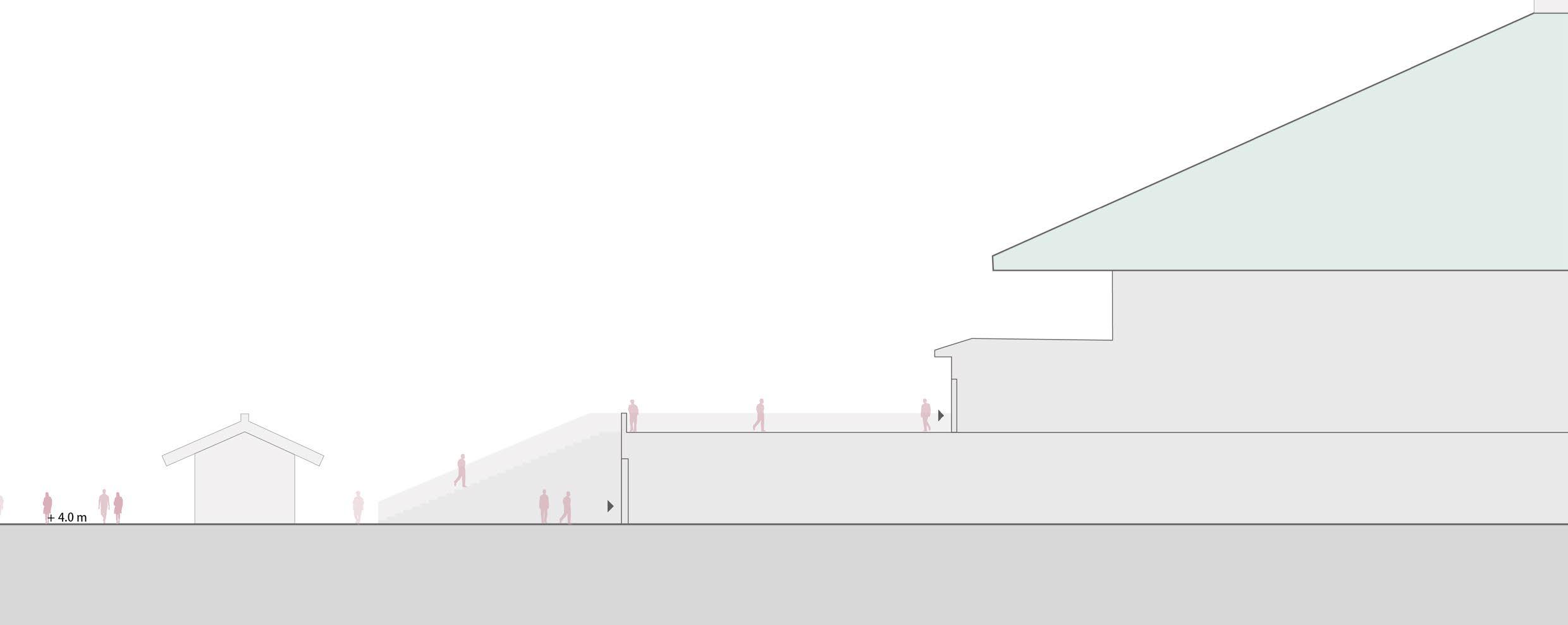
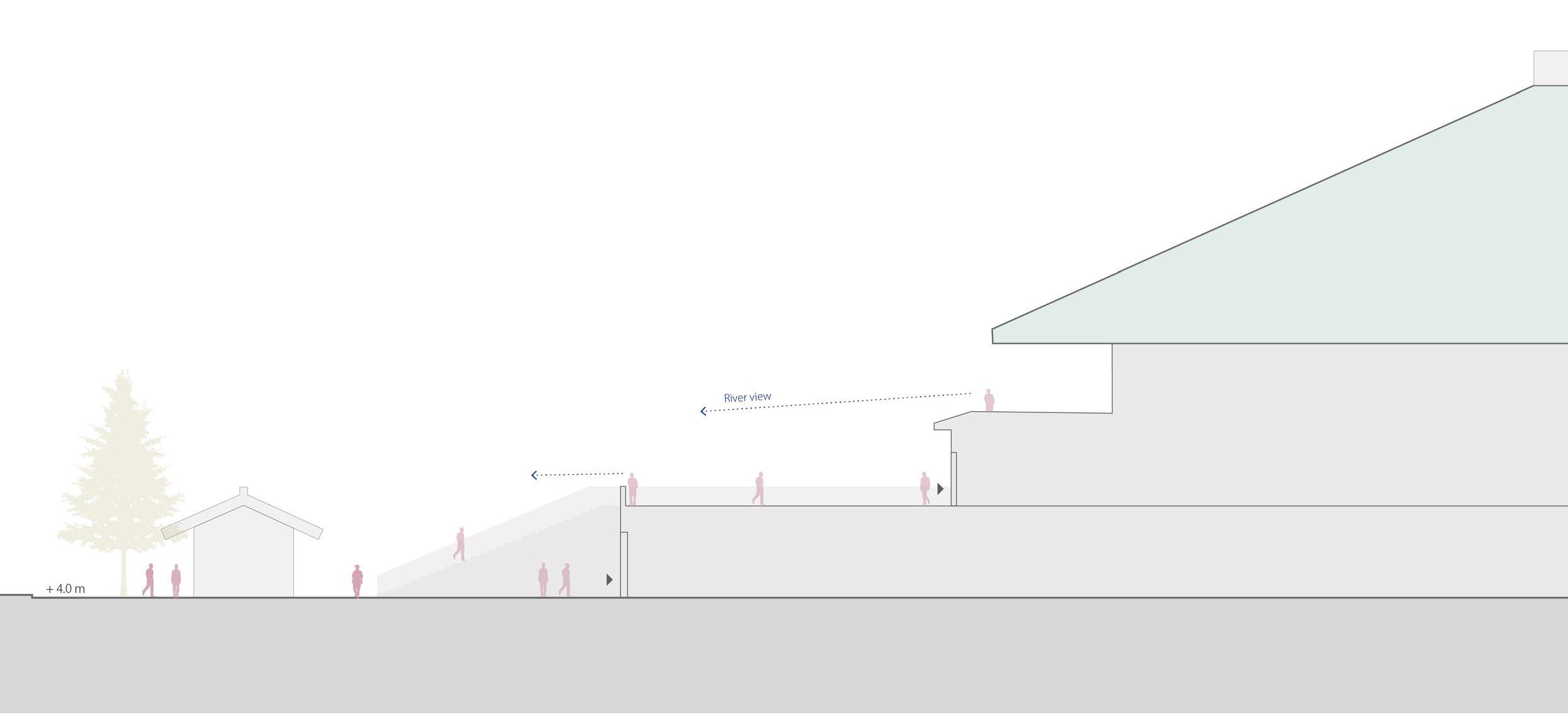
Approach: Connecting two famous area by the riverside park
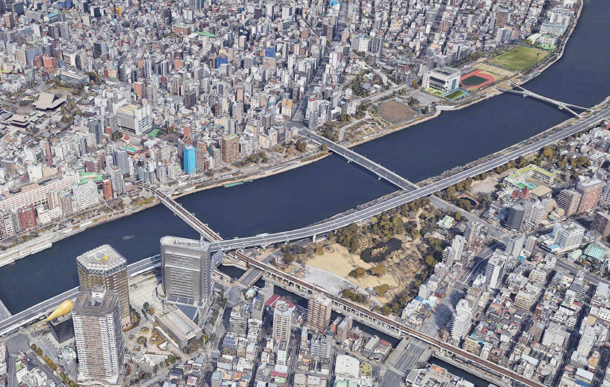
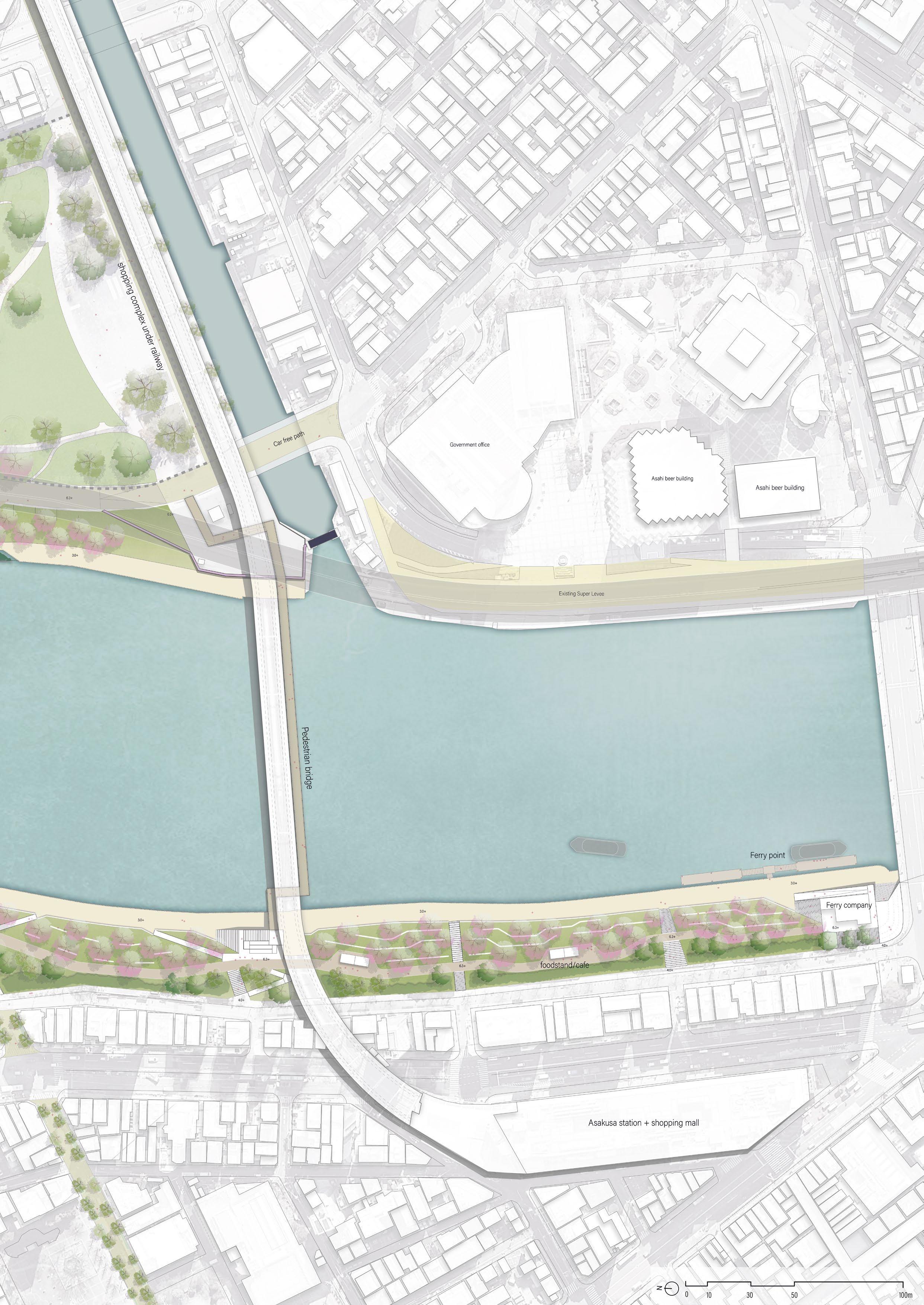
The Asakusa area and Tokyo Sky Tree are major tourist attractions in Tokyo. Between them, Sumida Park is located on both banks of the river. Currently, Sumida Park is obstructed by the flood wall and a two-lane road, and there is a lack of eastwest connection from the river.
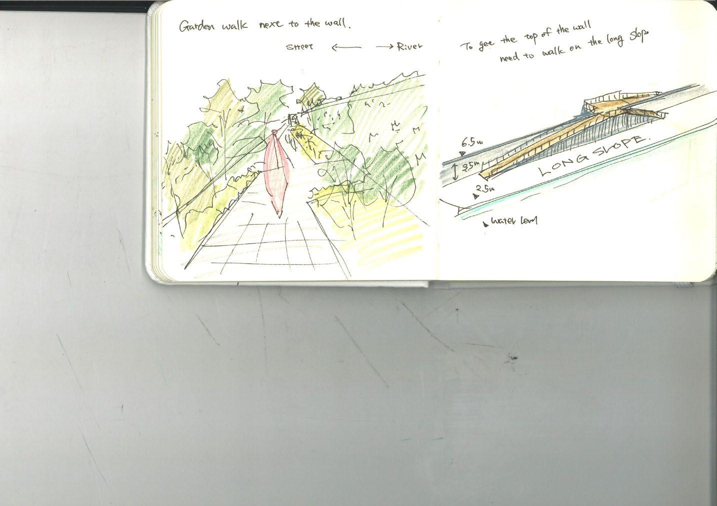
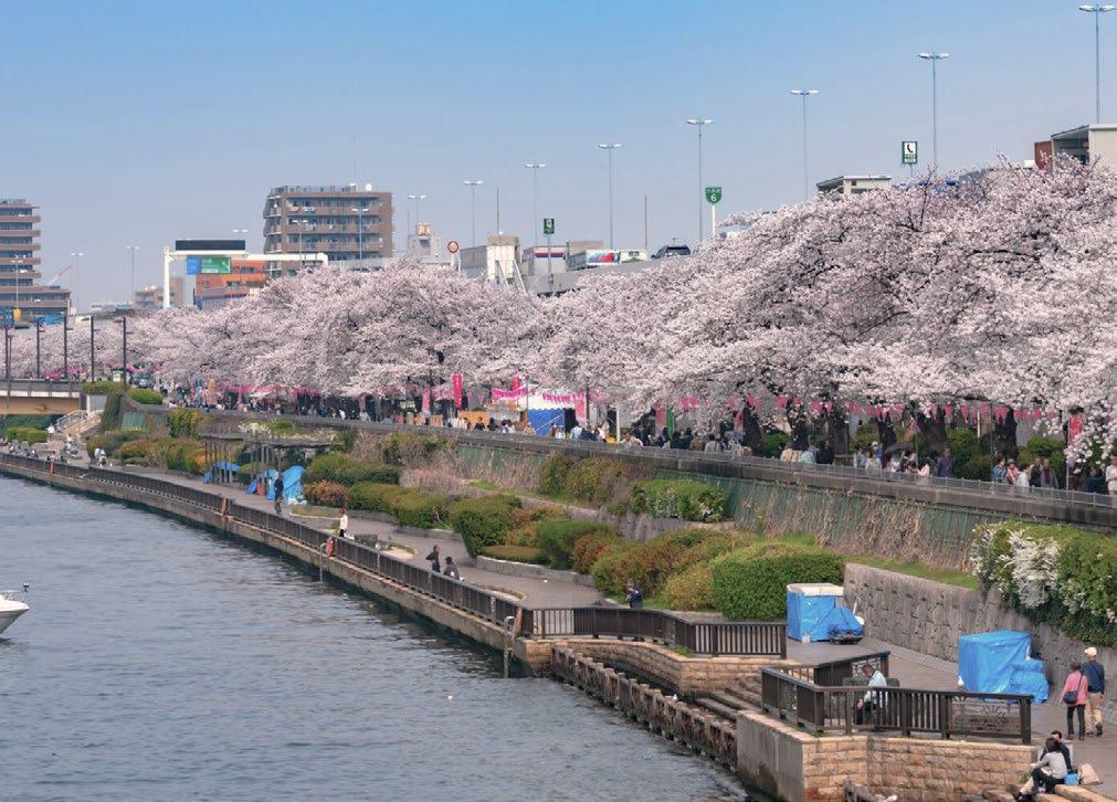
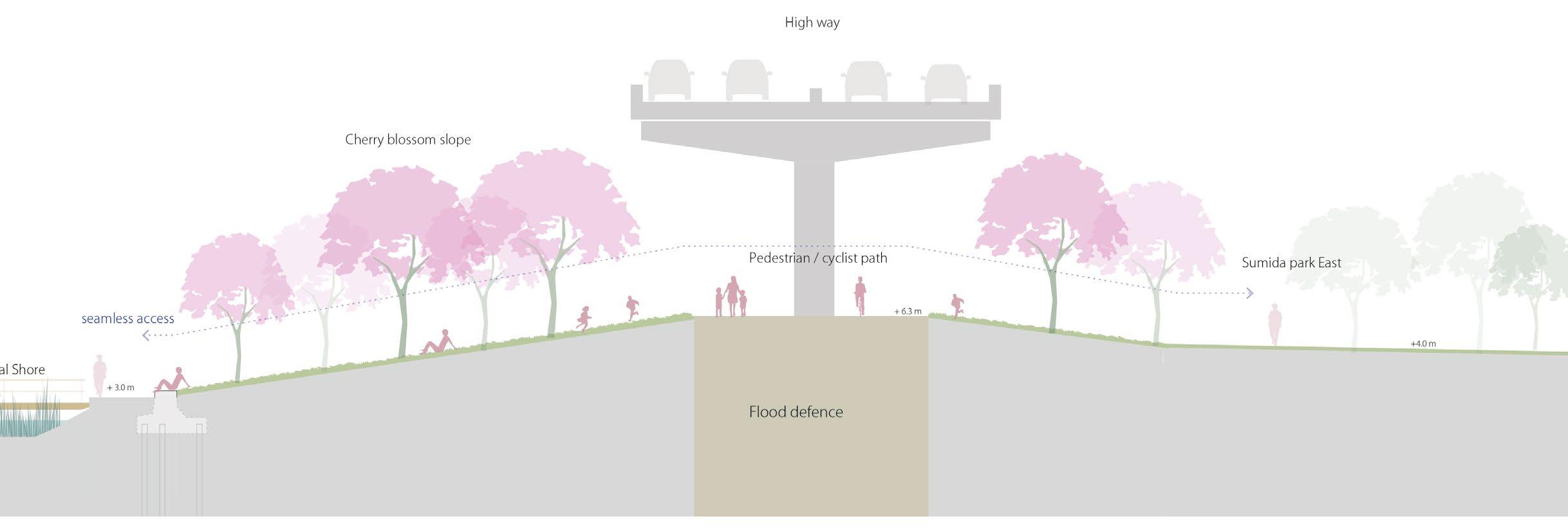
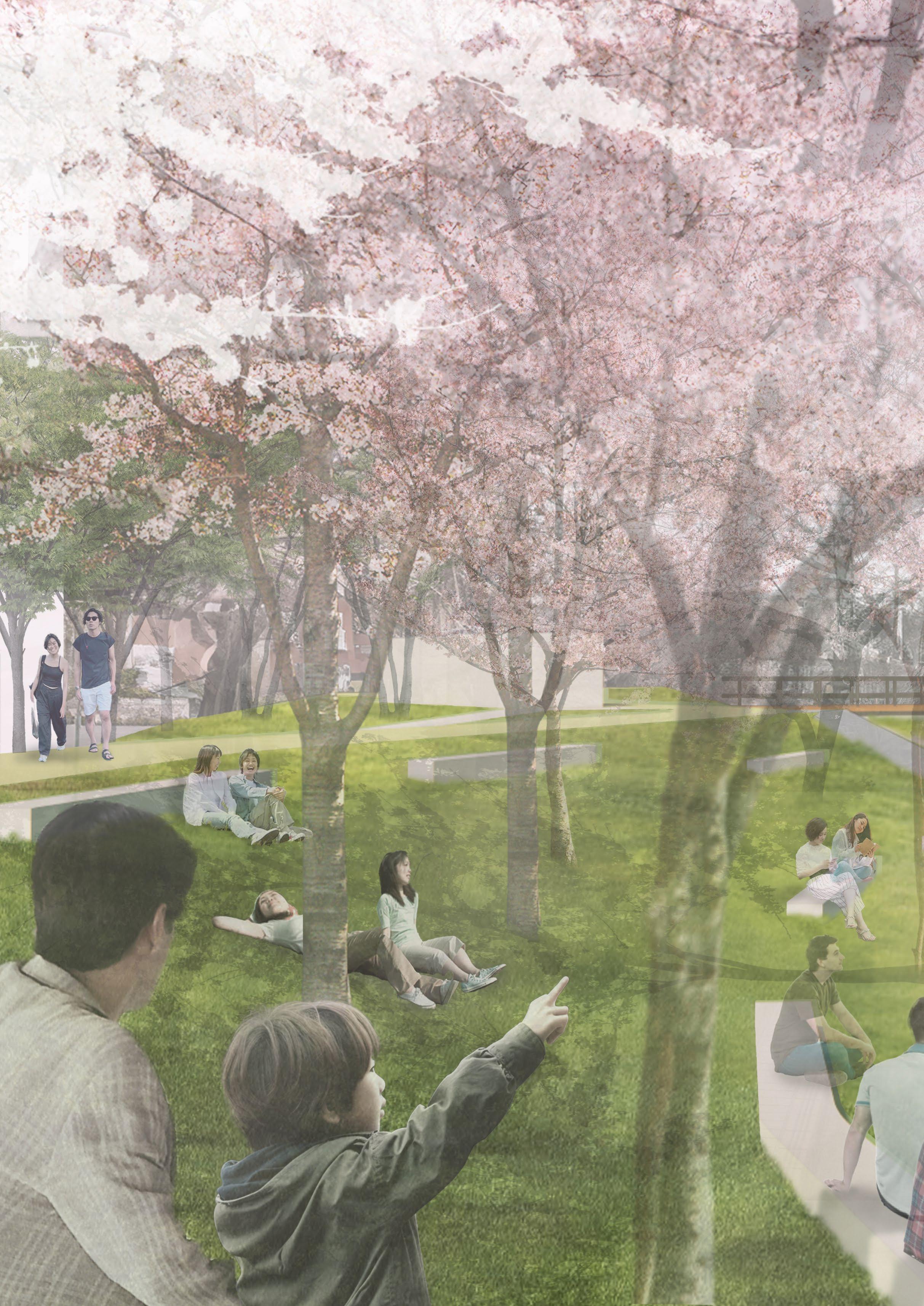
Therefore, in this case study, in addition to the design of pedestrian streets outlined in Goal 1, the aim is to integrate the river and Sumida Park into a cohesive design, creating strong connections with the surrounding areas. The profile will be changed from the flood wall type to a slope flood protection that creates smooth access to/from the river. Sumida Park is also known for its cherry blossoms, so the transformation of the topography of this park creates a new scenic spot where visitors can view the cherry blossom valley from their boats.
111
View 1
View 2
Section transformation :Expand river space
Current situation
River space
Proposal
River space
112
Park
Park Park
113
boulevard
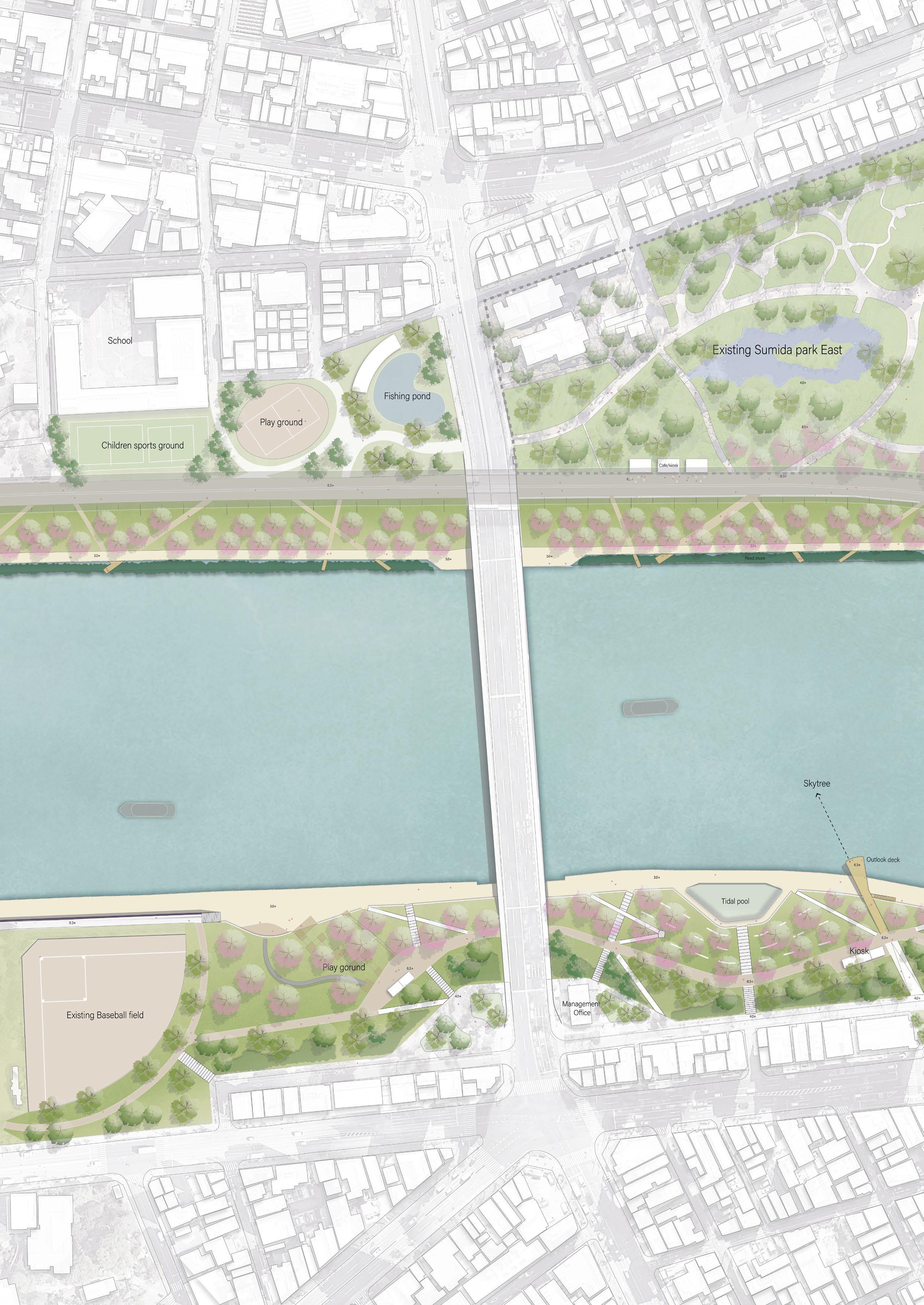
Plan drawing : Flood protection Sumida park
116
Sumida floodprotection Park
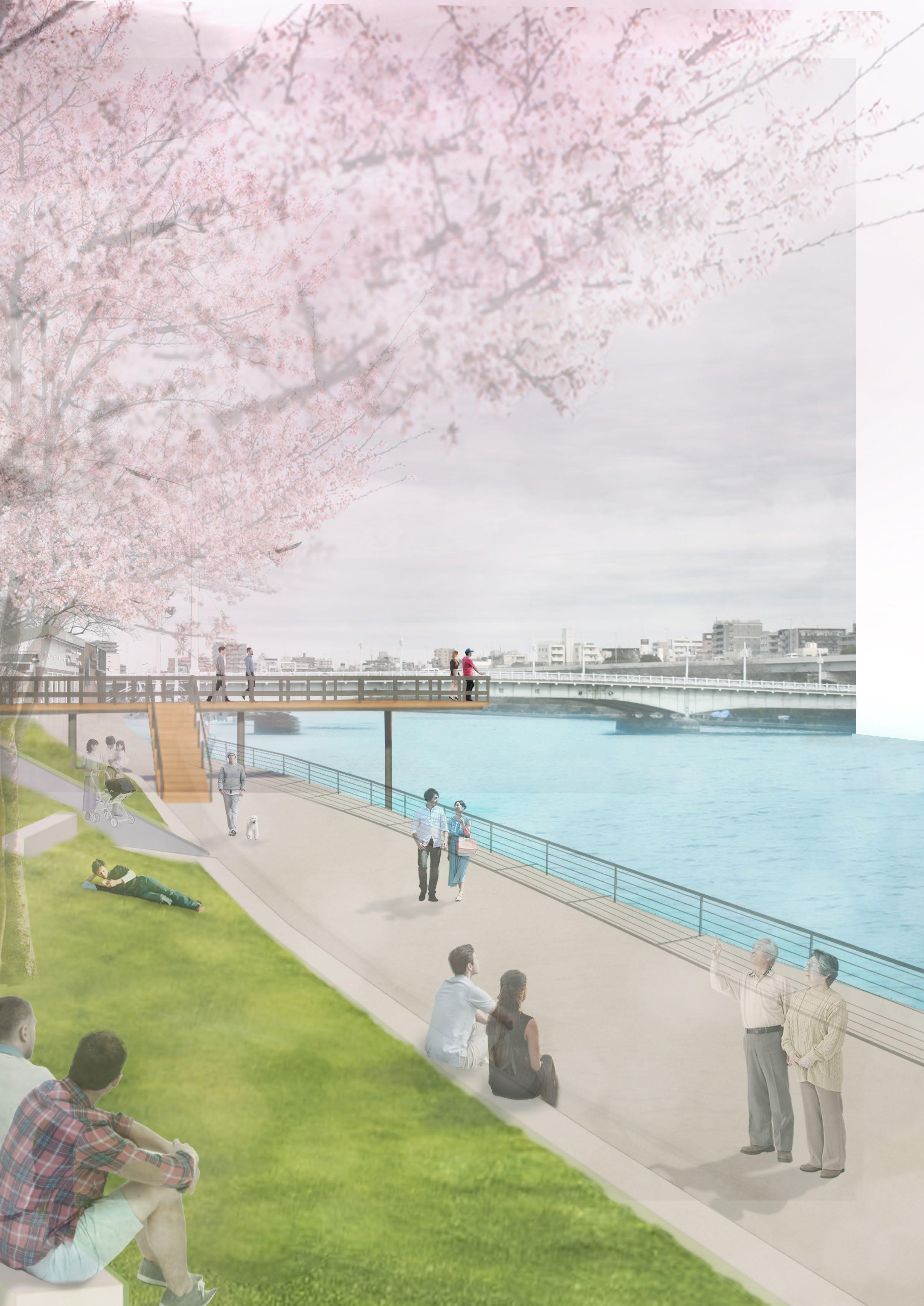
Impression Sumida floodprotection Park
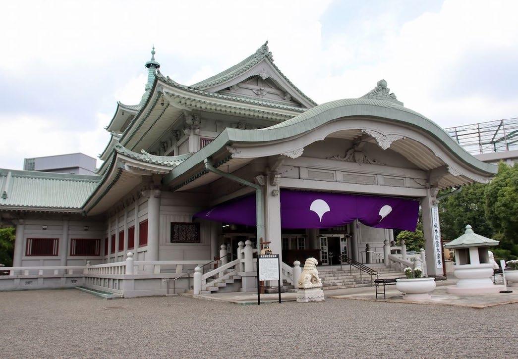
Japanese Sword Museum & Japanese garden
Tokyo Memorial Hall
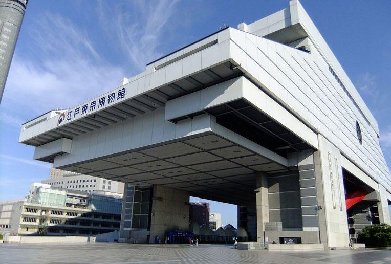
Edo-Tokyo Historical Museum
Ryogoku station
1 2
Ryogoku sumo arena
Ryogoku sumo arena
Edo-Tokyo Historical Museum
Tokyo Memorial Hall
Japanese Sword Museum
118
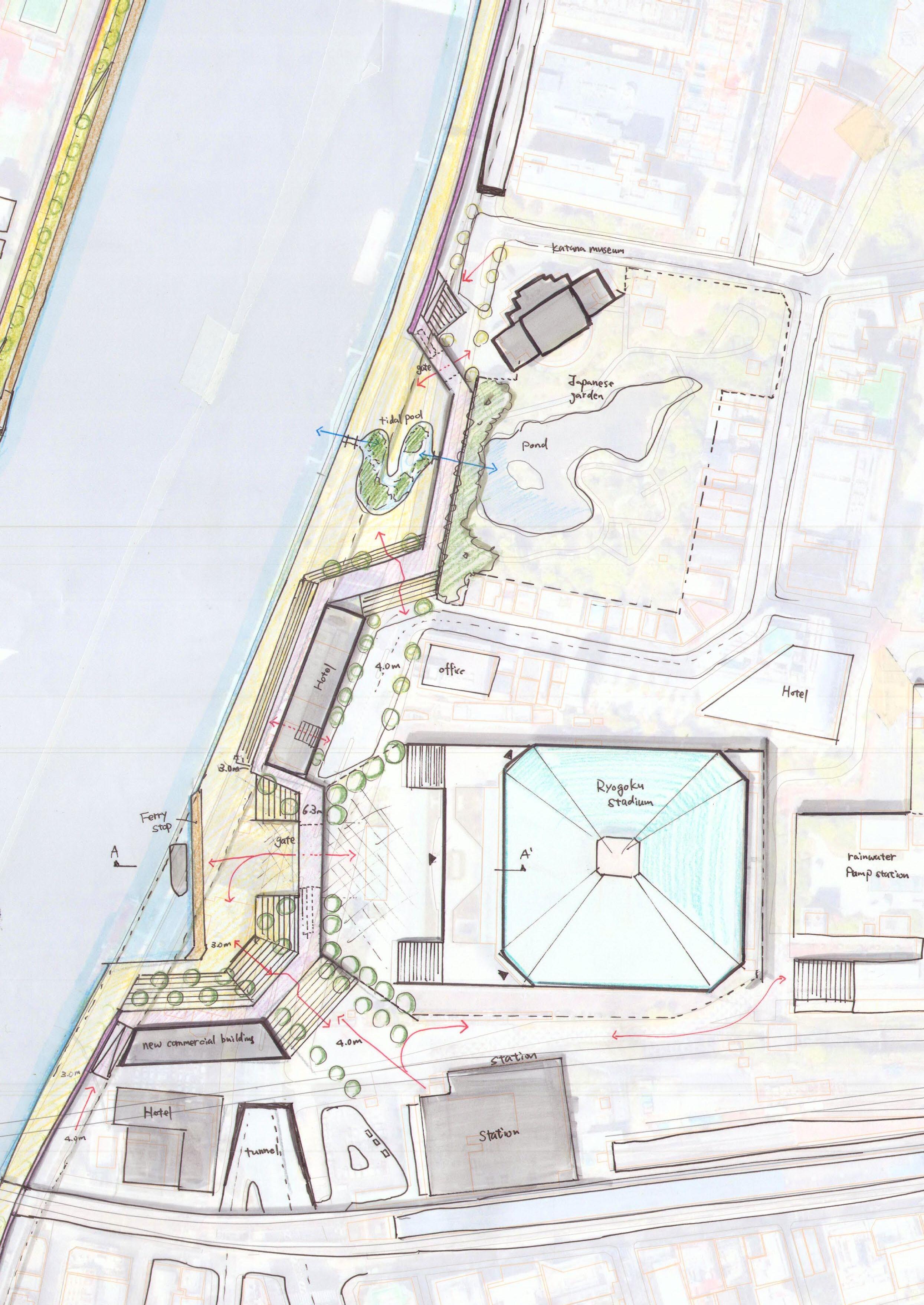
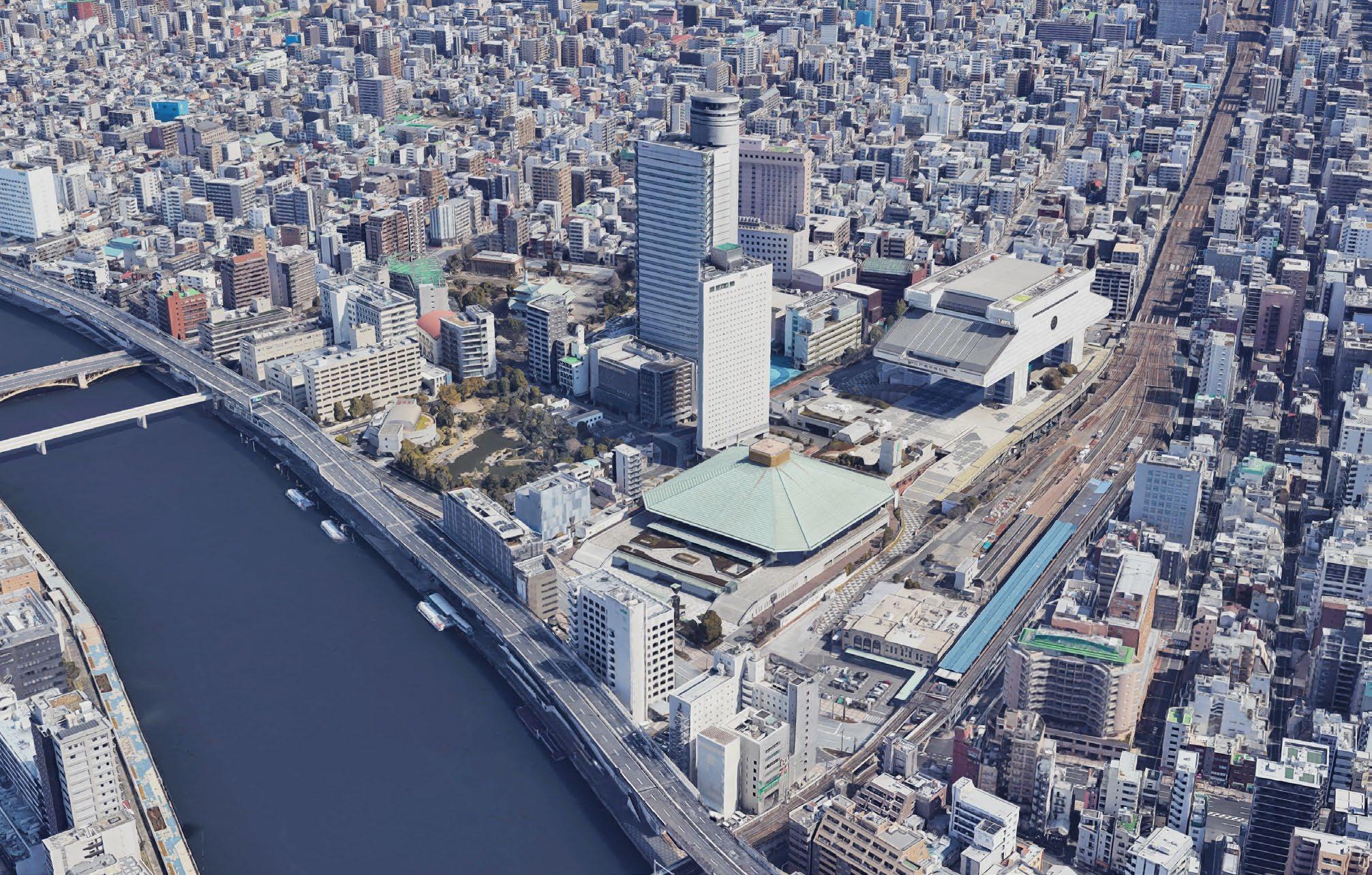
Case study 2: Ryogoku area
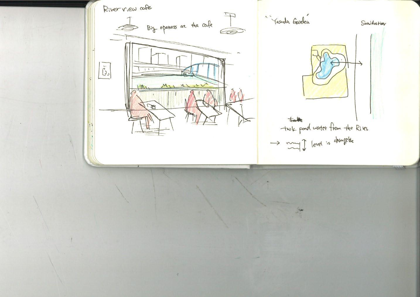
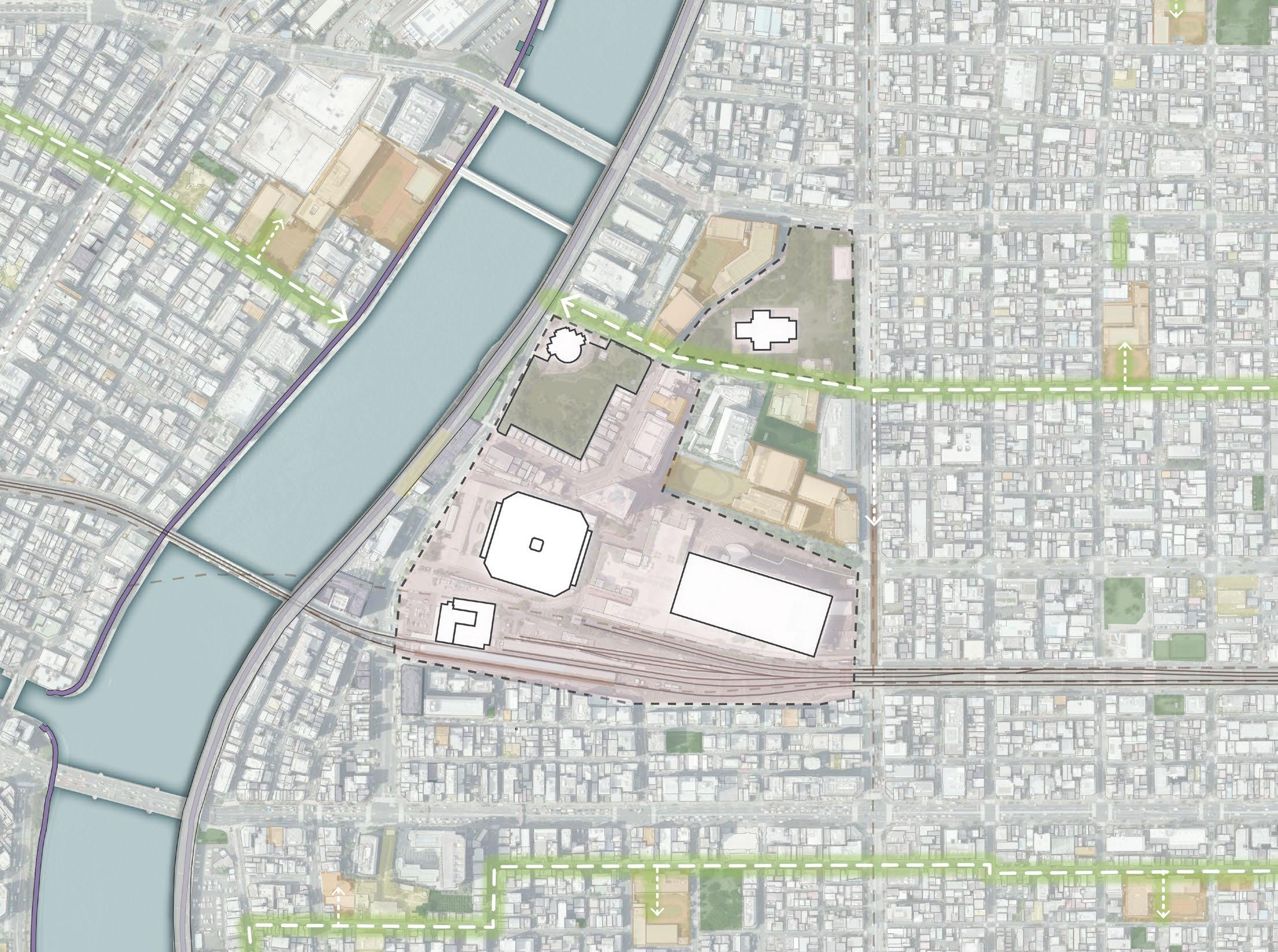
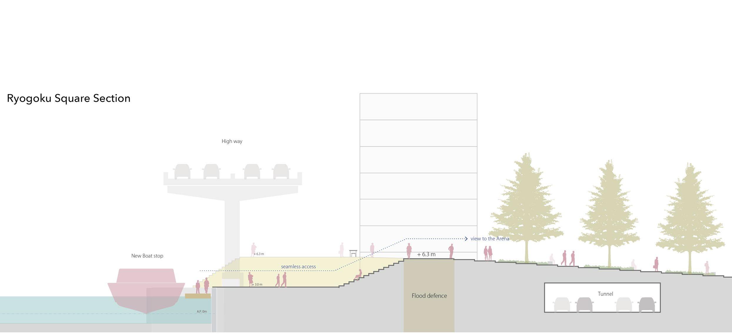
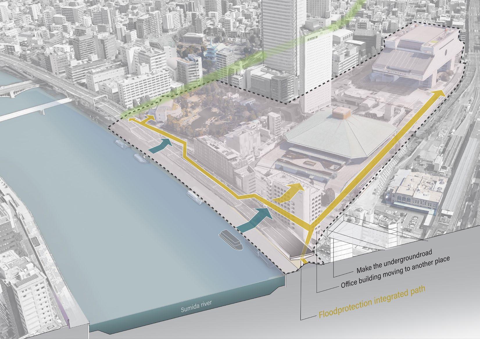
Approach: expanding the river space as bridging to each facility
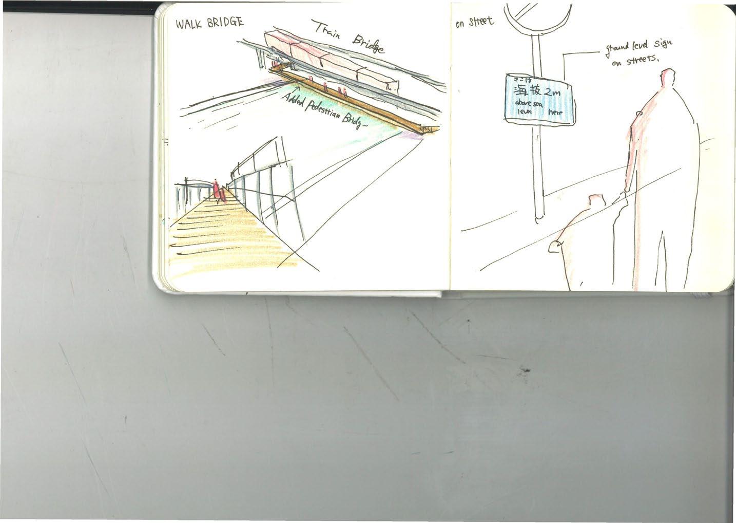
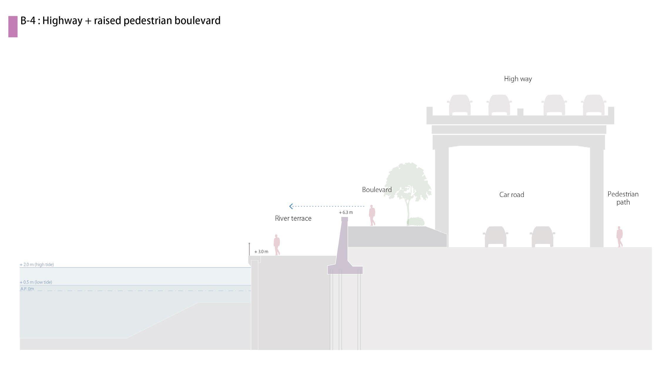
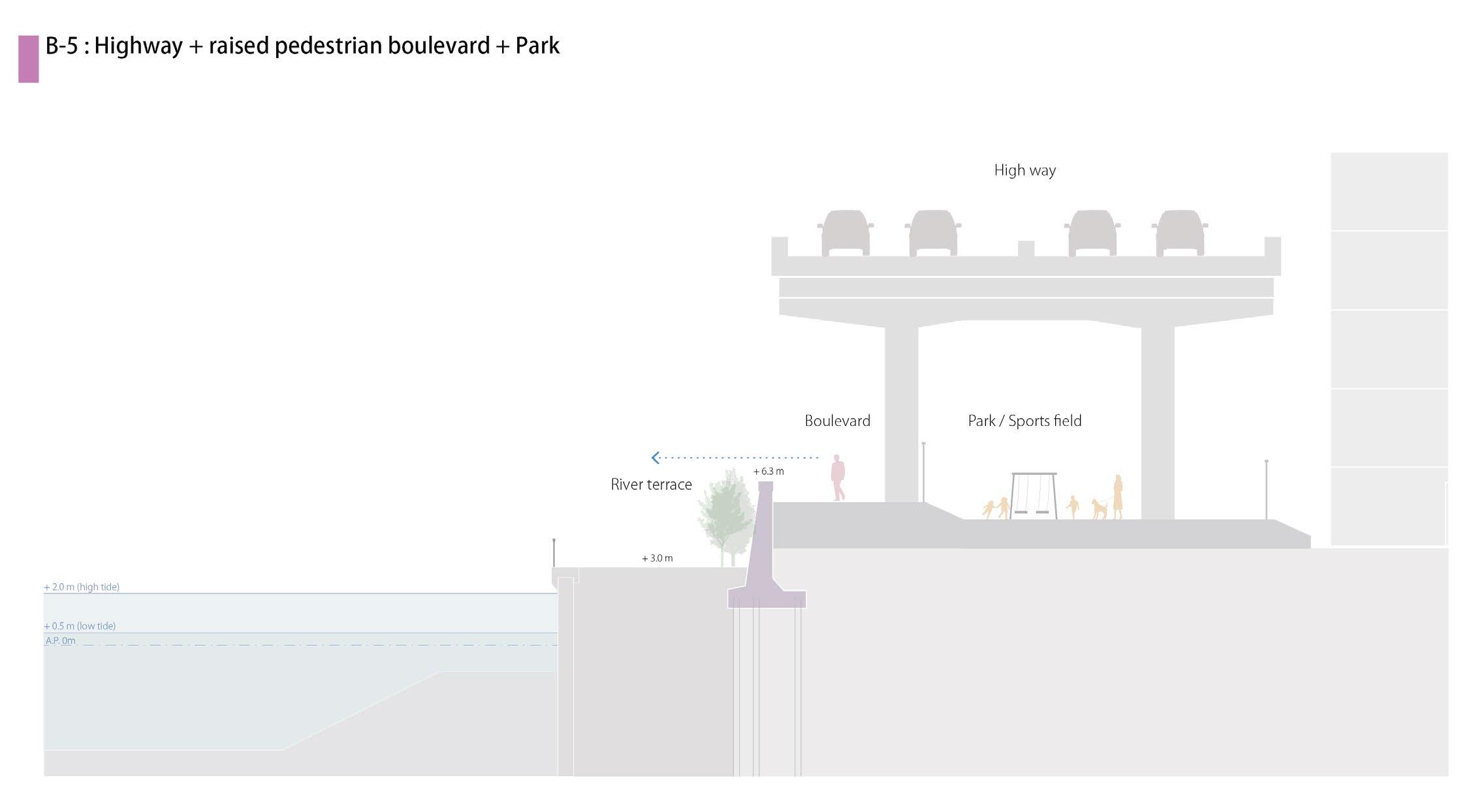
The Ryogoku area is Tokyo’s cultural district, with museums and cultural facilities. Surrounding the Ryogoku area, the Museum of History Tokyo, Yasuda Japanese Garden, and the WW2 Memorial Hall are located. In particular, the Ryogoku sumo arena is the site of official sumo matches, a traditional Japanese sport, and is visited by sumo fans from all over the country. However, this area is also poorly connected to the river. Not only the concrete flood walls but also the elevated Metropolitan Highway, the 2-lane road, and the parking lot create barriers between the riverside and this area. It is hard to access the Sumida River or even see the river from this area.
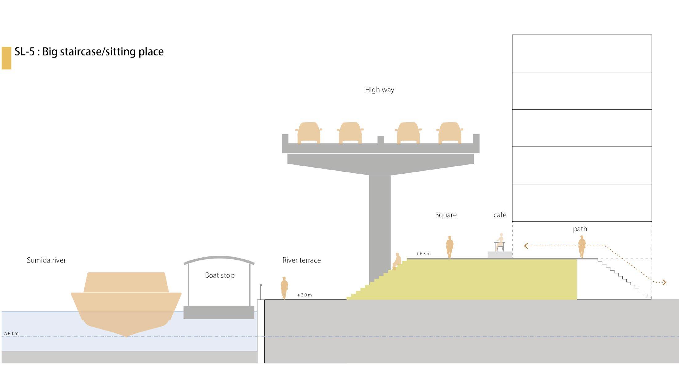
In this design, the 2-lane road is partially underground, and the above-ground space is designed as a walking space integrated with flood protection that allows easy access from the river to the major facilities. 6.8m high flood protection point is extended inland, and its gentle staircase or slope connects towards the facilities’ entrance.
119
view 1
View 2
 Current situation: Major places disconnected by infra and buildings from the river
 Approach : Connecting major places by flood protection path
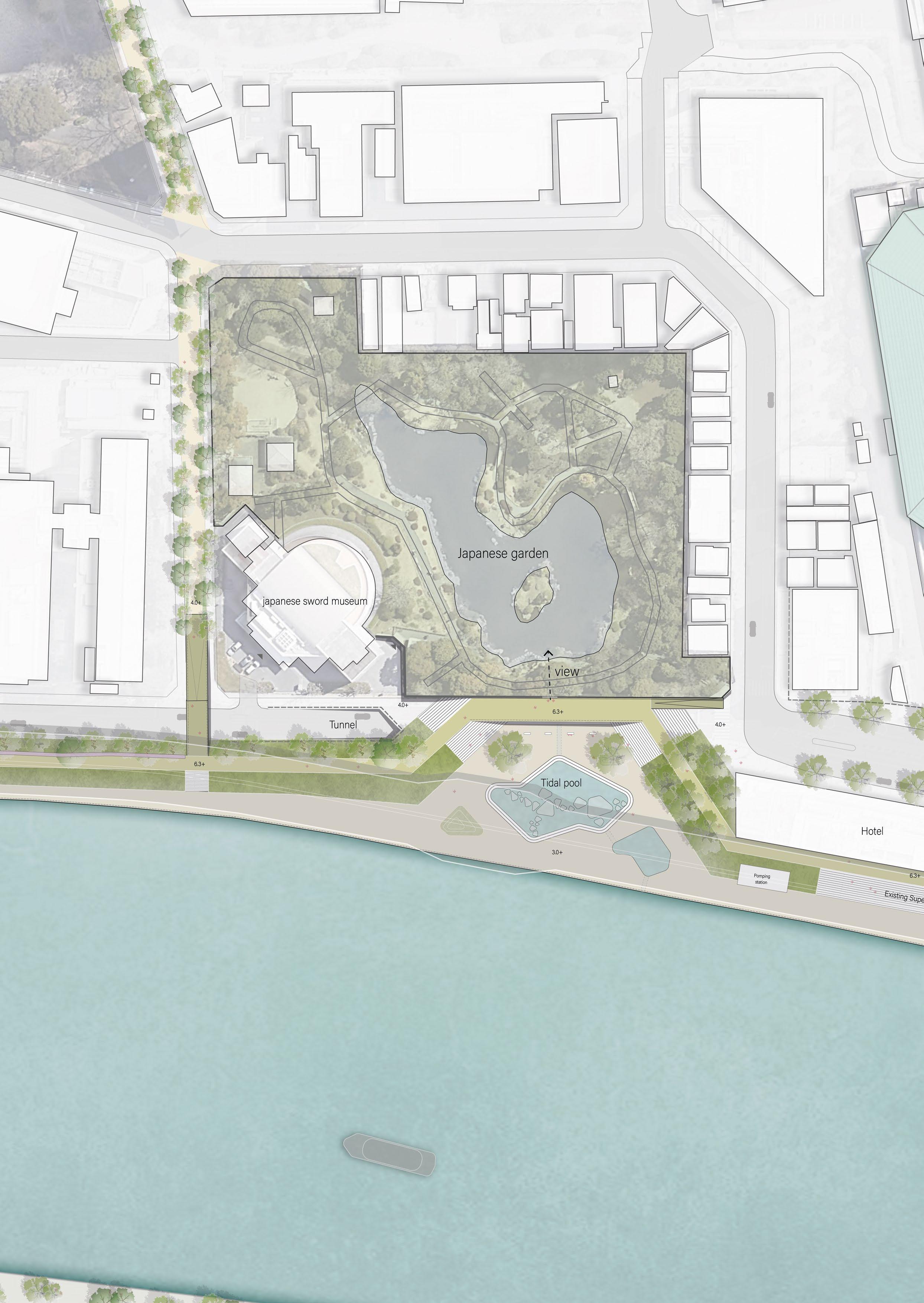
Plan : Ryogoku square
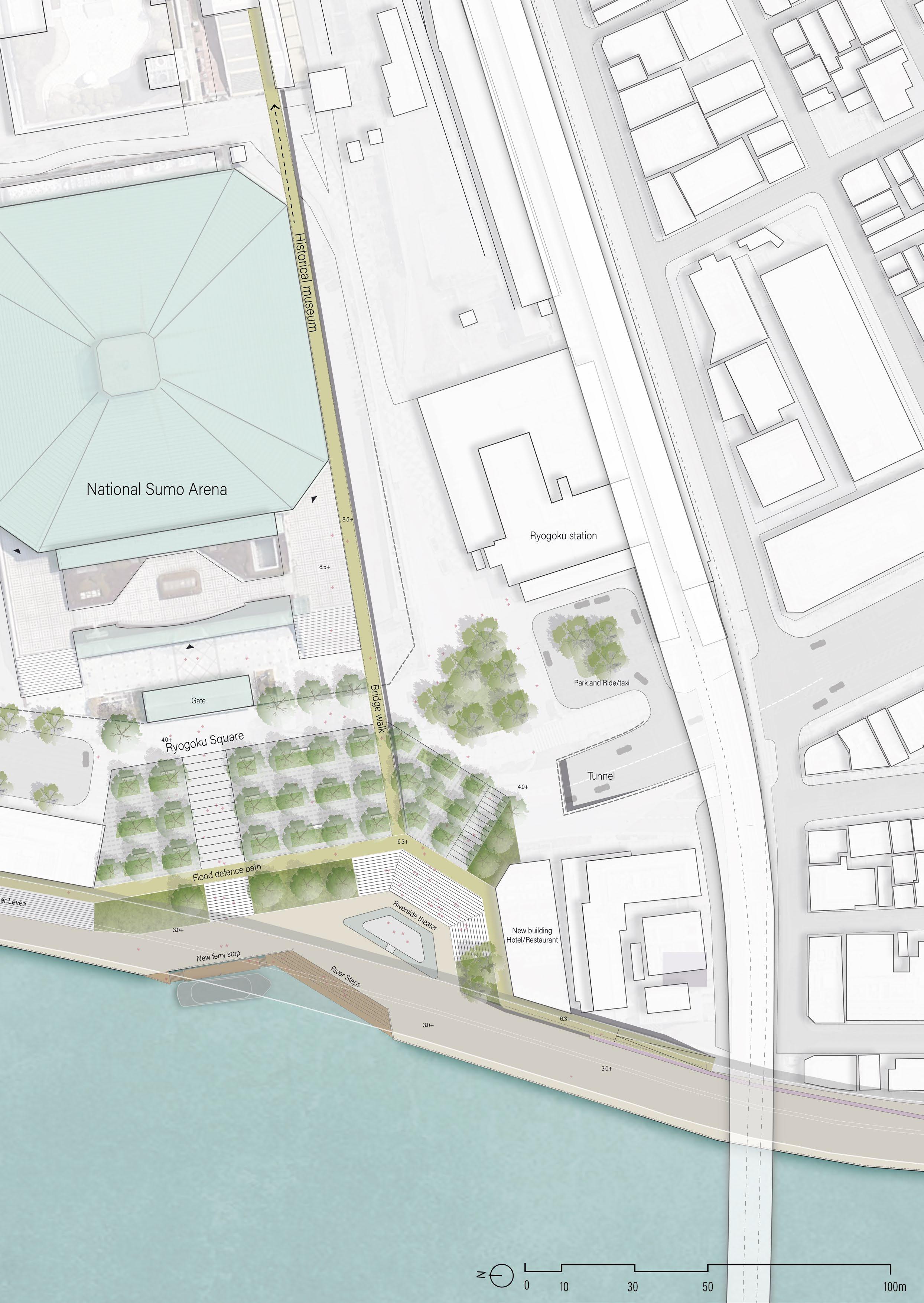
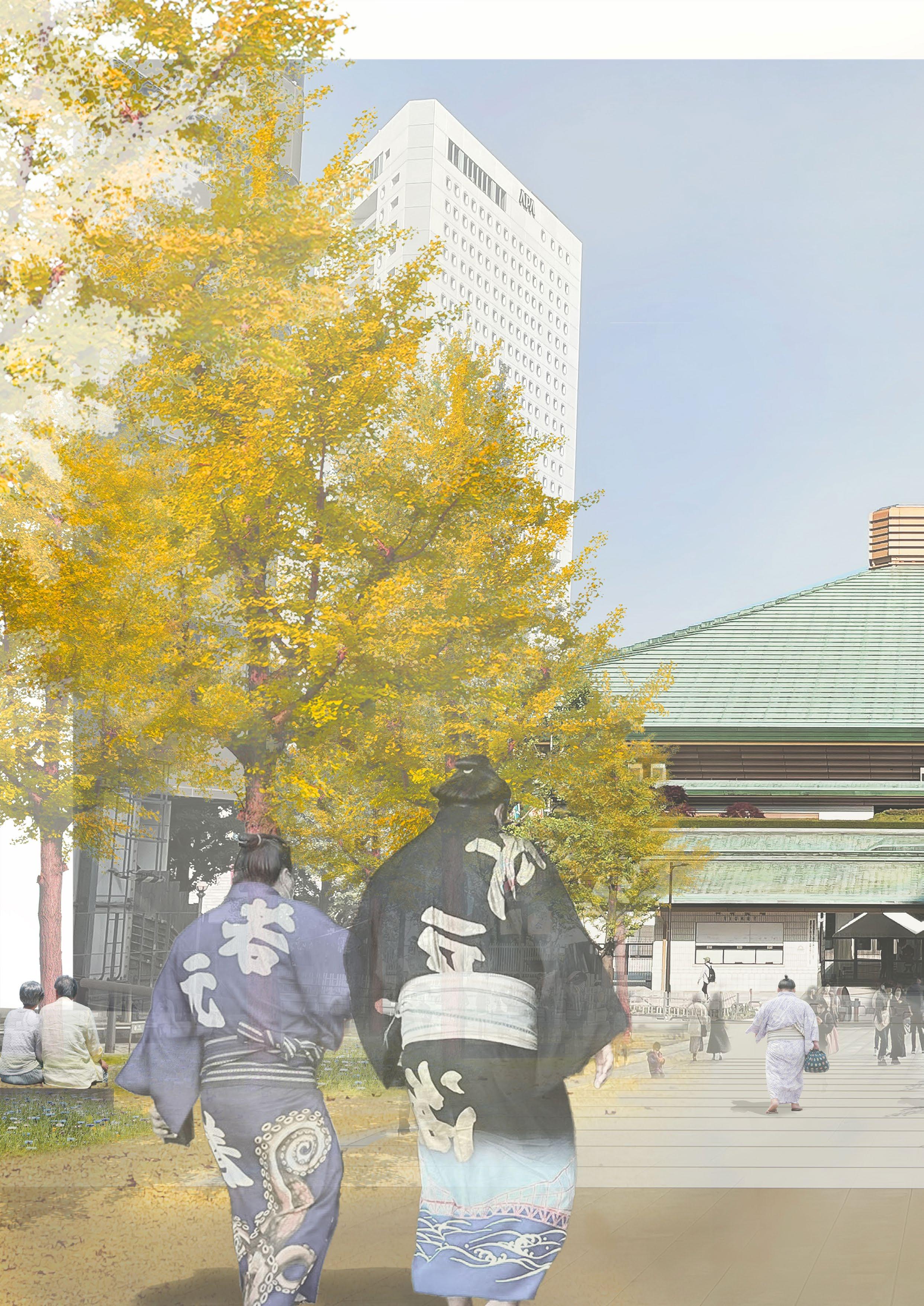
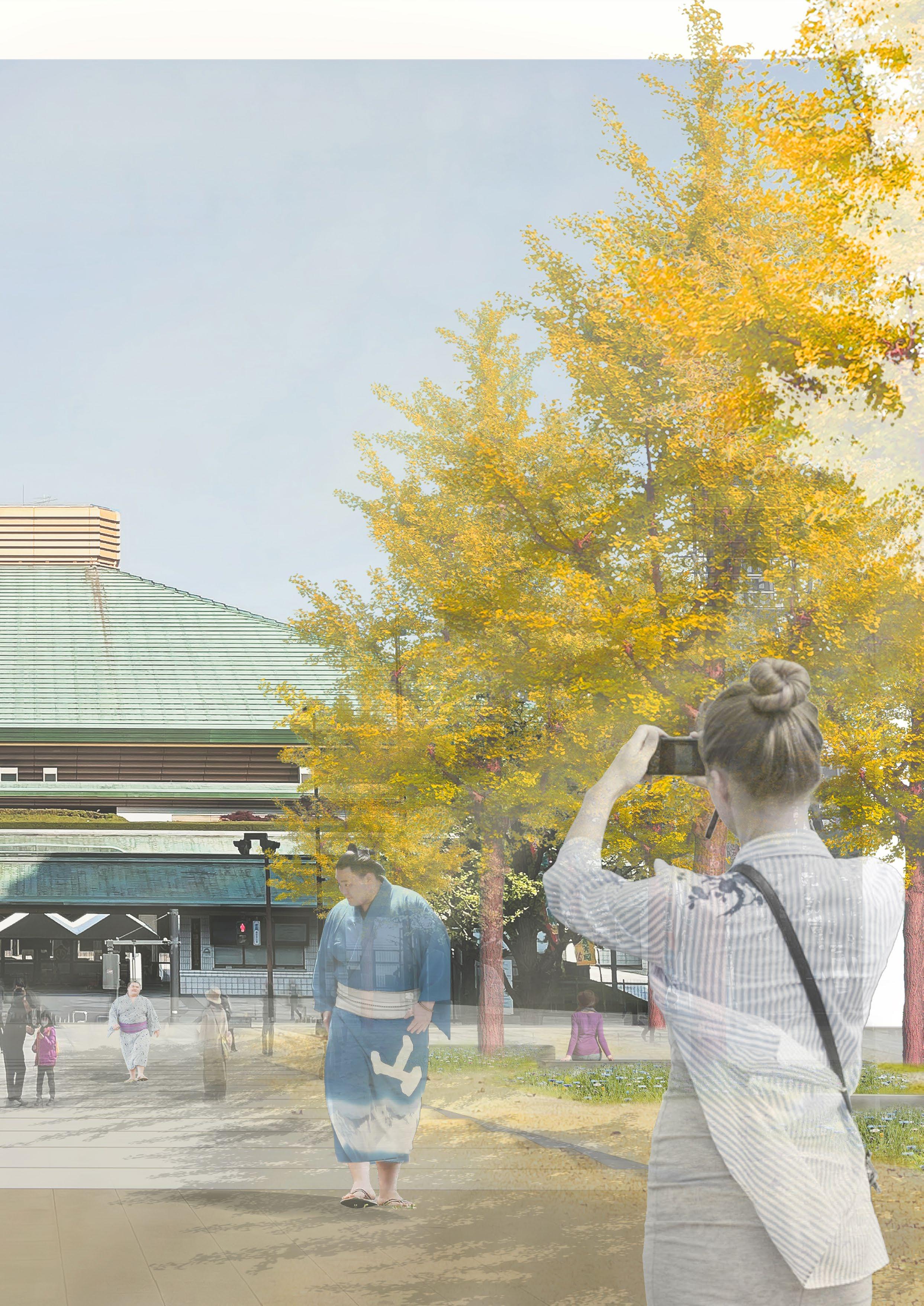
Direct access from the river side to the Ryogoku arena
126
Goal 3 - Designing new river spaces
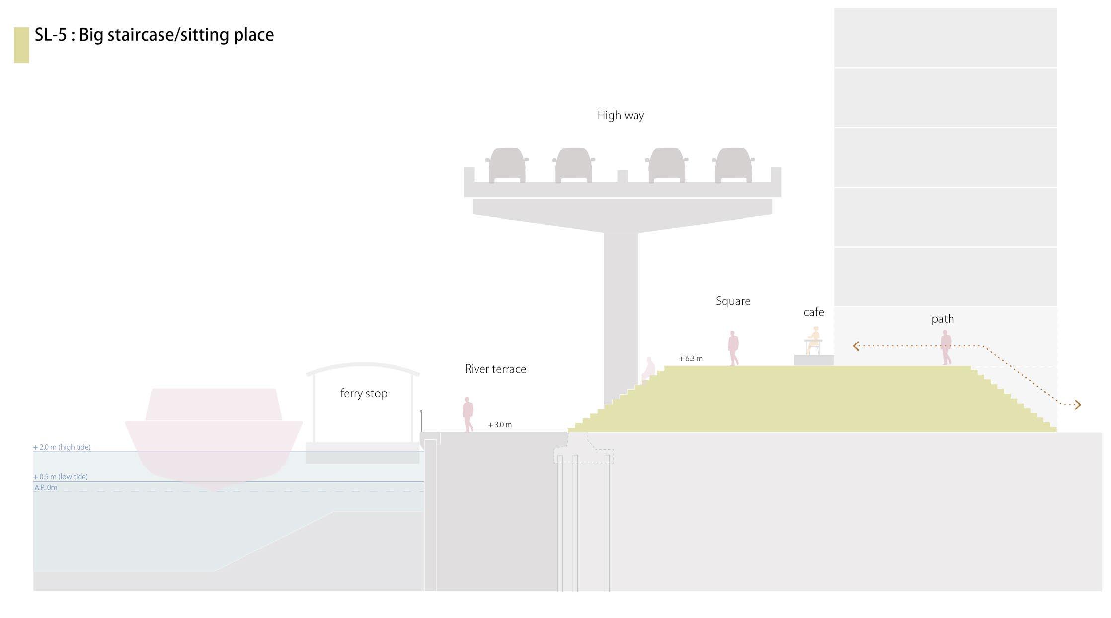
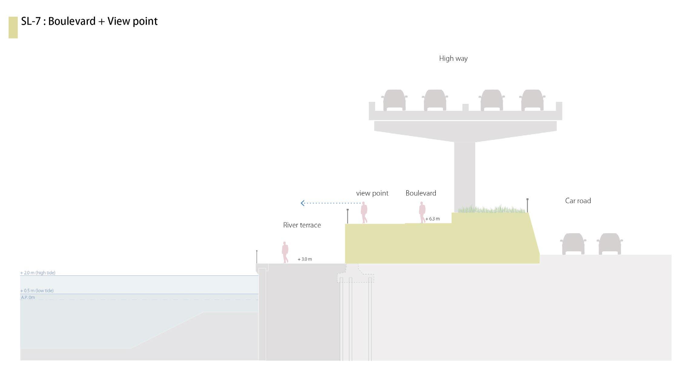
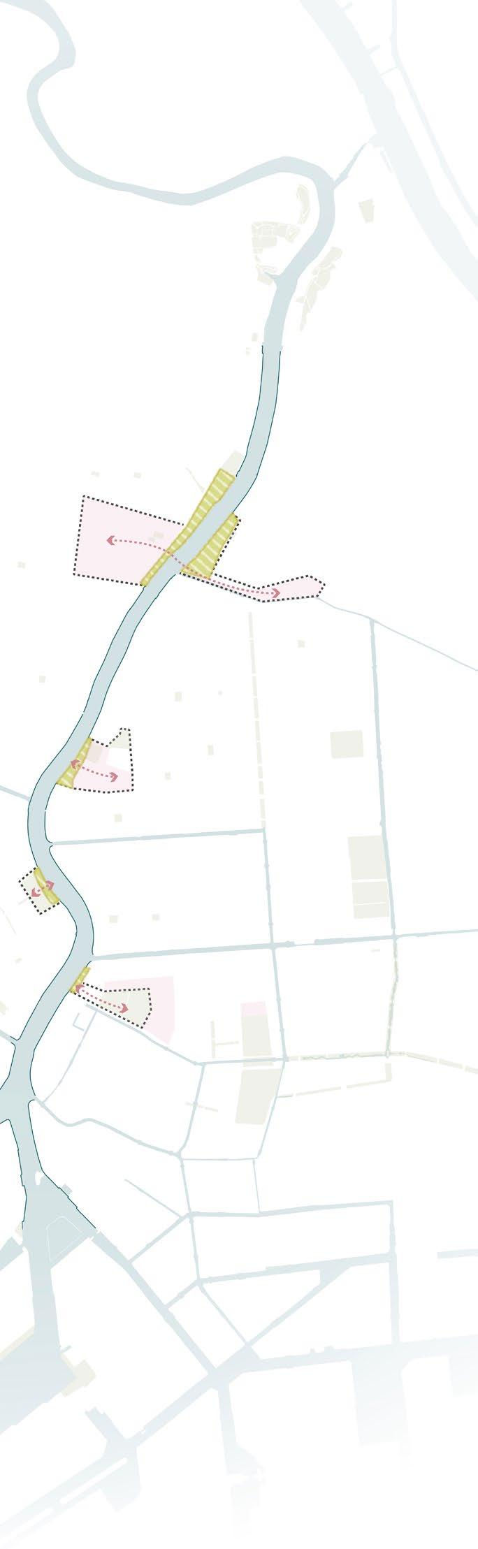
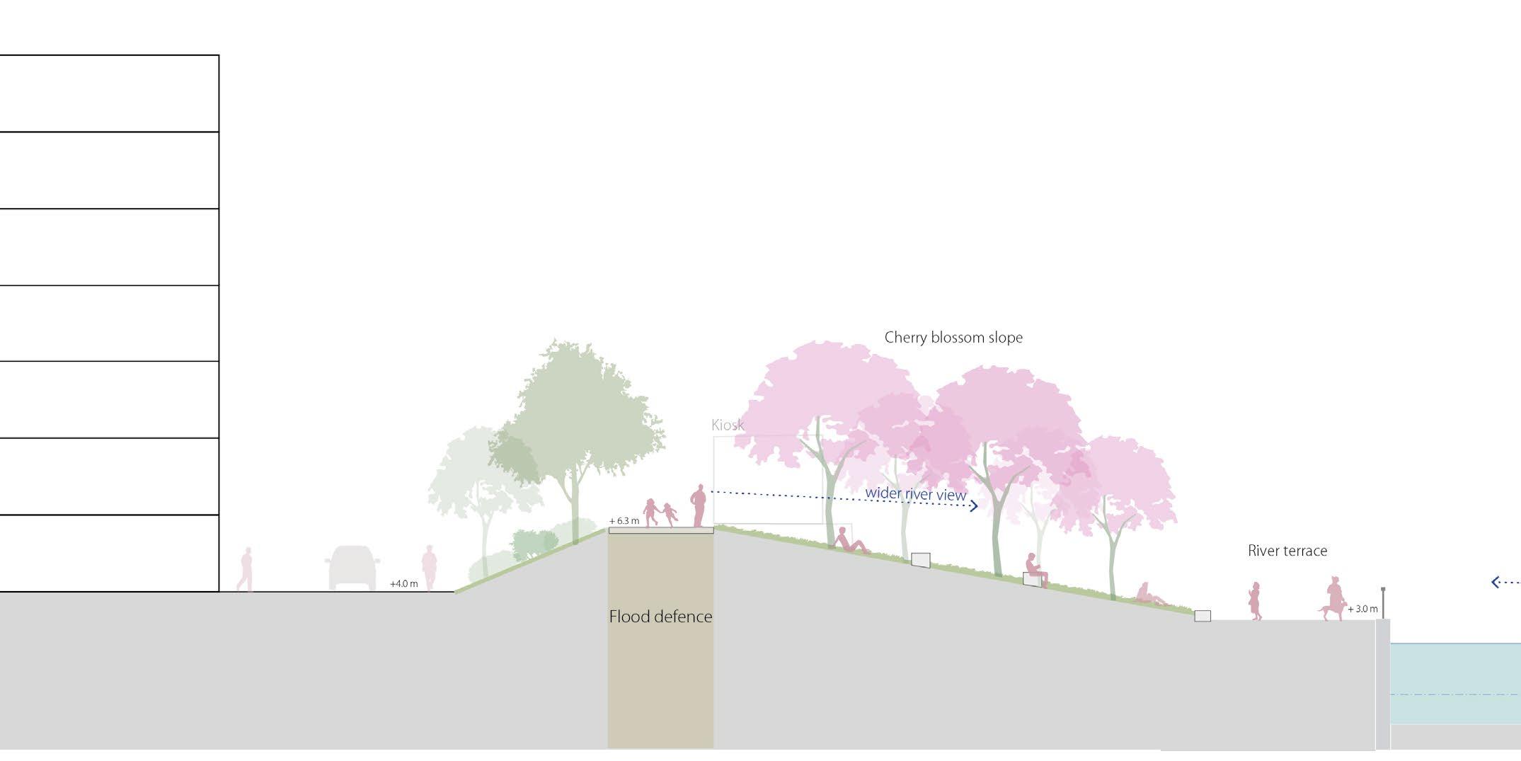
Approach: Developing the flood wall profile, revitalising the river as the city’s public space
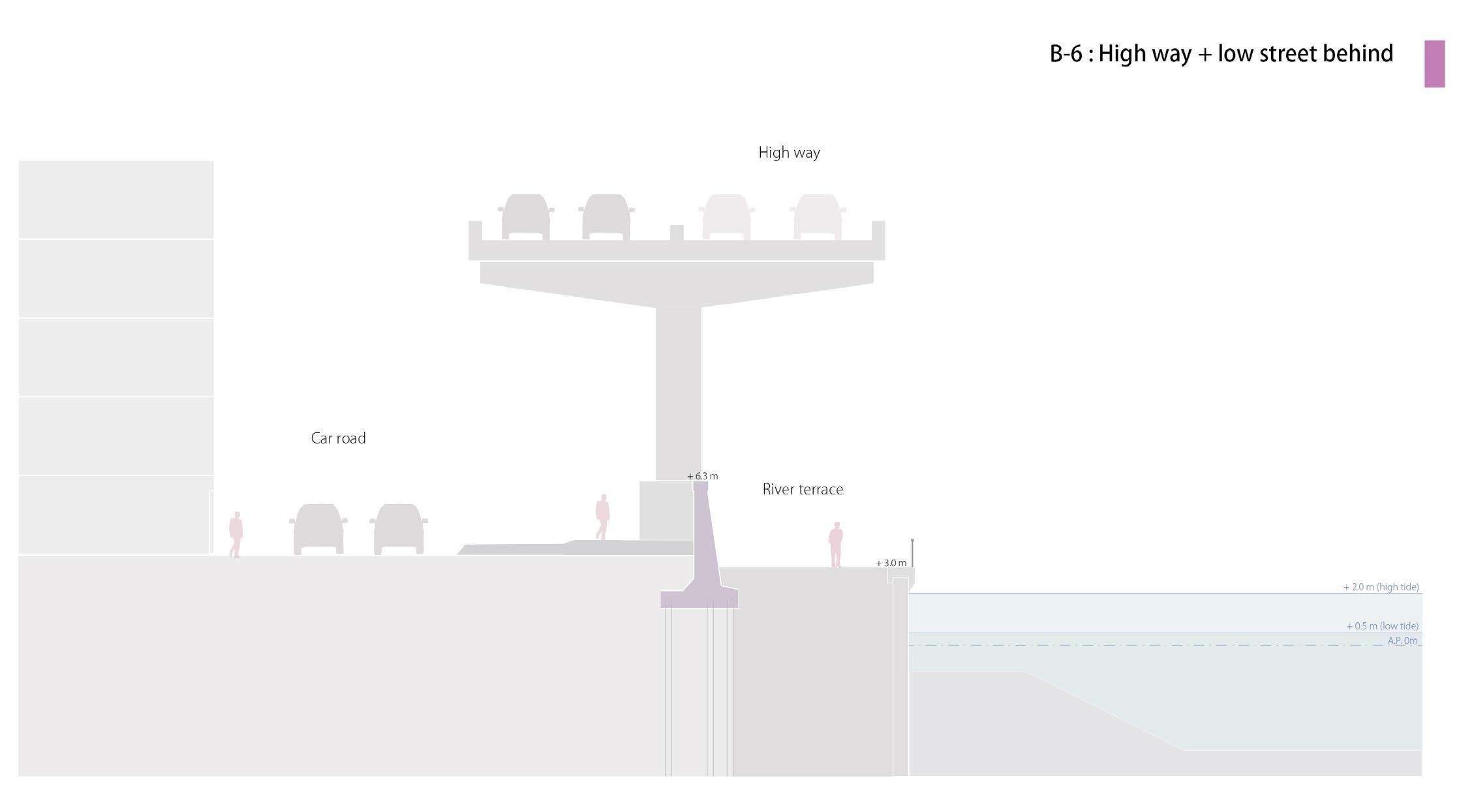
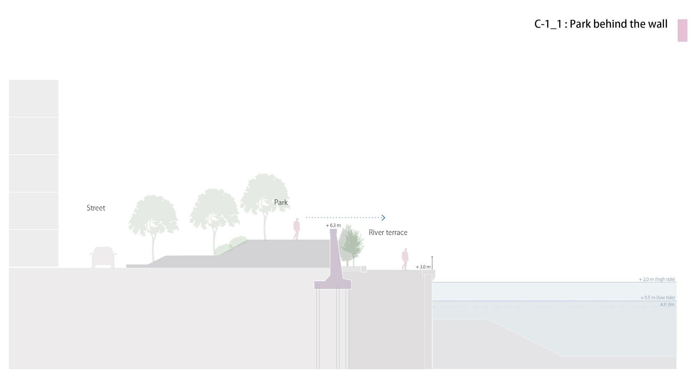
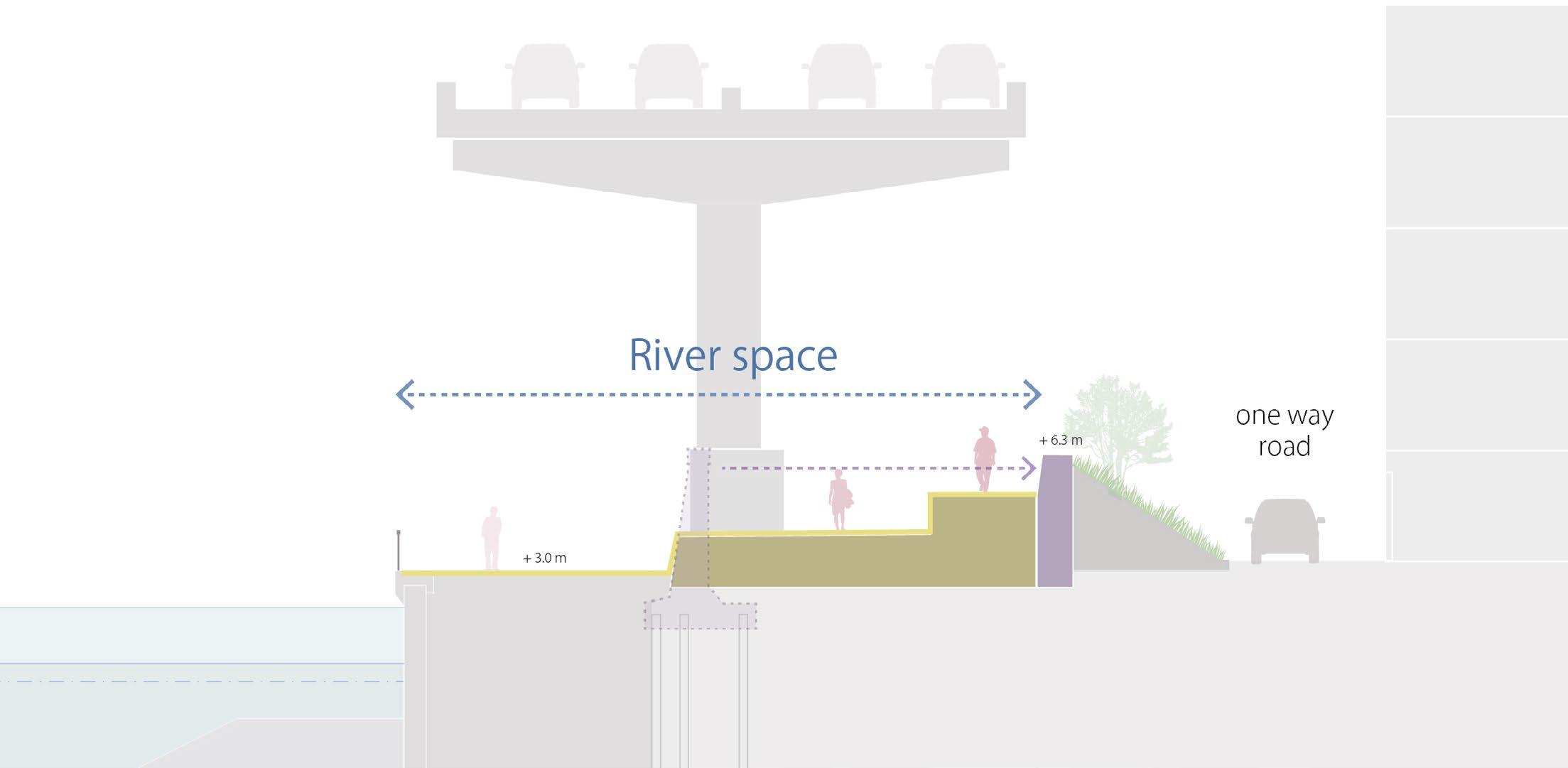
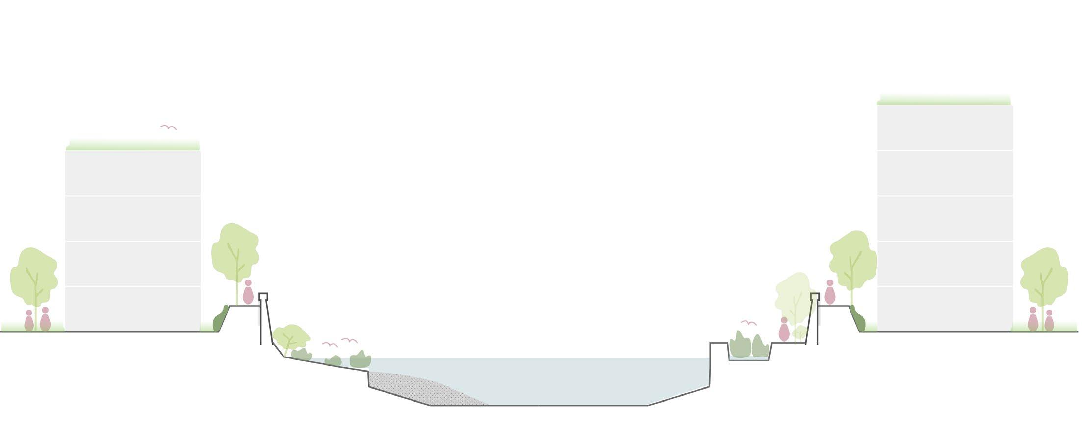
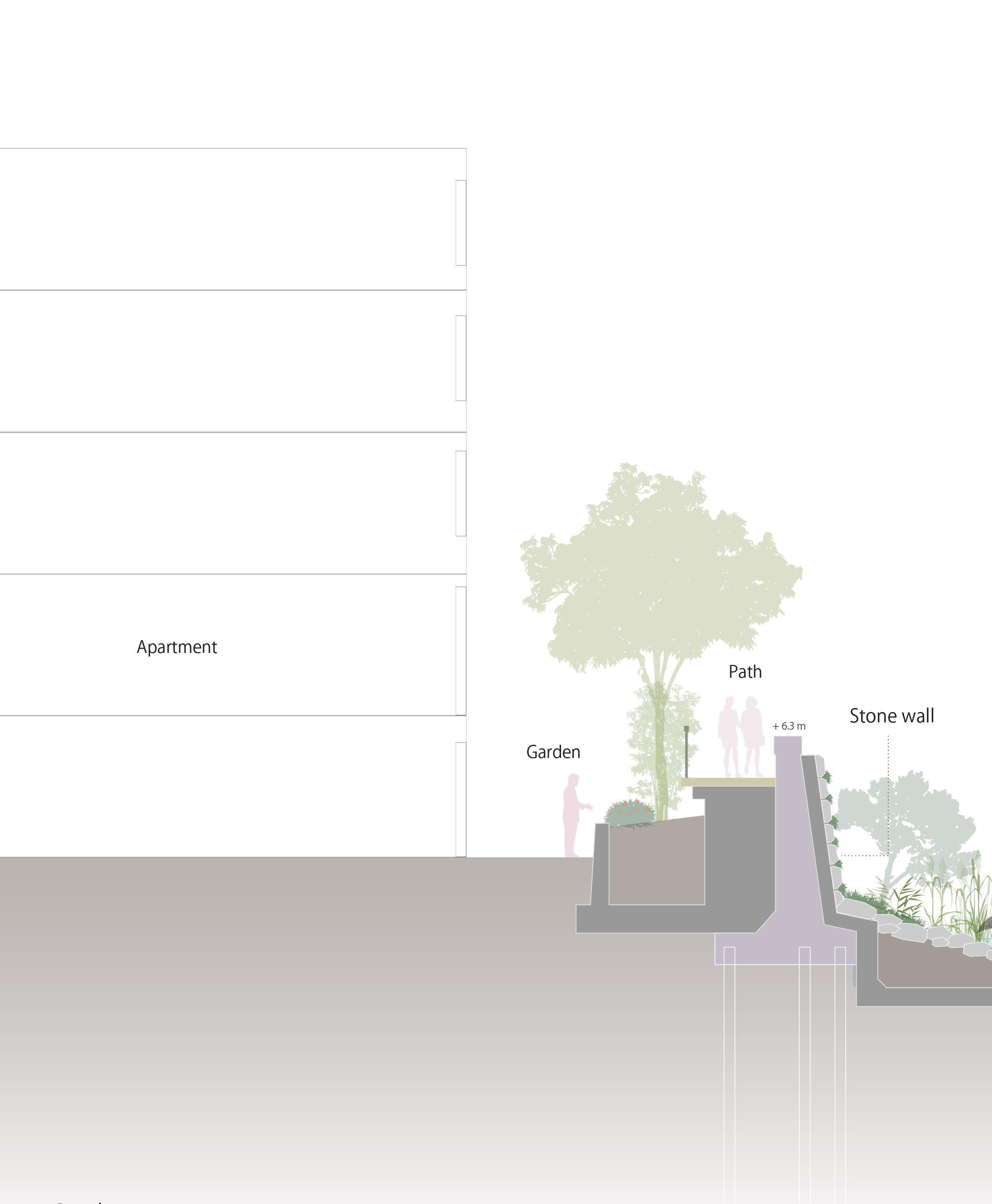
In Goal 3, the aim is to redesign current monotonous river spaces into new characterised river spaces. Currently, these spaces lack distinctive features or variation across different locations. This results in a lack of design coherence and a disconnect from the surrounding buildings or contexts.
Therefore, Goal 3 involves reinforcing ageing flood walls and incorporating new interventions as space for humans and nature. Also, the design will create a continuous walking space on both the front and back sides of the floodwall so that the entire Sumida River will be a continuous axis of public space where people can walk and stay without interruption. The design is based on integrating the characteristics of the surrounding context and the Sumida River landscape character, forming three major identities.
127
The danger of flood wall breach
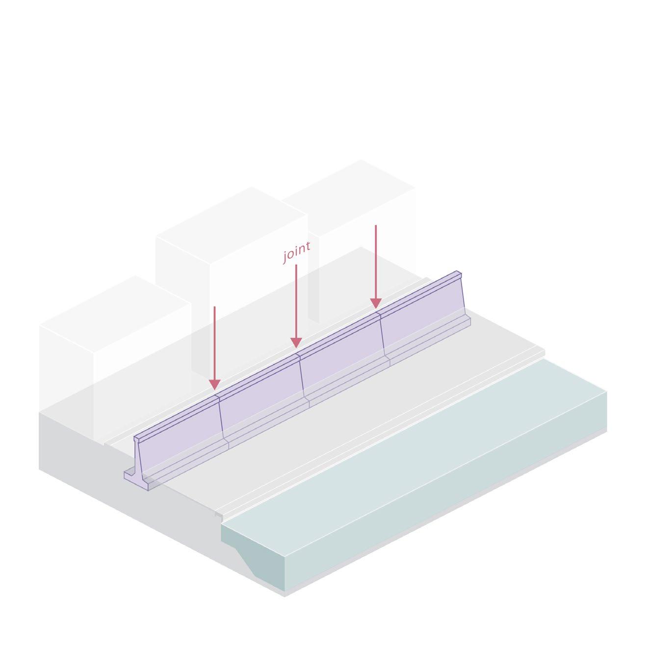
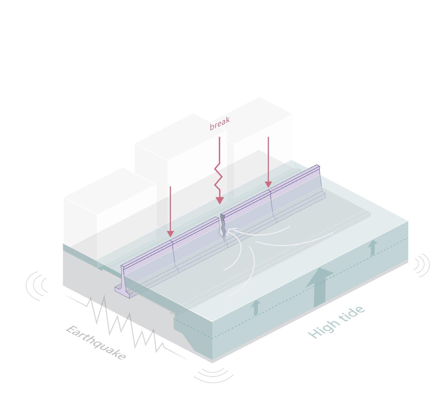
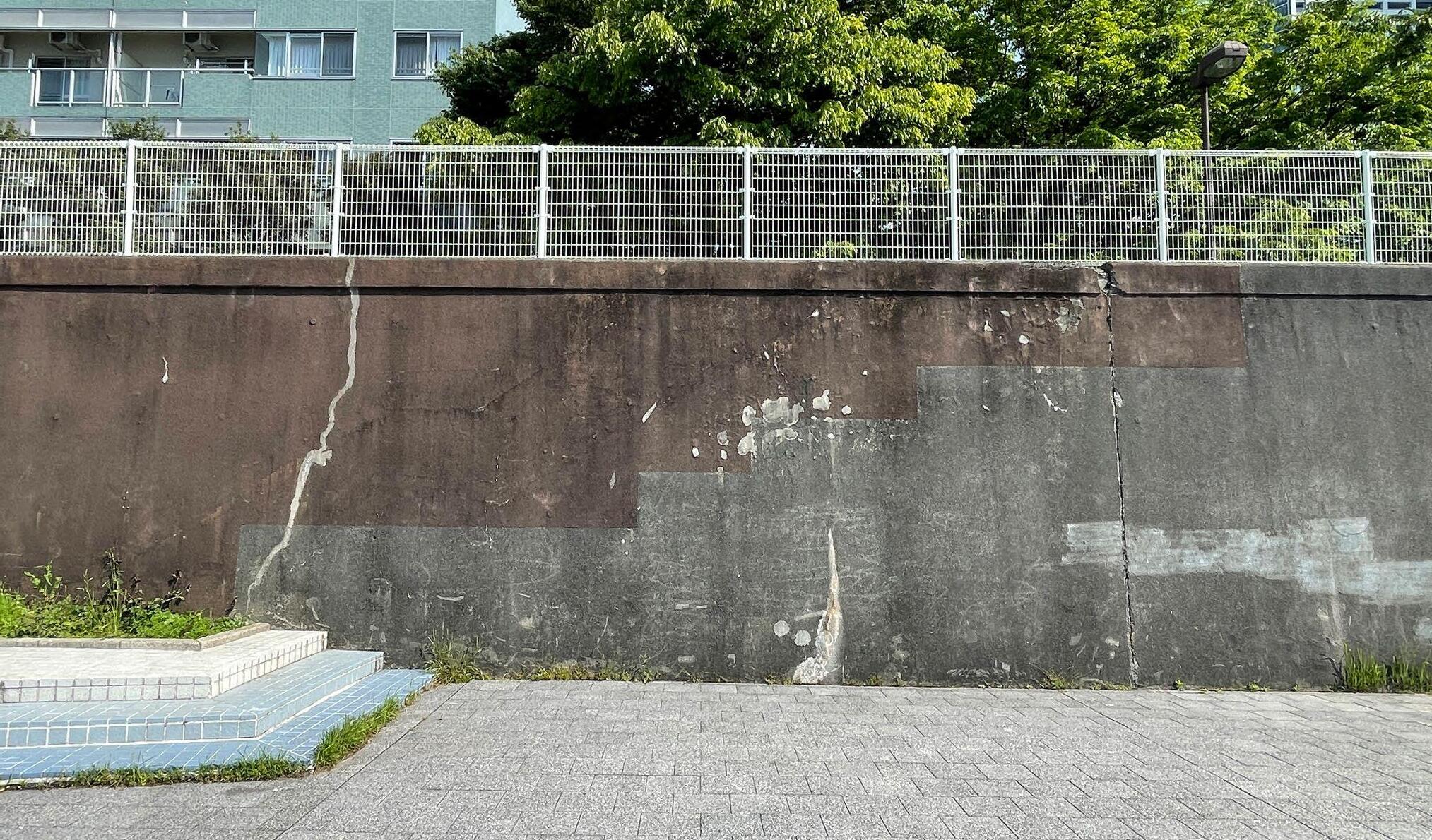
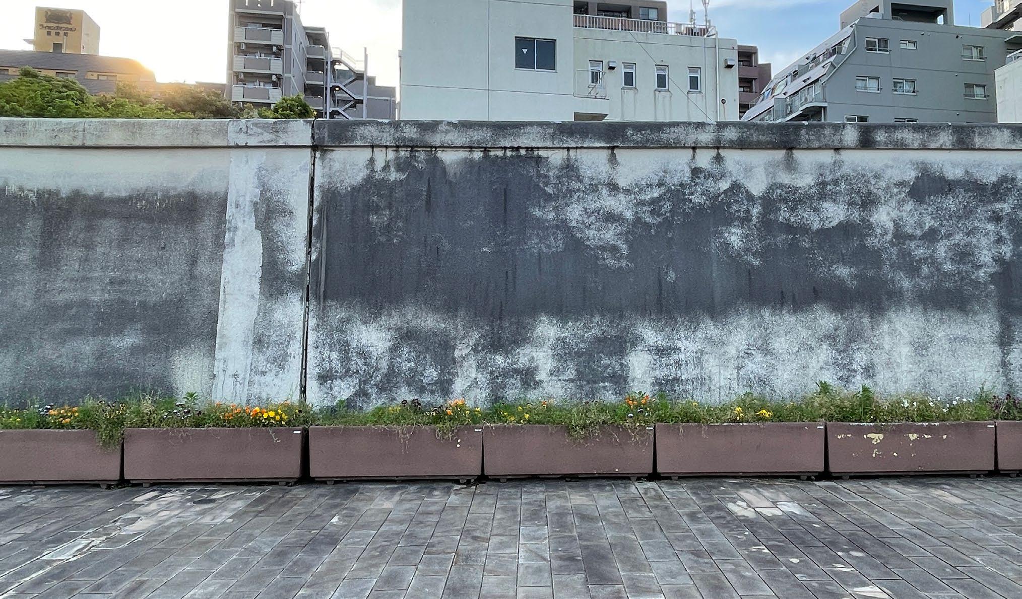
The floodwall consists of several concrete partitions connected to form a long, continuous wall. Most of these walls were built in the 1960s and are ageing.
When I had an interview with the flood protection expert in Tokyo, he explained to me that this wall would be in danger of breaking at the joints part when flooding and earthquakes occur at the same time. When I visited the flood wall, I found that the rubber at the joints was deteriorating and did not appear to be well maintained.
128
 joint part
129
joint part
The reinforcement at the connecting joints is not well-maintained
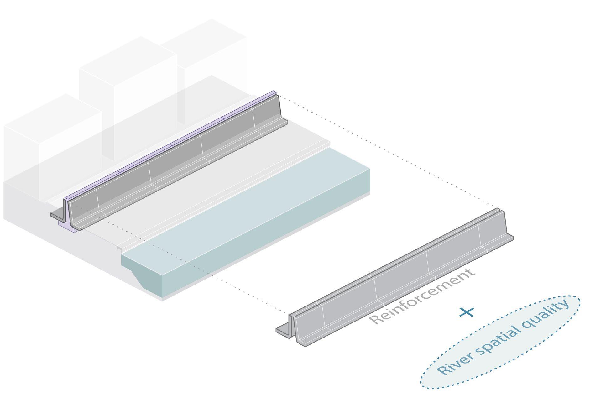
Reinforcement with Spatial Quality
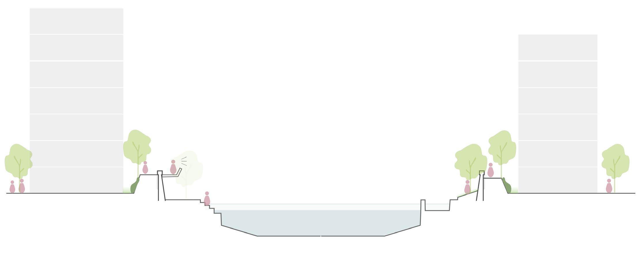
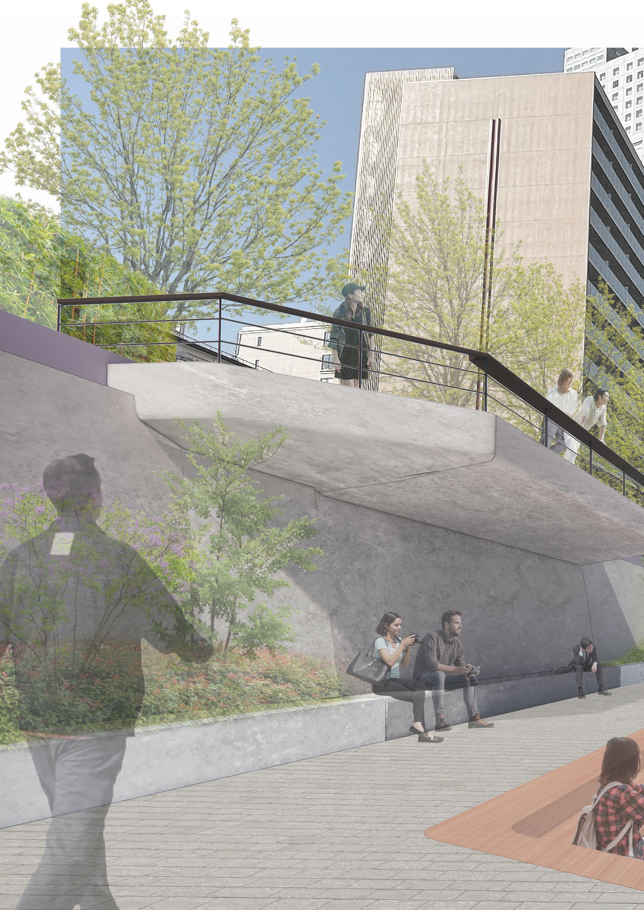
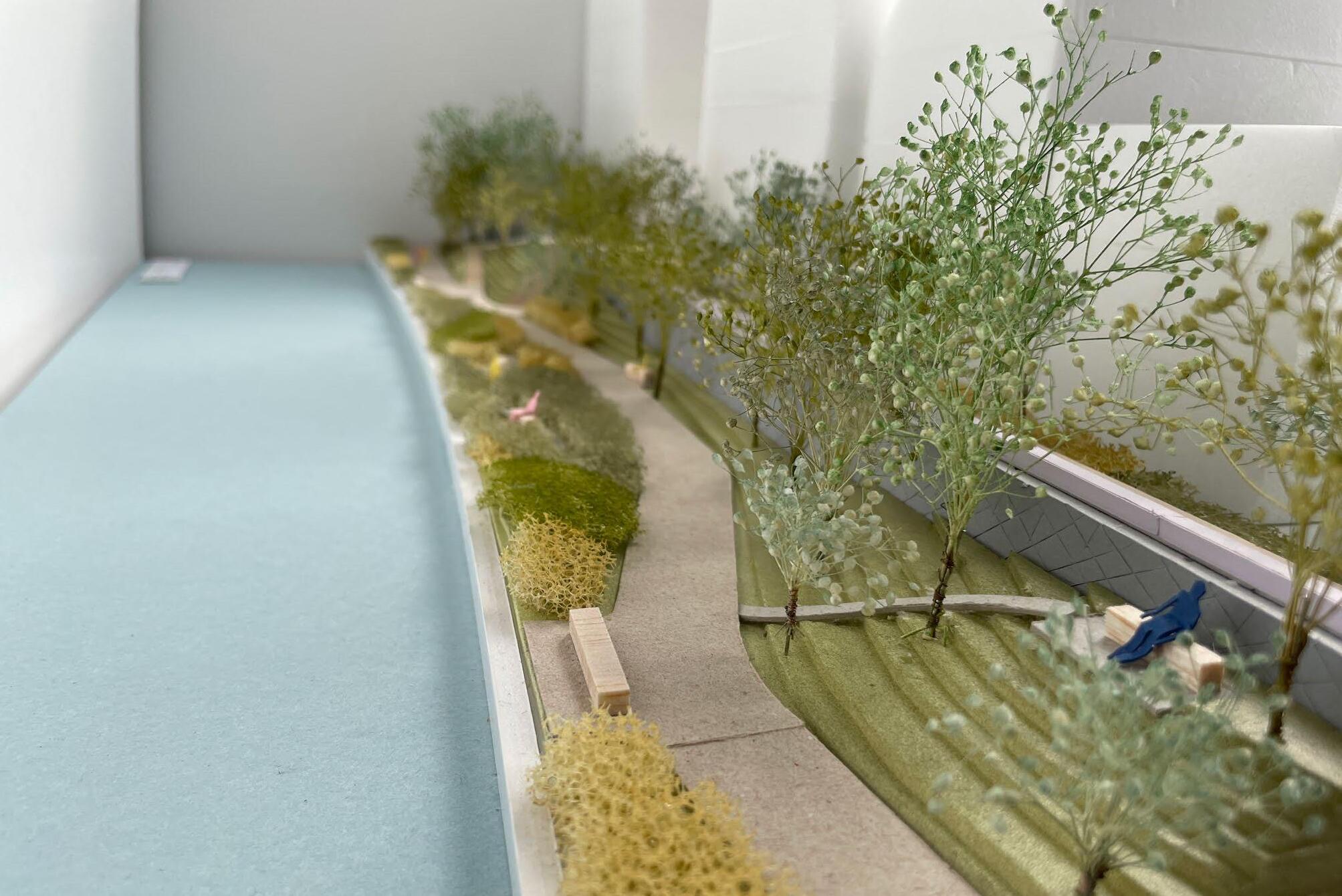
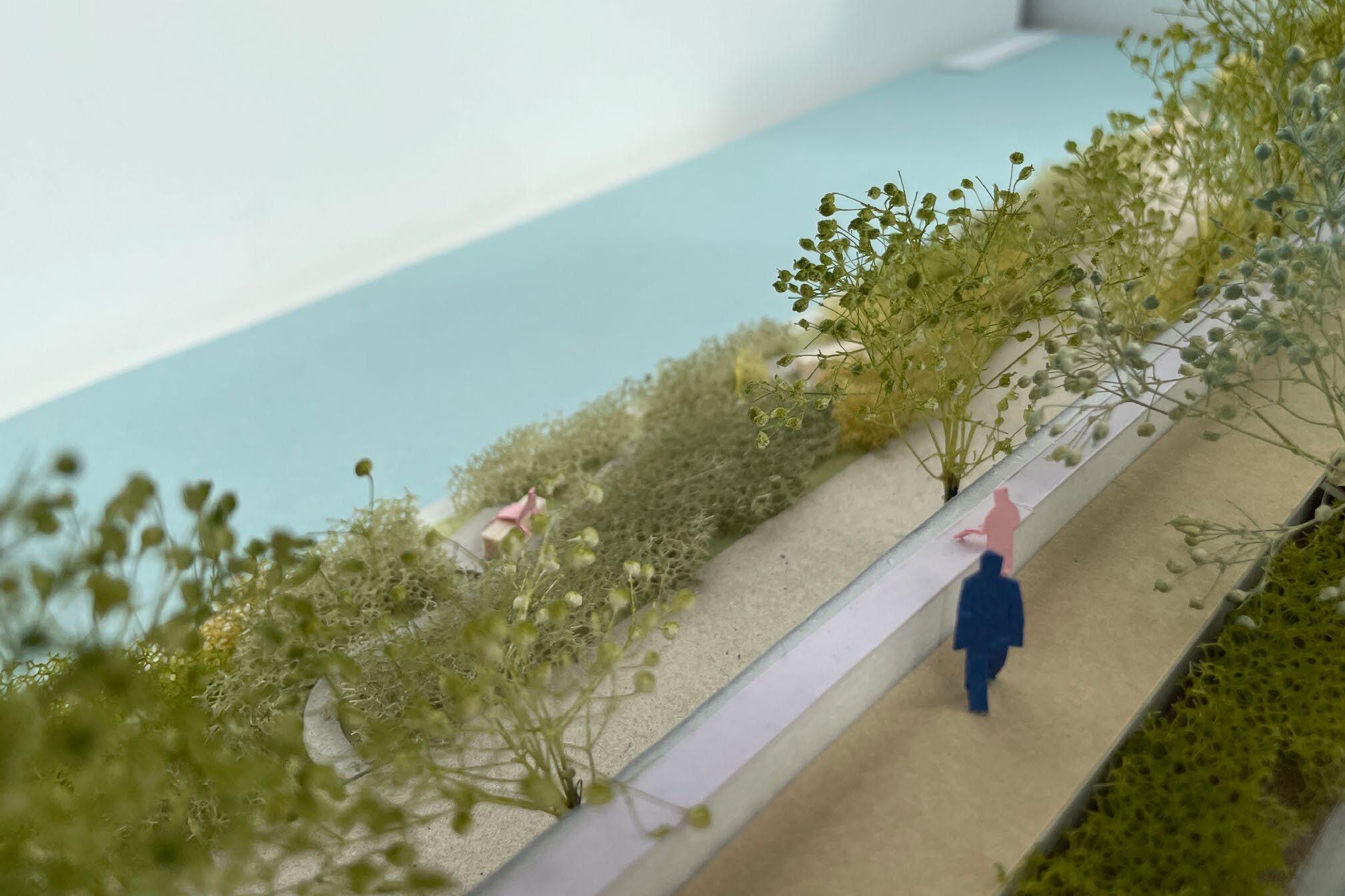
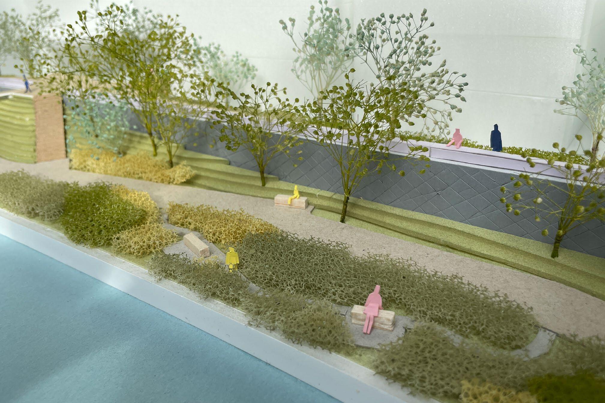
As a design method, I propose a reinforcement design to cover this fragile joint part from the front and back. The new space will be designed to allow people, animals, and plants to intervene and improve not only the strength of the floodwall but also the spatial quality of the river space.
The base design approach is creating pedestrian pathways behind the wall, allowing people to walk while overlooking the river. On the river side of the walls, new features such as lookout places, planting spaces, wetlands, and steps are introduced to create a new character for the riverfront space.
130
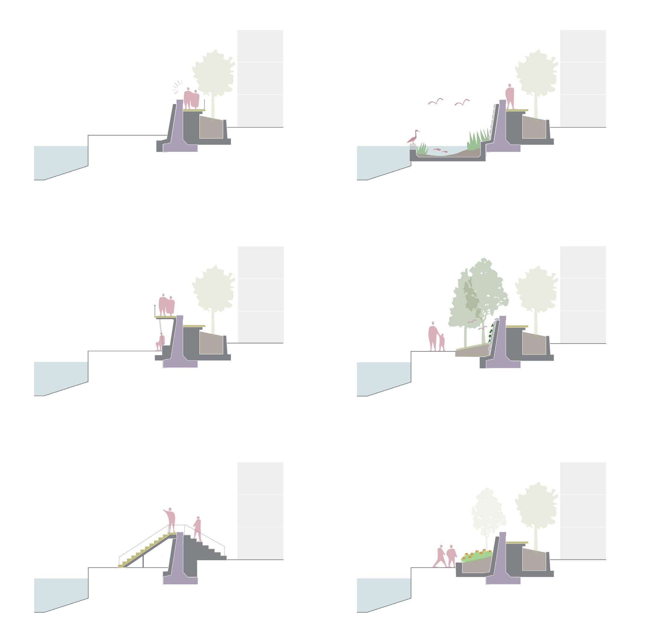
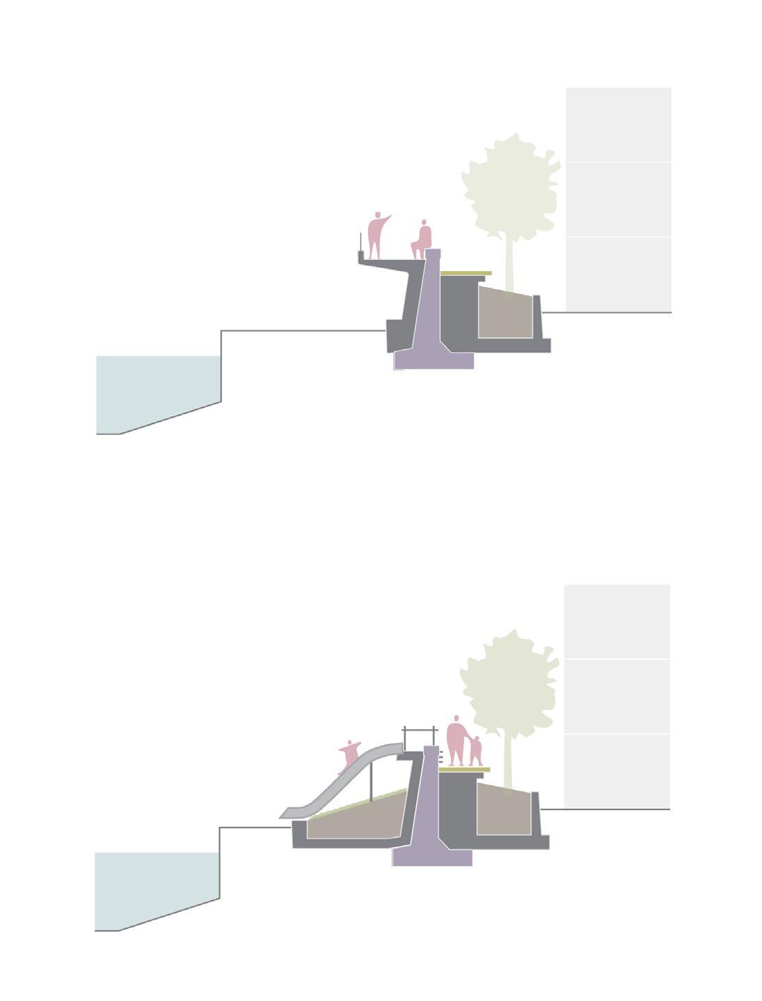
131
Lookout place
Playground
Theater
Wetland
Forest
Communal garden
Walking path
Walking bridge
132
Characteristics of areas around the river
133
Mix of apartment and small size office
High-rise office/apartments with business district
Tourist attractions with Japanese culture
Three different characters as the river space
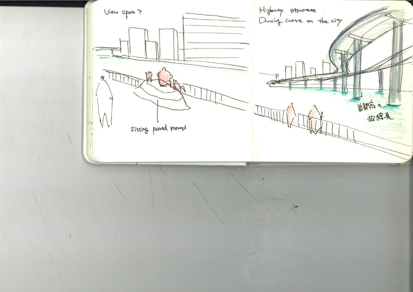
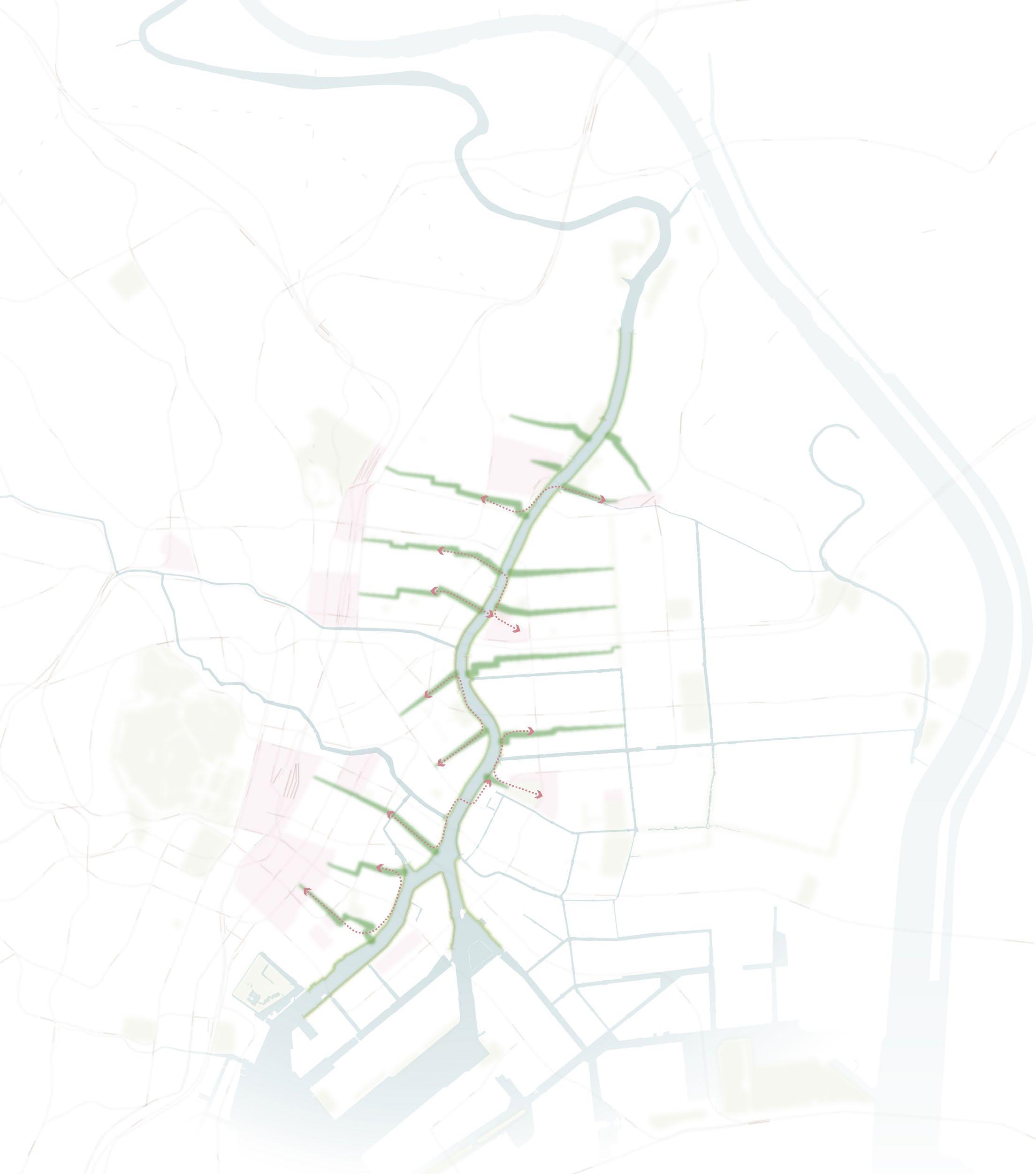
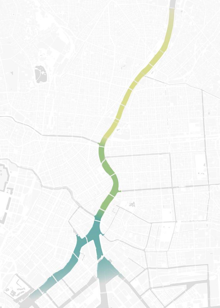
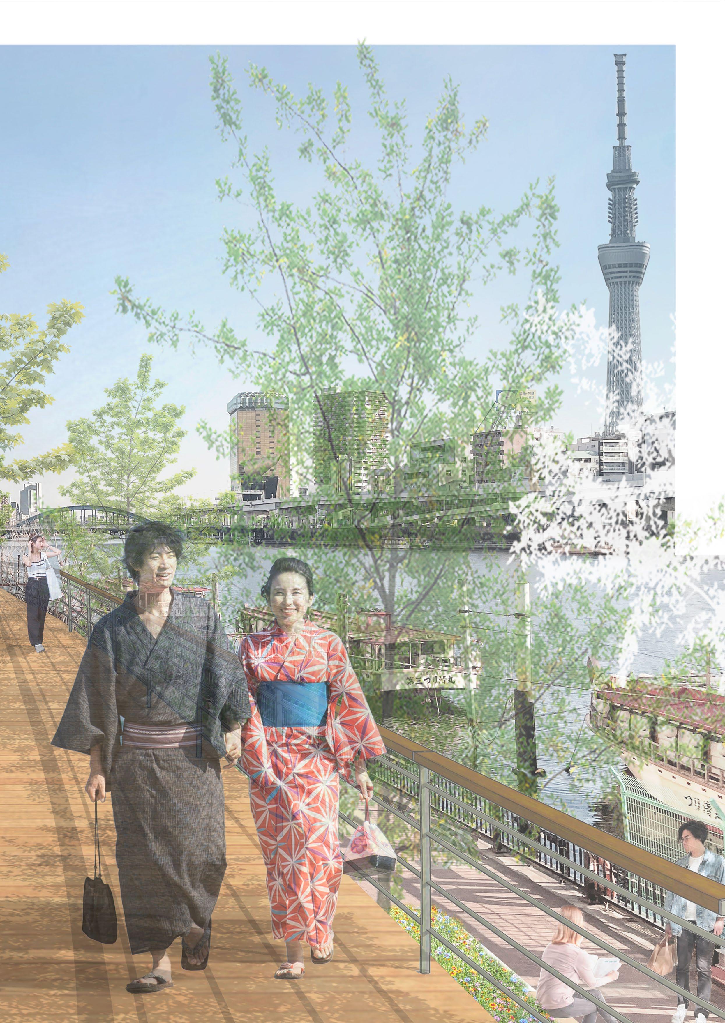
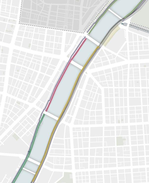
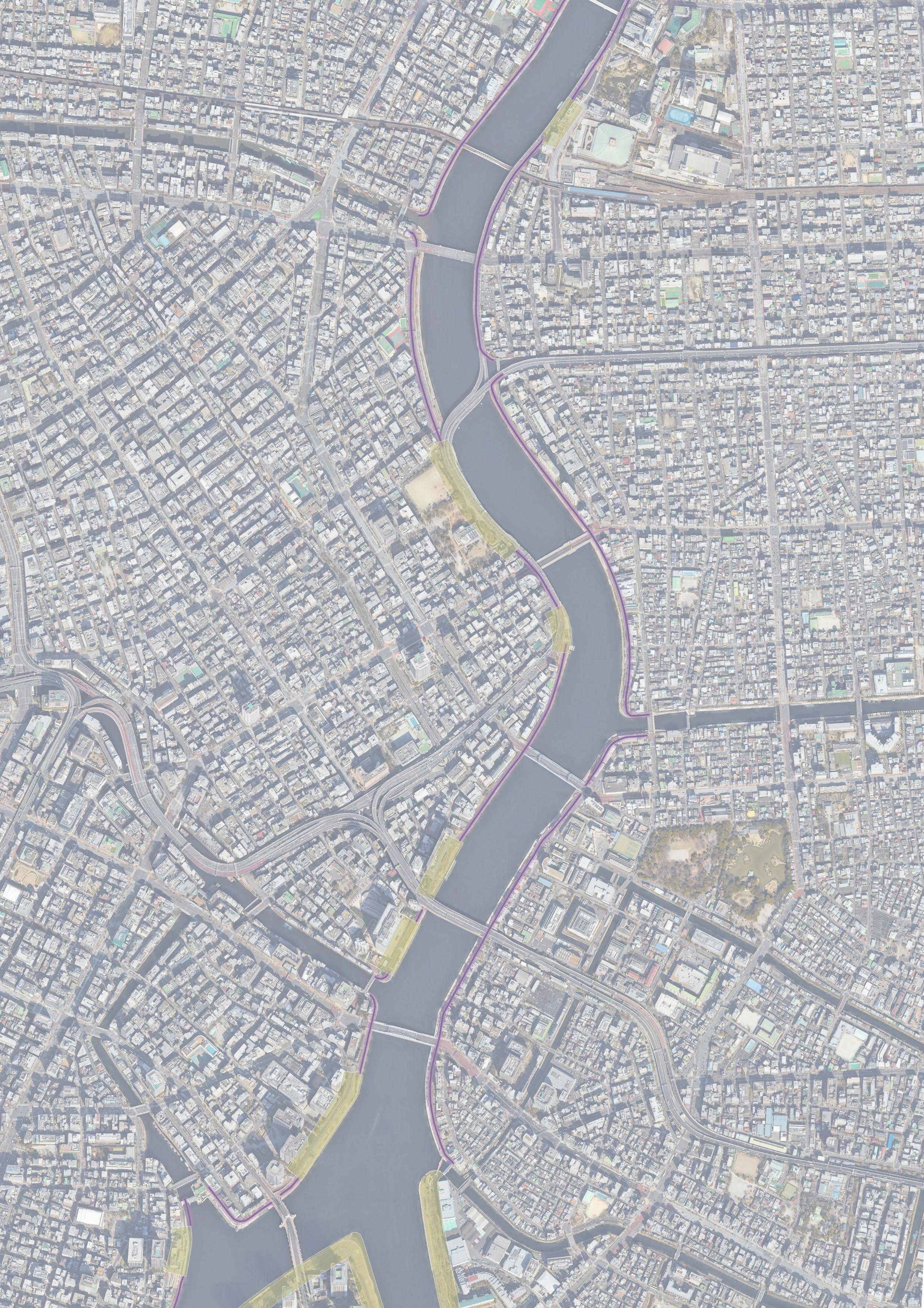
To change the monotonous river spaces lacking variation across different locations, the design begins by establishing broad characters. By combining the characteristics of the area surrounding the river and the Sumida River’s landscape, three main identities are formed:
The upper part has many traditional and historic facilities, and the surrounding area will be given the ‘CULTURE’ character.
The middle part of the river meanders, and the sedimentation caused by the different flows of the river is a ‘NATURE’. The lower part of the river is an area lined with high-rise buildings and is characterized as ‘URBAN’.
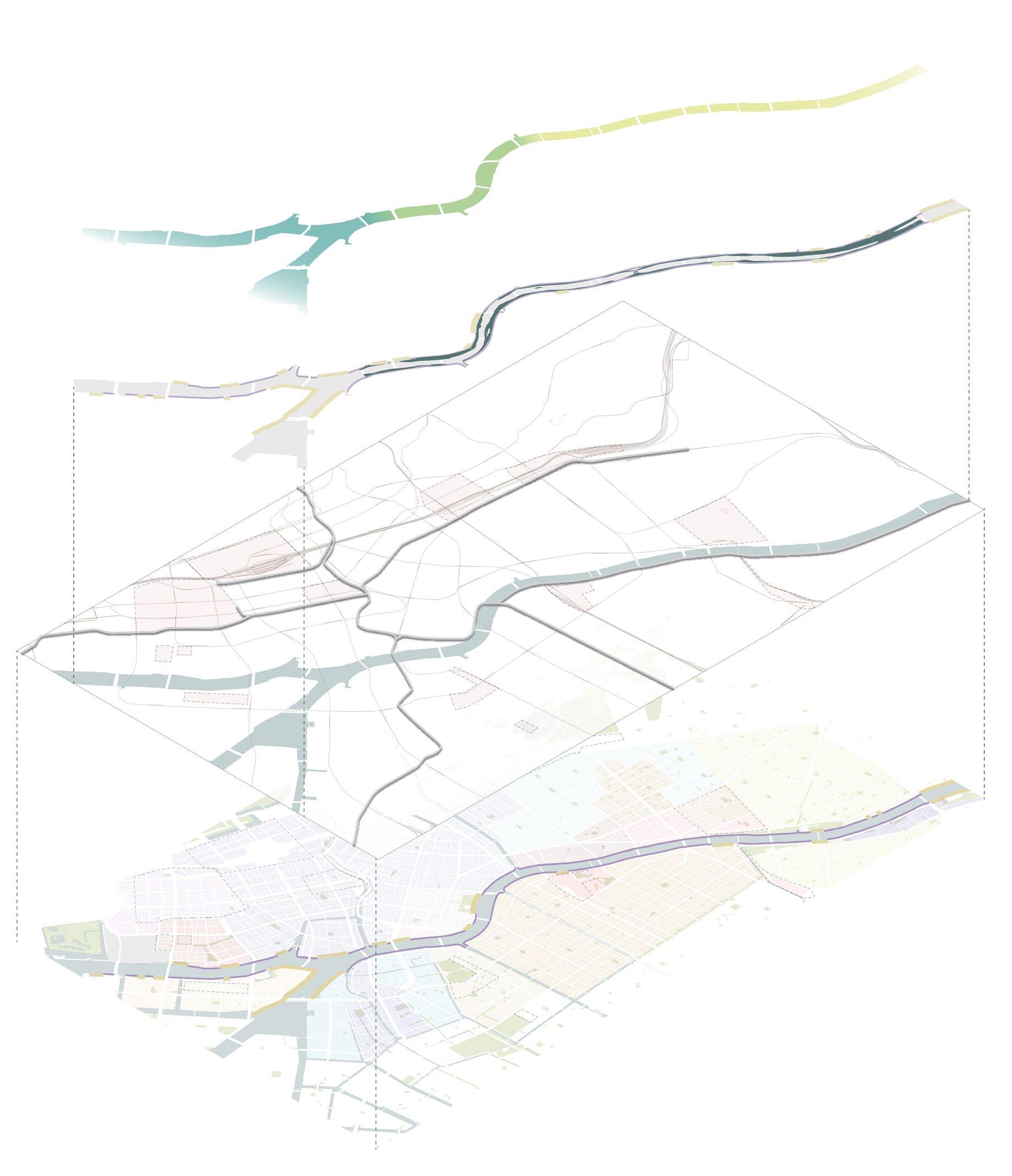
Identites
Riverlandscape
Sedimentation
citycharacteristic Infrastructure
134
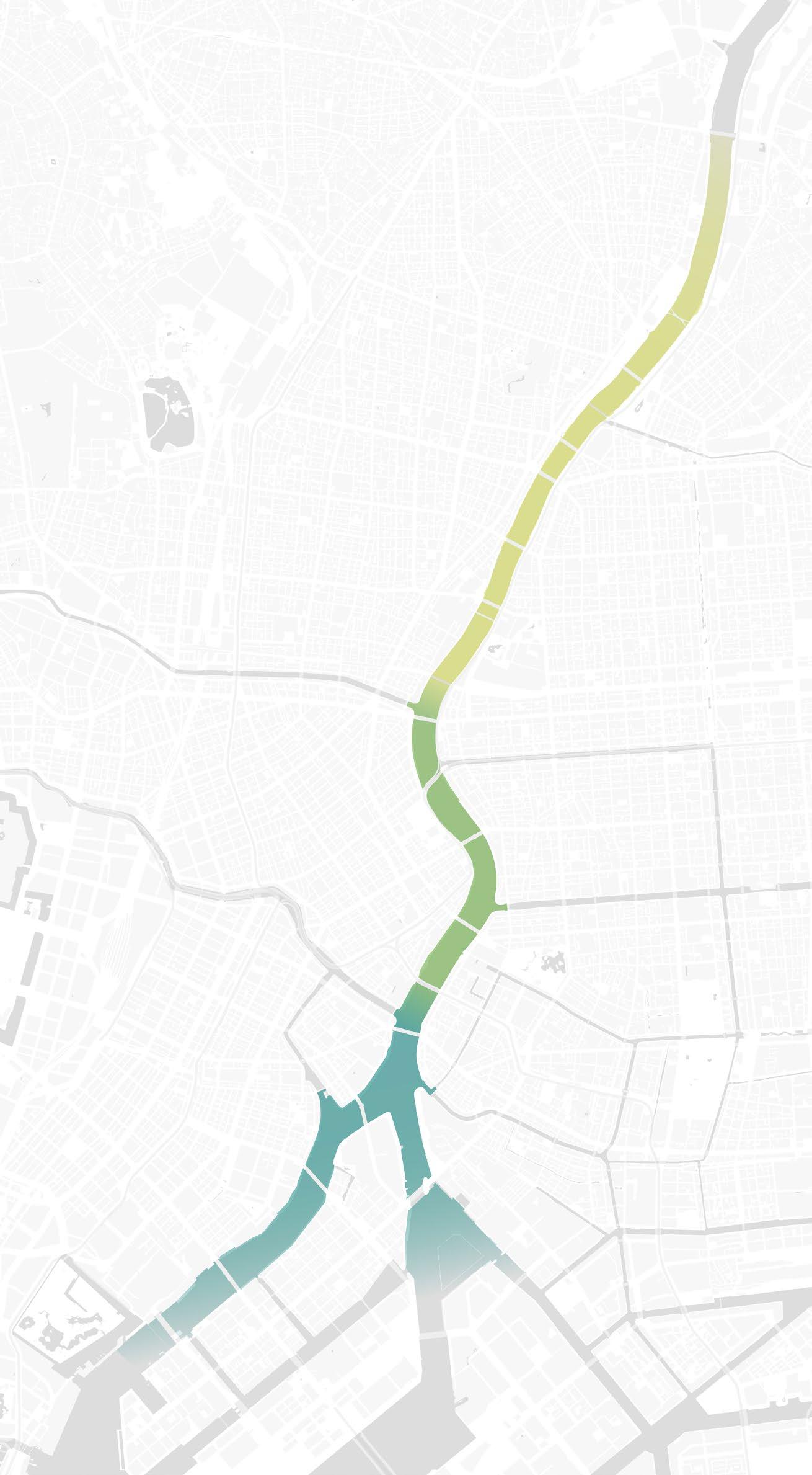
Three River identity
CULTURE
Straight river
Many bridges
Under highway
Tourist District: Historical Museum, Temple Cafe, Restaurant
NATURE
Curved river River dynamic Sedimentation
Green along the river Residential area
URBAN
Wider water
Transition to the sea
Ship traffic
Business District
Highrise building Tourist District
135
1 2 3 Flood wall Super levee
Existing situation
 view 1
view 2
view 1
view 2
137
view 3
 Sensoji Temple Sumida park
Tokyo sky tree tower
Sensoji Temple Sumida park
Tokyo sky tree tower
Commercial building Park Famous place Shrine, temple Accommodations
Ryogoku Sumo Arena Calture museums
Highway park CULTURE area
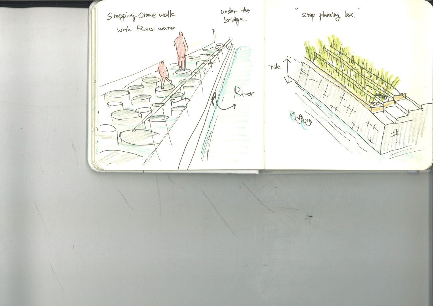
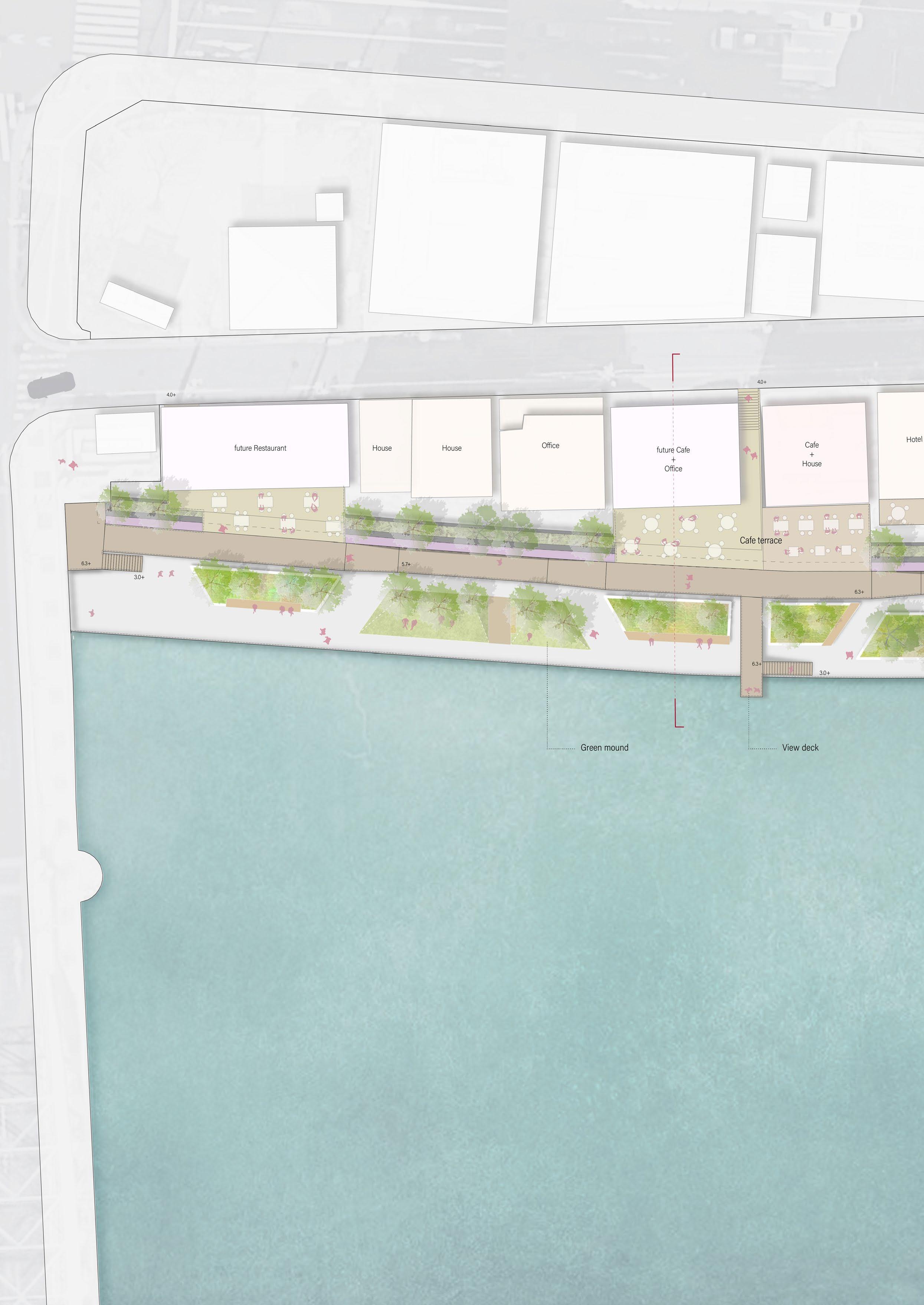
Terrace walk Under
CULTURE area
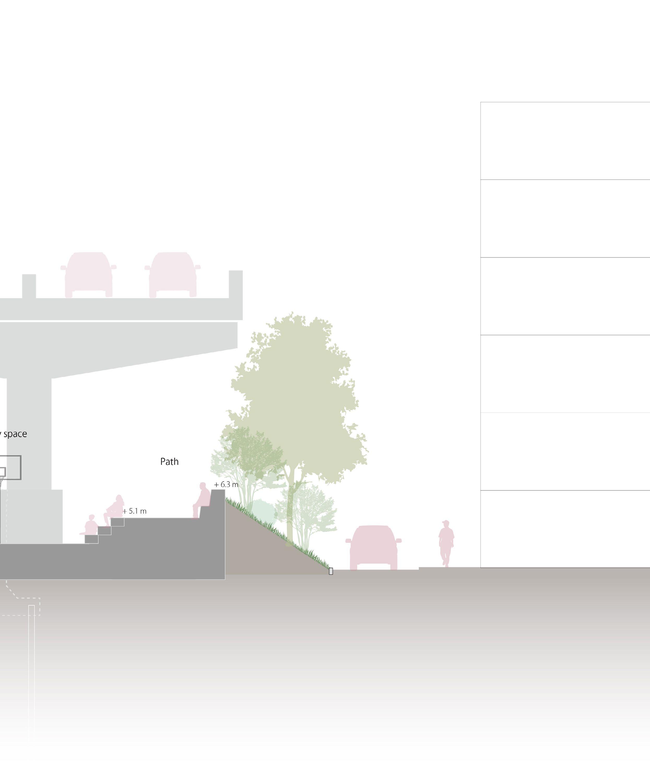
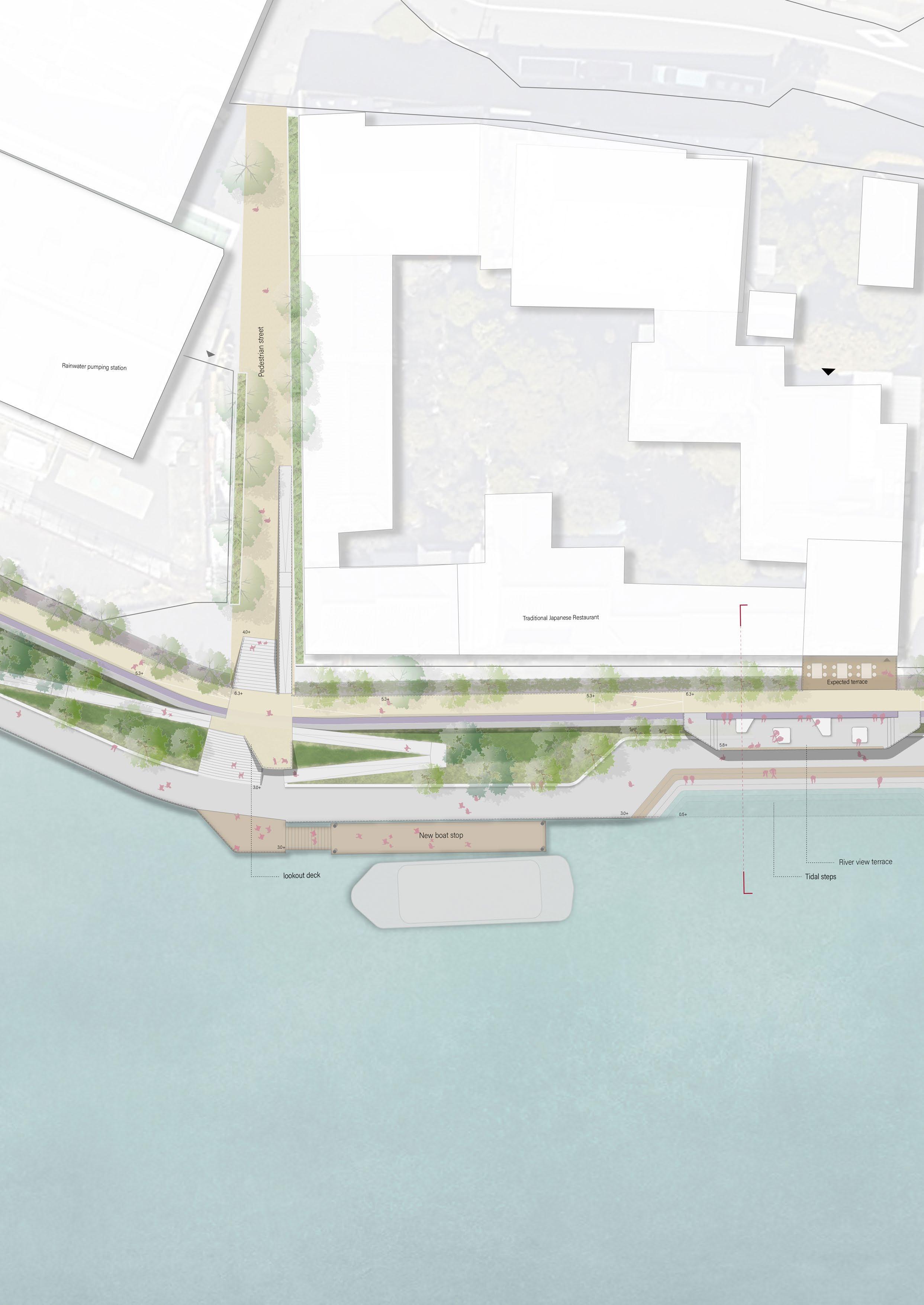
The upstream area is surrounded by numerous cultural facilities. Historically, the Asakusa area has been lined with many dining and entertainment facilities, some existing along the river’s western banks. Tourists seek picturesque river views along these riverside restaurants or cafes. In this area, the design aims to integrate the terraces of these restaurants with the river space by walking a bridge walk.
Furthermore, The highway running over the river space on the east side will be utilized to design an under-highway park that can be used even in the rain or hot summer days.
bridge walk
Under higway park
139
Existing river terrace and balcony
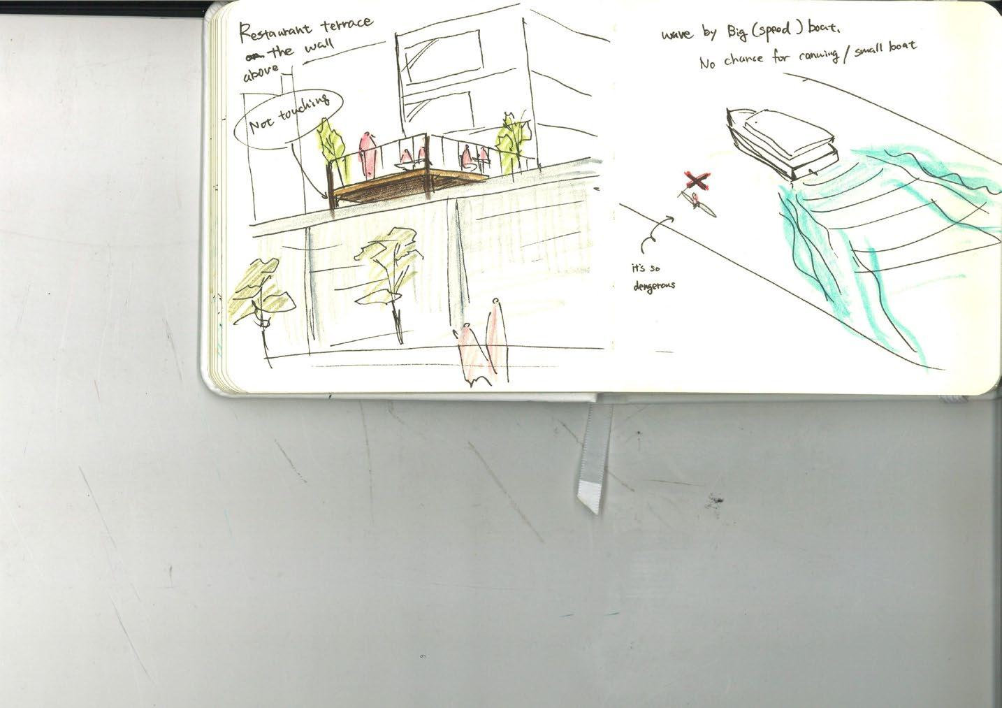
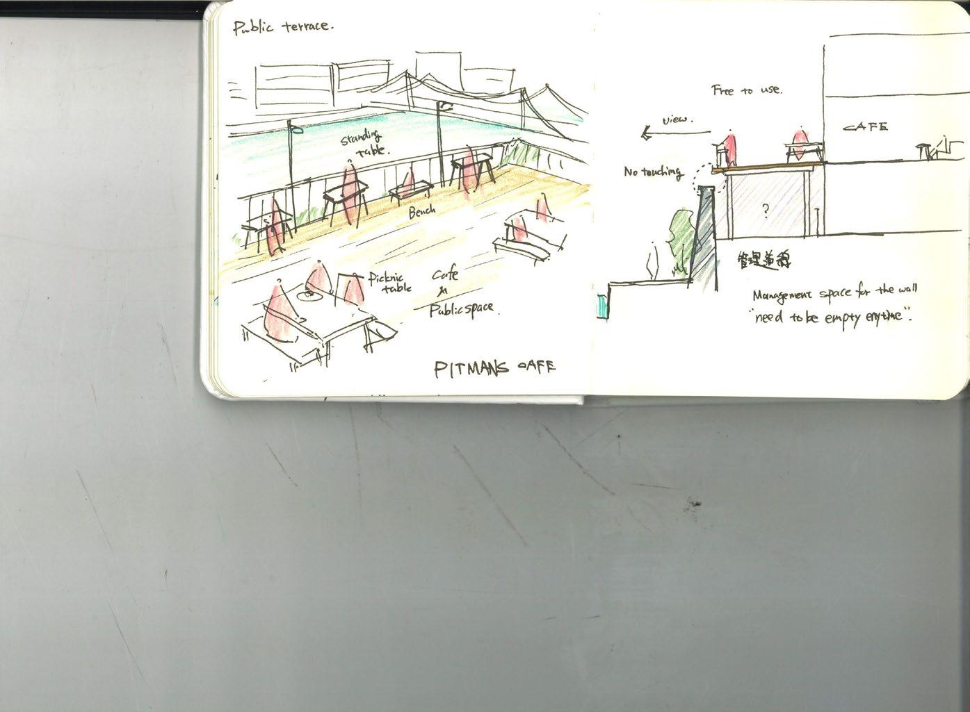
The field survey discovered that restaurants with riverside terraces are clustered in the Asakusa area, the western riverbanks.
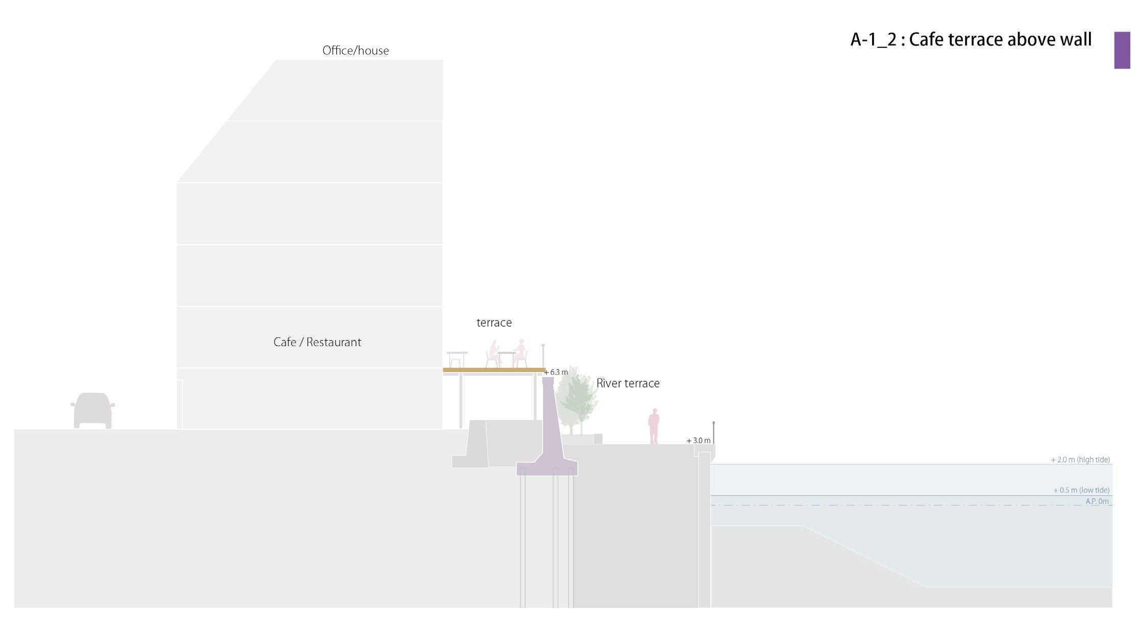
Most of them are either small balconies or terraces that extend above the flood wall. The Tokyo Metropolitan Government is promoting this type of terrace, allowing restaurants and cafes to install terraces as close to the flood wall, provided they obtain approval from the Tokyo Metropolitan Government.
This initiative began around 2018, and the Asakusa area has been actively moving toward the installation of terraces.
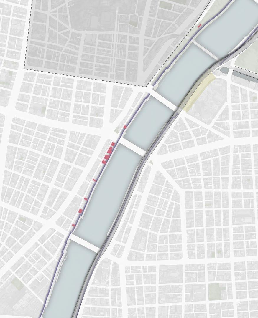
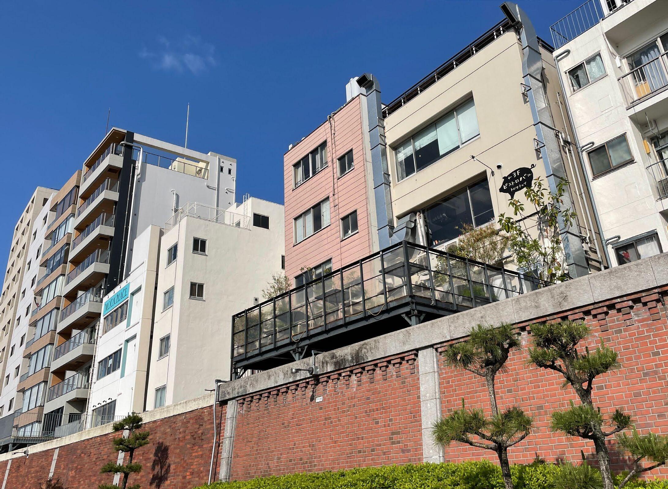
140
Current river view terrace
 Terrace
141
Balcony
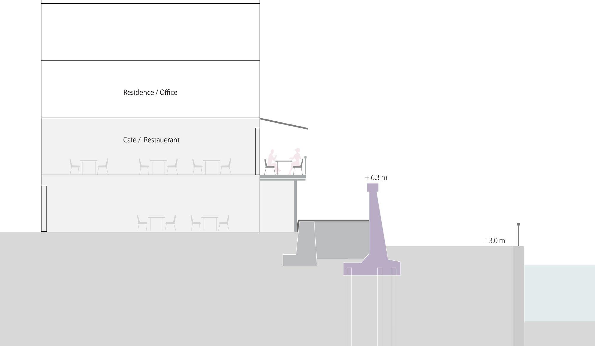
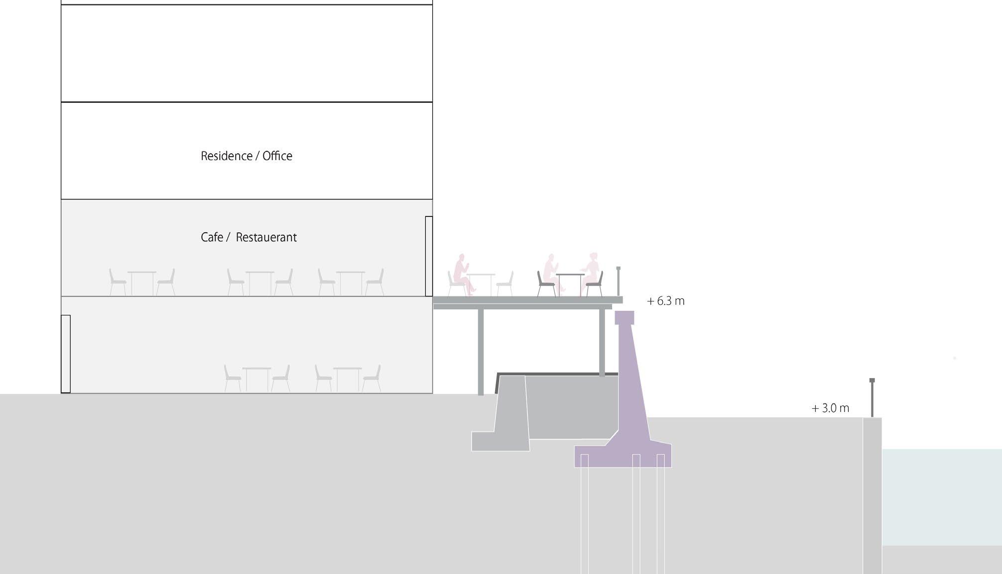
 Plan: Terrace walk
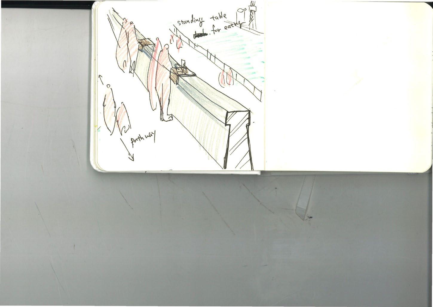
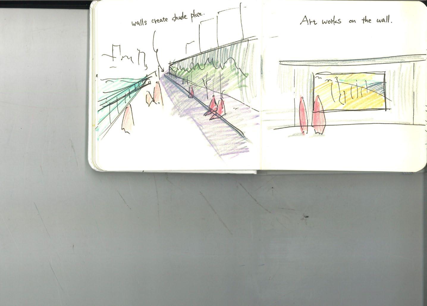
The pedestrian bridge, which can be connected to the existing terrace, integrates flood wall reinforcement and a walking path. The bridge leads to the terraces of each café, providing a second entrance for visitors. It also functions as a public promenade, offering panoramic views of the river while walking. Underneath the bridge, benches and planters are incorporated to create a space where people can linger in the shade of trees.
144
Section: Terrace walk

current situation
Impression of the terrace walk view
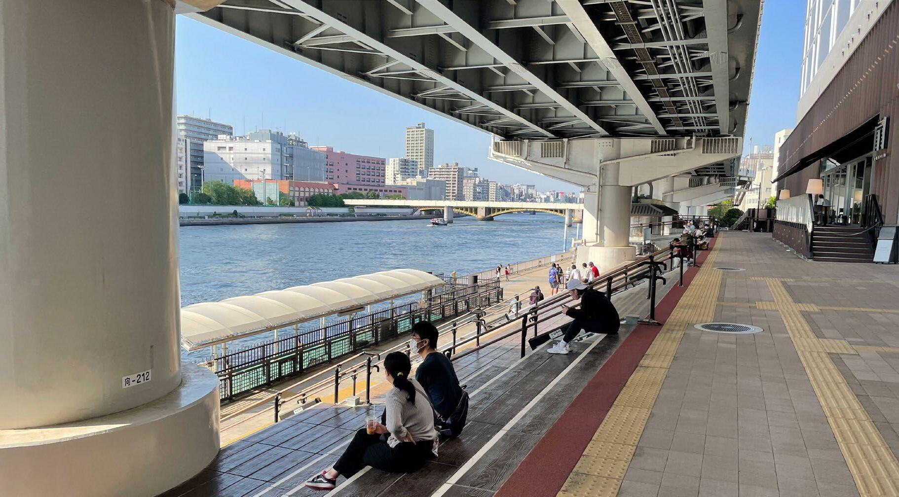
Elevated highway and the river space
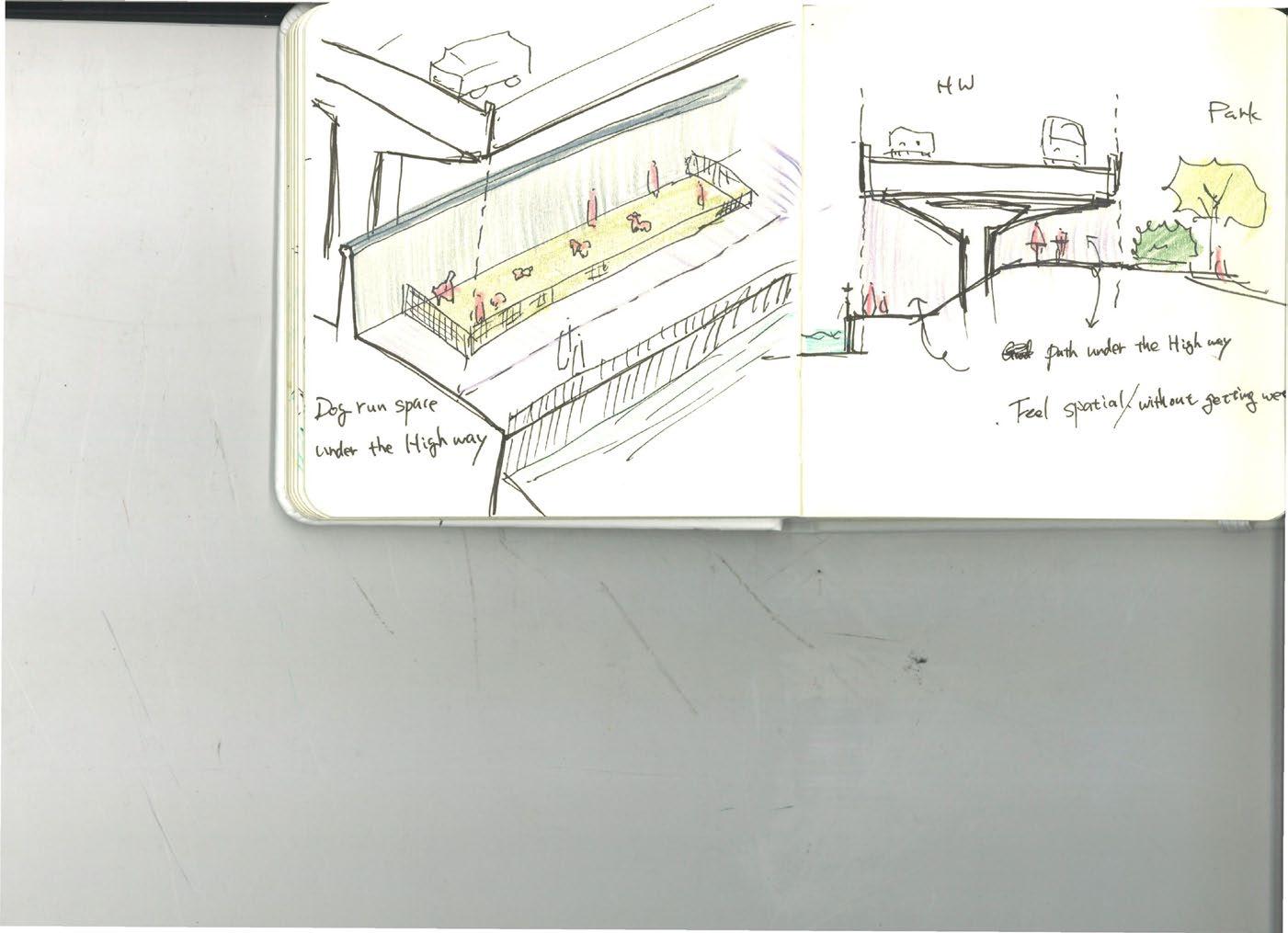
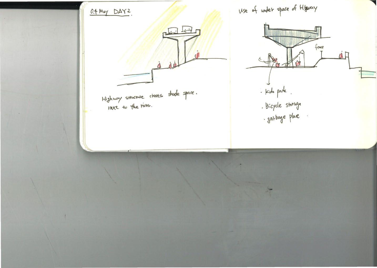
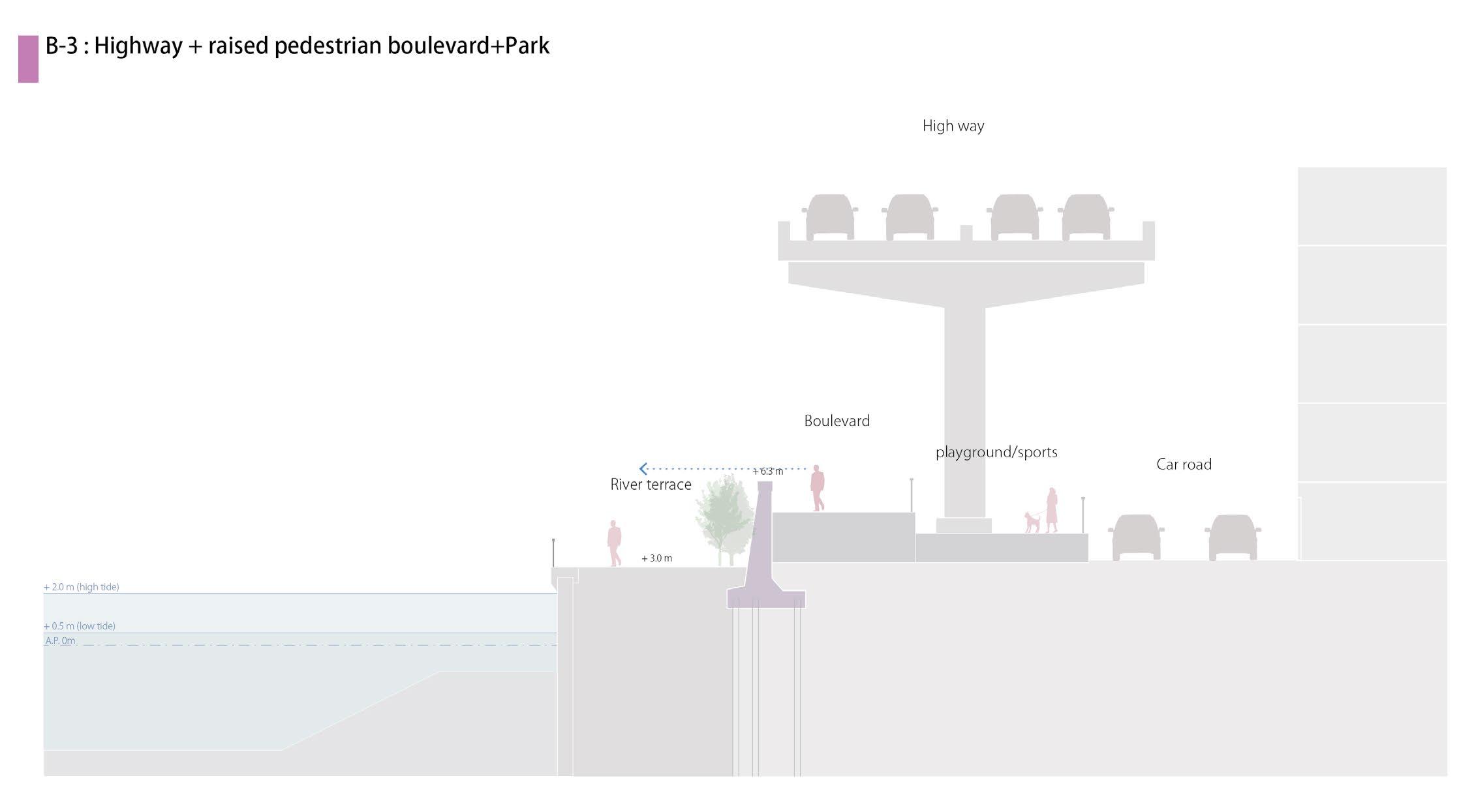
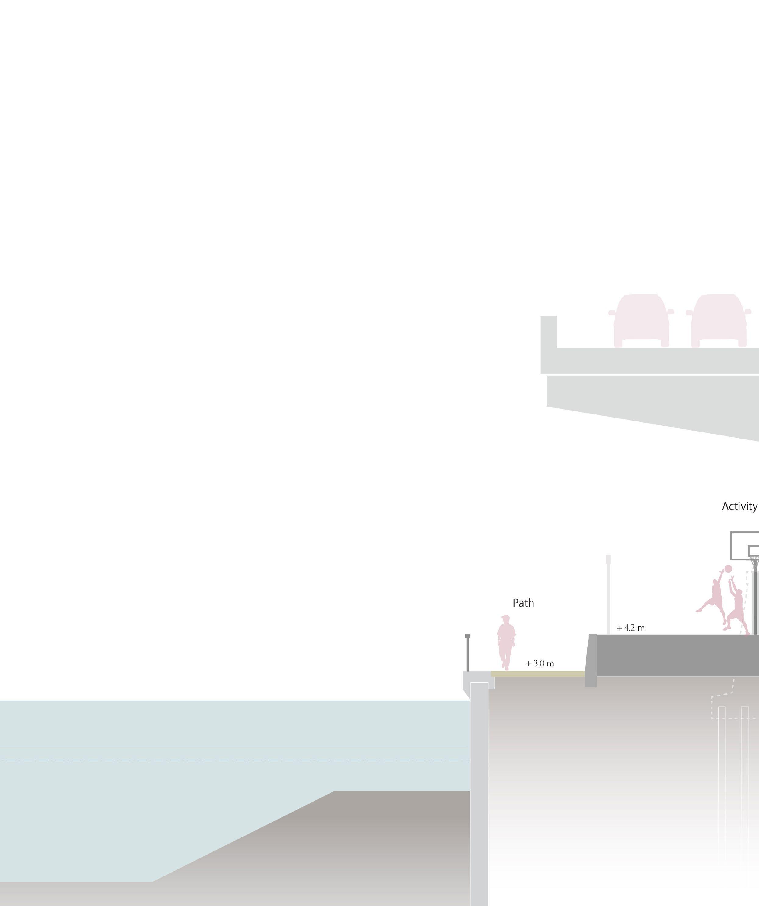
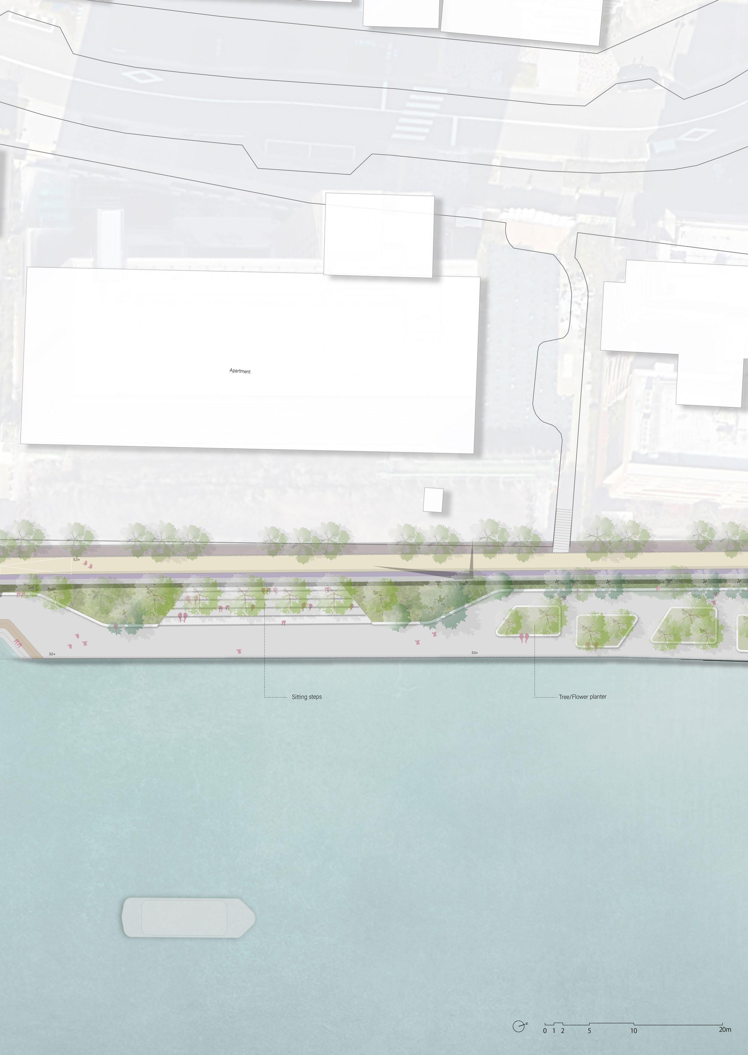
In the area east of the Sumida River, there are no buildings standing along the river because of the elevated highway, and a two-lane road runs north-south next to the floodwall. Here, the location of the floodwall is moved toward the road to expand the river space and make the space under the elevated highway function as an activity space for people.
148 current situation
149
Current situation
space
Expand the river
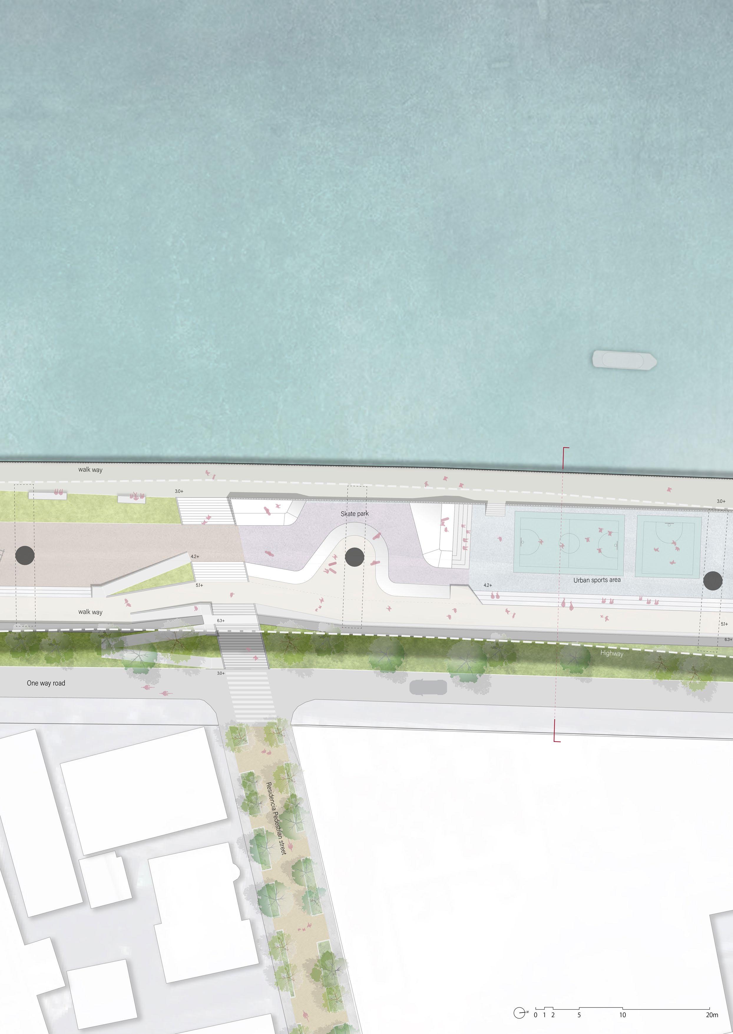
Section: Under Highway park
Under the elevated highway, the expanded river space will be designed as Under highway park, serving as a venue for sports, theatre, and playground activities unaffected by rain or intense sunlight. Here, people can enjoy their own activities while overlooking the river.
150
151
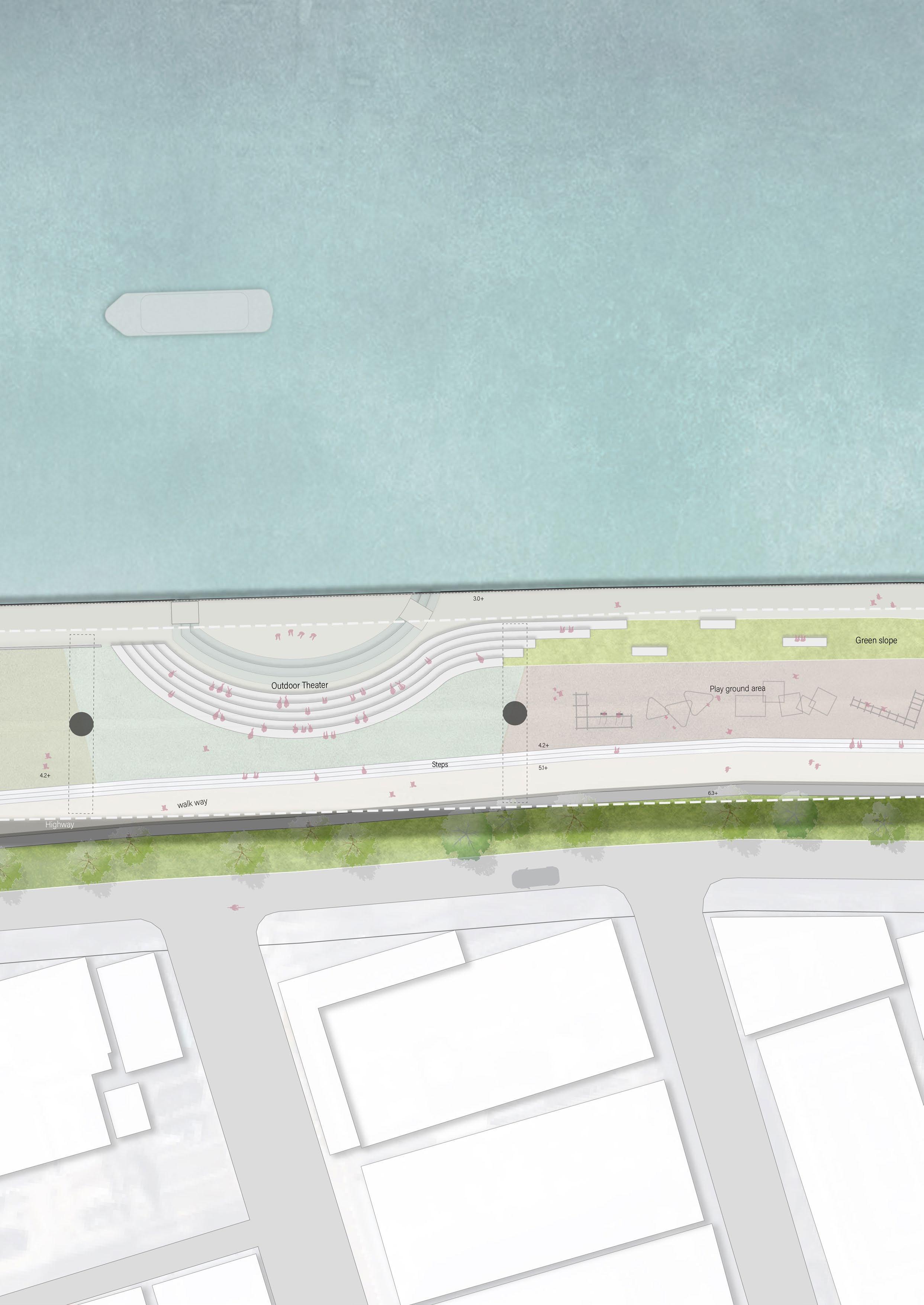
Plan: Under Highway park
1 2 3 Flood wall Super levee 154
Existing situation
 view 1
view 2
view 1
view 2
155
view 3
Existing park
Sedimentation wetland
River
Sedimentation
Japanese garden Commercial
Residential
Residential
River
building
Sedimentation Park Office
house
apartment
Forest
Nature area
Nature area
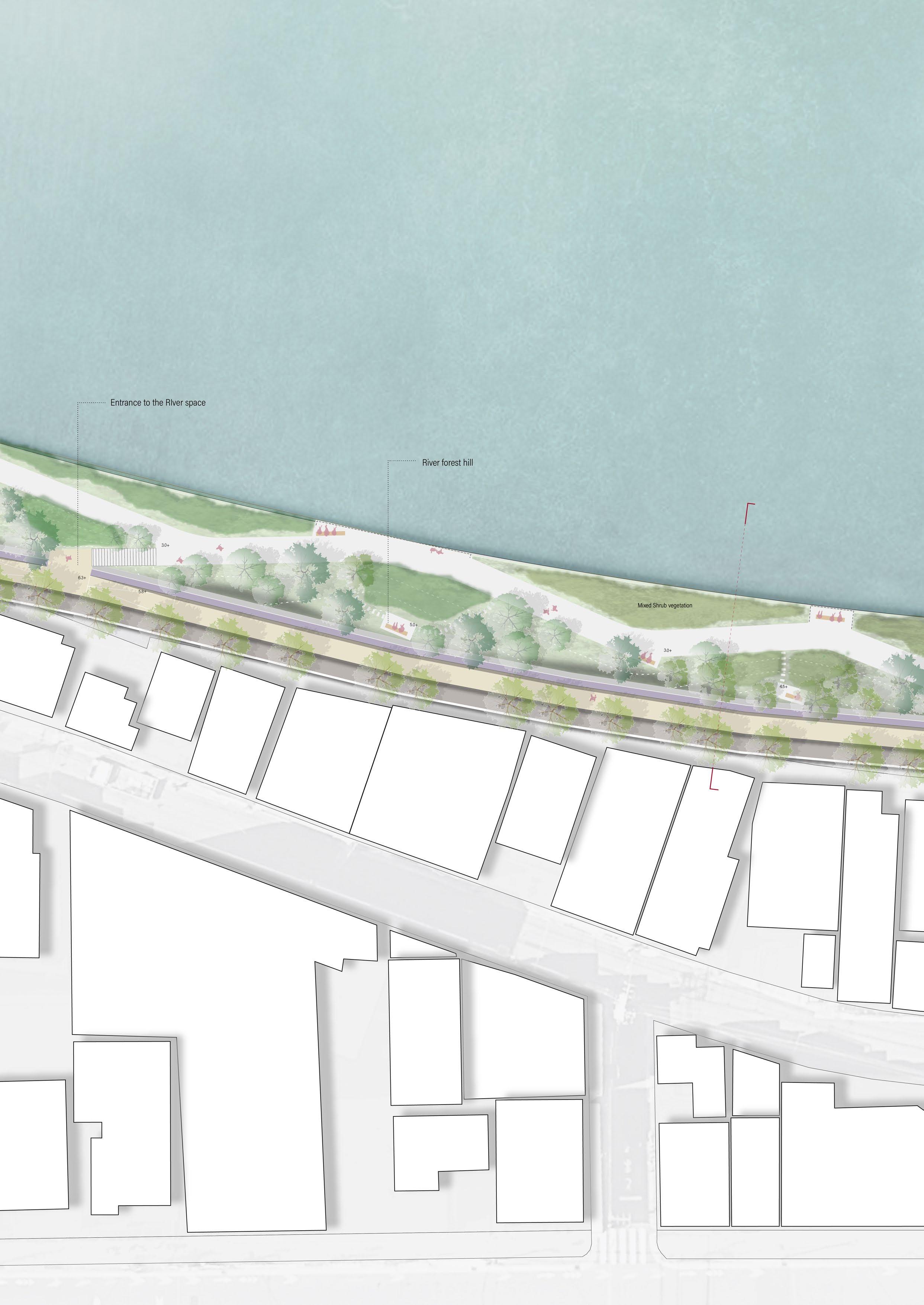
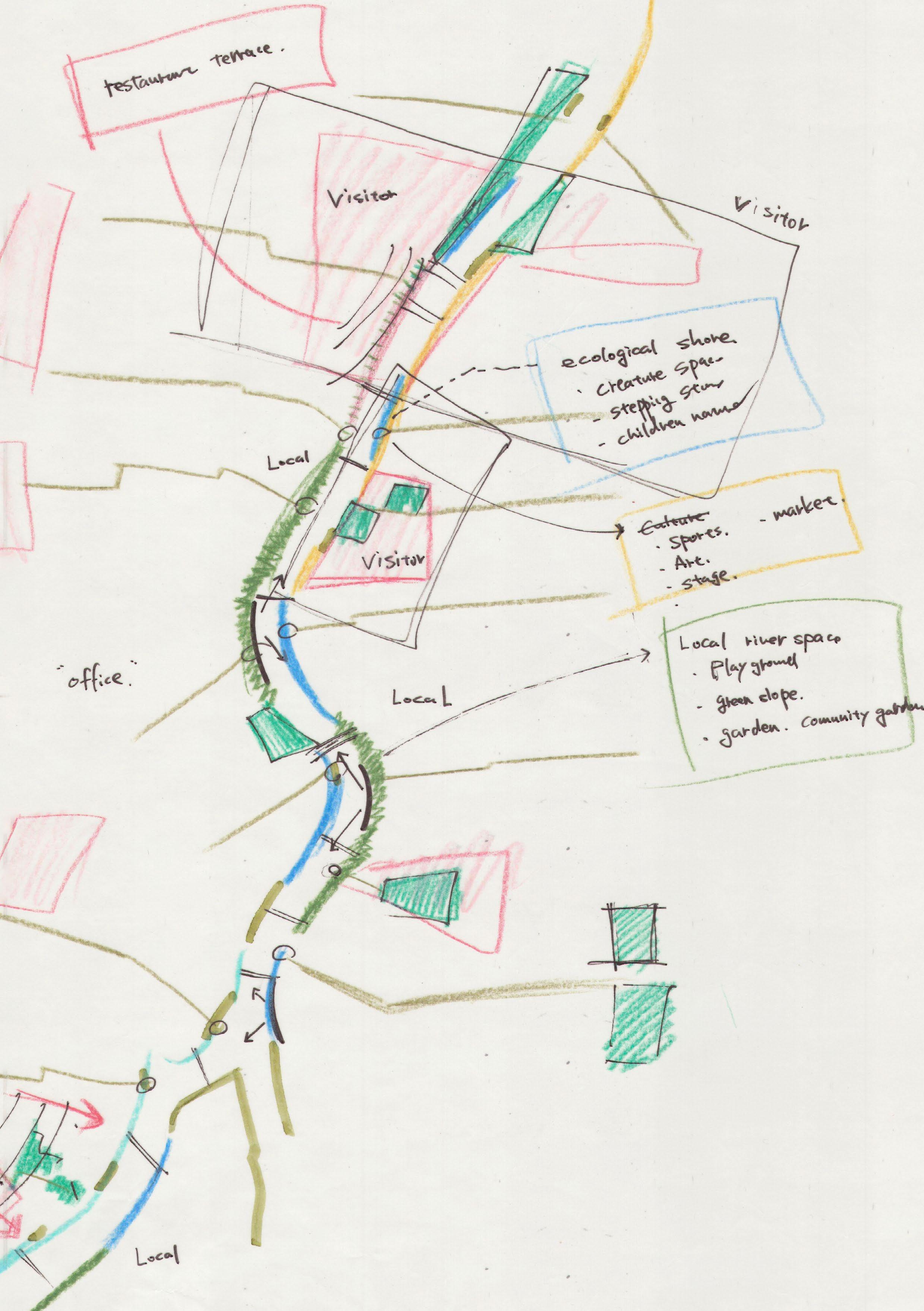
In the central area with a large meandering river, the design embraces the dynamic features of the river. It was found that there is sedimentation inside the curved river from the sedimentation map from the Tokyo government office. The aim is to create a small network of nature within the city by creating an ecotone tidal pocket on the inner side of the river and river forests as stepping stones for living creatures on the opposite outer curve.
ecological shore
Sedimentation
157
River forest
Sediment in the Sumida River
Due to the flow from the upstream, sediment accumulates at the bottom of the Sumida River. The Tokyo Metropolitan Government makes riverbed a cross-sectional survey every four years and uses those drawings as a guide for dredging operations to remove sediment.
Connecting the drawings provided by the Tokyo Metropolitan Government revealed that sediment accumulates more on the inside curves of the river, similar to natural river systems.
Sedimentation plans received from the Tokyo Government office 158
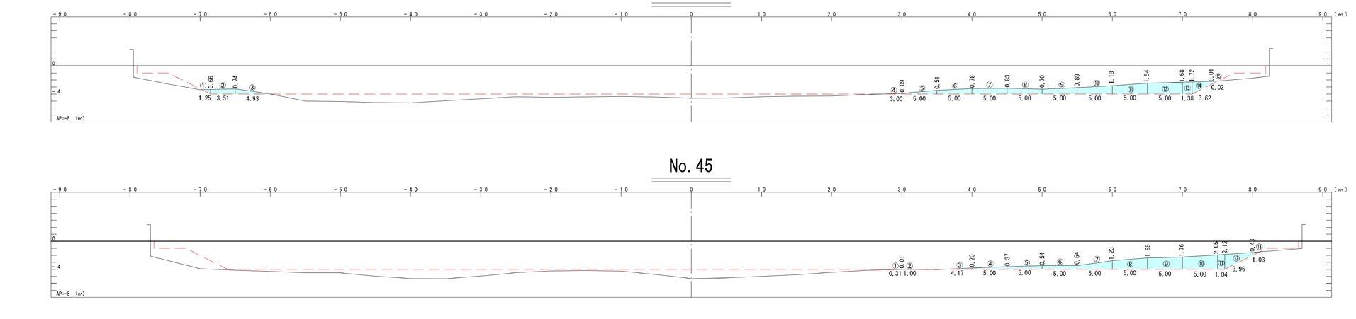
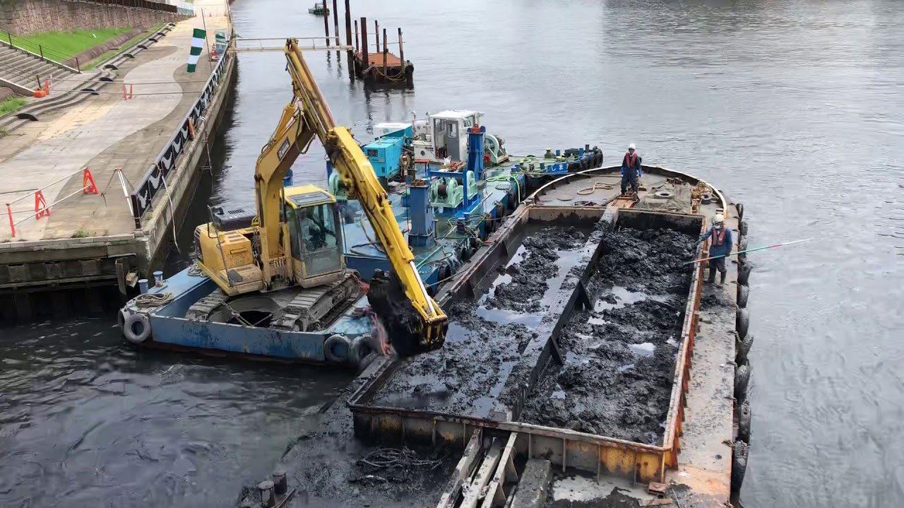 Once a few years, dredging work is performed.
159
Sedimentation sections received from the Tokyo Government office
Tidal land on the inner curve
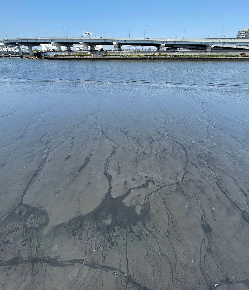
During the field survey, it was confirmed that there is sedimentation tidal land in the inner large curves part, upper stream. Gobies and shellfish inhabit here, and birds that prey on them are also seen.
Encountering such natural features within Tokyo was a unique experience for me, and seeing the changing appearance of the tidal land made me realize that the Sumida River is still a living river, despite being reinforced with concrete quay,
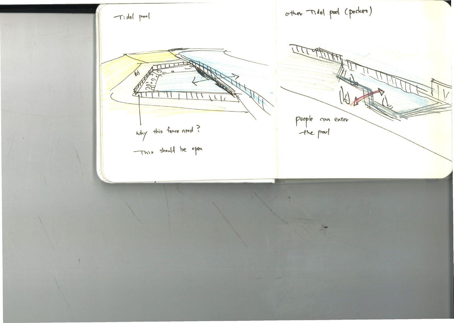
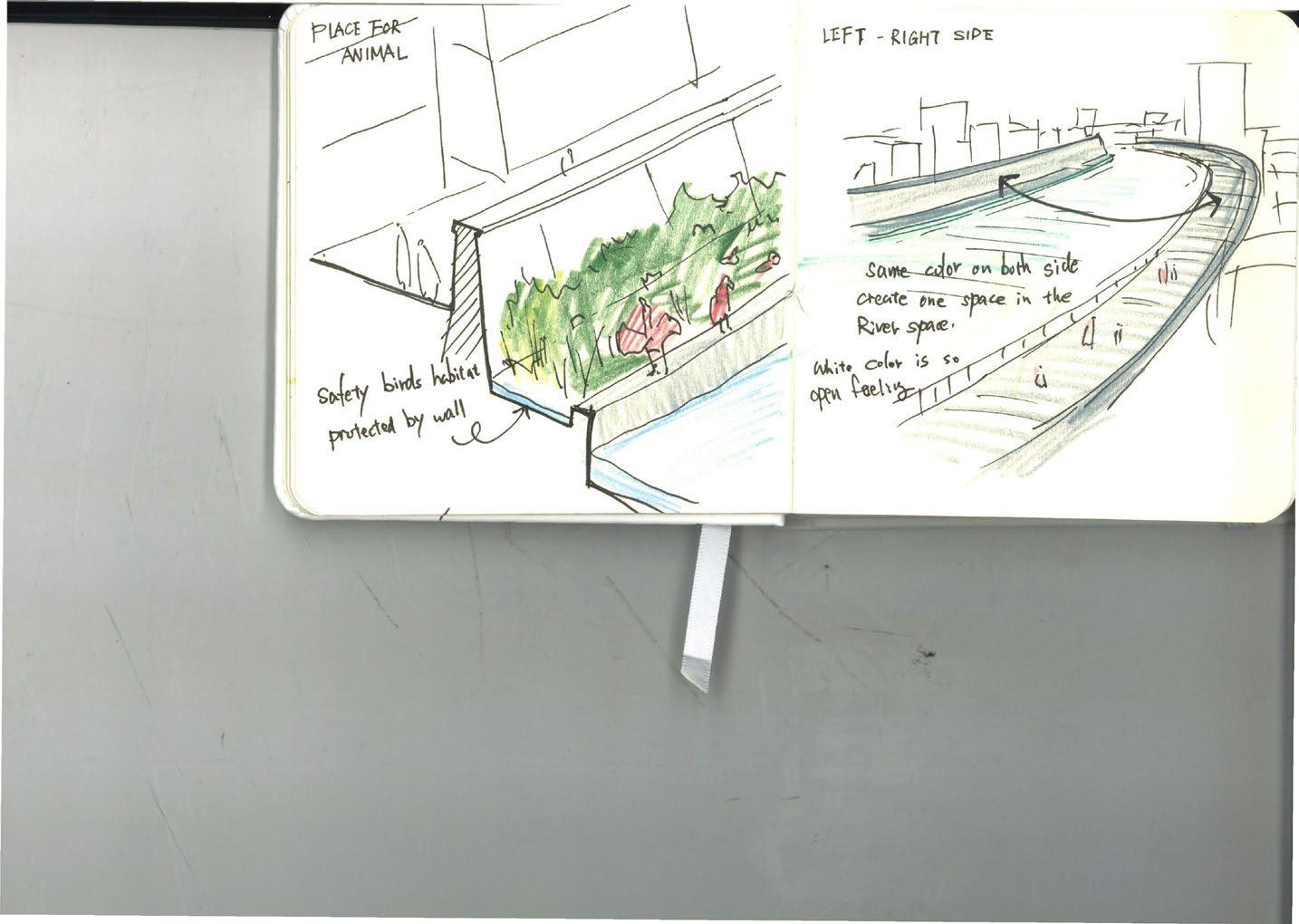
Taking inspiration from this sediment-formed tidal land, the concept of this area is to leave the sediments on the inner river without dredging and to create a soft edge in the urban river where living creatures can habit.
160
Current : Only hard edge
River dynamics into the river space in the urban river
Sedimentation as ecological shore
161
Plan : Sedimentation wetland
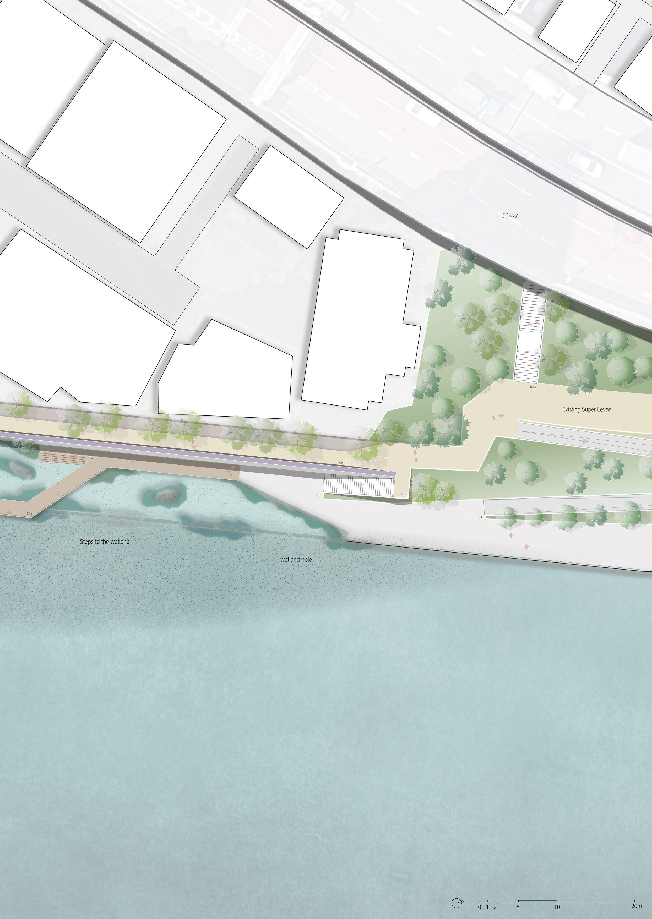
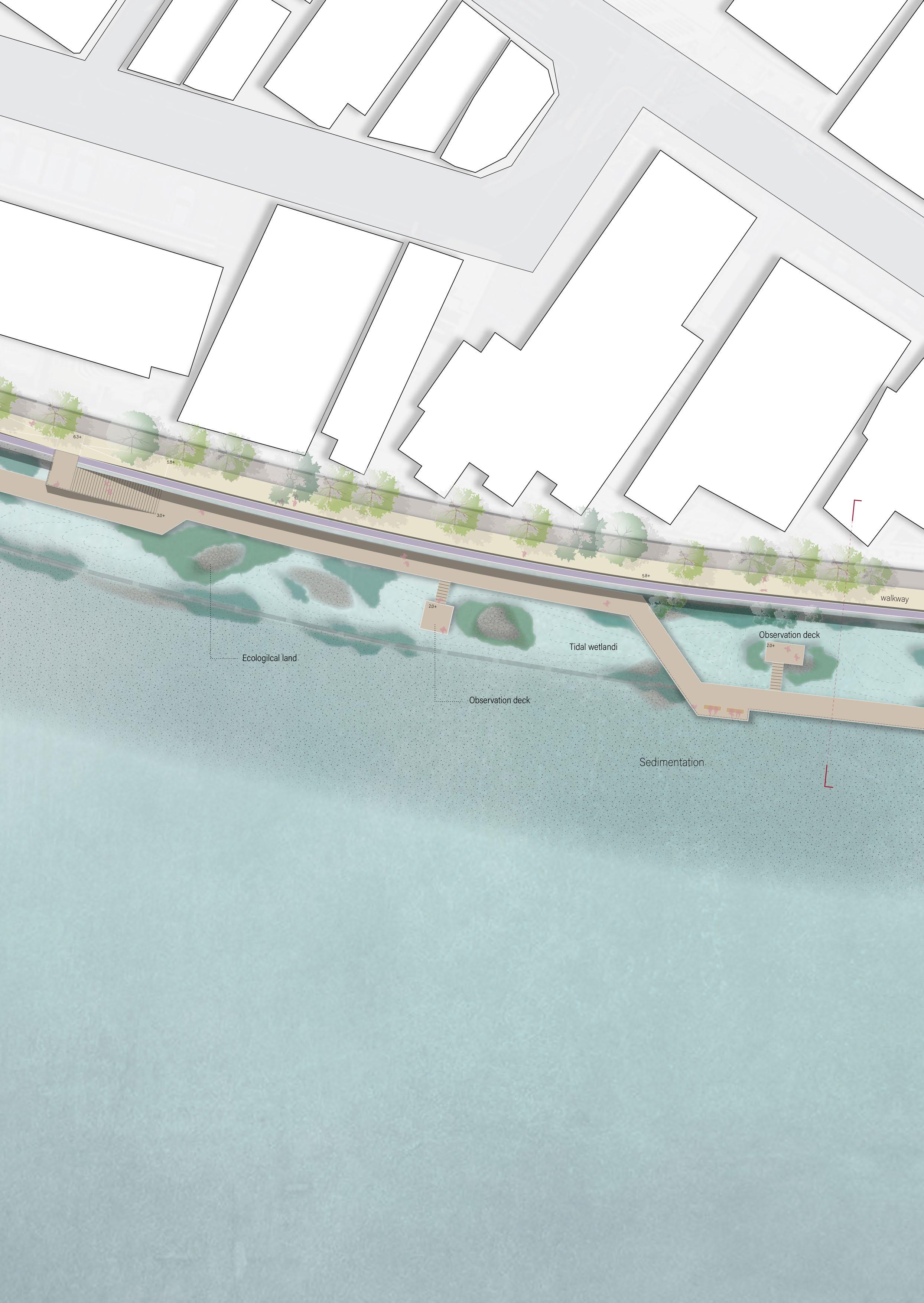
Sedimentation wetland ecotone
Here, the main characters are water creatures. At the inner curve of the river, a space is created to serve as an ecotone where water creatures can habit. The pavement of the river space and part of the quay wall will be broken up to create a tidal pool.
The sediments create a slope on the riverbed that extends to the tidal pool, with the appearance of the tidal land changing with the tide. The different depths of the tidal pool offer a habitat for diverse aquatic plants and creatures.
area 164
rocky
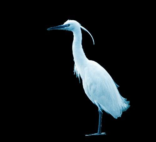
Little egret

Cormorant
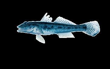
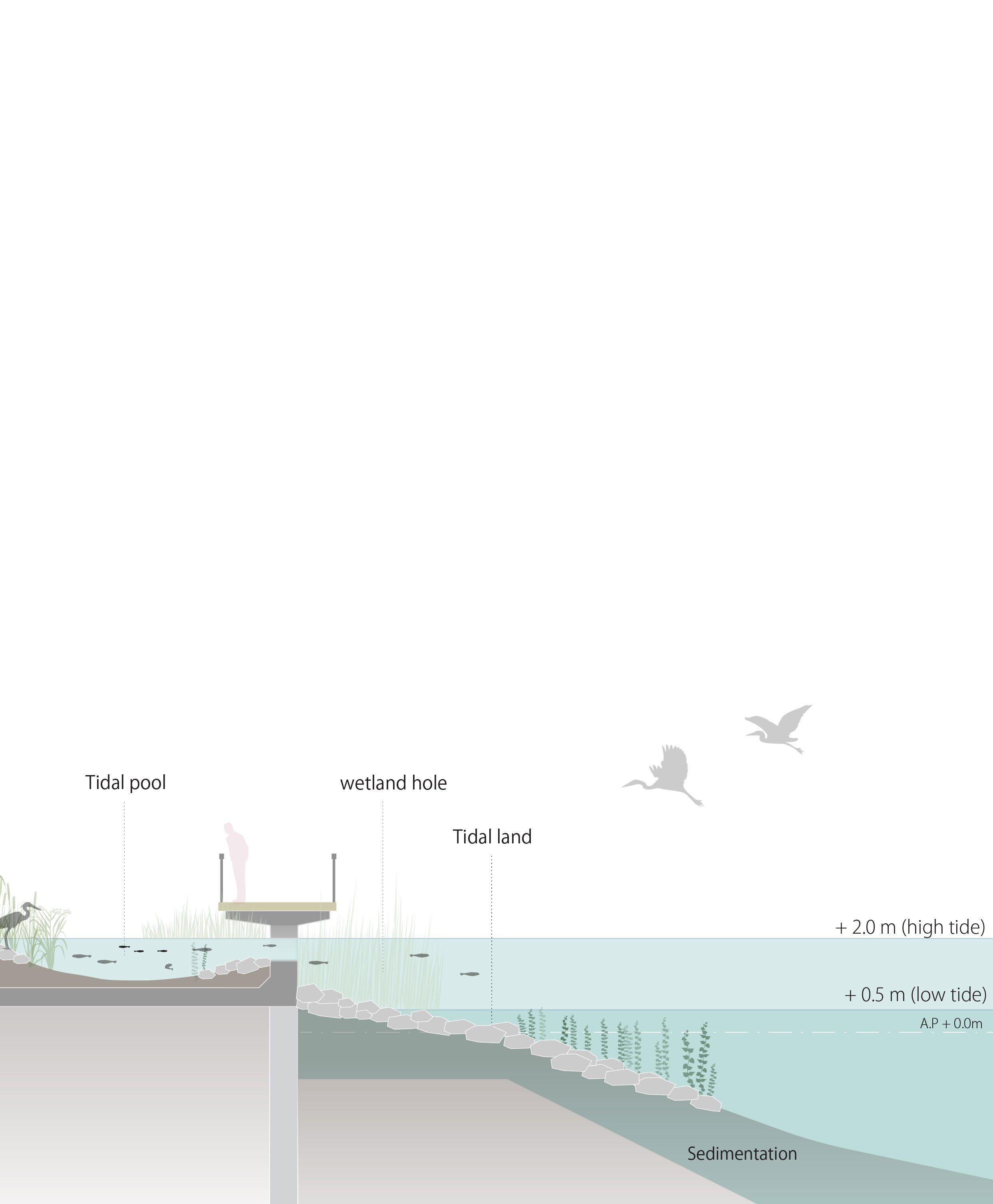 Gudgeon
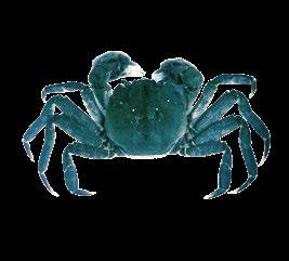
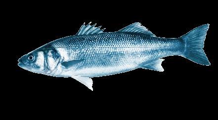
Mitten Crab lake prawn
Sea bass
Mullet Carp Eel
shallow water
Deeper water
Gudgeon
Mitten Crab lake prawn
Sea bass
Mullet Carp Eel
shallow water
Deeper water
Impression of the sedimentation wetland
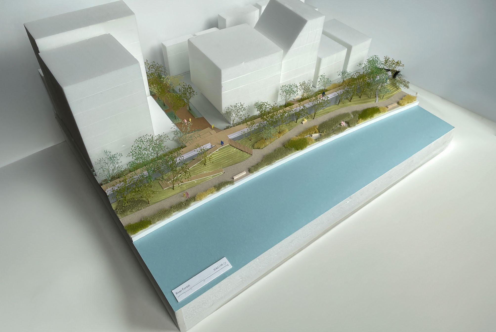
 Plan: River forest
Section: River forest
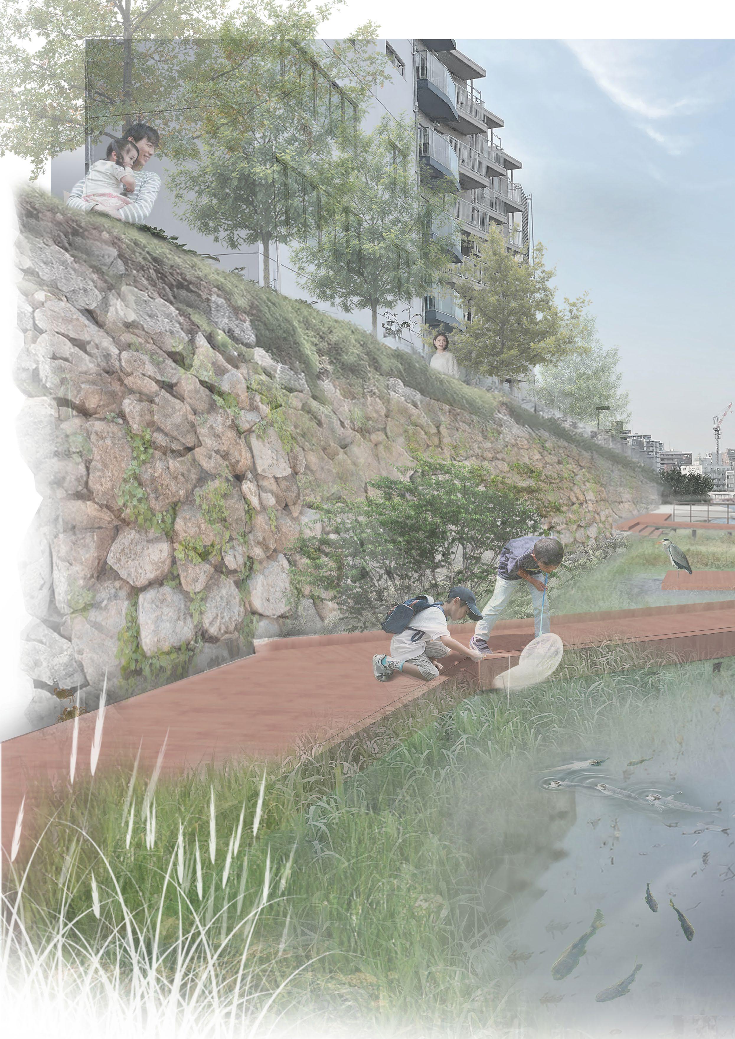
On the opposite bank, the outer curve of the river has fast-flowing currents, so the existing hard quay wall remains here. To introduce the flow of creatures from the Eco tone as stepping stones on the opposite bank, the river space aims to design a small natural area with forest elements.
The new reinforced wall keeps the green sloped, creating an oasis of greenery within the river with natural landscapes, deciduous trees, and shrubs, softening the hard-paved urban environment.
Mixed deciduous trees
- Maple - Hornbeam
- Zelkova
171
Possibility of the future building typology
Behind the flood wall, a new walkway integrated with reinforcement is designed. In the design, this new pedestrian path is made higher than the existing path, offering a view of the river.
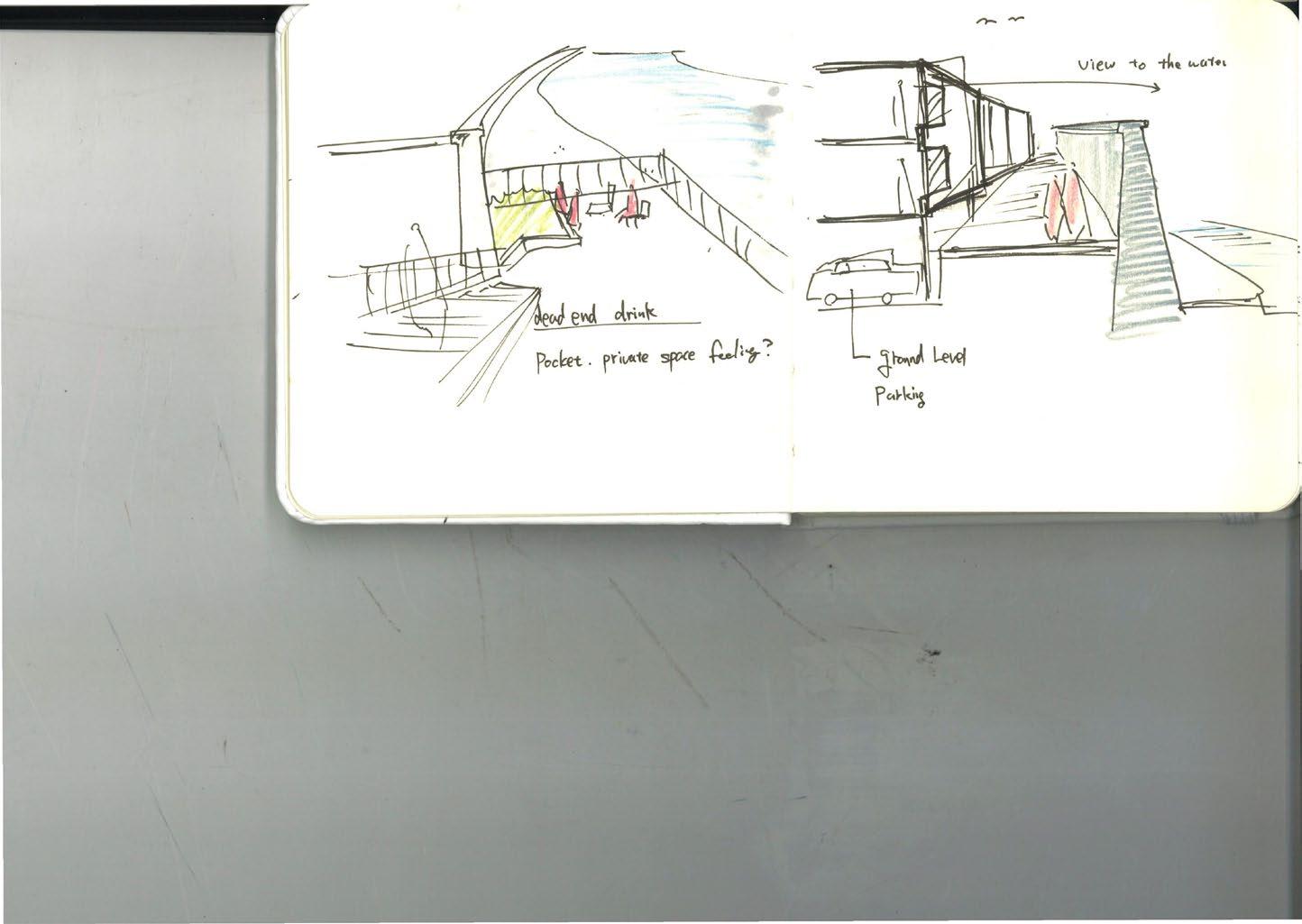
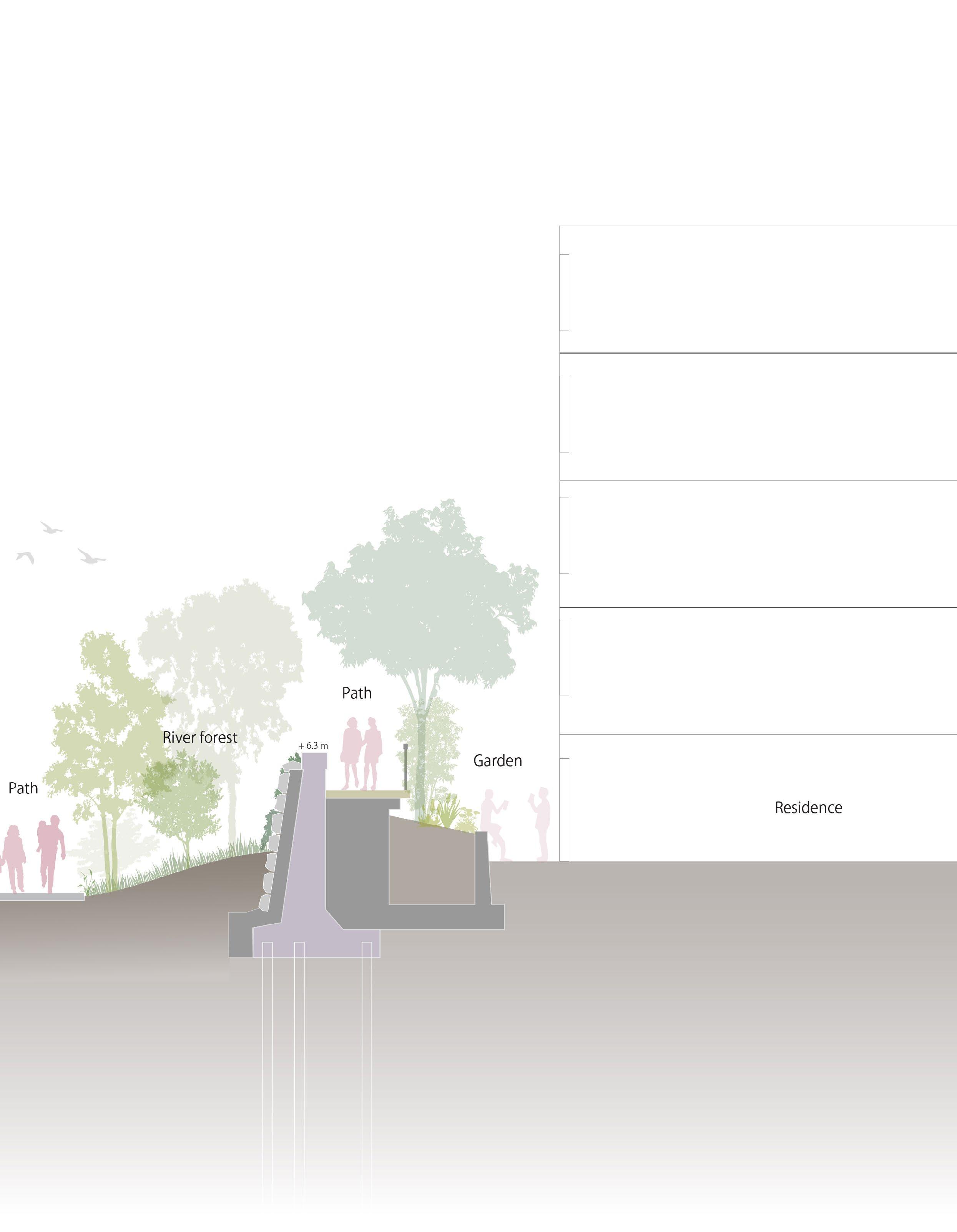
Currently, most of the space between the flood wall and buildings is almost dead space. Introducing pedestrian flow in this space creates an opportunity for new cafes and shops with entrances facing the river. This design has the potential to inspire new typologies in future architectural designs with the connection of the pedestrian path along the river.
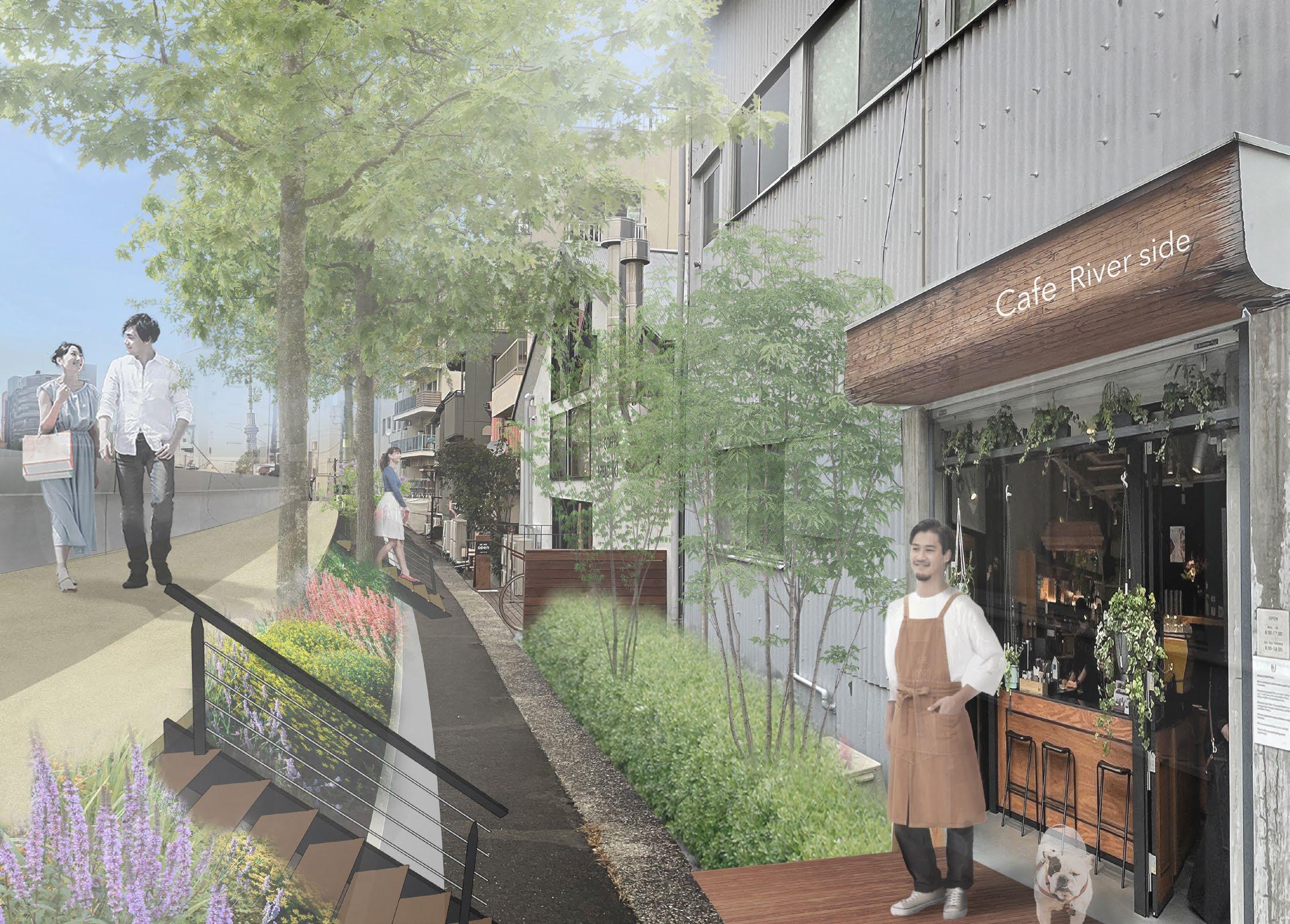
172

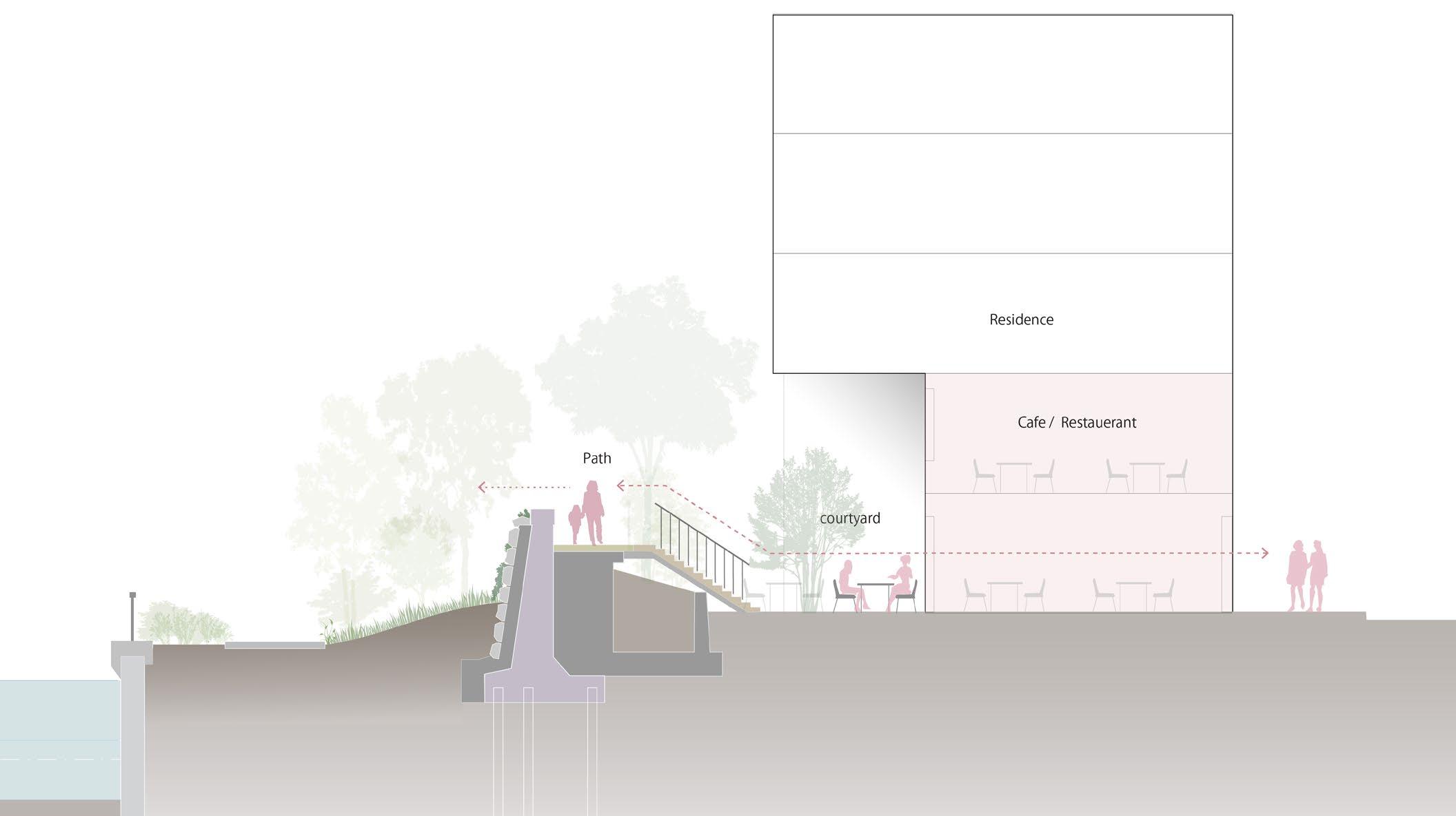
Possibility of new entrance of the shops, restaurant 173
1
3 Flood wall Super levee
2
Existing situation
 view 1
view 2
view 1
view 2
175
view 3
URBAN area
Urban waterfront park
Ginza shopping area
Tsukiji honganji temple
Tsukiji fish food market
Tsukishima food street
New development area (Baseball stadium)
Japanse garden
Residential apartment
Residential house
Commercial building Warehouse
Park Office
Urban area
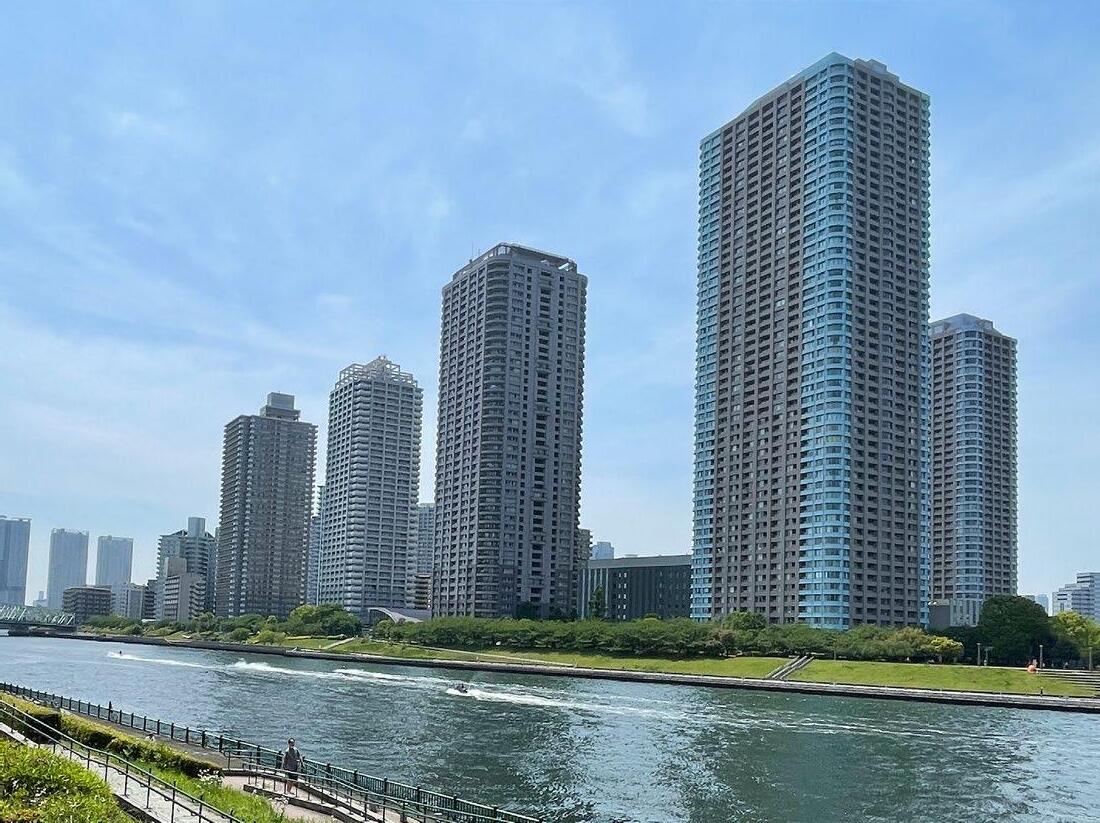
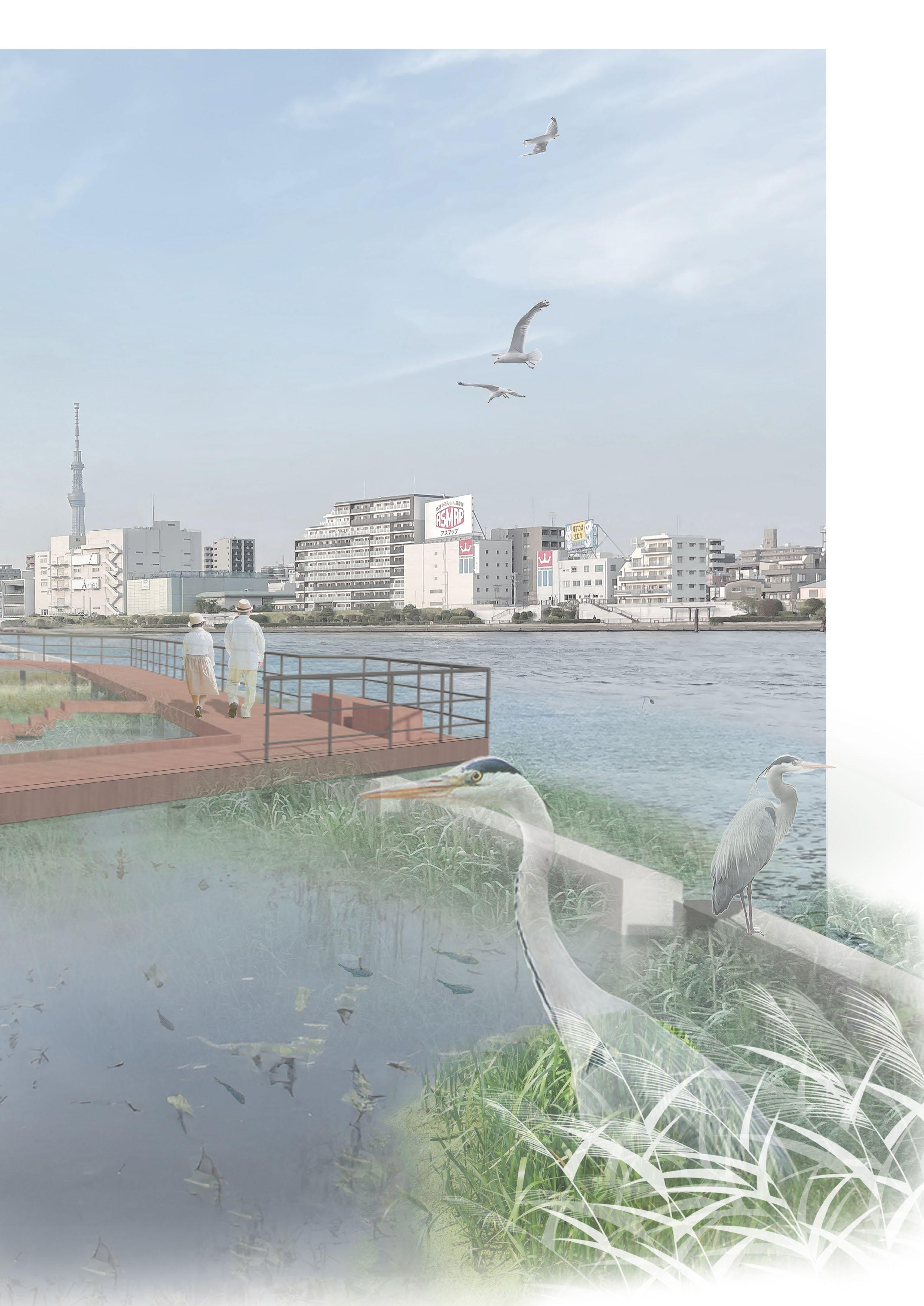
The mouth of the Sumida River was created by reclaiming the sea, so the river is wide and looks more like a harbor than a river.Many of the surrounding buildings are also skyscrapers, so here, the sense of the urban water landscape can be characterized by this area.
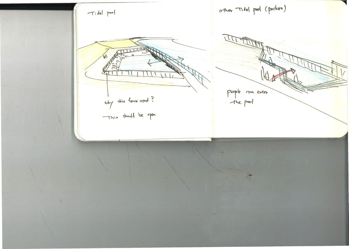
The design aims to create viewing points where visitors can enjoy the skyline of the cityscape with elevated buildings and iconic bridges, as well as the river view.In addition, due to being close to the ocean, the water has a large tidal range. Using this character, the water steps, which change according to the tidal range, are introduced.
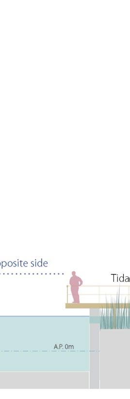
Viewpoint watersteps Tidal pool
High-rise building
177
High-rise building
 Plan: Urban waterfront park
Section: Urban waterfront park
The reinforcement of the floodwall integrates with terraces, providing an elevated structure from which the urban landscape can be viewed. The river space is basically made of hard pavements for the walking area, and on the wall side, a green slope with grass or stairs offering a place to sit or lie down towards the water view. On the riverside, the water steps will be created that appear and disappear by the tidal. Visitors will perceive the natural cycle of the tide by seeing the different sizes of the steps.
180
situation
current
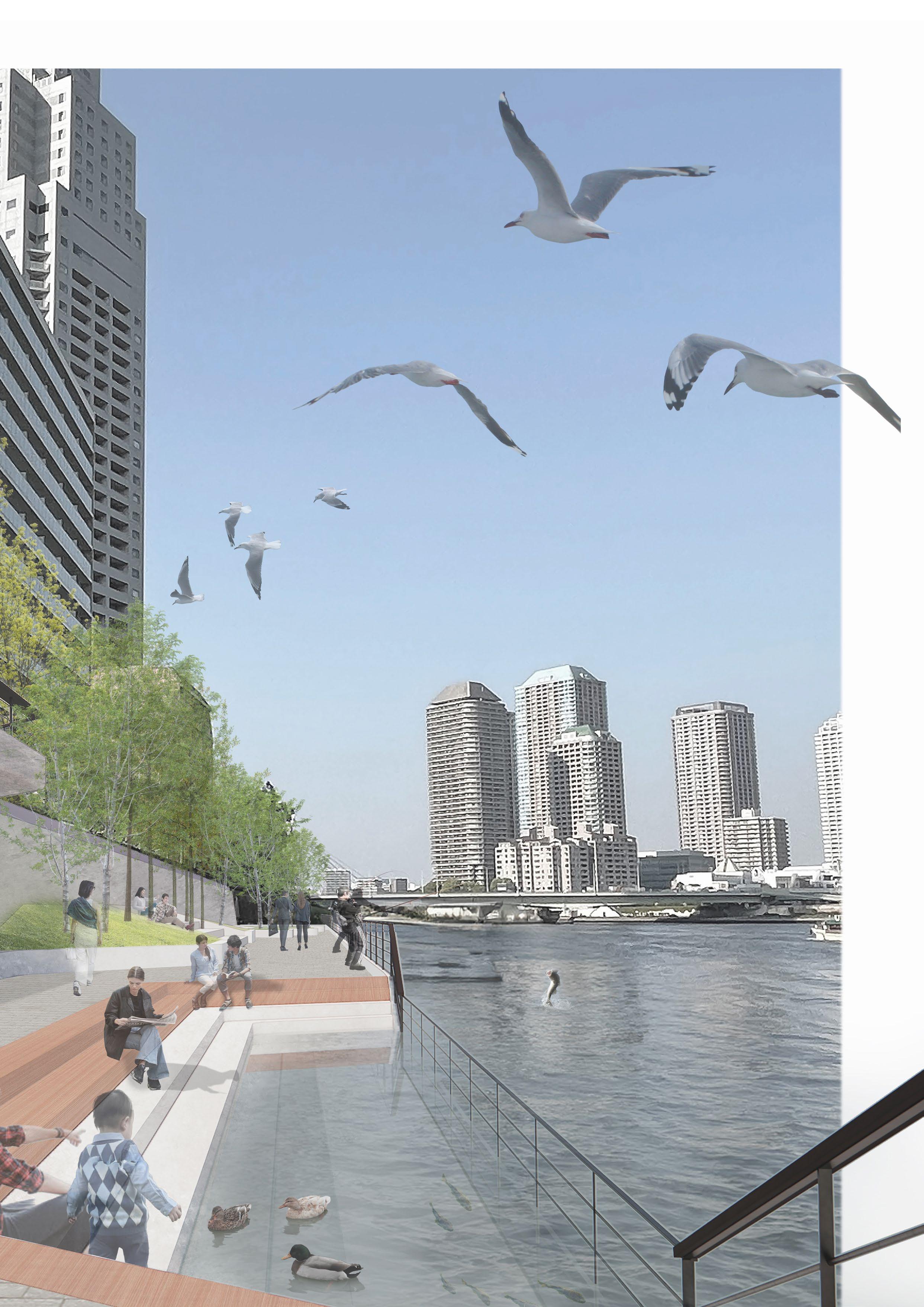
of the Urban waterfront park
Impression

 Super levee


 Sumida Park
Hamacho Park
kiyosumi japanese garden
Yasuda japanese garden
Ueno park
imperial palace
Sumida Park
Hamacho Park
kiyosumi japanese garden
Yasuda japanese garden
Ueno park
imperial palace