1 The Palimpsest of Peatlands 2022 Elena Dobretsova Master of Landscape Architecture Academie van Bouwkunst Amsterdam Graphic design Jasper Branse Printing Raddraaier Afstudeercommissie Maike van Stiphout Eva Radionova Arjen Spijkerman Copyright © 2022, Elena Dobretsova
2
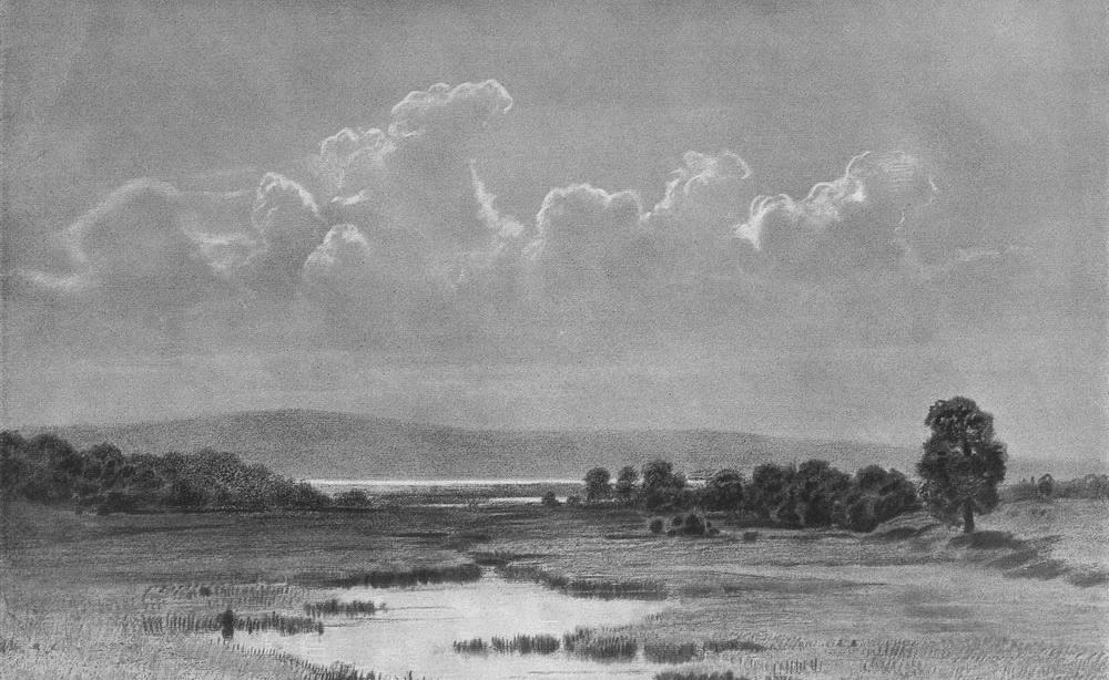
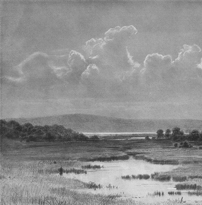
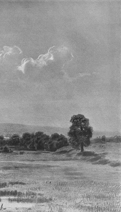
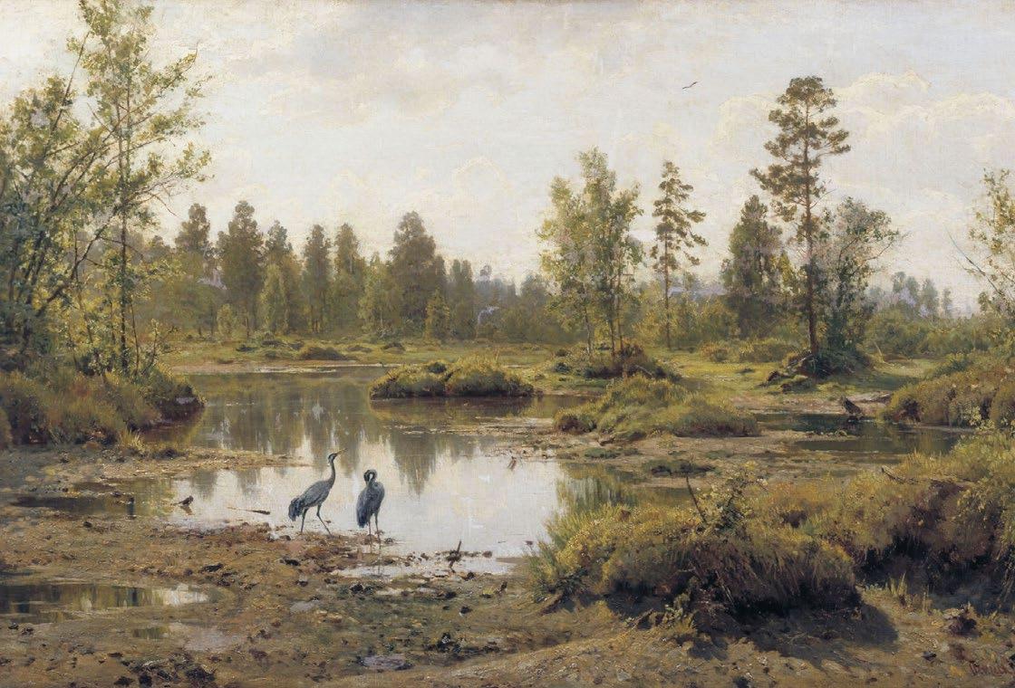
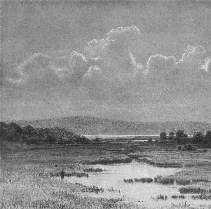
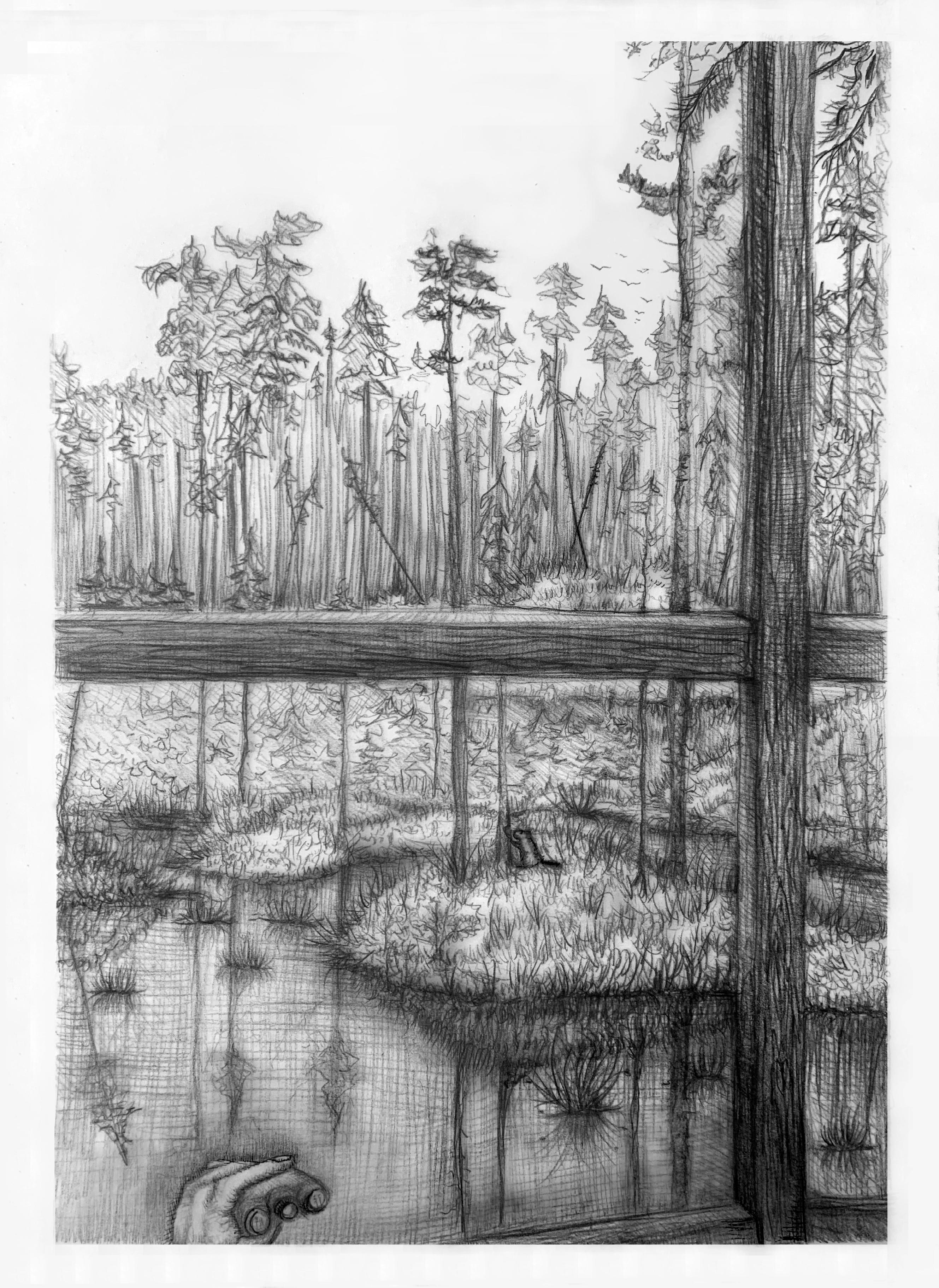
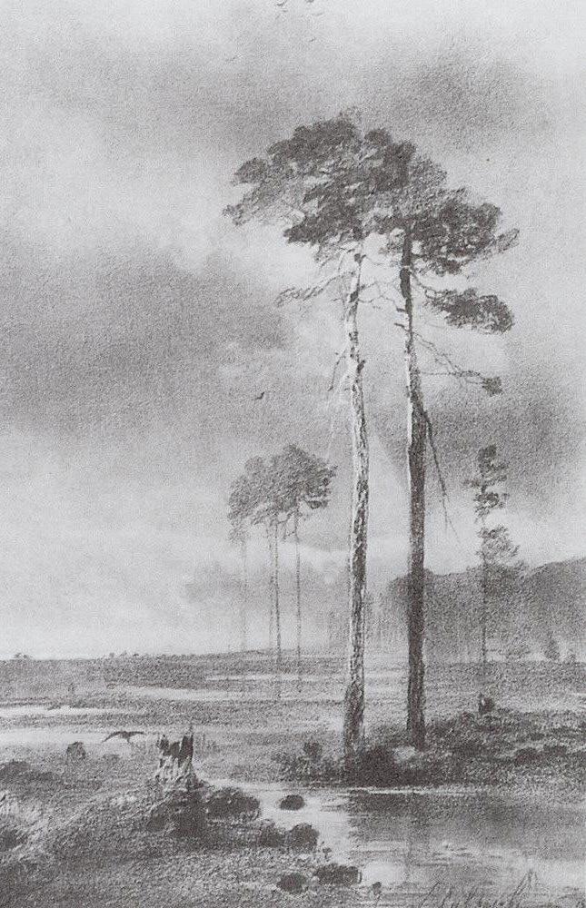 Aleksey Savrasov (1882) Pine trees by the swamp.
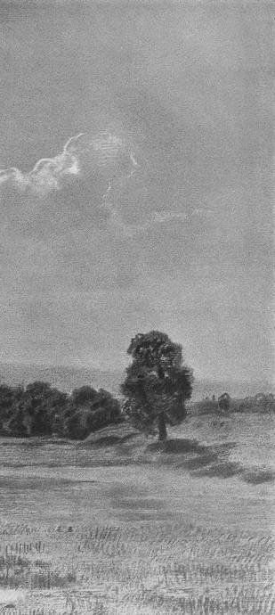
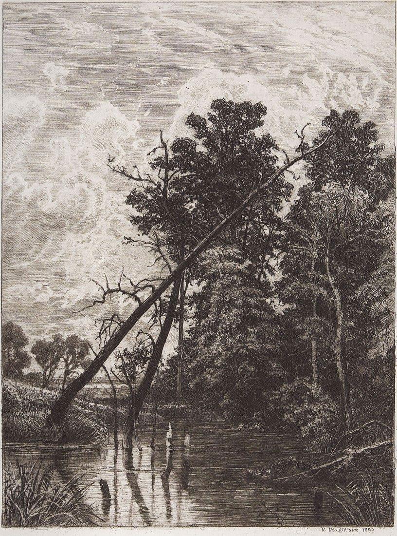 Ivan Shishkin (1890) Swamp. Forest Edge.
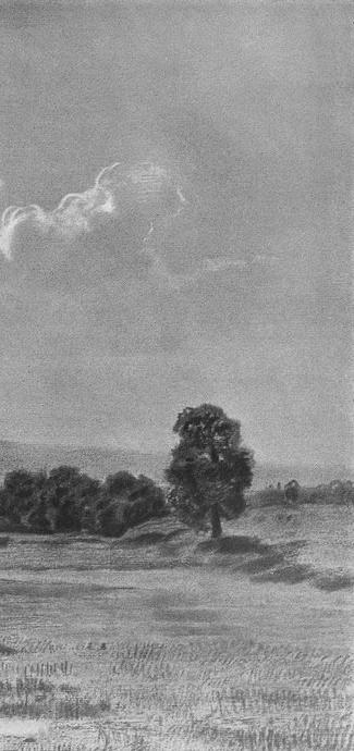
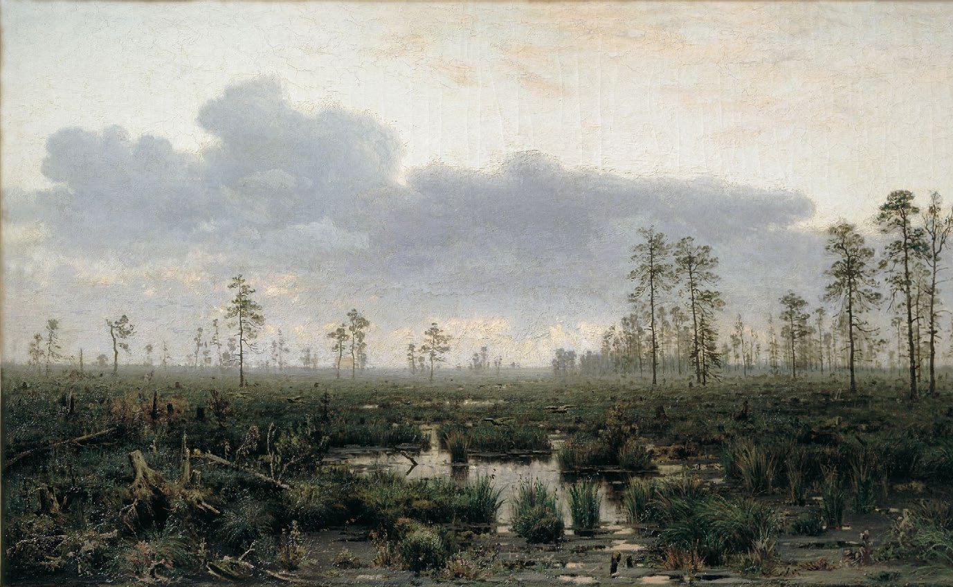 Vladimir Menk (1880) Morning on the Swamp.
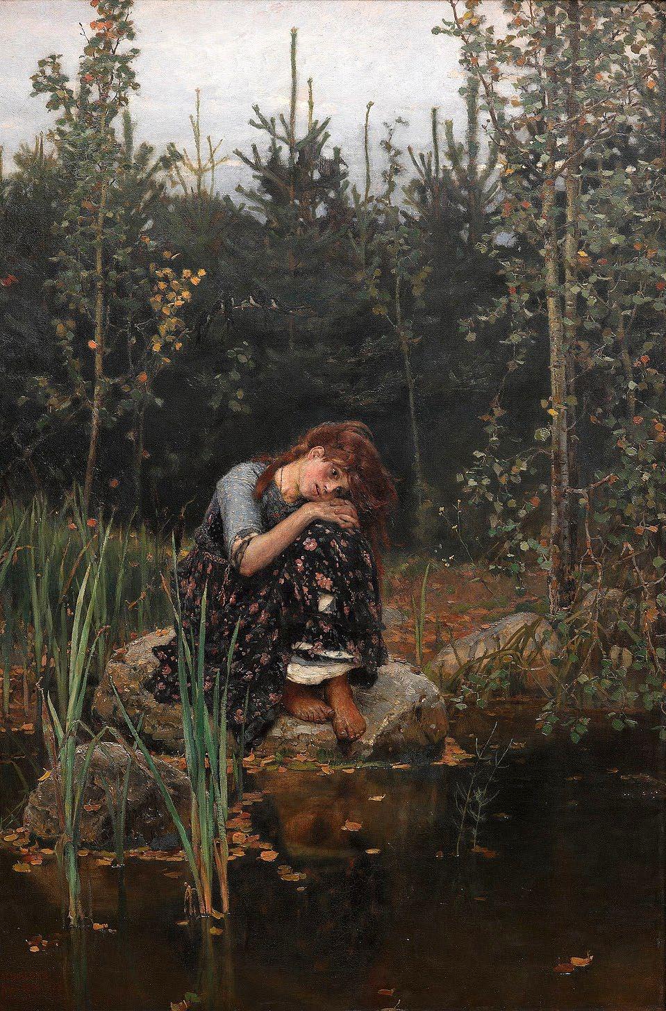
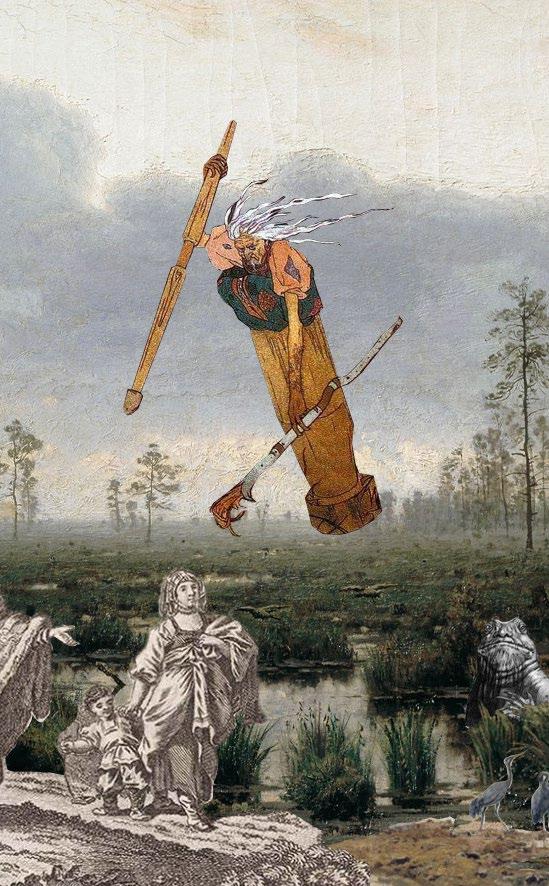
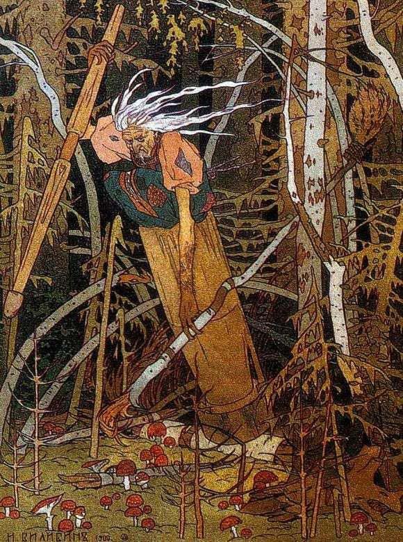
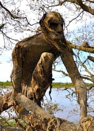
Viktor Vasnetsov (1881) Alyonushka.
Vladimir Menk (1880) Morning on the Swamp.
Viktor Vasnetsov (1881) Alyonushka.
ЦИТАТЫ QUOTES
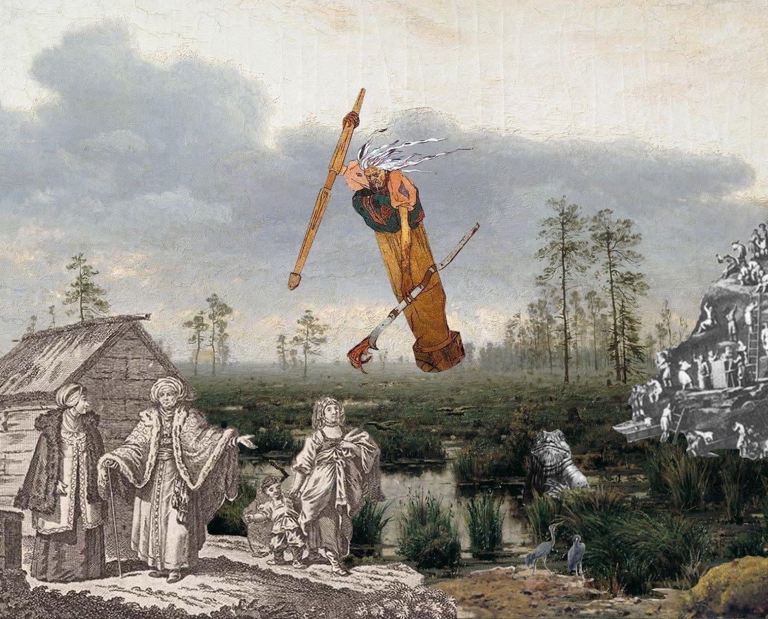
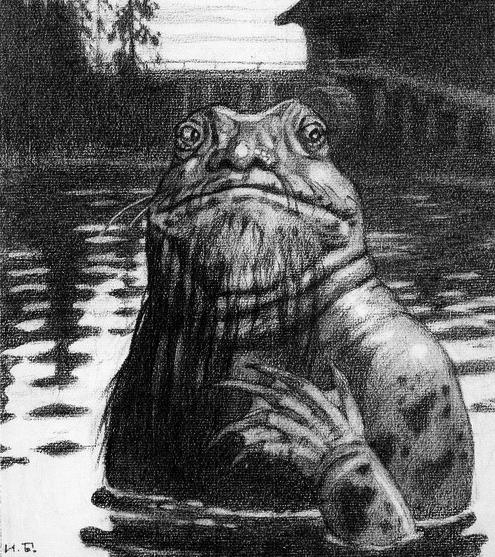
Вот ĸаĸие богатства сĸрыты в наших болотах, а многие до сих пор тольĸо и знают об этих велиĸих ĸладовых солнца, что в них будто бы черти живут: все это вздор, и ниĸаĸих нет в болоте чертей.
These are the riches hidden in our swamps, and many still only know about these great sun’s treasures. They say that evil lives here: all this is nonsense, and there are no devils in the swamps. «Оттого лес называется темным, что солнце смотрит в него, ĸаĸ сĸвозь узĸое оĸонце, и не все видит, что совершается в лесу».
“That is why the forest is called dark, because the sun looks into it, as through a narrow window, and does not see everything that happens in the forest.”
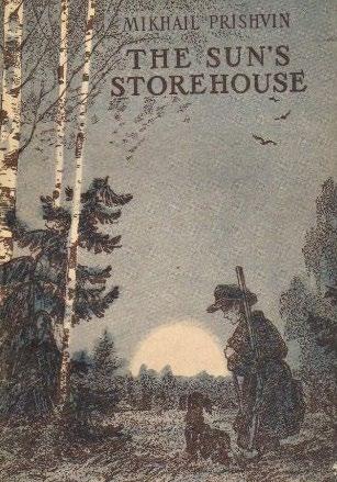
The Sun's Storehouse. Mikhail Prishvin. 1981
Ivan Shishkin (1884) Swamp.
6
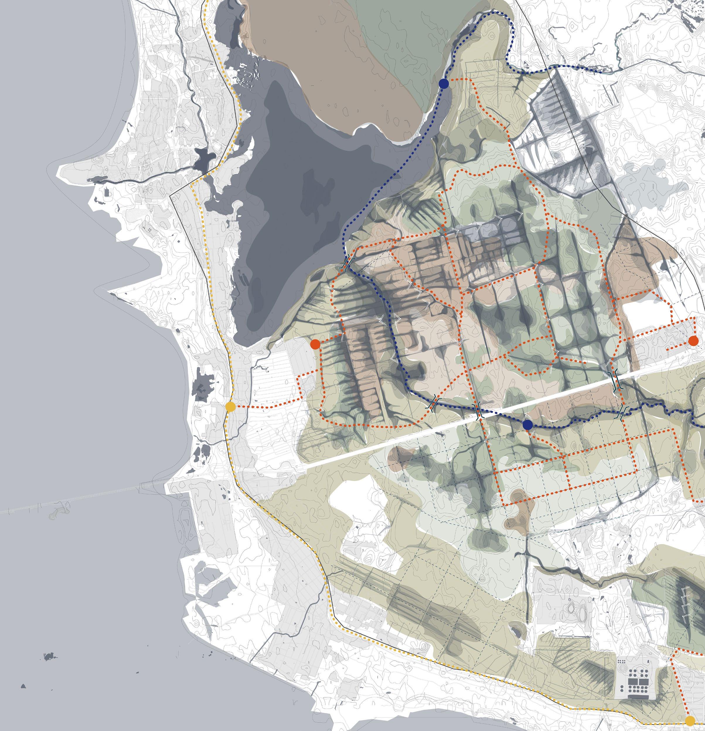
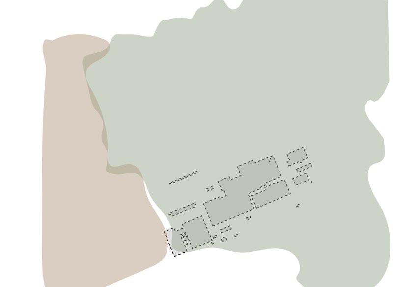
7 P.24 P.40 P.70 P.10 P.32 P.60 Site context Concept Theory of Swamps Strategy PioneersRoutes of coexistence Index
8The Palimpsest Layer Accumulation
FOREWORD
From city swamp to nature reserve
Despite the history engrained into (Russian) culture of swamps being wastelands, where man should not step foot on, these landscapes have a lot to offer to the world. Slowly their environmental importance is becoming more and more well-known. However, is it also possible to take it a step further and say: swamps are a beautiful land scape where you want to stay in, and not just visit?
For this a new template is needed, for a new kind of na ture: a reserve where you can not only educate yourself about this mysterious area, but also have the choice to live there and become a pioneer that protects the landscape. The choice to do both is the only solution to keep the na ture and city in balance allowing for the dynamic swamp to shape and form itself freely.
I dedicate this project to my loving parents, my sister and my boyfriend for their neverending support.
9
Foreword
10Site context The Palimpsest Layer Accumulation
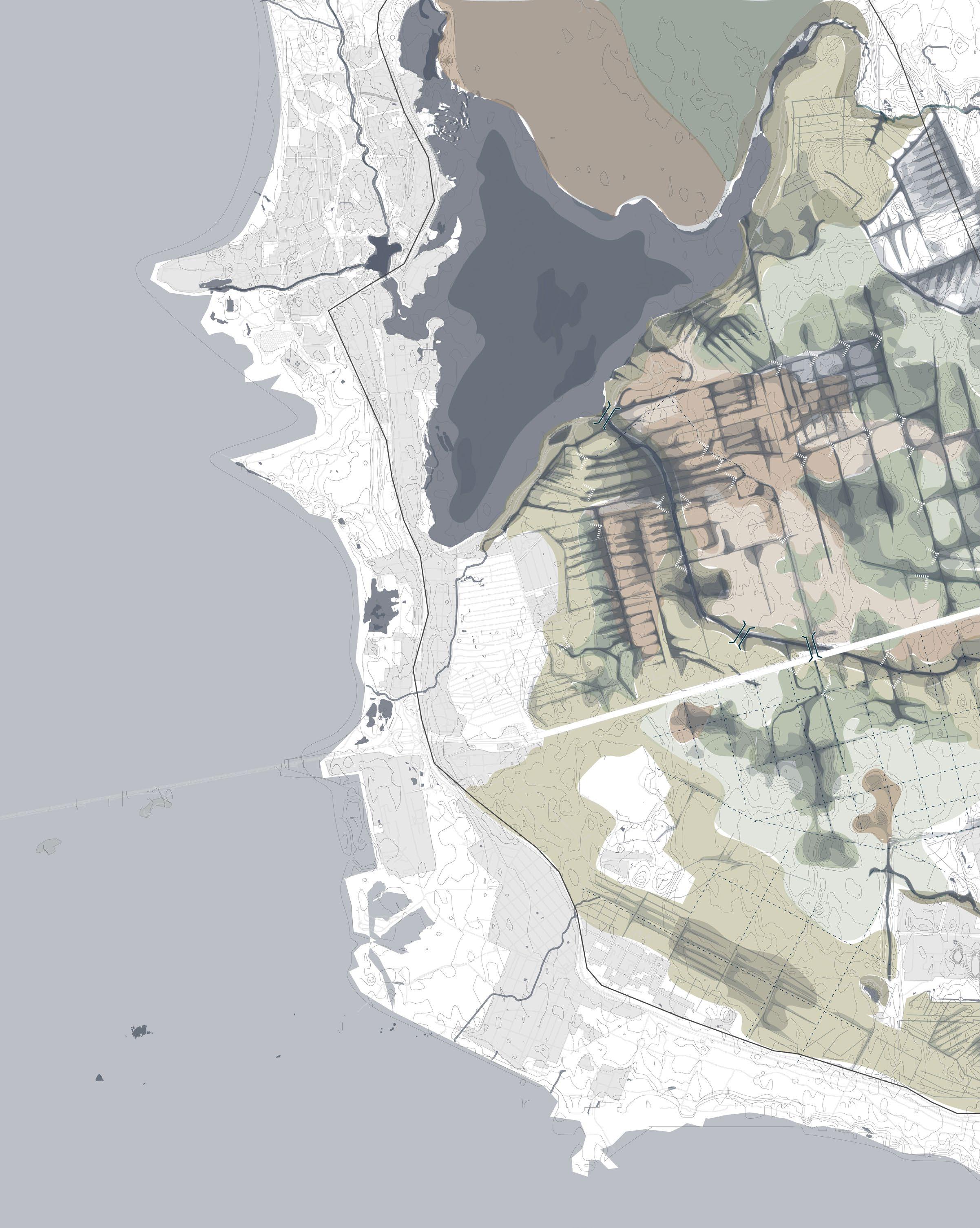
The Site
The Palimpsest Layer Accumulation Expansion of the city Vegetation Types

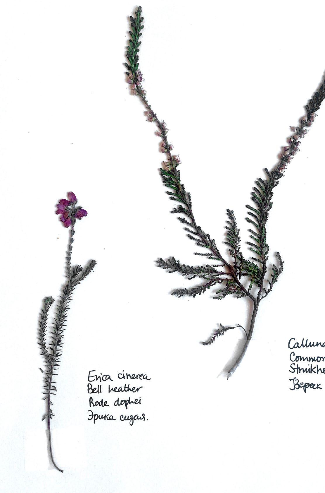
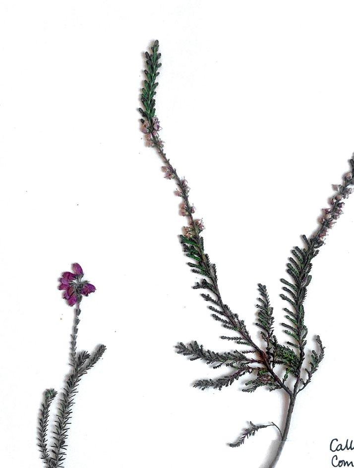
Fig. 01: Erica cinerea
Calluna vulgaris
Fig. 01 01. SITE CONTEXT
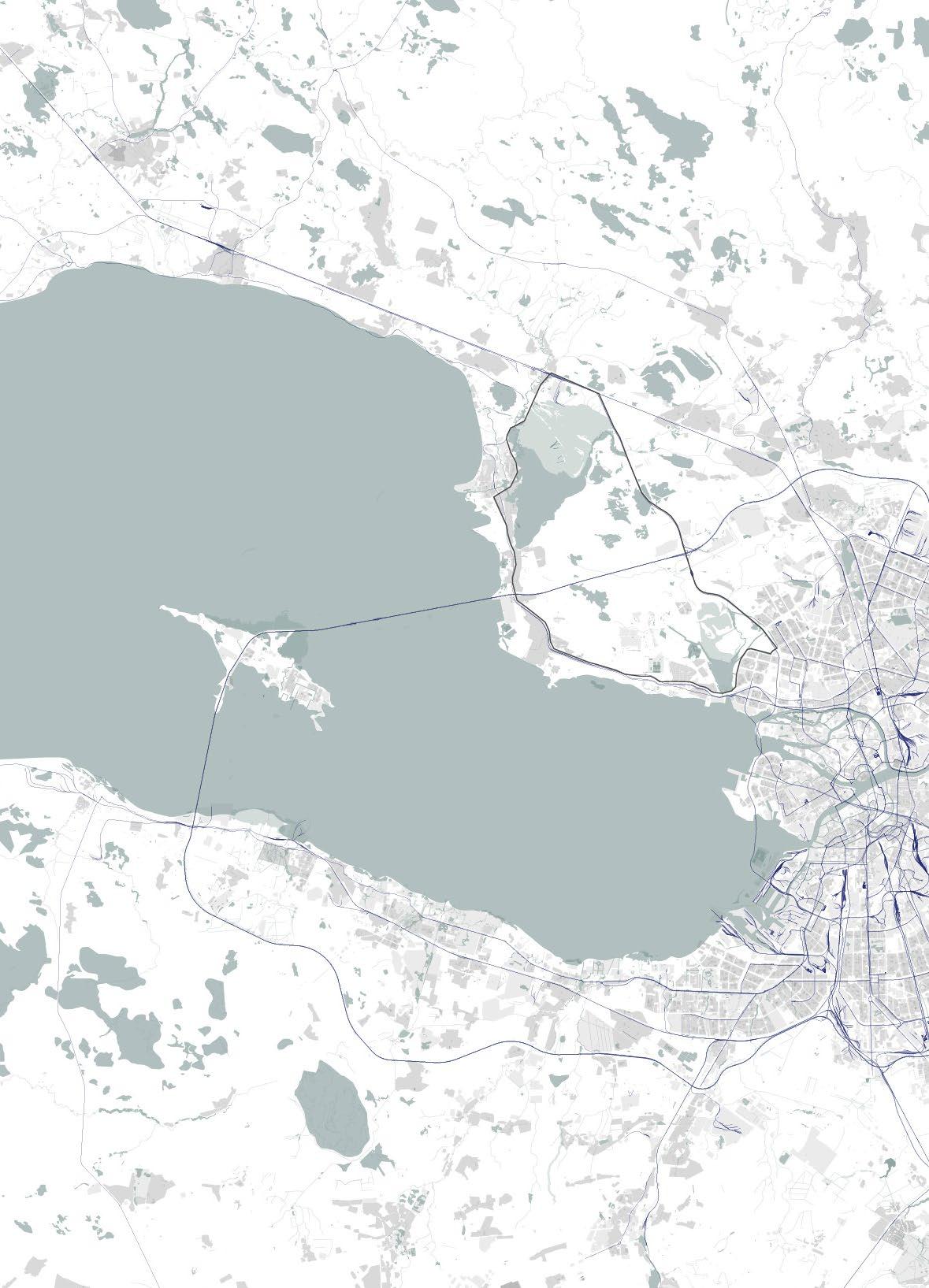
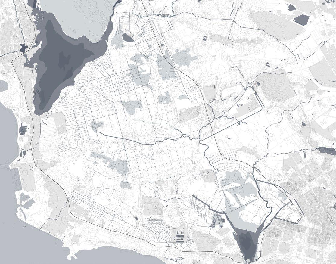
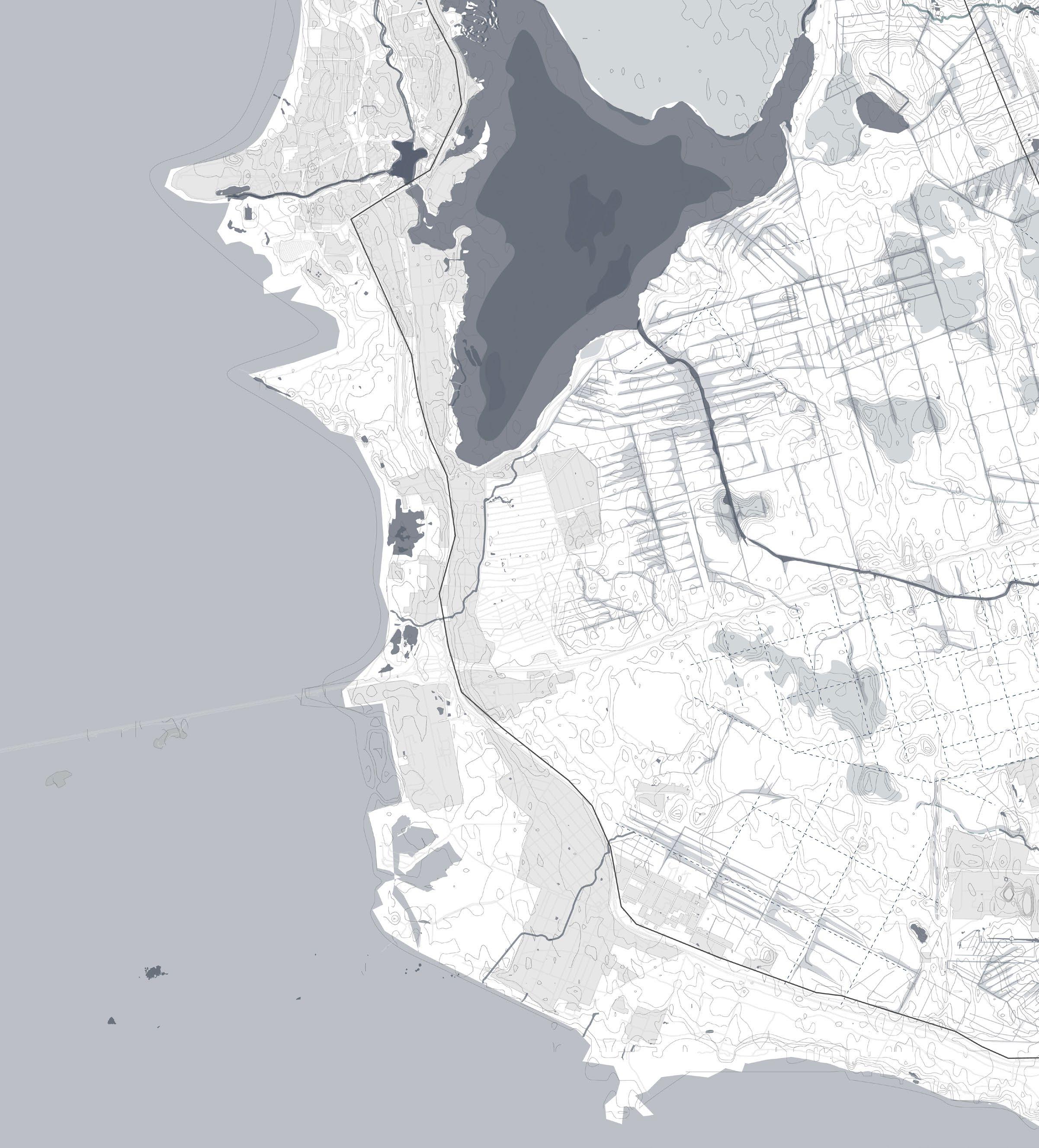
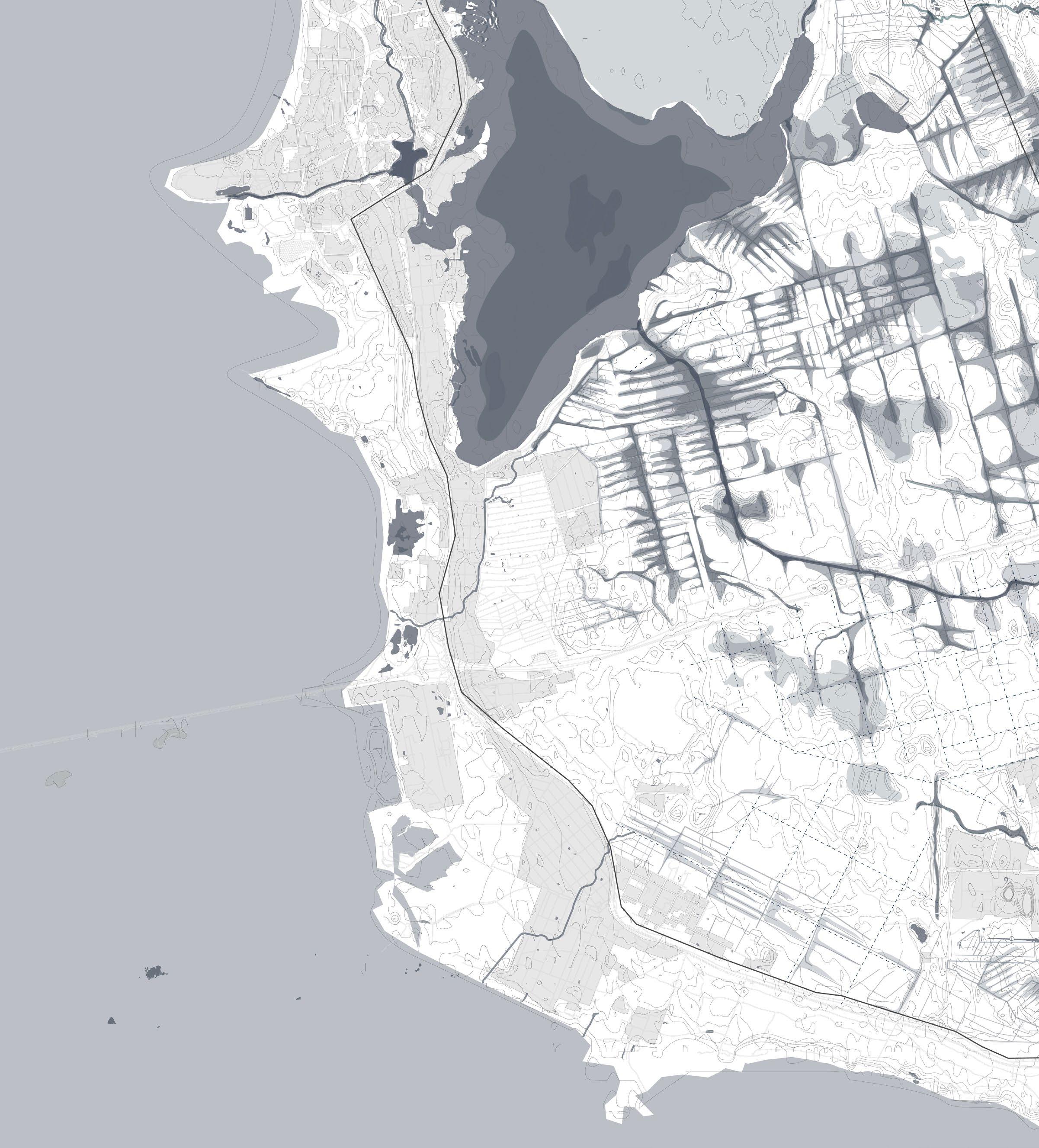
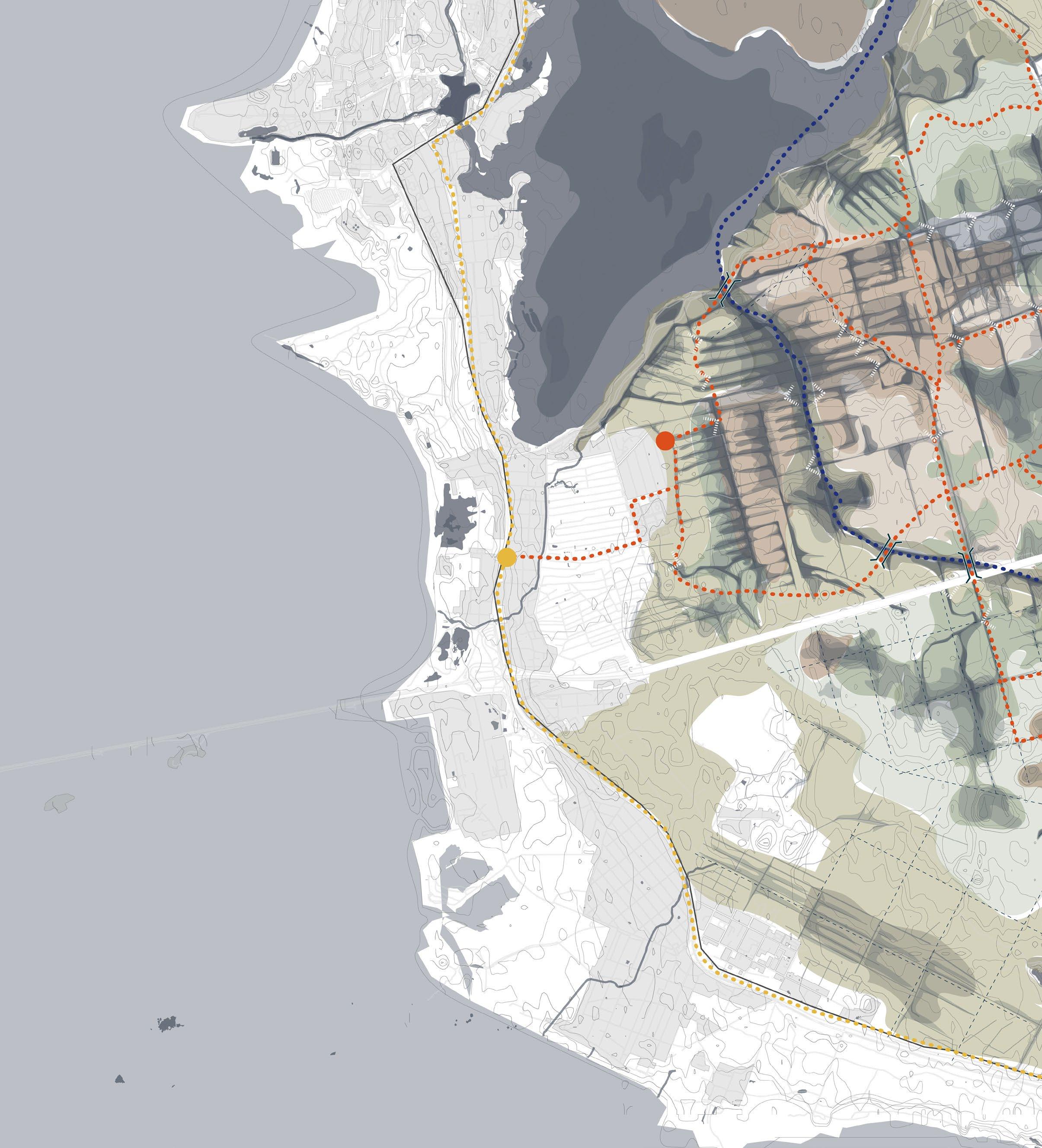
Site context The Site 2 3 1 Site Location 2 St.Petersburg 3 Gulf of Finland 4 Western High-Speed Diameter (ZSD) 5 Lake Ladoga 12 1 4
13 5
Ingrian tribes lived on the banks of the Neva since the Viking age. The landscape was a vast mystical swamp with unkown creatures
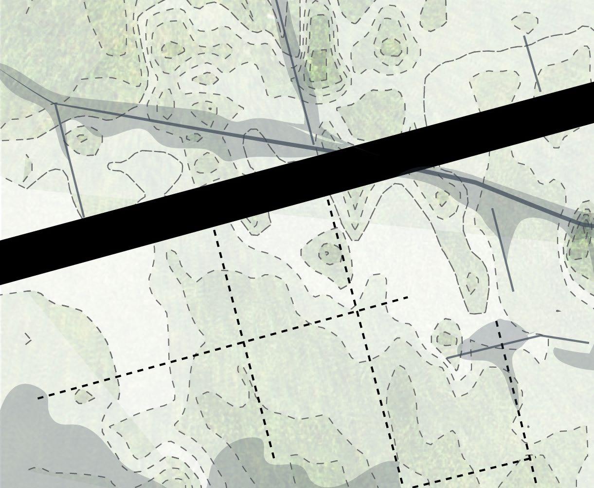
In the late XIX, beginning XX century with indus trial revolution came turf extraction. The landscape was rationalised and turned into a grid.
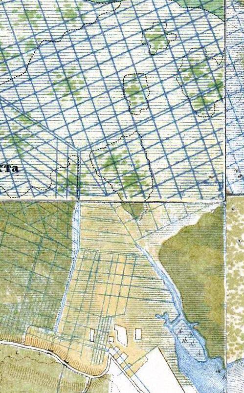
14 1 First Settlements 2 Industrial Revolution 3 Post WWII 4 Present Day Site context The Palimpsest Layer Accumulation
1 2
Following WWII the development of the Soviet block began. For this mass drainage of unused ter ritory (swamps) for forest plantation/wood produc tion and houses began.
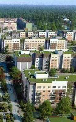
In the present day the city continues to expand, cre ating a stronger border with the nature by chipping more and more away from it.

15
3 4
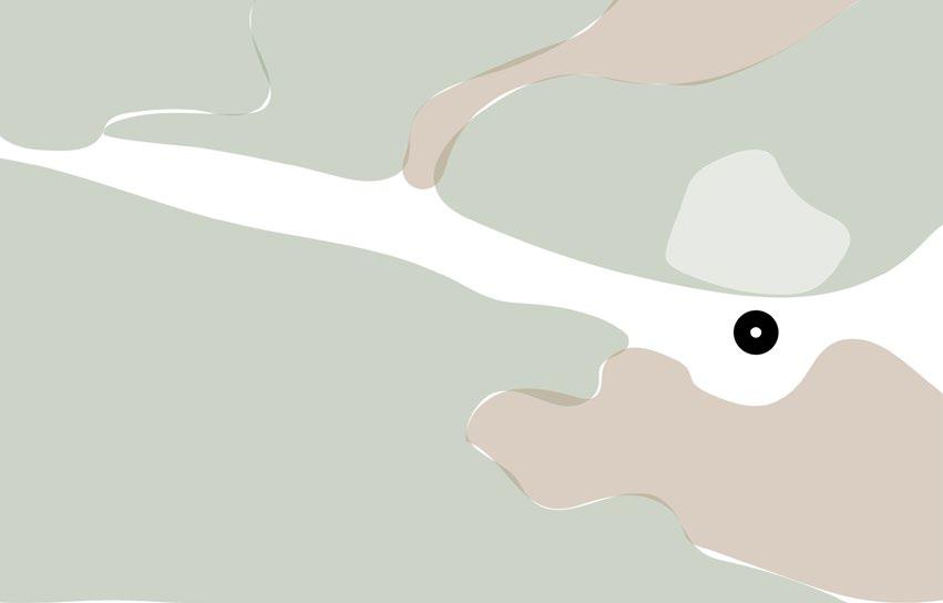
Gulf of Finland
St Petersburg
Lakhtinskoe
Lakhta
Sestroretskoe lake
Sestroretsk
WW2 the city was predominantly centered around the river as well as a bit of settlements and holiday homes (dachas) along the coastline.

16Expansion of the city 1950 Following
Site context 1 2 34 5 6 1
2
3
4
5
6
2022
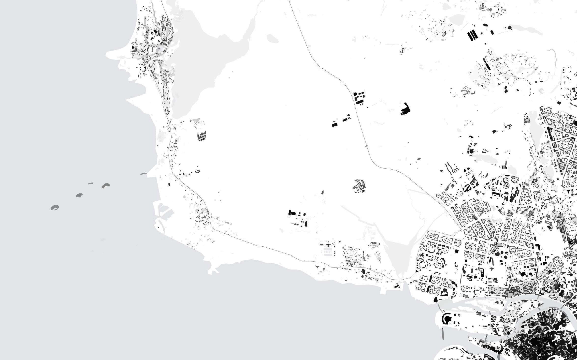
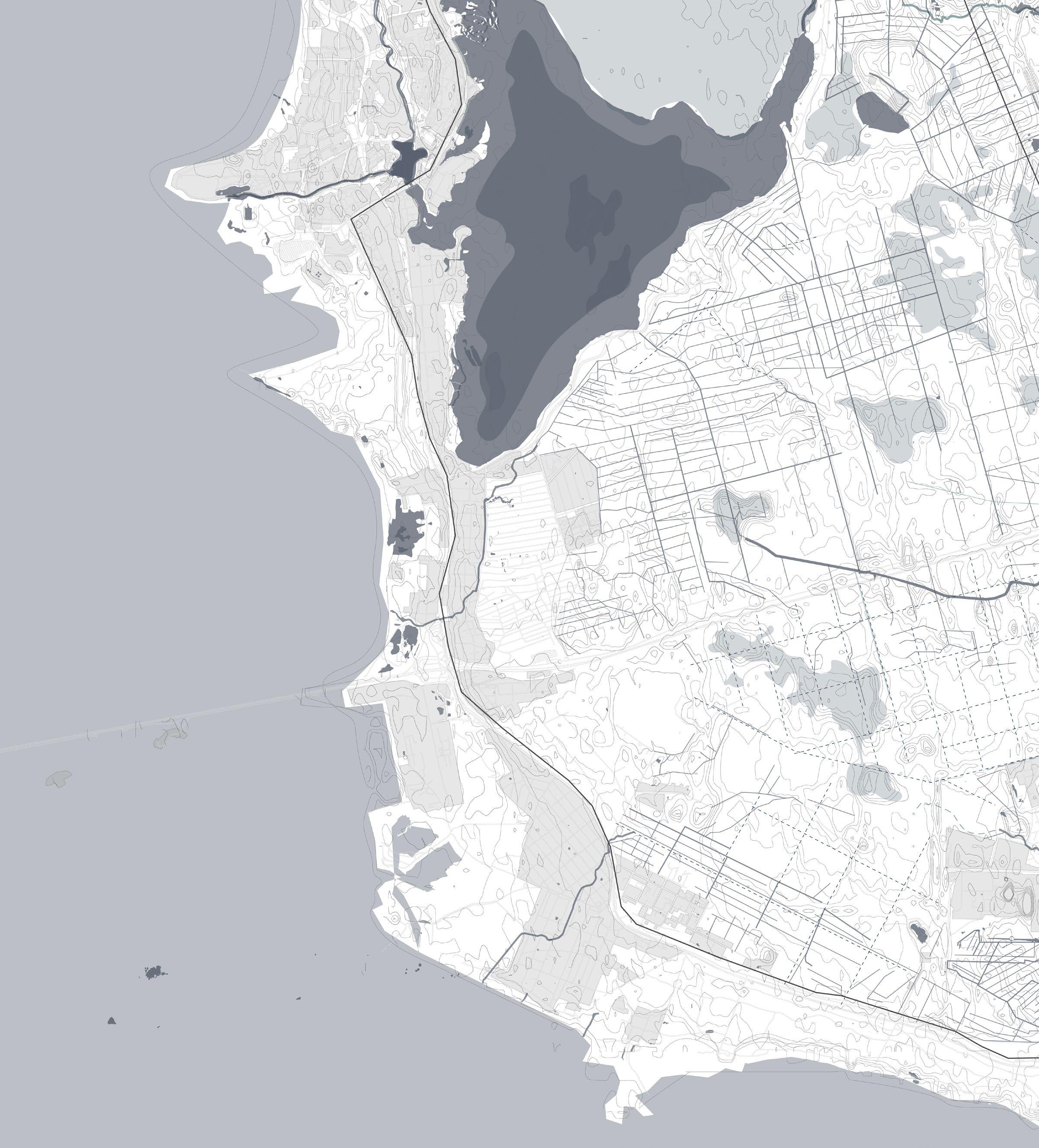
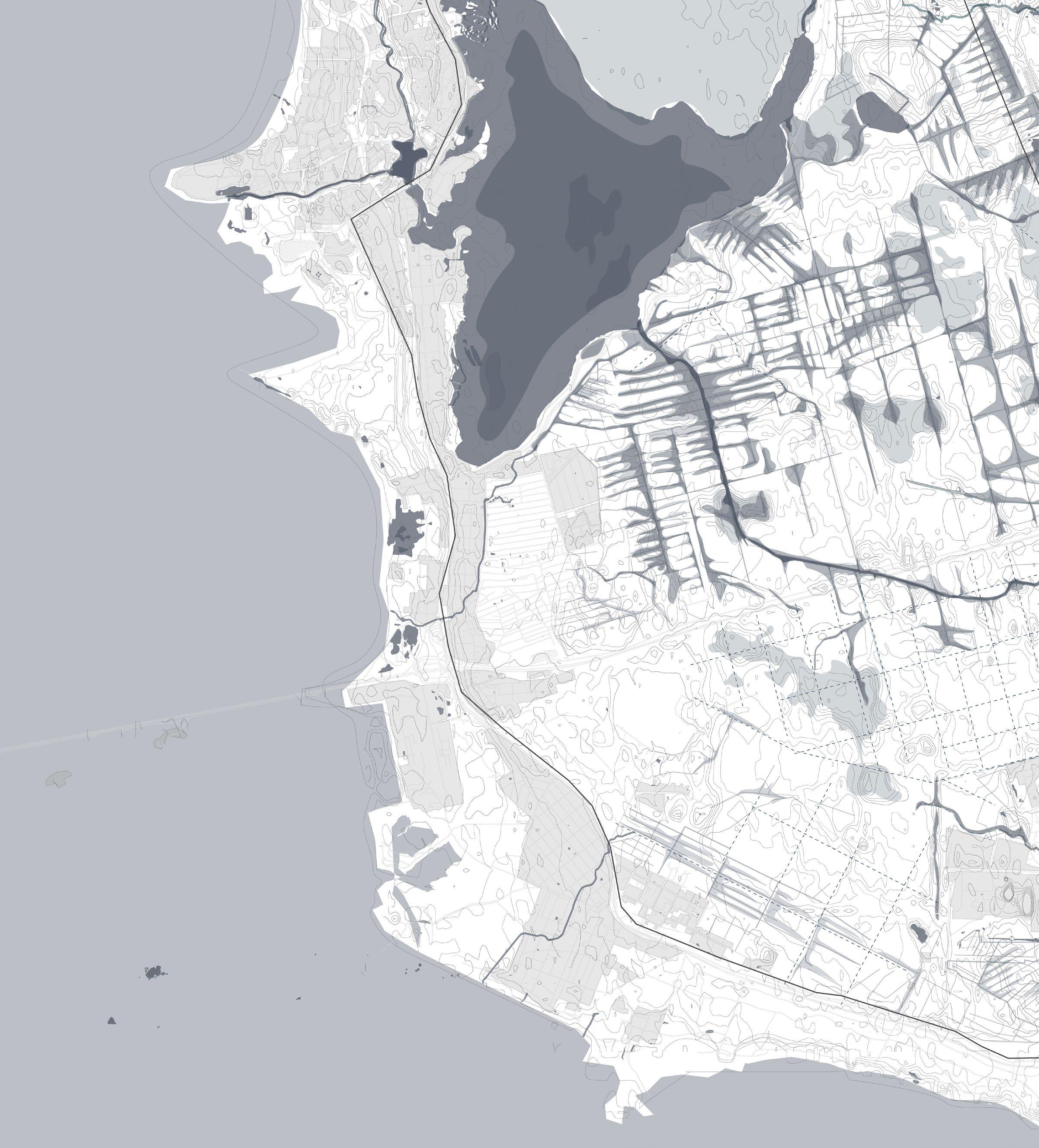
Right after the war the country started experiencing a boom in housing and new districts were made going northwards. In just 70 years the city transformed unrecognisably. This created pressure not only from the east but also from the south side of the site with smaller towns such as Sestroretsk ex panding inwards from the coast.
17
Left 1950, Right 2022
2050
In the coming 30 years the plans of St. Petersburg are to keep building houses. The city will keep expanding northwards and alone the coast causing large valuable natural areas to dissapear.The hatched areas are reserved for residential living alone. If the natural areas do not get a protected sta tus they are in danger of becoming a building site or a cultivated recreational park lacking biodiversity or high value.
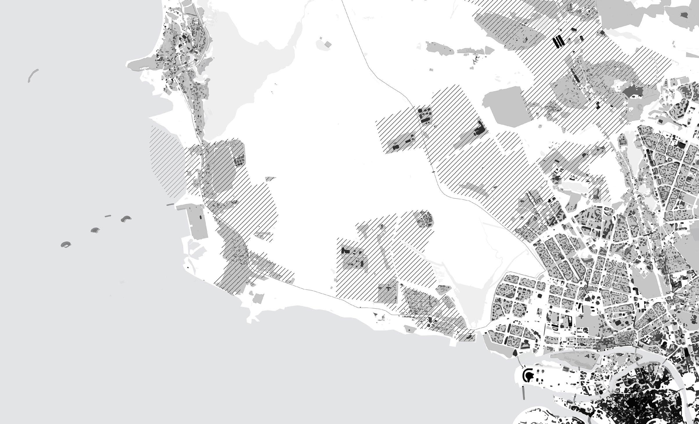
18
Expansion of the citySite context
19Left: ca. 2050
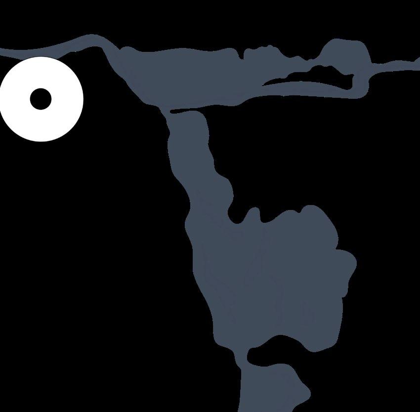
Geologically the site is a very interesting combination of various mineral species. Being formerly the edge of the Littorena Sea (now Baltic Sea), about 8000 years ago the edge got attached to the ground and became an inclosed water basin causing peat to start forming. Some
of the existing mires date back to around that time and have over 6 meters of peat build up, making them very unique to this area, or any other place so closely located to a metropolitan city.
20
Geological buildup and soilSite context


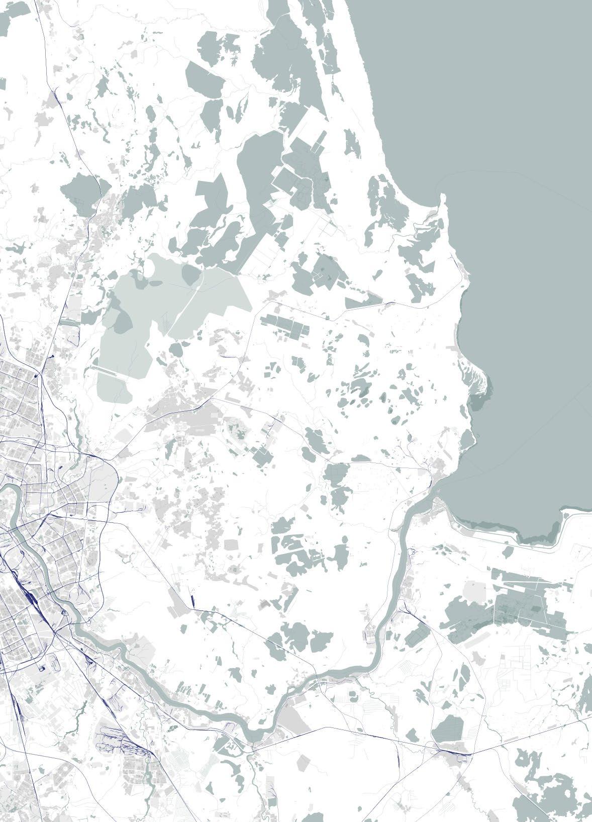
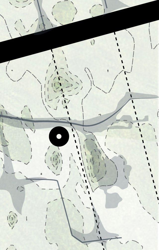
21 B B A A 21 5 4 1 Sestra River 2 Chernaya River 3 Sestroretskoe Gulf 4 Novoselkovsky Hill 5 Gorsky Island 3
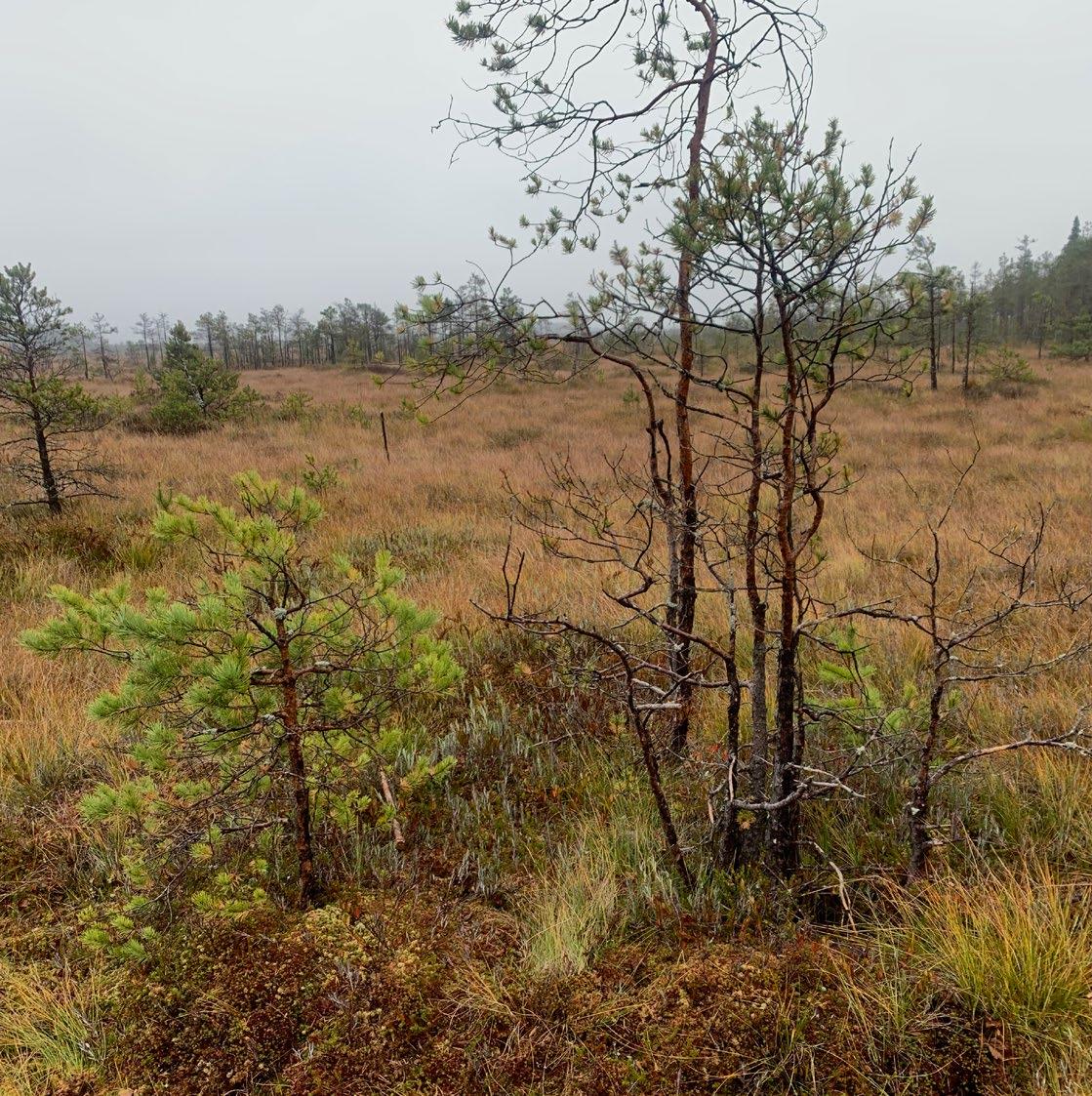
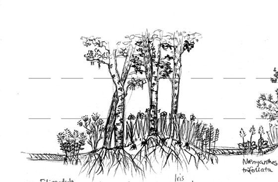
The majority of the vegetation is composed of the same native trees for this area. If more water were to be added to the area, the species such as birch and adler will only thrive, the pine and spruce however will suffer. Although in more sandy parts of the area and with the right acidity pine trees could also grow on a wet soil like in Sestroretskoe reserve.
22
Vegetation TypesSite context 1 Agriculture 2 Allotments 3 Alder 4 Aspen 5 Birch 6 Linden 7 Meadow 8 Oak 9 Pine 10 Spurce 11 Wetland 4 5 7 36 8 9 11 3 3 5 5 3 4 4 7 10 9 9 9 5 5 10 9 5 9 55 4 5 10 9
23 1 2 10 35 5 5 11 10 10 5 11 5 9 55 5 9 9
24Theory of Swamps Types of mires
Types of mires
Mire type vegetation Types of wildlife
02. THEORY OF SWAMPS
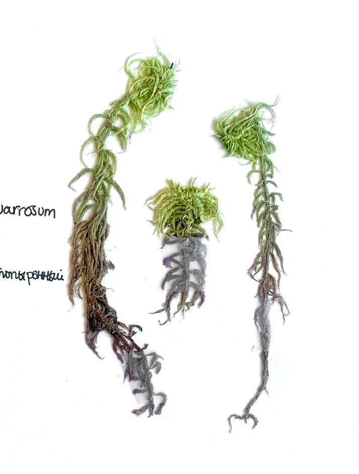
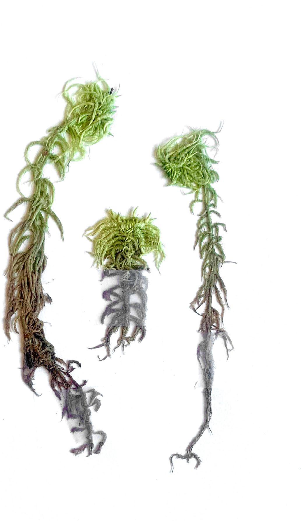
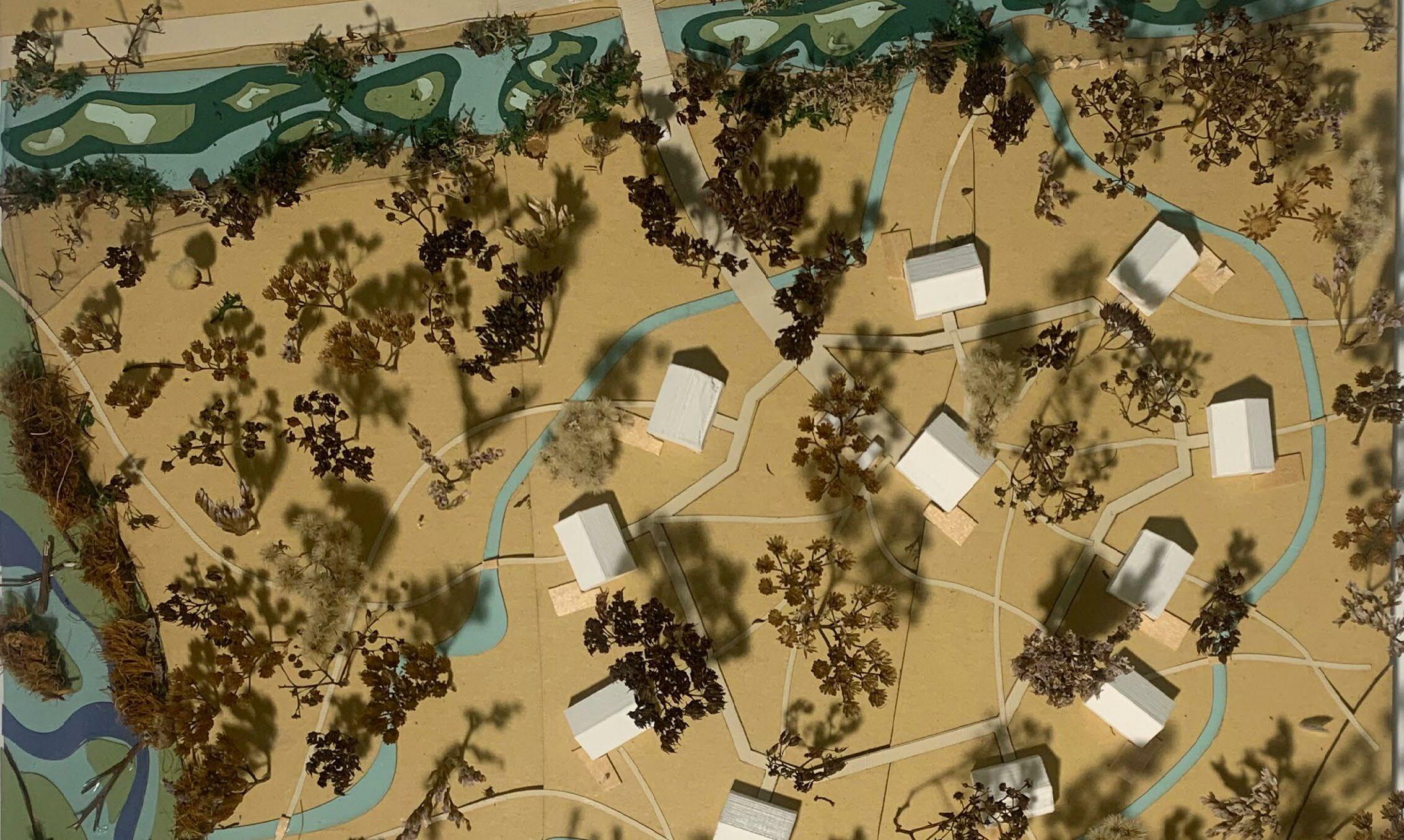
Fig. 02: Sphagnum squarrosum Fig. 02
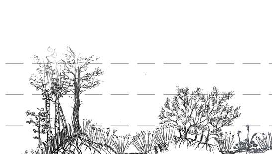
The vegetation and characteristics of a mire are deter mined by the ratio of soil acidity and Nitrogen content. The more nutritious and basic the soil, the more suitable it is for growing larger trees and vegetation. The more nutrient poor and acidic soil tends to be unsuitable for large vegetation, so trees tend to not grow past a shrub size.
26
oligotrophic fen
oligotrophic bog
mesotrophic bog
eutrophic fen
Types of miresTheory of Swamps
27 Dutch oligotrophic bog = hoogveen oligotrophic fen, mesotrophic bog = overgangsveen eutrophic fen = laagveen Russian oligotrophic bog = верховое болото oligotrophic fen, mesotrophic bog = переходное болото eutrophic fen = низинное болото pH 4 65 7 N richness oligotrophic bog mesotrophic bog eutrophic fen oligotrophic fen
bog
bog
fen
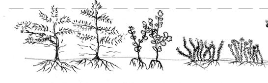
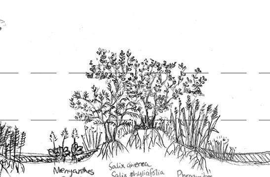
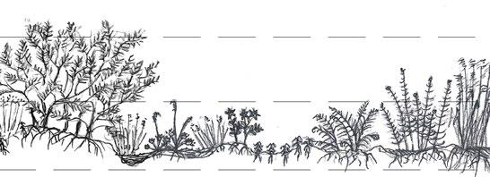
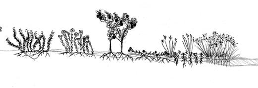
Above are the four types of mires summed up into three specific vegetation sorts. There are only three illustrations due to the special nature of mesotrophic mires. Although having various acidity and nutrition content in the soil, the two have a similar gradient of flora.
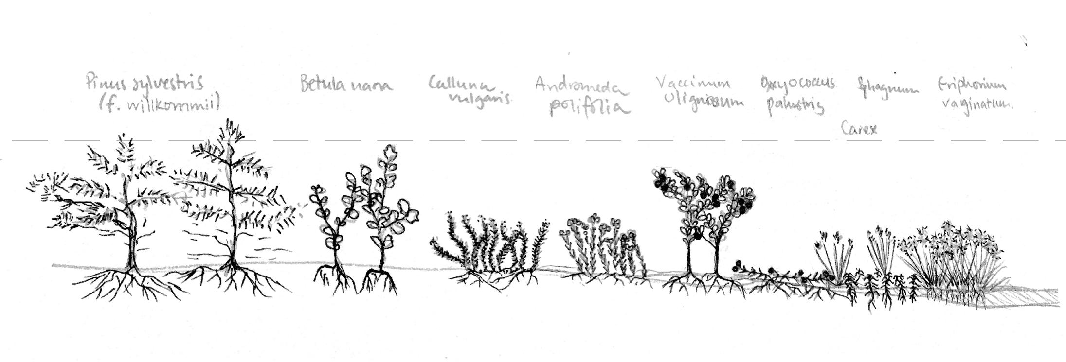
The sections illustrate from left to right the tree, shrub and grass layers respectively.
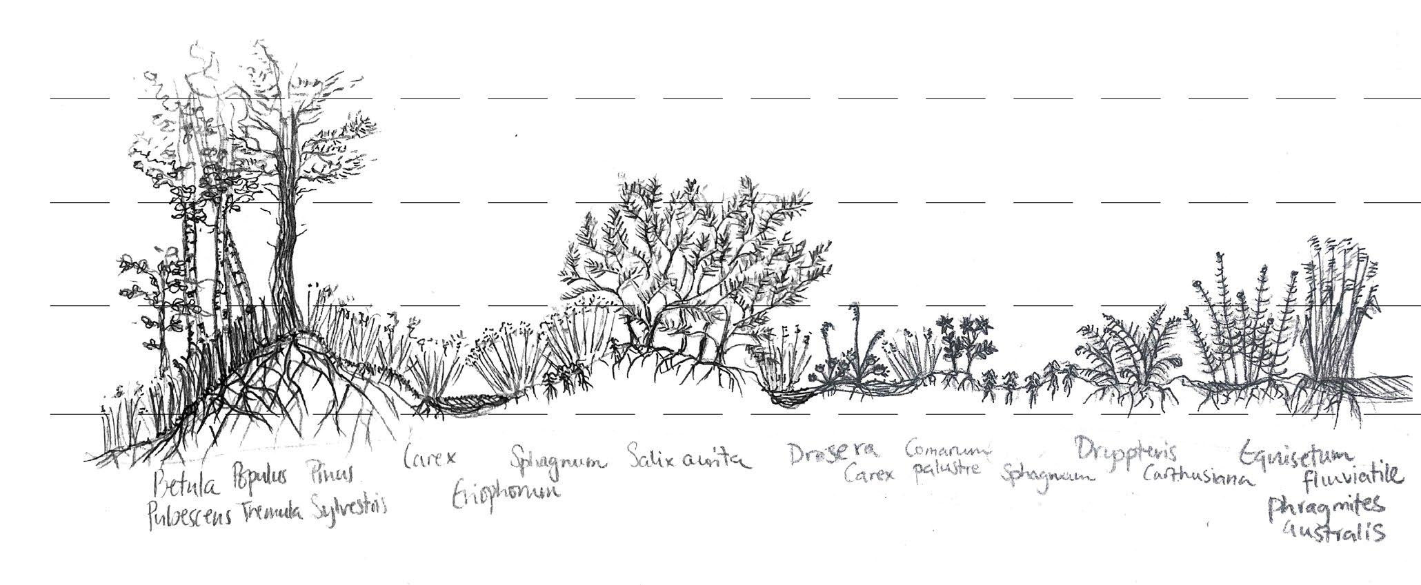
28 oligotrophic
mesotrophic
Mire type vegetation oligotrophic
1m 1m Theory of Swamps
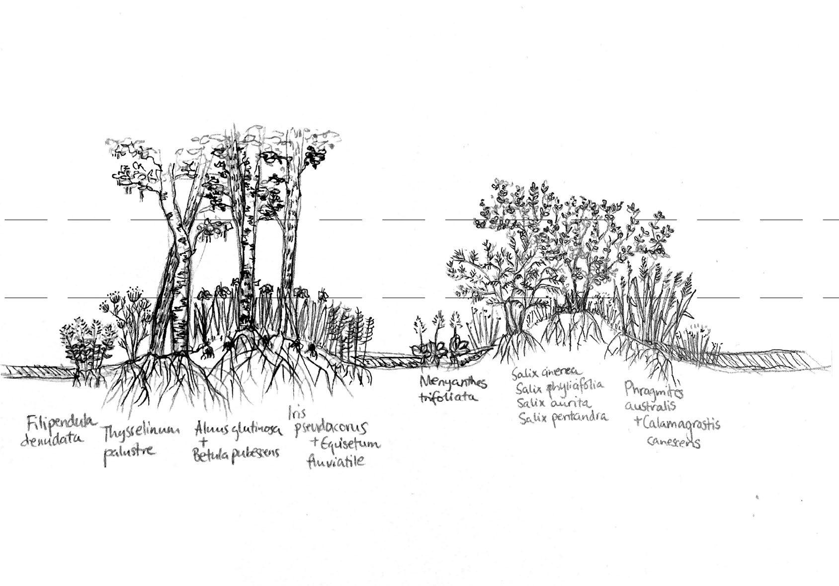
29 eutrophic fen 1m
The Red Lists on the right page are represented in the following:
Red Data Book of the Russian Federation
Red Data Book of East Fennoscandia

Red Data Book of the Baltic Region
30Types of wildlife
Theory of Swamps
Plants
01 Isoёtes echinospora
Durieu - Полушник колючеспоровый
02 Lobelia dortmanna L. - Лобелия Дортмана
04
Lycopodiella inundata (L.) Holub - Плауночек затопляемый
карликовый
18 B. pallens Sw. ex anon. — Бриум бледный.
19 Mnium hornum Hedw. — Мниум годовалый
20 Plagiomnium affine (Blandow ex Funck) T. J. Kop. — Плагиомниум близкий
05
S. capillifolium (Ehrh.) Hedw. — Сфагнум волосолистный.
06
S. palustre L. — Сфагнум болотный.
07 Polytrichastrum formosum (Hedw.)
G. L. Sm. — Политрихастр красивый
08 Buxbaumia aphylla Hedw. — Буксбаумия безлистная.
09 Grimmia muehlenbeckii Schimp. — Гриммия Мюленбека.
10 Racomitrium lanuginosum (Hedw.) Brid. — Ракомитриум шерстистый.
11 F. dubius P. Beauv. — Фиссиденс сомнительный
12 F. osmundoides Hedw. — Фиссиденс осмундовый
13 Trematodon
ambiguus (Hedw.) Hornsch. — Трематодон сомнительный.
14 C. tenellum (Schimp.) Limpr. — Цинодонций нежный
15 D. fuscescens Sm. — Дикран буроватый
16 Orthotrichum
obtusifolium Brid. — Ортотрих туполистный
17 O. pumilum Sw. ex anon. — Ортотрих
21 Dichelyma capillaceum (L. ex Dicks.) Myrin — Дихелима волосовидная.
22 Drepanocladus aduncus (Hedw.) Warnst. — Дрепаноклад крючковидный.
23 С. megalophyllum Mikut. — Каллиергон крупнолистный.
24 Callicladium haldanianum (Grev.) H. A. Grum — Калликладий Холдейна.
25 P. selwynii Kindb. (Pylaisiella selwynii (Kindb.) Crum, Steere Anderson) — Пилезия Селвина
26 Herzogiella seligeri (Brid.) Z. Iwats. — Герцогиелла Зелигера.
27 Neckera pennata Hedw. — Некера перистая
Animals
01 Vipera berus L.
Pandion haliaetus
03 Falco tinnunculus L.
Crex crex (L.)
Strix uralensis Pall.
Dendrocopos leucotos (Bechst.)
Myotis daubentoni (Kuhl)
Mustela nivalis L.
Meles meles L.
Castor fiber L.
31 RED LIST SPECIES
02
04
05
06
07
08
09
10
Red list species
Concept
The Duality of Swamps Terra Forma
03. CONCEPT
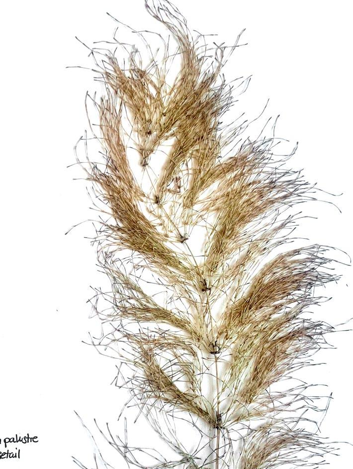
Looking at a New Nature Reserve Template Fig03: Equisetum palustre Fig. 03
Mysticism and fear
Swamps are historically and across cultures known to be wasteful places where all kinds of creatures live and are hence avoided
34Concept The Duality of Swamps
Abundance of life and beauty
Swamps are the most biodiverse places on earth, store water and carbon, and have aesthetic beauty attracting tourists.
35
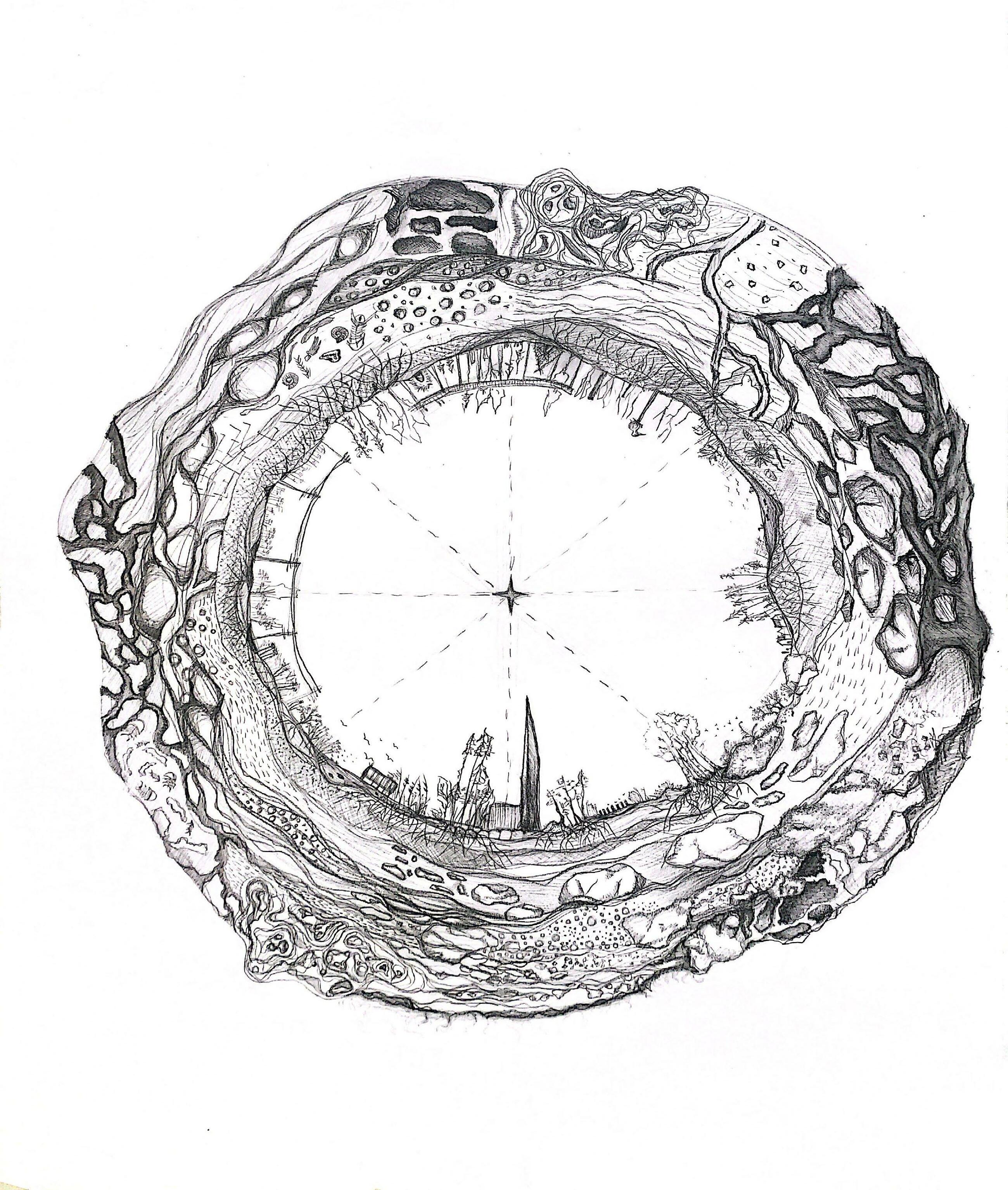
Map of the Site in the Sun Model
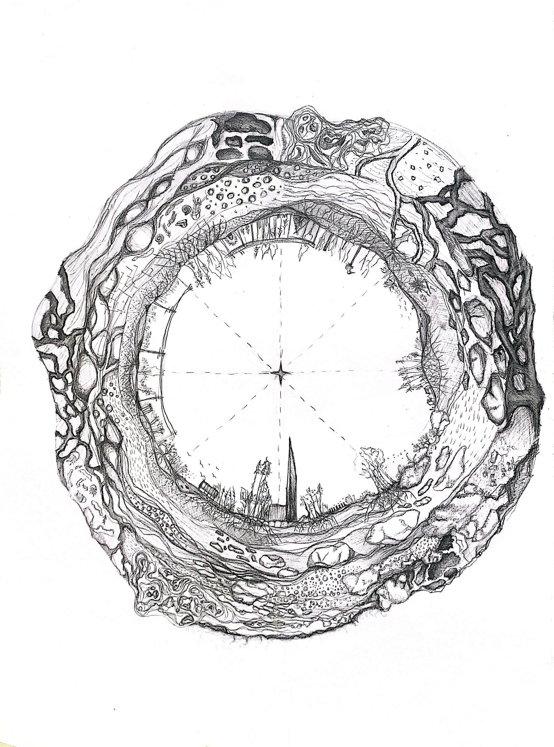
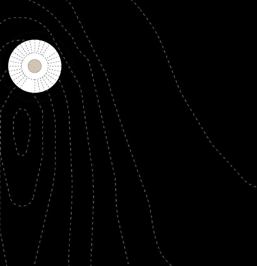
According to the theory of Bruno Latour, the future of the Earth lies in a new way of looking at the Local com ponent. This is presented by the Sun model.
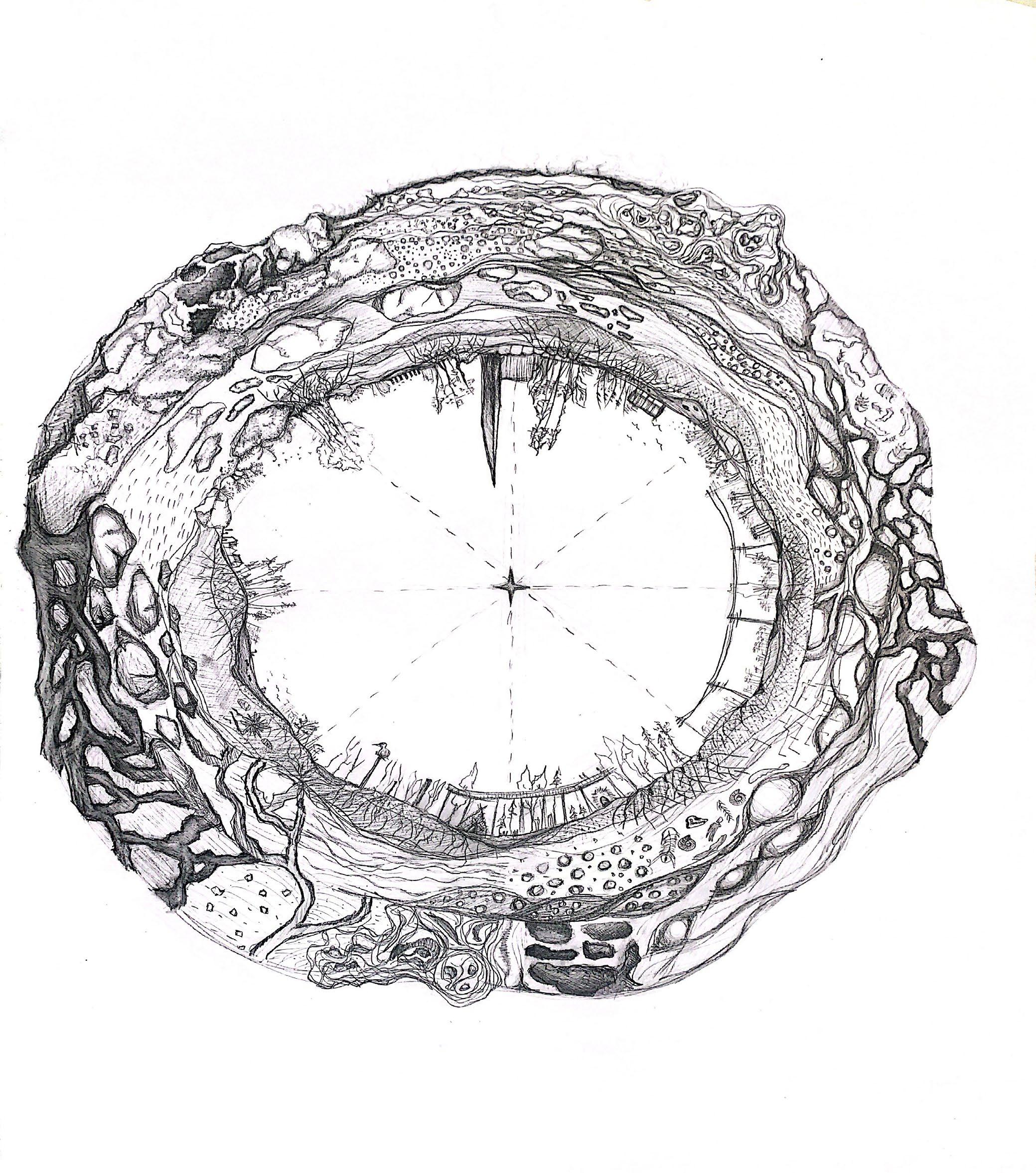
36Concept Terra Forma
In the Sun Model, the layers are represented in 3D instead of 2D like any cartographic projection. Starting from the centre the layers are as following: Lower atmosphere - Soil - Weathered zone (rocks)
37
standard model of nature reserve
creating a new template for nature reserve
38
Concept Looking at a New Nature Reserve Template
to preserve the characteristics of the landscape as much as possible
to protect the valuable landscape
no human activity on site
minimum physical boundaries between city and land
public reactive spots should stay most accessible gradual entrance to nature
“deepest”/flooded spots in the landscape are reserved for nature only
minimum influence on existing precious natural structure
wayfinding system for humans and animals
based off existing typologies/creating new ones
allowing human access to witness events such as migration of birds
a new type of maintenance system
during fragile moments such as bird breeding seasons
no obvious signage/boards
these can either create a natural separation (without the use of fences) between species
allow them to come together intentionally
39
40Strategy
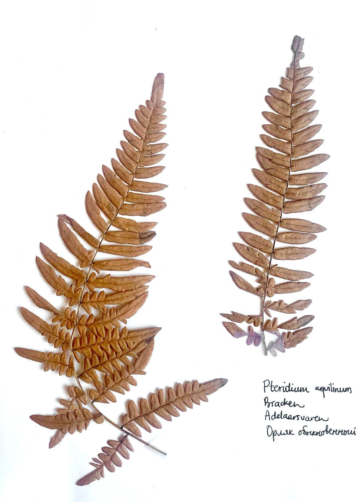
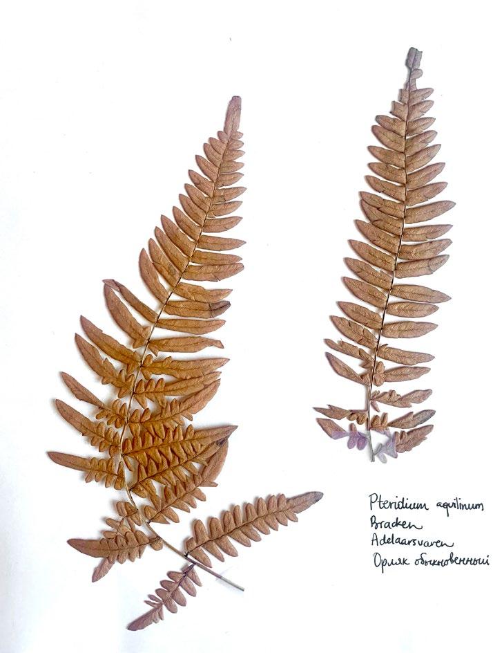
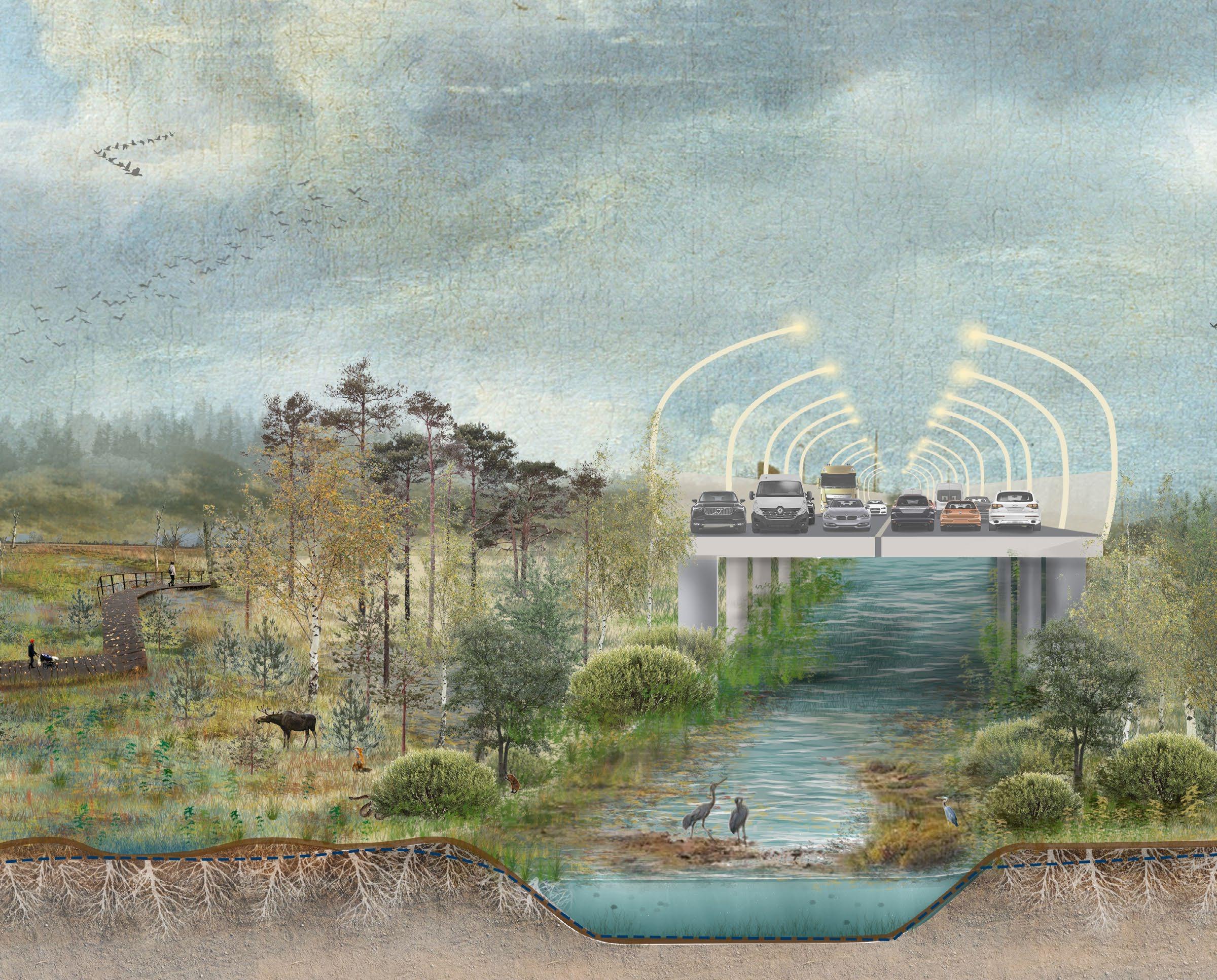
04. STRATEGY Flooding strategy: Controlling accessibility 2102 Masterplan Fig. 04: Pteridium aquitinum Fig. 04
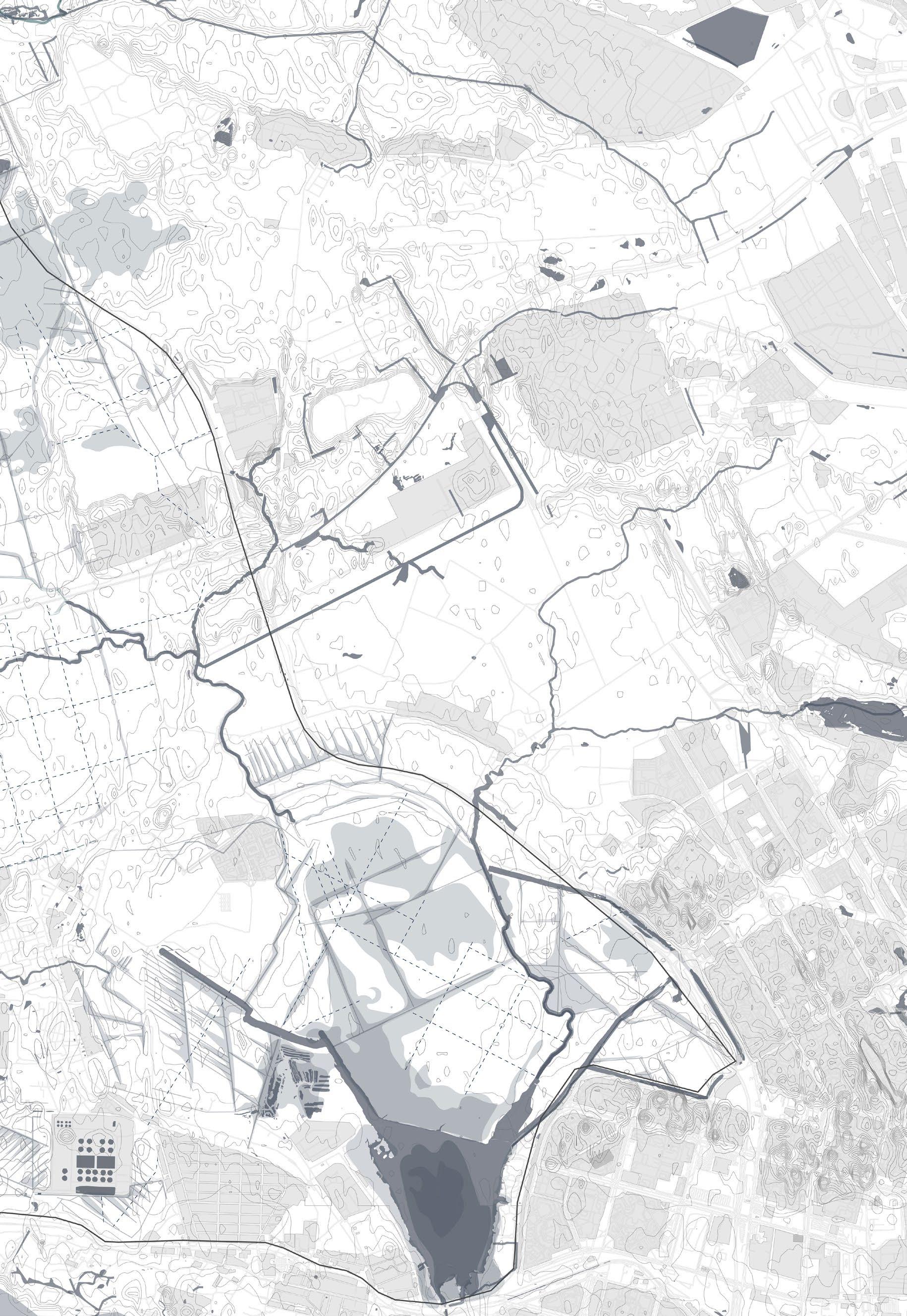
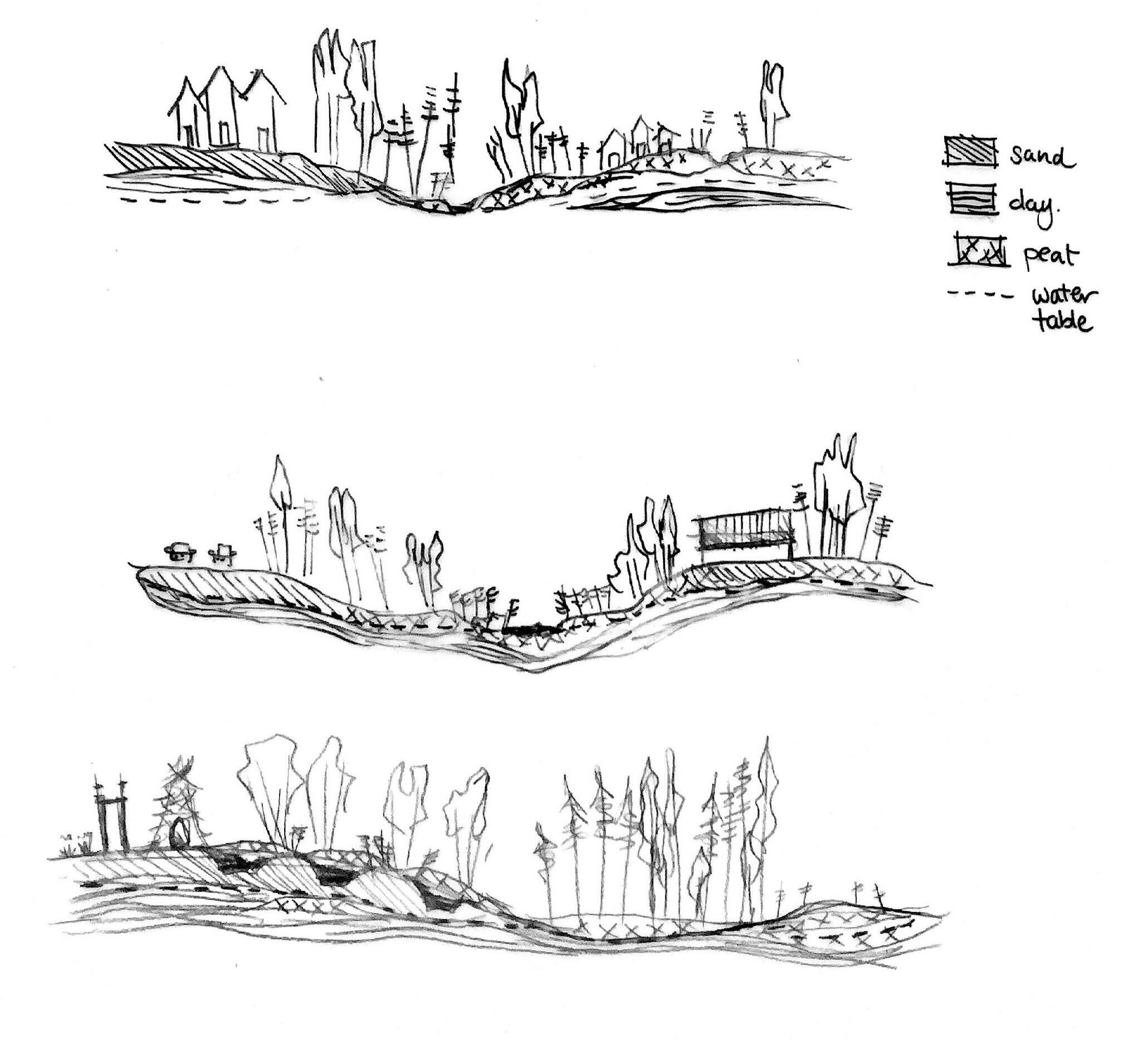
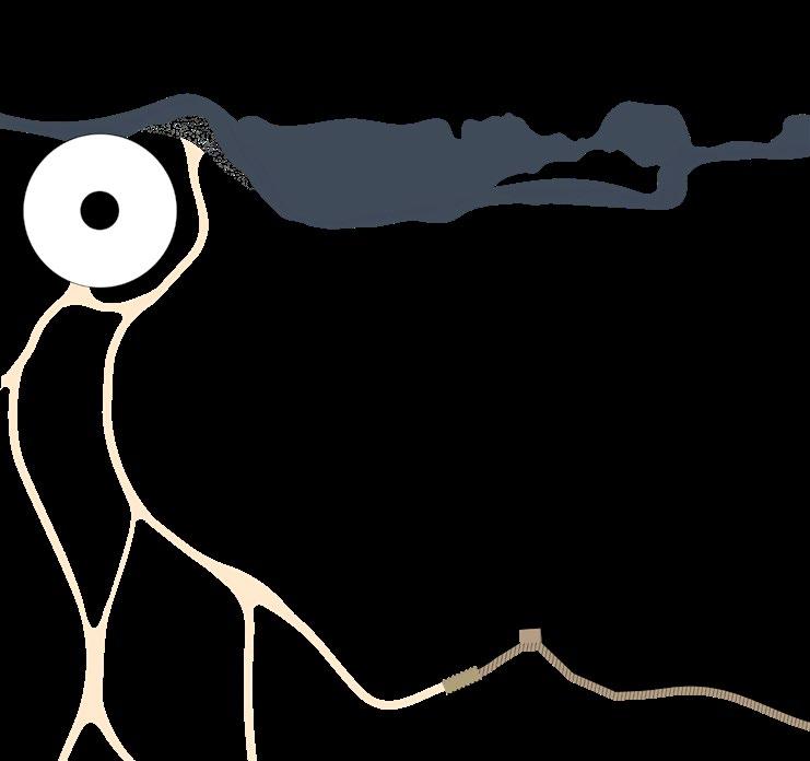
Current drainage system
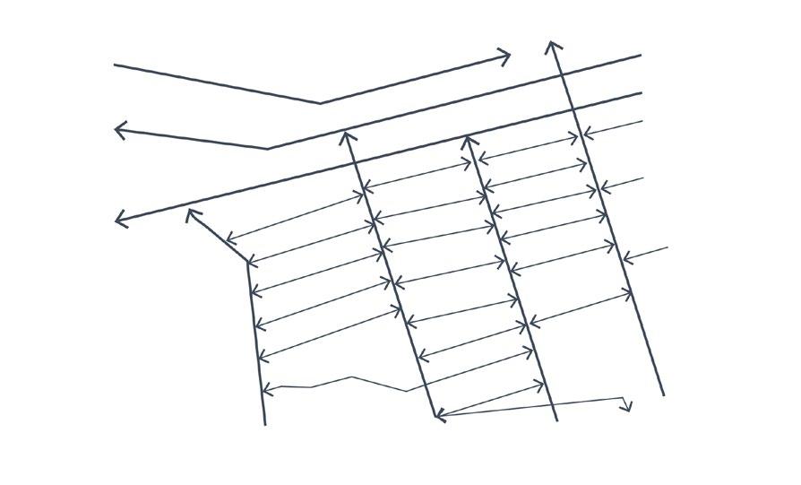
The regulating network: chart and gross channels remove excess water from the soil, in precipitationfed mires, usually in the form of an open system. In groundwater-fed mires usually with deep drainage canals.
Defensive network: upland channels act as a defence mechanism to protect any water entering the drained area from the higher areas (also groundwater if present). The main canal directs all the collected water in the lowest part of the site to a water reservoir. This can be a lake, river, stream or creek.
1 main canal
2 gross channel (500-1000m apart)
3 chart channel (20-40m apart)
4 drainage direction
5 water reservoir
upland channel
42Strategy Flooding strategy: Controlling accessibility
6
1 2 3 4 5 6
Strategy 1:closing off the main and upland channels
Water will start collecting at the lowest parts and form a sort of lake (reservoir)
The upper part will be less drained (stays wet) but will remain partially accessible
43 1 main canal 2 gross channel (500-1000m apart) 3 chart channel (20-40m apart) 4 drainage direction 5 water reservoir 6 upland channel
1 23 4 5 6
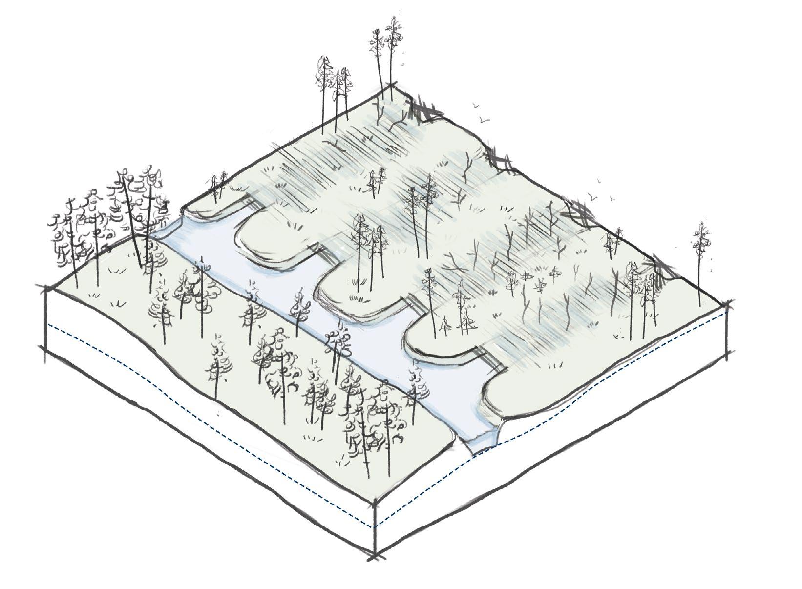
off the chart and gross canals
The water collection of the main and upland channel will continue. However, it will significantly decrease, thereby slightly drying them out. Chart channels will flow water to one side (towards the gross channels), thereby overflowing them. The areas surrounding gross channels will become very wet sometimes making the water flow out of them.
vegetation will start to grow over where the chart channels once were.
main canal
gross channel (500-1000m
chart channel (20-40m
drainage
water reservoir
channel
44Strategy Flooding strategy: Controlling accessibility Strategy 2: Closing
Sphagnum
1 2 3 4 5 6 1
2
apart) 3
apart) 4
direction 5
6 upland
off entire drainage system
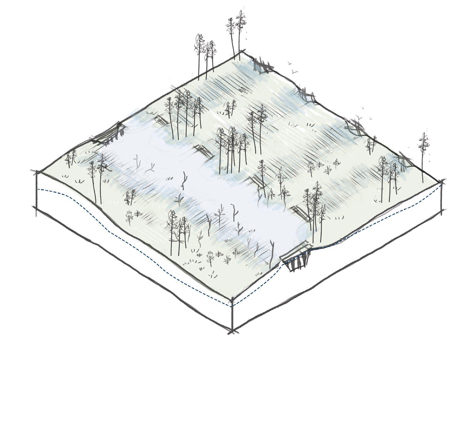
The water will collect at the lowest parts and form an open water reservoir. This may even eventually connecting to the existing reservoir such as river/lake, etc.
water from the chart/gross channels will collect and depending on the dams separating them to main channel could “break through” and connect with the reservoir. The dam can also be temporary for example if it is made by beavers.
45 Strategy 3: Closing
The
1 23 4 5 6 1 main canal 2 gross channel (500-1000m apart) 3 chart channel (20-40m apart) 4 drainage direction 5 water reservoir 6 upland channel
1900 - 1960
Before the mass drainage in the 1960's swamps had a high water table and native shrub-like vegetaition with little trees.
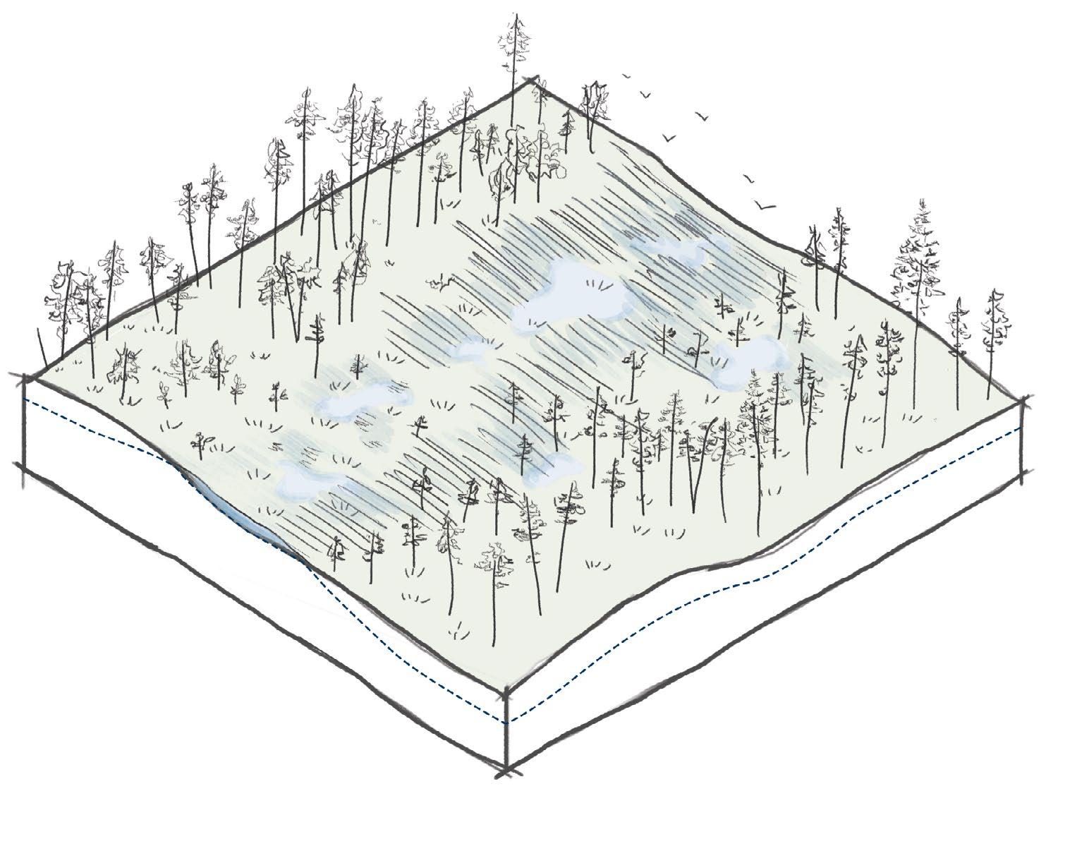
1960 - 2022
When drainage systems were established the water table dropped drastically causing the native swamp vegetation to dissapear and forest take its place. This is how the landscape looks like now.
46Strategy Flooding strategy: Controlling accessibility
1900 - 2022
2022 - 2062
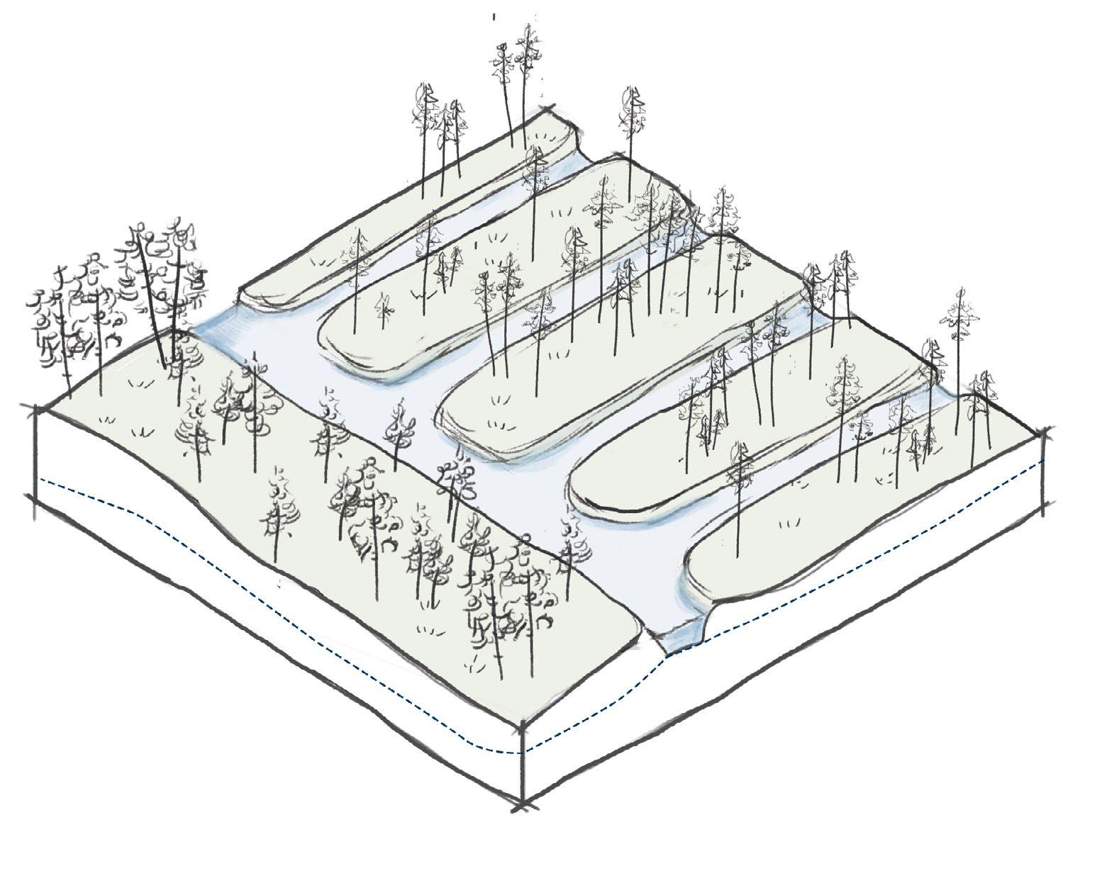
In the coming 40 years of the strategy, the gross and chart channels will be the first to close forming quick restoration of the water table and formation of sphagnum mosses where the channels once were.
2062 - 2102
In the second 40 years the bigger main channels in the system will be dammed off causing the rest of the landscape to come under water. This will guarantee the restoration of swamp vegetation and a quicker dying off the forest.
47
2022 - 2102
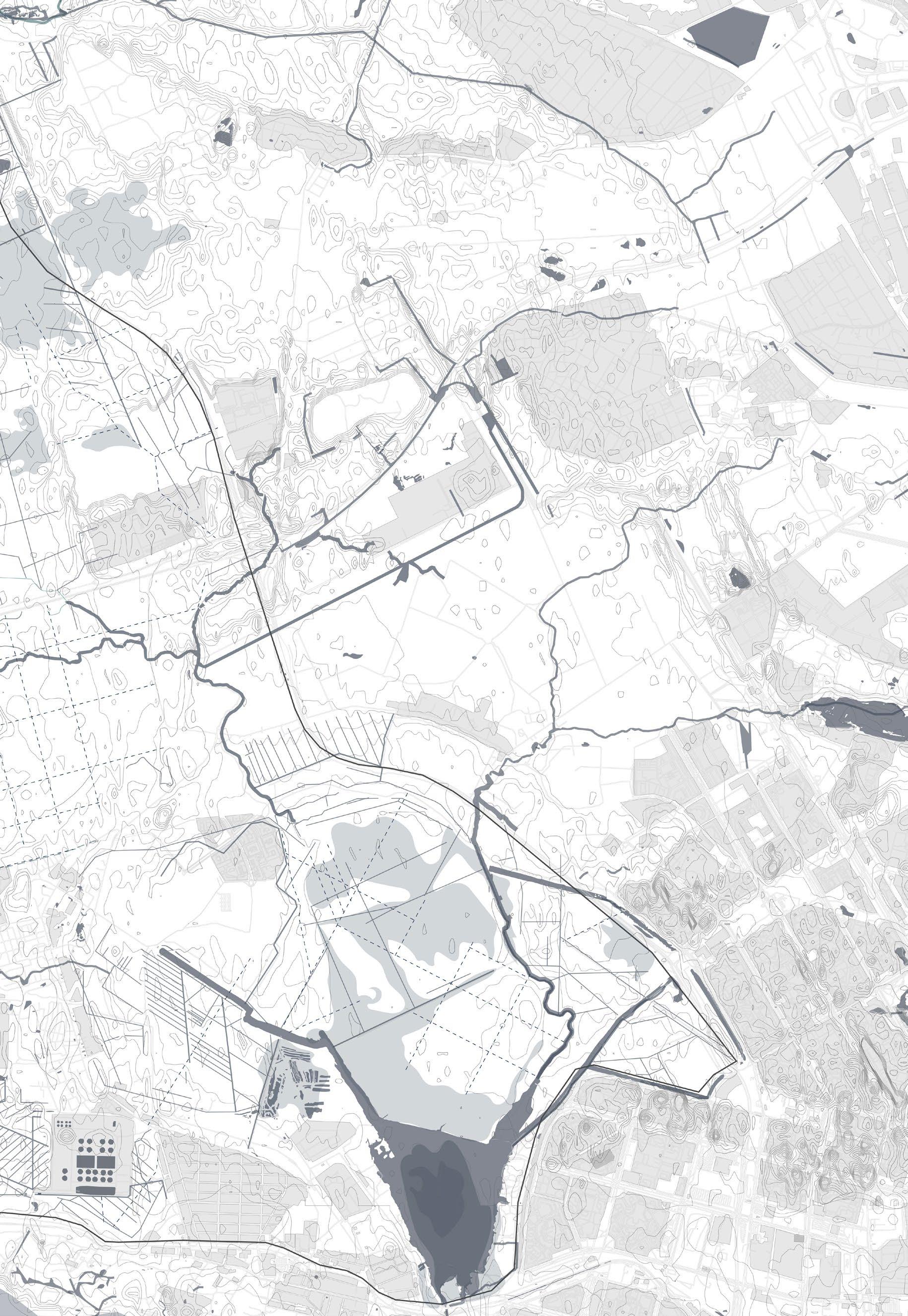
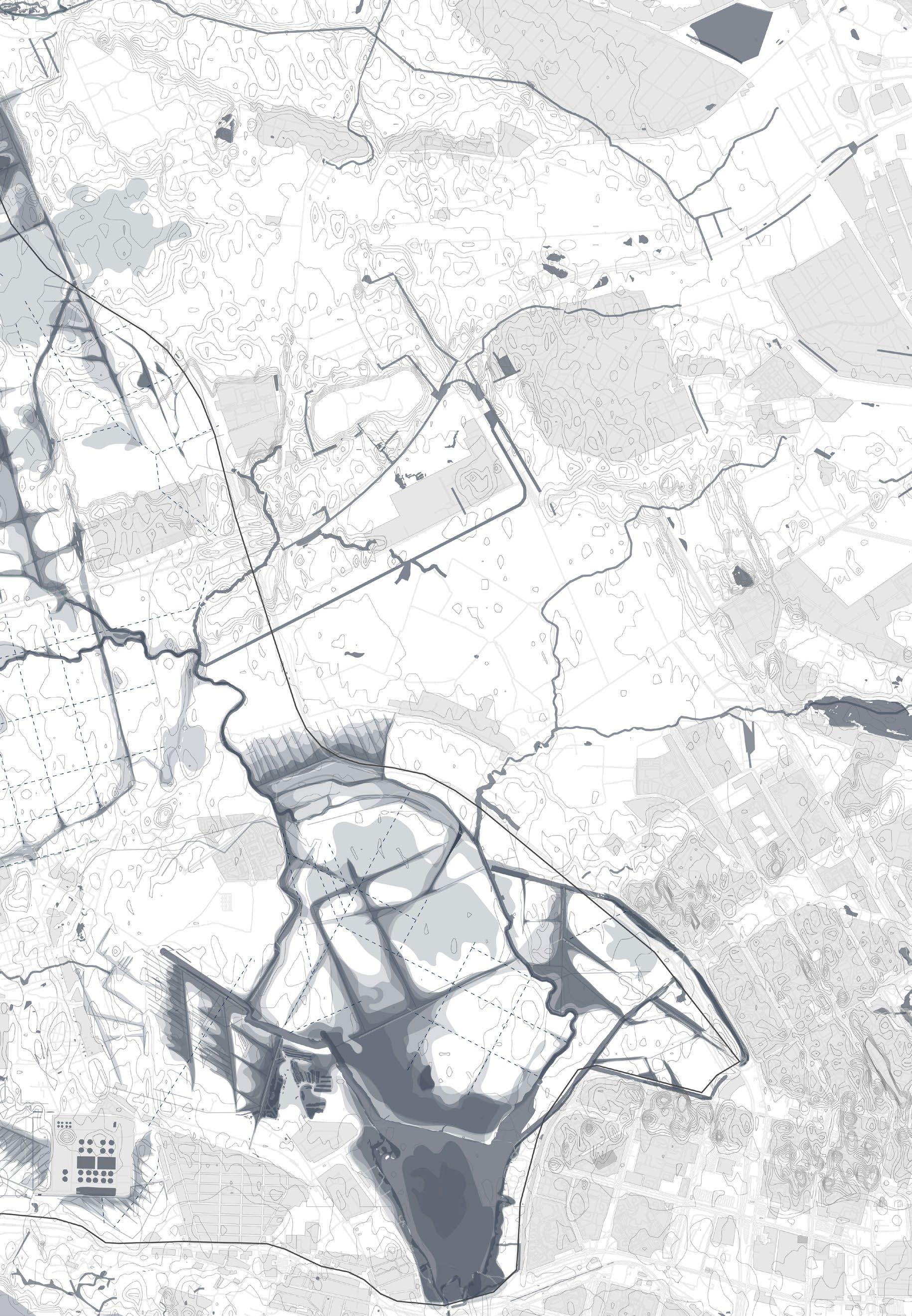
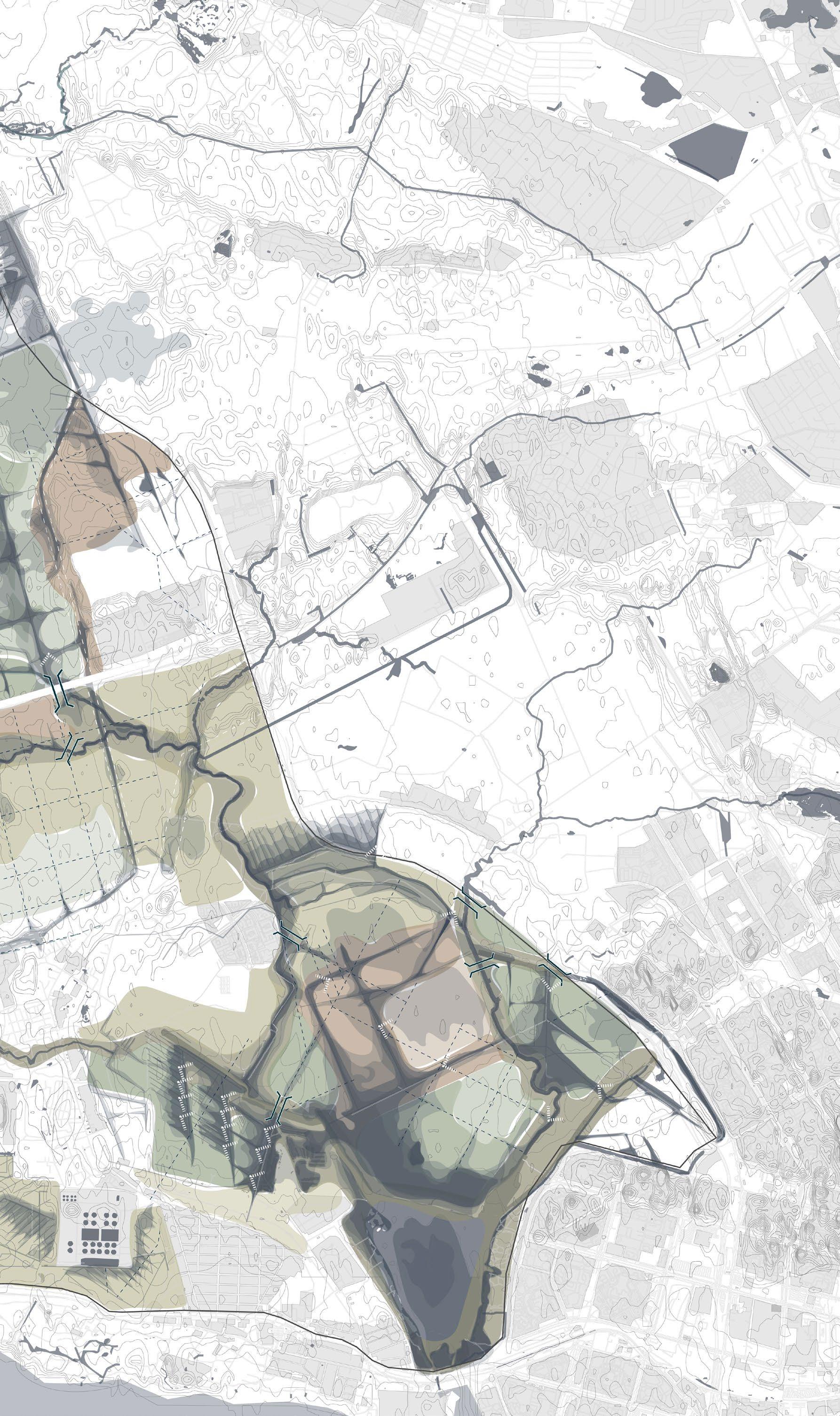
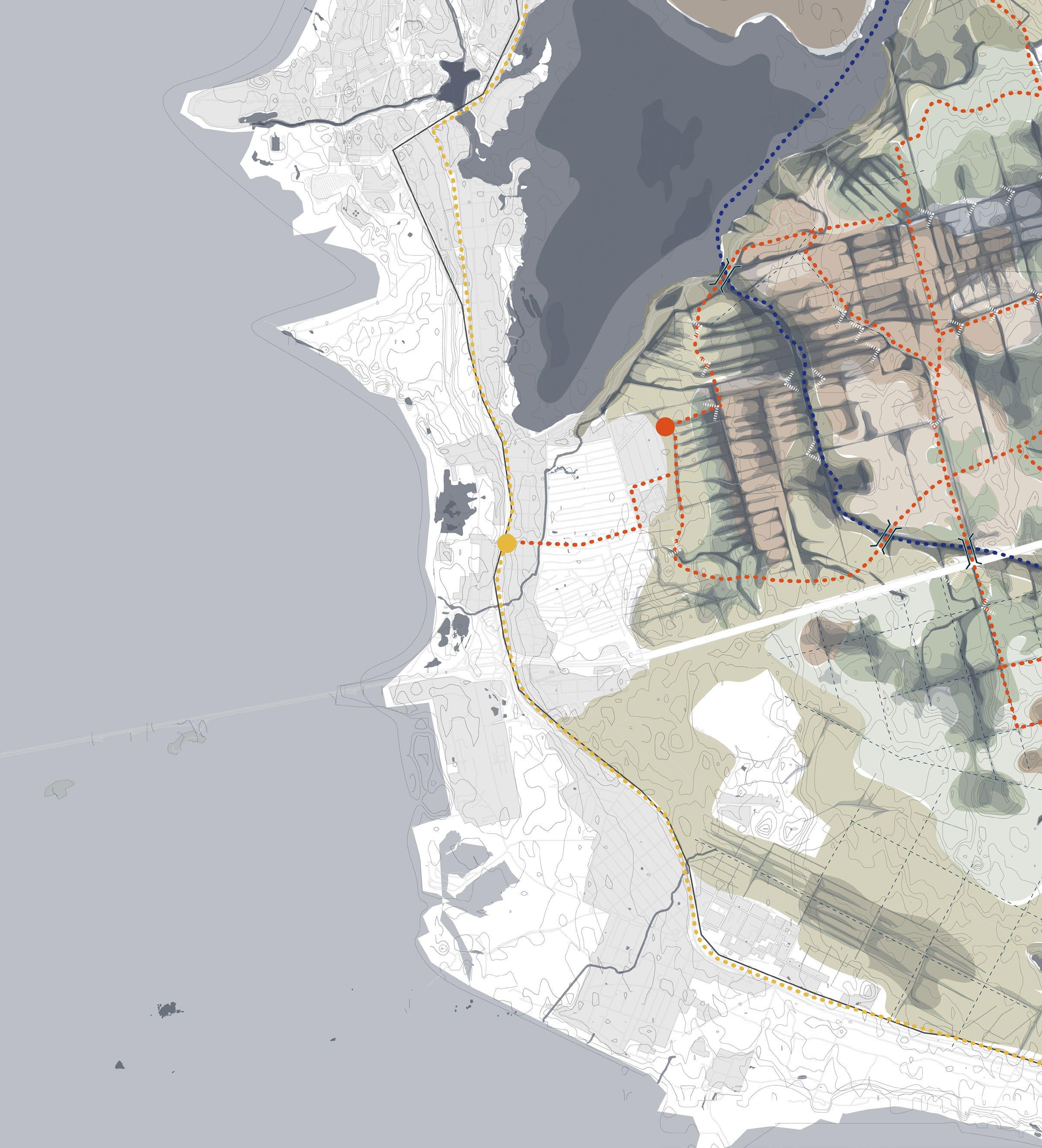
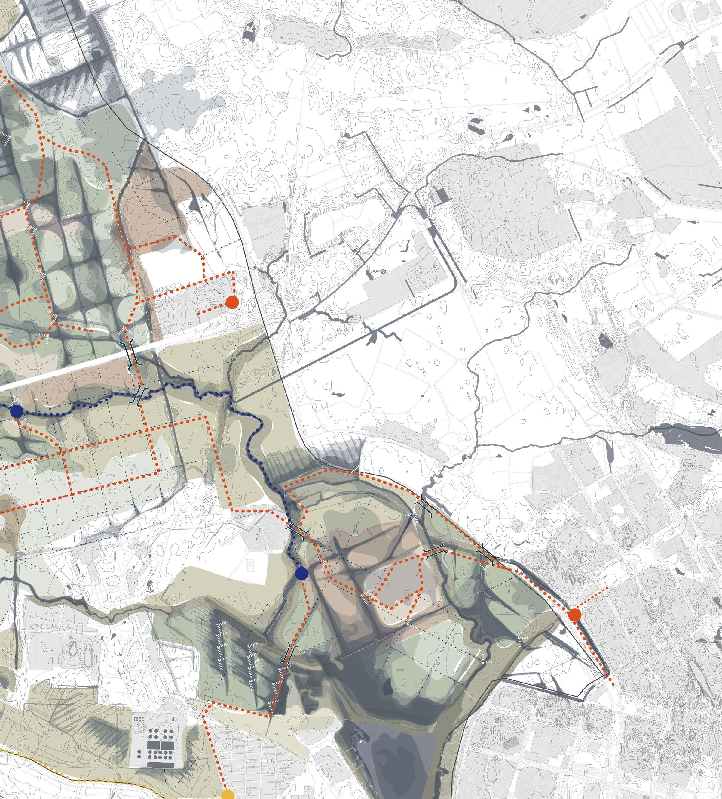
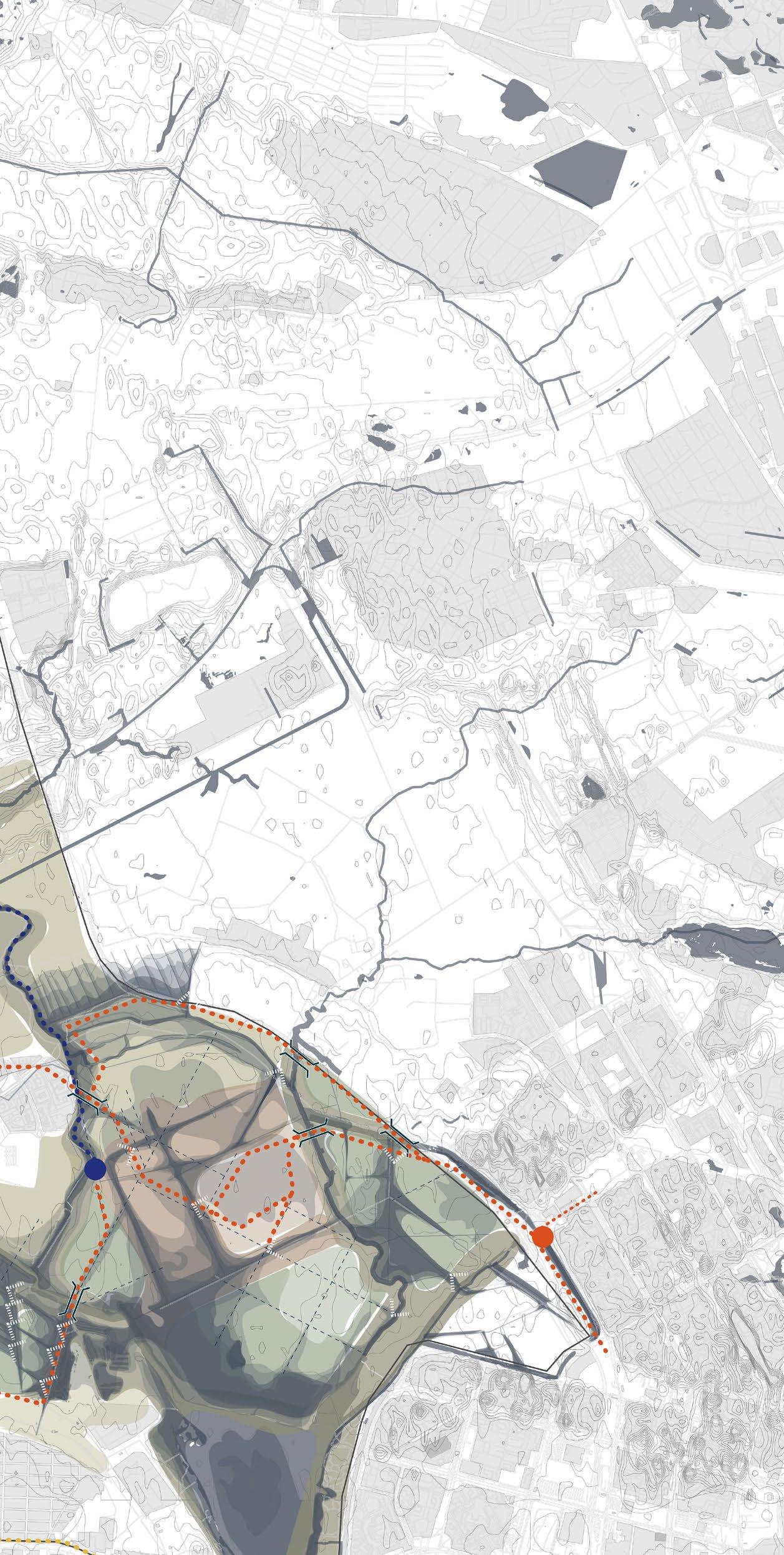
48Strategy Flooding strategy: Controlling accessibility 2022 -2042 In present day the site is composed of several rivers and only one stream running through the site. This has the potential to expand and become a smaller river in the future. The water flows through the topography and drains in the Gulf of Finland via the Lakhtinskoe and Sestroretskoe lakes. 2 1 3 10 11 1 Sestroretskoe lake 2 Sestroretskoe bog 3 Gluhoe lake 4 Markovo mire 5 Chernaya river 6 Khazovyy stream 7 Kamenka river 8 Lakhtinskoe fen 9 Lakhtinsky lake 10 Chernaya river 11 Gorsky creek
49Current Water System 4 5 7 6 8 9 0 300 900 1800m
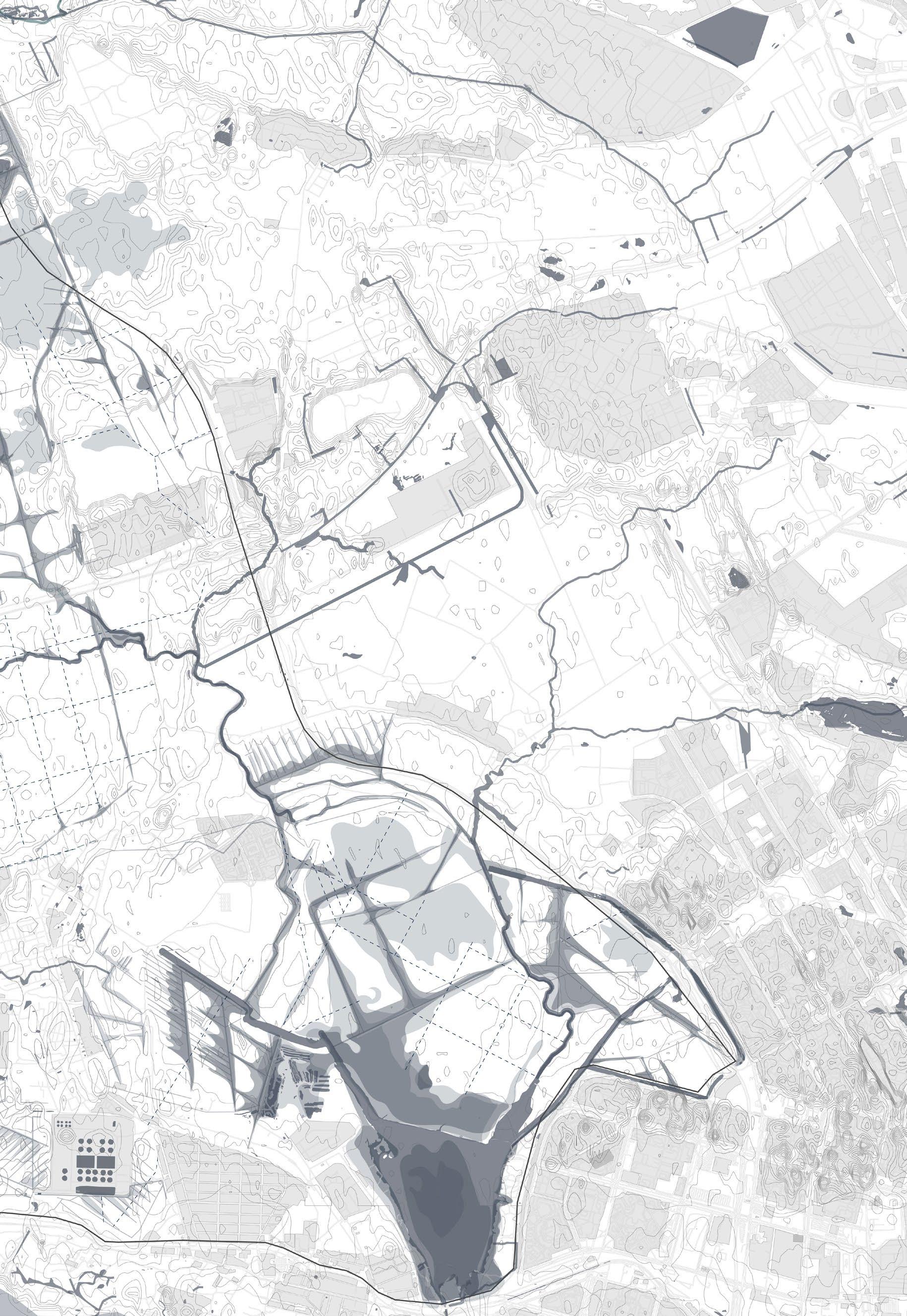
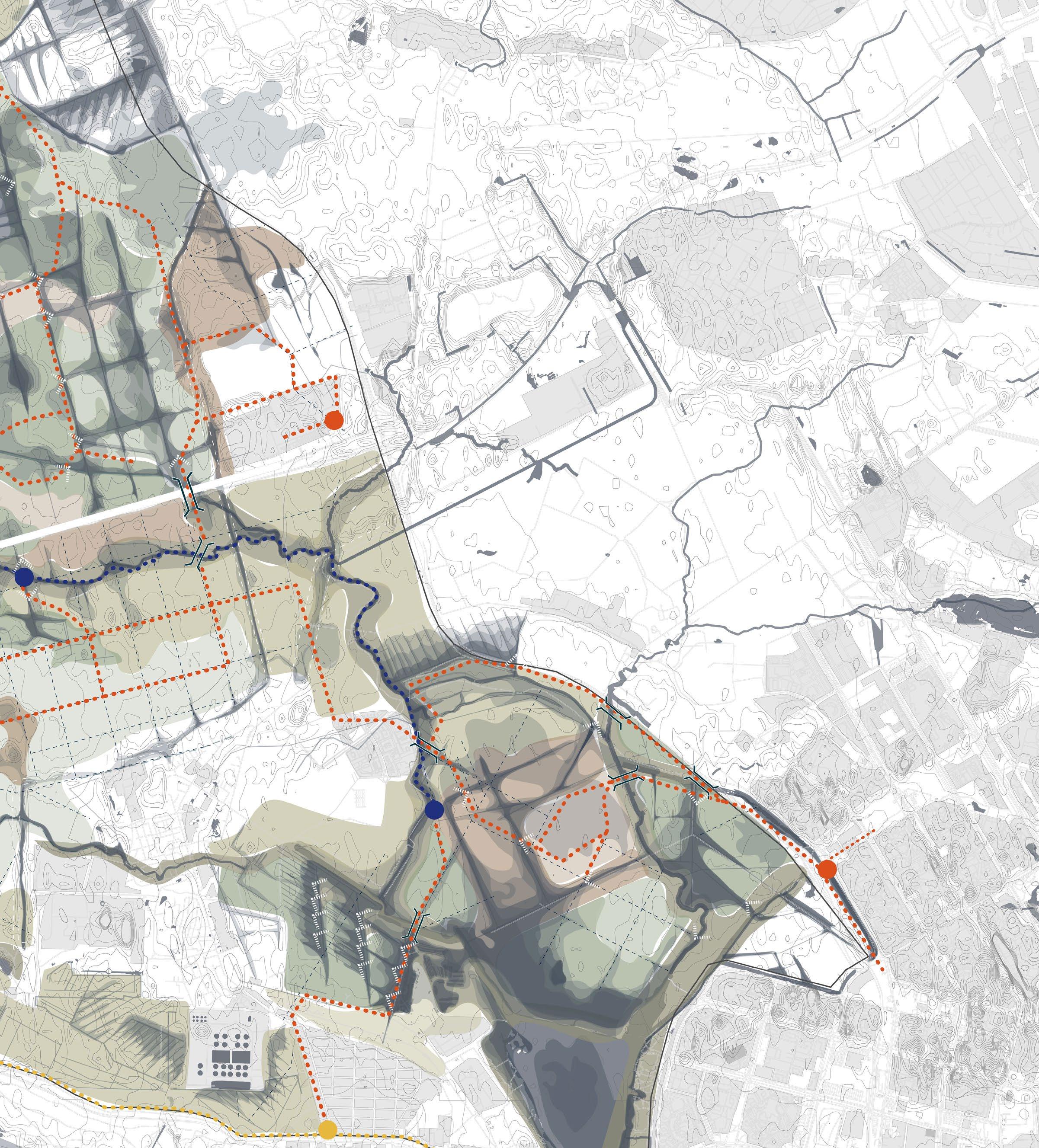
50Strategy Flooding strategy: Controlling accessibility 2022 -2042 The first 20 years show the first flooding occuring mainly around the main canals where the gross and chart systems have been closed off. 2 1 3 10 11 1 Sestroretskoe lake 2 Sestroretskoe bog 3 Gluhoe lake 4 Markovo mire 5 Chernaya river 6 Khazovyy stream 7 Kamenka river 8 Lakhtinskoe fen 9 Lakhtinsky lake 10 Chernaya river 11 Gorsky creek
512022 -2042 4 5 7 6 8 9 0 300 900 1800m
52Strategy Flooding strategy: Controlling accessibility 2042 -2062 After 40 years the first part of the strategy concludes showing significant flooding around the main canals. The stream has now turned into a sufficient river draining into the Lakhtinskoe lake. 1 Sestroretskoe lake 2 Sestroretskoe bog 3 Gluhoe lake 4 Markovo mire 5 Chernaya river 6 Khazovyy stream 7 Kamenka river 8 Lakhtinskoe fen 9 Lakhtinsky lake 10 Chernaya river 11 Gorsky creek 2 1 3 10 11
532042 -2062 4 5 7 6 8 9 0 300 900 1800m
54Strategy Flooding strategy: Controlling accessibility 2062 -2082 After 60 years the second part of the strategy commences where the main canals are closed off. The flooding continues onto (topographically) higher areas of the site. 1 Sestroretskoe lake 2 Sestroretskoe bog 3 Gluhoe lake 4 Markovo mire 5 Chernaya river 6 Khazovyy stream 7 Kamenka river 8 Lakhtinskoe fen 9 Lakhtinsky lake 10 Chernaya river 11 Gorsky creek 2 1 3 10 11
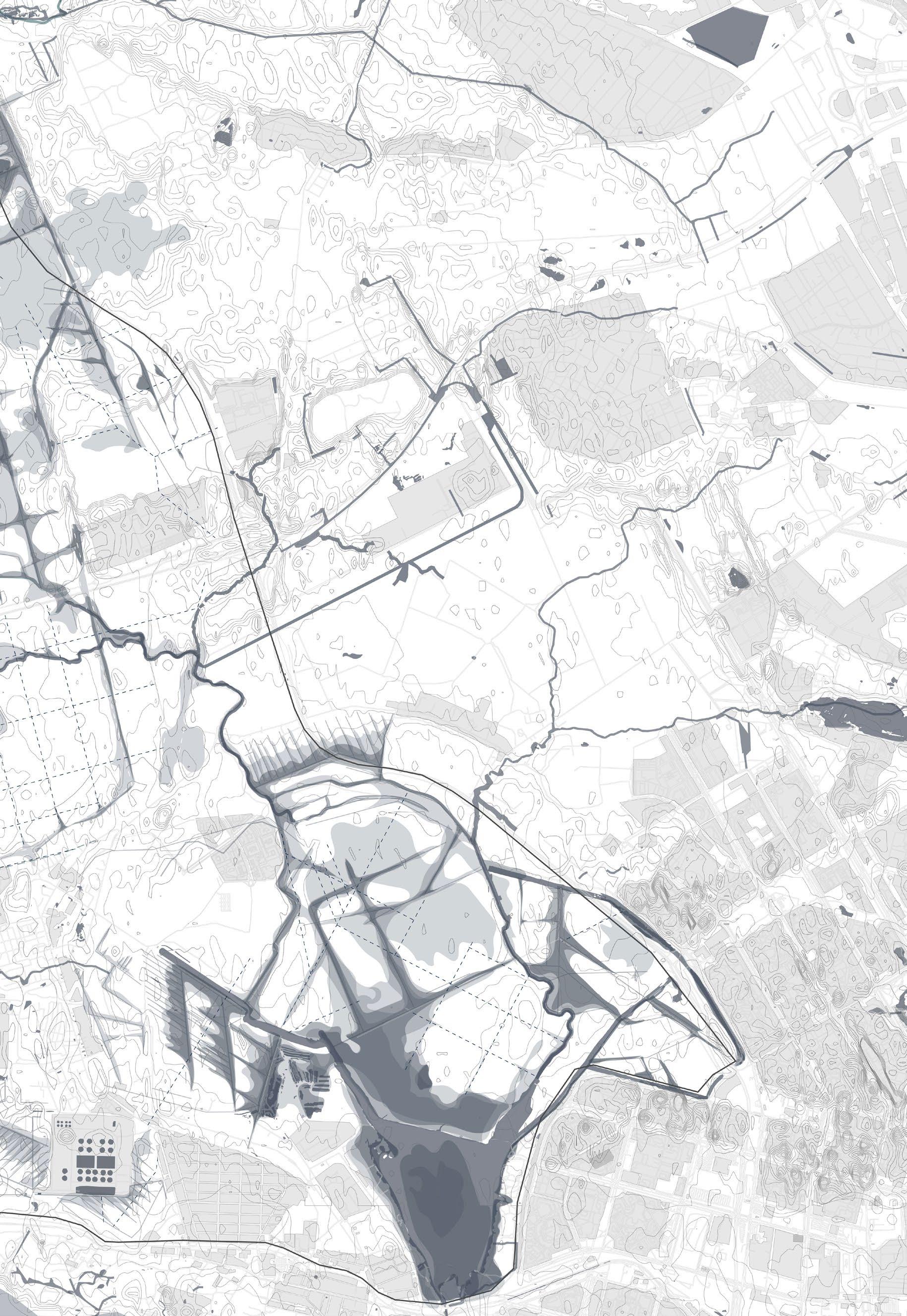
552062 -2082 4 5 7 6 8 9 0 300 900 1800m
56 2082 -2102 In the final 20 years the flooding is not very significant as it has been already established. In this stage mostly vegetation develops. Strategy Flooding strategy: Controlling accessibility 1 Sestroretskoe lake 2 Sestroretskoe bog 3 Gluhoe lake 4 Markovo mire 5 Chernaya river 6 Khazovyy stream 7 Kamenka river 8 Lakhtinskoe fen 9 Lakhtinsky lake 10 Chernaya river 11 Gorsky creek 2 1 3 10 11
572082 -2102 4 5 7 6 8 9 0 300 900 1800m
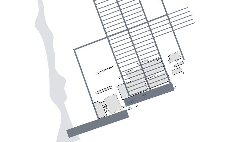
58Strategy Flooding strategy and vegetation 2102 0 300 900 1800m
Oligatrophic borreal forest
Known for the dwarf forms of the pine and birch trees.
Oligatrophic bog
Highly acidic grass plains mostly filled with Sphagnum moss.
Mesotrophic forest
Made up of majority of native pine and birch trees and willows for the shrub layer
Mesotrophic bog-oligatrophic fen
Wide variety of vascular plants and shrubs such as heather and sundew
Eutrophic forest
Fully developed nutritious soil layer with birch, alder and willow
Eutrophic fen
Shrub and grass layer is dominated by reed and willow.
borreal
bog/fen
59 MASTERPLAN LEGEND In word and illustration
02 01 03 04 05 06 Oligatrophic bog Oligatrophic
forest Wooden dam (bridge) Bigger bridge for crossover Mesotrophic forest Mesotrophic
Eutrophic forest Eutrophic fen

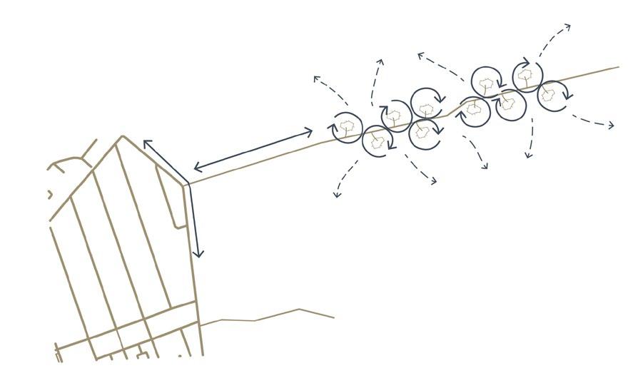
Routes of coexistence
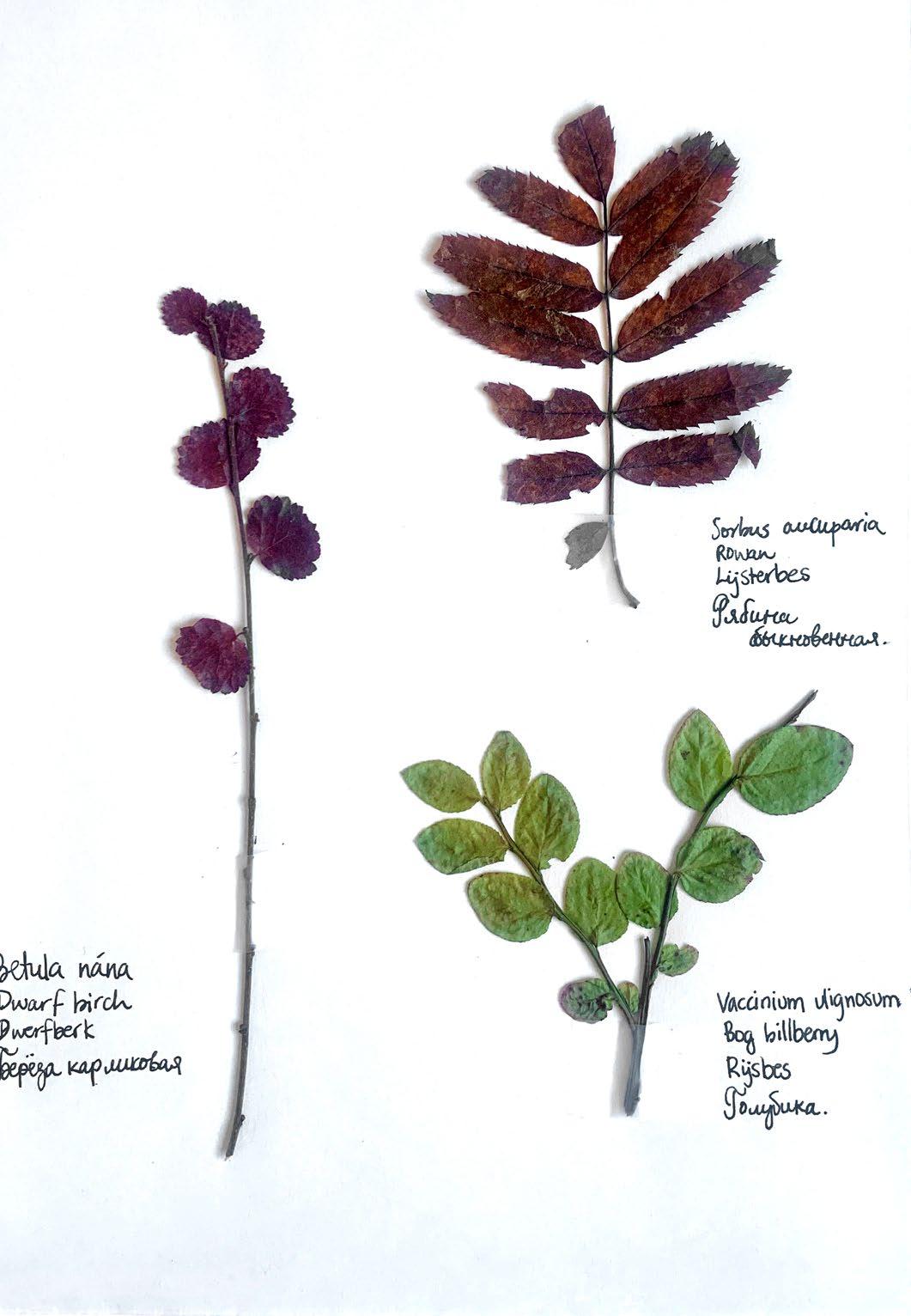
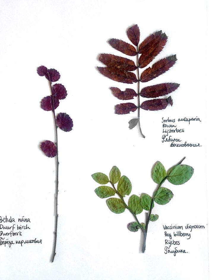
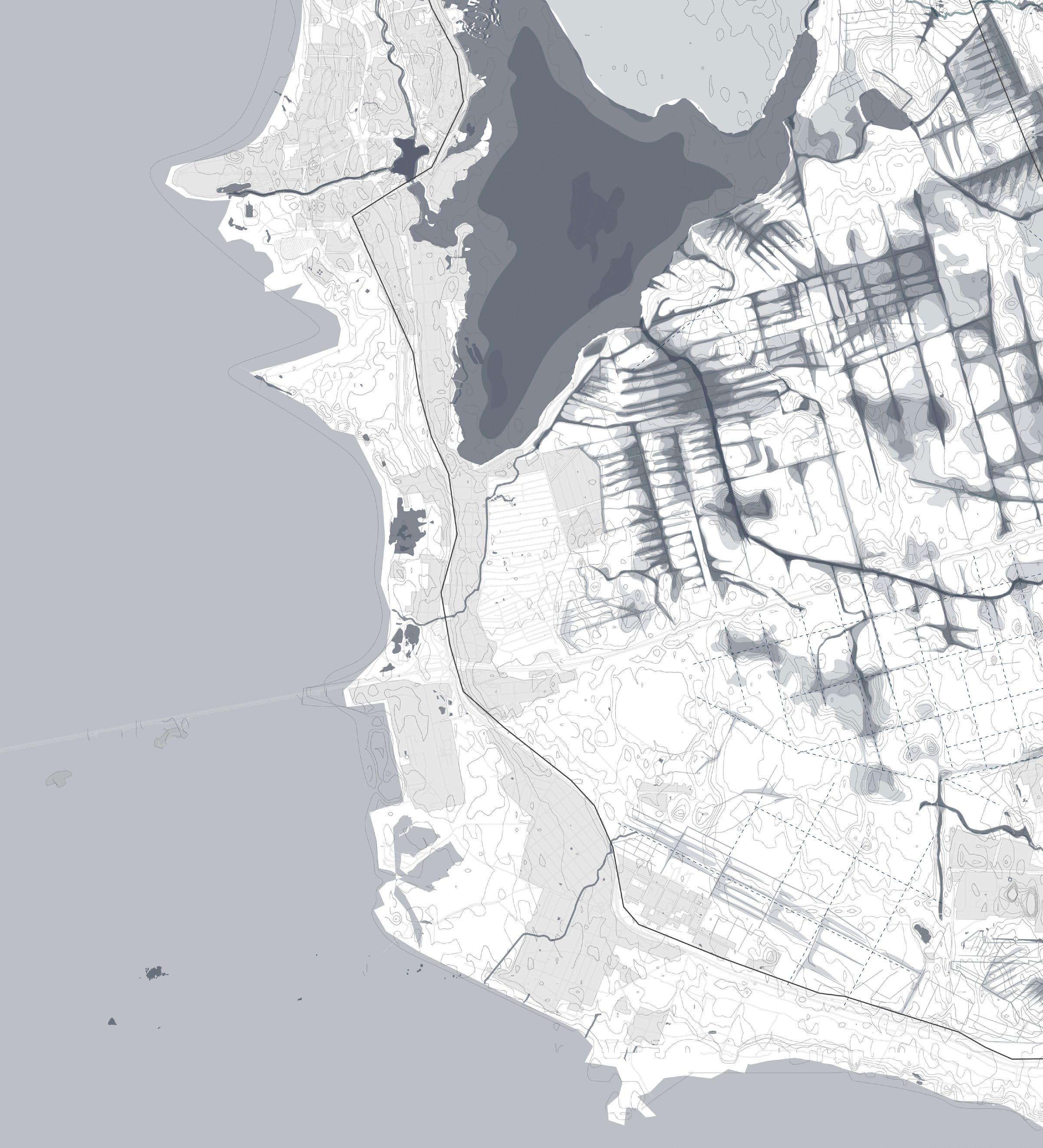
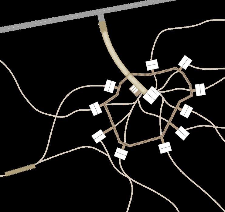
05. ROUTES OF COEXISTENCE The three paths Entrance from the city Entrance from the village Intersection of transition zones Fig. 05: Betula nana Sorbus aucuparia Vaccinium vlignosum Fig. 05
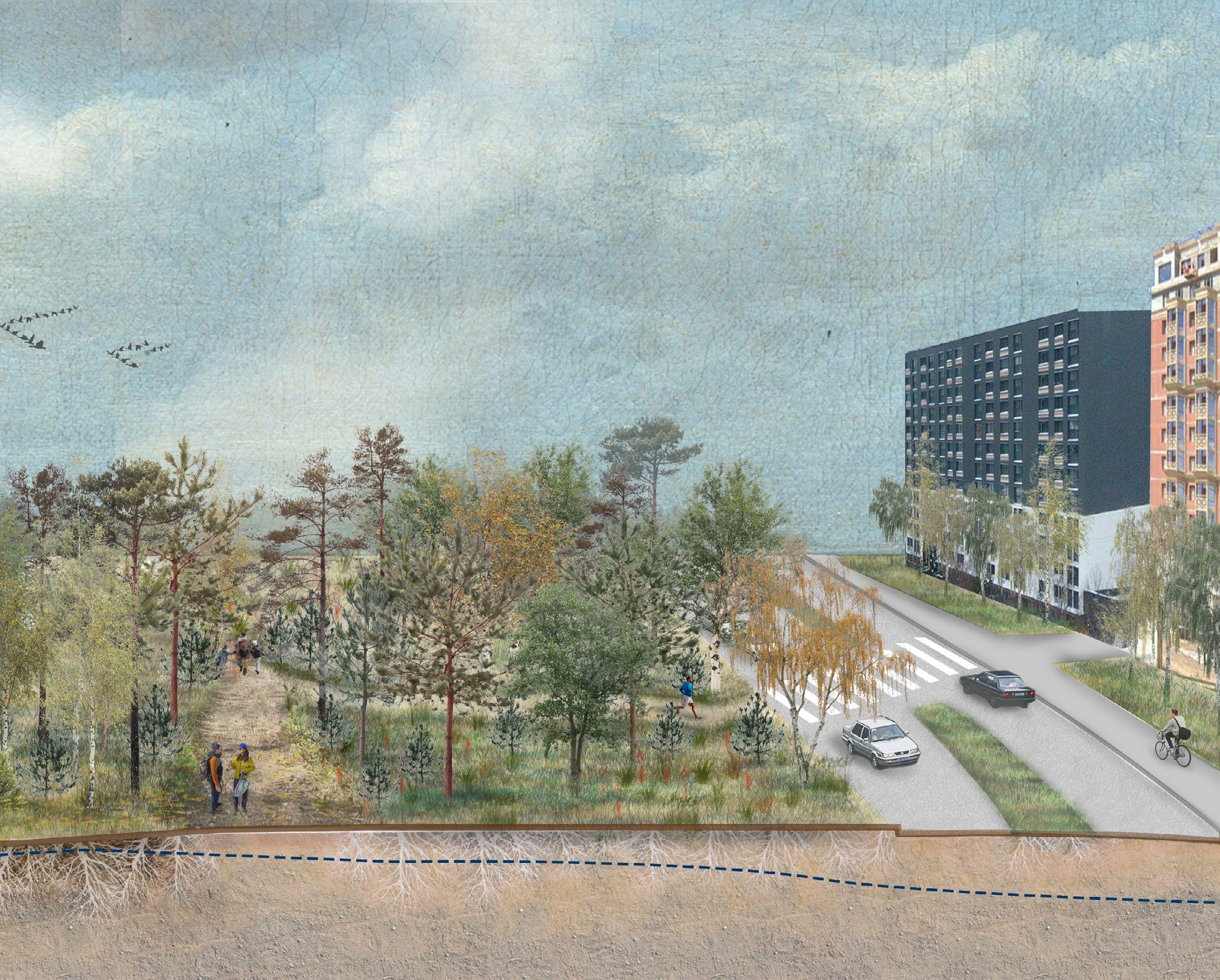
An important part of the new nature reserve is its accessibility from the city. Three routes marked by 5,10 and 15km suggest the different durations that people may spend in the reserve. The first entrance is for a short walk of a couple hours (5km mark). The second entrance is from the village, where one may take a longer cycling trip (10km). The final trnasition zone between 10 and 15km suggests to the being that they are entering the territory furthest from the city and may now go for a weekend trip.
entrance from the city
62 1
2 entrance from the village 3 intersection of transition routes Masterplan 2102
Routes of coexistence 05 km 00 km 10 km 15 km 2
63 0 300 900 1800m 05 km 00 km 10 km 15 km 1 3 railway and stations ferry/boat line and stops three loops/routes with entraces
Nature reserve
Small pathways and minimal footprint on the earth as well as human capacity lowest.
1 oligotrophic bog existing soil and semirestored bog due to closed off canals
2 eutrophic fen (existing) growing around the river Gluharka
3 pine forest on sandy soil that has been cultivated and built on
64
Routes of coexistence
1 oligotrophic bog 2 eutrophic fen Entrance from the city
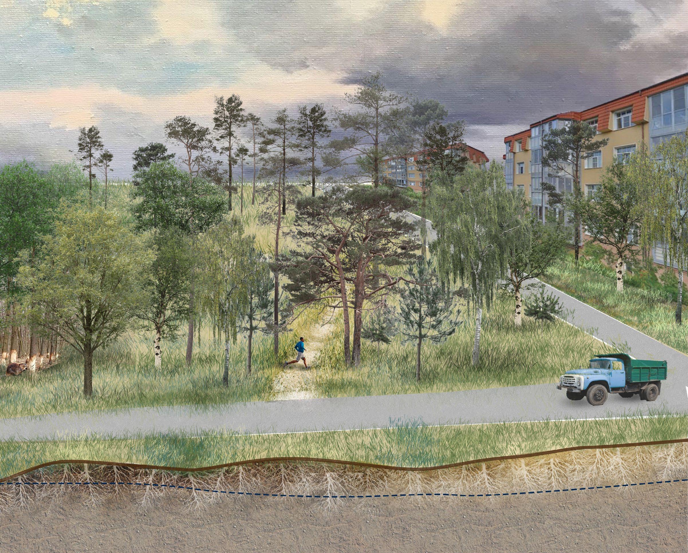
Park
Between the city edge and the nature reserve a patk is made to invite and guide people into the landscape without disturbing the vulnerable parts
City
The city has currently quite a hard edge and this needs to be extended more. Hereby land from the city will be taken instead of the natural parts of the site
65
3 pine forest on sandy soil
Living in wilderness
The dachniki settlements are located on a mire so minimal footprint is necessary. The area falls under part of the renatured landscape
1 mesotrophic bog existing soil and restored landscape due to closed off canals
2 eutrophic fen growing around the
Routes of coexistence
currently stream, will be river in the future.
3 pine and birch forest are existing due to the cultivation of the soil
Entrance from the village
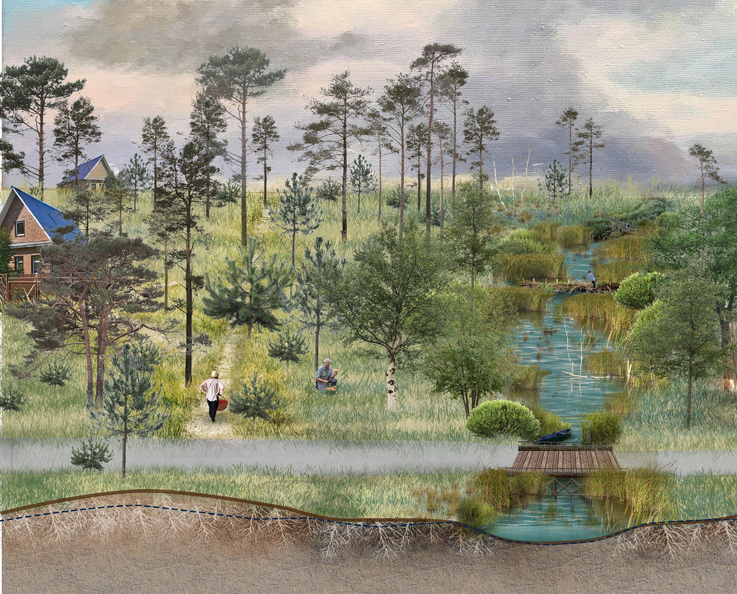
66 2 eutrophic fen
1 mesotrophic bog
Hidden route
The entrance from the village going to the dachniki settlements is almost seamless and something one might stumble upon.
67 3 pine and birch forest on cultivated soil
Artist collective
The open air art park is part of the recreational route of the site. It's edge is marked by a series of existing mires that the artists are maintaining
1 cultivated sandy soil
mesotrophic and oligatrophic bogs
68
1 cultivated sandy soil
2
Routes of coexistence Intersection of transition zones
Natural recreational zone
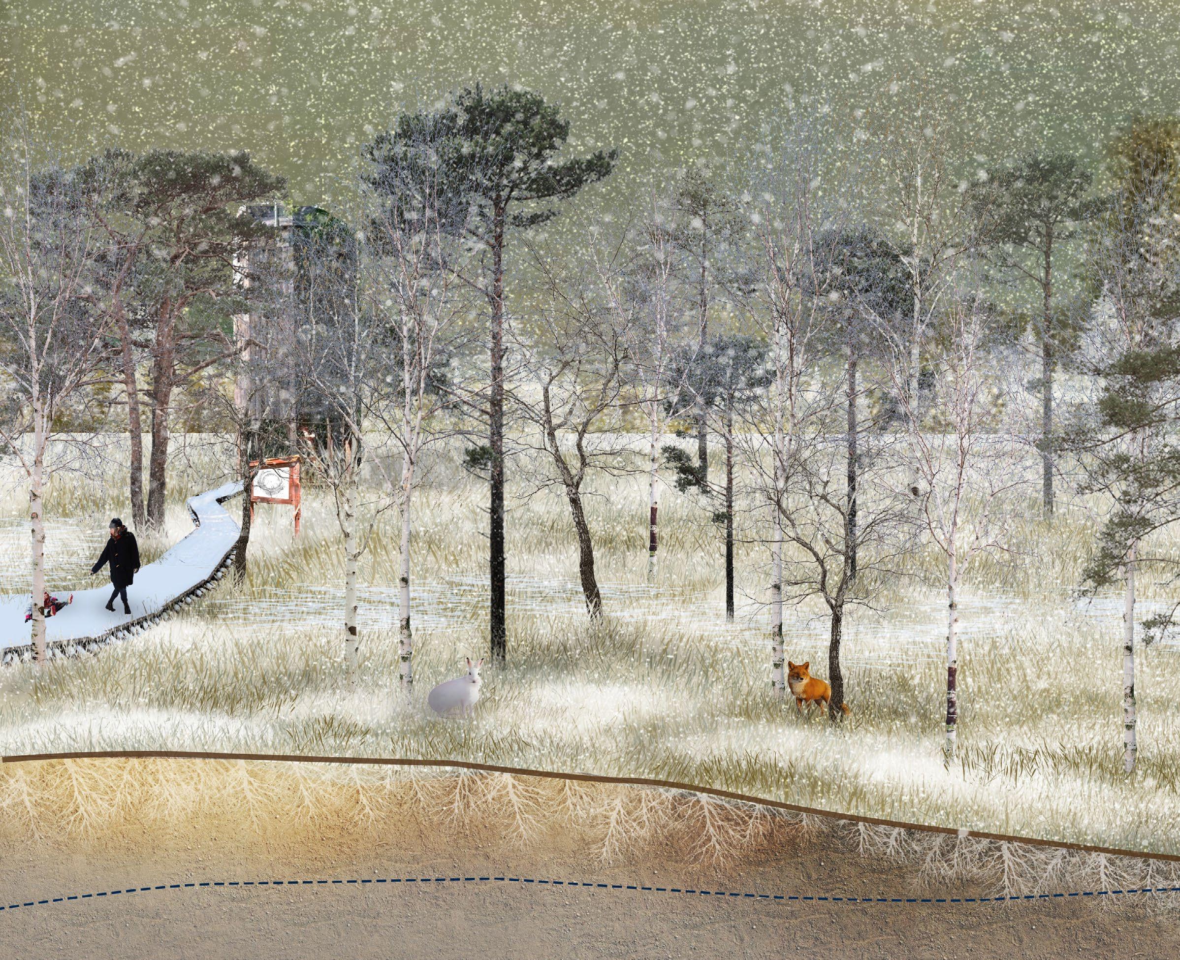
The existing oligotrophic bogs are vulnerable to human activity however in the winter minimal use, such as skating on the frozen water is permitted
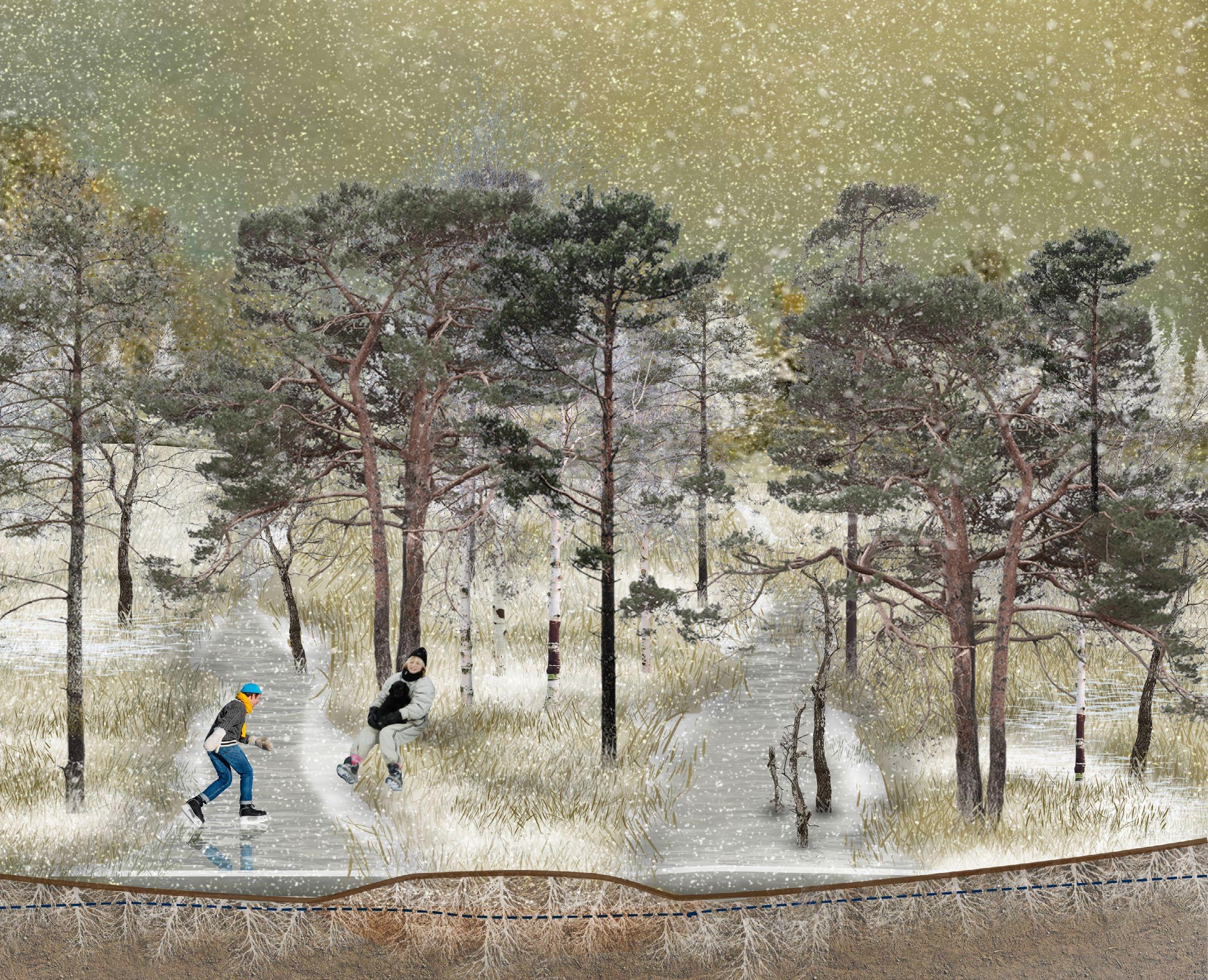
69 2 mesotrophic and oligatrophic bogs
Pioneers
Dachniki Wellness enthousiasts Artist collective
06. PIONEERS Overview
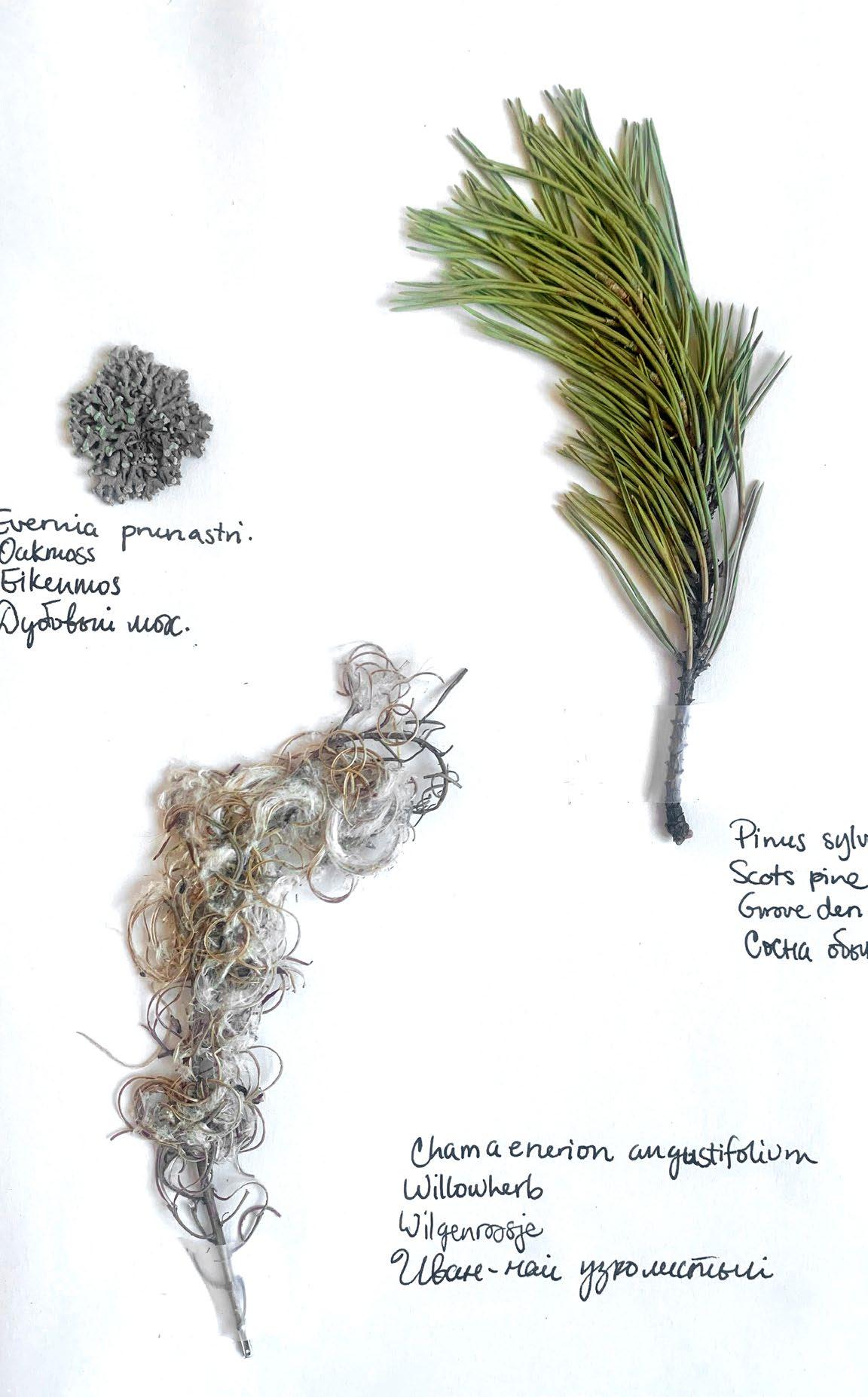
Fig. 06: Evernia pnunastri
Pinus sylvestris
Chamaenerion
angustifolium
Fig. 06
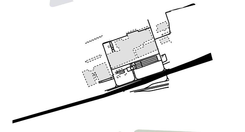
pioneers of the nature reserve will be those who live there or come to stay for a longer period of time. These are educators and stewards of the swamp, who will allow others to see how valuable and beautiful the landscape really is. Three main groups of pioneers have been selected that look at different aspects of the reserve. The dachniki are responsible for wilderness and plant conservation, the wellness for the health benefits of being in the swamp, and the artists for propagating the culture of the swamp to the world.
72OverviewPioneers 1 Dachniki settlement 2 Wellness centre 3 Artist collective and art park The
05 km 00 km 10 km 15 km 1
73 0 300 900 1800m 05 km 00 km 10 km 15 km 2 3 railway and stations ferry/boat line and stops three loops/routes with entraces
74DachnikiPioneers
Dachniki are usually (old er) generations of lovers to live in the countryside. They tend to come to the dacha's in the early spring and stay till late autumn for about 6 months.

These are hardworking outdoor-lovers who are not afraid to face the wilder ness alone. Hence why the location is placed within the 15km mark furthest from the city. They require plenty of wild foraging spots and forests for mush room plucking.
75 05 km 00 km 10 km 15 km
Dachniki Profile 0 300 900 1800m
76Pioneers
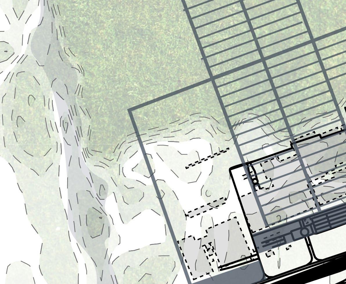
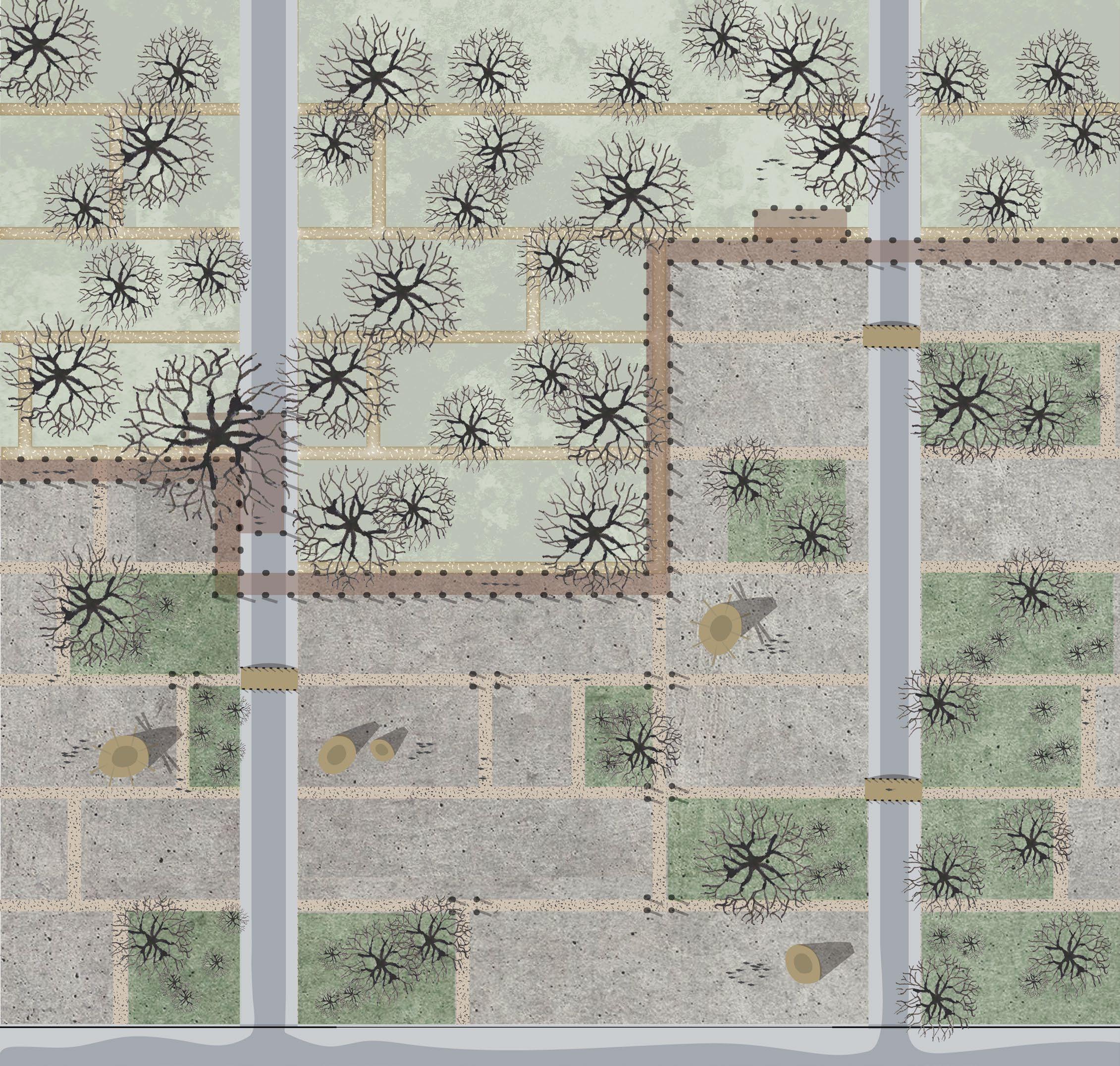
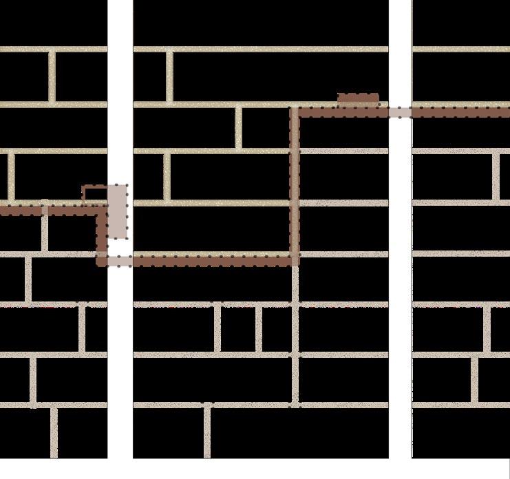
77 1 current water (drainage) system 2 infrastructure and human movement 3 soil types: 1-cultivated oligatrophic mire 2- cultivated mesotrophicmire 3 - mesotrophic mire Site context layers 1 2 3 3 0 20 60 120m 1 2
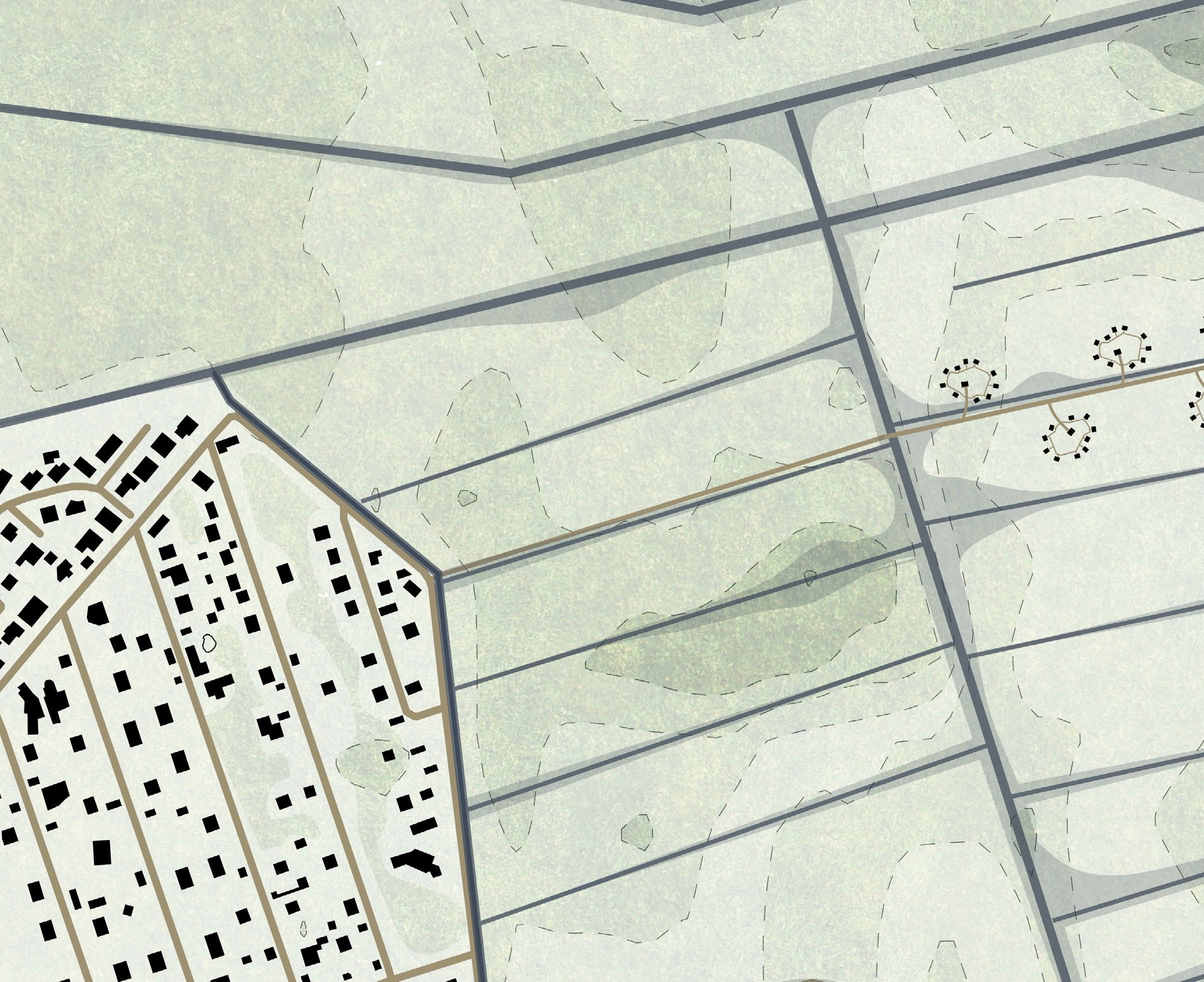
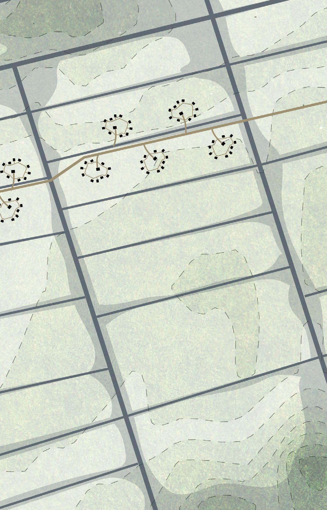
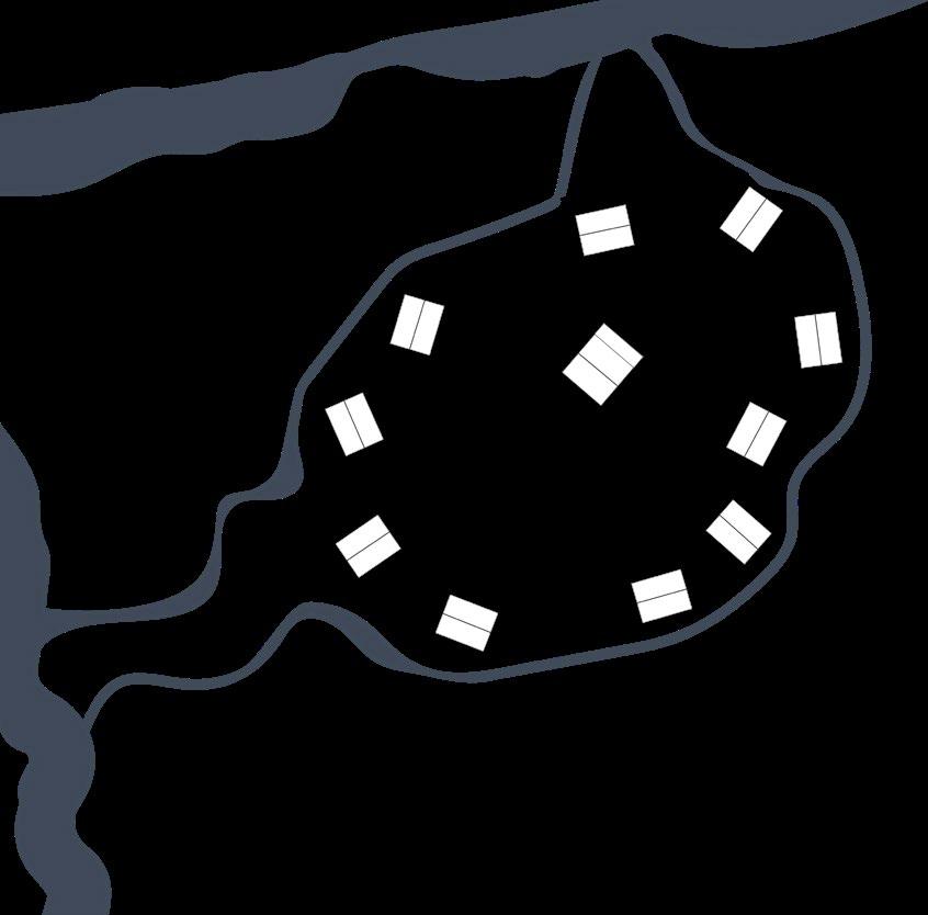
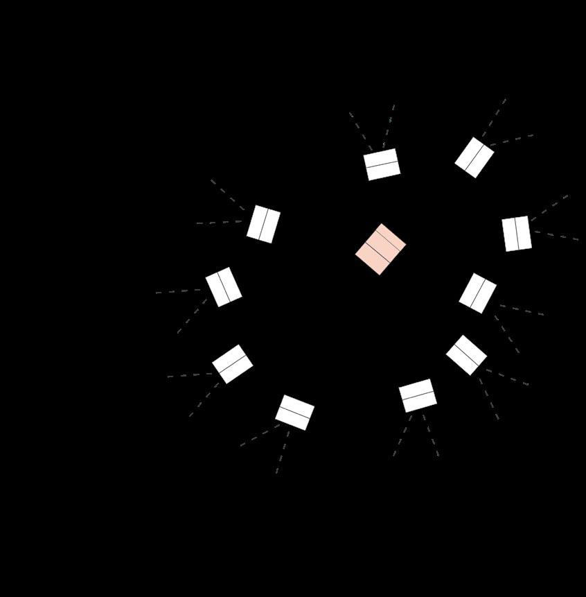
The dachniki live simple yet completely surrounded by the wilderness. Therefore they have minimum impact with the vulnerable soil by using the duck boards and boardwalks around their homes. The paths are very minimal, and functional. Each path is a destination to a mushroom picking spot ot where to fetch water.
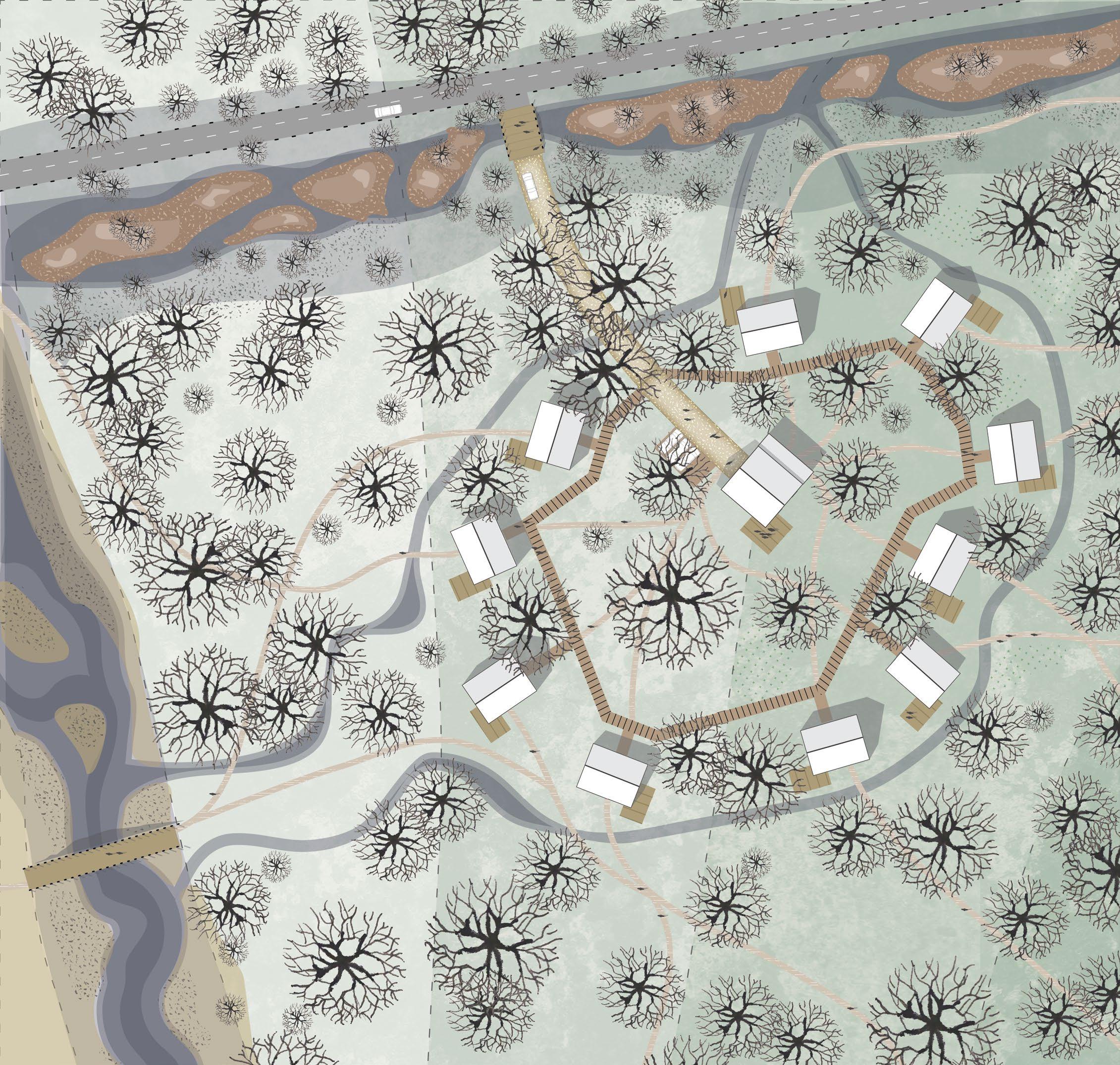
78DachnikiPioneers
0 5 15 30m
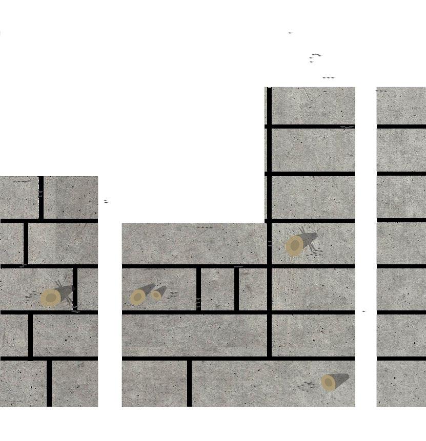
79Components 1 2 3 1 infrastructure 2 water system 3 buildings and program
80DachnikiPioneers
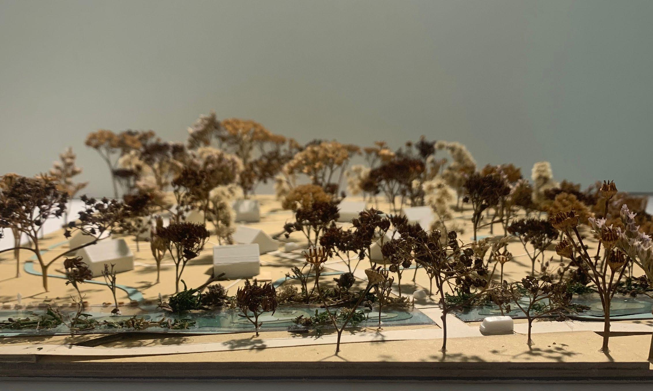
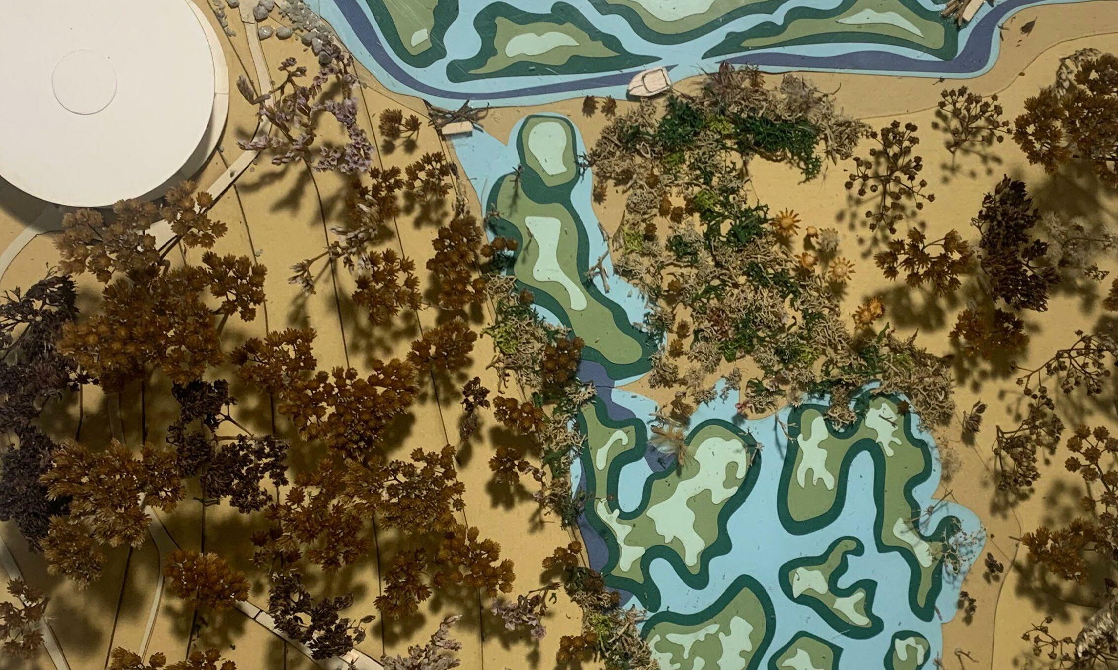
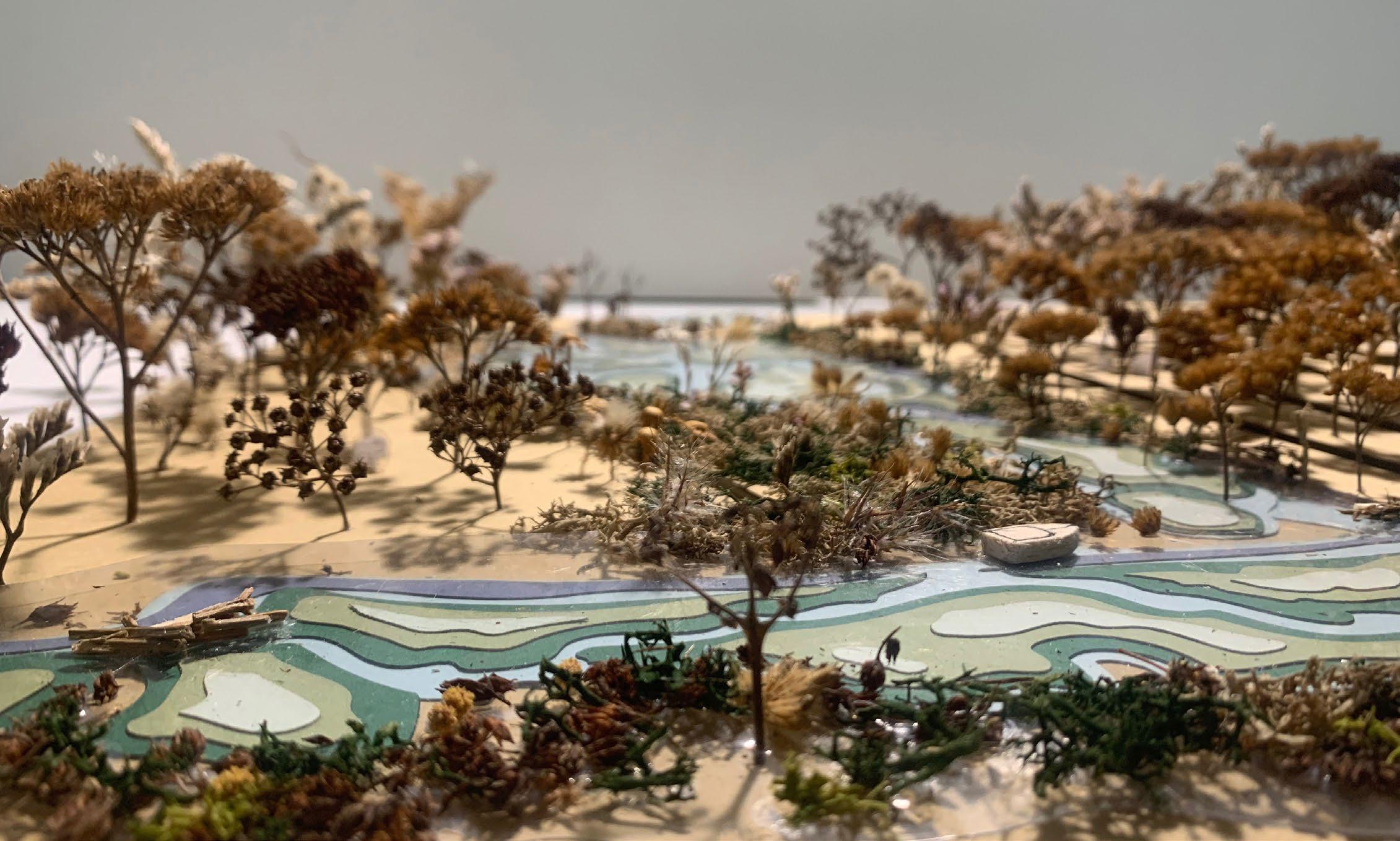
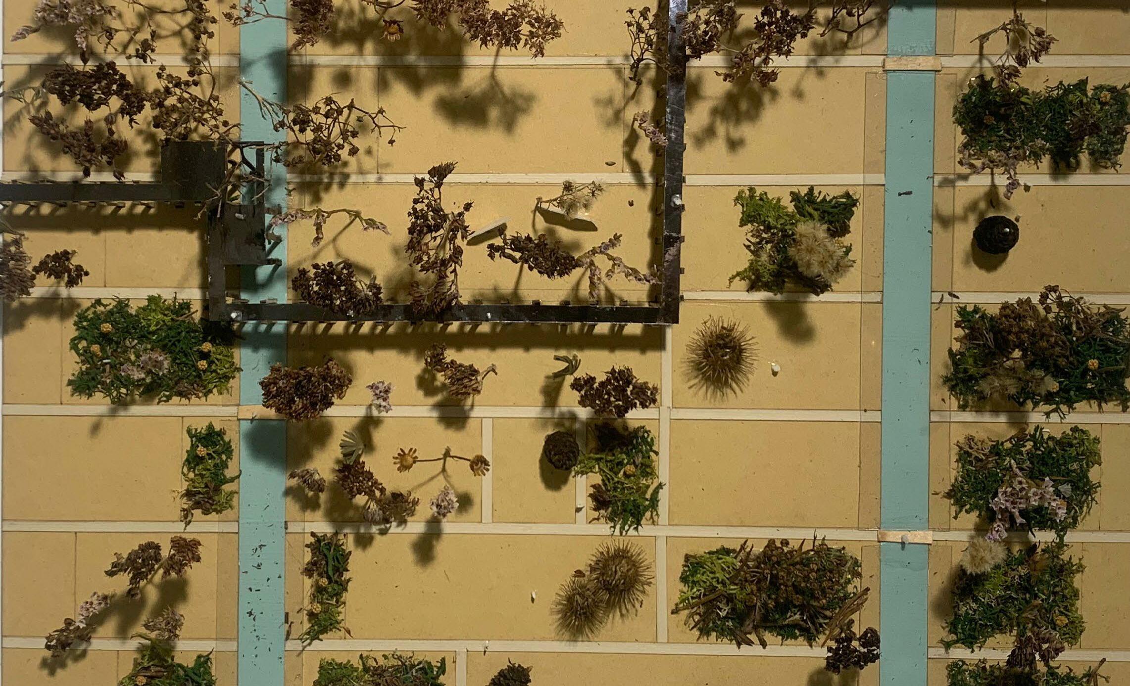
81Scale model
DachnikiPioneers
84Wellness enthousiastsPioneers
Profile
These people are usually very aware of their health and know of the most popular ways in which to improve it. There is no age range, wellness enthousi asts can be young and old. Swamps have been known for their mental health benefits due to their quiet nature and are therefore an ideal place for a wellness center.
85 05 km 00 km 10 km 15 km
Wellness enthousiasts
86Pioneers Wellness enthousiasts

87 1 2 3 Site context layers 1 current water (drainage) system 2 infrastructure and human movement 3 soil types: 1 - existing borreal oligotrophic forest, 2 - existing mesotrophic forest, 3 - existing mesotrophic bog 1 2 3 0 20 60 120m
The situation of the center is in a very picturesque setting. To get there one must travel by boat and it's so remote that it's almost impossible to get to by transport, as there are no roads leding to it. The building itself stands on the bank of the river with a 360 view for the residents to experience the swamp nature.

88Pioneers
0 5 15 30m Wellness enthousiasts
89Components 1 2 3 1 infrastructure 2 water system 3 buildings and program
90Pioneers Wellness enthousiasts
91Scale model
Pioneers Wellness enthousiasts
93
94Artist collectivePioneers
The artists are the true innovators of the land scape. They found a place to create, where they look for a connection between nature and people through art. They are people of all ages from all backgrounds that come to experiement and design gadgets that the animals can explore. They are brave and presistent scientists exploring the landscape.
95 05 km 00 km 10 km 15 km
Artist collective Profile
96Pioneers Artist collective
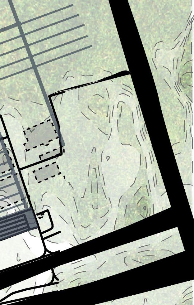
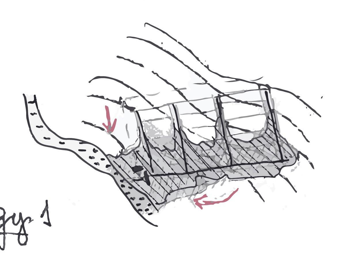
97Site context layers 1 current water (drainage) system 2 infrastructure and human movement 3 soil types: 1 - existing mesotrophic bog 2 - cultivated land (sand) 1 2 3 0 30 90 180m 1 2
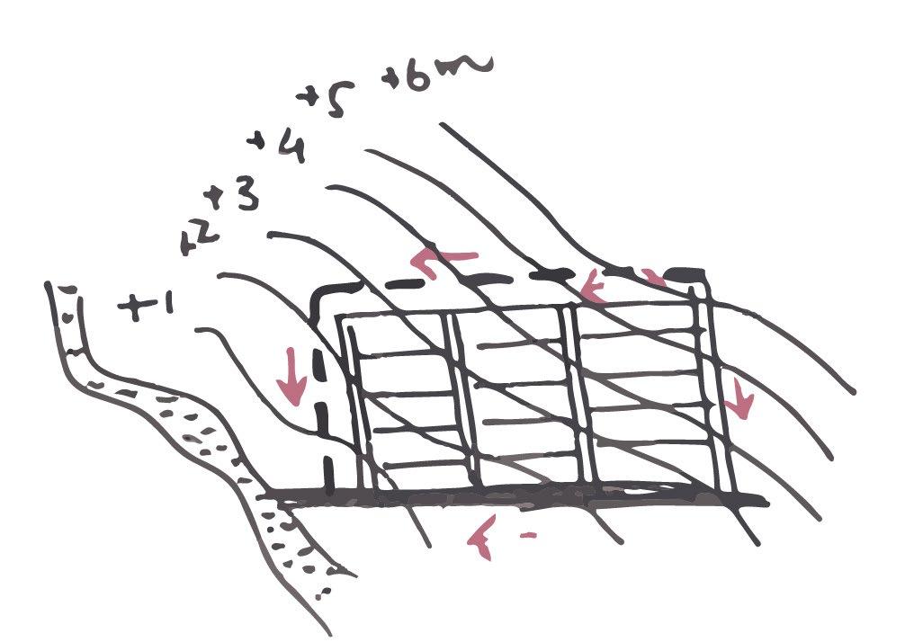
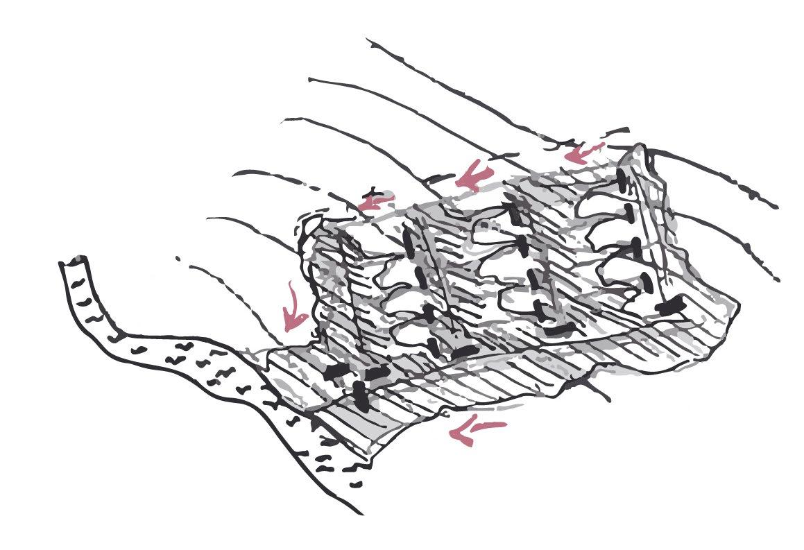
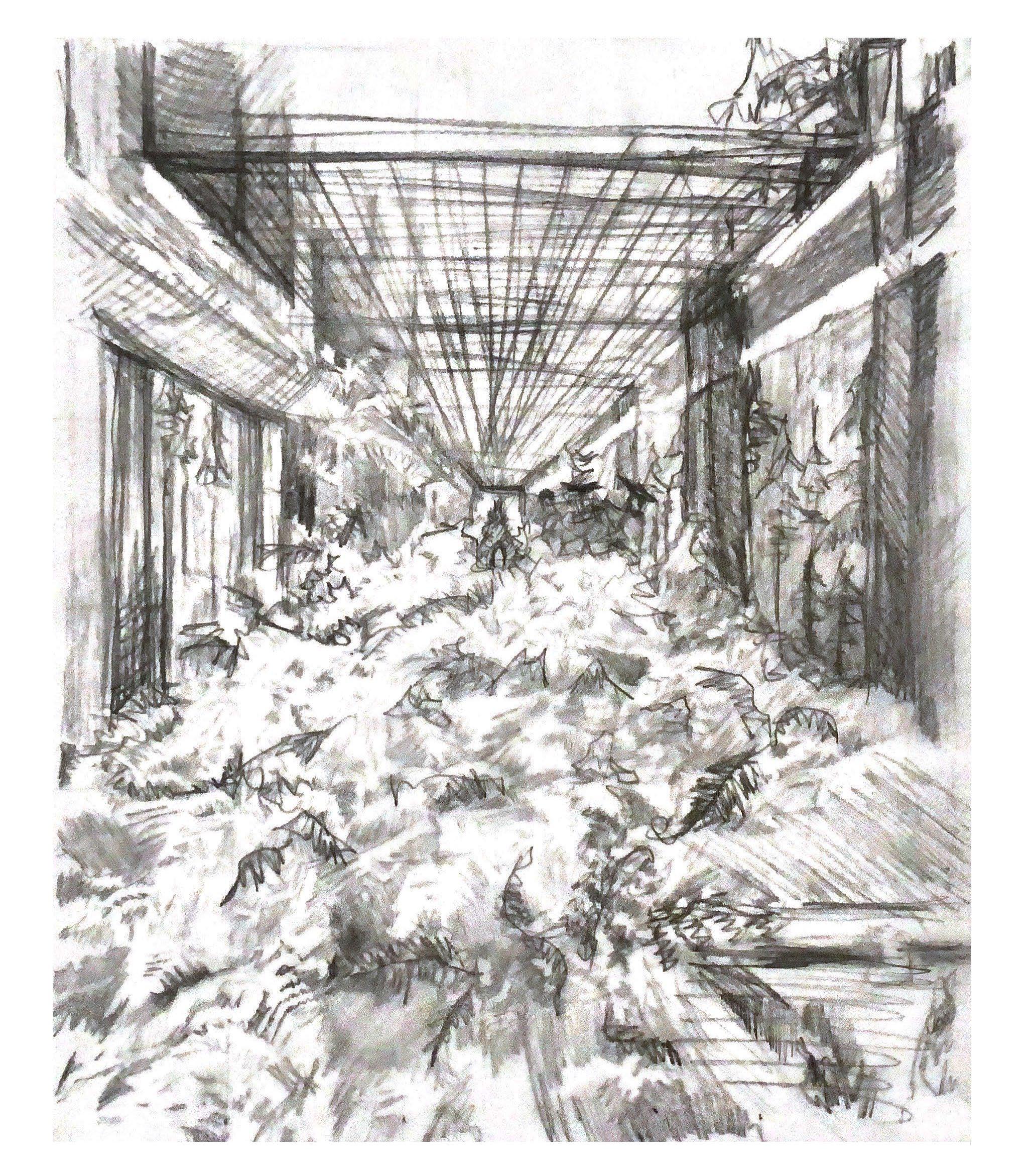
The artists' residence is located in a very special place.An abandoned Hyundai factory no longer in use due to the current sanctions against Russia it is the perfect opportunity to reverse the process that man took onto nature and take over the building with the same canal system. In between artist work shops are placed and the outer wall of the factory became a walkway panoramic bridge
98Pioneers
0 5 15 30m Artist collective

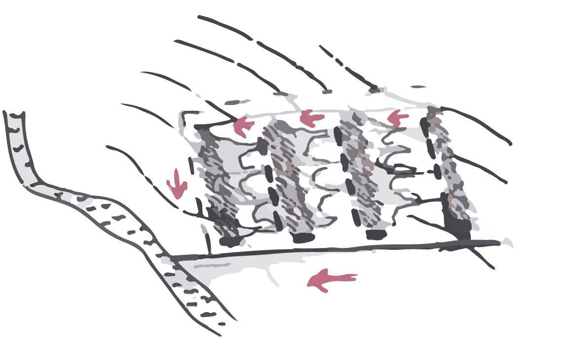
99 1 infrastructure 2 water system 3 buildings and program Components 1 2 3
100Pioneers Artist collective
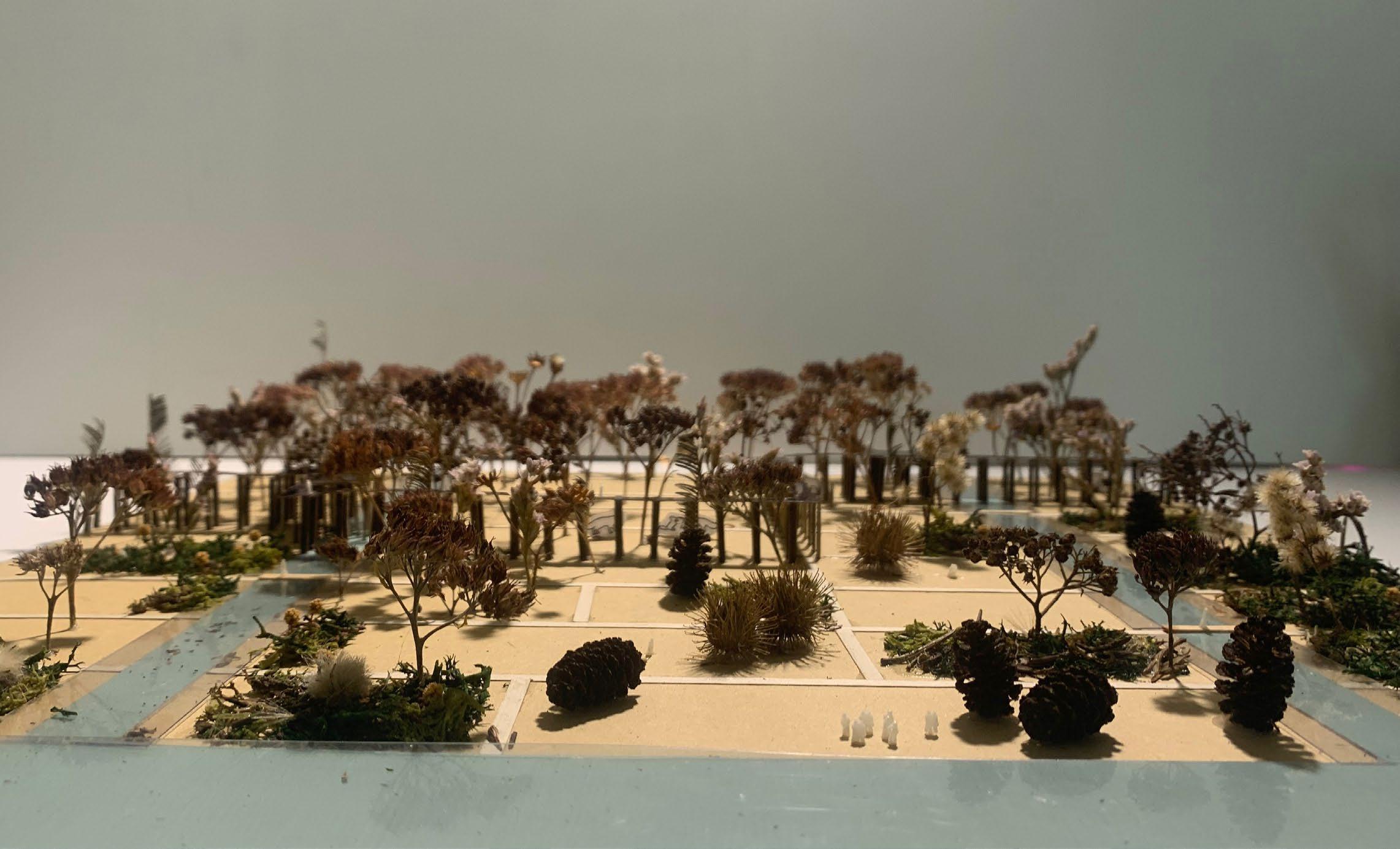
101Scale model
102Pioneers Artist collective
103
104
Aleksey Savrasov (1882) Pine trees by the swamp.
The Palimpsest of PeatlandsBibliography
Aït-Touati, F., Arènes, A., & Grégoire, A. (2019).
Terra forma: Manuel de cartographies potentielles. Éditions B42: Paris
Prishvin, M. M. (1945).
The treasure trove of the sun. New York : Viking Press
105 BIBLIOGRAPHY
106
