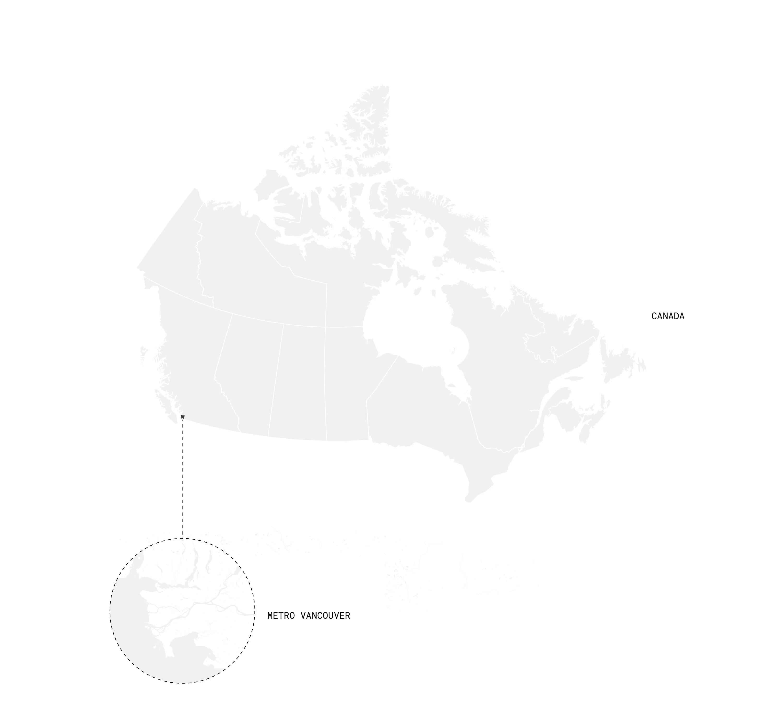
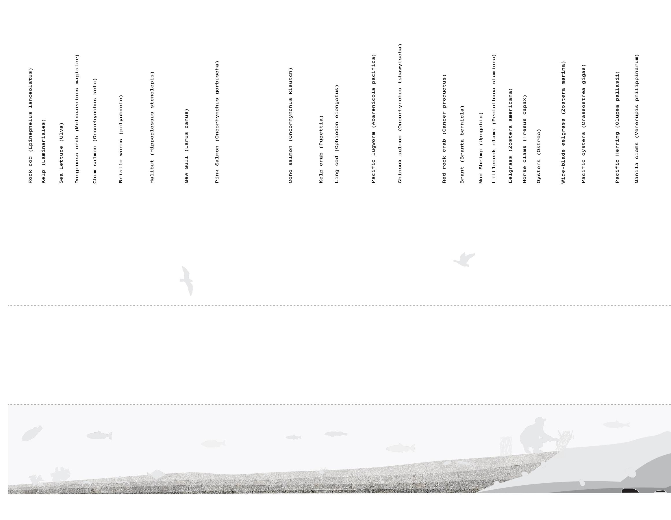
COASTAL ACCRETION

 Growing a new cultural landscape through resilience, aesthetics and time to address coastal sea level rise in Metro Vancouver, Canada
Blake Allen
Master Landscape Architecture Amsterdam Academy of Architecture 2021-2022
Growing a new cultural landscape through resilience, aesthetics and time to address coastal sea level rise in Metro Vancouver, Canada
Blake Allen
Master Landscape Architecture Amsterdam Academy of Architecture 2021-2022
02
COASTAL ACCRETION
Growing a new cultural landscape through resilience, aesthetics and time to address coastal sea level rise in Metro Vancouver, Canada
Blake Allen williamblakegallen@gmail.com
Master Landscape Architecture Amsterdam Academy of Architecture 2021-2022 Committee
Roel Wolters (Mentor) Hannah Schubert Remco van der Togt Exam Committee
Jana Crepon Cees van der Veeken
Head of Landscape Architecture Hanneke Kijne
03
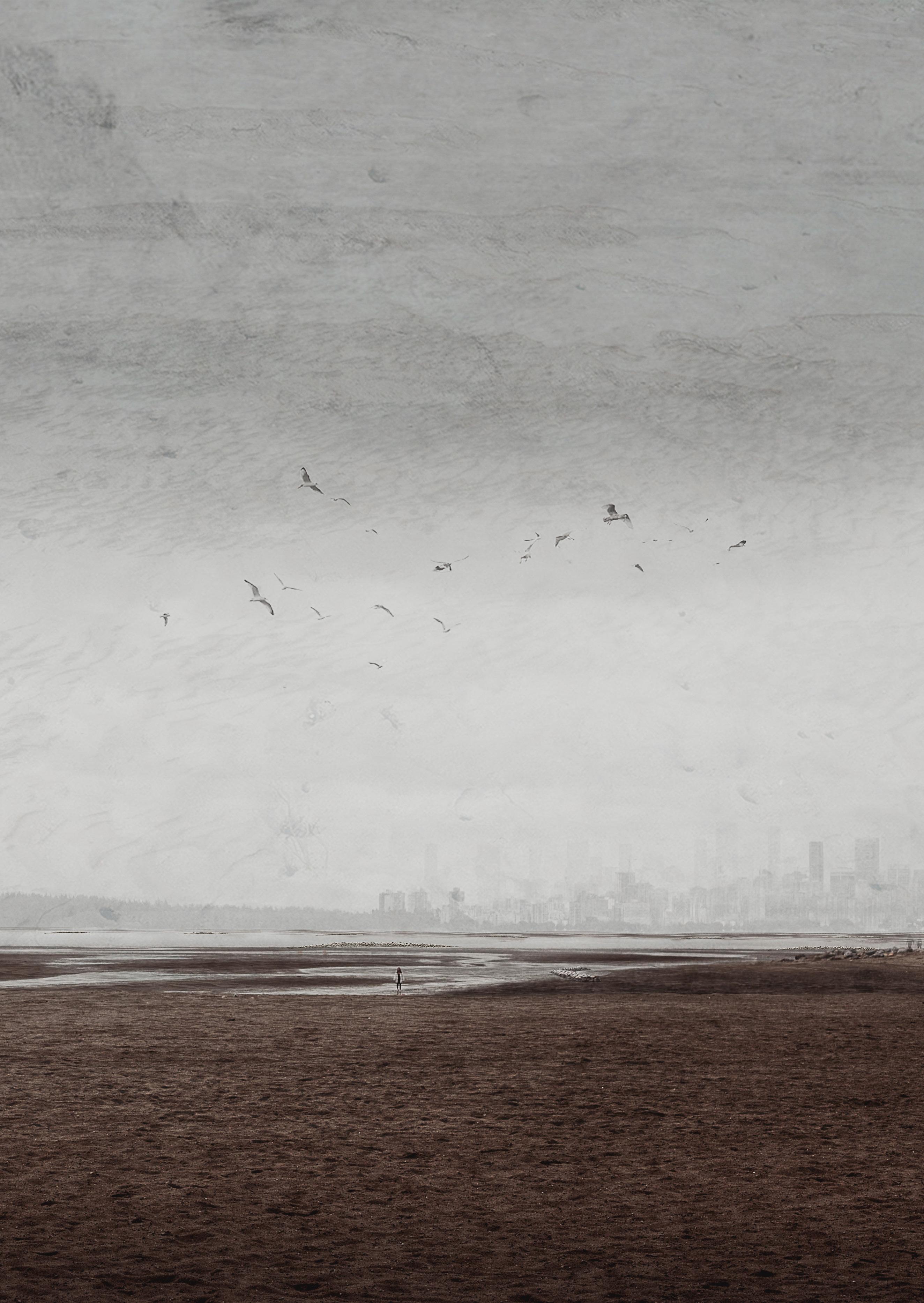
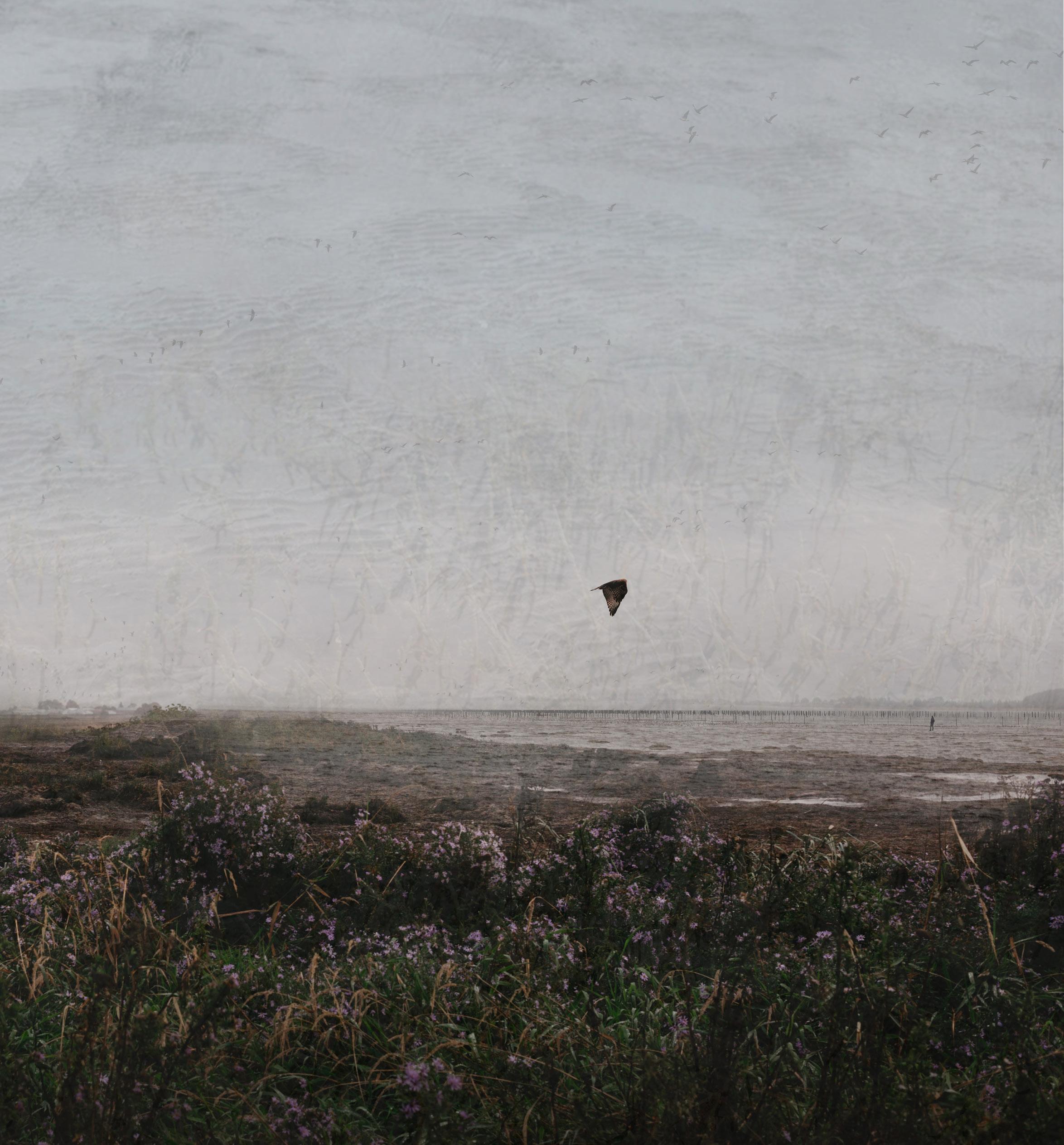
Due to the consequences of climate change, Metro Vancouver in British Columbia, Canada is project ed to experience 1m of SLR by the year 2100.
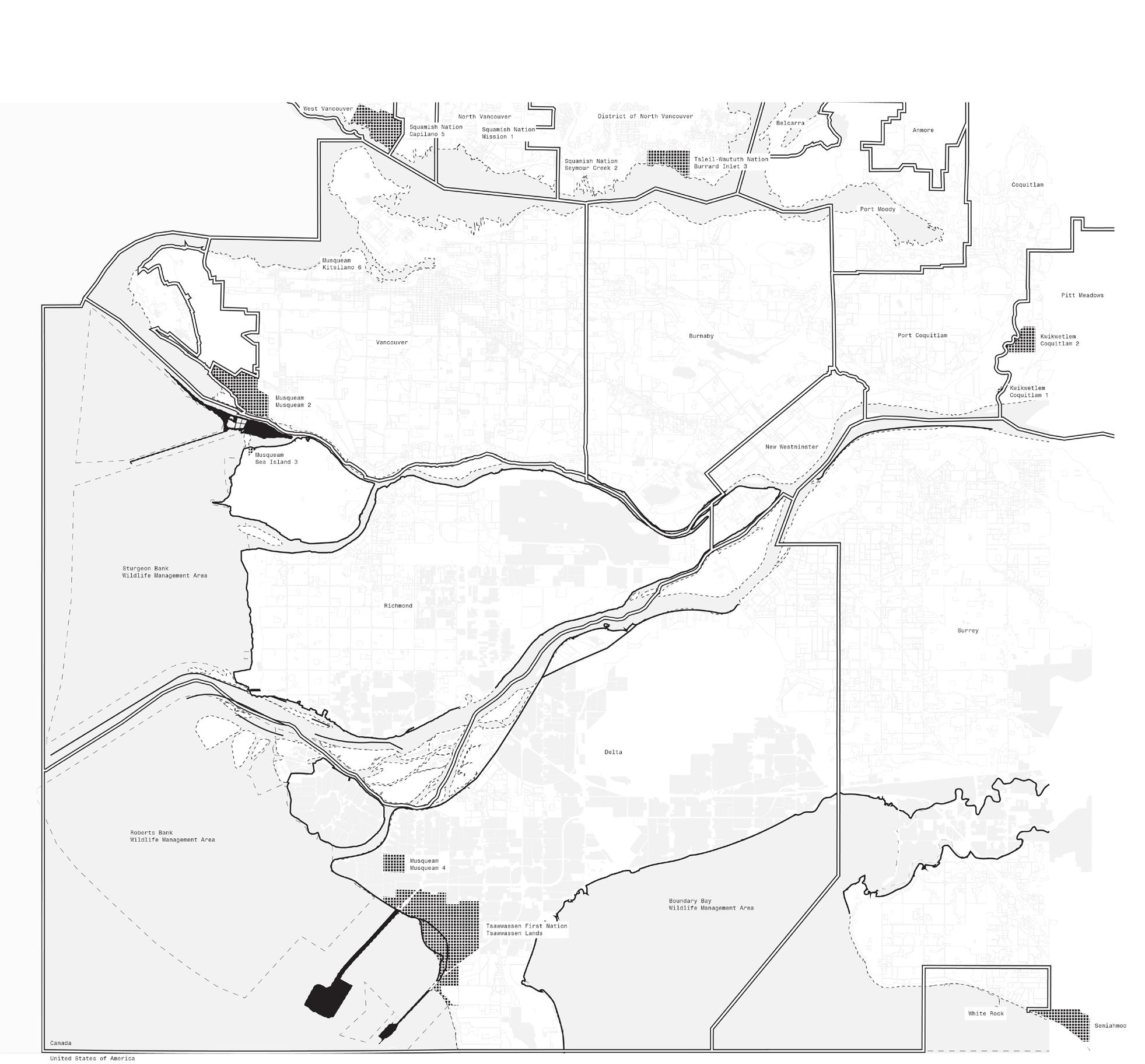
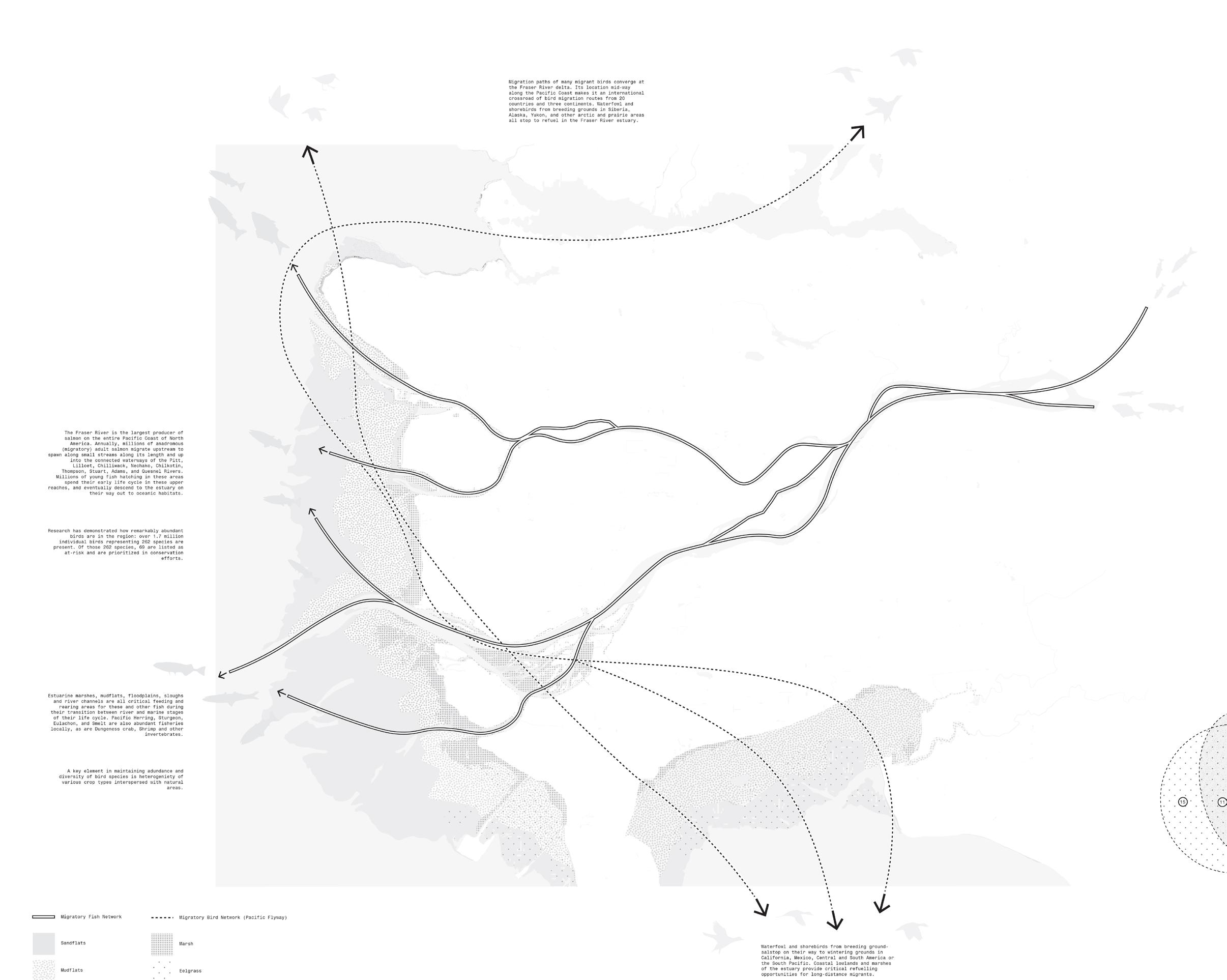
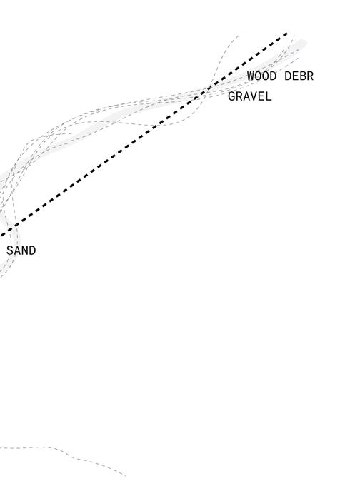
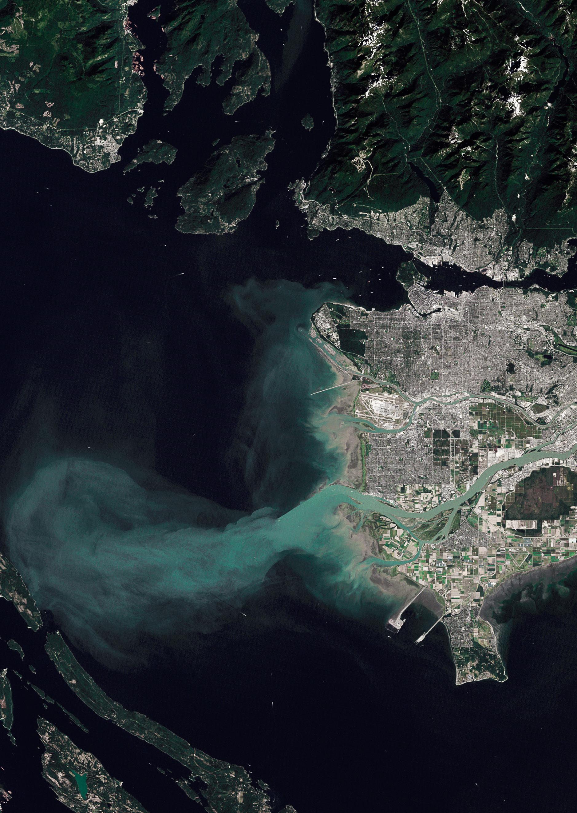
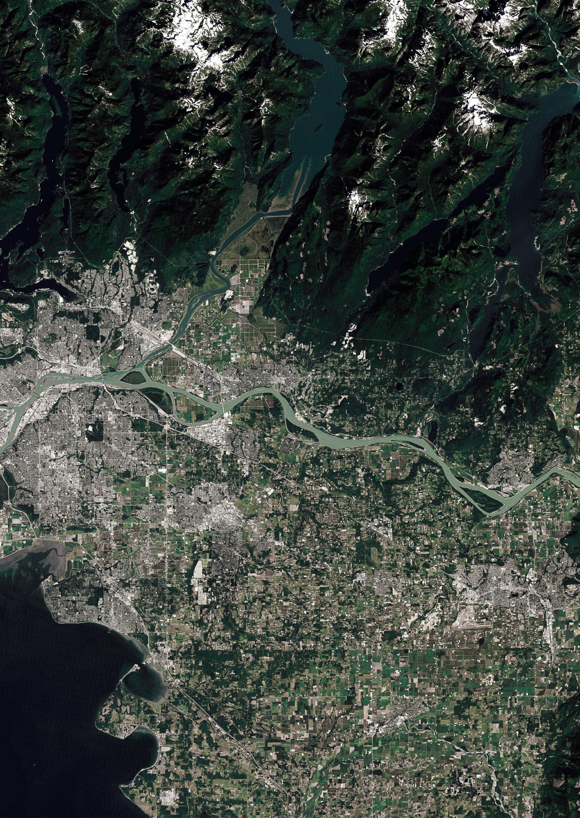
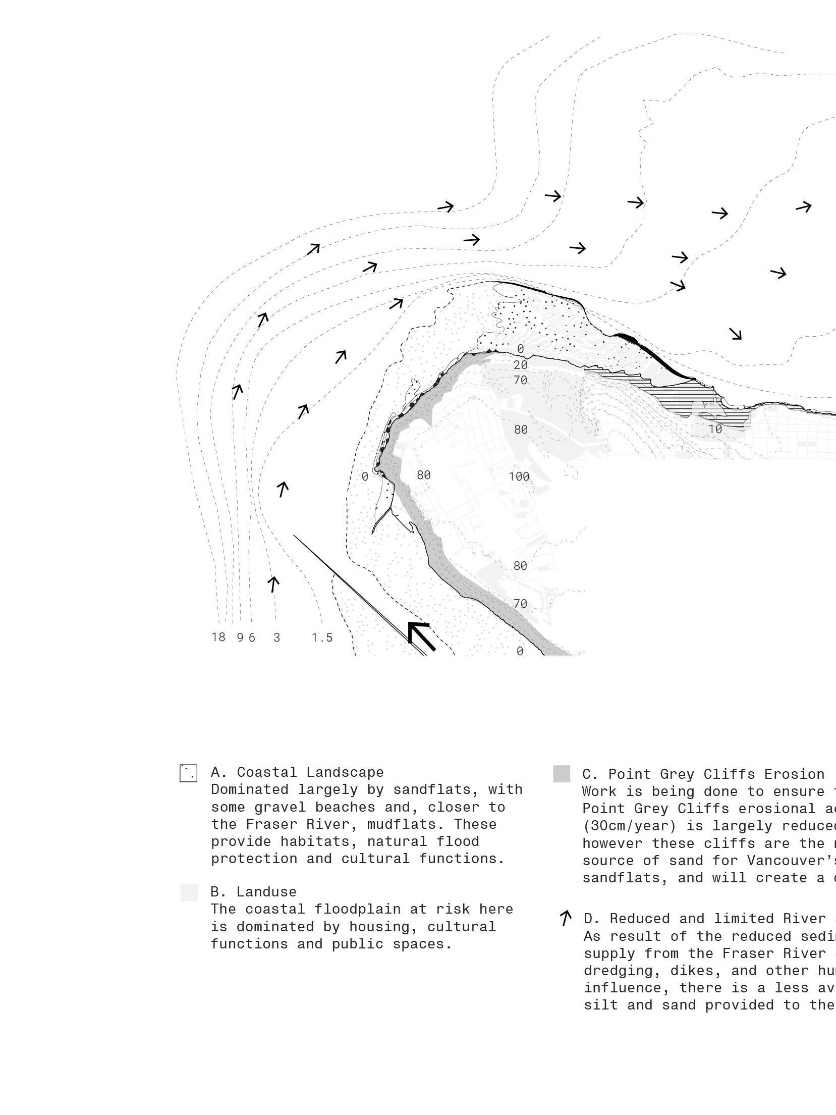
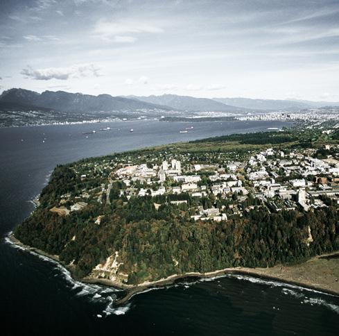
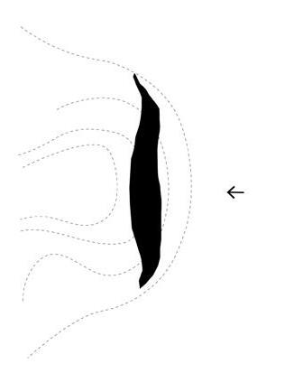
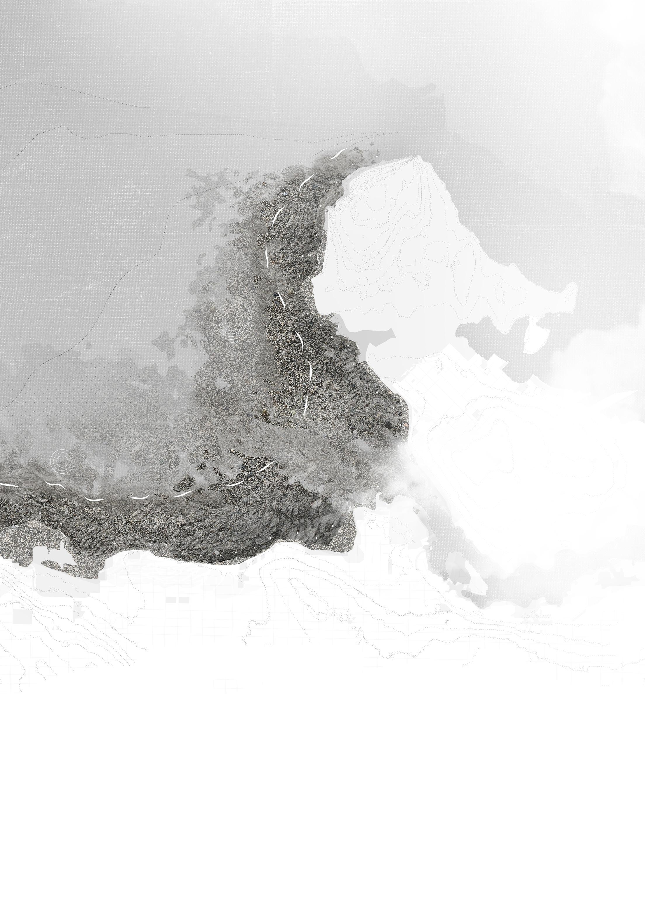
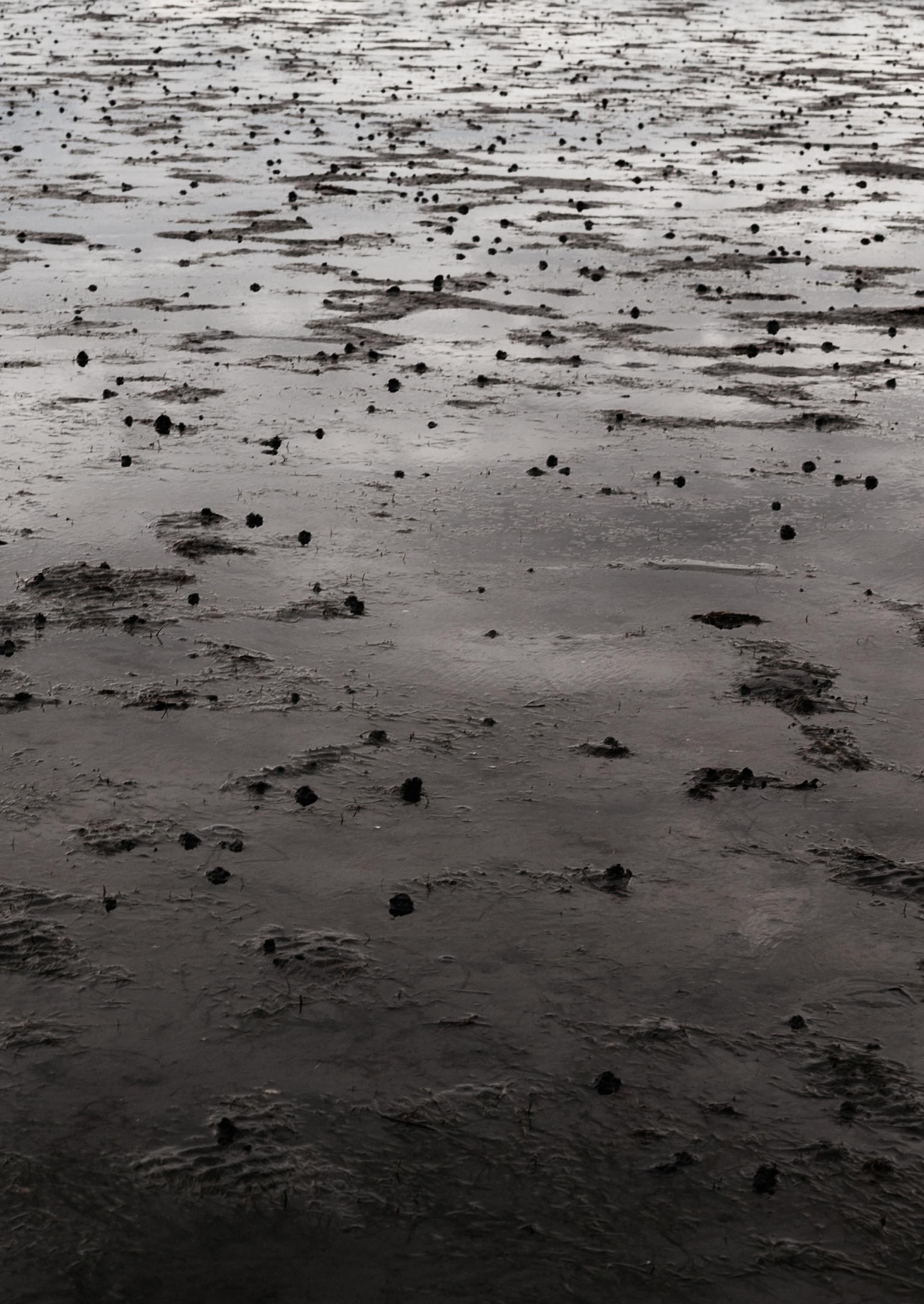
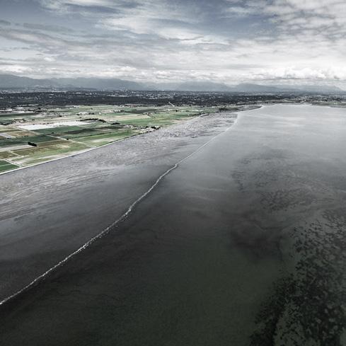
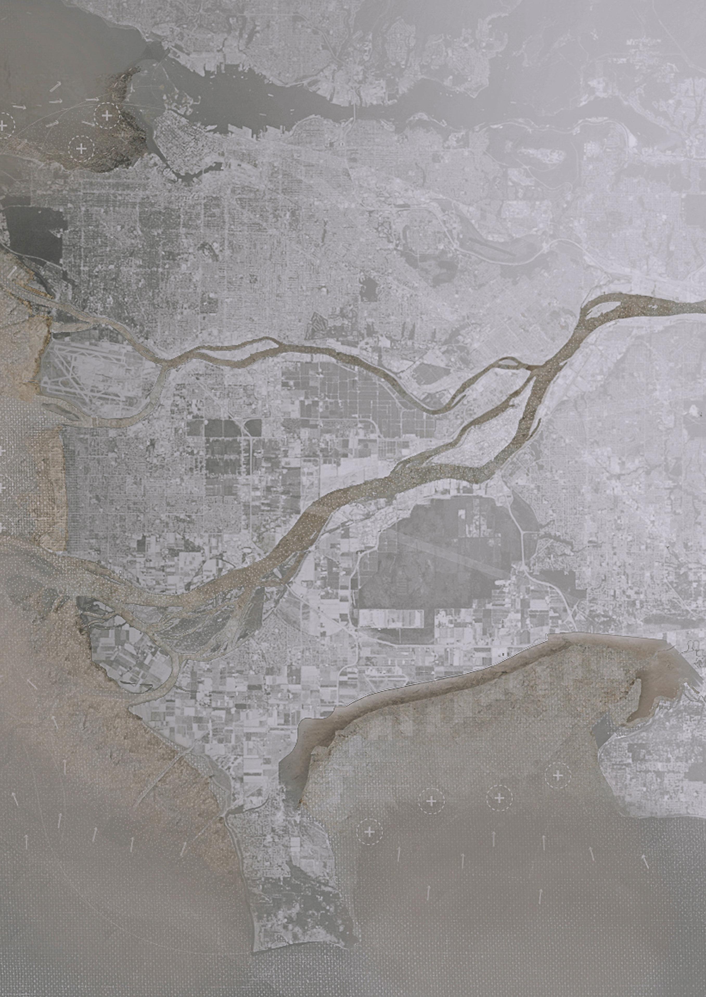
Coastal Metro Vancouver’s growth over the past 10,000 years was created through sedimentation and deltaic processes of the Fraser River. These natural processes shaped the landscape, as well as the histories and cultures of the Coast Sal ish First Nations peoples that have inhabited the landscape since time immemorial. With the intro duction of Western society into the region, a new relationship with nature was imposed onto the landscape, where controlling natural systems and defining borders was an extension of their soci ety. Today, the legacy of this period is still dominant, and is typified by sprawling and outdat ed infrastructure, urban development growth, and jurisdictional boundaries. This greatly stagnates coastal water management measures today. The risk this poses for the region is vast, and threatens the natural, built, and cultural landscapes of Metro Vancouver.
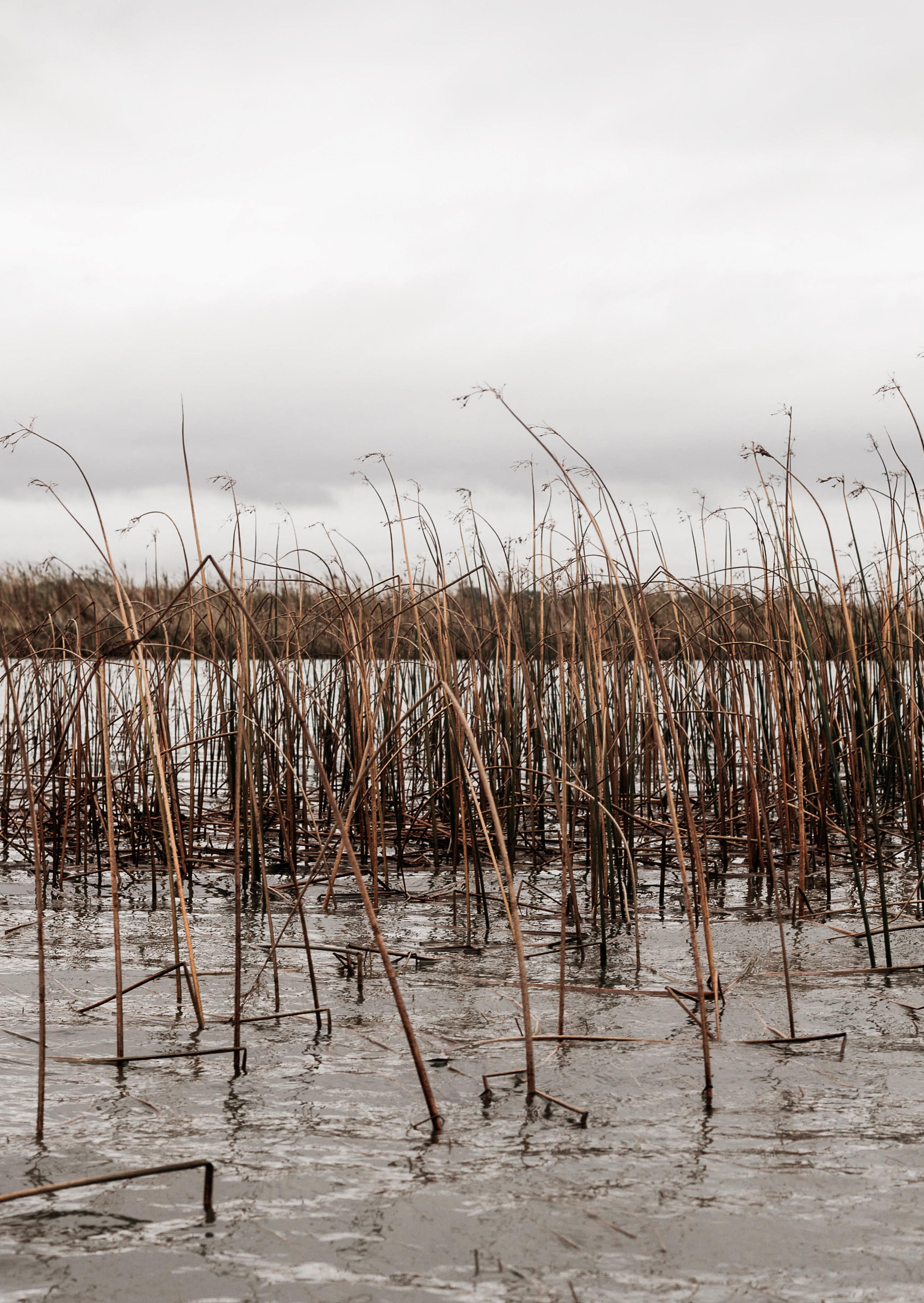
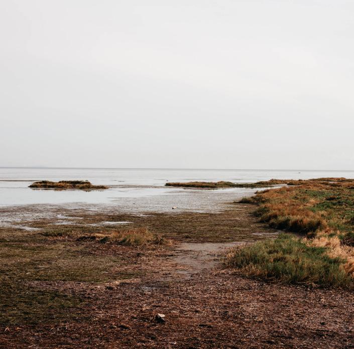
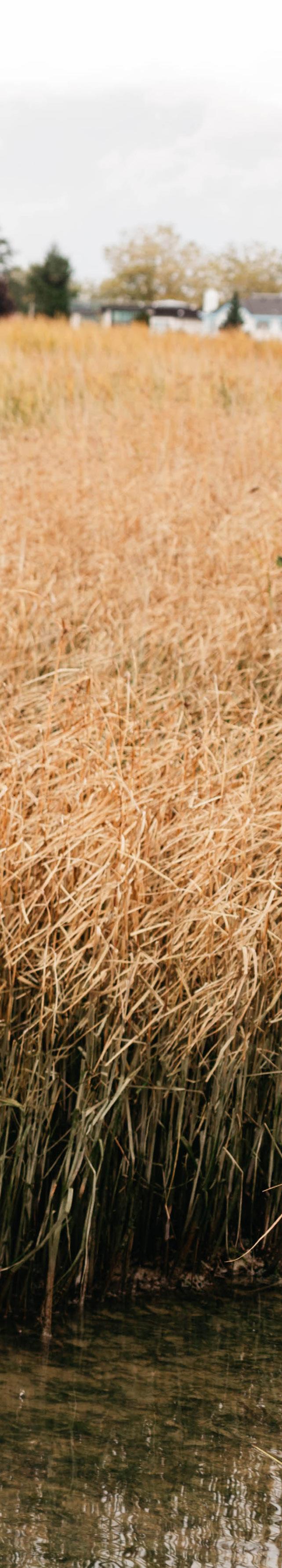
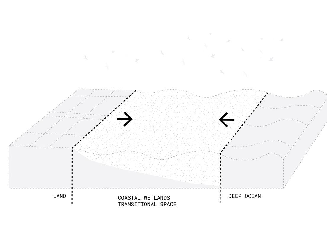
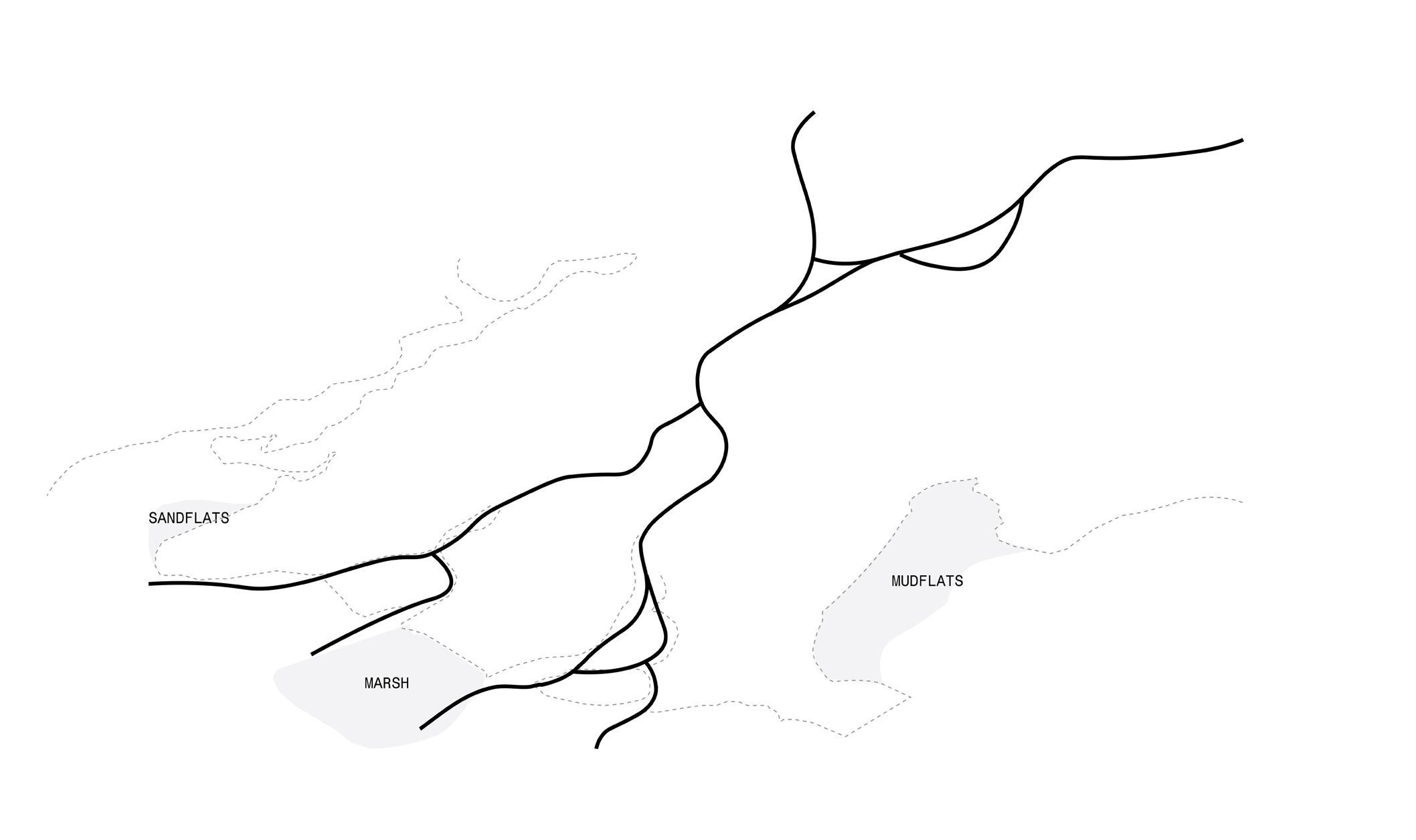
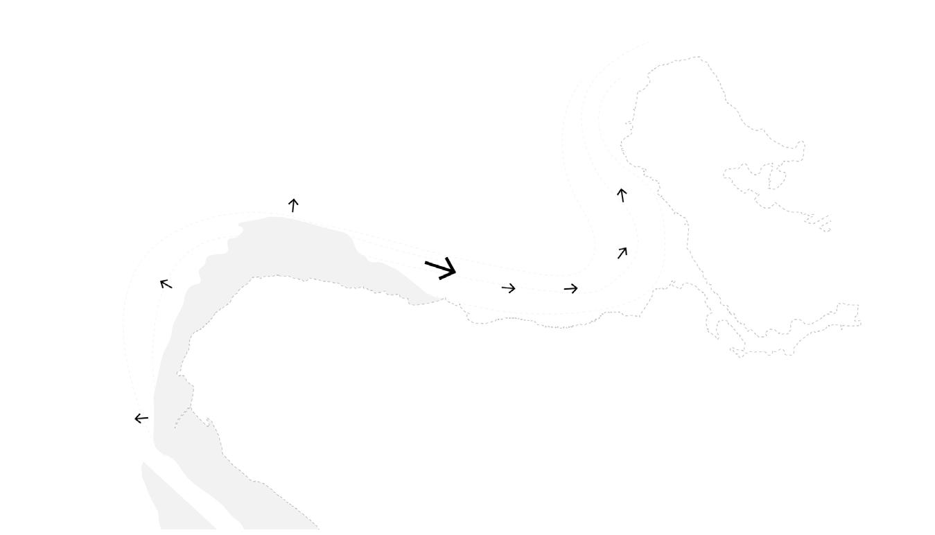
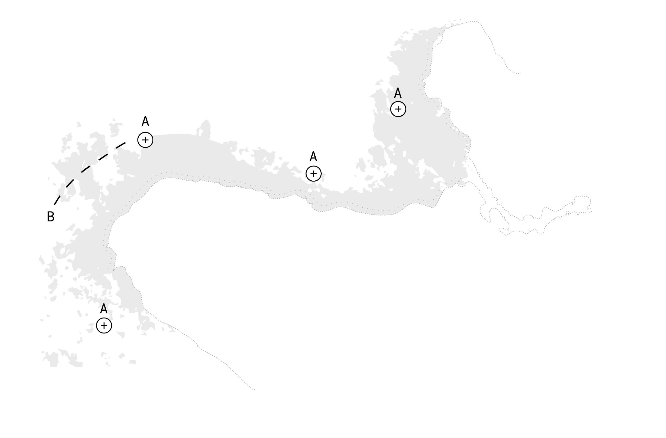
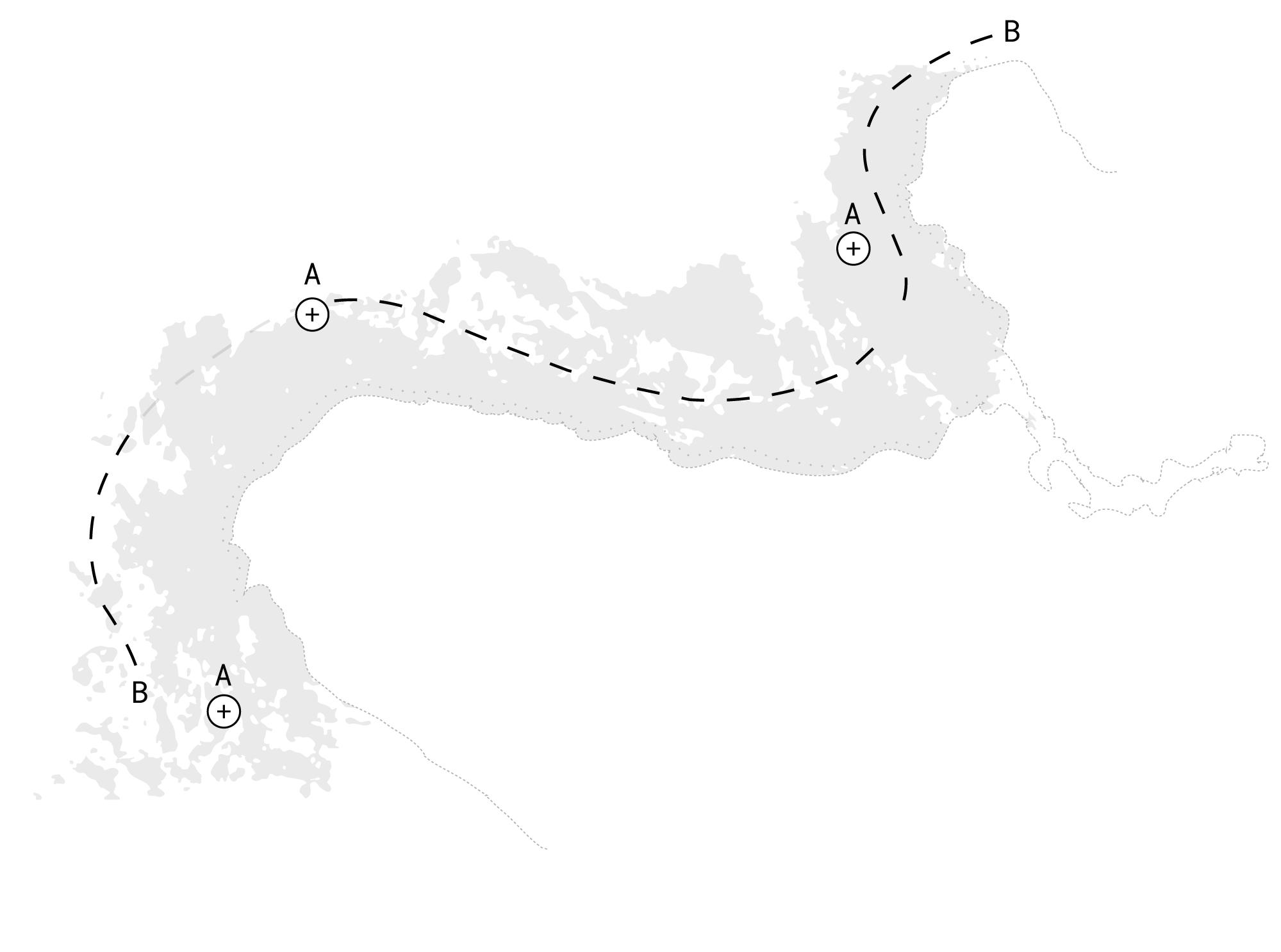
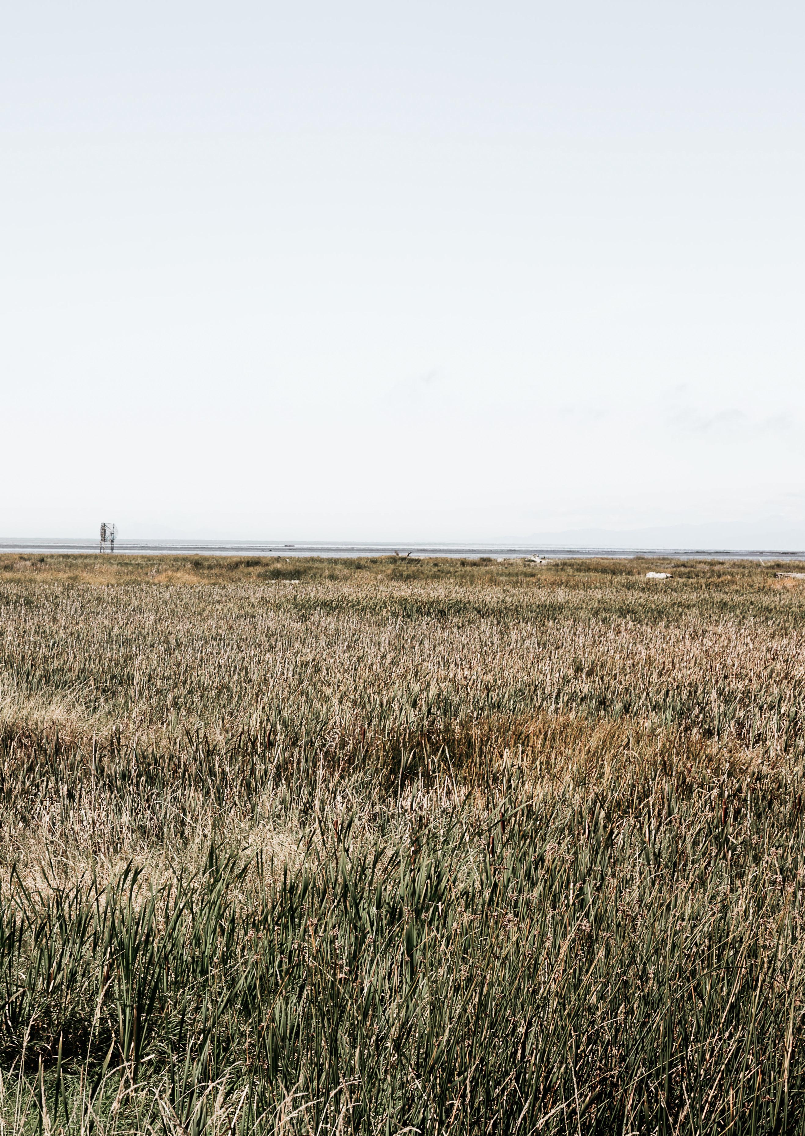
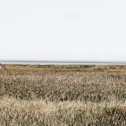
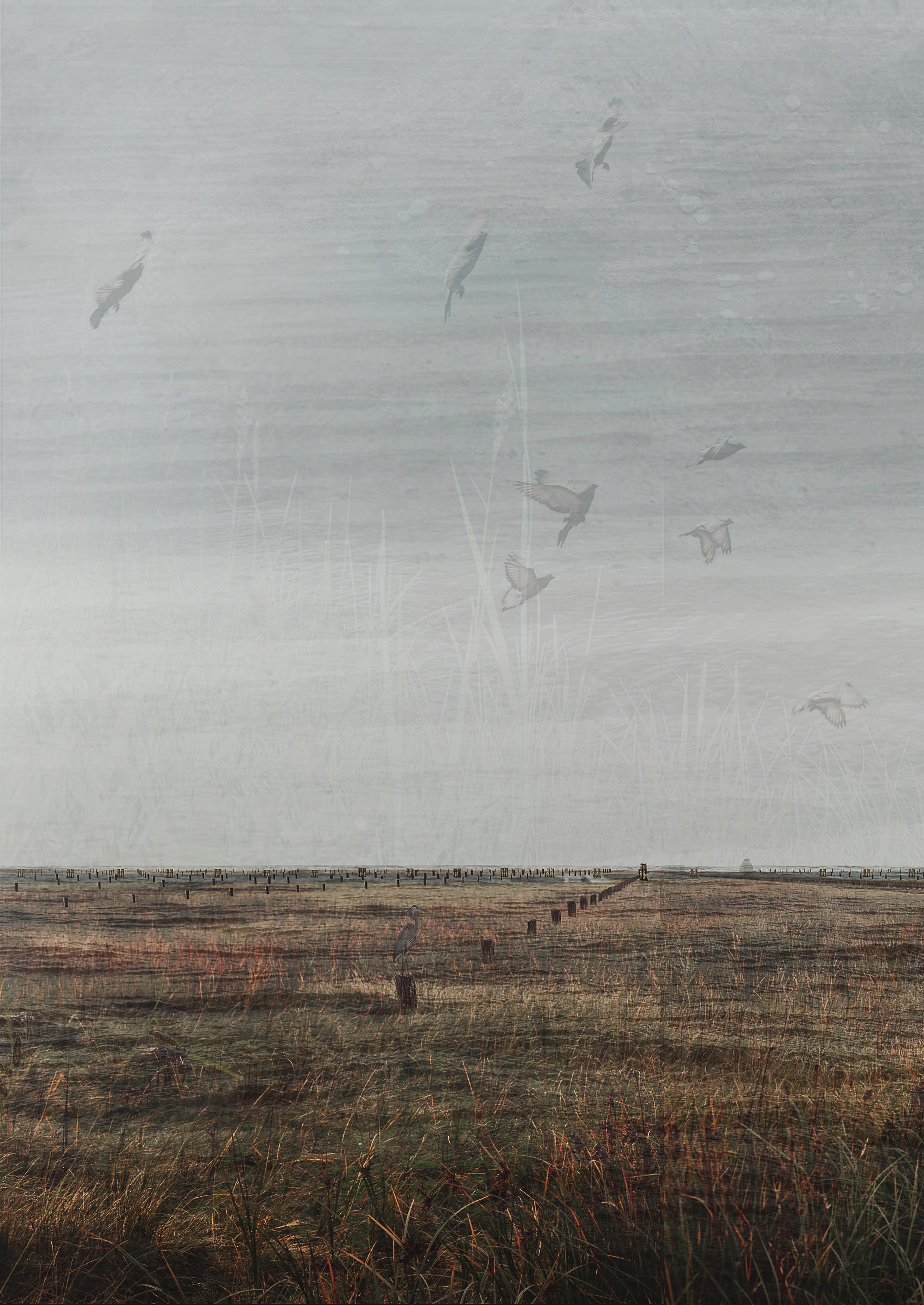
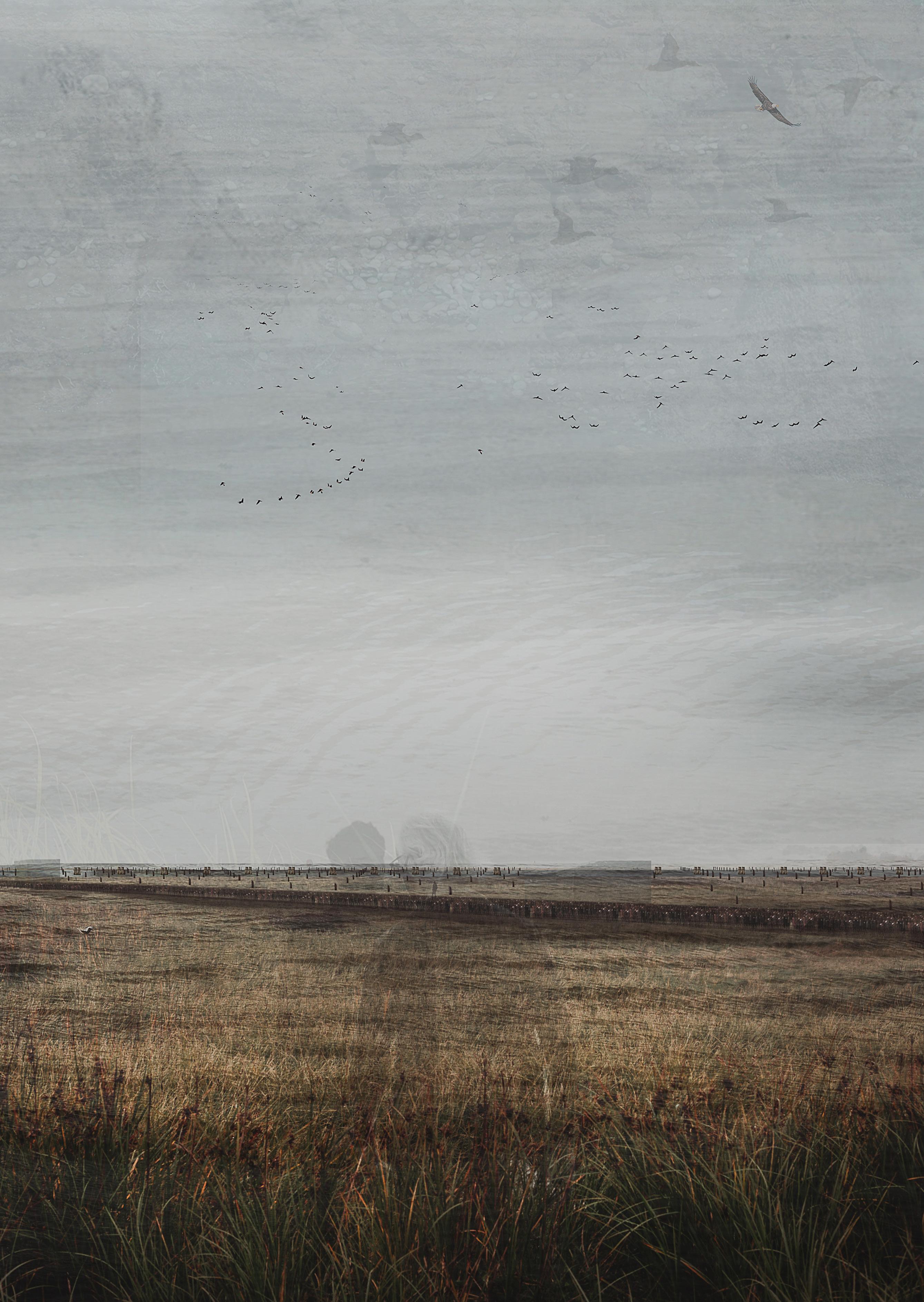
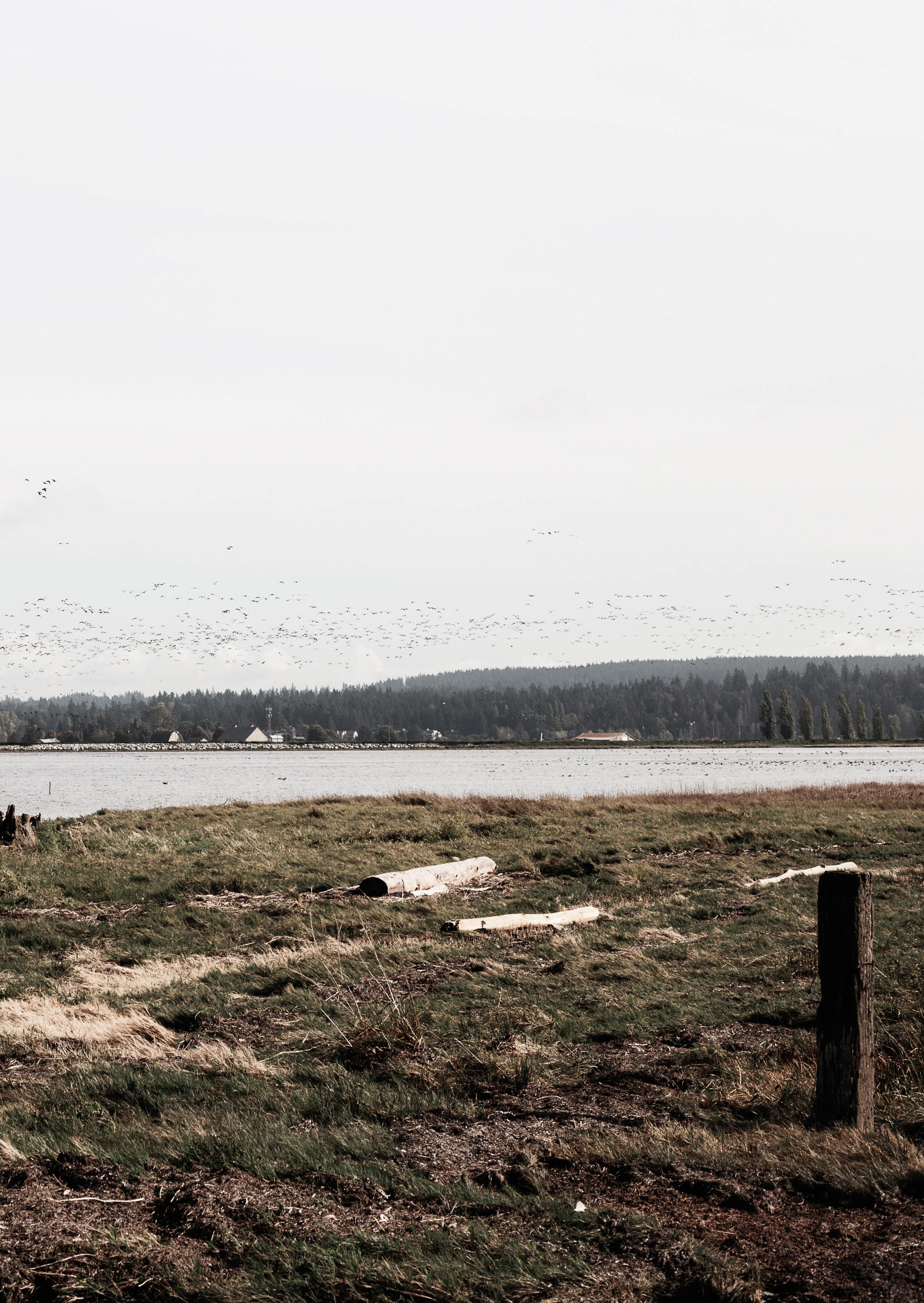
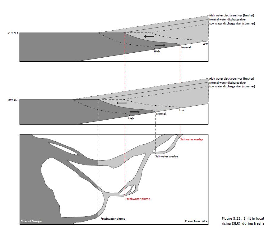
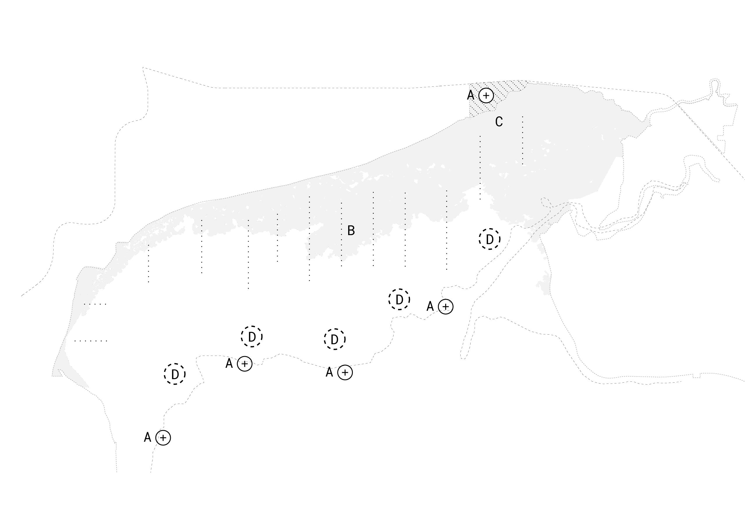
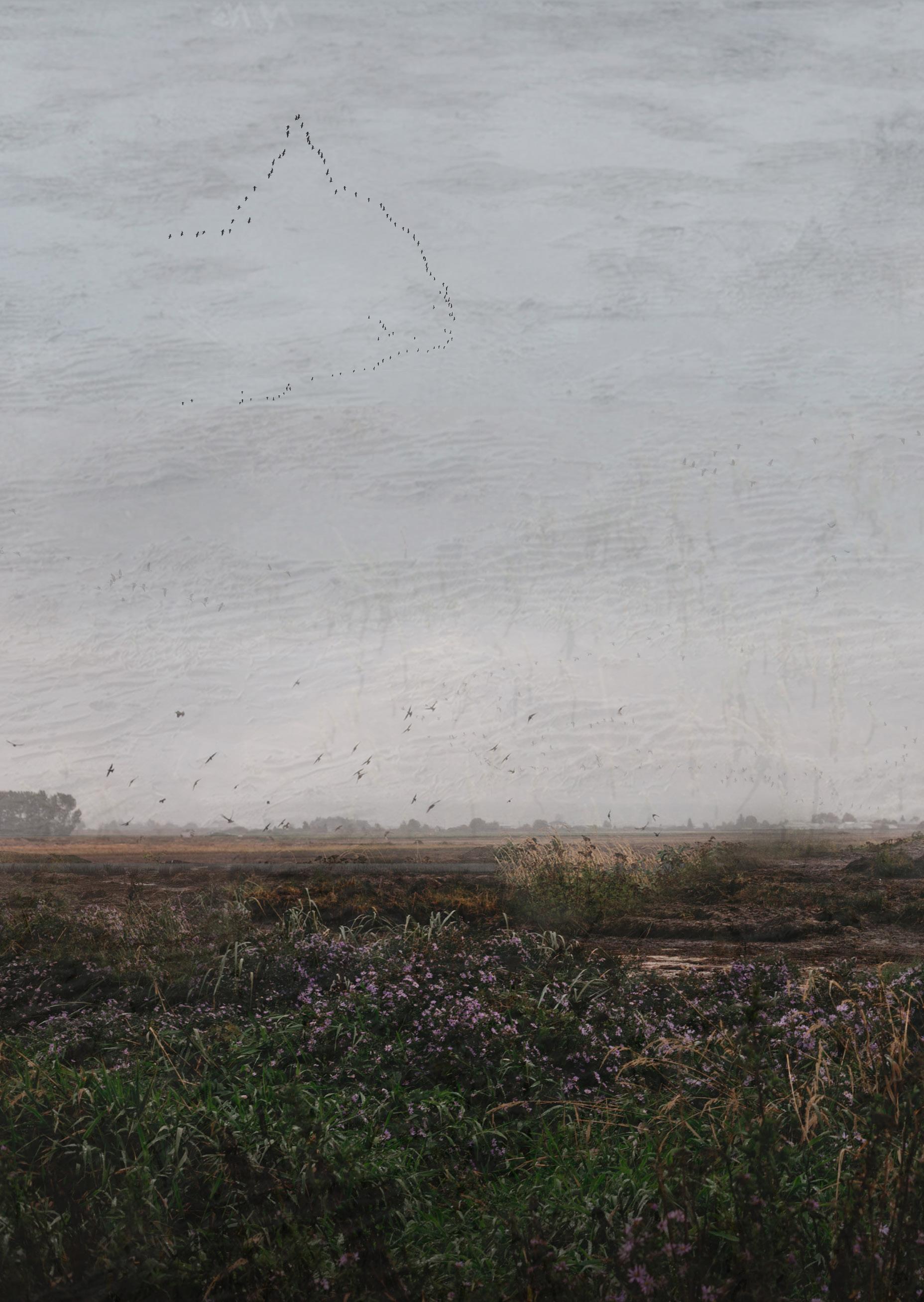
This project places emphasis on the transition spaces between land and water – the convergent, dynamic points of exchange and interaction be tween daily flooding and dryness. These sites have the capacity to connect, given their position at the intersection between land/society, and water/ nature. I believe these are the critical spac es of SLR resilience in Metro Vancouver due to their position, and their ability to attenuate waves and mitigate against flooding. Three sites were selected to develop resilience, and were se lected based on their urgency in SLR management, their unique ecotypes based on their proximity to the Fraser River, and their distinct cultur al contexts: sandflats, marsh and mudflats. These landscapes have the potential to adapt to SLR, although in the current condition of control when combined with SLR and storms, are at risk of be ing lost entirely.
05 PROJECT SUMMARY
Throughout this project, resilience is made by us ing the existing natural systems and qualities of the landscape to inform and lead growth towards resilience. Through harnessing the (currently un derutilized or lost) materials of the Fraser Riv er, that exist as a combination of sand, silt, clay, gravel and wood in various points throughout the river channel today, new opportunities arise to grow these existing coastal landscapes. Within each site chosen in the project, new potential ities of the landscape are shown. These are in teractive forms of layered resilience - showing how the influence of society can be harnessed in either directly producing that resilience (mud flats), experiencing resilience (marsh) or inter acting with resilience (sandflats) that attenuate and dissipate wave energy offshore through the use of various breakwaters, reefs, and wetlands. When combined, the natural systems of the landscape interact with these interventions to create a new landscape, new forms, and new co-created languag es of resilience.
The resulting proposal is formed through decades of landscape growth, as well as generations of new cultural practices and experiences - a process of coastal accretion. I hope other people also see themselves in this project, and that new inter pretations of this methodology could be designed based on differing local contexts and cultures. SLR contains the potential for society to recon nect to nature through time. Given the extreme long-term nature of these challenges, this is a landscape I will never know – but the one that I would hope to help initiate.
06
07
Reading Guide
This book is a summarized collection of my grad uation work carried out between March 2021 and August 2022. The book is composed of three parts: research, strategy and design.
Research
The research section of the book is composed of an analysis of Sea Level Rise, of the risks that it poses to Metro Vancouver Canada; the cultur al landscape of the region; and the values of its natural landscape.
Strategy
This is followed by the strategy that results from the research – focused on strategic sedimentation practices.
Design
The design section of the book elaborates on this strategy in three sites. The result is a series of details at the local level that have critical impacts at the regional scale, showing how sedi mentation can build resilience through time.
08
CONTENTS
Project Summary
Prologue
Research
Cultural Landscape Natural Landscape
Sea Level Rise
Sea Level Rise and Metro Vancouver Strategy
Resilience, Aesthetics and Time Fraser River Estuary Strategic Sedimentation
Design
Site Selection Sandflats Context Concept Strategy Details Plan Marsh Context Concept Strategy Details Plan
Mudflats Context Concept Strategy Details Plan Regional Plan
09
05 11 16 28 40 44 72 102 130
This project brought me back to the landscape that I grew up in. In many ways, I was hoping to com pare how my experiences in Dutch landscape archi tecture would relate to the culture of design and landscape architecture in Canada. As a Geographer first, I was inspired by nature-society relation ships throughout the project, and have found a deep belief throughout the process that landscapes are a product of cultural relationships with na ture. Because of this, I wasn’t able to simply use Dutch water management principles in the project, but needed to first research the context of the place that I was working in.
I worked through experimental models that allowed me to test the interventions I was proposing, In addition to extensive literature research, I also met with many local experts and practitioners that were working on SLR challenges in the region to help direct and inform my project. Finally, I visited the landscape over the course of several visits to the region, experiencing their seasons, rhythms and dynamics. The combination of this in tensive research and field work resulted in the designs and proposals found in this document.
11 PROLOGUE
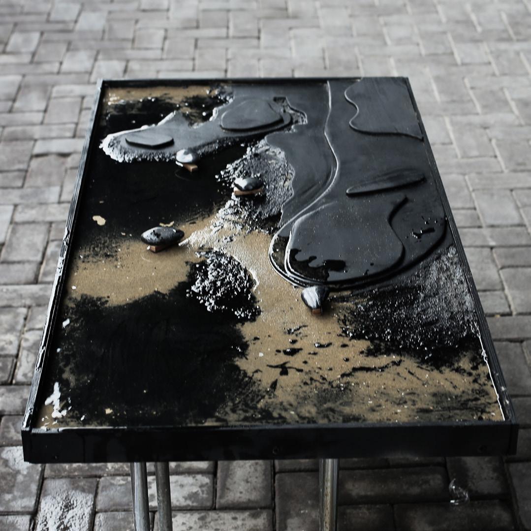
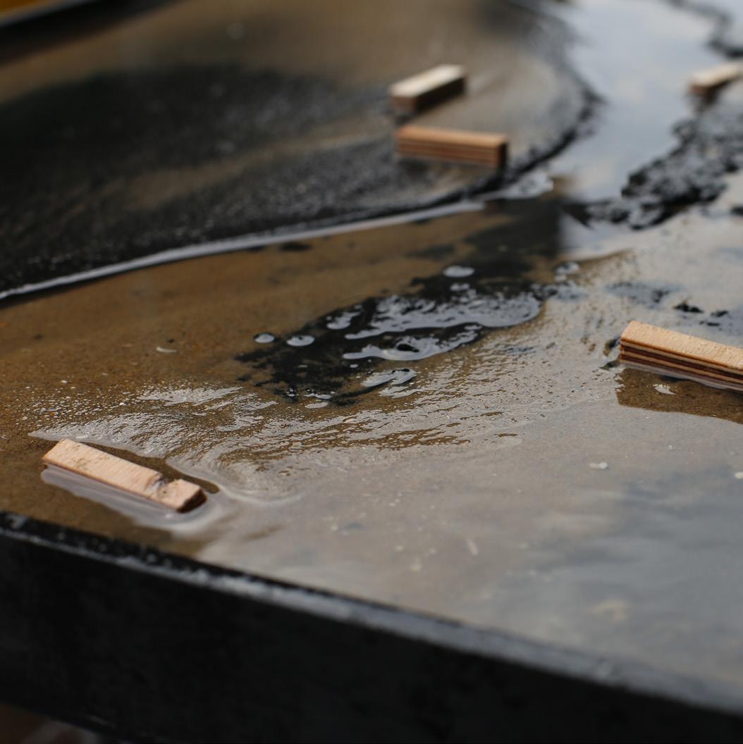
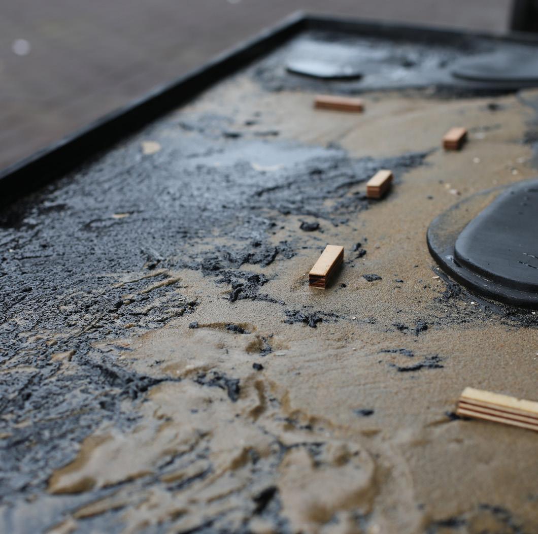
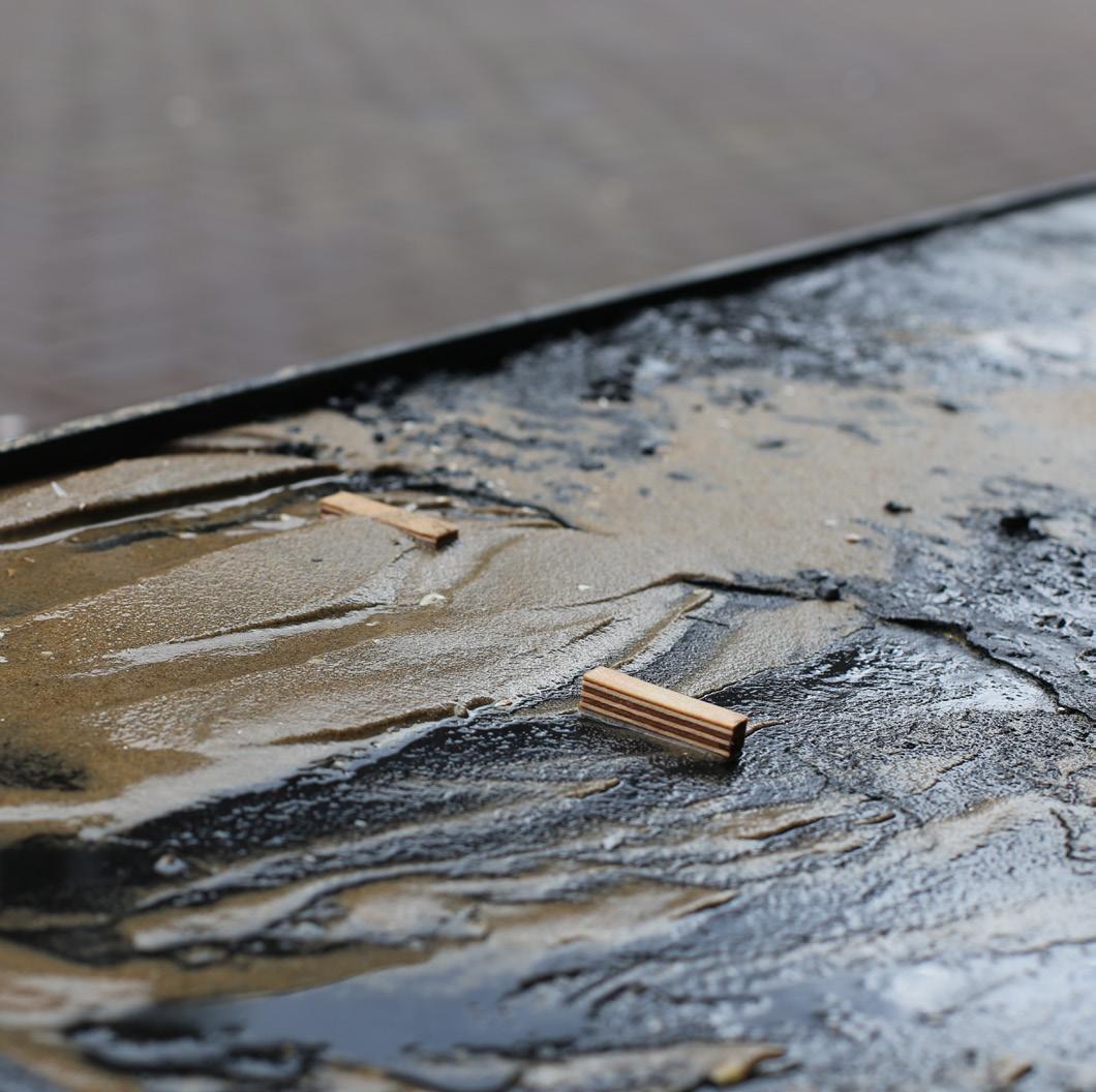
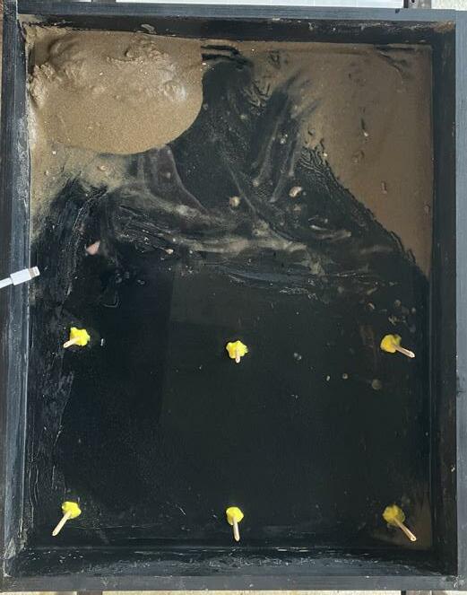
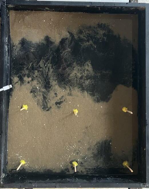
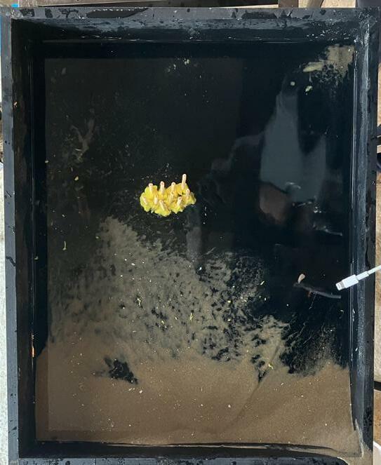
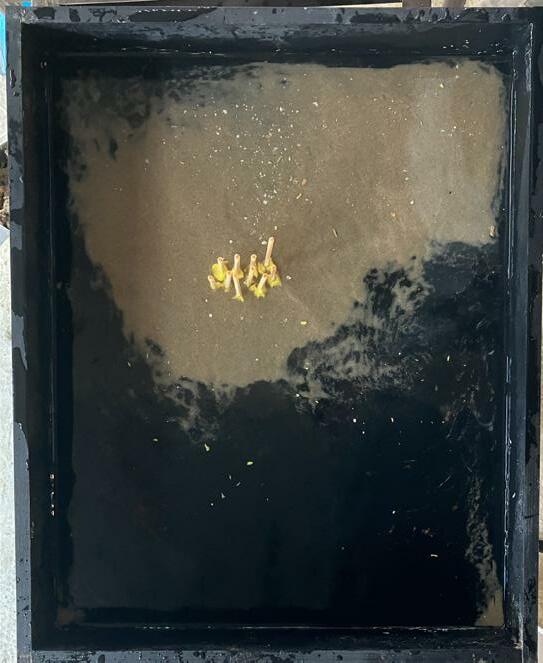
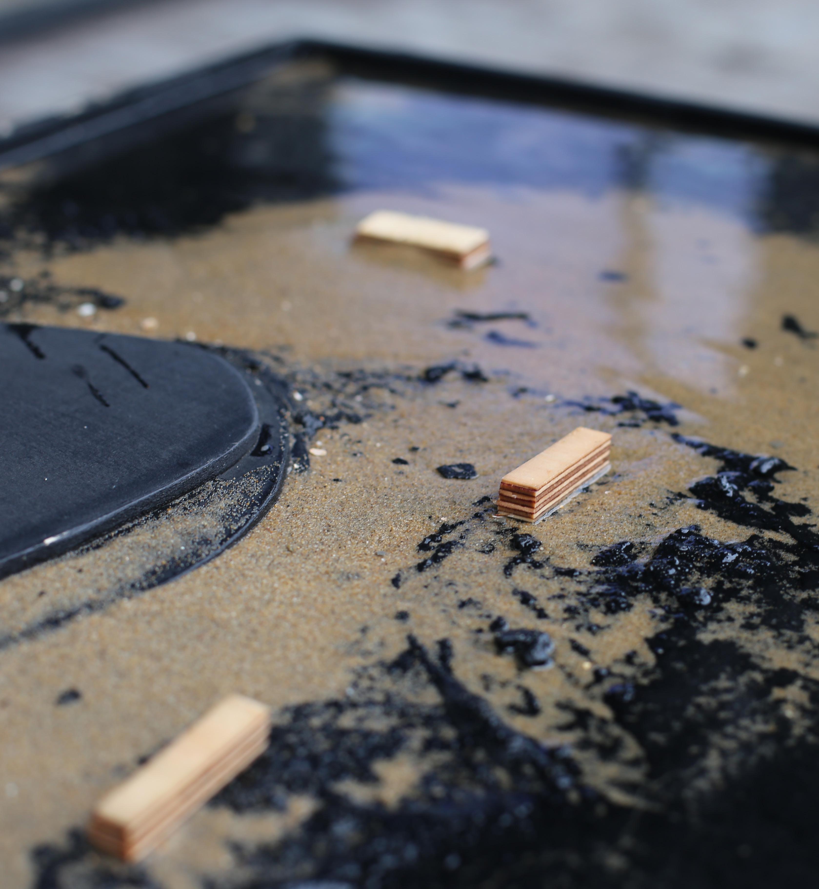
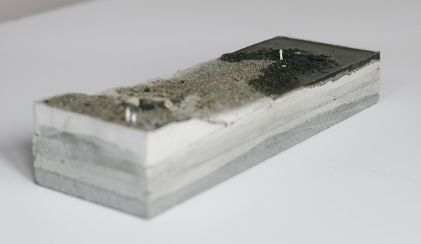
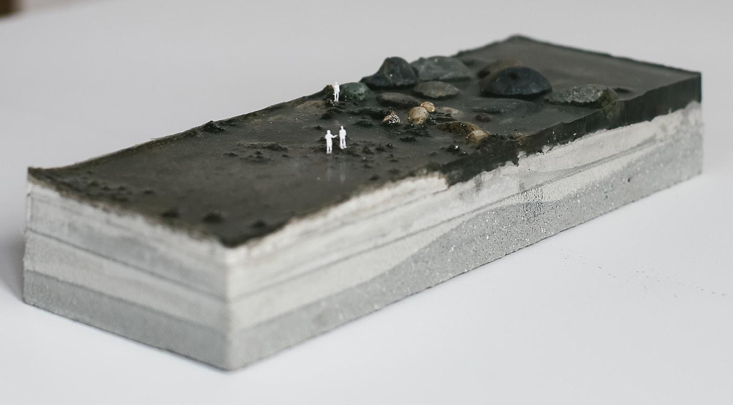
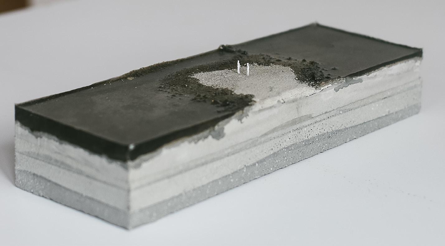
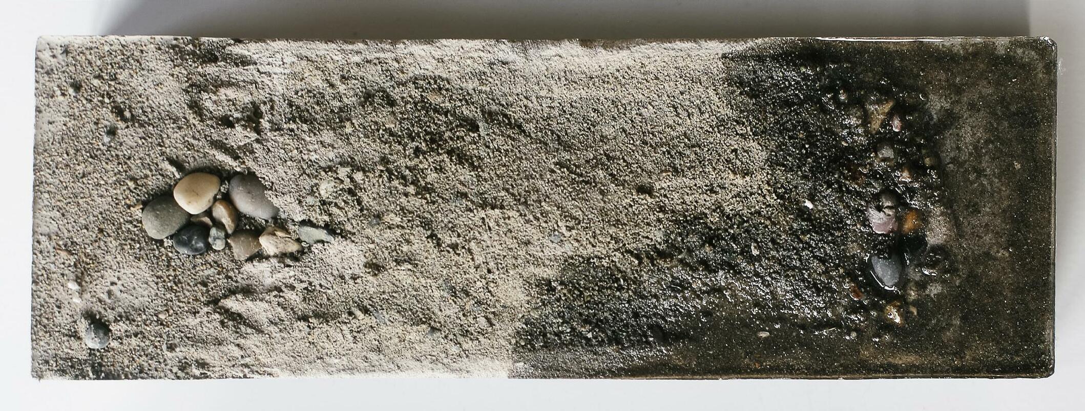
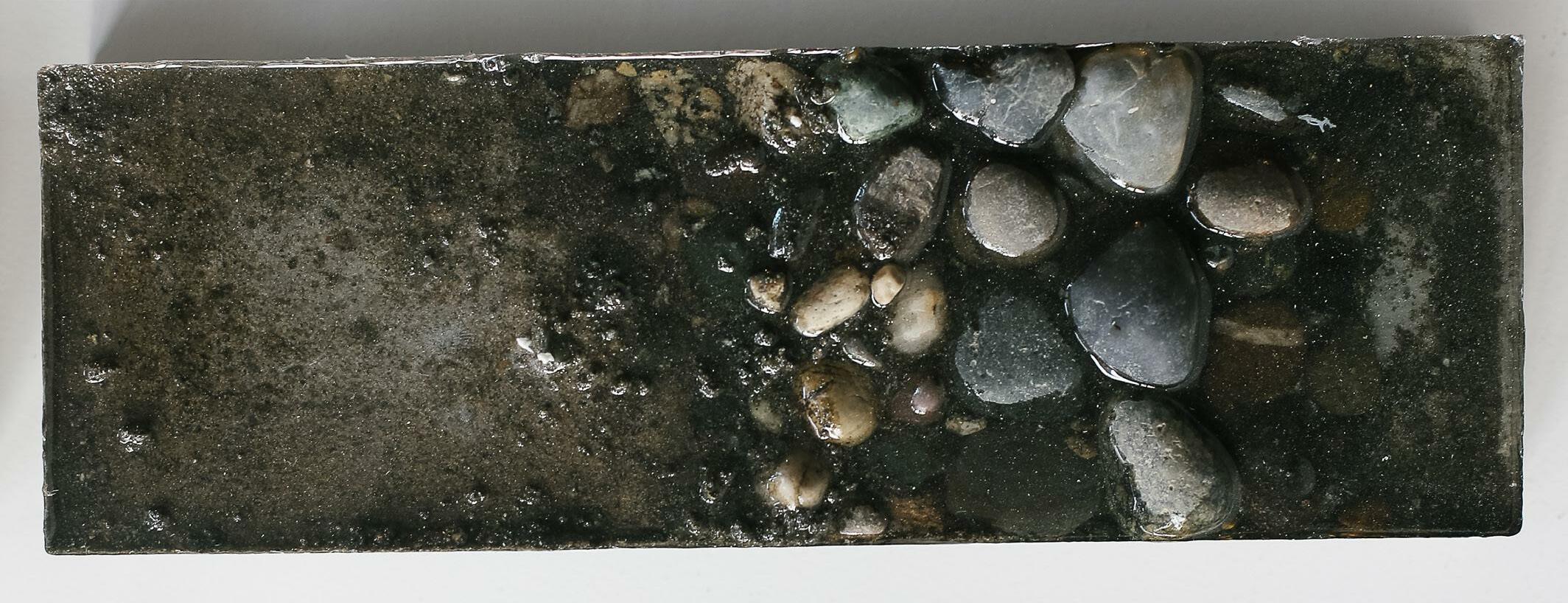
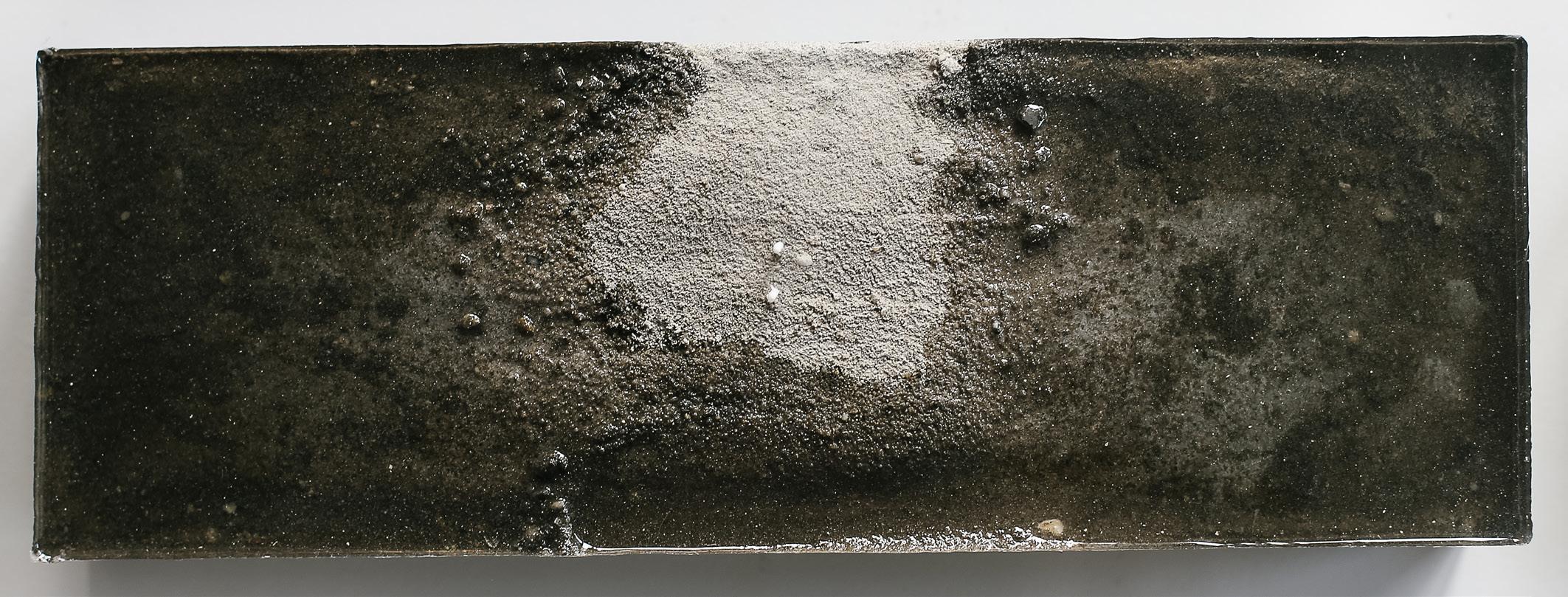
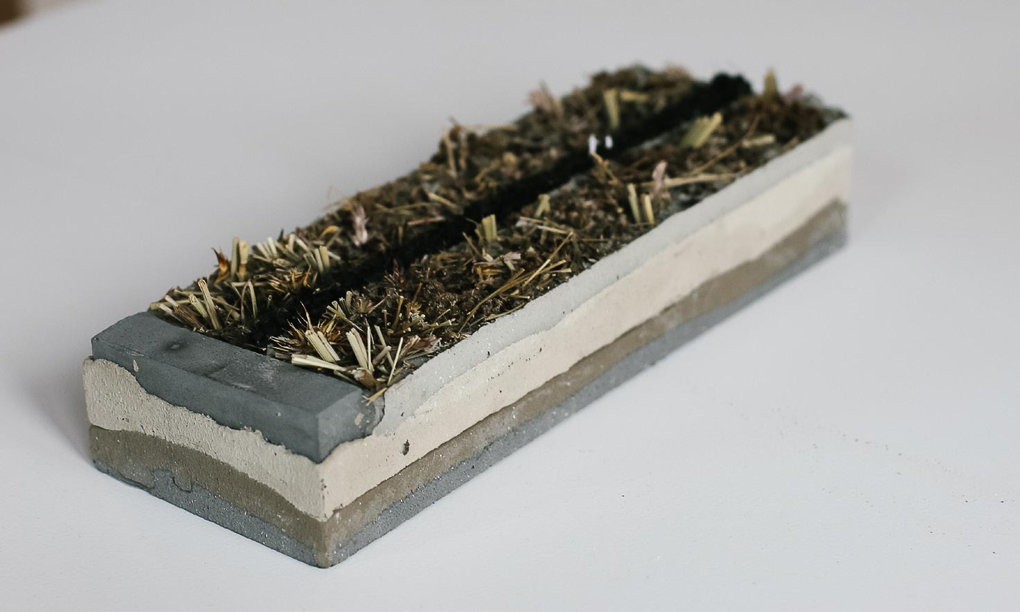
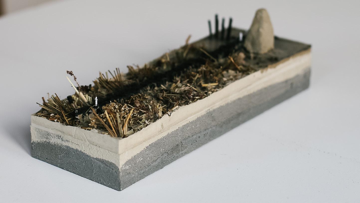
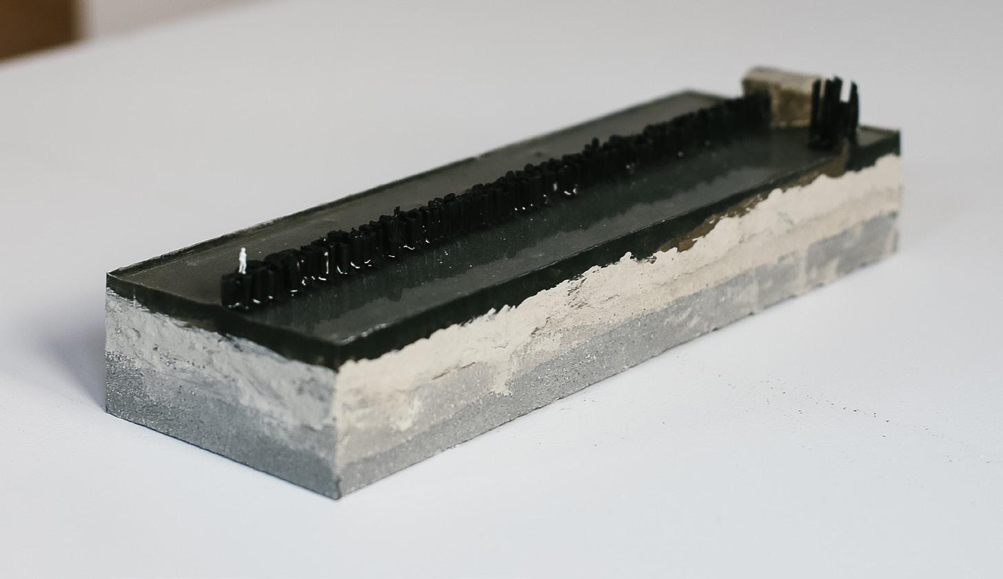
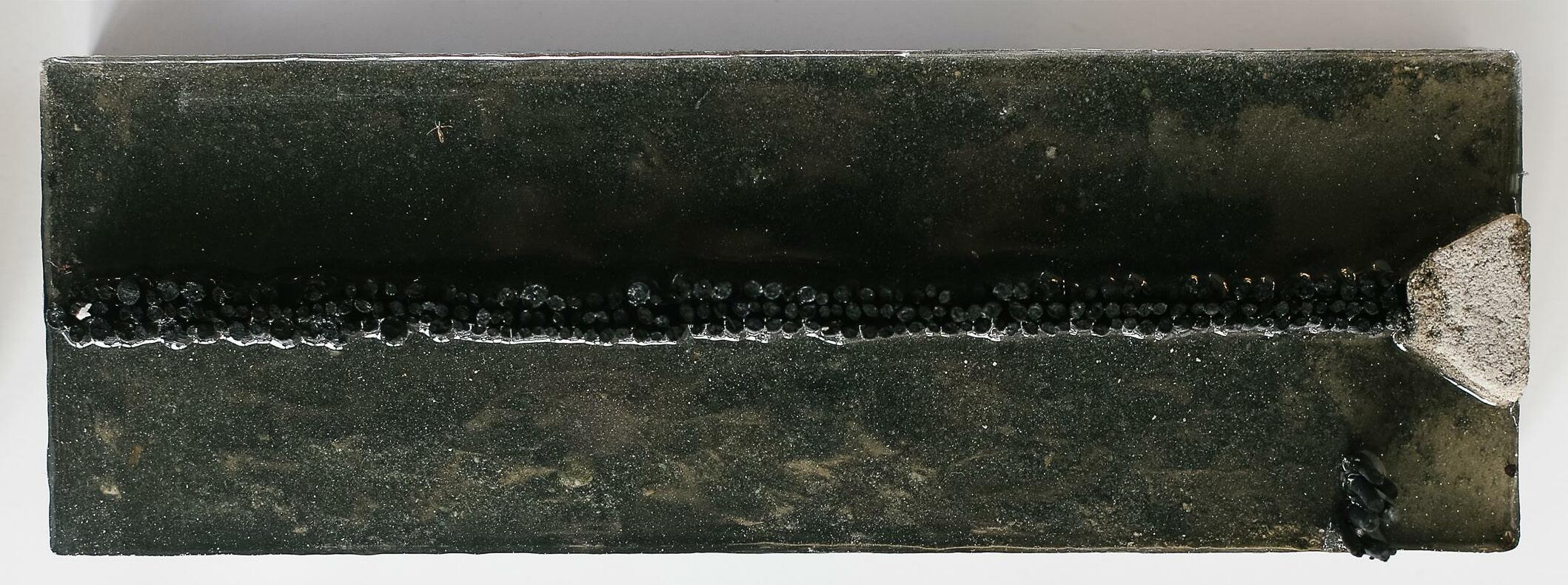
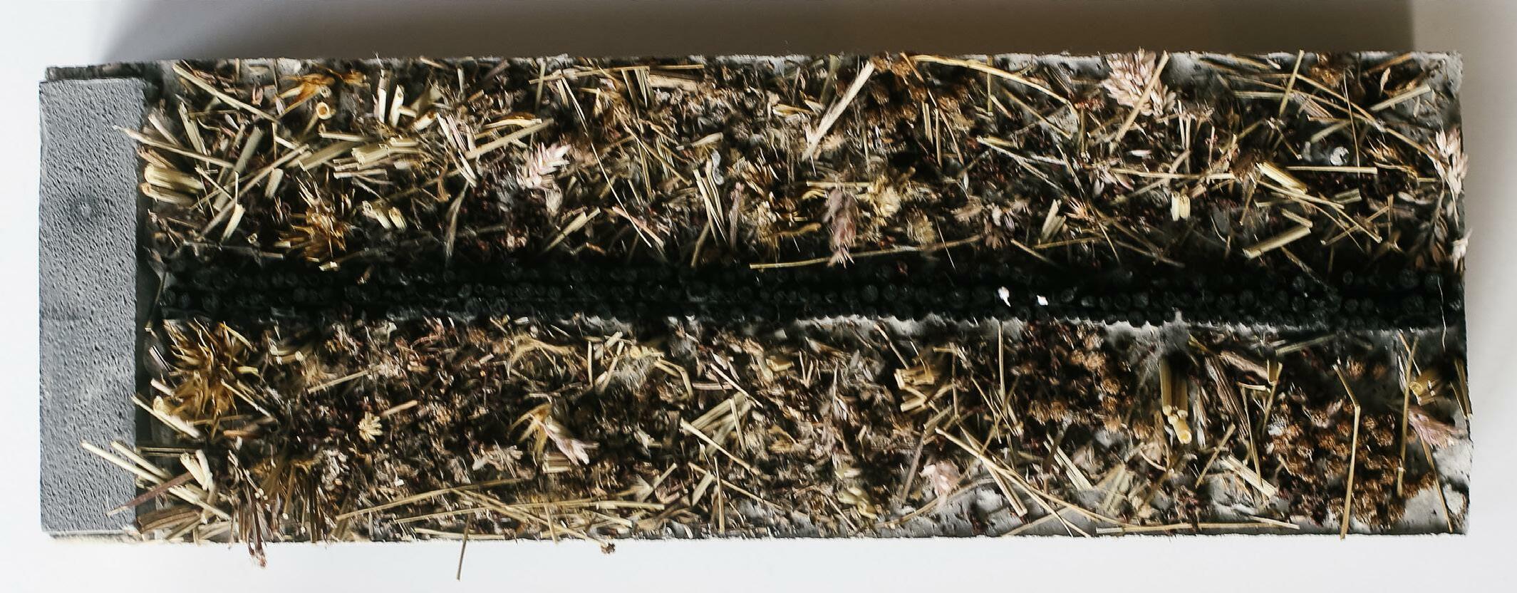
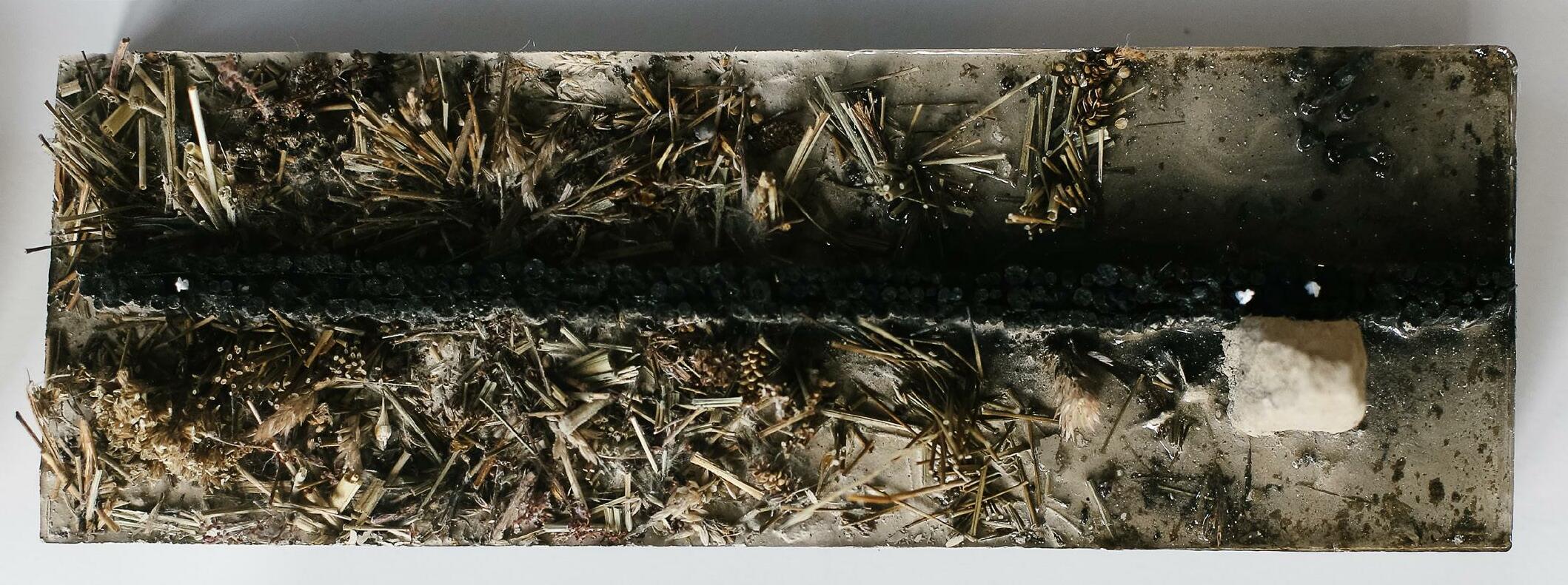
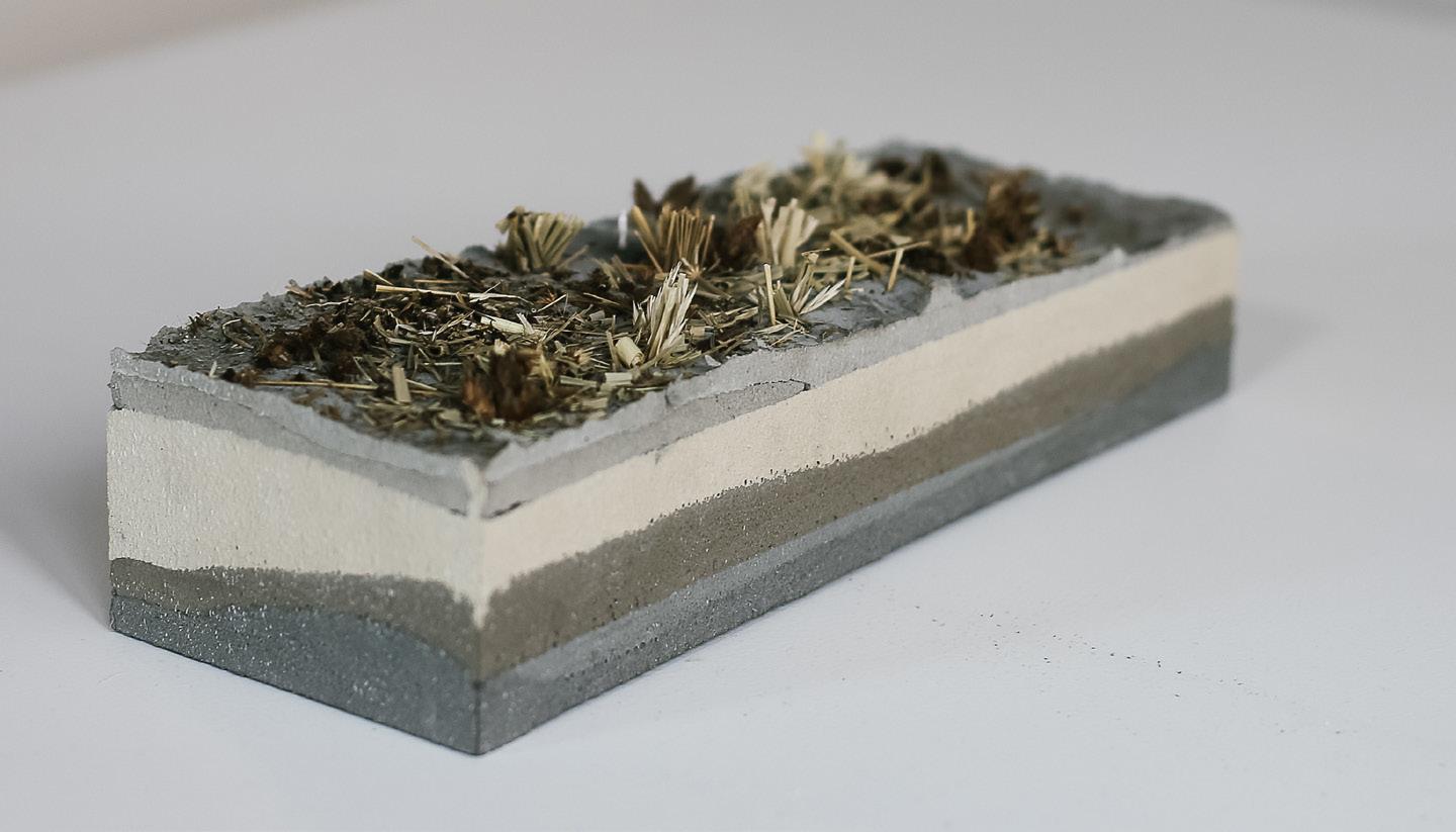
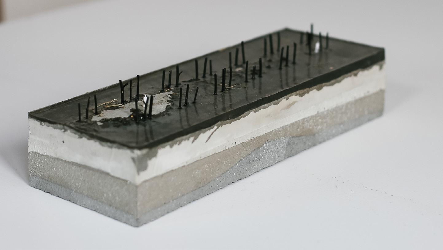
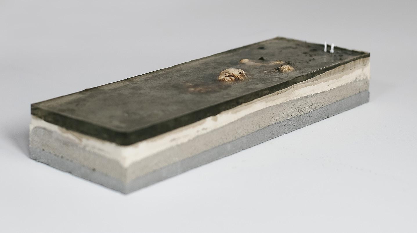
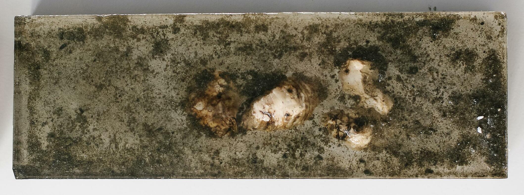
Throughout the project, I took on a largely experi mental approach to designing with sediment and natu ral processes. This experimental approach reflects the uncertainty of SLR, and shows the potential of an ar tistic and creative approach to addressing these chal lenges. Testing in this way allowed me to really get my hands into the landscape, mimicking its dynamics and changes through time. The product of this ongoing experimentation is not only fundamental to a climate challenge like SLR that exists over such a long period of time, but also informed all of the drawings and de signs made throughout this project.
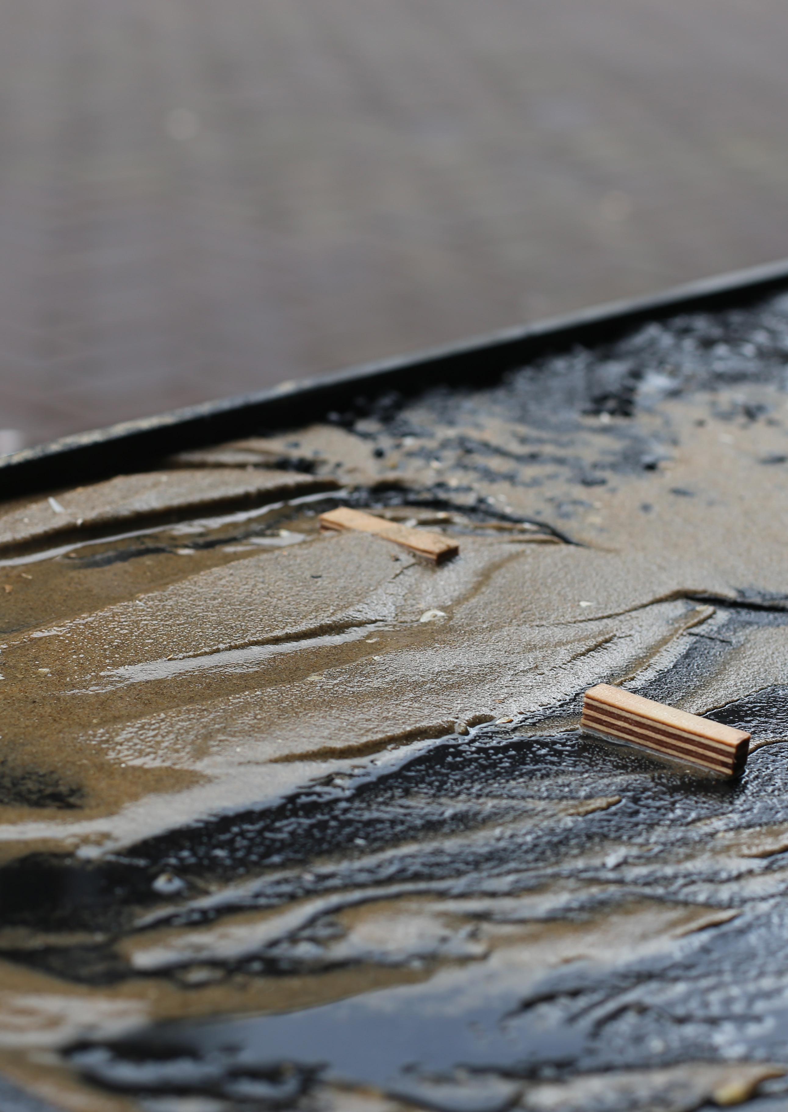
Three scale models of my chosen sites were made at scale 1:25,000. I then added water to the level of the sea now, and in the year 2100, experimented with sed iment additions and how they would interact with ele ments placed in the landscape. These tests allowed me to refine my proposals and designs showed throughout this book.
For my local interventions, I also made a simulation of each element at scale 1:100, and tested how these individual proposals and elements would interact with sediment. This was also refined and informed my final designs.
12 Approach
1:25,000 Landscape 1:100 Elements
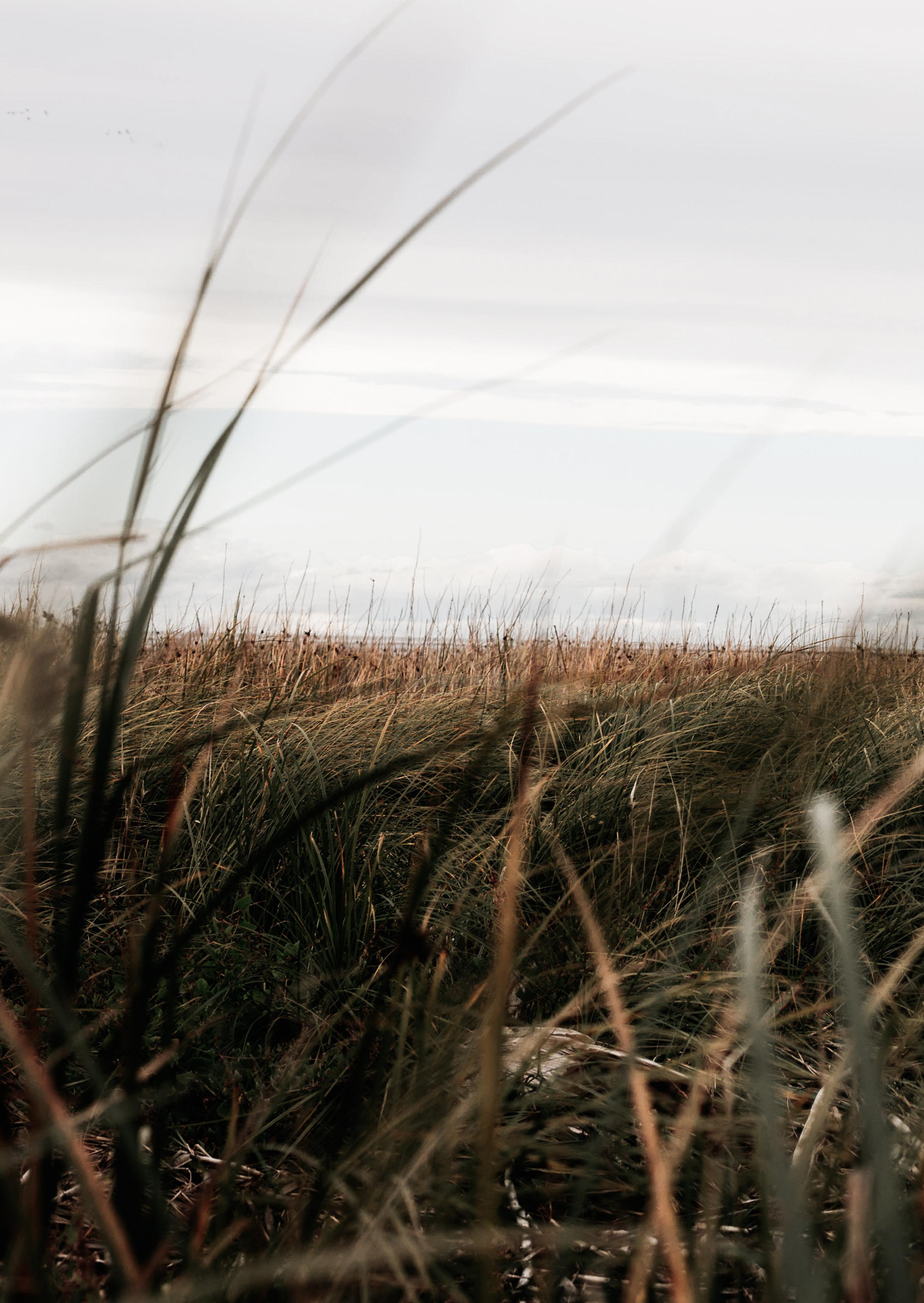
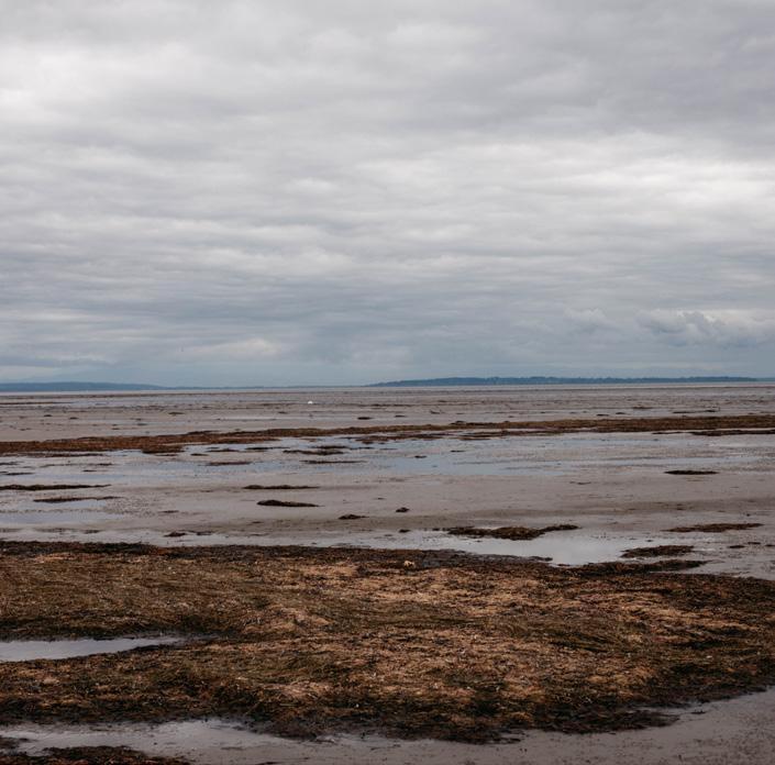
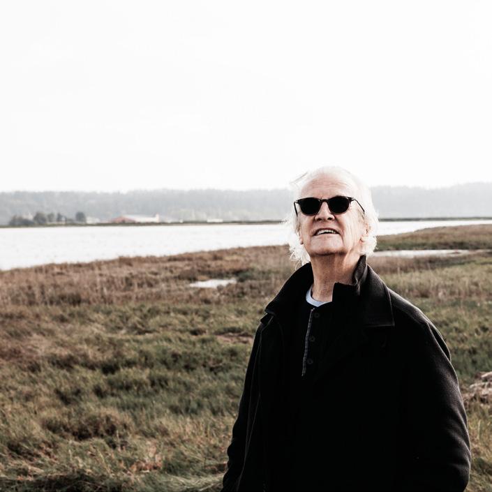
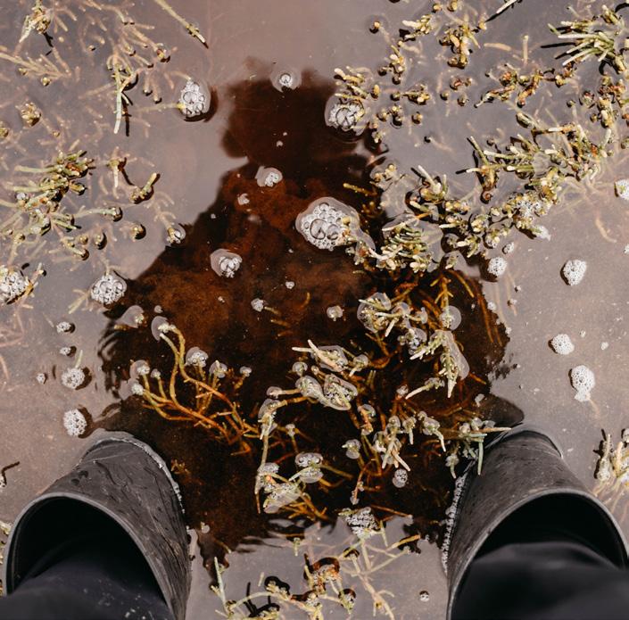
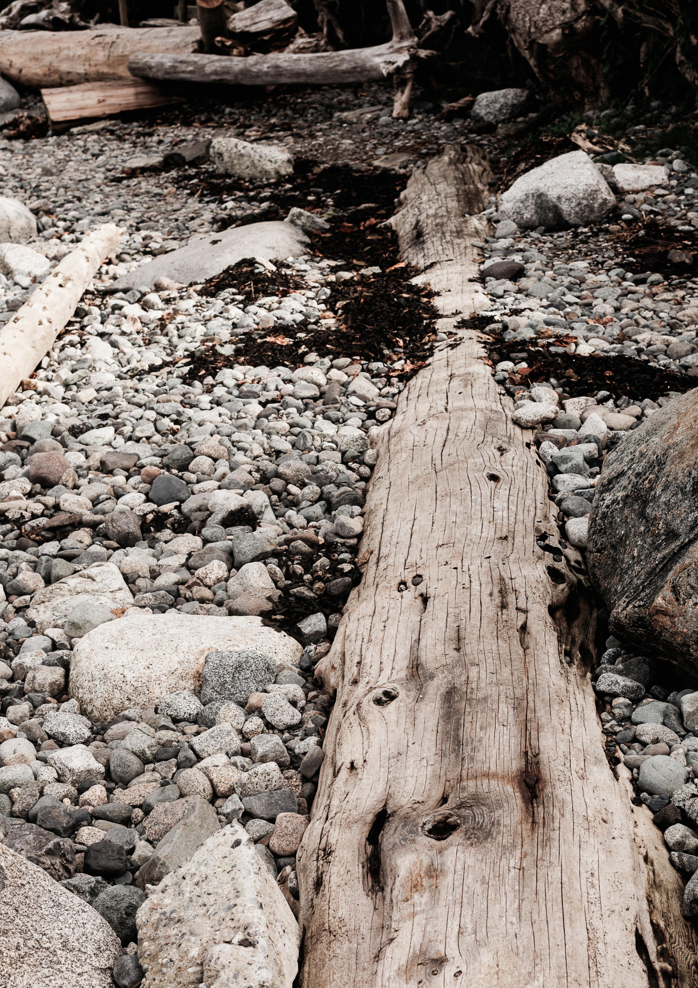
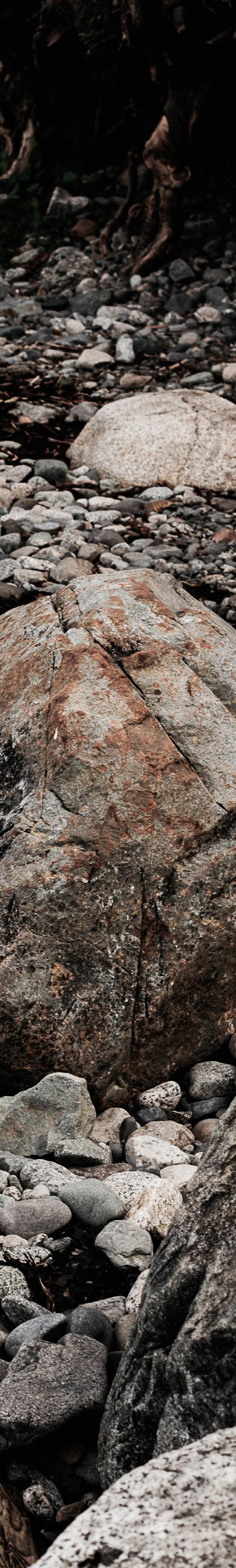
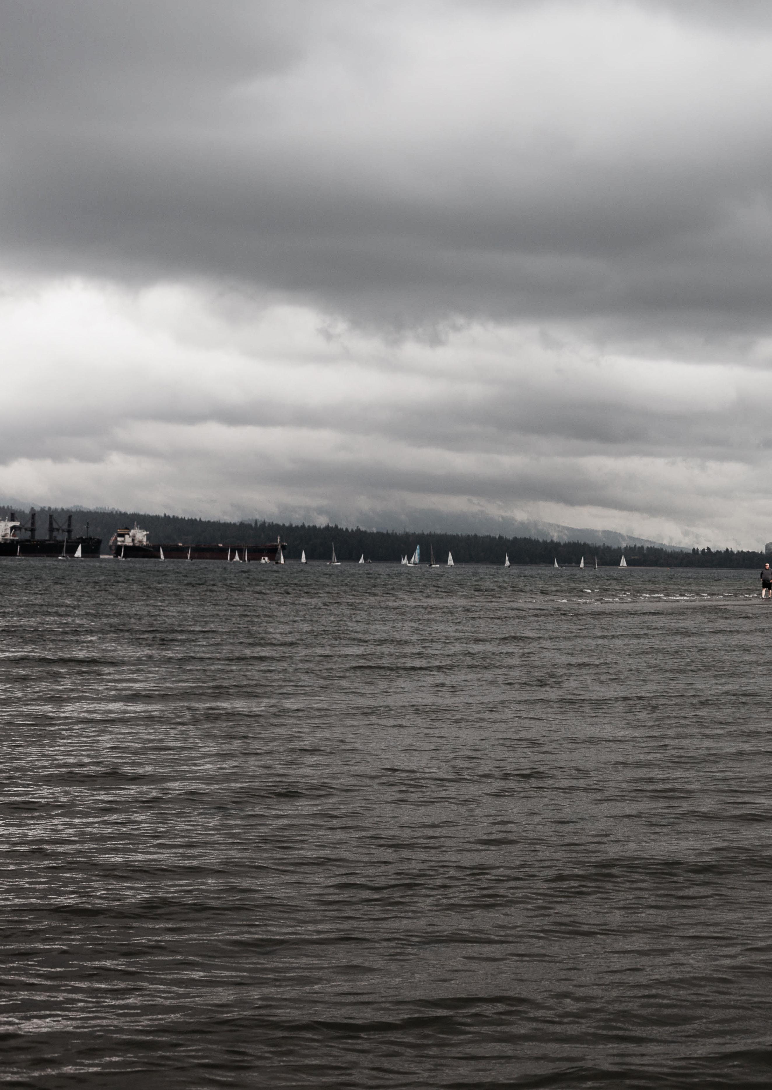
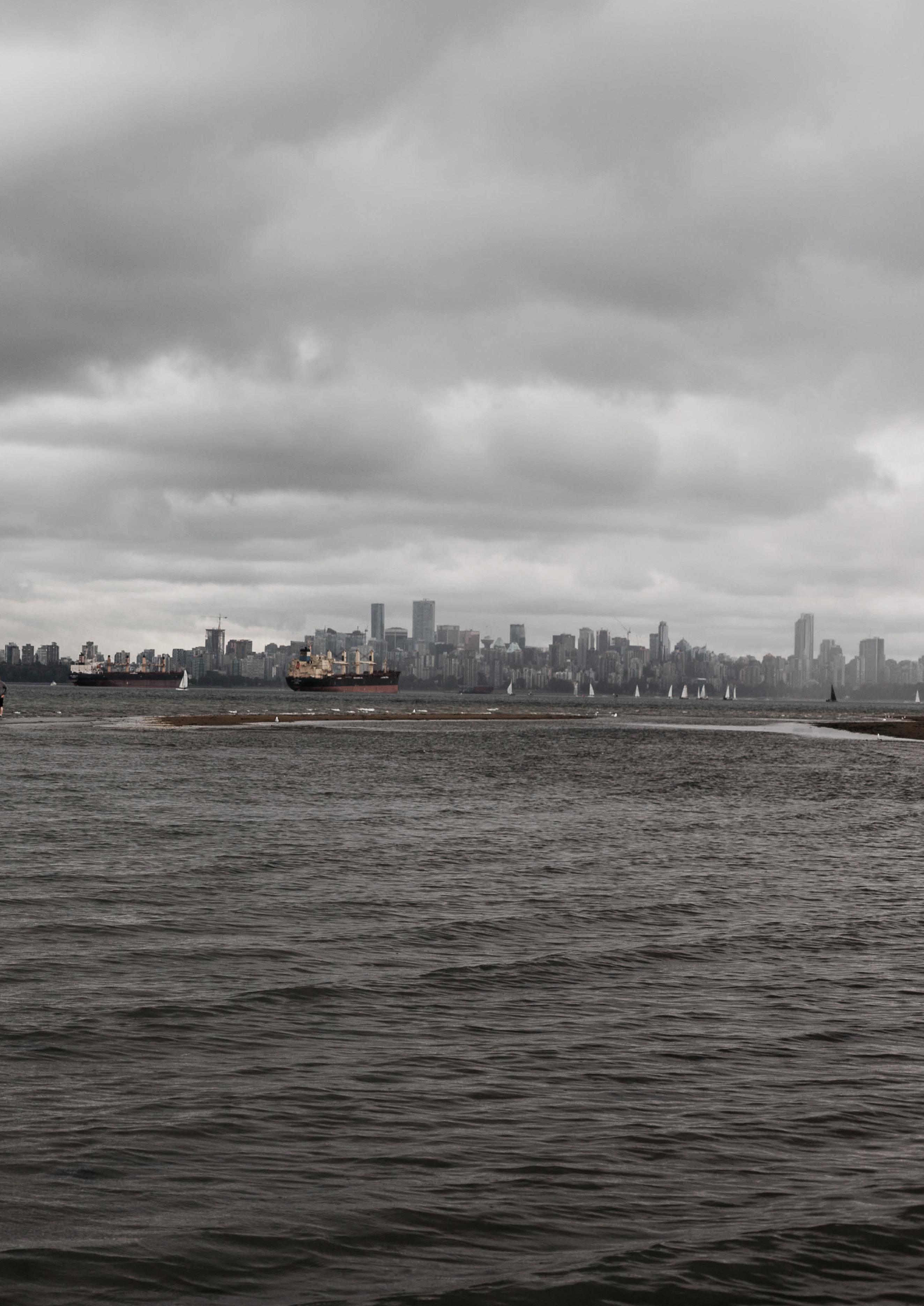
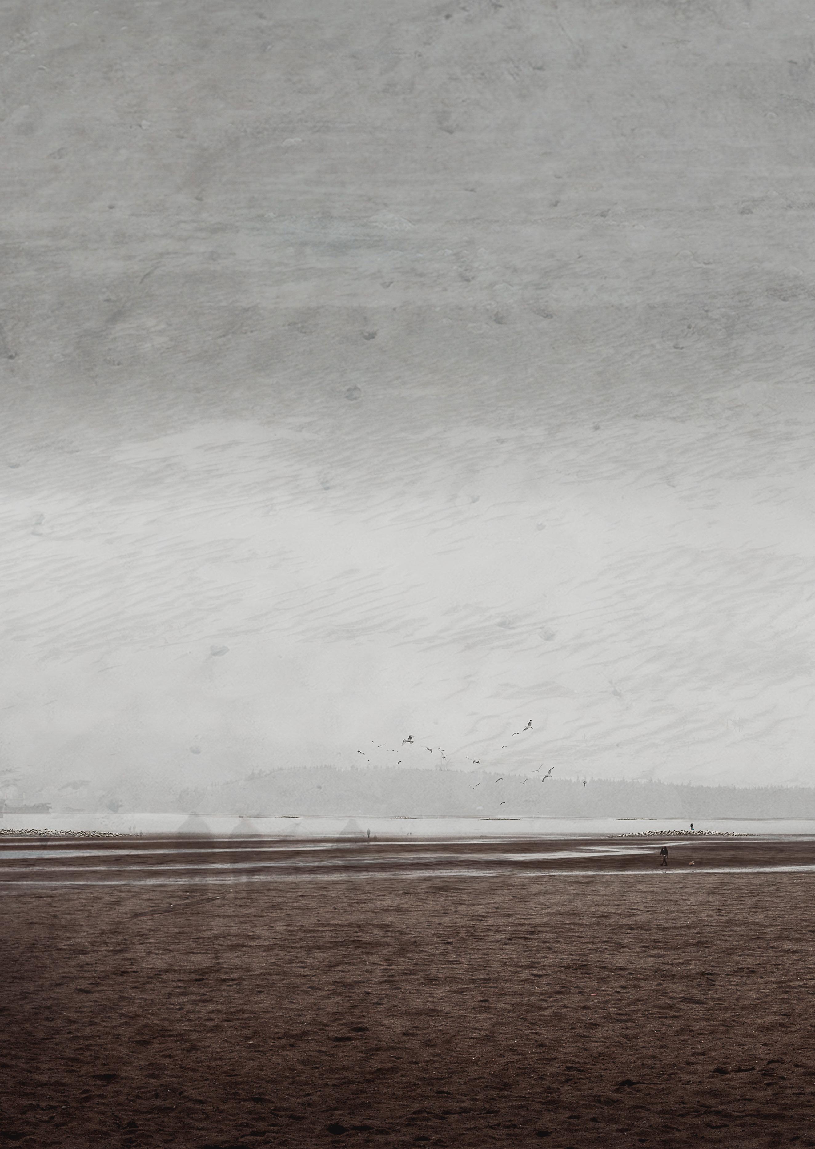
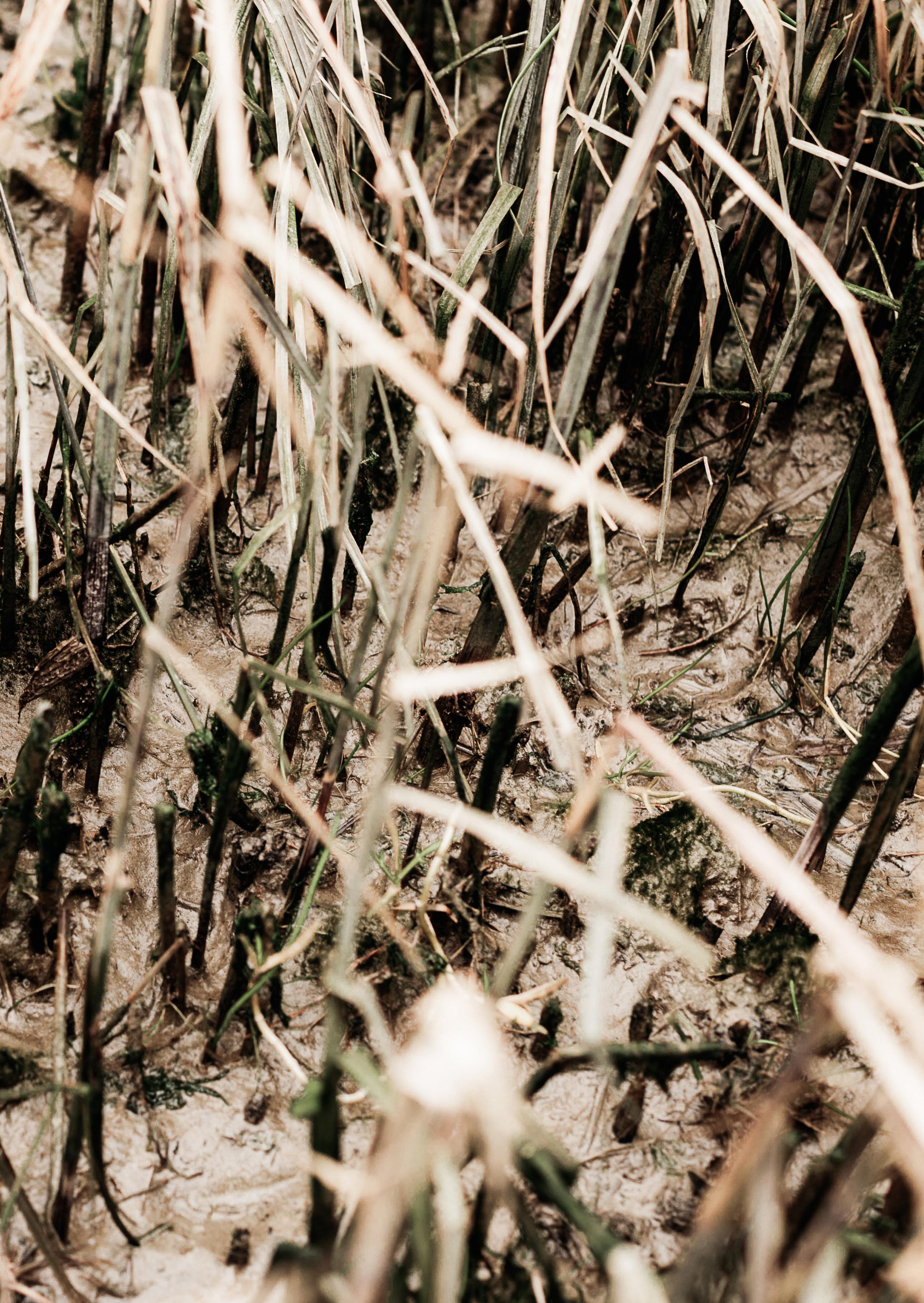
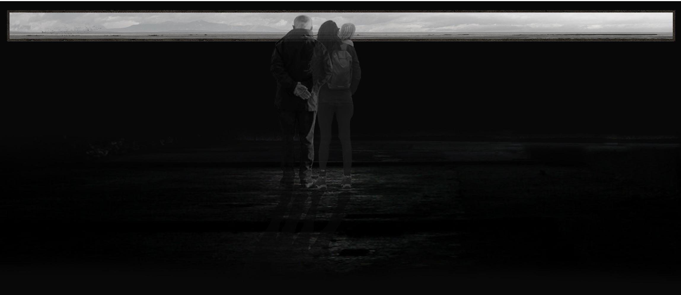
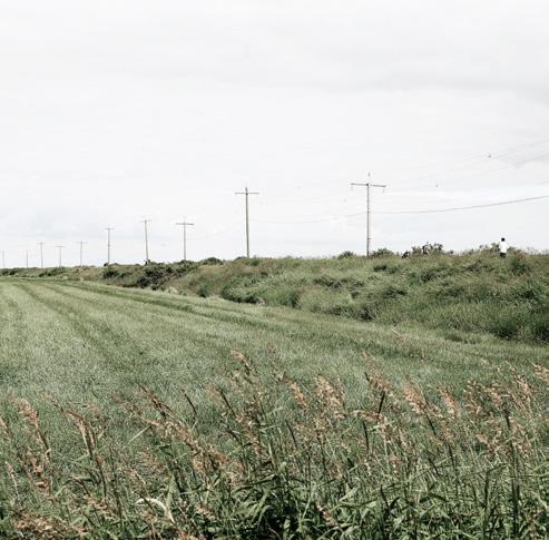
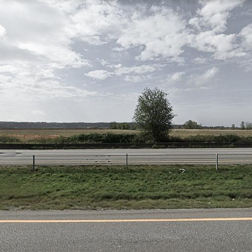
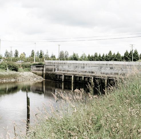
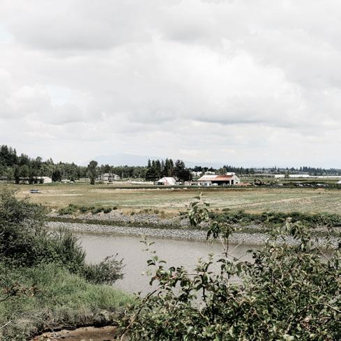
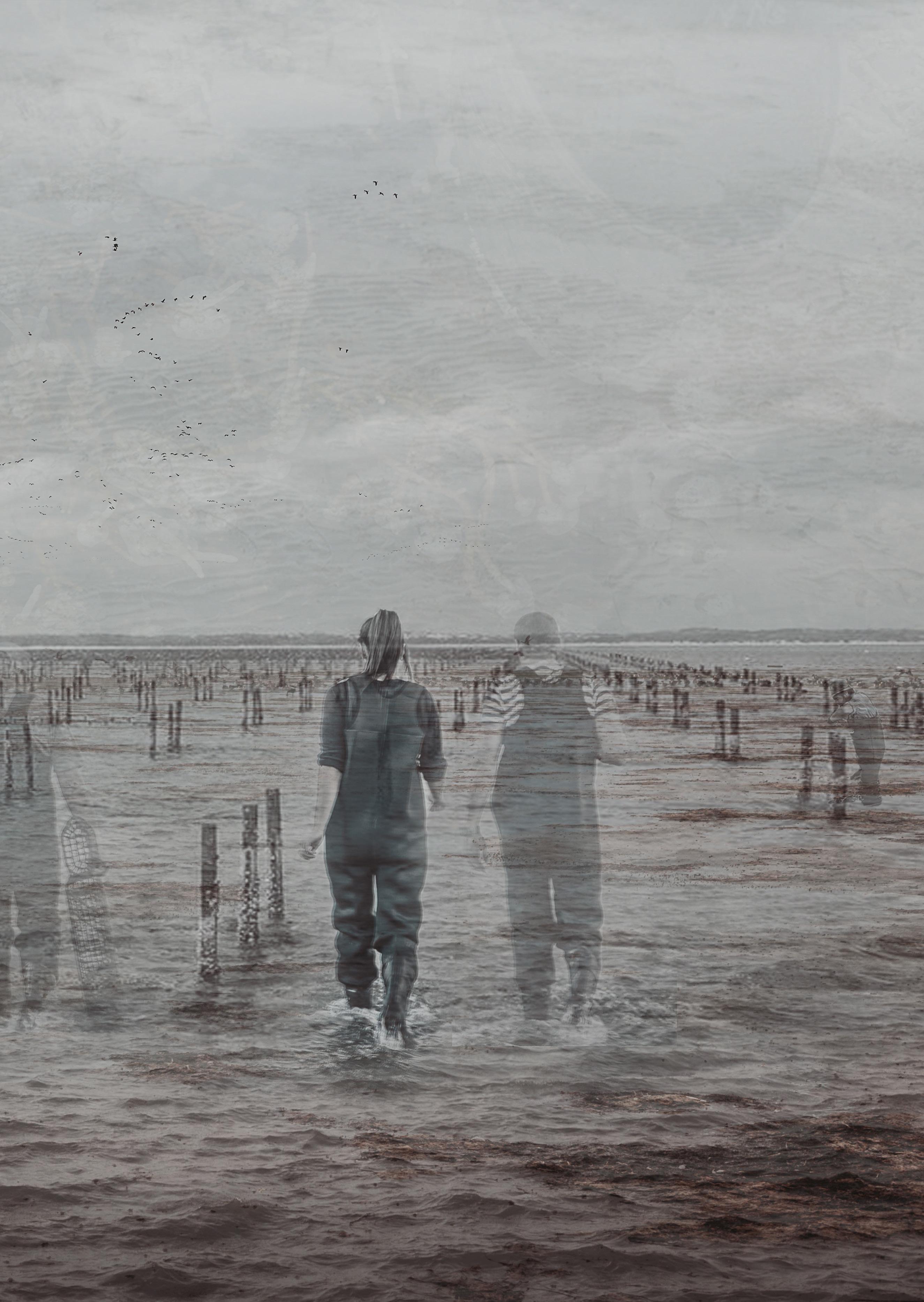
Throughout the project, I visited and spent as much time as possible being in the landscape as I could during my visits to the region. I walked, biked, kay aked and shared all of these experiences with my dad by my side. For the both of us, these were largely places that we had never been to, and so it was an opportunity to re-learn a landscape that we both have lived in, but rarely experienced in such an intimate way. These mo ments from these site visits deeply informed the design and atmosphere of the project.
14 Field

I. RESEARCH
17
10,000YA-1850

The coast of the Lower Mainland of British Columbia is both a naturally and culturally dynamic environment. For over the past 10,000 years, First Nations Peoples have inhabited, adapted and been shaped by the land scape of the region’s natural affordances, systems and change. The underlying culture, values and principles of these Peoples provide critical perspectives on the context and capacity of the landscape.
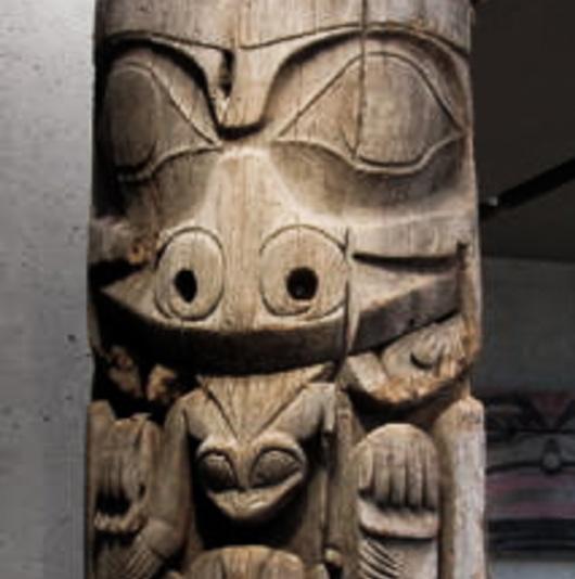
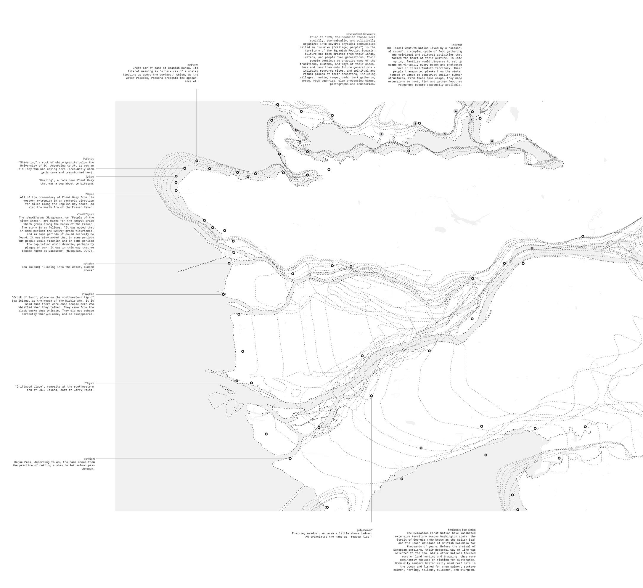
18 Cultural Landscape Fluid Landscape:
First Nations landmarks
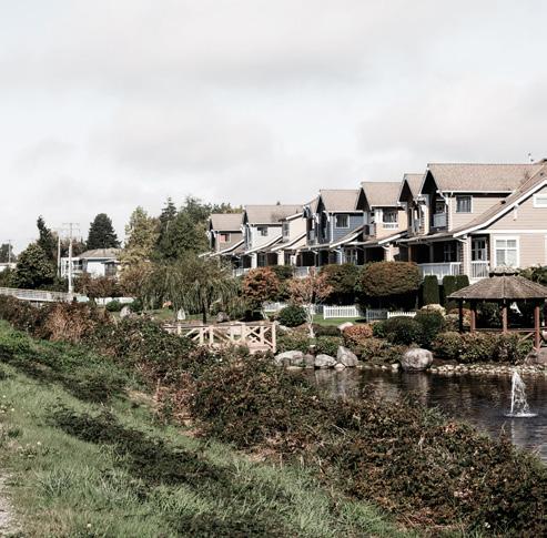
With the introduction of Western people into the region beginning in the 19th century, a fury of development oc curred across the landscape. Several challenges have re sulted due to this growth and now today: natural land scape loss, outdated and fixed infrastructure, growing urbanization, the Agricultural Land Reserve (ALR), and jurisdictional boundaries with no shared governing body for addressing SLR have resulted. The shared challenge amongst these is their inability to adapt to SLR.
19 Cultural Landscape Fixed Landscape: 1850-Present
Landscape Ecozones and Animals
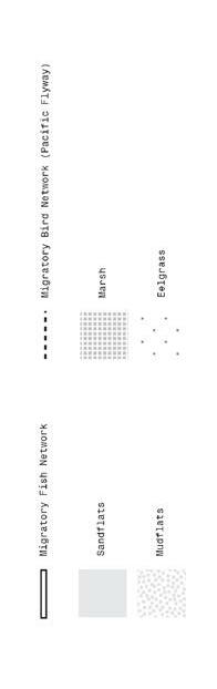
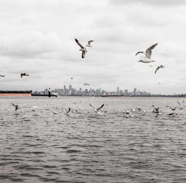
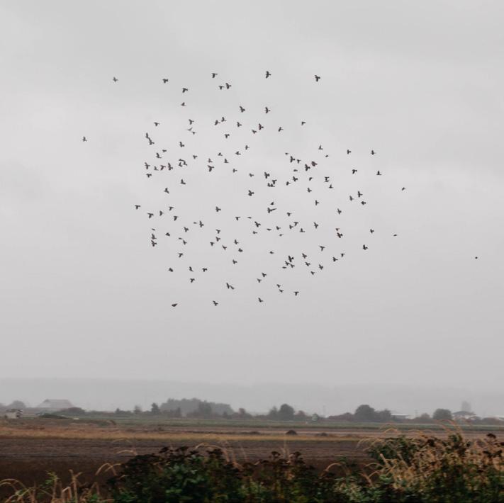
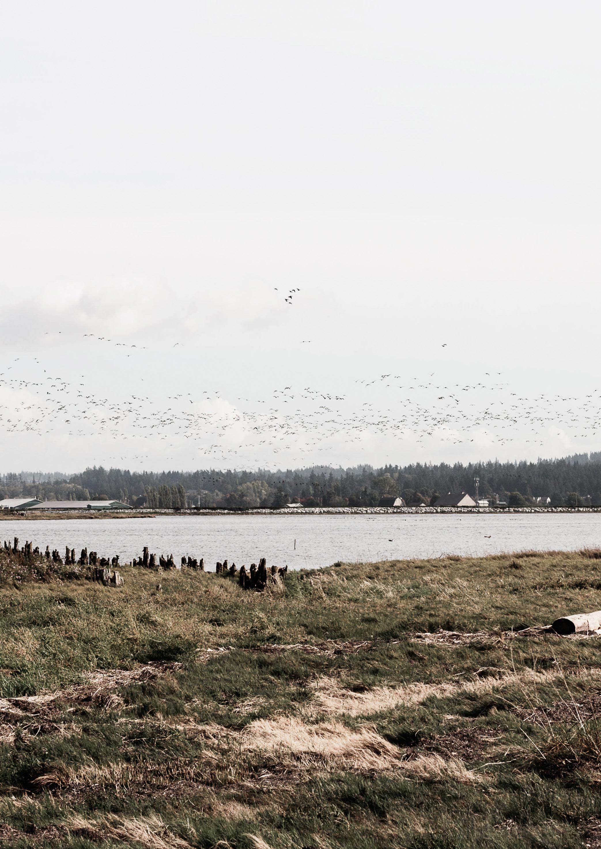
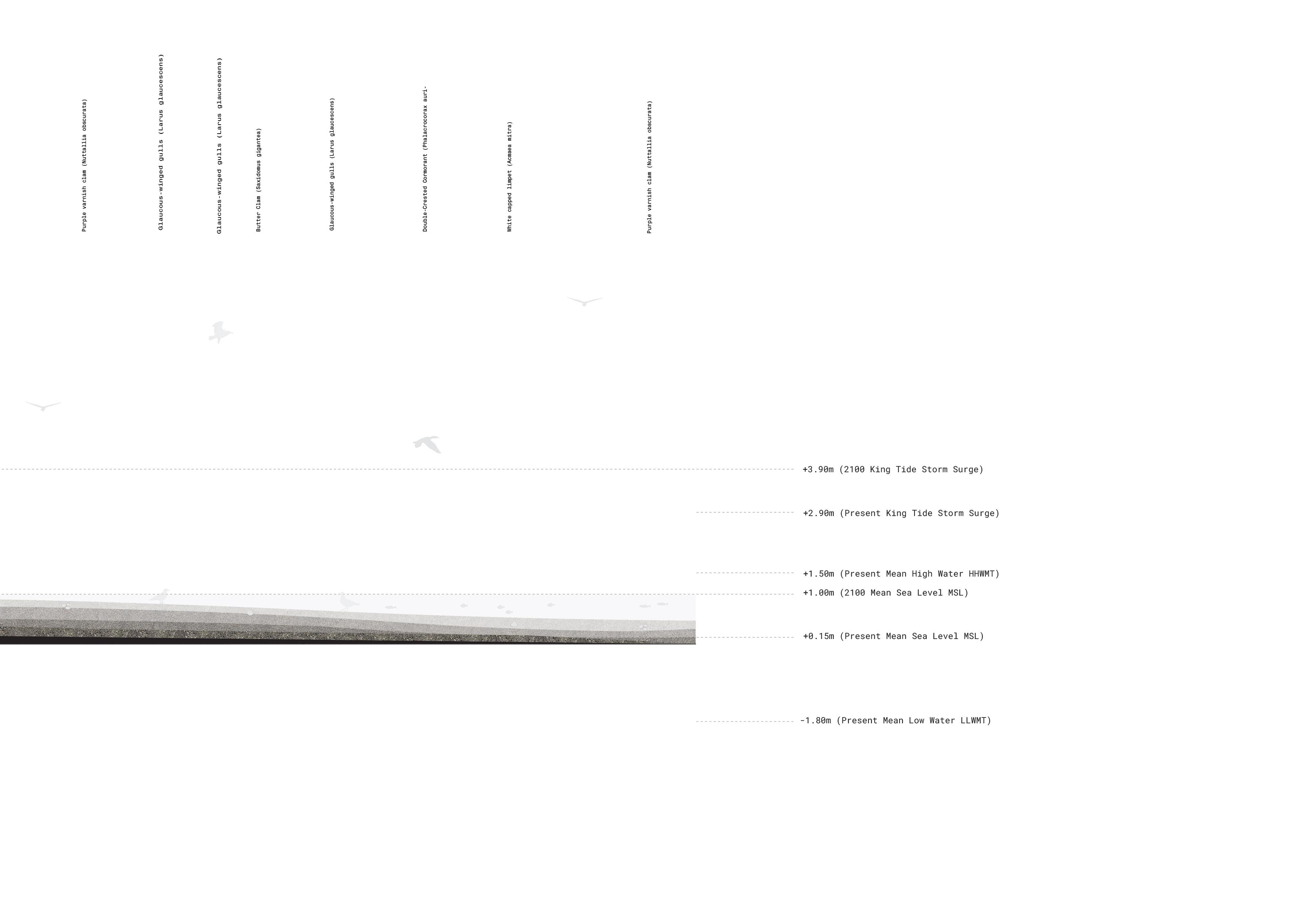
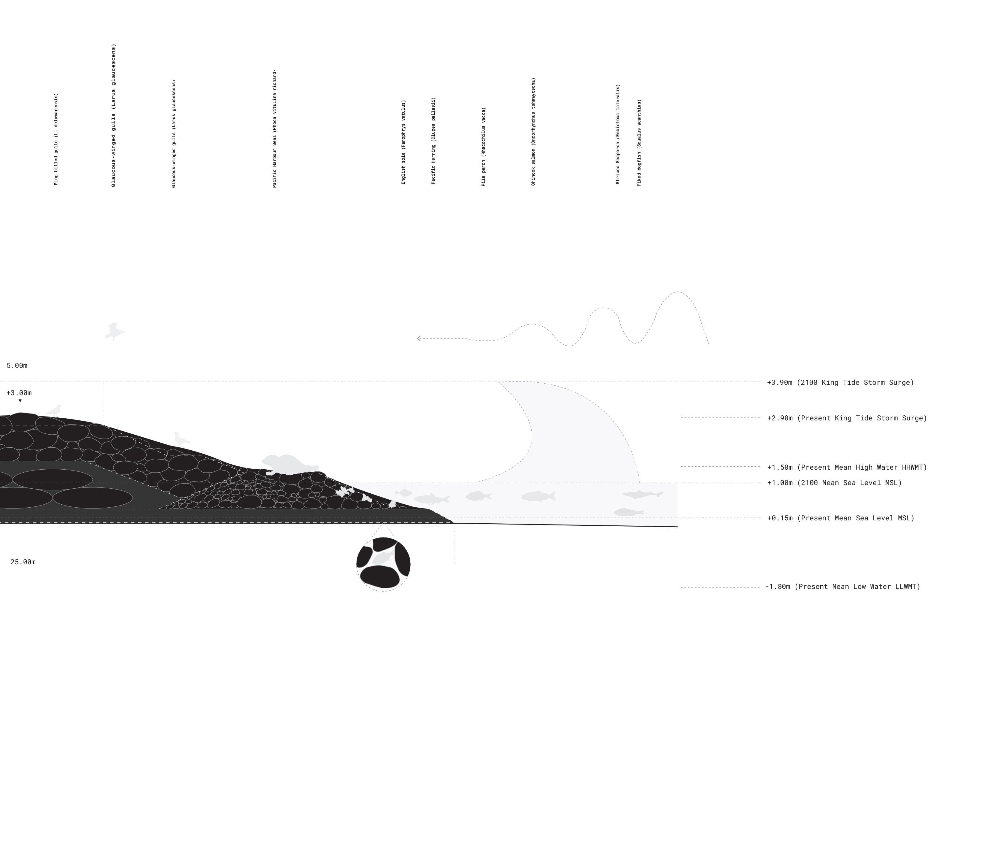
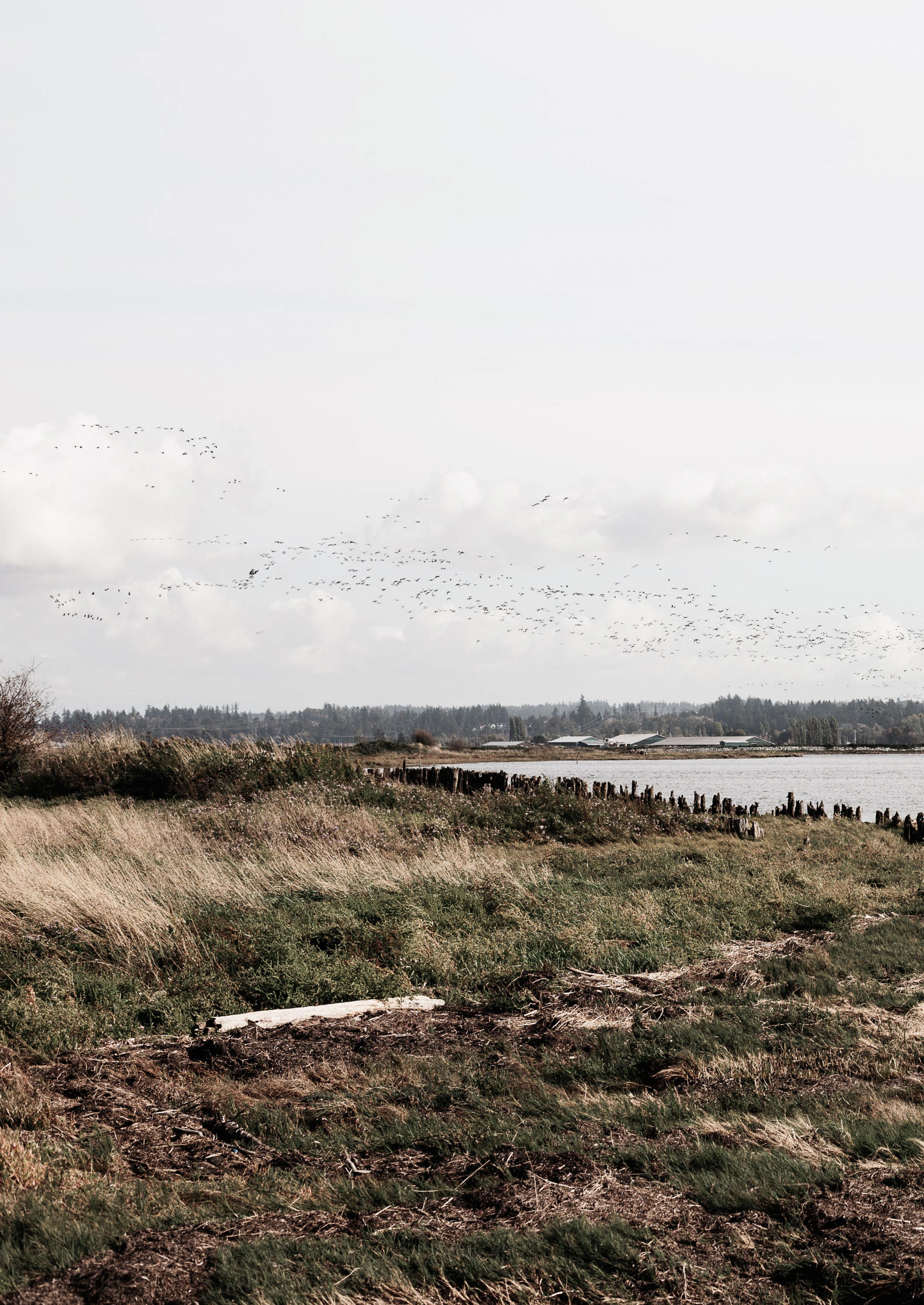
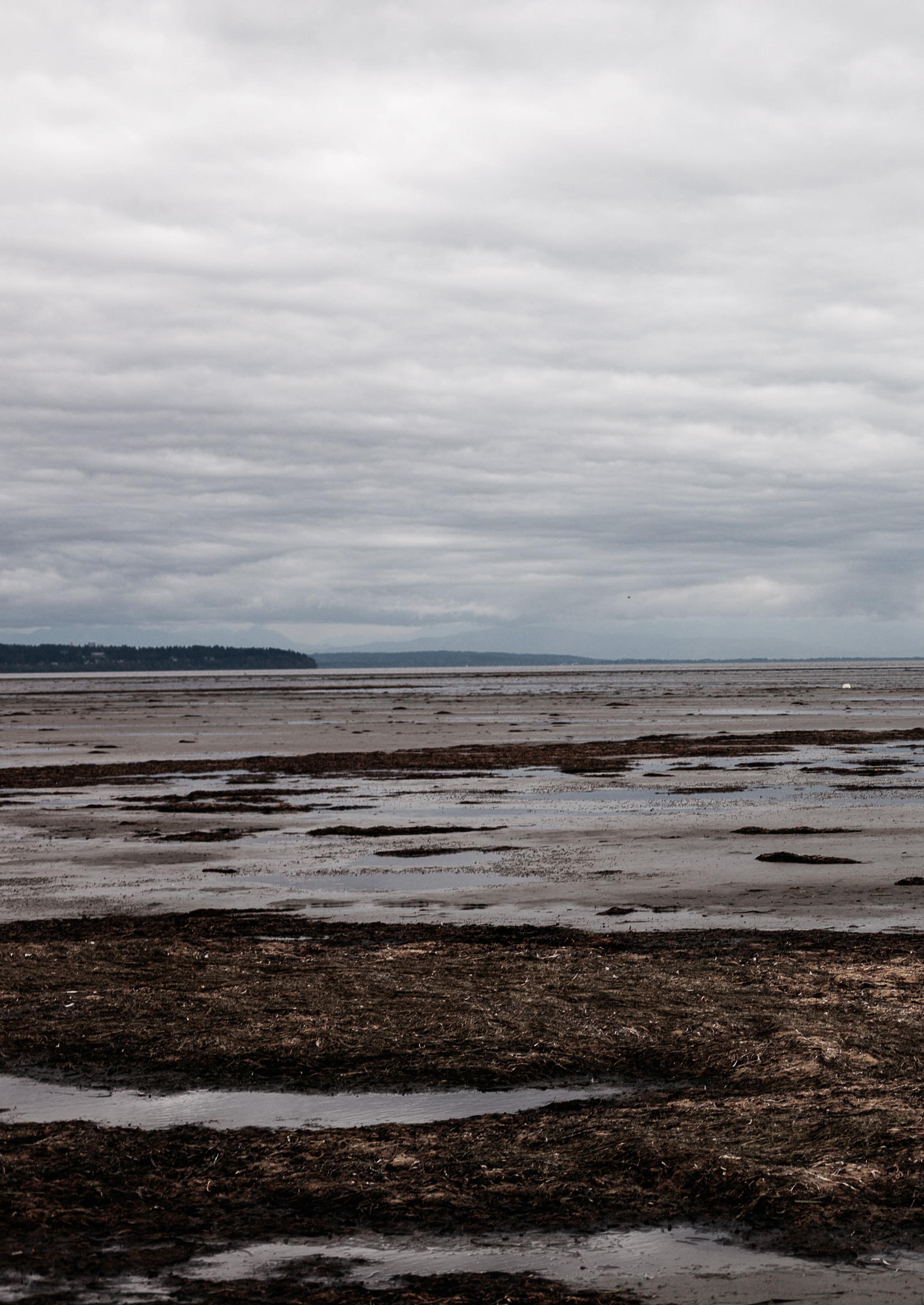
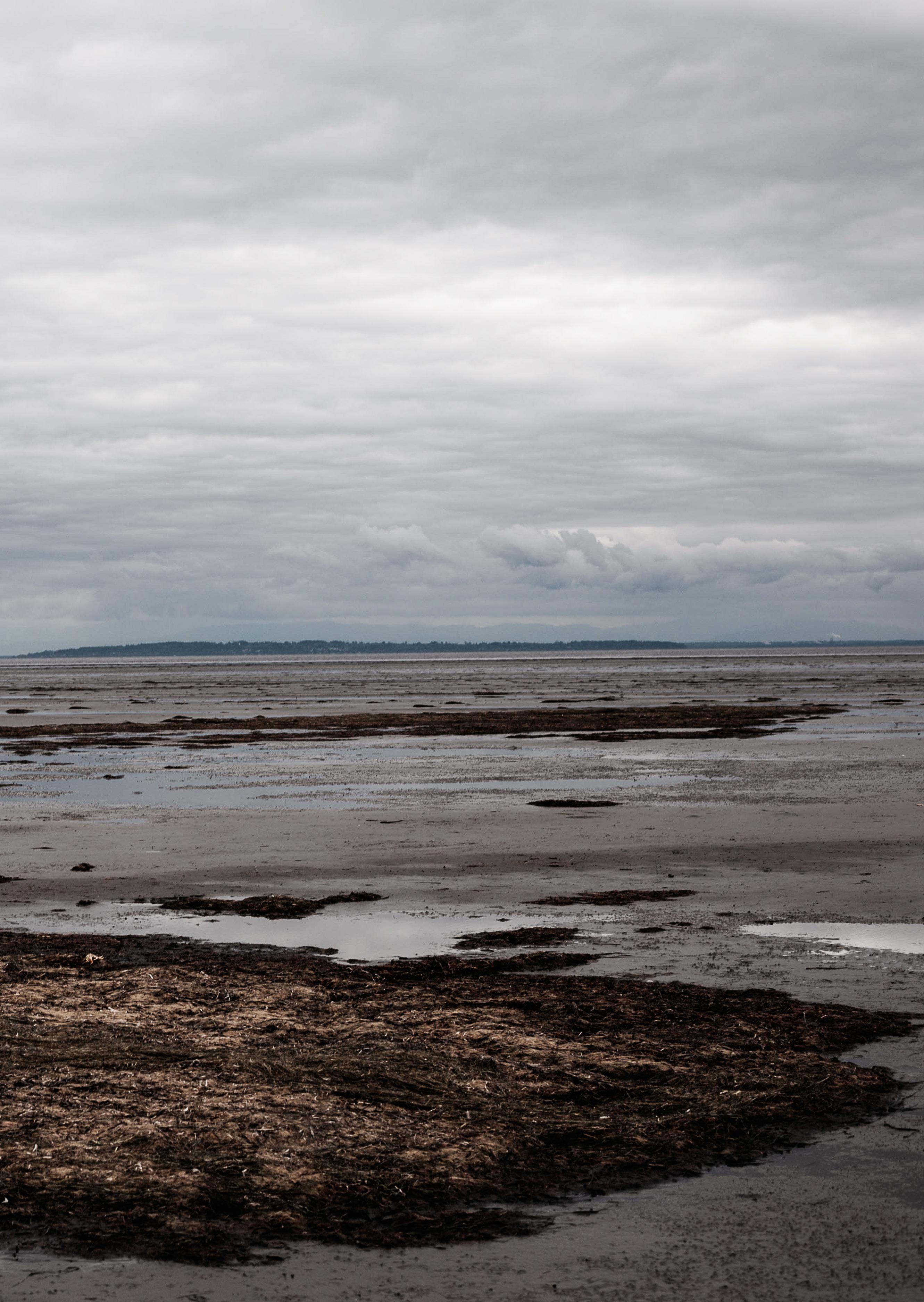
The Fraser River Delta, the largest estuary along the Pacific Coast of North America, is a critical crossroads along the Pacific Flyway where multiple paths of migratory birds converge. The complex food chains found on the foreshore extend from tiny mi croorganisms to large mammals. The invertebrates, plants and small fish in the estuary provide a nursery for millions of out-migrating juvenile salmon.
Natural
Natural Landscape Natural Flows
While the coastal landscape of the Lower Mainland has been largely controlled and augmented since 1850, natural processes still define the area. These are often suppressed or unable to continue as they once did, but are still present throughout.
21
“The draft warns of a series of thresholds beyond which recovery from climate breakdown may become impossible. It warns: “Life on Earth can recover from a drastic climate shift by evolving into new species and creating new ecosystems … humans can not.”
“Tipping points are triggered when temperatures reach a certain level, whereby one impact rapid ly leads to a series of cascading events with vast repercussions. Other tipping points include the melting of polar ice sheets, which once under way may be almost impossible to reverse even if car bon emissions are rapidly reduced, and which would raise sea levels catastrophically over many de cades.”
Sea Level Rise SLR IPCC
Level Rise
A Multi-faceted Climate Challenge: While the lit erature on SLR is focused on extreme weather events and sea levels, there are other simultaneous cli mate-related processes that affect this change. Temperature and precipitation patterns, storms, wave climate, sea ice, hydrology (glacier melt) ocean-water properties (e.g., salinity, acidifica tion and temperature), and changing animal migra tion patterns are all connected and interwoven into the challenges faced by SLR.
Uncertainty: While there are numerous projections and studies on the impacts of SLR throughout the world, there is still a tremendous amount of uncer tainty surrounding SLR and the impact that it may have in both the short and, especially, long term.
The following diagram expresses the process related to SLR, and how they interact to create the condi tions for increased sea levels and flooding.
23 Sea
SLR
Sea Level Rise
and Metro Vancouver
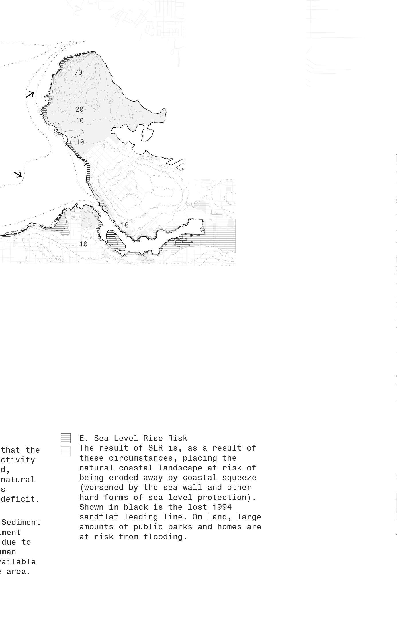
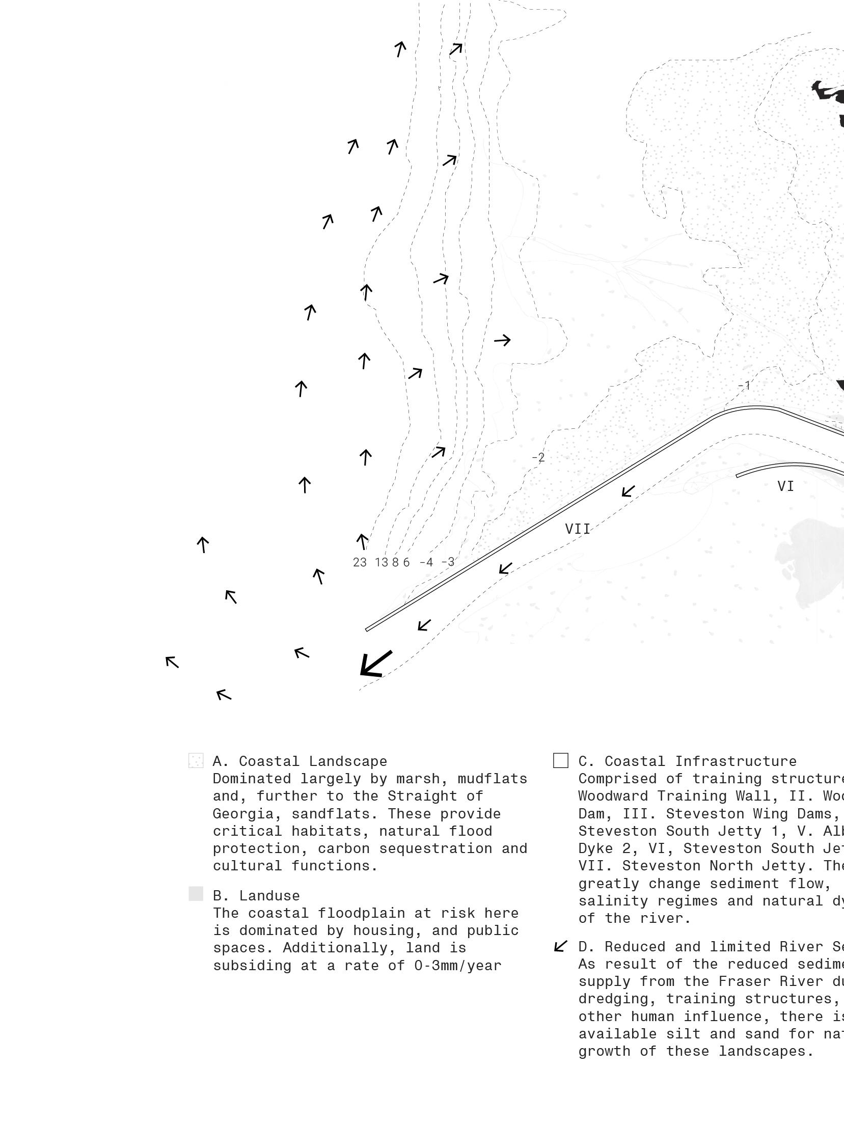
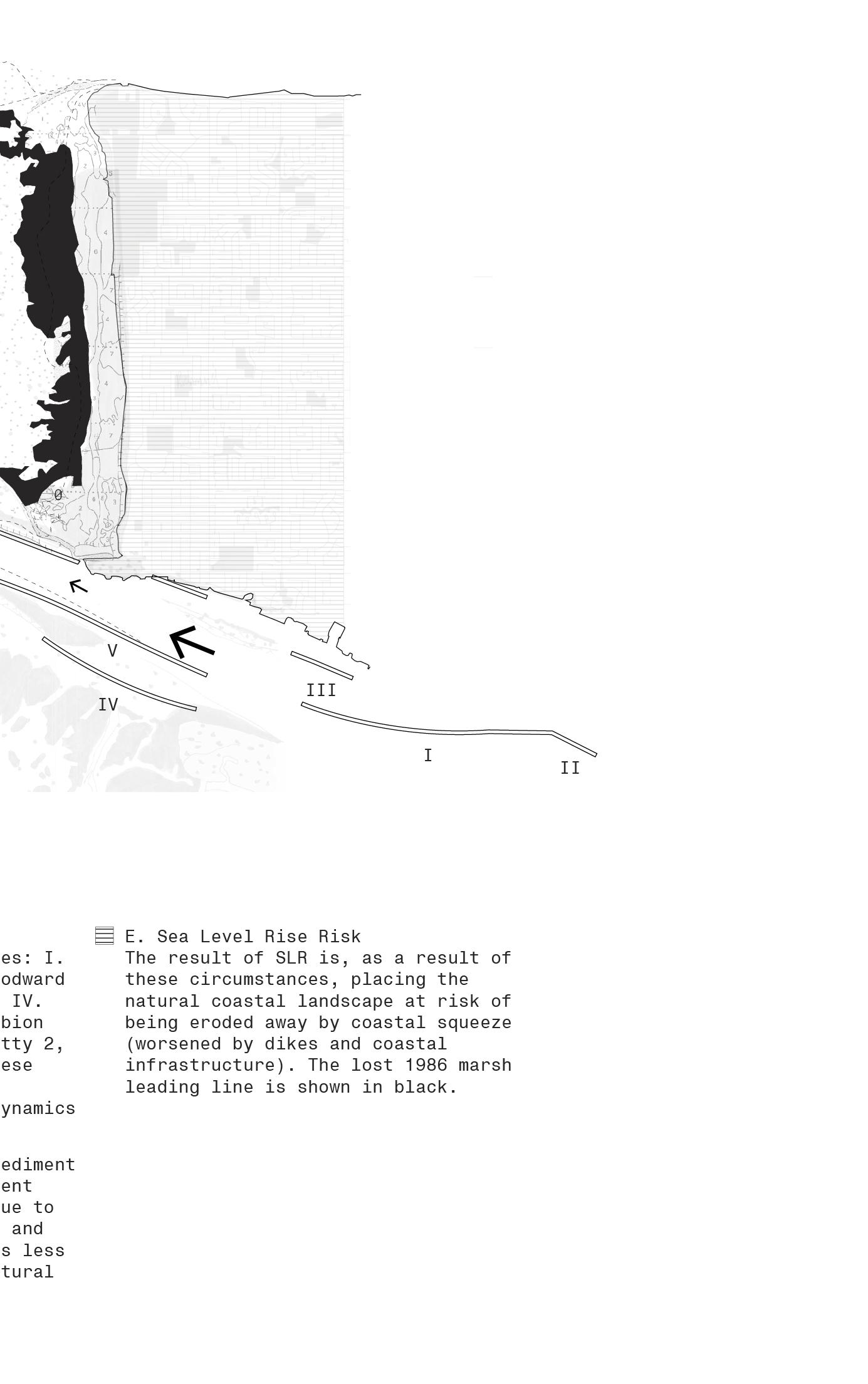
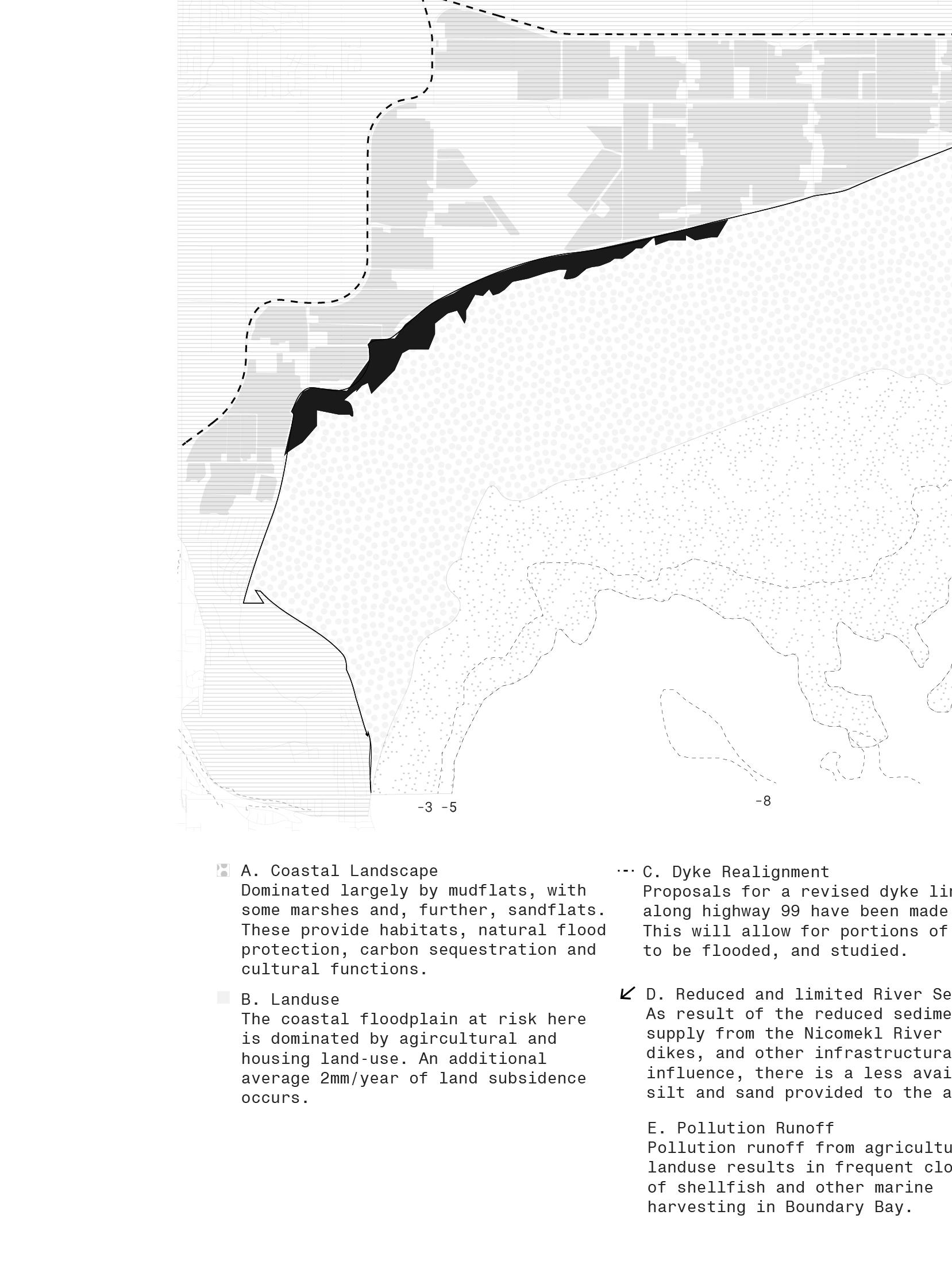
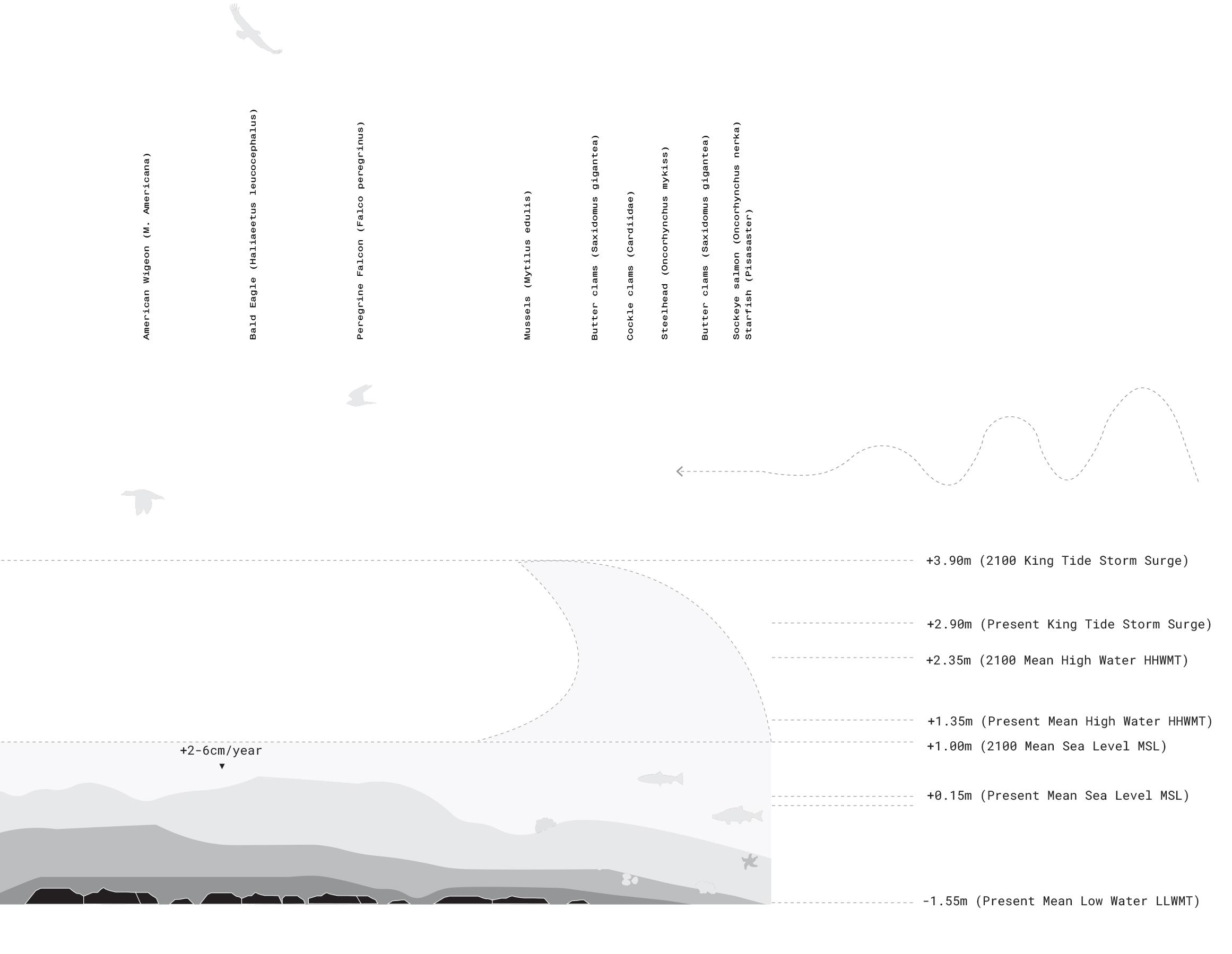
A Risk Assessment of flooding in the region shows how vulnerable agriculture, outdated infrastruc ture, urban development pressures, and natural landscapes are - and in how these places at risk are situated across several jurisdictional bound aries that lead to legislation and decision-making issues. Critically, the natural landscape has been contained, augmented and often lost in the process.
By the year 2100, policy recommendations for Brit ish Columbia use +1.00m of additional mean sea lev el as the figure to prepare for.
24
SLR
25
Rise
Coastal habitat squeeze is a major challenge in the face of SLR. A Risk Assessment of flooding in the region shows how vulnerable agriculture, outdated infrastructure, urban development pressures, and natural landscapes are - and in how these places at risk are situated across several jurisdictional boundaries that lead to legislation and deci sion-making issues. Critically, the natural land scape has been contained, augmented and often lost in the process.
Land subsidence 0.2mm/year
Critical Habitats Cultural Use!!
 Salt Water Intrusion
Saline Groundwater
Habitat Squeezed
Uplands No tidal influence High Marsh MHW-HTL
Salt Water Intrusion
Saline Groundwater
Habitat Squeezed
Uplands No tidal influence High Marsh MHW-HTL
Sea Level
SLR Coastal Squeeze
Salt
Water
Groundwater
Landward Erosion and Migration
Squeezed
Low Marsh MSL-MHT Mudflat Below MSL Open water
SLR 2100 HTL MLLW
Affected by Sea Level Rise
Carbon Sequestration Flood Protection
!!
II. STRATEGY
29
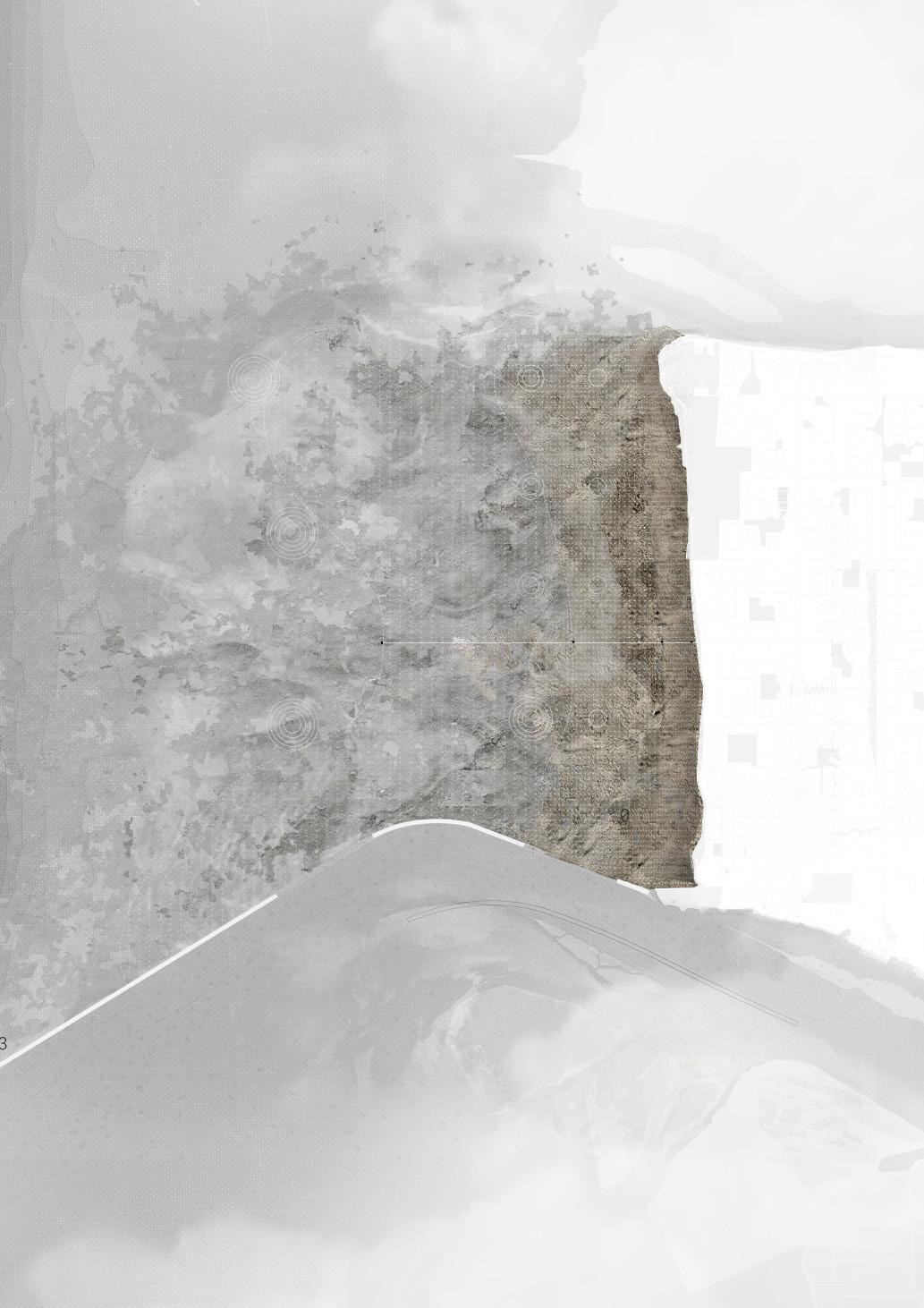
Sites
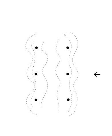
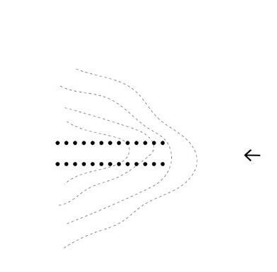
Transitional spaces
This project places emphasis on the transition spaces between land and water – the convergent, dynamic points of exchange and interaction between daily flooding and dryness. These sites have the capacity to connect, given their position at the intersection between land/society, and water/na ture. I believe these are the critical spaces of SLR resilience in Metro Vancouver due to their po sition, and their ability to attenuate waves and mitigate against flooding.
Natural landscape
Three sites were selected to develop resilience, and were selected based on their urgency in SLR management, their unique ecotypes based on their proximity to the Fraser River, and their distinct cultural contexts: sandflats, marsh and mudflats. These landscapes are rich natural landscape, and have the potential to adapt to SLR, although in the current condition of control when combined with SLR and storms, are at risk of being lost entirely.
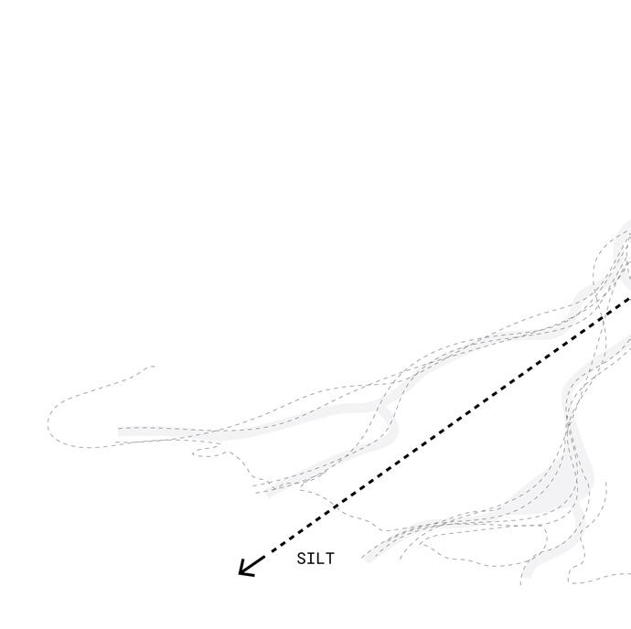
Sediment
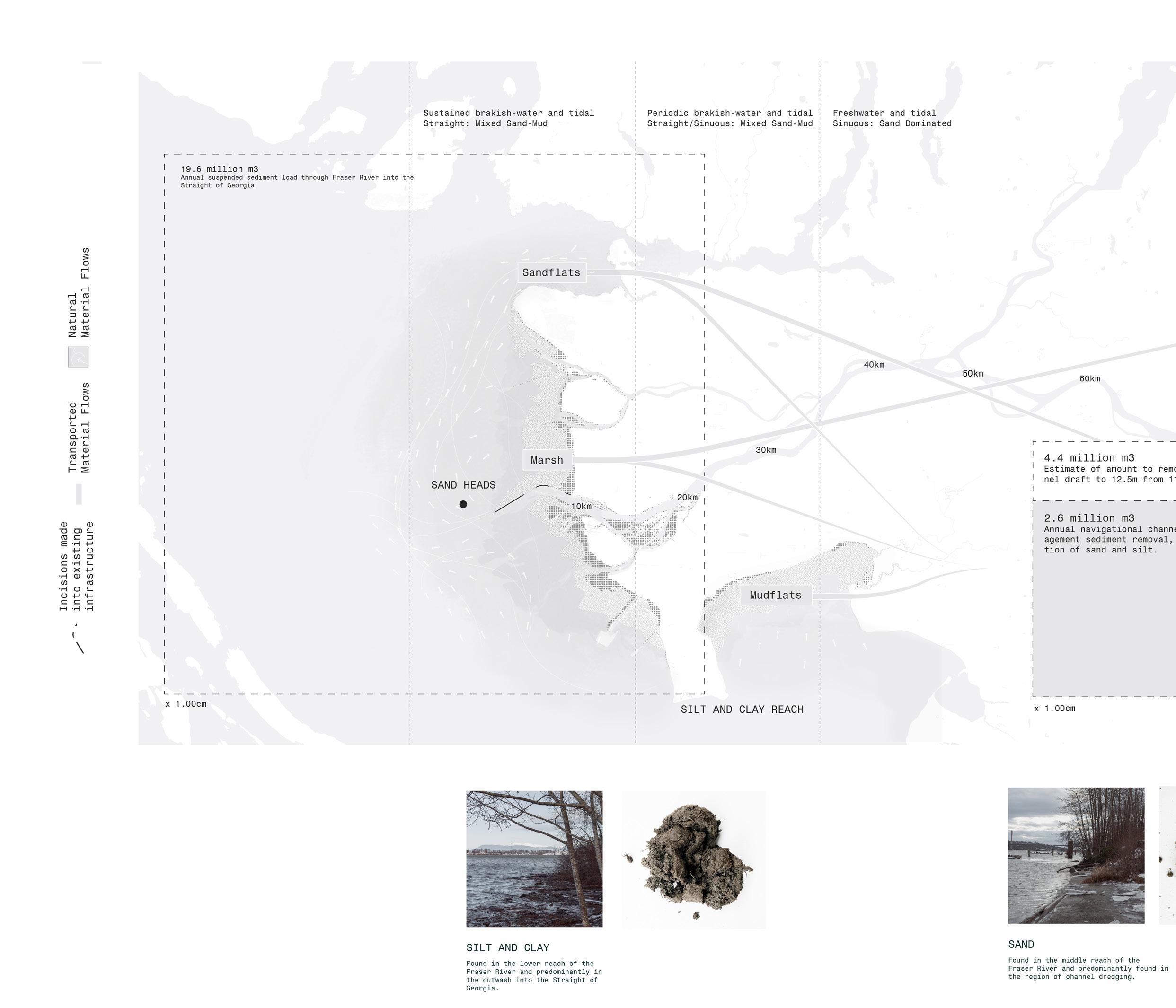
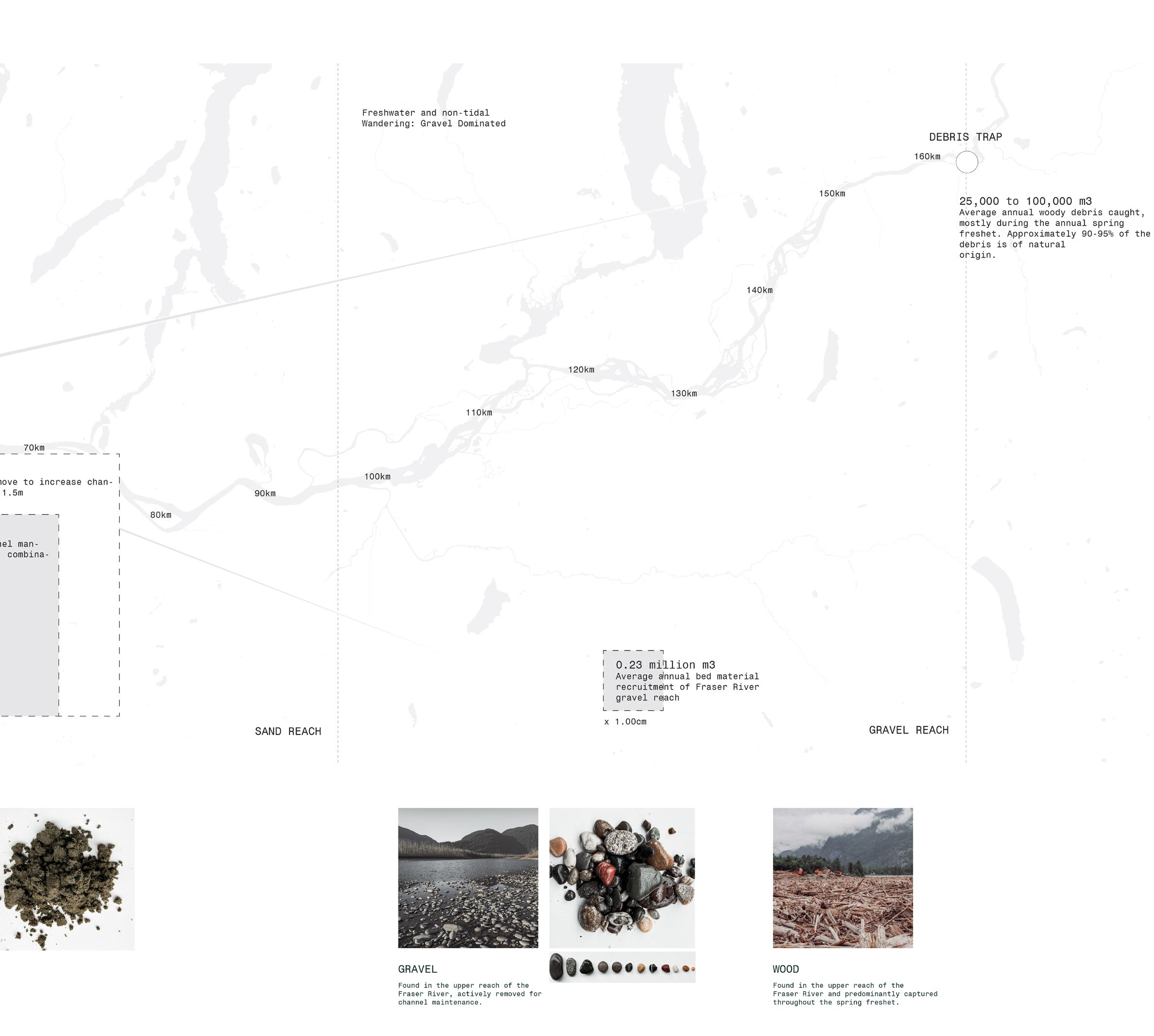
The Fraser River
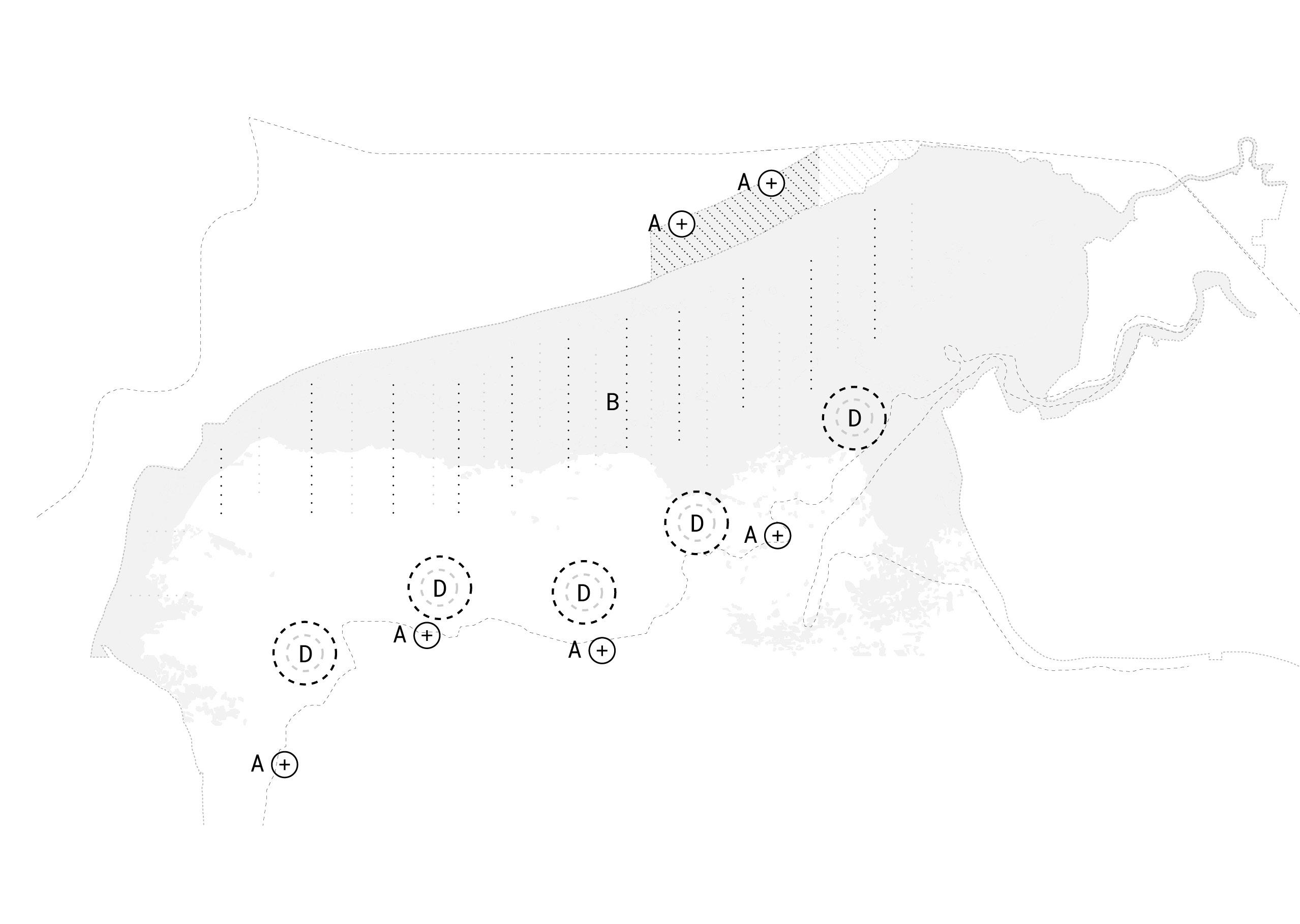
Throughout this project, resilience ing the existing natural systems the landscape to inform and resilience. Through harnessing derutilized or lost) materials that exist as a combination gravel and wood in various points river channel today, new opportunities grow these existing coastal
Placement and Flow
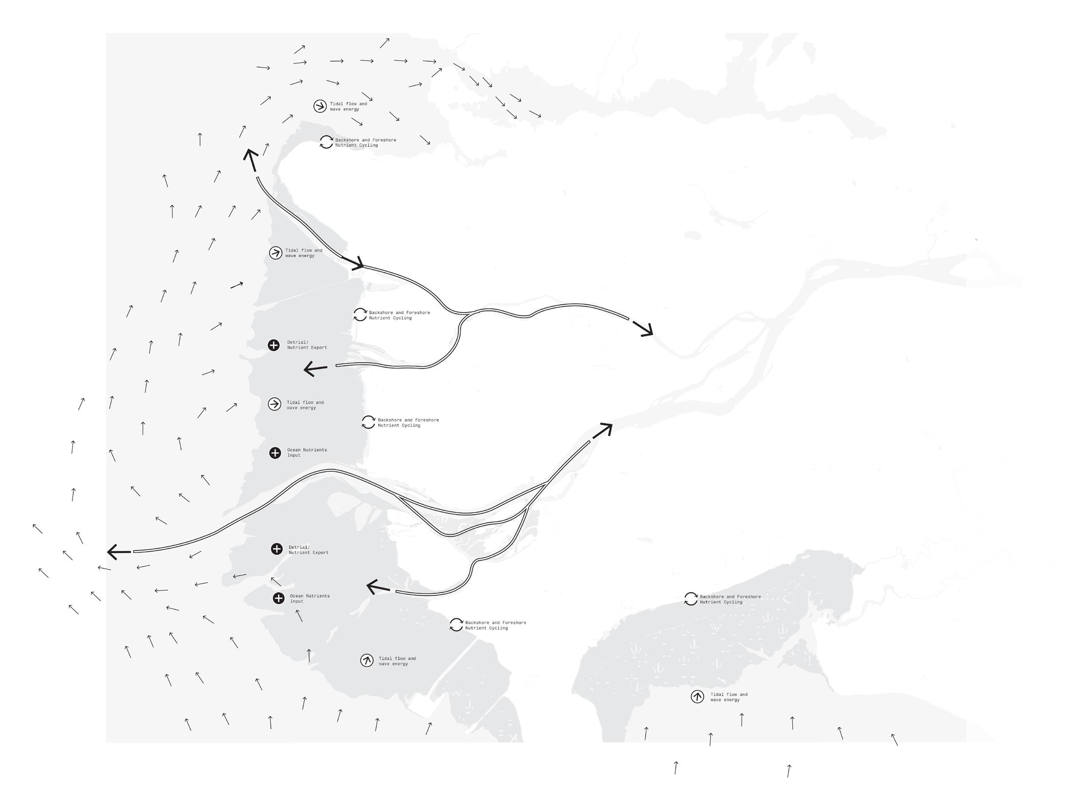
These materials are either dredged the Fraser River annually, and contextually placed along the they once would have been naturally influence. Interventions are isting infrastructure to allow imentation flow. Natural dynamics, storms then shape the landscape placing that sediment.
30
A B
resilience is made by us systems and qualities of lead growth towards harnessing the (currently un materials of the Fraser River, of sand, silt, clay, points throughout the opportunities arise to landscapes.
dredged or removed from and are proposed to be the coastal landscape as naturally before human are also made into ex allow for increased sed dynamics, flows and even landscape through naturally
COASTAL ACCRETION
CElements
Catalogue
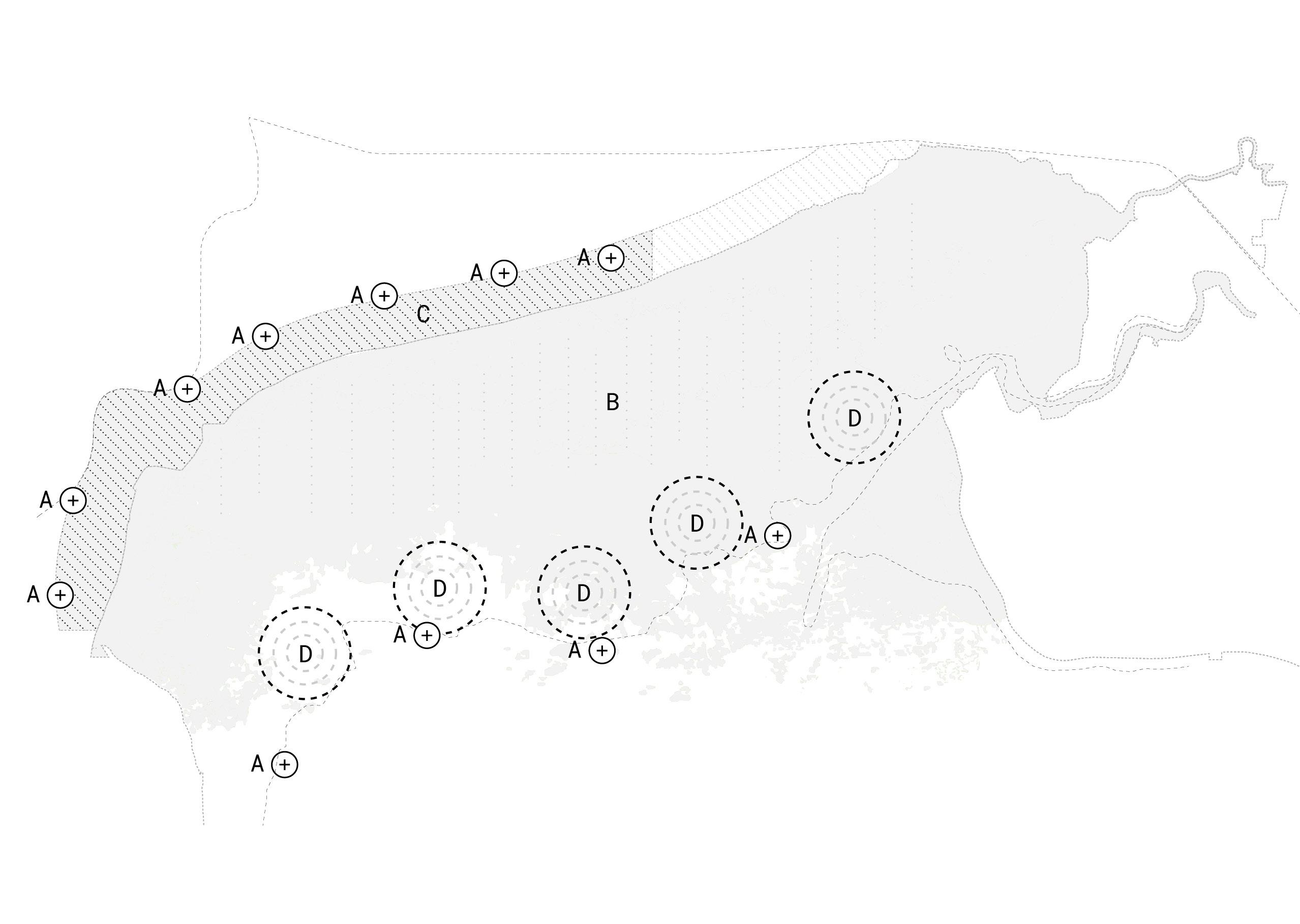
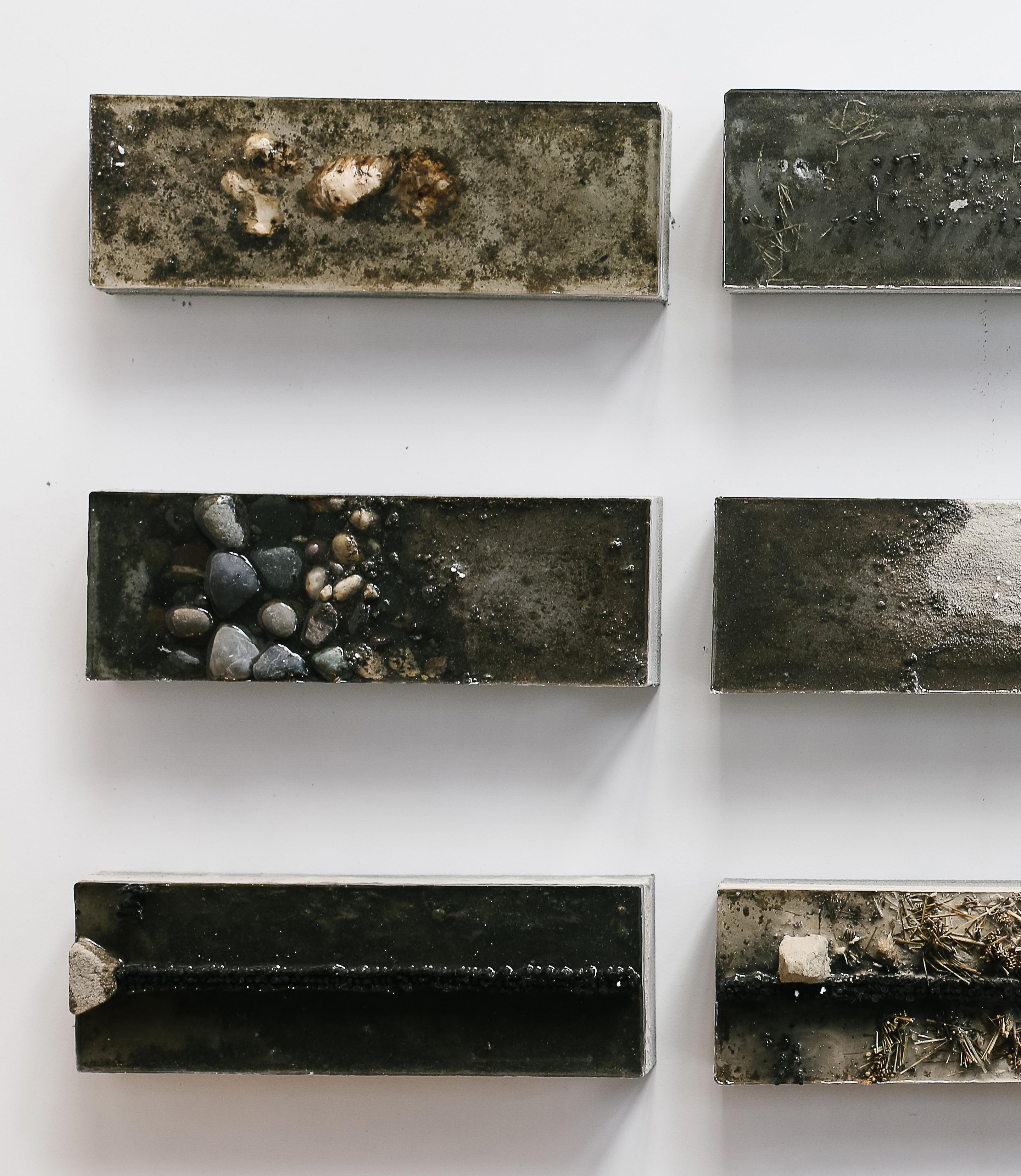
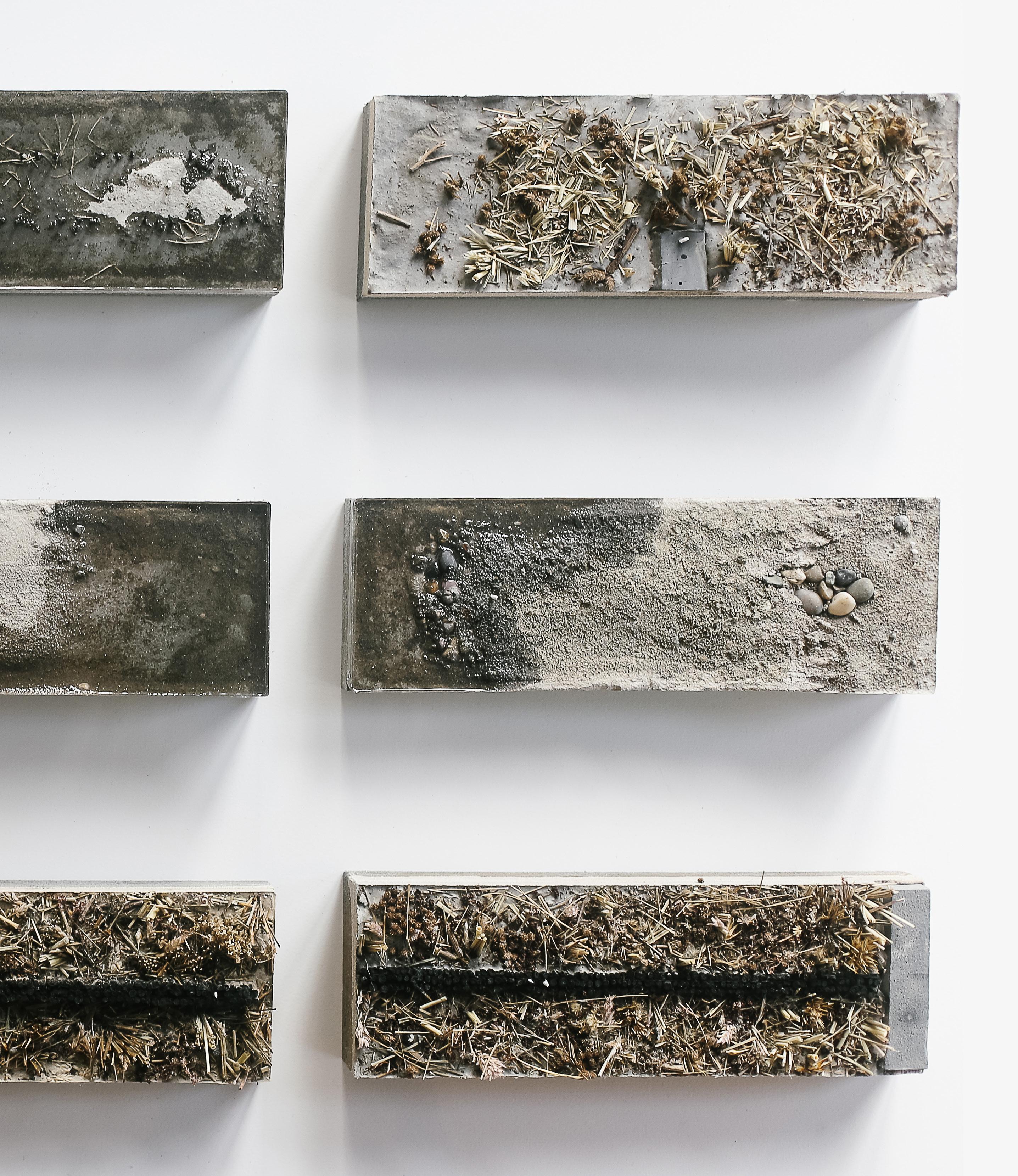
A series of contextual elements are added or grown on each site, that highlight its natural qualities, interact with sediment and build new forms of re silience.
Natural Interaction
When combined, the natural systems of the landscape interact with these interventions to create a new landscape, new forms, and new co-created languages of resilience. The natural landscape expands beyond its current level, accreting both sedimentation layers, and well as new ecological and natural ones through time that adapt to SLR.
Cultural Interaction
These elements and landscapes show how the influ ence of society can be harnessed in either directly producing that resilience (mudflats), experienc ing resilience (marsh) or interacting with resil ience (sandflats). The resulting proposal is formed through decades of landscape growth, as well as generations of new cultural practices and experi ences - a process of coastal accretion.
31
Resilience, Aesthetics and Time
Layered systems of coastal resilience combine strategies that, if implemented independently, are inadequate against flooding. When made together, these landscapes form a cohesive resilience and a new type of redundancy - and should: attenuate and dissipate wave energy offshore through the use of breakwaters, reefs, wetlands or islands, protect residents with flood protection structures through elevation and other defense, and plan for con trolled flooding through urban and landscape design that acknowledges the floodplain through waterfront parks and water-based agriculture, for example.
Not only are layered approaches chosen, but the influence of humans in either directly producing that resilience (mudflats), experiencing resilience (marsh) or interacting with resilience (sandflats) is made.
Resilience
Material from Landscape
The role of aesthetics in building awareness and connection to change is powerful. Through mark ing change (by using fixed elements that high light change through being static), framing spac es (through creating specific windows into this change), and by making the changing morphology of the system visible, new ways of relating to water and change can be made. Materials from the land scape are used to make new connections between the history of the growth of the region, and its fu ture. Woods, gravels, sands and silts are used con textually to make these connections.

Resilience, Aesthetics and Time Aesthetics
Marking change Richard Serra, Spin out
Framing Spaces and Change James Turrell, Outside Insight
Visible morphology Robert Smithson, Sandbox
Resilience, Aesthetics and Time Time
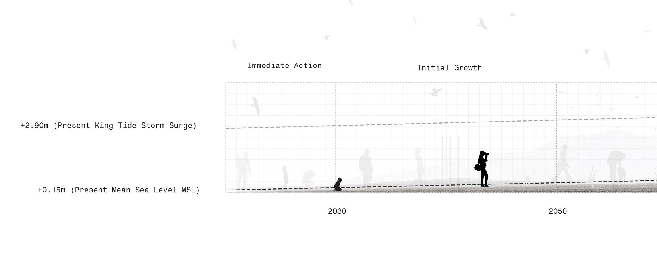
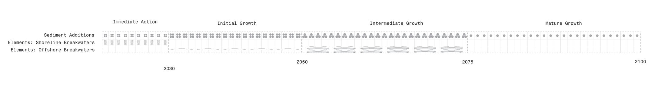
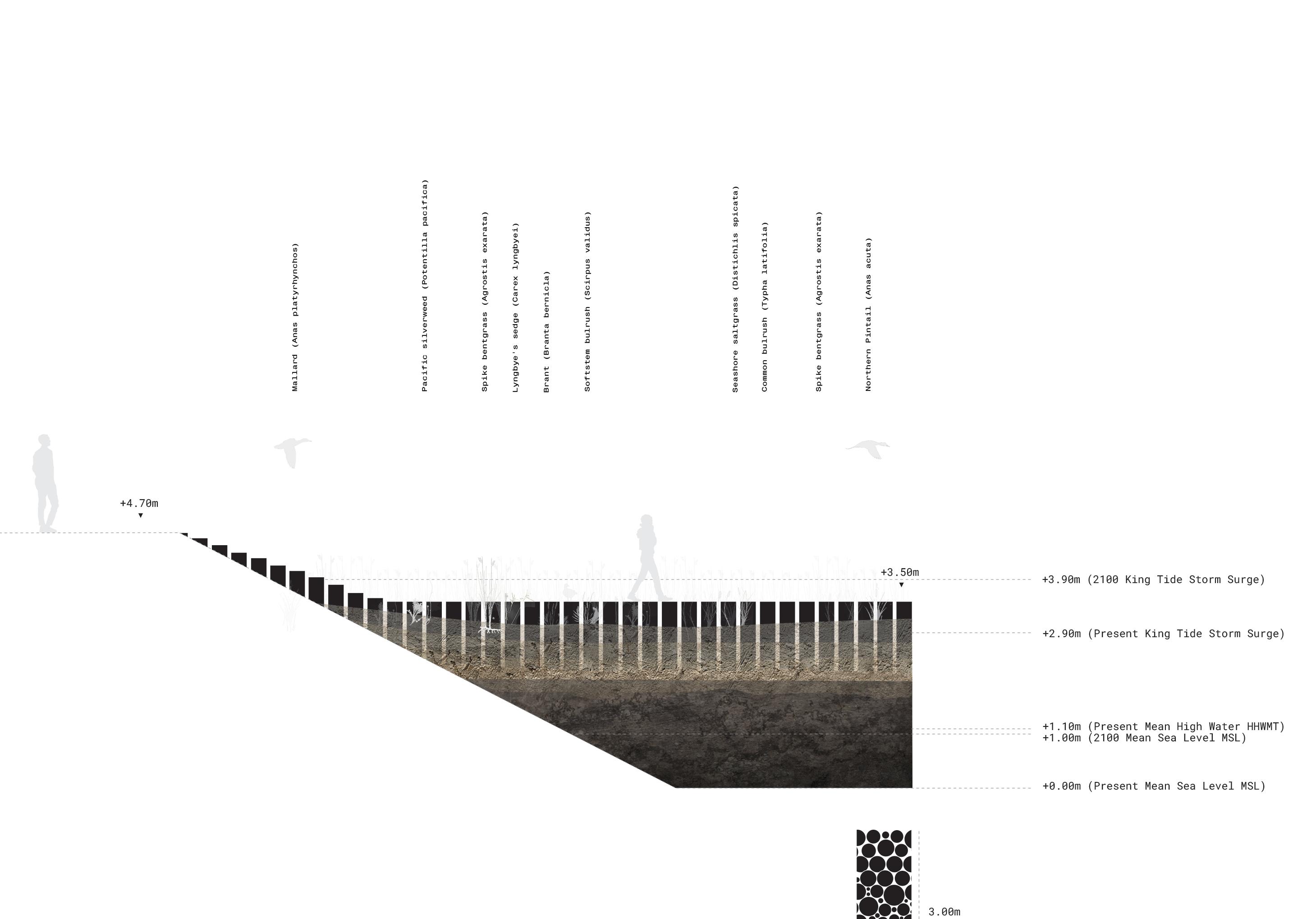
Time is an essential component of building resil ience through natural systems, and is embedded into SLR as a long-term climate challenge. Generations have the ability to build upon the knowledge, work and experiences of those who preceded them. Inter ventions and conceptualizing time is therefore very important to SLR, and has been split into four pe riods of time:
Present
Initial Growth 20 years
Lessons learned from first 10 years are applied to following 20 years: Sites selected for sediment enhance ment are narrowed down and inten sified. Elements are continually made, and are used to facilitate the growth of the system further and protect against larger storms.
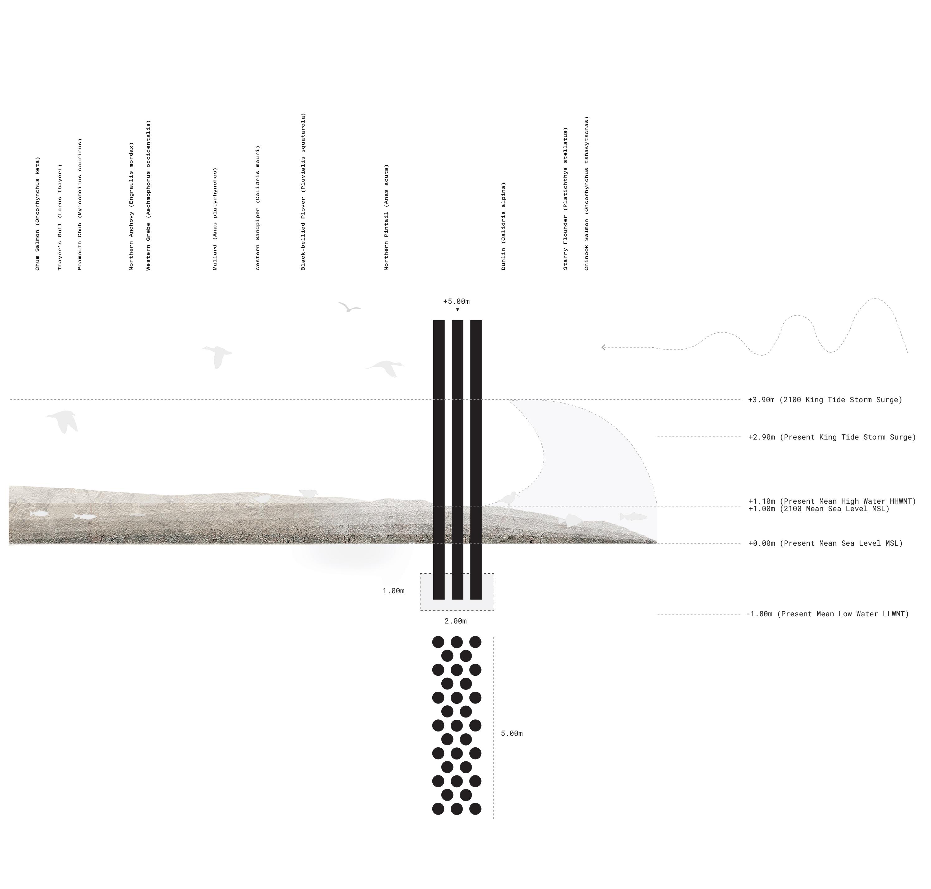
Immediate Action 10 years
Shorelines protected to current flood levels at storm surge (3.5m). Elements made to break existing king tide (2.9m). Elements made to shel ter existing natural systems and protect them from storms. Early pi lot projects and experimentation with sediment.
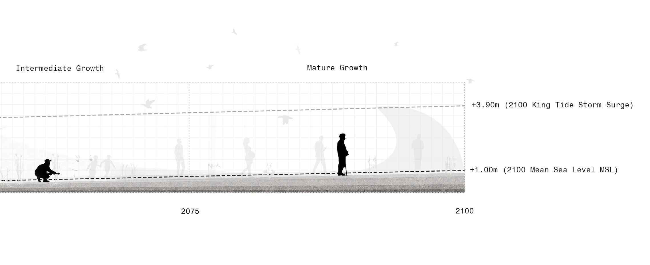
Intermediate Shorelines are future flood ment enhancement courage further Elements are location of natural and at the height tide flooding.
34
Growth 25
are protected now to the levels (4.7m). Sedi enhancement is increased to en further growth of systems. now made to the final natural system growth height of the future king flooding.
Mature Growth 25 years
The final period is where the new natural systems begin to become de fined clearly, and the flora and fauna begin to become stabilized. Sediment enhancement continues, but as maintenance and upkeep. Elements are maintained and updated as need ed, but no new significant additions are made.
35 2100
 River
River
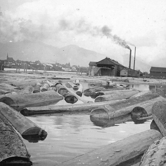
It’s clear that the coastal Lower Mainland of Brit ish Columbia’s growth over the past 10,000 years was created through sedimentation and deltaic pro cesses. The legacy and mighty of the Fraser River estuary is now today still present, although not well understood by the general public. Through harnessing dredge spoil materials, that exist as a combination of sand, silt, clay and gravel in various points throughout the river channel, new opportunities arise to build resilient landscapes in the face of SLR and climate change. Dependent on where the dredge material originates: up river, middle river, down river, on the bank of channel or in suspension, very different materials are found. These each have the potential to facilitate natural growth processes of existing natural systems, and to connect people to these places in new ways.
38
Strategy Fraser
Estuary
A critical opportunity lies in adopting these materials for their application in Sea Lev el Rise natural resilience. The following map explains how these materials could be either transported manually to their sites, based on the unique natural conditions of the site; or naturally through interventions into existing infrastructure.
39

III. DESIGN
41
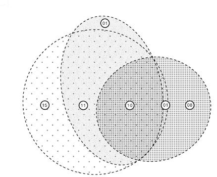
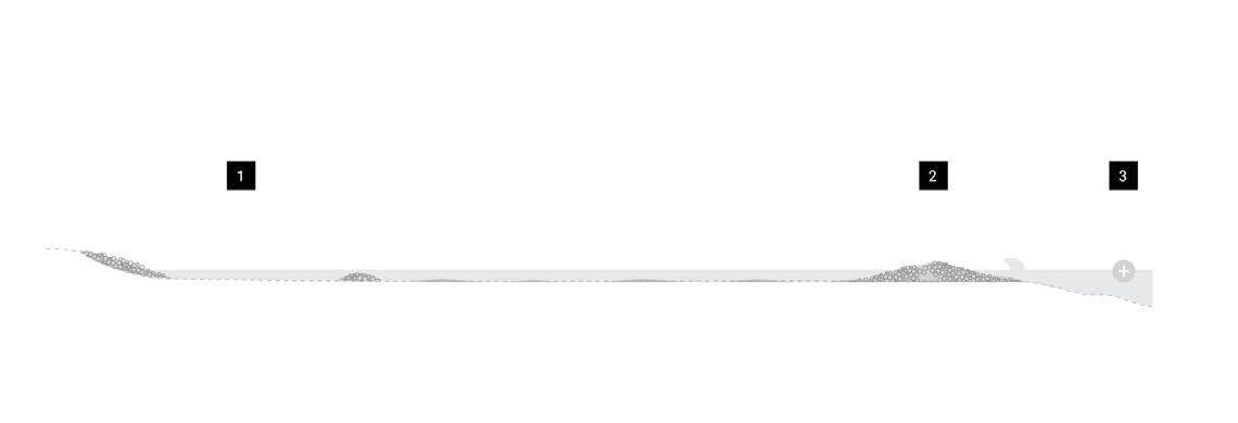
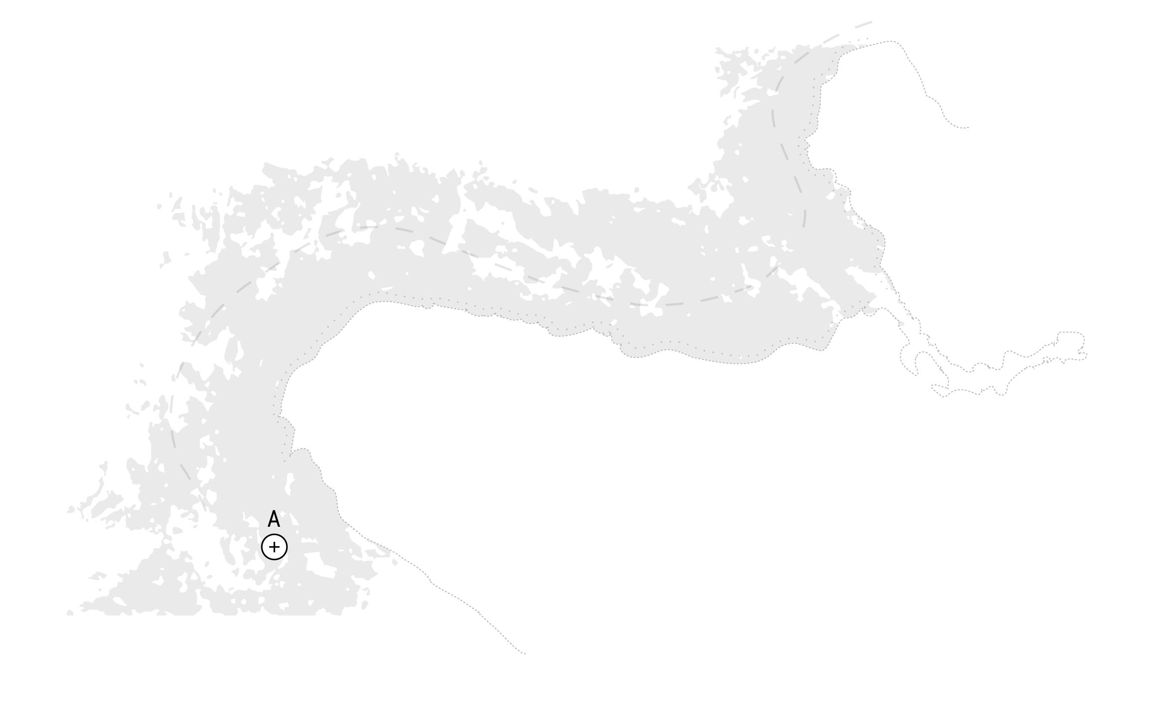
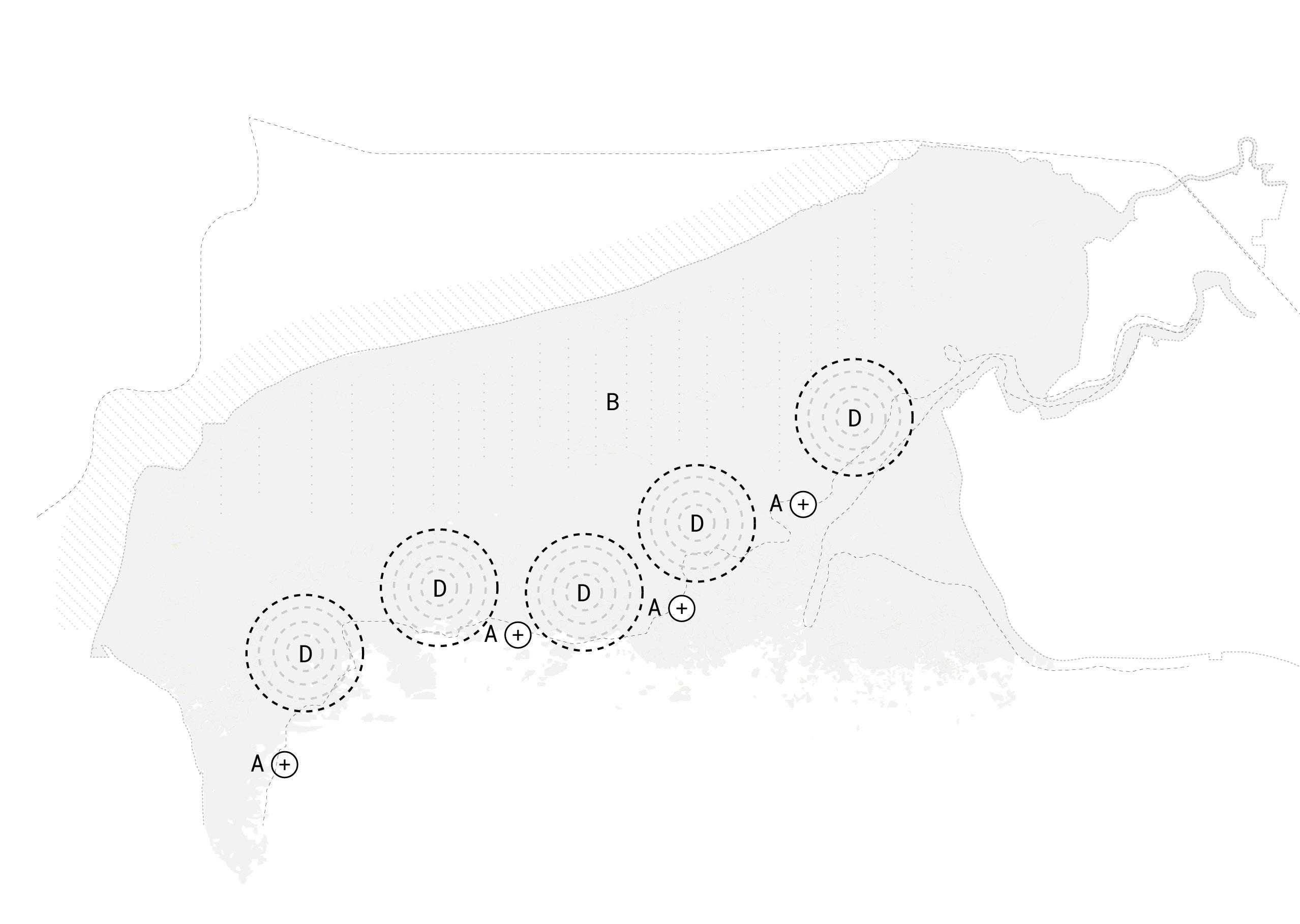
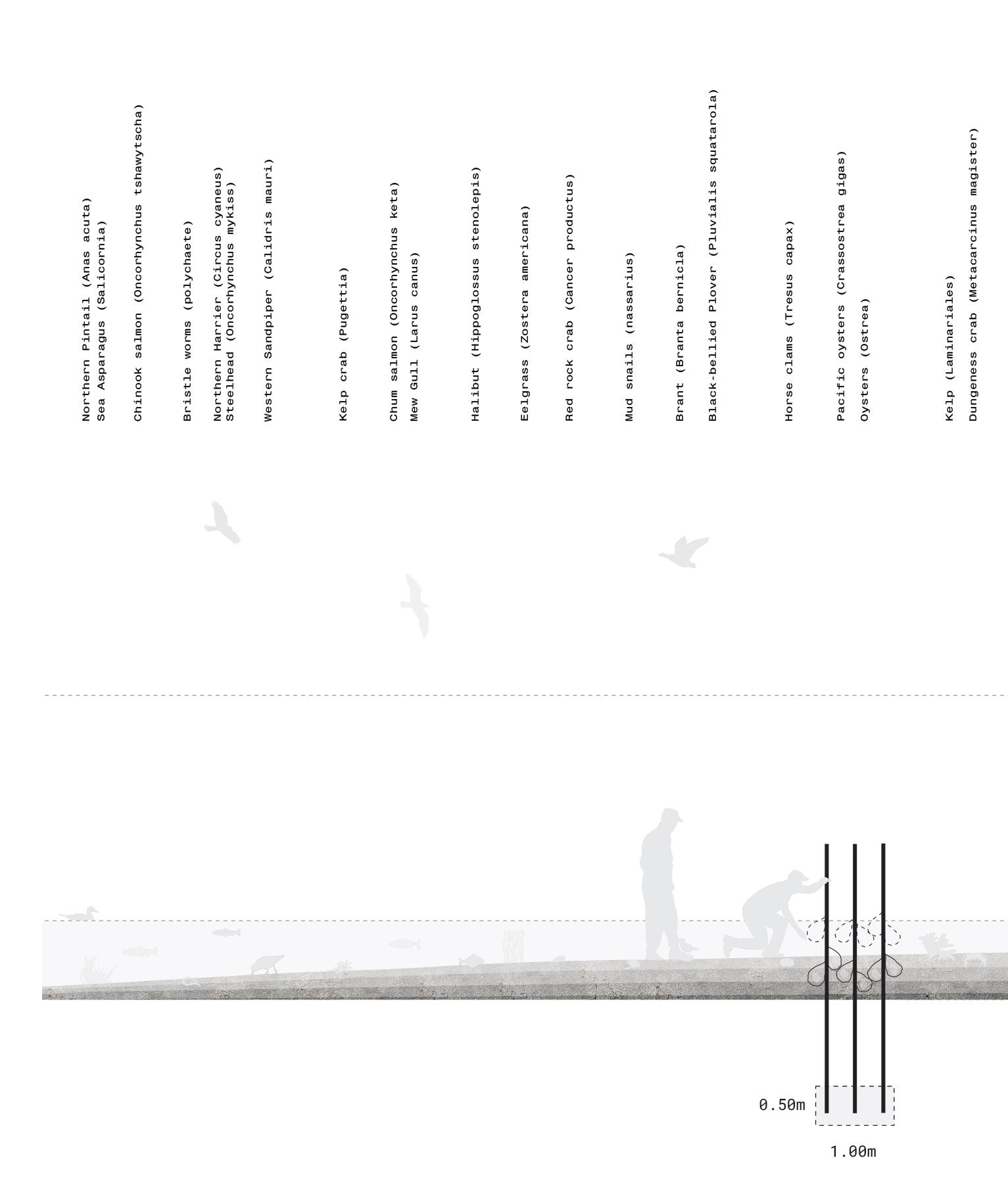
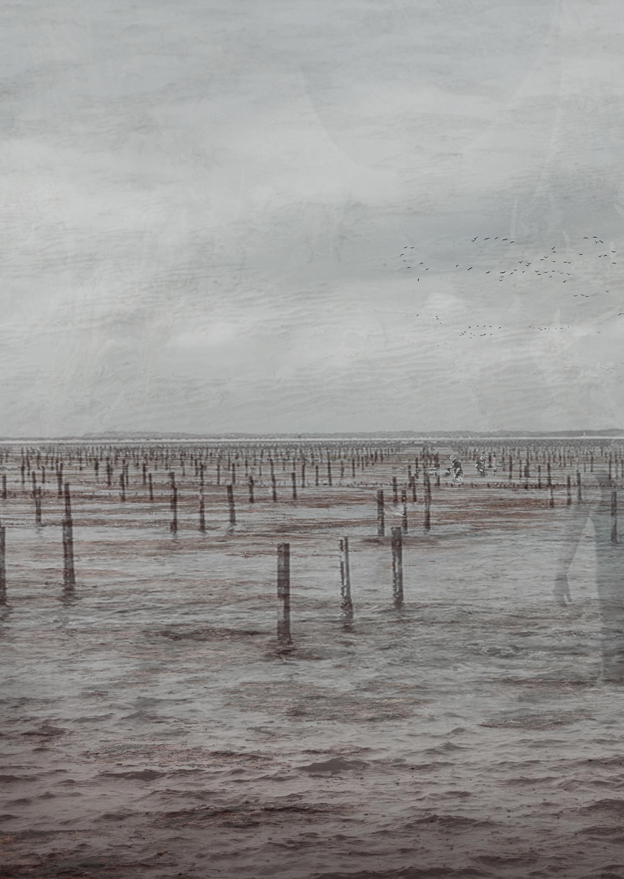
Three sites have been selected based on their: (1) urgency in SLR management, (2) their unique ecotypes based on their proximity to the Fraser River, and their (3) distinct coastal contexts.

The Sandflats of Vancouver are those that I grew up in, and have a far-reaching potential in ad dressing SLR along the coast of Vancouver. The Marsh of Richmond is a rich ecosystem, and typifies the relationship between the Fraser River and the Straight of Georgia. The Mudlfats are those in the agricultural landscape of Delta.
Site Selection
Vancouver, British Columbia, Canada
SANDFLATS

Sandflats Context
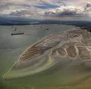
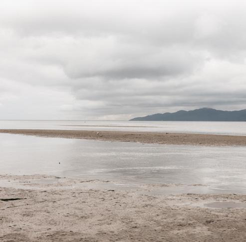
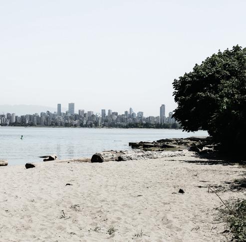
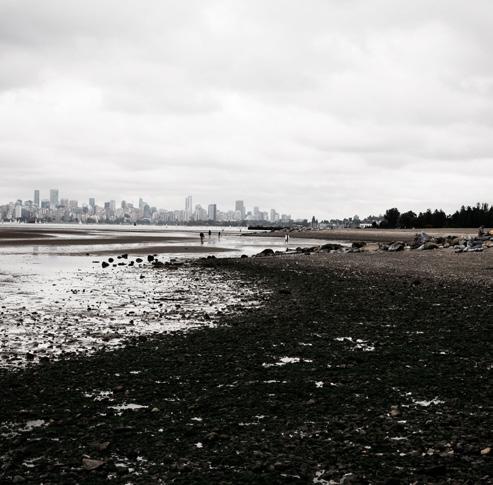
The strategy for Vancouver is to grow the existing sandflats as a new public space and sea level rise protection zone to be experienced in time.
This is achieved by (01) placing sand sediment locally (02) building shoreline sediment growing elements and (03) building offshore break waters to reduce wave action and guide sediment additions.
52 Sandflats Strategy
Strategy Phase I: Immediate Action

A. Sediment Placement
Placement of sand material in small quantities, placed locally
B. Shoreline Protection
Aimed at protecting and expanding shoreline with placed sediment
54 Sandflats
Initial Growth

A. Sediment Placement
Placement of sand material in small quantities, placed locally

B. Offshore Breakwaters
Offshore breakwaters made at vul nerable coastline points
55
Sandflats Strategy Phase II:
A. Sediment Placement
Placement of sand material in small quantities, placed locally
B. Offshore Breakwaters
Offshore breakwaters continue to be made at remaining vulnerable coastline points
56
Sandflats Strategy Phase III: Intermediate Growth
Mature Growth
A. Sediment placement
Single deposit site aimed at maintenance of sediment budget
57
Sandflats Strategy Phase IV:
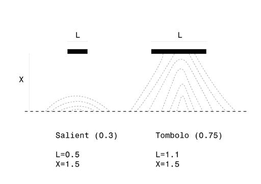
An extension of the existing shoreline is made by introducing two new elements to the coast: a groyne and a breakwater. The interaction between these two elements, with regular sediment input, makes the coast accrete between them - providing new rec reational opportunities and ecological habitats. These also attenuate wave action. The width and distance of these elements were chosen carefully through investigation and experiments.


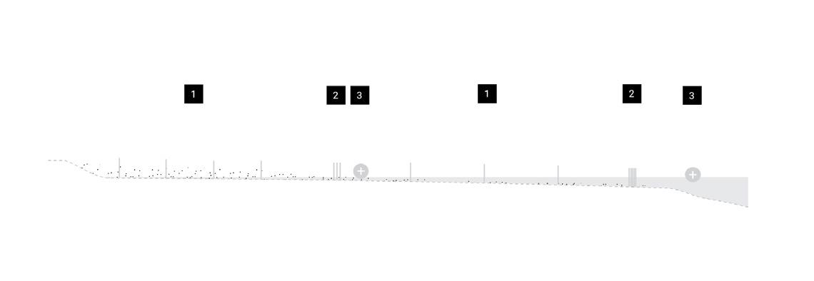
58 Sandflats Details Sedimentation Periods Phase 1 Phase 2 Phase 3 Phase 4
59
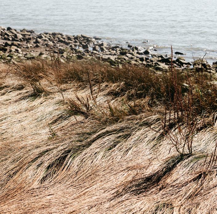
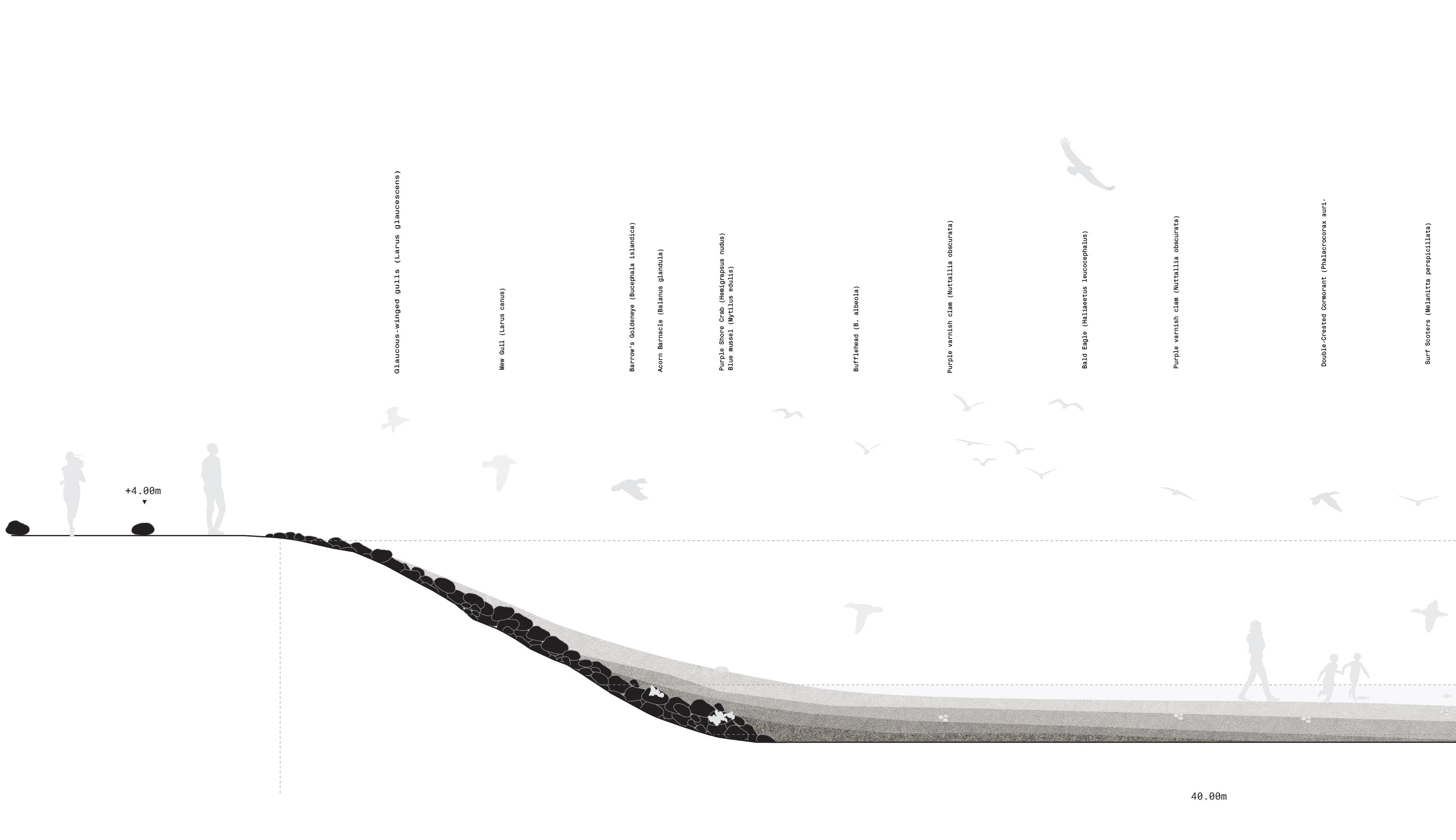
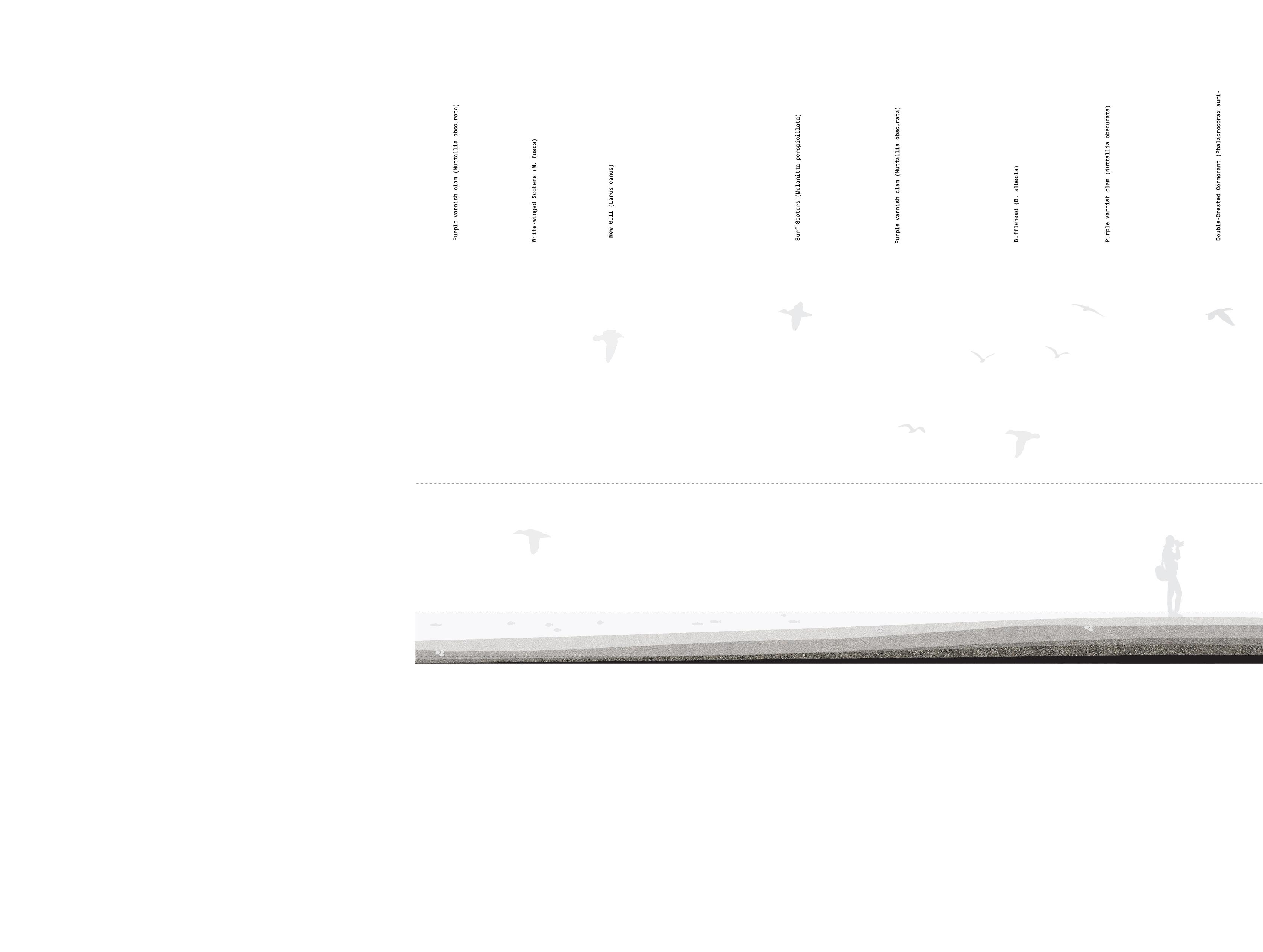
Sandflats
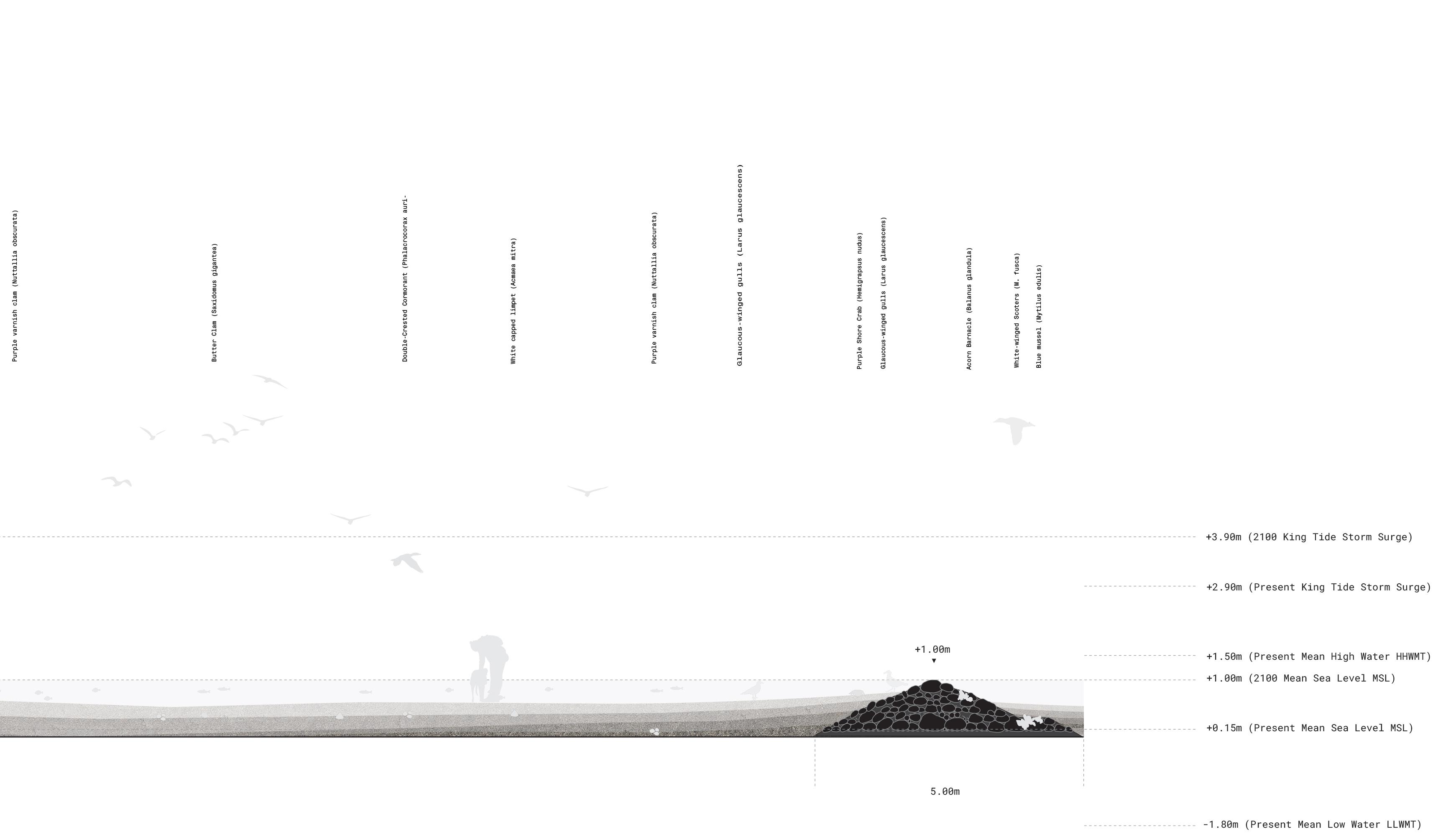
On the existing sandflats, very subtle mounds are found that create small height differences that can be experienced with changing tides. With regular sediment additions, these mounds, or “whale backs”, become exaggerated through time. The result is a series of new transitional zones between wetness and dryness, that also attenuate waves.
60
Details
61
Sandflats Details

The final element is a large whale-shaped breakwa ter made from a combination of larger and smaller gravel materials that are inspired by the form of the existing sandflats. These elements attenuate wave action, accumulate sediment and provide sev eral new ecological habitats within them. The di mensions of the gravel used are larger at the ocean facing side, where larger fish typically are found, and smaller on the land facing side, for those younger fish and animals that are found throughout the beach.
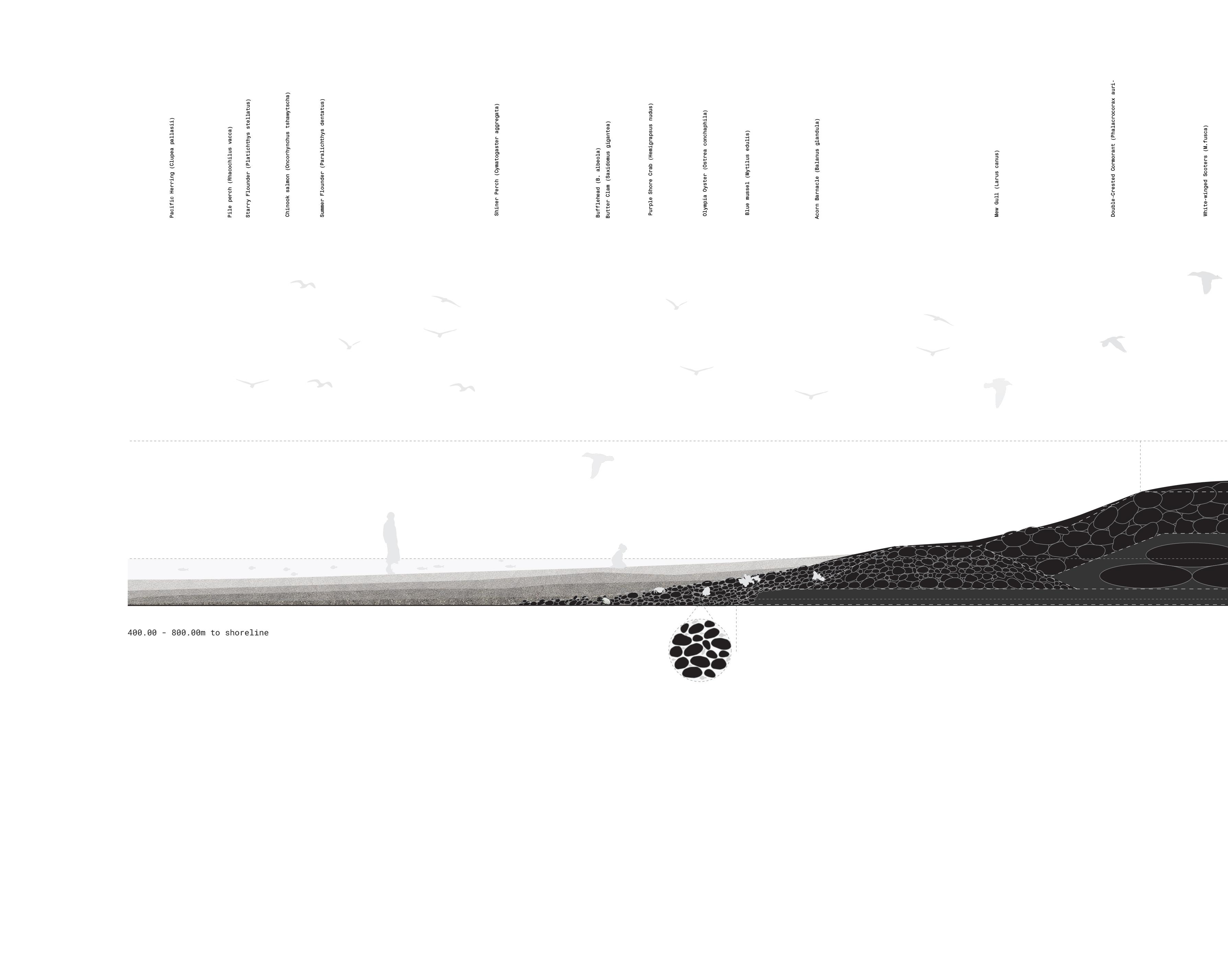
62 Sedimentation Periods Phase 1 Phase 2 Phase 3 Phase 4
63
64
65

Sedimentation PeriodsBreakwatersShoreline Interventions Sediment Additions Ring = 10y Phase 1 Phase 2 Phase 3 Phase 4 N 1:30,000
Richmond, British Columbia, Canada
MARSH
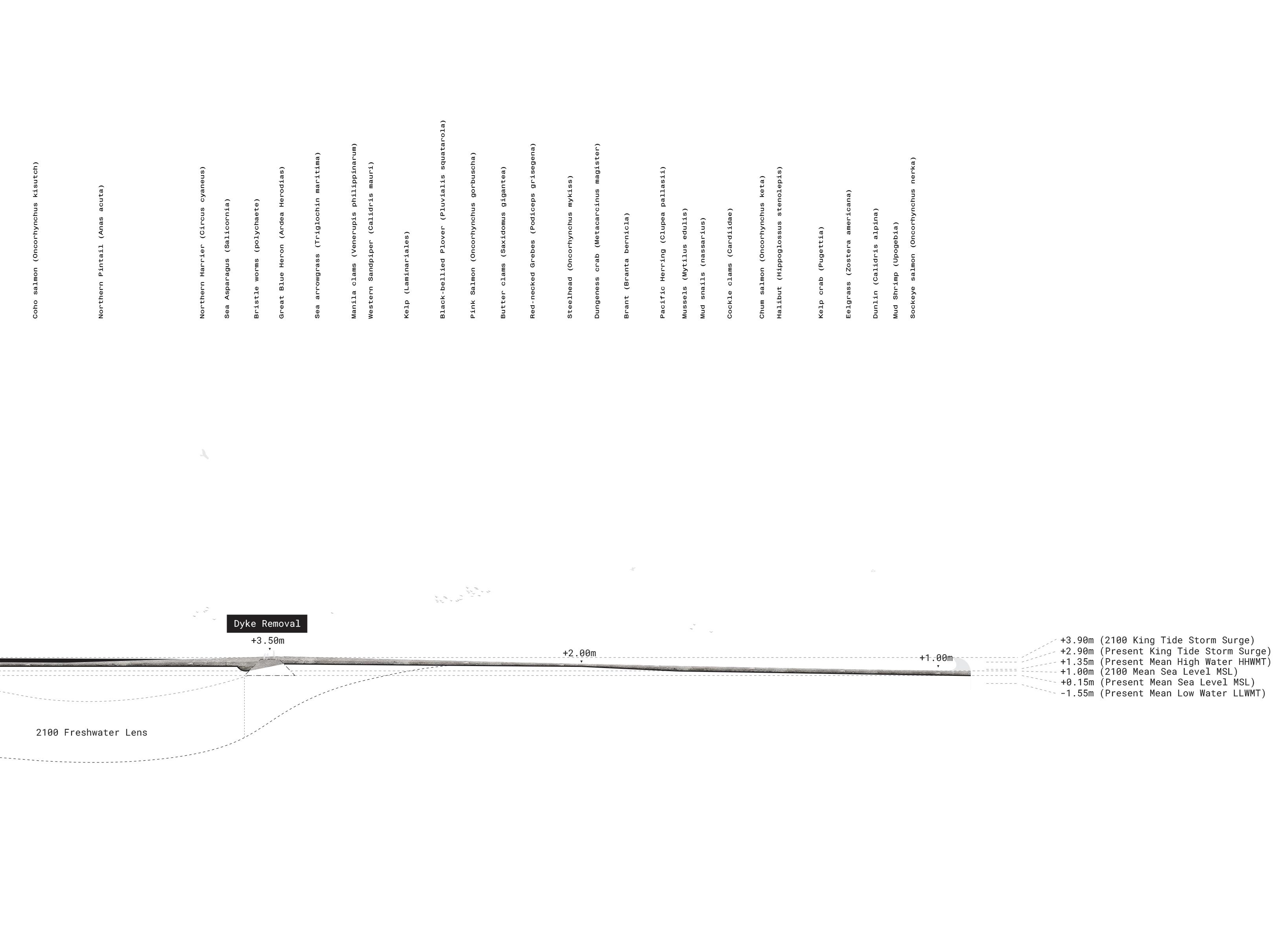
Marsh Context
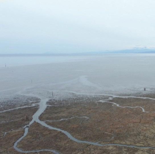
79
The strategy for the Marsh is to grow the existing marsh into a strengthened sea level rise protec tion zone, and new engagement op portunities.
This is achieved by (01) placing silt sediment locally (02) building shoreline sediment growing elements (03) building offshore breakwaters to reduce wave action and guide sediment additions (04) building pavilions/windows to create spe cific experiences for visitors and (05) making interventions in exist ing infrastructure to facilitate further growth of the system.
80 Marsh Strategy
A. Sediment Placement
Placement of silt material in small quantities, placed locally aimed at expanding marsh
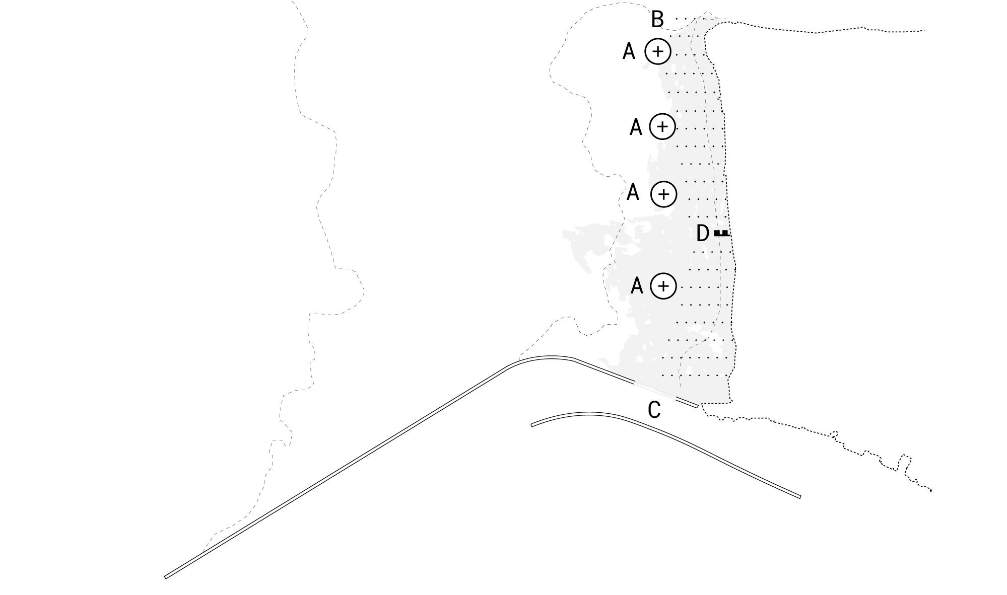
B. Shoreline Growth
Aimed at protecting and expanding marsh with sediment accumulating elements
C. Infrastructural intervention
Make initial pilot incision into the Steveston North Jetty, aimed at allowing sediment inflow.
D. Windows
Make first two windows in the marsh landscape
82
Marsh Strategy Phase I: Immediate Action
A. Sediment placement
Aimed at protecting and expanding shoreline with placed silt and partial sand sediment.
B. Shoreline Protection
Aimed at protecting and expanding marsh with protecting elements.
C. Infrastructure intervention Make further incision into the Steveston North Jetty, aimed at allowing sediment inflow.
D. Windows
Make following (3) window in the future marsh landscape
83
Marsh Strategy Phase II: Initial Growth
A. Sediment placement
Aimed at protecting and expanding shoreline with placed silt and partial sand sediment.
B. Shoreline Protection
Aimed at protecting and expanding marsh with protecting elements.
C. Infrastructure intervention
Make further incision into the Steveston North Jetty, aimed at allowing sediment inflow.
D. Windows
Make following (4) window in the sandflat landscape.
84
Marsh Strategy Phase III: Intermediate Growth
Mature Growth
A. Sediment placement
Sediment deposit sites aimed at maintainance of sediment budget.
85
Marsh Strategy Phase IV:
Marsh Details
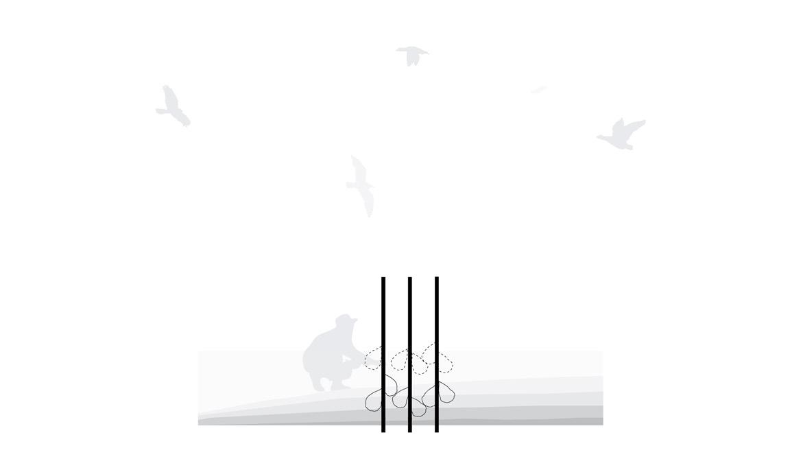
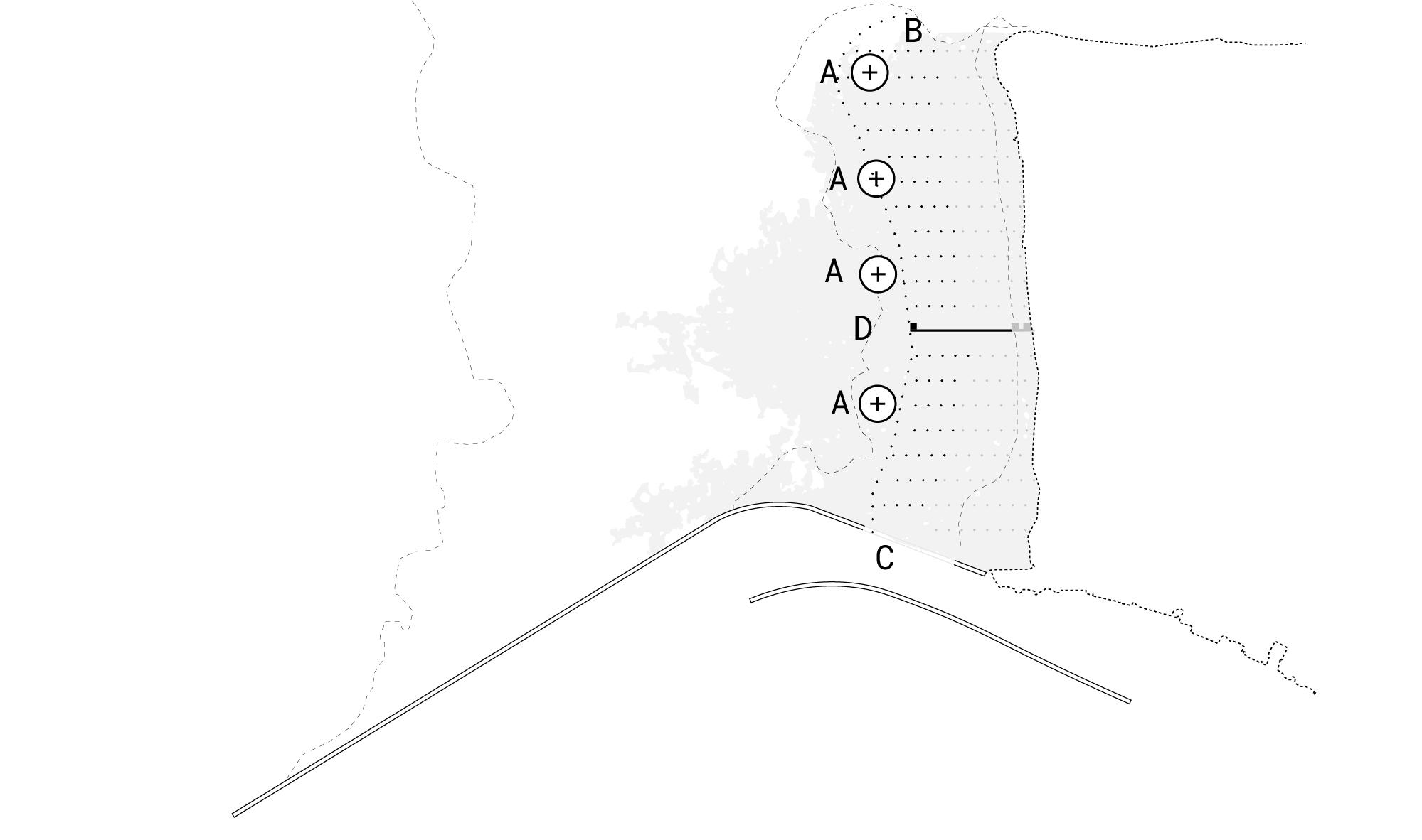
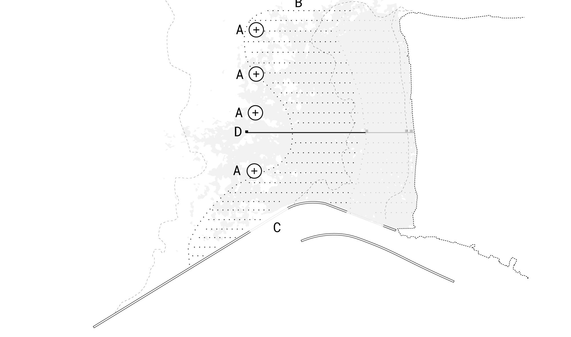
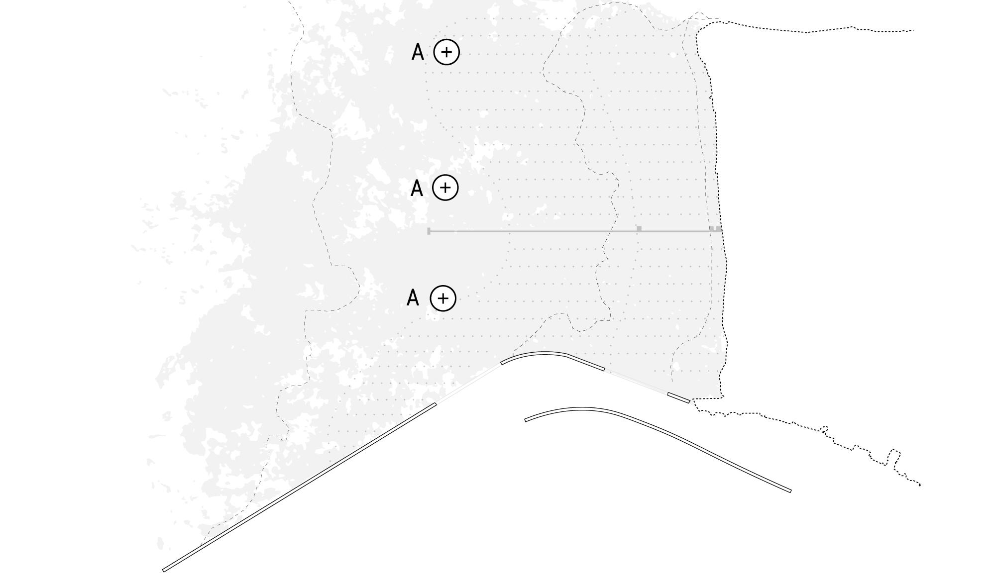
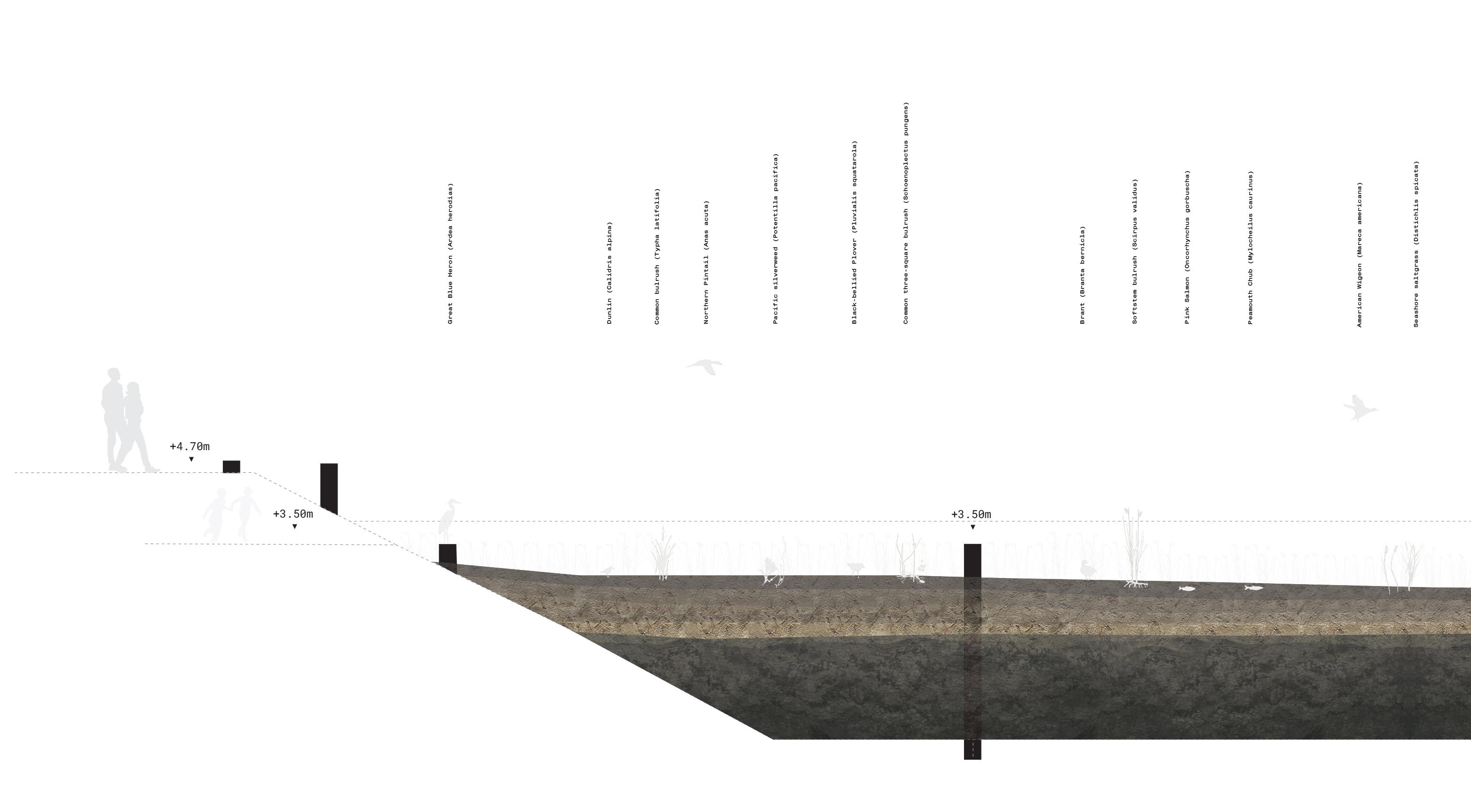
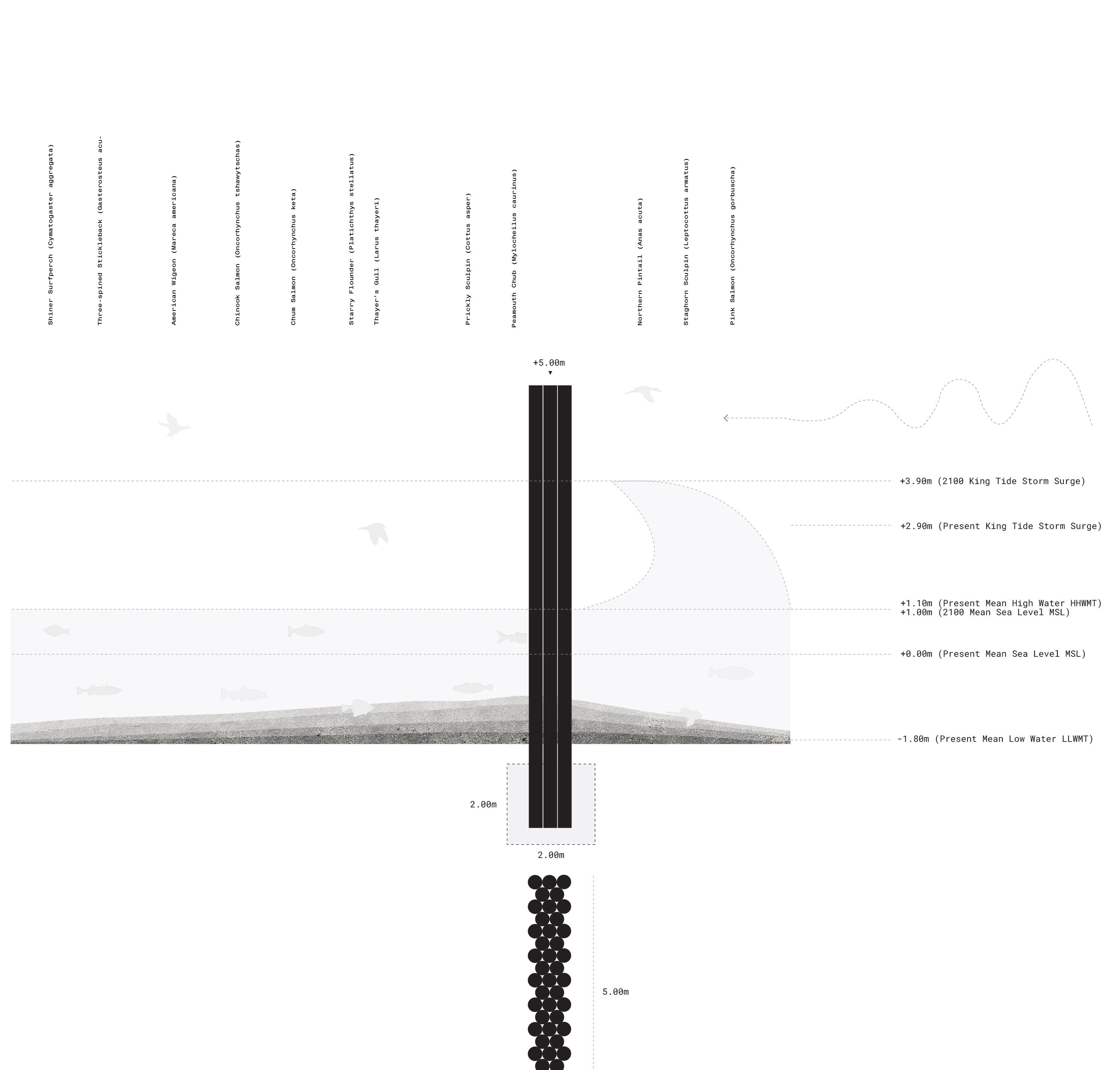
A series of sediment accumulating wooden poles placed at a height of 3.50m are placed throughout the landscape at specific intervals to ensure that sediment builds throughout the landscape.
86 Marsh Principle
25m 3.50m 50m Sedimentation Periods Phase 1 Phase 2 Phase 3 Phase 4
87 100m
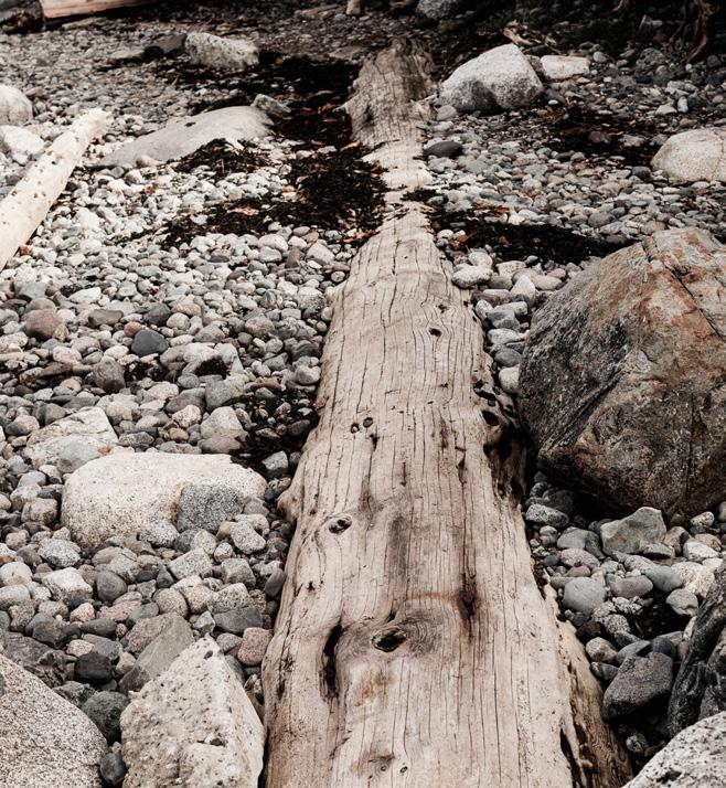
The following two elements are breakwaters placed at a height of 5.00m made from logs found at the debris trap. The first are placed closer to the shoreline, at the marsh. With the need for regular flow and with less severe wave action here, these poles are spaced apart. In the second breakwater elements, there is much more wave action and the need for attenuating this energy. As a result, they are bound together to ensure their strength. The form language of these elements take inspiration from how logs are transported along the Fraser Riv er today.
88 Marsh Details Sedimentation Periods Phase 1 Phase 2 Phase 3 Phase 4
89
A pathway is made at the same height as the sedi ment accumulating elements, as though you are walk ing on the resilience strategy itself. These are made with a combination of sizes of logs within, and connect the various windows highlighted in the following pages.
90 Sedimentation Periods Phase 1 Phase 2 Phase 3 Phase 4 Marsh Details
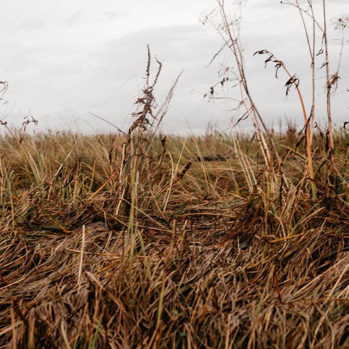
Given the highly sensitive nature of coastal marsh es to human use, this project proposes a series of curated windows, or experiences, of the marsh landscape, it’s resilience and change. The windows express the condition of very specific moments and dynamics that exist in the landscape. Most are ex periences that I had at various moments while being out in the marsh myself, and what I would hope to communicate and share about its qualities. These are built incrementally through time as the strat egy is built, and are meant to connect people to this particular landscape, and to be visited multi ple times, over many years. The four windows are: below, cliff, above and horizon.
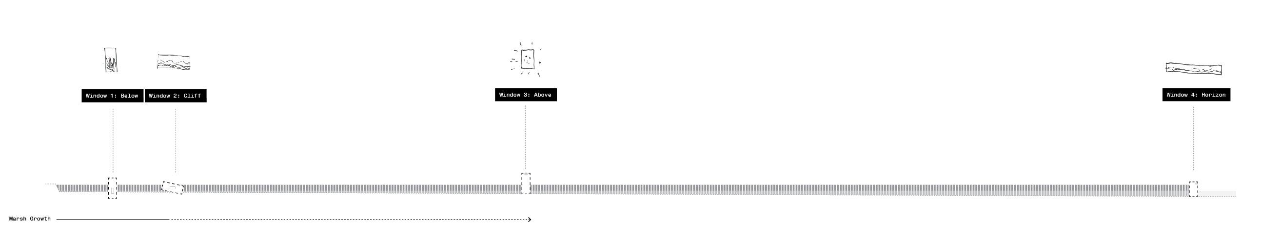
91 Marsh Windows
Window I: Below
Below is meant to bring visitors face to face with the vegeta tion that defines the marsh landscape. This vegetation has a critical importance in the ability of this coastal landscape to adapt to sea level rise and storms. It also has a highly specific sound and movement in the wind when viewed from up close. The height of the vegetation, and the type of vegeta tion will change through time. The precise final result is un known.
92
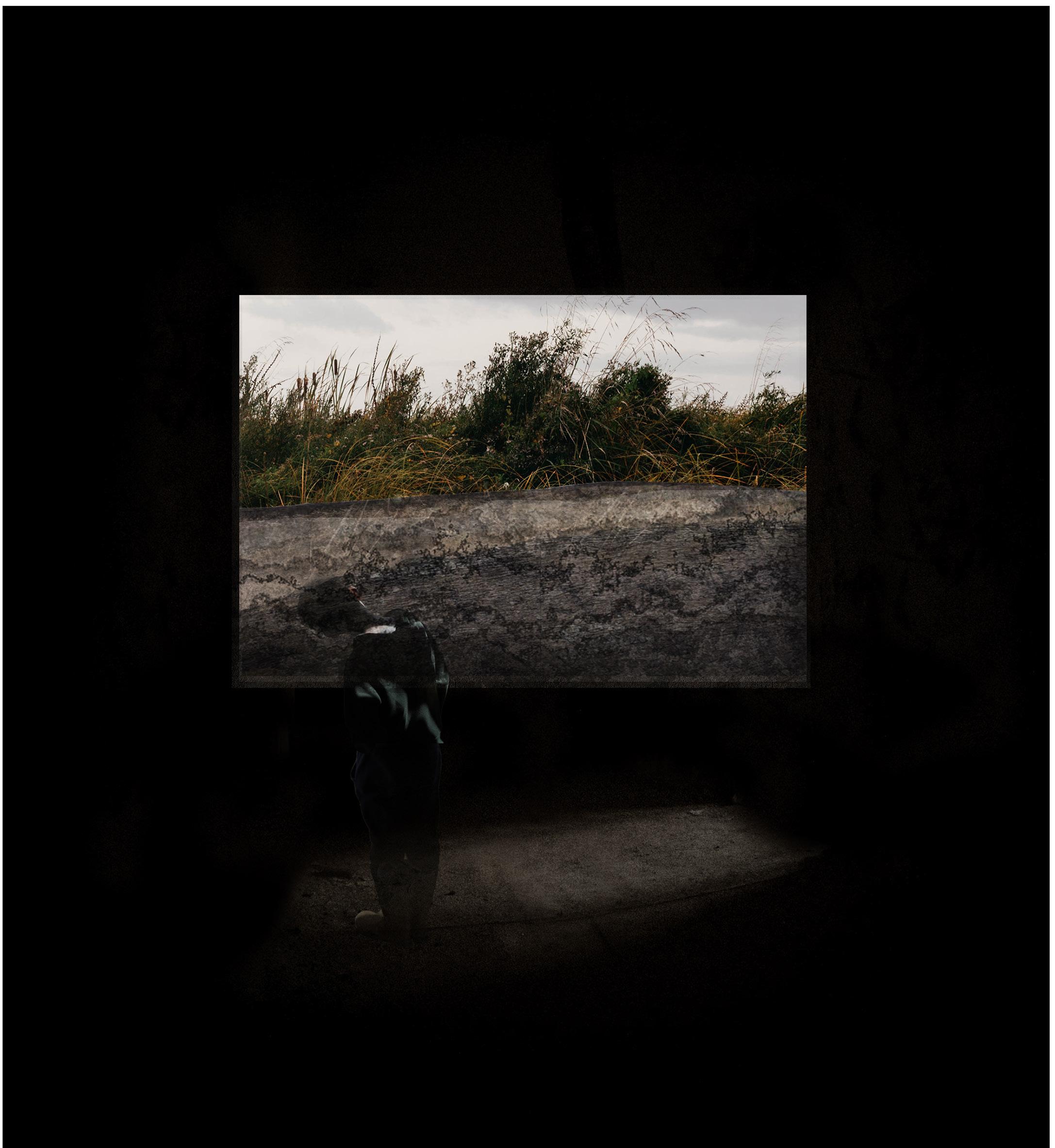
Window II: Cliff
Cliff is the leading edge of the marsh landscape today, where it suddenly drops off in height. This is where the marsh ends now, and was called a cliff to me on a site visit with a lo cal ecologist. With subsequent growth of the landscape through sediment additions, it was my ambition to highlight this dy namic change: showing where the marsh once was, and how it will grow through time.
93
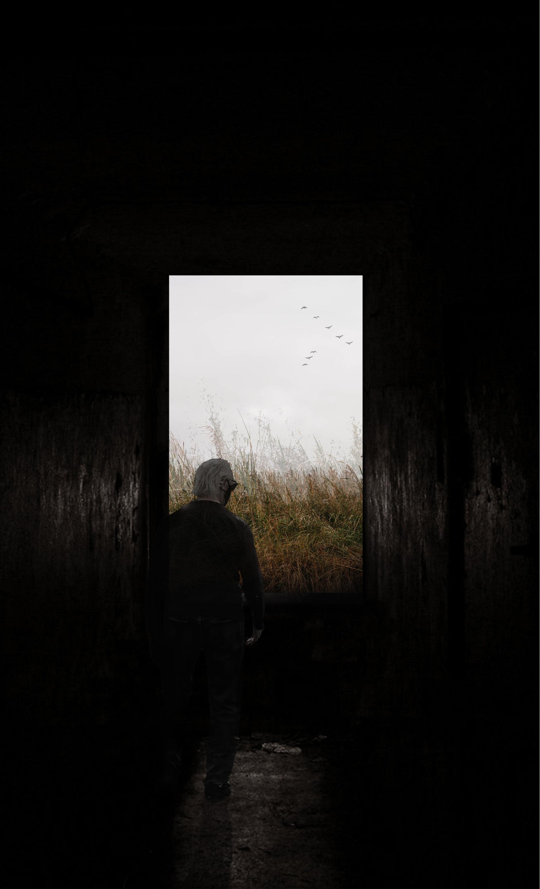
Window III: Above Above is meant to make the visitor aware of the openness of the sky above them, the clouds and animals that frequently fly above the marsh. I spent a great deal of time watching the sky while visiting the marsh, and wanted to bring this into focus.
94
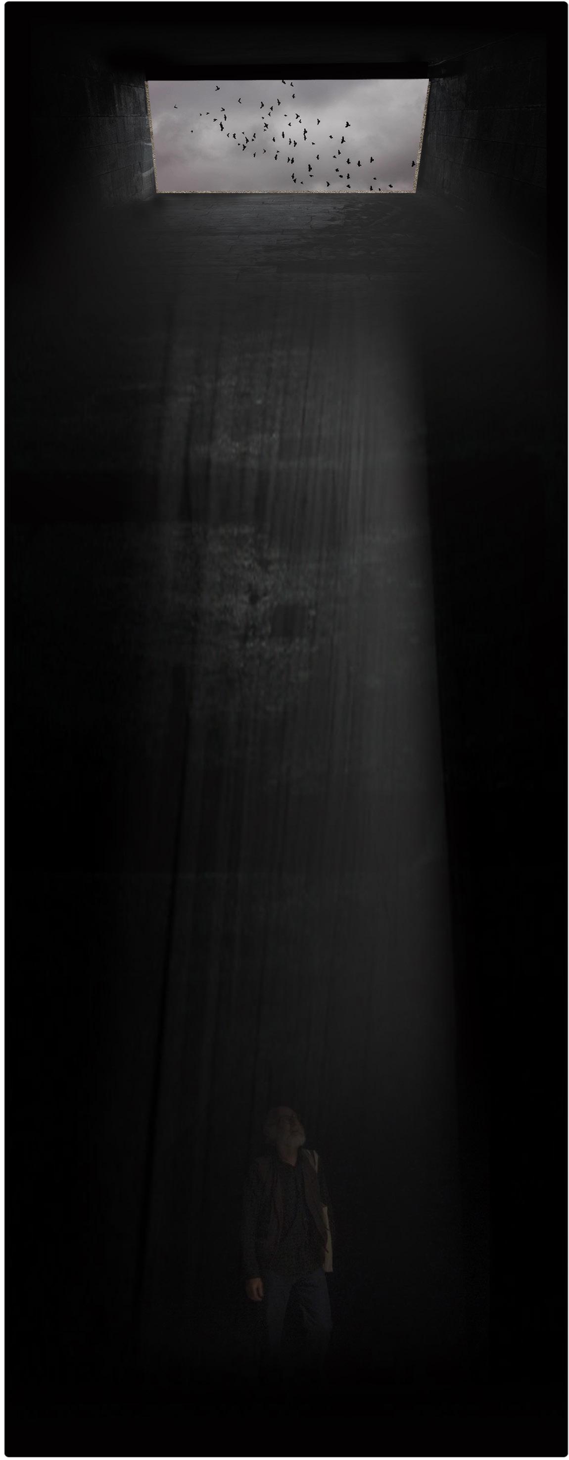
Window IV: Horizon
Horizon is the final window, and is designed to make the vast openness and flatness of this coastal landscape into focus. The scale of this landscape, of the specific light that shim mers on the water, and the animals that are often visible in this landscape are all able to be viewed from this point.
95
96
97


Sediment Accumulators Infrastructural Interventions Pathway and Pavilions Breakwaters Sediment Additions Ring = 10y N 1:30,000 Sedimentation Periods Phase 1 Phase 2 Phase 3 Phase 4
MUDFLATS
Delta and Surrey, British Columbia, Canada
Marsh Context
The strategy for the Mudflats is to grow the existing marsh and mud flats into a strengthened sea level rise protection zone, and to create new agricultural opportunities.
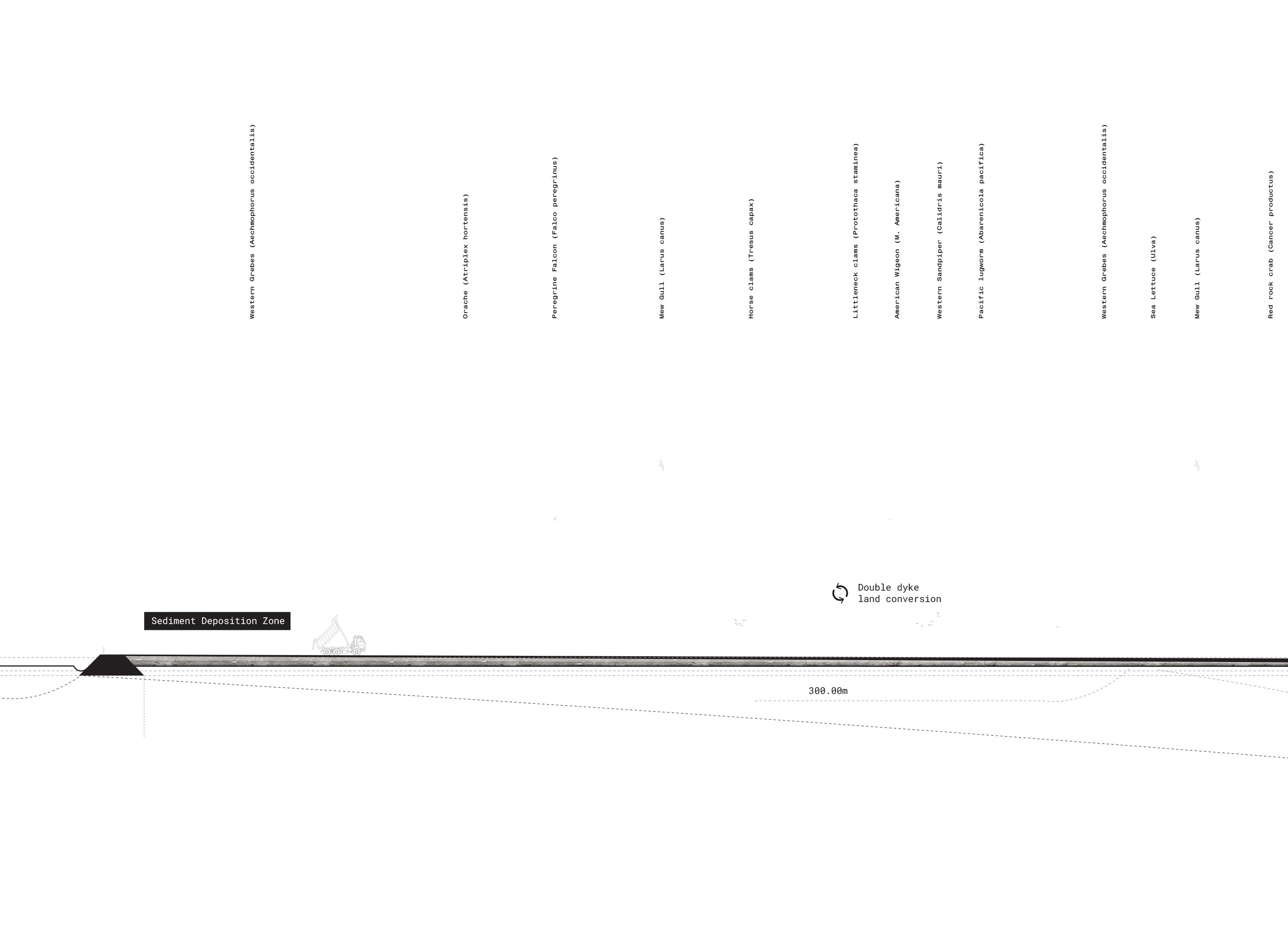
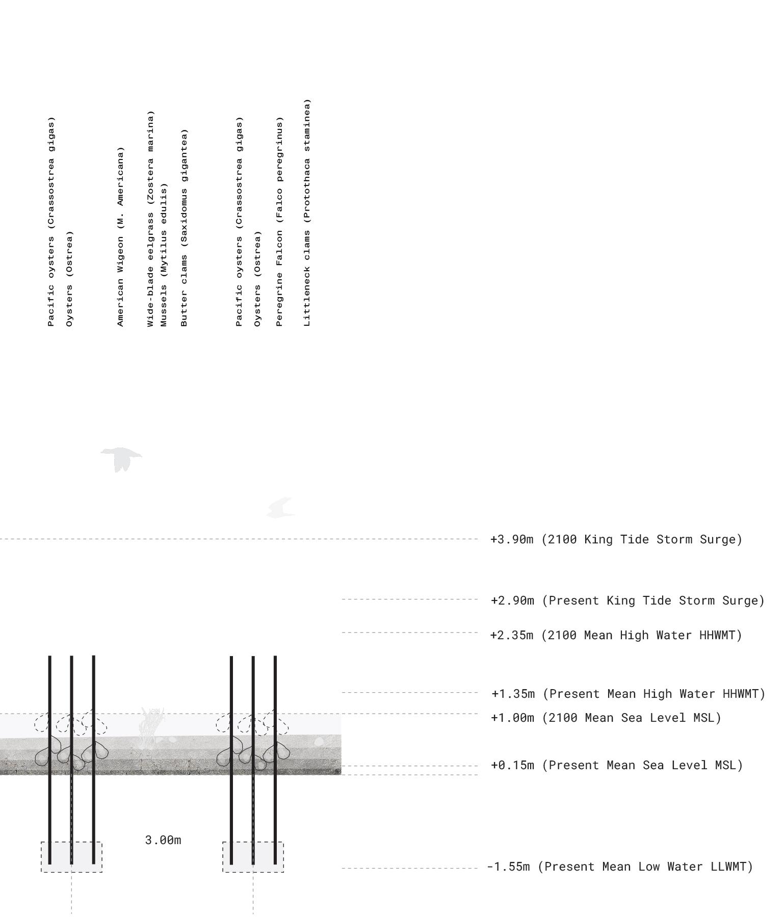
This is achieved by (01) plac ing silt and sand sediment locally (02) building shoreline sediment growing elements that are used for shellfish farming (03) introducing double dykes to grow the existing marsh and accumulate sediment and (04) grow offshore oyster reefs to reduce wave action and guide sedi ment additions to facilitate fur ther growth of the system.
110 Mudflats Concept
Immediate Action
A. Sediment Placement
Placement of silt and sand mate rial in small quantities, placed locally at -2m aimed at expanding marsh zone and growing mudflats
B. Shoreline Growth
Initial shellfish aquaculture es tablished aimed at protecting and growing coast with sediment accu mulating elements
C. Double Dykes
Make initial pilot projects for double dykes, aimed at expanding marsh zone and growing mudflat
D. Shoreline Protection
Initial natural oyster reefs to be established aimed at creating a natural buffer for wave action.
112
Mudflats Strategy Phase I:
Initial Growth
A. Sediment Placement
Placement of silt and sand mate rial in small quantities, placed locally at -2m aimed at expanding marsh zone and growing mudflats
B. Shoreline Growth
Continue shellfish aquaculture establishment aimed at protecting and growing coast with sediment accumulating elements
C. Double Dykes
Continue pilot projects for dou ble dykes, aimed at expanding marsh zone and growing mudflat
D. Shoreline Protection
Natural oyster reefs to be estab lished, aimed at creating a natu ral buffer for wave action.
113
Mudflats Strategy Phase II:
Mudflats Strategy Phase III: Intermediate Growth
A. Sediment Placement
Placement of silt and sand mate rial in larger quantities, placed locally at -2m aimed at expanding marsh zone and growing mudflats
B. Shoreline Growth
Continue shellfish aquaculture establishment aimed at protecting and growing coast with sediment accumulating elements
C. Double Dykes
Complete pilot projects for dou ble dykes, aimed at expanding marsh zone and growing mudflat
D. Shoreline Protection
Natural oyster reefs to grow, aimed at creating a natural buf fer for wave action.
114
Mature
A. Sediment Placement
Placement of silt and sand mate rial in maintenance quantities, placed locally at -2m.
B. Shoreline Growth
Shellfish aquaculture continues to persist, aimed at protecting and growing coast with sediment accumulating elements
D. Shoreline Protection
Natural oyster reefs continue to grow, aimed at creating a natural buffer for wave action.
115
Mudflats Strategy Phase IV:
Growth
A number of challenges of this site are addressed through creating a double dyke structure, that de velops through time. This is achieved by removing the existing dyke, and placing a new one behind it. Here, sediment can be easily placed (which is oth erwise difficult to do in this landscape), effec tively building the landscape in height. The impact of this is the development of a much more robust freshwater lens to address saltwater intrusion, and a marsh buffer to better filter agricultural pollu tion runoff before it enters the ocean.
116 Mudflats Details
117
A series of new agricultural opportunities are explored and tested through time. A proposal for shellfish and oyster farming is shown here, where wooden poles are used to both accumulate sediment, to attenuate waves, and to farm with. The form lan guage of these elements connect directly to the linear agricultural lands surrounding the bay. New cultural practices of farming are made through this.

118 Mudflats Details Sedimentation Periods Phase 1 Phase 2 Phase 3 Phase 4
119
To make a direct connection between the proposed oyster farms, the final elements proposed for this site are a series of oyster reefs. They begin by building rocky substrate surfaces. Oyster reefs have an incredible capacity to grow, and outpace projections of SLR. Moreover, they facilitate the growth of ecology, and create opportunities for foraging of shellfish - a critical practice of sur rounding first nations bands in this area. The re sult is an element that can attenuate wave action, accumulate sediment, and create new natural and cultural growth.

120 Mudflats Details Sedimentation Periods Phase 1 Phase 2 Phase 3 Phase 4
121
122
123


Oyster FarmsOyster ReefsDouble DykePrimary Dyke Sediment Additions Ring = 10y N 1:30,000 Sedimentation Periods Phase 1 Phase 2 Phase 3 Phase 4
132
133
the
Al, Stefan, and Edgar Westerhof. Adapting Cities to Sea Level Rise: Green and Gray Strategies. Island Press, 2019.
Armstrong, John. “Vancouver Geology.” 1990.
Attard, Maureen E., et al. “Suspended Sediment Trans port in Fraser River at Mission, British Columbia: New Observations and Comparison to Historical Records.” Ca nadian Water Resources Journal / Revue Canadienne Des Ressources Hydriques, vol. 39, no. 3, 2014, pp. 356–371., https://doi.org/10.1080/07011784.2014.942105.
Barrie, J. Vaughn. “Recent Geological Evolution and Human Impact: Fraser Delta, Canada.” Geological So ciety, London, Special Publications, vol. 175, no. 1, 2000, pp. 281–292., https://doi.org/10.1144/gsl. sp.2000.175.01.20.
Barrie, J., and R. Currie. “Human Impact on the Sed imentary Regime of the Fraser River Delta, Canada.” 2000.
Belzen, Jimvan. “Double Dikes as Robust Flood Defense Landscapes for a Prosperous Southwest Delta.” 2021.
Berger, Alan M., et al. “Theorizing the Resilience Dis trict: Design-Based Decision Making for Coastal Climate Change Adaptation.” Journal of Landscape Architecture, vol. 15, no. 1, 2020, pp. 6–17., https://doi.org/10.108 0/18626033.2020.1792648.
Boyle, C. A. “Changes in Land Cover and Subsequent Ef fects on Lower Fraser Basin Ecosystems from 1827 to 1990.” Environmental Management, vol. 21, no. 2, 1997, pp. 185–196., https://doi.org/10.1007/s002679900017.
Breslow, Sara. “Farmers’ Perceptions of Salmon Habitat Restoration Measures: Loss and Contestation.” 2001.
British Columbia Ministry of Environment. Indicators of Climate Change for British Columbia. 2016.
Butler, Robert. “Status and Distribution of Marine Birds and Mammals in the Fraser River Estuary, British Columbia.” 2017.
Church, Michael, and J.M. Ryder. “Physiography of Brit ish Columbia.” 2007.
Church, Michael, and Wendy Hales. “The Tidal Marshes of Fraser Delta.” 2007.
Church, Michael. “Estimation of Annual Gravel Influx to the Gravel-Bed Reach of Fraser River.” 2001.
Church, Michael. Fraser River: Managing the Gravel Reach Gravel Mining Is Not the Solution, 2012.
Church, Michael. “Gravel Extraction Inventory for Lower Fraser River (Mission to Hope) - 1964 to 1998.” 1999.
Church, M. (2002). Potential Changes in Relative Sea Level and Implications for Sustainability in the Fraser River Delta, in The Changing Face of the Lower Fraser River Estuary, Symposium Proceedings, pg. 34-39.
134
Works Cited A selection of works cited throughout
project
City of Vancouver. “Coastal Adaptation Plan: Fraser River Foreshore.” 2018.
City of Vancouver. “Flood Plain Standards and Require ments.” 2015.
City of Vancouver. “Vancouver’s Changing Shoreline: Preparing for Sea Level Rise.” 2018.
“Climate Change 2021—the Physical Science Basis.” Chem istry International, vol. 43, no. 4, 2021, pp. 22–23., https://doi.org/10.1515/ci-2021-0407.
Dashtgard, Shahin E., et al. “Sedimentation across the Tidal–Fluvial Transition in the Lower Fraser River, Canada.” The Sedimentary Record, vol. 10, no. 4, 2012, pp. 4–9., https://doi.org/10.2110/sedred.2012.4.4.
Forseth, Patrick. “Adaptation to Sea Level Rise in Met ro Vancouver: A Review of Literature for Historical Sea Level Flooding and Projected Sea Level Rise in Metro Vancouver.” 2012.
FREMP. “Dredge Management Guidelines .” 2005.
Groulx , B.J. Fraser River Delta, British Columbia: Is sues of an Urban Estuary. 2004.
Hales, Wendy. “The Impact of Human Activity on Deltaic Sedimentation, Marshes of the Fraser River Delta, Brit ish Columbia.” 1992.
Ham, Darren Gary. “Morphodynamics and Sediment Trans port in a Wandering Gravel-Bed Channel : Fraser Riv er, British Columbia.” Open Collections, Universi ty of British Columbia, 1 Jan. 1970, https://open. library.ubc.ca/cIRcle/collections/ubctheses/831/ items/1.0092264.
Hussain, Mohammed S., et al. “Management of Seawater Intrusion in Coastal Aquifers: A Review.” Water, vol. 11, no. 12, 2019, p. 2467., https://doi.org/10.3390/ w11122467.
James, T S, et al. “Relative Sea-Level Projections in Canada and the Adjacent Mainland United States.” 2014, https://doi.org/10.4095/295574.
Kirwan, Matthew L., and A. Brad Murray. “Ecological and Morphological Response of Brackish Tidal Marshland to the next Century of Sea Level Rise: Westham Is land, British Columbia.” Global and Planetary Change, vol. 60, no. 3-4, 2008, pp. 471–486., https://doi. org/10.1016/j.gloplacha.2007.05.005.
Kostaschuk, R. A., et al. “Bedforms, Bed Material, and Bedload Transport in a Salt-Wedge Estuary: Fraser Riv er, British Columbia.” Canadian Journal of Earth Sci ences, vol. 26, no. 7, 1989, pp. 1440–1452., https:// doi.org/10.1139/e89-122.
Kremen, C., and A. M. Merenlender. “Landscapes That Work for Biodiversity and People.” Science, vol. 362, no. 6412, 2018, https://doi.org/10.1126/science. aau6020.
Lemmen, D.S., Warren, F.J., James, T.S. and Mercer Clarke, C.S.L. editors (2016): Canada’s Marine Coasts in a Changing Climate; Government of Canada, Ottawa, ON, 274p.
135
Lievesley, Megan, et al. “Marsh and Riparian Habi tat Compensation in the Fraser River Estuary: A Guide for Managers and Practitioners.” 2017, https://doi. org/10.31230/osf.io/v4kbf.
Lokman, Kees. “The Port of Vancouver: Navigating an Un certain Future.” 2017.
Marijnissen, Richard J.C., et al. “Flood Risk Reduction by Parallel Flood Defences – Case-Study of a Coastal Multifunctional Flood Protection Zone.” Coastal En gineering, vol. 167, 2021, p. 103903., https://doi. org/10.1016/j.coastaleng.2021.103903.
Marijnissen, Richard. “Marsh Recession and Erosion Study of the Fraser Delta, B.C., Canada from Historic Satellite Imagery.” 2017.
Marriott, Andrew. Clean, Resilient Flood Technology Op tions in Canada. 2020.
Matthews, Major J.S. Early Vancouver. 1931.
McDonald, John. “Sturgeon Bank Marsh Recession: A Pre liminary Investigation into the Use of Large Woody Debris as a Tool for Restoring a Degraded Foreshore Marsh.” 2014.
McLean, David G., and Michael Church. “Sediment Trans port along Lower Fraser River: 2. Estimates Based on the Long-Term Gravel Budget.” Water Resources Research, vol. 35, no. 8, 1999, pp. 2549–2559., https://doi. org/10.1029/1999wr900102.
Meidinger, Del. “Sensitive Ecosystem Inventory for Met ro Vancouver & Abbotsford.” 2012.
Ministry of Forests, Lands and Natural Resource Oper ations. “Cost of Adaptation - Sea Dikes & Alternative Strategies .” 2012.
Ministry of Forests, Lands and Natural Resource Opera tions. “Lower Mainland Dike Assessment.” 2015.
Musqueam First Nation. “Musqueam: Giving Information about Our Teachings.” 2022.
NHC Report. “Strugeon Bank Enchancement Pilot Project Conceptual Plan.” 2020.
Nordenson, Seavitt Catherine, et al. Structures of Coastal Resilience. Island Press, 2018.
Penning-Rowsell, Edmund. “Floating Architecture in the Landscape: Climate Change Adaptation Ideas, Opportuni ties and Challenges.” Landscape Research, vol. 45, no. 4, 2019, pp. 395–411., https://doi.org/10.1080/01426397 .2019.1694881.
Reid, Michael G., et al. “Indigenous Climate Change Ad aptation Planning Using a Values-Focused Approach: A Case Study with the Gitga’at Nation.” Journal of Ethno biology, vol. 34, no. 3, 2014, pp. 401–424., https:// doi.org/10.2993/0278-0771-34.3.401.
Salish Sea Wiki. “Delta Sediment Dynamics and Vegeta tion.” 2021.
136
SNC-Lavalin. “Design Basis for the Living Dike Con cept.” 2018.
Thonon, Ivo. “The Fraser River Debris Trap A Cost Bene fit Analysis.” 2006.
Torrenta, Remi. “2021 Report Fraser River Estuary IBA EBird Survey.” 2021.
Van Loon-Steensma, Jantsje M, and Pier Vellinga. “Trade-Offs between Biodiversity and Flood Protec tion Services of Coastal Salt Marshes.” Current Opin ion in Environmental Sustainability, vol. 5, no. 3-4, 2013, pp. 320–326., https://doi.org/10.1016/j.cos ust.2013.07.007.
Wlodzimierz, Joseph. “Sustainable Dredging Program on the Lower Fraser River.” 1993.
Zepke, Stephen. “Eco-Aesthetics: Beyond Structure in the Work of Robert Smithson, Gilles Deleuze and Félix Guattari.” 2008.
Zhang, Yuan, et al. “Integration of Agriculture and Wildlife Ecosystem Services: A Case Study of Westham Island, British Columbia, Canada.” Agricultural Scienc es, vol. 08, no. 05, 2017, pp. 409–425., https://doi. org/10.4236/as.2017.85031.
137

138
This project would not have been possible with out the many groups and people that supported me along the way.
Special thanks:
Roel Wolters (Mentor)
Hannah Schubert (Committee member)
Remco van der Togt (Committee member)
Hanneke Kijne: Head Landscape Architecture, Academy of Architecture
Kees Lokman: Assistant Professor of Landscape Architecture, University of British Columbia
Grant Fahlgren: Chair CSLA Reconciliation Advisory Committee
Angela Danyluk: Senior Sustainability Specialist, City of Vancouver Fraser Basin Council
Eric Balke: Coordinator, South Coast Conservation Land Management Program (SCCLMP)
Jorrit Noordhuizen: Landscape Architect – Partner, NOHNIK
Jonas Papenborg: Landscape Architect, Flux landscape architecture
Jorne van de Water: Landscape Designer, NOHNIK
UNIT4 Collective
Graham Allen
Anne-Roos Demilt
Funded by:
Stichting NHBos
Amsterdamse Hogeschool voor de Kunsten Internationaliseringsfonds
139
COASTAL ACCRETION
Growing a new cultural landscape through resilience, aesthetics and time to address coastal sea level rise in Metro Vancouver, Canada
