1
INDICE
Vista Feria Fluvial de Valdivia
CIRCUITO 1 CIRCUITO 2 CIRCUITO 3 CIRCUITO 4 CIRCUITO 5 CIRCUITO 6
Amigos y Amigas:
PÁG 4 PÁG 6 PÁG 8 PÁG 10 PÁG 12 PÁG 14
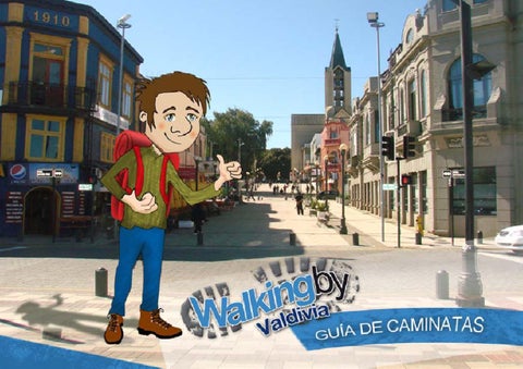
Walking by © Todos los derechos reservados.
Registro Propiedad Industrial, inscripción Nº 193889. Diseño: Juan Carlos Barría Fotografías: www.walkingby.cl Editor: www.walkingby.cl Traducciones: Karim Rahemtulla. Año: 2012 Contacto: www.walkingby.cl contacto@walkingby.cl Cel. 97464850 - Valdivia - Chile
Bienvenidos a Santa María la Blanca de Valdivia, la Perla del Sur por excelencia, fundada un 9 de febrero de 1552 por don Pedrode Valdivia, a orillas de un “Río de Plata” llamado Ainilebu, acutal Río Valdivia. La ciudad de Los Ríos, capital de la región del mismo nombre, les invita a recorrer sus distintos rincones pintorescos, plenos de naturaleza indómita, una mezcla cultural palpable en cada punto de la ciudad, vestigios de españoles, holandeses y alemanes, más toda el encanto del sur y su gente. Le invitamos a navegar sus ríos Calle-Calle, donde la luna se baña cada noche, Río Valdivia, Río Cau-Cau, Río Cruces y el hermoso Santuario de la Naturaleza Carlos Andwanter, Río Cutipay, Río Tornagaleones, Río Naguilán, Río Angachilla, entre otros esteros y humedales que adornan nuestra comuna. Descubra la magia de la Selva Valdiviana, el encanto del mar y sus productos fresco para disfrutar, recorra paso a paso los senderos naturales, rurales y urbanos que engalanan la Perla del Sur. Una invitación a caminar, disminuir la huella de carbono y dejar huella de vida Walking by
CIRCUITO 1
Plaza de la República - Catedral - Edificio Intendencia - Calle Pérez Rosales - Casa Von Stillfried - Iglesia San Francisco - Calle Yerbas Buenas - Torreón de los Canelos
1 Plaza de la República:
Antigua Plaza Mayor, hasta 1820, año en que Lord Thomas Cochrane cambió su denominación por PLAZA DE LA REPÚBLICA DE CHILE. Engalanada por una glorieta central, y hermosos árboles de Tilos plantados 1910 posterior al gran incendio de Diciembre de 1909 que destruyó casi toda la ciudad. Es el corazón de Valdivia, punto de reunión para la ciudadanía local, lugar de expresión artística de los ciudadanos.
Iglesia Catedral de Valdivia:
Se trata de una iglesia en cruz latina, una nave principal, flanqueada por intercolumnios que dividen las Antigua Iglesia Mayor del dulce nombre María la Blanca de Valdivia, posteriormente cambió de nombre a Iglesia Mayor para a finales del siglo XIX pasar a tomar el nombre de Iglesia Catedral. Con el Terremoto del 22 de mayo de 1960 fue destruida casi por completo, hacia el año 1987 se comenzó su reconstrucción hacia el actual edificio de 800 m2 que se emplaza frente al corazón de la ciudad.
Edificio Intendencia:
Restaurado el año 2008 y alberga desde Agosto 2009 a la Intendencia y Gobierno Regional de Los Ríos. A su Costado derecho se encuentra el edificio de Correos de Chile. Esta construcción data de principios del siglo XX.
Calle Pérez Rosales:
66
Antiguamente denominada calle de las tablas, debido al material que la recubría, como todas las calles de la ciudad, gruesos tablones, los que a mediados de los 80 fueron hallados bajo el actual asfalto. Se le nombró Vicente Pérez Rosales, a partir de 1930, en honor a este escritor nacional que dedicó la mayoría de sus obras a la ciudad de Valdivia y se caracteriza por encontrarse en la cuadra cercana a la Plaza, la chocolatería Entrelagos
Casa Von Stillfried:
Antigua casa de estilo alemán ubicada en el Nº 787 de calle Pérez Rosales esquina Yerbas buenas. Perteneció a la familia Von Stillfriend y data de mediados de 1800. Actualmente alberga un café tradicional llamado Última Frontera y al Centro de Producción Cinematográfica de Valdivia.
Calle Hierbas Buenas
Antigua calle de la ciudad que aún se mantiene cubierta por bellos adoquines que datan de fines del siglo XIX. Su nombre lo lleva en homenaje a la Batalla de Yerbas Buenas, en pleno periodo de la Independencia de Chile, hacia el año 1813.
Iglesia San Francisco:
Fundado en 1560 bajo la advocación de Nuestra Señora de los Remedios. En 1599 fue destruido junto a la ciudad por los indígenas. Una vez expulsados los jesuitas del País, los Franciscanos reconstruyeron la Iglesia (1768) cerrando la calle de las Tablas y dando origen a la calle San Francisco (hoy Pérez Rosales). Fue edificada nuevamente en 1864, iglesia y convento de madera, pero fueron destruidos por el incendio del 28 de diciembre de 192. Dos años más tarde se puso la primera piedra de la actual iglesia, cuenta con bellos vitrales.
Torreón de Los Canelos:
En 1774 se mandaron a edificar dos torreones, para resguardar los dos únicos accesos que había en aquella época para ingresar a la ciudad. En su construcción se emplearon ladrillos de la fábrica real de ladrillo y teja, ubicada en algún lugar de la actual Isla Teja. Un sistema de murallas de defensa remataba junto al torreón en una amplia reja tipo rastrillo y puente levadizo.
7
CIRCUITO 2
Calle General Lagos – Fuerte Santísima Trinidad – Casa Luis Oyarzún –Ex Edificio del diario “Correo de Valdivia” – Casa Burkin - Casa Kaehni – Centro Cultural “Austral” – Submarino O’Brien
9 Calle General Lagos:
13 Casa Burkin:
10 Fuente Santísima Trinidad:
14 Casa Kaehni:
11 Casa Luis Oyarzún:
15 Centro Cultural Austral :
Denominada con este nombre después de 1881. Antes se llamó Calle Los Canelos, aludiendo a la abundancia de esta especie en sus inmediaciones. Lleva su nombre en honor al General Pedro Lagos (1832 - 1884), cuya mayor gloria es la “Toma del Morro de Arica”, el 7 de junio de 1880, durante la Guerra del Pacífico. Es una calle destacada por la gran cantidad de casas de estilo alemán, y que además datan de 1850 aproximadamente. Fue principalmente en esta zona de la ciudad donde la gran mayoría de los inmigrantes germanos arribados a Valdivia optaron por ubicar sus residencias. Destruida la ciudad en 1599 producto de un alzamiento indígena, los españoles decidieron levantar una fortificación (1602), con el propósito de volver a reedificar la ciudad. El fuerte resistió sólo hasta 1804, fecha en que su reducida guarnición fue rescatada por un navío. Abandonada la ciudad y el fuerte por los españoles, aparecieron en escena los holandeses (1643), quienes se fortificaron en este mismo lugar. Sólo dos meses duró su empresa, la cual abandonaron ante la actitud hostil de los indígenas. Los últimos antecedentes que existen sobre esta fortificación es que en 1647 fue destinada como cuartel para el batallón militar de Pardos. (Antigua casa Hoffmann Deppe) En la esquina de Yerbas Buenas se yergue el imponente volumen de esta mansión neoclásica, cuyos interiores son un modelo en cuanto a terminaciones en madera. Provienen ellos de las reformas efectuadas en 1928, a cargo de la firma Rodolfo Auras Lanok, autora en Santiago de las terminaciones del Club de la Unión, Banco Central, Hotel Carrera, etc., sobresalientes en los detalles, puertas cielos y escaleras. Actualmente es la Casa de extensión de la UACH.
12 Ex Edificio diario “El Correo de Valdivia:
88
Antiguo edificio que albergó a uno de los más destacados periódicos de Valdivia. Fundado por don David Osorio Cuellar, su primer ejemplar salió a la venta el viernes 15 de febrero de 1895. Por razones de índole económica dejó de circular en el mes de julio de 1982, con el número 31.568. En esta casa nació el padre del periodismo nacional Fray Camilo Henriquez.
Al frente, en Yungay # 744, encontramos esta casa amarilla y café con cuatro columnas de madera; se trata de la antigua casa Burkin. El frontis está recubierto de latón pintado, tiene dos altillos, uno a cada lado del techo dándole al edificio una cierta simetría a no ser por la puerta principal que está a la izquierda de los ventanales del porche de entrada.
A un costado del Centro Cultural en Yungay # 735 la antigua casa Kaehni. Muchos de estos antiguos edificios han sido transformados en restaurantes, hoteles, instituciones, etc. y así han podido salvarse del abandono y deterioro. Sobrevivió el terremoto de 1960 además de incendios y ataques de termitas.
Casa Martens Hoffmann. No se sabe su fecha de construcción con exactitud, pero existen fotografías de 1800 que delatan ya su presencia en la ciudad. Sus propietarios mantuvieron la destilería de alcohol, fábrica de cecinas, conservas, tocino, agencia de vapores, transportes fluviales y ramos agropecuarios pertenecientes a su suegro, el señor Alberto Thater.
16 Museo Submarino O’Brien:
De clase “Oberon, “ fue construido en 1971 por solicitud de la Armada de Chile en los Astilleros Scott’s Shipbuilders Engineering Co. Ltd., Greenock, Escocia. Fue botado al agua por primera vez el 22 de diciembre de 1972, zarpando hacia Chile cuatro años más tarde, hasta donde llegó el 10 de agosto de 1976 a la ciudad de Punta Arenas. El 31 de diciembre de 2001 fue dado de baja, después de 25 años de servicio surcando silenciosamente las aguas. Actualmente es el Museo Submarino de la Ciudad de Valdivia, bajo la administración de la Municipalidad.
9
CIRCUITO 3
Muelle Schuster – Péndulo de Foucault – Costanera de la Ciencia – Paseo Libertad – Feria Fluvial – Mercado Municipal – Plaza Hendrick Brouwer – Plaza Chile
17 Muelle Schuster:
Punto de partida para las embarcaciones de turismo que surcan las aguas de los diversos ríos de la Comuna, principalmente motonaves cuyo destino es la Bahía de Corral, donde se visitan las fortificaciones españolas. Su nombre se debe su ubicación cercana al antiguo Hotel Schuster (actual edificio del Centro de Estudios Científicos del Sur CEC’s)
18 Péndulo de Foucault:
Lleva el nombre de su creador, León Foucault, es considerado el primer experimento de demostración del movimiento de rotación de la tierra. Tiene una longitud de 13 metros con un período de oscilación de 7 segundos. Posee un sistema de recuperación que devuelve la energía que se pierde por el roce con el aire, con un mecanismo compuesto por 4 sensores ópticos de movimiento, un circuito electrónico de control, un electroimán y un imán, sin este mecanismo, el péndulo dejaría de oscilar en un par de horas. En su base se observa una rosa de los vientos con los puntos cardinales y una graduación que permite medir el desplazamiento del plano de oscilación.
19 Paseo Libertad:
Antiguamente llamada Calle de los abastos, por la cual el Almirante Thomas Lord Cochrane subió un 7 de febrero de 1820, después de apoderarse de las fortificaciones de la Bahía de Corral, para tomar posesión de la Ciudad de Valdivia en su Plaza mayor. En honor a este hecho, se le cambió su nombre por calle Libertad y desde hace unos pocos años Paseo Peatonal Libertad. El Paseo Libertad es en la actualidad, uno de los atractivos turísticos más recorridos por los visitantes, por ser uno de los accesos más hermosos a la avenida costanera.
20 Costanera de la Ciencia:
10 10
Tramo de la costanera de la ciudad, remodelada por el Centro de Estudios Científicos del Sur (CEC’s) con el fin de embellecer la ciudad, descataca el Péndulo de Foucault, y un mapa de Chile (Arica al Polo Sur) a escala dibujado en el suelo, culminando en el Proscenio del Paseo Libertad, antigua “Plaza de los Abastos”. Lugar donde descargaban las embarcaciones que abastecían de provisiones a la ciudad.
21 Feria Fluvial:
Frente al Mercado Municipal, el eterno ícono elegido por pintores, fotógrafos y artistas en general. Uno de los lugares más típicos de la ciudad, punto de venta tradicional de frutas, verduras y principalmente pescados y mariscos de la zona. Se pueden fotografiar desde aquí los museos del otro lado del Río y los Lobos Marinos que cuentan con plataformas sobre el río donde pueden descansar.
22 Mercado Municipal:
Su arquitecto fue José Betti y data del año 1911. Cuenta con tres niveles, donde se ofrece a los visitantes: venta de artesanía, comestibles, flores, pescados y mariscos, y, en su tercer nivel, diversos restaurantes con comidas típicas de la zona, especialmente con productos del mar. Detrás de él se encuentra, por calle Yungay, el Mercado Persa.
23 Plaza Hendrick Brouwer:
Plaza en honor a este destacado militar Holandés. Fue el principal impulsor del plan de ocupación de Valdivia para su país. Comandó a expedición de cinco naves que partió en noviembre de 1642 rumbo a Valdivia. Engalanada por diversas esculturas de artistas locales.
24 Plaza Chile:
Pequeña plaza ubicada junto al Puente Pedro de Valdivia, la cual se extiende bajo éste, para continuar en su otra banda bajo la denominación Plaza Hendrick Brouwer. A su costado se encuentra el edificio consistorial de la ciudad, de color Blanco, que en su tercer piso ofrece exposiciones de arte.
11
CIRCUITO 4
Plaza Pedro de Valdivia – Puente Pedro de Valdivia – Río Valdivia – Parque Prochelle – Costanera Cultural – Museo Arte Contemporáneo – Museo Mauricio Van de Maele – Museo Philippi
25 Plaza Pedro de Valdivia:
En honor al fundador de la ciudad, cuenta con dos piletas de agua que engalanan más esta área verde de la ciudad. En el centro de una de las piletas se encuentra un busto a don Pedro de Valdivia.
26 Puente Pedro de Valdivia:
Creado en 1994, bajo la administración de la Universidad Austral de Chile, se ubica en el recinto de la Ex-Cervecería Anwandter, la que tras el gigantesco incendio de 1912, que destruye gran parte de sus instalaciones, fue vendida a la C.C.U. en 1916. Siguió en funcionamiento hasta Mayo de 1960, año en que el Terremoto destruyó gran parte de su infraestructura, Dos años más tarde los terrenos de la Cervecería son donados por la empresa a la Universidad Austral de Chile. Actualmente es un centro de exhibiciones culturales en la ciudad.
Junto al puente Calle-Calle, es hito inconfundible del aspecto urbano. Fue construido hacia el año 1954 por el ingeniero Weibbe. Une el centro de la ciudad con la Isla Teja, donde en 1766 por orden del Rey de España se instaló la Fábrica Real de Ladrillos.
27 Río Valdivia:
En el año 1544, Juan Bautista Pastene lo bautizó con su actual nombre, y en sus riberas, un 9 de Febrero de 1552, don Pedro de Valdivia fundó Santa María la Blanca de Valdivia, actualmente Valdivia. Hacia 1599, en una sublevación indígena, la ciudad fue destruida, y solo salvaron a través del río, tres embarcaciones con muy pocos sobrevivientes. En 1643 fue remontado por la Escuadra de Elías Horokmans que conquistó Valdivia para Holanda y en 1645, Antonio Toledo la restauró para España. En 1820 subió por él triunfante Lord Cochrane y a partir del año 1850, los colonos alemanes
28 Parque Prochelle:
Hermoso jardín cultivado por don Gustavo Prochelle, originalmente fue parte del jardín de la casa Prochelle el cual se vió separado del resto de los terrenos con la construcción del Puente Pedro de Valdivia. Actualmente es un pequeño parque a cargo de la Municipalidad de Valdivia.
12 12
29 Costanera Cultural:
Plataforma que permite vivenciar el borde rio más reconocible de la ciudad de Valdivia, reconstituye la línea que poseía la antigua Cervecería Andwanter con su margen ribereña y que en parte de lo que hoy son sus ruinas cobija al Museo de Arte Contemporáneo (MAC). Es un espacio público de recorrido peatonal y de exposiciones culturales, recreación, contemplación y de eventos cívicos, reforzando y revitalizando el vínculo histórico entre la ciudad y el cauce que le dio origen.
30 Museo de Arte Contemporáneo:
31 Museo Mauricio Van de Maele:
Museo Mauricio Van de Maele: El año 1981, el actual Museo Maurice Van de Maele, albergado en la Casa Anwandter fue declarado Museo Histórico Nacional. Construida en la década de 1860 por Don Carl Anwandter, pionero de la colonización alemana en Valdivia, con el propósito de servir de habitación a su familia y la posterior instalación en el terreno continuo de la primera cervecería nacional. Sus diversas y valiosas colecciones permiten conocer la historia de la sociedad regional y nacional.
32 Museo Philippi:
En honor a Rudolph Philippi, se encuentra albergado en la casa Schuller, que data de 1914, instalada desde el año 2006 a un costado de la Casa Anwandter. El proyecto arquitectónico de recuperación de esta casa patrimonial de Valdivia fue liderado por los arquitectos R.P. Gabriel Guarda O.S.B. y Sofía Sanfuentes. Es el museo de la “Exploración”, cuenta con valiosas colecciones patrimoniales en formato educativo, resaltando la importancia de los naturalistas en el surgimiento de la ciencia en nuestro país.
13
CIRCUITO 5
Av. Eduardo Morales Miranda – Universidad Austral de Chile – Jardín Botánico – Casas Prochelle – Av. Arturo Prat – Monolito Rotary Club – Ancla – Río Calle-Calle
33 Eduardo Morales Miranda:
Principal acceso al campus Isla Teja de la Universidad Austral de Chile. Se extiende una hermosa alameda engalanada con álamos europeos plantados hacia el año 1954. Su nombre es en honor al fundador y primer rector de la Universidad Austral de Chile, Dr. Eduardo Morales Miranda, médico cirujano de profesión, fue parte también de la legendaria “Sociedad de Amigos del Arte” de Valdivia
34 Universidad Austral de Chile:
Principal casa de estudios superiores de la ciudad de Valdivia, creada el 7 de septiembre de 1954, bajo el Decreto Supremo N°3.757. Pertenece a la “Red Universitaria Cruz del Sur”, “Agrupación de Universidades Regionales de Chile” y al “Consejo de Rectores de las Universidades Chilenas”, Acreditada hasta el año 2015, en sus áreas de Gestión institucional, Docencia de Pre y Post grado, Investigación y Vinculación con el medio, conformando así un selecto grupo de universidades complejas que tienen esta categoría. Cuenta con 50 carreras de pre grado y 43 de post grado, 22 programas de magister y 10 doctorados, 5 campus de estudios; Isla Teja y Miraflores en Valdivia, Campo clínico en Osorno, Pelluco en Puerto Montt y Trapananda en Coyhaique.
35 Jardín Botánico:
Creado el año 1957, cuenta con 10 hectáreas de terreno con una rica variedad de especies arbóneras, tanto nativas como exóticas, distribuidas de manera tal que se representan los diversos bosques de nuestro planeta. Ubicada en el corazón del campus Isla Teja de la Universidad Austral de Chile, colinda con los ríos Valdivia y Cau Cau, cuenta con diversos senderos para el paseo libre de los estudiantes y visitantes de la Universidad. Actualmente se encuentra protegido por un Comité de Manejo Sustentable, creado el año 2003.
36 Casas Prochelle:
14 14
A un costado del Puente, la primera Casa Prochelle, data de 1902 y fue declarada Monumento Histórico por D.L. Nº918 del 28 de noviembre de 1985. Construidas por don Gustavo Prochelle, casas de gran calidad, con postería de mayor calidad, envigados de espiga, sin clavos. La Segunda casa actualmente alberga al Consejo Regional de Los Ríos.
37 Av. Arturo Prat:
Conocida tradicionalmente como avenida Costanera, fue reconstruida y prolongada en el año 1964, extendiéndose desde calle San Carlos, donde antiguamente estaba el servicio de Aduanas de Valdivia, hasta el Cementerio Alemán. Su antigua denominación era Avenida Colón. Se encuentra adornada en toda su extensión con hermosos jardines y ha pasado a ser uno de los centros de restaurantes más importantes de la ciudad.
38 Monolito Rotary Club:
A la altura del Nº300 de la costanera Arturo Prat, en forma de libro abierto, existe un monolito con la siguiente leyenda: “Río Calle-Calle, con el nombre de Río San Pedro nace del Lago Riñihue, vaciando las aguas de los lagos Panguipulli, Calafquén, Pirehueico y Lácar. Toma el nombre de Calle-Calle al este de Antilhue. En este lugar recibe las aguas del Cau-Cau y continúa al mar con el nombre de Río Valdivia”. Rotary Club Valdivia, 1980.
39 Ancla
Ancla original cuya leyenda dice: “Homenaje a los navegantes del mundo” Hermandad de la Costa, 1974. Frente a ella, en el sector de Las Animas, se logra divisar los Astilleros Navales ASENAV.
40 Rio Calle Calle
Tiene su origen en el Lago Riñihue, el cual se alimenta de las aguas de los Lagos Lácar (Argentino), Pirehueico, Neltume, Pellaifa, Pullinque, Calafquén y Panguipulli. El Riñihue, luego de recibir las aguas de estos 7 lagos, desagua al Río denominado San Pedro, el cual a poco andar cambia de nombre a su denominción Calle-Calle, nombre con el cual llega a la ciudad de Valdivia, donde, al unirse con las aguas del Río Cau-Cau, junto a la Isla Teja, pasa a denominarse Río Valdivia, con cuyo nombre llega a desembocar al mar en la Bahía de Corral
15
CIRCUITO 6
Mirador del Remo - Puente Calle-Calle - Calle Carlos Condell – Torreón del Barro – Escuela México - Av. Ramón Picarte – Bandejón de Palmeras - Plaza Simón Bolivar –Coliseo Municipal
41 Mirador del Remo:
Construido en el año 2004, con el fin de testimoniar la vocación remera de la ciudad de Valdivia. Avance urbano en la costanera Valdiviana, en homenaje al deporte hito de Valdivia. Se cuentan con 3 clubes de remo: Arturo Prat, Centenario y Fenix, los que se distinguen por el color de las aletas de sus remos: blanco, rojo y azul respectivamente.
42 Puente Calle – Calle:
Sus obras comenzaron hacia 1940 y finalizadas en 1945, entrada norte de la ciudad, une el sector de Las Animas con la ciudad. Reparado con aportes de Estados Unidos luego de ser dañado por el Terremoto de 1960. Hacia 1996 fue remodelado y se amplió a dos pistas. Su nombre, en honor al río que cruza y que se denomina Calle Calle a raíz de una flor de color blanco que crecía en sus bordes y cuyo nombre científico es Libertia Oxipoides.
43 Torreón del Barro:
Construido en 1774, al igual que el de “Los Canelos”, por el Gobernador Joaquín de Espinoza y Dávalos, como punto de vigilancia en el camino del Barro, único acceso a la ciudad por el Este. Contaba con una dotación de 4 soldados y 1 cabo, usaban para su defensa un pequeño mortero. Posteriormente ambos torreones se integraron a la gran línea de defensa que permitía transformar a la ciudad en una verdadera isla. En 1785 sirvió de prisión al Coronel Tomás de Figueroa.
44 Escuela México:
16 16
Su arquitecto fue don Hugo Ferreira, se edificó luego del sismo de 1960, gracias al aporte del gobierno mexicano. Junto a su entrada, una placa de bronce recuerda el hecho. En su interior un busto de Gabriela Mistral, premio nobel de literatura, obra realizada en 1964 por S. Tapia Radich del taller Antonio Corsí.
45 Avenida Ramón Picarte:
Su antigua denominación era “Calle del Barro”, en 1832 se cambió su denominación en memoria de don Ramón Picarte y Castro, Gobernador de Valdivia desde 1823 y su Primer Intendente entre los años 1826 y 1828. Principal vía de la ciudad y la más importante arteria comercial. Nace en la Plaza de la República.
46 Bandejón central con Palmeras:
Plantadas por el arquitecto municipal don Luis Zorzi, bajo la dirección del Alcalde don Ricardo Barahona (1932-1933). Denominación científica Phoenix Canariense, conocida comúnmente como “Palma de Canarias”, árbol ornamental excepcionalmente resistente al frío y resulta particularmente interesante que con esta especie se haya formado aquí una de las avenidas de palmeras más australes de Chile.
47 Plaza Simón Bolivar:
Ocupa los terrenos que fueron parte de la mansión Harnecker Frick (1870), la que fue rodeada por sus propietarios de un hermoso jardín con especies nativas y exóticas. Entre estas últimas, destaca un alcornoque, árbol del cual se obtiene el corcho y que aún puede verse en una esquina de la plaza protegido por una reja. Existe además un busto del libertador de América Simón Bolivar, donado por el Gobierno de Venezuela en 1939.
48 Coliseo Municipal “Antonio Azurmendi”:
Su construcción se inició en 1962, oportunidad en que el Intendente don Germán Saelzer Balde, depositó en uno de los fundamentos del gimnasio, un pergamino con un mensaje para las futuras generaciones. Fue inaugurado el año 1966 con el Campeonato Mundial de Básquetbol, tiene una capacidad para más de 5 mil personas. Por su gran capacidad, suele utilizarse para eventos o festividades de carácter cultural y artístico.
17
INDEX TOUR 1 TOUR 2 TOUR 3 TOUR 4 TOUR 5 TOUR 6
Dear Friends:
PAG 18 PAG 20 PAG 22 PAG 24 PAG 26 PAG 28
Walking by ©, All rights reserved, prohibited its total or partial reproduction Inscription N° 193889 Design: Juan Carlos Barria Photographies: Walking by Publisher: walking by English Translation: Karim Rahemtulla Year: 2012 Contact: www.walkingby.cl contacto@walkingby.cl Cel. 97464850 Valdivia - Chile
Welcome to Santa María la Blanca de Valdivia, the Southeast Pearl by excellence, founded on February 9th 1552 by Mr. Pedro de Valdivia, along a “Silver’s River” called Ainilebu, actually Valdivia’s River. The River’s city, capital of the region of the same name, invites you to explore its various picturesque spots, full of untamed nature, a cultural mix palpable at every point of town, vestiges of Spanish, Dutch and German immigrants, plus all the southern charm and its people. Please browse rivers Calle-Calle, which bathes the moon every night, Valdivia’s river, Cau-Cau’s River, Cruces’ river and the beautiful Carlos Andwanter Nature Sanctuary , Cutipay’s river, Tornagaleones’s river, Naguilán’s river, Angachilla’s river, including estuaries and wetlands that adorn our commune. Discover the magic of the Valdivian Rainforest, and enjoy the charm of the sea and the fresh products, Step through nature trails, rural and urban that adorn the Pearl of the South. An invitation to walk, reduce carbon footprint and a trace of life Walking by
TOUR 1 1
Republic Square - Cathedral – Quartermaster Building - Perez Rosales Street - Von Stillfried House - San Francisco Church - Yerbas Buenas Street – The Canelos’ Tower.
Republic Square:
Old Town Square, until 1820, when Lord Thomas Cochrane renamed it as THE REPUBLIC OF CHILE’S SQUARE. A central gazebo adorned with beautiful Tilos trees planted in 1910, after the great fire of December 1909 that destroyed most of the city. It is the heart of Valdivia, a meeting place for local citizens, rather than an artistic expression of citizens.
Valdivia’s Cathedral Church: The church that the Former Mayor named María la Blanca de Valdivia, later renamed the main church for the late nineteenth century and to later to take the name Cathedral Church. After the earthquake on May 22nd, 1960, it was almost completely destroyed and by the year 1987 it began its reconstruction to the present building of 800 m2. It is located opposite the heart of the city.
Von Stillfried’s House:
Former German’ style house located in No. 787 of Perez Rosales street just in the corner of Yerbas Buenas’ street. Belonged to the Von Stillfriend’s family and dates from the middle of 1800. Currently houses a traditional coffee called Last Frontier and the Film Production Centre of Valdivia.
Yerbas Buenas’ Street: :
Old street of the city that is still covered by beautiful cobblestones dating from the late nineteenth century. Takes its name in honor of the Battle of Yerbas Buenas, in the period of independence of Chile, circa 1813.
San Francisco’s Church:
Quartermaster Building:
Refurbished in 2008, it has housed the Administration and Regional Government of Los Ríos since 2009. On the right side is the Post office building. This building dates from the early twentieth century.
Pérez Rosales street:
20 20
Formerly known street of tables, due to the overlying material, as all city streets, thick planks, which in the mid-80s were found under the existing asphalt. It was named Vicente Perez Rosales, from 1930, in honor of this national writer who gave most of his works to the city of Valdivia and features of which can be found in the block near the square, the Entrelagos’ chocolate store.
Founded in 1560 under the order of Our Lady of Remedies. In 1599 it was destroyed, along with the city, by the aborigines. Once the country expelled the Jesuits, Franciscans rebuilt the Church (1768) on the Tables’ street which gave rise to San Francisco’ Street (now Perez Rosales). It was built back in 1864, a wooden church and convent, but was destroyed by a fire on December 28th 1928. Two years later became the foundation of the present church and has beautiful stained glass windows.
The Canelos’ Tower:
In 1774 by order of Ambrosio O’higgins, were sent to build two towers, to guard the only two hits he had at that time to enter the city. It is constructed using real brick and tile, from somewhere in the current Isla Teja. A system of defensive walls overlooked by the tower. It also has a wide portcullis and drawbridge.
21
TOUR 2
General Lagos’ Street - Holy Trinity Fort- Luis Oyarzun’s House Ex Building newspaper “Correo de Valdivia” - Burking’s House – Kaheni’s House – “Austral” Cultural Center - O’Brien Submarine
9 General Lagos’ Street:
So named after 1881. Before it was called Los Canelos’ street, referring to the abundance of this species in the vicinity. It is named in honor of General Pedro Lagos (1832 - 1884), whose ultimate goal was the “Take the Morro of Arica” on June 7, 1880, during the Pacific War. It is a street leading to the large number of German-style houses, and also dating from about 1850. It was mainly in this area of the city where the vast majority of German immigrants to Valdivia chose to locate their residences.
10 Holy Trinity Fort:
The City was Destroyed in 1599 as a result of an indigenous uprising. The Spanish decided to build a fort (1602), when they returned to rebuild the city. The fort stood only until 1804, when its little garrison was rescued by a ship. Abandoned by the Spanish, the Dutch appeared on the scene (1643), and fortified themselves in the same place. This only lasted two months before being abandoned as a result of the hostile attitude of the Indians. The recent history of this fort is that in 1647 was intended as a barracks for military Pardos’ battalion.
11 Luis Oyarzun’s House (Hoffmann Deppe old house)
On the corner of Yerbas Buenas’ street stands this imposing neoclassical mansion, whose interiors are a model in terms of wood finishes. They come from the reforms in 1928, by signing Rodolfo Lanok Auras, author in Santiago of the Union Club’s ending, Central Bank, Carrera’s Hotel, etc., Outstanding details, doors and stairs skies. Currently the extension UACH House.
12 Building Former newspaper “El Correo de Valdivia”:
22 22
Old building that housed one of the leading newspapers of Valdivia. Founded by Mr. David Osorio Cuellar, its first issue was released on Friday 15 February 1895. For economic reasons it stopped circulating in the month of July 1982, with issue number 31568. It’s also the birth place of the father of national journalism, Fray Camilo Henriquez.
13 Burkin’s House:
Leading in Yungay # 744, we find this house with four yellow and brown wooden columns, it is the former home of Burkin. The front is covered with painted tin, has two mezzanines, one on each side of the roof giving the building a certain symmetry. The front door is to the left of the entrance porch windows.
14 Kaehni’s House:
Next to the “Austral” Cultural Center in Yungay # 735 is the Kaehni old house. Many of these old buildings have been transformed into restaurants, hotels, institutions, etc., and have thus been saved from neglect and deterioration. It survived the 1960 earthquake, fires and also termite infestations.
15 Austral Cultural Center:
Martens Hoffmann’s house. No one knows the exact date of construction, but there are tell-tale photographs of 1800 and its presence in the city. The owners kept the alcohol distillery, sausage factory, canned bacon fumes agency, inland waterways and agricultural branches all those belonging to his father, Mr. Alberto Thater.
16 O’Brien Submarine Museum:
class “Oberon,” was built in 1971 at the request of the Chilean Navy in Scott’s Shipbuilders Shipyards Engineering Co. Ltd., Greenock, Scotland. She was launched into the water for the first time on December 22, 1972, sailing to Chile four years later. On the August 10, 1976 it reached the city of Punta Arenas. On December 31, 2001 it was decommissioned after 25 years of service silently plying the waters. Today it is the Submarine Museum of Valdivia City, under the administration of the Municipality.
23
TOUR 3
Schuster Dock- Foucault’s Pendulum - Coastal Science – Liberty’s Walk – Fluvial Fair - Municipal Market - Hendrick Brouwer’ square- Chile’ square
17 Schuster Dock:
This is the starting point for the tourist boats that ply the waters of different rivers of the County. They are mainly motorboats which go to Corral’s bay, where you can visit the Spanish fortifications. It is named its because its location near the former Schuster’s Hotel(Current building Scientific Studies Center South CEC’s).
18 Foucault Pendulum:
It is named in honor of its creator, Leon Foucault, and is considered the first experiment to show rotation of the earth. It has a length of 13 meters with an oscillation period of 7 seconds. It has a recovery system which returns the energy lost by friction with the air, with a mechanism comprising four optical motion sensors, an electronic control circuit, an electromagnet and a magnet. Without this mechanism the pendulum would stop oscillating in a couple of hours. At its base there is a compass with the cardinal points and a ranking that measures the displacement of the plane of oscillation.
19 Science’s coastal:
Section of the coastal city, remodeled by the Center for Scientific Studies of the South (CECs) in order to beautify the city, it’s highlight is the Foucault Pendulum, and a scale map of Chile (from Arica to the South Pole) drawn on the ground, culminating in the proscenium of the Liberty’s Walk, former “Abastos Square”. It was a place of unloading for the vessels that supplied provisions to the city.
20 Liberty’s Walk:
24 24
Formerly called Street of the supplies. It’s where the Admiral Lord Thomas Cochrane arrived in February 7, 1820, after seizing the forts of Corral Bay, to take possession of the city of Valdivia in the Mayor square. In honor of this fact, it changed its name to Liberty Street and then, Liberty’s Walk . It is currently one of the top tourist attraction sites for visitors, and offers one of the most beautiful accesses to the coastal avenue.
21 Fluvial Fair:
in Front of the Municipal Market, the eternal icon chosen by painters, photographers and artists in general. One of the most typical places of the city, traditional point of sale of fruits, vegetables and seafood mainly in the area. From here you can go to museums across the river and watch sea lions that have platforms on the river where they can rest.
22 Municipal Market:
Its architect was Joseph Betti and dates from 1911. It has three levels, which is offered to visitors: selling crafts, food, flowers, fish and seafood, and, third level, different restaurants with typical food of the area, especially seafood. Behind it lies Yungay Street and the Persian Market.
23 Hendrick Brouwer’ Square:
in honor of this remarkable Dutch military officer. He was the main force behind the occupation drive of Valdivia for his country. He commanded an expedition of five ships that departed in November 1642 towards Valdivia. It is also adorned with various sculptures of local artists.
24 Chile’ Square:
Small square located next to Pedro de Valdivia’s Bridge, which extends under it, to continue in its other band under the name of Hendrick Brouwer’ Square. On its side is the town hall of the city, a white building, offering at exhibitions on the third floor.
25
TOUR 4
Pedro de Valdivia’s square- Pedro de Valdivia Bridge - Rio Valdivia - Prochelle Park - Cultural Coast - Contemporary Art Museum - Museum Van de Maele Mauritius - Philippi Museum
25 Pedro de Valdivia’ Square:
In honor of the founder of the city, it has two water fountains that adorn this city. In the center of one of the pools is a bust of Mr. Pedro de Valdivia.
26 Pedro de Valdivia’s Bridge:
Along the Calle-Calle’ Bridge, is unmistakable landmark. It was built around 1954 by the engineer Weibbe. It connects the city center with the Teja Island, where, in 1766 by order of the King of Spain, a real brick factory was built.
27 Valdivia’s River:
In 1544, Juan Bautista Pastene christened it with its current name, and on its banks, a February 9th, 1552, Pedro de Valdivia founded Santa María la Blanca of Valdivia, Valdivia currently. By 1599, during an Indian uprising, the city was destroyed, and only three boats escaped across the river, with very few survivors. In 1643 the squadron was led by Elias Valdivia Horokmans who conquered Holland and in 1645, restored it to Antonio Toledo Spain.
28 Prochelle Park:
Beautiful garden cultivated by Mr. Gustavo Prochelle, it was originally part of the garden of the house which was separated from the rest of the land with the Pedro de Valdivia Bridge. Now it’s a small park by the Municipality of Valdivia.
26 26
29 Cultural Coast
Platform for experiencing the most recognizable river edge of the city of Valdivia, reconstitutes the line that had the old Andwanter Brewery with riparian margin in part of what today are the ruins shelters the Museum of Contemporary Art (MAC). It is a public space and pedestrian route of cultural exhibitions, recreation, contemplation and civic events, strengthening and revitalizing the historic link between the city and the channel that gave it birth.
30 Museum of Contemporary Art:
Created in 1994, under the administration of the Universidad Austral de Chile, it is located on the campus of the former Anwandter Brewery, which was mostly destroyed after the huge fire of 1912. It was sold to the CCU in 1916 and kept running until May 1960, when the earthquake destroyed much of its infrastructure. Two years later the brewery grounds were donated by the company at the Universidad Austral de Chile. It is now a cultural exhibition center in the city.
31 Mauricio Museum Van de Maele:
In 1981, the current Maurice Van de Maele Museum, housed in the Anwandter’s House was declared a National Historic Museum. Built in the 1861 by Mr. Carl Anwandter, a pioneer of German colonization in Valdivia, with the purpose of serving as the family residence and subsequent continuous field installation of the first national brewery. Its diverse and valuable collections provide insight into the history of the regional and national society.
32 Philippi Museum:
In honor of Rudolph Philippi, it is housed in the house Schuller, dating from 1914, it has been on the side of the Anwandter’s house since 2006. The architectural design of this home THIS MAKES NO SENSE equity recovery of Valdivia was led by architects RP Gabriel Guarda O.S.B. and Sofia Sanfuentes. It is the museum of the “Exploration” and includes valuable heritage collections educational format, highlighting the importance of naturalists in the rise of science in our country.
27
TOUR 5
Eduardo Morales Miranda Avenue- Universidad Austral de Chile - Botanical Gardens - Prochelle Houses - Arturo Prat Avenue- Monolith Rotary Club - Anchor - Calle-Calle’s River
33 Eduardo Morales Miranda Av.:
It is the principalcampus access to the Austral University of Chile from Teja Island. It extends along a beautiful alley adorned with European poplars planted in 1954. Its name is in honor of the founder and first rector of the Universidad Austral de Chile, Dr. Eduardo Morales Miranda, a surgeon by profession, who was also part of the legendary “Society of Friends of Art” of Valdivia.
34 Austral University of Chile:
Created on September 7, 1954, under Supreme Decree No. 3757. It belongs to the “Southern Cross University Network”, “Regional Universities Association of Chile” and “Council of Rectors of Chilean Universities” Accredited through 2015, their areas of expertise include Institutional Management, Teaching undergraduate and graduate Research and connectedness, thus forming a select group of universities that have this complex category. It has 50 undergraduate and 43 graduate programs, 22 master’s programs and 10 doctoral degrees, five campuses of study; Isla Teja and Miraflores in Valdivia, Osorno clinical field, Pelluco Trapananda Puerto Montt and Coyhaique.
35 Botanical Gardens:
Created in 1957, has 10 acres of land with a rich variety of trees’ species, both native and exotic distributed so as to represent the diverse forests of our planet. Located in the heart of Teja’ island campus of the Austral University of Chile, Valdivia bordering rivers and Cau Cau, it has several trails for the free use by students and visitors to the University. Currently protected by a Sustainable Management Committee, created in 2003.
36 Prochelle’s Houses:
Next to the bridge, the first Prochelle House dates from 1902 and was declared a historical monument by DL No. 918 of 28 November 1985. Built by Mr. Gustavo Prochelle, high-quality homes, with higher quality Posteria, beamed from ear, without nails. The second house now houses the Regional Council Rivers.
28 28
37 Arturo Prat Avenue:
Traditionally known as Riverside Avenue, was rebuilt and extended in 1964, extending from San Carlos Street, which was historically the Customs Service Valdivia, to the German Cemetery. Its former name was Columbus Avenue. It is decorated in its entirety with beautiful gardens and has become one of the most important areas in town, filled with restaurants.
38 Monolith Rotary Club:
At the height of No. 300 of the Arturo Prat avenue, in the form of open book, there is a monolith with the caption: “Calle Calle river, born with the name of San Pedro river in the Riñihue lake, emptying water of lakes Panguipulli Calafquén Pirehueico and Láca. It takes the name of Calle Calle east of Antilhue. at this place receives the waters of Cau-Cau and continues to sea under the name of Valdivia River. “Rotary Club Valdivia, 1980
39 Anchor:
Original Anchor whose caption reads: “Tribute to the sailors in the world” Brethren of the Coast, 1974. Opposite, in the Las Animas is achieved shipyards ASENAV spot.
40 Calle Calle’s River: It originates Riñihue Lake, which is fed by the waters of Lake Lácar (Argentine), Pirehueico, Neltume Pellaifa, Pullinque, Calafquén and Panguipulli. The Riñihue, after receiving the waters of these seven lakes, drains into the San Pedro River, which before long was renamed Calle Calle, a name which comes to the city of Valdivia, where, by combining with the waters of Cau-Cau, next to the Isla Teja, it is renamed Valdivia River, which then comes into the wide sea in the Bay of Corral 29
TOUR 6
Mirador del Remo - Calle-Calle Bridge - Calle Carlos Condell - Tower of Barro - School Mexico - Avenida Ramón Picarte - floe of Palms - Plaza Simon Bolivar-Municipal Coliseum
41 Mirador del Remo:
Built in 2004, in order to witness the vocation shirt of Valdivia. Urban encroachment in the coastal Valdivian milestone in homage to the sport of Valdivia. They have three rowing clubs: Arturo Prat, Centennial and Phoenix, which are distinguished by the color of their oars fins: white, red and blue respectively.
Its old name was “Clay Street” in 1832 was renamed in memory of Mr. Ramon Picarte and Castro, Governor of Valdivia since 1823 and its first mayor from 1826 to 1828. It is the main route of the city and the most important commercial artery.
42 Calle-Calle’s Bridge:
: Its works began around 1940 and ended in 1945. It is the northern entrance to the city, joining the Las Animas with the city. It was repaired with contributions from the United States after being damaged by the 1960 earthquake. By 1996 it was remodeled and expanded to two tracks. Its name, in honor of the river crossing and called Calle Calle. A white flower grows along its edges, whose scientific name is Libertia Oxipoides.
46 Central floe Palmeras:
43 Del Barro’s Tower:
47 Simon Bolivar Square:
Built in 1774, like that of “The Cinnamon” by Governor Joaquin de Espinoza and Davalos, monitoring point on the path of Barro, only access to the city from the east. It had a crew of four soldiers and one out, used to defend a small mortar. Subsequently both towers joined the great line of defense that allowed the city transform into a real island. In 1785 he was imprisoned by Colonel Thomas Figueroa.
44 Mexico School:
30 30
45 Ramon Picarte Av:
Its architect was Mr. Hugo Ferreira, was built after the earthquake of 1960, thanks to support from the Mexican government. Next to the entrance, a bronze plaque recalls this fact. Inside a bust of Gabriela Mistral, winner of the Nobel Prize for Literature. The restoration was done in 1964 by S. Radich Tapia Antonio Corsi workshop.
Planted by the municipal architect Luis Zorzi, under the leadership of Mayor Ricardo Barahona (1932-1933). Phoenix Scientific name Canariense, commonly known as “Palma de Canarias” exceptionally ornamental hardy and it is particularly interesting that this species has formed an avenue of palms in southernmost Chile.
It occupies the land that was part of the Frick mansion Harnecker (1870), which was surrounded by the owners of a beautiful garden with native and exotic species. Among the latter, stands an oak tree which yields the WHAT??cork and can still be seen in a corner of the square protected by a fence. There is also a bust of the liberator Simon Bolivar America, donated by the Government of Venezuela in 1939.
48 Municipal Coliseum “Antonio Azurmendi”:
Its construction began in 1962, when Mayor Don Germán Saelzer Balde, deposited in one of the foundations of the gym, a scroll with a message for future generations. It was inaugurated in 1966 with the World Basketball Championship and has a capacity of over 5000 people. Its large capacity allows it to be used often for events or cultural festivals and artistic.
31