INDICE
Circuito 1 Circuito 2 Circuito 3 Circuito 4 Circuito 5 Corral Mancera
Pág. 4 Pág. 6 Pág. 8 Pág. 10 Pág. 12 Pág. 14 Pág. 15
Walking by, todos los derechos reservados. Prohibida su reproducción total o parcial. Fotografías: Walking by Recopilación antecedentes: walking by Editor: walking by Traducción Inglés: Elizabeth Fisher Diseño: Juan Carlos Barría contacto: www.walkingby.cl contacto@walkingby.cl Cel. 97464850 Año 2014 · Valdivia – Chile
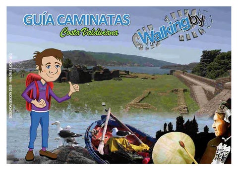
Estimados Visitantes: La Región de Los Ríos es una zona privilegiada por su geografía y belleza natural, engalanada por Bosques milenarios, Ríos y una Costa Valdiviana que invita a recorrer y descubrir una magia y encanto que sólo el sur de Chile puede brindar. La Cultura huilliche, la Gastronomía Marina, y la Selva Valdiviana se conjugan en esta zona de la Región, junto a la rica historia de la conquista Española, palpable en cada uno de los Castillos del Fin del Mundo. Descubra los senderos costeros que Walking By Niebla y Costa Valdiviana, ofrece para usted y familia, en cada rincón encontrará diversión, descanso y una variedad de servicios dispuestos para atender al visitante. Una invitación a caminar, disminuir la huella de carbono y dejar huella de vida. Walking By
CIRCUITO
1
Transbordador a Corral - Terminal Pesquero de Niebla - MuelleCostanera El Piojo - Calle del Castellano - Parque Vergara Dávila
1 TRANSBORDADOR A CORRAL Punto de partida de los transbordadores de vehículos y pasajeros hacia la Comuna puerto de Corral. Se realizan viajes regulares durante todo el día, los 365 días del año, saliendo desde este terminal en horas pares y desde Corral en horas impares.
2 TERMINAL PESQUERO DE NIEBLA Principal terminal de pescadores artesanales de la zona, bajo la administración de FIPASUR (Federación Interregional de Pescadores Artesanales del Sur) desde 1995. Punto de arribo de las diversas embarcaciones perqueras y naves menores con productos del mar. Cuenta con una planta de procesos de productos y un centro de venta directa y online de los mismos.
3 MUELLE Punto de partida y arribo de embarcaciones de pasajeros regulares desde y hacia Niebla, Isla del Rey, isla más grande la Región de Los Ríos, Isla de Mancera y Corral. Cuenta con servicios regulares durante todos los días desde las 07.30 hrs. hasta las 20 hrs.
4
GUIA DE CAMINATAS Costa
Valdiviana
Transbordador a Corral - Terminal Pesquero de Niebla - MuelleCostanera El Piojo - Calle del Castellano - Parque Vergara Dávila
CIRCUITO
1
4 COSTANERA EL PIOJO Bordeando el término del río Valdivia e inicio del mar, se emplaza junto a la playa del mismo nombre, una costanera peatonal que es utilizada por cientos de visitantes, no sólo para caminar, sino que también para practicar pesca de orilla. Desde aquí se obtiene una vista privilegiada de la Isla de Mancera y su fortificación San Pedro de Alcántara (1645).
5 CALLE DEL CASTELLANO Una de las principales avenidas de la localidad de Niebla, su nombre es en honor a los españoles que poblaron la localidad durante el periodo de conquista de Valdivia (Siglo XVII). Castellano se le denominaba al oficial militar a cargo del Castillo de Niebla.
6 PARQUE VERGARA DAVILA Donado por don José Vergara y doña Ana María Dávila al municipio de Valdivia hacia 1986. Parque con una vista privilegiada de la desembocadura del Río Valdivia en la Bahía de Corral y cuenta además con especies arbóreas nativas tales como arrayán, roble, helechos y plantas trepadoras, y otras especies exóticas introducidas.
GUIA DE CAMINATAS Costa
Valdiviana 5
CIRCUITO
2
Explanada Riecher - Caleta El Piojo - Playa Chica - Escuela Juan Boch Plaza Municipal de Niebla - Iglesia San Antonio de Niebla
7 EXPLANADA RIECHER Lleva su nombre en honor a don Amandus Riechers de Hamburgo, arribó a esta zona hacia 1917, quien construyó el primer hotel de la localidad de Niebla, actualmente es un estacio namiento rodeado por servicios de alojamiento y alimentación turística de la zona y principal acceso a la caleta el Piojo.
8 CALETA EL PIOJO Caleta de pescadores artesanales bajo la administración del Sindicato de Pescadores del balneario de Niebla desde hace 24 años, y que alberga además a 2 sindicatos de la localidad. Cuenta con una gran explanada que durante cada mes de Febrero es utilizada para el Encuentro Costumbrista de la Costa, donde se exponen artesanías, comidas típicas y un show de gran nivel artístico cultural. Cuenta con puestos de venta de mariscos, restaurant y embarcadero.
9 PLAYA CHICA Bajando por la calle Antonio Duccen a un costado de la explanada Riechers se accede a esta pequeña playa, una de las tres que existen en la localidad y la única autorizada para baños de sol y mar. Ubicación privilegiada durante el verano, pues se encuentra resguardada de fuertes vientos.
6
GUIA DE CAMINATAS Costa
Valdiviana
Explanada Riecher - Caleta El Piojo - Playa Chica - Escuela Juan Boch - Plaza Municipal de Niebla - Iglesia San Antonio De Niebla
CIRCUITO
2
10 ESCUELA JUAN BOCH Colegio básico perteneciente a la Ilustre Municipalidad de Valdivia, caracterizado por ser un colegio sustentable con diversos proyectos en esta línea, cuenta con una orquesta filarmónica y sus alumnos en conjunto a los profesores han logrado establecer un Museo Escolar Marino.
11 PLAZA MUNICIPAL DE NIEBLA Pequeña plazuela ubicada en el corazón de Niebla, justo en el acceso principal a la fortificación española. Punto de reunión para los jóvenes y niños de la localidad. Cuenta con especies arbóreas nativas y durante época estival es adornada con banderas nacionales.
12 IGLESIA SAN ANTONIO DE NIEBLA Pequeña parroquia, de arquitectura colonial, similar a las iglesias de Chiloé. Su estructura se basa en materiales nobles nativos como son las tejas y tejuelas de alerce. A su costado cuenta con un campanil que anuncia a diario las ceremonias que ahí se realizan.
GUIA DE CAMINATAS Costa
Valdiviana 7
CIRCUITO
3
Fuerte de La Pura y Limpia Concepción de Monfort de Lemus - Museo de Sitio - Batería Principal - Polvorin - Faro - Mirador Bahia de Corral
13 FUERTE DE LA PURA Y LIMPIA CONCEPCIÓN DE MONFORT DE LEMUS Data de 1671 en su construcción, siendo su principal arquitecto Juan Buitrón y Mujica. Declarado Monumento Nacional el 14 de Junio de 1950, es una de las 17 fortalezas construidas en la Bahía de Corral, con fines de proteger la Ciudad de Valdivia, hasta febrero de 1820, fecha en que Lord Thomas Cochrane tomó posesión de la Bahía de Corral para el Gobierno de Chile
14 MUSEO DE SITIO En el año 1992, se inicia una segunda reconstrucción del Castillo de Niebla, sobre las bases de lo que fue antiguamente la Casa del Castellano y cuarteles de soldados, se construye lo que actualmente es el Museo de Sitio de la fortificación. En sus 5 salas se presenta una exhibición didáctica e ilustrada de la historia de Valdivia, Niebla y toda la Bahía de Corral, además de una muestra arqueológica de restos encontrados durante los diversos procesos de reconstrucción del Castillo.
15 BATERIA PRINCIPAL Contaba con una guarnición de 200 soldados, con 18 cañones de bala calibre 24 y roja, esto quiere decir que la bala se calentaba en los hornos ubicados en la parte central de la batería previas a ser disparadas. En 1992, con la última restauración del Castillo, se repusieron 9 cañones para completar la batería como en su origen, por lo tanto, cañón por medio es original y copia respectivamente.
8
GUIA DE CAMINATAS Costa
Valdiviana
Fuerte de La Pura y Limpia Concepción de Monfort de Lemus - Museo de Sitio - Batería Principal - Polvorin - Faro - Mirador Bahia de Corral
CIRCUITO
3
16 POLVORIN Ubicado a un costado de la Batería principal, servía de refugio para la pólvora y balas que utilizaban los soldados de la fortificación. Su diseño y construcción también estuvo a cargo del primer arquitecto del Castillo, don Juan Buitrón y Mujica. Actualmente no puede ser visitado, sólo se puede observar desde la parte alta de la fortificación.
17 FARO MORRO NIEBLA Conocido también como Faro Niebla o Faro del Fuerte de Niebla, pertenece a la Red de Faros de Chile y su construcción data del año 1900, a cargo de los Ingenieros de la Armada de Chile. Tiene un alcance de 7 metros, con luz blanca y tiene fases de 1 destello cada 10 segundos, tiene una elevación de 50 m.s.n.m.
18
MIRADOR BAHIA DE CORRAL
A un costado del Faro de Niebla, una pequeña explanada con bancos, para disfrutar el paisaje se obtiene una vista privilegiada de toda la Bahía de Corral, desde la punta de Morro Gonzalo, donde existió una batería vigía, pasando por Chorocamayo, San Carlos, Amargos, Corral, La Aguada y la Ensenada de San Juan.
GUIA DE CAMINATAS Costa
Valdiviana 9
CIRCUITO
4
Calle del Castillo - Playa Grande - Calle del Molino - Muestra Costumbrista de la Costa - Mirador - Playa de Los Enamorados
19 CALLE DEL CASTILLO Inicia a un costado de la Plaza de Niebla y se extiende hasta una de las bajadas a la playa grande de Niebla, una de las vías principales de la localidad que concentra el comercio del sector. Su nombre deriva de la fortificación española que se encuentra al inicio de la misma.
20 PLAYA GRANDE Con una extensión de casi 2 kilómetros, se encuentra la playa grande de la localidad de Niebla, punto de encuentro veraniego para los visitantes locales y turistas. Autorizada para tomar solo baños de sol. Sus arenas son de color oscuro del tipo piedra volcánica.
21 CALLE DEL MOLINO Nace en la primera bajada a la Playa Grande de Niebla y termina en el cruce con la ruta principal de la costa hacia el sector de Los Molinos. Su nombre se deriva de la ruta que llevaba hacia la batería del Molino, otra de las fortificaciones construidas por los españoles durante el Siglo XVII.
10
GUIA DE CAMINATAS Costa
Valdiviana
Calle del Castillo - Playa Grande - Calle del Molino - Muestra Costumbrista de la Costa - Mirador - Playa de Los Enamorados
CIRCUITO
4
22 MUESTRA COSTUMBRISTA DE LA COSTA Junto a la ruta que conecta a toda la costa valdiviana, se encuentra desde 1986, la Muestra Costumbrista de la Costa, que reúne a 62 empresarios del rubro gastronómico de toda la costa valdiviana. Cuenta con un escenario para eventos musicales desde el año 1989. Funciona durante todo el año, en particular los fines de semana y durante toda la temporada estival.
23 MIRADOR Una pequeña explanada con capacidad para estacionar no más de 4 vehículos, se ubica un mirador de la Playa los Enamorados y Playa Los Molinos, con una vista privilegiada también de esta zona de la costa Valdiviana. Se puede distinguir el bello paisaje marino, junto a parte de la pluriselva valdiviana costera.
24 PLAYA DE LOS ENAMORADOS Pequeña playa escondida, la historias cuentan que fue bautizada con este nombre por los pobladores, debido a su difícil acceso, servía de refugio escondido para muchas parejas de enamorados que la visitaban durante el verano.
GUIA DE CAMINATAS Costa
Valdiviana 11
CIRCUITO
5
Los Molinos - San Ignacio - Playa Rosada - Misiones - Calfuco - Curiñanco
25 LOS MOLINOS Balneario autorizado para baños de sol y mar, cuenta con una costanera con protección para las altas mareas. Destaca en esta localidad, la Caleta de Pescadores de Los Molinos, ubicada allí desde hace más de 20 años, convirtiéndose en una de las caletas y puntos de venta de pescados y mariscos más visitada por residentes y turistas.
26 SAN IGNACIO Hermosa playa con una extensión de 1 kilómetro y medio, se encuentra autorizada solamente para baños de sol, cuenta con diversos sitios autorizados de camping y bajada para los visitantes del día. Cuenta con una pequeña caleta de recolectores de orilla que puede ser visitada.
27 PLAYA ROSADA Pequeña playa no autorizada para baños de mar, sino que sólo de sol, cuenta con una bella caída de aguas dulces, formando además una pequeña poza que sirve para que niños puedan degustar durante la época estival, de baños seguros.
12
GUIA DE CAMINATAS Costa
Valdiviana
Los Molinos - San Ignacio - Playa Rosada - Misiones - Calfuco - Curiñanco
CIRCUITO
5
28 MISIONES Con una extensión de casi 1 kilómetro podemos encontrar esta hermosa playa de arenas color plomo, con fácil acceso desde la ruta principal, no está autorizada para baños de mar, sólo baños de sol.
29 CALFUCO Con una extensión de 1,5 kilómetros, encontramos este rincón un poco escondido desde la ruta costera, que está engalanada en una de sus puntas acantiladas por el Laboratorio de Investigaciones marinas Calfuco, perteneciente a la Facultad de Ciencias de la Universidad Austral de Chile.
30 CURIÑANCO Hermosa y extensa playa , con 4 kilómetros de extensión, encontramos esta maravilla de la naturaleza, no apta para baños de mar, sin embargo, un punto de encuentro magnífico para los pescadores deportivos de orilla de mar, los que llegan a formar parte del paisaje tradicional de esta bella costa valdiviana.
GUIA DE CAMINATAS Costa
Valdiviana 13
CORRAL:
CASTILLO SAN SEBASTIAN DE LA CRUZ
La comuna puerto de Corral, antigua Cullamó, se ubica a 15 km. De la ciudad capital de la Región de Los Ríos, es uno de los puertos más antiguos de nuestro país y el más protegido para el resguardo de embarcaciones. Esta comuna alberga el Parque Nacional Alerce Costero y Reserva Costera Valdiviana, para acceder a ellas se debe bordear toda su bella geografía costera, pasando por las localidades de Amargo, San Carlos, Huape, llegando finalmente a la localidad de Chaihuin, que ofrece a los visitantes no sólo estas áreas silvestres protegidas, sino que también el placer de disfrutar de bellas arenas en forma de dunas engalanadas por los cuernos de Chaihuín, formas rocosas en el mar que se suelen confundir con el avistamiento de cetáceos en ciertas épocas del año.
14
GUIA DE CAMINATAS Costa
Valdiviana
Su construcción se inició el año 1645, bajo las órdenes del ingeniero irlandés Juan Garland, se utilizó piedra cancagua y mampostería en ladrillo. Está compuesta por tres sectores: Batería la Argolla, que fue edificada en 1764, que se une al Castillo San Sebastián (1765) mediante la Batería la Cortina, que data del año 1767 en su construcción. Contaba con una dotación de 21 cañones, los que dejaron de funcionar, luego de la Toma de la Bahía de Corral en manos de Thomas Lord Cochrane, una madrugada del 4 de Febrero de 1820, quién atacó la fortificación por tierra, dejando sin opción al regimiento Cantaurias que ocupaba dichas instalaciones. Cada verano se realiza una reanimación histórica que rememora estos hechos que devolvieron a nuestro país estas tierras del sur de Chile.
ISLA DE MANCERA Pequeña isla ubicada en el centro de la Bahía de Corral, en la desembocadura de los Ríos Valdivia y Tornagaleones. Su antigua denominación era Guiguacabín, y fue bautizada como Mancera el 6 de febrero de 1645, por los conquistadores, en honor al Marqués de Mancera, Pedro Toledo y Leiva, quien decidió construir en esta isla y poblarla. Tiene una extensión de 1.300 metros de norte a noreste y 650 metros de ancho, con un pequeño cerro de 89 msnm.
FUERTE SAN PEDRO DE ALCANTARA Fundado en 1645, contaba con una Plaza de Armas, con almacenes, caja real, sala de armas y palacio del Gobernador, hacia 1764 se construyó el depósito de pólvora que no tuvo los resultados esperados, al estar ubicado en un subterráneo se filtraba de agua, por lo que finalmente terminó siendo considerado foso carcelario para los esclavos que colaboraban en la construcción de las fortificaciones de la Bahía de Corral. En 1774 se levanta la Iglesia y convento de San Antonio, con una hermosa arquitectura barroca. Todas estas construcciones fueron destruidas finalmente por el terremoto y maremoto del 22 de mayo de 1960.
GUIA DE CAMINATAS Costa
Valdiviana 15
INDEX
Tour 1 Tour 2 Tour 3 Tour 4 Tour 5 Corral Mancera
Pág. 4 Pág. 6 Pág. 8 Pág. 10 Pág. 12 Pág. 14 Pág. 15
Walking by, All right reserved Prohibited its total or partial reproduction Photographies: Walking by Summery of precedents: Walking by Publisher: Walking by English Translation: Elizabeth Fisher Design: Juan Carlos Barría Contact: www.walkingby.cl contacto@walkingby.cl Cel. 97464850 Year 2014 · Valdivia - Chile
Dear Visitors: The Rivers Region is a privileged area for its geography and natural beauty, adorned by ancient forests, rivers and a Valdivian Coast that invites you to discover a magic and a charm that only southern Chile can provide it. Huilliche Culture, Seafood Gastronomy , and the Valdivian Rainforest combine in this area of the region, along with the rich history of the Spanish conquest, palpable in each of the Castles of the End of the World. Discover the coastal trails that Walking By Niebla and Valdivian Coast offers for you and family, in every corner you will find fun, relaxation and a variety of services ready for visitors. This is an invitation to walk, reduce carbon footprint and leave a trace of life. Walking By
TOUR
1
FERRY TO CORRAL - NIEBLA'S FISHING TERMINAL - DOCK - EL PIOJO COSTANERA - CASTILIAN STREET - VERGARA DĂ VILA PARK
1 FERRY TO CORRAL The starting point for cars and passengers, this ferry provides transportation to the Port of Corral Commune. Regular trips are made around the clock, 365 days a year, departing from this terminal on even hours and from the Corral terminal on odd hours.
2 NIEBLA'S FISHING TERMINAL The main terminal for fishermen from the area, this point of arrival for small vessels and purse seiner fishing boats with seafood has been under the administration of FIPASUR (Southern Federation of Interregional Fishermen ) since 1995. The terminal has a product processing plant and provides a direct shopping center, as well as online sales.
3 DOCK The point of departure and arrival of regular passenger boats to and from the Isla del Rey (King Island), the largest island in the Region, as well as the Isla Mancera and Corral, this dock has regular services every day from 07.30 hrs to 20 hrs.
18
GUIA DE CAMINATAS Costa
Valdiviana
FERRY TO CORRAL - NIEBLA'S FISHING TERMINAL - DOCK - EL PIOJO COSTANERA - CASTILIAN STREET - VERGARA DÁVILA PARK
TOUR
1
4 EL PIOJO COSTANERA Bordering the end of the Valdivia River and the beginning of the sea, the “Piojo Coastline” is located near the beach of the same name, a pedestrian walkway that is used by hundreds of visitors, not only for walking, but also for fishing from shore. From here you can enjoy a great view of Mancera Island and its fort San Pedro de Alcantara (1645).
5 CASTILIAN STREET One of the main avenues of the town of Niebla, its name is in honor of the Spanish people who settled the area during the conquest of Valdivia (Seventeenth Century). Castilian was named for the military officer in charge of the Fortress of Niebla during that time period.
6 VERGARA DÁVILA'S PARK Donated to Valdivia's Town Hall in 1986 by Jose Vergara and his wife Mrs. Ana Maria Davila, this park contains many native trees such as Myrtle, Oak, ferns, and vines, as well as other introduced exotic species. From this park you have a spectacular view of the Valdivia River meeting the Corral Bay.
GUIA DE CAMINATAS Costa
Valdiviana 19
TOUR
2
RIECHER PROMENADE - EL PIOJO COVE - SMALL BEACH - JOHN BOCH SCHOOL - NIEBLA'S SQUARE - SAN ANTONIO CHURCH
7 RIECHER PROMENADE Named in honor to Mr. Amandus Riechers of Hamburg, who arrived to this area around 1917 and built the first hotel in the town of Niebla, this promenade currently has space for parking and is surrounded by accommodations and local food tourism. It also provides the primary access point to the El Piojo Cove.
8 EL PIOJO COVE A small, traditional bay, administered by the Union of Fishermen of Niebla, this cove is and composed of fresh seafood stand, a restaurant and a small wharf. Each year (during February) a summer coastal market is hosted here, well known for its variety of crafts, souvenirs, food and artistic shows.
9 SMALL BEACH The access to this beach can be found by walking down Antonio Duccen Street, located just beside the Riechers' Promenade. The beach is a prime location in the summer, as it is sheltered from strong winds and is the only place authorized for swimming in the area.
20
GUIA DE CAMINATAS Costa
Valdiviana
EXPLANADA RIECHER - CALETA EL PIOJO - PLAYA CHICA - ESCUELA JUAN BOCH - PLAZA MUNICIPAL DE NIEBLA - IGLESIA SAN ANTONIO DE NIEBLA
TOUR
2
10 BOCH JUAN SCHOOL An elementary school belonging to the Municipality of Valdivia, this “colegio” is known for being a sustainable school with various projects in this area. Boch Juan has a philharmonic orchestra, and its students along with their teachers have successfully established a Scholarly Marine Museum.
11 NIEBLA'S SQUARE A small square in the heart of Niebla, it is right next to the main entrance to the Spanish fort. As a meeting point for young people and children of the town, the plaza features native tree species during summer and is adorned with national flags during festivities.
12 SAN ANTONIO CHURCH A small parish with colonial architecture, the San Antonio Church is similar to the churches of Chiloé. Its structure consists of native wooden materials such as shingles and tiles made from Larch trees. At its side there is a bell that announces the daily ceremonies that take place.
GUIA DE CAMINATAS Costa
Valdiviana 21
TOUR
3
PURE AND CLEAN CONCEPTION OF MONFORT OF LEMUS FORTRESS - ON-SITE MUSEUM - MAIN BATTERY - MAGAZINE - FARO - CORRAL BAY LOOKOUT
13 PURE AND CLEAN CONCEPTION OF MONFORT OF LEMUS FORTRESS Named in honor of the Earl of Lemus, former Viceroy of Peru, this fortress's main architect was Juan Buitron Mujica and its construction dates back to 1671. It was declared a National Monument on June 14th, 1950 and is one of 17 forts of the Bay of Corral built for protecting the city of Valdivia, until February 1820, when Lord Thomas Cochrane took possession of Corral Bay for the Chilean Government.
14 ON-SITE MUSEUM In 1992 the second reconstruction of Niebla's Fortress began on the base of what once was the house of the Castilian and soldiers barracks. Currently the building is the on-site museum of the fortification, where within its 5 exhibition halls a written and illustrated history of Valdivia, Niebla and the Bay of Corral is presented, along with samples of archaeological remains found during the various stages of reconstruction.
15 MAIN BATTERY Historically the main battery had a garrison of 200 soldiers with 18 cannons with red 24 caliber bullets, meaning the bullet was heated in furnaces located in the central part of the battery prior to being fired. In September 1992, during the final restoration of the fortresses, 9 cannons were replaced in order to complete the original battery. For that reason the cannons are half originals and half copies.
22
GUIA DE CAMINATAS Costa
Valdiviana
PURE AND CLEAN CONCEPTION OF MONFORT OF LEMUS FORTRESS - ON-SITE MUSEUM - MAIN BATTERY - MAGAZINE - FARO - CORRAL BAY LOOKOUT
CIRCUITO
3
16 MAGAZINE Located next to the main battery, the magazine was designed and constructed by the first architect of the fortress, Mr. Juan Buitron Mujica, and served as a haven for gunpowder and bullets used by the soldiers of the fortification. Although it can't be visited currently, it is visible from the top of the fort.
17 MORRO LIGHTHOUSE Also known as Faro or Niebla's Fort Lighthouse, this monument belongs to the Chilean Network of Lighthouses and was built in 1900 by the engineers of the Chilean Navy. It has a range of 7 meters, uses white light, and has phases of 1 flash every 10 seconds at an elevation of 50 m.
18 CORRAL BAY LOOKOUT To the side of the lighthouse, a small plaza with benches to enjoy the landscape gives a spectacular view of the Bay of Corral ranging from the tip of Morro Gonzalo, where a watch battery existed, to Chorocamayo, San Carlos, Amargos, Corral, La Aguada and the San Juan Inlet.
GUIA DE CAMINATAS Costa
Valdiviana 23
TOUR
4
FORTRESS STREET - NIEBLA'S BIG BEACH - DEL MOLINO STREET - COASTAL MARKET - LOOKOUT - LOVERS' BEACH
19 FORTRESS STREET Starting alongside Niebla´s square and extending to one of the largest declining entrances to Niebla's beach, Fortress Street is one of the main streets of the town, which is home to sector's trade. Its name derives from the Spanish fortress that is found at the beginning of the street.
20 NIEBLA'S BIG BEACH With an area of almost 2 kilometers, Big Beach is the largest beach in the town of Niebla, and the popular summer meeting place for locals and tourists. Permitted only for sunbathing, its sands are dark due to their volcanic origins.
21 DEL MOLINO STREET Originating at the first entrance to Niebla's Big Beach and ending at the junction with the main route from the coast to the Los Molinos area, this street's name is derived from the path that led to the battery of Los Molinos, another of the fortifications built by the Spanish in the seventeenth century.
24
GUIA DE CAMINATAS Costa
Valdiviana
FORTRESS STREET - NIEBLA'S BIG BEACH - DEL MOLINO STREET - COASTAL MARKET - LOOKOUT - LOVERS' BEACH
TOUR
4
22 COASTAL MARKET Next to the road that connects the entire Valdivian coast, the Coastal Market has been running since 1986 and consists of 62 gastronomic entrepreneurs from the area. It has had a stage for musical events since 1989 and operates all through the year, including weekends and during the summer.
23 LOOKOUT A small terrace with the capacity to park no more than 4 vehicles, this lookout is situated perfectly to see Lovers' Beach and Los Molinos, along with an exceptional view of the Valdivian Coast. From here you can distinguish the beautiful seascape, along with part of the Valdivian coastal rainforest.
24 LOVERS' BEACH A small hidden beach, the stories say Lovers' Beach was named for the people that used it, as it was difficult to access and the hidden shelter served for many couples that came to visit during the summer.
GUIA DE CAMINATAS Costa
Valdiviana 25
TOUR
5
LOS MOLINOS - SAN IGNACIO - PINK BEACH - THE MISSION - CALFUCO - CURIÑANCO
25 LOS MOLINOS An authorized beach for both sunbathing and swimming, “The Mills” has a waterfront with protection for high tides. Making this location stand out, the fishing village of Los Molinos that has been located here for over 20 years is becoming one of the inlets and sales points of seafood most visited by residents and tourists.
26 SAN IGNACIO A beautiful beach with an area of 1.5 kilometers, San Ignacio is authorized only for sunbathing, but also has local authorized campsites, access for day visitors, and a small shore pickers harbor that can be accessed.
27 PINK BEACH A small beach unauthorized for swimming, but common for sunbathing, Pink Beach has a beautiful freshwater waterfall, which forms a small pool that is ideal for children to safely swim in and enjoy during the summer.
26
GUIA DE CAMINATAS Costa
Valdiviana
LOS MOLINOS - SAN IGNACIO - PINK BEACH - THE MISSION - CALFUCO - CURIÑANCO
TOUR
5
28 PINK BEACH With an area of almost 1 kilometer, one can find this beautiful gray colored sandy beach via easy access from the main road, although it is authorized for sunbathing only, not swimming.
29 CALFUCO With a length of 1.5 kilometers, we found this spot a bit hidden from the coastal route. Calfuco is adorned with the Calfuco Marine Research Laboratory on one of its cliffs, which belongs to the Austral University of Chile's Faculty of Sciences.
30 CURIÑANCO This beautiful 4 km long beach is a wonder of nature. Although not suitable for swimming, Curiñanco is, however, a great meeting point for seashore sport fishers, who become part of the landscape of this beautiful and traditional Valdivian coast.
GUIA DE CAMINATAS Costa
Valdiviana 27
CORRAL:
SAN SEBASTIAN DE LA CRUZ FORTRESS
The commune of Corral port, the old Cullamó, is located 15 km from the capital city of the River Region and is one of the oldest ports of our country as well as the most protected for sheltering boats. This district is home to both the Coastal Larch Tree National Park and the Valdivian Coastal Reserve. To access these you must go around all their beautiful coastal geography, passing through the towns of Amargos, San Carlos, Huape, and finally reaching the town of Chaihuín, which offers visitors not only protected areas, but also the pleasure of enjoying fine sand dunes decorated with the “horns” of Chaihuín, rock formations in the sea that are often mistaken for whale sightings at certain times of year.
28
GUIA DE CAMINATAS Costa
Valdiviana
The construction of this fortress started in the year 1645 under the command of Irish engineer John Garland, who used stone masonry and brick for building. It consists of three sectors, including the Ring Battery, which was built in 1764, binding to the San Sebastian Fortress (1765) via the Cortina Battery, dating back to 1767 in its construction. The fortress had a supply of 21 cannons, which stopped working after the morning of February 4th, 1820, when the storming of the Corral Bay took place. Lord Thomas Cochrane, who attacked the fort by land, left no option to Cantaurias army that occupied the facility. Every summer a historical reenactment occurs commemorating the mentioned events that returned these lands of southern Chile to our country.
MANCERA ISLAND A small island in the middle of Corral Bay, Mancera is located at the end of the Valdivia and Tornagaleones rivers. Its former name was GuiguacabĂn, but on the February 6th, 1645 was renamed by the conquerors, in honor of the Marquis of Mancera, Pedro Toledo y Leiva, who decided to build on the island and populate it. Mancera has an area of 1,300 meters from north to northeast, is 650 meters wide, and has a small hill of 89 meters.
SAN PEDRO DE ALCANTARA FORT Founded in 1645, this fort had a plaza with storehouses, a real bank, a weapons room and a Governor's Palace. Around 1764 a powder magazine was built without the expected results. Located underground where water seeped in, ultimately it ended up being used as a pit prison for slaves who collaborated in the construction of the fortifications of the Corral Bay. In 1774 the church and convent of San Antonio was constructed with a beautiful baroque architecture, however all these buildings were eventually destroyed by the earthquake and tsunami of May 22, 1960.
GUIA DE CAMINATAS Costa
Valdiviana 29
Operador de Turismo y Agencia de Viajes
Caupolic谩n 270 VALDIVIA, FONO (56-63)2 433894 路 FONO (56-63)2211030 E-mail: lnotros@vtr.net / www.turismolosnotros.cl Regi贸n de Los R铆os, Chile