Colombia

Land of Rhythm, Rivers and Rich Diversity
• Magdalena and Megadiversity
• Colours, Cultures and Conservation

• Imagine a Country Winning Entries
• Climate, Coffee and Coca
• COP26 and Finland’s New Climate Targets
• The Passing of Our Patron
• Mungo Park, Libby Penman, Wade Davis

• Reader Offer: The World Atlas of Trees and Forests plus news, books and more...
Colombian proverb
“Poverty does not destroy virtue nor wealth bestow it.”
Winter 2022
The magazine of the Royal Scottish Geographical Society
The Geographer
The GeographerColombia
This edition of The Geographer is the result of a collaboration between RSGS and Colombian geographers at the University of the Andes, in response to their engagement in the international geographical society gathering we hosted in March. At the conference, Professor Andrés Guhl remarked that “Basic education around the importance of the natural environment to human societies is an urgent priority in order to tackle the serious threats to climate and biodiversity in Colombia, a country which is considered highly vulnerable in spite of relatively low emissions.” He asked us to help by increasing the profile of the country, and this magazine is our attempt to do that. With more than 10% of all living species on the planet, Colombia is famous for its biodiversity. So much so that this word barely does it justice: Colombia is often described as one of the most megadiverse countries in the world. It holds well over one in ten of the world’s plant, mammal and amphibian species, and is home to more species of birds (c1,900) than any other single country on Earth.
It is the crossroads of Latin America and the gateway to South America, reaching as it does from the Pacific coast via the Andes mountains in the west, to the Amazon rainforest and Llanos (plains) in the south and east, to the Caribbean coast in the north. As such it is also home to a multicultural population, and a great number of Indigenous communities. It is the only part of South America named after Christopher Columbus, reflecting the Spanish colonial history in the country. It was first invaded in 1499 and, fuelled by the European determination to seek out the fabled city of gold in the search for El Dorado, it remained part of the Spanish empire for more than 300 years. Although the nation celebrates its year of independence as 1810, it was another 12 years before it finally wrested control fully from Spanish resistance, in 1822.
Colombia is most famous for cocaine and coffee, but it is also a major exporter of oil, gas and gold. And yet, like many modern countries, it is also increasingly investing in renewable energy, with nearly 70% of domestic energy from hydroelectric. Although its environment is such an incredible jewel, and of global significance, it is struggling like many with the need to preserve this whilst developing its short-term national economy. So whilst it was one of the first countries in the world to grant a river (Atrato) its own legal status, it remains one of the most dangerous countries in the world to be a human rights or environmental rights defender.
Colombia is an incredible country and deserves our attention and our help. We are grateful to Professor Guhl for all his help with this edition of The Geographer. We hope you enjoy it.
Mike Robinson, Chief Executive
RSGS, Lord John Murray House, 15-19 North Port, Perth, PH1 5LU
tel: 01738 455050
email: enquiries@rsgs.org www.rsgs.org
Charity registered in Scotland no SC015599
Four Decades Behind a Camera
Follow us on social media


The views expressed in this newsletter are not necessarily those of the RSGS.
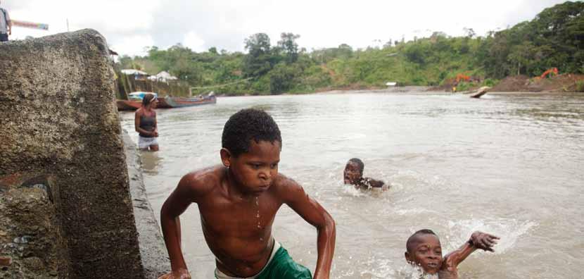
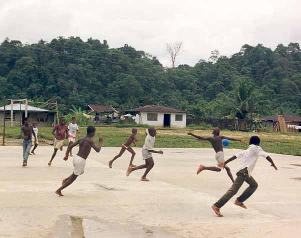
Cover image: Waving the Colombian flag in Cartagena during a running event. © Anna Pumer
RSGS: a better way to see the world
We are delighted that Mungo Park Medallist Doug Allan FRSGS will speak for RSGS at a special one-off event at Perth Concert Hall on Wednesday 21st December 2022. In a talk entitled Four Decades Behind a Camera, the Scottish wildlife cameraman and photographer, best known for his work in polar regions, will share some of his amazing experiences and spectacular images from his life and career.
book now!
Tickets are £17.50 for RSGS members, £12.50 for students and under-18s, and £22.50 for general admission, inclusive of booking fee. Please call 01738 621031 or book at www.horsecross.co.uk for a pre-Christmas treat!
Red Sea swim
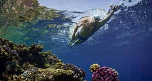
Ahead of November’s UN Climate Conference (COP27) in Sharm el-Sheikh, endurance swimmer and UNEP Patron of the Oceans Lewis Pugh FRSGS completed the world’s first swim across the Red Sea (lewispughfoundation.org/ red-sea-2022). Over 16 days, he swam the 123km from Tiran Island, Saudi Arabia to Hurghada, Egypt, to highlight the impact of climate change on coral reefs, which support 25% of all ocean life and are the most biodiverse ecosystem on Earth.
When he rounded the southernmost point of the Sinai Peninsula at Ras Mohammed National Park, he described the sea life as spectacular. “There’s arid desert as far as the eye can see, but under the water, life explodes!”
The most challenging part of the swim was crossing the Gulf of Suez. “In all my years of swimming, I’ve never experienced anything like this. There were hazards coming at me from every angle. Extreme heat, high winds, big waves, sharks, oil tankers and container ships. I had to fight for every metre.”
Scientists warn that if we heat our planet by more than 1.5°C, we will lose 70% of the world’s coral reefs. If we heat it by 2°C, 99% of coral reefs will die. We are currently on track for at least a 2.2°C increase.
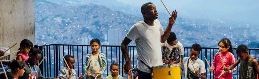
Masthead image: Drumming lessons for local children in Comuna 13. © Anna Pumer
21st December
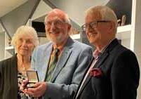
Thanks to retiring Trustees
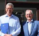
We were very pleased to have the opportunity, at a small private event in August, to thank recently retired Board members Tim Ambrose and Alister Hendrie for their many invaluable years as RSGS Trustees. Tim joined the Board as Treasurer in 2013, and has been incredibly generous with his expertise and time throughout. He has brought so much thoughtfulness and confidence to the Board, and has been instrumental in helping the Society develop. In recognition and sincere appreciation of this, we were delighted to present Tim with Honorary Fellowship of the Society.
Alister served on the Board for ten years, initially as the Local Groups Committee representative, and then, from 2015, as Vice-Chair of the Board. Throughout this time, he provided great expertise, knowledge and guidance, and we are grateful for his continued encouragement, help with strategic planning, and kindness.
We are extremely grateful for Tim’s and Alister’s contributions over the last decade; for their part in making the last few years as successful as they have been for the Society, allowing it to grow into what it is today.
SAGT Conference 2022
Alastair McConnell, RSGS Education Committee
In October, Geography teachers from across Scotland convened on Inverness Royal Academy for the first physical conference of the Scottish Association of Geography Teachers since the Covid pandemic pushed everything online. It was also the first conference to take place in the Highlands, allowing many to attend who would normally have to travel a great distance.
With a theme of one world, many stories, this was a perfect event for RSGS Writer-in-Residence Jo Woolf to give a keynote speech. She focused on information from the RSGS archives, with stories of exploration that captivated the audience. Her story of Mount Roraima in South America, the inspiration behind Sir Arthur Conan Doyle’s The Lost World, was fascinating and the images from this unique location were stunning. RSGS also had a presence with a stall publicising our work. Delegates were able to collect copies of Horrible Geography of Scotland, the James Croll ‘Penny Magazine’, and The Geographer Feedback was all very positive.
The other keynote speaker was Bobby McCormack, Chief Executive of Developing Perspectives. He gave a very humorous talk about bringing stories to the classroom and making the pupil the centre of any lesson, rather than the teacher.
As well as the keynote speakers, an impassioned speech from SAGT President Iain Aitken on the future of our subject, and a lovely lunch, the conference included a range of workshops. Everyone in attendance was in no doubt about the importance of meeting in person, and the conference will be hosted next year at the same venue.
Inspiring People 2022-23
Face-to-face talks
Since September, it has been wonderful to see so many of our members and supporters once again attending face-to-face events hosted by our Local Groups across Scotland. We have enjoyed talks from Christopher Horsley, Professor Colin Ballantyne, Elise Downing, Alex Bescoby, Will Copestake, Cameron McNeish, Professor Stephen Peake, Colin Prior, Rebecca Lowe, Shahbaz Majeed and Lee Craigie.
Now we are looking forward to the amazing talks to come in 2023: polar explorer Craig Mathieson, talking about his Polar Academy and the challenges of running a charity during a pandemic; kayaker Callum Strong, recounting his ambitious expedition to paddle the length of the Panjshir River in Afghanistan; historical geographer Professor Charles Withers, examining the achievements, inspiration and ‘afterlife’ of Mungo Park; author Richard Clubley, sharing stories of life on Orkney, from its past to its future; explorer Jacki Hill-Murphy, reflecting on recreating Isabella Bird’s 150-mile trek through Ladakh; mountaineer Alex Moran, on his amazing feat completing the first ever Island Munros Triathlon; filmmaker Libby Penman, sharing stories from her years of filming epic wildlife in Scotland; adventurer Sue Stockdale, recounting highlights and challenges from her travels to over 70 countries; nature writer Tom Bowser, exploring the past, present and future of red kites in Scotland; explorer Alice Morrison, on her epic walk across Morocco with three guides and six camels; and kayaker Sal Montgomery, sharing stories and adventures from road-tripping around America and British Columbia.
Admission to face-to-face talks is FREE for RSGS members, students and under-18s, and £10 for others. Tickets are available through rsgs.org/events, or at the door (cash only).
Online talks

In autumn 2022, we were delighted to bring you online interviews with renowned explorers David Hempleman-Adams and John Blashford-Snell, and ecocide campaigner Jojo Mehta. Our online events will continue into 2023 with skier and adventurer Myrtle Simpson, endurance swimmer Lewis Pugh, and explorer Robin Hanbury-Tenison
Tickets for online talks are FREE for students and under-18s, £2 for RSGS members, and £6 for general admission. Book now at rsgs.org/events
Francesco Sindico FRSGS
book online tickets now
In October, we were delighted to present RSGS Honorary Fellowship to Professor Francesco Sindico of Strathclyde Law School. Professor Sindico established and developed the Strathclyde Centre for Environmental Law and Governance (SCELG), which is now one of the leading centres in the UK in the field of environmental law. He has long supported and collaborated with RSGS, including by hosting medal presentation events, providing valuable platforms for our work, helping secure venues for talks, and consistently considering the Society through his work.
14Winter 2022 The Geographer 1 news
to a talk!
come along
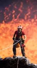
Inspiring People Illustrated Public Talks Inspiring People 2022-2023 Illustrated Public Talks Open to everyone • £10 general admission • FREE for RSGS Members, students, U18s • Evening talks start at 7.30pm • Afternoon talks (Edinburgh & Glasgow only) start at 2.15pm (*Note Dunfermline talks have a 7pm start) David Hempleman-Adams FRSGS In his extraordinary lifetime of global expeditions, Sir David HemplemanAdams has battled against the elements in the harshest climates known to man, often steeling himself against illness and injury; and in doing so he has proved that, if you have a childhood dream of adventure, you should never let it go. John Blashford-Snell The legendary explorer and RSGS Livingstone Medallist, Colonel John Blashford-Snell, has led over 100 expeditions in almost every part of the world, join us as he shares some of his most unbelievable tales from a life of adventure. Jojo Mehta FRSGS Jojo Mehta as spokesperson and Executive Director of Stop Ecocide International has overseen the growth of the movement to criminalise ecocide; knowingly causing mass destruction to the environment through unlawful acts. She recounts her journey to environmental advocacy, and the potential of the crime of ecocide to change cultural norms. 2022-2023 "The best national talks programme in Scotland" 28 Inspiring Speakers • 96 Fascinating Talks • 14 Locations Photo by Geoff Makley Christopher Horsley, Marum Crater, Ambrym, Vanuatu Motivational stories of adventure Expertise on vital current issues Inspirational insights into people, places and planet Christopher Horsley Having explored some of the most active volcanoes in the world, adventurer Christopher Horsley is drawn to the fires that created our planet. Capturing the beauty of these naturally destructive creators has led him closer to the edge of volcanic craters around the world than most people would dare. From abseiling over 400 metres to collect fresh lava samples from some of the most inaccessible places in the world to encountering armed rebels on volcanic slopes for his recent TV series, Exploration Volcano, for BBC Earth, Chris works closely with Congolese volcanologists to supply and install live-stream Drawn to Fire Sal Montgomery A worldwide explorer, often found kayaking full-on whitewater rapids through unknown deep canyons in some of the world’s most remote locations, Sal Montgomery has led several world-first expeditions for TV documentaries and short films. 2019 saw a sudden transition, from living in the Amazonian jungle to working in a major UK hospital during a global health emergency. National lockdowns may have put this wild girl’s travels on hold, but that didn’t mean that her craving for adventure was dimmed. She shares her latest stories and adventures from road-tripping around America and Best Day Ever: Road-Tripping With a Kayak The Karakoram: Ice Mountains of Pakistan and Inspired Myrtle Simpson RSGS Mungo Park Medallist Myrtle Simpson is a Scottish mountain climber and polar explorer, and the tenth woman to receive the Polar Medal, 50 years after she became the first woman to cross Greenland’s polar ice cap. She has scaled Andean peaks, dragged a sledge across glaciers and sea ice, and attempted to reach the North Pole, amongst many other adventures. Lewis Pugh FRSGS RSGS Mungo Park Medallist Lewis Pugh has pioneered swims in the world’s coldest and most vulnerable climates, tying his passion for swimming with his advocacy for human rights and environmentalism as UN Patron of the Oceans. He was the first person to swim across the North Pole, and undertook a multi-day swim in the Polar Regions, across the Ilulissat Icefjord, to awaken people to the threat of melting sea ice. Robin Hanbury-Tenison As an explorer, author, filmmaker, conservationist, and campaigner, Robin Hanbury-Tenison has spent over fifty years exploring the world, has undertaken over 40 expeditions to some of the world’s remotest regions and saved over 500 minority ethnic groups through his charity Survival International and led multiple ground-breaking expeditions. 22 Nov 22 21 Feb 23 21 Mar 23 20 Sep 22 24 Jan 23 18 Oct 22 Lord John Murray House, 15-19 North Port, Perth, PH1 5LU Charity registered in Scotland No SC015599 Extra Online Talks Open to everyone - £6 general admission - £2 for RSGS Members - free to students, U18s - 7.30pm Tuesday evenings Join us for ‘An Interview with’ series... Join the RSGS and get the live talks for free, plus quarterly editions of The Geographer ! Annual membership rates are: • £21 Student • £50 Single • £75 Joint • £30 School To join, see www.rsgs.org or email enquiries@rsgs.org or phone 01738 455050 Join us today to start your geographical adventure! Colin Prior Acclaimed landscape photographer Colin Prior presents two different stunningly illustrated talks this season. In The Karakoram: Ice Mountains of Pakistan, he looks at a range that is so remote, each trip requires careful planning and miles of trekking with a team of porters and ponies. The reward is the ultimate mountain landscape: “sculpted by wind and ice into monumental spires, towers, cathedrals and pyramids, these rocks are a showcase of natural design and form.” In Inspired, he speaks about his sources of inspiration and how they influenced his work on assignments in over 50 countries, travelling around the world Extra Online Talks! www.rsgs.org
Ordnance Survey in Dubai


Rare Colombian hummingbird rediscovered
Dubai Municipality has signed two contracts with Ordnance Survey (OS), to harness geospatial data and expertise, accelerate innovation, and help develop fundamental services for citizens, residents and visitors.
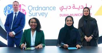
Working with Dubai’s Building Regulation and Permits Agency (BRPA), OS will provide expertise to improve planning and construction processes. Paul French, OS’s Chief Commercial Officer, said, “Dubai Municipality is at an exciting time in expanding its capabilities. We are pleased to be contracted to support the organisation in transforming the construction sector.” Engineer Maryam Obaid Almheiri, Chief Executive of BRPA, said, “The agency aims to implement pioneering systems to serve the city, develop executive planning, survey and construction services. Our partnership with OS and other internationally recognized consultancy firms supports us achieving our goals.”
A second contract, with Dubai’s GIS Center Department (GISCD), aims to implement the geospatial development strategy over several years. Accurate and trusted geospatial data will be critical in helping to tackle a range of challenges which are facing cities across the world, including transport and mobility, net zero, planning and infrastructure, and health. Juliet Ezechie, OS’s Director of International, said, “Dubai is a city primed to be at the cutting edge of geospatial innovation. The city is now laying the strong foundations that will form the tenets of this immense potential, ensuring comprehensive geospatial data coverage.” Maitha Ali Al Nuaimi, Acting Director of GISCD, said, “Dubai is one of the fastest growing cities in the world and GISCD’s strategy will provide an up-to-date ‘digital twin’ of the Emirate. The long-term cooperation between GISCD and OS contributes to achieving these goals, in addition to enabling us to enhance the aspirations of the Dubai government in making Dubai the happiest city in the world.”
COP conference
In the run-up to COP27 held in Sharm el-Sheikh in November, RSGS and the Open University in Scotland held a COP26: One Year On conference to understand what signs of positive change had begun to take root since COP26, nationally and internationally, and what more needed to be done. The conference heard from 18 speakers from multiple sectors within the climate arena, and allowed key stakeholders fighting climate change to discuss, debate and prioritise the actions, campaigns, policies and innovations that need to be accelerated to ‘keep 1.5 alive’. See page 32 for more information.
A Critically Endangered hummingbird has been sighted and documented in Colombia after going missing for more than a decade. The Santa Marta sabrewing is only found in Colombia’s Sierra Nevada de Santa Marta mountains, and was feared to have gone extinct after it hadn’t been spotted since 2010, with the tropical forests it inhabits having been largely cleared for agriculture.
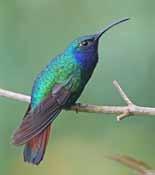
It is only the third time the species has been documented: the first was in 1946 and the second in 2010, when researchers captured the first photos of the species in the wild. “This sighting was a complete surprise, but a very welcome one,” said Yurgen Vega, who made the rediscovery while working with SELVA, ProCAT Colombia and World Parrot Trust to study endemic birds in the region.
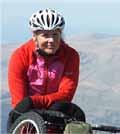
Karen Darke FRSGS, Explorer-in-Residence
In October, we were delighted to welcome Karen Darke FRSGS as an RSGS Explorer-in-Residence! Karen is a British Paralympic cyclist, Paratriathlete, adventurer, author, and RSGS Mungo Park Medallist. Just some of her amazing feats include becoming a Silver Medallist in the London 2012 Paralympics, and a Paralympic Champion in the Rio 2016 Paralympics. She has hand-biked the Carretera Austral through Chilean Patagonia, hand-biked from Canada to Mexico through the Pacific Coastal Trail, sea-kayaked from Canada to Alaska, sit-skied across Greenland, and scaled El Capitan, all whilst being paralyzed from the chest down. We now look forward to supporting Karen through her future expeditions.
Doors Open Day
We had a brilliant time at Doors Open Day in September, as we welcomed over 120 visitors of all ages from all over the world ‒ Australia, the United States, Canada, Hungary, Spain, France, Wales, England and Scotland ‒ to the Fair Maid’s House. The special display put together by our volunteers, titled Roots, Routes and RSGS, highlighted our remarkable Visitors Book and the potential storylines it hides in its pages, and was greatly enjoyed.
Amongst the visitors, we were delighted to see four RSGS Glasgow Group committee members, led by their Chair, Frank Norris, and popular mountaineer, writer and speaker Dr Hamish Brown FRSGS, who kindly brought the gift of some rare French maps of the Atlas Mountains and a very interesting Indian artefact to add to our collections. Thank you to them, and to all of our wonderful volunteers who helped organise and host the event.
Winter 2022 2 news
Colombia
The similar-looking Lazuline sabrewing. © Tom Friedel, BirdPhotos.com
Juliet Ezechie, Director of International at OS, and Maitha Ali Al Nuaimi, Acting Director of GISCD, sign the contract.
Cost-of-living crisis
Fellowships for Climate Solutions team
In October, Perth City Leadership Forum hosted a lunch for a group of local charities (including RSGS), organisations and individuals to discuss the cost-of-living crisis in Perth, specifically for those facing poverty. The event was a chance to hear more from the frontline organisations that are dealing with this issue every day, to hear ideas of how to reach more children and families, and to explore what organisations needed in order to scale up their efforts, tackle the crisis, and build collaboration.
Digital map transcription projects
In early 2022, the National Library of Scotland (NLS) initiated a set of new collaborative projects to transcribe features and text from old maps. With support from several hundred volunteers, NLS and its partners worked to transcribe details from the Roy Military Survey maps of Scotland (1747‒55), Ordnance Survey (OS) six-inch to the mile maps of Scotland (c1900s), and OS 25 inch to the mile maps of Edinburgh (1892‒94).
Roy Military Survey Project, in collaboration with the British Library: all 33,517 Roy placenames and their accompanying OS placenames have been transcribed, so that for the first time it is now possible to search all the names on this uniquely important 18th-century map covering all of mainland Scotland.
Scotways Historic Footpaths Project, in collaboration with Scotways: over 104,000 footpaths, spanning over 37,000 miles across Scotland, have already been traced, helping to facilitate Scotways’ work in researching the backgrounds of footpaths today and safeguarding them as rights of way.
OS 25-inch Edinburgh Transcriptions Project, in collaboration with the Machines Reading Maps team at the Alan Turing Institute: all 30,043 transcriptions have been recorded, edited and regrouped, allowing 21,950 placenames and related information on real-world features to be searched and viewed.
See maps.nls.uk/transcriptions for more information and links to search pages.
In August, we were pleased to present RSGS Honorary Fellowships to three members of the Climate Solutions team, for their contributions over the last six years in developing and delivering the courses. Their hard work allowed Climate Solutions to get off the ground, and helped make it so successful; the fact that we now have over 100,000 people signed up is a testament to their skills and effort. They were instrumental in creating the courses, and their contributions particularly stand out, not just for the expertise they shared, but for their personal commitment above and beyond what was required.
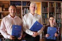
Galina Toteva, a PhD candidate in Carbon Management at the University of Edinburgh, is sole author of the Accelerator course, co-author of the Professional course, and lead author of the Student course. David Geddes, Director and Founder of Jump Digital, was instrumental in involving the company and producing a high-quality, easy-to-use system that can be rolled out universally. Robert Fleeting from Jump Digital was responsible for much of the technical build of the courses, and ensuring that they were delivered on time.
Dying to save the land
A report by non-governmental organisation Global Witness found that c200 environmental and land defence activists were killed around the world in 2021. More than threequarters of these killings took place in Latin America, particularly in Mexico, Colombia, Brazil and Nicaragua, with victims fighting resource exploitation and land disputes. “Most of these crimes happen in places that are far away from power and are inflicted on those with, in many ways, the least amount of power,” the report said. Global Witness also considers its report a baseline, noting “Our data on killings is likely to be an underestimate, given that many murders go unreported, particularly in rural areas and in particular countries.”
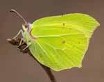
Butterflies in decline
Colombia
Butterfly Conservation’s annual citizen science project to monitor butterflies and some day-flying moths found numbers at the lowest on record for the third year in a row, despite a summer of persistent sunshine. The fine weather meant that the Big Butterfly Count in July–August missed the early peak emergence of some common midsummer species, but it was still a disappointing result once taking this into consideration. Some things that we can do to help include practising wildlife-friendly gardening, keeping long-grass areas in gardens, allotments and parks, and planting specific plants for some species, such as alder buckthorn for the brimstone butterfly.
Volunteer coffee morning
In October, we were delighted to host a coffee morning with Fair Maid’s House volunteers to say ‘thank you’ for all their hard work over the year. Volunteers were invited for tea, coffee and cake, and had the chance to reflect on our first open season since the start of lockdown. Many thanks again to all of our volunteers!
14Winter 2022 The Geographer 3 news
L-R: Robert Fleeting, David Geddes and Galina Toteva.
All three projects, blending together around Edinburgh.
Blog tales
With new content every week on our online blog (rsgs.org/ blog) there’s always something of interest. Recent additions include:
Sir Arthur Conan Doyle and Sherlock Holmes: looking for clues in the RSGS archives: Writer-in-Residence Jo Woolf investigates links between renowned crime writer Sir Arthur Conan Doyle, his characters, and RSGS.
By Railroad Through the Golden State: one night in September 1873, whilst travelling on the US Transcontinental Railroad, Isabella Bird rolled up in the town of Truckee, stepping out of her train carriage and straight into the hotel whose saloon was full of rowdy, gun-toting lumberjacks…
Thor Heyerdahl: six men, one balsa raft and 4,300 miles of Pacific Ocean: in celebration of the birthday of Norwegian adventurer Thor Heyerdahl, Writer-in-Residence Jo Woolf reflects on his life and the renowned Kon-Tiki expedition of 1947.
read the stories at rsgs.org/
blog
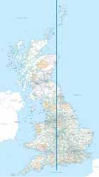
Three-norths point
In November, geospatial history was made as the three ‘norths’ combined over Great Britain for the first time. The point made landfall at Langton Matravers in Dorset, and will slowly travel up the country before finally leaving the land at Fraserburgh around July 2026.
Howie Firth, Tivy Education Medallist
 Professor Roger Crofts CBE FRSGS, RSGS Vice-President
At the 2022 Orkney International Science Festival, at an event hosted by Orkney whisky producer Highland Park in their excellent shop in Kirkwall, we presented our Tivy Education Medal to Dr Howie Firth MBE for his outstanding educational leadership over many decades. I welcomed the audience, saying that “Howie Firth established the Orkney Science Festival… and has grown it to become the international ‘gold standard’… He is a gifted communicator and educator, a broadcaster and a leading light in Radio Orkney. He is a true Orcadian polymath, demonstrated, for example, in his outstanding book Orkney. His insightful opening essay, An Orkney Panorama, demonstrates what only the most gifted scientists, cultural historians and educators can do.”
Formally presenting the Medal and Honorary Fellowship, Erica Caldwell, a previous recipient, reminded all that it is awarded, inter alia, for “exemplary, outstanding and inspirational educational work”, perfectly fitting Howie’s achievements. Howie responded, “Thank you for the huge honour of this presentation. It is amazing to be awarded something as special as this, and I am still absorbing it all. It is also inspiring me for the future.”
The ‘special line’ where magnetic north will join true north and grid north.
As expert map-readers will know, there is a difference between magnetic north (where the compass points, and which moves continually due to natural changes in the Earth’s magnetic field caused by changes in the flow of iron in the liquid outer core), true north (the lines of longitude that all converge at the North Pole) and grid north (the vertical blue grid lines shown on OS maps, which all but one need to vary from true north as they reflect the curve of the Earth).
Mark Greaves, Earth Measurement Expert at Ordnance Survey, said, “This triple alignment is an interesting quirk of our national mapping and the natural geophysical processes that drive the changing magnetic field.” Dr Susan Macmillan of the British Geological Survey, which makes detailed measurements of the magnetic field at 40 sites around the UK, said, “This is a once-in-a-lifetime occurrence. Due to the unpredictability of the magnetic field on long timescales it’s not possible to say when the alignment of the three norths will happen again.”
See www.ordnancesurvey.co.uk/newsroom/news/three-norths-aligngreat-britain for more information, including an illustrative YouTube video.
The United Nations Office on Drugs and Crime (UNODC) has reported that, in 2021, the cultivation of coca (from which cocaine is extracted) reached a historically high level in Colombia. The area of coca cultivation increased by 43%, from 143,000ha in 2020 to 204,000ha in 2021. The potential cocaine production also reached a historical record high, increasing by 14% to 1,400 metric tons. The difference between the percentage increases is partially explained by the planting of new fields that have not yet reached their most productive age.
Long-term factors associated with this upward trend include changes in the dynamics and relationships of illegal armed groups, an increased supply of goods and services in populated places near coca-growing areas, and a concentration of cultivation in efficient agro-industrial hotspots. Short-term factors include less crop reduction intervention, positioning of new criminal groups, and worsening of socio-economic conditions due to the pandemic.
Two-thirds of the increased cultivation was seen in and around existing coca hotspots, but in new areas the increase was sudden and concentrated, leading to fears that northern Chocó and Cauca could quickly become hotspots. Over half of coca cultivation is in special management zones: Afro-descendant communities, forest reserves, Indigenous reserves, and National Natural Parks; the coca cultivation, and the manufacturing of cocaine, can affect the ecosystems in these zones.
news Winter 2022 4
Dr Howie Firth FRSGS (centre) with RSGS VicePresidents Erica Caldwell and Roger Crofts.
The Energy Crisis: Chief Executive Mike Robinson considers some of the burning questions concerning the looming energy crisis, including what we can expect, and what we can do to help. Colombia
Colombian coca cultivation
Her Majesty Queen Elizabeth II (1926-2022) Patron of RSGS (1953-2022)
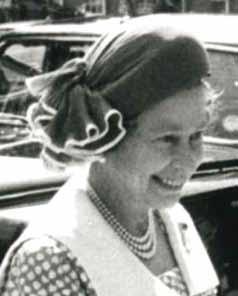
The end of an era
Jo Woolf FRSGS, RSGS Writer-in-Residence
With the sad announcement of Her Majesty The Queen’s death on Thursday 8th September, a long era in world history came to an end. The Queen’s reign was extraordinary for so many reasons: she was the longest-lived and longest-reigning British monarch, and she must surely have been one of the best-loved, having only recently celebrated her Platinum Jubilee amid outpourings of public celebration. For the generations who grew up knowing no other monarch, and listening to her words of calmness and strength during times of crisis, it is hard to believe that her smile, always radiant, is now a memory.
It is interesting to consider The Queen’s message during her Christmas broadcast of 2019. She said that, as a child, she never imagined that one day a man would walk on the Moon; yet, that year, we were celebrating the 50th anniversary of the Apollo 11 mission. This was, she believed, a timely reminder of the positive things that can be achieved when people set aside past differences and come together in a spirit of friendship and reconciliation. Looking to the future, she reflected, “It’s worth remembering that it is often the small steps, not the giant leaps, that bring about the most lasting change.”
To echo a tribute to King George VI which appeared in the Scottish Geographical Magazine of 1952, “We record our homage to the memory of a beloved Sovereign.”
Remembering an amazing life
Professor Roger Crofts CBE FRSGS, RSGS Vice-President
The outpouring of shock, sadness and grief at the death of Her Majesty Queen Elizabeth II should be of no surprise to any of us. We hoped that she would always be with us through smooth and turbulent times. Well, hopefully she will be, as her life and its constancy, dedication and devotion to duty will live on not only in our memories but, as he has stated, in her son His Majesty King Charles III.
I had the privilege of representing RSGS at the Motion of Condolence at the Scottish Parliament, when we heard tributes from the First Minister and three of the other political party leaders. In response, The King made clear his commitment to following in his mother’s footsteps.
I only had the privilege of meeting The Queen once, when she presented me with an honour at Holyrood Palace. She was surprisingly small in height, but the greatest in stature of anyone in my lifetime. Her constancy and dedication to
her role, and her devotion to God, the established church, and her people are well known. So many words have been written to reflect on her lifetime of service.
What strikes me, in particular, has been her role internationally. She was an apolitical world figure par excellence. She straddled the world stage with dignity, composure and authority. Her knowledge of people and places was astounding, resulting from her diligence in preparation and her first-hand experience of travelling to so many countries, and at home and abroad meeting so many people from diverse backgrounds and persuasions. Her ability to choose the right moment to use the native tongue of the place visited, and to use her astute judgement to address long-standing issues, were her hallmarks. There are so many lessons our leaders around the world, and indeed us ordinary citizens, can learn from her example. May her legacy lead to a better world.
Reflections on a funeral
Mike Robinson, RSGS Chief Executive
It is not surprising that so many people are saddened by the death of Her Majesty The Queen. She was a constant figure in our lives, a visible public face in every aspect of life in this country, and around the world. She represented continuity and longevity and, for many, a solid ‘anchor’ to the ups and downs of regular existence. It is understandable that so many people feel sadness, not just for The Queen as an individual and for the era she represented, but because living so much in the public eye she was a thread in the tapestry of so many people’s lives.
It was then an especial honour for me to attend the funeral in Westminster Abbey on behalf of RSGS, and to witness such a moment of history first-hand. Within the Abbey itself I felt the mood was not sad, as I had expected, but rather respectfully uplifting. In amongst the pageantry, the prayers, the hymns and the beautiful music were some thoughtful reflections which cast the spotlight more on the legacy of The Queen and the other leaders present.
Her Majesty The Queen understood the importance of charities in our society, and they played a huge part in her day-to-day interests. As a representative from one of the many charities that enjoyed her patronage, it was the reading by the Reverend Canon Helen Cameron whose words struck the greatest chord for me. “Grant to [this nation’s] citizens grace to work together with honest and faithful hearts, each caring for the good of all.”
14Winter 2022 The Geographer 5
“Her knowledge of people and places was astounding.”
“She was a thread in the tapestry of so many people’s lives.”
“The Queen’s reign was extraordinary for so many reasons.”
Her Majesty Queen Elizabeth II visited the RSGS office in Edinburgh in 1984, in celebration of the Society’s centenary.
Colombia: a little bit of everything, from rain to snow, from deserts
Professor Andrés Guhl, Department of History and Geography, University of the Andes
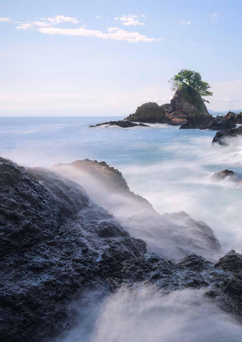
When one thinks about Colombia, usually coffee comes to mind, but there is a lot more to this country. The 2022 edition of the Natural Beauty Report (www.money.co.uk/loans/ natural-beauty-report) puts this South American nation as the third most beautiful in the world. With over 1.1 million square kilometres, about 0.7% of the world’s land area, it is home to about 10% of the planet’s terrestrial biodiversity.
It is located in the north-western corner of South America, where the Nazca, South America and Caribbean tectonic plates converge. Tectonic activity contributed to the rise of the Andes, and divides the country in two different areas. The eastern part of the country corresponds to the oldest, most stable part of Colombia, characterized by relatively flat terrain and underlain by some of the oldest rocks on Earth, the Guiana Shield. The western half, on the other hand, is characterized by mountainous terrain and seismic activity. This is where the majority of the population lives.
The eastern half can be further divided into a northern part that is characterized by savannah vegetation, and a southern section covered by the Amazon rainforest. The mountainous area includes the northernmost sections of the Andes. In Colombia, this mountain range divides into three separate branches that go roughly from south to north. These mountain chains are separated by deep valleys where two rivers flow to the Caribbean: the Cauca and the Magdalena, which are perhaps the most important in the country in terms of economic activity and historical significance.
The mountain ranges can reach more than 5,000 metres, meaning that one can find tropical lowland environments and snow-covered peaks in a small geographical space. The country still has six snow-covered mountains, but the permanent snowline is retreating due to climate change. The interaction of topography and wind patterns results in a wide range of climates, going from extremely dry to very rainy conditions that result in a stunning variety of ecosystems. When people think about biodiversity in tropical South America, the Amazon rainforest comes to mind. However, not too many people realize that the Andes, due to the diversity of climates and soils, are more biologically diverse than the Amazon rainforest.
Colombia is also a water country: it is among the top ten countries with the most renewable water in the world. Located along the Intertropical Convergence Zone, this means that there is abundant rainfall during the year. In addition, the Chocó stream, a low elevation wind stream flowing from west to east from the Equatorial Pacific Ocean, generates orographic rainfall on the Pacific coast lowlands. In this area, rainfall can reach more than 10,000mm per year, which is about 14 times the yearly rainfall amount Edinburgh receives. However, rainfall and humidity are not evenly distributed throughout the country. Many parts of the country receive little rainfall. For example, the northern tip of Colombia is a desert, and large portions of the Magdalena and Cauca basins are relatively dry.
On the western half of the country, the mountain ranges transition to a relatively flat area along the Caribbean coast. As the mountains disappear, the Cauca and Magdalena rivers create a seasonally flooded area characterized by river runoff, seasonal flooding and permanent lakes. Further north
of this region, smaller and lower mountains emerge. The Sierra Nevada de Santa Marta is located in this area. This massif reaches nearly 5,800m, making it the highest coastal mountain range in the world. As the crow flies, it is possible to go from sea level to 5.8km in about 50km.
The diversity of Colombia is also cultural. There are still more than 60 Indigenous languages in use, mostly in remote areas. Although many of these languages are threatened, most communities across the country are proud of their Indigenous heritage and are trying to revitalize their languages and traditions. But Colombia is also a cultural melting pot. The present population of the country is the result of the mixture of Spanish, African and Indigenous peoples. The way in which these groups are present in the country is not homogeneous. The Andean area is mostly a mestizo population, while both coasts exhibit traits of African tradition. Indigenous groups are present throughout the country, but are dominant in remote areas. Music, food and handicrafts, among others, reflect this cultural mélange.
Colombia is a country of great biophysical and social diversity in a relatively small geographic space, and it is a great opportunity for people interested in geography: pack your bags, and do not hesitate to come!
Winter 2022 6
“The Andes are more biologically diverse than the Amazon rainforest.”
deserts to lush forests
14Winter 2022 The Geographer 7
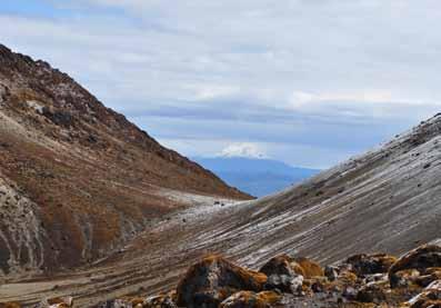
Nevado del Huila, from Los Coconucos. © Andrés Guhl
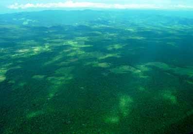
Small-scale colonization of the rainforest. © Andrés Guhl
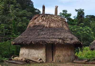
Indigenous hut, Sierra Nevada de Santa Marta. © Andrés Guhl
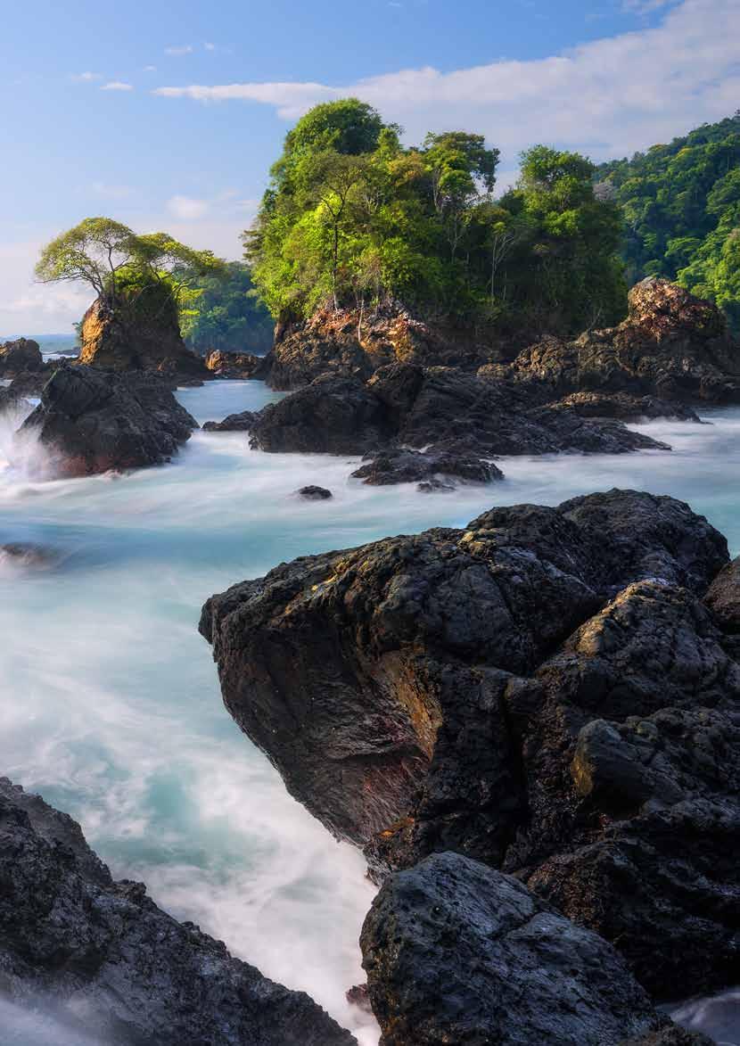
© Gabriel Eisenband
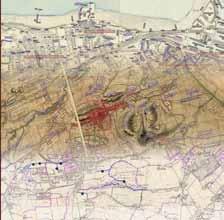
Creating national unity in Colombia
Chris Fleet FRSGS, Map Curator, National Library of Scotland
This map commemorates Agustín Codazzi (1793–1859) and his work to foster national unity and identity in Colombia.
Born in northern Italy, Codazzi was impressed by the ideals of the French Revolution, and he trained as a military engineer, going on to fight with Simón Bolívar to liberate Venezuela from Spanish control. Over the next two decades, Codazzi excelled in mapping and military work in Venezuela, before escaping to Colombia, where he continued his geographic and cartographic work with Comisión Corográfica.
The map shown here brings together the work of this interdisciplinary scientific project, involving both observation and description of the various inhabitants of the regions, as well as a survey of natural resources and economic infrastructure, also creating a series of regional maps.
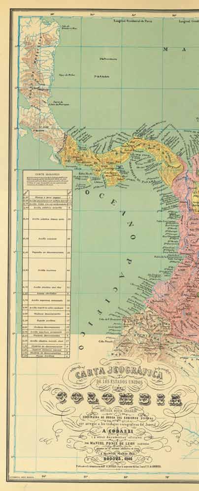
Following Codazzi’s death in 1859 from malaria, he was honoured in many ways, including the naming of Colombia’s national geographic and cartographic institute after him.
Codazzi’s maps were published in his Atlas fisico y politico de la República de Venezuela (1840), and his Atlas de los Estados Unidos de Colombia (1865). These are our two earliest national atlases of these South American countries, and both works promoted these newly-independent states.
As well as being early examples of atlas lithography – both volumes were lithographed in Paris, creating full-colour plates as shown here – the maps included thematic physical, political and historical themes, with introductory text and indices. They reflected the growth of nationalism, imperialism and national identity that accelerated through the 19th century; during the 20th century, many countries sponsored their own monumental national atlas projects.
Codazzi’s work is important to the history and geography of Colombia, as well as illustrating the very significant role of map-makers in promoting nationalism.
Winter 2022 8
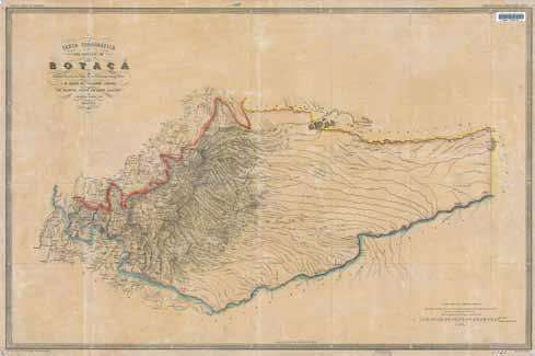
Carta Corográfica del Estado Soberano de Boyacá, from the Atlas de los Estados Unidos de Colombia, 1865. See commons.wikimedia.org/wiki/Atlas_ de_los_Estados_Unidos_de_Colombia_1865 for maps of individual states.

14Winter 2022 The Geographer 9
A Codazzi, Carta jeográfica de los estados unidos de Colombia (1864). Image courtesy of the National Library of Scotland.
“The maps reflected the growth of nationalism, imperialism and national identity that accelerated through the 19th century.”
The possibilities of peace: new opportunities for Colombia
Professor Andrés Guhl, Department of History and Geography, University of the Andes
Colombia has experienced one of the longest civil wars in the world. For more than 50 years, different groups (left- and right-winged) have fought against the Colombian government, mostly in remote areas of the country. In 2016, after several years of negotiations, the Armed Revolutionary Forces of Colombia (FARC), the largest rebel group, and the Colombian government signed a peace agreement in a very hopeful moment for the entire country. Although there are still other rebel and criminal groups fighting the State, the disarmament and demobilization of the FARC generated hope, and a very welcome change in parts of the country where conflict and fear had become the daily routine.
When the civil war ‘dissolved’, many regions that were out of bounds for most Colombians became attractive spots in many ways. There are many examples of how this process took place, and how it created new opportunities and challenges. In the first place, the civil war meant that wild ecosystems were relatively unaltered in many areas, and the peace agreement opened them up to travel. For example, Caño Cristales (Crystal Creek), also known as the river of five colours, was an area in a municipality where the FARC had a very strong presence, and now it is a very popular ecotourism destination. The same can be said about many other locations in the country. Areas that were closed are now open, and people come to enjoy their natural wonders and the hospitality of their inhabitants. However, as in many areas of the world, the success of ecotourism can be its greatest enemy: overcrowded sites and degradation.
The changes brought in by the peace agreement also bring opportunities to former FARC guerrilla men and women. They lived in these remote areas for a long period of time, and their former lives in the forest as rebel fighters mean they know the birds, plants, insects and animals in these isolated areas. Many of them have been trained as ecotourism guides, and now they can share with travellers their specific natural history familiarity with these previously conflictive lands. In other parts of the country, former guerrilla fighters have become involved in restoration efforts. But instead of trying to transform the landscape back to a former ‘pristine’ state, they are trying to transform an
agricultural frontier area, where deforestation is widespread, into sustainable landscapes, where patches of forest and other wild ecosystems are interspersed with agricultural fields and pasture, while trying to preserve the ecological functions of the forest through landscape corridors and other connectivity and management measures. Although this kind of intervention will never restore the original ecosystems, it is expected that these lands will become a landscape that can accommodate humans and wildlife, maintaining some of its ecosystems and functions, and reducing pressure to deforest elsewhere because of the benefits of keeping a mixture of agricultural fields, pasture and wild ecosystems. However, this has not been easy, as large holders and investors want to transform these native ecosystems into agro-industrial areas, replacing more heterogeneous and beneficial landscapes for homogeneous monocultures, as has happened in many areas of the Brazilian Amazon.
Another benefit of the peace agreement is related to scientific knowledge of Colombian biodiversity. Through a government initiative that began in 2016, the BIO expeditions try to study places that were previously out-of-bounds areas, the remnants of wild ecosystems in regions that have been heavily altered by human activities, or locations that were the stage of conflict. As well as bringing together researchers from different parts of the country, the BIO expeditions also engage local inhabitants, many of them former FARC rebels, so the status of different species and ecosystems can be assessed. In these scientific expeditions, many new species have been discovered, and the knowledge they generate contributes to better management, conservation, and sustainable use of Colombia’s biodiversity.
But the peace agreement also brings challenges to many regions of the country. The disappearance of the FARC armies, the de-facto government in many areas of Colombia, has meant that groups of people are trying to grab these lands since the Colombian government has yet to reach the most remote parts of the country. Most of these lands are not titled, and people living there do not have deeds. Large, unscrupulous investors are injecting enormous amounts of money to deforest large swathes of forest and other ecosystems so they can claim ownership of these lands. It remains to be seen how the Colombian State can maintain its most valuable asset: biodiversity.
Winter 2022 10
“Many regions that were out of bounds for most Colombians became attractive spots.”
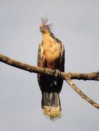
Hoatzin, San José del Guaviare. © Andrés Guhl
Image by Richard Brunsveld from Unsplash.
A river with rights
To think of a river as a person may be a strange concept, but for the Atrato River in Chocó, Colombia, it may be its saving grace. In 2017, it became just the third waterway on the planet to be granted its own legal rights. Such is the river’s significance that it also has its own Guardians who dedicate their lives to its protection and rehabilitation.
Whilst Chocó is not part of the Amazon biome, it has many similarities. Chocó is a richly biodiverse rainforest ecosystem, dominated by large rivers and thick forest cover. Just like the Amazon, Chocó is culturally diverse too, with a largely Indigenous and Afro-Colombian population. Like the Amazon, the Chocó region is rich in natural and mineral resources, and communities face an ongoing battle to protect their land and resources from outside interests. In Colombia, this means living within the midst of an ongoing internal armed conflict. Chocó’s five Indigenous tribes have lived there for thousands of years, and its Afro-Colombian communities, which make up the vast majority of the region’s population, trace back to the African people brought to the country by the Spanish as slaves.
The Atrato River and the Chocó region in general face many challenges, including environmental and social devastation; and face destruction by illegal gold mining. Consequently, communities are losing their traditional livelihoods as the region’s resources are depleted and degraded. When you add into the mix the presence of illegal armed actors, community life becomes precarious.
SCIAF has worked in Chocó since 2006, since identifying it as the poorest region of Colombia and one of the regions most affected by the conflict. To this day, it is the focal point of our Colombia Country Strategy. Through our local partners, we work with local Indigenous, Afro-Colombian, and Mestizo rural communities and their organisations, strengthening their capacity to defend, protect, and make sustainable use of their natural resources.
Colombia remains the world’s most dangerous country to be a human rights defender, meaning many community leaders are targeted for speaking out about the plight of their communities. Sadly, whole communities across Chocó have been forced to make the life-changing decision to leave behind the life they know to live in cities and towns, in search of safety and financial security.
We have worked to help communities gain legal rights and full access to their ancestral territories, develop plans for the sustainable use of their resources, and implement livelihood projects within their territories. We also work to ensure
local voices are heard loud and clear within Chocó, and at national and international level. We do this by strengthening leadership skills, helping new leaders find their voice, and adding our voice to the demands and campaigns of local organisations and partners.
The Atrato River is vital to people’s everyday lives: they fish the river, use it for transport, they bathe and wash their clothes in it, and it provides a livelihood.
In 2016, we worked with our partners to help them bring about a landmark case in the Colombian courts: the Atrato River court ruling. The voice of local communities was crucial to ensuring a positive result. The court ruled in favour of the Atrato River, granting the river the right to be protected, maintained, conserved and restored alongside the biocultural rights of its riverine communities. The Atrato River is only the third river in the world to be recognised in this way.
One of the river’s proud Guardians is Maryury Mosquera Palacios, who visited Glasgow in 2021 as part of COP26. She said, “The river is so important for the communities who live alongside it. The river is our washing machine. It’s our recreational centre. It’s our tourist centre where we have fun. Our economic source of our wealth, our economy. It’s our transport system. And we use it for cultural activities. Being a River Guardian and environmental activist is quite dangerous in Colombia. The River Guardians were created by the court ruling in 2016, but we have always been guardians of our homelands.
“The river is like a young child, and we are the adults who must care for its interests. Rights defenders run a lot of risks in Colombia, especially in vulnerable departments like Chocó. Right now, I don’t feel so much personal danger from the work I do. This doesn’t mean that the danger isn’t there, and I may face difficulties in the future. Some colleagues have had threats and situations carried out against them. But instead of focusing on the dangers to us, we must focus on what we’re doing for our communities. In favour of ourselves, but also in favour of future generations. So I never focus on how dangerous my work may be, but rather on who I’m doing it for.”
SCIAF Project Manager Mark Camburn said, “I am just in awe of the people we work with. Knowing the risks that they face, and yet they are prepared to take that risk for the greater good of their communities, for the good of their river, their forests. It’s really inspiring.”
14Winter 2022 The Geographer 11
Claire Cook, Senior Marketing and Communications Officer, Scottish Catholic International Aid Fund (SCIAF)
“I never focus on how dangerous my work may be.”
© SCIAF
Maryury Mosquera Palacios. © SCIAF
Protected areas: a security and peacebuilding approach
 Sandra Valenzuela de Narvaez, Executive Director, WWF Colombia
As the second most biodiverse country, Colombia plays a key role in preserving global natural resources. The country’s commitment to conservation is reflected in its National System of Protected Areas (SINAP, after its Spanish name), which covers 31 million hectares, equivalent to 15% of the country’s territory. The protected areas included in the system provide essential ecosystem services to local populations, including water provisioning and regulation. Protected areas produce the necessary water to generate 50% of Colombia’s hydro-energy (estimated at $502 million) and provide drinking water for more than 25 million people (an annual value of $491 million). In an average year, water provision and regulation services from national parks are expected to add at least $2.3 billion to the gross domestic product.
Despite these efforts, Colombia’s landscapes and seascapes are facing unprecedented ecological and climate-related pressures. Having endured five decades of armed conflict until a peace agreement was signed in 2016, the country is confronting a new wave of deforestation and significant alterations of terrestrial socio-ecological systems, leading to increased emissions and further compromising the ability of these ecosystems to adapt to climate change. In this case, deforestation is mainly caused by illegal activities, which are attractive as they generate income and have low or non-existent punishment. Studies have shown how post-conflict settings in key conservation areas are affected by the territorial control of armed groups and population dynamics of colonization. The interaction of such issues results in land grabbing, agricultural expansion of monoculture and illegal crops, extensive ranching, illegal mining, illegal infrastructure, and illegal wood extraction, which are the main drivers of deforestation and destruction of biodiversity.
Nowhere are these pressures more pronounced and complex than in and around vulnerable forested areas in SINAP.
As highlighted in a recent study conducted in Colombian National Natural Parks and National Nature Reserves using an open-access global forest change dataset, 31 of the 39 protected areas in the country (79%) have experienced increased deforestation in the post-conflict years. This can be seen in a dramatic and highly significant 177% increase in the average deforestation rate between the two three-year periods before and after the peace agreement. This postconflict setting not only has deforestation consequences, but also requires connection with the peacebuilding initiatives (both local and national) included in the peace agreement which have been implemented under the territorial security approach.
A territorial peace and security approach with peacebuilding interventions includes dimensions such as: (i) socio-economic
inclusion and wellbeing opportunities (addressing and solving objective causes of conflict, such as human needs, poverty, land tenure, marginalization, and livelihoods development); and (ii) enhancing collaboration, collective action and conflict management, including transforming conflicts over natural resources access into collaboration, agreements and collective actions to enhance territorial governance, rights, security and innovative governance structures and schemes for decision making. In sum, it is transforming tensions through dialogue in a giving territory. Nowadays, protection and conservation goals and management have evolved and are considered as a window of opportunities to include a broader range of social and environmental targets, understanding local communities as part of a well-functioning ecosystem. Recent studies have found that proximity to conserved areas delivers health and income co-benefits to populations. Thus, the contributions of conservation areas to prevent or solve conflict and consolidate peace are among these social and environmental benefits, minimizing the risk of conflict associated with natural resource access or deterioration or scarcity, and providing alternatives to illegal or unsustainable economies.
WWF Colombia is strengthening more than 80 natural resources community enterprises located in the surrounding zones of 30 protected or conserved areas with Afrodescendants, farmers, and Indigenous communities. These initiatives are based on agreements to resolve conflicts and land tenure problems, focused on the promotion of agroforestry systems with coffee, cocoa and nontimber natural products, and fisheries management. These processes are based on environmental zoning, are associated with ecological restoration processes, and include improving market access for producers and green financial mechanisms.
In sum, this territorial security approach aims to support the Government of Colombia in the quest for strengthening peacebuilding and conservation efforts by providing strategies aimed at involving local communities in conserving biodiversity, through improving their livelihoods and addressing land-related conflicts and property rights around national parks, promoting dialogue between different stakeholders, tackling the root causes of the conflict, and moving towards a comprehensive agrarian reform. This comprehensive territorial security approach will help in reducing deforestation and soil degradation and promoting the conservation of biodiversity and ecosystem services while communities’ wellbeing is improved based on a licit local economy.
Winter 2022 12
“Proximity to conserved areas delivers health and income co-benefits to populations.”
© Simon de Man
Biodiversity, inequality and Indigenous peoples
 Mariana Tafur-Rueda, Oxfam Colombia
In Colombia there are 115 Indigenous groups, of which 93 are native; the remaining 22 are newly recognised ethnic groups from border areas. Indigenous communities are found throughout the entire landscape of Colombia. In the Orinoquía and Amazon regions they represent more than 40% of the total population, but they also have an important presence in the Pacific and Andean regions, as well as the Caribbean coast. There is a smaller presence in the Insular region, which is mostly populated by the black Raizal community.
Although Indigenous peoples still suffer today from multiple forms of discrimination and inequality, a broad regulatory framework exists to protect them. It’s only since the 1991 constitution that the doors opened to protect the diversity of Indigenous peoples, and to recognise their rights, such as free informed prior consultation appropriate to ethnic communities in Colombia, collective rights, and autonomy and selfdetermination in their territories. However, despite this broad legal framework, the Colombian state has not managed to guarantee full enjoyment of the rights of these peoples. Not only because of a search for economic development based on the indiscriminate exploitation of natural resources (mining and agribusiness), but also because of private economic interests, illegal activities, and illicit crops, which involve the presence of illegal armed groups who are part of the conflict.
In addition to the effects of the armed conflict, such as forced displacement, the inequalities suffered by Indigenous peoples in Colombia are reflected in areas such as health and education. Compared to 4.5% of the national total, 13% of the Indigenous population do not have formal education. Though official figures report almost 100% coverage in health, the reality is that there are great difficulties in accessing services. Health centres are almost entirely unavailable in these areas, so people need to travel great distances to get medical support; there is a lack of disaggregated data; and even where healthcare is available, there is no guarantee of quality care due to the lack of capacity in the system.
Added to this is the fact that the territories of Indigenous peoples are usually of great ecosystem and geopolitical importance, as in the case of the Amazon, and are usually
adjacent to, or even part of, protected areas. The ethnic communities of Colombia assume responsibility for the preservation of these ecosystems in line with their traditional beliefs. They believe that they must care for the planet and that conservation of nature is an essential part of caring for oneself, for one’s family, and for collective life with whom we share the planet. Unfortunately, this position of ‘caretaker of nature’ puts them at risk in cases of dispute, not only in Colombia, but throughout the world.
Hence, Colombia is the most dangerous country in the world to defend environmental rights (for the second consecutive year), as well as being the second most biodiverse country on the planet. This privileged geography puts Colombia under the magnifying glass of extractive interests due to its ecosystemic and natural wealth, adding to the crisis sustained by deep inequality, massive migration, and the growth of a few fortunes versus a lot of poverty. This is caused not purely by issues at a local level, but also by the extractive companies, rarely national, that use both legal and illegal strategies to achieve their goals. In other words, it is not only the responsibility of Indigenous peoples to defend environmental and territorial rights; the international community must also bear responsibility.
Indigenous women play a key role due to their relationship with the land and with nature, owing to their physical and spiritual view of the world. For Indigenous women, defending nature is defending life. For this reason, they have developed deeply embedded resistance and survival strategies as part of their daily lives, despite the fact that they are putting themselves at constant risk.
If the economic development model is put above nature and those who protect it, not only are human rights and multiple international agreements being violated (in addition to denying the value of human diversity) but life is also being endangered. This is not a problem for just a few nations in the world to solve. It is a problem for all of us who inhabit the Earth, and we must be aware of that responsibility to make better decisions individually, in the community and, above all, in the public sphere.
14Winter 2022 The Geographer 13
“For Indigenous women, defending nature is defending life.”
Colombia’s Pacific lowlands: an ‘adopted Glaswegian’ geographer’s
Dr Ulrich Oslender, Department of Global and Sociocultural Studies, Florida International University
In March 1995 I travelled for the first time to the Pacific coast region of Colombia. By then, I had already spent four months in Colombia on a year-abroad study programme. I was pursuing an undergraduate degree in Geography and Hispanic Studies at the University of Glasgow at the time. As part of the Hispanic Studies section of the programme, students were sent away for a year to a Spanishspeaking country to become fluent in their language skills. My choice back then fell on Colombia. Why? I am not so sure anymore. Colombia is a crazed fútbol nation, of course. Their flamboyant style with the likes of René el scorpión Higuita, el Pibe Valderrama, and Freddy Rincón seduced many during the FIFA World Cup in 1990, when Colombia held West Germany to a dramatic 1:1 draw (with Rincón scoring the equalizer in the 93rd minute). This surely was a convincing pull factor.
Or maybe it was the sheer exuberance of a tropical geography that attracted me. Colombia is the only country in South America with coastlines on both the Atlantic and the Pacific Ocean. The massive Andean mountain range, which runs along the South American continent, suddenly seems to split as it reaches Colombia. It is as if it could not make up its mind where to go next. This topographic indecision has resulted in three distinct mountain ranges: the Western, Central and Eastern Cordillera. Deep valleys separate the ranges, notably those of the two great rivers, the Cauca and the Magdalena. Climatic variation is determined by this extremely diverse topography. The higher up you are in the mountains, the colder it gets. The further down you go, the hotter it becomes. Year-round. It’s not time that dictates these temperature patterns, but space.
The region that would hold my fascination for the next three decades is known as the Pacific lowlands. Stretching from Ecuador to Panama, with a coastline of 1,300 kilometres, it covers an area of almost ten million hectares of tropical rainforest. Separated from Colombia’s interior by the Western Andean mountain range, and sparsely inhabited by around 1.3 million people (some 3% of Colombia’s national population), the lowlands have been characterized by their physical and economic marginality in relation to the rest of the country. Initially of interest to Spanish colonizers for its rich alluvial gold deposits, the region’s economy has been dominated by ‘boom-and-bust’ cycles. During relatively short time spans, natural resources have been exploited intensively, before a decline in external demand led to a rapid decrease and collapse of these economies. Both tagua (ivory nut) and rubber exploitation in the first half of the 20th century followed this boom-and-bust logic.
Since the 1960s, the region has been an important source of the country’s timber supply. This has led to high levels of deforestation that pose a threat to traditional lifestyles. In the 1990s, the region began to attract attention in national development plans with a view to conserving its biodiversity. This conservationist trend has recently been sharply curtailed by an aggressive return to extractive economies, such as mechanical gold mining and agro-industrial exploitation, most dramatically seen in the sweeping plantations of oil palm monocultures. Throughout these changing development paradigms, a resilient local population – overwhelmingly made up of people of African descent – has continued to practise a diversified subsistence economy in the rural areas, based on fishing, hunting, agriculture, gathering, and smallscale artisanal gold panning for their everyday needs.
That was just about all I knew about this region back in February 1995, when I got off the small plane at the airport in Tumaco, the Pacific Coast’s third largest town. As a geographer-inthe-making, I was generally interested in conservation, biodiversity, and sustainable development. The Pacific lowlands seemed an exciting place, where these notions overlapped in complex ways with an emerging identity politics of the region’s Afrodescendant population. In the capital Bogotá I had met a US American woman who worked with the World Bank-funded biodiversity conservation program Proyecto Biopacífico I didn’t hesitate when she extended an invitation to accompany her to
Winter 2022 14
“Maybe it was the sheer exuberance of a tropical geography that attracted me.”
Fútbol in San Antonio.
geographer’s trip down memory lane
Guapi, a small coastal town some 150 kilometres north of Tumaco, where she needed to deliver equipment to Proyecto Biopacífico’s regional office.
This speedboat trip was a first taste of travelling through the maze of mangrove swamps that make up the southern coastline of the Pacific lowlands. Our captain suggested we should travel por dentro, slowly threading our way along the numerous meandering brooks and channels that cut through the mangrove landscape. He warned against navigating por fuera, on the open sea, as the Pacific Ocean was rough that day.
It was midday by the time we set off from the Bay of Tumaco. The sky was overcast, humidity near 90%, it was hot. I didn’t understand why we had waited so long. It was going to be a lengthy journey.
“Who are we waiting for?” I asked the captain, who had said something about esperando la marea.
“When is Marea coming?” …
Laughter all around. That was one of these silly gringo questions, of course. Marea means the tide. Apparently, there wasn’t enough water in the mangrove channels, and we had to be patient and wait for high tide to set in. Later I would realize how this seemingly mundane routine, the daily tidal changes, impacted everyday life patterns in a thousand and one ways. Travelling schedules are set according to the tides, calculating water availability not only in the coastal mangrove swamps but also further up the rivers. The alluvial plains have such a low gradient that the tidal impact can be felt up to 20 kilometres upstream. High tide also pushes salt water far up the rivers – a bad time for washing clothes or fetching drinking water from the river.
more than merely adaptive responses. The discourse of adaptation maintains those boundaries of culture and nature that seemed to dissolve in practice in front of my eyes. In 1999, I would spend many evening hours in the halfcovered courtyard of the house I rented on Calle Segunda, accompanied by Doña Celia Lucumí Caicedo, a traditional healer and midwife, with whom I shared this living space. As the rains pummelled the rooftops, generating a thunderous noise that drowned out all possibility of conversation, we just stared ahead watching sheets of rainwater hammering the patio’s tropical plants. These were moments of great peace and inner calm. There was nothing I could possibly miss out on. No one in Guapi left their homes during these deluges. No conversation could be had for the deafening roar of Changó’s fury unleashed on the rooftops of Guapi. It seemed we all became one with the rain.
Sitting in her rocking chair, Doña Celia was also lost in her thoughts back then, smoking pa’ dentro, with the lit end of the cigarette inside her mouth. A custom of many years, this enabled her to smoke while navigating her dugout canoe, come rain or shine. With both hands holding her paddle, the lit cigarette end was safe from wind and water in the navigator’s mouth. “A mi río, no lo olvido,” Doña Celia would murmur. “I don’t forget my river.”
I have since returned many times to Guapi and the Pacific lowlands. Doña Celia passed away in 2013. Other things have changed too. Illegal cultivation of coca was introduced to the region by outsiders, often forcing local peasants to cultivate this crop, which is turned first into coca paste and then cocaine, to be shipped to North American and European consumers. Unimaginable violence has accompanied those transformations in peoples’ everyday lives. Cocaine, make no mistake, is a blood-soaked white powder.
Sitting at the landing steps in Guapi the next day, I took in the majestic leisureliness with which the Guapi River descended to its meeting with the Pacific Ocean. It was there, where I spent innumerable hours in years to come, that the idea of the ‘aquatic space’ began to take shape. Anthropologists and geographers have described the interactions of rural populations with the tropical rainforest in terms of human adaptation to an often-unforgiving natural environment. Yet, sitting at the landing steps in Guapi, overlooking the busy activities – canoes arriving, women washing clothes on the river’s edge, children playing in the water, travellers awaiting embarkations to upstream locations – I felt that these were
Yet, the rivers still descend from the Andean foothills, carving their way calmly through the alluvial plains to their eventual encounter with the majestic Pacific Ocean. Locals still depend deeply on ‘their nature’, formed over hundreds of thousands of years, and shaped by human habitation and custom. And somewhere, in her little dugout canoe, Doña Celia is still digging her paddle into the river’s waves, smoking pa’ dentro, making her way upstream to her birthplace. Because, as everyone in Guapi knows, the ancestors are part of these landscapes, too.
FURTHER READING
Oslender U (2016) The Geographies of Social Movements: Afro-Colombian Mobilization and the Aquatic Space (Durham: Duke University Press)
West R (1957) The Pacific Lowlands of Colombia (Baton Rouge: Louisiana State University Press)
“The daily tidal changes impacted everyday life patterns in a thousand and one ways.”
14Winter 2022 The Geographer 15
Dad and daughter.
Doña Celia smoking pa’ dentro
The cartography of empowerment: the Ecobarrios of Bogotá
 Valeria Borrero-Ramos, Luis Sánchez-Ayala, University of the Andes
The urban growth of Bogotá (the capital of Colombia) was marked by a process of rapid and extensive urbanization that took place throughout the 20th century. During this time, a large number of internally displaced people arrived in the city, escaping the atrocities of the armed conflict. Most of these people settled in the outskirts of the city, where the ‘vacant’ lands were not suitable for urbanization, without any type of infrastructure and basic services. This scenario gave way to the construction of a landscape of inequality in Bogotá, divided by the contrast between the informal neighbourhoods in the peripheries and the planned city of the elites with access to public services.
This is the case of Manantial and Triángulo Alto neighbourhoods in south-eastern Bogotá. Two informal neighbourhoods that, today, decades after their creation, are now declared by the authorities as high-risk zones due to possible landslides. This declaration was followed by a resettlement programme that forces the community to leave their homes and neighbourhoods. In response to such state policies, the community decided to initiate the process of creating the ‘Ecobarrio’ (Econeighbourhood).
The denomination of Ecobarrio arises from a selfdenomination process that began in the year 2000. For these communities, the Ecobarrio is more than a label: it is a strategy of resistance in opposition to the resettlement plans. In this regard, the Ecobarrio is a way of betting on their right to the city. It is a political, social, and economic organization under a community vision of what they understand as their territory. By claiming their right to the city, the community bets on the creation of an urban life more in line with their definition of well-being, which encompasses a greater responsibility for the environment (the active and day-to-day realization of sustainable practices) and improved access to housing and public spaces.
It is in this context that the community, with a group of students and professors from the Department of History and Geography of the University of the Andes, designed a strategy of community organization, where cartography became a tool for the empowerment of the people of the Ecobarrio. In this sense, on the one hand, by carrying out exercises where the community traces the limits of its territory –
while locating on a map the different land covers and elements that exist on the ground – people became more aware of their surroundings and the role that every element plays for their territorial organization and aspiration, and, thus, gained a better understanding of what the Ecobarrio would entail.
Since a map allows transforming an intangible idea into a tangible image, the community saw for the first time, as a concrete and delimited entity, the idea of the Ecobarrio. Although this may appear simple, for many of the people who live in these neighbourhoods this exercise allowed them to see for the first time a detailed map of what they consider to be their territory. On the other hand, the cartography served to construct an alternative community plan. This plan, which is still in process, will result in a zoning that accounts for the aspirations, uses, forms of occupation, and relationship of the community with its territory. In this sense, the process of mapping, as well as the cartographic product, will allow the community to better understand their ‘human geography’; that is, a more concrete way to perceive space not only as an area occupied by buildings or objects but as an agent that produces and reproduces the identity of the people who inhabit those places.
In this sense, the concept of Ecobarrio takes on a special meaning. This concept is related to the right to the city by making a commitment to understand the subjects (the people) as deeply connected with the place in which they live. The prefix ‘Eco’ refers not only to the ecological nature of their spatial logic, but also to the sense of ‘home’ that gives it shape (considering its etymology: Eco comes from the Greek word Oikos, which means home; therefore, Ecobarrio means Home-Place). Thus, the concept of Ecobarrio works as a way of expressing and claiming the right to the city of people that have been historically marginalized.
Winter 2022 16
Participatory map-making.
“The cartography served to construct an alternative community plan.”
Indigenous communities: under threat of extinction
The communities and Indigenous peoples that inhabit the Amazon have enjoyed a connection with their land since time immemorial. They are linked to the environment by their shared fight for survival; inventing, transforming and multiplying various forms and methodologies of traditional practices based on their recognition of coexistence with the biodiversity that surrounds them. However, infrastructure projects and extractive industries are having a huge negative effect on their habitat. Their territory is being occupied by newly settled communities, who go on to dominate the culture and politics of these areas. Traditional practices, techniques and methods are disappearing because the Western world doesn’t recognise their importance or legitimacy. Foreign intervention tries to enforce sustainable management plans for the Amazon from a museological vision, where Indigenous peoples are not acknowledged to be an integral part of that habitat.
The knowledge and traditional practices of Indigenous communities are key to maintaining a balance of coexistence with the habitat. The most important areas of traditional practice that are at risk are fishing, hunting/agriculture and culture.
Fishing
Having a house near a river is a necessity. Having a river with many fish is vital, as well as having knowledge of fishing techniques, knowing the varieties of fish and plants, and understanding the lunar cycle. But this is no longer enough. “The fish are running out,” say many people who live on the banks of the rivers Putumayo, Caquetá and Amazon. “And what is caught is contaminated with mercury.”
Mercury is used for gold extraction, and within the Putumayo and Caquetá rivers, in the Los Monos Reservation in the zone of Araracuara, illegal mining dredgers can be seen extracting gold and polluting the river. One of the fish with the highest concentrations of mercury found by the Murui Indigenous people of the Caquetá river is the silver fish (Brachyplatystoma tigrinum), which spreads disease among the families that consume it.
Another problem that affects water in the Amazon is caused by energy mining extraction projects; they spill crude oil into rivers and their tributaries, destroying and altering the ecosystem and habitat.
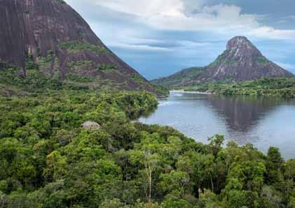
Hunting/Agriculture
Hunting is an ancient practice, based on understanding the variety of animal and plant species, and ensuring sustainable management of the land. This is how the Murui, an Amazonian people whose hunting practice has been recognised for its variety of methods, describe it.
However, as in many places, the advance of ‘development’ meant the introduction of heavy machinery and industrialisation. The building of roads, bridges, viaducts and oil pipelines led to massive displacement of species deeper into the jungle. Roads opened up the land to new populations, who generally do not know the rhythms and timing of the jungle. They brought domesticated animals, and they hunted way beyond their needs, resulting in a rapid decline of certain species.
As well as extensive cattle ranching, the cultivation of plants for illicit use, and aerial spraying with glyphosate, have caused unimaginable damage to our traditional natural environment, massively reducing the areas in which we are able to hunt traditionally.
Culture
The main cultural characteristic of the Indigenous communities that inhabit the Amazon is their worldview: living in harmony with the environment, and valuing the intrinsic value of the land and nature. Indigenous mythology refers to various goddesses, for example Pacha Mama, Alpa Mama, Tsbasana Mama, and Tata Inti.
This romantic worldview of embracing the spirits of Viracocha (spirit of the sun) or Pacha Kamaq (found physically in nature) vanishes when those with a Western viewpoint arrive. From the time of the original invasion, to colonisation and the formation of a Republic, they have insisted that the origin of humanity is Adam and Eve, and that the Bible is the last word in worldview and spirituality. There is no recognition, acknowledgement or respect for Indigenous traditions and beliefs.
Over the decades, numerous religious sects have encroached on Indigenous territories. They build ‘temples’, they preach on radio stations, and they broadcast on television channels in an attempt to convert. Sometimes they even give money to native residents to attend their religious events and activities. This is a strategy of domination that contains a desire to change the Indigenous peoples’ spirituality, in order to build a more effective dominion based on fear.
Since the arrival of Cristobal Colón (Christopher Columbus) to the Americas, there has been a constant battle against Indigenous communities to change their law of origin, surrender their culture, give away their territories, and shed their beliefs. There is an attempt to divide and create disharmony between Indigenous groups, and ultimately lead to their extinction.
14Winter 2022 The Geographer 17
Jaime Benjamin Tisoy Tandioy, Mayor (Alcalde), Resguardo Inga de Santiago, Putumayo, Colombia
“Roads opened up the land to new populations, who generally do not know the rhythms and timing of the jungle.”
© Gabriel Eisenband
Serving communities under threat
Jenny Barchfield, Regional Spokesperson for South America, UNHCR, the United Nations Refugee Agency
As a local human rights authority in one of Colombia’s most dangerous regions, Yasselly Martínez Ortiz regularly receives threats meant to keep her from doing her job. Still, she continues to work to help communities affected by the country’s armed conflict.
As soon as Yasselly accepted her position as a civil servant in the remote Chocó area of Colombia, a life insurance policy was taken out in her name. She works as a so-called personera, a sort of municipal ombudsperson tasked with ensuring that residents’ human rights are respected. It is an indication of just how dicey their work is that Yasselly says that, as far as she knows, personeros are the only civil servants in Colombia who are automatically issued life insurance.
“We are the voice of those communities that have no voice,” she said, adding that this very public advocacy role has regularly made her a target. “I personally have received threats for doing the kind of work that we do… [and] I know that around 80% of my colleagues have also faced threats.”
Even among this high-risk cohort, Yasselly’s position is particularly precarious. The 31-year-old lawyer is based in Bellavista, a small city that was founded in the wake of the 2002 massacre in the nearby hamlet of Bojayá, which left 79 people dead and became among the most emblematic events of Colombia’s 58-year-long armed conflict.
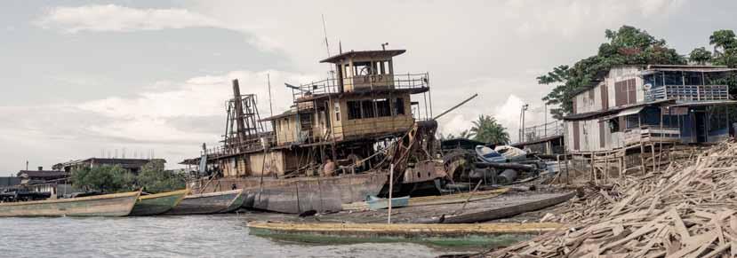
The country’s Truth Commission recently put at around 450,000 the estimated death toll from the internal conflict between guerrillas, the Colombian military, and paramilitary groups. While the government signed a peace agreement with the main guerrilla group, the FARC, in 2016, the conflict between other guerrilla groups and paramilitary factions continues in Chocó – a sparsely populated jungle region on Colombia’s western Pacific coast – and beyond.
The ongoing violence here means that Yasselly is regularly called upon to grapple with such devastating situations as ‘confinement’, a widespread practice that sees armed groups lock down entire villages, warning residents not to leave the confines of their settlement, under pain of death or other retaliation, including sexual violence.
The inhabitants of Chocó are overwhelmingly of Indigenous
or Afro-Colombian origin and have for centuries lived off the land, fishing in nearby rivers and farming the rich tropical soil. The practice of confinement wreaks havoc on their traditional ways of life, depriving people of such basic rights as access to healthcare, education and even food for weeks, months, or even years on end, and resulting in widespread hunger and desperation.
“They hang on for as long as possible,” says Yasselly, “but when they start to see clashes within the villages, or they feel like they are at imminent risk of being killed, or when a member [of the community] is killed, they find themselves forced to flee.”
With an estimated 6.8 million Colombians displaced within the borders of their own country, Colombia has the world’s second-highest population of internally displaced people, after Syria. All too often, entire villages in Chocó end up fleeing to the region’s largest city, Quibdó, where, deprived of their livelihoods, they struggle to scrape by and keep a roof over their heads. In a cruel twist of fate, these internally displaced people sometimes find themselves relegated to marginalized neighbourhoods that are also under the control of armed groups.
Yasselly, the personera, works to ease the suffering of confinement by, for example, ensuring that schoolteachers are able to access confined communities, and preventing loss of life or limb by reporting land mines, which are often planted by the armed groups, to the authorities in charge of removing them. UNHCR is helping Yasselly and other personeros to do their work by donating equipment they need to do their jobs, as well as much-needed aid to the communities they serve. One such community is the Embera Dovida Indigenous Reservation, a village of around 150 people that is perched on the banks of the Atrato River. Theirs was once a “tranquil” life, says the village gobernador, or chief, Darío Mecha [name changed for protection reasons].
“Before, we fished at the waterfall and worked in the fields,” he recalled. But then, in around 2004, armed groups appeared. “They started saying we could no longer walk to the fields, we could no longer work, and they also told us we weren’t to bring very much food” from the city, in
Winter 2022 18
“We are the voice of those communities that have no voice.”
the motorized canoes which are the region’s main form of transport.
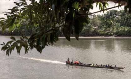
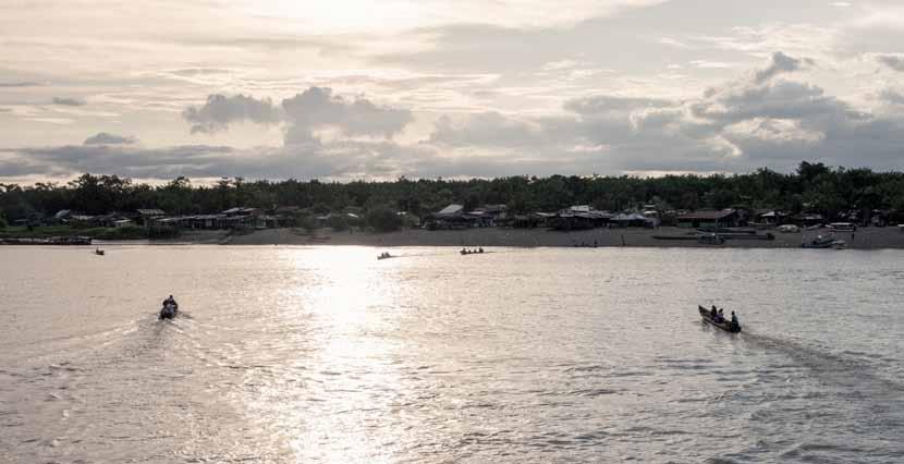
“So now we just stay here,” he said, gesturing at the small grouping of thatched homes, perched on stilts. The confinement has led not only to nutritional problems, but also to increased tensions in the community, as parents struggle to cope with hungry, bored children, and women live in terror of the omnipresent spectre of sexual violence, should they stray too far from the village.
While the longevity and sheer scope of the conflict in Chocó mean that inhabitants’ needs far outstrip Yasselly’s capacity to respond, she says she takes great satisfaction in every act of violence she is able to address, or occasionally, even prevent.
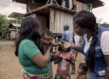
“We aren’t going to resolve the problems because they are structural problems, but we do our part so that communities that find themselves in these situations get timely help and, in the midst of so many difficulties, have some hope,” said Yasselly, a native of Quibdó, whose family, like so many other Colombian families in Chocó and beyond, was also a victim of forced displacement.
Yasselly says that despite the dangers of her job, both her family and her wider community serve as a wellspring of motivation. Having lived the drama of internal displacement herself and seeing how the effects of it ripple out, devastatingly, across the years and the generations, she knows first-hand just how crucial it is that she continues to stand up for the voiceless communities of Chocó.
“If those of us who are doing this work of defending human rights don’t do it,” she asks, “how will the communities survive?”
14Winter 2022 The Geographer 19
“Colombia has the world’s second-highest population of internally displaced people.”
All images © Nicolò Filippo Rosso
Captivating Colombia
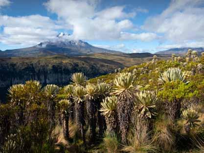
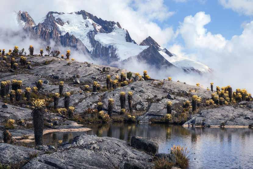
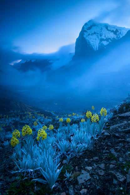
All images © Gabriel Eisenband, Instagram @gaboeisenband, www.gaboeisenband.com
Winter 2022 20
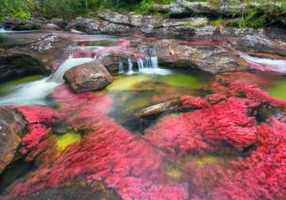
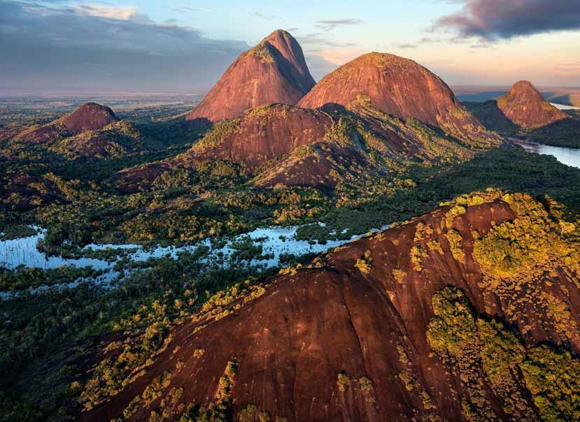
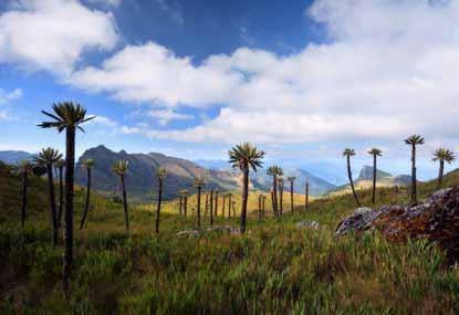
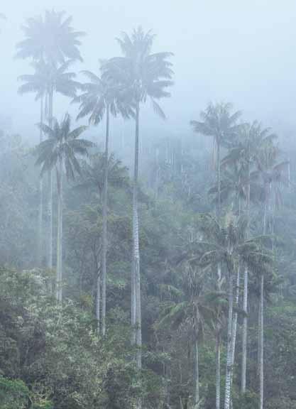
Winter 2022 The Geographer 21
Magdalena: River of Dreams
Travellers often become enchanted with the first country that captures their hearts and gives them licence to be free. For me, it was Colombia. The mountains and forests, rivers and wetlands, the mysterious páramos and the beauty and power of every tropical glen and snow-crested equatorial peak opened a doorway to a wider world that I would spend my entire life coming to know. In ways impossible fully to explain, the country allowed me, even as a boy, to imagine and dream. Colombia is most assuredly not a place of violence and drugs; it is a land of colores y cariño, where the people have endured and overcome years of conflict precisely because of their character, which is itself informed by an enduring spirit of place, a deep love of a land that is perhaps the most bountiful on Earth, home to the greatest ecological and geographical diversity to be found on the planet. It speaks volumes of the strength and resilience of the Colombian people that through all these difficult and impossible years the nation has maintained civil society and democracy, grown its economy, greened its cities, created millions of acres of national parks and sought meaningful restitution with scores of Indigenous cultures, a progressive record unmatched by any other nation state.
Colombians today long for peace. Those of a certain age look back to a time when the country made sense, before the rivers were awash with the dead. Those born into the cauldron of war yearn simply for a chance to live in a land without fear, where violence no longer clouds the destiny of the young. Memories and longing, I suspect, drew many readers to the narrative of El Río, which in part recounts my experience as a student in the 1970s, free to travel at will in Colombia to any place my feet took me; from Chocó to the Putumayo, Cauca to the coast of Magdalena, Nariño to the far horizons of the Llanos.
In the end, El Río surely belongs to neither me as author nor Nicolás as translator, but rather to the young people of Colombia, an entire generation, perhaps two, that like the nation itself have not deserved the ravages of these last many years. In 2009, when the third edition was published, Colombia was still very much a nation at war, and vast reaches of the country remained off limits for ordinary people. In the new foreword I expressed “my fervent hope that one day all young Colombians will be free, as I was, to travel without fear to every crossroads and forest stream, every mountain and páramo, the primordial slopes of the Macarena and into the very heart of the Amazon. That time will come. If in the meantime this book might inspire a few travel plans, let it be as a map of dreams.”
Mercifully, the promise of peace has come to Colombia, and sooner than many imagined possible in 2009. The signing of the accords in Cartagena on 26th September 2016
This article was extracted with permission from Wade Davis’s book, Magdalena; River of Dreams. See the back page for details.
sent a powerful message to every nation that while the world may be falling apart, Colombia is falling together. It will be a long, slow, and uneven process of reconciliation and rebirth. Sporadic violence is certain to flare. Intense pressure will be brought to bear to exploit lands and forests long insulated from development by the conflict. The corrosive influence of cocaine will remain, unless governments everywhere have the courage to destroy the illicit trade with the cleansing stroke of legalization, a dim prospect despite being widely acknowledged as the only rational solution. For the nation to heal, Colombians will have to find their way to forgiveness, even as they honour always the memory of loved ones so cruelly and unjustly taken from this life. War is easy. Peace will be hard. But it brings with it limitless possibilities. Today, two generations of young Colombians forced to flee the conflict are returning from New York, London, Paris and Madrid, with highly developed skills in every conceivable field of endeavour, leaving their nation on the verge of an economic, cultural and intellectual rebirth unlike anything ever seen in Latin America. Within the country, literally millions are on the move. Some displaced by the violence are finding their way back home. Others almost as pilgrims are taking to the open road in search of work, family, and new lives. In 2016 alone, some twenty million Colombians travelled within their country, close to half of the national population.
As men and women from Valledupar to Pasto, Manizales to Mocoa, Bucaramanga and Buenaventura to Barrancabermeja, Cali, Medellín and Bogotá are at last free to discover their own homeland, all of Colombia has awoken to the realization that because of the conflict, vast regions of the nation, long isolated by the war, have been mercifully spared the ravages of modern development. This perhaps will be the real peace dividend, the opportunity for the nation to consciously and deliberately decide the fate of its greatest asset, the land itself, along with the forests, rivers, lakes, mountains, and streams. If the lowland rainforests of Ecuador, to cite but one example, have since 1975 been utterly transformed by oil and gas exploration, colonization and deforestation, the Colombian Amazon, though now under threat, has remained until recently an essentially roadless expanse of pristine forest the size of France. Decisions made today about the fate of all the wild lands of Colombia will benefit from the wisdom of indigenous elders and the insights of decades of scientific research, all informed by an awareness of the importance of biological and cultural diversity that simply did not exist when the fate of lowland Ecuador was determined fifty years ago. Rarely in history has a nation state been given such an opportunity to envision its future, and such a reprieve from the industrial forces that have impacted so much of the world over the last half-century.
As Colombians chart their way forward, everything hangs in the balance. Some months ago, outside of Santa Marta on the banks of the Don Diego river, an old friend and revered Arhuaco elder, Mamo Camilo, summed up the challenge. “Peace will not matter,” he said, “if it is only an excuse for the various sides of the conflict to come together to maintain a war against nature. The time has come to make peace with the entire natural world.”
Winter 2022 22
Wade Davis FRSGS, anthropologist, author, explorer

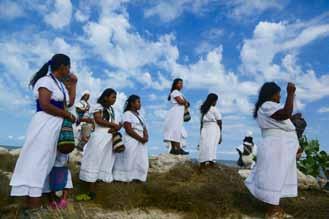
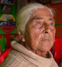
14Winter 2022 The Geographer 23 Image from iStock.
Making offerings to the river, at Bocas de Ceniza. © Wade Davis
“‘The time has come to make peace with the entire natural world.’”
Adelfa Pineda Ibáñez, Murillo. © Wade Davis
In the streets of Colombia
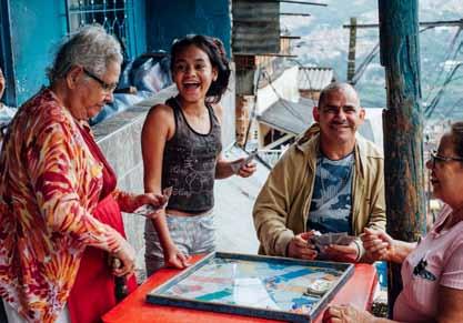
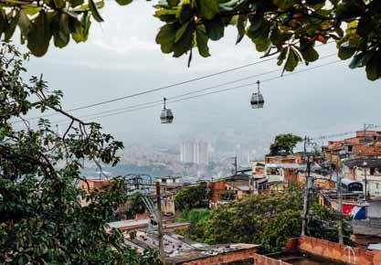
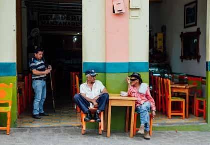
1. A lightning storm over Medellín, taken from the rooftop of a hostel. | 2. The cable cars leading from Medellín to the Santa Cruz community. | 3. A man enjoying a beer at the famous tango dancehall Salon Malaga in Medellín; behind me was a dancefloor packed with locals and my friends all dancing tango. | 4. Locals playing board games in Santa Cruz. | 5. A coffee house in Jardin. | 6. Waving the Colombian flag in Cartagena during a running event. | 7. A street stall in Medellín. | 8. A grocery shop in Medellín. | 9. Comuna 13, a neighbourhood in Medellín known in the 80s and 90s for being one of the most dangerous places in the world. | 10. Drumming lessons for local children in Comuna 13. All images © Anna Pumer, annapumerphotography.com Anna is a wedding photographer based in Brighton. She loves organising street photography and travel photography trips all around the world with her photographer friends, telling the stories of local people through photography.
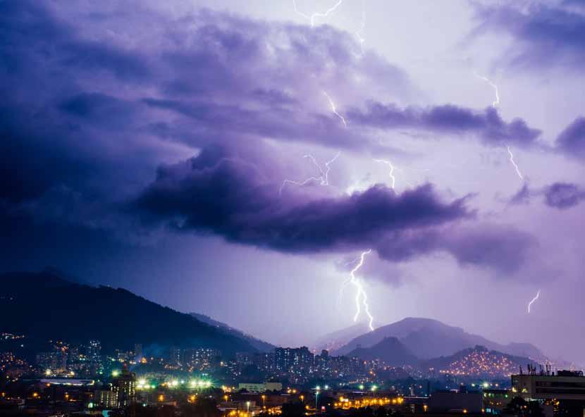
Winter 2022 24 1 2 4 5 3
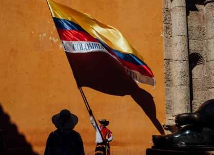
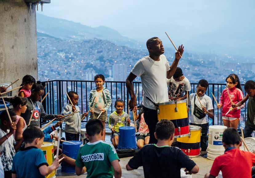
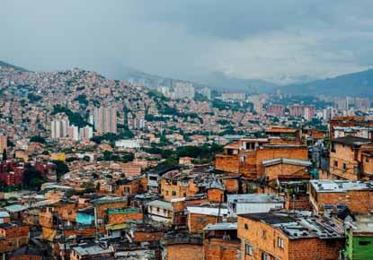
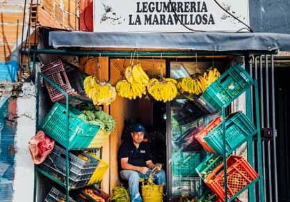
14Winter 2022 The Geographer 25 6 8 7 9 10
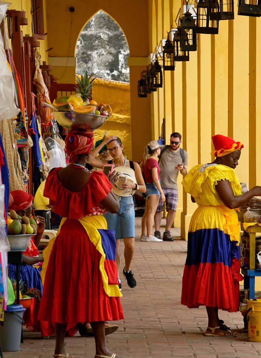
Winter 2022 26
“Cartagena is astonishingly vibrant, with everything a traveller could possibly hope for.”
Image by Ricardo Gomez Angel from Unsplash.
Cartagena
Sailing into Cartagena, our first sight of the city was otherworldly: huge tower blocks appearing out of nowhere in the middle of the ocean. On approach, modern high-rise buildings gave way to stone walls and Castle San Felipe de Barajas standing prominently at the top of San Lazaro hill. It was beginning to get dark and loud music from party boats appeared from all directions, their bright lights confused against the city skyline, sneaking up close enough that we could almost make out every passenger standing on the decks, dancing, drinking and singing.
We arrived at Club de Pesca marina in the dark, taking in the sights and sounds of Cartagena by night, overwhelming our senses after a three-day sail from the relatively serene island of Bonaire. The marina was built protruding from one of the city’s oldest defence posts, Fuerte de San Sebastián del Pastelillo, with the oldest part of the fort dating back to the 16th century. The next morning, we sat at the marina restaurant and had our first ‘refreshing beverage’ before heading into town.
Cartagena is astonishingly vibrant, with everything a traveller could possibly hope for: historical sites, incredible cuisine, music, festivals, dancing and quirky, colourful streets filled with unique shops and cafés. Colombia is known as ‘the land of a thousand rhythms’ and, walking around Cartagena, you can hear them being played out from every corner of the city.
With only a couple of days to spend there, we decided to start by taking in some of the city’s impressive historical sites. Our first stop was Castillo de San Felipe de Barajas, a UNESCO World Heritage Site. Built in 1536 and extended several times, the formidable building boasts a complex maze of tunnels and imposing stone walls, which have seen invasions from pirates to colonial powers. Cartagena was once a prominent slave port, and looking at the immense structure in the heat of the day it’s important to remember that it was painstakingly built by slave labour. First known as San Lazaro castle, it underwent its first significant expansion in 1657 and was renamed after Philip IV of Spain. We walked along the castle walls, taking in the vistas across the city, and learned a little about the many raids and battles that took place here.
Once the midday sun became too unbearable for two Scottish tourists, we headed for the Getsemaní district to find shelter and a cold drink. Getsemaní is a lively, quirky and colourful area located between the castle and the walled old town. Vibrant paintings and murals line the streets, flowers and bunting tumble down from wires above, and colourful chairs spill out from artsy cafés. Once considered a ‘dangerous’ area of town, Getsemaní has certainly undergone a revival and boasts many hostels, bustling nightlife and culinary delights. Through the lens of a geographer, while there have been many benefits from the urban revival of areas like Getsemaní, gentrification has led to the displacement of locals and a lack of opportunity for those trying to eke out a living. To combat this issue, there are some companies offering walking tours with Zenú indigenous groups, employing locals to share their valuable knowledge of the city and run cultural workshops.
The next day, we headed for the Old Town, our second UNESCO World Heritage Site in such a short visit. After walking along the old city walls, we weaved our way down cobbled streets to El Centro where, standing elegantly in the square, is the imposing Palace of the Inquisition. Now a museum, this aesthetically beautiful Spanish colonial building once saw horrific cruelty at the hands of the Tribunal of the Holy Office, otherwise known as the Spanish Inquisition The aim of this court was to ‘combat’ heresy, often using awful torture methods to obtain confessions from those accused.
The exhibition inside has information boards in each room with case studies about individuals brought here to be trialled. Also displayed throughout the building are some chilling instruments once used to ‘obtain’ confessions. In Cartagena, nearly 900 people were trialled and punished at the Palace, accused of practices such as witchcraft, reading forbidden books, bigamy and other ‘acts of heresy’. The message inside the museum was, understandably, a very clear wish to move past this terrible part of history, using the space to remember those who suffered, celebrate huge advances in human rights, and honour diversity.
While we only had a short time in Cartagena, the combination of historical sites, diverse cultural heritage and vibrant areas to explore was a fitting introduction to Colombia. I look forward to delving deeper into all this incredible country has to offer one day.
14Winter 2022 The Geographer 27
Kirsty Fisher, former RSGS Young Geographer project participant
Colour abounds on the streets of the Getsemaní district. @ Kirsty Fisher
Helen Sanborn: a long way to go for a good cup of coffee
Helen Josephine Sanborn knew a lot more about coffeemaking than most American women of her generation, but she found the Guatemalan method quite peculiar. First, the beans were burned over a charcoal fire until they were black and bitter, then they were ground and mixed with water to make a strong, black liquid. A small amount was poured into a cup, and hot water added. No milk, and rarely any sugar. At first she found it disgusting, but after a while she was drinking it freely. In the middle of the Guatemalan rainforest, she found she had little choice.
Helen’s father was James Sanborn, the co-founder of one of America’s biggest coffee importers: Chase & Sanborn of Boston, Massachusetts. In January 1885, James planned an expedition to forge trading agreements with coffee growers in Central America; his itinerary included Guatemala, Panama (then part of Colombia) and Mexico. His 28-year-old daughter, a graduate of Wellesley College, found the idea tremendously exciting and begged to be allowed to go too. She quickly learned Spanish and ignored her friends’ warnings about the dangers of Central America. “I felt very sure,” she wrote, “that I could go wherever my father could; and besides, we did not believe more than half that was told us.”
Despite Helen’s brave words, when they disembarked in Livingston, Guatemala, she had no way of knowing what to expect. Her first challenge was a journey by mule train, following crumbling paths cut into the sides of steep ravines. For a woman accustomed to all the comforts that her father’s wealth could provide, it was a shock to have to string up a hammock or bed down on a blanket in a roofless, dirt-floored room.
The rainforest environment, however, had its compensations. Helen observed everything with wonder: “I could scarcely believe that what I beheld was real, so totally different was it from anything I had ever seen… When I looked at the flowers and trees, and the beauties that nature had so freely bestowed on this spot, I wondered if I was in fairy-land.”
In Guatemala City, President Justo Rufino Barrios proudly invited James and Helen to sample some coffee beans grown on his own plantations. A former revolutionary, Barrios wielded the power of a dictator; he showed them every courtesy, but Helen noted that, as he reclined on a sofa, his hand hovered within easy reach of a bell that would summon a gunman to shoot offending visitors.
Plantations inspected, shipping ports visited, and deals
concluded, the Sanborns travelled by railroad from Guatemala City to the Pacific coast. As they admired the mountain scenery, they could not have known that, within weeks, President Barrios would be killed by gunfire in El Salvador. Having declared himself the President of a Central American Union, which included Guatemala, Costa Rica, El Salvador, Honduras and Nicaragua, Barrios found the other nations’ cooperation sadly lacking and decided to invade El Salvador. Meanwhile, from the port of San José, Helen and James sailed south, unaware of their lucky escape.
At Panama City the sea was crowded with ships, and Helen watched with interest as dredgers excavated a section of the De Lesseps Canal. Overseen by French entrepreneur Ferdinand de Lesseps, who had masterminded the Suez Canal, this ambitious project aimed to cut a sea-level channel between Panama City and Colón. Helen wrote, “We were told by one of the engineers that so far only the ‘installation’ was done – only ten million of the required two hundred and fifty million cubic metres of earth had yet been removed.”
Thousands of workmen were falling victim to tropical disease, and it was this danger that particularly worried Helen and her father. The isthmus was notorious for yellow fever and Chagres fever, the latter being a form of malaria named after Panama’s Chagres River. Only 47 miles of rail track separated Panama City from Colón on the Atlantic coast, where the Sanborns hoped to board a steamer for New Orleans and then Vera Cruz, but the risks were immense: Helen observed that travellers “had been known to go on shore in perfect health and die before next morning.”
In the Grand Central Hotel they passed a hot and fretful night. Helen’s father had been sickening for a few days, and now he was weak with fever. The building was new but had an
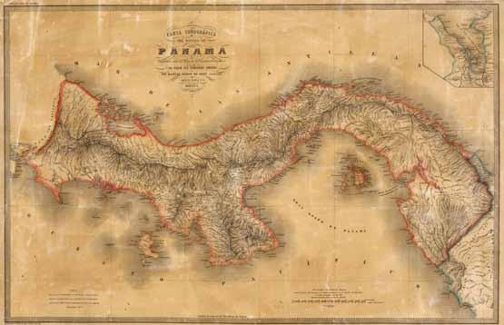
Winter 2022 28
Jo Woolf FRSGS, RSGS Writer-in-Residence
“‘I could scarcely believe that what I beheld was real.’”
Carta Corográfica del Estado Soberano de Panamá, from the Atlas de los Estados Unidos de Colombia, 1865 (commons.wikimedia.org).
indefinable odour of decay; they read in the newspapers that a corpse had been found beneath one of the city’s hotels, and suspecting it was theirs, they were desperate to leave. Early next morning, they boarded a train for the three-hour journey to Colón.
The city named after Christopher Columbus rivalled Panama City for the undesirable reputation as Panama’s most unhealthy port. Helen wanted to get her father onto a ship as quickly as possible, but the New Orleans steamer was not yet in dock. To make matters worse, violence was breaking out on the streets: a rebellion, later known as the Panama Crisis, was just beginning. Helen wrote in despair, “We had slept in mud huts… and encountered many hardships cheerfully; but now, for the first and only time (although neither of us acknowledged it until we got home) we felt like giving up, and almost wished we had never undertaken this journey.”
The steamer’s arrival brought little relief. Passengers were informed that, until its scheduled departure in two days’ time, they would be unable to embark. The Sanborns’ luggage was already on the dockside; another boat was leaving imminently for New York, and offered an easy solution. Impulsively, Helen said, “Father, let us take the Pacific Mail steamer and go home.” His vigorous response surprised her. “Do you want to give up Mexico?” he asked, and promptly climbed aboard the New Orleans steamer without asking permission.
Work on the De Lesseps Canal began in 1881, but progress was hampered by floods and landslides. Some 20,000 labourers died of tropical disease, many within three months of arriving. After less than ten years, the project ran into financial difficulty and was abandoned. Following the separation of Panama from Colombia in 1903, the United States took over the construction of the Panama Canal, which opened in 1914.
The Panama Crisis of March 1885 occurred when Colombia withdrew troops from Panama to deal with an insurgency elsewhere. Panamanian separatists then occupied Colón, hoping to intercept a shipment of US weapons. Amid fierce fighting, the combined efforts of US warships and Colombian forces prevented this from happening but not before much of Colón was burned and American hostages taken (later released unharmed).
Confronted by a determined American businessman, the captain of the Legislator, a British steamship of the Harrison line, found that ‘no’ was not an acceptable answer. James Sanborn told him that they would sleep on deck if necessary, if they could only come aboard. “There stands my daughter on the wharf,” he declared, “and I believe we shall both die before morning if we have to stay on shore.” A few minutes later the gangplank was lowered, and the Sanborns’ anxieties were over. On their northward voyage, watching with relief as her father recovered his health, Helen had ample time to reflect on their good fortune. “I felt,” she wrote, “like one who had passed through a fiery furnace unscathed.”
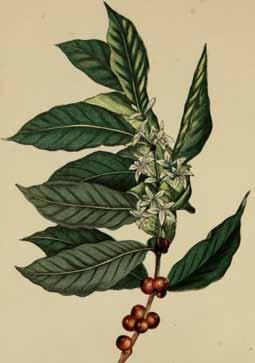
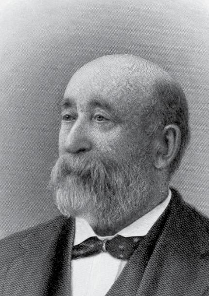
14Winter 2022 The Geographer 29
“The isthmus was notorious for yellow fever and Chagres fever.”
FURTHER READING
A Winter in Central America and Mexico, by Helen J Sanborn (1886)
Chase & Sanborn, 87 Broad Street, Boston.
James Solomon Sanborn. Coffee flowers and beans.
The challenges of climate change for Colombia
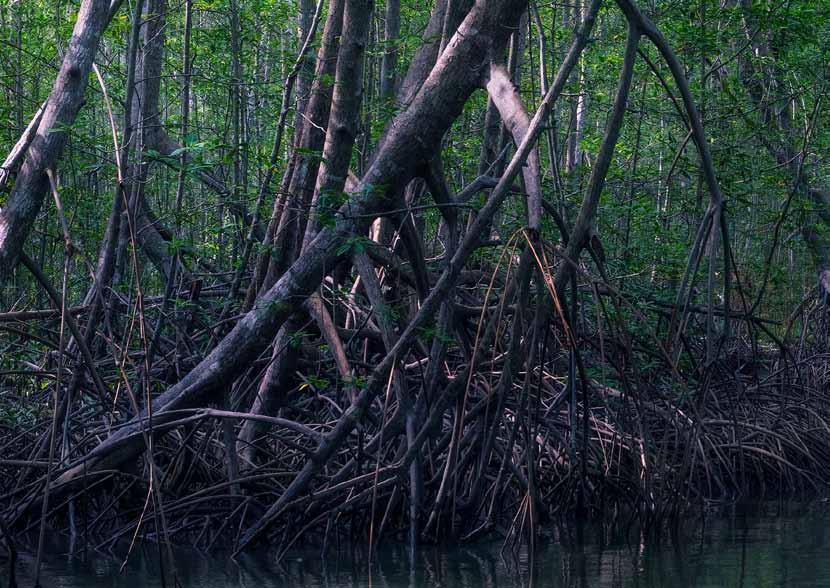 Nohra León Rodriguez, José Daniel Pabón-Caicedo, Department of Geography, National University of Colombia
Global warming and climate change are environmental issues of special concern for different countries, because of the impacts these phenomena will bring to physical-biotical and socio-economical dimensions of diverse regions around the world. Therefore countries, through the United Nations Framework Convention on Climate Change (UNFCCC), agreed to control causes of the warming, reducing the atmospheric concentration of greenhouse gases, and to promote actions for adapting to the changing climate.
Colombia, as a signatory country of the UNFCCC and of connected instruments such as the Kyoto Protocol and the Paris Agreement, carries out several efforts in mitigation and adaptation. Nationally, Colombia has structured a Climate Change Policy (“carbon neutral and climate resilient development”) and introduced several institutional instruments, such as Law 1931 that rules the management of climate change issues in the country.
The Third Biennial Update Report (BUR), presented by Colombia to the UNFCCC in 2021, shows that in 2018 the national emissions summed about 303 million tons of CO2-eq, and the national captures close to 24 million tons. The balance (emissions minus captures) indicates that the Colombian net emissions of greenhouse gases compound approximately 0.75% of the global emissions which total close to 40 Gigatons of CO2-eq. Most of the national emissions were caused by deforestation (33%) and enteric fermentation (12%), and by transport (11%) and industrial (7%) sectors.
Notwithstanding this small contribution to the global environmental problem, in 2015, at the 21st UNFCCC Conference of the Parties (COP), Colombia presented the Nationally Determined Contribution (NDC) compromises for mitigation goals. This NDC was updated in December of 2020, confirming the compromise to reduce greenhouse gas emissions by 51% compared to the reference scenario (the business-as-usual trend of emissions calculated since 2015) by 2030. At COP26, Colombia engaged with the Long-Term Climate Strategy E2050 that aims to achieve the country´s carbon neutrality by 2050. Assuming these compromises, Colombia has the challenge to modernize technologically the transport and industrial sectors towards the energy transition, and to fight against deforestation. The good news is that the current political situation has pointed to this issue as a priority. However, the desirable fast advance in energy transition requires huge financial resources for investment in clean technology, but these resources are limited due to the current economic situation of the country.
Colombian progress in mitigation may be followed through the Monitoring, Reporting and Verification (MRV) system that the country operates as a result of the decisions of the UNFCCC, and in the sequence of the BURs the country presents to the Convention every two years; up to today, Colombia has presented three BURs.
On the other hand, the territorial dimensions (ecosystem, water resources, food security, human health, productive sectors, infrastructure, disaster risk, and cultural issues) of Colombia are exposed to climate change. As it was assessed in 2017, these dimensions exhibit diverse degrees of vulnerability, mainly moderate and high vulnerability. This situation emphasises adaptation of the territories by reducing the vulnerability. The slogan “climate resilient development” of the National Policy on Climate Change aims precisely at achieving such a purpose.
The adaptation actions to address the climate change risks in the country include various strategies in the National Plan for Adaptation to Climate Change (PNACC, the acronym in Spanish). Additionally, several normative instruments have been released in order to mandate the inclusion of adaptation in territorial and sectorial planning. The country, in the NDC presented at COP21, assumed compromises related to adaptation, which were updated in 2020 too. The adaptation goals of the NDC consider achieving a reduction in vulnerability to climate change in all territorial dimensions, mainly by strengthening their adaptation capacity. Due to the high degree of vulnerability to climate change in most territories, adaptation becomes a crucial and challenging issue for the country.
Like for mitigation, the Monitoring and Evaluation (M&E) system has been implemented in the country for adaptation, as a response to the requirements of the UNFCCC. With the M&E system, the advances in adaptation may be tracked and the NDC adaptation goals may then be accomplished.
Law 2169 on Climate Action, issued in December 2021, represents the most recent effort of the country to have more concrete results in mitigation and adaptation in the path to carbon-neutral development and territories adapted to climate change. As it states, the objective is “to establish goals and measures to achieve carbon neutrality, climate resilience and low-carbon development in the country in the short, medium and long term, within the framework of the international commitments assumed by the Republic of Colombia on the matter.”
Winter 2022 30
“The desirable fast advance in energy transition requires huge financial resources for investment in clean technology.”
© Gabriel Eisenband
Climate change and Colombian coffee
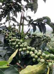
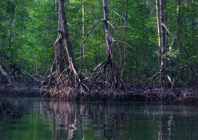 Ben Smith, Perfect Daily Grind
As the red pickup truck trundled along the rutted track, carrying us higher into the Antioquian mountains, the driver, a third-generation coffee farmer, pointed at the slopes below us. “Over there,” he said. “That’s where they’ve started uprooting their coffee trees and planting avocados.”
We’d reached a point above the clouds, to a height of almost 2,000 metres above sea level (masl), and were on our way to see the speciality coffee varieties the driver had planted almost a year ago. He was excited about the harvest ahead, having already secured buyers for the entire season’s crop. But the area he was referring to was much lower, at around 1,400 masl or less. Rising temperatures due to climate change mean the lower limit for coffee growing has risen by 200m in the last 40 years alone. Consequently, the optimal range for growing coffee has gone from 1,250 ‒1,600 masl to 1,450 ‒1,800 masl.
This has left farmers at these lower altitudes with little choice but to abandon their coffee crops and go in search of new sources of income. Strong global demand for avocados has made them a logical option. But farmers are still leaving behind the only industry they know for one full of unknowns.
In several low-lying regions across Central and South America, crop diversification and, in some cases, replacing coffee altogether, has become commonplace. Where green trees peppered with red coffee cherries once stood, now trees bearing avocados and bright yellow cacao pods can be found. This is because, as a crop that depends on a delicate balance of warm days and cool nights, suitable areas for growing arabica coffee are shrinking at an alarming rate. Changes to precipitation and humidity have already started affecting coffee production in Colombia, while outbreaks of pests and diseases are occurring with ever greater frequency, wreaking havoc on yields.
The oft-quoted statistic is that, as it stands, the total land available to grow high-quality arabica coffee could be halved by 2050. But in Latin America, it will be even worse. According to the journal Proceedings of the National Academy of Sciences, that number could be as high as 90%. Naturally, the Colombian government is worried. Coffee production provides livelihoods for more than 500,000 of the country’s population and many more indirectly involved, from trade to transport. Between October 2019 and September 2020, Colombian coffee exports amounted to 12.9 million 60-kilogram bags, bringing in several billion dollars. Losing this income would leave a huge hole in the country’s agricultural GDP (between 10% and 16% by recent estimates).
As such, finding a long-term solution has been a priority for the country’s National Federation of Coffee Growers (FNC in Spanish). Among the most promising is Cenicafé 1: a labmade coffee variety that provides the desirable cup profile of arabica with the more climate change resilient properties of robusta.
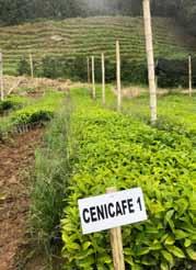
Its size and structure (said to be similar to Caturra and Colombia coffee varieties) enables high crop densities, which are crucial to improving profitability for farmers. It also offers heightened resistance against coffee leaf rust disease and berry-boring beetles, both of which have become increasingly prevalent as global temperatures have risen. Cenicafé 1 was 20 years in the making and caused a lot of buzz when it was unveiled at the 83rd National Coffee Growers Congress in 2016. Indeed, the coffee farm that I visited back in June this year proudly showed me its own Cenicafé 1 lot.
But there’s an overriding sense that, like many ‘solutions’ to climate change induced problems, this is of the band-aid variety. If Colombia and, indeed, the rest of the world is to avert seeing the end of coffee as we know it within the next 100 years, then the real solution lies with all of us. Decreasing cloud cover, higher than average rainfall, weather extremes, and disease outbreaks, to name but a few, are all direct consequences of rising global temperatures from human-made greenhouse gases.
Until we, in coffee-consuming countries, reduce our carbon emissions, then farmers will continue to be pushed further up into the mountains to produce the same coffee they could before. When this land eventually runs out – which it will –then we’ll be facing the only future we can be sure of: one without coffee.
14Winter 2022 The Geographer 31
“Suitable areas for growing arabica coffee are shrinking at an alarming rate.”
COP26, one year on: from Glasgow to Sharm el-Sheikh
Mike Robinson, RSGS Chief Executive
It is a year since Glasgow’s UN Climate Change Conference, COP26, and November saw COP27 in Sharm el-Sheikh. So what, if anything, has been achieved?
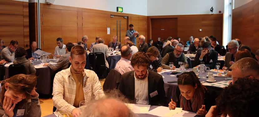
Much was expected of COP26 in Glasgow, and expectations are difficult to manage. A coming together of the world’s governments, in which everyone needed to agree, was never going to be radical, but it was a brief window when much of the world was not distracted by other global short-term concerns, and the focus was clearly on climate action. These moments, when the whole world is looking in the same direction, are rare. COP15 in Copenhagen back in 2009 was one such moment, which is why it was so disappointing it didn’t achieve more. We then had to wait six years until COP21 before reaching a similar focus in Paris. Although not conclusive, the Paris Agreement was at least (and at last) a welcome step in the right direction. Glasgow too felt like such a focused moment, so it is disappointing it didn’t result in anything more definitive.
So what did Glasgow’s COP26 achieve? The UN has been quick to highlight progress, but UN Secretary-General António Guterres pointed out that, despite the accomplishments in Glasgow, the world is still far off track to stabilizing global temperature rise at 1.5°C, and he urged further and immediate international collaboration to get the world back on track to achieving this goal.
Perhaps the biggest lesson of COP26 is how essential it is that our institutions, businesses and ‘non-state actors’ really begin to step up and make it happen. What COP26 did achieve beyond the disappointing headlines was a wave of other lower-level commitments from ‘non-state actors’. Regional governments, coalitions, cities, multinationals and many organisations put forward their own commitments, in support of their own nation’s pledges (NDCs). Thousands of businesses declared their own net zero targets, and whilst there is much scepticism about their ability or drive to fulfil these targets, there is a significant momentum for people beyond national governments to step up and do more, and this has to be welcome.
Whilst COP26 might be lacking concrete achievements, it has accelerated the momentum behind this issue. And whilst COP27 competed for headlines with energy costs, food price
inflation, war in Ukraine and much besides, it did at the very least maintain some of that momentum.
The UK has been seen globally as the leader within the G20, and Scotland as the leader in the UK. But the rest of the world is catching up. Indeed, since Glasgow’s COP26, Finland can lay claim to have overtaken the UK with a new commitment of net zero by 2035. Although we hear a lot about Scotland’s target of net zero by 2045, this has now been matched by Germany and Sweden. Even countries which have previously been reluctant laggards (or outright climate deniers) have brought forward legislation. The UK, with its target of net zero by 2050, has now been matched by the USA, Canada, Australia and New Zealand, and although some are again sceptical of their ability or commitment to deliver, these targets are a huge step forward and were inconceivable only a handful of years ago. Even Russia, China and Saudi Arabia have declared net zero by 2060, and India by 2070. The momentum is undoubtedly there, and despite many nations being slow to deliver against these targets, and even though the current commitments don’t yet go far enough to avoid runaway climate change, they are ratcheting up year on year on year. The direction of travel could not be clearer.
The opportunity for Scotland and the UK (so long as we retain credibility by delivering against our targets) is that we are at the front of a wave of change that is sweeping the world. We have potential stronger alliances with those nations which are leading that change, like Finland, Sweden, Denmark, Norway, Costa Rica, Morocco, Germany and the EU. But perhaps even more starkly, we have a huge opportunity to help our natural allies in North America and Australasia, who are late to the party but now determined to catch up and looking for examples to follow.
Working with the Open University, we ran a conference in October ahead of COP27 to understand what signs of positive change have begun to take root since COP26, nationally and internationally. What projects and activities have begun which will start to bring about this necessary transition? And what else do we need to see happen, what ideas are out there in the ether, which will help build the low-carbon future we all know we need, and need more of a spotlight? See rsgs.org for the conference report.
Winter 2022 32
“We are at the front of a wave of change that is sweeping the world.”
Finland’s plan for climate neutrality by 2035
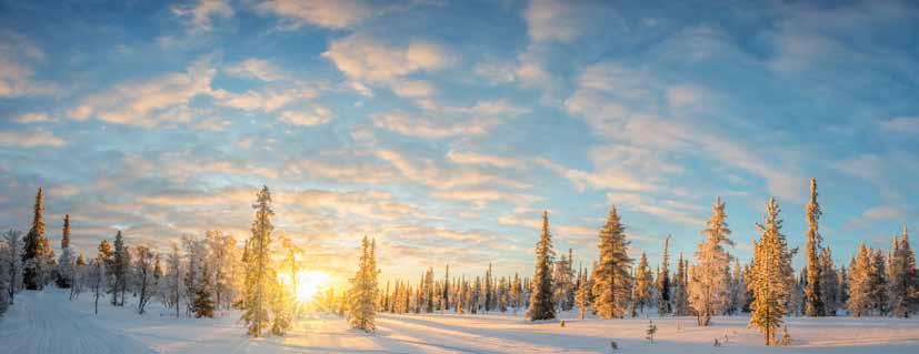 Jarmo Muurman, Senior Environmental Adviser, Ministry of Environment, Finland
Finland aims to become not only climate neutral by 2035, but also the world’s first fossil-free welfare society. Climate neutrality means that emissions and the sinks that sequester carbon are in balance. To achieve this ambitious goal, Finland will both carry out emission reduction measures and enhance carbon sinks.
Finland’s new Climate Change Act, which entered into force on 1st July 2022, lays the foundation for national efforts to tackle climate change and, for the first time, makes the target of climate-neutral Finland by 2035 into a legal requirement. Drawing on the recommendations of the Finnish Climate Change Panel, the Act sets the emission reduction targets at 60% by 2030, 80% by 2040, and at least 90%, but aiming at 95%, by 2050 of the levels in 1990.
The Climate Change Act also lays down provisions on policy plans. The scope of the Act has been extended to cover emissions from the land use sector (land use, forestry and agriculture) and, again for the first time, to include the objective of enhancing carbon sinks.
An energy reform, especially in heat production, has become vital for Finland. While nearly 80% of Finland’s electricity is already generated using fossil-free fuels, as a country with cold winters, heating is our Achilles’ heel. For example, half of Finland’s district heating is produced with fossil fuels and peat. It is therefore crucial that we find ways to put an end to burning coal, oil and peat.
To this end, Finland has already banned coal-fired power and heat generation from 1st May 2029 and provided energy companies with investment incentives to replace coal as early as by 2025. For home owners, new grants and a temporary tax credit for household expenses have been made available to cover the cost of converting an oil or gas heating system into other forms of heating.
Domestic transport emissions, which account for over one fifth of Finland’s total national emissions, have to be reduced by half. To achieve this target, we aim to reduce transport performance (total annual mileage), support electrification, and increase the blending obligation of sustainably produced biofuels. We will also introduce the concept of Mobility as a Service (MaaS), shifting away from personally-owned modes of transport towards providing mobility as a service through digital channels that combine different modes of transport. It is companies in the private sector that will make the transition to a green and fossil-free economy a reality. The Finnish Government is helping them by creating favourable conditions and predictability for investment decisions, supporting research and innovation, and fostering a culture of experimentation. Energy and transport taxation already take climate factors into consideration, with emissions affecting
the level of tax. Nevertheless, taxes for fossil fuels have been raised, including doubling the tax on peat, while taxes for electricity have been lowered.
Finland set up a climate fund in 2020 to combat climate change, promote digitalisation and boost low-carbon operations in manufacturing industries. But public funding alone will not be enough to make the urgently needed transition to a climate neutral society happen. Fortunately, Finnish businesses and industries largely see investing in climate-friendly, energy-efficient circular solutions beneficial for their activities. Many businesses are pioneers in their sectors, aiming at increased exports and a larger carbon handprint. As a new tool, the Government, together with industries such as the chemical, technology, forest and energy sectors, has developed sectoral low-carbon roadmaps to promote the actions industries can take to reduce their emissions.
A future low-carbon society must be fair, both socially and regionally. In Finland, we believe that participation is key to making the most of policy implementation and ensuring public support for policies. It is encouraging that Finnish citizens, businesses and civil society largely support our ambitious climate action and the measures to enhance the circular economy. To help ensure that climate actions are in the best interest of society and gain broad approval from the public, the Government has established a roundtable on climate policy, bringing together a wide range of sectors and social parties.
Finland pays special attention to how climate change action may affect the livelihoods and culture of vulnerable people, such the Indigenous Sámi peoples living in the Arctic regions. Under the new Climate Change Act, a Sámi Climate Change Council will be set up as an independent expert body supporting the preparation of policy plans and giving the Sámi peoples’ opinions on them. New tools, such as the national Citizens’ Jury and recognising the active role of young people, will also help in finding accepted and effective climate actions.
The Finnish Annual Climate Report 2022 notes that we are on track to achieve climate neutrality. However, preliminary data indicate that the land use and transport sectors have challenges to tackle in the coming years. A key factor for achieving the climate neutrality target is the expected number of carbon sinks in 2035, which determines the magnitude of the required emission reductions. The Government has taken note of the newest findings and is considering additional action.
In the words of the Finnish Prime Minister Sanna Marin, climate neutrality by 2035 is a bold target, but investment in the green transition and exports of green technology are essential for Finland’s future success.
14Winter 2022 The Geographer 33
Image from Shutterstock.
“An energy reform, especially in heat production, has become vital for Finland.”
Finland’s new Climate Change Act
Professor Kati Kulovesi, Director of the Center for Climate Change, Energy and Environmental Law, University of Eastern Finland
On 25th May 2022, the Finnish Parliament adopted a new Climate Change Act, enshrining in law the goals for the country to be carbon neutral by 2035 and for Finland to become carbon negative beyond that date. What is particularly interesting in the Finnish example is the role of science and the detailed analysis of the country’s fair contribution to the implementation of the 2015 Paris Agreement 1.5°C target.
In the autumn of 2018, the IPCC released its Special Report on 1.5°C of global warming. The report generated a strong public reaction in Finland and elsewhere. Shortly after the report’s release, the Finnish Climate Change Panel proposed that Finland should step up its climate action, becoming carbon neutral by 2035. Inspired by the UK model, the Finnish Climate Change Panel is an independent scientific advisory body, created in 2012 and given a permanent status and formal mandate through Finland’s first Climate Change Act in 2015.
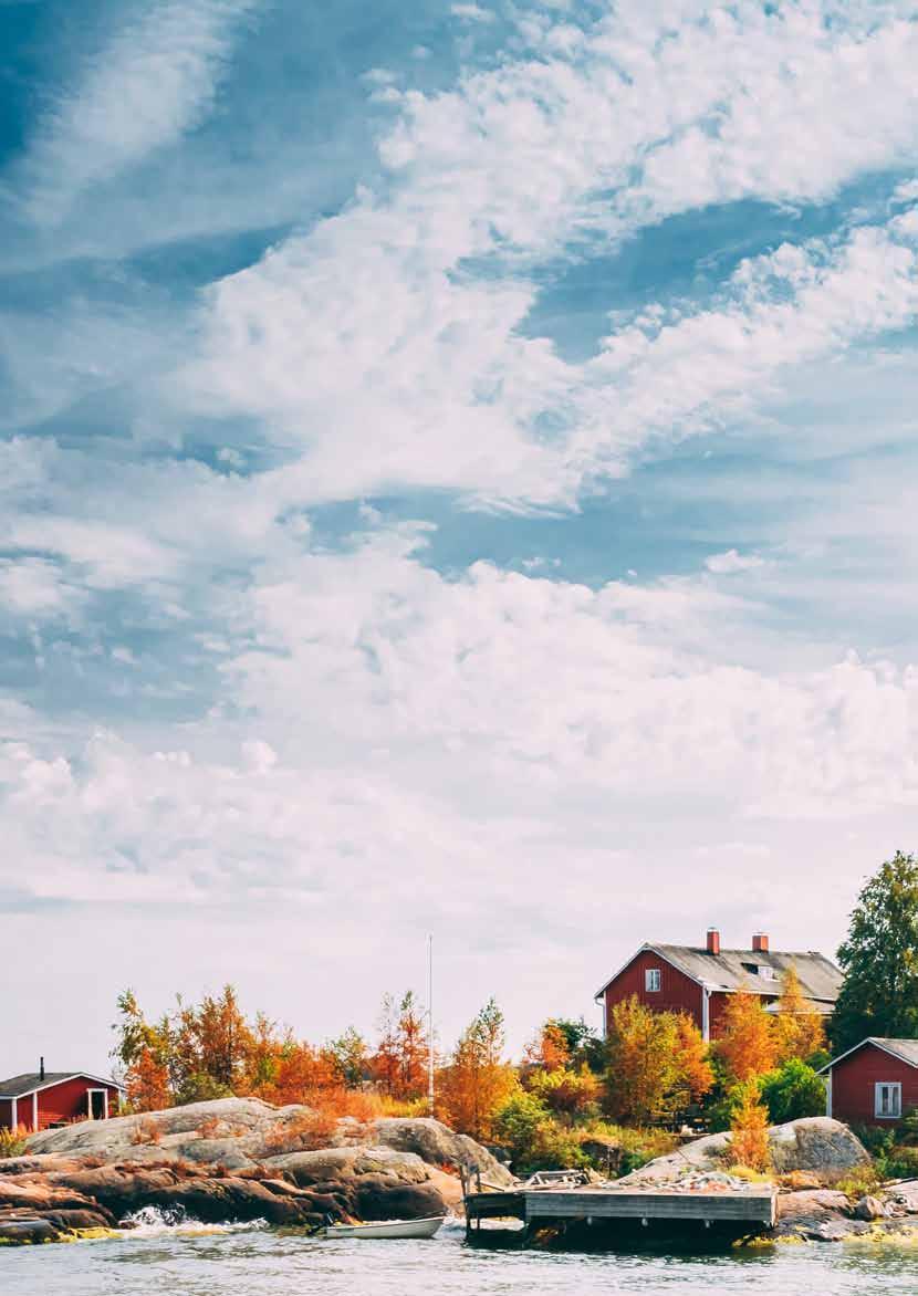
In 2018–19, the Panel analysed Finland’s long-term climate targets and ways to divide the global carbon budget based on equity, ability to pay and historical responsibility, concluding that Finland’s fair share of the budget for 2020–50 amounted to 79 million tonnes of carbon dioxide equivalent.
During discussions on the new Climate Change Act, various stakeholders argued that the carbon neutrality target should be even more ambitious; others thought it was already too ambitious. Indeed, the Panel’s analysis can, like any scientific work, be contested and criticized. What is important is that the carbon neutrality target builds on transparent and detailed scientific analysis of a country’s fair contribution to the implementation of the Paris Agreement. This is a good practice that could and should become more widespread globally.
Meanwhile, political momentum was also building up in Finland for updating climate policy objectives. Following the release of the IPCC report in October 2018, the Finnish Prime Minister invited all political parties represented in the Finnish Parliament to a roundtable discussion with the aim of agreeing on stronger climate action.
Climate change played an exceptionally strong role in the general elections in the spring of 2019. The Green Party performed particularly well and was invited to form a coalition government along with the Social Democrats and Centre Party. Based on the mandate given by the voters, climate
change featured strongly in the new government’s programme for 2019–23. The new Climate Change Act includes targets to reduce gross emissions by at least 60% by 2030, by at least 80% by 2040, and by 90–95% by 2050. In addition, it requires carbon neutrality by 2035, and that emissions keep decreasing thereafter, along with the carbon sink increasing. Achieving the targets enshrined in Finland’s new Climate Change Act will be challenging. In early 2022, the Finnish Climate Change Panel identified an important gap between existing climate policies and those needed to reach the 2035 carbon neutrality target. In other words, the current Government has been highly successful in terms of setting science-based climate targets and enshrining them in the new Climate Change Act. It has, however, been far less effective when it comes to adopting concrete climate policies. Furthermore, and almost ironically, on the very day that the new Climate Change Act was approved by the Finnish Parliament, early reports shocked the Finnish climate policy community by showing that the Finnish land use sector –traditionally a sizeable net carbon sink – had for the first time become a source of greenhouse gas emissions, due to increased logging combined with updated estimates pointing to a slower than expected growth of forests. If these early results prove to be accurate, they signal a deep crisis not only for Finland’s national climate policy, but also for Finland’s legal obligations under European Union law, including the so-called LULUCF Regulation. An important gap between climate targets and concrete action is of course all too familiar for those following climate policy. However, what is now new in the Finnish context is that there is a legal obligation to reach carbon neutrality by 2035. The target is binding not only on the current and all subsequent governments, but also on all civil servants obliged by the Finnish Constitution to ensure that the country’s laws are respected and implemented. Addressing the looming climate policy crisis and decreasing carbon sink is therefore no longer only a moral and political but also a legal necessity. In a Rule of Law country, this is bound to mean something.
Winter 2022 34 Image from Shutterstock.
“Achieving the targets enshrined in Finland’s new Climate Change Act will be challenging.”
Commitment will not hold: forests are not delivering
Tero Mustonen, Adjunct Professor, Lead Author IPCC AR6 WG2, Snowchange Cooperative, Finland
The Government of Finland has established an ambitious target of carbon neutrality by 2035. This is being looked at through a range of projects such as reform and enactment of the Climate Change Act, improvements in low-carbon buildings, fossil-free transportation, energy reforms and several roadmaps. Many of the expected goals to be filled have relied on the capacity of the Finnish economic forests, and hence land use sector (known officially as LULUCF), to act as carbon sinks.
However, in June 2022 the Finnish Climate Change Panel confirmed that LULUCF had become a net source of emissions for the first time in recorded history. This is especially painful as the country has a history and economic emphasis on use of economic forests. National institutes have warned that logging levels are beyond sustainable levels already, further reducing the carbon benefits of the forests, and they identify a juxtaposition between a growing demand from the forestry and pulp lobby that meets and is in conflict with this discovery of net emissions.
But there is more to this story of potential failure, of missing the target. The Nordic countries, Sweden and Finland foremost, champion themselves as ‘green, sustainable model’ societies. Yet, Finland resembles more an economy of extractive natural resources than a highly developed nation if we look at the spatial peripheries of the country, including the north and east. Combined with this are questions of historic equity in the use of forests and peatlands.
I spoke recently to Parks & Wildlife Finland experts, Natural Resources Institute Finland, and Finnish Environment Institute scientists, as well as the Ministry of the Environment and local administrations, on one of the key questions regarding the forests: “how much of the natural forests (ie, non-economic, nonlogged) have been lost since 1945 [advent of the clear felling and transformation of the landscape], how much remains and why are we still logging the last remaining primary and natural forests of Europe, especially in the Indigenous Sámi area?” Answer: nobody knows! This was rather profound. For Lapland, which is the northernmost province and the area of the last remaining large natural forests, nobody has inventoried the logging, chopping down 400–600-year-old trees. Secondly, in the governmental and science institutes, Finland has not been able to agree even on a definition of a natural or old-growth forest, leading to no need of inventorying before stands are logged. In the process, we lose the last remaining natural timber forests.
Not all people realize that 95% of the natural forests of Finland have been converted to economic production spaces, and
millions of peatland hectares have been ditched over the past 75 years. Most of these natural forests and boreal ecosystems remained fairly intact until the 1900s. The interlinked Finnish and Sámi communities maintained lifeways of fisheries, hunting, small-scale slash-and-burn farming, and reindeer herding, using these forest commons that altered but in minor ways those habitats where humans lived. However, the multiage and multi-species forests could be considered natural. The first wave of looking at forests in a commercial sense was with the international tar trade in the 1600s. Tar enabled ships to survive in tropical seas and enabled colonial powers to extend their reach across the oceans. A second wave emerged in the 1800s when sawmills started to appreciate boreal forests as a resource. Thirdly and most importantly, large-scale clear felling of timber forests for pulp and paper industries from 1945 to the present resulted in a total loss of 95% of remaining natural boreal forest ecosystems south of the Arctic Circle in 80 years.
Since the Ice Age, large river catchments such as Kemijoki (spanning approximately a quarter of the territory of Finland), Kokemäenjoki and Kymijoki defined the biogeography of the country. These cold river streams were homes of cold ecosystem dependent aquatic species such as Atlantic salmon, trout, grayling, burbot, whitefish and freshwater mussels. Associated with the avalanche of industrial forestry and pulp industries, between 1945 and the 1970s most of these rivers were dammed, altered and changed. Catchment areas, especially peatlands, released massive amounts of organic loading, nutrients and mercury downstream. This altered clear northern rivers into mucky brown waters, effectively resulting in losses of populations of cold-water species and their spawning areas, and increased eutrophication. Hundreds of hydroelectric stations destroyed genetically unique salmonid and other anadromous species, and associated human cultural systems dependent on them, resulting in loss of rights, linguistic and cultural diversity, and direct assimilation into the industrial ‘new world’.
In summary, the extremely important goal of 2035 will be missed. Why? The reliance on the economic forests as sinks is not delivering as planned (the forests would be cut in any case), the peatlands as massive carbon stores have not been prioritised, and society is not even inventorying how the forests are managed from the biological and climate viewpoint. The plan does not answer to hard questions of interlinked and downstream climate impacts, such as forestry water impacts. In a country of millions of economic timber hectares, every single point matters and affects the 2035 target, which, for now, will most likely be missed. Corrective measures building on ecosystem approaches, keeping carbon in the ground, and reforms to the forestry sector might be a saving grace for this target.
14Winter 2022 The Geographer 35
“Logging levels are beyond sustainable levels already.”
Colombia: an eye-witness report
Larry Flanagan, General Secretary, Educational Institute of Scotland
Colombia is a vast land, rich in natural resources and one of only 17 megadiverse countries, as defined by Conservation International. Notwithstanding its natural assets, however, its reputation internationally has most recently revolved around its prominence in illegal drug cultivation, the widespread abuse of human rights, and political and state violence. For years the campaign group Justice for Colombia (justiceforcolombia.org) has been organising solidarity missions to the country, primarily comprising British and Irish parliamentarians and trade union representatives. I was privileged to be part of such a delegation in 2022, as General Secretary of the Educational Institute of Scotland.
The visit coincided with an historic period, and we were able to witness the first round of the Presidential elections which eventually led to the election of Gustavo Petro, the country’s first leftist President, and his running mate, Francia Márquez, an environmental activist and the first black Vice-President of the country. The sense of hope generated by this election result is impossible to overstate. In a country where a fragile peace agreement between the Government and FARC (Revolutionary Armed Forces of Colombia), achieved in 2016, has been constantly pressured by state repression, criminal violence (over 1,000 social leaders, trade unionists and human rights defenders have been killed since the peace agreement was signed) and political inaction on the key ‘peace agreement’ targets, there is now a genuine sense of progress being possible.
One of those key action points was comprehensive rural development. Colombia has a mass of people who class themselves as ‘peasants’, smallhold and communal farmers who wish to work the land. Many FARC former combatants and their families have established communities to further this desire. The delegation visited one such ‘reincorporation zone’ in Agua Bonita, Caquetá, and heard about the experiences of those who have developed productive projects including agriculture, fish farming and even tourism. Much of the agricultural work is linked to regeneration projects around the Amazon, where illegal land clearance and mining have wreaked environmental havoc. The
community had opened a cultural centre with a library and museum, and was providing its young people with journalistic training; indeed, we were accompanied by some budding journalists let out of class for the day.
Advancing the rural reform programmes is critical to easing some of the extreme inequalities which exist in Colombia, but to date insufficient change has materialised in such speciallydesignated zones. The new government offers hope.
Prior to the election, the continued participation of almost 100,000 families in voluntary crop substitution programmes (away from the illegal coca trade) demonstrated the strong support for peace among civil society. However, many families lack adequate state support to transition to legal crops, and it is essential that alternative economic opportunities are provided or efforts to eradicate illicit crop production will be unsustainable. Over the course of the week, we met with many diverse groups, including the family of a man assassinated by soldiers. Invariably we were thanked for being there and taking an interest in what was happening in Colombia. Repeatedly we were told that if it wasn’t for the fact that the international community was so actively monitoring developments, a poor situation would have been much worse.
We even had a breakfast meeting with the British Ambassador – the UK has a long history in Colombia – who rather unexpectedly hailed from Airdrie! When I met with the General Secretary of FECODE (the country’s largest teaching union), he told me that not only does he have to travel with armed bodyguards at all times (including to our meeting) but that, even locally, teachers needed protection because they were often community leaders also, speaking out against illegal mining and deforestation, the intimidation by drug cartels and the indifference of elected government, national and local.
Here in Scotland, continuing to find ways to express our solidarity through the projects we do in class as teachers, our union work, or the time we take personally to be informed about Colombia, is a means to strengthen the hope shared by the Colombian people that a more prosperous and peaceful future is realisable.
Winter 2022 36
Community library.
“The community was providing its young people with journalistic training.”
One of our cub reporters.
The economic case for biodiversity protection
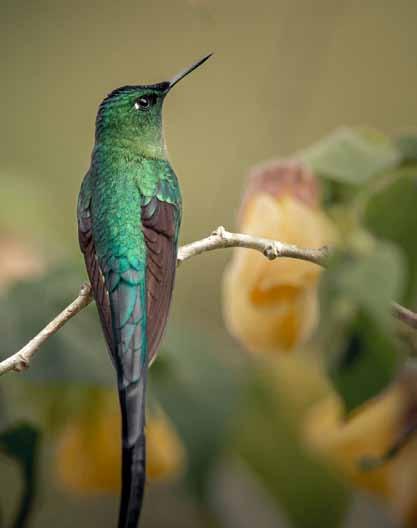
Generating positive impact for nature, wildlife and people is arguably the greatest challenge and opportunity of our time. Efforts to protect, restore and sustainably manage natural ecosystems are in desperate need of funding, and the private sector has a critical role to play in closing the annual US$700 billion financing gap.
UK and Colombian governments are leading the way, within drastically different contexts. Global Forest Watch reports that the UK is amongst the most nature-depleted countries in the world, with only 9.8% forest coverage; while Colombia is the world’s second most biodiverse country, with forest accounting for 42% of the national territory. Yet both countries are leading global conversations around biodiversity protection through introduction of regulatory mechanisms that facilitate private sector investment in the protection and restoration of nature.
In the UK, Biodiversity Net Gain is a mandatory compensation requirement to be enacted under the UK’s Environment Bill that requires developers to offset their impact on ecosystems. However, the law will go beyond like-forlike offsets by requiring creation of new habitats with a minimum 10% biodiversity uplift. In 2018, the Government of Colombia adopted the National Strategy of Environmental Compensations, and under Resolution 256 it lays out a ‘no net loss’ approach that mandates companies to prevent, mitigate and ultimately offset up to ten times the area of the damaged ecosystem under a like-for-like approach. These regulations are an important stepping stone to mobilizing private finance toward biodiversity protection, but one thing is clear: we need bold, innovative and holistic approaches to maximize the impact of these mandates.
The concept of Habitat Banks, pioneered in Colombia by local firm Terrasos, could be a solution. Habitat Banks are areas placed under restoration and/or conservation efforts to produce biodiversity credits under a performance-based approach. As explained by Mariana Sarmiento, Terrasos’ founder and CEO, “Each hectare generates one biodiversity credit, and each credit is then used by companies who need to comply with environmental regulations in an efficient and transparent way.”
Habitat Banks provide a cost-effective alternative to isolated and usually costly and ineffective initiatives. As stated by Andrew Sutherland, Director for Nature-based Solutions at Palladium, “protecting biodiversity through Habitat Banks is a more resilient way of looking after nature long-term.” By aggregating production of biodiversity credits into one site which can then be used to provide credits to multiple offtakers, this model enables habitat connectivity and generates additional benefits for nature and people. Terrasos’ model secures the area over a 30-year period, the time required by ecosystems to reach significant biodiversity gains. The mechanism has proven effective in meeting an estimated demand of 1.6 million hectares and £148 million pending for compensation. With support from Palladium and the UK Government’s Partnerships for Forests programme, Terrasos has successfully launched six Habitat Banks representing 2,300 hectares under sustainable management. The Habitat Bank model also offers potential for additional economic benefits to landowners and communities. By trialling the production of non-timber forest products
(such as seje), honey and ecotourism projects within the areas, Terrasos is developing a model to stack multiple revenue streams at the landscape level. With Habitat Banks, landowners can receive up to 50% increase in productivity as opposed to traditional land use activities such as cattle ranching.
The World Economic Forum recently estimated implementation of nature-positive policies represents a US$10 trillion opportunity for companies and investors. There is therefore significant potential for social and environmental impact, alongside financial returns for investors, if biodiversity offset mechanisms, such as Habitat Banks, can tap into this market.
Ultimately, there is good reason for cautious optimism in pioneering efforts led in Colombia to guide markets into becoming key allies to address the indivisible biodiversity. “Everywhere there is degradation in nature and the interest in restoring it, there is the potential for Habitat Banks,” says Andrew Sutherland. He hopes to see this mechanism replicated in as many countries as possible, but highlights the need of working together “to prove that Habitat Banks are competitive and provide a much better quality of restoration” so that more governments, investors and project developers take the leap to maximize potential impact.
FURTHER READING
Deutz A, et al (2020) Financing Nature: Closing the Global Biodiversity Financing Gap (Paulson Institute, The Nature Conservancy, and the Cornell Atkinson Center for Sustainability, www.paulsoninstitute.org/conservation/financing-nature-report)
14Winter 2022 The Geographer 37
Natalia Atuesta, Investment Associate, Partnerships for Forests; Lucas Woodward
“Implementation of nature-positive policies represents a US$10 trillion opportunity.”
Long-tailed sylph. Image courtesy of El Globo Habitat Bank
Trussell Trust
Emma Revie FRSGS, Chief Executive, Trussell Trust
Faced with rising energy prices, inflation and a potential recession that is pushing people deeper into poverty, the soaring cost of living is driving a tsunami of need to food banks. Our recent research has highlighted the devastating impact that the cost of living crisis is having on people forced to survive on the lowest incomes.
A YouGov survey of people in receipt of Universal Credit during August 2022 found more than two million people had skipped meals across the previous three months to keep up with other essential costs. Worryingly, 38% of people said they’d gone a whole day with no food at all or just one meal, in the last month, because they couldn’t afford to buy enough food. This research shows that financial insecurity is a problem for millions of people, and this number is growing, even before we get into winter, when people will have increased energy bills.

Our network of more than 1,300 food bank centres is set to face the hardest winter yet as they prepare to provide a predicted 1.3 million emergency food parcels in the next six months, including half a million for children. Day after day, staff and volunteers are telling us of the impossible and often heart-breaking choices families are having to make and this is not right.
This increase in need has led food banks in the Trussell Trust network to distribute 46% more emergency food parcels over August and September than over the same period last year. This means that the gap between donations and food being distributed is widening, and food banks have already started using reserve stock that would normally help them get through winter. As more people find themselves unable to afford the essentials, food banks are struggling to meet the increased need. Food banks rely on donated food from the general public to make up their parcels, but due to increased need are now having to spend on average £1,400 a month per food bank on food to make up the shortfall. To ensure that food banks can continue to support the rising number of people facing hunger and hardship this winter, the Trussell Trust has launched its first large-scale emergency appeal. We grew up seeing appeals for emergencies around the globe. But here
we are, having to run one here, in the UK, just so people can receive the essentials for life. Through this emergency appeal we hope to raise the vital funds required to ensure that food banks can meet this devastating rise in need and continue to support people who are experiencing hardship. We never wanted to run an appeal like this; we would rather there was no need for food banks at all. But, right now, they are on the front line of this cost of living emergency and we have no other option.
As well as raising vital funds, we hope this emergency appeal will be a stark reminder of how reliant we have become as a society on the kindness of volunteers. No one should need to turn to charity for something as essential as food, and the situation we are facing is too great for food banks to solve alone.
We know it doesn’t have to be this way; the Government has shown that the right support, at the right time, can help people out of hardship. It’s wrong that people here in the UK are going without the essentials we all need to get by. As prices continue to rise, we will see more and more people forced to use food banks.
That’s why we’re calling on the Government, now more than ever, to provide support directly targeted at people on the lowest income so that no one needs a food bank to get by. Beyond this, we want to see a long-term commitment that benefit rates will always be enough for everyone to afford life’s essentials.
People who are in a position to support can help in a number of ways; by making a financial donation to the Trussell Trust, or by donating food and toiletries to their local food bank, and by checking their local food bank’s website and social media to see if they need any volunteering support. Visit www.trusselltrust.org/appeal for more information, and check your local food bank’s social channels on what items they are most in need of. Together, we can end the need for food banks, for good.
“Our network of more than 1,300 food bank centres is set to face the hardest winter yet.”
Image by Miti from Unsplash.
Winter 2022 38
Image by Sonny Mauricio from Unsplash.
Who is studying Geography in Scotland?
Ian Selmes, Alastair McConnell FRSGS, Jim Bruce FRSGS, RSGS Education Committee
We have been analysing data from the Scottish Qualifications Authority and other organisations about who is choosing to study Geography. Taking inspiration from the Royal Geographical Society-commissioned Geography of Geography report published in 2020 for England, our report, published in the Scottish Geographical Journal, focuses on who is studying Geography in Scotland and the trends associated with this. The findings of the report prove very interesting and actually raise a lot of positives. Here are a few highlights.
Have numbers taking Geography in school declined?
The number of Scottish school Geography students declined significantly between 2016 and 2020. However, some of this decline has been reversed over the last two or three years, and the numbers completing Advanced Higher Geography in 2022 are the highest over the whole study period.
The number of Higher Education Institutions
offering Geography has decreased from ten to nine since 2016, but overall numbers studying Geography have increased from 2,445 to 2,600 over the same period, while postgraduate geographers have increased from 365 to 465.
What is the gender balance of students studying Geography?
Across the study period, the number of male students was greater than the number of female students at National 5 level, with about 53% of the cohort. However, they only made up 44–49% of Higher pupils and 39–45% of Advanced Higher pupils. This trend continues at undergraduate level with 61–66% of undergraduate students. In 2021, 55% of postgraduate geographers were female.
Are most students studying Geography white?
Unsurprisingly, the answer to this question is yes. With 96% of the Scottish population identifying as white (2011 census), this is actually quite close to the proportion of students taking Geography. At National 5 (93%) and Higher (94%), there is a slight under-representation of white students, and at Advanced Higher (98%) there is an over-representation. Asian Pakistani were the second-largest ethnic group, representing 1.6% (Higher) and 1.9% (National 5) compared to 2% of the population (2011 census).
Does deprivation influence numbers taking Geography?
It is very apparent in the data that those studying Geography are much more likely to come from areas of lower deprivation, and this variance increases as you move up the school. At National 5 level, entries for the most deprived SIMD quintile were half that of the least deprived, and by Advanced Higher level it was just 8–11%.
Which regions have higher uptake of Geography?
Regions with the greatest increase in uptake from their mean level have been Dumfries and Galloway, South Ayrshire and East Dunbartonshire. The highest pass rates can be found in East Renfrewshire (National 5), East Dunbartonshire (Higher) and Aberdeen City (Advanced Higher).
The importance of our subject has never been more evident, with climate action, biodiversity decline, energy security and waste never far from the news. The reversal in the declining numbers may be linked to post-Covid results, but it is also an indication that Geography is seen as an important subject. In this time of educational transition, the positive data in this report should help justify the continued inclusion of Geography.
FURTHER READING
Selmes I, McConnell A, Bruce J (2022) The Geography of Geographical Education in Scotland: Who studies geography and why? (Scottish Geographical Journal)
Community land ownership for schools
Emma Margrett, Community Land Scotland
We have been developing educational resources (hopefully available early in 2023) to raise awareness of community land and building ownership, and the role it can play in creating and sustaining resilient, successful communities while building better futures for local young people. We wish to encourage more young people to get involved in local democratic decision making (such as by acting as Young Directors on community landowner boards) and to raise awareness of rural community development as a career option in an effort to stem the flow of rural depopulation. There are two strands: paper-based or downloadable lesson ideas for pupils in P7, and an app-based resource called The Quest which takes students in S1/S2 through the eight stages of a community buy-out. The Quest has been piloted at rural schools on Mull and the Western Isles, identified as good test locations primarily due to the existing density of community landowners. An urban version of The Quest is being developed and piloted in areas which are seeing increasing numbers of
urban community buy-outs. During the pilot phase, schools worked closely with their local community landowners, with pupils going on field trips to visit their local community land and buildings and income-generating projects.
The cross-curricular resources focus on the Curriculum for Excellence areas of modern languages, social studies, mathematics and numeracy, and English and literacy, and also on Scottish history, Scotland’s relationship with its land, entrepreneurship, citizenship and democracy, and Scotland’s place in the world. A short film (available at www.communitylandscotland.org.uk) was made about the experience of the pupils and teacher from The Sir E Scott High School on North Harris. Pupils said, “it was really interesting to learn about things which relate to where we live” and “we also got to go around some places including the wind turbines and find out how they worked.”
Nat 5 Higher AH 2016 11,017 8,157 900 2017 10,756 7,945 779 2018 9,794 7,329 803 2019 9,795 6,867 708 2020 9,698 6,438 750 2021 10,073 7,131 794 2022 10,265 7,175 1,025
notes
from the classroom
“Geography is seen as an important subject.”
14Winter 2022 The Geographer 39
“Schools worked closely with their local community landowners.”
Imagine a Country
Professor Jo Sharp FRSGS, Geographer Royal for Scotland
In 2020, writer Val McDermid and I edited a book called Imagine a Country. This book is about hope. We challenged 100 people from across Scotland to think about one thing –big or small – that would make a difference to the country they live in.
Imagination is something that I see as central to geography: if we’re going to make changes to improve our world, the first step is to imagine how the world can be different. And so, when we had the opportunity to launch the second edition of Imagine a Country at the Edinburgh International Book Festival (EIBF), it seemed like a great opportunity to invite young people from across the country to share their hopes and ambitions for the future.
Alastair McConnell, Chair of the RSGS Education Committee, and I hastily came up with a flier and introductory video, and with the help of RSGS opened the competition to all secondary school geography students in Scotland. Although there was a relatively short turnaround, we were delighted to receive nearly 120 submissions. The contributions were thoughtprovoking, compassionate and often funny, arguing for the need to look after our environment, create a culture that welcomes all regardless of gender, sexuality, race or place of birth, change our cities to encourage healthier forms of transport, promote the importance of supporting local economies… and the need to move to a four-day school week was also popular!
Where am I?
by Andrew, Hutchesons’ Grammar School, S1
As I felt the light pressure my eyes into opening, I awoke to see a crowd staring down at me as well as a glaring light from the sun standing tall in the cloudless, royal blue sky. Where am I? I asked myself.
I rose and pushed through the flock of strangers, it was my hometown but not quite the same, so my previous question continued to sit unanswered. The old, neglected community centre was now replaced by a bright welcoming building far different from the one I was used too. Everything seemed alien to what I had once called my home, the local Tesco’s windows were un-smashed, the stench of cigarette smoke and rubbish had evaporated, the heaps of litter that was typically scattered across the roads, streets and bushes was no more, all kinds of people from all sorts of places were smiling, chatting, laughing, socialising. This was not what I had come to know as my town, so I had to ask myself again. Where am I?
The community that I had settled, if you could call it a community, appeared to have been flipped on its head entirely. The park I had once enjoyed as a young child only for it to be vandalised by its newer arrivals was intact and had children the same age as I once was enjoying it once more. Parts of streets initially coated in cracked concrete now blossomed with trees with a variety of barks and leaves. A pond that had once sat as an oily brown colour riddled with litter and all sorts of thrown away items was now clear with ducks floating gracefully along it’s calm surface, with the occasional rebel leaf gently touching down onto the aqua blue water’s brim. I continued my stroll through the streets taking in my surroundings of tasteful modern and eccentric architecture as I went, awkwardly being lost for words when greeted joyfully by the usually grumpy faces of my past hometown. Yet still, I couldn’t fathom an answer to that question. Where am I?
It was difficult choosing just two winners, but after much discussion between the judges (Professor John Briggs, Chair of RSGS, Catherine Jones from EIBF, Val, Alastair and me) we selected Andrew McElrea from Hutchesons’ Grammar School and Ellie Morrison from Boroughmuir High School. Andrew and Ellie joined us on stage at the EIBF on 27th September. Their (unedited) winning entries are printed here.
I could feel people’s eyes turn their gaze to me not judgingly but curiously as I gawked at every detail of the town like I had just been whipped straight from the 19th Century, I couldn’t help myself. This town was somewhere I could have been happy, somewhere where everyone could try and live, not just survive. Granted I had not travelled the world and seen every town but from what I had witnessed it was rare to find a flourishing community not just a settled for what you’ve been given one, a united community not one with the unspoken but very much thought of idea of every man for themselves, a proud community not a shameful neglectful one. But eventually my old friend of a question came calling again, the same shameful question that I had no recognisable answer for, crawled back into view. Where am I?
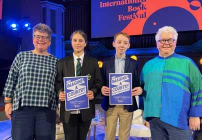
Winter 2022 40
“It was my hometown but not quite the same.”
After discussion with members of the Education Committee, we plan to run the competition again next year and will circulate details in the New Year. So, if you are studying geography at school (or know someone who is), then it’s time to start imagining a better country!
L-R: Jo Sharp, Ellie Morrison, Andrew McElrea, Val McDermid. © Pako Mera | EIBF
Imagine a country
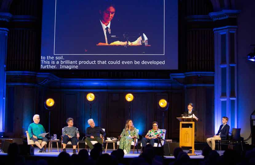 by Ellie, Boroughmuir High School, S4
Scotland is one of the most beautiful countries in the world which is bursting with green spaces, lush forests, towering mountains, rolling hills and huge long deep lochs and is a delight to both locals and visitors to see and experience. Edinburgh is the capital and the city where I was born and live and is surrounded by seven rolling green hills. Like most people I love to walk to school or go out on my bike or walk through the many local parks which has become more of a habit for me since lockdown and I especially like days when I can walk or cycle all 7 hills around Edinburgh. I love open green spaces and wooded areas with running streams or burns and all types of living creatures and habitat that live there.
However what do you see on the ground within 100m of stepping out of the house are piles of discarded dog poo that owners have failed to pick up. This could be because they were distracted or just because they didn’t think anyone was looking and the owner thought maybe leave it for someone else to pick up or worse still step in it. Let’s face it everyone has stood in some dog poo at some point in their life. This continues all the way to the Braid of Hermitage. What is an eyesore to see in these beautiful places are dozens of bags of dog poo crammed into bursting bins or left hanging from a gate, tree to shrub.
I absolutely love dogs and I would love to see a country where people can enjoy their dogs and pick up their poo so that others can enjoy these beautiful open spaces without the risk of stepping in it but that doesn’t seem to be the reality. What I propose is to imagine a country where people who walk dogs can now use a spray that comes in a reusable and recyclable container so it is good and safe for the environment. Inside this recyclable canister are living microorganisms made up of bacteria, fungi and dare I say it useful beneficial viruses. The dog walker can then spray this on the offending poo and the micro-organisms get to work super fast to digest the dog poo leaving the space as good as it was before within fifteen minutes. This would keep our beautiful green places, pavements and parks tidy, delightful and as nature intended. These open spaces, road, pavements, rivers, shrubs and trees will be free from those green and black dog poo bags that seem to fill up the bins in local parks.
Everyone is happy and can benefit from this genius product as the dog walkers don’t need to carry the bags and pick up the poo, everyone else can enjoy the beauty and scenery. The spray is natural and contains microorganisms that already exist that will break down the waste into a fine microscopic powder that returns to the soil. This is a brilliant product that could even be developed further. Imagine a country whereby we could find micro-organisms that will digest plastic so that we can eliminate land fill sites and finding plastic in our marine life in the oceans and rivers but that’s another story.
“Everyone is happy and can benefit from this genius product.”
14Winter 2022 The Geographer 41
L-R: Val McDermid, Jo Sharp, Billy Kay, Carey Lunan, Jackie Kay, Ellie Morrison reading her winning entry, Andrew McElrea. © Pako Mera | EIBF
An interview with Libby Penman
 Holly McNair, RSGS Communications Officer
I know that you started as an extreme sport fanatic. Is that what got you initially interested in filmmaking?
Yeah, definitely. I was constantly at the skatepark, either rollerblading, skateboarding, BMXing, Heelys, anything. I spent the whole of my summer at the skatepark every year and suffered quite a few accidents. One summer I had a cast on my arm which meant I couldn’t really skate, but I still really wanted to be at the skatepark, so I started filming people till my arm got better and fell in love with it straight away. I soon began to be known as the person at the skatepark that would be filming.
How did you then get into nature documentary in particular?
I always just had an absolute fascination and love of animals. If I wasn’t at the skatepark I was always in the woods right behind my house. I was able to combine my love of animals with the skill set that I already had for filming fast-moving objects, like rollerblades or skateboarders, things that are unpredictable, so a lot of elements were really similar to filming wildlife. I had also developed a lot of patience from waiting for someone to land a trick on a skateboard, and understanding that things take time, and that was also transferable to wildlife. So, everything lined up, and then I just started pursuing it more seriously and working on my own wildlife films.
I believe that you have worked with Gordon Buchanan. Has he had any influence on your work?
Oh yeah, absolutely, he’s definitely someone I looked up to massively. We went out and filmed a piece on Loch Lomond for my Scottish wildlife documentary Shooting Animals, and chatted about everything including his career, mistakes, advice for other people who want to get into filmmaking. We also talked a lot about the situation for nature in Scotland, and what needs to happen at a government level. The documentary is still available on STV Player, and actually just won ‘best doc’ at the Scottish Short Film Festival. Do you have a favourite place you have filmed?
Mull blew me away. I visited for the first time only last summer, and I’ve been back several times since already. Mull is like a wildlife haven: sea eagles, otters, deer, owls, everything I saw was phenomenal. I spent hours watching and filming otters, which was magic. I was able to spend a substantial amount of time observing them and their amazing behaviours.
Is there anything you dream of filming and do you have any projects that you are working on?
I’ve always really wanted to see and film a pangolin, which is unfortunately the most trafficked mammal in the world. I would really like to have the opportunity to go out and do
some work filming and telling the story of the people who are working to protect them, and the bigger picture of the trafficking situation. But in terms of future projects, I have just won the National Geographic sponsored ‘wild pitch’ contest at the Wildscreen Festival in Bristol with a pitch called The Animal Kingdom of Fife, featuring myself and fellow Fifer and RSGS Fellow Doug Allan. So, we are very much hoping to make our TV show about local ecological issues next year. What do you hope people take away from your documentaries?
I hope that when people watch, it puts a smile on their faces to see amazing animals and the epic nature we have in Scotland, and also compels them to think about what they can do to help the situations that are happening in the background for these animals, and the fragility of wildlife. Rather than feeling despair at certain situations, I would like people to feel inspired and empowered to want to help.
Can you tell us a bit about your Inspiring People talk?
My talk is about the idea that the ultimate thing that brings people together is adventure. I’ve been filming a series of short films for The Adventure Show on BBC Scotland, where I have been out across Scotland meeting people doing amazing outdoor activities, including a group of wild swimming women who met online over lockdown, a mountain bike workshop group using mountain biking to be more in touch with mental health, cave kayaking through unbelievably amazing caves in Arbroath, and on a hike with the Black Scottish Adventurers. I’ve been meeting so many groups that have found connection to the environment and landscape through outdoor adventure, or have found a connection to a different group of people. So, I’ll be talking about how these adventures bring us together as a community group or together with the landscape, and of course I’ll also be sharing a couple of wildlife anecdotes from being out in the field too!
Winter 2022 42
“I would like people to feel inspired and empowered to want to help.”
In February, Libby Penman is speaking to RSGS audiences in Kirkcaldy, Edinburgh and Glasgow as part of our Inspiring People programme.
Inspiring the next generation of young geographers
Mark Evans FRSGS, Heart of Arabia Expedition Leader
In 1917, Ernest Shackleton (recipient of the RSGS Livingstone Medal in 1911) and his men had just returned to the UK after their long journey home following the incredible ordeal of the Endurance and Elephant Island. Within a few months, another extraordinary individual set his compass on 180 degrees and headed south on an adventure that would shape the rest of his life, and that would also help shape a nation.
Sailing south from Basra under the orders of Gertrude Bell, political officer Harry St John Philby’s instructions were to lead a small mission to travel into the interior of Arabia. There he was to forge an alliance with Ibn Saud in an effort to cut off Turkish supply lines across the central desert, and so support the work of Lieutenant T E Lawrence who was busily disrupting supply lines further west.
On 16th November 1917, having come ashore at the small port of Al Uqair, Philby and his small team started their journey west, reaching Riyadh on 30th November and striking up a lifelong friendship with Ibn Saud that would result in Philby converting to Islam and spending the rest of his life in Arabia.
After several days of intense discussions, under the protection of Ibn Saud’s men Philby pushed on west, eventually reaching Jeddah on the Red Sea and so crossing the Arabian Peninsula from east to west. So meticulous were his field notes that cartographers were able to add considerable detail to the existing maps of the interior of Arabia, and in 1920, with the approval of King George, the Royal Geographical Society in London awarded Philby their prestigious Founder’s Medal. Philby went on to spend the rest of his life exploring Arabia, writing several books, including one called The Heart of Arabia that described his famous journey of 1917. He passed away in Beirut in 1960 whilst travelling from London to Riyadh, and his son Kim scratched on his grave the next day “the greatest of all Arabian explorers”, something that is very hard to argue against.

Some 105 years later, I am leading a small team in retracing Philby’s 1917 journey on foot, by camel and by 4-wheel drive. Continuing Philby’s focus on gathering field data the team, consisting of expedition photographer Ana Maria Pavalache, Riyadh-based expedition logistics expert Alan Morrissey, and Philby’s granddaughter Reem Philby, will gather data to support three projects: recording bat calls and roost sites, photographing lithic artefacts on the desert floor, and fieldtesting a digital application designed to optimize human performance in extreme environments. With a land mass approximately ten times the size of the UK, and a population less than half of the UK, much of the region remains undersurveyed and recorded.
The Heart of Arabia Expedition was launched in September at the Royal Geographical Society in London by HRH The Princess Royal, expedition patron and RSGS Vice-President, with good coverage appearing on BBC News and in The Times. A major focus of the Heart of Arabia Expedition is to inspire the next generation of ‘Philbys’, and encourage more young people to get outdoors and to journey with purpose, not just for journey’s sake. To that end, we are pleased to be working in partnership with RSGS’s Future Generations Fund,
established to encourage and support more young people to study, learn about and explore the world…. so please donate! By the mid-1920s, Philby was considered by RSGS to be the greatest authority on Arabia, and attempts were made in 1927 and again in 1928 for him to address the members using his lantern slides at the Synod Hall in Edinburgh. Sadly, duty called and, having agreed the dates, on both occasions Philby was hurriedly called back to Arabia and was unable to attend. It is hoped the Heart of Arabia Expedition team can finally share his work with members via the RSGS Inspiring People talks programme later in 2023. Readers can follow the progress of the expedition through social media and the expedition website www. heartofarabiaexpedition. com Audio diaries captured each day will be used to build a series of expedition podcasts which can be accessed via the website.
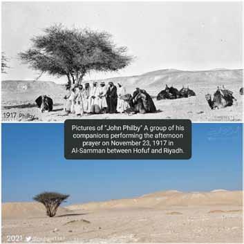
14Winter 2022 The Geographer 43
“Political officer Harry St John Philby’s instructions were to lead a small mission to travel into the interior of Arabia.”
Solving a 2,000-year-old geographical mystery: the exploration
Professor Charles W J Withers FRSGS
By the late eighteenth century, the river Niger was a two-part 2,000-year-old geographical mystery: in which direction did the river run? Where did it terminate? For those who believed the river to flow eastwards and connect with the Nile, the Niger was the key to Africa’s interior.
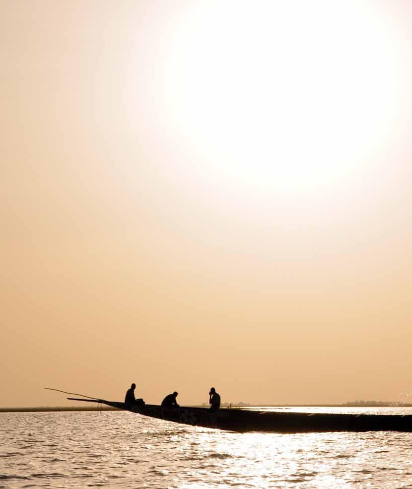
But no one agreed over the Niger. In the fifth century BCE, Greek historian and geographer Herodotus argued that the Niger flowed eastwards across north central Africa to join a lake and, from there, flowed into the Nile. In the second century CE, the Classical geographer Ptolemy similarly reckoned that the river flowed eastwards. Rather than join the Nile, however, he claimed that the Niger emptied into an inland lake. Medieval commentators took a different view. Both al-Idrisi in the mid twelfth century and Abu’l-Fida in the early fourteenth century claimed that the Niger ran east to west. In his 1526 Description of Africa, Leo Africanus equivocated: some people, he said, reckoned that the Niger flowed east to west, others that it flowed westwards, perhaps from an inland lake, perhaps from the Nile. The fact that Indigenous peoples knew the river by different names for different stretches of its 2,600-mile course confused matters further.
Solving the Niger problem would advance European geographical knowledge about Africa, provide a route to commercial opportunity, and help end the evil of slavery. The route to a solution began in a London pub. The nobility, clergy and parliamentarians led by the naturalist Joseph Banks, who in June 1788 established the Association for Promoting the Discovery of the Interior Parts of Africa, known as the African Association, were motivated by commercial interests, abolitionist beliefs and, as they freely admitted, by geographical ignorance. Parts of northern Africa, the Nile valley and the Cape were known to Europeans but almost nothing was known of the interior beyond the trading posts of coastal west Africa. The Association sent out individuals to explore the region and to determine the course and end of the Niger. Among those selected was a 23-year-old Scot. Mungo Park, born in 1771 in Foulshiels near Selkirk and educated at the University of Edinburgh, was not the first Association man to search for the Niger, but he was the most successful. In 1794, Banks appointed him on behalf of the African Association – Park was “geographer enough”
in Banks’ eyes. After some delays, Park landed in west Africa in May 1795.
Park’s African travels between May 1795 and July 1797 mark a major moment in the history and geography of European-African relations. He travelled alone for the most part, was ill for long periods, was held captive for months, and was several times near death: all is documented in his best-selling Travels in the Interior Districts of Africa (1799) – a book which Park admitted was only part of the story. On 21st July 1796, Park encountered the “long sought for, majestic Niger, glittering to the morning sun, as broad as the Thames at Westminster, and flowing slowly to the eastward” (original emphasis). With these words, Mungo Park solved the first part of the Niger problem by seeing the river at first hand – “ocular demonstration” as he put it – and by returning safely to write about it. But because Park was too ill to investigate the river’s later course and termination, the second part of the Niger problem remained unsolved.
To remedy his earlier failure, Park set out on a second African journey in April 1805: the delay between his two trips was the result of war with the French, government prevarication and, initially, Park’s hesitancy. Park’s first journey, a largely individual endeavour, was personally punitive but geographically successful. His second, a militarised expedition with Park in charge of British and African troops, was a catastrophe with almost no geographical consequences. Park drowned in the Niger, in circumstances which are still unclear, sometime in early 1806.
To the remaining problem of where did the Niger terminate was now added a further problem: how and where had Park died? Between 1815 when the government sanctioned further Niger exploration and 1830, the Niger was subject to an expeditionary impulse without parallel in the world’s exploration. Nearly all these expeditions ended in the death of the explorers without adding much to knowledge of Africa’s geography. But when in November 1830 Richard and John Lander navigated the river’s course as it flows south to join
Winter 2022 44
“Mungo Park solved the first part of the Niger problem by seeing the river at first hand.”
Frontispiece portrait of Mungo Park as it appears in his Travels in the Interior Districts of Africa (1799). From author’s own collection.
Image by Claire Tardy from Pixabay.
exploration of the Niger
the Atlantic Ocean, they solved the second part of the Niger problem by first-hand in-the-field exploration.
It is ironic, then, that the remaining Niger problem had already been solved, a quarter of a century earlier, and by someone who never visited Africa.
By the time Park set off on his second expedition, four hypotheses were circulating concerning what contemporaries called “this most doubtful and obscure problem in modern geography.” One, long held, was that the Niger ended in the Nile. Another, equally ancient, was that the Niger emptied itself in the African interior, either in an inland lake or simply by dissipating into the soil. A third was that the Niger ended in the Congo, that the two rivers were one and the same: Park believed this idea which he took from George Maxwell, a Scottish African merchant. The fourth idea, hotly disputed by British commentators, was that the Niger emptied into the Atlantic in the Bight of Benin. This idea was advanced by a German, Christian Reichard, in German geographical journals in 1802 and 1803. Reichard based his arguments on textual critique and by analogy with other major rivers and their deltas. And he was right.
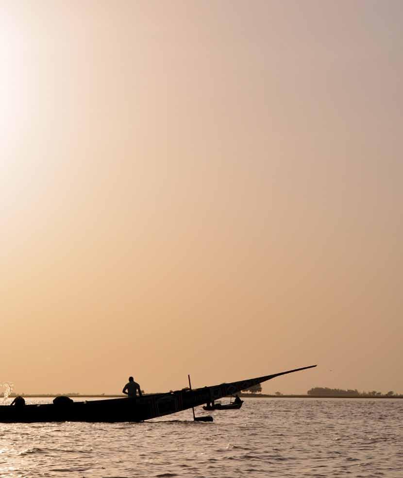
Reichard was not the only person to solve the remaining Niger problem without seeing the river. As expedition after expedition was despatched between 1815 and 1830, only to end in failure, other commentators proposed the correct solution to the problem and did so based on careful textual scrutiny and by taking Indigenous knowledge seriously. Following confirmation of the river’s termination, the Niger and surrounding regions became the focus of British and French commercial and humanitarian attention. But while the Niger’s course was now understood, the river’s depth, which varied seasonally, was not. In 1832, and again in 1841, British expeditions using steam ships failed disastrously as the vessels grounded on sandbanks and the crews died from yellow fever or malaria. The Niger was only first safely encountered by Europeans in 1855 following William Balfour Baikie’s Pleiad expedition and his regular administration of quinine.
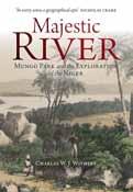
The long-dead Mungo Park was by then being memorialised, in plays, poetry, and stone. A statue to Park was erected in Selkirk in 1859. Park, the “celebrated African traveller,” was commemorated as a local worthy and for his sympathetic depiction of Africans, not for helping to transform Europeans’ geographical ignorance. That view of him – of Park the explorer-author – came later and was prompted in part by Henry Morton Stanley and other African explorers. Park’s varied afterlife includes the RSGS’s Mungo Park Medal,
first awarded in 1930, and given for “an outstanding contribution to geographical knowledge through exploration or adventure in potentially hazardous physical or social environments.”
Mungo Park would have merited the medal that now honours him. Yet the exploration of the Niger is a wonderful illustration of two contrasting routes to geographical understanding: the work of in-the-field explorers, many of whom died for geography without accomplishing their goal, and that of ‘armchair geographers’, or ‘critical geographers’ as they were also known, who arrived at the solution by patient and collaborative sedentary study.
The exploration of the Niger and Park’s role in it is discussed and illustrated, in detail, in Majestic River: Mungo Park and the Exploration of the Niger – the first full biography of Park for nearly 50 years, the first ever to examine Park’s afterlife, and the first full account of the different solutions to a 2,000-year-old geographical mystery. See the back page for details.
Professor Withers will bring this remarkable story to RSGS audiences in Kirkcaldy, Edinburgh and Glasgow in late January.
14Winter 2022 The Geographer 45
“The Niger was subject to an expeditionary impulse without parallel in the world’s exploration.”
The commemorative statue to Mungo Park in Selkirk. In his right hand, Park holds a sextant. In his left, he is holding a scroll of paper with the words – in the end, prophetic – of his last letter to Lord Camden: “If I could not succeed in the object of my journey, I would at last die on the Niger.” Photo courtesy of A Withers.
Magdalena River of Dreams
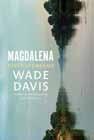
Wade Davis (Bodley Head, August 2020)
Only in Colombia can a traveller wash ashore in a coastal desert, follow waterways through wetlands as wide as the sky, ascend narrow tracks through dense tropical forests, and reach verdant Andean valleys rising to soaring ice-clad summits. Both a corridor of commerce and a fountain of culture, the wellspring of Colombian music, literature, poetry and prayer, the Magdalena has served in dark times as the graveyard of the nation. And yet, always, it returns as a river of life. Braiding together memoir, history, and journalism, Wade Davis tells the story of the country’s most magnificent river.
Blue Scotland
The Ultimate Guide to Exploring Scotland’s Wild Waters
Mollie Hughes (author), Rachel Keenan (photographer) (Birlinn, September 2022)
Scotland is famed for its rugged coastlines, pristine beaches, endless rivers and deep lochs; the whole country is a magnet for outdoor enthusiasts. In this unique, fully-illustrated and practical guidebook, adventurer Mollie Hughes introduces many of her favourite places to paddleboard, kayak, swim and surf, and includes her own personal experiences and tips. She shows us how to access and enjoy these varied blue spaces, whether urban or rural, enabling wild watersports fans of all levels to make the most of the amazing opportunities Scotland has to offer.
Special Reader Offer - 30% discount
Offer ends 31st March 2023
The World Atlas of Trees and Forests

Exploring Earth’s Forest Ecosystems
Herman Shugart, Peter White, Sassan Saatchi and Jérôme Chave (Princeton University Press, September 2022)
The Earth’s forests are havens of nature supporting a diversity of life. Shaped by climate and geography, these vast, dynamic wooded spaces offer unique and intriguing ecosystems that shelter complex, interdependent webs of flora, fungi and animals. This beautiful large book explores what forests are, how they work, how they grow, and how we map, assess, and conserve them. It provides wideranging coverage of the world’s forests; draws on the latest cutting-edge research and technology; takes readers beneath the breathtaking variety of wooded canopies; profiles a wealth of tree species, with enlightening and entertaining natural history highlights; and features stunning colour photos, maps and graphics.
only £30.80
Majestic River
Mungo Park and the Exploration of the Niger

Charles W J Withers (Birlinn, November 2022)
Mungo Park achieved lasting fame in 1796 by solving the first part of the Niger problem: which way did the river run? He died in 1806, in circumstances which are still uncertain, in failing to solve the second: where did the Niger end? Numerous expeditions explored the river in the decades following Park’s death, but not until 1830 was its final course revealed following in-the-field exploration. By then, however, the Niger problem had been solved by ‘armchair geographers’ who had never even visited Africa. This is the thrilling story of the many expeditions that sought to determine the Niger’s course and the facts of Park’s disappearance.
Atlas of Untamed Places An Extraordinary Journey Through Our Wild World
Chris Fitch (Aurum Press, September 2017)
In a world that has increasingly become tamed by human activity, the true wild holds a growing mysticism. Rugged landscapes with unspoilt scenery invoke romantic visions of paradise, but there are also powerful wildernesses that produce fear and awe, and unexplored zones where feral wildlife roams in the shadows. Chris Fitch visits immensely diverse floral kingdoms, remote jungles abundant with exotic birds, freezing cold and scorching hot inhospitable environments, places being reclaimed by nature, isolated realms and bizarre destinations. With beautiful maps and evocative photography, this is a fascinating voyage to nature’s most unusual, unpredictable, and extraordinarily wild places.
From Utmost East to Utmost West My Life of Exploration and Adventure
John Blashford-Snell (Bradt Travel Guides, October 2022)
We are delighted to offer readers of The Geographer the chance to buy The World Atlas of Trees and Forests online for only £30.80 (RRP £44.00). To order, please visit press.princeton.edu and quote special code ‘RSG23’ at the checkout.
Phone
(RRP £44.99)
For over 60 years John Blashford-Snell has been exploring some of the planet’s most remote, inaccessible, dangerous and extraordinary places. Now he has gathered together a collection of evocative tales from Africa, Asia and the Americas, about expeditions in pursuit of archaeological, anthropological, botanical, biological and zoological objectives. From the Blue Nile to the Darien Gap, Kathmandu to Colombia, mountains, rivers, forests and jungle have been his domain. From meeting dangerous wildlife and navigating rapid-filled rivers to encountering bandits, these adventure stories from a man who has become an institution in his own right are a joy.
RSGS: a better way to see the world
01738 455050 or visit www.rsgs.org to join the RSGS.
John Murray House, 15-19 North Port, Perth, PH1 5LU
SC015599 Printed by www.jtcp.co.uk on Claro Silk 115gsm paper. 100% FSC certified using vegetable-based inks in a 100% chemistry-free process. Winter 2022 46 BOOK CLUB
Lord
Charity
Follow us on social media
