
COLLECTIVE PERCEPTIONS

Author: Magali Sanz Casas
Committee members: Saline Verhoeven, Remco van der Togt and Anna Fink
Landscape architecture master
Amsterdam Academy of Architecture
Amsterdam, Netherlands 2023
Harvesting
COLLECTIVE PERCEPTIONS
3
0
Introduction
Over the past 10 years, I have witnessed how Barcelona, my hometown, slowly lost its quality of life. The lack of connection with nature has been one of the main reasons for that, despite the city having two rivers, the sea and the coastal hills in its surroundings.
This project focuses on the restoration of the neglected Llobregat riverscape, which is one of the few natural spaces surrounding Barcelona. It used to be a dynamic, natural and beloved riverscape but it has become an abandoned waterway that is no longer in people's minds.
Given the continuous precariousness of the public sector and the lack of cultural connection with nature, I propose to create a slow project that works in an innovative way, going from the bottom up. It starts with small, low-cost, and strategic interventions in different parts of the river system that slowly engage people to restore the river biotopes and ecosystem, enhance the spatial quality and create a new natural structure beneficial for the entire metropolis, while creating a new bond between them.
The way to work together between landscape and community is through the landscape harvest process, a circular process where people can collect over time exceeding materials from the river and give them back in a transformed way. This harvesting process links to the already deep-rooted agricultural harvesting fests from the region.
Within this Llobregat river, we propose to harvest three exceeding materials (clay, reed, and water) that, when applied to the four different parts of the river system (river Delta, the river islands, the river forest, and the river reeds), will start creating a new collective perception of this natural place and start to improve the spatial and ecological qualities of the river.
Once this new mindset is established and the new concept of living with the river is embraced, these small interventions can grow in scale and complexity, becoming landscape projects that can continue to improve the entire river condition.
5
Location and context 1
social and economic context
The Llobregat river is the second longest river in Catalonia, flowing from the Pre-Pyrenees towards the sea. In this Mediterranean country, the economic situation has been unstable for decades and the relation people-nature is not existing.
The permanent economic crisis experienced since 2008 has caused a deep precarious public sector with no money to invest in any type of projects. Even less in developing long term and high-cost landscape visions.
Adding to that, the social relation between people and nature has rapidly disappeared during the last 50 years. During the last decades, we have continuously urbanized and tried to control the nature crossing through the city, instead of creating a strong link between the two of them. Without this collective bond, its difficult to have general approval, from citizens and institutions, to implement a landscape vision which tries to create a new relationship.
These two socio-economic facts have become a central issue in the decision making of this project.

7

river context
Within this project we work on the delta plain area of the Llobregat river which comes across the edge of Barcelona ́s metropolis.
This river has completely changed its dynamic during the last years because of human interventions: 3 dams were built on the higher part of the river and more than 100 locks appeared along its way to feed the old textile industries and the current electric houses.
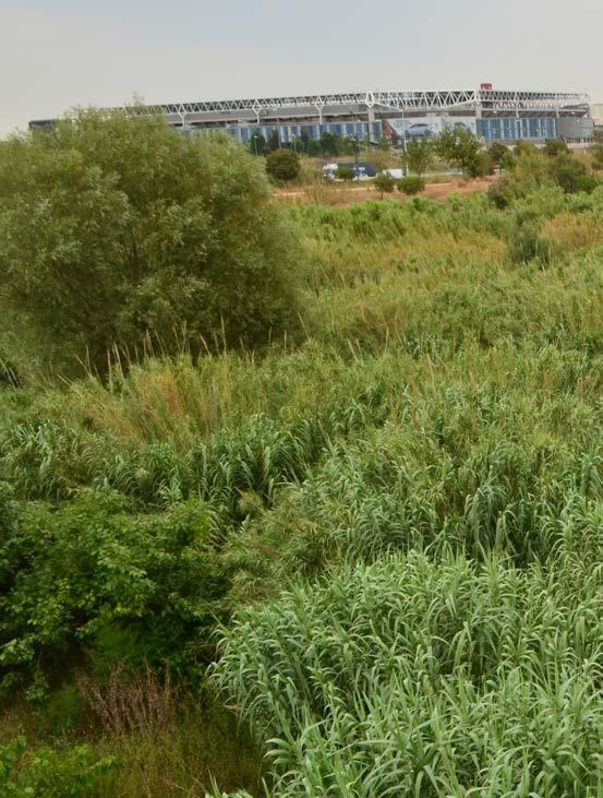
Even so, the Delta area has been the most damaged because of the direct connection with Barcelona. The new infrastructures, the urban pressure and the recent industry expansion have affected the river section and the quality of its landscape in only 50 years.
Obviously, all these changes have also affected people's relation with the place, turning it from a beloved space towards a neglected zone.
9


Llobregat Delta 1956


Llobregat Delta 2020 11


Llobregat Delta 1956


Llobregat Delta 2020 13
perception context
There is a big contrast between the wild, natural atmosphere of the existing riverscape and the expectations that people have of the site. This broken connection is one of the reasons why people don’t visit the place.
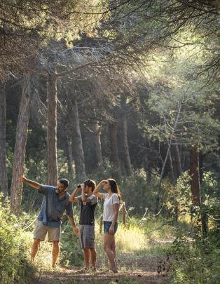
When walking along this riverscape you can appreciate a unique natural atmosphere, difficult to find in other parts of Barcelona. A playful river with plenty of hidden spots where you can experience the dynamics of nature.
Contrary to that, the inhabitants of the area describe this riverscape as a grey and dirty place, full of noise from the infrastructure surrounding the river and without any attractive places to visit.
distant
quietness
arundo donax
fish
fishing heron
relaxing noise
narrow movement
poplars
roads everywhere industrial
peace healthy forest
polluted
raising and falling
water
backround noise
waterfalls
connecting stones wild
green life
grey disconnected
river vegetation
flooded areas
no nature
difficult acces
meanders flooding
15
“I see a polluted and dirty river between an industrialized

Jordi Guiu,
industrialized city, with an unpleasant background noise”
Barcelona

17
"I see the potential of a big natural riverscape on the
Magali Sanz Casas, site

the edge of a very dense urbanized metropolitan area"
site visit December 2021

19
“I see an unaccessible river that you just
Mireia Martin,

just see when crossing over the bridges”
Martin, Barcelona

21
"I noticed a river with many hidden Magali Sanz Casas, site

hidden natural places to discover"
site visit October 2022

23
“It feels like a road
 Maria Rosa Verges,
road with water”
Verges, Barcelona

25
"water flowing, sandy islands, and suddenly
 Magali Sanz Casas, site
suddenly a group of birds flying around"
site visit January 2023

27
“I have never been in the metropolitan Llobregat
Nuria Vinyoles,

Llobregat river but I imagine a grey area”
Vinyoles, Barcelona

29
"I experienced the playfulness of the Magali Sanz Casas, site

the river by interacting with its nature"
site visit December 2022

31
Research 2
intangible perceptions study
The first research part of this project focuses on intangible perceptions, the feelings that can’t be seen or touched.
Within this intangible perception study we investigate the old ways people interacted with the river and the new collective perceptions that people have on the site. In addition, we search for a new method to evoke the start of future bonds with the place.
To achieve it, we create a choreography of inspiring images that combine people’s imaginaries and expectations of the river with past relationships and the current potential of the site.

33

“The movement of the water creates an attractive separation that Alba Guillen,
that generates the game of finding the best place to cross over it”

Guillen, Barcelona 35
“A river with temporal crossings made Carlota Sanz, Sant

made of stones or other natural materials”
Sant Just Desvern

37
“A river where you can touch the water, where you
Carlota Sanz, Sant

you can get your feet wet, where there is a game”
Sant Just Desvern

39
“On the shore poplars, willows, hazelnuts, rotten trunks, brambles and some yellow
Jordi Vinyoles,

yellow
lilies. Suddenly the song of the blackbird and the sound of a green woodpecker”
Vinyoles, Barcelona

41
“I also imagine this river as a place
Ramon Padullers,

place to hang out with friends”
Padullers, Barcelona

43
“I also think of a place with not very close vegetation, a rather open

Alba Guillen,
open area, with areas of water raising and falling and long views”

Guillen, Barcelona 45
“A river with not only reeds, but also ripian vegetation, Carlota Sanz, Sant

poplars and other trees combined with open spaces”

vegetation,
47
Sant Just Desvern

“The ending of the river is this moment when you finally breath, Xavier Nogues, Sant
breath, smell, touch and experience the beauty of the sea”
Sant Just Desvern

49
Pau Nogues, Sant

“The river delta is this moment where the river widens
Sant Just Desvern

widens up and pines, sand and sea start to be present”
51
Research 2
Functional river analysis
The second research part of this project focuses on the functional analysis of the river system.
The functional analysis aims to understand the human interventions that over time have re-shaped the ecological and spatial conditions of the river and define the future challenges to improve the entire river situation.
To achieve this, we analyse the different ecological and cultural layers related to the river.

53


roads old delta mouth clay accumulation railways groynes
river hydromorphology
The construction of 3 reservoirs and 100 locks on the higher part of the river; together with the new river section, the covering of river streams and the new Delta mouth have completely changed the flow and sedimentation process of this river delta area.
The direct consequence of all this is the accumulation of river clay in the Delta mouth. The river needs more speed along all its way and a better movement of bigger pebbles to improve the Delta extraction process.
This accumulation of clay in the Delta mouth requires an urgent solution, otherwise it will provoke floodings in this very dense urban delta.
55
Reservoirs and locks construction

sediments trap


flow change
 sediments trap
flow change


in river
180 3 100 7 1920 2018 sediments trap flow change 57
Change
section


River streams covering 1920 2018 loss sediment transportation


120 New delta mouth 1920 2018 250 sediments trap reduction flow speed 59


covered infiltration clogged waterways natural infiltration aquifer
river water infiltration
The aquifer under this river delta is the main fresh water resource for Barcelona, although the fast growth of this metropolis is drastically reducing the amount of underwater.
The re-filling of this aquifer is mainly done artificially because the natural infiltration system is not working anymore.
On one hand, with the new river section the river floodplain is drastically reduced; and the secondary river brenches remaining are being clogged by reeds and mud because the river is losing speed and large sediments.
On the other hand, the river streams are being covered with concrete reducing again the natural infiltration surface.
61
River streams covering 1920 2018 loss sediment transportation
flow change

 Change in river section
loss of infiltration surface
clogged riverways
Change in river section
loss of infiltration surface
clogged riverways
63


 river forest
river islands
river islands
river reeds
river reeds
river delta
river delta
river forest
river forest
river islands
river islands
river reeds
river reeds
river delta
river delta
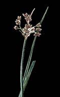
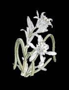
river habitats and spatial quality
There are 4 different biotopes along the river: river forest, river islands, river reeds and river delta with qualities to improve, enhance or regenerate.

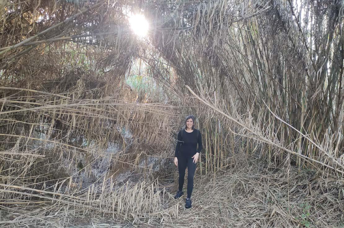
The river forest and river islands are losing their spatial and ecological qualities because the invasive specie arundo donax is taking over.
The river reeds is a new landscape not very appreciated by people. Even so, it creates very interesting experiences for people and brings good shelter for animals.
Finally, the river delta with the dunes that have completely disappeared. The old flowing landscape that protected the coastline has become a flat sandy surface.
65


 Tamarix sp
Falco tinnunculus Pica pica Ardea cinerea
Salix Alba Populus spp.
Phalacrocorax carbo
Remiz pendulinus
Scirpus Mauremys leprosa
Holoschoenus
Gallinula chloropus
Charadrius dubius Bubulcus ibis Rana perezi.
Himantopus Actitis hypoleucos
river forest
river reeds
Tamarix sp
Falco tinnunculus Pica pica Ardea cinerea
Salix Alba Populus spp.
Phalacrocorax carbo
Remiz pendulinus
Scirpus Mauremys leprosa
Holoschoenus
Gallinula chloropus
Charadrius dubius Bubulcus ibis Rana perezi.
Himantopus Actitis hypoleucos
river forest
river reeds
river islands
psammodromus hispanicus


 Hirundo rustica
Emberiza schoeniclus arundo donax
Motacilla spp
Delichon urbicum rallus aquaticus
Gallinula chloropus
cakile maritima
morus bassanus
medicago marina
eryngium maritimum
pancratium maritimum
larus michahellis
charadius alexandrinus
carpobrotus wacinaciformis
Hirundo rustica
Emberiza schoeniclus arundo donax
Motacilla spp
Delichon urbicum rallus aquaticus
Gallinula chloropus
cakile maritima
morus bassanus
medicago marina
eryngium maritimum
pancratium maritimum
larus michahellis
charadius alexandrinus
carpobrotus wacinaciformis
67
river delta


river forest 1990 2020


river islands 1990 2020 69


river reeds 1990 2020

river dunes 1990 2020 71


historical city centers railway bike & pedestrian path municipal limits
river accessibility
The Llobregat delta is located on the left edge of Barcelona but politically is part of the Llobregat region.
This region has a very interesting urban composition. Throughout the history many small towns were settled on side and side of the river; and in recent years this towns have become small cities very well connected by train with Barcelona.
During the last 10 years each municipality in the Llobregat region has been building connecting paths from their city center towards the river. These paths are a starting action to connect with the river but they should improve its spatial and natural qualities.
Another important action done in this region has been the construction of two paths along the river, on side and side. These paths have started to open up this neglected area but, again, they should evolve into something much more connected with the riverscape: visual connections, experiencing paths, bridges to cross the river...
73
existing paths towards the river


existing paths along the river


75


river culture
People mainly know the Llobregat region because of the agricultural park along the river.
The different municipalities in the region have created a sequence of “harvesting fests” with the objective to enhance the landscape around the area and bring people closer to the farming process.
When the harvesting moment of a product comes, the municipality organises several activities and workshops for the inhabitants, visitors and farmers to come together and celebrate.
This harvesting rooted tradition of this region will become the starting point to implement the new river strategy.
77
Strategy 3
Given the continuous precariousness of the public sector and the lack of cultural connection with the landscape, I create a slow project that works in an innovative way, going from the bottom up. It starts with small, low-cost, and strategic interventions in different parts of the river that slowly engage people to restore the river ecosystem while creating a new bond with it.

The way to work together river and community is through the landscape harvest process, a circular process where people can collect exceeding materials from the river and give them back in a transformed way.
And over time when a new mindset is established and the new concept of living with the river is embraced, these small interventions can grow in scale and complexity, becoming landscape projects that continue to improve the river conditions and create a better natural structure beneficial for the entire metropolis.

79

Slow project concept

A slow project requires time and tactical action between people and river.
The starting point of this project is a sequence of festivities spread on strategic spots along the river system. In these festivities a landscape architect and material expert together with several members of the community start restoring the river and sharing their knowledge and expertise.
The objective after these festivities is to let the same community encourage other people to go to the river and continue to harvest it while having fun.
After some time, when a new mindset is established, another set of festivities are organised along the river system where new stakeholders, like the municipality, are invited. The aim is to bring these first tactile actions into bigger and more complex landscape projects, and even a vision, that can continue to improve the conditions of the riverscape.
81
 River delta
River reeds
River islands
River forest
River delta
River reeds
River islands
River forest
reed harvest

Landscape harvesting concept

The way to work together with landscape and community is through the landscape harvest process, a circular process where people can collect over time exceeding materials from the river and give them back in a transformed way.
Within this Delta plain of the Llobregat river, we propose to harvest three exceeding materials: clay, reed, and water. Different types of material are harvested on each part of the river system (river delta, river reeds, river islands and river forest) according to the river needs.
The clay is harvested on the lowest part of the river (river delta) where the accumulation of clay can cause future floodings in the area.
water harvest 83
The aroundo Donax, an invasive reed is harvested along the entire river except in the river delta (river forest, river islands and river reeds). The objective is to bring back the old variety of biotopes and create better spatial quality.

Finally, the water is harvested along the central part of the river (river islands) where most of the streams flow into the river. clay harvest

The starting point of the whole landscape harvesting process relates to the existing deep-rooted agriculture harvesting fests from the region.
We propose as a start of the project this sequence of festivities spread along the river that relate to the annual landscape calendar. This new calendar describes the best moment in the year to harvest each specific material, letting people understand better the overall dynamics of the place.

The reed harvesting period is from December to April, aiming to harvest the reed in its softest moment of the year but with the strongest structure of the stem for the after construction.
The clay harvesting period is from June to September, relating to the period after the big storms were more clay is accumulated on the riverbed.
Finally, the water harvesting periods is from March to June, taking into account the harvesting preparation before these big rains.
85
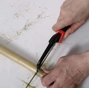
Harvesting process 4
In this Delta plain of the Llobregat river, we propose to harvest three exceeding materials: clay, reed, and water. Each material has its own harvesting and transformation process.
Within this project we search for the best way to treat the material on site and define some transformation opportunities and guidelines.
First, we built a one to one reed plank (40x30cm) model and a real clay brick (7x15cm) with the materials of the river, testing the liability of the entire process and defining a possible way to work.
Second, we experiment with tiny models the different results of each material. Arriving to the conclusion that there are several types of interventions possible depending on the required tools, expertise, time and number of people.

87


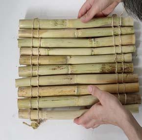
harvest the reed peel the reed smooth the reed cut the reed tie the reed build with reed


harvest the clay mold the clay dry the clay build with clay 89
filter the clay mix the clay
simple intervention no material treatment, harvest and create tools expertise


reed experience path
medium intervention material harvesting and simple
clay milestone path

people people time time
reed mud crossing path
intervention
simple treatment to create
tools expertise
people

difficult intervention requires time, expertise and tools to create time

tools expertise


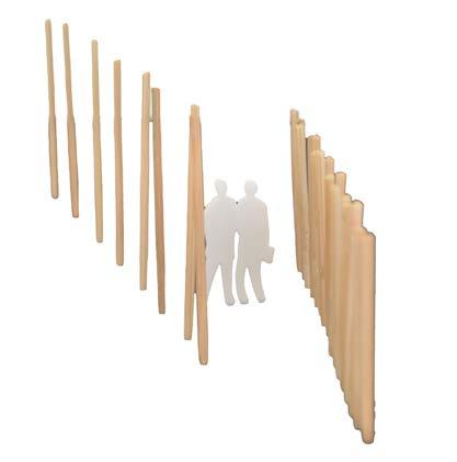
 reed playing sheds
reed crossing platform
reed meeting platform clay resting benches clay viewpoint
reed playing sheds
reed crossing platform
reed meeting platform clay resting benches clay viewpoint
91
reed crossing bridge
Design 4
This project wants to define an evolving process between riverscape and community, without creating a pre-defined design. Nevertheless, we create this inspiring document aiming to engage and guide the entire process.
This document is created based on the result of combining the deep river technical knowledge with the potentials found on site, the past historical research and the collection of people's imaginaries.
We propose a sequence of spatial interventions along the 4 different landscapes that we have defined in this metropolitan river system: river forest, river islands, river reeds and river delta. Each one with its own urgent topics to solve which define the harvesting materials of the area. We also envision the evolving process of these interventions and how they can grow over time.
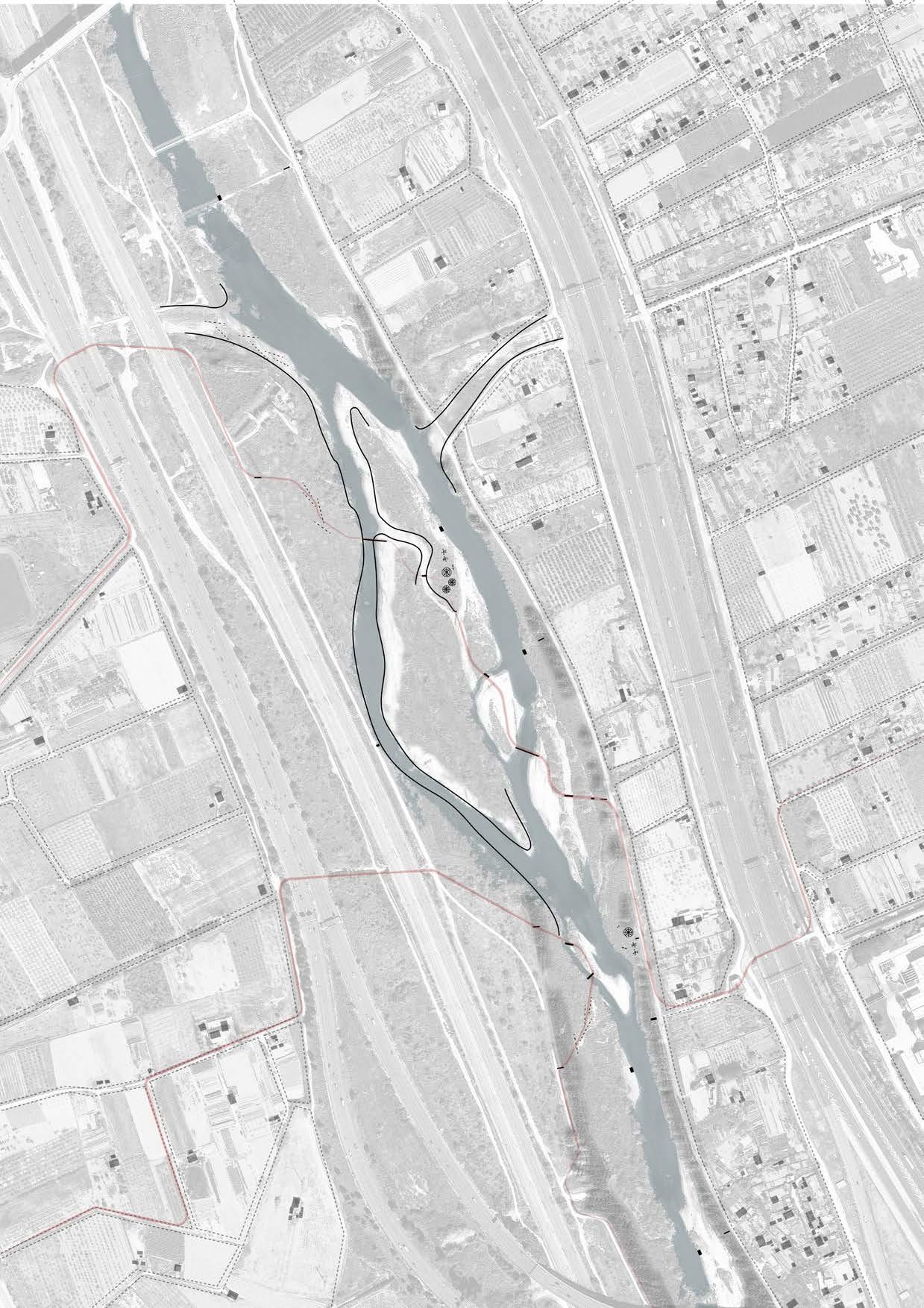
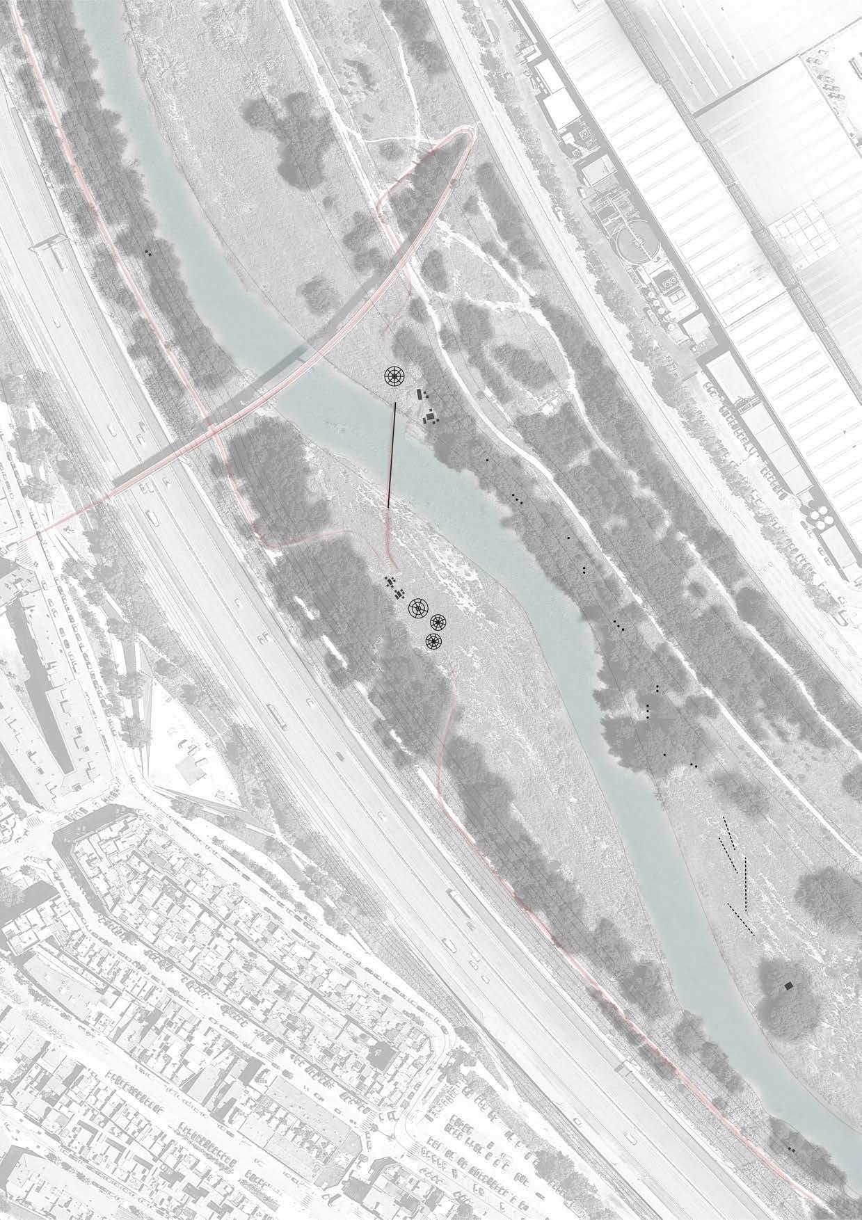
For each intervention we define a working zone of about 1km lenght, directly connected to the paths that come from the towns. Within this area we think the interventions won't get lost in the landscape and we attach them to the main entrances to make them visible for the river stakeholders.
 River delta
River reeds
River islands
River delta
River reeds
River islands
93
River forest
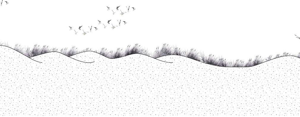
The river delta is this very unique moment of the river where it slowly melts into the sea. A changing landscape with pineforests, open lakes, sand and many birds.
In this bottom up process we propose three stages of work for the next 10 years and we mainly work with the first two:
It's also the only place along the entire metropolitan river where they have invested in creating natural reserves, recreational paths and integrated cultural heritage.
The main change over time in this coastal landscape is the disappearance of dunes, mainly because of human pressure, changes in the river sedimentation process and a lack of sand movement along the coast. This situation is leading to an unprotected coast with faster loss of the coastal line and also to the loss of a very special habitat.
Regarding the river, the main issue is the excess of clay accumulation on the riverbed because of all hidromorphological changes along the river (3 reservoirs, 100 locks, covering of river streams, change in river section and new delta mouth). This whole situation could cause flooding in this very dense urban delta.
1. start the process by harvesting the clay from the river together with the community and create with the exceeding clay a base to help the dunes re-shape. We let this process evolve over time.
2. continue the process by defining a specific landscape project on site that can rapidly improve the river conditions: create a new river edge with groynes that help to reduce the width of the Delta mouth and generates habitat for the different animals.
3. end the process by making a vision of the entire river that predicts and improvement of water flow and sedimentation processes by uncovering parts of river streams, removing some of the locks or even creating wider spaces for the river in some spots, aiming to get a better tranfer of sediments from the river into the sea.
River delta
95


97


99
pineforest

old dunes

sand motor
viewpoint
N 0m 25m 50m 100m olddeltamouthwidth
existing situation
The new delta mouth, much wider than the old one provokes an accumulation of clay on the riverbed.

The start of a pineforest and some remaining sandy areas without any dunes are part of the natural coastal barrier.
The new sand motor built some years ago nourishes the south coast. A temporary landscape that will be water.
Finally, the last viewpoint along the river where people can see the sea helps to create a closed and protected coast for birds. Even so,people would like to also acces to the sea as a final experience.

dunes riverbed +0m +6m +5m dunes riverbed harbour recreation path
101

Int 1 N 0m 25m 50m 100m
We start by organizing a festivity on site with a landscape architect, material expert and members of the community. We do this festivity next to the existing viewpoint, where people can easily have access.
During this festivity we harvest clay from the river and make bricks. With these bricks we make low walls perpendicular to the sea wind direction that will help the sedimentation process to create new dunes.

2024 - Int 1
103

Int 2 N 0m 25m 50m 100m
2025 - Int 2
Every spring we repeat the harvesting process, helping the river to extract the accumulated clay after the rains. New brick walls are created, letting the dune landscape expand, creating a combination of old and new dunes.
Finally, this moment of the year becomes a unique moment where people can access this protected area and enjoy the dunes, the birds and the sea.


“we still need to improve it, like in the past, make it more natural”
Anna Juhe, Barcelona
105

Int 3 N 0m 25m 50m 100m Int 2
2026 - Int 3
We organize a second festivity where the municipality and other stakeholders are invited to participate, together with the community and landscape architect. This second festivity is more hidden in the landscape.

For this festivity the idea is to engage the new parties involved to take action and invest time and money on bigger landscape projects that can continue to improve the river conditions.

“the river delta is this moment where the river widens up and pines, sand and sea start to be present”
107
Pau Nogues, Sant Just Desvern


Int 4 Int 2 N 0m 75m 150m 300m
We envision that five years later a bigger and more complex project could be developed, parallel to the evolving new dunes.

A "design with nature" project that deals with the bad design of the new delta mouth, built in 2004. The construction of several groynes along the river reduce the river width while creating soft edges for animals.

2031 - Int 2 & 4
109

Int 4 Int 2 N 0m 75m 150m 300m
We envision that 10 years later a completely different type of landscape will appear in the area with the new dunes and a new natural delta mouth.

In that moment, even a bigger vision could be developed thinking on how to improve the general flow of the river and the sediment transportation to reduce the amount of accumulated clay.
 2036 - Int 2 & 4
111
River reeds
This new reedscape has grown recently as a result of building several groynes in 2008. These river constructions aimed to prevent the clay accumulation in the Delta mouth.
1. start the process by harvesting the reed from the river together with the community and create interesting spaces for people to appreciate the brutality of the reeds. We let this process evolve over time.
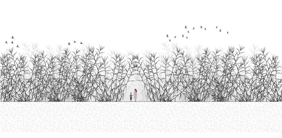
The slow flow of the river has created a sea of Arundo Donax, an invasive specie that is appearing along most of the riverscape, but it becomes more obvious here.
This Arundo Donax is hated by people because it's repetitive and monotonose. Even with that, it creates unique experiences when walking through it: very enclosed and silent place which gives home to many types of animals.
In this sense, this is the perfect "temporal" place in the river to enhance the reed qualities and let people reunite with this plant, hoping that over time, when the river conditions get better, it will slowly disappear.
In this bottom up process we propose three stages of work for the next 10 years and we mainly work with the first two:
2. continue the process by defining a specific landscape project on site that can rapidly improve the river conditions: create a municipal maintenance team which regularly takes care of the harvesting process and the new public spaces created by the community. We also envision a circular system with the farmers where they can use the extra reeds for integrating their fields to the river atmosphere, expanding the river feeling beyond the current edge.
3. end the process by making a vision of the entire river that predicts and improvement of water flow and sedimentation processes by uncovering parts of river streams, removing some of the locks or even creating wider spaces for the river in some spots, aiming to remove the invasive specie arundo donax naturally.

113


115


117


0m 25m 50m 100m N highway agriculture
groyne
reedscape
groyne
existing situation
A river section with a highway on one side that generates continuous background noise in the area. On the other side the agriculture park connects with the river.

The river is a sea of reeds, some of them older than others. Some groups of trees also mark where the groynes were built.

riverbed +0m +7m +4m +1m +5m
riverbed railway highway agriculture recreation paths recreation path recreation path
119

Int 1 0m 25m 50m 100m N
We start by organizing a festivity on site with a landscape architect, material expert and members of the community. We do this festivity on the edge of the reedscape, where people can easily have access.
During this festivity we harvest reeds from the river and create interesting spaces for people to appreciate the brutality of the reeds.

2024 - Int 1
121

Int 2 Int 2 0m 25m 50m 100m N
We let the reed harvesting process evolve during the following years, letting the community take over the harvesting and creating process.

We imagine people to expand the existing paths, create new interesting routes, discover hidden hems and create unique spaces in nature.
2025 - Int 2
“small and lonely environment, surrounded by trees that make you difficult to see the sky”
123
Nuria Vinyoles, Barcelona

Int 3 0m 25m 50m 100m N
2026 - Int 3
We organize a second festivity where the municipality and other stakeholders are invited to participate, together with the community and landscape architect. This second festivity is more hidden in the landscape.

For this festivity the idea is to engage the new parties involved to take action and invest time and money on bigger landscape projects that can continue to improve the river conditions.

“it invites you to walk around, spend time contemplating it. It calms you down and makes you enjoy nature”
125
Anna Juhe, Barcelona

Int 4 0m 75m 150m 300m N
We envision the creation of a municipal maintenance team which regularly takes care of the harvesting and new public spaces. We also envision a circular system with farmers where they use the extra reeds for integrating their fields, expanding the river feeling.

In that moment, even a bigger vision could be developed thinking on how to improve the general flow and sediment transportation of the river, aiming to naturally remove the arundo donax.

2031 - Int 4
“a place totally linked to nature and the disconnection from the daily routine”
127
Nuria Vinyoles, Barcelona
River islands
The most active and dynamic area of the metropolitan river. With some extra water flow and sediments coming from the side streams.
An open area with not a lot of vegetation creating long views towards the surrounding hills. With sandy islands appearing and disappearing along its way, attracting very special type of birds.
The main landscape change over time has been the expansion of the invasive specie Arundo Donax which is closing off this open space.
In addition, the slow river flow and broken reeds in the area is blocking the river waterways reducing drastically the total infiltration surface.
In this bottom up process we propose three stages of work for the next 10 years and we mainly work with the first two:
1. start the process by harvesting the clay from the river together with the community and create unique spaces that enhance the openness. In addition, we also propose to open up the closed waterways to harvest the water from the river. We let this process evolve over time.
2. continue the process by defining a specific landscape project on site that can rapidly improve the river conditions: create a municipal maintenance team which regularly takes care of the harvesting and new public spaces, linked with a new circular system where the farmers can use the extra reeds for integrating and expanding the river feeling beyond the edge. We also envision that old traces of covered meanders can be openned up to give room for the riverand re-naturalize the covered streams.
3. end the process by making a vision of the entire river that predicts and improvement of water flow and sedimentation processes by uncovering parts of river streams, removing some of the locks or even creating wider spaces for the river in some spots,aiming to remove the invasive specie arundo donax and the clogged waterways naturally.

129


131


133

N 0m 25m 50m 100m highway railway riverbed path path
existing situation
A river section with a highway on one side and side that generates continuous background noise in the area.


In between the highways we have two worlds:
the outer world very noisy with two recreation paths running between the river and the agriculture.
the inner world very silent with the river and the sandy islands, 6meter lower than the recreational paths.
riverbed +6m +1m +1m +0m +6m riverbed
agriculture highway railway abandoned water retention recreation path recreation path recreation path recreation path
135

N 0m 25m 50m 100m Int 1
We start by organizing a festivity on site with a landscape architect, material expert and members of the community. We do this festivity on the middle level between the path and river, where people can access.
During this festivity we harvest reeds from the river to open up the area, creating nice view lines towards the water, as they used to be in the past.

2024 - Int 1
137

Int 4 Int 2 Int 3 N 0m 25m 50m 100m
We let the reed harvesting process evolve during the following years, letting the community take over the harvesting and creating process. We imagine people to create new meeting points next to the water or

viewpoints to look over the river to the mountains.
We also let them harvest the water by unclogging the river waterways from reed and other river material.

2025 - Int 2, 3 & 4
“a river where you can touch the water, where you can get your feet wet, where there is a game”
139
Carlota Sanz, Sant Just Desvern


“I also imagine this river as a place to hang out with friends”
Ramon Padullers, Barcelona

“I also think of a place with not very close vegetation, a rather open area with water raising, falling and long views”
141
Alba Guillen, Barcelona

Int 5 N 0m 25m 50m 100m
2026 - Int 5
We organize a second festivity where the municipality and other stakeholders are invited to participate, together with the community and landscape architect. This festivity becomes part of the new connecting path.

For this festivity the idea is to engage the new parties involved to take action and invest time and money on bigger landscape projects that can continue to improve the river conditions.
“the movement of the water creates and attractive separation that generates the game of finding the best place to cross over it”
143
Alba Guillen, Barcelona

Int 6 N 0m 75m 150m 300m
2031 - Int 6
We envision the creation of a municipal maintenance team which regularly takes care of the harvesting process and the new public spaces created by the community.
We also envision a circular system with the farmers where they can use the extra reeds for integrating their fields to the river atmosphere, expanding the river feeling beyond the current edge.
“a place totally linked to nature and the disconnection from the daily routine”
145
NuriaVinyoles, Barcelona
Int 7 N 0m 75m 150m 300m
We also envision that old traces of covered meanders can be openned up to give room for the river. Another action to envision is the naturalization of covered streams improving the sediment sources to the river.

In this moment, even a bigger vision can be developed thinking of how to improve the general flow of the river and its sediment transportation, also linked to the surrounding river biotopes.

2036 - Int 7
“a river is an irregular watercourse, completely free of artificial obstacles and with its own territory much larger than its riverbed”
147
Xavier Carceller, Barcelona
River forest
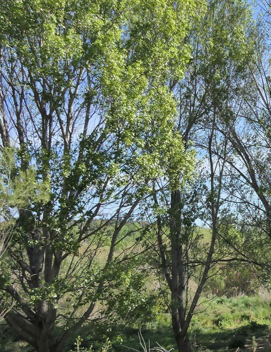
The river forest becomes this transition zone between the Delta plain and the Montserrat hills. A new river atmosphere appears with more shaded shore lines, ideal for flora and fauna.
1. start the process by harvesting the reed from the river together with the community and create a nice shaded biotope for animals and people. We let this process evolve over time.
Two types of river forest co-exist in this area: a very dense forest that makes difficult to look through, but on the other hand, protects you from the road sounds; and the open forest with high trees and low underforest vegetation that let you walk towards the water shore.
Finally, the Arundo Donax expansion is taking over the forest zones closing off the connection with the water.
In this bottom up process we propose three stages of work for the next 10 years and we mainly work with the first two:
2. continue the process by defining a specific landscape project on site that can rapidly improve the river conditions:we envision the openning of the covered stream crossing Sant Andreu de la Barca, aiming to bring more dynamics to the river and reconnecting the city with the riverscape again.
3. end the process by making a vision of the entire river that predicts and improvement of water flow and sedimentation processes by uncovering parts of river streams, removing some of the locks or even creating wider spaces for the river in some spots, aiming to remove the invasive specie arundo donax naturally.

149


151


153

N 0m 25m 50m 100m city highway river river forest river forest industry
existing situation
A river section, next to the town Sant Andreu de la Barca but with a wide highway separating the natural space from the houses and generating continuous background noise in the area.

A river covered with forest on side and side of the shoreline creating and enclosed space protected from the noise of the highway and the industry.

riverbed +0m +5m +5m +6m riverbed
recreation paths recreation
recreation
railway highway agriculture
path
path
155

Int 1 N 0m 25m 50m 100m
We start by organizing a festivity on site with a landscape architect, material expert and members of the community. We do this festivity on the middle level between the path and river, where people can access.
During this festivity we harvest reeds from the river that clear up the existing river forest, creating a nice shaded biotope for animals and people.

2024 - Int 1
157

Int 2 Int 3 Int 4 N 0m 25m 50m 100m
We let the reed harvesting process evolve during the following years, letting the community take over the harvesting and creating process.
We imagine people to create new routes along the river forest and also sheds on trees and in between the woods.

2025 - Int 2, 3 & 4
159


“tall trees, relax, fine air and chirping of birds”Maria Rosa Verges, Barcelona
“on the shore poplars, willows, hazelnuts, brambles and yellow lilies. Suddenly the song of the blackbird and the sound of a green woodpecker”


161
Jordi Vinyoles, Barcelona

Int 5 N 0m 25m 50m 100m
2026
We organize a second festivity where the municipality and other stakeholders are invited to participate, together with the community and landscape architect. This festivity becomes part of the new connecting path.

For this festivity the idea is to engage the new parties involved to take action and invest time and money on bigger landscape projects that can continue to improve the river conditions.
 - Int 5
“a river with temporal crossings made of stones or other natural materials”
163
Carlota Sanz, Sant Just Desvern

Int 6 N 0m 75m 150m 300m
We envision the openning of the covered stream crossing Sant Andreu de la Barca, aiming to bring more dynamics to the river and reconnecting the city with the riverscape again.

In that moment, even a bigger vision could be developed thinking on how to improve the general flow of the river and the sediment transportation aiming to take control naturally of the arundo donax in the shore lines.

2031 - Int 6
“In general I imagine a very natural space, space with movement and lots of life.”
165
Roger Carceller, Barcelona
