
Tip of the CAP Celebration FALL 2022 A PUBLICATION OF THE ARKANSAS DEPARTMENT OF TRANSPORTATION ArDOT PRESENTS PLAN For EV Charging Stations RECYCLING PLASTICS into Asphalt 30 CROSSING A Progress Report 31 PROMISES MADE, 31 PROMISES KEPT


It has been a true pleasure to attend the 2022 Service and Safety Award Ceremonies this year. I really enjoy getting to take a road trip and spending time with everyone. You all are so hospitable and make me feel welcomed. Thank you! It has given me an opportunity to talk to you about the great things that have happened this year at A r DOT, such as winning the Regional Roadeo in Baton Rouge and employees receiving at least a 7% pay raise. And, you all have been great sports and tolerated my pirate joke! Just in case you missed out, here it is:
A pirate and a sailor were at a bar sharing a pint of beer. The sailor pointed to the pirate’s peg leg and asked, “How did you get that?” The pirate said, “Arrrg, I wrestled a shark and lost me leg.”
The sailor pointed to the pirate’s hook and asked, “How did you get that?” The pirate said: “Arrrrg, I was in a fight with Red Beard’s crew and lost me hand.”

The sailor pointed to the pirate’s eye patch and asked, “How did you get that?” The pirate said, “Arrrrrg, a bird came by and pooped in me eye.” The sailor said, “That’s not as impressive as the other two…” “Aye,” the pirate answered “But it was me first day with the hook - Arrrrrggg.”
While this is funny (especially if you use your best gravelly pirate voice J), it is also sobering. One moment of not paying attention, one moment of not being mindful and alert, one careless action and your life can change forever. That is true for everyone including myself. It is especially true for our Arkansas Highway Police, maintenance and construction employees that are working along our highways.
A r DOT’s most important core value is “Safety first in all we do”. Nothing is more important than safety. Safety needs to be a mindset with no exceptions and no excuses and no tolerance for taking shortcuts just to finish the work faster.
In 2022, we implemented several safety initiatives and improvements such as the Slow Down, Phone Down Work Zone Safety Campaign, Guardian Angel Lights and new safety vests. In 2023, we will continue to improve and expand our culture of safety. I challenge you to be safety focused – keeping yourselves safe and watching out for your fellow workers. Keep each other accountable.
The greatest accomplishment we celebrated this year were the Safety Awards. Congratulations to all the crews that had a safe year. Looking forward, let us make 2023 accident free! Everyone deserves to go home safe every day. I wish you all a Merry Christmas and a Blessed, Happy and Safe New Year!
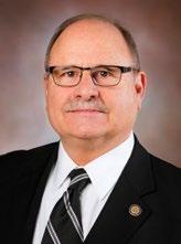
Lorie H. Tudor, P.E., Director
FRONT COVER:
Fall foliage on State Highway 10.
BACK COVER:
Fall foliage on Interstate 49.

EDITOR
David Nilles
David.Nilles@ardot.gov
STAFF WRITERS
Britni Padilla-Dumas
Britni.Padilla-Dumas@ardot.gov
Valerie Williams
Valerie.Williams@ardot.gov

Marrissa Miller
Marrissa.Miller@ardot.gov
Lamarie Rutelonis
Lamarie.Rutelonis@ardot.gov
PHOTOGRAPHER
Rusty Hubbard
Russell.Hubbard@ardot.gov


Correspondence should be directed to: David.Nilles@ardot.gov
ARKANSAS HIGHWAYS
Public Information Office
P.O. Box 2261
Little Rock, AR 72203-2261
Arkansas Highways is published by and for employees of the Arkansas Department of Transportation as a medium of departmental news and other information. It is also distributed free of charge to the public upon request.

The Arkansas Department of Transportation (Department) complies with all civil rights provisions of federal statutes and related authorities that prohibit discrimination in programs and activities receiving federal financial assistance. Therefore, the Department does not discriminate on the basis of race, sex, color, age, national origin, religion (not applicable as a protected group under the Federal Motor Carrier Safety Administration Title VI Program), disability, Limited English Proficiency (LEP), or low-income status in the admission, access to and treatment in the Department's programs and activities, as well as the Department's hiring or employment practices. Complaints of alleged discrimination and inquiries regarding the Department's nondiscrimination policies may be directed to Joanna P. McFadden Section Head – EEO/ DBE (ADA/504/Title VI Coordinator), P. 0. Box 2261, Little Rock, AR 72203, (501)569-2298, (Voice/TTY 711), or the following email address: Joanna.McFadden@ardot.gov. Free language assistance for Limited English Proficient individuals is available upon request. This notice is available from the ADA/504/Title VI Coordinator in large print, on audiotape and in Braille.


SEPTEMBER 8 AND OCTOBER 26 WERE DAYS OF CELEBRATION FOR ArDOT AS COMMISSIONERS, STAFF, CITIZENS, CONTRACTORS AND ELECTED OFFICIALS GATHERED IN EL DORADO AND JONESBORO, RESPECTIVELY, TO CELEBRATE THE COMPLETION OF THE CONNECTING ARKANSAS PROGRAM (CAP).


The CAP is one of the largest highway construction programs ever undertaken
by Ar DOT. The 31 projects making up the program were made possible by a 2012 voter-approved temporary ½ cent sales tax with revenue dedicated to road and bridge projects.
“With support of the Arkansas State Legislature, the Governor and Arkansas voters, the last 10 years have generated $1.8 billion, funding 31 projects and 200 miles of road improvements as part of this program,”
Ar DOT Director Lorie Tudor told a crowd gathered at The Murphy Arts District in El Dorado. “The people I
thank the most are the voters that approved the ½ cent sales tax.”

The 31 road projects that are part of the program stretch across the entire state.
“It took all of our legislators working together as well as the wisdom of the voters of Arkansas to pass the ½ cent sales tax that provided these improvements,” Highway Commission Chairman Robert S. Moore, Jr. told the crowd.
(continued on page 6)


The events in El Dorado and Jonesboro were a way to recognize every project included in the program.
“I have attended many highway dedications, but this one is different,” stated Dan Flowers, President of the Arkansas Good Roads Foundation. “Normally, you dedicate a single highway or bridge completion. Today, we celebrate the completion of multiple projects that will significantly improve safety and mobility for motorists traveling Arkansas.”
Representative Matthew Shepherd addressed what a learning experience the sales tax effort was for him as he worked on the constitutional amendment.
“I had the opportunity to be engaged in this process in my first term in the House. I learned so much from Commissioners Robert Moore and Madison Murphy, and from DanFlowers - Ar DOT’s Director at the time. When it comes to highway funding and putting together a program of this magnitude, it takes champions who are willing to go to the mat for these issues.”
Also part of the celebration in El Dorado was the completion of the widening of the Highway 167 corridor to four lanes. Motorists now have four lanes extending from the Louisiana state line northward to the Interstate 530 interchange near Little Rock.
“What a pleasure to celebrate completion of so many projects on Highway 167,” former Highway Commissioner Madison Murphy shared. “We can also celebrate the future of Highway 82. As this area of Arkansas grows, Highway 82 will be just as important to vitality, safety and mobility as Highway 167 has become.”
Murphy also stressed the importance of people working as partners.
“Partnerships are so important. They are how you make things happen. When you look at these highway improvements; the state, our cities and our counties worked together and got things accomplished.”
Just prior to a symbolic ribbon cutting
for Highway 167, Tudor tipped her cap to all involved.
The CAP event in Jonesboro was held on the campus of Arkansas State University.
“Like every other part of the state, northeast Arkansas has benefited from the CAP program,” stated Highway Commissioner Alec Farmer of Jonesboro. “We improved three miles on the Highway 18 Monette Bypass, widened two miles of Highway 18 to five lanes east of Manila and widened approximately 14 miles of Highway 412 to four lanes.”
“Infrastructure investment is what propels us and is going to move us even further into the 21st Century,” Congressman Rick Crawford shared in Jonesboro. “Your Congressional representatives from Arkansas work closely with Ar DOT to prioritize what projects need to be earmarked. We make sure we are doing what we can to enhance infrastructure investment in Arkansas.”
“Thanks to everyone who put their trust in Ar DOT to complete the CAP program,” Tudor shared.
The CAP celebration in El Dorado was sponsored by Murphy USA and the Arkansas Good Roads Foundation. The Foundation also sponsored the Jonesboro event.
THE 30 CROSSING CONSTRUCTION PROJECT THAT IS UNDERWAY IN LITTLE ROCK AND NORTH LITTLE ROCK IS THE LARGEST CONSTRUCTION PROJECT ArDOT HAS EVER UNDERTAKEN. The ultimate project stretches from the interchange at Interstate 440 in Little Rock northward to the interchange with Highway 67/167 in North Little Rock.
Recently, the Department held a news conference to celebrate a milestone in the project and to present an update on construction progress.
“The ultimate 30 Crossing project is making improvements to two Interstates, measuring a distance of just over seven miles, and is also building an impressive new bridge over the Arkansas

River,” ArDOT Director Lorie Tudor shared as the event got underway.
Tudor went on to explain that construction crews had reached a milestone in the project as eastbound traffic was shifted in September to the newly built eastbound bridge. The eastbound and westbound bridges will better handle traffic flow and also provide better navigation for recreational boats and barges traveling the river below. Both eastbound and westbound bridges are expected to be completed by the end of 2024.
Construction crews began tearing down the old river bridge in September to make way for a second Interstate 30 bridge that will carry westbound traffic and be built adjacent to the new eastbound bridge.
(continued on page 8)
In addition to the bridge work, the project in the downtown areas of Little Rock and North Little Rock will feature three through lanes of Interstate 30 with two collector-distributor lanes in both directions of Interstate 30.
Following Tudor’s welcome at the media event, Keli Wylie, Alternative Delivery Project Administrator, presented an overall update on the progress of the entire $633 million project.
“This is a very important corridor. It is the convergence of six major interstates and highways as well as the navigable channel of the Arkansas River and two Union Pacific railroad yards,” Wylie shared.
Wylie congratulated Kiewit-Massman Construction, a joint venture of Kiewit Infrastructure South and Massman Construction who serve as contractors on the project, for their success in meeting projected milestones.
"Our construction schedule before crews began on-site work showed us switching traffic on this bridge on September 1st," said Wylie. "So, two years into the largest project ever constructed in ArDOT history, and the contractor is on time."

Construction began in September of 2020. In recent months, contractors have met milestones that include the demolition of the Sixth Street overpass, demolition of the Cantrell Road/Highway
10 ramps and the opening of the new Ninth Street overpass. Recently on the north side of the river, crews hung girders over the Interstate 40 eastbound lanes. All of the work has been carried out while an average of 120,000 vehicles per day travel the corridor. By 2045, Wylie said state officials expect the figure to rise to 143,000 vehicles a day due to regional growth.
The demolition of the Cantrell Road/ Highway 10 ramps has left 16 acres of space between Rock Street and Cumberland Street that will be utilized as a green space.
“The City of Little Rock will present ArDOT with a plan for developing that space,” Wylie added.
Wylie shared other highlights of the project that are in the works including:
• A new widened two-lane ramp from Interstate 630 eastward onto Interstate 30 east.

• A new exit ramp onto the frontage road at the interchange so traffic traveling from I-630 east can access downtown.
• A new entrance ramp leading from the McArthur Park area onto I-630 westbound.
“The scale of this project is just incredible,” Commissioner Marie Holder stated. “Construction has been underway for only two years, and it is amazing that we have already reached this milestone. I’m grateful for the partnership between ArDOT
and the cities of Little Rock and North Little Rock. We also thank Governor Hutchinson and all of our Arkansas legislators who saw the need for this project. I want to also thank the residents and businesses located near the construction site and the motorists that travel this stretch every day for their patience and their commitment to safety during this project.”
Wylie shared that there has been no increase in traffic accidents in the
construction zone since the project began.
Holder concluded by sharing the benefits the project will bring to the area.
“It will improve safety, connectivity and the quality of life for those who live and work here, those that visit and those who are just passing through.”
Construction on the 30 Crossing project is estimated to be completed in July 2025.

THE ARKANSAS DEPARTMENT OF TRANSPORTATION RECENTLY SAID GOODBYE TO ITS LONGEST SERVING FORMER HIGHWAY COMMISSION MEMBER. BOBBY HOPPER PASSED AWAY ON JULY 29.
Not all Arkansans knew Hopper, but they may know the name. Arkansas’ only highway tunnel, on Interstate 49 near Winslow, is named after Commissioner Hopper. So are a bridge and highway in Cotter, a bypass in Mountain Home and a park in Springdale. For a young boy born and raised in Cotter, these are all impressive tributes to this hardworking visionary.
Bobby Hopper was born in Cotter in 1932. Following high school, he joined the military, serving in the U.S. Army. His service included a tour in Korea during the Korean Conflict. On returning to the States and finishing his time in the Army, he married Lois Oels.
They moved to Springdale where Hopper was selected by the Ford Motor Company to open a car dealership. Those old enough to remember may recall his advertising slogan, “Don’t say Ford, say Bobby Hopper Ford!”
Hopper was appointed to the Arkansas Highway Commission by Governor Bill Clinton in 1983. He was the first Commissioner to serve consecutive terms. He filled the unexpired term of Festus Martin and was then asked by Clinton to serve an additional 10-year term at the time. Hopper served twice as Chairman, from 1987 through 1988 and again from 1997 through 1998. Over the years, Hopper had a huge impact on Arkansas’ highway system.

“Bobby built a legacy of public service, hard work and perseverance in working towards a vision,” ArDOT Director Lorie Tudor shared.
Hopper strongly believed that a dependable and efficient highway network would open northwest Arkansas to the rest of the state and the region. During his time on the Commission, he made that vision a reality. He was instrumental in creating Interstate 540, now Interstate 49, that reaches from Interstate 40 up into the far northwest corner of the state.
“Bobby Hopper was the influence that made northwest Arkansas open to the rest of the country when he came up with Interstate 540,” former
Today, Interstate 49 makes its way through the Boston Mountains and is a route that includes ArDOT’s highest bridge and Arkansas’ only tunnel, fittingly named after Hopper.
Hopper told KFSM in 2016 that “We have a beautiful forest down there, and of course, the Commission did not want to mess it all up.”
His dream for a dependable highway reaching northwest Arkansas became a reality in 1999, right about the same time his term on the Commission concluded.
Hopper’s vision, however, wasn’t limited to northwest Arkansas. As a Commissioner, he was committed to providing an excellent highway network in every region of the state.
Rodney Slater served on the Commission at the same time as Hopper.
“We were committed to serving an entire state struggling to be the best it could be and ensure opportunity
for everyone. It was very important that we travel the state and make ourselves available to the people we had the honor to serve.”
Hopper and his fellow Commissioners dedicated themselves to making Arkansas’ highway system as good as any in the country. Work in Central Arkansas in the 1980s saw the last leg of Interstate 630 completed through downtown Little Rock. Interstate 440 around southern edge of the city was completed as well. In 1985, the Commission created the Rural Road Program. The program consisted of 4,850 miles of improvements selected from a backlog of priority projects. For the first time in history, the Commission specifically listed which roads would be improved.

The early 1990s saw the Commission implement the Highway Improvement Program, a long-term road improvement program to address the state’s many highway
and bridge needs, many in the Arkansas Delta.
Roadside litter was a growing problem and in 1987, the Commission implemented the Adopt-A-Highway Program to address the issue. Nearly 2,400 volunteer groups adopted approximately 4,500 miles of state highways.
All of the improvements on Arkansas’ highway system were completed operating with a budget that was at a level lower than in years past. With hard work and a determination to succeed, Commissioners found a way to improve the state’s roadways with advancements that would last for years to come.
In addition to serving on the Highway Commission, Hopper gave back to the community he loved. He was a member of the Springdale Civil Service Commission; the Arkansas and the American Automobile Dealers Associations;
and the Springdale Rotary Club, where he also served as a board member and was honored as a Paul Harris Fellow. Hopper also served as a board member of the Springdale Chamber of Commerce, which recognized him with lifetime membership status.
“Bobby also had a special interest in giving to the community, funding projects for the Springdale-based Northwest Medical Center and the Springdale Fire Department. He also provided land to establish a park for the Springdale Police Department, which was later turned into a baseball and soccer park for children’s sports,” noted an obit provided by the family.
“While we have lost a great friend, a wonderful person and a dedicated servant of the people, Bobby and his legacy will never be forgotten,” Tudor concluded.
“If there is a highway commission in heaven, Bobby Hopper will be on it,” Trammel reflected. “And heaven will have the best roads available.”
Twenty-six ArDOT employees have a Remote Pilot Certificate—also known as a Part 107 license—from the Federal Aviation Administration (FAA). The bridge inspection program currently has 18 UAVs in service; each District has at least one drone readily available for inspection purposes.
“Our team of drone pilots is made up of District Bridge Inspectors, Heavy Bridge Inspectors and Heavy Bridge Engineers,” explained Heavy Bridge Maintenance Engineer Kevin Weston. “We’ve added drones to an already existing bridge inspection program; these drones are an excellent tool to supplement the inspection process and increase the ease of access to the bridge for photo documentation.”
It’s safe to say that multiple uses of drones occur each day across the state; recent records indicated that there were 131 ArDOT flights in the past 30 days (at the time of this article). These drones offer high-resolution imagery of hard-to-reach areas. Inspectors around the state consistently provide positive feedback about how drones have improved the inspection and documentation process and report produced.

“For our major complex bridges, we’ve added drone use to the inspection process,” Weston said. “We want that extra layer of visibility; drones aren’t replacing any process, they’re supplementing. This is in addition to what we were already doing.”
ArDOT follows all of the Federal Highway Administration's (FHWA) guidelines for using drones in bridge inspections.
“We’re following the information on the FHWA’s website and taking feedback from other DOTs; we’re just implementing it on a smaller scale,” Weston explained.
Weston is a member of the National Cooperative Highway Research Panel (NCHRP). This panel proposed AASHTO Guidelines for Applications of Unmanned Aerial Systems Technologies for Element-Level Bridge Inspection. He and other panel members advise the consultant through the research project and explain what field engineers and inspectors want to see regarding drone usage in element-level bridge inspections.
“That report will be released in a few years and will be the guidance for DOTs, which means ArDOT has a direct influence on what the national guidance will be for drone usage in bridge inspections,” Weston stated.
“One unique thing I’ve noticed is that several of our inspectors paid for their Part 107 licenses and drones themselves before ArDOT had anything in place to support it,” Weston shared. “Other DOTs shared that they don’t have as much buy-in from their employees. I feel like that’s a complement to our inspectors; it shows that our employees take initiative to learn new things to do a better job and implement new technology.”

Locals celebrated a new bridge over Osage Creek on County Road 1785 near Siloam Springs. Arkansas Department of Transportation leadership and Highway Commissioner Philip Taldo joined Benton County Justice of the Peace Kurt Moore and Benton County Judge Barry Moehring on June 20 to celebrate the new structure.
The 502-foot long bridge officially opened to traffic at the beginning of June. Crossland Heavy Contractors, Inc. completed the $2.3 million contract.

The intersection of Highway 367 and Highway 319 in Ward carries 4,900 vehicles every day. There is also a railroad track that passes through the area. But, it wasn’t always that way.
“I can remember back in 1971 there was a racetrack right here and every afternoon after school, I would ride a motorcycle to this area and gallop racehorses,” Lonoke County Judge Doug Erwin told a crowd gathered for a recent A rDOT ribbon cutting.
The September 30 ribbon cutting was to celebrate the installation of Ward’s first traffic signal.

“This intersection has had some issues as this area of town has grown,” the judge added. “With this light, this will solve a lot of problems.”
Hardrock Construction recently completed work on the $1 million project. The intersection of the two highways is unique in that a railroad crossing is located just twenty yards away that crosses Highway 319. The new traffic signal will be synchronized with the railroad crossing signal to help traffic safely make its way through the area.
“Safety is our top priority at A rDOT,” Rex Vines, Deputy Director and Chief Engineer, told the crowd. “This light is going to make a huge difference for this intersection.”
The intersection was, at one time, the eighth most dangerous intersection in Arkansas.
“With these improvements, this is going to be one of the safest
intersections in the state,” Ward Mayor Charles Gastineau told the crowd. “It is our first light at an intersection and reflects our progress as we grow as a community.”
“It took everybody working together to make these improvements happen,” Judge Erwin added. “We thank the city, the county, A rDOT, the engineers and Metroplan. That’s what it is all about, the entire community working together.”
“I am proud for Ward because it took a lot of work on the part of everyone to come up with a design that can now handle the traffic and the railroad activity through the area,” Representative Jim Wooten told the crowd.
WORK IS UNDERWAY IN WEST MEMPHIS ON A PROJECT THAT WILL EXPAND COMMERCIAL TRUCK PARKING ON INTERSTATE 40 IN EASTERN ARKANSAS. The $6 million project was awarded to Weaver-Bailey Contractors and will be located on the former site of a Tourist Information Center in West Memphis. The new facility will feature 84 spaces for overnight parking.

How badly needed is more truck parking for commercial vehicles across the country? You’ve probably seen 18-wheelers parked for the night on the shoulders of Interstate entrance and exit ramps. Or perhaps you’ve seen them rolled to a stop in the parking lot of your local big box store. That’s because they
have trouble finding somewhere to pull over for the night. “I cannot adequately express how important this parking expansion is here on Interstate 40 or how much it is needed for our truckers as they travel through Arkansas,” ArDOT Director Lorie Tudor shared. “Not just in Arkansas, but across the nation.”
In 2020, truck parking was the No. 3 issue on the American Transportation Research Institute’s list of top industry issues, behind the driver shortage and driver pay. The truck parking issue rose two spots on the list from 2019 and worsened amid the COVID-19 pandemic.
“Truck drivers give up an average of 56 minutes of available drive time per day to park early rather than risking not being able to find parking down the road,” Shannon Newton, President of the Arkansas Trucking Association, told Talk Business & Politics
In February of this year, the American Trucking Associations and the Owner-Operator Independent Drivers Association sent a letter to U.S. Secretary of Transportation Pete Buttigieg urging Infrastructure Investment and Jobs Act funds be prioritized to boost the nation's truck parking capacity. The two groups say the nationwide shortage of truck parking has plagued America's truckers for decades, with a wide range of consequences for highway safety, driver health and well-being, supply-chain efficiency and the environment.
The parking lot expansion in West Memphis is funded with a grant from the Arkansas Commercial Trucking Safety and Education Program (ACTSEP). The program was approved by the State of Arkansas 89th General Assembly in 2013.
The purpose of the program is to create a joint effort between the trucking industry and ArDOT with a goal to improve commercial truck safety and the efficiency of freight movement.
“This project represents a big step forward in reaching the program’s goal,” Tudor added.
Not only is this project bringing additional parking for commercial vehicles, it will also feature a construction first for ArDOT District One.
“This project will be the first use of roller-compacted concrete in our District,” stated District One Construction Engineer Jeff Adams. “It is befitting of a project of this nature and provides a cost savings over other construction materials.”
Roller-compacted concrete (RCC) is an economical candidate for many pavement applications. It has traditionally been used for pavements carrying heavy loads in low-speed areas because of its relatively coarse surface. However, in recent years its use in commercial areas and for local streets and highways has been increasing.
Roller-compacted concrete gets its name from the heavy vibratory steel drum and rubber-tired rollers used to compact it into its final form. RCC has similar strength properties and consists of the same basic ingredients as conventional concrete—well-graded aggregates, cementitious materials, and water—but has different mixture proportions. The largest difference between RCC mixtures and conventional concrete mixtures is that RCC has a higher percentage of fine aggregates, which allows for tight packing and consolidation.
RCC is typically placed with an asphalt-type paver equipped with a standard or high-density screed, followed by a combination of passes with rollers for compaction. Final compaction is generally achieved within one hour of mixing. Unlike conventional concrete pavements, RCC pavements are constructed without forms, dowels or reinforcing steel. Joint sawing is not required, but when sawing is specified, transverse joints are spaced farther apart than with conventional concrete pavements.
RCC pavements are strong, dense, and durable. These characteristics, combined with construction speed and
economy, make RCC pavements an excellent alternative for parking areas.
The only other ArDOT project using roller-compacted concrete can be found in District Eight where two miles of Highway 213 in Conway County was reconstructed using RCC.
The extension of the parking facility in West Memphis is expected to be completed in late Spring of 2023. A project slated for early 2023 will add restrooms and an Arkansas Highway Police substation on site. Without a doubt, the spaces will be a welcome sight to truck drivers and become a regular stopover for many.
“Providing ample truck parking makes it easier for drivers to get rest when they need it, and then get back on the road to safely deliver America’s freight,” Newton added.
Some information for this article was provided by Iowa State University’s Institute for Transportation Guide for Roller-Compacted Concrete Pavements and by Talk Business & Politics.

ENVIRONMENT, WE ARE OUR OWN WORST ENEMY. HUMANS LIVE IN A “THROW AWAY” SOCIETY WHERE TONS OF SINGLE USE CONTAINERS MADE OF PLASTIC, GLASS AND CARDBOARD ARE DISCARDED EACH YEAR. Fortunately, we now have recycling programs that lessen the volume of recyclable materials going into landfills. But things are changing.
For years, China imported recyclables from other countries. Unfortunately, that came to an end in 2018. They no longer take other countries’ waste. India has followed suit. Today, Turkey is the leading receiver of plastics from around the world, but that only accounts for 11% of what is being produced.
What happens to the rest? It is being shipped to landfills. In order to improve the situation, we have three options: stop producing so much plastic, allow for larger landfills or find alternative ways to recycle waste into something else.
At ArDOT’s recent Transportation Research Conference held in Hot Springs, attendees were introduced to a manufacturing process that utilizes plastic bottles and plastic bags, and recycles them into asphalt mixes.
Pacific GeoSource (PGS), an industry leader in pavement design and engineering, hosted a presentation at the conference to share news on its partnership with NVI Advanced Materials Group and an innovative asphalt called NewRoad®. NewRoad is made from 100% recycled post-industrial waste plastic and has been engineered to significantly improve the performance of asphalt pavements.
“We are always looking for ways to innovate and make better pavements,” said Michael Frey, President of PGS. “NewRoad allows us to offer our customers more than just better pavements—we can now impact the amount of waste that reaches our landfills, too,” he added.
For example, a typical retail parking lot features approximately 2,500 tons of asphalt pavement. Using NewRoad in that same lot keeps the equivalent of 250,000 plastic water bottles from reaching landfills and waterways.
“The amount of asphalt pavement in the United States is significant, and with NewRoad we have formulated a plastic that is compatible with all asphalt pavement mix designs,” said Mark Beeman, President of NVI Advanced Materials Group. “We are excited to have PGS partner with us to get the word out on this amazing innovation so we can make a real difference across the United States.”
When it comes to adding plastic to an asphalt mix, all plastics are not created equal. There are different types of plastics and not all of it can be put in asphalt.

Using NewRoad, 2 million plastic bags recycled = 10,000 tons of asphalt
“You have to consider melting points,” stated Joe Yaede, lead Pavement Engineer at GeoSource. “We want to be sustainable, but we want the asphalt performance to match. If we can modify that plastic, we get better performance. Newroad utilizes a modified high-density plastic that takes inconsistency out of the formula. We know what is going in, and our lab and field results have been very consistent. Our goal is to make asphalt stronger, more sustainable and more predictable.”
NewRoad has been extensively tested in the lab and in the field for years. Test results have been positive. Adding recycled plastics into the mix has resulted in asphalt that shows improved resistance to rutting, less cracking and increased longevity.
Pacific GeoSource has worked with Departments of Transportation in New York, Utah and Missouri with a goal of maintaining proper roadway integrity and safety while ensuring the entire pavement system – from surface to subgrade.

“This process of adding recycled plastics to the mix is starting to pick up,” Yaede added. “There are more agencies within the government that now want to try it. They want to be proactive. I think it is here to stay and it is only going to get bigger and bigger. We now have a sustainable solution, without sacrificing performance.”
NewRoad is now helping to solve the plastic waste problem, while improving asphalt performance and longevity. It sounds like a win-win situation for motorists and the environment.
 Photos courtesy of Pacific GeoSource
Testing of NewRoad in the field.
Photos courtesy of Pacific GeoSource
Testing of NewRoad in the field.
 BY DAVID NILLES
THE SUMMER ISSUE OF ARKANSAS HIGHWAYS FEATURED AN INFORMATIVE ARTICLE ON THE FUTURE OF ELECTRIC VEHICLES (EV) IN THE UNITED STATES AND ACROSS THE GLOBE. Since that time, developments in Arkansas continue to advance the EV movement, bringing it closer to, one day, becoming our mainstream means of getting from Point A to Point B.
In late 2021, the Bipartisan Infrastructure Law established a National Electric Vehicle Infrastructure Formula Program (NEVI Formula) to provide funding to states to build a national network of 500,000 electric vehicle charging stations by 2030 along federally designated Alternative Fuel Corridors. The program will carve out $5 billion over five years to help states create that charging station network. States must submit an EV Infrastructure Deployment Plan before they can access the funds.
“We are modernizing America’s national highway system for drivers in cities large and small, towns and rural communities, to take advantage of the benefits of driving electric,” said U.S. Secretary of Energy Jennifer M. Granholm. “The Bipartisan Infrastructure Law is helping states to make electric vehicle charging more accessible by building the necessary infrastructure for drivers across America to save money and go the distance, from coast-to-coast.”
Each state must submit a plan to the USDOT describing how the state intends to use NEVI Formula funds awarded. Working hard to coordinate that plan at ArDOT are Brad McCaleb, Division Head of Transportation Planning & Policy (TPP) and Aaron Pinedo, Advanced Transportation Planning Engineer, also in TPP.
“As part of the NEVI Formula, the state of Arkansas is expected to receive $54 million over five years beginning with $8 million in 2022,” Pinedo shared.
ArDOT recently made its Arkansas Electric Vehicle Infrastructure Deployment Plan available for public comment.
To develop the plan, ArDOT collaborated closely with the Arkansas Department of Energy and Environment (E&E). A working group was also formed which included: the FHWAArkansas Division office, the U.S. Department of Energy designated Arkansas Clean Cities Coalition, Arkansas’ Metropolitan Planning Organizations, the Arkansas Public Service Commission, Arkansas’s Electric Utilities (investorowned, cooperative, and municipal), and local governments.
“ArDOT hosted a virtual public engagement session and developed a public engagement plan to continue convening meetings with a wide variety of participants from the electric vehicle industry, community-based organizations, environmental groups and other transportation stakeholders,” Pinedo added.
Arkansas has created and will maintain an Arkansas NEVI Plan website for the five-year NEVI Formula program period. Hosted by ArDOT and available at www.ardot.gov/evplan, the Arkansas NEVI website is designed to provide a central location and clearinghouse for all Arkansas NEVI Formula developments.
ArDOT has conducted introductory NEVI plan engagement meetings with each of its neighboring state Departments of Transportation to discuss unique challenges, opportunities, coordination needs and solutions for charging stations at gaps
along the shared border regions. ArDOT convened meetings with Missouri, Tennessee, Mississippi, Louisiana, Texas and Oklahoma.
“ArDOT brought HNTB in to assist us with development of our deployment plan,” McCaleb shared. “They are a national architecture and engineering firm with a focus on infrastructure solutions and have worked with us on a variety of projects.”
The Draft Plan was provided to FHWA-Arkansas Division and the Federal Joint Office of Energy and Transportation for advanced feedback before official submittal on August 1.
“We received positive feedback and some recommendations for our consideration,” McCaleb added.
In accordance with FHWA guidance, ArDOT’s overall timeline for the NEVI deployment will focus on building out Arkansas’ portions of the federal Interstate Highway System that are FHWA designated EV Alternative Fuel Corridors (AFC) for at least the first year, then moving on to remaining Interstates and FHWA Designated EV AFCs.

“Initially Interstate 30, Interstate 40 and Interstate 49,” McCaleb stated. "Once we have been certified as built-out for those corridors, then we'll be able to expand the program to include routes other than the interstate highways."
“Arkansas has 770 interstate miles. Plans call for building EV charging stations approximately every 50 miles along Arkansas’ interstates,” Pinedo explained. “Location of the stations are required to be within one mile of an interstate and include four 150kW DC Fast Chargers capable of delivering a combined minimum of 600kW at each charging site.”
(continued on page 20)
Other factors to be considered in site location include access to the power grid, ability to allow public access 24 hours a day, 7 days a week, ability to provide amenities on site or adjacent to the site and others.
“ArDOT’s analysis yields a minimum of at least 15 charging sites needed to meet NEVI Formula Program guidance on our Interstates and Designated Electric Vehicle Alternative Fuel Corridors,” McCaleb added.
The charging stations are intended to be built by public or private entities, or a combination of both.

“The Department does not plan to own, operate or maintain the charging stations nor have any public stations on Department property,” McCaleb added. “Arkansas would like to see more than 50 charging sites built. As the charging station network expands, there will need to be enough electric capacity to operate charging stations in rural areas as well.”
There will be no cost to ArDOT for power. The charging station owner-operator will be responsible for the cost of the electricity. The cost to the driver for the power will be set by the owner-operator of the charging site.
In Arkansas and across the nation, EV infrastructure development will generate a direct need for qualified electrical
contractors and electricians to install, operate and maintain EV stations. Arkansas currently has a robust pipeline of union and non-union electrical training centers offering apprentice and journeymen programs that provide training to equip the state’s needed electricians and electrical contractors.
Arkansas also has a number of licensed electricians who have proactively sought and received additional Electric Vehicle Supply Equipment (EVSE) specific training and certification through the Electric Vehicle Infrastructure Training Program. “The chargers need the ability to deliver 600kW of energy per hour, on demand,” Pinedo added. “By comparison, the average U.S. home uses less than 900kW per month.”
Registrations for new electric vehicles soared 60% nationally in the first three months of this year. Considering all of the preparation and planning that has been invested in the EV Deployment Plan, it is a good bet that Arkansas will be ready when the first NEVI funding is distributed.
ArDOT anticipates construction of charging stations to begin in 2024.
All current information and the year one plan can be found on ardot.gov/evplan. Readers interested in staying up to date can subscribe to the email list on the website.
The chargers need the ability to deliver 600kW of energy per hour, on demand.
 BY DAVID NILLES
5 RUNS LOCKETT CREEK. You can’t see it from the highway as it is hidden in the woods but over the past year, there has been a great deal of activity behind those trees. Activity that has resulted in big improvements to the creek itself.
ArDOT purchased 250 acres in the area of the creek in 2017 and has made it a mitigation site.
“We were going to use this as a stream mitigation bank for future projects,” Clint Hutcheson with ArDOT’s Environmental Division shared. “When we got into all of the impacts on the Hot Springs Bypass project, we decided that we needed to utilize this entire site and the one at Blowout Mountain near Pencil Bluff to offset the stream impacts from the bypass project.”
Hutcheson is a lead Natural Resources Specialist for ArDOT and has been with the Department for 26 years.
“I do Section 404 permitting for projects and Section 7 endangered species coordination with the U.S. Fish & Wildlife Service,” Hutcheson shared. “I handle all of the offsite locations around the state for ongoing projects and I handle stream and wetland restoration work on our sites.”
Hutcheson has spent over three months on the mitigation property over the past year working to restore Lockett Creek to its historical location. Years ago, the creek’s path was altered, and flow was moved into a manmade channel so that gravel could be extracted from the area.
“Mickey Matthews, Lead Natural Resources Specialist, was the one that discovered the creek had been altered to a manmade channel,” Hutcheson shared.
As a result, discussion in the Environmental Division turned to returning the creek to its original location.
Similar to highway projects, construction issues can significantly influence both the feasibility and design of a stream restoration project. The constructability of a stream restoration plan is a primary design criterion during project scoping. Site limitations such as terrain, environmentally sensitive areas,
(continued on page 22)
regulatory constraints, stockpiling and staging areas, and access are constructability issues that may influence stream restoration design components.

“There was some discussion back in the office and with the U.S. Army Corps of Engineers in the beginning about whether or not we should tackle this,” Hutcheson said.
Lockett Creek is a large perennial stream, and the restoration plan called for more complex and technical design components than had ever been undertaken in-house; however Hutcheson had previously reconstructed several smaller streams at ArDOT’s Upper Saline Mitigation Bank back in the fall of 2017.
Hutcheson has completed several stream restoration courses and workshops; Applied Fluvial Geomorphology, River Morphology and Applications, Stream Investigation, Stabilizaton and Design, and Stream Functions Pyramid Framework.
Hutcheson also holds a Commercial Drivers License and has extensive experience operating the necessary
heavy equipment used in constructing stream restoration projects.
Onsite work began in August 2022. The first step in restoring the stream to its original location was to find the old stream bed.
“There was no reference of a stream still here, it was all wooded,” Hutcheson shared as we toured the site. “We used aerial photography and some LiDAR imagery to help us out. I cleared some vegetation and was then able to use a big Sycamore tree and a Sugarberry tree as reference. I figured those were by the edge of the stream where it was originally and used those as a bearing. We used some GPS, and I flagged the edges of the banks where they were going to be. After shooting some elevations, we went in and started digging.”
It took three weeks to dig the channel. Hutcheson did 90 percent of the work on the project by himself. He did have help from Eric Sanders, Environmental
Technician, and Nick Dial, Natural Resources Specialist, doing some bulldozer work.
“I would load materials and Eric and Nick would run the dump truck for me,” Hutcheson recalled. “We had two stockpiles of material that we moved out.”
Hutcheson was worried about one thing that was out of his control during restoration.
“I was nervous when I started the project. I was scared we were going to get into hurricane strength rains or something and that they would blow all of our work out.”
Once Hutcheson relocated the creek to its original location, the bed had to be prepared to handle the flow of water.
“We installed multiple rock features to ensure that the channel stays where it is supposed to. We have five Bend Way Weirs set in at 30-degree angles. They are presently working as they are supposed to.”
A Bendway Weir is a low level, totally submerged rock structure that is positioned from the outside bankline of a riverbend, angled upstream toward the flow.
“In a high-water event, the weirs slow the velocity of the water down and prevent scour (scour is the removal of the bank by powerful currents of water). Since restoration, none of the rocks have moved.
The 1,000 cubic yards of rock (Novaculite) brought on site was waste material generated from rock cuts on the Hot Springs Bypass project and was used to create stone weirs.

Once the creek was relocated to its historical location, attention turned to the manmade channel that was left behind. Three rock plugs were constructed in the channel.
“If you slow down water velocity with rock plugs, sediment and rock that is flowing with the water will fall. Over time, the sediment will fill up the manmade channel,” Hutcheson explained.
Today, the creek averages a depth of approximately two feet. A number of smaller streams feed into the creek. Even with the heat of the summer of 2022, the creek flows constantly.

“This is a real pristine stream. The fish have really come in here as have micro invertebrates. There are schools of minnows, some largemouth bass and I’ve even found an alligator snapping turtle,” Hutcheson shared. “The wildlife has really been using the area.”
In addition to channel work, Hutcheson planted over 3,000 bare-root seedlings of various species including River Birch, Buttonbush, Persimmon, Witch Hazel, Box Elder, White Oak, Water Oak, Shumard’s Oak and Redbud along the stream. The project also included draining three ponds and tearing down a 10-stall horse barn.
“We don’t like to leave structures on mitigation sites.”
Work on the creek was substantially completed in November 2022. Total length of the project was 5,000 linear feet, making it the largest stream restoration project ArDOT has done in house.
In perspective, the project has been a great success and Hutcheson has seen it as a learning experience.
“Lots of the other streams I’ve worked on are small and can dry up this time of year. You can’t really put a lot of features in them or hone your skills with the hydrology. This one I really enjoyed because I could do actual structures and learn from them. I enjoyed doing this project. It kind of pushes you a little bit because you have some plans on paper, but then there is a lot of change on the fly. Classes help give you general knowledge, but then you do one and learn firsthand what actually works.”
With so much talk back at the office about the project, Hutcheson invited a group of Environmental Division staffers on site to take a tour of the project.
“Everybody in the office has been tickled to see the final results.”
THIS MONTH’S RIVER TOWN ADVENTURE FOLLOWS THE ARKANSAS RIVER WEST TO THE CITY OF FORT SMITH. HERE YOU WILL FIND THE SECOND LARGEST CITY IN ARKANSAS AND MANY OF THE SIGHTS TO BE SEEN ARE FOUND IN FORT SMITH’S HISTORIC DISTRICT, JUST STEPS FROM THE RIVER.


As with most cities, a trip to Fort Smith begins at the Visitors Center. That would be MISS LAURA’S SOCIAL CLUB, and it just happens to be a restored former bordello. Miss Laura’s is located in the historic district and a guided tour of the building is a must. The Victorian mansion has been restored to its original splendor and is a fascinating look at Fort Smith’s past and what took place within its walls. Miss Laura’s is the first bordello ever listed on the National Historic Register. After a tour, check out the travel brochures featuring the area’s many attractions. Miss Laura’s is located at 2 North B Street and is open Monday through Saturday.
 Miss Laura's Social Club
Mural in downtown Fort Smith.
Miss Laura's Social Club
Mural in downtown Fort Smith.
Arkansas is known as the Natural State due to its beautiful landscapes featuring mountains, valleys, rivers and lakes. Without a doubt, there are plenty of places to escape in order to enjoy the outdoors. In this series, Arkansas Highways explores Arkansas’ river towns. With 33 rivers running through our state, we will explore communities that have grown up along the riverbanks.
Located just four blocks away in the historic district is what has to be Fort Smith’s premier attraction, the NATIONAL HISTORIC SITE

The site preserves years of history including two frontier forts from the early 1800s, an overlook to the Trail of Tears and the Federal Court for the Western District of Arkansas. It is here where “Hanging Judge” Isaac Parker presided over Indian Territory for 21 years. Visit the Judge’s restored courtroom, walk into the historic jail and then walk into a replica of the gallows where 86 men met their fate. Be sure to walk across the railroad tracks to the site on the river where settlers first arrived and to see where the first fort was built. The National Historic Site is located at 301 Parker Avenue. Just look for the statue of Bass Reeves, one of the most famous deputy U.S. marshals west of the Mississippi River, and you’ll know you have arrived.
Not far from the National Historic Site is the FORT SMITH MUSEUM OF HISTORY. Its galleries are housed in the 1907 Atkinson-Williams Warehouse Building which is also listed on the National Register of Historic Places. The exhibits inside reveal the history of the area and its people, among them soldiers, Native Americans, outlaws and lawmen. The exhibits take up several floors so plan to spend some time here. A pleasant surprise inside the museum is an old-fashioned soda fountain serving handmade sodas, floats and sundaes. The museum is located at 320 Rogers Avenue and is closed Sundays and Mondays.
Also in the historic district, visitors will find the FORT SMITH TROLLEY MUSEUM at 100 S. 4th Street. The museum is dedicated to the preservation and appreciation of electric powered streetcars, railroad equipment, transportation and other technology that existed during the early 1900s. The museum is home to nine trolleys, and yes, you will have an opportunity to ride one. There is also a railroad collection outside the building featuring a steam engine, other locomotives, a dining car and cabooses. The museum is open on Saturdays, but trolleys run every day except Monday. Needless to say, during your visit to Fort Smith plan to take a ride on a trolley!
For those that enjoy the visual arts, the FORT SMITH REGIONAL ARTS MUSEUM (RAM) just east of the historic district makes a perfect destination at 1601 Rogers Avenue.

The museum offers fine art exhibitions in five galleries featuring world-class artists, important traveling exhibitions, the museum’s extensive permanent collection and art by emerging artists. The building that houses RAM, the old Superior Federal Savings and Loan Bank building, is now listed on the Arkansas Register of Historic Places as an example of a Mid-Century Modern design by the Fort Smith architecture firm of Mott, Mobley, Horstman and Staton. The museum is closed on Mondays.
For fans of Elvis Presley, a must-see stop in the Fort Smith area is the FORT CHAFFEE BARBERSHOP MUSEUM located in the Fort Chaffee Historic District. Elvis spent his first days in the military at Fort Chaffee. It was here, in 1958, that he received his first, now famous, G.I. haircut after enlisting in the Army. Photos from the event made international headlines. The museum is located at 7313 Terry Street and is closed on Sundays.
Though it is not open to the public yet, Fort Smith will soon be home to the UNITED STATES MARSHALS MUSEUM, a center that will spotlight the accomplishments of the U.S. Marshals Service. There could be no more appropriate home for the museum than this “Gateway to the West” city.
Plan to make a visit to Fort Smith soon. As a river town, this city has plenty to see and do.

 Fort Smith Regional Art Museum
NATIONAL PARK IS LOCATED WITHIN A SUBSECTION OF THE OUACHITA MOUNTAINS KNOWN AS THE ZIGZAG MOUNTAINS. In ancient times, this mountain range looked very different; it was the location of an ocean! Sediments began covering the ocean floor, compacting into different rock layers throughout millions of years. Eventually, the remains of this ancient ocean were forced upwards by tectonic activity. When this happened, the layers of rock were not merely lifted higher than the surrounding areas, they were folded! The folding of these sedimentary layers helped create what we now refer to as the Ouachita Mountains.
The Ouachita Mountains, at one point jagged and rough, have been eroded over time to form more gentle slopes. With the recent construction of the Highway 7 extension on new location, many geological formations have been exposed and employees of the Arkansas Department of Transportation (ArDOT) have been able to witness an interesting chemical reaction occurring on site.
To begin, there are four major sediment types that make up the surrounding area of Hot Springs: shales, sandstones, chert and novaculite. Arkansas Novaculite is a very special type of rock found in the Ouachita Mountains, because it has historically been used as a natural whetstone, or a stone that is used to sharpen cutting tools. According to the National Park Service, the “rocks found within the park are approximately 400 million years old.” That means that the rocks currently exposed by the construction
of the Hot Springs Bypass were formed mostly in the Paleozoic era. These layers can be seen in the walls that have been carved in order to accommodate the bypass.
ArDOT Geologist, Carson Sloan, provides a great walkthrough of these exposed sedimentary layers. “From oldest to youngest, the Paleozoic periods are: Cambrian, Ordovician, Silurian, Devonian, Mississippian, Pennsylvanian and Permian. The rock formations exposed along the new Hot Springs alignment extend in age from the Ordovician through the Mississippian. The very oldest rocks exposed are at the north end of the alignment and consist of shales of the Womble Formation (Ordovician). The youngest rocks that can be seen along the alignment are igneous dikes

(presumed to be Cretaceous in age, so think of the time of the dinosaurs) that can be seen approximately in the middle of the alignment cutting across Mississippian-aged Stanley Shale.”
When the Hot Springs Bypass is completed, travelers will be able to see at least seven major rock outcrops along the alignment. The oldest visible rock layer will be Womble Shale from the Ordovician period (found at the north end of the alignment), followed by Bigfork Chert (also from the Ordovician period), Missouri Mountain Shale from the Silurian period, Arkansas Novaculite from the Mississippian and Devonian periods, Stanley Shale and Hot Springs Sandstone (both also from the Mississippian period), and Igneous dikes from the Cretaceous period. That means that the youngest rock layer that is visible in the area (Igneous dikes) was formed during a time when dinosaurs roamed the earth, and the oldest rock layer that is visible (Womble Shale) was formed approximately 195 million years before dinosaurs ever existed. Not only did ArDOT crews get to view these amazing rock formations, but they also witnessed something extremely interesting happening in the workzone.
While the construction crew was working on the bypass, they came across a chemical reaction happening with some of the minerals that had been unearthed. According to Doug Hanson, Geologist Supervisor of the Arkansas Geological Survey with the Arkansas Department of Energy and Environment, “the construction of the new roadway exposed iron sulfide mineral-rich shale to the elements, which causes it to oxidize and break down. Groundwater in the area then carries these dissolved minerals to the surface of the outcrop where the water evaporates and leaves the minerals behind.” The minerals that were left behind were two that can be found at other sites in the Ouachita Mountains:
sulfur and melanterite.
To the viewer, the sulfur appears as a sprinkling of bright yellow rocks which stands out greatly in comparison to the darker colored shale that it now resides on. Upon closer inspection, viewers can see that the sulfur has formed in clusters of small, rounded deposits. The melanterite, however, can currently be found along the outcrop in three different color variations. According to ArDOT Advanced Water Quality Specialist, Lindsay Zweifel, “melanterite is very unstable and its presence is highly dependent on conditions like humidity and acidity. When the sulfur and melanterite appeared, we were experiencing 100° plus temperatures and unseasonable rainfall. So when it

freshly appeared this past summer, it exhibited that bright green to bluegreen color. When the ideal weather conditions changed, the mineral dehydrated and is now just present as a white crust.”

Chemists working for ArDOT surmised that this reaction was sped along by the extreme heat of the Arkansas summer at the time the minerals were exposed to the air. It is unknown how long the sulfur and melanterite will be visible along the Hot Springs Bypass, as the minerals are easily broken and eroded. Depending on weather and the construction happening nearby, travelers may have a chance to see the bright yellow formation along the bypass.
 Oxidized iron deposits mixed in nearby drainage water leave it a rusty orange color.
Sulfur deposits forming on the outcrop.
Oxidized iron deposits mixed in nearby drainage water leave it a rusty orange color.
Sulfur deposits forming on the outcrop.
IN NORTHEAST ARKANSAS CONNECTING COMMUNITIES SUCH AS DYESS, LEPANTO AND MARIE. It also intersects with Interstate 55, and it is just east of that interchange that you will find Rivercrest Schools: an elementary school, junior high and high school.
With three schools on the same campus, and just a two-lane highway serving 1,400 vehicles per day, it’s easy to imagine how traffic wanting to turn left into the school driveway could back up in the mornings and afternoons as students come and go.
“When traveling east on Highway 14, traffic turning left into the school driveways would back up greatly,” states Brad Smithee, District 10 Engineer. “So much so that it could back up and over the Interstate 55 overpass bridge and to the west side of the Interstate.”
Over the years, many people approached ArDOT about a turn lane for the schools.
“We heard from citizens, elected officials, the schools,” Smithee shared. “We just never could find a way to make it work out until now. Most recently, State Representative Monte Hodges contacted Director Tudor to ask about getting it done.”
In 2018, a project was awarded to replace the bridge crossing over Interstate 55 just next door to the schools. The project included a total of a half mile of repaving that would resurface the approaches to both ends of the bridge. Opportunity had knocked.
“The left turn lane was initially tied on to the bridge replacement project utilizing a Change Order,” Smithee recalled. “Unfortunately, the contractor we were working with decided to cease operations and retire before performing the Change Order, so we were not able to get the turn lane phase moving.”
Subsequently, District 10 was asked by the administration if they thought they could manage the volume of work…and get it completed before school opened for the fall semester of 2022.

“I must admit this was a pretty daunting task because this involved a good bit of earthwork, widening, base, asphalt and a ton of coordination,” Smithee shared.
“When I sat down with our District administrative team and asked them their thoughts, we all had doubts. This was because of all the other work we were dealing with and the time constraints. We had to complete the added blessing of the $1 million in asphalt received before the end of the fiscal year, we needed to get started sealing for the year and we were dealing with the routine maintenance work and unexpected bridge repairs that pop up.”
All things considered, all parties involved knew the turn lane was needed and was definitely wanted by the community. As a result, ArDOT’s “can do” work ethic kicked in.
The team and crews in District 10 put together a plan. A timeline was established, and materials were obtained and organized. Work got underway and was going well when Mother Nature entered the equation.
Deadly tornadoes left a trail of devastation in Trumann
destroying more than 70 homes and leaving a debris field in the middle of town. State agencies, including ArDOT, were asked to come in and assist in debris removal.
“Hauling the debris out of town required every available truck,” Smithee shared. “Plans for the left turn lane changed and our timeline got a pretty severe belt tightening.”

Even with the many obstacles, District 10 crews were successful in getting the turn lane completed and striped in time for school to open on August 16. In fact, Department crews were so committed to completing the project, work wrapped up several weeks before school started.


“I cannot express my thanks enough for the efforts of our staff,” Smithee proudly exclaimed. “From our District Maintenance leadership, to all the folks that operated trucks and equipment, to every Flagger involved. They all worked through these extremely hot days and just willed this work to be done.”
Now that the work is complete and the school year is underway, traffic in front of the Rivercrest schools is flowing at a much better pace. As for the District 10 employees on the project, mission accomplished!
 The new left turn lane to Rivercrest Schools.
IT’S QUIZ TIME. TAKE A MOMENT AND SEE IF YOU KNOW THE ANSWER TO THE FOLLOWING QUESTION. What do the roadways leading into Lake Catherine State Park, onto the campus of Arkansas Tech and up to the Blytheville Municipal Airport all have in common?
Each of these roads and over a hundred more "nontraditional” roads, as they are called, are maintained by ArDOT.
Institutional routes were established as a part of the State Highway System in April 1952. Per legislation and Arkansas Highway Commission policy, ArDOT maintains certain routes that provide public access to state owned facilities. That includes 240 miles of public roads on the 16,400-plus mile State Highway System that access state parks, airports, state institutions, Arkansas Game and Fish Commission use areas and industrial areas.
In 1937, the Arkansas State Legislature adopted Ark. Code § 27-67-204: Designation of roads in and connected to state parks. This legislation instructed the State Highway Commission to include certain state park access roads, parking areas and parking facilities as part of the State Highway System.
Ar DOT maintains roads at 40 of the 52 state parks across the state. They range in length from 0.3 mile at Prairie Grove Battlefield State Park to 16.2 miles at Delta Heritage Trail State Park. As of December 2021, more than 93 miles of state park roads are included in the State Highway System.

An example of the type of work that Ar DOT performs on nontraditional roads in State Parks can be seen in Arkansas City where the Delta Heritage Trail State Park attracts thousands of bicyclists and walkers each year.
Speed humps were installed in 2022 on Highway 600 just outside of town and leading to the McCallie Access boat ramps.
Additional speed humps will be installed in the park in the near future using Transportation Alternatives Program (TAP) funds. The Arkansas Department of Parks, Heritage and Tourism received a grant of $140,000 for the new speed humps during the 2021 TAP application cycle.
“With cyclists traveling on the Delta Heritage Trail and then along Highway 600 to the new boat ramps, these speed humps will keep traffic at a safe speed and that helps keep cyclists at ease,” stated Highway Commission Chairman Robert S. Moore, Jr.
The addition of certain designated roads leading to municipal airports onto the State Highway System occurred in 1971 when the Arkansas General Assembly approved Act 248. ArDOT-maintained airport access roads vary in length with the longest being 3.6 miles at the Nashville Municipal Airport. As of December 2021, almost 33 miles of airport access roads were included on the State Highway System.
Arkansas Highway Commission Minute Order 4201, approved August 1961, introduced a new policy for maintenance of institutional access roads and drives. What
are Institutional Roadways? They include roadways leading to prisons, higher learning facilities, agri-stations and other state-owned facilities.
There are almost 92 miles of institutional roads and drives on the State Highway System. They range in length from 0.06 mile at the Black River Vo-tech Fire Training Center to 7.9 miles at Arkansas State University in Jonesboro.

Arkansas Game and Fish Commission roads provide access to certain fishing and boating recreational areas under the general supervision of the Arkansas Game and Fish Commission (AGFC). In December 1963, ArDOT and the AGFC entered into an agreement regarding the construction of access roads to Game and Fish use areas. Arkansas Highway Commission Minute Order 70-188, approved June 1970, authorized the Director to execute a Memorandum of Understanding between the two agencies for improved access to public waters administered by the AGFC. ArDOTmaintained Game and Fish Access roads can be as short as 0.1 miles at Lake Pine Bluff or a three-mile drive to Lake Wilson. As of December 2021, there were almost 19 miles of Game and Fish Access Roads on the State Highway System.
Regardless of whether a nontraditional road you travel in the future leads to a scenic overlook, your favorite fishing hole or your next airline flight, ArDOT is there to make the journey a pleasant one.
With cyclists traveling on the Delta Heritage Trail and then along Highway 600 to the new boat ramps, these speed humps will keep traffic at a safe speed and that helps keep cyclists at ease.
Arkansas Department of Transportation

P.O. Box 2261
Little Rock, AR 72203-2261
FORWARDING SERVICE REQUESTED
