


L L II N N E E S S & &
S www.plsw.org Volume 34: Issue 1 January, 2023 THE EQUALITY STATE SURVEYOR Professional l and s urveyors of Wyoming
P P O O II N N T T S

Lines & Points 1|Page
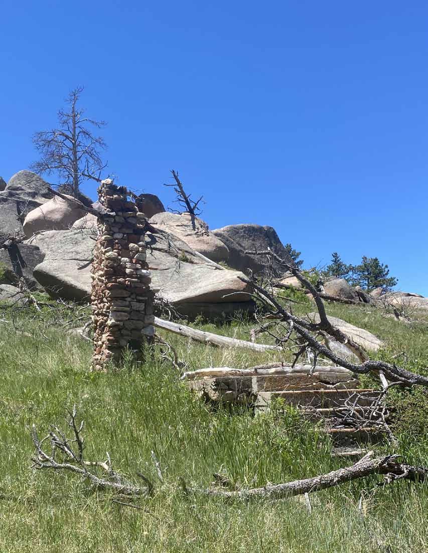
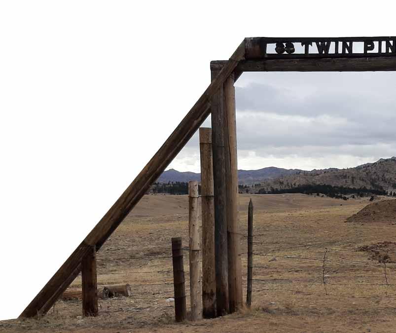
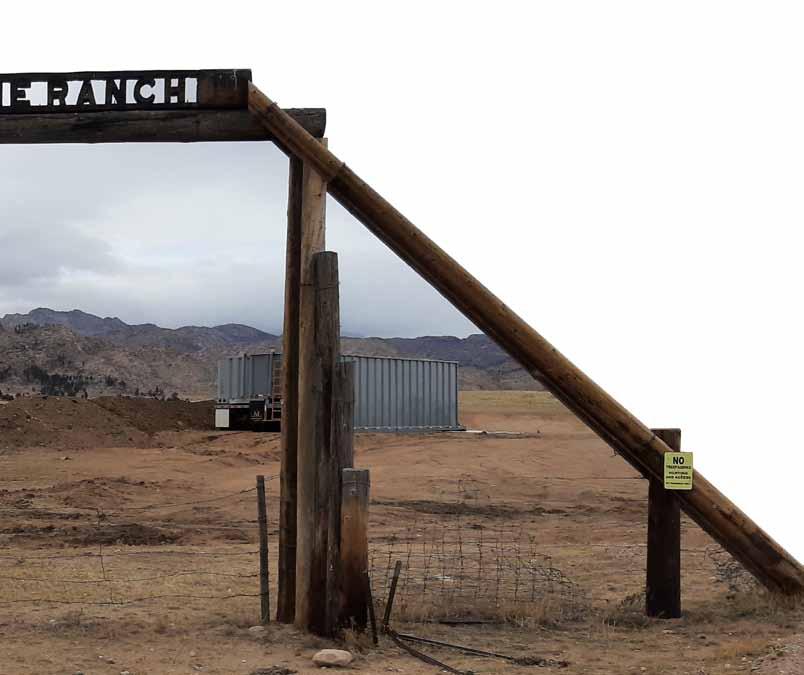
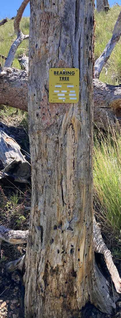
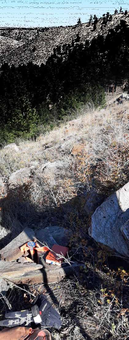
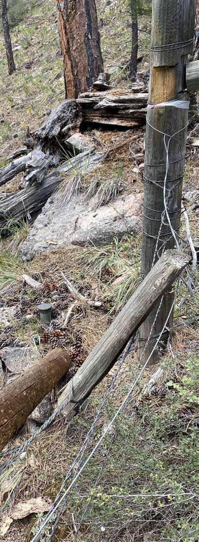
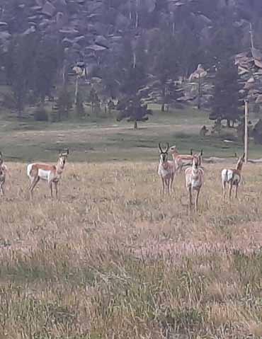
Twin Pine Ranch cabin Remains
Photo By: Randy Stelzner, P.L.S., CFedS
President President Elect Secretary/Treasurer
Tomas Johnson, PLS
Doug Boyd, PLS
John “Jack” Studley, PLS
Cotton Jones, PLS Area Director Wyoming Delegate
PRESIDENT’S MESSAGE ANNOuNCEMENTS
John Lee, PLS
Publications committee
Committee
Steven “Dennis” Dawson, PLS dennieandbarb@gmail.com
Michael Flaim, PELS mike.flaim@bresnan.net
John “Jack” Studley, PLS jklz0318@gmail.com
Joel Ebner, PLS jvebner@bresnan.net
Herbert W. Stoughton, PhD, PELS, CP hws.geod.engr@gmail.com

Sonja “Suzie” Sparks, PLS sasparks7@gmail.com
Pete Hutchison, PELS petehpels@gmail.com
PLSW (Professional Land Surveyors of Wyoming; PO Box 8, Cheyenne, WY 82003) is a statewide organization of Land Surveyors registered to practice in the Equality State of Wyoming. PLSW is dedicated to improving the technical, legal, and business aspects of surveying in the State of Wyoming. PLSW is affiliated with the National Society of Professional Surveyors (NSPS) and the Western Federation of Professional Land Surveyors (WestFed).
Lines and Points is published by the Professional Land Surveyors of Wyoming. Lines and Points is not copyrighted and permission is hereby granted to reprint articles with appropriate credit. The Professional Land Surveyors of Wyoming assume no responsibility for statements made or opinions expressed in this publication. The articles and opinions as put forth in this journal are not necessarily those of PLSW or the Editorial staff of this journal.
STATE PLANE COORDINATE SYSTEM ExPLAINED by: Karen Rogers

A HISTORY OF THE TWIN PINE RANCH by: Peggy Hagemeister Gerke
SETTING CLEAR BOuNDARIES by: Janet Milek, Matthew Pollock & Darby Schock, PLS
THE CAPITAL AvENuE BRONzE PROJECT
•Jennifer Dibona - That CAD Girl
•Jason Dysthe - Frontier Precision Inc.
•John Baffert - Surv-KAP, LLC
•Kelly Goff - Underground Consulting Solutions

•Susan Hall - Trimble
•Tim Klaben - Berntsen International Inc.
•Troy Langston - Monsen Engineering
Advertising Information
Digital-ready, full-color advertising with payment should be mailed to Lines & Points, P.O. Box 8, Cheyenne, WY 82003. Advertising rates are as follows: Year Issue Full Page $810 $210 Half Page $540 $140 Quarter Page $310 $80 Business Card $40 $10 Employment Free Free Special Rates apply for PLSW Chapters and cover placements. For more information please contact Jack Studley.
Chair-Chief Editor Designer Treasurer & Advertising Circulation Copy Editor Website Emeritus Member
Page
L II N E E S & & P P O O II N N T T S S www.plsw.org Volume 34: Issue January, 2023 THE EQUALITY STATE SURVEYOR
CONTENTS Page 3
4 Page 6 Page 7 Page 19 Page 21 On The Cover
January 2023 Page|2
PRESIDENT’S MESSAGE
PLSW Tech session 2022 is behind us at this point and hopefully those extra credits from this session are helpful
It was a joy to see Dennis Mouland again. If you have attended the Tech Sessions for 10 or 20 plus years, along with WES conventions, you can relate to the fact that some topics are fairly repetitive. The good speakers make you enjoy to subject even if your have heard it before, and the good speakers are usually ones with real war stories. Dennis is one of those. I had to think back, but waaaay back in 1988, at the Riverton Holiday Inn, I first heard Dennis speak on the subject of restoration of lost corners. I would also say that Dennis was one of the best instructors of the CFEDs program of study. I think our great 2022 attendance from numerous states was perhaps due in part to Mr. Mouland. Cheers to you Dennis.
Cheers also to each chapter of PLSW for the work that you do for the organization. Admittedly, my chapter might be one of the least active in the state, but we have members of Scholarship fundraising, Scholarship selection and membership committees. I believe each Chapter has now or has had persons involved in some part of PLSW activities.
Something to watch for soon, hopefully, is an updated PLSW website. We have contracted with a well reviewed firm to help with the website and I am looking forward to what they will do for us.
My goal in the coming months is to encourage chapters to recognize someone from your area deserving of recognition by PLSW as a Life or Honorary member. We certainly have some senior members of our guild who are proven mentors, or perhaps someone who has stepped up time and time again to make something good happen in the profession, or for PLSW. Please be thinking about these folks and get some names to your Director. That person can then bring that information to a directors meeting and we can act on it.
Best Wishes to all, Tom Johnson, PLS Presedent, Professional Land Surveyors of Wyoming
Lines & Points 3|Page
ANNOUNCEMENTS
PLSW.org WEBSITE REQuEST


As you the reader may or may not know, PLSW is in the process of developing a new website to serve the organization and it’s membership. Edge Marketing Design is developing the new website and has requested that we the members submit videos and photos to be used in the Website. The more of that digital information that we can provide, the better our final Website will be. Please submit your contributions to my personal email and I will forward the data to Edge Marketing Design. They will be needing this information beginning in early October. The development process will be relatively short so the deadline will be November 1, 2022.
Every contribution that you make will make our Website better.
Thanks!”
Dennis Dawson, PLS
My Email is: dennieandbarb@gmail.com
I encourage you, the reader, to review the current draft of the new website: update.edgemarketingdesign.com
January 2023 Page|4
Lines and Points articLe rotation submission scheduLe by chaPter
Responsible Chapter First Call Date Last Call Date Publication Date

Central Chapter ThanK YOU!! (see “Twin Pine Ranch’” in This issUe)
South Central Chapter March 1 March 15 April 1, 2023
Southeast Chapter June 1 June 15 July 1, 2023
L L II N N E E S S & & P P O O II N N T T S S
H ints to A ut H ors
Dear Readers:
The editors of Lines & Points wish to convey our gratitude to the numerous authors who have contributed photographs, technical and professional articles, and other information to be incorporated into the quarterly journal. In recent years, the assembly and redaction of the submitted materials has taken on considerable technical application of the various English language compilers, office suites, and “publishing suites”. This means that the communication and transfer of information and materials arrive at the editors’ desktops in a multitude of formats and styles, which sometimes are not compatible with the PLSW personal computers.
We, the editors, are setting forth some simple rules for submitting materials which, hopefully will simplify your efforts and make the transition to the published version simpler and less time consuming.
1. If you have any questions or comments, please contact S. Dennis Dawson, Publications Comm. Chm., (dennieandbarb@gmail.com) or Michael A. Flaim, Editor-in-Chief (mike.flaim@bresnan.net).
2. If an article contains any illustrations, photographs, graphs, or other graphics, please transmit them as separate individual files. You may also include the illustrations within your manuscript, but the
image integrity/quality is degraded seriously when attempting to extract them from the manuscript to create a published digital image. The Editor-in-Chief states that a much better digital resolution is obtained from the separate, individual illustrations submitted.
3. All submissions (electronic and snail mail) should be sent to S. Dennis Dawson (4005 Snyder Avenue; Cheyenne 82001). It is recommended a second copy be sent to Mike Flaim (1212 Southwest Drive; Cheyenne 82007).

4. It is strongly recommended that all submissions be transmitted six weeks prior to the publication deadline. The publication deadlines are: 1 January; 1 April; 1 July; and 1 October, annually.
5. Lines & Points is the official publication for the Professional Land Surveyors of Wyoming. Therefore, hence forth there will be incorporated in the publication all formal announcements pertaining to official business of the organization and other announcements. This includes announcements for the Annual Meeting; state-wide membership meetings; seminars; and the Fall Technical Session. These announcements are to be submitted to the PLSW Secretary/Treasurer John J. Studley (PLSW; Attn.: Mr. Jack Studley; P.O. Box No. 8; Cheyenne 82003) (jklz0318@gmail.com), at least four weeks prior to the publication deadline in which the announcement will appear. The PLSW Secretary/Treasurer will circulate the announcements to the Publication Comm. Chm.; the Editor-in-Chief; and the PLSW Board of Directors.
6. Advertisers and prospective advertisers should communicate directly with PLSW Secretary/Treasurer Studley about any advertisements and modifications.
Lines & Points 5|Page
The Lines and Points Editor’s Introduction
With the upcoming need for legislation to authorize NSRS 2022, there is a need for a concise explanation of how and why the State Plane Coordinate System works that can be referenced, trusted and relied upon by Legislators and the Public in General. The following is Karen’s educational dissertation of the State Plane Coordinate System being provided in Lines and Points as a means to promote discussion within the Land Surveying Profession with the intent of establishing a uniform front to the Legislature and Legislative Service Office.
State Plane Coordinate System Explanation
By Karen Rogers December 2022
Since land surveyors set out across the west to map out federal lands with the intent of patenting some for private ownership, a basic tenant of land surveying is that the section corner is always the definitive mark of property ownership. The section corner monument is the immutable place on earth that denotes a boundary. Coordinates that are assigned and lines on maps to depict those property lines are estimations based on mathematical representations of a curved world on a flat screen.
The challenge of GIS and surveying is accurately representing the 3-dimensional (3D) world through a 2-dimensional computer screen or paper. When flattening out the curved world, distortions are bound to occur. The extent of those distortions depends on the scale at which the map is made and viewed, as well as the projection used for the data. The datum used to tie map control points to specific x,y (latitude and longitude) coordinates also affects how accurately those points correspond to real places on the Earth. With the advent of better 3D modeling and measurements, control points can now have highly accurate z (height) values.
The National Geodetic Survey (NGS) is the branch of the federal government responsible for maintaining and improving the geodetic control for the country. Simply stated, “geodetic control provides a common reference system for establishing the coordinate positions of all geographic data. It also provides the means for tying all geographic features to common, nationally used horizontal and vertical coordinate systems.” (reference COGO NSDI Report Card 2018) The mission of NGS is based on the science of geodesy, which measures the center of the earth and how that affects where and how points on the surface of the earth should be measured in relation to each other. Plate tectonics plays a factor as the continental plates are in constant motion. Another factor complicating accurate measurements is how the earth is not perfectly round nor is the topography flat, and so measuring elevation becomes a complicated mathematical endeavor.
To date, NGS has published two datums (North American Datum 1927 and North American Datum 1983), and the agency is on the verge of publishing its newest and most accurate datum, known as the State Plane Coordinate System of 2022 (SPSC2022). State Plane Coordinate Systems are developed specific to each state and are affected by the state’s size and topography. NGS has taken into consideration feedback and preferences from state user groups to develop the new SPCS2022. The system is designed to minimize distortions, which is the amount by which a length or distance in a projected coordinate system diverges from the “true” horizontal distance on or near the curved topographic surface of the Earth.
users in the GIS and surveying communities have a variety of projections to use, and different ones are better suited depending on the geographic scale at which they typically work or collect their data. The State Plane Coordinate System is ideal for smaller-scale projects, such as utility work, road designs, or site construction planning. It is used heavily by city engineers and the Wyoming Department of Transportation (WYDOT). It is also relied upon for parcel mapping as managed by county assessors.
Wyoming Statute 34-25-104 instructs land parcels to be mapped using the current datum (NAD83) that will be obsolete with the implementation of SPCS2022. In the interest of reducing possible errors introduced from different datums being used across the State, it is recommended that Wyoming adopt this standard and update its statutory language to reflect the new datum. As NGS will design and implement new datums with increasing frequency given the improvement in measurement and modeling capabilities, it is also recommended that the statutory language be more general to adopt the latest datum NGS publishes. Specifying one specific datum will require revisiting statutory language again in the future. To make the statute ‘future-proof’, generic language using examples from other states should be incorporated into draft legislation to be considered at an upcoming session.
January 2023 Page|6
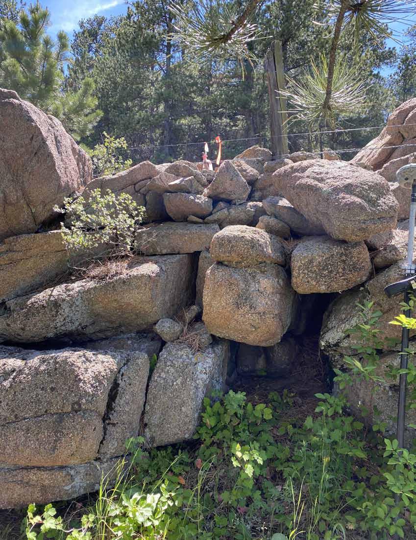
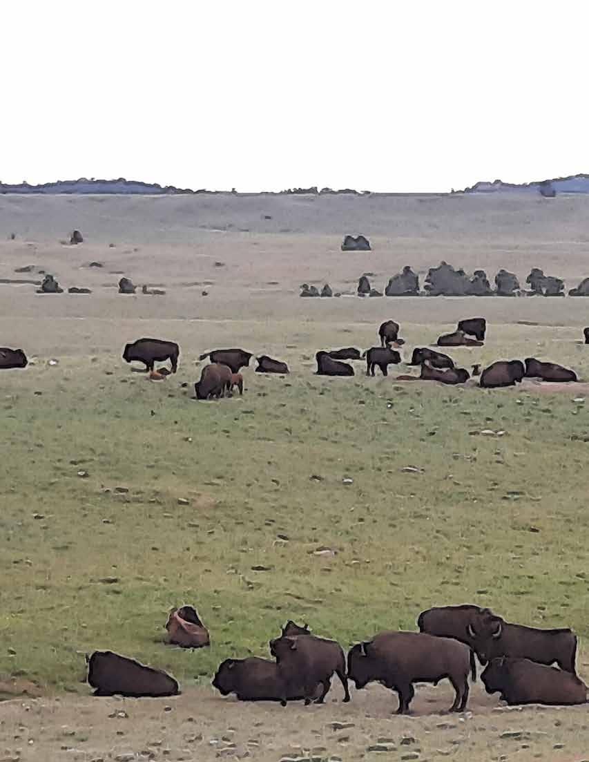
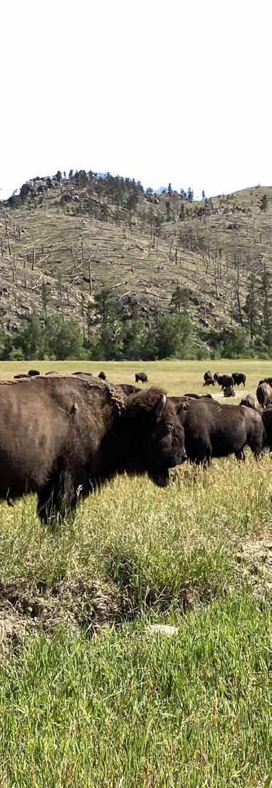
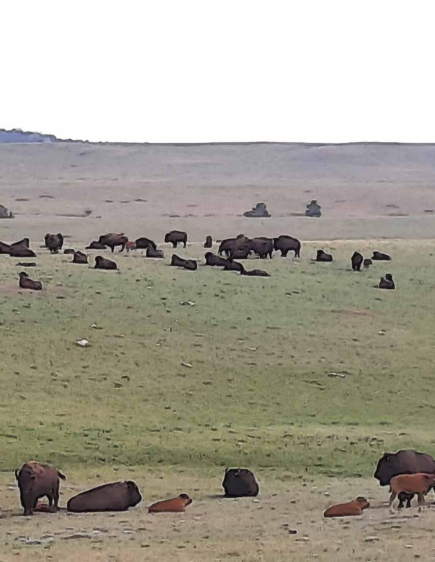
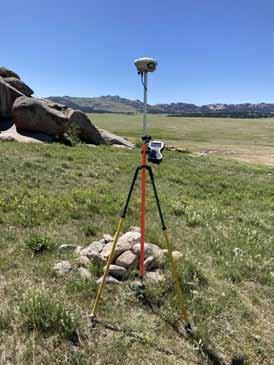
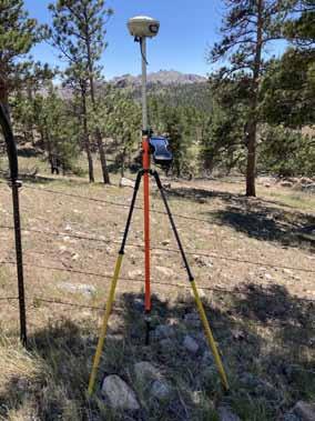
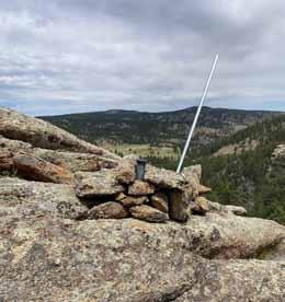
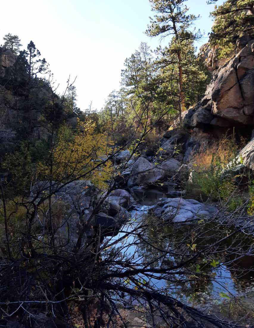
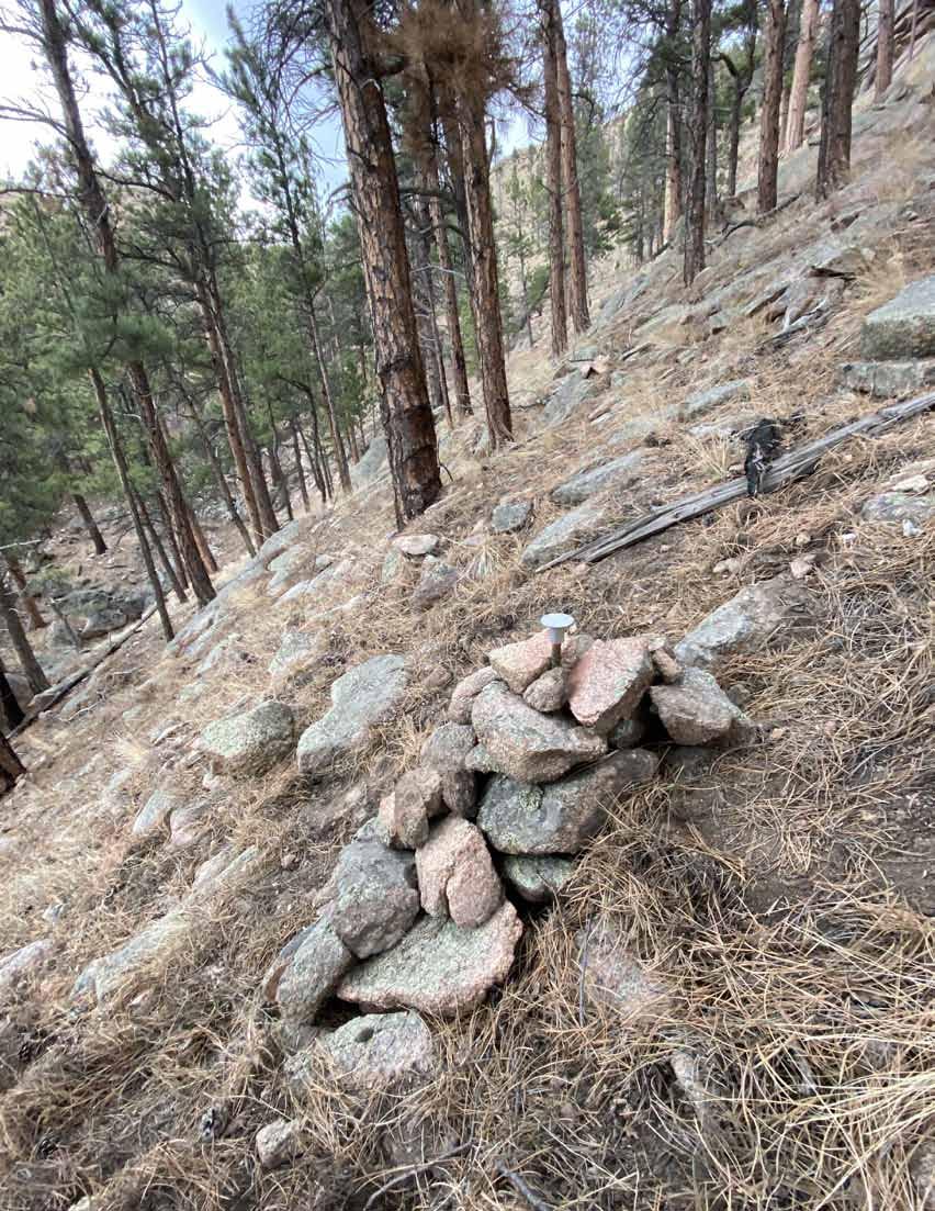
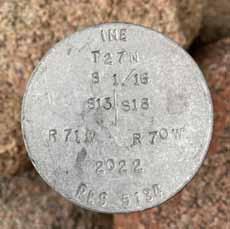
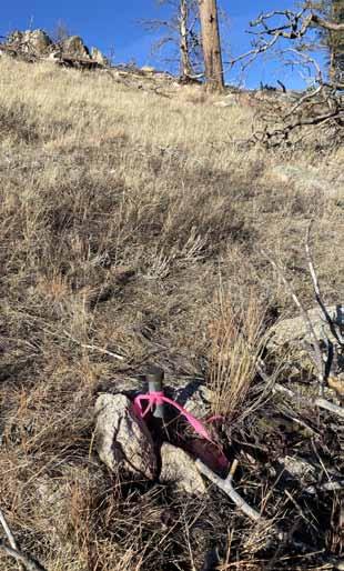
Introduction: The boundary survey for the Twin Pine Bison Ranch located north and west of Wheatland, Wyoming during the summer and fall of 2022 will certainly be one to remember! The country could have been wide-open prairies, deep canyons, and rugged mountainous terrain, all in the same day! The Wyoming weather did not offer any surprises with lots of sun, lots of wind along with rain, lightning and snow. The project would include 29 sections to subdivide in 3 different Townships. Two of the Townships were 1944 and 1965 Dependent Resurveys monumented with brass caps but included some of the most difficult terrain to access. The remaining Township would include 22 sections where we would follow the footsteps of the 1880’s original survey. This township was discovered to be 650± long in the west
A HISTORY OF THE TWIN PINE RANCH
by Peggy Hagemeister Gerke
Its earliest known history as a cattle ranch shows that in 1878 the Duck Bar outfit was operated and owned by Bill (or Will) and Howard Warner on Cottonwood Creek where the Twin Pine Ranch now is. The brothers had about 3,000 head of cattle and had previously lived on Duck Creek in Colorado. Coming to Wyoming, they brought the Duck Bar brand with them, an outline of a simple duck with bar underscore, a brand that was to become one of the most historic in the state.
In 1878 the Warner brothers commissioned Tom Shaw, a 20 year old Texan, to pick up cattle from Oregon, that had already been brought as far as Green River, Wyoming, for their ranch. Tom started with the trail herd and reached the Cottonwood Creek area of Wyoming on October 11, 1878. The cattle were branded with the Duck Bar brand at the Cottonwood ranch. Tom spent that winter on the ranch in a 10’ x 12’ cabin with a dirt floor and roof. He acted as cook and cowboy
and spent quite a lot of time hunting to supply the other hands with meat.
The next step for the cattle ranch on the Cottonwood came from dynamic characters in a romantic era. Hubert Teschemacher was born in Boston, Massachusetts in 1856, the son of H.F. Teschemacher, an Englishman of Swiss-Huguenot extraction. The elder Teschemacher had gone to California in 1846, where he came to prominence as one of San Francisco’s early day mayors and, apparently, also made a fortune. Both of his sons, Hubert, who was the oldest, and Arthur, attended Harvard, where the former was a close friend and classmate of Teddy Roosevelt.
Following Hubert’s graduation from Harvard, his father sent him on a trip around the world. When the tour ended, he joined his family who were then living in Paris. There he chanced to read an article describing life in the mountains
Lines & Points 7|Page
by Randy Stelzner, P.L.S., CFedS
With
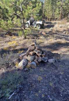
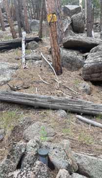
mile with very little monumentation. Primary retracement methods would prove to be unequitable. Instructions for BLM resurvey notes in adjacent Townships instructed their surveyors to follow lines of occupation which was obvious in reviewing those plats showing large bearing angles and distorted mile distances. Secondary methods were implemented that would follow topo calls, fences and one unrecorded monument set by the uS Forest Service based on landowner testimony. All told, we found 43 brass cap monuments in the resurveyed Townships, 20 aluminum cap monuments on adjacent properties, 46 stone monuments, and 167 aluminum cap monuments were set for boundary and controlling corners. Approximately 250 corner recordations will be filed with the Platte and Albany County Clerks offices.
of western America. His imagination caught fire and he could hardly wait to return to the united States. In 1879, Hubert, accompanied by his Harvard classmate, Frederic DeBillier from France, came to Wyoming. They spent weeks on the plains and in the mountains, riding in the clear air and temporarily living the wild, free life of the cowboy on roundups and hunting trips. Then, in 1880, Hubert and Arthur Teschemacher and DeBillier formed the Teschemacher and DeBillier Cattle Company.
Their first venture was to purchase the Duck Bar outfit on Cottonwood from the Warner brothers. Starting with 600 cattle, a few horses and around $40,000 in cash, the company grew rapidly. Teschemacher spent the winter of 1881-’82 back East canvassing friends and acquaintances, where he succeeded in raising $250,000 in additional capital. The company bought up more ranches in the Cottonwood area, building to five ranches
and somewhere around 18,000 to 25,000 head of cattle with a valuation of around $480,000. Teschemacher was evidently an apt salesman, spreading enthusiasm to many businessmen back East and creating a desire to become “partners” in the western cattle business. As an example of the genre, in October of 1882, a letter and check came to Teschemacher from Teddy Roosevelt, for a $10,000 investment in stock in their cattle company.
Teschemacher served in both houses of the Wyoming Territorial Legislature and was a member of the first and only Constitutional Convention, and thus helped to frame the Constitution of the State of Wyoming. Much later it was realized that Teschemacher and several other rich, influential, and essentially foreign cattle barons formed Wyoming’s legislative beginnings to heavily benefit the huge cattle owners they represented. Teschemacher and DeBillier were members and
Condensed
permission from William Hoskinson and Mark Junge
January 2023 Page|8
prime movers of the Cheyenne Club, then worldfamous as “The” area social club.
In late 1884, cattle prices declined drastically and the range was overstocked with cattle. The summer of 1886 was very dry with little grass and the cattle were in poor condition. Then the horrible winter of 1886-87 hit. In November heavy snow fell and covered the range for two months. On January 28, 1887, a blizzard struck and raged four days and three nights. When the sun finally came out and the wind died down, cattle were dead in piles all over the range. Halfstarved remnants of herds were all that remained of the millions of cattle that had been here. Many of the huge cattle companies, financed at high interest rates, were ruined.
The Teschemacher and DeBillier Cattle Company came through the calamitous winter in far better condition than many others, estimating that they had lost about 10% of their herd. But Teschemacher was in truth a very poor businessman. In spite of poor management, dwindling values and decreasing herds, Teschemacher continued to create the illusion of prosperity by continuing to pay dividends to stockholders, even borrowing money for that purpose.
Teschemacher and DeBillier were both involved in the infamous Johnson County Invasion. Teschemacher became involved because he was one of the executive committee members of the Wyoming Stock Growers and Live Stock Commissioners who planned the action against the Johnson County “rustlers.” This led to the organization of a group of some 45 men, some of them hired guns, who went to Johnson County intent on killing the “rustlers” and reclaiming their stock. After a confrontation where eventually the invaders were surrounded by some 400 men, the invaders had to be rescued by the u.S. Sixth Cavalry and returned to Cheyenne, where they were held a short time, then went through a mostly superficial trial, and were released. DeBillier had long been less than enthusiastic about life in the West and after recovering from the nervous collapse brought on by his participation in the Johnson County War, joined the diplomatic corps and spent the rest of his life in Foreign Service posts in Peru , Greece, Italy, Iran, and Bolivia from 1908 to 1924.
Finally, the Teschemacher DeBillier Cattle Company liquidated in 1892. Records from that year show an unexplained loss of 20 horses and 3,045 “mixed” cattle, the sale of some 4,113 cattle,
Lines & Points 9|Page
January 2023 Page|10
Lines & Points 11|Page
and an estimated 1,815 cattle that were to be gathered and sold by the Milwaukee & Wyoming Investment Company to pay all remaining expenses and taxes.
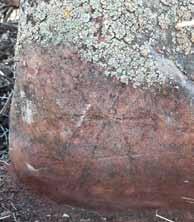
The Shaw brothers, who were virtually acquired along with the Duck Bar holdings, worked off and on with Teschemacher and DeBillier until the liquidation. Then, in 1892, Tom obtained the ranch on the Cottonwood (Twin Pine); Jim, the ranch headquarters on the North Platte. Tom Shaw was married in 1889 to Miss Harriet Westwick and they settled on the ranch on the Cottonwood. Differing accounts state both that he was given the ranch in 1892 by the Teschemacher DeBillier Company, and that he bought it from them in 1886. Regardless, Tom renamed the ranch the Lu Bar Ranch (now the Twin Pine). The Lu Bar brand is carved into the wood inside the old barn , along with more recent carvings made by cowboys who worked here down through the years.
Tom first built a two story, dirt floor, sod roofed log home for his bride, then in 1898 hauled lumber from a lumber mill on Preacher Creek to build the original part of the present Twin Pine ranch house. A year later, in 1899, he and neighbors built the big barn that still is in use. The barn was built with wooden pegs instead of nails.
Tom’s son, Jim, was born in 1894 and continued to live for 42 years at the Lu Bar Ranch after Tom’s death. In about 1935, Jim and his help built at least one cabin to be used to house Michigan summer visitors ... something of a dude ranch effort. The other cabins were supposedly to house summer hay hands. In 1936, with the cattle business seemingly going downhill, young Jim decided to sell the ranch and move to a ranch near Dubois, Wyoming, to run a hunting business in the Teton mountains. He was unable to sell the ranch outright, so for almost two years he leased it to a large sheep outfit run by a Mr. Lemplin and Wylie Brown. 2,500 sheep grazed the ranch lands, a complete change from the cattle ranch it had been.
In 1938 Claude Lewis, who owned a ranch near Savery, Wyoming near the Colorado border, purchased the Cottonwood Duck Bar/Lu Bar from Jim Shaw. He sold his southern Wyoming ranch, let the current Lu cowboys go and brought his cowboys up from the other ranch and stocked the ranch with cattle. He supposedly had wanted to buy this ranch for 25 years.
Yet in 1945, only seven years later, Lee and Alice Hagemeister purchased the original ranch from Claude Lewis. Lee and Alice continued to
January 2023 Page|12
own and manage the ranch, renamed the Twin Pine Ranch, until Lee’s death in 1983 at age 79. During the intervening years, they continued to make purchases of surrounding areas until the Twin Pine reached a size of approximately ten miles north and south by eight miles east and west. They also purchased a ranch 5 miles to the south, called “The Flying Lazy Lee Ranch,”. The Flying Lazy Lee Ranch was sold by the family in 1993 to True Ranches.
Lee and Alice raised three daughters: Jeane, Patsy and Peggy. vacations and holidays were spent at the Twin Pine and the girls all grew to love the ranch. Jeane’s first husband, Jack Ferguson, was made foreman of the Twin Pine and they lived on the ranch for several years. Jeane lived in Lee and Alice’s old home in Estes Park for several years, then moved to Arizona. The second daughter, Patsy Nichols, lives in Scottsbluff, Nebraska, where she worked for many years with Community Services. Peggy, the youngest daughter, as estate administrator, took over the management of both the Flying Lazy Lee and the Twin Pine ranches after Lee’s death in 1983. In 1986 a family ranch corporation was formed with Alice, Jeane, and Patsy as board members and Peggy as managing officer. Peggy and the ranches’ general foreman, Larry Gerke, were married after Peggy moved to the Twin Pine from Nebraska in 1988. Larry had been ranch foreman since February of 1981. In 1993, after Alice’s death, the sisters dissolved the original corporation, sold the Flying Lazy Lee, and Peggy retained ownership of the Twin Pine Ranch.
The Twin Pine has many historical spots, besides being the site of the original Duck Bar Ranch. Sioux, Cheyenne, Arapahoe and Crow Indians roamed the area in past years. A large, four room cave on the Twin Pine Ranch held human bones carbondated back over a thousand years. The cave was supposedly used as an Indian burial cave. There are many, many Indian teepee rings. On one hill on the ranch can still be found a lot of jasper chips, accumulated when Indians made jasper stone into arrow points and other tools.
Irrigation ditches that date back to the 1850’s and built by Mormon pioneers, according to some accounts, were built on one of the early Duck Bar ranches near the Laramie River. They were some of the first permanent irrigation ditches in Wyoming. Other ditches, most likely built by early homesteaders to meet homestead requirements in an attempt to provide terracing to stop rain water and snow melt, rather than actual irrigation, crisscross some of the present Twin Pine Ranch.
Lines & Points 13|Page

January 2023 Page|14


877-686-8561 l www.berntsen.com SURVEY MARKING Custom Survey Markers & Monuments • Signs & Witness Posts • Flagging & Targets • Nails & Washers Custom Survey Markers & Monuments • Signs & Witness Posts • Flagging & Targets • Nails & Washers ■ Digital Aerial Photography ■ LIDAR ■ Mobile Mapping ■ Topographic Mapping ■ Orthorectified Imagery 40 West Oakland Avenue, Salt Lake City, UT 84115 · PHONE: 801-487-3273 · Fax: 801-487-3313 Lines & Points 15|Page
The “Binford,” a meadow up the Cottonwood Creek from the present Twin Pine house area, was a mail stop tha mail carriers rode 30 miles horseback several times a month in all weather to deliver mail to “Binford , Wyoming” and a few other rural mail stops. The present Twin Pine bunkhouse, now a guest cabin, was originally the Binford “post office” and stage stop which was at one time run by Mrs. Tom Shaw. The bunkhouse was removed to its present location, log by log, in later years, with each log numbered so that it could be replaced in exactly the right location.
The ranch is the site of the death of Lt. Levi Robinson, for whom Ft. Robinson in Nebraska is named. In 1874, Lt. Robinson and two other soldiers were hunting game to supply meat for a group of soldiers who were cutting wood for Ft. Laramie when they were surprised by Lakota Sioux Indians. Robinson and his corporal were killed, while a private escaped by turning his horse loose, then hiding in the rocks. As the Indians chased his horse, the private ran back to the other to warn them.
There is an abundance of wild game in the area. In 1938 turkeys were first released in the Laramie Peak area on the Twin Pine. Since that time, and after a subsequent release of more turkeys, there are still Merriam turkeys in the area. Predators, hard winters and cold springs keep the population suppressed. There are mountain lions, bobcats, mule deer, whitetail deer, elk, pronghorns and black bears on the ranch. The Twin Pine prides itself on being a “game preserve” where game of all kinds, including coyotes and prairie dogs, are protected all year except for a very limited number of game animals allowed to be harvested by hunters in order to keep population better in control. A hunting program was promoted for years in the spring and fall when deer, elk, turkey and pronghorn hunters came to be fed, housed and guided on hunts by the Gerke’s and their employees. The Gerke’s very popular guidedhunt program was discontinued after the 1999 fall season, after 13 years, and the ranch was then leased to an outfitter for deer, elk, and pronghorn hunts.
After Lee’s death, Gelbvieh cattle were introduced for a 3-way cross. From 1878 until 1999 the ranch was a cow-calf cattle operation. The ranch raised most of its own feed for the cattle on its well-watered ranch, and still is a good place to raise livestock. In 1999, Peggy and Larry sold
January 2023 Page|16
Lines & Points 17|Page
the last of the Twin Pine cattle and in April of that year, introduced bison, the first to be back on the ranch for at least 150 years. The bison seem most content on the Twin Pine, almost as if they have come home.
In order to further diversify their business, the Twin Pine Ranch opened to guests for “working vacations” for five years from 1995 through 1999. Old cabins, first built as “dude” or cowboy cabins in the 1930’s were renovated. With the coming of the bison, the Gerkes decided to discontinue the guest program. A buffalo “hunting” program was started in 2003, with hunters from all over the u nited States coming to shoot buffalo for their excellent meat, beautiful head mounts and soft robes.


The current owners have maintained the buffalo “hunting” program as survey crews witnessed a few of the “hunts”. Also, it appears that the current owners of the ranch are attempting to maintain the ”flavor” of the original ranch. Accessibility has been improved along with buildings and utilities added for modernization and staff needs.
• REBAR & PIPE CAPS • CONCRETE MARKERS • SURVEY MONUMENTS • SECTIONAL ROD MONUMENTS • ACCESS COVERS • WASHERS & NAILS • SUBSURFACE MAGNETICS • STAMPING TOOLS • ACCESSORIES CALL OR ORDER ONLINE! 520-622-6011 • 800-445-5320 • FAX 520-792-2030 • SURV-KAP.COM THE LANDMARK NAME IN SURVEY PRODUCTS Exceptional Customer Service
January 2023 Page|18
Wyoming Wildlife
Setting Clear Boundaries
Surveying lands and having fences that adequately mark boundaries are all in a day’s work.
People often use fences to mark property boundaries, and hunters frequently rely on them to determine if they’re on a property where they can hunt. No responsible hunter wants to get caught on the wrong side of the fence, but that markers isn’t always the most accurate portrayal of a boundary.
In some cases, people build these markers near property lines where it was easier to construct or maintain the structure. GPS units can help tell people where they are, but they often don’t show who owns the land and can sometimes be off by
tens to hundreds of feet. To help hunters and recreationists on lands owned by the Wyoming Game and Fish Commission, the Wyoming Game and Fish Lands Branch, Habitat and Access Branch and Conservation Engineering Branch work together to place fence lines as close to the actual property boundary as possible. With clearly defined property boundaries, the sporting public can enjoy those lands without inadvertently trespassing.
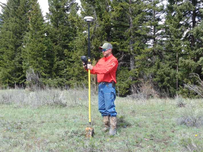
But marking boundaries isn’t always easy. This is where Darby Schock gets to work.
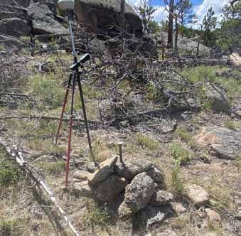
Darby Schock , Game and Fish senior professional land surveyor, conducts land surveys on Game and Fish Commission own land.
(Photo by Jason Burckhardt/ WGFD)
Janet Milek, G&F Information and Education Specialist (Casper Region) Darby Schock, P.L.S., G&F Senior Professional Land Surveyor Matthew Pollock, G&F Fish Habitat and Access Supervisor (Casper Region)
Lines & Points 19|Page
Photographs by Jason Burckhardt, G&F
Schock, Game and Fish senior professional land surveyor, conducts land surveys in all types of weather and terrain to determine who owns which parcels and where the lines were drawn. He completes these surveys to clean up boundary discrepancies on existing Commission-owned properties or when the Commission attempts to acquire or dispose of a piece of property.
“As the saying goes ‘Good fences make good neighbors,’ and I think that’s foundational to Game and Fish’s mission of conserving wildlife and serving people,” Schock said.
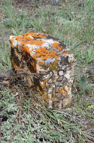
Schock begins his work with research. He visits the county courthouse to find the property descriptions recorded with the county clerk. Once Schock has the descriptions, he heads to the field. He locates property corner monuments or survey markers, which help orient him to the area.
“Records research is really about the history of the land and the people who lived there,” Schock said. “Like putting the pieces of a puzzle together, you can’t really see the whole picture until you have all the pieces. The whole records research picture allows me to walk in the shoes of my predecessors, and hopefully find the historical property monuments. These found monuments are the best indicator of original boundaries, hence essential to locating ownership.”
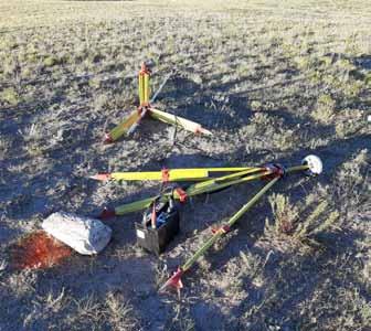
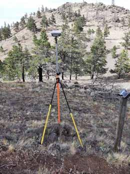
Schock then sets up survey-grade Global Navigation Satellite System equipment, which includes a base station and a mobile data logger, over a known and established position. The base station receives satellite information and broadcasts realtime correction factors. Once Schock establishes the base, he enters the area using a mobile data logger to collect positional data.
Schock then uses the data to create accurate maps. Other field personnel, such as Game and Fish’s Habitat and Access crew, use the data Schock collects and the maps he makes to affect changes on the ground. This work includes moving fences or building fences and installing boundary signage.
Sometimes simply moving or building a fences isn’t the best fix. Creative solutions to a discrepancy can sometimes benefit both parties. That was the case with the Commission’s Sunlight Basin Wildlife Habitat Management Area in the
Cody Region. The fencing did not adequately mark land ownership, sometimes crossing the original boundary to one side or the other. These boundaries went back to 1881, when Frank and Kitty Chatfield first established a homestead on the land. Instead of moving fencing, it was more feasible for the Commission to swap land with the landowner, setting new boundaries that followed the existing fence line.
Accurately marking boundaries on Commission-owned properties is one of the many ways Game and Fish works to maintain properties for the betterment of wildlife and people. These properties provide important wildlife habitats and offer many opportunities for recreational pursuits.
Editor’s Comment: This article was published in Wyoming Wildlife (Vol. 86, No. 10; October 2022; pp. 16 - 17). Permission to reproduce this article was granted by Tracie Binkerd, Editor of Wyoming Wildlife.
Property monuments helped land surveyors find original land boundaries.
January 2023 Page|20
( Photo by Jason Burckhardt / WGFD )
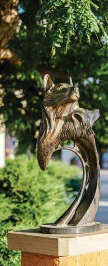
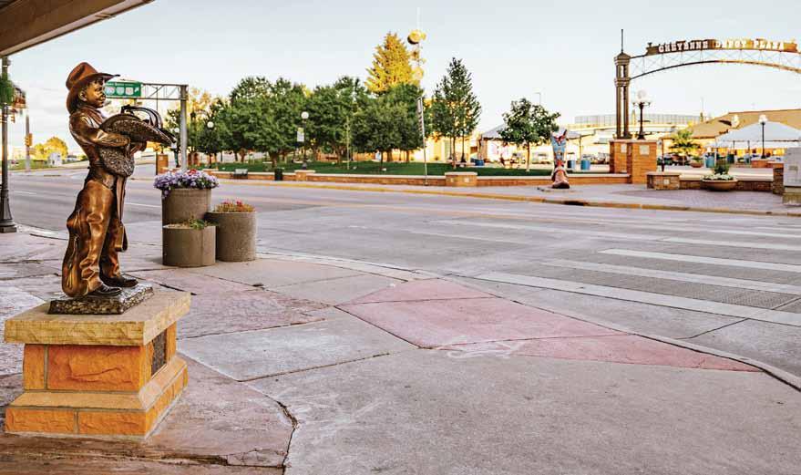
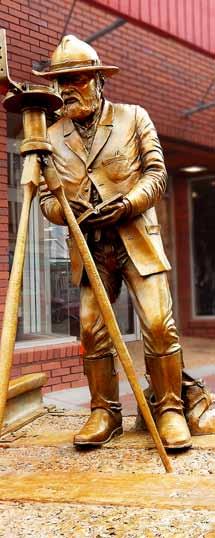
Capturing
the heART
of C heyenne
The Capitol Avenue Bronze Project is preserving the heart of Cheyenne for generations to come through visual art. Each statue not only tells a story about what it is like to live in Wyoming, but also shows the vast diversity of how its people embrace life.
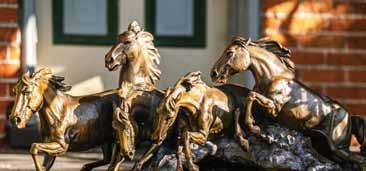
Some of the artists are from right here in Cheyenne, while others live throughout the state of Wyoming. Artists from Nebraska, Colorado, Utah and Missouri have also contributed to this historic project.
The Capitol Avenue Bronze Project is fully underway and picking up steam, after first being conceptualized twelve years ago by Harvey Deselms, owner of Deselms Fine Art and Custom Framing. The first bronze statue for this project was installed by the 2010 Leadership Cheyenne class at the Cheyenne Depot Plaza, and in the following year a couple other bronze statues were donated and installed downtown. The project had lost some of its momentum until last September when a small group of donors (Nathaniel Trelease, Caren Murray, Susan Samuelson, Dixi Roberts, and Jeff Wallace) along with Deselms presented the project to Mayor Patrick Collins, who loved the idea. The Capitol Avenue Bronze Project committee was born out of a common love for Cheyenne, and a new breath of life was instilled into the bronze project.
To date 24 bronze statues have been installed along Capitol Avenue and down 17th Street. With 30 (and counting) more commitments for additional beautiful works of art to adorn the streets, they are looking to expand the project onto Carey Avenue. Fifteen different artists have taken part in bringing these works of art to life.
“In my wildest dreams, I never thought the project would have grown to this size,” Deselms said. “I thought we’d get a couple installed and that would be a great legacy. But it’s just exploded in popularity over the last year.”
All of the bronze statues are funded by private donors, not public funds. The cost of the statues varies. One of the more recent pieces had a cost around $40,000 to make and install. The overall cost of the project has been about $1.5 million so far, with mostly individuals and families of Cheyenne making the donations.
“By being involved in this legacy project, they can not only leave their mark, but also support the city in its beautification goals,” said Deselms.
Lines & Points 21|Page
Photos by AK PhotoStudio Layout by Heather Hansen, #1 Properties Marketing Newsletter
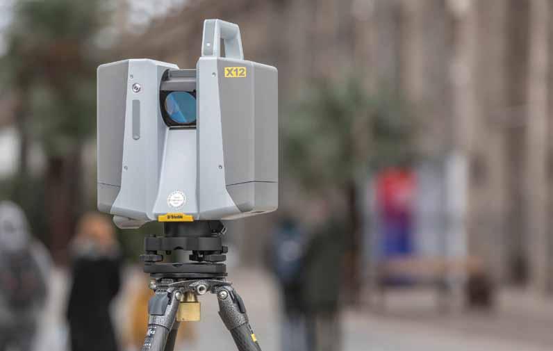


PRODUCTS | TRAINING | REPAIR | RENTALS | TECHNICAL SERVICES January 2023 Page|22
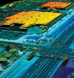
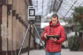
LEARN MORE www.frontierprecision.com/product/trimble-x12 The Trimble® X12 Scanning System unites the best of both worlds with industry-leading hardware and Trimble’s powerful, ultra-efficient Trimble Perspective software for guaranteed peak performance. No more complicated workflows. No complex registration process. No compromises in accuracy, speed, range, or imaging.


Please Recycle
AND POINTS
LINES
P.O. BOX 8 CHEYENNE, WY 82003
