


L L II N N E E S S & & P P O O II N N T T S S www.plsw.org Volume 34: Issue 2 April, 2023 THE EQUALITY STATE SURVEYOR Professional l and s urveyors of Wyoming

Lines & Points (Vol. 34: No. 2) 1|Page
President President Elect Secretary/Treasurer
Thomas A Johnson, PLS
Doug Boyd, PLS
John “Jack” Studley, PLS
Cotton Jones, PLS Area Director Wyoming Delegate
John Lee, PLS
Publications committee
Committee Chair-Chief Editor Designer Treasurer & Advertising Circulation
Copy Editor Website Emeritus Member
Steven “Dennis” Dawson, PLS dennieandbarb@gmail.com
Michael Flaim, PELS mike.flaim@bresnan.net
John “Jack” Studley, PLS jklz0318@gmail.com
Joel Ebner, PLS jvebner@bresnan.net
Herbert W. Stoughton, PhD, PELS, CP hws.geod.engr@gmail.com

Sonja “Suzie” Sparks, PLS sasparks7@gmail.com
Pete Hutchison, PELS petehpels@gmail.com
PLSW (Professional Land Surveyors of Wyoming; PO Box 8, Cheyenne, WY 82003) is a statewide organization of Land Surveyors registered to practice in the Equality State of Wyoming. PLSW is dedicated to improving the technical, legal, and business aspects of surveying in the State of Wyoming. PLSW is affiliated with the National Society of Professional Surveyors (NSPS) and the Western Federation of Professional Land Surveyors (WestFed).

Lines and Points is published by the Professional Land Surveyors of Wyoming. Lines and Points is not copyrighted and permission is hereby granted to reprint articles with appropriate credit. The Professional Land Surveyors of Wyoming assume no responsibility for statements made or opinions expressed in this publication. The articles and opinions as put forth in this journal are not necessarily those of PLSW or the Editorial staff of this journal.
On Volume 34: Issue April, 2023 THE EQUALITY STATE SURVEYOR
Page 3
Page 4
Page 6
The
Breakfast on the Big horns (inez’s Composite)
By: Roy Bandy, Irvin “Shorty” Shope (& Photoshop)
CONTENTS
PRESIDENT’S MESSAGE ANNOuNCEMENTS
HERB FOuND SOME EAR WAx by: Herbert W. Stoughton, PhD, PE, PLS, CP
SEARCHING FOR ROY
BANDY’S 1912 CAMPSITE
by: Glenn Borkenhagen, PE
LEAvE NO TRACE OR FIGHT IT ALL THE WAY TO THE SuPREME COuRT
...of Nebraska at least by: Paul A. Heintz, PE, PLS
•Jennifer Dibona - That CAD Girl
•John Baffert - Surv-KAP, LLC
•Kelly Goff - Underground Consulting Solutions
•Susan Hall - Trimble
•Tim Klaben - Berntsen International Inc.
•Troy Langston - Monsen Engineering
Advertising Information
Digital-ready, full-color advertising with payment should be mailed to Lines & Points, P.O. Box 8, Cheyenne, WY 82003. Advertising rates are as follows: Year Issue
Full Page $810 $210
Half Page $540 $140
Quarter Page $310 $80
Business Card $40 $10
Employment Free Free Special Rates apply for PLSW Chapters and cover placements. For more information please contact Jack Studley.
April 2023 Page|2

Page 7 Page 11 Cover L II N E E S & & P P O O II N N T T S S www.plsw.org
•Jason Dysthe - Frontier Precision Inc.
PRESIDENT’S MESSAGE
Fellow surveyors, stob drivers, chain pullers, button pushers, all: Thankfully, the winter weather is giving way to spring. My area has had record snowfall this year, and that has put a crimp in field work during these winter months. The slow times give us a chance to catch up on some things that help organize our businesses, but cabin fever is worsened by a growing list of projects that need field work completed. On top of that, it certainly seems that Wyoming’s highway system has had more closures than in most years. As I write this, the date is March 20, the first day of Spring.
Something to report to the membership, and possibly you have heard about this already, is that Wyoming is set to host the 2024 Western Planner Conference. Reportedly this is to be in Cheyenne. Our president elect, Mr. Doug Boyd was contacted by the Wyoming Planning Association with a request for support from PLSW. Specifically, they ask if we have members who are interested in doing a presentation. There was some interest from among the PLSW BOD, but others who are interested might want to get involved.
A colleague once stated to me that he was getting too old to start all over “educating local boards”. He was referring to the succession of new members who get involved in planning boards and come
PLSW.org WEB REQUEST
As you the reader may or may not know, PLSW has launched a new website to serve the organization and it’s membership. The request to the members to submit videos and photos to be used in the website is always open. The more of that digital information that we can provide, the better the website will be. Please continue to submit your contributions to my personal email and I will forward the data to Edge Marketing Design.
Every contribution that you make will make our Website better.
Thanks!
Dennis Dawson, PLS
My Email is: dennieandbarb@gmail.com
I encourage you, the reader, to review the current the new website: www.plsw.org
from various, often non-technical, positions in the community. It seems we are doomed to have to repeatedly start fresh at building their trust in our profession. This could be a good place to do some of that. If you have interest in this, touch base with your chapter director, Doug Boyd, or Jack Studley.
At a recent Central Chapter meeting we had a short discussion on handheld LiDAR scanning technology. One of our members is pretty well versed in this. This is certainly not something that I am knowledgeable about, but it’s pretty fascinating. This SLAM, or Simultaneous Localization and Mapping, is something to keep your eye and ears out for. They even have an app for that! This week, I found myself at the dentist getting prepped for a crown to fix a broken tooth. Surprisingly, my dentist pulls up a video screen and scanner wand and scanned my teeth to build the crown from. We visited a bit about this and he said he has been quite successful using it in place of the old molds that had to be taken. So apparently this is a next level technology in the medical field as well. It will be interesting to see how this technology develops for 3-D mapping.
Best Wishes to all,
Thomas Johnson, PLS President Professional Land Surveyors of Wyoming
BACK ISSUES REQUEST
To readers of Lines & Points.
Herb Stoughton, PLSW Honorary Member, has a nearly complete set of Lines & Points from volume 1, Issue 1. He has prepared author and article-title indices for the complete set. However, he does not have the following issues:
v. 18, No. 4, 2008;
v. 19, No. 1, 2009;
and v. 19, No. 4, 2009.
It is hoped that the indices will be published on the PLSW website.
If you have a copy, Herb requests that you xerox the complete issues and mail them to him. His address is: 2821 Carey Avenue; Cheyenne 82001.
Thank you!
3|Page Lines & Points (Vol. 34: No. 2)
by Herbert
W. Stoughton
Price: $30.00 (includes S&H)
Proceeds from the sale will be invested in the PLSW Scholarship fund.
Send orders to: 2821 Carey Avenue, Cheyenne, WY 82001

CONGRATULATIONS!
The members of the Professional Land Surveyors of Wyoming would like to recognize the achievement of the following new Wyoming registrants:
Joshua Super - Cody, WY SI 190
Dana Parsell - van Buren, OH LS 19338
Andraya Stamenkovi - Sheridan, WY LS 19344
Mark vanDuser - Jackson, WY LS 19374
Jacob Dunham - Deerfield, IL LS 19391
Theodore vahle - Keokuk, IA LS 19413
Shawn Christensen - Cypress, Tx LS 19443
Chad Walsh - Houston, Tx LS 19480
APPLY NOW FOR A PLSW SCHOLARSHIP

If you are attending college with the intent of pursuing a career in Land Surveying in Wyoming, we want to give you money!


A Scholarship Application is available on our website http://www.plsw.org

“Journeys: One Individual’s Excursions into the Surveying and Mapping Professions:
Page|4 April 2023
ANNOUNCEMENTS
Lines and Points articLe rotation submission scheduLe by chaPter


Responsible Chapter First Call Date Last Call Date Publication Date South Central Chapter THANK YOU!! (see “LeAve NO TrAce...” iN THis issUe) Southeast Chapter June 1 June 15 July 1, 2023 upper Platte Chapter September 1 September 15 October 1, 2023 Southwest Chapter December 1 December 15, 2023 January 1, 2024 Northeast Chapter March 1 March 15 April 1, 2024 Northwest Chapter June 1 June 15 July 1, 2024 West Chapter September 1 September 15 October 1, 2024 Central Chapter December 1 December 15, 2024 January 1, 2025 5|Page Lines & Points (Vol. 34: No. 2)
While performing research for volume 2 of my Handbook of Surveying Mathematics and Computations - Route Surveying, I encountered the “tongue-in-cheek” communication from the nineteenth century, which I would like to share with the PLSW membership. This communication appeared in Engineering News and American Railway Journal, vol. xxIII; 21 June 1890; p. 592.
A New Use For Ear Wax
Minneapolis, Minn., June 12, 1890
to the editor of engineering News: sir: In running a line in the Minnesota pinery 50 miles from a railway, and 200 miles from an instrumentmaker, after a hard storm followed by bright sunshine, the levelman came up with the refreshing intelligence that the hairs (instrument’s reticle) had gone of the level. We were three miles from camp and everything at a standstill. I started every man in the party with a wooden fork to get spider web, straightened out a shoe buttoner on a stump for an adjusting pin, aided by a pinknife for a screwdriver, and fastened to the ring with ear-wax, adjusted, and went to work; all of which took 10 minutes. and as I used the level steadily for two weeks and am using it yet. I conclude the operation was a success. Moral: “Carry ear-wax”

[balsom gum, or the gum from almost any conferous tree, ill answer very well for this use; but we have never heard of such a use for ear-wax. - ed. eng. News].


e.t. abbott
■ Digital Aerial Photography ■ LIDAR ■ Mobile Mapping ■ Topographic Mapping ■ Orthorectified Imagery 40 West Oakland Avenue, Salt Lake City, UT 84115 · PHONE: 801-487-3273 · Fax: 801-487-3313 Page|6 April 2023
Herbert W. Stoughton, Ph.D., P.E., P.L.S., C.P. Geodetic Engineer
Searching for Roy Bandy’s 1912 Campsite
by Glenn Borkenhagen
During August 1912 a General Land Office (GLO) survey party headed by Roy Bandy was traveling across northern Wyoming with two horse-drawn wagons and one saddle horse. The GLO, part of the u.S. Department of the Interior, was the government agency designated by law to survey the public lands and make them available for homesteading, sale, or transfer by other means from federal to private ownership. This crew had just finished work associated with some homestead entry surveys in Wyoming’s Sunlight Basin about 19 miles southeast of Cooke City, Montana and was headed for the area of the Little Bighorn River about 14 miles west of Parkman, Wyoming to complete a township survey begun in 1902 to enable finalization of some homestead claims.
Their route took them along the summit of the Bighorn Mountains within the Bighorn National Forest, and the evening of 12 August the party traveled until dusk before finding and camping beside a snowbank left from the previous winter. As they were traveling high above any flowing streams, the snowbank was a welcome sight that would provide water for the crew and their horses.
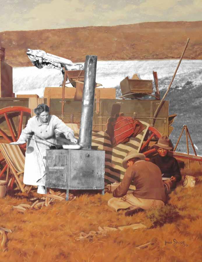
The next morning, Roy Bandy captured a Kodak photo of their campsite with the snowbank in the background as his wife Inez, the cook for the party, was preparing breakfast. Almost 60 years later, in 1970, Roy and his daughter Zoe Reith commissioned Irvin “Shorty” Shope, a popular Montana artist, to create an oil painting titled breakfast on the big Horns (Figure 1) based
 Figure 1 - breakfast on the big Horns, oil painting by Irvin “Shorty” Shope, 1970
7|Page Lines & Points (Vol. 34: No. 2)
on that photo in memory of Inez. Prints of that painting are regularly offered on scholarship auctions sponsored by the Montana Association of Registered Land Surveyors (MARLS) at their annual conferences, as well as being sold outright by MARLS, and now grace the walls of many offices and homes in the region.
William Roy Bandy (1885-1972) began his landsurveying career in 1905 near Garland, Wyoming while employed by a surveyor performing work for the GLO on a contract basis. In 1906 Bandy was appointed a u.S. Deputy Surveyor, reportedly the youngest person to receive such an appointment. During 1907 through 1910 he worked as a surveyor and engineer on canal and tunnel construction for irrigation projects, both federal and private, in Wyoming and Idaho.
In 1910 the GLO, in accordance with a new law, ended their previous practice of awarding contracts for surveys of public land. Such surveys were thereafter to be done by surveyors directly employed by the GLO. In 1911, newly married and looking for stable employment, Mr. Bandy accepted employment as a u.S. Transitman with the Wyoming office of the GLO with headquarters in Cheyenne. His first assignment included the resurvey of six townships around and to the north of Cody. His wife Inez joined the party as cook. In 1914 he was transferred to the Montana GLO headquartered at Helena where he remained through 1945 except for a few special details.
In 1930 Bandy earned a Bachelor of Law degree from the Blackstone Institute of Law of Chicago, Illinois.
In 1929 and 1930 Congress enacted legislation changing large parts of the north and east boundaries of Yellowstone National Park from the original rectangle defined at the park’s establishment in 1872 by parallels of latitude and meridians of longitude to a shape in part defined by the crests of mountain ranges that divided watersheds. During 1931 through 1933 Bandy and his crews surveyed the rough and remote eastern boundary of the park as well as the revised portions of the park’s northern boundary.
The summer of 1936 found Bandy (then 51 years old) leading survey parties doing township completion surveys in the rugged mountains around Cooke City, Montana and along the eastern side of the Pryor Mountains, an area previously considered to be impossible to survey.
During the mid-1940s the Pick-Sloan Missouri Basin Program, which provided a comprehensive
plan for the conservation, control, and use of water resources in the entire Missouri River Basin, began to take shape under direction of the u.S. Bureau of Reclamation, part of the u.S. Department of the Interior. In 1946 the GLO Director placed Bandy in charge of all public land surveys in the ten Missouri River Basin states with the title Cadastral Engineer, a position he held until he retired at the end of 1954. upon completion of his long career of government service, the Secretary of the Interior granted Mr. Bandy the Department’s highest honor, the Distinguished Service Award.
In his retirement, Bandy wrote several articles that appeared in local newspapers as well as in regional and national magazines. He also served as a consultant on property and boundary issues.
This writer, the successful bidder on a framed print of breakfast on the big Horns at a MARLS scholarship auction held sometime in the late 1990s or early 2000s, had for several years considered an attempt to locate Bandy’s 1912 campsite. The writer’s home in Cody, Wyoming is about 65 air miles from the search area.
At a Wyoming Engineering Society convention I mentioned this possible quest to Joel Ebner, who was at the time a cadastral surveyor assigned to the Gillette, Wyoming office of the Bureau of Land Management (BLM – established in 1946 when the GLO was merged with the u.S. Grazing Service). A few weeks later, Mr. Ebner sent an envelope (postmark reads 03 April 2003) containing several items including photocopies of pages from a 1991 BLM publication titled running line – recollections of surveyors that contain a Bandy account of the party’s journey across the Bighorn Mountains. Also included were documents related to the work they were traveling to as well as a photocopy of the title page of legal Principles of Property boundary location on the Ground in the Public Land Survey States (by Ira M. Tillotson, 1973) that features breakfast on the big Horns. The page immediately opposite the title page of the Tillotson book includes an explanation of the painting written by Roy Bandy that states the elevation of the campsite as 9,560 feet. The same Bandy writing also appears on the back of my framed print of breakfast on the big Horns.
My campaign to locate the campsite remained stuck in “Park” until the summer of 2018. My initial activities included downloading and acquiring from others historic maps of the area, investigating historic travel routes in the area, and trying to locate a print of the photo on which the painting is based.
Page|8 April 2023
Bandy’s account in running line . . . states they crossed the Bighorn River at Kane, Wyoming where a ferry was in operation. From Kane, evidence suggests the historic route for teams and wagons heading eastward to the top of the Bighorns ascended via the Five Springs Creek drainage to around 8,000 feet elevation before turning south into the Crystal Creek drainage and passing south of Medicine Mountain. A 1914 Bighorn National Forest map shows this route being used to reach the Porcupine Creek Ranger Station (now known as the Porcupine Ranger Station; that name appears on a 1927 Bighorn National Forest map) from the west. That 1914 map also shows two sawmills along that route close to the western Forest boundary. That is the route developed during the 1930s into part of the Dayton-Kane Road, the western portion of which later became officially known as U.S. Highway 14A. u.S. Highway 14A on the west side of the Bighorns was relocated to its current farther-south alignment in 1983.
Information provided in 2003 by Joel Ebner showed the location of the surveys the Bandy party performed after reaching their destination. Bandy’s account includes the name of the homestead entryman, W.T. Broderick, waiting for their arrival. Searching the online GLO records

defined the lands patented to Mr. Broderick.
In 1901 the u.S. Geological Survey (uSGS) issued the Bald Mountain 30-minute (1:125,000 scale) quadrangle map (hereinafter referred to as a “quad”). That map was part of a massive campaign to map the newly established Forest Reserves, which became today’s National Forests. The 1901 Bald Mountain quad shows a group of unimproved roads running from the area of the Porcupine Creek / Porcupine Ranger Station up over Duncom Mountain, then north and east until entering Montana a few miles west of the Little Bighorn River and the party’s destination. Those roads still exist today; the ones of primary interest are known by the names Sheep Mountain Road (Forest Service Road 11) and Marble Quarry Road (Forest Service Road 111).
Due to terrain and available roads the Bandy party would have traveled through southern Montana for about seven miles before re-entering Wyoming on the way to their destination. The Wyoming road now designated by Sheridan County as Pass Creek Road also appears on the 1901 Bald Mountain quad.
It remains a mystery how Roy Bandy determined the elevation of the campsite. Did he simply interpolate the elevation from the 100-foot-interval contour lines on the uSGS quad? Field notes of the work done at their destination state they did have a clinometer which they used while chaining to determine true horizontal distances. Did they use their transit or clinometer to derive elevation by employing trigonometric leveling to a local bench mark? Or did they just read the elevation on a bench mark they passed (a bench mark very close to Sheep Mountain Road was marked “9566 SHER” and the group would have passed it - the capless pipe was still protruding from the ground on 17 September 2018 but was found broken off flush with ground on 13 August 2020) and call that good?
Drawing from the rather precise elevation mentioned above, I decided to concentrate on sites with elevations between 9,500 and 9,600 feet with a history of persistent snow. I created a KMZ file consisting of contour lines at those elevations and opened it in Google Earth.
The latest Google Earth satellite imagery for the general area was (and still is) dated 25 June 2017. Several areas along the route of interest (generally described as between roughly three to eight miles north of u.S. Highway 14A along the Big Horn-
P.O. Box 8 Cheyenne, WY 82003
9|Page Lines & Points (Vol. 34: No. 2)
Jack Studley
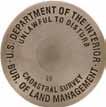
• REBAR & PIPE CAPS
• CONCRETE MARKERS


• SURVEY MONUMENTS
• SECTIONAL ROD MONUMENTS


• ACCESS COVERS
• WASHERS & NAILS
• SUBSURFACE MAGNETICS
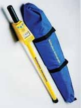

• STAMPING TOOLS


• ACCESSORIES
Sheridan County line, which in that area follows the hydrologic divide between the Bighorn River to the west and the Little Bighorn River to the east) showed snow remaining on that date at between 9,500 and 9,600 feet elevation.
I reached Roy’s grandson Dirk Reith who is my age, we both graduated high school in 1968. He lives in Hawaii and has a business called Maui Movers. He said that in addition to the original painting that hangs in his living room, he had a box of papers and photos that Roy left behind to his late mother Zoe Reith (Roy and Inez’s only child who lived to maturity), who in turn left it to him. Dirk said he would go through it and let me know if he found anything that may be of use in my efforts.
During July 2018 I hired an independent researcher based in Helena, Montana to visit the Montana Historical Society (MHS) to see what she could find that could aid my search. The Bandy file at MHS did not have any photos or negatives, but it did include a Bandy manuscript that provided another breakfast on the big Horns account, as well as newspaper clippings that included an article Bandy wrote that appeared in the Great Falls Tribune on Sunday 03 September 1961 that recounted the party’s adventure while
crossing the Bighorn River on their return trip to Wyoming’s Bighorn Basin later in 1912. That piece included a cropped photo of the campsite depicted in breakfast on the big Horns but was too grainy to be of any use in the immediate project.
My first trip to the area on 03 July 2018 was mainly for orientation and casually looking around on Sheep Mountain Road for someplace obvious.

My second visit on 20 July explored the areas generally southwest of Medicine Mountain with elevations between 9500 and 9600 feet and lateseason snowbanks. It quickly became obvious that it would have been impossible to traverse those areas with teams and wagons. That outing did provide plenty of exercise nonetheless.
Before my third outing on 01 August 2018 I used QGIS (an open-source geographic information system [GIS] program) to georeference a road shown on a 1917 Forest Service map onto the 1901 Bald Mountain 15-minute quad, found that they agreed well as to the road location. Loaded that map into my Garmin Montana GPS receiver and headed for the Bighorns. While driving to the search area that morning on Sheep Mountain Road it was noticed that as I got close to Duncom Mountain (which for the purposes of this article (continued on Page 15)
CALL OR ORDER ONLINE! 520-622-6011 • 800-445-5320 • FAX 520-792-2030 • SURV-KAP.COM
THE LANDMARK NAME IN SURVEY PRODUCTS Exceptional Customer Service
Page|10 April 2023
Leave no trace, or fight it all the way to the Supreme Court...of Nebraska at least.

The next time someone can’t seem to find one of your stakes, cite this case as why you’d never dare leave anything sticking out of the ground. Just in case some old fart decides to trip over it and break his hip. Fortunately, I can’t find anything close to this case in Wyoming case law. Hopefully, a judge would throw it out with extreme prejudice. I have often been quite interested in case law and do whatever I can to learn from someone else’s mistakes and not become part of the “Official Record.”
Paul A Heintz, PE, PLS
Bixenmann v. Dickinson Land Surveyors
294 Neb. 407
Filed August 5, 2016; No. S-15-695
NATURE OF CASE
The appellants, Lawrence M. Bixenmann and Norma J. Bixenmann, brought a negligence action against Dickinson Land Surveyors, Inc. (Dickinson). Lawrence tripped and fell on a stake that the owner of Dickinson, a licensed surveyor, had placed on the Bixenmanns’ property while performing a land survey. The district court for Douglas County dismissed the Bixenmanns’ complaint with prejudice and granted summary judgment in favor of Dickinson. The court determined that surveyors are professionals and that the Bixenmanns were required to present expert testimony as to the standard of care required of surveyors in order to rebut the evidence presented by Dickinson. The court further concluded that the alleged negligence was not within the comprehension of laypersons and that the “common knowledge” exception to the requirement of expert testimony did not apply.
BACKGROUND
The accident at issue in this case occurred on property which, at the time, was owned by the Bixenmanns, in Keith County, Nebraska. The property contained a large building which the Bixenmanns used for
storage. During the summer of 2010, the Bixenmanns entered negotiations to sell the property to a third party. As a precondition of sale, the prospective buyers requested that a survey be conducted to identify the boundaries of the property. The Bixenmanns agreed to the survey so long as the prospective buyers paid for it.
In June 2010, the prospective buyers hired Dickinson to complete a basic boundary survey of the property. The owner of Dickinson located the boundaries and drove lengths of rebar flush into the ground. He then marked the four corners of the property with wooden stakes tied with ribbon, which were securely driven into the ground. The stakes extended approximately 12 inches above ground and were surrounded by 1 to 2 inches of grass but were visible, in plain sight. Lawrence was present during the surveying and witnessed Dickinson doing a portion of the survey.
On June 22, 2010, the Bixenmanns visited the property to retrieve two lawnmowers that were being stored in the building. They loaded the lawnmowers and left to complete yardwork at a different location. They returned later that evening to place the lawnmowers back into the storage building. Lawrence was in the process of unloading
11|Page Lines & Points (Vol. 34: No. 2)
one of the lawnmowers from a trailer when he tripped on one of the survey stakes and fell, causing serious injuries to his left hip. The stake was located near the driveway that accessed the storage building.
The Bixenmanns brought an action against Dickinson for negligence and loss of consortium. Dickinson moved for summary judgment, which the district court granted. The district court determined that Dickinson was a professional, noting that surveyors are licensed by the state and that their work is overseen by state agencies and a regulatory board. Given that Dickinson was a professional, the court found that any failure to exercise reasonable care must be proved by expert testimony. The owner of Dickinson submitted an affidavit stating that he is a licensed professional land surveyor in the State of Nebraska.
The owner of Dickinson averred that the purpose of marking and staking the boundaries was to clearly identify the boundaries for the benefit of the party commissioning the survey. It is his practice to leave markers and stakes on the property in order to clearly identify the boundaries for the customer. This practice is standard in the surveying industry and generally accepted in the State of Nebraska. Removing the boundary markers or stakes at the completion of the survey would defeat the purpose of surveying the property. The owner of Dickinson stated that he was familiar with the standard of care in the surveying industry in the State of Nebraska and that he complied with the applicable standard in completing the survey in this matter. Because the Bixenmanns failed to present expert testimony to rebut the owner’s affidavit, the district court found that they could not prevail as a matter of law.

[1,2] The district court recognized that under the “common knowledge” exception, a party may make a prima facie case of professional negligence even without expert testimony in cases where the evidence and circumstances are such that recognition of the alleged negligence may be presumed to be within the comprehension of laypersons.1 However, this common knowledge exception is limited to cases of extreme and obvi¬ous misconduct.2 The district court determined that the exception did not apply in this case, due to the specialized nature of the surveying work and because Dickinson’s conduct was not extreme or obvious. The Bixenmanns appeal.
ASSIGNMENTS OF ERROR
The Bixenmanns assign that the district court erred in (1) finding that the owner of Dickinson was a professional, (2) holding that the Bixenmanns were required to present expert testimony as to the standard of care of a surveyor to rebut the owner’s affidavit, (3) finding that the alleged negligence was not within the comprehension of laypersons so that the “common knowledge” exception could not be applied, and (4) entering summary judgment in favor of Dickinson.
STANDARD OF REVIEW
[3,4] An appellate court will affirm a lower court’s grant of summary judgment if the pleadings and admitted evidence show that there is no genuine issue as to any material facts or as to the ultimate inferences that may be drawn from those facts and that the moving party is entitled to judgment as a matter of law.3 In reviewing a summary judgment, an appellate court views the evidence in the light most favorable to the party against whom the judgment was granted and gives that party the benefit of all reasonable inferences deducible from the evidence.4
ANALYSIS
[5] This case initially presents a question of law which we have not previously decided: whether surveyors are professionals for purposes of professional negligence. Whether a particular vocation is a profession is a question of law that is determined independently of the trial court.5 We have defined a “profession” as
“‘a calling requiring specialized knowledge and often long and intensive preparation including instruction in skills and methods as well as in the scientific, historical, or scholarly principles underlying such skills and meth¬ods, maintaining by force of organization or concerted opinion high standards of achievement and conduct, and committing its members to continued study and to a kind of work which has for its prime purpose the rendering of a public service.’”6
Page|12 April 2023
[6] Additionally, we have held that the requirement of a license to practice one’s occupation, although not dispositive, “strongly indicates that an occupation is a profession.”7 However, the requirement of a license alone does not make an occupation a profession, as the preparation and training required to procure that license are also important factors.8 Although we have held that a college degree indicates such preparation and training,9 a college degree itself is not required.10
In Churchill v. Columbus Comm. Hosp., 11 we determined that physical therapists are professionals, based largely on the requirements of the Physical Therapy Practice Act,12 which requires that physical therapists be licensed and sets forth the requirements for licensure. under that act, obtaining a license requires completing an approved educational program and an examination. We held that these requirements indicate that physical therapists complete the “‘long and intensive program of preparation’” that is required of professionals.13 Additionally, we noted that physical therapists render a public service and are subject to both mandatory continuing education requirements and professional discipline for ethical violations and failure to follow professional practice.
The Nebraska Court of Appeals similarly concluded in Cooper v. Paap 14 that abstractors were professionals, based on the requirements of the Abstracters Act. 15 It reasoned that abstractors must be licensed, which requires that they pass a written examination and prove they have 1 year of verified land title-related experience. Once licensed, abstractors are subject to oversight and discipline by a board of examiners and must earn board-approved professional development credits. The court noted that although their education is not as long as that in some of the other professions, abstractors overwhelmingly satisfy the other factors used to judge professionals in that they have specialized knowledge requiring a license and provide a service to the public upon which the public relies, in addition to the other factors listed above.
On the other hand, in Jorgensen v. state Nat. bank & trust , 16 we determined that so-called retirement planners were not professionals because they did not have specialized knowledge requiring long and intensive preparation, did not hold licenses, did not regularly supplement their educations, and were not subject to an ethical code enforced by a disciplinary system.
Here, the evidence presented at the summary judgment hearing shows that the owner of Dickinson was a licensed surveyor in the State of Nebraska.

In order to become registered as a surveyor in this state, one must meet the requirements of the Land Surveyors Regulation Act,17 which at the time of the incident in question provided in part:
No person shall be eligible for registration unless:
(1) He or she has successfully passed an examination, designed to determine his or her proficiency and qualification to engage in the practice of land surveying. No applicant shall be entitled to take such examination until he or she shows the necessary practical experience in land surveying work; and
(2) He or she has not less than six years of surveying experience of which five years must be [certain surveying activities defined in the Land Surveyors Regulation Act]. Three of such five years must have been in a responsible position as a subordinate to a licensed land surveyor, and for the purpose of this section, responsible position shall mean a position that requires initiative, skill, and independent judgment; this term excludes chainman, rodman, instrument person, ordinary drafter, and others doing routine work, or has graduated, after a course of not less than four years in surveying, engineering, or other approved curriculum, with proportionate credit for lesser time, from a school or college approved by the examining board as of satisfactory standing, and an additional two years of practice in a responsible position.18
Once registered, surveyors continue to be required to complete 30 hours of “professional development” every 2 years.19 In addition, surveyors are now subject to a code of practice established by the board to “govern their professional conduct” and continue to be subject to discipline, including suspension or revocation of registration, for negligence, incompetency, or misconduct in the performance of their duties.20
[7] It is clear, based on these statutory requirements, that registered surveyors have specialized knowledge, complete long and intensive training and preparation, are subject to high standards of achievement and conduct, are committed to
13|Page Lines & Points (Vol. 34: No. 2)
continued study, and perform work of which the primary purpose is the rendering of a public service. Thus, we conclude that registered surveyors are professionals for purposes of professional negligence. Because the evidence shows that the owner of Dickinson was a licensed or registered surveyor, we conclude that he is a professional.
[8] Having determined that he is a professional, we now turn to the second assignment of error regarding whether the Bixenmanns were required to present expert testimony as to the standard of care applicable to surveyors. The general rule is that expert testimony is required to identify the applicable standard of care in professional negligence cases.21
The Bixenmanns argue that expert testimony was not required in this case because the owner of Dickinson’s act of placing the survey stakes in a manner in which they were not clearly visible by persons entering the property was not professional negligence, but, rather, was ordinary negligence. The Bixenmanns also assert that the common knowledge exception to the requirement of expert testimony applies in this case. under the common knowledge exception, a party may make a prima facie case of professional negligence even without expert testimony in cases where the evidence and circumstances are such that the recognition of the alleged negligence may be presumed to be within the comprehension of laypersons.22

[9,10] We need not decide these questions, because we hold that a surveyor’s duty of reasonable care is to his or her client and generally does not extend to third parties absent fraud or other facts establishing a duty to them.23 Whether a legal duty exists for actionable negligence is a question of law dependent on the facts in a particular case.24
Although the accident at issue occurred on the land owned by the Bixenmanns, Dickinson was hired to conduct the survey by the prospective buyers, not by the Bixenmanns. In their brief, the Bixenmanns state they had no contractual relationship with Dickinson. Thus, there was no privity of contract claimed between the Bixenmanns and Dickinson and there were no facts establishing a duty to the Bixenmanns. The record contains no evidence of fraud or facts establishing a duty of Dickinson to the Bixenmanns. Accordingly, albeit for a different reason, we find that the district court did not err in granting summary judgment in favor of Dickinson.
CONCLUSION
For the reasons set forth above, we affirm the judgment of the district court.
ciTATiONs:
1 Thone v. Regional West Med. Ctr., 275 Neb. 238, 745 N.W.2d 898 (2008).
2 Id.
3 Sulu v. Magana, 293 Neb. 148, 879 N.W.2d 674 (2016).
4 Id.
5 See Churchill v. Columbus Comm. Hosp., 285 Neb. 759, 830 N.W.2d 53 (2013).
6 Id. at 765-66, 830 N.W.2d at 58, quoting Tylle v. Zoucha, 226 Neb. 476, 412 N.W.2d 438 (1987).
7 Jorgensen v. State Nat. Bank & Trust, 255 Neb. 241, 246, 583 N.W.2d 331, 335 (1998).
8 See Parks v. Merrill, Lynch, 268 Neb. 499, 684 N.W.2d 543 (2004).
9 See Jorgensen v. State Nat. Bank & Trust, supra note 7.
10 See Cooper v. Paap, 10 Neb. App. 243, 634 N.W.2d 266 (2001).
11 Churchill v. Columbus Comm. Hosp., supra note 5.
12 Neb. Rev. Stat. § 38-2901 et seq. (Reissue 2008).
13 Churchill v. Columbus Comm. Hosp., supra note 5, 285 Neb. at 766, 830 N.W.2d at 58.
14 Cooper v. Paap, supra note 10.
15 Neb. Rev. Stat. § 76-535 et seq. (Reissue 2009).
16 Jorgensen v. State Nat. Bank & Trust, supra note 7.
17 See Neb. Rev. Stat. § 81-8,108 et seq. (Reissue 2014 & Supp. 2015).
18 § 81-8,117 (Reissue 2003).
19 § 81-8,119.01(1) (Reissue 2014).
20 § 81-8,111. Accord § 81-8,123 (Reissue 2014).
21 See, Thone v. Regional West Med. Ctr., supra note 1; Medley v. Davis, 247 Neb. 611, 529 N.W.2d 58 (1995); Overland Constructors v. Millard School Dist., 220 Neb. 220, 369 N.W.2d 69 (1985).
22 Thone v. Regional West Med. Ctr., supra note 1.
23 See, Perez v. Stern, 279 Neb. 187, 777 N.W.2d 545 (2010); Swanson v. Ptak, 268 Neb. 265, 682 N.W.2d 225 (2004); Citizens Nat. Bank of Wisner v. Kennedy & Coe, 232 Neb. 477, 441 N.W.2d 180 (1989).
24 Swanson v. Ptak, supra note 23.
Page|14 April 2023
(continued from Page 10)
I consider to be the summit where u.S. Coast & Geodetic Survey [C&GS] triangulation station DuNCOM [PID PW0564] is located, not the location shown by Google Earth as Duncum Mountain) I was a few hundred feet west of the 1917 road. The current road is on a significant side hill and crosses several gullies, which would have been an unlikely (more like impossible) road alignment
renditions of the 1901 Bald Mountain uSGS quad show this alignment. The C&GS recovery notes for point DuNCOM indicate Sheep Mountain Road was in its current alignment in 1957. The 1960 Bald Mountain 7.5-minute (1:24,000 scale) uSGS quad shows the road at its current farther west alignment.
During the morning I walked over the summit of Duncom Mountain looking for possible campsites
before the advent of motorized earthmoving equipment. The 1901/1917 road went across the top of the mountain crossing contour lines at right angles. To the best of this writer’s knowledge, all

to the south and east and did not see anything. After lunch I investigated an area spotted earlier from the summit, generally north-northwest of said summit. I believed that to be the most likely
 Figure 2 – 1912 photo of group on snowbank, taken from the north, with prominent rocks marked.
Figure 3 – Prominent rocks seen at site of author’s location thesis of 2018-08-01, as seen on 14 August 2019
Figure 2 – 1912 photo of group on snowbank, taken from the north, with prominent rocks marked.
Figure 3 – Prominent rocks seen at site of author’s location thesis of 2018-08-01, as seen on 14 August 2019
15|Page Lines & Points (Vol. 34: No. 2)
campsite. It had a significant amount of snow remaining on 01 August, it being the only wagonaccessible snow I found that day, there was a small stream in a defined channel flowing from the snowbank from which it would have been easy to fill buckets (as mentioned by Bandy in his accounts), the elevation matched the reports, and it would have been fairly accessible with teams and wagons with minimal side hill. (This site also had snow remaining on 14 August 2019 and 13 August 2020.)
Around the same time I was discussing this little mission with some Wyoming and Montana surveyors, including Stanton “Stan” Abell (Wyoming and Montana professional engineer and land surveyor) of Worland, Wyoming and Kurt Luebke (professional land surveyor in Wyoming, Montana, and eleven additional states) of Missoula, Montana.
During August 2018 Linda Abell (wife of Stan Abell) came across the Bandy breakfast on the big Horns account that appeared in the March 2018 issue of the florida surveyor. That retelling mentions Sheep Mountain to the north (which is not exactly “towering” as Bandy described it), states the snowbank was 50 feet deep, and indicates the “altitude” as 9546 feet. Here Bandy also describes how they went northeasterly into Montana a few miles to intersect a road that led southeasterly back into Wyoming and the lands to be surveyed, which confirmed the route assumed earlier.
Stan and Linda Abell visited the area during Labor Day weekend of 2018 and Stan offered his own thesis as to the campsite location. Kurt Luebke submitted his idea as well, based only on his examination of the maps and other materials available at the time.
As the anniversary date of the event neared in 2019, I planned a trip to the Bighorns for 14 August. On 13 August I went to the post office and found waiting two boxes from Roy’s grandson Dirk. He had sent me everything from some of Roy’s grammar-school report cards and letters of reference he brought with him to Wyoming in 1905 to his late-in-life writings. Included were three more accounts of the breakfast on the big Horns campsite. I soon found a print of the photo that was the basis for the painting (Figure 7), obviously Roy was not in the photo because he was behind the camera - teamster Karl Suhr is where Roy appears in the painting. There were also two other prints (on postcards) of the group standing on the snowbank, one taken from the north and one from the east. I was off to the races, or so I thought.
ATTENTION!
SAFETY MANUAL FOR SURVEYORS
NOW AVAILABLE FROM THE SW CHAPTER OF PROFESSIONAL LAND SURVEYORS OF WYOMING
COMPREHENSIVE,AFFORDABLE,ADAPTABLE! SpecialOffer - Only$50+$2SHIPPING!
CD CONTAINS ENTIRE 206 PAGE M ANUAL IN BOTH “WORD” AND ADOBE “.pdf” FORMATS THAT CAN BE EDITED AND ADAPTED FOR YOUR PARTICULAR USE
I scanned the photo prints and printed my working copies, then headed up the mountain the next morning. The photo of the group taken from the north showed two good-sized rocks in the background. Those rocks are denoted as Rock 1 and Rock 2 on Figure 2. That photo was taken by Roy’s younger brother Willis Bandy (who appears at the far left in the painting and in Figure 7) and includes Roy at the lower left. Rock 1 and Rock 2 sort-of matched what is now at the site I found the previous summer and that are shown in Figure 3. I walked the areas chosen by Stan and Kurt, and honestly did not see anything matching the background of the from-the-north image.
It was believed that Rock 1 and Rock 2 would be the key to identifying the actual campsite. As of that time, the rocks shown on Figure 3 (at the site of my 2018 thesis) appeared to be the closest match to those in the historic image, at least among those seen by this writer. Things can and do change over 110 years, with frost heave, soil accumulation, erosion, etc.
Bandy’s account in the florida surveyor described the campsite as being “nestled in the shelter of a natural cove.” My bowl-shaped site seemed to match that characteristic well.
During the 14 August 2019 visit I also located uSGS BM 9810 SHER, which supported my
Contact Secretary/Treasurer: Olian T. Shockley Olian_Shockley@msn.com or phone 307-875-0146
Page|16 April 2023
original thesis because in uSGS Bulletin 558 results of spirit leveling in Wyoming 1896 to 1912 Inclusive (published in 1914) bench mark 9810 SHER is described as being “150 feet east of road”. That information confirms the original location of the road and the path taken by the Bandy party near the Duncom Mountain summit. If one zooms in on the Google Earth imagery dated 25 June 2017 the tracks of this original route are visible 160 feet west of uSGS BM 9810 SHER. It is believed they could have seen a snowbank at the site of my 2018 thesis from a wagon seat.
Then on 16 August 2019 I dug further into the materials received from Dirk earlier that week and found a folded copy of the 1960 Boyd Ridge 7.5-minute (1:24,000 scale) uSGS quad, which was apparently marked up by Roy himself! In addition to indicating the location of the campsite and the route traveled, Roy also marked the map with the land’s section, township, and range in the Public Land Survey System (PLSS).
Figure 4 is a satellite image showing where Roy marked the uSGS quad of the previous
paragraph. It also shows the three location theses presented during 2018, the C&GS triangulation station DuNCOM, and the uSGS bench marks 9566 SHER and 9810 SHER. The 9500-foot contour line appears in red and the 9600-foot contour line appears in blue. The white line running south to north is Sheep Mountain Road. Finally, to avoid including another image in this writeup, the actual campsite location is also shown there.

To provide a sense of scale for Figure 4, the distance between uSGS BM 9810 SHER on the south end and the Stan Abell thesis 2018-09-04 on the north end is 2.45 miles.
Based on Roy’s mark, Kurt Luebke’s thesis is the winner!
Roy’s PLSS statement of Section 5 in Township 55 North Range 91 West Sixth Principal Meridian (S5 T55N R91W) is quite a ways off - that land remains unsurveyed but by protraction shown on the 1993 Boyd Ridge u SGS quad it would be Section 28 of Township 57 North Range 91 West. That is roughly 8 miles farther north than Roy’s section.
Nothing found to date indicates Roy ever revisited the site but he and Inez lived in Billings, Montana (about 70 air miles to the northnorthwest) for several years in the late-1940s-tomid 1950s era and he wrote about visiting the Cody-Powell area at least once.
During 2020 I found another version of the breakfast on the big Horns story, this one appeared in the Congressional Record – Senate dated 08 September 1972. Roy Bandy passed away on 23 July 1972.
So things were uncertain for a few years. My site from 2018 matched Bandy’s description in several ways, but it was a stretch to believe the rocks in Figure 3 were actually the ones shown in Figure 2. There is nothing in the area selected by Stan and Kurt (as well as where Roy marked the uSGS quad) that looks like the background in Figure 2 and that area does not have much of anything for late-season snow (climate change??). Also, there are no visible channels of runoff water in that area.
Cody Schatz (Wyoming professional engineer and land surveyor) of Cody, Wyoming and I went to the area on Sunday 28 June 2020. We walked about two miles that morning, but unfortunately
17|Page Lines & Points (Vol. 34: No. 2)
Figure 4 – Annotated satellite image
the rain forecast for mid-day arrived right on schedule. A section of the south end of Sheep Mountain Road is steep with some deep ruts so we quickly left the area to avoid getting stuck or worse. We did not have time to check out the site of my 2018 thesis.

On Saturday 20 August 2022, 110 years and one
week after the photo was taken, three of us (hiking buddies Kathy Morgan and Doneen Fitzsimmons, both of Cody, Wyoming, and myself) ventured back to the area.
Our first stop was my favored site from 2018, where I failed to convince my fellow searchers that that was the site pictured in the 1912 photos. They
 Figure 5 – 1912 from-the-north image with comparison rocks circled
Figure 6 – 2022 from-the-north image with comparison rocks circled
Figure 5 – 1912 from-the-north image with comparison rocks circled
Figure 6 – 2022 from-the-north image with comparison rocks circled
Page|18 April 2023
noted that the small drainage features descending right-to-left in the 1912 photo of the group on snowbank viewed from north (Figure 2) were missing (as Kurt Luebke pointed out in an email message in August 2019) and the terrain generally did not match that shown in the photo.
Then we went to the next wagon-accessible site to the north with a historic late-season snowbank, an area I had walked three times previously, including with Cody Schatz on our rain-shortened 2020 search. Cody mentioned that based on his decades-long experience in the area this site is where he had observed the most persistent snowbank. This site does have runoff channels that would have made filling buckets easy. Again nothing matching Rock 1 and Rock 2 was immediately seen, but that did not stop my sharp-eyed teammates from looking for and finding similarities.
No snow was present this day but Kathy and Doneen soon noted that the terrain features matched those shown in the from-the-north photo of the group on the snowbank. They also observed five or more smaller nearby rocks that matched up

nearly perfectly with those appearing in the image of the group on snowbank viewed from north, as well as some farther-away rocks, as shown in Figures 5 and 6. Finally, we noted that the rocks near the horizon in the background of the photo featuring Inez Bandy cooking breakfast agreed with those seen presently. Those are shown in Figures 7 and 8. This site also agreed with Bandy’s account in the florida surveyor describing the campsite as being “nestled in the shelter of a natural cove.” On our walk back up to Sheep Mountain Road we noted a long-abandoned twotrack path about 140 feet east of the current road that is presumably the route used in 1912, which means the snowbank would have been obvious from a wagon. We suspect that they spotted the snowbank as they passed by, then circled around to their right and down to the campsite.
So we determined that the Bandy party’s August 1912 campsite “on the Big Horns” was very close to the site from which the image in Figure 8 was taken, which is 44.87355 degrees north latitude and 107.85802 degrees west longitude. That position is near the northwest corner of the Bald Mountain 7.5-minute (1:24,000 scale) uSGS quad.


877-686-8561 l www.berntsen.com
Custom Survey Markers & Monuments • Signs & Witness Posts • Flagging & Targets • Nails & Washers Custom Survey Markers & Monuments • Signs & Witness Posts • Flagging & Targets • Nails & Washers
SURVEY MARKING
19|Page Lines & Points (Vol. 34: No. 2)
The astute reader will now be asking “What about Rock 1 and Rock 2? They do not appear in Figure 6 (the 2022 comparison image). Where are they?” Well, both of those rocks fell victim to erosion over the past 110 years and are now on the side and bottom of a gully respectively, as shown in Figures 9 through 11. Those rocks also appear from a distance in Figure 8. That is why they went unobserved in my three previous visits to the site.

I learned a valuable lesson that day and gladly give Kathy and Doneen full credit for finding the site. Without them I would still be wandering around looking for Rock 1 and Rock 2, expecting to find them as they appeared in 1912!

cOmmeNTs
The day after we located Bandy’s 1912 campsite the temperature was forecast to reach over 90 degrees in Cody. Early on 21 August a group of us headed for Yellowstone National Park (YNP). There we hiked up Avalanche Peak, which is on the eastern border of YNP. My companions humored me on the way down and we took a 0.31-mile side trip to YNP Mile Corner 32½ which was set by Roy Bandy in 1932, 20 years after he took the snapshot memorialized in breakfast on the big Horns
Now my next task is to get all the materials entrusted to me by Roy’s grandson Dirk to
someplace where they will be preserved and accessible to future users. Since Roy spent the majority of his life and career in Montana, the Montana Historical Society (MHS) is the logical choice. The MHS facility in Helena is now in the construction phase of being expanded to almost double its current size, and as mentioned
Figure 8 – 2022 from-the-east image with comparison rocks circled
Figure 7 – 1912 from-the-east image of campsite with comparison rocks circled
Page|20 April 2023
above, they already have a William Roy Bandy file. The other leading contender is the American Heritage Center at the u niversity of Wyoming in Laramie.
I have posted an “online” version of this article to one of my download websites. That version includes a number of endnotes and hyperlinks to related information. You can view that version as a PDF at <https://inlandwyo. com/pub/Breakfast on the Big Horns/> in the folder labeled “00 Searching for Roy Bandy’s 1912 Campsite.”


Also posted to that site are several of Bandy’s recountings of the breakfast on the big Horns story, unmarked scans of the 1912 images, full-size copies of the other figures presented above, a Bandy manuscript, newspaper and magazine articles by Bandy, a scan of the 1960 Boyd Ridge quad with Roy’s markings, old maps, KMZs of points mentioned, tracks of walked routes, and miscellaneous items I came across or generated while researching this little bit of history.
If you find any errors in this presentation or have any questions, suggestions, or criticisms, please contact the writer by email addressed to glenn@inlandgps.com. Make sure to include “Breakfast on the Big Horns” in the subject line.
Figure 9 – Rock 1 viewed from the north
Figure 10 – Rock 2 viewed from the northeast
Figure 11 – Rock 1 and 2 viewed from the east
21|Page Lines & Points (Vol. 34: No. 2)
The Trimble® X12 Scanning System unites the best of both worlds with industry-leading hardware and Trimble’s powerful, ultra-efficient Trimble Perspective software for guaranteed peak performance. No more complicated workflows. No complex registration process. No compromises in accuracy, speed, range, or imaging.


LEARN MORE www.frontierprecision.com/product/trimble-x12
PRODUCTS | TRAINING | REPAIR | RENTALS | TECHNICAL SERVICES Page|22 April 2023


Please Recycle
AND POINTS
BOX 8
WY 82003
LINES
P.O.
CHEYENNE,

