Road Trip Holiday Planner 2023
Your
guide to exploring the region.
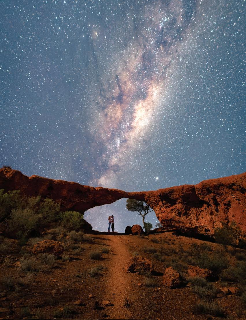
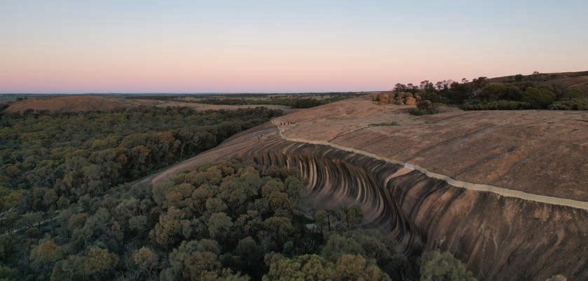
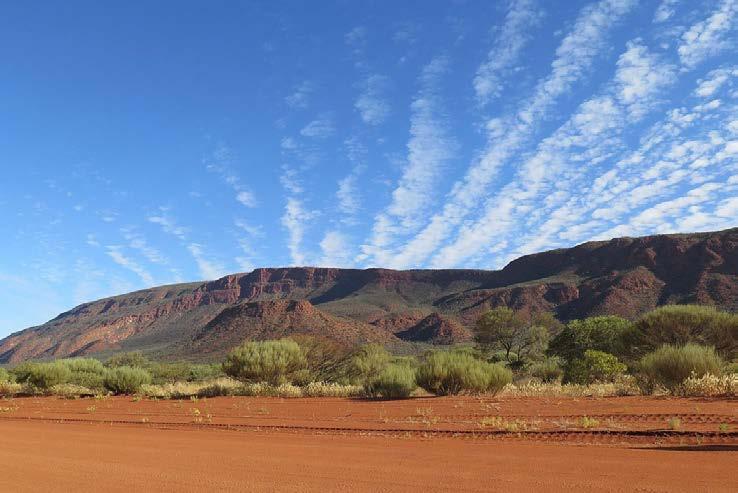
COVER London Bridge, Sandstone WA
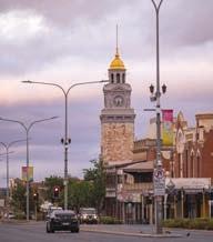
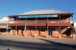
LEONORA | ALICE SPRINGS
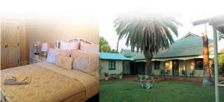
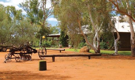
Leonora Lodge was originally a mining village for FIFO workers at the nearby Sons of Gwalia gold mine. Today, the history continues with Leonora Lodge housing local mine workers alongside tourists. Stay in our well-appointed Studio room - It’s taste of mine life with added comfort and amenities such as a large screen TV, queen bed and kitchenette with Nespresso coffee machine. With a fully catered kitchen serving buffet breakfasts, packed lunches and hearty dinners, Leonora Lodge has all the amenities you need and is the ideal place to base yourself while you explore all the region has to offer!
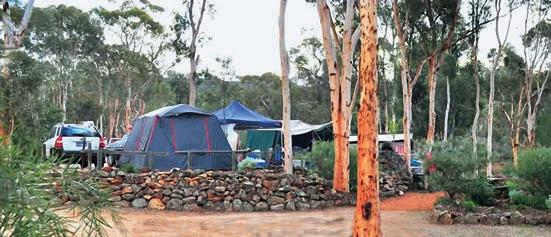
If you’re travelling in a caravan Leonora Caravan Park is a small, friendly oasis right in the centre of town. The park is a popular base for prospectors who come back year after year looking for gold and sharing their stories around a camp fire at the end of a day. It is also an ideal base for exploring the famous Golden Quest Discovery Trail and Leonora Loop Trails.
If you’re on your way to the Northern Territory you can stay with us in our newly developed Alice Village. With everything from a single unit with private ensuite to a 4-bedroom house we have accommodation options to suit any traveller, whether on a solo trek through the Red Centre or travelling with a large group.

For more information see our website www.opl.net.au or call one of our properties on the below:
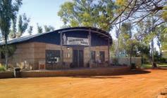
Leonora Lodge (08) 9037 7053
Leonora Caravan Park (08) 9037 6568


Alice Village (08) 8953 2643

Australia’s Golden Outback.
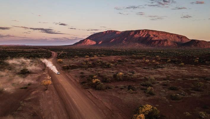
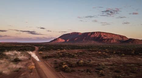
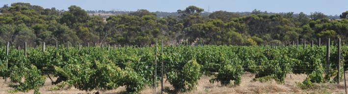
Hit the road and let endless horizons lead the way as you take in the dazzling displays of wildflowers, rugged rocky outcrops, wild woodlands, brilliant beaches, and vast open plains of Australia’s Golden Outback. Networks of road trips sprawling throughout the region will take you far and wide, covering 54 per cent of Western Australia.
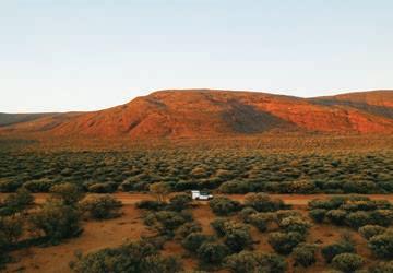
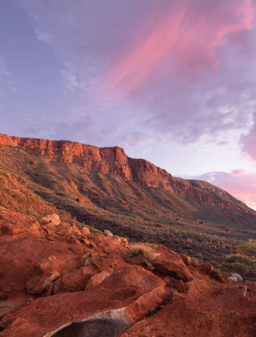
In the north discover Gascoyne Murchison, the red heart of the state where pindan soils sweep the plains and station stays abound for a trueblue outback experience. The expansive ranges and massive Mount Augustus / Burringurrah are majestic sites to behold.
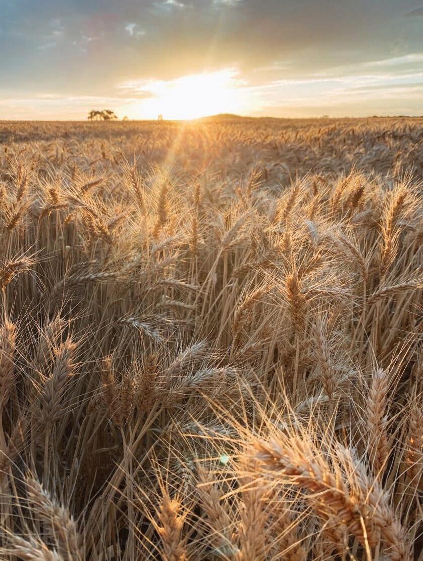
Venture to the Wheatbelt where
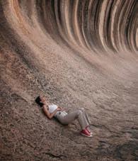
country charm emanates, carpets of canola sweep over rolling fields, and quaint streetscapes light up with character. The iconic 100-metre-wide Wave Rock is a must-see sight, and immersive farm stays and fresh produce will give you a rich taste of the region.
If Gascoyne Murchison is the red heart of state, Kalgoorlie Goldfields is certainly its heart of gold. History and heritage of wild gold rush days of the late 1800s will forever be imprinted here, despite the modern mining boom transforming the Kalgoorlie-Boulder City into a progressive place to explore.
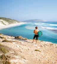
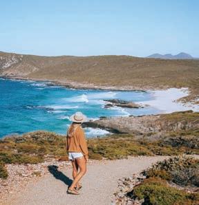
Travel further south and find the spectacular coastal destinations of Esperance and the Fitzgerald Coast. Glistening blue waters, snow-white
beaches and over 100 islands are in stark contrast to the red earth of the surrounding outback, making for an invigorating spot to cool off and bathe in tranquillity. Cape Le Grand National Park and Fitzgerald River National Park are paradises of biodiversity to discover.
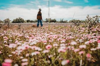
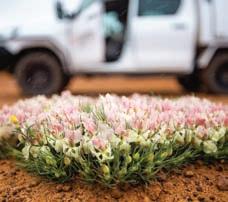
Spectacular displays of wildflowers bloom all around in season, erupting in the north from August and until November in the south. Discover these magical displays of colour on one of the regions many wildflower trails.
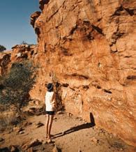
Walk the lands and stretch your mind back to over 60,000 years ago when Aboriginal people first began tending to this Country. Ancient Aboriginal culture and remnants of history run deep through Australia’s Golden Outback and are inspiring to observe and understand.
While accessible to even the most inexperienced tourer, this is territory that should be respected. Use this guide to thoroughly plan ahead, contact our local visitor centres and ensure you equip yourself properly to make the most of your adventure ahead.
With so much natural beauty to explore in this vast and varied region, when you immerse yourself in its rich experiences, the time is always now.
australiasgoldenoutback.com | 3
The adventure of a lifetime awaits in the untamed expanse of
PUBLISHED & PRINTED BY Vanguard Publishing, 26 John St, Northbridge WA 6003 | (08) 9273 8933 EDITOR | Tori Wilson, tori@vanguardpublishing.com.au | DESIGNER | Cally Browning SALES DIRECTOR |
Du Preez, natalie@vanguardpublishing.com.au
Australia’s Golden Outback acknowledges the Traditional Custodians throughout the Golden Outback of Western Australia and their Elders, past present and emerging.
Natalie
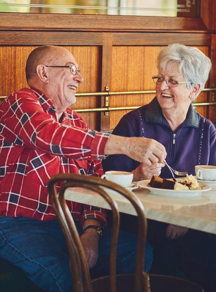
10:35am wednesday. discovering gold together.
You’ve taken so many wonderful road trips together over the last 40 years, but none of them were as special as your first. It only seems fitting to celebrate your anniversary by recreating that magical trip all over again. It brings back so many golden memories of meeting new friends, sharing stories and singing your favourite songs at the top of your lungs. For realising the real gold is right next to you, there’s no place like Dôme.
Perth Metro, WA Regional: Albany, Bunbury, Busselton, Dunsborough, Esperance, Geraldton, Kalgoorlie, Katanning, Margaret River, Newman, Northam, Port Hedland, Rottnest.
bcells48850
domecoffees.com


Welcome to Australia’s Golden Outback 3 Road Trips by Region 6 Top 13 Experiences 8 Unmissable Events in 2023 10 Top Travel Tips 13 Wildflower Wonderland 14 Contents The Gascoyne Murchison 16 Immerse Yourself in Outback Life 18 Gascoyne Murchison Road Trips 20 Gascoyne Murchison Shires 24 The Wheatbelt 32 Farming Country, for the Free Spirited 34 Wheatbelt Roadtrips 38 Wheatbelt Shires 43 Kalgoorlie & the Goldfields 72 A Rich History Runs Deep 74 Kalgoorlie & the Goldfields Road Trips 76 Kalgoorlie & the Goldfields Shires 81 Esperance & The Fitzgerald Coast 94 Plunge into a Natural Paradise 96 Biodiversity at its Best 98 Esperance & The Fitzgerald Coast Roadtrips 100 Esperance & The Fitzgerald Coast Shires 104 australiasgoldenoutback.com | 5
Road Trip COUNTRY
GASCOYNE MURCHISON
Page 16
Monthly Av temp (°C)
Dec-Feb 37°
Mar-May 29°
Jun-Aug 20°
Sep-Nov 29°
THE WHEATBELT
Page 34
Monthly Av temp (°C)
Dec-Feb 33°
Mar-May 25°
Jun-Aug 17°
Sep-Nov 24°
KALGOORLIE & The GOLDFIELDS
Page 72
Monthly Av temp (°C)
Dec-Feb 32°
Mar-May 25°
Jun-Aug 18°
Sep-Nov 25°
ESPERANCE & The FITZGERALD COAST
Page 94
Monthly Av temp (°C)
Dec-Feb 25°
Mar-May 23°
Jun-Aug 17°
Sep-Nov 21°
australiasgoldenoutback.com
Take a few back roads, marvel at the ancient geology and witness the culture of outback stations in this extraordinary region. Kaleidoscopic carpets of wildflowers spring from the rich red earth during springtime and Mount Augustus, twice the size of Uluru, is simply mesmerising. Come and be enthralled by the wonders of an ancient outback landscape which delivers a perfect self-drive holiday.
ROAD TRIPS by region: Refer to map opposite
Road to the Rock
Canning Stock Route
Kingsford Smith Mail Run
Wool Wagon Pathway
Miners’ Pathway
With its great web of self-drive trails and relatively short distance from Perth, it’s no wonder the Wheatbelt is such a popular holiday destination. Seeing the world-famous Wave Rock is on everyone’s bucket list, while charming pioneering townships, miles of golden fields, delightful rural stays and spectacular wildflowers each spring make for an exhilarating driving experience.
Pathways to Wave Rock
Granite Woodlands Discovery Trail
Golden Pipeline Heritage Trail
Wildflower Country & Wildflower Way Everlasting Trail
Wheatbelt Way
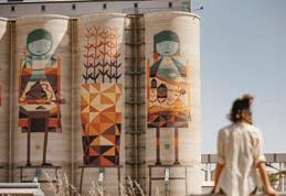
Public Silo Trail
Wineries, Woodlands & Wheatbelt Trail
Pioneers Pathway
Northern Wheatbelt Wonders
Road to the Rock
The Holland Way and the John Holland Track
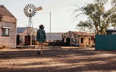
Drive yourself through a window into history built on the dreams of fortune-seekers who flocked to the area following the discovery of gold in 1892. Immerse yourself in the rich tapestry that is the Goldfields by exploring routes like the Golden Quest Discovery Trail, creating your own true outback adventure. Discover amazing salt lakes, ghost towns and quirky outback pubs and try your luck at gold prospecting.
Golden Quest Discovery Trail Outback Way
Leonora Loop Trails
Norseman Heritage Trail
Gunbarrel Highway
Anne Beadell Highway
With enough spectacular scenery to inspire a road trip movie, this region’s brilliant turquoise waters and pearly-white beaches create a dazzling contrast to the red earth of the Outback. Considered one of Australia’s most significant biodiversity hotspots, the countryside features our state’s most pristine and untouched coastal national parks, all easily accessed by a grid of roads.
Road to Esperance
Great Ocean Drive
Eyre Highway & Nullarbor Links
Ravensthorpe Ranges
6
|
JUNCNCTION GASCSCOYNE CAARNARVON
MT. AUGUSTUS TOURIST PARK
WOOLEEN STATION
NORCIA A NEW W
TOODYAY Y TOOO YA
NALBARRA STATION
MEEKATHARRA
NALLAN STATION
CUE
AGN N NEW SANDSTONE
LEONORA A GWALIA A
LAVERTON MENZIES
MURCHISON GOLDFIELDS KALGOORLIE AND
KOOKYNIE ORA BANDA ND BROAD ARROW
THE
BEACON BENCUBBIN
KOORDA
WYALKATCCHEM YA EM
NORTHAM ORRTHAM M
WILLIAMS
MECKEKERING
MUKINBUDIN U M
TRAYNING NING
DOWERIN YORK Y YO CU CUNDERDIN
PINGELLLLY
ARTHUR R RIVER
TAMMIN MMIN
WESTONIA WES
KELLERBERRIN R K
BRUCE ROCK U B
KONDININ CORRIGIN C
KULIN
WICKEPIN
KATANNING
U UTHERN CROSS SOU
MT. MAGNET LA L LAKE KING
LAKE GRACE ONGERUP
GA NEWDEGAGATE TE E
PINGRUP
RAVENSTVENSTHORPE VENST PE
NARROGIN NAREMBEEN MERREDIN M M MURCHISON SETTTLEMENT YALGOO O Y PERENJORORRI MININGENEW MORAWA MULLEWA GERALDTON DALWALLINU MOOORA CERVANTES PERTH H WUBIN W KALGOORLIELEINSTER PAYNES FIND PINDAR AR LEARMONTTH L WAVE ROCK AV MUNGLINUNGLINUP UNNGLINUP QUAIRADINADING QUA WANDERING IN W WA 4WDONLY WESTERN WILDFLOWER FARM WAGIN W To Adelaide FRASER RANGE NUNGARIN NG
HOPETOUN
COOLGARDIE BOULDER ESPERANCE
ALBA ALBANY
australiasgoldenoutback.com | Region | 7
NORSEMAN EXMOUTTH
WILUNA
BROOMEHIMEHILL
DUMBLEYUNG DUMB DU DUNDAS MT MARSHALL NGAANYATJARR ATJARTJARRAKU UPPER R GASCOYNE YN BALLIDU WONGAN AN H HILLS L G YILGGARN MELLEN MELLEENBYE ON N STATION BUNBURY H MANDURAH R MARGARET RIVER PEMBERBERTON WALPOLE WALPOL DENMARK N LANCELIN HYDEN KUKERIN KU BONNIE ROCK MIA MONKEY
M DENHAM BUSSELTON H DUNSBOROUGH A AUGUSTA DONGARA CARNAMAH H COOROW W WHEATBELT THE PAGE 70 PAGE 16 PAGE 52 PAGE 94 MELANGATA STATION GABYON STATION
GASCOYNE
ESPERANCE & THE FITZGERALD COAST
MIA
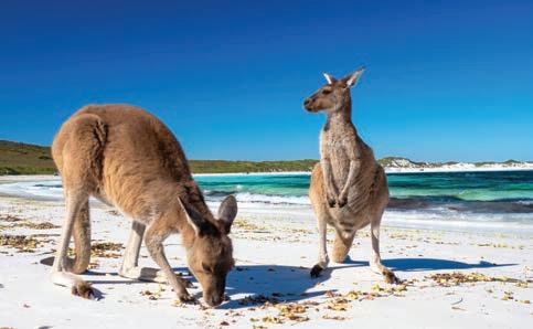
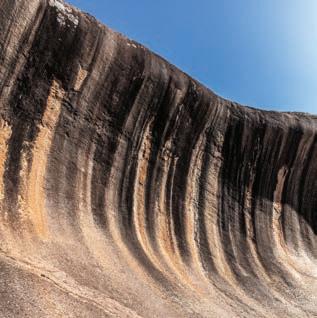
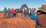
8 | australiasgoldenoutback.com TOP Things to Do Visit the world’s largest outdoor gallery at Lake Ballard Experience life on the land at an outback station stay Meet the Lucky Bay kangaroos in Cape Le Grand National Park Go for a “surf” at Wave Rock
Hike or simply wonder at the world’s largest rock, Mt Augustus
Search for rare and beautiful wildflowers across
a
Explore
UNESCO biosphere reserve of coastal beauty at Fitzgerald River National Park
a
a
Tour the Public Silo Trail for inspiring art on
grand scale Take
step back in time at Gwalia ghost town
in the
and
Take
view
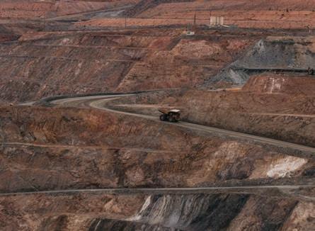
mining history at the Kalgoorlie Super Pit Learn about indigenous culture on a local tour
Marvel
at the endless canopy of constellations in the dark sky of the outback
Travel the quirky Tin Horse Highway
australiasgoldenoutback.com | 9
the outback
Don’t miss the action and cultural activity kicking off annually across Australia’s Golden Outback. Plan your journey to time with one or more of these incredible and diverse events!
Unmissable Events in 2023
MARCH
• Wagin Woolorama
APRIL
• Merredin Show
• Nullarbor Muster
• Quindanning Picnic Race Day
MAY
• Pipeline Challenge
JUNE
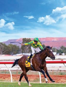
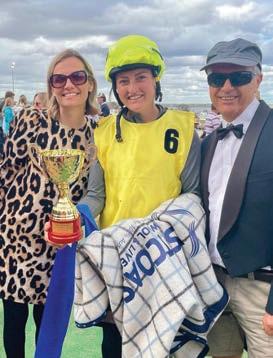
• Goldfields Cyclassic
• Leonora Golden Gift Weekend
JULY
• Gascoyne Dash
AUGUST
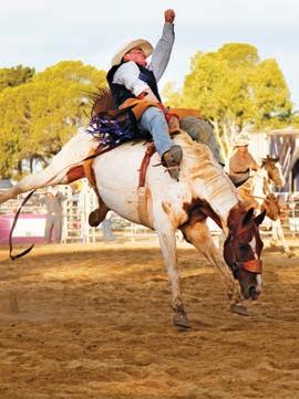
• Coolgardie Rodeo
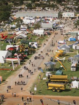
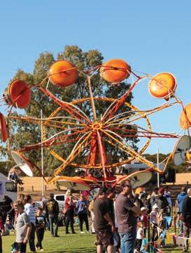
• Dowerin Field Days
• Wyalkatchem Rodeo
SEPTEMBER
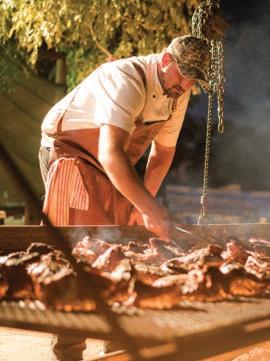
• Australia’s Biggest BBQ
• Chasing the Sun Golf Festival –Nullarbor Links
• Coolgardie Day
• Esperance Wildflower Festival
• Lake Perolilli Red Dust Revival
• Landor Races
• Meekatharra Outback Festival
• Mt Magnet Astro Rocks Fest
• Newdegate Machinery Field Days
• Ravensthorpe Wildflower Show & Spring Festival
• Wattle Week Festival
• Wave Rock Weekender
OCTOBER
• Bruce Rock Back to the Bush Veterans Reunion
• Kalgoorlie Desert Race
• Kulin Bush Races
• Landor Races
• Reynoldson Reserve Festival
• Yalgoo Emu Festival
NOVEMBER
• Bruce Rock Back to the Bush Veterans Reunion
• Narrogin Revheads Weekend
DECEMBER
• Pingelly Christmas Festival
• St Barbara’s Festival
Scan here to discover more amazing regional events

11
Coolgardie Rodeo
Australia’s Biggest BBQ
Koorda ShowKulin Races
Reynoldson Vintage Car Show
Wattle Week FestivalKalgoorlie Desert Race
Dowerin Field DayKalgoorlie Cup
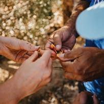
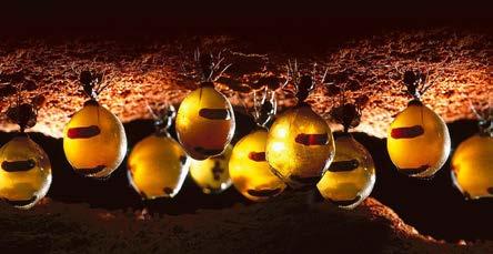
With a variety of experiences in hunting, food gathering, bush survival and bush medicine, your guide will take you on a unique journey along ‘hidden tracks’, which unveil a fascinatingly different perception of the country’s rich natural treasures and the influential role they play in paving their lifestyle. For the Aboriginal people, their spiritual connection to the land and natural environment is a key part of their identity.
Their knowledge of the country and the sacred places that are scattered through it are priceless gems in a fast changing world and a deeply moving experience, that you’re sure to take home as lasting memories.
For more details about the full range of authentic Aboriginal tourism experiences in Australia’s Golden Outback and Western Australia, visit www.waitoc.com


The Western Australian Indigenous Tourism Operators Council (WAITOC) is the peak not for profit organisation representing Indigenous Tourism on Country, showcasing over 100 of the best of WA’s unique Indigenous Tourism experiences & authentic cultural offerings.

Immerse yourself in the rugged wilderness of Australia’s Golden Outback, which has remained largely unchanged for billions of years. Travelling this region will arouse a feeling of venturing back into ancient times, especially when you’re with an Aboriginal guide who can reveal astonishing secrets handed down by his ancestors over thousands of years.
waitoc WAITOC.AboriginalCulture waitoc
When you holiday in WA, book with Quality Tourism Accredited Businesses and you’ll get a quality assured operator wherever you go. From hotels and guided tours to shops and services, you can expect quality, reliability and great customer service. To book your holiday with Quality Tourism Accredited Businesses, visit www.holidayinwa.com.au Holiday in WA
Goldfields Honey Ant Hunters Image: Reg Morrison
Top
for the Best Outback Experience Travel Tips

Daily Vehicle Check
(P.E.T.R.O.L)
PETROL – fill up with the fuel type for your vehicle.
ELECTRICITY – check battery condition and fluid levels.
TYRES – Check tyre pressure, look for bulges, tread damage etc.
RADIATOR – Check the coolant level via the overflow reservoir and the washer bottle level.
OIL – Use the dip stick to check engine oil levels.
LIGHTS – Check headlights, indicators etc.
Some driving tips:
Australia’s Golden Outback is rugged and beautiful, full of vast stretches of dry plains. Exploring it is a true adventure, warranting considered preparation.
Here are a few top tips from the experts at Western 4W Driver to get you started.


1. Make sure you get your vehicle serviced before you depart to avoid costly surprises.
2. Share your plans. Let someone know where you are going and when you plan to return.
3. Australia’s Outback can be hot! Carry two to four litres of water per person, per day between destinations.
4. If you breakdown or get stuck, stay with your vehicle. It is easier to find a vehicle than it is a person. Stick your bonnet up to signal you’ve broken down.
5. Check current road conditions prior to departure. Visit travelmap. mainroads.wa.gov.au/Home/Map.
6. Mobile reception is extremely limited in many areas. For the best connectivity use Telstra
7. To find electric vehicle charging stations, visit plugshare.com
Here’s a handy checklist of important items to carry on your journey:
✔ A first aid kit
✔ A good quality, 12-volt air compressor. You will need it if you want to drive on sand or corrugated roads (when pumping tyres back up, check how hot the compressor is getting and maybe let it cool down a little between tyres).
✔ Stay on track. Invest in a quality GPS and carry a paper map road book as back up. Don’t rely on Google Maps. You will have limited mobile signal and many tracks and backroads are not shown. We recommend getting your hands on a HEMA HX-2, great for on and off-road navigation.
✔ Bring cash with a range of notes and change. Don’t rely on internet being available to run eftpos and your Apple iPay as you travel.
✔ If you brought it with you, take it with you. Rubbish bins can be scarce or not emptied very often so get yourself a dirty gear bag to hang off your spare wheel and put your rubbish (and any you find) in it. Empty it when you come into town.
AWD or 4WD? Many SUV’s are constant AWD, which doesn’t make them 4WD. When you are on gravel, engage 4WD to ensure better road handling and stability. Make sure you switch back to either 2WD or AWD before you are back on the bitumen otherwise you can do serious damage to your vehicle.
It’s a popular myth that you need to drive as fast as possible to get a smooth ride where there are corrugations. This is NOT TRUE.
Driving fast over corrugations limits the contact your vehicle has with the ground, resulting in less control and the possibility of a serious accident.
If this is your first rodeo on the outback roads then read our top tips for a safe and seamless journey.
DO YOU LIKE TO EXPLORE? Subscribe today at western4wdriver.com.au Western 4W Driver magazine will get you and your family discovering exciting and interesting places off the beaten track in Australia’s Golden Outback and the rest of WA. Western 4W Driver is THE magazine for all 4WD enthusiasts whether you are a new or seasoned 4W driver. australiasgoldenoutback.com | 13
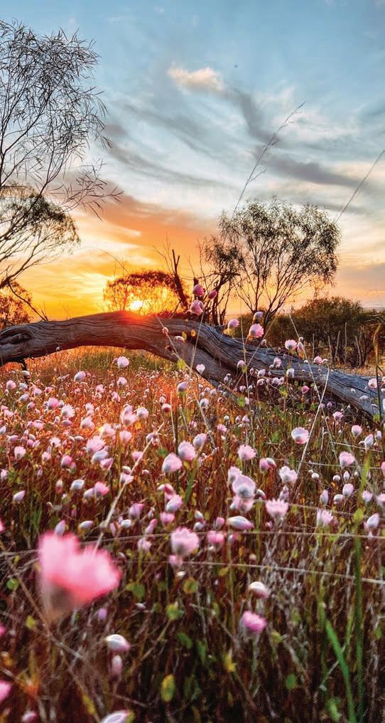
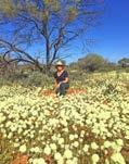
WILDFLOWER Wonderland
By DANIELLE AUSTIN
From late winter and early spring, thousands of pastel pink, yellow and purple wildflowers carpet the wilds of the state’s vast outback — the sight of over 12,000 varieties blooming in a multi-coloured vision signalling the impending spring.
A wet winter makes for a better wildflower season, particularly in the north where blooms are more susceptible to dry conditions. From late July in the northern regions of the Golden Outback, follow the wildflower season south through late winter for awe-inspiring views. From golden hued fields of canola, to wildflower carpeted bushland, to flower-studded seaside cliffs, the landscapes invite visitors to stop and smell the fragrant wildflowers.
The Gascoyne-Murchison
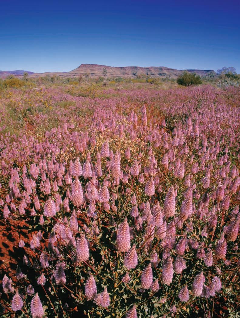
The wildflower season comes early to the Gascoyne Murchison region, with blooms typically visible from late July or early August. A covering of mulla mulla, scarlet red sturt desert pea, everlastings, native cornflower, eremophiloa, flannel bush, cassias, acacias, bachelor buttons and golden billy buttons take over the hinterland from late winter in some of the best wildflower displays in the state. Looming Mount Augustus, surrounded by delicate wildflowers, is always a vivd
14 | australiasgoldenoutback.com
Be enchanted by blankets of ephemeral candy-coloured blooms juxtaposed against centuries-old rock formations come wildflower season in Western Australia’s Golden Outback.
sight; as are the bloom-spotted walking trails along the Gascoyne River and Bilung Pool; while the wetland waterfalls and gorges of the Kennedy Ranges brim with budding displays of colour.
The Wheatbelt
Come August, wildflower season reaches the Wheatbelt, where buttery yellow fields of canola are a common sight as you drive along the endless roads. During peak season, the region is famed for thousands of orchid varieties, from startling white sugar orchids, sunshine-hued cowslip orchids, blushing pink candy orchids, and the incredible greens and reds of the many spider orchids nestled among everlastings and wreath flowers. The vast Wheatbelt region and its many landscapes make for ideal growing conditions for a wide range of wildflowers, with the northwestern Wildflower Country famed for its incredible dense blooms, while the rolling hills and salt lakes of the
Enjoy the freedom
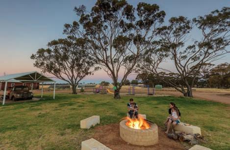
Caravan Parks in Australia’s Golden Outback offer a range of spectacular destinations and accommodation options, from camping sites for tents, powered sites for vans, to fully self-contained cabins . . . the choice is yours!
northeast Wheatbelt are a sea of colour after a wet winter.
Kalgoorlie & the Goldfields
Wildflowers in the Kalgoorlie and Goldfields regions also typically begin to bloom from around August, but can be scarce after a drier winter. Wildflower season will typically see bush tomatoes, sundews, sturt peas, daisies and more take hold of the region. Driving the Great Eastern Highway through the Goldfields, you’ll spot plenty of roadside wildflower hotspots, particularly through the Yellowdine Nature Reserve and Boorabin National Park. Alongside the abundant wattles, everlastings, senna and
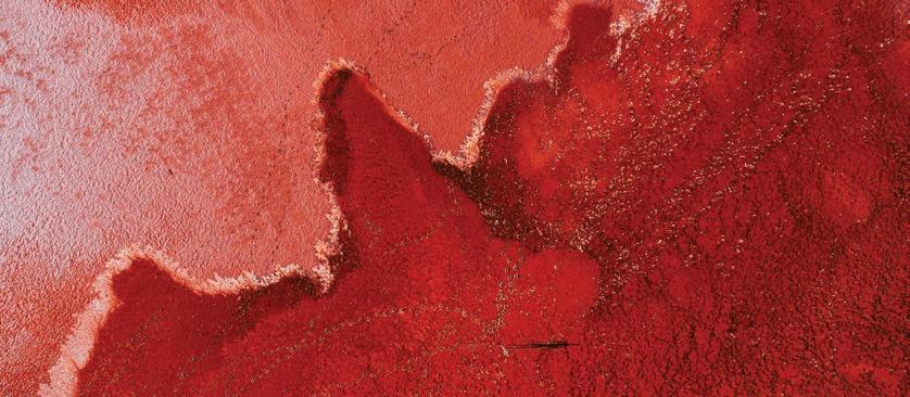
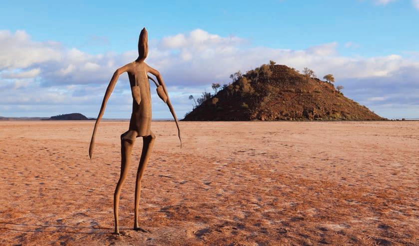
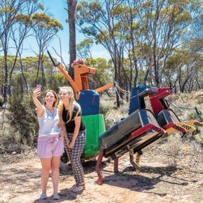
eremophilla of Lake Ballard, take in the black steel Anthony Gormley sculptures scattered across the salt lake.
Esperance & The Fitzgerald Coast
By the end of August and early
September the wildflower season has made its way south to Esperance and the Fitzgerald Coast, where the bush blooms with a plethora of jewel-like flowers. The Fitzgerald Coast’s rocky cliffs and rugged peaks alone boast more than 1,800 wildflower varieties, including vibrant acacia, wattles, redcaps, dainty wedding brush and hakea, with the depthless blue sea making for an incredible backdrop to the enchanting flowerscapes, while the sandy, rocky expanses of Ravensthorpe are a mecca for stunning qualup bells, a diaphanous flower with papery, moth wing-like petals. At the peak of wildflower season, the Cape Le Grand National Park is an endless sea of wildflowers, with Frenchmans Peak offering incredible views.
FOR YOUR NEAREST CARAVAN PARK VISIT www.caravanwa.com.au
Your holiday starts now.
Kick back, relax and discover regional WA on Transwa’s modern Prospector train. We travel between Perth and Kalgoorlie 18 times weekly, enjoy on-demand entertainment, buffet service whilst travelling in comfort and now free wi-fi accessibility on Prospector services.

Transwa also operates luxury road coaches between Kalgoorlie and Esperance six times weekly, all services are air conditioned and fully accessible, equipped with on-board entertainment, bathroom facilities and USB charging ports.
To book your next holiday, or to see where Transwa can take you call 1300 662 205 or visit transwa.wa.gov. au
australiasgoldenoutback.com | 15
Gascoyne The Murchison
TOP THINGS to See & Do
• Walk on Mount Augustus / Burringurrah, Australia’s largest rock
• Experience true outback hospitality at a station stay
• Discover the geological heritage of the Murchison GeoRegion
• Enjoy a yarn over a beer at an outback pub
• Dress up and attend a bush race meeting
• Explore all of the Outback Pathway road trips
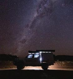
• Admire a chandelier of stars from your swag
• Visit the gallery of rock paintings at Walga Rock
• Camp out in Kennedy Range National Park / Mundatharrda
• Swim in the oasis of Bilung Pool / Birlungardi
In the Gascoyne Murchison, the red heart of Western Australia, pindan soils sweep expansive plains and immense, towering rocks and ranges dwarf all that surrounds, humbling the soul. Here, you’ll be greeted with a classic vision of Australia’s Golden Outback — rugged, all-encompassing, otherworldly and completely awe-inspiring.
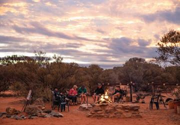
It’s the kind of place that you can’t just pass through on the breeze. You need to live and breathe it to connect with the life here; and there’s no way to immerse yourself into the lifestyle and landscape quite like a station stay. Embrace this pastoral region’s culture when living like the locals, and experience the most brilliant, glittering starry skies around the campfire at night, allowing time to become naught but a foreign concept.
With your station stay as a base for a while, embark upon inspiring touring routes and walking trails to soak in the sights. Wildflower season (July – Aug) is one of the most spectacular times to explore. If you’re lucky, late downpours will time perfectly just prior to your visit, transforming the red, dusty landscapes into lush, green carpets speckled like an ice-cream with hundreds and thousands of colourful wildflowers.
Walking trails around Wooleen Station will expose you to the likes of wurmbea densiflora, eremohpilas, cassias, sidas, everlastings, acacias and bachelor buttons opening their tiny petals to the sun.
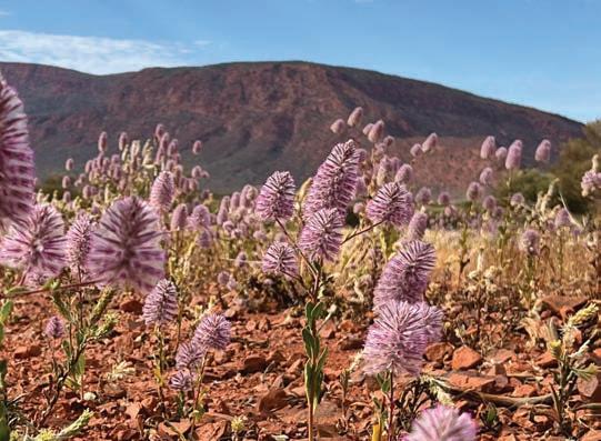
In the north you’ll find iconic species like the scarlet red sturt desert pea setting the undergrowth ablaze and the royal purple mulla mulla carpeting the roadside.
The magnificent Kennedy Range / Mundatharrda and Mount Augustus / Burringurrah also offer particularly inspiring wildflower settings — their rugged, golden outlines are enhanced by clusters of wildflowers at the base.
Mount Augustus, not to be missed, is twice the size of Uluru and something of an icon for the region. Experienced hikers can climb its summit, or walk the base and admire accessible galleries of ancient art. Every year the massive rock is the fitting venue for Australia’s Biggest BBQ when the Gascoyne Food Festival celebrates the best of the bush.
Kennedy Range National Park is a
How to Get There
By Road:
film directors’ outback vision of stunning gorges, red sand dunes, natural springs and honeycomb rocks. Camp under a canopy of endless stars here and 4WD to your heart’s content — the range stretches 75 kilometres.
Explore the majestic Mount Augustus when travelling the Road to Rock or Kingsford Smith Mail Run. You’ll also find the Kennedy Ranges along your way, as well as along the Wool Wagon Pathway Kingsford Smith Mail Run and Wool Wagon Pathway belong to the trifecta of trails that comprise the Outback Pathways, along with Miner’s Pathway The stories and secrets of the region unfold along these trails via interpretive roadside signage along the lattice of sealed and unsealed roads.
The Gascoyne Murchison’s collection of self-drive pathways criss-cross the region and showcase the many natural wonders and rich history of this magical landscape.
The Murchison GeoRegion Trail is another jewel in the region’s crown, showcasing the significant natural, cultural and geological heritage of the area and easily explored from the region’s towns and the Outback Pathways. Download the Murchison GeoRegion app which takes you on a journey of 21 significant sites, through a unique and ancient landscape full of stories that reach back almost to the earth’s beginning, some 4.54 billion years ago.
Celebrate the culture and heritage
The Gascoyne-Murchison has a good network of sealed and allweather roads. There are also the gazetted Outback Pathway trails that make for an enjoyable selfdrive adventure.
By Air:
Skippers flies regular air services from Perth to Wiluna, Meekatharra and Mount Magnet. Reservations 1300 729 924.
By Coach: Transwa operates coaches to a number of the GascoyneMurchison towns - including Yalgoo, Mount Magnet, Cue and Meekatharra.
Tel: 1300 662 205.
of Aboriginal people of the area at Carnarvon’s exceptional Gwoonwardu Mia Gascoyne Aboriginal Heritage and Cultural Centre. As you walk through its interpretive centre, you’ll encounter many themes ranging from stories of the land through to station tales.
The main surviving language of the Gascoyne Murchison is Wadjari, originally spoken in the eastern Murchison area. While a number of languages were spoken in the region, the people all referred to themselves as Yamatji. Today, they refer to the language they speak as the Yamatji language.
australiasgoldenoutback.com | The Gascoyne Murchison | 17
Immerse Yourself in
Outback Life
WA’S OUTBACK IS the sort of place where the horizon seems to stretch forever and the rugged beauty of the place fills you with awe and wonder, beckoning you to dive deeper into its splendour.
for generations.
By TOM DE SOUZA.
It can be hard to envision it sometimes, but there are many folk who have lived and worked the land out here
For those of us from the city, it can be difficult to appreciate the sheer size of their station properties. Many are the size of small European countries and each one is often worked by only a handful of tenacious station workers.
In recent years, however, many of those stations have opened up their gates to travellers and tourists. Hidden within the boundaries of their properties are some of the most stunning natural attractions the state has to offer, and a unique insight into what life is really like out in the bush.
David and Frances Pollock are one such family within the heart of the stunning Murchison region to open up their 380,000-acre cattle station, Wooleen Station, for travellers to live and dine like a local for a while.
“I describe it as a bit of relaxed luxury,” says Frances, winner of the Individual Excellence in Customer Service award at the Perth Airport WA Tourism Conference, 2022.
“The homestead is quite beautiful,
18 | The Gascoyne Murchison | australiasgoldenoutback.com
Be awestruck by vast plains by day and dazzling stars by night when living the outback life on a station stay.
An outback eco-tourism experiment that challenges a hundred years of European Orthodoxy.
A rare kind of holiday!
wooleen station murchison,
western australia
Wooleen Station is one of the finest working cattle stations in the heart of outback Western Australia, situated on the Murchison River and covering half a million acres of picturesque rangelands.
At One With Nature Wooleen is a place to relax and enjoy your getaway. Simply unwind, connect with country and take in the Australian outback at its best.

Creature Comforts
Accommodation ranging from camping to self-contained rammed earth guesthouses. Or stay in the gracious National Trust Listed Wooleen homestead including stylish accommodation, delicious home style cooking, cellar of West Australian wines, magnificent formal dining room, full sized billiards table and swimming pool all amidst an oasis of spectacular award winning gardens.
Rich in History
Guided tours of the station encompassing such things as the listed wetlands of Wooleen Lake, seasonal wildflowers, Aboriginal heritage, colonial history, and spectacular granite outcrops. Learn how the Pollock family are now working towards making Wooleen an ecologically sustainable enterprise.

Wooleen Station is situated on the Twin Peaks-Wooleen Rd in the Shire of Murchison, 690kms north east of Perth, Western Australia. Access is via bitumen and gravel roads. Fuel supplies can be obtained from the Murchison Roadhouse, 37km north of the Homestead. Flying brings the outback to within 90 minutes of the city and two airstrips are available for aircraft, private or chartered.
David and Frances invite you to come and stay today. For more information or reservations contact us at:
T: (08) 9963 7973
E: info@wooleen.com.au
W: www.wooleen.com.au

Bookings are essential. Please call or email to enquire. Open for tourism each year from April to October. Wildflowers are seasonal. Drinks and tours extra charge.

australiasgoldenoutback.com | The Gascoyne Murchison | 19
DAVID & FRANCES POLLOCK
“We’ve got a couple of dance floors in the shearing quarters, with disco lights, a music area, a bar area, and we can accommodate about 110.”
With diverse settings, guests have the option of experiencing life in the converted shearers quarters or to stay in glamping tents, cottages, cabins, apartments, motel style suites or at the campground.
STATION STAY MELLENBYE
Experience the wide open spaces, dark night skies and expansive wildflower displays in season, including the famous wreath flower. Mellenbye is a working cattle station in the Yalgoo/Morawa district, just 4.5 hours drive from Perth and just 6.5 km off the bitumen. Offering an extensive range of accommodation, camp ground and unique function area, Mellenbye is the perfect holiday destination for your station stay experience or to host your special function.
Open from Easter until early October.
To find out more and to book, go to www.mellenbye.com.au
It helps that the station stay is in prime wildflower country, says Shelly. Mellenbye offers numerous self-drive trails on the property so guests can witness an explosion of colour in season.
“The wildflowers have been absolutely awesome this year. There are a few that are not marked, but there is certainly a lot to see, even just around the homestead and camping areas.”
Like Mellenbye, Melangata Station Stay began its life as a sheep station, taken up for pastoral lease and continuing to operate as a working sheep station to this day.
Located in the Yalgoo region, between the Murchison and the mid-west, the station has a unique homestead that was designed by the Priest John Hawes, who spent over 20 years in the Geraldton Diocese and is responsible for the design and construction of many buildings in the area.
There are a number of different accommodation options from unpowered bush sites, bed and breakfast rooms in the homestead, cottage accommodation, and selfcontained shearers quarters, so guests can opt for their preferred level of luxury.
If wildlife is what you’re in the Outback for, Melangata is a haven for it — home to over 40 different species of birds, and also hopping mice, fat-tailed dunnarts, and micro bats. Opt for a guided station tour and sundowner trip to discover the most spectacular areas on the station.
Like many other stations in the area, it’s right in the thick of wildflower country, and is best experienced from August to October.
MelangataSTATION STAY
20 | The Gascoyne Murchison | australiasgoldenoutback.com
in the Yalgoo region of WA, this sheep station has a unique heritage-listed homestead and offers various types of accommodation from campgrounds with basic facilities to a Homestead Dinner, Bed and Breakfast package. Tag-along, walking and homestead tours and camp oven cooking classes available. For more info & booking, contact Jo on (08) 9963 7777 or email melangatastationstay@gmail.com melangatastationstay.com.au
Situated
It’s giving people that real sort of outback experience.”
Kennedy Range NP Mt Augustus NP Collier Range NP Karlamilyi NP Karijini NP Millstream Chichester NP LEGEND Sealed road Unsealed road ROAD TRIPS Road to the Rock Canning Stock Route Kingsford Smith Mail Run Wool Wagon Pathway Miners Pathway Wubin TO HALLS CREEK 1,850km (from Wiluna) 154km 131km Paynes Find Mount Magnet 193km 123km 141km Cue Meekatharra Wiluna Sandstone Leinster Menzies Dongara Geraldton Newman Laverton Mt Augustus Gascoyne Junction Marble Bar Warburton 154km 96km 83km 84km Yalgoo Leonora 280km 103km 165km 181km 146km 123km Carnarvon Exmouth 78km34km 86km 154km 142km 160km 109km 136km 78km 177km 238km 102km Mullewa 118km 421km TO PERTH 266km TO KALGOORLIE-BOULDER 129km 552km 307km Wooleen Station Murchison 298km 355km 202km Tom Price Emu Creek Station Bullara Station Mingenew Perenjori 102km 116km 78km 120km 476km Denham Kalbarri Minilya Bridge Roadhouse Coral Bay 55km Road Trips GASCOYNE MURCHISON
ROAD TO THE ROCK
9 days | Sealed and unsealed roads
Shires on your journey: Dalwallinu, Yalgoo, Mount Magnet, Cue, Meekatharra, Upper Gascoyne, Murchison, Mullewa, Mingenew, Perenjori
This adventurous, rugged road trip takes you more than 1,000km north of Perth.
You’ll weave your way through gorgeous country towns, historical sites, station stays and carpets of seasonal wildflowers before arriving at the world’s biggest rock, Mount Augustus.
You’ll venture through historic towns like Paynes Find, Mount Magnet, Cue and Meekatharra, seeing amazing natural attractions like the Aboriginal rock art at Walga Rock. In springtime, this area is ablaze with a kaleidoscope of wildflowers.
At Mount Augustus National Park, the colours of the landscape change from chalky white soils and fields of olive-coloured shrub to a dark, ruby red moonscape. The park is a lush outback paradise with swimming holes, ancient rock art and a buzzing outback village.
Mount Augustus is the star of this road trip. At 1,700 million years old, it’s three times older than Uluru and twice its size.
There are a number of walking trails around the base, and a summit trail if you’re up for a climb with epic views.
CANNING STOCK ROUTE 15 days | 4WD Track
Shires on your journey: Wiluna
Internationally recognised as one of Australia’s most iconic journeys, The Canning Stock Route runs from Halls Creek in the Kimberley region to Wiluna in the Northern Goldfields. Stretching 1,850km, it is the longest historic stock route in the world and is perfect for experienced off-roaders. Permits are required and travelling with another vehicle or in a convoy is recommended.
It’s a route steeped in history – from both an Aboriginal and a pioneer perspective – and you’ll notice this in every kilometre. You’ll cross four deserts on the way: the Little Sandy, Gibson, Great Sandy, and Tanami. Along the way you’ll see amazing outback scenery of sand ridges stretching to the horizon, spinifex grasslands, narrow gorges, sheer cliffs, ancient Aboriginal art sites, and engravings left by the explorers and drovers of old.
WOOL WAGON PATHWAY
3 days | Unsealed roads
Shires on your journey: Mullewa, Yalgoo, Murchison, Upper Gascoyne, Exmouth


This trail epitomises the Australian outback. The drive takes you from Geraldton through the Gascoyne Murchison up to Exmouth in the Coral Coast, passing through historic and timeless towns like Pindar and Murchison Settlement. Camp along the way or get a taste for life on the land by enjoying one of the many station stay options. There are wide open spaces, historic homesteads and lots of attractions to enjoy on this adventure, including a natural spring, seashell fossils and gorgeous picnic spots. Take in the beauty of the Kennedy Ranges; some 75kms of cliffs, canyons and wildlife. Finish your trip in Exmouth with an experience on the spectacular Ningaloo Reef and witness majestic whale sharks in season.
22 | The Gascoyne Murchison | australiasgoldenoutback.com


australiasgoldenoutback.com | The Gascoyne Murchison | 23 Address: 53 Austin St, Cue 6640 | T: (08) 9963 1625 E: info@queenofthemurchison.com.au | W: www.queenofthemurchison.com.au GENUINE OUTBACK HOSPITALITY YOU DESERVE IT Plan a stay at the grand old Queen of the Murchison Guest House and soak in the history of Cue. Admire the preserved buildings, fossick for gold, photograph amazing sunsets. Owner Joyce Penny has created a fresh and homely environment for travellers and workers. GUEST HOUSE OTHER ROAD TRIPS TO EXPLORE Kingsford Smith Mail Run | 3 days (unsealed roads) Miners Pathway | 4 days (sealed/unsealed roads) Scan the QR code for more insights.
Shire of CUE
At a Glance
WHAT’S ON
Australia Day Fireworks — 26 Jan 2023
Monthly Community Markets — Feb-Sept 2023
Anzac Day Ceremony — 25 Apr 2023
Free Community Concerts — Apr-Sept 2023
Town Christmas Party — Dec 2023

TOP ATTRACTIONS
Cue Heritage Centre / Walga Rock / Big Bell / The Masonic Lodge / Great Fingall Mine Office
WILDFLOWERS TO DISCOVER
CUE
649km north of Perth
Known as ‘Queen of the Murchison’ because of its importance in the gold production of the area, Cue makes a fascinating starting point to explore the Murchison and Goldfields regions of Western Australia.
As legend has it, Cue came about thanks to a gold find by prospector Mick Fitzgerald who, having spotted an Aboriginal fellow called ‘Governor’ with a 10-ounce nugget around his neck, enquired where he had found the nugget, and he was then led to a quartz hill bearing gold in Cue’s centre on New Year’s Day in 1892. The quartz blow is still visible today, located behind the fire station. Cue is ready to delight tourists with attractions ranging from charming 19th century gold rush era buildings to 10,000-year-old Aboriginal rock art.
If you are planning on including Cue in your outback adventure, make sure to take advantage and explore its main attractions…
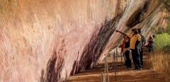
Aboriginal Art – Walga Rock
A huge granite monolith known as Walga Rock, situated 48km west of Cue, is a site of deep Aboriginal cultural and spiritual significance. The most unusual art depicts a sailing ship in white ochre with masts, rigging and portholes.
The Cue Historical Photograph Collection
Step back in time to the wild gold rush days of Cue’s past with a journey among
the collection of historical photos on display in the Cue Shire Administration Building. Built in 1895, it was once home to the London and Western Australian Investment Company offices, and later the Gentlemen’s Club.
Nallan Lake
Nallan Lake is a nature reserve and during periods of heavy winter rains transforms into a favoured picnic spot.
Old Cemetery
About 4km east along the Sandstone Road, view a cluster of graves from the late 1890s. It is thought that nine graves were moved here from their original burial sites in 1897 to make way for the railway station.
Old Gaol
Located in the Cue Tourist Park, the Old Gaol was built in 1896 and was a temporary home to prisoners being transported from outback lock ups in the north until its official closure in 1914.
Cue Heritage Centre
Located behind the Cue Community & Visitors Centre the Heritage Centre is a museum full of memorabilia and showcases the history of Cue.
Masonic Lodge
Built in 1899 from timber and galvanised iron, the Masonic Lodge is said to be the biggest free standing, double story corrugated iron construction in the southern hemisphere. It is subject to many a ghost story!
Everlastings / Pink Mulla Mulla / Eremophilas (The Emu Bush) / Bush
Tomatoes / Eremophila rostrata
Chinnock Subs Rostrata
CUE COMMUNITY & VISITORS CENTRE, CUE HERITAGE CENTRE
72 Austin Street, Cue (08) 9963 1198 info@cuecrc.net.au cuecrc.net.au
Cue Hospital Ruins
The hospital served the old Day Dawn township and started as a canvas and bough shed in July 1892. In 1895 a sturdier structure was built from local stone. Today several walls from this building remain, as does the ruins of the chimney from the hospital’s crematorium.
Great Fingall Mine
The Great Fingall Mine Site Office is another turn-of-the-century structure that is a truly magnificent example of the buildings of this period. Interestingly, Herbert Hoover, President of the USA, worked in this building.
Big Bell
The ghost town of Big Bell, situated approximately 30km north-west of town was gazetted in 1936 and soon after became the terminus of a spur line from the main railway in Cue. The town was deserted by the mid-1950s. The hotel reputedly had the longest bar in Australia and the remains of this once impressive structure are still standing.
24 | The
|
Gascoyne Murchison
australiasgoldenoutback.com
Post Office at night
Shire of MEEKATHARRA
elements. You can obtain information brochures at the Visitor Centre. Features include the Rangelands Discovery Trail along the town creek, a lookout, and the Meekatharra Drive Trail, which takes in the famous racecourse “at the end of the earth,” spectacular views of open cut mining pits, and more.
At a Glance
WHAT’S ON Meeka Outback Festival — 22-25 Sept 2023
TOP ATTRACTIONS

MEEKATHARRA
764km north of Perth
Meekatharra is an historic outback town with so much to see and do. A busy regional hub located 764km north of Perth, Meekatharra is a friendly place to refresh and refuel on your Golden Outback adventure. Pastoral and prospecting settlement began in the late 1800s, changing the rangelands landscape and the rich Aboriginal culture of the area. The town was gazetted in 1903 and named Meekatharra after the first mine was registered there in 1894. The Shire of Meekatharra wonderfully displays the Murchison Georegion’s ‘ancient lands and brilliant skies’ with a wealth of fascinating geological formations, mind-blowing stargazing opportunities and significant cultural
Meekatharra is an RV-friendly town with potable water and a chemical toilet dump located at the ‘Welcome Park’ on Main Street. It also boasts a hospital, chemist, and GP clinic as well as visiting dental and specialist services, a post office, and 24-hour fuel. ‘Meeka’ has a state-of-the-art small wheels park behind the supermarket, and playground at the town oval. The centrally located town pool is an oasis for all with family-friendly facilities. Discover more of Meekatharra’s top attractions when visiting the town…
Peace Gorge
Free camping is permitted at Peace Gorge, just 3km from town. The site is named after a picnic held for service people returning from WWI. However, it is also a registered Aboriginal heritage site with many cultural uses. This beautiful area of the shared country is popular for weddings, town celebrations, and get-togethers.
Prospecting
Prospecting is a popular pastime, and many locals have their own leases. Venture out bush and discover traces of the past, including Garden Gully, where you can see the remains of kerosene tin ‘humpies’.
Peace Gorge / Museum / Drive and Walk Trails / Gold Mining Pits and Prospecting / Wildflowers and Wildlife
WILDFLOWERS TO DISCOVER
Mulla Mulla / Native Hops / Flannel Bush / Cotton Bush / Various Eremophila
Corner Main & Savage Street, Meekatharra (08) 9980 0600
cso@meekashire.wa.gov.au
meekashire.wa.gov.au
Respecting People and Country
There are untold cultural sites with locations passed on from the Traditional Owners who can read the ancient signposts. If you want to learn more about the Aboriginal history and culture of the area, just ask – there is usually an Elder who will be happy to explain aspects of their country and culture.
Lloyd’s Plaza
Refurbished in recent years, this town jewel encompasses a bakery, shops, and the Visitor Centre.
australiasgoldenoutback.com | The Gascoyne Murchison | 25
MEEKATHARRA SHIRE OFFICE
Peace Gorge
Shire of MOUNT MAGNET

continuous gold mining centre since 1891, Mount Magnet is rich in history and more. Services include a visitor centre, swimming pool and fitness centre, caravan park, station stays, hotel-motels, units, post office, mines office, police station, medical service, supermarket, butcher, hardware with Muzz Buzz coffee, Centrelink, library, internet, mechanics, Swagman Roadhouse, airport and more. Discover some of its main attractions while visiting…
Mining and Pastoral Museum
At a Glance
WHAT’S ON Astro Rocks Festival — 22-24 Sept 2023 Mt Magnet Races — 23 Sept 2023 Markets — bi-monthly
TOP ATTRACTIONS
Tourist Drive / Ampitheatre / The Granites / Mining and Pastoral Museum / Walga Rock

WILDFLOWERS TO DISCOVER
MOUNT MAGNET
560km north-east of Perth
Mount Magnet is the gateway to one of the world’s natural geoparks. With accessible, awe-inspiring geology of the Murchison GeoRegion, three geosites and overarching dark skies, it is the perfect place for landscape and deep space astrophotography. Mount Magnet, Geo Hub of the Murchison and on ‘one of the finest goldfields in the world’ is far more than just about gold. Discover ancient landscapes where some of the oldest, rarest and largest rock formations in the world have been created over billions of years. Mount Magnet is at the Magnetic Centre of Australia’s Golden Outback, on the Murchison GeoRegion Geo Trail and Gascoyne-Murchison Miners’ Pathway. Featuring Aboriginal culture, early pastoralism from 1878 and the longest
Located at the Mount Magnet Visitor Centre, the Mining and Pastoral Museum is considered one of the best regional museums in Australia with extraordinary exhibits, including No1 Rabbit Proof Fence, Hill 50 Gold Mine Winder and Miners Tribute. See the new Genestream Songlines Mural here. While at the visitor centre peruse the locally-connected gifts on offer and ask for travel advice.
Heritage Walk
Take a trip back in time where stories of pioneer pastoralists, grand gold rush days and Government Proclamations are revealed through buildings and new public art sites unique to Mount Magnet.
Tourist Drive Trail
Popular 37km drive or cycle through famous gold mining areas, scenic lookout, ghost town and spectacular outback scenery.

Warramboo Hill Lookout
See spectacular views across open cut mines and the township to far horizons.
Hops / Everlastings / Mulla Mulla / Paprika / Wisteria
MOUNT MAGNET VISITOR CENTRE
Southern entrance to town on the Great Northern Highway 39 Hepburn Street, Mount Magnet (08) 9963 4172
visitor@mtmagnet.wa.gov.au mtmagnet.wa.gov.au
Amphitheatre
Part of the Murchison GeoRegion Trail, view extraordinary ancient waterfall rock formations that are the ideal surrounds for landscape astrophotography. No camping permitted.
The Granites
Fascinating historical evidence of ancient Aboriginal presence is revealed and celebrated at The Granites, a Geo Trail site of Aboriginal rock art and place of cultural significance for the Badimia tribe.
Disabled access.
(Northern end of) Hepburn St, Mt Magnet
E: caravanpark@mtmagnet.wa.gov.au


T: (08) 9963 4198 www.mtmagnet.wa.gov.au
Mt Magnet Visitor Centre, with entry into Mining & Pastoral Museum is the best place to visit for information, regional geo-tourism, heritage, Aboriginal & astronomy interest. Local, regional, statewide information. Heritage walk & drive trail maps. Wirnda Barna Art. Internet. WIFI. Gift shop. MWA & rare orbicular granite display. “Treasures of the Earth” rock collection.
Southern Entrance to Mt Magnet, Great Northern Hwy
E: visitor@mtmagnet.wa.gov.au
Tel: (08) 9963 4172
www.mtmagnet.wa.gov.au
Fully self-contained serviced units. Motel style accommodation. The quietest most comfortable accom in town. See for your self. Continental breakfast supplied. Coin operated laundry, fully equipped, special weekly rate.
Thurkle Cove Mt Magnet
M: 0408 996 346
T:(08) 9963 4380
26 | The
|
Gascoyne Murchison
australiasgoldenoutback.com
A welcome stay with friendly service, clean, tidy facilities in pleasant surrounds. Modern Ablutions, washing machines, dump point, gas, powered sites, grassed tent sites powered /un-powered. Cabins(no kitchen facilities) linen provided. Campers kitchen, electric BBQ, full kitchen facilities with outdoor setting. Close to shops, post office & parks.
Mount Magnet Caravan Park
Mount Magnet Vistor Centre Mining & Pastoral Museum
Mt Magnet Miners Rest Units
The Granites
Welcome to the Mt Augustus Tourist Park located in the Heart of the Gascoyne region of WA. Home to the largest rock in the world. Our Tourist Park is described as a ‘green oasis’ in the rugged outback, with powered green grassed caravan and camp sites, to airconditioned accommodation units to suit all. Shop, fuel supplies and tyre service as well.
New to the park is the Mt View Cookhouse serving our famous Mt Augustus ‘Shorthorn’ steaks, fully licensed with big screen tv and a fantastic outback atmosphere. With scenic spots such as Emu Hill and Cattle Pool for a swim, there’s plenty to see and do. Oh did we mention a “Bloody Big Rock”? Spend a few days just exploring this amazing site, with Aboriginal art and views as far as the eye can see. So come and join us for a true Heart of the Gascoyne holiday experience.
Undernew management2021
The Junction Pub and Tourist Park has been welcoming guests to Gascoyne Junction since 2014. ACCOMMODATION • ROAD HOUSE • TAVERN

WILDFLOWER WALKABOUT
CULTURE & COLOUR
For the Yinggarda people wildflower season is a time of celebration and ceremony. Join us on a Wildflower Walkabout, discover the significance of this special time, hear a traditional cultural song and cultural interpretation of the wildflower season.
KENNEDY RANGES GUIDED TOURS

A CULTURAL INTERPRETATION
Walk amongst prehistoric landscapes and hear the Dreaming stories connected to this place of great spiritual significance to the Yinggarda people. Explore the culturally significant locations and land formations that have been at the heart of our Dreaming stories for many thousands of years.
The tourist park has chalets, caravan and camping sites available for your stay.

Visit to see the real outback. Stay to experience:
• The world’s biggest rock at Mt Augustus
• The stunningly beautiful Kennedy Range
• Outback rivers & waterholes
Contact Rennee
T: 0477 126 983

E: mulanji.consultants@gmail.com
wooramulla.com.au
Gascoyne
Depart the Junction Information Centre each weekday at 3pm
April to September (except public holidays)


australiasgoldenoutback.com | Region | 27 Landor Cobra Road, East Lyons River T: (08) 9943 0527
www.mtaugustustouristpark.com.au
W:
• A landscape carpeted in wildflowers Junction Walking Tours
Whether you need to refuel and grab a real coffee, want to enjoy a world class meal cooked by our renown Chef Omo or need a place to lay your head, the friendly team at the Junction Pub and Tourist Park have got you covered during your stay in Gascoyne Junction. Serving breakfast, lunch and dinner and everything in between, stop in for a well deserved break and relax with a cool drink in the beer garden before taking a Wander Outback and visiting Kennedy Range & Mt Augustus National Park.
T: 08 9943 0868 | www.junctiontouristpark.com
Shire of MURCHISON
At a Glance
WHAT’S ON
Ancient Land Under Brilliant Skies
Festival — 15 - 16 April 2023
TOP ATTRACTIONS
Errabiddy Bluff / Bilung Pool / Oasis Roadhouse / Wooleen Lake / Murchison Museum
WILDFLOWERS TO DISCOVER
Mulla Mulla / Bladder Dock / Native Hops / Flannel Bush / Cotton Bush / Various Eremophila
MURCHISON
669km
north of Perth
It doesn’t get any more outback than the Shire of Murchison. The ‘Ancient Lands Under Brilliant Skies’ are home to sprawling pastoral stations, abundant wildlife, and seasonal wildflower displays, yet very few people. The shire covers an area of 49,500 square kilometres with a population of just 153.
The hub of the shire is the Murchison Settlement, home to around 20 people. Murchison Shire is home to incredible sophisticated space technology – the Australian Square Kilometre Array Pathfinder (ASKAP) and Murchison
Radio-astronomy Observatory site (MRO). The ASKAP/MRO explores the history of the universe with its worldleading survey radio telescope. The MRO is operated by CSIRO as a restricted site and is not open to visitors, but it’s here for good reason — the light pollution is nil, and the night sky is spectacular. Discover more of Murchison Settlement’s main attractions…
Murchison Settlement
Be at one with nature on the upgraded rangeland botanical walk or view the many artefacts of pastoral and Indigenous Australian life at the Murchison Museum. Go bird watching, enjoy the sunsets, gaze at the amazing night sky, or just boost the population for a day.
Errabiddy Bluff and Outcamp
Fifteen kilometres west of Murchison
Settlement, Errabiddy Bluff’s large rock formations make a mark on the landscape — it’s an ideal setting for a day trip and a picnic or barbeque. The magnificent sunsets seen from the bluff are a prelude to a breath-taking display of stars.
Bilung Pool and Wooramel River Gorges
On the Carnarvon-Mullewa Road, discover the tranquil waters and enjoy a picnic at Bilung Pool. While you’re there be sure to take in the Wooramel River Gorges, a spectacular example of an inland river system.
Old Stock Well
Fifty-five kilometres south of Murchison Settlement on the Carnarvon-Mullewa Road, this recently restored well was once used by drovers moving stock. A picnic area with barbeque is now available for visitors making it a great place to stop off and take in the vast history of the area.
Ballinyoo Bridge
Further south, the oldest concrete bridge in Western Australia has been replaced with a new bridge, but a span of the original Ballinyoo Bridge has been preserved as an historic marker of its former glory.
Wildlife and Wildflowers
Kangaroos, emus, majestic eagles, red-tail black cockatoos and many amazing reptile species. Seasonal rain can bring fields of everlastings and other rangeland natives.
MURCHISON VISITOR INFORMATION
Murchison Oasis Roadhouse
3001 Carnarvon-Mullewa Road
Murchison (08) 9961 3875


oasis@murchison.wa.gov.au
murchison.wa.gov.au
Station Stays
Experience true station life, discover Indigenous Australian rock art or soak in the outback atmosphere at the various station stays throughout the region.
Accommodation for campers, caravans, motorbikes and clubs: 9 rooms available - 3 with ensuite, 3 with ensuite and common kitchen. Bookings essential.
Oasis Restaurant - dine in or takeaway, alcohol not available.
Fuel, ice, grocery items, free wifi and laundry facilities.
Birdwatching, lawn bowls, stargazing, annual events (email for details).
There’s so much to see and do and it’s gentle on your pocket! Carnarvon
28 | The Gascoyne Murchison | australiasgoldenoutback.com
SETTLEMENT
Mullewa Rd, Murchison
oasis@murchison.wa.gov.au Ph: 9961 3875
7 days. Scan QR code for seasonal opening hours.
WA E:
www.murchison.wa.gov.au Open
Murchison Oasis
Murchison Shire Office
Shire of SANDSTONE
At a Glance
WHAT’S ON Australia Day Games — 26 Jan 2023
Art Show — Aug 2023
Astrodome — Viewings by arrangement. Book at Heritage Museum & Visitor Centre
TOP ATTRACTIONS
London Bridge / Sandstone and Nungarra Cemeteries / Old Post Office / National Hotel / Old Brewery
WILDFLOWERS TO DISCOVER
Royal Mulla Mulla and Pink Mulla Mulla / Ruby Dock or Bladder Dock / Pink
Thryptomene / Calandrinia / Crimson
Eremophila
SANDSTONE 725km north-east of Perth
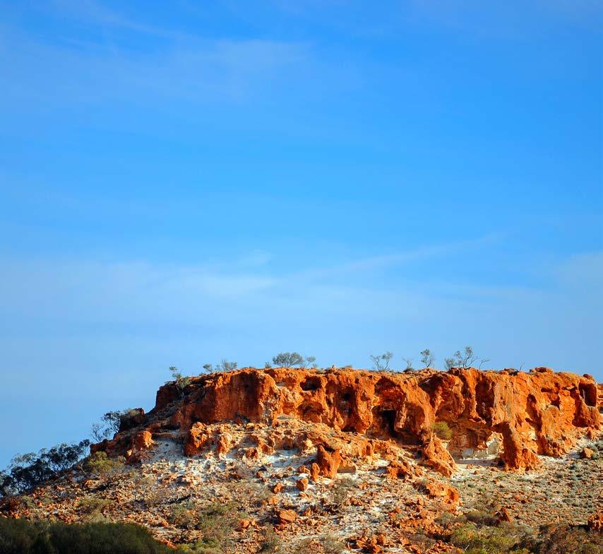
In the heart of the spectacular lower Murchison district, Sandstone’s bronzed landscape contains many unique and picturesque locations. Throughout the stunning Shire of Sandstone, natural rock formations contrast dramatically with rust-stained landscape. Gold was first discovered in the immediate Sandstone area in 1894 and remains popular for the casual gold prospector. From 1906, Sandstone grew to a small city of some 7,000 people. By the end of the 1920s, only 200 people remained. Fortunately, Sandstone survived and makes an ideal stopover at the centre of some of WA’s great tourist routes. While in town, explore some of Sandstone’s main attractions…
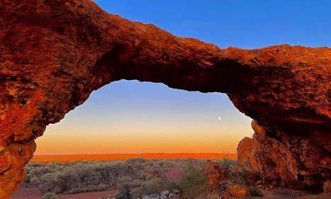
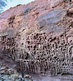
Sandstone Heritage Trail
Take to the road along the 18km Sandstone Heritage Trail and discover a series of natural and historically significant sights, including the breakaway that housed the Old Brewery. Photograph London Bridge, the natural basalt formation which is over 350 million years old. The trail also includes the former State Battery and Contradiction Well.
Sandstone Heritage Town Walk
Step back in time and wander the Sandstone Heritage Town Walk. The Post and Telegraph Office was built in 1909.
Some of the sites you will see on the town walk include the old and new Shire Office buildings, Black Range Chapel, Heritage Cottage, Pioneer Park, Gold and Wool Interpretive Park and former School (the original Courthouse). The Police Lock-up and the Water Park are favourites on this easy stroll about town.
Peter Denny Lookout
For stunning natural vistas, head to the Peter Denny Lookout, just over 30km east of Sandstone, en route to Leinster and bring a picnic for when you arrive.
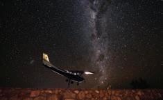
Sandstone Night Sky
Another unbeatable view that’s truly spectacular is Sandstone’s clear, deep dark night sky. The shire has installed a telescope system and stargazers can book a viewing, from April to October, by calling the visitor centre during office hours.
SANDSTONE HERITAGE MUSEUM & VISITOR INFORMATION CENTRE
18 Hack Street
Sandstone WA 6639 (08) 9963 5061 or (08) 9963 5802
visitus@sandstone.wa.gov.au
sandstone.wa.gov.au
National Hotel
If you’re looking for a feed and a place to rest your head, the National Hotel is iconic. The smallest of four hotels built during the gold rush years, it’s the only one still standing and a great spot to meet some locals.
Post Office Café
Situated on the corner of Hack Street, the Post Office Café is a great place to grab a coffee and a light meal.
australiasgoldenoutback.com | The Gascoyne Murchison | 29
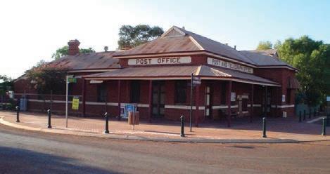
IMAGE Steve Armstrong
Sandstone Post Office
London Bridge
Shire of UPPER GASCOYNE
At a Glance
WHAT’S ON
Under Gascoyne Stars Festival — 20-30 April 2023
Gascoyne Dash — April 2023
Gascoyne in May — May 2023
Junction Races — Aug 2023
Australia Biggest BBQ — Sept 2023
Gascoyne Food Festival in the Junction — Sept 2023
TOP ATTRACTIONS
Dark Sky Destination / Two Rivers Memorial Park / Gascoyne Junction Museum, Gascoyne Junction War Memorial / The Waterhole
The residents of the Upper Gascoyne invite you to take a wander outback: to experience the rivers, the rock, ranges, and the real outback found in their backyard. With 57,809 square km of outback to share, you will find the space and tranquillity you have been looking for with the beauty of nature as a backdrop. The roads are less travelled than most with around 1,800 kilometres of unsealed road traversing ever-changing landscapes, with colours that make you feel like you are driving through a set of Derwent pencils. Epic road trips are inevitable in both 2WD and 4WD vehicles.
GASCOYNE JUNCTION
1069km north of Perth
Start your wander outback in ‘the Junction’ where the Lyons and Gascoyne Rivers meet and stock routes of the past overlap at the gateway to the incredible Kennedy Range National Park (50km N of The Junction) and otherworldly Mount Augustus National Park (300km NE of The Junction).
Using Gascoyne Junction as your base, explore our iconic national parks, take epic road trips and unwind at our spectacular waterholes and rivers. Discover some of our world-renowned options…
Mt Augustus National Park –Burringurrah
Almost twice the size of Uluru, Mt Augustus is the biggest rock in the world. Rising spectacularly over the surrounding plain and at 715m, it is visible from kilometres away. Interesting rock formations, caves and Aboriginal
engravings are found on many parts of the rock that have been untouched for thousands of years. Camping is not permitted within the national park however Mount Augustus Tourist Park is the perfect place to call home located on a working station sitting at the rock’s base.
Kennedy Range National Park / Mundatharrda
Kennedy Range National Park offers spectacular scenery of gorges and precipitous faces, with a vast plateau of ancient dune fields on top of the range. Just 50km north of Gascoyne Junction, the area retains a wilderness feeling with camping beneath the sandstone cliffs available within the National Park. Artefacts found in the park provide evidence of the long history Aboriginal people have with the area. The developed visitor sites on the eastern side of the range can be reached by 2WD.
Road Trips
Road trip the 49km Burringurrah Drive circuit for excellent views of Mt Augustus’ changing faces.
For excellent vantage points of the Kennedy Range, road trip its loop track. This extreme 4WD-only track provides access to the remote western side of Kennedy Range before crossing over the range top to enjoy the more accessible eastern side. This 270km circuit from Gascoyne Junction will take a minimum of one and a half days to complete. Or hop in the car and embark upon a self-drive trail to see the sights. Wool Wagon Pathway Road Trip and Kingsford Smith Mail Run Road Trip are two top options.
WILDFLOWERS TO DISCOVER
Eremophila / Flannel Bush / Mulla Mulla / Native Cornflower / Everlastings
GASCOYNE JUNCTION VISITOR INFORMATION CENTRE
4 Scott Street, Gascoyne Junction (08) 9943 0988 visitorcentre@uppergascoyne. wa.gov.au uppergascoyne.wa.gov.au/ tourism.aspx
30 | The Gascoyne Murchison | australiasgoldenoutback.com
Mount Augustus National Park
Honeycomb Gorge, Kennedy Range National Park
Astrotourism
The Murchison GeoRegion Trail takes you on a journey through a unique and ancient landscape full of stories that reach back almost to the Earth’s beginning some 4.54 billion years ago. The self-drive trail visits 21 sites of natural and cultural significance in a region where you can develop a deeper understanding and connection with the land.
WITNESS
the result of colliding continents, long-gone oceans and destructive meteorites, and marvel at the spectacular rock formations created by these massive geological forces.
DISCOVER
the unique native flora and fauna of the Murchison region and be treated to dazzling displays of wildflowers every July to September.

CONNECT
with culture, stories and legends that map thousands of years of human history.
LEARN
about Western Australia’s largest gallery of Aboriginal rock art, the stories behind gold exploration and pastoralism in the Murchison or explore the remains of a fine brewery carved deep into the rock.
All this and more awaits you as you explore the Murchison GeoRegion.
MORE INFORMATION Go to www.murchisongeoregion.com to learn more and download the Trail Guide and free app. Discover Trail Guidebook Ancient lands Brilliant skies ASK A LOCAL! Driving one of the Outback Pathways or experiencing a Station Stay on your travels in the Murchison GeoRegion? Contact one of our local Visitor Information Centres for information and advice. Cue – 08 9963 1198 Meekatharra – 08 9980 1811 Mount Magnet – 08 9963 4172 Murchison – 08 9961 3875 Sandstone – 08 9963 5061 Wiluna – 08 9981 8009 Yalgoo – 08 9962 8042
TheWheatbelt
TOP THINGS to See & Do
• Explore Kulin’s Tin Horse Highway
• Camp at the base of Wave Rock / Katter Kich
• Visit the Wheatbelt’s spring wildflowering
• Touch the Rabbit Proof Fence
• Take an Aboriginal cultural tour
• Visit Elachbutting Rock and walk Monty’s Cave
• Sit in Earthquake House at Cunderdin Museum
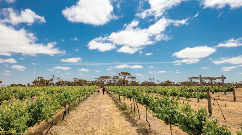
• Follow the PUBLIC Silo Art Trail
• Experience award winning Wheatbelt wineries
• See Aboriginal rock art at Mulka’s Cave
• Take in the vastness of Lake Dumbleyung
Fresh produce, friendly and authentic farm life, and great open roads taking you through rolling hills and pastural fields to places less hurried, are the experiences you’ll find all around in the Wheatbelt.
Book an overnight stay at secluded camp sites, guesthouses, charming B&Bs, rural cottages or visit an authentic farmstay – there are many that will welcome you to experience real country life and meet the range of cuddly animals roaming the fields.
Make a point to pause, look up at dark, country skies at night to a boundless canopy of bejewelled stars; and be sure to meet the makers of the area’s fantastic farm-gate produce. Olive oil, preserves, yabbies, emu oil and lavender products are all found here, as are award-winning boutique wineries created by passionate producers.
The countryside provides one of nature’s most dazzling shows from July to early November when the landscape explodes into colour as grain crops ripen, wildflowers bloom and winter orchids light up the land. As wildflowers are dependent on seasonal rain, check information with local visitor centres.
Sweeping roads stretch through this rustic country, revealing a patchwork of golden fields, character towns, pioneering history, festivals and selfdrive trails leading to spectacular granite outcrops with infinite views and unique ecosystems.
Journey the Holland Way and
How to Get There
By Road:
John Holland Track, the Pathways to Wave Rock, and the Wheatbelt Way to discover some of the area’s best natural attractions, adventurous 4WD trails and towns that will teach you of outback history worth remembering. The Wheatbelt is rich with stories of early day explorers and settlers, and of fortunes made and lost in the gold rush of the late 1800s.
Both Aboriginal and pastoral history is captured along interpretive trails through towns and in museums of military and railway memorabilia. Tin horse sculptures, an art deco theatre and a historical retro drive-in cinema form part of a huge collection of curiosities and legends.
This region is the traditional land of the Njaki Njaki – Ballardong –Gubrun people, and its features hold great cultural significance to them. Understand what it means to tread in the footsteps of their ancestors by taking a locally owned Aboriginal tour and listen to Dreamtime creation stories to learn how landscapes were formed.
For an experience full of modern, artistic splendour, journey the Public Silo Art Trail — an open-air gallery stretching from Northam to Albany.
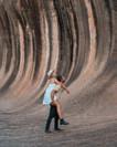
This trail, along with several others, will also take you through the town Hyden, a five-minute drive from Wave Rock, one of our state’s most recognisable tourist attractions worth adding to the agenda.
The unique granite cliff — also known as Katter Kich to the land’s original
The Wheatbelt has a good network of sealed roads and gazetted drive trails. There are a number of tour companies offering one day and extended holidays from Perth throughout the Wheatbelt, if you’d like to leave the driving to someone else.
By Coach/Train:
Transwa operates coaches to many of the Wheatbelt towns and The Prospector train stops in Cunderdin, Kellerberrin, Merredin, Southern Cross and Kalgoorlie. Tel: 1300 662 205.
custodians — stretches over 100 metres and stands 15 metres high, appearing like a giant wave about to crash over the surrounding bush.
There are other fascinating granite rock outcrops in the Wheatbelt such as Elachbutting and Chiddarcooping near Mukinbudin, Kokerbin Rock at Bruce Rock and Buckley’s Breakaway at Kulin.
Nature lovers and bushwalkers will enjoy the Dryandra Woodland National Park. This is one of the most important sites in our state for wildlife preservation harbouring numbats, tammar wallabies, brushtail possums and tawny frogmouth owls.
With many events hosted in the Wheatbelt, time your adventure and spend an Anzac Day dawn service in a woodland town, join a country triathlon or watch a classic agricultural show.
australiasgoldenoutback.com | The Wheatbelt | 33
Bask in the fruits of farming country on a journey across the Wheatbelt, where you’ll meet the makers of the freshest produce and delicious drops before soaking in the serenity of starry outback skies.
By DANIELLE COSTLEY
Farming country,
free spirited for the
Venture inland to the Wheatbelt where pastures stretch across vast plains and crops grow in abundance to discover a wealth of enchanting local wine and food destinations, where the produce is as fresh as it comes.
All it takes to become enamoured is one quick stop at the tiny Walkers Hill
Vineyard, located in Lake Grace, where you will meet the owners and discover what makes this winery so inspiring.
Established in 1995, Walkers Hill Vineyard grows Chardonnay and Shiraz grapes at Western Australia’s most inland winery; now owned by Tania and Jared Bray who purchased the property in 2011 and tend to the five-acre plot with devotion.
“We can experience frost periods and low rainfall in the Wheatbelt, so we often ship in water to replenish the vines and nurture them through the important growing period during the dry summer months,” says Tania.
While the vineyard is renowned for its Shiraz, the Brays have been experimenting with Chardonnay and Shiraz blends, resulting in its recently released Rosé. Stop in for a complimentary wine tasting or book ahead for an à la carte lunch or dinner
34 | The Wheatbelt | australiasgoldenoutback.com
at the estate.
While on your wine journey, add Downderry Wines in Dumberning to your list. This award-winning winery is tucked amidst Narrogin’s rolling wheat fields on a small 10-acre plot.
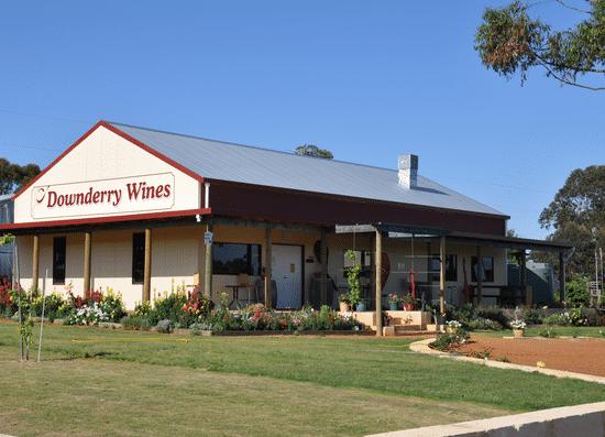
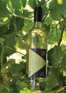
When owners Rex and Jan Hayes purchased the property in 1998, they were determined to realise their dream of owning a vineyard in their pursuit to create the perfect drop.
The industrious couple transformed the working farm into a vineyard with plantings of Muscat, Zinfandel, Shiraz, Semillon, Fiano, Chenin Blanc, Cabernet Sauvignon, Tempranillo and Sagrantino. The Shiraz is particularly suited to the warmer conditions experienced in the Wheatbelt, with its 2015 Shiraz being awarded WA’s Best Red Table Wine.
“When we purchased the land, a vineyard seemed an ideal location with its north-facing aspect and fertile soils,” says Rex. “Minimal chemical usage is undertaken in our vineyard, allowing the natural flavours and characteristics of our wines to prevail.”
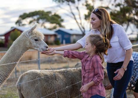
The cellar door’s verandah allows visitors to bask in the quiet surrounds whilst satisfying their taste buds with a wine and a cheese platter. Afterwards, visitors can feed the alpacas, sheep, and cattle.
Caravanners or campers can stay onsite for up to three-days for a small fee.
FARM STAYS
Quiet your mind as you stay a while at secluded properties situated on expansive paddocks in this special part of Western Australia; blessed
An authentic, environmentally friendly, rural experience with modern comfort. Ranked number 1 in the region and the ideal base to visit nearby award winning Cambinata Yabbies plus iconic Wave Rock & Lake Dumbleyung.
• Accommodation includes eight 1 bedroom apartments and 2 bedroom cottages plus motel units

• Breakfast and dinner baskets on request
• Uninterrupted farm views from every room with private facilities and air-conditioning.
3645 Dumbleyung Lake Grace Rd, Kukerin WA 6352 Phone: 0437 341 679
www.marysfarmcottages.com.au
See Australia’s Largest Yabby Farm

One hour from famous Wave Rock or visit Cambinata Yabbies enroute to Albany or Esperance.
• Jars of gourmet yabby tails and abalone available for purchase.
• Lunch or dinner with fresh cooked yabbies available for groups by appointment if staying at Mary’s Farm Cottages.
Phone: +61 8 9864 6054
www.cambinatayabbies.com.au
4208-10 Dumbleyung -
Lake Grace Road, Kukerin, WA
| The Wheatbelt | 35
australiasgoldenoutback.com
Walkers Hill
with ancient granite rocks, bushland exploding with wildflowers during spring, and glittering starry night skies.
If fresh produce in a picturesque location is the sort of experience you envision for your outback travels, Mary’s Farm Cottages and Cambinata Yabbies in North Kukerin delivers on both.
Watch the sun’s graceful decline over the paddocks on this eco-friendly and completely off-grid property. See the beehives and sample some of the local honeys and dukkahs. Inspect the farm machinery, shearing shed and local Aboriginal artworks, or wander out yonder to the Cambinata Yabbies farm where the kangaroos are grazing. View the abundant birdlife and surrounding bush that is filled with magnificent wildflowers from July to December.
If you can round up a big group, gather 20+ people for a get-together in the shearing shed, complete with freshly caught yabby meals.
The Nenke family offer a choice of accommodation, from a one-bedroom apartment, two-bedroom cottage or three-bedroom farmhouse. Fire up the barbecue that’s located under the bonnet of an old Austin truck while the children enjoy the play equipment. The verandahs offer some welcome respite for star gazing at the end of a day’s exploration in the region.
Nulla Nulla Farm Retreat is another farm stay experience that is well
worth investigating while journeying the Wheatbelt.
Visitors can expect a warm country welcome from Ron and Laura Goodhill at this farm retreat and wildlife sanctuary, located seven kilometres south of Moorine Rock.
Pack a picnic of local produce and connect with the surrounding 600-acres of ancient granite rock and pristine bush, where you can observe a bounty of native flora and fauna. Explore the old farm machinery, feed the farm animals, or tour the Yilgarn Shire with its rich mixture of mining and agricultural history.
“There are plenty of easy walk trails to explore the amazing array of wildflowers that blanket the surrounding bushland,” says Ron Goodhill. “You’ll always find a quiet place for contemplation.”
What makes this place so unique is its Parnana Pikurtu Wildlife Sanctuary Guests can embark on an educational experience at the sanctuary and assist in the care of the injured and orphaned animals.
This farmstay offers accommodation in either a three-bedroom farmhouse or a tent that sleeps four comfortably. Observe the brilliantly clear starry sky from around the campfire at night.
If you’re looking for a feed, the local hotel serves meals and is easily accessible, only five-minutes away from the farm.
Perched atop a hill on the outskirts of Narrogin is Chuckem Farmstay, a delightfully comfortable and wellappointed home with breathtaking views over the fields.
Chuckem is an Aboriginal word that takes its namesake from the winter creek that meanders through the property. Relax in comfort and enjoy the peace and tranquillity of the surrounding countryside.
Expect a warm welcome from hosts Christine and Bob Wiese, who offer a choice of accommodation at this stylish three-bedroom farmstay that sleeps up to six people. Each bedroom has
36 | The Wheatbelt | australiasgoldenoutback.com
Mary’s Farm Cottages
Mary’s Farm Cottages
an ensuite or private bathroom and the dining and lounge room is ideal for a relaxing finish to the day with a comforting book.
This working farm produces merino sheep and a variety of grains local to the Wheatbelt region such as canola, barley, oats and lupins.
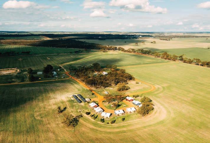
Observe the seasonal farm activities such as shearing, cropping and harvesting. Feed the farm animals, enjoy the abundant and colourful bird life and the exquisite wildflowers in spring.
Take a picnic lunch to one of many picturesque locations on the farm, or fish for yabbies at one of its dams. Wander around the farm and discover the old stone cottage built by the Pustkuchen family that to this day remains unfinished.
If you’re seeking a more modern experience that doesn’t skimp out on the animal life, Mains Guest House in Corrigin is one to consider.
On the journey towards Wave Rock or along many a wildflower discovery trail, stopover at Mains Guest House and wander around the small farm, pick
fresh fruit, and feed the animals. There’s sheep, alpacas, rescued kangaroos, goats and poultry, as well as a vast selection of inquisitive native birds.
Owner Carly Kenny says the best thing about living and working in the outback is the constant fresh air and ability to connect with nature daily.
“I love the lifestyle and freedom of living in the bush,” says Carly.
“I enjoy the sunrises with my morning
coffee and sunsets in the evening with a beer or glass of wine.”
Stay a while and, just like Carly, watch the sun as it sets over the nearby Corrigin Rock or bask in its spectacular morning rays over the eastern horizon. The clear, blue skies and star-filled nights guarantee a relaxing evening by the fire pit after a day of exploration in this colourful region.
• Self-contained with up to 3 spacious queen rooms
• Luxurious bathroom with bath & separate rain shower
• Kitchenette with fridge, microwave & coffee pod machine
• BBQ on verandah overlooking farmland
• 2 minute drive to the Corrigin Hotel and local Cafes
• Basket breakfast with homemade bread and jam available on request
www.themainsguesthouse.com.au

australiasgoldenoutback.com | The Wheatbelt | 37
A perfect base when exploring the Pathways to Wave Rock searching for wild flowers or overnight stop on the Public Silo Trail. Suitable for singles, couples or families. Relax and enjoy our clear blue skies, star-filled nights and feeding our friendly farm animals.
• 6005 Bruce Rock-Corrigin Rd, Corrigin WA 637 • T: 0427 772 323
Mary’s Farm Cottages
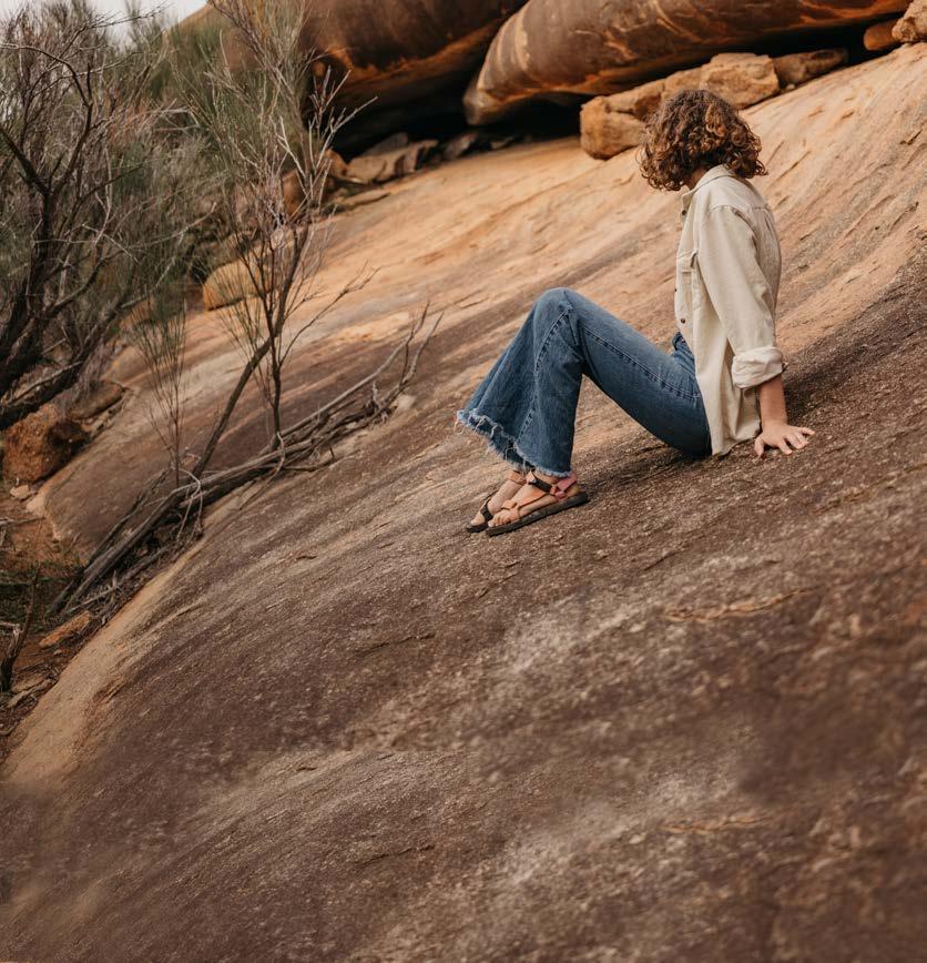
38 | The Wheatbelt | australiasgoldenoutback.com Boorabbin NP Goldfields Woodlands NP Jilbadji Nature Reserve Fitzgerald River NP Stokes NP Lake Magenta NR Lake King NR Frank Hann NP LEGEND Sealed road Unsealed road ROAD TRIPS Public Silo Trail Golden Pipeline Heritage Trail Granite & Woodlands Discovery Trail Wheatbelt Way Wildflower Way Pathways to Wave Rock The Holland Way & The John Holland Track Wineries, Woodlands & Wheatbelt Trail Northern Wheatbelt Wonders Pioneers’ Pathway KALGOORLIE-BOULDER Northam Wave Rock 95km PERTH Merredin Narembeen Hyden Newdegate Lake King Ravensthorpe Esperance Hopetoun Pingrup Albany Ongerup Cranbrook Tambellup Katanning Wagin Arthur River Williams Narrogin Mount Barker Southern Cross Coolgardie Norseman The CampgroundBreakaways Bonnie Rock Beacon Warralakin Westonia Mukinbudin Koorda Dowerin Wyalkatchem Trayning Bencubbin GERALDTON Mullewa Wilroy Tardun Canna Gutha Morawa Perenjori Latham Bunjil Wubin Dalwallinu Moora Coomberdale Coorow Marchagee Carnamah Arrino Mingenew Gingin Lake Grace Kulin Kondinin Corrigin Brookton Quairading York Broomehill Bruce Rock Bunbury Busselton Mandurah Rockingham Augusta Boyup Brook Manjimup Bremer Bay Jurien Bay Lancelin Yanchep Paynes Find Dongara 4WDONLY Lake Johnston Campground McDermid Rock 109km 187km 38km 49km 68km 77km 138km 90km 91km 63km 72km 155km 49km 187km 71km 58km 50km 54km 30km 37km 164km 98km 198km 51km 41km 112km 93km 98km 334km 56km 45km 55km 99km 84km 40km 49km 44km 132km 65km 107km 81km 78km 59km 153km 99km 56km 107km Pingelly Wandering Wickepin 56km Calingiri Wongan Hills Bindoon New Norcia 91km 57km Toodyay Nungarin Western Wildflower Farm Kellerberrin Tammin Cunderdin Road Trips THE WHEATBELT
THE HOLLAND WAY AND THE JOHN HOLLAND TRACK
3 days | Sealed and unsealed roads
Shires on your journey: BroomehillTambellup, Kent, Lake Grace, Kondinin, Coolgardie
Journey along the Holland Way before connecting up with the more adventurous John Holland Track, created by pioneer John Holland in 1893 as a shortcut to the Goldfields in this adventurous outback route.
The Holland Way connects Broomehill in the Southern Wheatbelt to Coolgardie in the Goldfields and consists of mainly bitumen roads and good surface gravel roads.
The John Holland Track also starts in Broomehill, but from the Hyden/ Norseman Road north it follows a different route that is a proper adventure accessible only by high clearance 4WD. There are no facilities, so you’ll need to be gloriously self-sufficient!
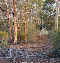
Both options offer an amazing drive through gorgeous countryside, beautiful salt lakes, granite outcrops, rock formations and nature reserves. There are lots of great camping spots but come prepared as much of this track is remote. The trail’s better known camps
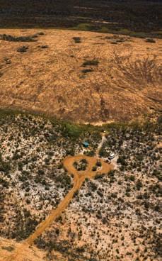
are Holland Track Farm, Wattle Rocks, Sandalwood Rocks, Centenary Rocks, Mt Holland and Thursday Rock.


PATHWAYS TO WAVE ROCK
3 days | Sealed roads
Shires on your journey: York, Quairading, Bruce Rock, Narembeen, Kondinin, Lake Grace, Kulin, Corrigin, Brookton
Make your road trip to the iconic Wave Rock a journey of real discovery.
This drive is best done over three days and will take you through the changing landscapes and charming farming communities of the Western Australian Wheatbelt. Choose your options from the various pathways linking the several shires and always plan to stop at welcoming rural towns to enjoy some proper country hospitality.
Route highlights include Kokerbin Rock, the Grain Discovery Centre, the wonderfully creative Tin Horse Highway at Kulin, Lake Grace (visit the outback winery) and of course, Wave Rock.
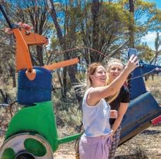
The trail is punctuated with massive granite outcrops perfect for hiking and taking in some spectacular views. You’ll see natural bushland, expansive yellow canola fields and in spring, amazing displays of vibrant wildflowers and rare orchids. There are lots of places to camp out underneath a chandelier of stars and enjoy the space and serenity.
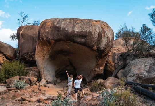
australiasgoldenoutback.com | The Wheatbelt | 39
Hyden/Norseman Road Hippo’s Yawn
Tin Horse Highway
John Holland Track
PUBLIC SILO TRAIL
5 days | Sealed roads
Shires on your journey: Northam, Merredin, Narembeen, Lake Grace, Ravensthorpe, Esperance, Gnowangerup, Kent, Plantagenet, Cranbrook, Broomehill-Tambellup, Katanning, Wagin, West Arthur, Williams
Discover stunning outdoor artworks — visible for miles — on silos, street walls and transformer boxes celebrating the people and stories of the Wheatbelt and Great Southern regions.
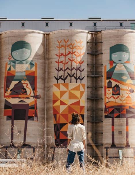
The PUBLIC Silo Trail is an open-air art gallery stretching from Northam to Albany. Wind your way through gorgeous Wheatbelt country towns like Merredin, bright with yellow canola fields and wildflowers in spring. Pause at pretty picnic spots and discover nature walks as you travel. Go via Hyden and see the famous Wave Rock before heading south to
Newdegate where Perth muralist Brenton See has painted the area’s local wildlife on an epic scale. The Western Bearded Lizard, Mallee Fowl, Thigh Spotted Tree Frog and a Redtailed Phascogale are depicted across four silos.
As you leave the countryside behind, you’ll head towards the beautiful and expansive coastline of South West WA.
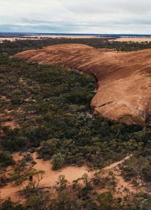
Enjoy some time in quaint Hopetoun and be sure to explore the Fitzgerald River National Park, a stunningly beautiful yet rugged area with many walk trails, camping spots and picnic places. Continue along the coast to Albany, home to the ANZAC Centre and amazing whale watching opportunities in season. On the return, head back inland towards the charming farming towns of Katanning and Pingrup, taking in those wide landscapes and open skies. At each site, read about the artists and the stories of the silo towns they’ve shared in their stunning works of art.
WHEATBELT WAY
4 days | Sealed roads
Shires on your journey: Dowerin, Trayning, Koorda, Mt Marshall, Mukinbudin, Westonia, Wyalkatchem


Follow the bright skies and big horizons along the Northern Wheatbelt on a star-gazing, bird watching road trip that delivers all the history and charm of this laidback region. Be sure to check on upcoming events and weave these cultural gems into your plans, too.
The Wheatbelt Way takes you from cute country towns like Dowerin, Koorda and Beacon through to the Hood-Penn museum at historic Westonia and onto charming places like Bencubbin, Mukinbudin and Westonia where you’ll find towering granite outcrops perfect for exploring. Highlights include Wyalkatchem CBH Museum, Nungarin Markets and Mangowine Homestead.
Throughout this self-drive route you’ll be treated to stunning natural surrounds, sites of historical significance, and the laidback country atmosphere of the Wheatbelt. There are lots of campsites along the trail as well as walk trails and pretty picnic spots.
40 | The Wheatbelt | australiasgoldenoutback.com
OTHER ROAD TRIPS TO EXPLORE
Golden Pipeline Heritage Trail | 3 days (sealed road)
Granite & Woodlands Discovery Trail | 2 days (unsealed road)
Wildflower Way | 3 days (sealed road)
Wineries, Woodlands & Wheatbelt Trail | 3 days (sealed road)
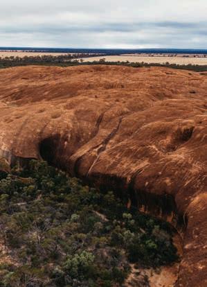
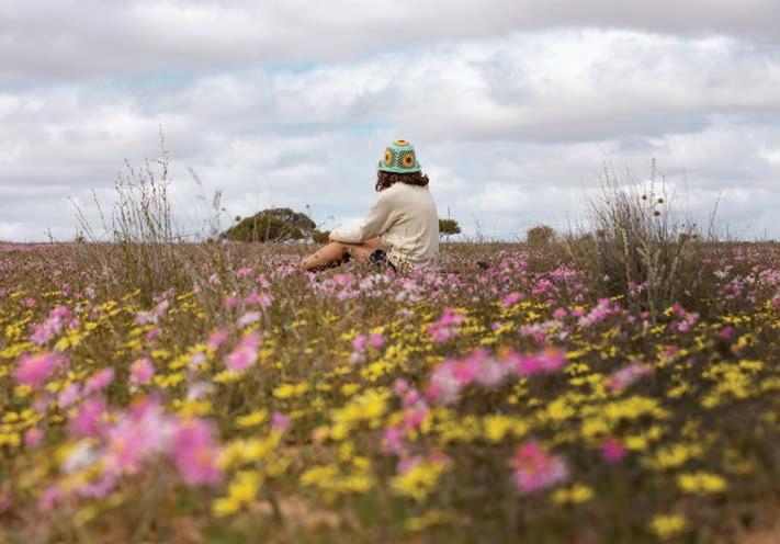
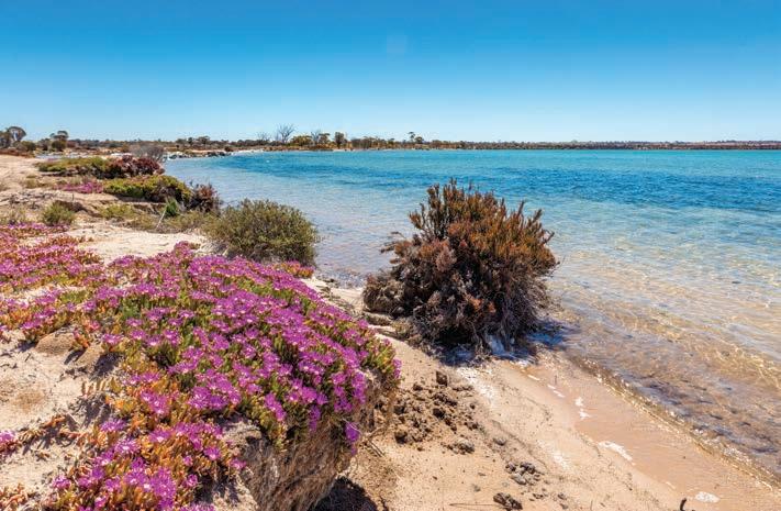
Northern Wheatbelt Wonders | 3 days (sealed road)
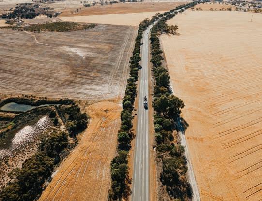
Scan the QR code for more insights.

australiasgoldenoutback.com | The Wheatbelt | 41
Elachbutting Rock
Wildflowers Perenjori
Golden Pipeline Heritage Trail
Which path will you take?
Make your journey to Wave Rock an experience to remember. Enjoy country hospitality, natural bushland with wildflowers in season, spectacular night skies and immerse yourself in an agricultural experience.

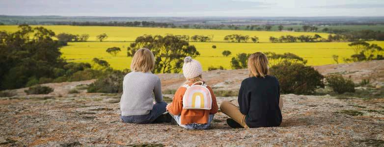
Duration: 4-5 Days | Distance: 847km | Road Conditions: Sealed
Your Wheatbelt experience begins when you leave Perth on the Brookton Highway, travelling 225km to Corrigin, where you can visit the iconic Dog Cemetery, enjoy the beauty of wildflowers in spring and wander through the Pioneer Museum.
Continue 49km onto Kondinin, taking in the beautiful fauna and flora along the way. Stop and stroll through the community garden and view the creative artworks. Walk the Yeerakine Rock trail to the unique ANZAC light horseman statue, before travelling 27km south towards Kulin, home of the famous Tin Horse Highway, a fun and entertaining drive showcasing imaginative community creations. The Kulin Visitor Discovery Zone gives visitors a sense of the region’s history and identity.
Travel 73km south west to view the mighty salt lake at Lake Grace with its changing colours and take in the atmosphere of an early 20th century hospital, when you visit the only remaining Australian Inland Mission Hospital in the state. A friendly welcome awaits you at the Lake Grace Visitor Centre. Extend your journey and visit Newdegate, along the FORM Public Silo Trail.
Continue northwards to the town of Hyden, with excellent overnight accommodation, dining and bright starry nights. Spend the following day exploring the internationally famous Wave Rock and surrounding attractions, before continuing 93km on the Mt Walker Road, with its colourful wildflowers, towards Narembeen.
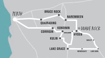

Learn all about farming at the modern, interpretive Grain Discovery Centre, giving an insight into past and present in this typical Wheatbelt town.


Travel 39km to Bruce Rock, with its Amphitheatre and Sculpture Park, Memorials to servicemen and fabulous aquatic centre for summer fun. Continue 48km to Kokerbin Rock, a massive monolith with incredible views and a great nature spot. Drive 39kms to Quairading, check out ‘El Toro’, a life-size spanish bull sculpture in the centre of town and explore the amazing Nature Reserve and Nookaminnie Rock, great for wildflower spotting and watching the Wheatbelt’s breathtaking sunsets. Take a leisurely trip back to Perth via the historic town of York.
Free Visitor Guide & Map


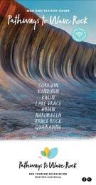
For a memorable visit, pick up a copy of the ‘Pathways to Wave Rock’ Map and Visitor Guide to take along on your journey. Available from Visitor Centres or online at www.pathwaystowaverock.com.au or email roetourism@outlook.com pathwaystowaverock.com.au
Tag your photos #pathwaystowaverock
 Images by Angie Roe Photography
Shire of BRUCE ROCK
At a Glance
WHAT’S ON
Bruce Rock and Districts Agricultural Show — Sept 2023
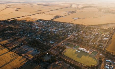
Back to the Bush Veterans Reunion — Nov 2023
TOP ATTRACTIONS
Bruce Rock Remembrance Park / Kokerbin Rock & Kwolyin Free Camp Site / Bruce Rock Museum & Machinery Museum / Centenary Mosaic Pathway / ‘Australia’s Smallest Bank’
WILDFLOWERS TO DISCOVER
The Underground Orchid / Everlastings / Spider Orchids / Isopogons / Tinsel Flowers
BRUCE ROCK
240km east of Perth
Bruce Rock has several iconic places to visit, including Bruce’s Rock, Kokerbin Rock, Shackleton Lakes and the Ardath Hotel. Bruce Rock provides an excellent base with ample parking and rest areas running the length of the main street, making it easy to explore the surrounding regions, both within the shire and further throughout the Central Wheatbelt region.
Bruce Rock
Named after sandalwooder John Rufus Bruce, who used the outcrop as his depot in 1869, Bruce Rock is a must-visit landmark when stopping through the town. There are two old wells located at the picnic site at the foot of the rock and good walks are to be enjoyed over the rock outcrop, with stunning wildflower displays in spring.
Kokerbin
Rock
Covering 9ha and rising 122m above the ground, Kokerbin Rock is Australia’s third largest monolith. Situated 40 kilometres north-west of Bruce Rock, it is a great place for a hike and a picnic with barbecue and toilet facilities.
Bruce Rock Remembrance Park
Located in the main street, this park pays tribute to the men and women who served and continue to serve Australia in military conflicts and peacekeeping
operations across the globe. Eight sculptures of the theme ‘war and peace’ feature throughout the park, with the highlight being the replica Peace Window from the Bruce Rock St Peters Anglican Church.
Centennial Mosaic Pathway
The Mosaic Pathway was commissioned in 2013 to commemorate the town’s centennial. Comprising of 417 mosaics, the pathway celebrates the Shire of Bruce Rock’s early settlers, community members, local businesses and sporting clubs.
Bruce
Located on Johnson Street, in Bruce Rock Museum you will find an original one schoolhouse, a replica mud brick
settler’s cottage, and a replica early shearing shed and workshop. The Machinery Museum is across the street from the main museum and houses working farm machinery, vintage cars and a steam traction engine, all of which were once in use within the shire.
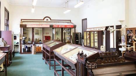
australiasgoldenoutback.com | The Wheatbelt | 43
BRUCE ROCK VISITOR INFORMATION CENTRE
42 Johnson Street
Bruce Rock (08) 9061 1687 roctel@wn.com.au brucerock.wa.gov.au
Rock Museum and Machinery Museum
Bruce Rock Townsite
Bruce Rock Museum & Machinery Museum
Shire of CUNDERDIN
At a Glance
WHAT’S ON Australia Day Celebrations — 26 Jan 2023
Cunderdin Hot Rod Show — late Oct 2023
TOP ATTRACTIONS
Meckering Memorial Rose Garden / Meckering Earthquake trail / Cunderdin Museum / Ettamogah Pub / Cunderdin Hill Lookout
WILDFLOWERS TO DISCOVER
Everlastings / Dandelions / Orchids / Blue Pincushions CUNDERDIN
158km east of Perth
In the heart of the spectacular Wheatbelt is Cunderdin, a major town situated on the Great Eastern Highway approximately a two-hour drive from Perth. The town was settled and evolved into the Wheatbelt centre it is today due to the development of the Coolgardie/ Kalgoorlie Goldfields railway in 1894 and the Goldfields water supply pipeline in 1901. While in town, explore some of Cunderdin’s main attractions…
Cunderdin Museum
Explore this central attraction showcasing historic machinery and memorabilia, Aboriginal district culture, the agricultural industry, railways, the Cunderdin training aircraft from World War II, a Meckering earthquake simulator and much more.
Cunderdin Hill Lookout
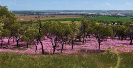
When visiting the Cunderdin Hill (1km south of the main street), you’ll be greeted by 360-degree panoramic views of the town and surrounding farmland.
Ettamogah Pub
This is one landmark you certainly won’t miss when you visit Cunderdin. The brightly coloured and rather distinctive Ettamogah Pub is based on the wellknown comics of Ken Maynard – made famous by the Australian Post magazine.
Bulgin Rock Reserve
Bulgin Rock, located off Burges Road, is the perfect place to absorb the rolling landscape and observe an array of wildflowers.
Youndegin
At Youndegin (19km south of Cunderdin along the Cunderdin-Quairading Road, and left onto Goldfields Road), you’ll find the original police outpost still standing, built in the 1880s from stone and mud with a thatched roof.
MECKERING 132km east of Perth
The name Meckering originates from a local Aboriginal language meaning ‘place of water’ or ‘moon on water’. The town formerly called Beebering was established in 1887 then renamed Meckering in 1897. Today, Meckering is probably best known for the devastating earthquake in October 1968 with many of the places of interest relating to this event. Discover some of the town’s highlights…
Meckering Earthquake Gazebo and Memorial Rose Garden
Explore the devastation of the 1968 Meckering earthquake first-hand at this impressive display, which includes a section of the damaged railway line, a mangled piece of the Golden Pipeline, photographs, statistics and information. Take a stroll across the road to the beautiful Memorial Rose Garden – a tribute to the dedication and hard work of many local volunteers.
Meckering Earthquake Walk Trail
Visitors can view images, descriptions and footprints of the former Meckering Main Street businesses and public buildings through a trail of interpretative signage. View the preserved fault line 12km south of Meckering on York–Meckering Road.
CUNDERDIN TOURIST CENTRE 100 Forrest Street Cunderdin (08) 9365 1291
cunderdin.wa.gov.au
Meckering Earthquake Farm Ruins
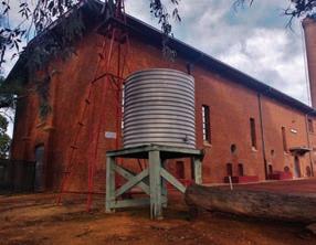
‘Salisbury’ - an old stone homestead built in 1904 - was flattened during the quake. The ruins give an eerie insight into the scale of the devastation experienced (2km north of Meckering, turn off Meckering to Goomalling Road).
The Big Camera – Museum of Photography
It is impossible to miss this unique building on the Great Eastern Highway. An amazing history of photography is on display including a wonderful collection of earthquake images.
44 | The Wheatbelt | australiasgoldenoutback.com
Cunderdin Museum
Everlastings on Cunderdin Hill
Image: Nicole Taylor
Image: Nicole Taylor
Shire of DALWALLINU
At a Glance
WHAT’S ON
Australia Day Celebrations — 26 Jan 2023
ANZAC Day Service — 25 April 2023
Wattle Week — Sept 2023
Dalwallinu Arts Festival — Sept 2023
Christmas Street Party — Dec 2023
TOP ATTRACTIONS
Petrudor Reserve / Buntine Rocks / Xantippe Tank & Reserve / Cailbro
Mudbrick School / Wubin Wheatbelt Museum
WILDFLOWERS TO DISCOVER
DALWALLINU
253km north of Perth
Dalwallinu is a vibrant shire located 253km north of Perth and covering 7,235km2 of predominantly agricultural land. The five towns in the shire are Buntine, Dalwallinu, Kalannie, Pithara and Wubin. Located on the Wildflower Way, with a great range of services and accommodation, Dalwallinu is an ideal base from which to explore the region’s prolific wildflowers from late winter to spring. Discover some of the main attractions while in town…
Dalwallinu Discovery Centre
The impressive Dalwallinu Discovery Centre houses the Public Library, Community Resource Centre, visitor information and environmental displays. Open weekdays 8.30am to 4.30pm and weekends during wildflower season.
McIntosh Park
Located 14km south of Dalwallinu in the town of Pithara, McIntosh Park was the site of the first fatal commercial plane crash in WA and is home to Pithara Speedway.
Petrudor Rocks
An attractive reserve 45km south east of Dalwallinu with fabulous wildflowers and natural water pools that cascade following winter rains.
Xantippe Tank & Reserve
Constructed in the 1920s to capture water run-off from the granite outcrop
and located 33km east of Dalwallinu, the tank and reserve are a hotspot for orchids and bush flowers.
Rabbit Proof Fence and Boundary
Rider’s Waterhole
Situated on Rabbit Proof Fence Road, sections of the No. 2 Rabbit-Proof Fence are still visible, as is one of the original water holes blasted for the Boundary Rider who maintained the fence.
Miamoon Reserve
Located 27km north east of Dalwallinu, Miamoon is a hotspot for wildflowers and has a gnamma hole in the granite outcrop.
WUBIN
270km north of Perth
Wubin is the ‘gateway to the north’ and the magnificent seasonal display of wildflowers in the area. Discover places of interest when stopping through…
Wubin Wheatbin Museum
The heritage-listed Wheatbin Museum depicts the history of agriculture through
Wattle / Wreath Leschenaultia / Everlastings / Orchids (Spider, Donkey, Ant, Blue Fairy, Pink Candy) / Fringed Lilies
DALWALLINU DISCOVERY CENTRE 53 Johnston Street
Dalwallinu (08) 9661 1805
shire@dalwallinu.wa.gov.au
photos, models and artefacts. It houses a motor vehicle and machinery annexe and an extensive rock and mineral collection. The museum also tells the story of Gustav Liebe, who after a distinguished career as a master builder in Perth (His Majesty’s Theatre; Maylands Peninsula Hotel), successfully turned his hand to farming in the region.
Buntine Rock
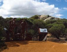
A granite outcrop and nature reserve located 3km east of Buntine, Buntine Rock offers a magnificent view of farmland from the top and is an inviting place to find wildflowers.
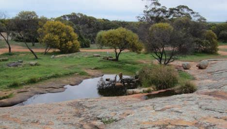
Jibberding Reserve
Located on the Great Northern Highway 25km from Wubin, Jibberding Reserve has pretty displays of white, pink and yellow everlastings.
Cailbro Mudbrick School
This restored one room school located 33km from Wubin features a local history display.
australiasgoldenoutback.com | The Wheatbelt | 45
Petrudor Rocks
Buntine Rocks
Shire of DOWERIN
At a Glance
WHAT’S ON Dowerin GWN7 Machinery Field Days — 30-31 Aug 2023

TOP ATTRACTIONS
Rusty & Rosey / Tin Dog Walk Trail / Minnivale / Namelcatchem Well / Dowerin Museum
WILDFLOWERS TO DISCOVER
Donkey Orchid / Bunny Orchid / Leek Orchid / Spider Orchid
DOWERIN COMMUNITY RESOURCE CENTRE
DOWERIN 156km north-east of Perth
The name Dowerin is derived from the Aboriginal word “Daren” given to a series of lakes found 10km south of town. It was originally established as a watering hole and resting place for prospectors and travellers on their way to the goldfields. Dowerin is a two-hour drive from Perth, located along the Wheatbelt Way and Pioneers’ Pathway self-drive trails. Dowerin is a welcoming and wellserviced country town. Explore its main attractions...
Rusty & Rosey
When in town, be sure to say ‘hi’ to ‘Rusty’ and ‘Rosey’, the iconic, large tinsculpture dogs Rusty is located to the west entrance of town and was a project designed by local school students in 2004. Rosey is located along Stewart Street and its paw directs visitors to the Dowerin Visitors Centre. Rosey acknowledges the pioneering women who were integral in the development of Dowerin.
The inspiration for Rusty came from the Tin Dog Creek, which you can observe on the Tin Dog Creek Walk Trail through native bushland. Along the walk trail discover the Dowerin Bird Hide, home to a variety of birds.
Dowerin and Districts Museum
For a peek back in time, visit the Dowerin and Districts Museum (by appointment
only through the shire). The Dowerin District Museum is a genuine cottage, containing various artefacts from around the district and was built in 1915 by Eugene O’Shaughnessy.
Minnivale
The old town Minnivale will also showcase life once upon a time. Its importance was lost as rail was replaced by roads and now, Minnivale boasts the old general store, still displaying advertisements from times gone by, the picturesque church, cemetery, and the old baker’s oven.
Located in Minnivale is the Wheatbelt Heritage Rail Discovery Centre. Housed within a 1964 Type B wheatbin is a collection of carriages dating from early in the 20th century. Climb aboard passenger carriages, read the history of the district, along with the early days
13 Stewart Street, Dowerin (08) 9631 1662

dowerin@crc.net.au
of the wheat industry (by appointment only through the shire).
Namelcatchem Well
Namelcatchem Well is located within a 600-acre reserve, 17km east of Dowerin. Built in 1865, it is the earliest European built structure in the area. The well was used to provide water to miners and travellers, later for horse teams carting wheat to Minnivale.
The Rabbit Proof Fence No.2
Runs north to south through the east, this fence was built in 1907-1908 and designed to control the rabbit plague. Much of it remains in good condition.
Dowerin Short Stay
Accommodation & Caravan Park
A hidden gem in the Wheatbelt with quality, comfortable accommodation for business and leisure travellers, located a short stroll to local amenities and attractions.
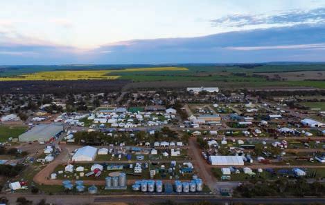
• One bedroom self contained units with full kitchen

• Studio rooms with kitchenette, 1 with disabled access
• Powered caravan/camper sites with hardstand
• Sites for caravans/campers who are self-sufficient
• Grassed tent sites with power
• Modern ablutions & laundry facilities
• Camp kitchen & alfresco dining area
Located on Fraser Street, Dowerin
T: (08) 9631 1202 (M-F 8.30-4pm) 0429 311 202 A/H
E: dowshire@dowerin.wa.gov.au
W: www.dowerinaccommodation.com.au
The Wheatbelt | australiasgoldenoutback.com
46
|
Dowerin Townsite
Shire of DUMBLEYUNG
At a Glance
WHAT’S ON Taste of Dumbleyung
Kukerin Creekbed Burnouts
— Please refer to the Shire of Dumbleyung website for event dates
TOP ATTRACTIONS
Lake Dumbleyung / Donald Campbell interpretation centre at Dumbleyung
CRC / Dumbleyung Mainstreet Bluebird Replica / Tarin Rock / Cooks Vintage Car Collection
WILDFLOWERS TO DISCOVER
DUMBLEYUNG
267km south-east of Perth
While in Dumbleyung, discover some of the town’s main attractions...
The Bluebird Precinct
Visit The Bluebird Precinct to discover the incredible story of how Donald Campbell made history on Lake Dumbleyung in 1964 by breaking both land and water speed records in one year – a feat that has never been achieved before or since.
Lake Dumbleyung
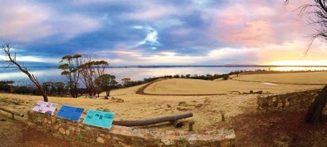
Lake Dumbleyung is the largest open lake in WA’s southwest at 13km in length and 6.5km wide. It may very well be the reason the ‘Dumbleyung’ town name exists, thought to be derived from the Aboriginal word ‘Dambeling’ meaning large lake or sea. Experience the natural beauty of a sunset or sunrise at Pussy Cat Hill Lookout, take a picnic or venture down to the lake shore to walk, paddle or boat depending on varying water levels.
Culture and Farm Tours
Visit the Wuddi Aboriginal Cultural Centre and book your Bushfood Garden Experience or On Country Bus Tours including ‘Lake Dumbleyung & Significant Sites’ and the ‘Emu & Djilgi Dreaming’, with short and full-length tours available.
Wildflowers and Reserves
Explore our reserves and discover wildflowers at Tarin Rock, Lakeview
Golf Club and Bicentennial Park as well as keeping your eyes peeled as you traverse our shire roads. If you look closely, you will find different blooms all year.
Shopping
Enjoy some retail therapy at the Dumbleyung Mini Mall, demonstrating a modern approach to retail. The precinct is an intimate and ever-evolving space, incubating more than six small businesses and filled to the brim with homewares, clothing, art, local produce, books, eco products and so much more!
KUKERIN 316km south-east of Perth
Further south-east you will find Kukerin, where immersive farm experiences are a feature. Visit Cambinata Yabbies, which will guide you through its yabby processing facility and on request can
Greenhood Orchid / Yellow Acacia / Hibbertia / Synaphaea / White Leucopogon / Cryptandra
SHIRE OF DUMBLEYUNG
Harvey Street, Dumbleyung (08) 9863 4012
visitdumbleyungshire.com
DUMBLEYUNG CRC
28 Absolon Street, Dumbleyung (08) 9863 4829
dumbleyungcrc.com
show you other aspects of their farming operation including cropping, livestock, and bees. At Emu Essence Farm you can get up close and personal with the flock and even join an emu egg hunt during laying season.
Be sure to visit Kukerin’s free Bouncing Pillow, it’s great fun for the whole family!
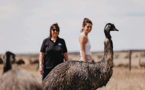
australiasgoldenoutback.com | The Wheatbelt | 47
Emu Essence Farm
Lake Dumbleyung
Shire of KONDININ
At a Glance
WHAT’S ON Yeerakine Rock Anzac Dawn Service — 25 April 2023
Wave Rock Weekender — 22 -25 Sept 2023
Kondinin Art Show — Oct 2023
TOP ATTRACTIONS
Wave Rock / Hippo Yawn, Mulkas Cave & Humps / Yeerakine Rock / Statue Lake (Kondinin)
WILDFLOWERS TO DISCOVER
Spider Orchid / Donkey Orchid / Ant/ Man/Clown/Jack-in-the-box Orchid
Situated in the heart of WA’s Golden Outback, the Shire of Kondinin is located 273km east of Perth. The Shire of Kondinin consists of three towns namely Kondinin, Karlgarin and Hyden. The shire is encircled by fertile agricultural plains, dramatic granite monoliths, spectacular woodlands and majestic salt lakes.
Filled with heritage shop fronts and museums, the towns are quintessentially Australian with friendly locals, rambling pubs and quirky country events. These include the Wave Rock Weekender (music festival), Kondinin’s Gourmet in the Garden and a variety of colourful country market days.
KONDININ 273km north-east of Perth
While travelling through Kondinin, make sure to stop in town and explore some of our great attractions such as our amazing ‘Art Trail’. Art Trail starts at Statues Lake (located 10km west of Kondinin on the Corrigin-Kondinin Road) finishing off at Yeerakine Rock (located 3km south of Kondinin via the WilliamsKondinin Road).
Glorious wildflowers can also be seen during August and October at Yeerakine Rock. Yeerakine Rock is the best spot to check out the wildflower along the walking trails.
KARLGARIN 326km south-east of Perth
Karlgarin is a small and proud Wheatbelt town, located 321 kilometres south-east of Perth in the eastern Wheatbelt region of Western Australia. The first European to visit the area was Surveyor-General John Septimus Roe who passed through in 1848. ‘Carlgarin’ was the original name Roe gave the district, now spelled with a K, and is said to come from the Noongar language. “Karl” is the Noongar word for fire.
Karlgarin has a lot of history and unique attractions, such as Stafford Park featuring old farm machinery, unique artwork and historic information about the Karlgarin district since 1920. There are many other attractions in Karlgarin such as the Malleefowl travel stop and McCann’s Rock, which is a great camping spot.
HYDEN 342km south-east of Perth
Hyden is bush living at its best! Situated 340km east of Perth WA, via the Brookton Highway. The earliest recorded farming was in 1922 and descendants of these settlers still live in Hyden. In Hyden you can find the iconic Wave Rock along with amazing rock formations, dazzling seasonal
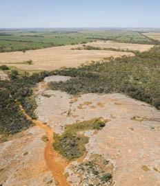
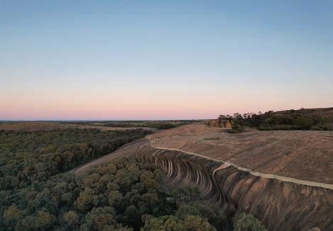
KONDININ TOURIST INFORMATION SHIRE OFFICE Gordon Street, Kondinin (08) 9889 1006 kondinin.wa.gov.au
HYDEN TOURIST INFORMATION CENTRE
Wave Rock Wildflower Shoppe, Wave Rock (08) 9880 5182 waverock.com.au
wildflowers and clear starry nights. Be sure to visit Wave Rock, Mulka’s Cave, Hippo’s Yawn, Lake Magic and the state Barrier Fence — all of the great geological and historical interest.
48 | The Wheatbelt | australiasgoldenoutback.com
Wave Rock
Yeerakine Rock
Wave Rock, not just a photo stop!
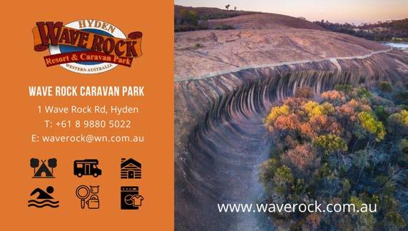
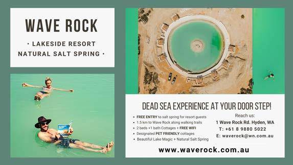
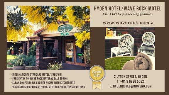
| The Gascoyne Murchison | 49
Shire of KOORDA
At a Glance
WHAT’S ON Koorda Drive In — Monthly Feb – Nov Koorda Show — 16 Sept 2023
TOP ATTRACTIONS
Mollerin Rock / Newcarlbeon Tank & Reserve / Koorda Museum / Koorda Motor Museum & Military Collection / Koorda Art Gallery
WILDFLOWERS TO DISCOVER
Koorda Rose / Everlastings / Feather Plant / Tinsel Bush / Variety of Orchids
SHIRE OF KOORDA
KOORDA
240km
north-east of Perth
Take the road less travelled to the Shire of Koorda and enjoy the peaceful atmosphere of this small country town. Catch a movie under the canopy of stars at the Koorda Drive In or take a serene stroll around one of the many nature reserves Koorda has to offer. Colourful flowering shrubs and wildflowers are a blaze of glory many months of the year.
Approximately three hours’ drive north-east of Perth and situated along the popular Wheatbelt Way self-drive trail, Koorda’s main industries include wheat, coarse grain and sheep farming. Koorda is famously referred to as ‘Corn Dolly Country’, attracting sightseers wanting to learn more about this ancient tradition of creating ‘dollies’ from stalks and husks of wheat. While in town, explore some of Koorda’s main attractions…
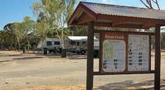
Koorda Drive In Theatre
The iconic Koorda Drive In Movie Theatre is one of only three left in WA, showing two new release movies at its monthly screenings. It’s a fantastic activity for making memories.
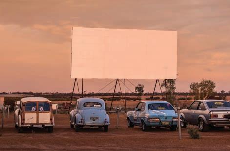
Museums
Koorda boasts two new museums. Koorda Museum draws on the building’s origins as a hospital in the years before World War II. It is worth a visit to view
the collection of antique medical and surgical equipment that was used in the former hospital ward. There is also a large display of early farming machinery and pioneer homestead artefacts. The Motor and Military Museum has an extensive private collection of motor and military memorabilia and a café where you can rest and have a cuppa.
Koorda Swimming Pool
The Koorda Swimming Pool consists of one large and two small swimming pools. Open from November to April, the facilities include a barbecue area and plenty of grassed shaded areas to enjoy.
Granite Outcrops and Wildflowers
For natural splendour, there’s a wealth of granite outcrops and wildflowers
10 Haig Street, Koorda (08) 9684 1219
koorda.wa.gov.au
KOORDA COMMUNITY RESOURCE CENTRE
Railway St, Koorda (08) 9684 1081
koorda.crc.net.au
to be discovered. Near to town you can find Mollerin Rock, Newcarlbeon, Badgerin Rock, Native Flora Reserve and Moningarin. These picturesque outcrops each have their own peculiar mini environment of magnificent wildflowers and native shrubs including the Koorda Rose, dozens of bird varieties and native animals including kangaroos and echidnas. Most have picnic and/or barbecue facilities.
Bookings: Shire of Koorda Office
10 Haig St, Koorda
T: (08) 9684 1219
32 Scott Street, Koorda
www.koorda.wa.gov.au
Eight brand new, two bedroom self contained units located within walking distance to the swimming pool and the town centre, including two universal access units.
Bookings: Shire of Koorda Office

10 Haig St, Koorda


T: (08) 9684 1219
28-30 Greenham Street, Koorda
www.koorda.wa.gov.au
50 | The The Wheatbelt | australiasgoldenoutback.com
Yalambee Units
Enjoy a relaxing stay with natural bush surrounds with your choice of a powered, unpowered or grassed tent sites. Facilities include campers’ kitchen, washing machine and dryer.
Koorda Caravan Park
Koorda Caravan Park
Yalambee Units
Koorda Drive In Theatre
Shire of KULIN
At a Glance
WHAT’S ON
Blazing Swan — 5 – 11 April 2023
Kulin Bush Races — Oct 2023
TOP ATTRACTIONS
Tin Horse Highway / Jilakin Rock and Lake / Buckley’s Breakaway/ Macrocarpa Trail / Visitor Discovery Zone
WILDFLOWERS TO DISCOVER
One-sided Bottle Brush / Plummed
Feather Flower / Candy Orchids / Guinea Flowers / Blue Squill
TOURIST INFORMATION
38 Johnston Street, Kulin (08) 9880 1021
KULIN

285km south-east of Perth
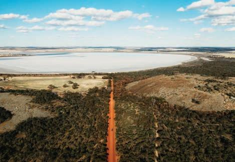
Famous for its quirky Tin Horse Highway drive, annual Bush Races event and giant waterslide, the vibrant Kulin region provides a true rural experience. Kulin is the perfect base to explore the eastern Wheatbelt and easy day trips can be made to many of the region’s unique and iconic sights, including Wave Rock. Experience some of Kulin’s main attractions during your stay…
Tin Horse Tourist Route & Highway
Make the most of your journey to Wave Rock on the fabulous 120km Tin Horse Tourist Route drive trail, which takes you to Wave Rock via Kulin and the famous Tin Horse Highway. Dubbed a ‘quirky open-air gallery’, the Tin Horse Highway’s famous collection of clever community art provides a seriously entertaining drive and is fast becoming a must-see for travellers across Australia.
Discovery Zone
Learn about Kulin at the Discovery Zone in town. The new zone along Kulin’s main street includes picnic facilities, public amenities, art works and interpretative signage, which tell of Kulin’s past, present and future. It also contains a free 72hour RV-friendly parking area for fully self-contained travellers.
Giant Water Slide and Aquatic Centre
To fill your day with summer fun, don’t miss regional Australia’s BIGGEST waterslide, located at the vibrant Kulin Aquatic Centre (open during summer months).
Jilakin
Lake and Rock
For stunning scenery, stop and admire the breathtaking views from the top of Jilakin Rock or enjoy a picnic under the most inland stand of jarrah trees found in the area.
Buckley’s Breakaway
Buckley’s Breakaway is another beautiful picnic spot and a photographer’s delight. This picturesque landform displays a contrast of vibrant orange clays against spectacular white cliffs and gullies.
crccounter@kulin.wa.gov.au visitkulin.com.au
australiasgoldenoutback.com | The Wheatbelt | 51
Jilakin Rock
Tin Horse Highway
Tin Horse Highway
Kulin Aquatic Centre and Slide
Shire of LAKE GRACE
At a Glance
WHAT’S ON
Winter Sports — April – Sept
Wildflower season — June – Dec
Newdegate Machinery Field Days — 6 - 7 Sept 2023
Market Day & Treasure Trail — last week in Oct or first week in Nov
Community events — ongoing
TOP ATTRACTIONS
Museums - Australian Inland Mission Hospital, Hainsworth Building, Bush Tractor Museum and Varley Museum / Silo Trail Art & Art exhibitions / Walk Trails – Jam Patch, Kwongan Heathland Walk, Lake Grace StoryTrail / Walker’s Hill Winery / Salt Lakes and lookouts
WILDFLOWERS TO DISCOVER
Cowslip Orchid / Rushtike Dampier / Painted Feather Flower / Granite Honey Myrtle / Yellow Feather Flower
LAKE GRACE
345km south-east of Perth
Lake Grace is a thriving rural town named after a shallow lake 10km west of the townsite. Lake Grace itself is one of Western Australia’s largest inland salt lakes and a nationally significant wetland, comprising two separate bodies of water – Lake Grace North and Lake Grace South.
Lake Grace has a diverse range of public artwork from the Story Trail nestled in the centre of town, to the detailed mural of pioneering women from the region. Visit the restored Stationmaster’s House now operating as the Lake Grace Visitor Centre and right next door is the Lake Grace Regional Artspace featuring exhibitions from local artists, travelling exhibitions and artists in residence. Sample wines from a local winery Walkers Hill Vineyard, located 8km north of Lake Grace and stop by the stunning nature reserve, the Jam Patch.
NEWDEGATE 397km south-east of Perth
‘Gateway to the Holland Track.’ Follow the traces of John Holland’s 1893 epic
journey when he and his partners cut the now famous Holland Track. Explore salt lakes along the ancient river systems and immerse yourself in the natural beauty of Dragon Rock Reserve.
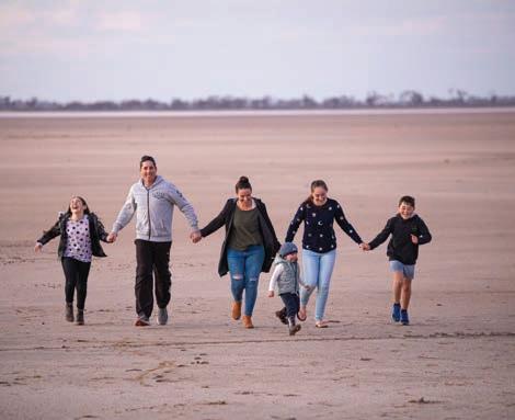
Part of the PUBLIC Silo Trail, visitors to Newdgate can view the stunning creations by Perth muralist Brenton See, depicting the area’s local wildlife across four 30m high silos.
Visit Pioneer Park in the town centre and read up about the town, then head across the road to the skate park and check out this family-friendly facility. Step back in time with a visit to the Hainsworth Museum and be transported back to a bygone era.
LAKE KING 460km south-east of Perth
A small rural town on the fringe of the Wheatbelt’s sheep and wheat farming country, the area truly comes alive during spring with some of the districts best wildflower displays. Walk trails through the town’s bushland enable visitors to take short, self-guided walks and enjoy the wildflowers, native vegetation, birdlife and a little local history.
The Roe Heritage Trail retraces part of
LAKE GRACE VISITOR CENTRE
1 Stubbs Street, Lake Grace (08) 9865 2140
lgvisitorscentre@westnet.com.au lakegrace.wa.gov.au
Surveyor General Roe’s historical journey in 1848.
Travel 30km east on the Lake King Norseman Road to the Rabbit Proof Fence. Make sure you call in at the new Lake King Tractor Museum with its exhibit of unique locally made tractors.
VARLEY 40km south of Hyden on Brookton Highway
Travel from Varley to Hatters Hill or to the historic Rabbit Proof Fence that skirts the eastern end of the shire.
Gold was discovered at Hatters Hill in the early part of the twentieth century and the small settlement is now uninhabited and an interesting spot for fossickers.
52 | The Wheatbelt | australiasgoldenoutback.com
on the Esperance to Perth, Albany to Hyden crossroads.
Lake Grace
Shire of MERREDIN
Hunt’s well and rock wave formation, from a wheelchair accessible car park.
Merredin Peak
This massive granite rock and early water catchment scheme is adjacent to the town. Walk to the top for a spectacular view and sunset or the bush walk for seasonal wildflowers and nature. Follow the National Trust WA interpretive signs taking in the pipeline history, Railway Dam and the remains of the WWII 2/1 Australian General Hospital site.
At a Glance
TOP ATTRACTIONS
Merredin Peak Reserve / Silo Art / Military Museum & Railway Museum / Cummins Theatre / Totadgin
Conservation Park
WILDFLOWERS TO DISCOVER
Yellow Feather Flower / Wheatbelt
Donkey Orchid / WA Cornflower / Pink Everlastings / Bluebeard Fairy Orchid
MERREDIN
260km east of Perth
Located in Njaki Njaki Country, Merredin is the perfect place to engage with nature and absorb the ambience of a RV-friendly country town. Enjoy its cafés, dining or a movie at the cinema while in town and discover its main attractions…
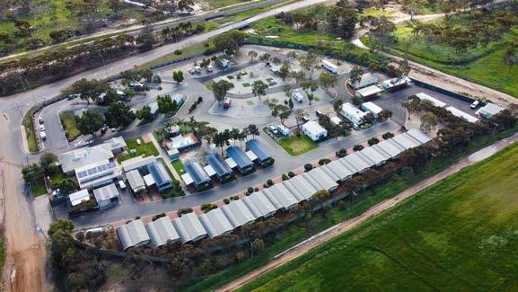
Public Silo Trail
Merredin is one of seven WA regional towns on the PUBLIC Silo Trail, an outdoor art gallery celebrating the state’s regions. The CBH silos were transformed in August 2017 by internationally renowned Perth artist Kyle Hughes-Odgers, with artwork inspired by the local landscape and community.
Golden Pipeline History
View three generations of pump stations at the stabilised ruin of the No 4 Pump Station 3km west of town.
Totadgin Rock Conservation Park
Find interpretive walks among natural bushland that take you to a historic C.
Walk & Cycle Trails
Take a town map to explore the Merredin Heritage Trail or two multi-purpose trails.
Cummins Theatre
Be captivated with a live show at this historic venue, view the history panels inside and outside the building and walk the Stars of Fame.
Experience Our History
Wander through the original Railway Station exhibits and historic steam engines and rolling stock at the Railway Museum. Climb the signal tower to find 95 hand operated levers that controlled this busy railway hub. The Military Museum’s collections include two helicopters from the Vietnam War, and an array of tanks and armoured vehicles. The No 1 Rabbit Proof Fence interpretive site is located 5km east of Burracoppin.
Green Energy
Collgar Wind Farm’s 111 wind turbines is the largest single stage wind farm in the
CENTRAL WHEATBELT VISITOR CENTRE
(08) 9041 1666 or 1300 736 283
visitor@merredin.wa.gov.au
wheatbelttourism.com
Transwa Rail & Coach Bookings
Cummins Theatre Tickets
Parks & Playgrounds
Head to Apex Park playground for a family barbecue. Enjoy a picnic at Roy Little Park with paved paths to a duck pond and fountain. Pioneer Park has enjoyed a redevelopment with vehicle parking providing safe access to shaded seating, the museums, CBD and visitor centre.
Pet Friendly
For family and pet friendly escapes, Merredin has a dog exercise park, fully
Farm features 354,425 370W panels mounted on tracking systems.
Cummins Theatre
Shire of MOORA
At a Glance
WHAT’S ON
Moora Show — 16 Sept 2023
Moora Races — Oct 2023
Moora Bedrace Street Festival — Dec 2023
TOP ATTRACTIONS
Candy’s Bush Reserve / Moora Town Walk / Carnaby Cockatoo Walk Trail / Stack Cooper Reserve / Moora Museum
WILDFLOWERS TO DISCOVER
July to November
MOORA 172km north of Perth
The beautiful country town of Moora is situated on the banks of the Moore River in the Wheatbelt Region of WA. It is surrounded by impressive salmon gums, beautiful parks, gardens and heritage buildings and is a popular stopover for tourists following the Wildflower Trail.
Located less than two hours’ drive north of Perth, Moora is a thriving town strategically located between two of Western Australia’s most popular tourism attractions – New Norcia, Australia’s only monastic town, and the natural wonder of the Pinnacles in Nambung National Park near Cervantes.
Moora is the largest inland service centre between Perth and Geraldton, providing services to a population catchment of 6,000 residents within

a 100km radius. Whether you are just passing through or planning to stop and breathe in some fresh country air for a few days, Moora has something for everyone.
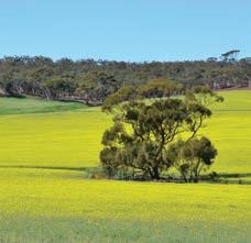
Candy’s Bush Reserve
Features informal walk trails, plentiful wildflowers and orchids. Parking and access off Midlands Road.
Watheroo National Park and Jingemia Cave
The Watheroo National Park, situated 63.6km north of Moora, is very rich in many different kinds of wildflowers, and Jingemia Cave has a shady picnic site. The cave is formed in chert, an unsealed rock that leads to a vegetation community in the hill that is very different from the surrounding areas.
Carnaby
Cockatoo Walk Trail
The trail currently extends between the two town bridges and Candy’s Bush Reserve. The Carnaby Cockatoo Walk Trail plays a major role in educating the community about the conservation of the Carnaby’s Cockatoo, the importance of the salmon gums, and Moora’s flora and fauna.
Stack Cooper Reserve
Located between Stack Street and Cooper Street. Enjoy a short walk through the reserve which features signage on local flora and fauna.
MOORA COMMUNITY RESOURCE CENTRE & VISITOR CENTRE 65 Padbury Street, Moora (08) 9653 1053
moora@crc.net.au
moora.wa.gov.au
Moora Museum
The Moora Museum is open every Sunday from 9am to 2pm during May to October, or appointment only: (08) 9651 1372.
Moora Town Walk
This fascinating walk trail leads to Moora’s historic buildings, murals and points of interest including the Moora town clock. This stunning clock was designed by local school students, before constructed into a magnificent stained-glass feature by local artists.
Creating connections between people, places and produce, across the Midwest, in celebration of all things local.
Featuring: Local Tours & Sightseeing, Seasonal Wildflower Tours, Multi-night Farm & Station Stays.
0474 922 552 | www.newleafconnect.com.au
54 | The Wheatbelt | australiasgoldenoutback.com
Tours | Custom Trips | Experiences | Private Transport NEW LEAF CONNECT T:
Federation Park
MORAWA
370km north of Perth
The Shire of Morawa is located on the traditional lands of the Yamatji People and their ongoing connection to its land, water and culture is still evident in the district today. Morawa’s recent history began when Sir Augustus Charles Gregory travelled through the area in 1846. In 1896, Sir John Forrest carried out exploratory trips around the present Morawa district, with the first farmers settling in the early 1900s. Morawa was declared a town in 1912. Morawa is often referred to as the ‘Heart of the Wildflower Country’. Its shire is one of the most prolific areas for native flowering plants. If you roam through its numerous reserves from late July to early October you will come across many species of flowers that are unique to this district.
The Shire of Morawa has some of the clearest and darkest night skies, ideal for stargazing. Bring your telescopes and cameras to fully capture this pristine environment, or simply look skyward to soak it in. Also explore some of its main attractions…
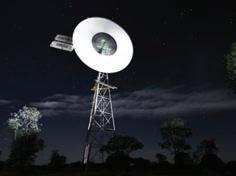
War Rock and Pintharuka Dam Hills at Pintharuka come alive with white everlastings during wildflower season. The surrounding bushland hosts a variety of birds, flowers, mammals and reptiles. In the backdrop are the Moonagin, Karrakarook and Milhun Ranges, which change their colours when the everlastings are blooming right to their tops. Legend has it that War Rock received its name when war occurred
At a Glance
WHAT’S ON
Midwest NAIDOC event — July 2023
Speedway Midwest Masters – Oct 2023
Morawa Christmas Street Festival — Dec 2023
Bi-Annual Art Show and Awards — Aug 2024
TOP ATTRACTIONS
Karara Rangeland Park / War Rock / Widimia Trail / Koolanooka Springs / Bilya Rocks
WILDFLOWERS TO DISCOVER
between two Aboriginal tribes many years ago. The gnamma hole is usually full of water particularly after heavy rains.
Bilya Rock
20km north of Morawa is a large granite outcrop, surrounded by bushland, making it an enjoyable place for picnicking and bushwalking. On top of the rock is a large cairn of rocks built by John Forrest. Koolanooka, meaning, ‘place of plenty wild turkey’ is an ideal place for a picnic. It is also an ideal area to see the wildflowers or to gain a picturesque view of the surrounding land from the top of the ironstone formations that encapsulate the springs.
Historic Canna Store
Built in 1929, the Canna Store is owned by Sue and Paul Offszanka who have a wealth of knowledge of local flora and fauna. Please note this location provides information only; food or fuel are not available in Canna. Maps can be found outside the store.
Morawa Museum
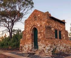
The Morawa Museum is located on Prater Street and is run by the Morawa District Historical Society. The Museum hosts a vast collection of memorabilia, including the world’s sixth largest collection of windmills, a wide array of farming implements and machinery of historical interest, and the original Morawa Police Station.
Koolanooka Springs
Koolanooka, meaning, ‘place of plenty wild turkey’ is an ideal place for a picnic, see the wildflowers and gain a
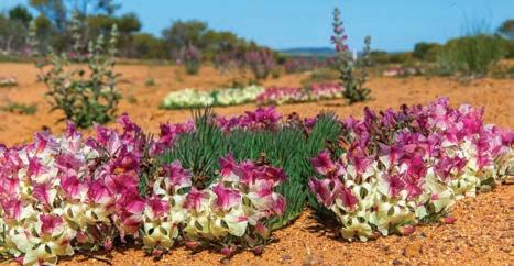
Wreath Flower / Schoenia / Beaufortia / Verticordia / Cornflower
Winfield Street, Morawa (open July to Oct) (08) 9971 1421
admin@morawa.wa.gov.au morawa.wa.gov.au
picturesque view of the surrounding land from the top of the ironstone formations that encapsulate the springs. The picnic area provides barbeque and toilet facilities.
australiasgoldenoutback.com | The Wheatbelt | 55
MORAWA VISITOR CENTRE
Shire of MORAWA
Hermitage ‘Priest’s Cell’
Wreath Flower
Shire of MT MARSHALL
At a Glance
TOP ATTRACTIONS
Marshall Rock and Pergande
Sheepyards / Waddouring Dam and Reserve / Lake McDermott / Beacon Mens Shed / Billiburning Rock
WILDFLOWERS TO DISCOVER
Spider Orchid / Pink Everlastings / Sugar Candy Orchid / Emu Tree / Wattle
MT MARSHALL 350km north-east of Perth
The Shire of Mt Marshall is located deep in the heart of Australia’s Golden Outback, an easy threehour drive north-east of Perth. The two main towns within the shire are Beacon and Bencubbin as well as the locations of Gabbin, Wialki, Welbungin and Cleary. There is a heritage trail located in the old Gabbin townsite that showcases all the highlights of Gabbin’s history. If you love the outdoors, it is a great place to take a trip back in time and visit the remains of historical buildings, rocky outcrops, nature reserves and amazing night skies. From July to October, you will be treated to a spectacular vista of wildflowers.
BENCUBBIN 270km north-east of Perth
The main street of Bencubbin features many original buildings built between 1911 and 1929. Enjoy a walk around the Heritage Trail to learn more about the history of the town including a restored sandalwood dray and the town’s first generator and engine. Some other highlights of the town include…
Waddouring Dam & Reserve
Enjoy free camping, waterless toilet facilities, picnic shelter and fire pits at this stunning location. Perfect for kayaking, paddle boarding or enjoying a picnic on the water’s edge.
Marshall Rock
Free camping, waterless toilet facilities, fire pits and large shady trees make this location the perfect spot for self-sufficient campers or a picnic lunch. Enjoy a walk or drive to the top of the rock where
you can experience 360-degree views of surrounding farmland and the Lake McDermott catchment.
Lake McDermott
Free camping, shelter and fire pits make this a great place to camp or picnic. Season rainfall determines the water level with the lake only filling every 10 to 15 years.
BEACON 320km north-east of Perth
Beacon is the farthest north-easterly town in the Wheatbelt. While in Beacon, learn a little more about the pioneer settlement of the town by taking a walk around the new historic walking trail. Beacon has become famous for its wildflower tours run throughout August and September each year. Also look out for…
Beacon Men’s Shed
The Men’s Shed holds an important place in Australian culture. Visitors are invited to view the restored projects on display and check out current projects.
Beacon Caravan Park
Walking distance to local businesses and town facilities. The Beacon Caravan Park is surrounded by bushland, providing a peaceful and relaxing environment for guests. Camping and on-site self-contained accommodation options available along with modern comfortable facilities.
283 Monger Street, Bencubbin (08) 9685 10072
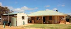
bencubbin@bencubbincrc.net.au
mtmarshall.wa.gov.au
bencubbin.com
Billiburning Rock
Enjoy free camping, waterless toilet facilities, picnic shelter and fire pits at this beautiful reserve. Billiburning provides fantastic views from the top of both cropping and pastoral country, and offers many great photographic opportunities. Located on the reserve are a gnamma hole and a soak well, which are easily accessible.
Datjoin Well & Rock Reserve
Located 18km east of Beacon is the Datjoin Well and Rock Reserve. During the winter and spring months the reserve is a popular picnic destination for picnickers and visitors looking to find some of the best orchids and wildflowers in the district.
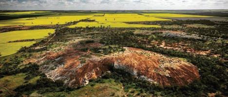
Experience
Walking distance to local businesses and town facilities. Camping and on-site self-contained accommodation options available along with modern comfortable facilities.
Visit www.mtmarshall.wa.gov.au to make a booking or find out more.
Walking distance to local businesses and town facilities. Experience a country sunset overlooking farmland at the end of your day. Camping and on-site self-contained accommodation options available along with modern comfortable facilities.
Visit www.mtmarshall.wa.gov.au to make a booking or find out more.
Visit www.mtmarshall.wa.gov.au to make a booking or find out more.
T: (08) 9685 1202 during office hours • www.mtmarshall.wa.gov.au
T: (08) 9685 1202 during office hours www.mtmarshall.wa.gov.au
T: (08) 9685 1202 during office hours www.mtmarshall.wa.gov.au
56 | The Wheatbelt | australiasgoldenoutback.com
BENCUBBIN COMMUNITY RESOURCE CENTRE
Marshall Rock
Bencubbin Caravan Park
a country sunset overlooking farmland at the end of your day.
Surrounded by bushland, providing a peaceful and relaxing environment for guests.
Beacon Caravan ParkBencubbin Caravan Park
Shire of MUKINBUDIN
At a Glance
TOP ATTRACTIONS
Beringbooding Rock / Weira Reserve / Pope’s Hill Historical Site / Wattoning Historical Site / Bonnie Rock Townsite
WILDFLOWERS TO DISCOVER
Native Cornflowers / Pink Everlastings / Freckled Sun Orchid / Orange
Immortelle
MUKINBUDIN
300km north-east of Perth
Mukinbudin is situated along the Wheatbelt Way self-drive trail and is home to a friendly, vibrant community and ample facilities. Along the Wheatbelt Way, explore the massive granite outcrops of Mukinbudin and the Central Wheatbelt. This self-drive route includes Beringbooding Rock. Discover some of Mukinbudin’s highlights while travelling through…
Beringbooding Rock
Beringbooding Rock has one of the largest rock water catchment tanks in Australia, built in 1937 and holds 2.25 million gallons. Beringbooding features an amazing balancing boulder, a huge gnamma hole and paintings of hands by the Kalamaia tribe found in a cave at the rear of the rock.
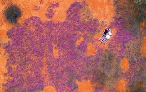
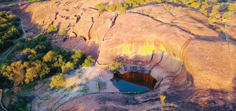
Wattoning Historical Site
This was a significant historical settlement used for carting water at the turn of the century. Precious water was carted from a gnamma hole (water lifted by bucket tied to a rope), a soak and two wells constructed by early pastoralists, skilfully lined with rocks. These wells are still in good condition today. Three lonely graves of two babies and an earlier pioneer remind us of time gone by.
Weira
Reserve
Just 20km east of the Mukinbudin townsite is Weira Reserve. Here you will see a breakaway area with gnamma hole. Barbecue, toilets and picnic facilities are available. Seek out the shy native orchids in the damp areas of the bush trail, also the Red Capped Robin.
Mukinbudin
Men’s Shed
The Men’s Shed is utilised by local men who have renovated and restored many
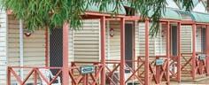
MUKINBUDIN COMMUNITY RESOURCE CENTRE
8 White Street, Mukinbudin WA 6479 (08) 9047 2150
info@mukacrc.net.au
SHIRE OF MUKINBUDIN
15 Maddock Street, Mukinbudin (08) 9047 2100
admin@mukinbudin.wa.gov.au
old machinery and household items. Drop in and meet the local members who will happily take you on a tour of the shed.
Pope’s Hill
Situated 8km east of the townsite, this site honours and tells the story of Colonel Harold Pope, John Mulqueeny and the returning soldiers who contributed greatly to the development of farming land in the Lake Brown area, which was the first large scale Soldier Settlement Scheme in Western Australia.
MUKINBUDIN CARAVAN PARK
MUKINBUDIN CARAVAN PARK

Accommodation includes: self-contained holiday houses, cabins, units, motorhome, caravan and camping sites with access to sporting and swimming pool facilities (in season). Unique Camper’s Kitchen, clean ablutions & BBQ facilities. Free NBN wireless internet. RV friendly town. Dumpsite available.
Ideally located adjacent to recreation oval, golf course, swimming pool (free access in season) and short walk to main shops.
30 powered sites, three 3 bedroom houses within the Caravan Park to rent. Linen provided. Unique campers’ kitchen, new clean ablutions & BBQ Facilities. Free NBN wireless internet. RV Friendly Town. Dumpsite available.
E: stay@mukinbudin.wa.gov.au
T: 0429 471 103
E: stay@mukinbudin.wa.gov.au
W: mukinbudincaravanpark.com
T: 0429 471 103
australiasgoldenoutback.com | The Wheatbelt | 57
Mukinbudin Wildflowers
Weira Reserve
Shire of NAREMBEEN
At a Glance
WHAT’S ON Australia Day — 26 Jan
Ladies Long Lunch — 18 March
SOCK Week — last week of June
Narembeen Astrotourism Night Sky
Adventures — 18 Nov 2023
Christmas Street Party — 16 Dec 2023
TOP ATTRACTIONS
NAREMBEEN
286km east of Perth
Located between Wave Rock and the Great Eastern Highway, Narembeen is the perfect location to discover, explore and stay. Enjoy beautiful nature trails, a wildlife sanctuary, prolific wildflowers in spring, granite outcrops and the undisturbed beauty of this country town. Discover Narembeen’s top attractions...
Hidden Hollow
Approximately 30km from Narembeen, the perfect place for a picnic. A secluded granite outcrop that boasts a natural amphitheatre. For the more energetic –the vantage point from the summit offers spectacular views of the district.
Walker Lake & Avoca Farm Walk Trails
Located near the town site, the Walker Lake Trail is 1.8km and the Avoca Farm walk trail is 2.2km.
Narembeen Lesser Hall Precinct
This newly refurbished outdoor interpretation area is a great place for visitors and locals to learn about the value of Narembeen’s heritage and the way that social life developed in country towns of this era.
Narembeen Grain Discovery Centre
Located within Narembeen’s roadhouse is an interpretive centre focusing on grain growing in Western Australia. Learn more about farming in Narembeen as you wander through the exhibits. Open 9am to 5pm daily.
Narembeen Public Hall
Narembeen Sculptures
Discover amazing metal sculptures around town including the Narembeen Hawk located at the Recreation Centre and the Narembeen Draught Horse located at the Lesser Hall Precinct.
Roe Dam
Approximately 45km east of Narembeen, a 20-million-gallon storage dam built in 1971. Picnic area and toilets are available.
Roe Lookout
Only 8km from Narembeen, this site is the first site of European contact in the Narembeen Shire. A scenic drive takes you to the peak of this granite formation with beautiful panoramic views of the district.
Step Back in Time
Visit one of the many historical museums in Narembeen including The Old Church, History Museum and Machinery Museum, History Centre and the Spotters Post.
Wadderin Wildlife Sanctuary, Information Centre and Walk Trail
A 400ha nature conservation project managed by the local community, focused on the reintroduction of animals that are uncommon or locally extinct in the Wheatbelt. Be sure to check out the new Information Centre and Walk Trail!
Narembeen’s Mile of Boots
A quirky spectacle, located on the Mt Walker Road, more than 1000 odd shoes and boots hanging from a fence-line. The collection of footwear put together by local farmers stretches for more than 1km.
Wadderin Wildlife Sanctuary / Avoca Farm & Historical Machinery / Narembeen Grain Discovery Centre / Roe Lookout / Narembeen Lesser Hall
Precinct and Draught Horse Sculpture
WILDFLOWERS TO DISCOVER
Flame Grevillia / Cowslip Orchid / Hibbertia / Dampiera lavandulacea / Caladenia Longicauda / Yellow Granite Donkey Orchid (Diuris hazeliae)
NAREMBEEN COMMUNITY RESOURCE CENTRE
2/19 Churchill Street, Narembeen (08) 9064 7055
crcmanager@narembeen.wa.gov.au narembeen.wa.gov.au
SHIRE OF NAREMBEEN
1 Longhurst Street, Narembeen (08) 9064 7308
edo@narembeen.wa.gov.au narembeen.wa.gov.au
58 | The Wheatbelt | australiasgoldenoutback.com
Shire of NARROGIN
At a Glance
WHAT’S ON Narrogin Agricultural Show — 14 Oct 2023
Narrogin Rev Heads — 18 Nov 2023
Christmas in Narrogin Night Markets — Dec 2023
Narrogin Farmers & Makers Market — see Facebook for dates

Anytime Orienteering at Foxes Lair
TOP ATTRACTIONS
Downderry Wines / Foxes Lair / Barna Mia / Narrogin Railway Station / CBD Walk
WILDFLOWERS TO DISCOVER
NARROGIN 192km south-east of Perth
Narrogin is situated within the Gnaala Karla Booja region in the land of the Noongar People. Narrogin is a Wilman Noongar name, first recorded in 1869 as “Narroging” for a pool in this area. It is a regional centre and an easy drive of just over two hours from Perth. It’s a perfect destination for day trippers or for a stop over for a few days with a range of enticing attractions. Discover some top spots to explore while in town...
Downderry Wines
Established in 1997, this is a must-visit attraction just 12km west of Narrogin. Downderry makes chemical-free awardwinning quality wines. Enjoy free wine tastings, cheeses, tea and coffee. Free overnight camping available and childfriendly farm animals to pat!
Gnarojin Park
“When the wind blows we hear more than just the rustle of leaves or the sound of falling bark. We hear and feel the presence of our ancestors.” —
Noel Nannup.
Gnarojin Park contains significant cultural sites including a ceremonial Corrobboree Ground and a birthing tree. Narrogin Brook, a running waterway within the park, is believed to be part of a song line, which possibly runs to the mouth of the Blackwood River. Enjoy the interpretive signage and public art.
Foxes Lair
Take a stroll on one of the five walking trails replete with interpretive signage in this stunning 68-hectare bush reserve on the town’s doorstep. Spend time at the arboretum with over 60 species of the iconic Australian eucalypt. This fascinating reserve has a wide array of wildflowers, landscapes, birds and wildlife. From August to early October is the best time for viewing wild flowers.
Barna Mia Nocturnal Wildlife Experience and Dryandra Woodland National Park
Enjoy a unique wildlife experience at the Barna Mia animal sanctuary nestled in the heart of Dryandra Woodland National Park, 25 minutes’ drive from town. A tour guide with special torches for night viewing will help you discover this magical place. You will be captivated by the sight of threatened native nocturnal marsupials such as the bilby, woylie and quenda.
Astrotourism and a Dark Night Sky
Use telescopes and binoculars to enjoy an evening of stargazing at the local golf club. Take stunning images of the starry night sky over the special landscape at Yilliminning Rock.
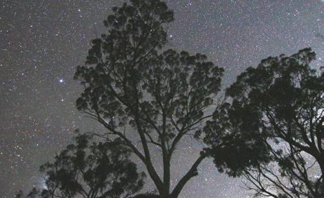
Narrogin Heritage Walk Trail
Take an easy stroll along the Heritage Walk Trail within the CBD. This walk, with 25 interpretive signs, celebrates the town’s early buildings which stand as
Stark White Spider Orchid / Primrose Spider Orchid / Smooth-lipped Spider Orchid / Golden Dryandra / Tassel
Grevillea
VISITOR CENTRE
1 Pioneer Drive, Narrogin (Narrogin Railway Station) (08) 9881 2064
visitorcentre@narrogin.wa.gov.au
monuments to the times and people of another era.
Visitor Centre and Narrogin Railway Station
Stop at the visitor centre at the State heritage-listed Narrogin Railway Station. Make sure you take the time to view the amazing miniature model of Narrogin’s railway precinct and the railway of bygone days. Enjoy interpretative signage, public art, and free WIFI and relax in the lounge while planning your next move.
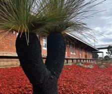
australiasgoldenoutback.com | The Wheatbelt | 59
Narrogin Railway Station
Astrotourism
Shire of NUNGARIN
At a Glance
WHAT’S ON
Vintage Car Rally & Search Light Party –4 Mar 2023
Homegrown Music Festival – Oct 2023 (TBC)
Harvest Festival – Oct 2023
Mangowine Concert – Oct 2023
Nungarin Wheatbelt Markets –first Sunday of the month
TOP ATTRACTIONS
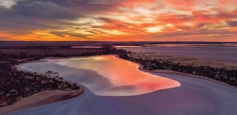
Eaglestone Rock
NUNGARIN
269km east of Perth
Located a 3.5-hour drive east of Perth and just 30 minutes north of Merredin in the North Eastern part of the Central Wheatbelt Region is the vibrant town of Nungarin. With a population of around 300, Nungarin is a small town with a big heart. This little town is rich in history with a few stories to tell and covers an area of 1,145km². Its agricultural base is predominantly wheat and sheep farming.
Nungarin is just one of the stops along the Pioneers’ Pathway self-drive trail. During the 1880’s gold rush many pioneers and farmers travelled east in hope of fortune and rich land. Jane Adams broke the stereotype of women being silent spectators during this time by maintaining the Mangowine Homestead as accommodation to pioneers passing through as well as maintaining the land herself. Jane is buried at the Nungarin cemetery and the old mudbrick homestead is standing strong and maintained by the current owners. Mangowine Homestead promises a historical experience for tourists and is worth a visit.
Home to an abundance of wildflowers you will discover a dazzling array of wildflowers and fields of canola spreading across the landscape. This makes for the perfect opportunity to take a day trip or stay for the weekend in town at our caravan base (upgrades commencing in early 2023 with a new ablution and laundry block) or pick a spot and camp at one of the reserves listed below…
Eaglestone Rock is a spectacular natural granite rock and cave formation situated 20km north east of Nungarin. Enjoy great views over Lake Brown and watch the sunset – a sight to be truly treasured. As the name boasts, Eaglestone is home to Wedgetail Eagles and are often seen perched on the Rock. This is also a popular organised rockclimbing spot. The rock is a great place to take the kids to explore and there is some lovely shade on the western side of Lake Brown for a barbecue. A good picnic area with camping facilities.
Danberrin Rock
A pleasant drive approximately 10km from Nungarin, Danberrin rock is home to a mass of wildflowers in season. A lovely climb to reach the peak which is marked by a tin tower with 360° views of the land cleared by the original settlers.
Talgomine Reserve
Talgomine Reserve, just east of Nungarin, has colourful displays of everlastings and is a spectacular sight. Enjoy a stroll
Mangowine Homestead / McCorry’s Old Hotel / Nungarin Army & Heritage Museum / Wheatbelt wildflowers
WILDFLOWERS TO DISCOVER
Canola / Everlastings / Native Cornflower / Orchids / Acacia
SHIRE OF NUNGARIN
Railway Avenue, Nungarin (08) 9046 5006
admin@nungarin.wa.gov.au nungarin.wa.gov.au
through the endless fields of pink and yellow everlastings which bloom during spring. Nature lovers will appreciate the york gum and jam tree woodlands within the reserve, home to a variety of orchids and other wildflower species. Take a stroll along the walk trail to discover more of Talgomine and climb Mount Moore for scenic views across the reserve and out to Lake Campion, an inland lake. If time permits take the short 15-minute drive to the Lake and enjoy a refreshing swim or canoe across the huge expanse of water.
Opening hours:
Mon - Sun, 9:00AM - 4:00PM
Sunday 8:00AM - 10:00AM for a big breakfast (except Market Sunday)
Check our website for special events & group bookings: www.nungarinmuseum.com.au

Nungarin Heritage Museum
T: (08) 9046 5040
E: nungarinheritage@bigpond.com
60 | The Wheatbelt | australiasgoldenoutback.com
The museum is housed in an original massive Army Vehicle Workshop building constructed in Nungarin in 1942-43 as part of Australia’s defence during WWII and showcases the little-known presence of the Australian Army in the Wheatbelt.
Nungarin Heritage Musem
Lake Campion Nature Reserve
Astrotourism
Shire of PERENJORI
At a Glance
WHAT’S ON
Off Road Racing – 3-6 March 2023
Stargazing with AstrotourismWA –22 April 2023
Anzac Day Ceremony – 25 April 2023
Perenjori Agricultural Show – 12 Aug 2023
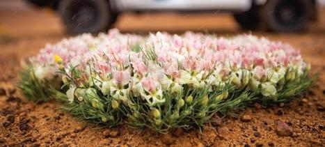
TOP ATTRACTIONS
John Forrest Lookout / Pioneer
Museum / Camel Soak / Astrotourism
Observation Platform / Charles Darwin Reserve
WILDFLOWERS TO DISCOVER
PERENJORI
355km north of Perth
Just three and a half hours from Perth, come and enjoy the peace and wonder of the countryside in Perenjori. Derived from the Aboriginal word “Perangery”, meaning water hole, this is predominantly an agricultural area. Situated in the heart of wildflower country, every spring the countryside is ablaze in colour.
Perenjori is famous for its wide selection of native birds. Apart from the many species of parrots, cockatoos, and water birds, look out for honeyeaters, thornbills, babblers, and fairy wrens.
Perenjori Roadhouse, located 800m north of town, is the only roadhouse in the region open seven days a week and offers 24-hour fuel.
Charles Darwin Reserve
About 60km to the east of Perenjori, you will find a park of national significance for its ecological diversity’ – the Charles Darwin Reserve. It provides habitat for over 230 animals and over 680 plant species. Camping is available JuneSeptember at Samphire Campground. Bookings are essential and managed by Bush Heritage Australia.
Rothsay Heritage Trail and John
Forrest Lookout
Work your way east of Perenjori from Caron Dam to Camel Soak and Mongers Lake Lookout, which takes you through pastoral and mining country to the John Forrest Lookout. There, you’ll find impressive 360-degree views of farms, stations, and mine sites. Caron Dam is a
popular picnic and overnight camping site with a natural catchment area and interpretive signage.
Caron Rail Trail
Rail enthusiasts will not want to miss the heritage listed Caron Coal Stage. Follow the rail trail to the dam catchment, especially scenic during springtime with a great range of flora and fauna and an ideal picnic spot.
Perenjori Tourist Centre and Pioneer Museum
Located in the heritage listed Bank of NSW building, the centre offers great information on the best wildflower and orchid viewing locations. View the impressive collection of historical memorabilia and machinery and wander through the community garden.
Astrotourism WA
Enjoy a night of stargazing under the Milky Way and utilise our Giant Planisphere star wheel and dark sky observing platform just a few minutes’ walk from the Perenjori Caravan Park.
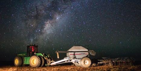
Wreath Flowers / Donkey Orchids / Spider Orchids / Pink Everlastings / White Everlastings
VISITOR INFORMATION
56 Fowler Street, Perenjori
T: (08) 9973 0100
E: reception@perenjori.wa.gov.au
Visit visitperenjori.com.au
Alternatively, enjoy a short drive out of town to the Astrophotography Hotspot at ‘the Salmons’.
Lindum Farm Stay
A peaceful country getaway 25 minutes from town. Comfortable self-contained cottage for up to five guests. A perfect location to stargaze or go bushwalking.
Perenjori Aquatic Centre
The Perenjori Aquatic Centre provides a welcome relief for travellers on a hot summer’s day – open annually from November to Easter.
Wreath Flower
australiasgoldenoutback.com | The Wheatbelt | 61
Shire of PINGELLY
At a Glance
WHAT’S ON
Pingelly Country Collective — April 2023
Tutanning Wildflower Walk — Sept 2023
Pingelly Christmas Village — Dec 2023
Pingelly Party on the Oval — Dec 2023
TOP ATTRACTIONS
Pingelly Recreation and Cultural Centre (PRACC) / Moorumbine Heritage
Townsite / Boyagin Rock / Tutanning
Nature Reserve
WILDFLOWERS TO DISCOVER
Jarrah / Wandoo / Powderbank
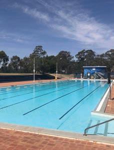
Wandoo / Brown Mallet
PINGELLY 158km south-east of Perth
Pingelly is a pleasant 90-minute drive from central Perth, close enough for an overnight stay or a day trip. Settled in the 1860s, Pingelly is a rich and diverse cropping and grazing agricultural region contributing significantly to the state’s wool and grain exports.
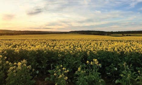
The town is picturesque, with many parks, free barbecue facilities, picnic areas, playgrounds, gardens and two RV dump points. Facilities include a 24/7 medical centre, chemist, supermarket (open seven days), butcher, ATM, community crafts and giftware shops, an op-shop, a swimming pool (November – March), and dine-in and takeaway food options. While in Pingelly, explore some of the town’s main attractions…
The PRACC
The PRACC is the largest timber structure built in Western Australia since World War II. This amazing facility was built using 1,000 tonnes of yellow stringy bark, and contains a bar and bistro, and is open from Wednesday to Sunday each week.
Moorumbine Heritage Townsite
This picturesque site was originally settled in 1864. Many of the original houses and buildings built by convicts survive, such as St Patrick’s Church, which was consecrated in 1873 and is still in use today.
Boyagin Nature Reserve
Boyagin Nature Reserve is a designated flora and fauna reserve with picnic, bushwalking activities, and wildflowers in season. Boyagin Rock rises 50m above the surrounding countryside and is of immense spiritual and cultural significance to Noongar people.
Apex Lookout on Ironstone Hill
The lookout offers panoramic views of the town and countryside. Access and parking is found off Balfour Street.
Tutanning Flora and Fauna Reserve
Tutanning is world renowned as a sanctuary for the endangered Tammar wallaby, and for hundreds of wildflower species and native orchids.
Dryandra Woodland
Dryandra Woodland offers one of the best opportunities to view native animals in their natural habitat.
Memorial Park
In the heart of Pingelly, Memorial Park now features purpose-built play spaces encompassing an early years’ playground, an adventure and nature playground for all ages, an expanded children’s playground, as well as barbecue, picnic and toilet facilities.
Pingelly Community Craft Centre
Purchase local crafts and souvenirs from the shop, which doubles as a tourist information source and booking centre
PINGELLY COMMUNITY CRAFT CENTRE AND TOURIST INFORMATION
28 Parade Street, Pingelly (08) 9887 1295
pingelly.wa.gov.au
PINGELLY RECREATION AND CULTURAL CENTRE
Somerset Street, Pingelly (08) 9887 0092
enquiries@pracc.net.cu
for the local caravan park. Open from 9.30am. Further tourist information and shire location maps are available from all retail outlets in town.
62 | The Wheatbelt | australiasgoldenoutback.com
Pingelly Community Swimming Pool
Canola Flowers
Shire of QUAIRADING
At a Glance
TOP ATTRACTIONS
Toapin Weir / Nookaminnie Rock Nature Reserve / Quairading Railway Museum / Rabbit Proof Fence / El Toro
WILDFLOWERS TO DISCOVER
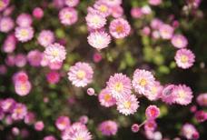
Banksia Cuneata (Matchstick Banksia) / Donkey Orchid / Spider Orchid / Everlastings
QUAIRADING VISITOR CENTRE
QUAIRADING COMMUNITY
RESOURCE CENTRE
QUAIRADING
167km from Perth
Quairading is a beautiful town nestled in the Central Wheatbelt of Western Australia, just 167km east of Perth on the York-Quairading Road. This vibrant community has a population of about 1,200 and a strong agricultural industry, producing cereal and grain crops, forestry, wool, sheep and cattle, supported by rural service industries. While in town discover some Quairading’s highlights...
Toapin Weir
The largest and most comprehensive privately constructed reservoir and water scheme in Western Australia, this picturesque area boasts spectacular views, an electric barbecue and toilet facilities.
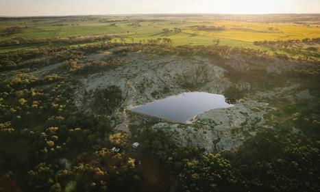
El
Toro
El Toro is a major artistic attraction in town — a sculpture crafted by the world-renowned metal sculptor based in WA. Jordan’s attention to detail and incredible craftsmanship along with his obvious passion, all contribute to El Toro magnificently displaying his collection of time worn scrap iron that is catching the eyes and hearts of locals and visitors alike in this small rural town. Quairading proudly aligns itself with many traits of the bull that El Toro resembles. El Toro is on public display in Quairading, outside the Quairading Town Hall.
The Nookaminnie Rock Nature Reserve lies 3km west of town on the YorkQuairading Road. The heart of the reserve is dominated by Nookaminnie Rock, which is a large granite outcrop with magnificent views of the surrounding landscape and the town of Quairading. The top of Nookaminnie Rock offers a perfect platform to watch the Wheatbelt’s breathtaking sunsets and in spring you can enjoy some of the most beautiful wildflowers the Wheatbelt has to offer. Marked walk trails provide easy and safe access to the reserve.
Rabbit Proof Fence
The Rabbit Proof Fence is the longest fence in the world! Two re-created examples of the fence and rabbit traps are located south of Quairading on the Corrigin Road. There are three fences in Western Australia: the original No. 1 Fence crosses the state from north to south, No. 2 Fence is smaller and further west, and No. 3 Fence is smaller still and runs east–west. The fences took six years to build. When completed in 1907, the rabbitproof fences (including all three)
1 Parker Street, Quairading (08) 9645 0096
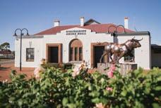
admin@quairadingcrc.com.au quairading.wa.gov.au
stretched 3,237km (2,023 miles). The cost to build the fences at the time was about £167 per mile ($250/km) which totals just over 80 thousand dollars.
Kwirrading Koort — coming soon
An adventure playground will be completed in early 2023 thanks to generous funding from Lotterywest. The playground will feature equipment for all ages, vast lawn areas, barbecues and gazebos and will be a must-see Wheatbelt attraction.
Quairading Caravan Park
Need somewhere to stay? Book into the Quairading Caravan Park! There are two-bedroom self-contained cabins as well as single rooms, powered/ unpowered caravan sites and camping options available. Book online at www.quairading.wa.gov.au or call 0438 213 042.
australiasgoldenoutback.com | The Wheatbelt | 63
Nookaminnie Rock Nature Reserve
Toapin Weir
Everlastings within the Nookaminnie Rock Nature Reserve
Quairading Town Hall & ‘El Toro’ Sculpture
Shire of TRAYNING
At a Glance
WHAT’S ON
Trayning Tractor Pull, Burnouts, Mud Bog & Lawnmower Racing — 9 Sept 2023
TOP ATTRACTIONS
The Wheatbelt Way / Trayning
Caravan Park / Yarragin Rock / Billyacatting Hill / Yelbeni Centenary Museum
WILDFLOWERS TO DISCOVER
Common Firebush / Yellow Feather Flower / Rock Buttercup / Pink
Everlasting / Orchids / Grevilleas
TRAYNING
235km from Perth
Located along the Wheatbelt Way self-drive route, the Shire of Trayning consists of the three townships of Kununoppin, Trayning, and Yelbeni and is home to 300 people with a distinct focus on agriculture.
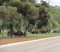
The area is named after Trayning
Well, the Aboriginal name of a nearby water source located on the old Goomalling to the Eastern Goldfields. It was first recorded by a surveyor in 1892 and allegedly derives from white man’s interpretation of the Aboriginal word ‘dur-iring’ meaning ‘snake calling in the grass near a campfire’.
While in Trayning, discover natural granite outcrops, native birds, insects, reptiles, woodlands and stunning panoramas of wildflowers in season. Explore some of its main attractions…
Billyacatting Hill
Situated on the shire’s eastern boundary (27km east of Trayning), this 2,500 ha flora and fauna reserve is a nature lover’s delight.
Yarragin Rock
24km north-east of Trayning, Yarragin Rock consists of twin monoliths rising from a flat granite outcrop and is visible from a great distance.
Gnammas
18km north of Trayning are the gnamma
holes. Birds and other wildlife frequent the rock pools. The perimeters of gnamma holes are also good places to search for orchids, and other wildflowers.
Rance Caravan
Home of one of the first registered caravans in Western Australia you will find the old Rance Caravan and its story displayed on Railway Street in Trayning. A variety of amazing flora and fauna can be found at these locations, highlighting the natural diversity of the area.
Yelbeni Centenary Museum
Marvel at machinery from yesteryear at the Yelbeni Centenary Museum.
Trayning Caravan Park
This quaint little spot really is the peace and quiet you have been looking for. With drive-through powered sites, free wifi, barbecues, an expansive grassed area, a playground, laundry and kitchen amenities, and an RV dump point, this
VISITOR INFORMATION
Railway Street (PO Box 95), Trayning (08) 9683 1001
admin@trayning.wa.gov.au trayning.wa.gov.au
dog-friendly caravan park is a great spot to stop and stay a while. Enjoy starry night skies around the communal fire pit at night (subject to fire season) Situated north on the Bencubbin/ Kellerberrin Road and close to town the caravan park is in walking distance to everything.
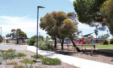
Trayning Short Stay Accommodation
On Felgate Parade, there are two furnished, two bedroom cottages, accommodating up to four people which are perfect for a family of four visiting relatives or visitors travelling the Wheatbelt.
64 | The Wheatbelt | australiasgoldenoutback.com
Aquatic Centre Pioneer Park and Gymnasium
Yelbeni Museum
Kununoppin
Shire of WAGIN
At a Glance
WHAT’S ON
Wagin Woolorama — 10-11 March 2023
Wagin Gymkhanarama — Sept 2023
Wagin Christmas Street Carnival — 16 Dec 2023
TOP ATTRACTIONS
Bart – the Giant Ram / Wagin Historical Village / Puntapin Rock / Norring Lake / Ninja Park
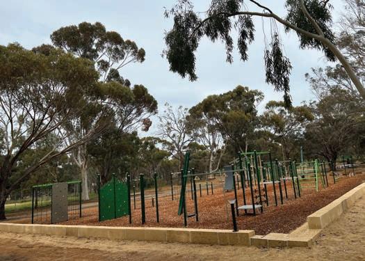
WILDFLOWERS TO DISCOVER
Everlastings / Donkey Orchids
Green Spider Orchids / Jug Orchids / Cats Paws
WAGIN
227km south-east of Perth
The town is the centre of a thriving Merino stud industry and proud home to the Wagin Woolorama, Western Australia’s largest rural show. A 2.5-hour drive from Perth, you will be enthralled with the beautiful rolling Wheatbelt countryside and quaint historical towns along the way. Settled in early 1880s, Wagin is near a series of ancient lakes and is regarded as one of the most heritage rich rural towns in Western Australia. The streetscapes boast some of the state’s most beautiful early 20th century historical hotels. Their architectural significance adds extra interest as you walk the streets of this friendly town absorbing all the charm of a regional farming community.
To acknowledge the prosperity created by the wool industry, meet ‘Bart’ the Giant Ram on the western side of the town. This iconic attraction is found in the pristine wetlands park with playground, picnic and barbecue facilities. Discover more main attractions...
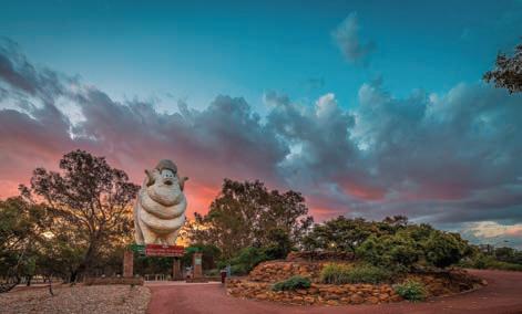
Giant Ram
No doubt the most photographed ram in Australia! Come see ‘Bart’, standing some 9m tall and 13m in length located in the beautiful wetlands park, right alongside the shire offices as you enter the town.
Wagin Historical Village Museum
This is acclaimed as the largest and
best social history museum in Western Australia. Some 25 historical or recreated buildings house the history of the region.
Norring Lake
Norring Lake is a large freshwater lake south west of the Wagin townsite. Fantastic camping and picnic area and ideal for skiing and water sports.
Town Well, Mount Latham and Puntapin
Come see the town’s original water source, the 1890’s Town Well located in the parking bay just off Arthur Road. This water was used prior to the construction of water catchments at Badgarning Rock at Mt Latham and Puntapin Rock. These two granite formations have wonderful views over the town and
HISTORICAL
& TOURIST
Kitchener Street, Wagin (08) 9861 1232 wagin.wa.gov.au
WAGIN
VILLAGE
INFORMATION
Bart the Giant Ram
War Memorial
Ninja Park
Shire of WESTONIA
At a Glance
WHAT’S ON Wessy on the Green — April 2023 (bi-annually)
Wessy Christmas Markets — Nov 2023
TOP ATTRACTIONS
Edna May Lookout / Hood-Penn Museum / Elachbutting Rock / Baladjie Rock / Wolfram Street façades
WILDFLOWERS TO DISCOVER
Orchids / Cowslip Orchid
/ Grevilleas / Hakeas / Red Morrell
Eucalypts / Lesser Bottlebrush
WESTONIA
316km east of Perth
Wessy’, as locals call it, is just over three hours’ drive east of Perth, where the Wheatbelt meets the Goldfields. The town owes its origin to gold mining and now relies largely on wheat and sheep farming. Westonia is located along the Golden Pipeline Heritage Trail and the Wheatbelt Way self-drive trail and boasts beautiful historic façades on its main street. While in town, discover some of Westonia’s main attractions…
Hood-Penn Museum
Showcasing early life in the shire, including a mine tunnel and blast simulation.
Wolfram Street
The main street features charming façades of the original bank and other historic buildings such as the café, hotel, fire station, boarding house and greengrocer.
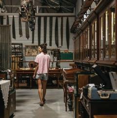
Elachbutting Rock
A prominent landmark with excellent views from the top and colourful caves.
Baladjie Rock
Extensive granite outcrops in attractive woodland setting adjacent to Baladjie Lake with spectacular views of the nearby lake system landscape. Popular for camping in milder months.
Edna May Lookout
A working gold mine which offers a view of a mine by day or night.
Westonia Common
Westonia townsite is nestled inside approx. 5,600ha of remnant bushland. “The Common” features salmon gum, morrell and gimlet woodlands, a woodlands and wildflowers walk trail with miniature replicas and points of interest, and Boodalin Soak – a historic water and rest place for travellers and was the place of capture for Moondyne Joe (WA’s best known bushranger) in 1866.
Yanneymooning Rock and Reserve
Comprises granite rock formations and bushland. Spot the abundant ornate dragon lizard (Ctenophurus ornatus), an inhabitant of Yanneymooning Rock.
SHIRE OF WESTONIA & COMMUNITY RESOURCE CENTRE 41 Wolfram Street, Westonia (08) 9046 7063
shire@westonia.wa.gov.au
westonia.wa.gov.au
Sandford Rocks Nature Reserve
Experience the granite outcrop, wildflowers scrub and woodland. A must do for birding and wildflower enthusiasts.
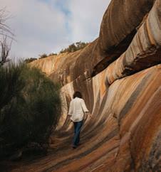
Chiddaracooping Reserve
This reserve has abundant and unique flora such as the cowslip orchid and the lesser bottlebrush or Callistemon phoeniceus, one of only two bottlebrush species native to south-west Western Australia.
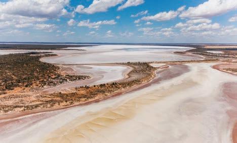
66 | The Wheatbelt | australiasgoldenoutback.com
Elachbutting Rock
Baladjie Reserve
Hood-Penn Museum
Shire of WONGAN-BALLIDU
At a Glance
WHAT’S ON Reynoldson Reserve Wildflower Festival — Oct 2023
Bike it to Ballidu — 14 Oct 2023
TOP ATTRACTIONS
Lake Ninan / Gamma Rock / Reynoldson Reserve / Ballidu Heritage Centre / Astrotourism
WILDFLOWERS TO DISCOVER
Verticordia / Orchid Species / Grevillea ‘Superb’ / Pink Poker (Grevillea Petrophiloides) / Wongan Cactus
WONGAN HILLS
184km north-east of Perth
Ashort, scenic drive from Perth brings you to Wongan Hills, the largest town within the Shire of Wongan-Ballidu. Translated from the Aboriginal Wongan Katta, or Talking Hills, the area falls within WA’s rich and diverse floral region and is home to over 1,300 varieties of wildflowers including 24 species found only in Wongan Hills. Noted as one of WA’s first Astrotourism towns, visit Lake Ninan or the airport to gaze at spectacular starry night skies. The town offers outstanding cycling paths, sporting facilities, museum and cultural festivals and activities. Discover some of Wongan Hill’s highlights while travelling through…
Mt Matilda Walk Trail
Located within the Wongan Hills nature reserve, this walk trail boasts spectacular views, fauna, and flora. Two trails are available for people with a moderate fitness level.
Mt O’Brien Lookout
Mt O’Brien is the second highest point in Wongan Hills and has a variety of wildflowers, some of which are only found in these hills. Barbecue and lighting facilities are provided.
Christmas Rock Walk
This trail is easily accessible and will take approximately an hour to walk at a leisurely stroll. Filled with natural attractions and cultural history of the town.
Gathercole Nature Reserve and Walk Trail
This granite outcrop is home to many species of native plants and animals. The walk trail is suitable for people with moderate levels of fitness.
Dingo Rock
This large granite outcrop has a gnamma hole on the rock face, which is a water collection site. During late winter and spring, the reserve develops a picturesque covering of wildflowers.
Reynoldson Reserve
The Reserve is renowned for its spectacular displays of Verticordia. Flowering seasons vary with most blooming between October and January, with November being the peak season.
Lake Ninan
Once a thriving ski lake with its own yacht club, Lake Ninan is a beautiful place for a picnic. The perfect spot for watching the sunset and stargazing under the night’s sky. An RV friendly site and only a short 8km from Wongan Hills town centre.
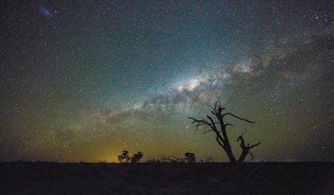
BALLIDU 214km north-east of Perth
Still sporting the verandas and posts on the original main street shops, this cultural hamlet town is famous for its annual Bike it to Ballidu race and art exhibitions. The old Ballidu Hall has been repurposed to house a charming history collection and is well worth a visit. Be sure to visit the local tavern for a
WONGAN HILLS VISITOR CENTRE
The Station, 1 Wongan Road
Wongan Hills (08) 9671 1973
wongantourism@westnet.com.au wongantourism.com.au
sense of country hospitality. The town’s arts scene can also be enjoyed at the award-winning Ballidu Lodge Art Gallery. Ballidu Town dam and the Balli-Balli Rocks offer nature enthusiasts great scenery, fauna, and flora.
CADOUX 231km north-east of Perth
At the core of Cadoux is its general store, school, outstanding recreation centre and wheat-bins. The town suffered major destruction during the 1979 earthquake and the fault lines and geological phenomena are clearly marked with interpretive signage. Just north of the town will take you to the Flat Rocks Nature Reserve, a water catchment area built during WWII. During winter and spring this is a great place to enjoy the wildflowers and gnamma hole.
australiasgoldenoutback.com | The Wheatbelt | 67
Astrotourism
‘Get Your Bikes Out’ in Ballidu
Shire of WYALKATCHEM
At a Glance
WHAT’S ON Wyalkatchem Rodeo — 26 Aug 2023
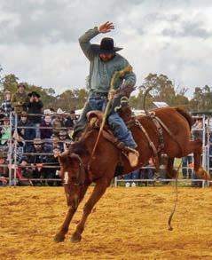
TOP ATTRACTIONS
Wyalkatchem CBH and Agriculture
Museum and Pioneer Pathway display – John Lyndsay / Wyalkatchem


Schoolhouse Museum / Korrelocking Reserve / Pioneer Park Memorial Rose Garden / Olympic swimming pool and childrens’ pool
WILDFLOWERS TO DISCOVER
Wyalkatchem Foxglove / Spider Orchids / Donkey Orchids / Paper Daises
WYALKATCHEM
192km north-east of Perth
Wyalkatchem lies along the popular Pioneers’ Pathway and Wheatbelt Way self-drive routes, an easy two-hour drive from Perth via Northam or Toodyay. The first recorded exploration was in 1846, guided by local Aboriginals. Settlers first arrived in 1904 and the town site was officially declared in 1908. By 1905, Wyalkatchem was home to pioneer and politician John Lindsay, a key advocate for farmers and the bulk handling of wheat. Later, Wyalkatchem became known as the “cradle of bulk handling” and remains a thriving grain and sheep farming region. Discover some of Wyalkatchem’s top attractions while travelling through…
CBH Agricultural Museum
The first delivery of bulk wheat in Western Australia was received at Korrelocking in November 1931. Today, the Museum’s original K Type wheat bin protects an impressive collection of early farming equipment including the rare Waterloo Boy - one of the first John Deere tractors (1920).
Wyalkatchem Town Heritage Walk
The town boasts many fine historical, National Trust and heritage listed buildings from the early 1900s. A leaflet is available at the visitor centre and shire offices.
Old School House
Once home to Sir William Heseltine, who later became a member of the
Royal Household and Press Secretary to Queen Elizabeth II, see life from a bygone era at Old School House. Viewing by appointment only – contact Pat Jones on (08) 9681 1036 or Wendy Begley on (08) 9681 1397.
Walk-A-Wyal Tracks
Three different tracks, marked by yellow, blue and red triangles, along the Walk-A-Wyal Tracks you can observe unique flora and fauna in the peaceful surrounds of some of the oldest bushland reserves in WA.
Cowcowing Lake
Cowcowing Lake and Cemetery lie 26km to the north of town. The lake gives its name to Cowcowing Siding and covers an area of 15,000ha. On rare occasions when the lake is full, locals use it to water ski.
Yorkrakine Rock
A spectacular granite outcrop rising 341m and covering some 160ha, Yorkrakine Rock is an ideal spot for picnics (amenities) and bush walking.
Korrelocking Reserve
Site four on the ‘Wheatbelt Way’ selfdrive trail, Korrelocking Reserve features 259ha of bushland and a picturesque picnic spot (especially during wildflower season) with amenities, interpretative signage, a marked walk trail and pioneer well. Some 44 bird species have been recorded at the reserve including Pacific Heron, Black-shouldered Kite, Whistling Kite, Little Eagle, Black-tailed Native-hen and Long-billed Corella.
WYALKATCHEM VISITOR CENTRE
Wyalkachem Visitor Centre
CRC & CBH Museum
Railway Tce, Wyalkatchem WA 6485 (08) 9681 1500
wyalkatchem@crc.net.au wyalkatchem.crc.net.au
general@wyalkatchem.wa.gov.au wyalkatchem.wa.gov.au
Historic Wyalkatchem Well
Commonly known as ‘Wyalkatchem
Tank’, find the unique granite Wylkatchem Well at site five on the ‘Wheatbelt Way’ self-drive trail.
68 | The Wheatbelt | australiasgoldenoutback.com
509641A_Shire of Wyalkatchem l 2621.indd 1 19/7/2022 3:16 pm
Wyalkatchem buildings
Wyalkatchem Rodeo
Shire of WICKEPIN
At a Glance
WHAT’S ON
Yealering Regatta — Oct 2023
Ignite Wicky Festival — 24 Feb 2024
TOP ATTRACTIONS
Malyalling Reserve / Lake Toolibin / Albert Facey Homestead / Lake Yealering / Wildflowers Harrismith
WILDFLOWERS TO DISCOVER
Fringed Mantis, Banded Greenhoods, Many Orchid varieties (e.g. Spider Orchids – Pink & Blue Fairy Orchids –Sugar Orchids – Purple Enamel Orchids)
WICKEPIN
227km south-east of Perth
The Wickepin area was settled in the early 1900’s as a service centre for grain and sheep farming and still features many preserved historical sites from this period. The shire covers an area of 198,900ha including the towns of Wickepin, Yealering, Harrismith and Tincurrin.
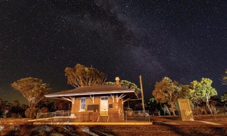

Wickepin town boasts impressive sporting and recreational facilities including: a sporting oval, indoor courts, synthetic bowling greens, a swimming pool, golf course, tennis courts, and a dynamic nature playground located within the town’s centre. This RV friendly town has 24-hour fuel available. Discover some of Wickepin’s main attractions…
Albert Facey Homestead
Located in the main street of Wickepin, the Albert Facey Homestead celebrates the life of Albert Facey, author of the bestselling autobiography ‘A Fortunate Life’. The homestead was moved into town from his family farm and has been lovingly restored to reflect the harsh and simple lifestyle of the 1930s.
Wickepin Heritage Precinct and Walk Trail
The Wickepin Heritage Precinct walk trail is located within the town centre. There you’ll find The Old Railway Station, Stationmaster’s House, Old Police Station,
along with the former Road Board Building all built prior to 1915.
Yealering
The town of Yealering is located 27km north of Wickepin. Yealering is known to be the only country town in Western Australia with a lake within the town boundary and is part of the Living Lakes initiative.
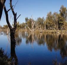
Lake Yealering
In a picturesque setting with picnic and barbecue facilities, Lake Yealering is an ideal place for a variety of water sports including skiing, swimming, sailing and windsurfing. There are nature walks throughout the surrounding bush land which is alive with birdlife. Overlooking the lake are modern sporting facilities including tennis courts, a bowling green and cricket oval. The golf course surrounds the lake and the 18th hole features a unique tee box set out over the water. The Town Hall,
VISITOR INFORMATION
SHIRE OF WICKEPIN
77 Wogolin Road, Wickepin (08) 9888 1005
admin@wickepin.wa.gov.au
wickepin.wa.gov.au
or contact Wickepin Community Resource Centre
24 Wogolin Road Wickepin WA 370 (08) 9888 1500
Harrismith
Harrismith is located 45km south-east of Wickepin and the area boasts some of Western Australia’s most unique wildflowers. An established wildflower walk trail with informative signage surrounds the town and showcases the magnificent display of orchids, verticordias, grevilleas and banksias. Visitors will enjoy the display of historical machinery and memorabilia assembled by local community members including information about the well-renowned Rabbit Proof Fence. Facilities in the town include a Town Hall, Caravan Park and accommodation units, cricket oval as well as an 18-hole golf course.
Tincurrin
The small town of Tincurrin is located 35km south of Wickepin which showcases a stunning display of wildflowers.
australiasgoldenoutback.com | The Wheatbelt | 69
caravan park and picnic facilities are located on the lake shore.
Toolibin Lake
Albert Facey Homestead
Shire of YILGARN
SOUTHERN CROSS 368km east of Perth
The town of Southern Cross was founded in 1888 and is named after the stars that guided the first settlers. Today, all the streets in the area are named after stars and constellations. If you are sightseeing or just taking a break from driving, there are many interesting sites, facilities and amenities situated within town. Off Great Eastern Highway on Antares Street you will find cafés, a chemist, hardware store, newsagent, post office, pubs, a supermarket, op-shop and hairdresser. Or enjoy the outdoors and rest under the shade of a gum tree in the Rotary Park, with barbecue and toilet facilities. Parts of the main street and park are covered by free public wi-fi. Reminisce at the Yilgarn Historical Museum, exercise in our well-appointed outdoor fitness centre, or give your four-legged friend a workout at the dog park. If visiting during summer come and have a splash to cool down in our swimming pool, free of charge.
Constellation Park
Located on Antares Street, Constellation Park has a new skate park, toddlers bike track, fenced and shaded playground, barbecue and soccer pitch.
Southern Cross Dog Exercise Park
Come and exercise your four-legged friend at the dog exercise area located conveniently close to the RV dump point on the corner of Achernar and Sirius Street.
Southern Cross Aquatic Centre
The new aquatic facility located on Antares Street boasts a 25m pool with
At a Glance
WHAT’S ON
Australia Day Community Breakfast — 26 Jan 2023
ANZAC Day Dawn & 11am Services
— 25 April 2023
Southern Cross Car and Bike show — Biannually, next one Sept 2024
Yilgarn Agricultural Show — 26 Aug 2023
wheelchair access as well as a wading pool with water features. There’s also a basketball half court, cricket net, barbecue facilities and kiosk. Open November to March with free entry.
Yilgarn History Museum
Located on Antares Street, see the earliest Registrar’s Office in Western Australia (now the Museum) built in 1892.
Wimmera Hill Lookout
This lookout allows visitors to view the townsite of Southern Cross, the surrounding farmland and gold mines.
BEYOND SOUTHERN CROSS
While journeying to or from Southern Cross, experience some of these highlights…
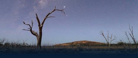
Karalee Dam
Collecting water running off the rocks, this historically significant aqueduct was constructed to provide water to the dam for steam trains. Great picnic and camping facilities, located 56km east of Southern Cross along Great Eastern Highway.
Check visit.yilgarn.wa.gov.au
TOP ATTRACTIONS
Yilgarn History Museum / Karalee Dam / Lake Koorkoordine / Wimmera Hill / Frog Rock
WILDFLOWERS TO DISCOVER
Spider Orchid / Donkey Orchids / Dainty Blue Orchids / Tea Tree / Boryceae
SHIRE OF YILGARN
23 Antares Street, Southern Cross (08) 9049 1001
yilgarn@yilgarn.wa.gov.au visit.yilgarn.wa.gov.au
Frog Rock
A miniature wave-like formation, dam and picnic area located 30km southwest of Southern Cross.
Lake Koorkoordine
A vastly spectacular salt lake, which has recently become a popular land sailing destination.
The Sandalwood Motor Lodge has fully equipped air-conditioned motel style rooms. We offer free Wi-Fi in parts of the park, coin operated laundry facilities, free BBQ’s, playground, campers’ kitchen, recreation room with TV. Dogs are allowed in the caravan park but not in our lodge rooms (special needs & guide dogs excepted) conditions apply.

Great Eastern Highway, Southern Cross Tel: (08) 9049 1212
Email: caravanpark@yilgarn.wa.gov.au
Web: www.yilgarn.wa.gov.au
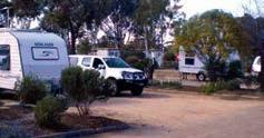
70 | The Wheatbelt | australiasgoldenoutback.com
Conveniently located on Great Eastern Hwy and within walking distance of the town centre, dog park and free community swimming pool. We offer 5th wheeler premium and drive-through bays, spacious tent sites, recently fully refurbished ablution block and an en-suite disability site.
Southern Cross Caravan Park & Sandalwood Lodge
Astrophotography
GOLDEN PIPELINE hERITaGE TRaIL
Duration: 2 to 4 days
Distance: One way Perth to Kalgoorlie 650km
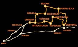
Road Conditions: Sealed roads with short stretches of maintained unsealed road to attractions.


Accommodation: Bed & Breakfasts, Self-Contained Units, Farm Stays, Motels, Hotels, Caravan Parks and RV Friendly Camp Sites. An impressive engineering feat, C.Y O’Connor’s water pipeline was constructed over 100 years ago. See the 1968 earthquake memorial sites at Meckering or experience an earthquake simulation room at Cunderdin’s No.3 Pump Station Museum. South of Tammin visit Charles Gardner Nature Reserve on route to see Tammin’s Hunt’s Well. Don’t miss the view from the Kellerberrin Hill lookout as the pipeline takes you past rock water catchments and springtime wildflowers. South of Merredin visit Totadgin Conservation Park and another of Hunt’s Wells then travel onto the ruin of Merredin’s No.4 Pump Station and Merredin Peak and Railway Dam. Two museums at Merredin showcase the military and railway history of the town. The site of the No.1 Rabbit Proof Fence is 5km east of Burracoppin. North of Carrabin is Westonia where the town’s building facades are preserved and its history encapsulated in the Hood-Penn Museum. Visit Southern Cross’s Yilgarn History Museum displays and mineral collection and 50km east Karalee Rock and Dam with an original timber and steel aqueduct. The Great Western Woodlands follows the Great Eastern Highway to RV Friendly sites onto Coolgardie and Kalgoorlie. www.goldenpipeline.com.au
For more information visit www.wheatbelttourism.com or www.weroc.com.au
PIONEERS’ PaThWaY

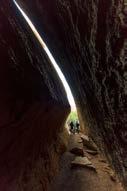
Duration: 2 to 5 days


Distance: 292km One Way Perth via Toodyay to Merredin


Road Conditions: Sealed road with some unsealed access sections into nature reserves.
Accommodation: Bed & Breakfasts, Self-Contained Units, Heritage Homestead, Motels, Hotels, Caravan Parks and RV Friendly Camp Sites.

Traverse the Wheatbelt following the well worn trail many prospectors once took on their way to the Yilgarn and Kalgoorlie Goldfields.

This scenic journey wanders past expansive Wheatbelt farmland and through the small towns of Goomalling, Dowerin, Wyalkatchem, Trayning, Kununoppin and Nungarin, providing a classic experience of Western Australia’s Wheatbelt heartland.
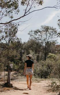
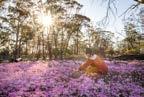
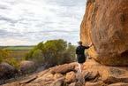
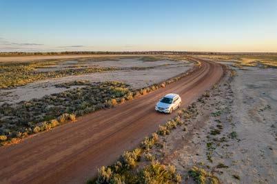
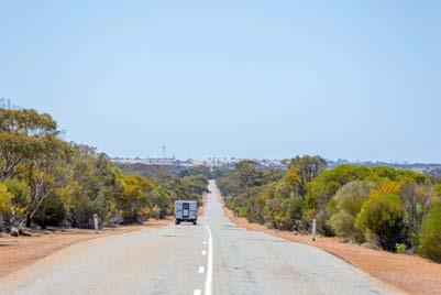
Whether you’re travelling from Perth to the Goldfields, or from the west to east coast, this trip is a rewarding alternative to the Great Eastern Highway direct route, adding only 44 kilometres to the journey. It offers the remarkable view of wildflowers in colourful profusion during the season, invigorating leg-stretching nature walks, as well as numerous buildings and museums reflecting the unique rural historical significance of the region.
www.pioneerspathway.com.au


www.storytowns.com.au
Weir)
www.wheatbeltway.com.au
Outcrops • Walk trails • Bushland Wildflowers • Museums • Drive In Caravan Parks • Free Camping Country Accommodation • RV Friendly An open adventureroad SELF DRIVES CENTRAL WHEATBELT FOR YOUR FREE MAP & GUIDES CALL 1300 736 283 (WA ONLY) OR (08) 9041 1666 MERREDIN WA 6415 www.wheatbelttourism.com CENTRAL WHEATBELT VISI TO R CENTRE
Granite
SOUTHERN CROSS COOLGARDIE MERREDIN NORTHA TAMMIN CUNDERDIN MECKERING KELLERBERRIN WESTONIA M KALGOORLIE-BOULDER PERTH (Mundaring
HYDEN LAKE GRACE WAVE ROCK An International Civil Engineering Landmark PERTH NORTHAM DOWERIN WYALKATCHEM TRAYNING NUNGARIN MERREDIN GOOMALLING TOODYAY
through the
& the KalgoorlieGoldfields
TOP THINGS to See & Do
• Try your luck on a gold prospecting tour
• Don hi-vis and tour the Super Pit
• Explore the historic streetscapes
• Make an epic journey of discovery through the Norseman Heritage Trail
• Marvel at the Gormley Sculptures of Lake Ballard
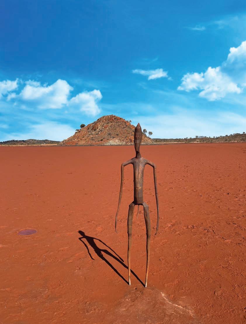
• Explore Aboriginal history on a cultural tour
• Wander through Kalgoorlie’s Heartwalk trail to 50 stunning murals
• Amble along Coolgardie’s dog-friendly Bluff Trail Walk
• Explore the fascinating Gwalia ghost town
• Unearth the virtual journey of gold via the Heart of Gold Discovery Trail
• Take a break and experience the local flavours of an outback pub
72
From the early era of gold rush fever to the scale of modernday mining, Kalgoorlie / Karlkurla and the Goldfields have epitomised the character, sense of adventure and outback glamour of a long dreamt of destination. The true heart of gold of Western Australia is here – come on out and discover it for yourself.
Built on the dreams of fortune seekers, the busy twin city of Kalgoorlie-Boulder presents stunning colonial architecture that will immerse you in another era of gold rush glory and brazen pioneers.
The collection of notable civic buildings, hotels, infamous Hay Street brothels and shops chronicle more than a century of history with tales of scandals, scallywags, successes and swindles, brothers, bootleggers and rebellions (discover more on page 74).
Call into the impressive KalgoorlieBoulder Visitor Centre to plan your visit. The Museum of the Goldfields is a great place to begin, then perhaps pan for gold and try the unique game of ‘Two Up’ at Hannan’s North Tourist Mine
Visit the Super Pit, the home of the world’s richest gold mine, to marvel at the collossal engineering feats and truly appreciate the scale of today’s mining. Gear up in high-visibility clothing and join a guided tour or just drive yourself to Super Pit Lookout (check to see if blasts are scheduled and time your visit).
From quirky outback pubs to wide open landscapes that’ll steal away your
How to Get There
By Road:
Kalgoorlie is the transport hub of the Goldfields, with a good network of sealed roads that link Kalgoorlie with Perth, Esperance and the Northern Goldfields, Murchison and Gascoyne.
breath, the Golden Quest Discovery Trail shows off the best of this outback territory. This four-day road trip takes you on an adventurous loop from Coolgardie to Laverton and back, along the glittering Golden Mile and through Australia’s greatest outback city, Kalgoorlie-Boulder.
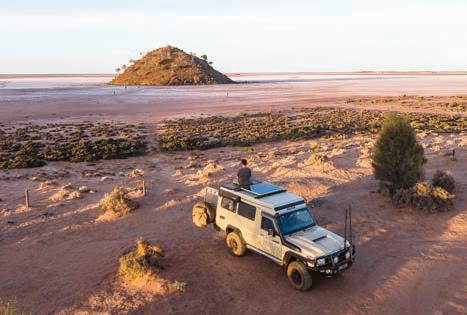
This all-wheel drive route also brings you to the acclaimed Antony Gormley Sculptures near the township of Menzies. Placed into Lake Ballard, a salt lake of immense beauty, the metal artworks seem to take on a life of their own, stoically inhabiting their remote address. Another lake worth a visit is Lake Lefroy in Kambalda, which hosts exciting land sailing events.
In Coolgardie, walk the twin cemeteries for a fascinating insight into the history of a ville, the site of WA’s first major gold rush and almost home to both a parliament and succession movement. In Leonora, a heritage trail showcases buildings and sites dating back to 1896 and Laverton’s Great Beyond Explorers’ Hall of Fame uses technology to bring the pioneers and olden days to life.
The pioneering spirit is alive and well in the locals who will always give you a good yarn over a cold beer in traditional outback hotels like Kookynie’s Grand Hotel (meet Willie, the resident horse), and the Broad Arrow Tavern For seasonal ales head across to Kalgoorlie’s Beaten Track Brewery
By Rail:
Transwa operates the Prospector train, with daily services between Perth and Kalgoorlie.
Tel: 1300 662 205.
If you have a valid Western Australia Pension Concession Card you are entitled to one free return trip or two single trips per calendar year on the Transwa network. Book your Transwa Seniors Break in person at the WA Visitors Centre or call on 1800 812 808 or Kalgoorlie Boulder Visitor Centre on 08 9021 1966.
The coast to coast Indian Pacific rail service, travelling between Sydney, Adelaide and Perth, travels through Kalgoorlie weekly in each direction.
Tel: 13 21 47.
By Air
Kalgoorlie-Boulder is serviced by Qantas and Virgin Airlines with multiple daily flights from Perth. Skippers flies from Perth to Leonora, Laverton and Wiluna.
Reservations:
Qantas 13 13 13 | Virgin 13 67 89 |
Skippers 1300 729 924
By Coach
Goldrush Tours operates a weekly service linking Kalgoorlie-Boulder, Menzies, Leonora and Laverton.
Tel: 1800 620 440.
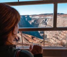
australiasgoldenoutback.com | Kalgoorlie-Boulder & the Goldfields | 73
By TOM SPARK
Runs Deep A Rich History
In a state full of such beautiful extremes, from tropical climates in the north to snow-capped peaks in the south, many a WA bolthole can claim to be unique. But, with apologies to grammar obsessives, there is one spot that can claim to be the most unique of them all – and that’s Kalgoorlie-Boulder. Here’s a city that, unlike so many of its Aussie counterparts, is a long, long way from the nearest ocean — some 340km to be precise, meaning it’s surrounded by the kind of dry, red, unforgiving bush
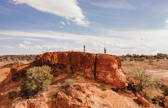
that only the hardiest of souls would brave. So why is it there then? The answer’s glitteringly simple. Gold.
The story goes that, back in 1893, a pair of gung-ho prospectors by the name of Paddy Hannan and Tom Flanagan were trudging through the land of the Wangkatja people when one of their horses threw a shoe. The curses and despair of the forced halt, however, quickly turned to whoops of delight as they spotted signs of gold where that fortuitous horseshoe landed and
realised that they were going to be very, very rich men.
News of their luck spread quickly and pretty soon hundreds of fortunehunters descended on the area and the town of Hannan’s Find was born. The early settlement grew and grew — by 1901 it was 4,800-strong and had been rechristened Kalgoorlie, a corruption of karlkurla, the native Aboriginal word for silky pear and a bush tucker staple abundant in the area. Now, though, there was a new natural treasure

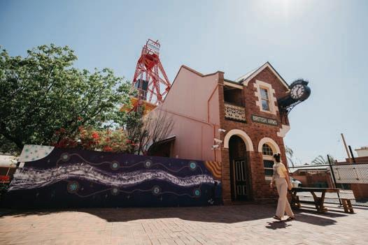
While its wild west reality has tempered over time, the richness of Kalgoorlie-Boulder’s gold rush origins flow through the city’s veins and can be felt all around.
74 | Kalgoorlie-Boulder & the Goldfields | australiasgoldenoutback.com
taking centre stage — the gold buried in what was to become known as the Golden Mile, a piece of real estate many consider to be the world’s richest square mile of earth.
With the gold rush came development. Railway lines linked Kal with Perth and the rest of the country — the Prospector still whips through the bush from the state capital every day. When nickel was found in large quantities, the expansion continued apace and soon this young town was quite the Australian powerhouse.
It was, however, quickly becoming the black sheep of the family, as its reputation for being a southern hemisphere wild west blossomed. Bandits were rife and prostitution flourished. These were puritanical days, of course, and pretty soon Kal found itself as something of a pariah. The perceived government neglect led to calls for the area to secede from the rest of country and become Auralia — a
name taken from the Latin for golden. In the end the plan came to nought, but it was a shot across the bows to the rest of the country — you may not like our way of life, but if you want to share our gold, then you’re stuck with it.

From there, then, Kalgoorlie flourished, making itself both famous and infamous across the world. C.Y. O’Connor’s ambitious pipeline, for instance, bringing fresh water from Perth to the desertbound golden oasis, remains a triumph in engineering — and the Super Pit was, for many years, Australia’s largest opencut gold mine.
But still, this was Kalgoorlie, and the hard-living excess had no plans to go away. Brothels abounded — one now serves as a museum and is a major tourism draw — and the iconic game of two-up left many a miner destitute when the pennies came down the wrong way up.
Skimpies, barmaids who serve drinks and tucker in every state of undress,
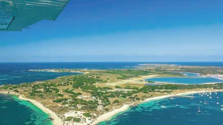
were a proud institution, never hidden away — for many a year The Kalgoorlie Miner, a bastion daily newspaper that still trades today after launching in 1895, published ‘Skimpie of the week’, and getting featured was a honour. And as if all this weren’t enough, throw in the odd earthquake — the last big one hit in 2010 — and you can see just how unique this place is.
City status arrived in 1989, when Kal and the Shire of Boulder merged to become Kalgoorlie-Boulder, and much has been done to tone down the wild west feel as the world grows up. The annual Diggers and Dealers festival, for instance, the biggest and most influential mining meet-up in Australia, has worked hard to throw off some of the more unsavoury aspects of early settler culture. But the spirit of the wild west, the adventure, the derring-do, the ever-driving dream of a golden future, truly lives on in KalgoorlieBoulder.
Delve into augmented reality games, watch exclusive videos, explore fun widgets and uncover audio stories walking Kalgoorlie’s #heartofgold Discovery Trail.
DOWNLOAD THE
HEART OF
AUSTRALIA APP DISCOVER A NATION BUILT
GOLD!
CLAIM
MEDALLION! Discovery Trail Walk Kalgoorlie’s #heartofgold Discovery Trail using the free Heart of Gold Australia app! DOWNLOAD APP goldindustrygroup.com.au/heart-of-gold-australia-app
FREE
GOLD
ON
YOUR
australiasgoldenoutback.com | Kalgoorlie-Boulder & the Goldfields | 75
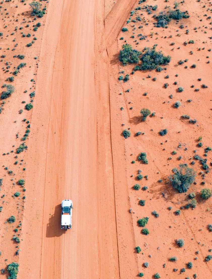
Wanjarri Nature Reserve Queen Victoria Spring Nature Reserve Mount Manning Range Nature Reserve Mount ManningHelena & Aurora Ranges Conservation Park Boorabbin NP Goldfields Woodlands NP Goongarrie National Park Dundas Nature Reserve Jilbadji Nature Reserve Balladonia Roadhouse Balladonia Norseman Fraser Range Station TO EUCLA 507km 108km 82km 50km Hyden Wave Rock 162km The Breakaways Campground Lake Johnston Campground McDermid Rock 297km LEGEND Sealed road Unsealed road ROAD TRIPS Golden Quest Discovery Trail The Outback Way Anne Beadell Leonora Loop Trails Gunbarrel Highway Norseman Heritage Trail KALGOORLIE-BOULDER Southern Cross Broad Arrow 132km 280km Coolgardie Koolyanobbing Leinster Agnew Leonora Gwalia Laverton Bullfinch Menzies Kambalda TO RAWLINNA 378km (from Kalgoorlie-Boulder) Kookynie Niagara Dam 187km 105km 118km 131km Sandstone 146km Goongarrie TO WARBURTON 552km (from Laverton) TO PERTH 369km (from Southern Cross) TO ESPERANCE 203km (from Norseman TO COOBER PEDY 1,350km (from Laverton) TO MT MAGNET 154km (from Sandstone) Wiluna Carnegie Station TO WARBURTON 826km (from Wiluna) Meekatharra 181km 38km 165km AgnewLoop DarlotLoop The Terraces Road Trips KALGOORLIE & THE GOLDFIELDS 76 | Kalgoorlie-Boulder & the Goldfields | australiasgoldenoutback.com
THE OUTBACK WAY
4 day | Unsealed roads
Shires on your journey: Laverton
Known as ‘Australia’s Longest Shortcut’, the 2,800km Outback Way offers an awe-inspiring journey through the red centre from the gold rush town of Laverton, Western Australia to Winton in Queensland.
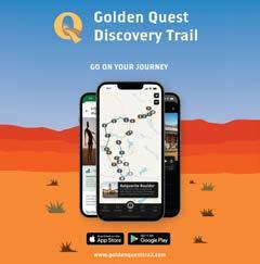
The Outback Way crosses central Australia through the Great Victoria Desert encountering vast salt lakes,
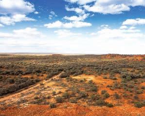
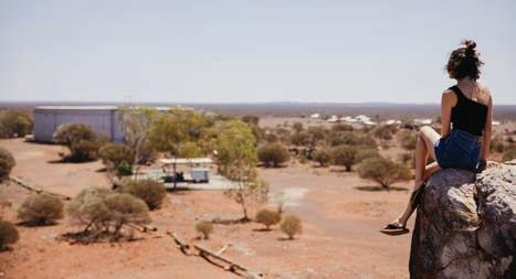
scenic nature reserves, waterholes, natural springs and caves. The route runs via Uluru, Alice Springs and Winton where you’ll learn about ancient Aboriginal culture, life in the outback, and the natural environment of Australia’s central desert. Visitors can enjoy searching for treasure boxes hidden along the ‘Outback Way Geocache Trail’.
This route is fast becoming one of the must-see and must-do coast to coast drives. Permits are required.
WA NT TOURS


The West Coast is our home! High-quality guided tours in comfortable vehicles for small groups. Tour modules can be easily combined and guarantee all-year round regular departures from two persons onwards. Consequently, according to budget and planned duration, your individualised holiday can be found.


Big4 Prospector Holiday Park Kalgoorlie

GUNBARREL HIGHWAY
6 days | Unsealed roads
Shires on your journey: Dundas
Get ready to experience one of Australia’s most famous and challenging 4WD tracks and tell your friends you conquered the rugged and unforgiving Gunbarrel.
Built by surveyor Len Beadell, this 1,400km outback adventure is perfect for the experienced and well prepared 4WD enthusiast.
The route runs from Wiluna in WA’s Northern Goldfields to Yulara in the Northern Territory. Highlights include Giles Weather Station, Banjo Creek, Mt Beadell, Lasseter’s Cave and Docker River. You’ll find original bores and blaze trees along the trail, and keep an eye out for the interpretative plaques as well as wild camels and dingoes. Travelling with another vehicle is recommended and permits are required.
32 Paitt St, Willagee WA 6156 08 9331 3933 | info@want-tours.com.au www.want-tours.com.au
Billygoat Hill, Laverton
australiasgoldenoutback.com | Kalgoorlie-Boulder & the Goldfields | 77
Gunbarrel Highway
GOLDEN QUEST DISCOVERY TRAIL
3 days | Sealed and unsealed roads
Shires on your journey: Coolgardie, Menzies, Laverton, Leonora
Travel from Kalgoorlie-Boulder on an amazing loop trail from Coolgardie to Laverton through incredible goldfields
OTHER ROAD TRIPS TO EXPLORE
Anne Beadell | 5-7 days (unsealed roads)
Leonora Loop Trails | 2 days (unsealed and sealed roads)
Norseman Heritage Trail | 1-2 hours (sealed roads)
Scan the QR code for more insights.


towns rich in heritage, history and charm. This is a true outback adventure which unearths the riches of the Goldfields’ 120-year old gold rush and showcases what is still one of the world’s biggest gold producing regions.
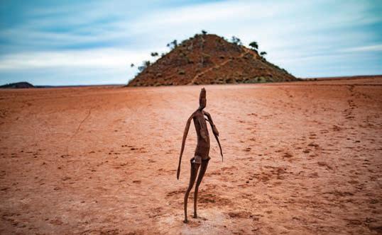
The 965km trail leads you from the buzz of one of the largest open-cut gold
Gunbarrel Highway
mines on earth, the Super Pit, to the striking beauty of artist Antony Gormley’s 51 steel statues on Lake Ballard. There are a number of beautiful nature reserves and campsites, including the man-made lake Niagara Dam. Tour the town of Kookynie, (the pub is well worth the stop) as well as old camps in the town of Gwalia, near Leonora, where the 31st United States President, Herbert Hoover, lived and worked.
The linked Green Trail highlights sites in the Kambalda and Coolgardie areas with outstanding environmental, historical or cultural values such as beautiful woodlands and natural salt lakes.
Lake Ballard
AWARD-WINNING SELF-DRIVE ADVENTURE IN WESTERN AUSTRALIA’S GOLDFIELDS


SELF-DRIVE ADVENTURE IN WESTERN AUSTRALIA’S GOLDFIELDS

THE TRAIL PROVIDES TRAVELLERS WITH A UNIQUE INSIGHT INTO THE RICH GOLDRUSH HERITAGE OF THE REGION.
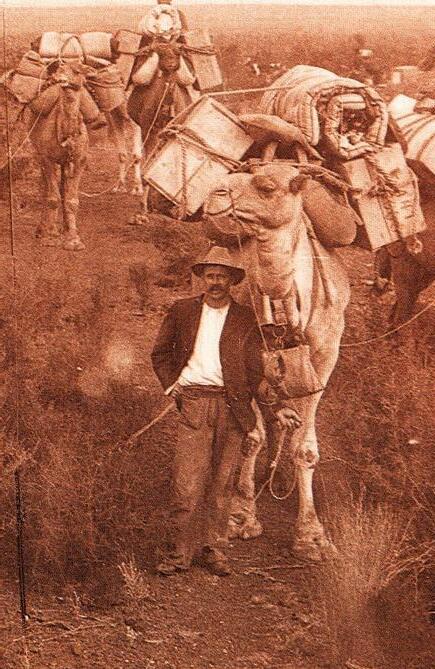
A COMPLETELY REVISED AND UPDATED 2ND EDITION OF THE GUIDEBOOK IS AVAILABLE FOR DOWNLOAD FROM OUR BRAND NEW WEBSITE, FROM VISITOR CENTRES ALONG THE TRAIL AND AT SELECT BOOKSTORES.

THE TRAIL PROVIDES TRAVELLERS WITH A UNIQUE INSIGHT INTO THE RICH GOLDRUSH HERITAGE OF THE REGION. A COMPLETELY REVISED AND UPDATED 2ND EDITION OF THE GUIDEBOOK IS AVAILABLE FOR DOWNLOAD FROM OUR BRAND NEW WEBSITE, FROM VISITOR CENTRES ALONG THE TRAIL AND AT SELECT BOOKSTORES.

FP Golden Quest Discovery Trail Complete set of 25 AUDIO TRACKS aGUIDEBOOK YOUR OFFICIAL GUIDE DETAILS THE 25 OFFICIAL SITES THAT PUNCTUATE THE 965KM TRAIL, COMPLEMENTED BY 25 AUDIO TRACKS TO BRING YOUR ADVENTURE TO LIFE. AN
Complete set of 25 AUDIO TRACKS a AN
WWW.GOLDENQUESTTRAIL.COM
AWARD-WINNING
WWW.GOLDENQUESTTRAIL.COM
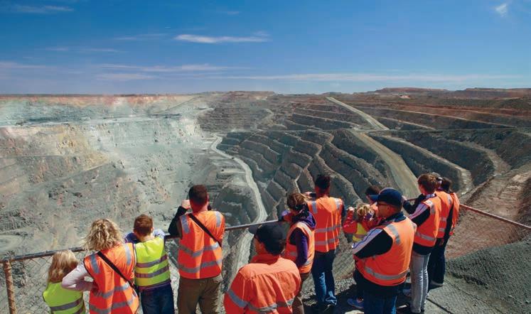
Visit rydges.com/kalgoorlie to book. Use promo code GOLDEN. Stay Friday or Saturday night & enjoy a bottle of wine on arrival on us and a sleep-in the next day with complimentary late check-out at midday* YOUR DESERT OASIS *Subject to availability. Black-out dates apply.
World Class Golf
Tee off at the Kalgoorlie Golf Course, one of Australia's top 20 public courses Enjoy the outback with its rugged and natural terrain, making for the perfect backdrop for a round.
Exciting Events

Discover the local arts and culture scene with an array of renowned events throughout the year. To find out what's on head to ckb.wa.gov.au/events for event listings.

A Rich History & Heritage
Immerse yourself in the unique history of Kalgoorlie-Boulder by visiting the Kalgoorlie and Boulder Town Halls, as well as the thought provoking displays at the Gold-fields War Museum.
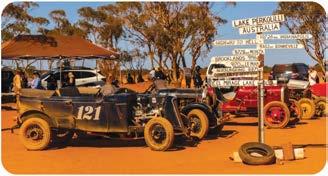
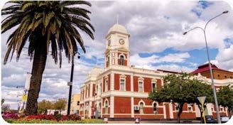

Vibrant Arts & Cultural Scene
Take the Heartwalk Tour of the Kalgoorlie CBD. This award-winning project includes over 60 public art murals from talented artists. Go at your own pace and stop at a local cafe along the way.
Unique experiences like no other visitkal.com.au

City of "" Kalgoorlie Boulder
City of KALGOORLIE-BOULDER
A Rich Gold Rush History
KALGOORLIE-BOULDER
596km east of Perth
Located in the Eastern Goldfields region of Western Australia, the City of Kalgoorlie-Boulder is a vibrant regional centre with a population of 30,000.
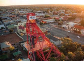
Its rich history and culture provide an experience like no other. There is something for everyone including a variety of activities and attractions, captivating scenery and enthralling culture.
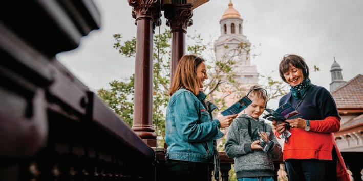
Kalgoorlie-Boulder promises a unique adventure to all those who visit.
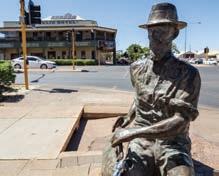
Explore
FREE ENTRY
Open daily | 10am – 3pm 17 Hannan Street, Kalgoorlie
museum.wa.gov.au/goldfields
In 1893, prospectors Patrick (Paddy) Hannan, Tom Flanagan, and Dan Shea, were travelling through the region, when one of their horses cast a shoe. During the unexpected interruption to their journey, the men noticed signs of gold located on a hill north of what is now the City of Kalgoorlie-Boulder. In the hope of discovering gold, they decided to stay and investigate.
On 17 June 1893, Hannan filed a Reward Claim, leading to hundreds of men swarming to the area in
search of gold; and Kalgoorlie, originally called Hannan’s Find, was born. However, it was the major gold discoveries of William Brookman and Sam Pearce, who would go on to make up the richest square mile on earth known as “The Golden Mile,” that secured the region’s future.
In 1896 the town site was laid out and gazetted. The first town blocks sold quickly, then a second sale a few months later saw blocks sold for twice as much!
Building then began in earnest. Elaborate business facades and public buildings lined Burt Street. Grand brick homes were built for doctors and public officials. In 1908 the Boulder Town Hall was opened.
In 1989, the Town of Kalgoorlie and Shire of Boulder formally amalgamated to create the City of Kalgoorlie-Boulder.
the rich history of the Goldfields and the city’s mining heritage.
Image: Billy Stokes
Paddy Hannan
The name ‘Kalgoorlie’ is derived from the Wangai word ‘Karlkurla’, or ‘Kulgooluh’, meaning ‘place of the silky pears’.
82 | Kalgoorlie-Boulder & the Goldfields | australiasgoldenoutback.com
DISCOVER A UNIQUE HERITAGE
Kalgoorlie Town Hall
The Kalgoorlie-Boulder Visitor Centre is located inside the Kalgoorlie Town Hall. Whether you need information on the area or just want to marvel at this magnificent building, the Kalgoorlie Town Hall is the heart of the city. Guided tours of this historic building are available on Monday and Wednesday at 10:30am.
Boulder Town Hall and Goldfields War Museum
With its pressed tin ceilings, wrought iron balustrades, and beautifully
preserved interiors, the Boulder Town Hall is the home of the Goldfields War Museum. Opened in 1908, not only is the building itself of historic architectural significance, but also provides a detailed history of the Goldfields. Visitors come from far and wide to the hall to see the priceless and world-renowned Philip Goatcher stage curtain. This spectacular artwork, painted in the Trompe-l’œil or ‘optical illusion’ style, depicts the scene of the Bay of Naples and has hung in the hall since 1908. Local guides offer tours of the Boulder Town Hall on Tuesdays and Thursdays at 10:30am and the Goldfields War Museum on Thursdays at 1:30pm, including war artefacts from the Boer
War, World Wars I and II, Korea, Malaysia, Vietnam, and more recent conflicts and peacekeeping missions. Immerse yourself in stories of the Goldfields region and its warfare history– a worthwhile and enriching experience for locals and visitors alike.
Tours: $10 Adult, $8 Concession, $4 Child (includes tour badge giveaway).
Museum of the Goldfields
The Museum of the Goldfields showcases the rich history of the Eastern Goldfields and the city’s mining heritage. Step back in time to what life would have been like for early prospectors and their families in the early 1900s and explore the state’s largest collection of gold bars and nuggets.
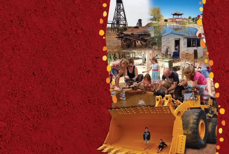
Hannans North Tourist Mine
During your visit, climb aboard a giant 793C haul truck, stand in the shovel of a 994F loader, listen to Paddy tell his tale of discovery, pan for gold and try your hand at a game of two-up. Open Sunday to Friday, 9am to 4pm.
Uncover the story of Australia’s Golden Mile, with a vibrant mix of Goldrush history and modern day mining. Climb aboard a giant 793C haul truck, stand in the shovel of a 994F loader, listen to Paddy Hannan tell his tale of discovery, pan for gold and try your hand at the legendary game of Two Up. Free BBQ and picnic facilities in the Chinese Gardens. Open Sun - Fri 9am - 4pm. Open Saturdays in holiday periods, please see our website for details. Entrance fees apply.
Like us on Facebook! Find us off the Goldfields Highway, 1.5km left from top end of Hannan St, Kalgoorlie.
T (08) 9022 1664 | www.hannansnorth.com.au
Kalgoorlie Town Hall
Boulder Town Hall
THINGS TO SEE & DO
The Kalgoorlie Two-Up Shed
Experience the thrill of ‘two-up’, a classic Australian gambling game. As the only legal venue of its kind in WA, the Kalgoorlie Two-Up Shed is still in its original condition of corrugated iron and brush ring. Games are held on Sundays from 2.30pm.
Goldfields Art Centre
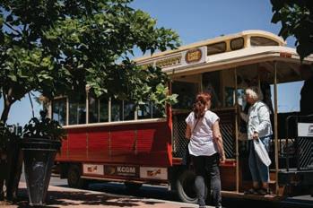
Owned by the Perth Theatre Trust and proudly operated by the City of Kalgoorlie-Boulder, the Goldfields Arts Centre presents an annual program of events that provides unique cultural experiences and opportunities for residents and visitors alike. Stroll upstairs to the A-class gallery, home to year-round exhibitions and public programs showcasing works of local artists, national and state touring exhibitions, and the City of KalgoorlieBoulder’s annual Art Prize and Art Collection.
Kalgoorlie Golf Course
The Kalgoorlie Golf Course is a premier, 18-hole championship golf course, designed by top course architect Graham Marsh. The course is currently ranked number 20 in the top 100 public golf courses in Australia and is also home to two holes of the Nullarbor Links — an 18hole course spanning 1,365 kilometres from Ceduna in South Australia to Kalgoorlie-Boulder.
Whether you want to hit 9 or 18 holes, or try out the driving range, stop for a hit of golf at one of the country’s best courses. You may even bump into one of the friendly local kangaroos while there.
Goldfields
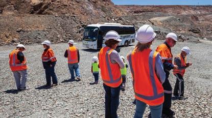
Oasis Recreation Centre
‘The Oasis’ is open year-round, and offers an Olympic-sized, heated indoor pool, child-friendly swimming areas, playgrounds, two waterslides, and a fully equipped 24-hour gymnasium with group fitness

classes. The facility also boasts an indoor stadium, outdoor sporting field, spas, saunas, and a kiosk.


Karlkurla Bushland Park
A gateway to the Goldfields Western Woodlands, Karlkurla Bushland Park is 200-hectares of regenerative natural bushland. With four kilometres of walking trails, it is abundant in native plant species, which are highlighted with interpretive flora signage throughout.
Hammond Park
Hammond Park is the jewel of the Kalgoorlie-Boulder’s parks and reserves. It is a haven for a variety of birdlife, including peacocks and pink cockatoos, who wander freely around the park. Other popular features include a miniature Bavarian Castle decorated with 40,000 gemstones and an aviary. Pack a picnic, take the kids to the playground, or watch the world go by over a drink or light lunch from the onsite café.
•
“Katherine
•
•
HOSPITALITY KALGOORLIE
560 Hannan Street | T: (08) 9021 2888 | E: kalgoorlie@hospitalityinns.com.au | W: www.hospitalityinnkalgoorlie.com.au
Well appointed, affordable air conditioned motel rooms with locally renowned on-site restaurant
Station” plus cocktail bar, room service and outdoor swimming pool with BBQ facilities.
A special brand of Goldfields hospitality!
• Foxtel including movies & sport
FREE wireless internet
FREE guest laundry
Book DIRECT and save 10% (website or phone)
84 | Kalgoorlie-Boulder & the Goldfields | australiasgoldenoutback.com
Kalgoorlie Tram Tour Kalgoorlie Super Pit
UNIQUE EXPERIENCES
There is always something happening in the City of Kalgoorlie-Boulder. Visit ckb.wa.gov.au/events to see what community events are happening during your stay.
Heartwalk
Grab a coffee from a local café and immerse yourself in culture with an award-winning arts trail. Heartwalk features over 60 street art murals, installations, and sculptures, created by artists from the Goldfields and beyond. Self-guided walking trail maps can be downloaded at artgold.net.au/artmap
The Round
Join the thousands of people who flock to Kalgoorlie-Boulder from all over the country for The Round — a feature event in the WA racing calendar.
The outback city provides the perfect backdrop for this one-of-a-kind event, giving you an opportunity to experience the best of Kalgoorlie-Boulder’s culture, food, wine, and fashion. Head to the Kalgoorlie-Boulder Racing Club’s website for the calendar of events during The Round
Lake Perkolilli Red Dust Revival
This world-renowned bi-annual event unique to Kalgoorlie-Boulder is every vintage car and motorbike enthusiast’s dream. Held 32km north-east of the city, the lake’s unique hard clay pan bed provides the ideal race landscape for this large-scale motorsport event which re-enacts racing pre-World War II. Camping on site is available. Event dates can vary, for more information please visit the City of Kalgoorlie-Boulder’s website.
Stay a while with free RV stays
In addition to services offered at local caravan parks, the City of KalgoorlieBoulder offers two 72-hour RV stay areas for self-contained vehicles.
Centennial Park - Hannan Street, Kalgoorlie. Set alongside shady parklands and located within walking distance to Kalgoorlie’s CBD.
Lake Douglas - Enjoy the beauty of the outback in this bushland setting -
located 15km west of Kalgoorlie-Boulder off the Great Eastern Highway.
Tours
There are a variety of tours to choose from in Kalgoorlie-Boulder. Hop on a historic tram for daily tours of KalgoorlieBoulder, that will take you to several local attractions. Spend the day as a gold rush pioneer, exploring 50 sites on a Kalgoorlie-Boulder Audio Walking Tour, available for hire from the KalgoorlieBoulder Visitor Centre. Wander the streets of Kalgoorlie’s CBD to explore 11 locations for the #heartofgold Discovery Trail.
At a Glance
WHAT’S ON
Australia Day Celebrations —
26 Jan 2023
Sunset Concert Series — Jan-Feb 2023
Outback on Ice Experience — April 2023
Multicultural Festival — June 2023
Goldfields Cyclassic — June 2023
ArtPrize — Sept/Oct 2023
WA PGA Championship — Oct 2023
Lorna Mitchell Spring Festival — Oct 2023
Saint Barbara’s Festival & Parade — Dec 2023
Christmas in the City — Dec 2023
TOP ATTRACTIONS


Historic Town Halls / Goldfields

Woodlands National Park / Kalgoorlie
Golf Course / Goldfields Arts Centre / Super Pit Lookout
WILDFLOWERS TO DISCOVER
Everlastings / Large-fruited Mallee / Mulga / Spider Flower / Yellow Cassia
VISITOR INFORMATION
KALGOORLIE TOWN HALL
316 Hannan Street, Kalgoorlie (08) 9021 1966

visitors@kalgoorlietourism.com kalgoorlietourism.com

• Central location, just minutes from the town centre • Self-catering apartments, executive rooms & spa suites • Onsite restaurant Kal Brew Co. • Free Foxtel & Free Car Parking 430 Hannan Street, Kalgoorlie WA, 6430 E: reservations@theviewonhannans.com.au T: (08) 9091 3333 www.theviewonhannans.com.au
The View on Hannans Kalgoorlie
Boulder Town Hall
australiasgoldenoutback.com | Kalgoorlie-Boulder & the Goldfields | 85
Kalgoorlie Town Hall
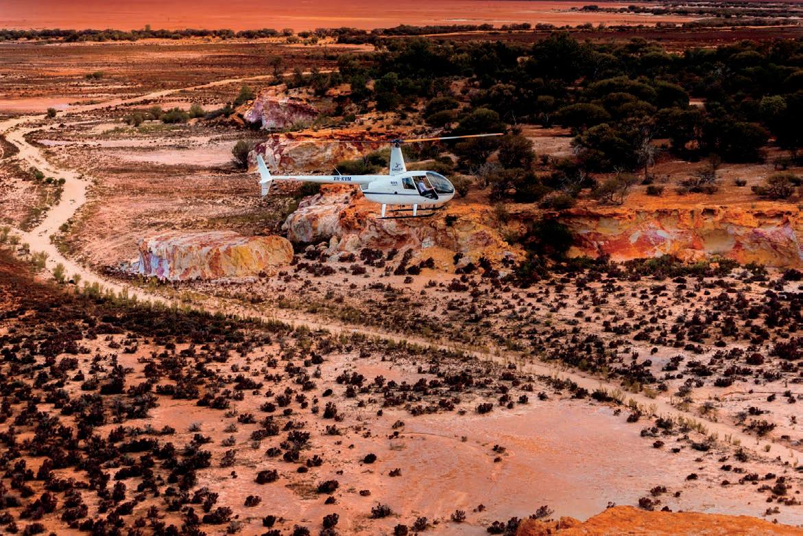
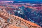


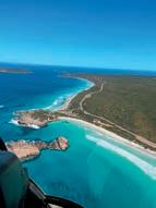


ScenicFlight 0432 237 744 | WWW.CIRCLEHHELICOPTERS.COM.AU | @CIRCLEHHELICOPTERS PACKAGES KALGOORLIE GEMS Witness the rare beauty of Kalgoorlie-Boulder from above, take in its history and find yourself in awe of the mammoth size and location of the infamous KCGM Super Pit, in coerce with this remote town that we call home. 15 MIN | $205 PER PERSON GOLDFIELDS LAKE COUNTRY This flight truly encompasses the diversity of our region. Your flight will depart Kalgoorlie, over the super pit and all our special bits, then you will break out of the city limits and head north to some impressive expanses of Salt Lake Country that truly set Kalgoorlie-Boulder apart from the rest. 30 MIN | $385 PER PERSON BROADY BURGER + PINT With all trimmings above, devour the landscape and history of The Goldfields Capital by air on your flight to The Broad Arrow Tavern. Where we will stop in to fill up with a Famous "Broady Burger" and relax with a pint. This place really is a hidden GEM...! 2 HRS | $460 PER PERSON LUX HELI-PICNIC This is for those looking for a hearty taste of indulgment in The Goldfields...! For this flight our local partner will bundle up all you need to relax, explore and fill your cups. We will whisk you over Kalgoorlie to the most secluded little place you could ever dream. 2 HRS | $530 PER PERSON LUCKY BAY BREW ESCAPE Direct Kalgoorlie to the doorstep of the Lucky Bay Brewery in Esperance. We will land for a delicious lunch and a taster of the regions finest brew - absorb the fresh sea air and let yourself unwind... Enroute home witness the the pristine white sandy coast line and take a peek at Cape Le Grand National Park. 5.5 HRS | $1820 PER PERSON *terms and conditions apply to all flights n KALGOORLIE BOULDER VISITOR CENTRE g Audio Walking Tours � Bike Hire � Car Rental Contact the Kalgoorlie-Boulder Visitor Centre to book your next adventure to explore our region. Kalgoorlie-Boulder Visitor Centre, 316 Hannan Street, Kalgoorlie (inside the Kalgoorlie Town Hall) Phone: (08) 9021 1966 Email: visitors@kalgoorlietourism.com www.kalgoorlietourism.com GPS: Lat 30.748746. Long 121.4705232 �� Accommodation * Local Attractions � Scenic Flights II � Book Exchange Souvenirs and Gifts Train and Bus Bookings
Shire of COOLGARDIE
At a Glance
WHAT’S ON Coolgardie Rodeo and Ute Muster —
18-20 Aug 2023
Coolgardie Day — Sunday 17 Sept 2023
TOP ATTRACTIONS

Goldfields Exhibition Museum / Warden Finnerty’s Residence / Ben Prior Park / Cave Hill / Lake Lefroy
WILDFLOWERS TO DISCOVER
Mulla Mulla / Hop Bush / Eremophila / Ruby Dock
COOLGARDIE
557km east of Perth
Spend time in the footsteps of early goldfields pioneers as you explore the dramatic and rich history of Coolgardie “Mother of the Goldfields”. A kaleidoscope of history-making events highlights how the discovery of gold in 1892 led to the creation of a ramshackle tent city, before it went on to become the third largest city in Western Australia, servicing a population of 25,000 residents and 700 mining companies. Experience some of Coolgardie’s main attractions during your stay…
Lions Lookout
Offering spectacular panoramic views to the east of Coolgardie, as seen by Arthur Bayley and William Ford when they arrived here in 1892 and discovered gold.
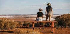
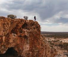
Historic Cemeteries
History is etched into the headstones of the Pioneer and Coolgardie Cemeteries. Among these headstones you will find John Holland and his wife, explorer Ernest Giles, and Bertha Finnerty, wife of the first Magistrate and Warden of the goldfields.
Goldfields
Exhibition Museum
This museum is housed in the historic Warden’s Court Building (built 1898). Each room features fascinating displays of the dramatic and often tragic stories of life in and around Coolgardie during the gold rush days. Here you will also find the Varischetti mine rescue story, the famous Waghorn bottle collection and an extensive pharmacy display.
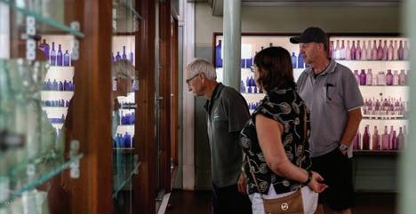
Warden Finnerty’s Residence
Built by the Bunnings Warehouse brothers in 1895, Warden Finnerty’s is a beautiful old house constructed of local stone for Coolgardie’s first Mining Warden and Resident Magistrate, John Michael Finnerty. During a visit here walk through the rooms containing lovely antique furnishings and chinaware which capture the feel of life in the 1890’s. Enjoy a Devonshire tea from the verandah overlooking the Coolgardie townsite.
KAMBALDA 651km east of Perth
Visit Australia’s first nickel township originally established in 1897 as a gold mining town during the gold rush frenzy. Virtually deserted by 1908, the town came alive again during the 1960s with the discovery of one of the world’s largest nickel sulphide deposits and the opening of Australia’s Golden Outback’s first nickel mine known as St Ives.
Discover some of the top things to do while in Kambalda…
Kambalda Memorial Garden
A memorial dedicated to the men who lost their lives whilst working on mines around Kambalda, as well as the hundreds of men who died from illnesses attributed to mining.
Red Hill Lookout
Visit Red Hill which overlooks Lake Lefroy and active mining operations. The bush trails take you around the hill, showcasing some mining history and rare flora and fauna.
COOLGARDIE VISITOR CENTRE
62 Bayley St (Warden’s Court Building), Coolgardie (08) 9026 6090
visitors.centre@coolgardie.wa.gov.au coolgardie.wa.gov.au
Red Hill Pioneer Cemetery
Here you will find only a handful of graves of the early pioneers of Kambalda that give a glimpse into the early history of the town.
Nullarbor Links
The world’s longest golf course! Play the par 3, Hole 15 Golden Eagle in Widgiemooltha and the par 4, Hole 16 Silver Lake in Kambalda.
Lake Lefroy, Kambalda
Coolgardie Bluff
australiasgoldenoutback.com | Kalgoorlie-Boulder & the Goldfields | 87
Goldfields Exhibition Museum
Shire of LAVERTON
At a Glance
WHAT’S ON Australia Day Breakfast & Activities — 26 Jan 2023
NAIDOC Celebrations — July 2023
Laverfest (Biennial) — Sept/Oct 2023
Laverton Race Day — late Oct 2023
TOP ATTRACTIONS
Laverton Outback Gallery / The Outback Way / Old Police Precinct / Explorers Hall of Fame / Golden Quest Discover Trail (site 13)
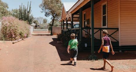
WILDFLOWERS TO DISCOVER
LAVERTON
955km north-east of Perth
Located along the western end of the Great Central Road, which forms part of the Outback Way, is the outback mining town of Laverton – once known to be the wildest town in the west. Laverton was founded by Dr Charles Laver, a keen prospector who rode his bicycle from Coolgardie into the area and was active in attracting investors to the small town.
From the very beginning, Laverton developed as the centre for commercial and social activity. Today, the small town with a population of just over 340 people, features a range of accommodation options including a caravan park, hotel and motel. Laverton also has a supermarket, service station and sports club.
For those following the Golden Quest Discovery Trail, Laverton is the northern most site on the trail (site 13) with a few places of interest to explore…
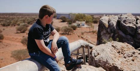
The Great Beyond Explorers’ Hall of Fame
Take a step back in time with explorers who led challenging expeditions through Central Australia during the mid to late 19th century. Using cutting-edge technology, the characters and their stories of the past are brought back to life, providing visitors with a rich visual history of the Northern Goldfields.
Windarra Mine Site Lookout
The lookout provides panoramic views over the famous Poseidon Nickel site and its main mining structures that remain standing.
Lonely Bush Graves
For those intrigued by the ghoulish and macabre, the lonely bush graves will leave you with a chill down your spine as you note that disease, accidents, suicide and murder were common causes of death in the small town. Legend says that some past souls still haunt some areas of Laverton.
The Outback Way
AKA Australia’s Longest Shortcut, this 2,800km route that links Winton in Queensland to Laverton in Western Australia via Alice Springs and Uluru is an awe-inspiring journey through the heart of Australia’s most breathtaking and remote desert landscapes.
Laverton Outback Gallery
Adjacent to the hotel, the Laverton Outback Gallery displays a wide range of local Indigenous art that you can view and purchase.
Sturt’s Desert Peas / Wattles / Hop Bush / Eremophila / Fruiting varietals such as Quandong, Native Apricot & Bush Tomato
THE GREAT BEYOND VISITOR CENTRE
Augusta Street, Laverton (08) 9031 1361
greatbeyond@laverton.wa.gov.au
laverton.wa.gov.au
Free Wi-Fi at Visitor Centre
Billy Goat Hill Lookout
Situated at the top of Hawks Place you’ll get a bird’s eye, panoramic view over the township and beyond.
Old Police Precinct
Visit the original Police Sergeant’s house, the police office and the gaol, all of which have been extensively refurbished in recent years. The buildings are open from 11am to 1pm daily or by appointment.
Old Police Precinct
88 | Kalgoorlie-Boulder & the Goldfields | australiasgoldenoutback.com
Billy Goat Hill Lookout
Features of The Great Beyond Visitor Centre:
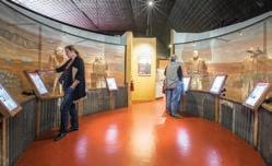
• Home of the Explorers’ Hall of Fame
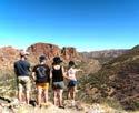
• Best Barista Coffee in the Goldfields!
• Extensive range of maps and guidebooks


• Unique collection of history books of the Laverton and Goldfields area

• Impressive souvenir and gift shop
Open: Mon - Fri 9am - 4.30pm | Sat - Sun 9am - 1pm
Augusta St, Laverton WA 6440 | T: (08) 9031 1361
www.laverton.wa.gov.au


Laverton Aboriginal Art Gallery has a wonderful range of paintings and artefacts for sale, created by artists from Laverton and the Ngaanyatjarra Lands of the Western Desert region of Western Australia. The unique works share the Tjukurrpa (Dreamtime) stories of this beautiful country and celebrate the cultural heritage of the region.
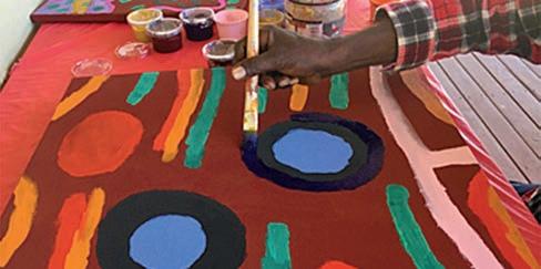
The Gallery is housed in a heritage building which was a mine manager’s house in the early 1900’s and is located on the corner of Augusta & Euro Streets, an easy walk from the Great Beyond Visitor Centre.
(08) 9031 1395
lavertonlcca@outlook.com

Monday to Friday 8:00am – 4:00pm
Other times by appointment only
ILKURLKA VISITOR CENTRE
Proudly owned and operated by the Spinifex people. Ilkurlka sells fuel, basic groceries and is an outlet for the renowned Spinifex Arts Project. Learn about the rich heritage and culture in Spinifex country and enjoy the unique natural beauty of the Great Victoria Desert. Phone 08 9037 1147

Anne Beadell Highway, Beadell WA 6440
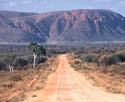
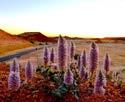
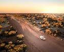

manager@ilkurlka.org.au www.ilkurlka.org.au
 Great Central Road Patrick Hill
Winton John Elliot
Warakurna Rob Mulally
Great Central Road Patrick Hill
Winton John Elliot
Warakurna Rob Mulally
Travel Australia’s Longest Shortcut through the heart of Australia BUY the Travel Journal, DOWNLOAD the app and podcast for this great road trip. outbackway.org.au LAVERTON • TJUKAYIRLA • WARBURTON • WARAKURNA • YULARA • ALICE SPRINGS • GEM TREE • TOBERMOREY • BOULIA • WINTON From Laverton WA to Winton Qld 1600km of bitumen and 1100km of gravel.
Trephina Gorge Rob Mulally
Shire of LEONORA
At a Glance
WHAT’S ON
Leonora Golden Gift — 3 – 4 Jun 2023
TOP ATTRACTIONS
Hoover House / Abandoned Gwalia
Cottages / The Terraces / Malcolm Dam / Poison Creek
WILDFLOWERS TO DISCOVER
Eremophila / Parakeelya / Purple
Flannel Bush / Sturt’s Desert Peas / Everlastings
LEONORA INFORMATION CENTRE
LEONORA
831km north-east of Perth
Leonora is located on Wangkatja Country and is a main regional centre in the Northern Goldfields, an area rich in history and stunning unique landscapes. The town’s history dates back to 1869, when explorer John Forrest and his party made camp near a hill and named it Mount Leonora. This prominent feature is an ancient Aboriginal spiritual site, associated with the Dreamtime story of the dingo, Baba Ngoorrba.
Gold was first discovered in the area in 1895 and a year later the townsite of Leonora was established. The town quickly grew and by the early 1900s had a population of over 1000 people. Leonora grew from the resourcefulness of early gold prospectors and pastoralists.
Explore some of the main highlights across the Shire of Leonora…
Malcolm Dam
Located 12km from Leonora, Malcolm Dam was built in 1902 to provide water for the railway. Today, this dam is a haven for birds and other wildlife.
The Terraces
A large breakaway formation about 40km north-east of Leonora provides good bushwalking and camping, and magnificent views for kms in every direction.
Leonora Heritage Trail
A showcase of the history of Leonora
townsite can be found on the Leonora Heritage Trail. The trail consists of 30 sites, including several old banks, hotels and churches, and the Barnes Federal Theatre.
Leonora Loop Trails
The Leonora Loop Trails are two self-drive trails and are a great way to see the area and learn the history of the region. Each trail takes about a day, so allow two days to see everything, or you can combine them for a longer day of exploring.
LEINSTER
Leinster is often described as an oasis in the desert. The town was first established in 1976 as a company town supporting the nickel mine of the Agnew Gold Mining Company. Here there are a variety of services available for travellers.
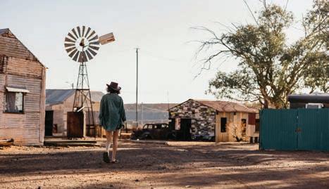
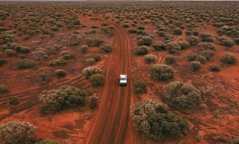
Cnr Tower & Trump Streets, Leonora (08) 9037 7016
library@leonora.wa.gov.au
leonora.wa.gov.au
Gwalia Historic Precinct
Gwalia, located approximately 3km south of Leonora, is a truly unique and fascinating place to visit. Here you can wander around the abandoned miners’ cottages of Gwalia Ghost Town, learn about the history of the settlement and gold mine at Gwalia Museum, enjoy a Devonshire tea on the verandah of Hoover House while looking out over the working open pit mine, or stay a night or two in one of the period-style bedrooms at Hoover House Bed & Breakfast.
Malcolm Dam
90 | Kalgoorlie-Boulder & the Goldfields | australiasgoldenoutback.com
Gwalia Historic Precinct
Shire of MENZIES

At a Glance
WHAT’S ON
ANZAC Day Dawn Service and Gunfire
Breakfast — 25 April 2023
Menzies Rodeo — May 2023
Menzies Cyclassic — 3 June 2023
Remembrance Day Ceremony — 11 Nov 2023
Town Christmas Party – Dec 2023
TOP ATTRACTIONS
Lake Ballard / Niagara and Kookynie
MENZIES
724km north-east of Perth
Found along the Golden Quest Discovery Trail (site 6), Menzies was named for its rich history, after early prospector Leslie Robert Menzies. During the gold rush days of the 1890’s Menzies was home to 10,000 residents, 13 hotels, three banks, breweries and cordial factories, a post office with a staff of 25, a school with 205 students, a public library and four churches. Today, Menzies is a smaller town, however it is again beginning to prosper.
Experience some of the highlights of Menzies when you stay…
Walking Tours
Explore the heritage and gain insights into the Aboriginal experience of Menzies with two self-guided walking tours – “Our Place” and Gubbee Menzies Wongi “Our Way.” Brochures are available from the Menzies Visitor Centre.
Menzies Cemetery
Site 7: Golden Quest Discovery Trail
Menzies Cemetery is distinctive for the number of galvanized iron monuments which are skillfully shaped and scrolled by the early tinsmiths making use of available material.
Historic Buildings
The railway station built in 1898 is a brick federation building and the last railway station remaining on the Northern Goldfields railway line. Other historic buildings include the Nursing Post housed in the former Menzies Warden’s House, the ‘old’ Menzies Hotel, (now the
Achievable Outback Café), the post office, tearooms, and the butcher’s (now Donna’s Diner and Takeaway), Pioneer Store, (now an Art Gallery) and the current Menzies Hotel - a place to enjoy a drink, have a meal and stay the night.
Tjuntjuntjara Community in the Great Victoria Desert
About 700km east of Menzies near the South Australian border, the Spinifex people express the traditional culture of Spinifex lands and lore through art.
Lake Ballard
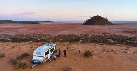
The iconic ‘Inside Australia’ exhibition features 51 sculptures by internationally renowned artist Sir Antony Gormley. With its eerie statues and clear, wide-open skies, it is recognised as one of Western Australia’s best sites for stargazing. Free camping, toilets, and picnic facilities are available, as well as a black water dump station.
Kookynie
Site 9: Golden Quest Discovery Trail
In 1903 Kookynie was a thriving township of more than 400 buildings and 2,500 people. Now a ‘Living Ghost Town’ Kookynie’s stories are interpreted at the Visitor Information Bay. From there visit many historical sites such as the ruins of the Cosmopolitan Hotel, the Cosmopolitan mine site, the cemetery, and the Grand Hotel - a real outback pub with cold beer and comfortable accommodation.
Niagara Dam
Site 8: Golden Quest Discovery Trail
Completed in 1898 to provide water
Ghost Towns / Lady Shenton Hotel Building / Menzies Town Hall and Historic Buildings / Niagara Dam
WILDFLOWERS TO DISCOVER
Eremophilas / Everlastings / Goodenias / Sturt’s Desert Peas / Parakeelya / Monkey Orchids / Mulla mulla
MENZIES VISITOR CENTRE
Lady Shenton Hotel Building
Cnr Shenton & Brown Streets, Menzies (08) 9024 2702
cso@menzies.wa.gov.au menzies.wa.gov.au
for the steam trains operating on the Kalgoorlie-Menzies line, Niagara Dam has spent the last 100 years as a picnic and swimming spot. Free camping facilities include shady sites, gas barbecues, picnic tables, toilets, and a black water dump point.
Menzies Caravan Park
The ideal place to base yourself with historic and natural sites close by.
Self-contained modern cabins. Caravan and camping sites.


Camp kitchen, ablution blocks & dump point.
Dedicated disabled amenity with wheelchair access.
Dogs on leads welcome.
Located adjacent to the Visitor Centre
Shenton Street, Menzies
Ph: 08 9024 2702
australiasgoldenoutback.com | Kalgoorlie-Boulder & the Goldfields | 91
Lake Ballard campground
Shire of NGAANYATJARRAKU
At a Glance
TOP ATTRACTIONS
Tjulyuru Cultural and Civic Centre / Giles Weather Station / Yarla Kutjarra / Surveyor Generals Corner
WILDFLOWERS TO DISCOVER
Balsam Wattle / Balonne Parakeelya / Soft Spinifex / Calytrix Warburtonensis / Mulga Grass
VISITOR INFORMATION
Great Central Road, Warburton Community
PMB 87, Kalgoorlie
(08) 8956 7966
NGAANYATJARRAKU
1,542km north-east of Perth 550km north-east of Laverton
The Shire of Ngaanyatjarraku encompasses an area of 159,948km2 and is diverse in natural beauty from the magnificent Rawlinson Ranges to the red sandy plains of the Gibson and Great Victoria Deserts. The distinctive red sand and blue skies form a spectacular context for a diverse array of desert rangelands and arid zone flora and fauna. Rocky escarpments and other landforms give texture to this beautiful country.
The shire is home to 10 Aboriginal communities scattered throughout the district with a total population of approximately 1,650 people. The main regional centre is Warburton, situated on the Great Central Road.
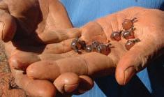
The Great Central Road forms the main thoroughfare for the Shire of Ngaanyatjarraku. It is part of the ‘Outback Way’, a 2,800km trans-national link stretching from Laverton in Western Australia to Winton in Queensland. The Outback Way passes through Australia’s most spectacular outback country, including the Uluru-Kata Tjuta National Park.
Pass through the Rawlinson Ranges, Walter James Ranges, and Gill’s Pinnacle and break your journey with visits to these attractions…
Tjulyuru Cultural and Civic Centre, Warburton
The Tjulyuru Cultural Centre complex is a cultural hub for visitors and locals based at the Warburton Community on the Great Central Road. Visitors to the area are encouraged to visit the Tjulyuru Regional Arts Gallery and check out the arts, crafts and publications for sale at the Warta Shop. Tjulyuru Regional Arts Gallery exhibitions draw from contemporary Ngaanyatjarra art practice in the region and the Warburton Art Collection - reputably the world’s largest collection of community-owned and controlled Aboriginal art.
Giles Weather Station, Warakurna Giles Weather Station (est 1956) is a fully functioning meteorological observation station based at Warakurna Community. Visitors can view the daily release of the observation balloon at 8.45am CST from the Weather Station car park.
Yarla Kutjarra (rest stop)
The Yarla Kutjarra wayside stop between Warburton and Warakurna has been provided by the Ngaanyatjarra people as a place where visitors can camp and enjoy the peace and tranquillity of the Ngaanyatjarra Lands without disturbing any of the culturally significant places along the Great Central Road.
Surveyor General’s Corner
The intersection of the borders of the
mail@ngaanyatjarraku.wa.gov.au ngaanyatjarraku.wa.gov.au
PERMITS:
permits@ngaanyatjarra.org.au
(08) 8950 1711 dplh.wa.gov.au/entrypermits
Northern Territory and the states South Australia and Western Australia is known as the Surveyor General’s Corner. Access to the area is limited to guided tours and visitors require a special permit. Contact Wingellina Community on (08) 8956 7566.
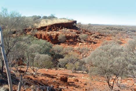
Local Roadhouses
Roadhouses form vital sources of water, fuel, food and accommodation along the Great Central Road. Two Roadhouses operate in the Shire of Ngaanyatjarraku – Warburton Roadhouse and Warakurna Roadhouse. Both facilities operate seven days per week (please check opening hours) and offer fuel, fast food and supplies, and motel or campground accommodation for travellers.
Honey ants
92 | Kalgoorlie-Boulder & the Goldfields | australiasgoldenoutback.com
Bat Cave area
Shire of WILUNA
displays of the town’s mining and pastoral histories, Aboriginal culture, and the Canning Stock Route and Gunbarrel Highway.

Tjukurba Art Gallery
At a Glance
TOP ATTRACTIONS
WILUNA

966km north-east of Perth
The Shire of Wiluna covers an area of 184,000km2 and is predominately mining, pastoral and native title land, including Indigenous Protected Areas at Matuwa (Lorna Glen Station), Kurrara-kurrara and Birriliburu.
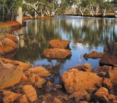
The town of Wiluna is on the edge of the Little Sandy Desert, located east of Meekatharra (unsealed) and north of Leinster (sealed) on the Goldfields Highway. It’s the gateway to the Canning Stock Route which runs north to Halls Creek, and the Gunbarrel Highway that runs east to Alice Springs. Good fuel and grocery outlets are available in Wiluna. While in town, discover Wiluna’s main attractions…
Canning-Gunbarrel Discovery Centre
The Canning-Gunbarrel Discovery Centre is a beautiful complex including five historical and heritage-listed buildings, a central courtyard and
The Tjukurba Art Gallery offers visitors a sample of unique and affordable paintings by the Birriliburu artists. The gallery is located in the Eastern building of the historic former Wiluna District Hospital (now Canning-Gunbarrel Discovery Centre).


Statues of Warri and Yatungka
Visit the town’s statue ‘Last of the Nomads’ and read the plaque to learn of the beautiful love story behind their culturally frowned-upon relationship. Their deaths marked the end of a tribal lifestyle that has stretched back more than 40,000 years. Not to be missed!
Pioneer Cemetery
Visit 19 grave sites identified from shire records dating from 1893 to 1903 when the cemetery was moved because of periodic flooding in the area first chosen.
Gunbarrel Highway
The Gunbarrel Highway is a popular four-wheel drive which takes you across the ranges and central desert to Warburton and Alice Springs.
Canning Stock Route (CSR) CSR wells number 1 and 2 are close to the town, as are the original cattle loading yards. The turn-off for well number 1 is located 3.8km north of town
Canning-Gunbarrel Discovery Centre
Whether you’re setting off on your epic drive along the Canning Stock Route or Gunbarrel Hwy, or newly arrived after your desert adventure, you’ll get a warm welcome and complimentary hot drink at the Canning-Gunbarrel Discovery Centre, a true celebration of the area’s remarkable history. T: (08) 9981 8009
Canning-Gunbarrel Discovery Centre and Tjukurba Art Gallery / Wiluna Town Heritage Trail / Statues of Warri and Yatungka, the Last Nomads / Mingal Pool / Clay Pans
WILDFLOWERS TO DISCOVER
Sennas / Eremophillas / Sturt’s Desert Peas / Purple Mulla Mulla / Pipitjarli
SHIRE OF WILUNA
70 Wotton Street, Wiluna (08) 9981 8000 reception@wiluna.wa.gov.au wiluna.wa.gov.au

on Neds Creek Road and then 3.5km to the west. Well number 2 is located approximately 39km to the north, also along Neds Creek Road and then to the east along the CSR track.
North Pool
North Pool is located on the Canning Stock Route within 20km of town and is a pleasant spot for a picnic and fantastic for bird watching.
Accommodation
Enjoy a maximum of three night’s free accommodation by parking your caravan at the temporary RV site, located next to Canning-Gunbarrel Discovery Centre.
Co-located within the Discovery Centre view authentic Aboriginal artworks available for purchase by Martu artists and an opportunity to meet the artists who still live a semi traditional lifestyle.
(08) 9981 8080
OPENGALLERY
Tjukurba Art Gallery
FOR VIEWING&SALES
www.tjukurbagallery.com.au 28 Scotia St, Wiluna WA 6646 Discover the magic of Wiluna & the Western Desert & the start of the Canning Stock RoutE Canning Stock Route | Gunbarrel Highway Aboriginal Art for sale
T:
E: reception@wiluna.wa.gov.au
australiasgoldenoutback.com | Kalgoorlie-Boulder & the Goldfields | 93
North Pool
Esperance & the
Fitzgerald Coast
TOP THINGS to See & Do
• Take a selfie with the kangaroos at Lucky Bay
• Marvel at the scenery along the Great Ocean Drive
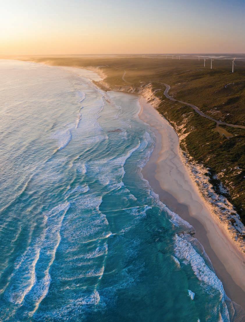
• Explore the biodiversity hotspots at nearby National Parks
• Check out a paddock-to-plate microbrewery and a bush-tobottle distillery
• Check out the Esperance Museum and its Skylab exhibit
• Cruise to the Recherche Archipelago and Woody Island
• Discover the superb art and craft galleries around Esperance
• Explore Esperance’s Museum Village and Growers’ Markets
• Take an immersive cultural tour and discover the rich history of Esperance and its surrounds.
• Take to the skies to view Middle Island’s pink Lake Hillier
94
Esperance & the Fitzgerald Coast are cooling coastal oases and nature wonderlands within Australia’s Golden Outback — out of the way and out of this world. With brilliant blue waters, snow-white beaches and some of the most spectacular national parks, it’s a mesmerising place to bring the family, friends or embark on an a serene solo adventure.
Pitching a tent at one of the local campgrounds is one of best ways to immerse yourself in the area’s great outdoors. Le Grand Beach and Lucky Bay Campgrounds are the ideal bases for exploring the majestic Cape Le Grand National Park, which combines sheltered bays, granite peaks, rolling heathlands and native wildlife into one nature wonderland. While Four Mile Beach and Hamersley Inlet, perched on the edge of the UNESCO recognised biodiversity hotspot Fitzgerald River National Park, are two spectacular spots worth experiencing.
Ravensthorpe (home to the world’s largest wildflower show) and Hopetoun are both gateways to this spectacular park.
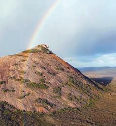
Plan your road trips to take you through these otherworldly highlights with the Fitzgerald Coast Loop a popular drive and The Great Ocean Drive a must-experience route, taking you along Esperance’s coast from the Esplanade all
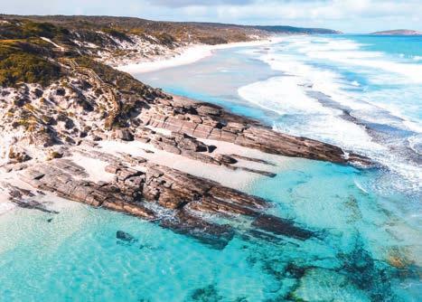
How to Get There
By Road:
Road conditions are excellent, with sealed main roads heading in and out of Esperance.
the way to the enchanting Twilight Bay. Drive yourself right into the quintessential Aussie beach holiday; no crowds, just space. Unplug for a moment, find a private cove, lay out your towel and exhale. Rock pools form natural aquariums where shy hermit crabs and starfish play hide and seek. Kangaroos sunbathe at Lucky Bay all day while you sip a signature ‘Kangacino.’
The southern gem of Esperance is the ideal base to explore the most mesmerising beaches and hinterland of this remarkable coast. Immerse yourself in its live music scene, enjoy outdoor movies and summertime twilight markets, explore the James Street Precinct and take a photo with the Whale Tail Sculpture or the full-size replica of Stonehenge on the town’s outskirts.
Just offshore, 105 islands peek across the horizon presenting a maritime maze to explore by boat or air. The Recherche Archipelago is a paradise inhabited only by dolphins, whales, seals and seabirds.
The largest isle, Middle Island, is home to the famed pink Lake Hillier, a sight best accessible by heli or scenic flight. From above, the contrast of the fairy floss lake and the azure ocean is especially striking.
Kepa Kurl is the Wudjari name for ‘Esperance’ – which translates to “where
Esperance is accessible from many of the drive routes from Perth and the Nullarbor
By Air:
Esperance is serviced by Rex with daily flights from Perth.
Tel: 13 17 13.
Skippers provides charter services from Perth to Ravensthorpe.
Tel: 1300 729 924.
By Coach
Transwa operates regular coach services from Perth to Esperance and from Albany to Esperance via Ravensthorpe.
Tel: 1300 662 205.
the waters lie like a boomerang.” Listen to Dreaming stories and discover the songlines of the land by choosing an Aboriginal-owned, local eco-culture tour during your visit.
For the ultimate Australian road trip, traverse the Nullarbor Plain along the southern edge of the Golden Outback. Start at the woodland town of Norseman, where the corrugated iron dromedarie (camels) are a tribute to the camel trains of old, and continue east to the Caiguna Blowhole, Eyre Bird Observatory and the old Eucla Telegraph Station ruins. It’s a true outback Aussie culture fix.
Eleven Mile Beach
australiasgoldenoutback.com | Esperance & the Fitzgerald Coast | 95
Frenchman Peak
NATURAL PARADISEPlunge into a
Nestled at the base of Australia’s Golden Outback, Esperance / Kepa Kurl is an isolated wonderland, ripe for exploring. It’s a place where kangaroos call the stretches of white sandy beaches and crystal-clear water home, diverse flora and fauna abound in the national park, and dolphins surf the rolling, aquamarine waves.
Explore the expansive outdoors of this dreamlike town any time of year, with autumn and spring tending to be a little cooler and the ideal seasons to spend longer hours outside. It’s also when brilliant rainbows of wildflowers bloom.
With so much to see, a guided tour — whether by air, sea, or land — is one of the best ways to soak in all the sights of the stunning landscape and gain a local’s perspective of the area.
“Autumn and spring are by far the best times of year to visit Esperance,” says director of Fly Esperance and Tour Esperance, Christopher Hurst.
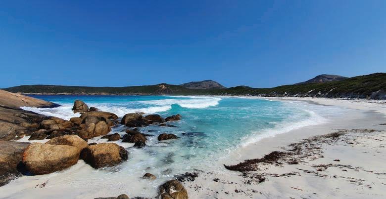
“The temperatures are mild and the winds are much calmer than through the heat of summer. Spring boasts
spectacular blooms of wildflowers as the country comes alive with new growth, while autumn sees the ocean temperature at the warmest it will be all year. With less tourists around and calm weather, March is the time to be here!”
Embark on the Fly – Lunch – Fly tour with Fly Esperance for the ultimate vantage point of Esperance, with lunch at the Condingup Tavern. Or for the more adventurous, there’s the ‘Flying Pub Crawl,’ which visits two pubs and the Lucky Bay Craft Brewery in between two hours of scenic flying across the
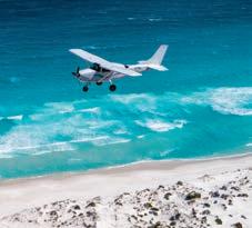 By KATE JONES
amazing Pink and Rainbow Lakes.
While on land, Tour Esperance’s 4X4 tours traverse up to 50km of whitesand beaches, leading all the way to the majestic Cape Le Grand National Park. Highlights include driving up a 45 degree incline to the top of Wylie Rock for panoramic views of the bay, and morning tea on the whitest beach in Australia, Lucky Bay, within the park.
Cape Le Grand National Park is one of the crowning jewels of Esperance’s dazzling trove of natural attractions and easy to explore on your own or with a guide. A 63km drive east of Esperance to the park will bring you to the most tranquil beaches and the clearest water you have seen. Lucky Bay is famed for its western grey kangaroos that stretch out in the sun, but other worthy contenders to explore include Hellfire Bay and Wharton Beach
Make the most of the mild temperature and embark on some of the many inspiring walk trails winding throughout the park. Follow the Frenchman Peak Walktrail over a kilometre return-journey and climb to
Immerse yourself in the invigorating Esperance any time of the year with these autumn and spring activities.
96 | Esperance & the Fitzgerald Coast | australiasgoldenoutback.com
the summit for sweeping vistas across the expansive national park and ocean.
Marvel at the magical burst of wildflowers that spring up through August to November. One day is rarely enough to take it all in, so melt into the moment and choose from one of two campgrounds in the park to stay a few nights – Le Grand Beach Campground or Lucky Bay Campground
Fuel up
For the moments when you’re seeking refuge from a sprinkle of rain or are simply looking for a rest and to refuel, Lucky Bay Brewing is the ideal lunch stop, boasting award-winning craft beer. This brewery sources raw barley straight from neighbouring farmers in the region and are three-time winners at the Perth Royal Beer Awards. Wood-fired pizzas are a staple here for lunch, but you’ll also find nachos, bruschetta, burgers and hot dogs to tuck into. Live music is hosted every Friday and Sunday.

ESPERANCE STONEHENGE
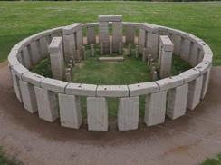
If spirits are more your cup of tea, pay a visit to small batch experts Esperance Distillery Co. to sample their range of gin, all made from local native botanicals. Their cellar door hours change seasonally.
Join the locals at one of several community-run markets operating on the weekends. Esperance Growers Market is held every second Saturday at the Scouts Hall and is where you’ll
find an abundance of fresh fruit and veggies, flowers, plants, artisan jewellery, local honey, condiments and more.

The Museum Village Markets takes over the Museum Village two Sundays each month, with stalls of homemade arts and crafts, preserves and jams, freshly brewed coffee, and food vendors. Check each market’s social media channels for upcoming dates.
Woody Island Eco Tours will get you over & onto the unique, untamed and iconic Woody Island. Return ferry ride, guided bush walk, morning tea & a range of accommodation options. We operate from 23 September 2022 to 6 June 2023 with day tours running everyday depending on numbers.
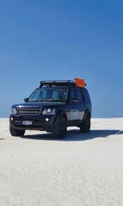


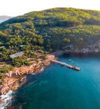
Accommodation available throughout the season to suit all.


Departing Daily: Taylor Street Jetty
|
•
•
•
•
HOSPITALITY ESPERANCE Well appointed rooms in town centre overlooking Esperance Bay! 44 The Esplanade, Esperance | T: (08) 9071 1999 | E: esperance@hospitalityinns.com.au | W: www.hospitalityinnesperance.com.au Enjoy Esperance and surrounds whilst our friendly team take care of you. Quality assured, great value accommodation and superior service ensuring an effortless stay and a reliable hotel experience.
Seasons Restaurant open daily
•
Foxtel - including movies & sport
FREE wireless internet
FREE guest laundry
Book DIRECT
and save 10% (website or phone)
www.woodyisland.com.au | ph: 0484 327 580 | Booking Office:
32 The Esplanade, Esperance WA
Did you know there is a full size granite replica of the UK Stonehenge in Esperance? Come and marvel at the wonder that is Esperance Stonehenge.
Open Daily 9am -3pm 817 Merivale Road, Esperance (On the way to Cape Le Grand) 08 9075 9033
australiasgoldenoutback.com | Esperance & the Fitzgerald Coast | 97
Biodiversity at its Best
Must see spots
East Mount Barren
season) or just soak in the crash of the waves of the mighty Southern Ocean as you gaze out at seabirds.
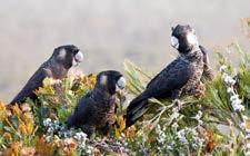
Hakea Trail
For the adventurous, a spectacular two-day (46km return) walk, Hakea Trail is recognised as one of the best trails in the state.
Recharge your soul as you explore coastal rocky cliffs and rugged beaches as you make your way to one of the most stunning landscapes at Quoin Head, the edge of the park’s untouched central wilderness.
A hut at Whalebone Creek with water tanks will help you replenish.
Where to stay
Completely immerse yourself in the Fitzgerald National Park and rejuvenate your spirit when staying at one of its campgrounds. Four Mile Beach and Hamersley Inlet are the two most popular destinations, bookable year-round.
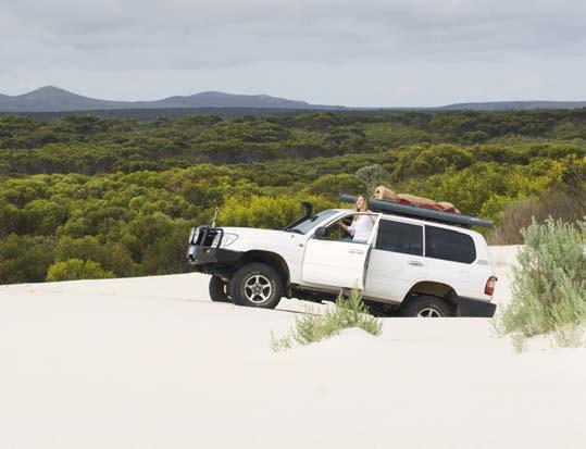 By CLAIRE TYRELL
The Fitzgerald Biosphere is a haven for lovers of nature, encapsulating some of the best of Western Australia’s natural landscapes and flora and fauna.
Located more than 500km southeast of Perth, the expansive 1.5 million hectare zone encompasses the towns of Ravensthorpe, Hopetoun, Jerramungup and Bremer Bay.
Internationally recognised by UNESCO as a place of ecological significance, the region is Western Australia’s only biosphere and the country’s largest.
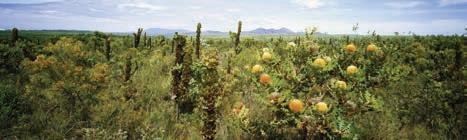
Fitzgerald River National Park, the heart of the biosphere, is a must-visit destination when travelling the Fitzgerald Biosphere Coast. Home to one-fifth of the state’s described plant species, 22 mammal species, 41 species of reptile and more than 200 bird species — its rich diversity will not disappoint even the most intrepid traveller, offering a sensory feast at every turn. Immerse youself in a world of untamed wilderness, whale watching, nature walks and wildflowers.
Walking up the 1.5km incline of East Mount Barren trail makes the breathtaking panoramic views at its summit well and truly worthwhile.The track provides a cornucopia of beauty, peppered with unique wildflower species sure to catch the eye. Soak in the stunning Southern Ocean views and over the central park, eastern Eyre Range, Culham Inlet and to Hopetoun and beyond before preparing for your gradual descent.
Cave Point Lookout
The sheer cliffs, spectacular coastal views across West Beach from the Cave Point Lookout provides a visual feast for lovers of land and sea. An ideal place to discover the plethora of native wildflowers year round, spot whales (in
Four Mile Campground is only 10km west of Hopetoun, in an idyllic setting on the eastern edge of the national park. This popular unpowered site is about 150m from Four Mile Beach and a short stroll to Barrens Beach. There are picnic tables, gas barbecue facilities and a hot water shower. Visitors will need to bring their own drinking water.
Hamersley Inlet is a stunning little campground, with 14 sites available in a peaceful natural setting, located at the end of the sealed section of Hamersley Drive on the eastern side of the national park. Enjoy close access to the inlet for all of your hiking, boating and fishing activities and a short 4WD to Hamersley Beach or Hamersley Sand Dunes.
St Marys Inlet, in the western end of the national park, is a small camping ground accessible via an unsealed road in dry conditions only.
Venture the Fitzgerald Biosphere to uncover a world of wildlife and unique plant species in this UNESCO biodiversity hotspot.
98 | Esperance & the Fitzgerald Coast | australiasgoldenoutback.com
www.flyesperance.com
Perfectly private and ideally located. These stunning multi-award winning apartments are yours to enjoy.

Spacious with magnificent ocean views. Fully self contained 1 & 2 storey apartments suit couples, families or friends. CD, TV, DVD, phone, wireless internet, fully equipped kitchen, laundry & BBQ on spacious balcony or courtyard. Spa apartments & facilities for disabled available. Perfect in any season, attracting the winter sun & cool sea breezes in summer.
14-15 The Esplanade, Esperance WA 6450

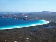
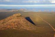

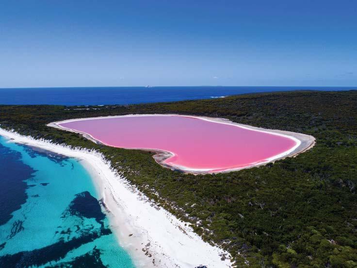
Tel: (08) 9072 0044 • 1800 440 508
Email: admin@esperanceapartments.com.au
Web: www.esperanceapartments.com.au


Over 30 Flavours of Ice Cream


Take Away Foods
Homemade

Pies & our Famous Sausage Rolls
9072 0002
Cnr The Esplanade & Emily Street
Southern Fried Chicken
Catering - Platters
Gourmet Salads

See Lake Hillier!!

Road Trips ESPERANCE & THE FITZGERALD COAST Cape Arid NP Cape Le Grand NP Nuytsland NR Dundas Nature Reserve Fitzgerald River NP Frank Hann NP Peak Charles NP Stokes NP Jilbadji Nature Reserve LEGEND Sealed road Unsealed road ROAD TRIPS Road to Esperance Ravensthorpe Ranges Great Ocean Drive Eyre Highway and Nullabor Links Bremer Bay KALGOORLIE-BOULDER Kambalda Coolgardie Hyden Wave Rock Lake King Newdegate Salmon Gums Grass Patch Balladonia Balladonia Roadhouse ESPERANCE Norseman Hopetoun Ravensthorpe Munglinup Gibson Southern Cross The Breakaways Campground Lake Johnston Campground McDermid Rock Archipelago of the Recherche SOUTHERN OCEAN Wharton Israelite Bay Cape Pasley Cape Arid Lucky Bay Cape Le Grande Stokes Inlet Jerramungup Fraser Range Station Middle Island Mondrain Island TO PERTH TO PERTH TO ALBANY TO EUCLA 507km 122km 72km 85km 105km 50km 187km 38km 54km 110km 96km 28km 53km 297km 116km 108km 63km 297km 162km 82km 45km 100 | Esperance & the Fitzgerald Coast | australiasgoldenoutback.com
THE GREAT OCEAN DRIVE 1-2 hours | Sealed roads
Shires along your journey: Esperance


The road trip that should be on everyone’s bucket list, the Great Ocean Drive is a 40km circular loop showcasing a coastal wonderland of stunning, powder-white beaches, rocky headlands, small bays of crystalline water, steep cliffs and hidden ocean pools.
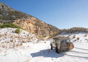
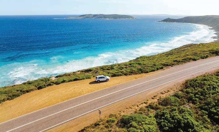

Highlights include the Rotary Lookout
(an ideal first stop), the famous Twilight Bay, Observatory Point and 11 Mile Beach and Nine Mile Beach renowned for its serene rock pools. If you’re feeling adventurous, you can also cycle or walk the trail, following the coast from the Esplanade all the way to Twilight Bay.
The best way to travel the Great Ocean Drive is slowly. Plan a picnic lunch, throw in your towel, picnic rug, snorkel and fins, surfboard or just your walking shoes. Wherever you go on this loop, the views are constant and amazing.
scan for flights and tours HeliSpirit Esperance 2022-23_V1.indd 1 19/10/2022 3:47:01 PM
DREAMING OF FLYING OVER THE BUBBLE-GUM PINK WATER OF LAKE HILLER?
australiasgoldenoutback.com | Esperance & the Fitzgerald Coast | 101
EYRE HIGHWAY & NULLARBOR LINKS 2 Days | Sealed roads
Shires along your journey: Dundas
The Nullarbor Plain, with the epic Eyre highway to follow, is easily one of Australia’s greatest road trip adventures. Take off into the west from the border town of Eucla down the sweeping highway into the scenic lower Nullarbor around Mundrabilla, then pause to look back at the lookout at Madura.
The Eyre Bird Observatory, a remote research station, has fantastic programs (check them out online) and the 10th hole of the Nullarbor Links course at Cocklebiddy is a top introduction to the
Driftwood Apartments
• Four ground floor self-contained 2 bedroom apartments, private covered decks & BBQs
• Three two storey luxury self-contained 2 bedroom apartments with spas & BBQ balconies
Reverse cycle air-con, full cooking & laundry facilities. A short stroll to CBD, restaurants, parks & island cruises.
69 The Esplanade, Esperance WA 6450

Tel: 0428 716 677
Email: info@driftwoodapartments.com.au

Web: www.driftwoodapartments.com.au
World’s Longest Golf Course. The aptly named 90 Mile Straight will bring you to Balladonia by nightfall.
Explore the remains of Skylab space station at the nearby Esperance Museum, which plummeted to the earth in 1979, before continuing west. Take your time and savour the sense of space and timelessness that makes the Nullarbor unique. Soon you’ll arrive at Norseman, the end of this 880km trip and the Eyre Highway. Next to the town’s cute tin camels is a photographic gallery where the region’s stunning landscapes are captured in prints. To appreciate the vastness of the place, drive up to Beacon Hill Lookout before heading either north to Kalgoorlie or south to Esperance.
ROAD TO ESPERANCE 5 days | Sealed roads
Shires along your journey: Kondinin, Lake Grace, Ravensthorpe and Esperance
Esperance is a picture-perfect reel of nature’s wonders with an abundance of pearl-white beaches boasting translucent blue waters, and rugged national parks. Expect to experience a glorious journey, worthy of this stunning destination, on the 700km stretch to Esperance from Perth.
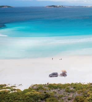
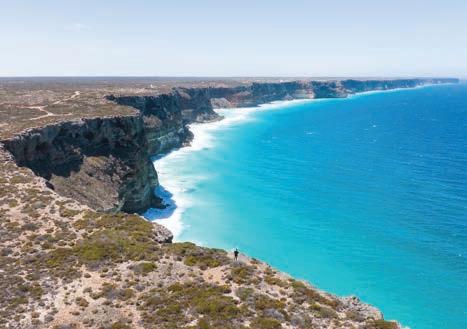
You can take two routes, so mix it up and see different perspectives of the Wheatbelt region. Go out via Hyden so you can take the famous surfing selfie
ESPERANCE BAY HOLIDAY PARK
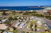

162 Dempster Street, Esperance WA 6450
Ph: (08) 9071 2237


E: info@esperancebayholidaypark.com.au
www.summerstar.com.au
A family-friendly caravan park situated just 1km from the town centre. The park is located a short walk from calm swimming beaches and an easy walk to fishing jetties, with a variety of cafes and restaurants close by. A variety of accommodation options are available to suit all travellers. Self-contained holiday units, basic cabins and well-maintained grassed sites to suit tents and camper trailers - including sites with concrete slabs for motorhomes and caravans.
102 | Esperance & the Fitzgerald Coast | australiasgoldenoutback.com
Pets accepted - strict conditions.
Freecall: 1800 011 311


119 Pink Lake Road, Esperance WA 6450
Email: pinklake@westnet.com.au

Web: www.pinklakepark.com.au
at Wave Rock, then admire the bright white salt lakes at the Lake King Nature Reserve. Ravensthorpe is home to the superb 25m high wildflower murals of the Public Silo Trail, then head for the Southern Ocean and soon you’ll be in the charming coastal town of Esperance.
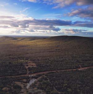
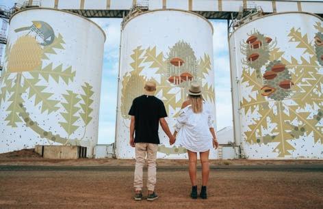
On the way back, stop for more supersized art at Newdegate, before heading through the Southern Wheatbelt countryside including Lake Grace, Dumbleyung and Wagin. In Esperance, spend at least a day exploring Cape Le Grand National Park and, while there, climb Frenchman Peak for stunning views of the ocean and the myriad of offshore islands. Meet the photogenic kangaroos of Lucky Bay
along the way, swim, snorkel or walk on some of the most incredible beaches in the world, or simply chill with a craft beer at the local Lucky Bay Brewing.
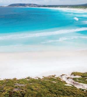
Finally, book a boat cruise and explore some of the 105 islands of the Recherche Archipelago, locally known as the Bay of Isles. You can also see the islands from the air if you hop on a scenic flight of the local coastline or over Middle Island to view the bubble-gum pink Lake Hillier.
www.acclaimparks.com.au

Road
(08)
17 Harbour
Chadwick, Esperance, WA 6450 Ph:
9071 4100 / 0498 321 888
Email: pinegrove@acclaimparks.com.au
Surrounded by trees and grassed areas, 2km from town centre. Ideal for quiet, relaxed getaway. Accom options include deluxe 1 & 2 bedroom villas with TV, free WiFi, microwave, aircon, kitchen, linen supplied. Ensuite cabins, budget cabins. Large shady powered/ unpowered sites, campers kitchen and BBQ areas.
Pink Lake Tourist Park
DISCOVER MORE Ravensthorpe Ranges | 2- 3 hours (sealed/unsealed roads) Scan the QR code for more insights.
australiasgoldenoutback.com | Esperance & the Fitzgerald Coast | 103
Esperance is a picture-perfect reel of nature’s wonders...
Shire of ESPERANCE
NATURAL ATTRACTIONS
Breathe deep and experience the best of the great outdoors in beautiful Esperance. Situated in isolated splendor, surrounded by stunning national parks, on the south-east coast of Western Australia, Esperance is one of the few remaining places on earth where you can often enjoy a beach all to yourself. It boasts spectacular white sand and crystal-clear water, remote camping wilderness experiences, and fantastic fishing and 4WD opportunities.
Some of Esperance’s many natural highlights include…
Cape Arid National Park
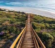
This spectacular park is a place for the truly adventurous and bold explorers. You can see ruins of homesteads, buildings and dams constructed by pioneer graziers in the early 1870s, camp under the stars and walk through the magnificent landscapes to your heart’s content. 4WD vehicles and outdoor experiences are highly recommended.
Kepwari Wetland Walk Trail
Kepwari is the local Aboriginal word for ‘place of moving water’ and this interpretive walk trail is designed to be a learning experience with bird hides and seating along the way. A short drive from
town and nestled out of the wind, this one way 3.5km trail is perfect for families with young children. For a different perspective, explore the lakes from kayak or canoe.
Comfort Inn Bay of Isles
62 modern motel units
• Premier motel and function centre located on the beachfront and a short stroll to town.
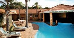
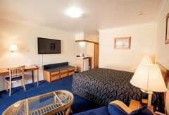
• Eljay’s Bar & Restaurant onsite.
• Free Wi-Fi.
• 90+ Fox channels & Foxtel On Demand.
Just 90km east of Esperance, beautiful peaceful location on the beach. 6 chalets and 6 park homes. Plenty of powered and unpowered sites.
Lot 1 and 5 Wharton Road Via Condingup WA 6450
Tel:(08) 9075 0033
orleansbaycamp.com.au

• Perfect spot to base yourself to discover the beautiful Esperance beaches.

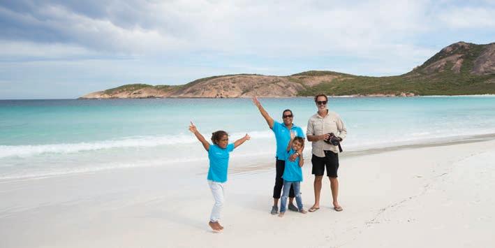
Tel: (08) 9071 9000
Fax: (08) 9071 3800
Email: reservations@comfortinnbayofisles.com.au
Web: www.comfortinnbayofisles.com.au
104 | Esperance & the Fitzgerald Coast | australiasgoldenoutback.com
of
Orleans Bay Caravan Park
ESPERANCE 721km south-east
Perth
Lucky Bay
Observatory Beach
Lake Monjingup
An ideal place for a picnic, birdwatching and walking through the bush or along the boardwalk. Visit the Environmental Centre at Lake Monjingup for information about the various plants and animals which live there. With toilets and picnic tables, the reserve makes for a fantastic day out for the whole family.
Peak Charles National Park — Karrukarrunya (4WD recommended)
This ancient granite peak and its companion, Peak Eleanora, give sweeping views over the dry sandplain heaths and salt lake systems of the surrounding countryside. The park lies within the Great Western Woodlands, an internationally significant area of great biological richness.
Recherche Archipelago


The 105 islands of Recherche Archipelago offer incredible spots for fishing, diving, snorkelling and sailing. This natural treasure is a haven for a variety of wildlife, as well as a hotspot for holiday makers. Fishing charters and island cruises available.
Mount Ridley — Marbeleerup

Head north out of Esperance and explore our hinterland. The coast is a distant memory out here but you may encounter ancient Aboriginal cave art that shows a whaling ship in action and also enjoy a surf on our very own ‘Wave Rock’. The climb to the summit of this wave shaped rock is of medium difficulty but the spectacular views make it very worthwhile. 4WD access only.
Duke of Orleans Bay
East of Cape le Grand National Park, you’ll find breathtaking beaches made of snow-white sand, washed by turquoise blue waters and framed with a backdrop of rugged granite peaks. Wharton Beach in particular is a sight to behold and for those averse to camping, there’s also a caravan park. This area is dog-friendly.
Munglinup Beach & Oldfield Estuary
West of Esperance, find Munglinup Beach and the Oldfield Estuary. Picturesque views of the winding inlet and a rugged coastline await. The estuary offers small boat access for fishing and is a great place for canoeing, or strolling along the walk trail. The Munglinup Beach Holiday Park is not far if you would like a place to stay overnight.
Lake Hillier, Middle Island
This lake is a cause for fascination but Middle Island holds a greater mystery, with the ruins of Australia’s rumored
pirate Black Jack Anderson’s camp. The island is located off the coast of Cape Arid and can be visited by helicopter and plane. Contact Esperance Visitor Centre to discuss the best option for you and arrange a booking.
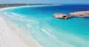

ARTS, CULTURE & COMMUNITY

With a population of 13,849, Esperance is home to a vibrant community rich in history, creativity and culture. Bordered by the stunning Esperance Foreshore, the Esperance town centre offers unique retail with specialty crafts stores, markets, cafés, facilities, tourism attractions and much more. Discover some of Esperance’s community-based attractions…
Esperance Museum
As one of Western Australia’s outstanding regional museums, view the world’s largest and most comprehensive displays of Skylab (the first American space station), the Sanko Harvest (the largest diving wreck off the Australian
Clean, comfortable and affordable accommodation in Esperance conveniently located in the centre of town. Bayview Motel is just a 10 minute walk from the local restaurants, shops and cinemas AND just a 2 minute walk from Australia’s most beautiful beaches. Our aim is your complete enjoyment. Our well-appointed motel rooms have all the comforts you would need away from home. Our commitment to you, our guest, is paramount for each and every one of us here.


australiasgoldenoutback.com | Esperance & the Fitzgerald Coast | 105 Esperance Central offers several styles of self-contained accommodation at Esperance Central Apartments and The Beach House & Villas. Both are within walking distance to the centre of town and across the road from the Esperance foreshore, have ample parking and awesome complimentary WIFI. Esperance Central Apartments 73 The Esplanade, Esperance The Beach House & Villas 20 The Esplanade, Esperance Tel: 0427 774 287 info@esperancecentral.com Book online: www.esperancecentral.com
31 DEMPSTER STREET, ESPERANCE WA 6450 (08) 9071 1533 reception@bayviewmotel.com.au • www.bayviewmotel.com.au
coast) and learn about the agricultural history of the region.
Esperance Community Arts
Showcasing local artwork of all genres, Esperance Community Arts is a place to discover the local artistic talent of the town and purchase any artworks that catch your eye. Creative workshops are often hosted here, particularly during the school holiday periods. Ask about the Arts & Culture Trail.
Cannery Arts Centre
Located in town, the Cannery Arts Centre is a premier exhibition space and the gallery doubles as an event space for the local music scene. You’ll find touring exhibitions, studios, and art and craft shops featuring local works for sale. Keep an eye out for events and workshops at this venue.
Mudjar Aboriginal Gallery
Mudjar Aboriginal Gallery is community and fair trade focused, featuring a powerful collection of local artworks, authentic handcrafted traditional tools and ethically created and sourced giftwares. This guarantees that the original artists and their communities benefit from the royalties of all items sold projecting their unique stories and talents.
Esperance Foreshore & Jetty
Grab a coffee and take a leisurely stroll along the foreshore and new Esperance Jetty. More than a kilometre of oceanfront by the town centre is beautifully landscaped. With walking paths, exercise equipment, public
artworks, all abilities and nature playgrounds, barbecue facilities, picnic shelters, beach access, and an enclosed swimming area and lap pool.
Museum Park Village
Wander through the historical buildings of Museum Village. You’ll find art, craft and design shops. Don’t miss the bustling Sunday markets regularly held in the village.
Adventureland Park
Let the kids blow off some steam in this beautiful open space. Perfect for a picnic, there’s plenty to do with various playgrounds, a duck pond, mini golf, and the mini steam train (1 October – 30 April).
Youth Precinct – Skate & Pump Track
Test out your skate skills on an array of different elements and obstacles varying in difficulty at the Skate Park & Pump Track. This hub of multigenerational interaction activity invites families and individuals to join in and enjoy the space. Remember to skate and ride to your abilities.
Helms Arboretum
Acres of a diverse range of botanical species. Wildflowers, especially orchids, are prolific in season, and there are picnic areas and walking trails.
Esperance Stonehenge
Esperance Stonehenge is an impressive monolith and the only full scale replica of UK’s Stonehenge in the world. Appreciate the atmosphere as you stroll among the giant sarsens erected from Esperance’s own pink granite.
TIP: More than just a quick getaway, Esperance is the ideal place to ‘get away from it all’. To book accommodation, find the perfect restaurant or pub or to explore more of the coastal region, head over to visitesperance.com to plan your perfect holiday.
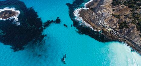
At a Glance
WHAT’S ON
Family Fun Day in the Park — 26 Jan 2023 (Australia Day)
Esperance Wildflower Festival — Sept 2023
Esperance Districts & Agricultural Show — Oct 2023
Edge of the Bay Festival — 2 Dec 2023 New Year’s Eve (at the foreshore) — 31 Dec 2023
TOP ATTRACTIONS
The Great Ocean Drive / Peak Charles National Park – Karrukarrunya / Cape le Grand National Park / Lake Monjingup / Mount Ridley – Marbeleerup
WILDFLOWERS TO DISCOVER
Spider Orchids / Pincushion Hakeas / Banksias / Kangaroo Paw ESPERANCE VISITOR CENTRE
Cnr Dempster Street and Kemp Street, Esperance (08) 9083 1555 or 1300 664 455 info@visitesperance.com visitesperance.com
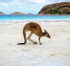
106 | Esperance & the Fitzgerald Coast | australiasgoldenoutback.com
Cape Arid National Park Coastline
Lucky Bay, Cape Le Grand National Park
STAY OFF SLIPPERY BLACK ROCKS
Esperance Holiday Park
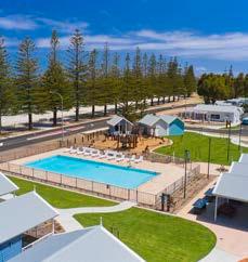
Enjoy a spectacular beachfront location with brand new accommodation and facilities, only a short walk to town.
Choose from 2 and 3-bedroom villas, studio apartments, pet-friendly cabins or shady caravan and camping sites.
Our park is now open after an exciting redevelopment. Still our same spectacular beachfront location just a short walk to town, but now with modernised accommodation and facilities.
Choose from new 2 and 3-bedroom villas, studio apartments, pet-friendly cabins or shady caravan and camping sites.
New facilities include state of the art camp kitchen, rec room, swimming pool, playground, BBQs, dump point, WIFI, onsite dog wash, general store and wash down bay for your boat or car.
Pet and accessible friendly.
New facilities include state of the art camp kitchen, rec room, swimming pool, playground, BBQs, dump point, WIFI, onsite dog wash, general store and wash down bay for your boat or car.
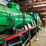
Pet and accessible friendly.
Goldfields Road, Esperance T: 08 9071 1251
Goldfields Road, Esperance T: 08 9071 1251

E: reservations@racesperanceholidaypark.com.au
E: reservations@racesperanceholidaypark.com.au
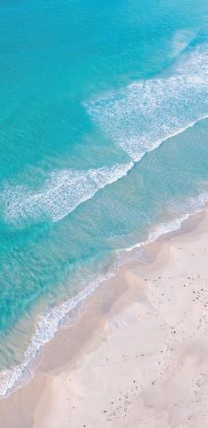


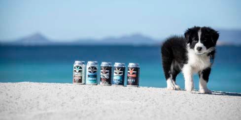
CHAMPION SMALL/MEDIUM

Discover the Esperance of yesteryear through a large display of exhibits that invite visitors to unearth the stories of our region.
your senses in our history and explore the people and places. People of all ages are bound to learn something new! Take a step back in time! The Esplanade James Street Dempster Street Contact us (08) 9083 1580 EsperanceMuseum esperance.wa.gov.au/museum for OPening times visit our Website or facebook page Rain, hail or shine... LUCKYBAYBREWING.COM.AU 63 Bandy Creek Rd, Esperance On the way to Lucky Bay - family & pet friendly, live music, beer, wine, cider, wood-fired pizza, full menu, wood fires, beer tastings, tours, gifts.
Submerge
BREWERY !
PERTH
Updates and Information on facebook.com/EsperanceCoastalSafety
2021
ROYAL BEER AWARDS
RAC
RAC Esperance Holiday Park
Shire of RAVENSTHORPE
Located on the South Coast Highway between Albany and Esperance / Kepa Kurl, the Shire of Ravensthorpe is located within the stunning Fitzgerald Biosphere Coast. The internationally recognised biosphere reserve is brimming with undiscovered wilderness and easily one of the state’s best kept secrets. It is the gateway to one of the largest and most botanically significant national parks in Australia — Fitzgerald River National Park.
Two thirds of the Shire of Ravensthorpe is natural bushland, made up of the national park, the Ravensthorpe Range and reserves — rich in geology and native flora and fauna, including many rare species unique to the area. The coastal scenery of Hopetoun and Munglinup is spectacular, with grand headlands and pristine beaches unique to the south east of WA.
RAVENSTHORPE 509km south-east of Perth
Begn at Ravensthorpe Silos followed by a visit to the visitor centre and museum, before venturing upon scenic drives around the stunning Ravensthorpe. Discover the highlights of the area when exploring…
The Ravensthorpe Range
The Ravensthorpe Range is a haven
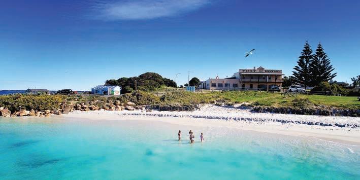
for natural attractions, scenic drives and walks. With geological complexity, an abundance of plants, wildflowers and fauna, it has the most eucalyptus species for its size in the world. The rugged range has seemingly endless unspoiled bushland stretching 45km from Ravensthorpe to Kundip. The range is accessible by all vehicles along Archer Drive although 4WD is required to access the remainder of the Range Top Drive. Enjoy sweeping views and picnic spots from Archer Drive Lookout, along Mt Short Scenic Drive and Mt Madden Scenic Drive.
Farm Gate Art Trail
The Farm Gate Art Trail is a great selection of sculptures made from farm scrap metal, dotted around the
landscape. A map of their location and explanation of each work is available on fitzgeraldcoast.com.au
Kukenarup Memorial and Heritage Walk
This memorial and heritage walk is a place for reflection and is one of the first memorials of its kind in Australia to acknowledge the tragic past and help move towards reconciliation.
PUBLIC Silo Trail
Visible for miles around, the 25m high mural by renowned artist Amok Island, showcases the flowering cycle of a banksia, native to the region and is part of the Public Silo Trail by FORM.
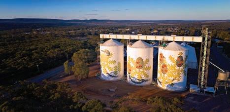
Railway Heritage Walk Trail
Immerse yourself in this four-section
Kids at Hopetoun Beach
Ravensthorpe Silos
Image: Dene Bingham
108 | Esperance & the Fitzgerald Coast | australiasgoldenoutback.com
Image: Dene Bingham
walk track through natural bush. The original railway track was built to connect Ravensthorpe mines to the Hopetoun Port and operated from 1909 to 1935.
HOPETOUN
558km
south-east of Perth
Hopetoun is surrounded by unspoilt wilderness and is the perfect setting for a relaxed, all-year round holiday. September to April is especially ideal to enjoy the 200km of pristine beaches, picturesque scenery, abundance of water activities and the easy access to the Fitzgerald River National Park. Take to boating, windsurfing, swimming, snorkelling, fishing and whale watching while in Hopetoun.
Jim McCulloch Park
Be sure to check out the family-friendly park, just a stone’s throw from the grassy foreshore with gas barbecue, picnic shelters, play equipment, replica railway station and jumping pillow.
Southern Ocean Road
East from Hopetoun is the scenic Southern Ocean Road which takes in the spectacular coastline, passing several lookout viewing points and access points to many beaches, salt water pools and fishing spots including Two Mile Beach, Five Mile Beach, Twelve Mile Beach, Mason Bay and Starvation Bay.
Mason Bay and Starvation Bay
Take a day trip east of Hopetoun to discover two spectacular bays. Swim, fish, snorkel and play all day or enjoy coastal camping at its finest. Each with boat launching points and snow white beaches you won’t want to leave.
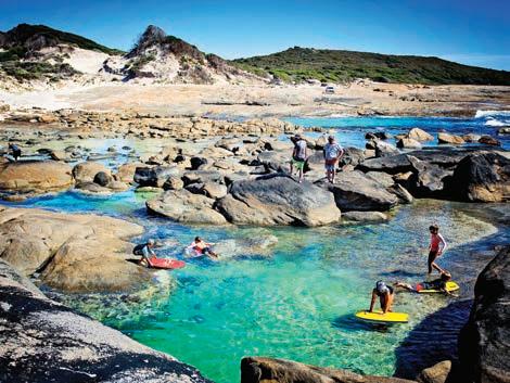
MUNGLINUP 590km south-east of Perth
Munglinup Beach forms a lagoon that is protected by a reef and here you can swim or snorkel, enjoy the underwater world or just relax on the beach. If you are looking for a secluded beach you needn’t go any further, you’ll find it here. Just a short distance away, Lake Shaster and the Oldfield Estuary are renowned havens for rare and unusual birds. The Oldfield Estuary area offers visitors plenty of activities including canoeing, small boating, kayaking, nature bush walks, wildflower viewing and fishing.
At a Glance
WHAT’S ON Hopetoun Summer Festival — Jan 2023
Hopetoun Annual Fishing Classic — 4-5 March 2023
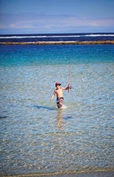
Ravensthorpe Enduro Club Peak Charles Ride — July 2023 (school holidays)
Ravensthorpe Wildflower Show and Spring Festival — 11-23 Sept 2023
Ravensthorpe Enduro Club Rat Run (Motocross) — Oct 2023
TOP ATTRACTIONS
Farm Gate Art / Ravensthorpe Silos / Ravensthorpe Ranges / Walk Trails / Phillop’s River Canoe Trail
WILDFLOWERS TO DISCOVER
Royal Hakea / Qualup Bell / Barrens Regelia / Scarlet Banksia / White Spider Orchid
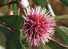
RAVENSTHORPE VISITOR CENTRE AND MUSEUM
86 Morgans Street, Ravensthorpe (08) 9838 1191
visit@fitzgeraldcoast.com.au fitzgeraldcoast.com.au
Starvation Bay
Pincushion Hakea
12 Mile Fishing
Image: Dene Bingham
Image: Dene Bingham
australiasgoldenoutback.com | Esperance & the Fitzgerald Coast | 109
Image: Anne Bell
Shire of DUNDAS
THE NULLARBOR PLAIN is somewhat of a rite of passage for Australians. One of the country’s most epic road trips, it extends from the town of Norseman through to the Eyre Peninsular in South Australia. There are seven main stops along this route between Norseman and the border with South Australia – Fraser Range, Balladonia, Caiguna, Cocklebiddy, Madura, Mundrabilla, and finally Eucla, just 11km from the South Australian border.
This is a harsh and unique landscape,
home to various wildlife, including wombats, wedge-tailed eagles, and whales. Crossing the plain is one of the world’s great road adventures with plenty to see.
NORSEMAN 726km east of Perth
Located in the south east of WA, the town of Norseman is the gateway to Western Australia. The Shire of Dundas has a diverse landscape, home to
remote and rugged coastlines, the famous Nullarbor Plain, spectacular granite outcrops and vast sparkling salt lakes. Norseman also sits in the heart of the ecologically significant Great Western Woodlands, the world’s largest, untouched temperate woodlands. The Ngadju and Mirning people are the traditional owners of the land. Aboriginal cultural heritage draws visitors to the region to learn about and experience local Ngadju and Mirning culture through tours, arts and sharing of knowledge and heritage.
Gold was Norseman’s original claim to fame when prospector Laurie Sinclair and his horse Norseman passed through only 20km north of the original Dundas townsite. When his horse went lame, Sinclair discovered that the piece of rock lodged in Norseman’s hoof was gold-bearing. Excited by his lucky find, he continued prospecting resulting in a major find that sparked a gold rush and established a town named after his trusty horse. Gold has been mined ever since.
The Woodlands Centre is a must-see with friendly staff ready to welcome you to Norseman.
Whether seeking information, enjoying the interpretive displays, watching the murals come to life with AR technology, or shoppingfor a souvenir to show off after your travels, the Woodlands Centre has everything you need.
78 Prinsep Street, Norseman WA 6443
T: (08) 9039 0040
E: tourism@dundas.wa.gov.au www.dundas.wa.gov.au
Tel: (08) 9038 1500 / 0438 188 118
Email: gateway@acclaimparks.com.au
Lot 1175 Prinsep Street, Norseman, WA 6443

www.acclaimparks.com.au

110 | Esperance & the Fitzgerald Coast | australiasgoldenoutback.com
• • • • • • • • • • • •
Caiguna Blowhole
Camel Roundabout
Norseman Woodlands Cultural Community and Visitors Centre
Gateway Caravan Park
Our main highway midway between Kalgoorlie & Esperance. Explore the real outback with its surreal landscape & captivating history. Range of accommodation options.
BALLADONIA
191km east of Norseman
Balladonia is a small roadhouse community offering an important rest stop for travellers traversing he plain. Balladonia Roadhouse includes a restaurant, bar, motel and caravan park. Visit the Cultural Heritage Museum with Skylab debris and interactive displays while passing through.
CAIGUNA
180km east of Balladonia
Caiguna is a small roadhouse community and a 146.6-kilometre stretch of the highway, being one of the longest straight stretches of road in the world. Find the Caiguna Blowhole 5km west of town.
COCKLEBIDDY
66km east of Caiguna
Cocklebiddy lies on the southern edge of
Western Australia’s vast sheep grazing belt. Visit Australia’s first bird observatory here, the Eyre Bird Observatory, which offers a delightful retreat for nature lovers. The observatory requires advance bookings (call 08 9039 3450) with access by 4WD only.
MADURA
91km east of Cocklebiddy
Madura was settled as a pastoral homestead in about 1876. Stop at Madura Roadhouse before visiting the Madura Pass Lookout for a rare vantage point of the sweeping plans.
MUNDRABILLA
115km east of Madura
Mundrabilla Roadhouse offers fuel, accommodation, food and the world’s longest golf course, Nullarbor Links Golf Course. This picturesque location along the escarpment is also the site of Australia’s biggest meteorite.

EUCLA 62km west of Mundrabilla
Eucla is the final stop within WA before crossing the border to SA. This tiny settlement is home to service station, hotel-motel, caravan park and golf course. The old, desolated Telegraph Station here is an iconic image of the Nullarbor — a reminder of the lonely, harsh environment.
At a Glance
TOP ATTRACTIONS
The Norseman Museum / Tin Camel Roundabout / Nullarbor Links / Granite and Woodlands Discovery Trail / Norseman Woodlands Cultural, Community & Visitors Centre / Dundas Heritage Trail & Dundas Rocks
STOPS ALONG THE PLAIN
Norseman / Balladonia / Caiguna / Cocklebiddy / Madura / Mundrabilla / Eucla
WILDFLOWERS TO DISCOVER
Sturt Desert Pea / Eremophilia / Wattle / Orchids / Everlastings
NORSEMAN VISITOR CENTRE
78 Princep Street, Norseman (08) 9039 0040 or 1300 664 455
tourism@dundas.wa.gov.au dundas.wa.gov.au
australiasgoldenoutback.com | Esperance & the Fitzgerald Coast | 111 Quarantine Check Point Quarantine Check Point
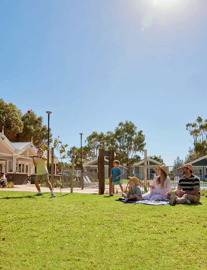
Call 1800 871 570 or visit racparksandresorts.com.au Terms and conditions apply. RAC member discount not applicable on already discounted rates. Discounts available on direct bookings only made online or via phone. For more information visit our website. R18822 Holiday Park open and ready to welcome you Esperance RAC members enjoy exclusive discounts
