> Continued from Page 12
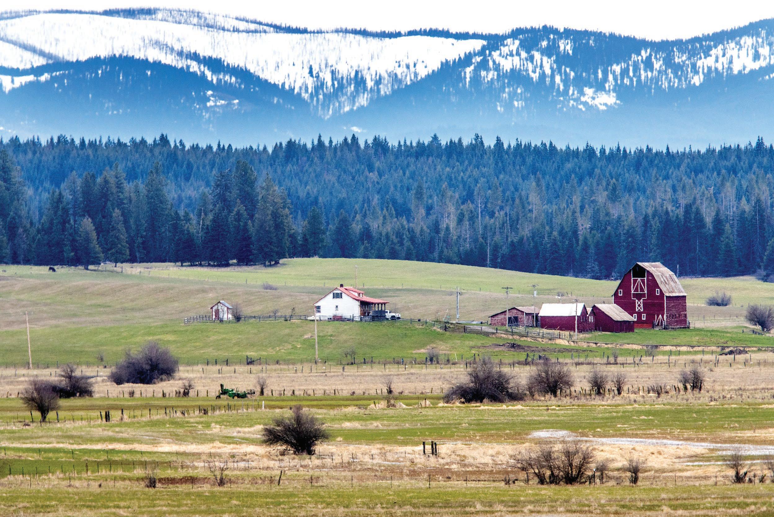
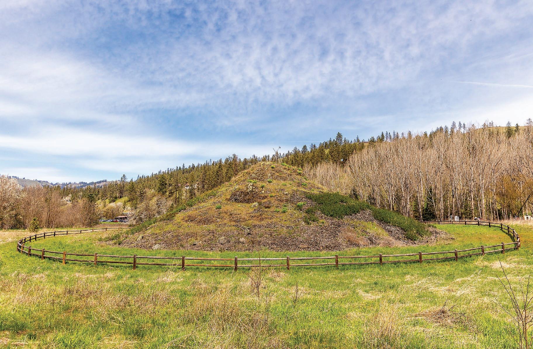
Mary McCroskey traveled with her 10 children from Tennessee to Washington to take advantage of the fertile Palouse soil.

Virgil McCroskey felt called to dedicate the land to honor her and the other pioneer women of her time.
Virgil McCroskey, however, was not off the hook when he donated

the land. The Idaho Legislature required him to maintain the park for the next 15 years. Even though he was in his 70s, Virgil McCroskey fulfilled his duty.
He lived exactly 15 more years and his obligation to the state was fulfilled just weeks before his death in 1970 at age 93.
Now visitors can enjoy McCroskey State Park for a variety of


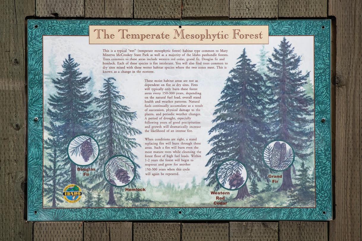
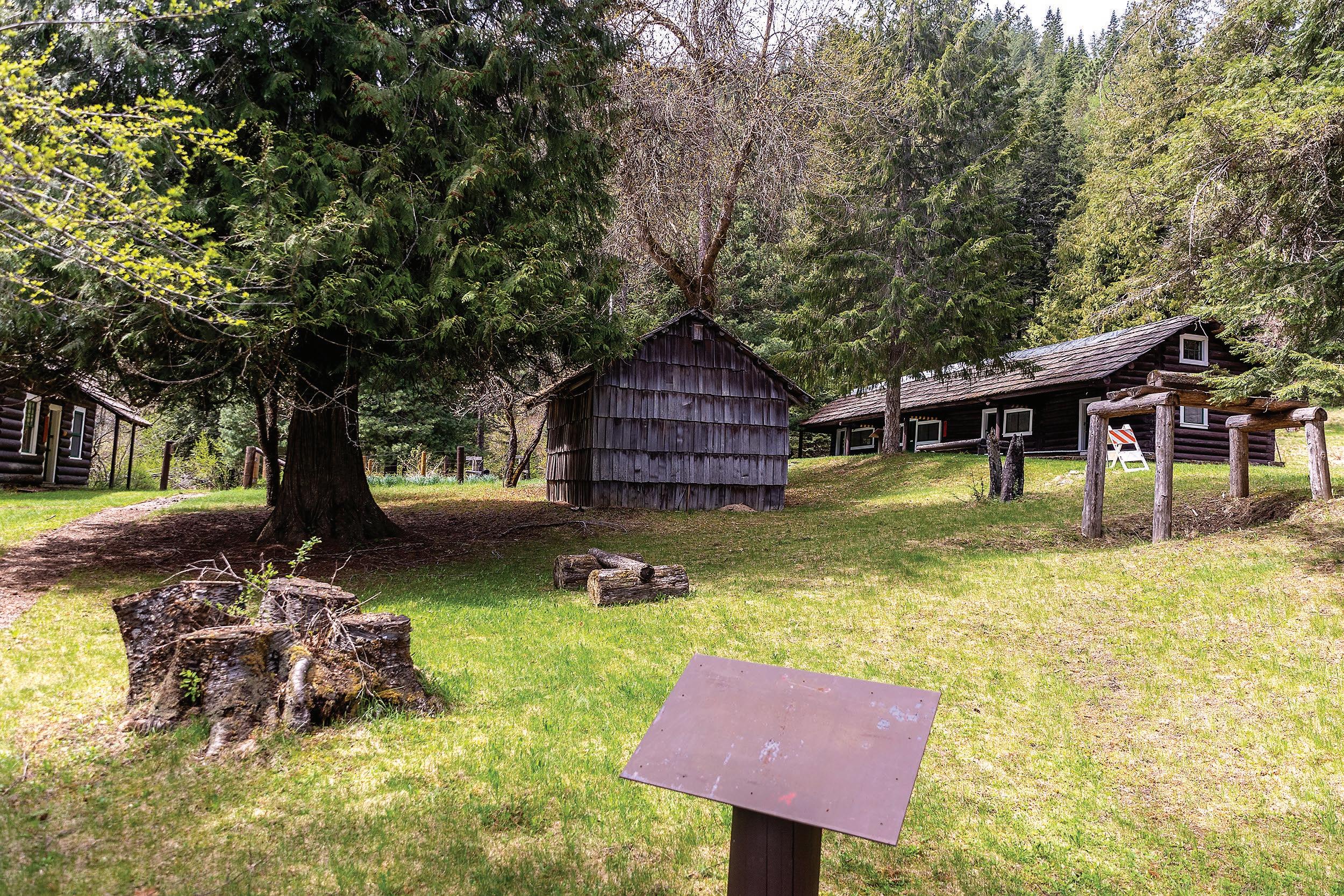
ABOVE: Signs offering environmental insight to guests is displayed at McCroskey State Park north of Potlatch.
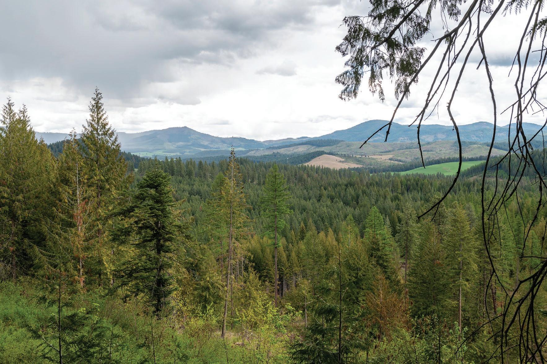
LEFT: This photo shows a view from an overlook along Skyline Drive at McCroskey State Park north of Potlatch.
Zach Wilkinson/for Daytripping
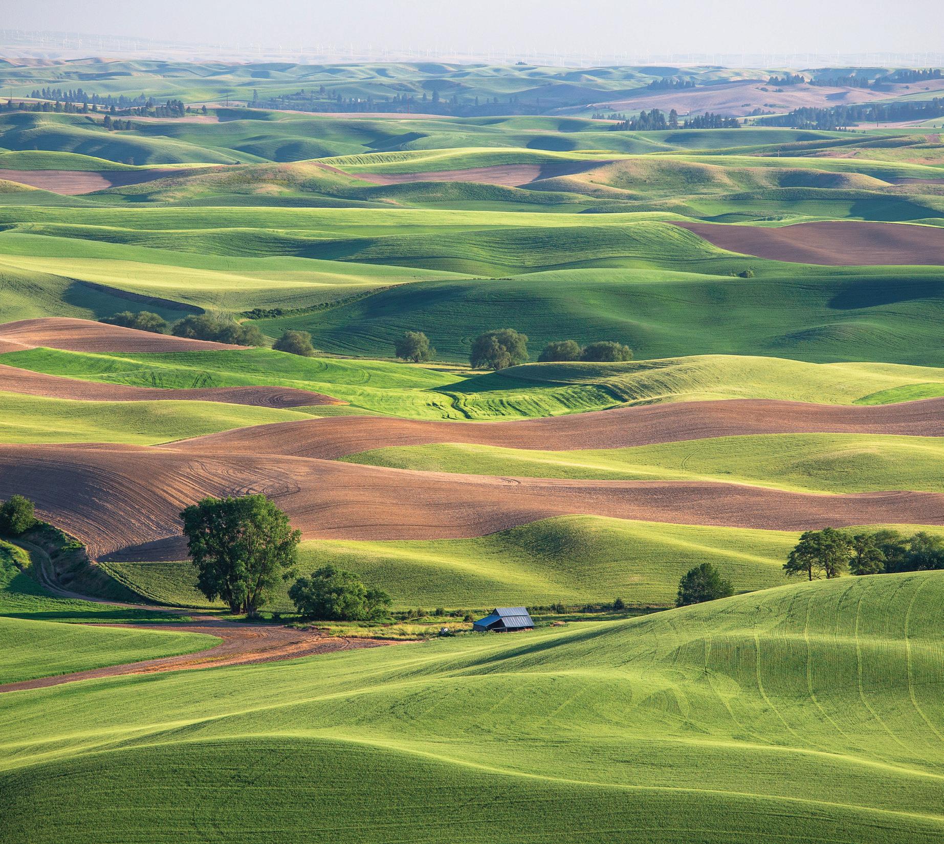
reasons. They can get away from it all on a camping trip. They can take in the views of the Palouse and the foothills of the Bitterroot Divide on the Idaho-Montana border. They can spot Palouse Prairie and ornamental flowers that were planted by Virgil McCroskey himself in honor of his mother. Or they can take their mountain bikes and ATVs and explore the trails.
> McCroskey State Park
LOCATION: 25 miles north of Moscow off U.S. Highway 95 in Latah County.
WHAT YOU’LL DO: Hike, camp, bike, ATV, enjoy the scenic views.
DIFFICULTY (1-5 SCALE): 3 or 4. The park features steep, winding trails and secluded camping spots.
DON’T FORGET: There is no garbage service. There is running water, but it is only seasonal. Skyline Drive becomes snowed in during the winter months.
FRIDAY, MAY 19, 2023 13 DAYTRIPPING PART 2
Arts & Culture Biking Trails for all Levels Breweries & Wineries Golf Course Hiking/Walking Trails & Pathways Museums Music & Theatre Shopping TOURIST INFORMATION CENTER 415 N Grand Ave Pullman 509-334-3565 www.visit-pullman.com We'll Be Waiting For You! You!
All aboard for historic train depot
A visit to the restored Potlatch Train Depot is a step back in time
By EMILY PEARCE FOR DAYTRIPPING

With a lot of love and dedication, almost two decades’ worth of restoration work has made the Potlatch Train Depot a true hidden gem in northern Idaho.
When the Washington, Idaho and Montana Railway History Preservation Group took over the depot in 2001, it didn’t know how much work it would be getting into. But the group stayed committed to the station, and its hard work paid off.
The depot, more than 100 years old, has been restored to its original condition. From its signature red paint to its antique iron-plated windows, the station will teleport visitors to the pioneer era of early Idaho.
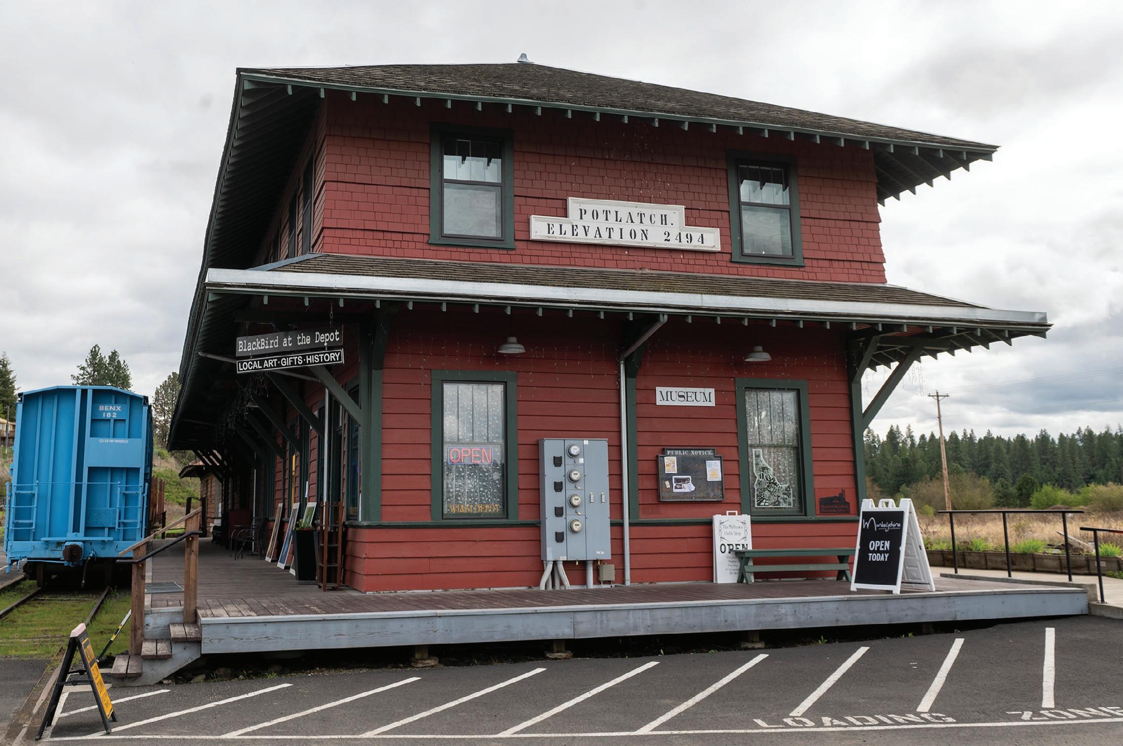
The group finished restoration efforts on the depot in 2016, when it completed renovations on the second floor. In 2007, the group restored its exterior and replaced the roof, and in 2010, renovations were made to the first floor. Both floors include historically accurate fixtures, and the second floor contains 11 refurbished spaces.
tions of history, artifacts from the historic Washington, Idaho and Montana Railway and board rail cars dating back to the 1910s and ’20s. The depot offers a special event space on the first floor, and those who can’t get enough of the station can rent out spaces on the second floor. The gift shop is hard to pass by, as all proceeds go toward maintenance of the depot.
stretching almost 50 miles from Palouse to Bovill, the depot was consequential
LEFT: The freight room of the Potlatch Train Depot is photographed on a recent weekend.
BELOW: The exterior of the Potlatch Train Depot is seen in a recent photo. The depot was Potlatch’s first commercial building upon completion in 1906, and has been refurbished over the past decade or so.
FRIDAY, MAY 19, 2023 14 DAYTRIPPING PART 2
Zach Wilkinson/ for Daytripping

FRIDAY, MAY 19, 2023 15 DAYTRIPPING PART 2
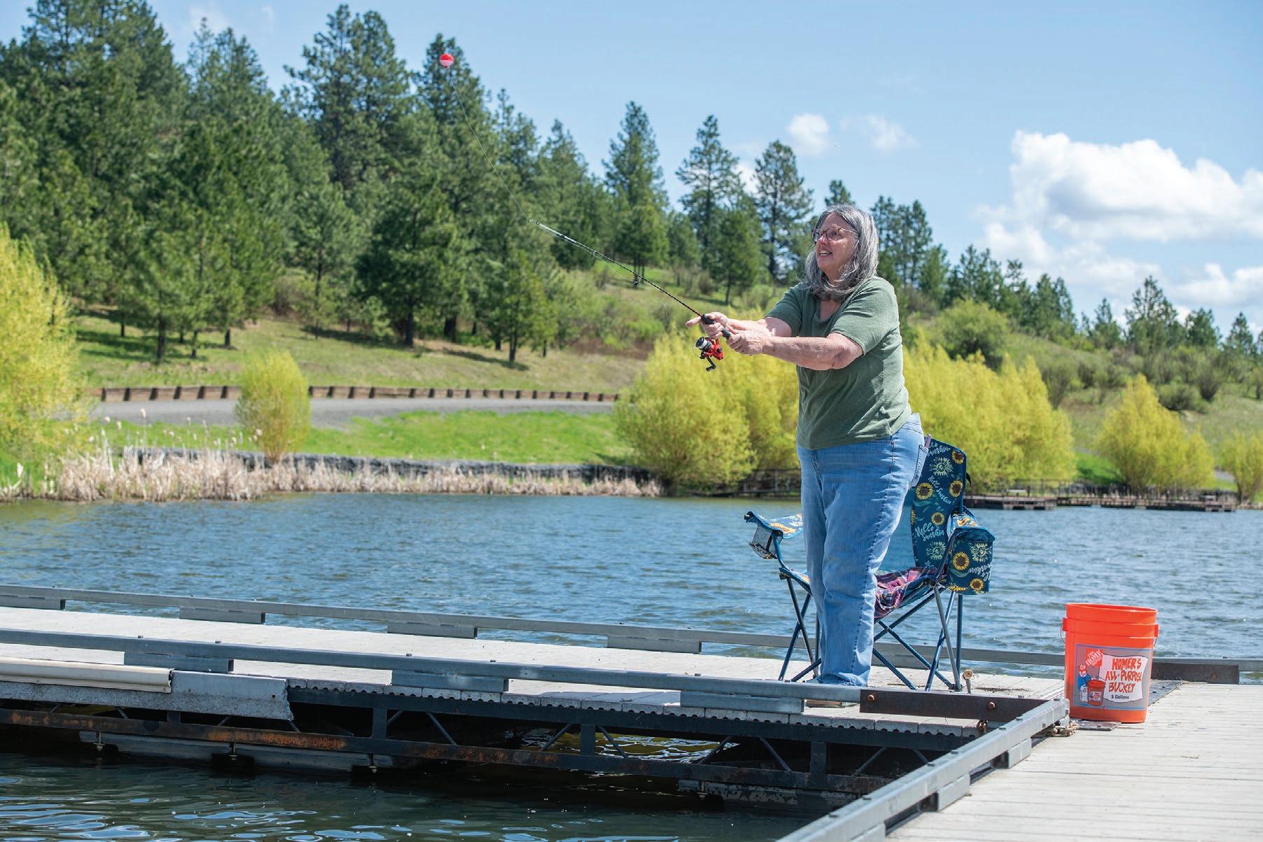
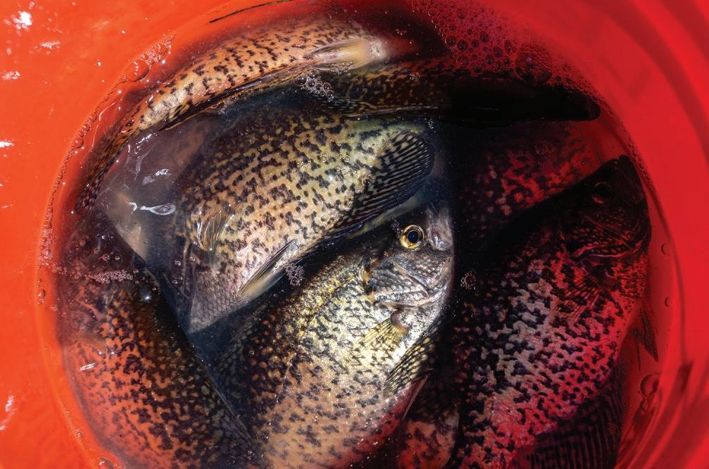
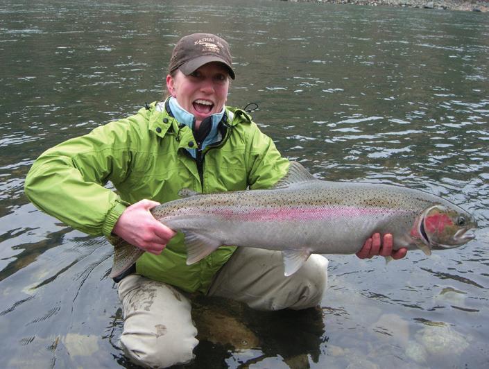
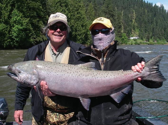
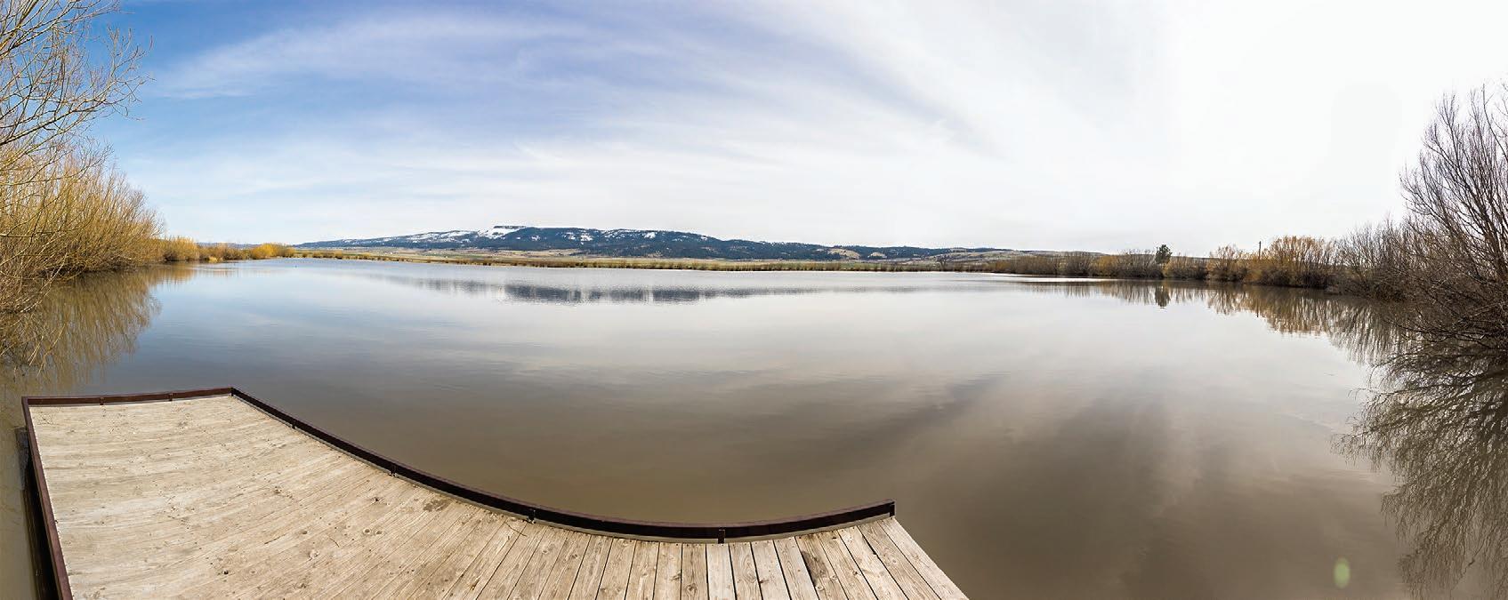
ABOVE: Crappies fill a 5-gallon bucket as Patti Toone fishes at Spring Valley Reservoir near Troy.
Spring Valley Reservoir 208-476-3531 175 140TH STREET HWY 12 M/P 40 • OROFINO www.theguideshop.com | Email:guideshop@hotmail.com The Guide Shop and Clearwater Drifters is a full service outfitter and tackle shop. With over 30 years of experience, our team of guides offer some of the finest Steelhead and Salmon fishing available in Idaho. THE FINEST IN STEELHEAD & SALMON FISHING ON IDAHO’S CLEARWATER RIVER 611538E_22
RIGHT: Toone casts her fishing line from a dock at Spring Valley Reservoir. She said there’s nowhere else she’d rather be than fishing in peace.
By RACHEL SUN
FRIDAY, MAY 19, 2023 16 DAYTRIPPING PART 2
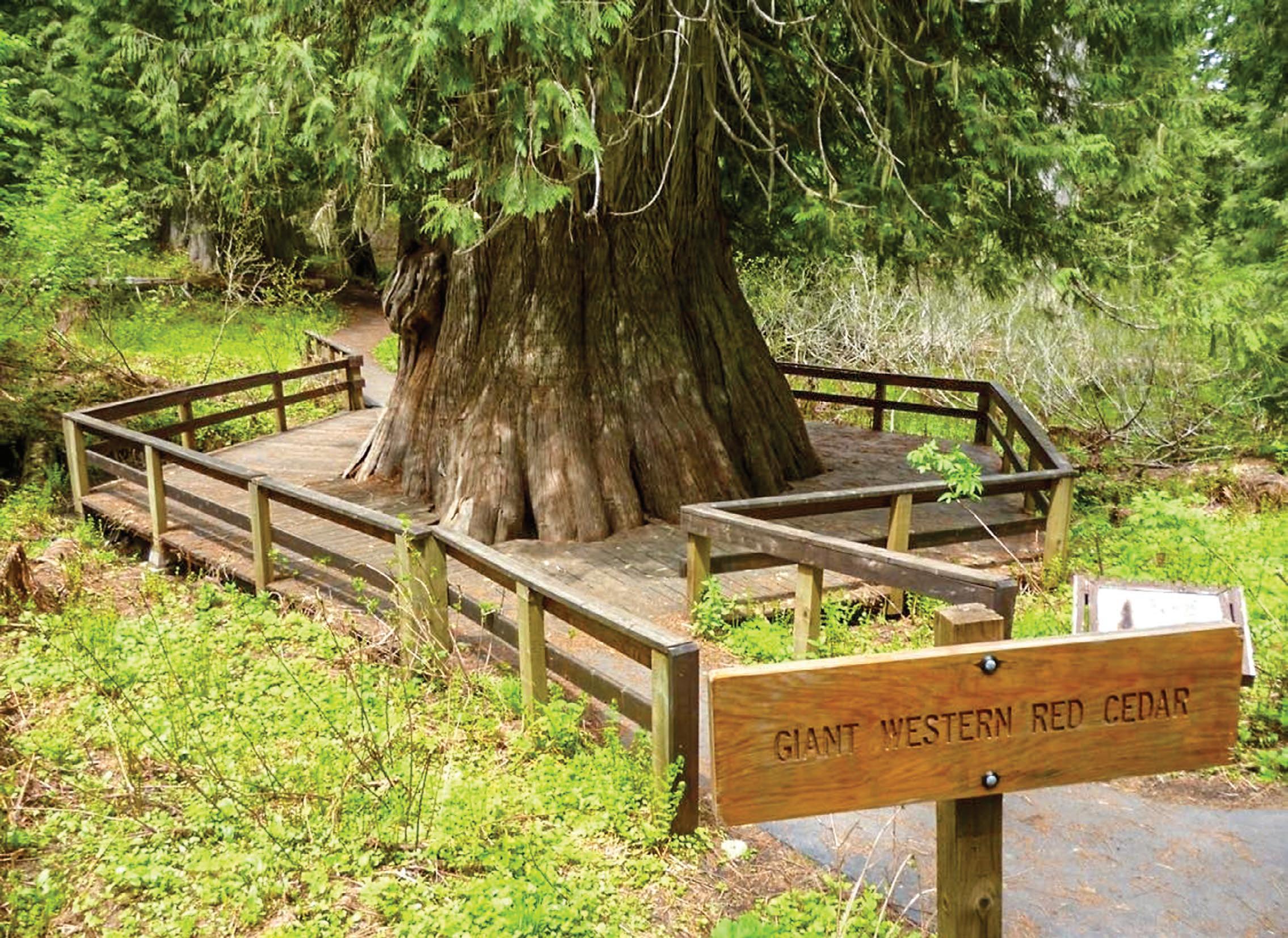
Giant Cedar Grove Trail offers an easy hike to one of the largest trees in Idaho, which is estimated to be 3,000 years old
an ancient giant Giant Cedar Grove Trail 30 minutes north of Elk River A walking trail with access to the “Champion Tree of Idaho” DIFFICULTY (1-5 SCALE): 2 NEARBY SITES OF INTEREST: The town of Elk River, Elk Creek campgrounds, Elk Creek Falls
file
A short hike to see
Daytripping
Kendrick •Open at 4pm for Dinner Every Day •Lunch at 11am Friday, Saturday, and Sunday •Curbside Espresso at 6am Every Morning 208.289.5000 701 E Main St, Kendrick Under New Ownership Hardware Brewing
This giant western red cedar is known as the “Champion Tree of Idaho” and is the crown jewel of the the Giant Cedar Grove
LEFT: The Weippe Prairie is the spot where the Nez Perce Tribe and explorers from Lewis and Clark Corps of Discovery first encountered each other in September 1805.
BELOW: Musselshell Meadows tends to be a good camas bloom location, but can be covered by snow well into the spring, as it was in late April when this photo was taken.
August Frank/for Daytripping
Natural beauty, and historical significance
it and Musselshell Meadows haven’t changed much since then
 By KATHY HEDBERG FOR DAYTRIPPING
Nearly 220 years after the Lewis and Clark Corps of Discovery met with members of Nez Perce Tribe, the Weippe Prairie and Musselshell Meadows in Clearwater County continue to offer a glimpse of the region’s natural beauty and historic significance.
The Weippe Prairie National Historic Landmark covers about 3,120 acres. Most of it is privately owned, but 274 acres are owned by the Nez Perce National Historical Park, and that area is publicly accessible and offers sweeping views of the landscape.
Historically, the Nez Perce would come to the prairies in the summer to harvest roots and berries. In September
1805, the Lewis and Clark expedition arrived, famished and exhausted, on the westerly leg of their trek. The Nez Perce welcomed them and fed them meals of camas root,
dried salmon and berries.
The explorers departed later that month, but reunited with the Nez Perce the following spring on their return trip east and remained on the

> Weippe Prairie and Musselshell Meadows

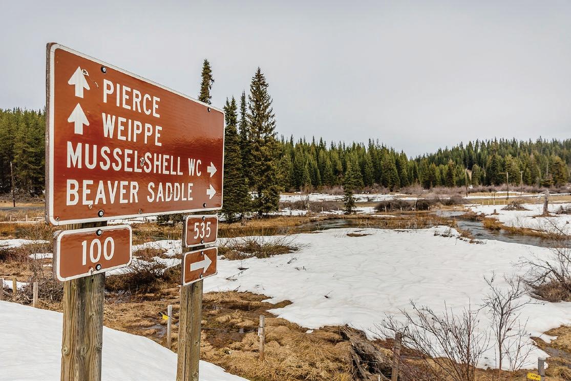
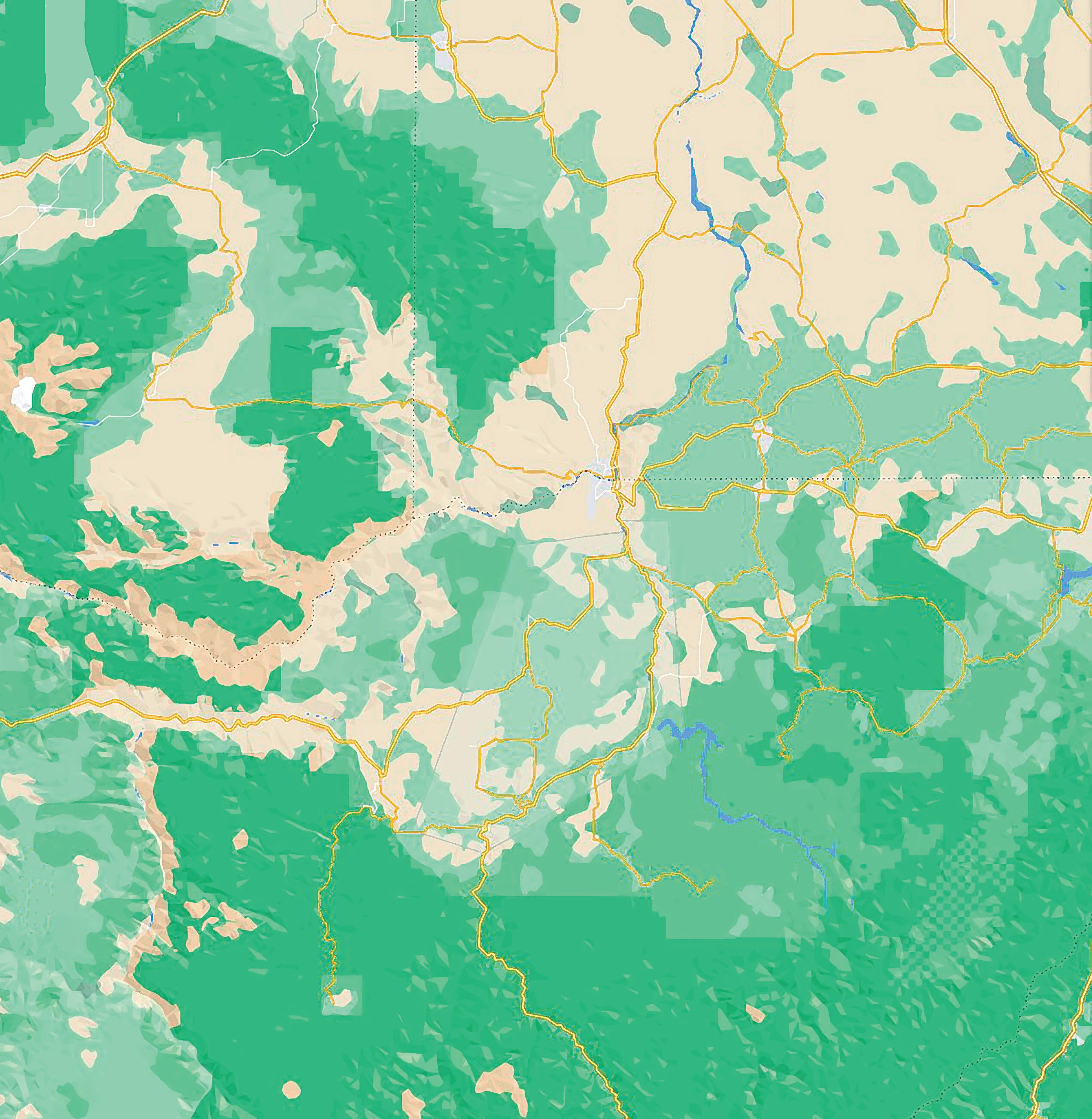
LOCATION: From Orofino, travel east on U.S. Highway 12 for 7 miles, then turn left onto State Highway 11 and travel through the town of Greer. The Weippe Prairie is about 20 miles away near the town of Weippe. Five miles farther, the road turns into Musselshell Road or Forest Service Road 100. Travel another 11.5 miles and turn left onto Road 535 and 1 mile farther the meadows will be on the left.
DIFFICULTY (1-5 SCALE): 1 to 3. These sites can make for an easy driving tour, or the activities offered can make it more of a challenge.
WHAT YOU’LL DO: Bicycling, camping, hiking, horse riding, hunting, nature viewing, outdoor learning, picnicking, scenic driving
prairie for several days.
Nearby Musselshell Meadows, south of Pierce, is home to rare wildlife and dense forests.
and winter sports.
Weippe Prairie/ Musselshell Meadows
ino Pierce Kamiah 12 12

DON’T FORGET: Parts of Forest Service Road 100 are groomed for snowmobiles in the winter; other areas are not plowed. There is no fee and no drinking water is available. One vault toilet at the north end of the meadow near the Trail 40A trailhead is available.
Visitors can enjoy trail riding, hiking, fishing, hunting, scenic driving, horse trail riding and wildlife viewing.
FRIDAY, MAY 19, 2023 17 DAYTRIPPING PART 2
The Nez Perce Tribe first encountered Lewis and Clark at Weippe Prairie;
A visit to the heart of creation
Heart of the Monster is a sacred place for the Nez Perce Tribe — and an easy place for travelers to visit
By KAYLEE BREWSTER FOR DAYTRIPPING
Along U.S. Highway 12 and the Clearwater River
lies the creation site for the Nez Perce Tribe.
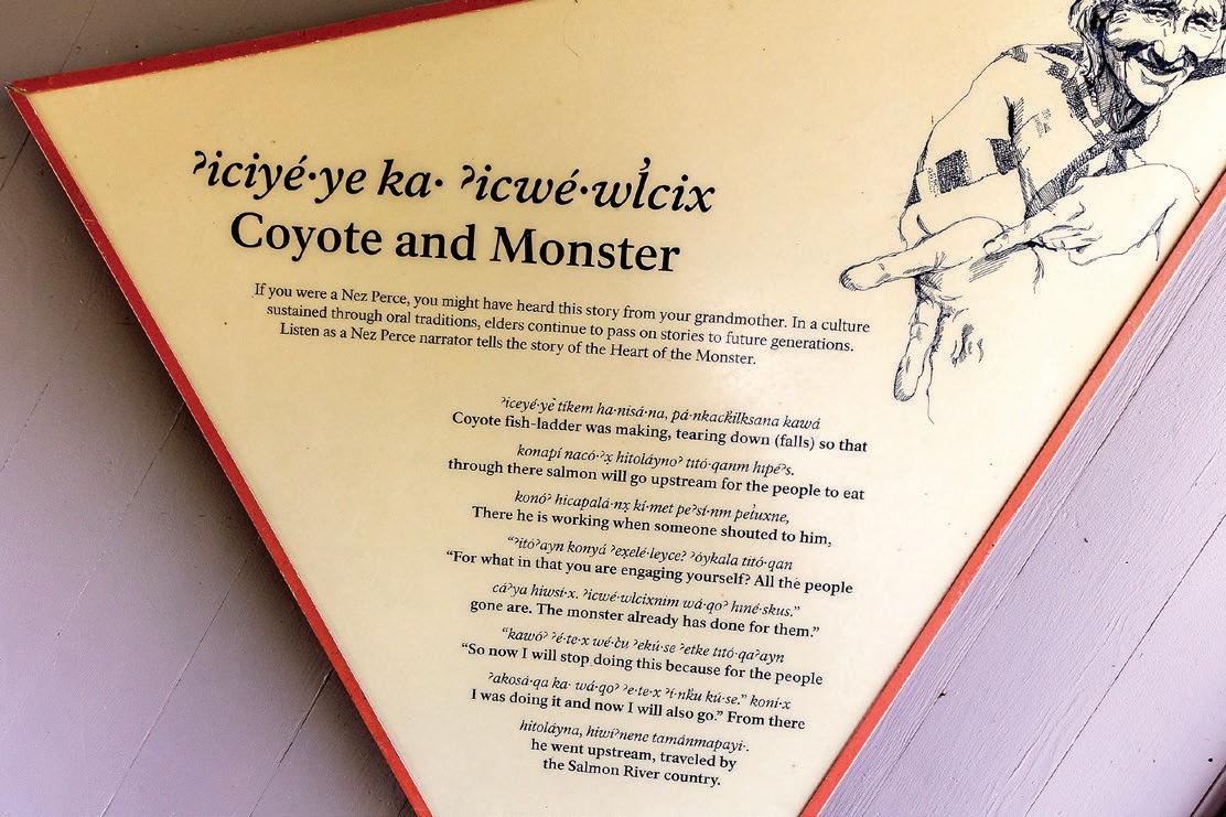
The Heart of the Monster is where the creation story of the Nimiipuu, or Nez Perce, takes place, which began when Iceye’ye, or Coyote, killed a monster that was eating all the animals. Coyote tricks the monster into eating him and cuts out his heart, which becomes the rocky mound known as
August Frank/for Daytripping
ABOVE: People walk their dog down the trail that leads to the Heart of the Monster — the rocky mound in the distance. Nez Perce Tribe tradition holds that this site near Kamiah is where all Native American tribes were created. ABOVE LEFT: The story of Coyote and Monster is told on a display at the Heart of the Monster.
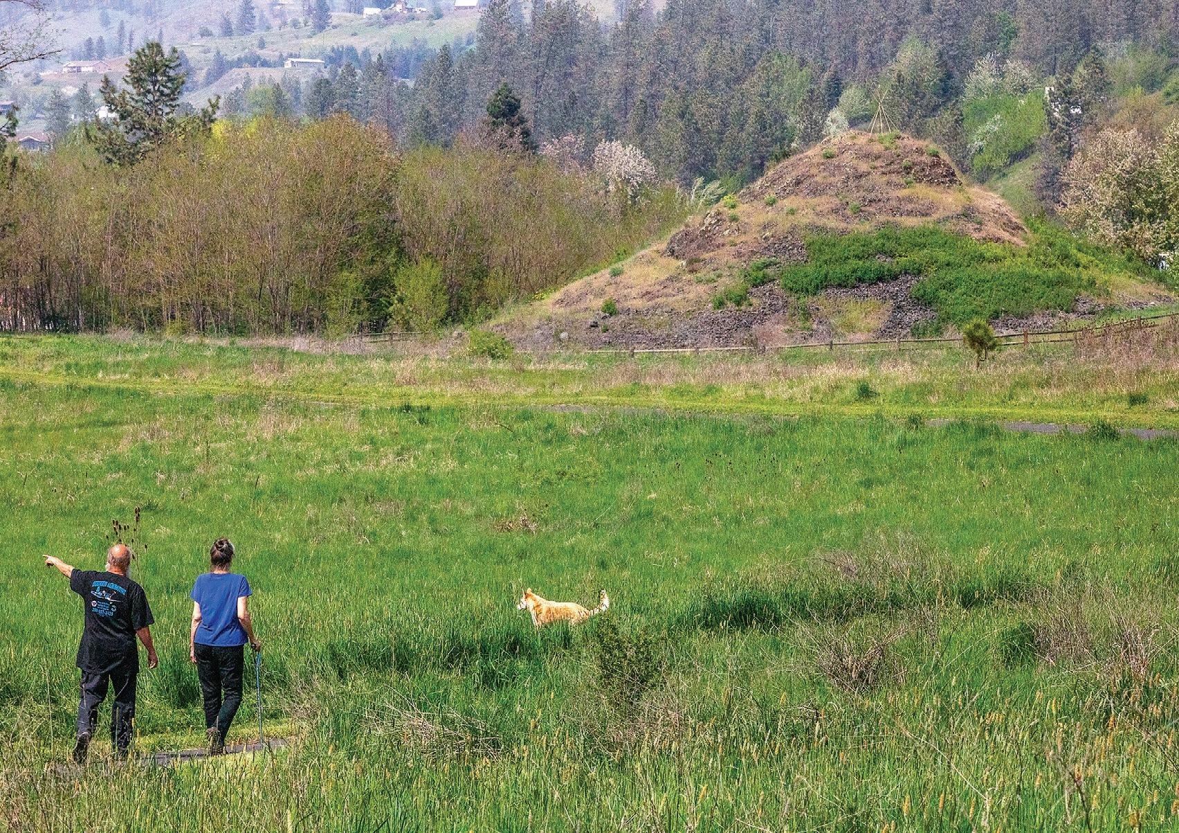
the Heart of the Monster. Coyote then creates the Native American tribes, including the Nimiipuu.
Those who visit the site will get a more detailed version of the story with signs and an audio
recording of the story in English and Nez Perce. From the parking lot, it’s
> Continued on Page 19
FRIDAY, MAY 19, 2023 18 DAYTRIPPING PART 2


August Frank/for Daytripping
> Continued from Page 18 Imua Hawaiian Restaurant • The Mad Hatter Tea Shop Skalicky’s Sweet Sensations Bakery • Nez Perce Traditions Gift Shop Idaho Memories Gift & Souvenir Shop • Vine 46 800 Main Street | Lewiston Explore One of Lewiston's Historic Buildings and Find A Unique Shopping Experience Sweet Sensations
The Heart of the Monster is pictured in late April near Kamiah.
Mad
Shop
Skalicky s Skalicky’s Bakery
The
Hatter Tea
RIGHT: The Lochsa Historical Ranger Station dates back a century. It was once a key hub for the U.S. Forest Service, but now serves as a memento from the past.
BELOW: A kayaker hits rough rapids as he travels down the Lochsa River in early May.
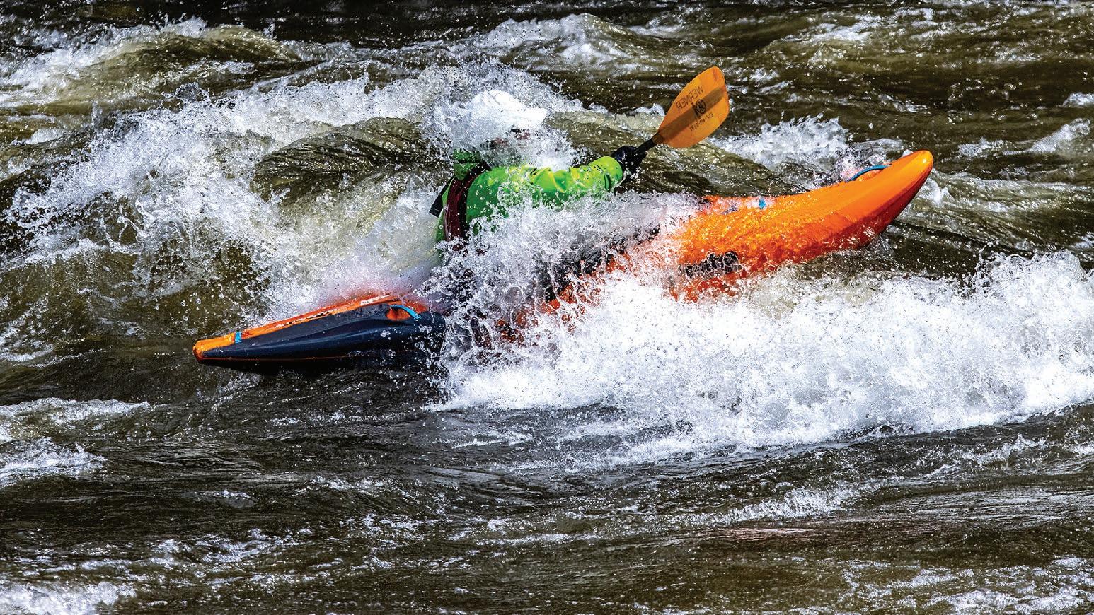
August Frank/ for Daytripping
Historic station tucked away in unspoiled wilderness
Come to visit the Lochsa Historical Ranger Station — stay for the rugged natural beauty
By KATHY HEDBERG FOR DAYTRIPPING
The Lochsa Historical Ranger Station, located about 48 miles northeast of Kooskia along U.S. Highway 12, is a popular draw for tourists traveling between Idaho and Montana.
The idyllic log structure was built in 1925 and originally used as a backcountry ranger station by the U.S. Forest Service. It served as the administrative hub for fire lookouts, a bunkhouse for smoke chasers and was a key part of the Forest Service’s system of pack trails and telephone lines.
In 1976, the station was formally dedicated as an interpretive site, as part of the nation’s Bicentennial Celebration. The station also is listed on the National Register of
Historic Places. The visitor center, located within the Alternate Ranger’s cabin, sits amid a shady oasis of conifers and locust trees.
The ranger station is adjacent to the Lochsa River corridor that borders the highway. The Lochsa, which means “rough water” in the Nez Perce language, was designated in 1968 as part of the National Wild and Scenic Rivers Act.
The Lochsa and Selway rivers are the two primary tributaries of the Middle Fork of the Clearwater River and have no dams or regulated flow. In late spring, the Lochsa River is rated as one of the world’s best for continuous whitewater. The Lochsa River Floating Guide lists more than 60 rapids between Powell and Lowell, most of which are rated in the medium to difficult classification.
> Lochsa Historical Ranger Station

LOCATION: The Historical Ranger Station is located at mile marker 121.5 on U.S. Highway 12 between Wilderness Gateway Campground and Fish Creek River Access.
DIFFICULTY (1-5 SCALE): 1.
DON’T FORGET: It is open at no cost to the public from 9 a.m. to 5 p.m. from Memorial Day through Labor Day and is staffed by volunteer hosts. The hosts at the visitor center provide information to the public about recreational opportunities on the forest. These include trails, campgrounds, the Lolo Trail National Historic Landmark, the Selway-Bitterroot Wilderness and Lolo Pass Visitor Center. Books, maps, T-shirts and other souvenirs are available for purchase at the visitor center. Drinking water is provided and two flush toilets are available.
It’s not uncommon to spy wildlife in the area, including elk, black bear and moose in meadows and wet places. Birds include Canada geese, swans, eagles, osprey and great blue herons. Wild turkeys can be seen at lower elevations.
The Lochsa River is home to cutthroat trout, rainbow trout, chinook salmon and steelhead.

FRIDAY, MAY 19, 2023 20 DAYTRIPPING PART 2
ino
Pierce Kooskia
Kamiah wood 12 Lochsa Historical Ranger Station
August Frank/for Daytripping
Tolo Lake near Grangeville is rich with history. It was a traditional gathering place for various bands of the Nez Perce Tribe, and the remains of three mammoths were found there in 1994.
Tolo Lake: More than just a rest stop
Camas Prairie body of water
birding and history
By LAURA GUIDO FOR DAYTRIPPING
Travelers on U.S. Highway 95 seeking to bypass Grangeville have likely stopped at the outhouse at Tolo Lake at least once or twice.
But the 36-acre lake is more than just a scenic rest stop on a gravel road; it’s a historical meeting site for the Nez Perce Tribe, the site of a major mammoth discovery, and a popular fishing and birding spot.
The pond is the largest natural body of water on the Camas Prairie and an affiliated site of the Nez Perce National Historical Park.
The lake had served as a rendezvous site for bands of the Nimiipuu — or Nez Perce — used for gathering food and meeting with neighboring bands, according to the National Park Service. The canyon
LOCATION: From Lewiston, drive south on U.S. Highway 95 for about an hour, turn west onto Tolo Lake Road, drive for just more than 4 miles. (Note: The easier way to access the site is from Lake Road, but it has been closed for a while.)
WHAT YOU’LL DO: Fish, bird watch, read about its history, take out a boat, picnic, enjoy the view.
Difficulty (1-5 scale): 1.
DON’T FORGET: Fishing gear and valid license for anglers, binoculars and camera for birders.
NEARBY SITES OF INTEREST: The Tolo Lake mammoth skeleton replica can be seen in a pavilion at Eimers Park in Grangeville. The White Bird Battlefield Overlook is located about 15 minutes away, south on U.S. Highway 95.
was also part of an ancient transportation network that connected the Salmon River and the Snake River drainages.


The lake was a gathering spot during the Nez Perce flight of 1877, in which at least
August Frank/for Daytripping
Tolo Lake is pictured in a panoramic photo created by stiching multiple photos together. Fishing and birdwatching are among the activities visitors to the Camas Prairie body of water can enjoy.
95
Kooskia
Nez Perce Reservation near Lapwai, according to the National Park Service.
found three mammoth skeletons and an ancient bison skull.
er Cottonwood Grangeville
White Bird
95
The lake is now owned and managed by Idaho Department of Fish and Game. The department has said it will stock Tolo Lake with 700 rainbow trout in May. The lake supports a warm water fishery.
In 1994, state officials sought to improve fish and wildlife habitat at the lake and in the process found a huge bone. It was later determined to be a Columbian mammoth. A paleontological recovery effort
An exhibit about the Tolo Lake mammoths can be viewed in nearby Grangeville at Eimers Park, which includes a life-sized replica of a mammoth skeleton.
The quiet pond is also a popular spot for birders. The online birding database eBird ranks it as a top spot in the region, with 162 species reported being observed there.
The location includes picnic tables, fire pits, a dock and a boat ramp.
FRIDAY, MAY 19, 2023 21 DAYTRIPPING PART 2
600 members of the tribe were driven from their traditional lands to resettle on the smaller
offers fishing,
> Tolo Lake
Tolo Lake
Come
208.962.7233
Heaven and hell, all in one drive
Stunning views of Hells Canyon are available for those with the wherewithal to journey to Windy Saddle and Heavens Gate Lookout
 By ERIC BARKER FOR DAYTRIPPING
The peaks of the Seven Devils Mountain Range give Hells Canyon its extraordinary depth.
The canyon — which snakes its way north and forms much of the border between Idaho and Oregon — counts He Devil, She Devil, The Ogre and other monstrous summits as its eastern rim. Because some of them reach more than 9,000 feet above sea level, the canyon is deemed to measure 8,000 feet from top to bottom, making it the deepest in North America.
Lumberyard is a multi-cuisine food hall established in 2018 from a 1950’s Quonset hut used as a lumberyard and building supply facility.
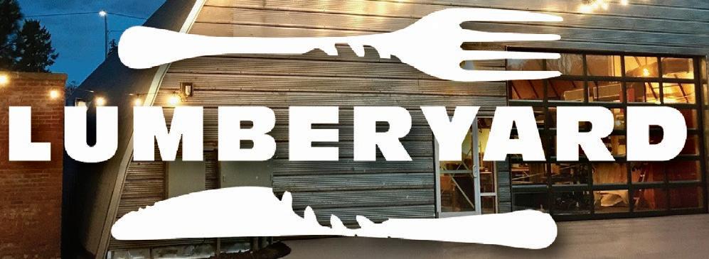
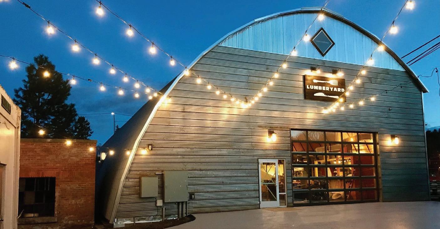
food hall offers unique, yet complimentary food and beverage establishments, full bar, gaming area, outdoor and enclosed patio seating, and a children’s corner.
As the first of its kind in our area, Lumberyard serves as a gathering space for adults, families and children alike.
We are highly focused on providing a casual, fun communal experience with careful preparations of the freshest and sustainably sourced ingredients.
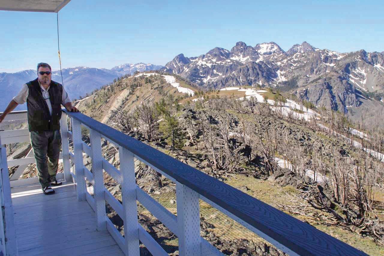
You can view much, but not all, of that depth from the base of the mountains. Windy Saddle and Heavens Gate Lookout offer stunning views of the mountains and the wrinkled canyon below. You can’t see all the way to the Snake River but much of the viewshed includes the Seven Devils and Hells Canyon wilderness areas.
The pair of vantage points are
> Heavens Gate Lookout and Windy Saddle

GETTING THERE: Forest Service Road 517 joins U.S. Highway 95 just less than a mile south of Riggins. Turn right and follow the road for 17 miles.
an adventurous drive from the Lewiston-Clarkston Valley but are well worth the time. The mountains are gorgeous and during much of the summer, their slopes are speckled with stunning wildflowers. Hiking and backpacking trails abound. Seven Devils Lake is a short walk from the nearby Seven Devils Campground. The Windy Saddle Trailhead provides longer routes to wilderness lakes at the base of the mountains. Expect a long day and sometimes a rough ride. According to Google Maps, it’s 134 miles and about three hours from Lewiston to Heavens Gate
> Continued on Page 23
LEARN MORE: Information is available at the Hells Canyon National Recreation Area office at Riggins.
LINKS: bit.ly/41i2zAh
DIFFICULTY (1-5 SCALE): 5.
SEASON: Late June to early July through October. For road status call (208) 628-3916.
FRIDAY, MAY 19, 2023 22 DAYTRIPPING PART 2
Riggins
Gate Lookout and Windy Saddle
White
Bird Heavens
Roger Phillips photo
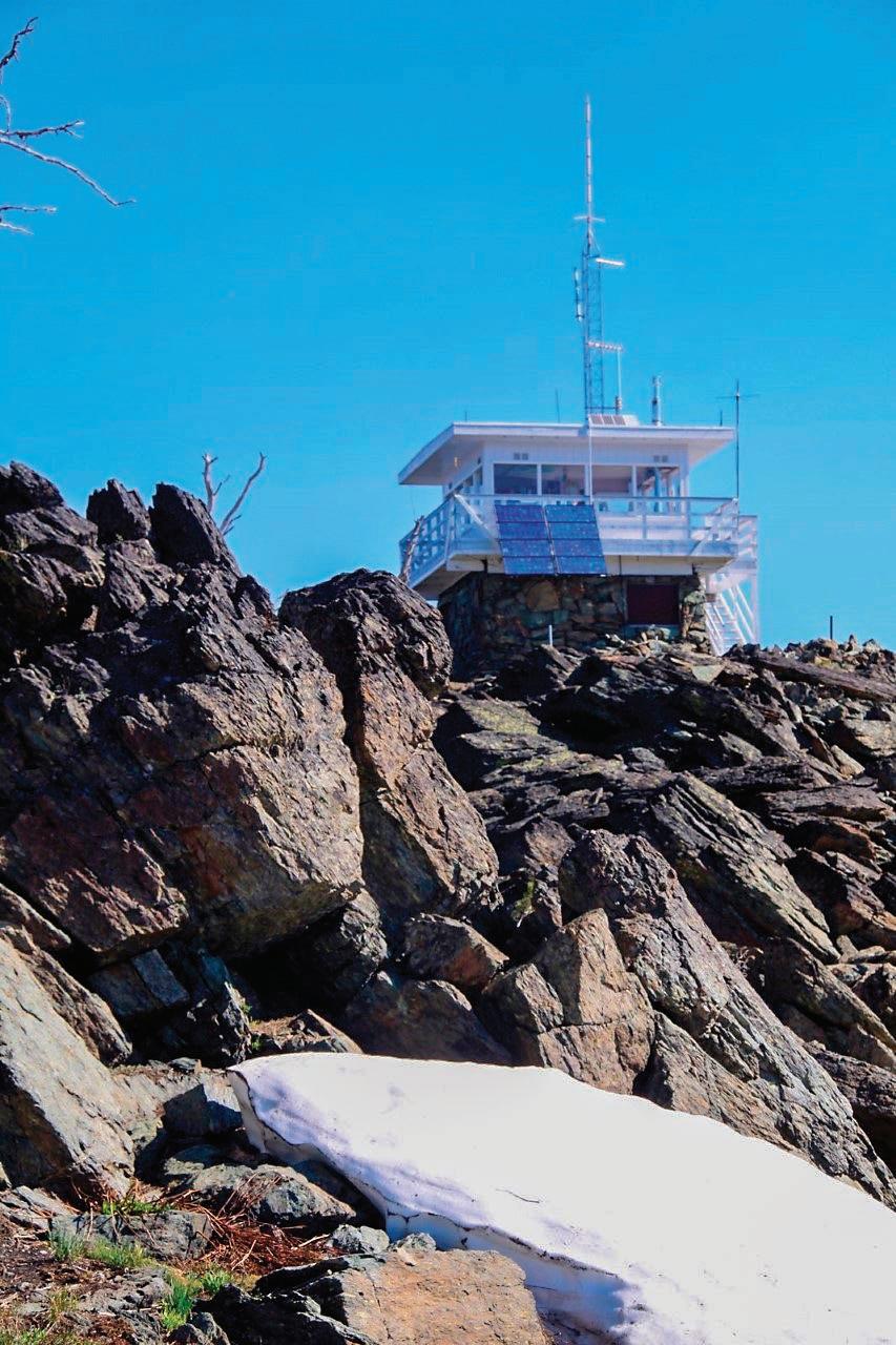
Heavens Gate Lookout offers views of the surrounding forests and grasslands, as well as the snowcapped peaks of the Seven Devils Mountain Range.
on in to enjoy 12 beers on tap, full
bar, award
stocked liquor
winning bite size and great service!
PULLMAN'S HOME FOR FOOD, FAMILY & FUN
BOWL Salad Bar ISLAND GRILL Island Comfort TIN TAN TACOS Mexican TIMBER American Pub
THE
Our
Monday: Closed • Tuesday-Sunday: 11am-9pm • Timber Food & Nightlife 18
Friday
Saturday 9pm-2am 305
+:
&
N Grand Ave. Pullman • 509-339-6988 lumberyardfoodhall.com
> Continued from Page 22
Gate Lookout. Depending on how recently it’s been graded, the road from the Riggins area to the lookout can be rough. Go slow and it should be a doable journey for most rigs with decent suspension like small SUVs and pickup trucks. This is a high-elevation destination and can be snowed shut until late June or early July.
Heavens Gate Lookout sits on a high spine between the Salmon and Snake river drainages at the base of the Seven Devils Mountain Range.
Roger Phillips photo
If you manage to make your way through this year’s list of destinations, maybe you can revisit some suggestions from our 2022 Daytripping section. Scan the QR code or go to bit.ly/3M2hjNM to learn about those.

Here are the destinations profiled in that section:
Palouse Falls
Walla Walla cycling trip
Buffalo Eddy petroglyphs

Hole in the Wall along Grande Ronde River
Wallowa Lake
Lower Granite Dam and fish ladder
WSU Bear Center
Kamiak Butte County Park

Steptoe Butte State Park
Newman Lake cycling trip
Moscow Mountain trail system
Elk Creek Falls
Nez Perce National Historic Park

Dworshak Dam and Reservoir
Deer Creek Reservoir

Selway Falls
Winchester Lake State Park
St. Gertrude’s Monastery

White Bird Battle Field
Pittsburg Landing
FRIDAY, MAY 19, 2023 23 DAYTRIPPING PART 2
Safe Travels Start Here üTiming Belts üMufflers üExhaust Systems üEngine Cooling Systems üHoses üBrake Services üAnd more! Road-Trip-Ready Call for your appointment today! Let us fix your vehicle right, the first time. 1014 Bryden Ave., Lewiston 208-743-5887 petersontransmission.com
NEED MORE DESTINATIONS?

FRIDAY, MAY 19, 2023 24 DAYTRIPPING PART 2
