Holey moley, it’s a pioneer tunnel!
Hole in the Wall, along the Grande Ronde River, is a unique example of homesteader stick-to-itiveness
By KERRI SANDAINE FOR DAYTRIPPING
ANATONE — If you’re looking for a fun little adventure and gorgeous scenery, check out the Hole in the Wall at the bottom of Shumaker Grade along the Grande Ronde River.
There you can imagine what it was like to travel to and from Oregon in the late 1800s and early 1900s. It may make you scratch your head, wondering how people got their wagons or vehicles down there in the first place.
Make no mistake, the gravel road leading to this treasure can still be treacherous. It’s a steep descent with more switchbacks than nearby Rattlesnake Grade and there’s not a guardrail in sight. Dry weather is the only time to embark on this jaunt, and it’s probably not for folks who freak out on narrow routes, such as the Going-to-the-Sun Road in Glacier Park.
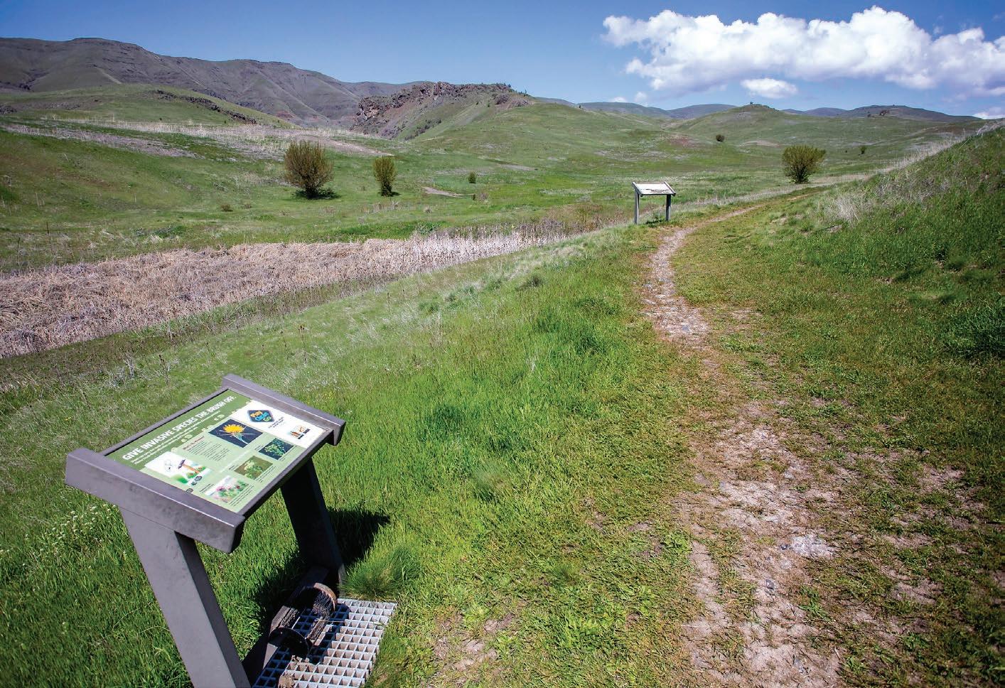
Other than that, this is a perfect drive in rural Asotin County. Late spring and early fall are ideal times to drop into the canyon for a step back in time and a breath of fresh air. The hills are green now, and an array of wildflowers are in bloom. A few lilac bushes offer their sweet fragrance near a former homestead, where you can also see the hard work of settlers who built rock walls that are still standing.
Before you see the mysterious Hole in the Wall, which was once part of the only highway leading to Oregon, you’ll come across primitive campsites and a public toilet managed by the Washington
Department of Fish and Wildlife. There are no picnic tables, power or water hook-ups, and campers must haul their own trash.
Fire pits and shade trees make this an attractive place to get away from it all, and it only requires a Discovery Pass, which are available at the Nom Nom market in Asotin or online. No reservations are needed because it’s first-come, first-serve, and there’s no special fee to use the space.
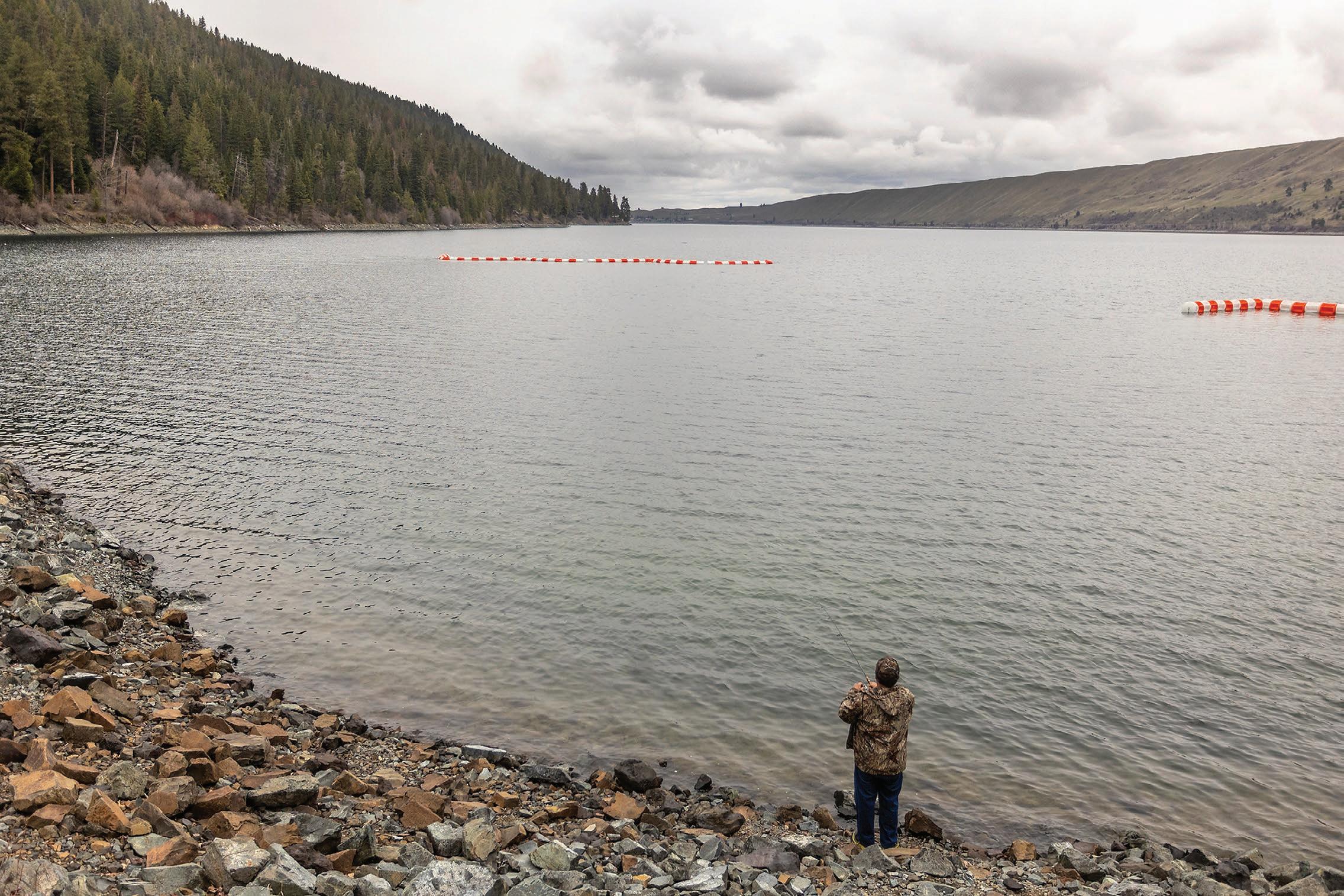
It can get busy during the summer months and whenever the fish are biting, but on a recent spring day, the campground was empty, and the only sounds heard came from the rushing river, wind in the trees and chirping birds.
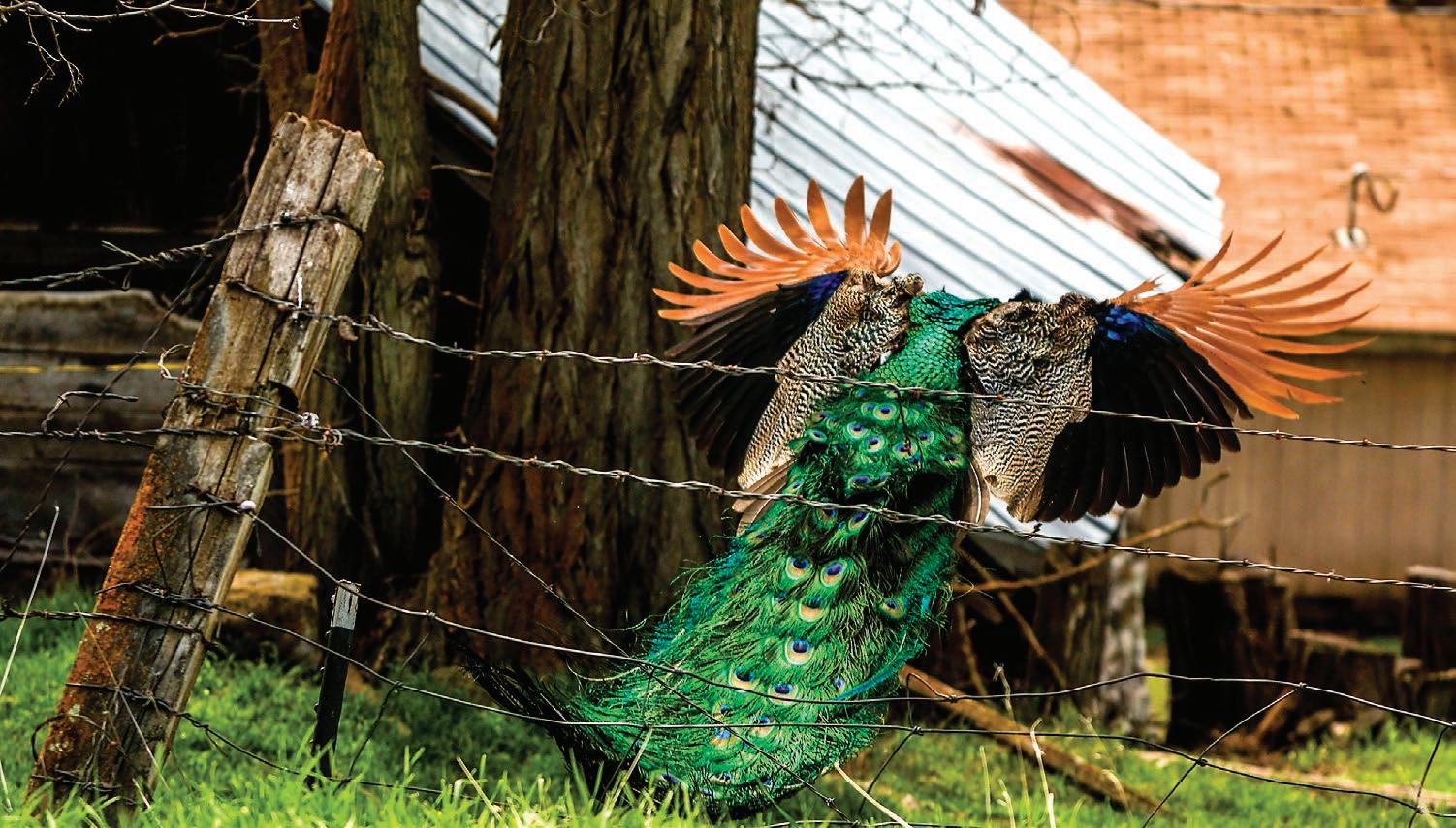
A few ranch houses are at the bottom of the grade, where you may see peacocks preening and cattle lowing along the road. Other wildlife is abundant.
According to historians, Shumaker Road was the original route between Lewiston and Enterprise. It was carved out of the canyon in 1892 for wagons and replaced with the current state highway route in the 1930s.
Montgomery Ridge Road and Schumaker are now maintained by the Asotin
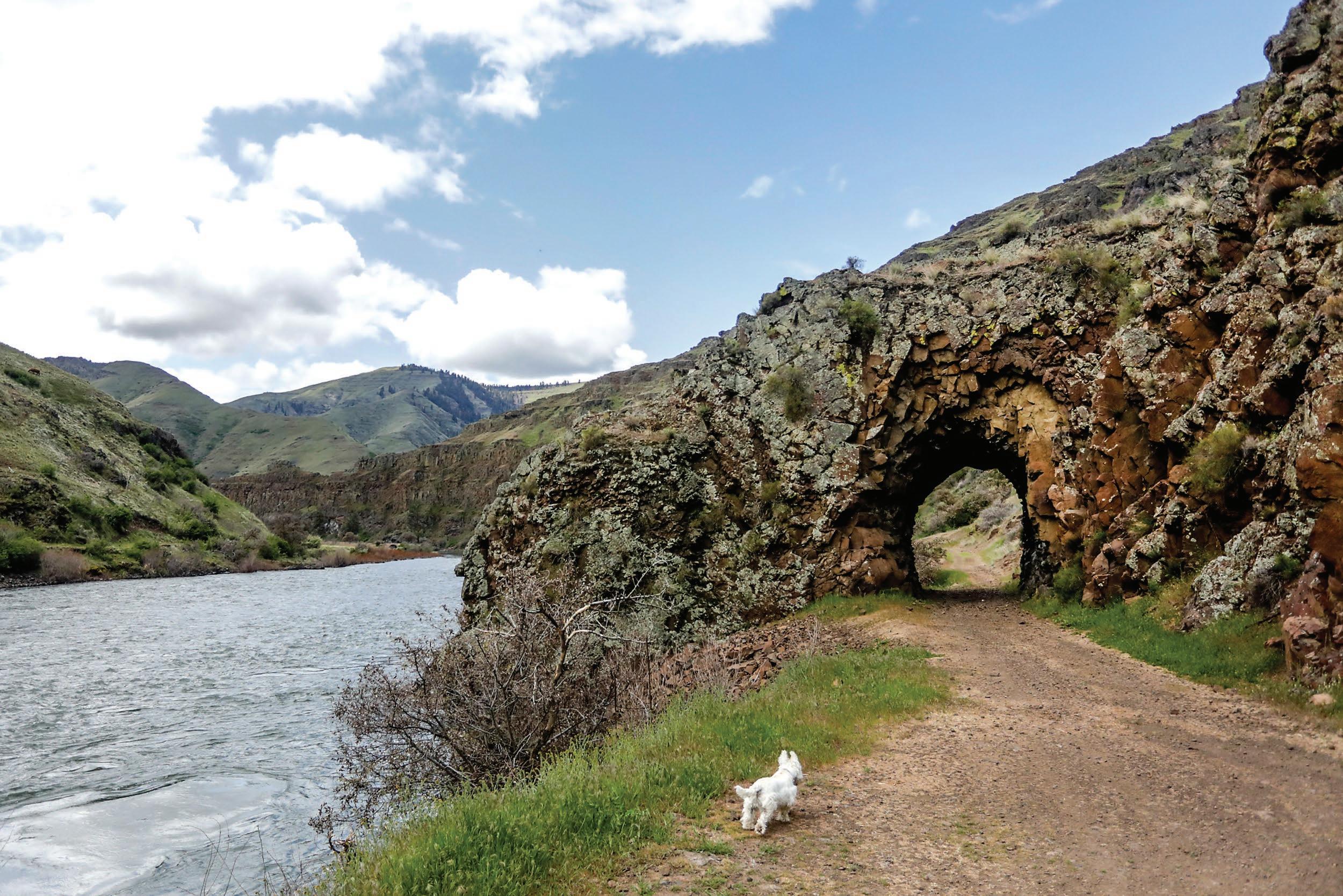
County Road Department. In the 1890s, dynamite was used to blast through basalt rock along the river, creating the Hole in the Wall. A cable secured to the nearby rocks suggests a ferry system was once used there to get folks across the river. After the tunnel was completed, a bridge was
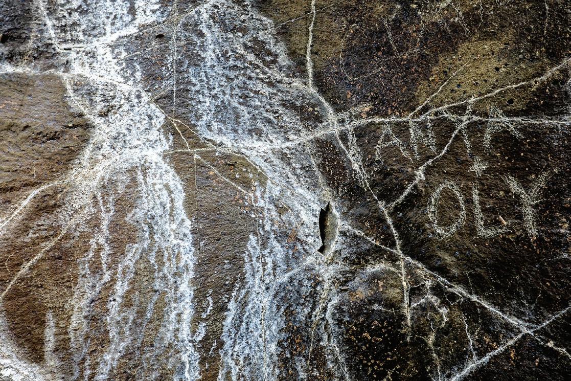
LEFT: “Anya + Oly” is written on the inside of the Hole in the Wall along the Grande Ronde River.
RIGHT: Holes, intended to house dynamite, are seen inside the Hole in the Wall along the Grande Ronde River.
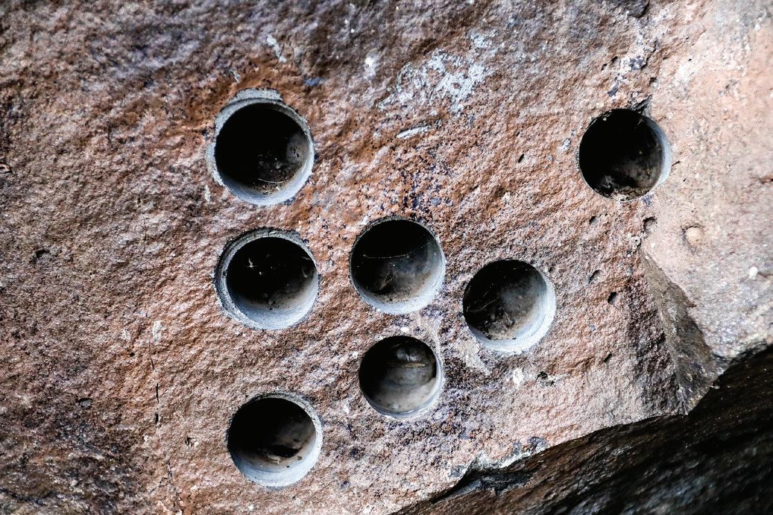
August Frank/ For Daytripping
built upstream to replace the ferry, but it was destroyed by an ice dam in 1930.
The hole now provides a great backdrop for photos and an interesting and unique site to visit. There’s room to turn around near the entrance, if you choose to drive all the way to the wall. n
ABOVE: Hole in the Wall is seen along the Grande Ronde River, as Pete the dog runs forward to investigate. The hole in the basalt rock was created in the 1890s by dynamite blasting so wagons of the day could continue their journey along the river.
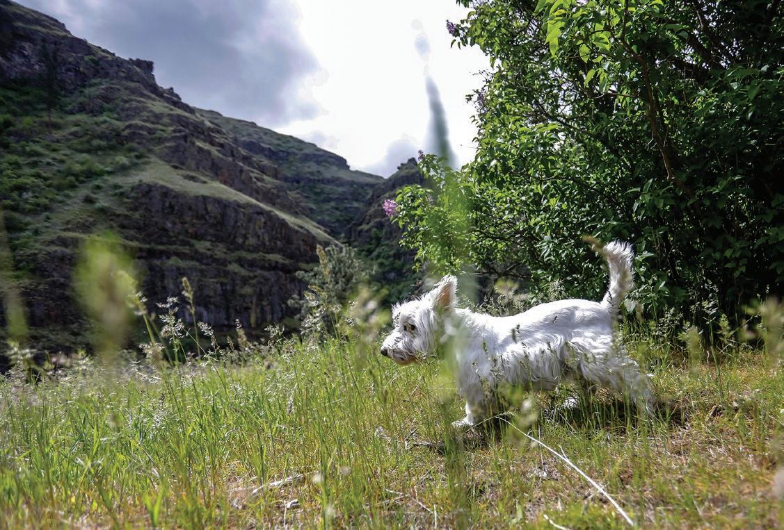
August Frank/For Daytripping
> Hole in the Wall

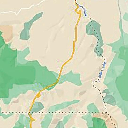
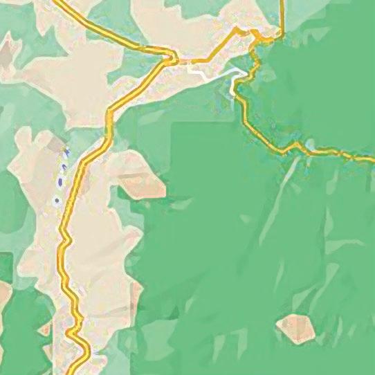
LOCATION: Bottom of Shumaker Grade in Asotin County, 30 miles south of Asotin. About 2 miles after you pass through Anatone, take a left on Montgomery Ridge Road, and a mile later, take a right on Shumaker Road, where your descent to the Grande Ronde River begins. At the bottom of
the grade, the road turns west and proceeds upriver about 2.5 miles.
WHAT YOU’LL DO: Explore the intriguing rock hole, pack a picnic lunch or camp and fish on public lands along the river.
Campsites at Snyder Bar are first-come, first-serve and an outhouse is available. The site is managed by the Washington Department of Fish and Wildlife.
DIFFICULTY: Between 2 and 4 out of
5, depending on the weather and road conditions. Once you’re near the hole, the walk is easy or you can drive to it.
DON’T FORGET: Shumaker Grade is twisty and can be muddy and slick, so take it slow, and avoid the drive in the winter or after a hard rain. It’s also remote, so it’s a good idea to pack food and water for emergencies. When the weather warms up, keep an eye out
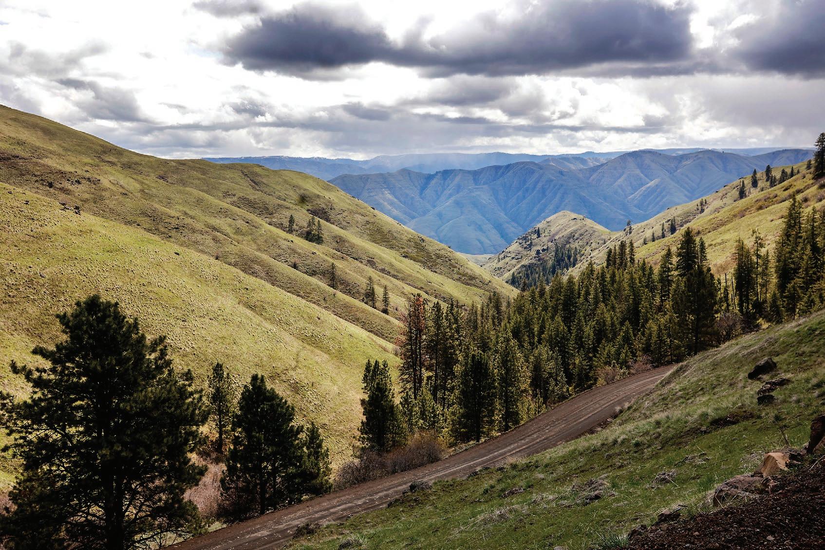
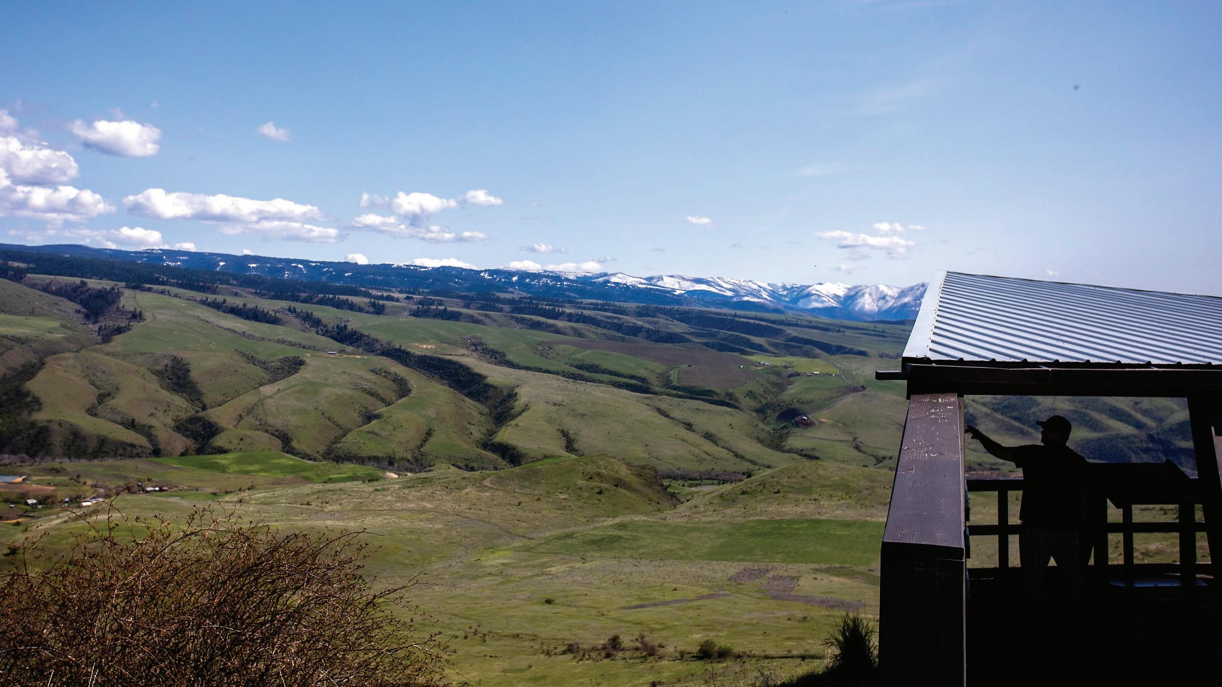
TOP: A peacock flies down from a fence at a residence along Shumaker Road. Numerous peacocks as well as turkeys and longhorn cattle can be spotted along the road.
ABOVE: Hills extend out into the distance in the view from the top of Shumaker Road.
LEFT: Pete the dog stands near a lilac bush at the campground.
August Frank/For Daytripping
for rattlesnakes when you’re walking.
NEARBY SITES OF INTEREST: Along the scenic drive, you’ll likely see longhorn cattle, peacocks, deer and other wildlife. Snyder Bar campsites require a Discovery Pass or a vehicleuse permit that comes with a fishing and hunting license. The area is a popular staging and camping area for anglers, rafters and boaters.
THURSDAY, MAY 19, 2022 16 DAYTRIPPING
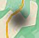
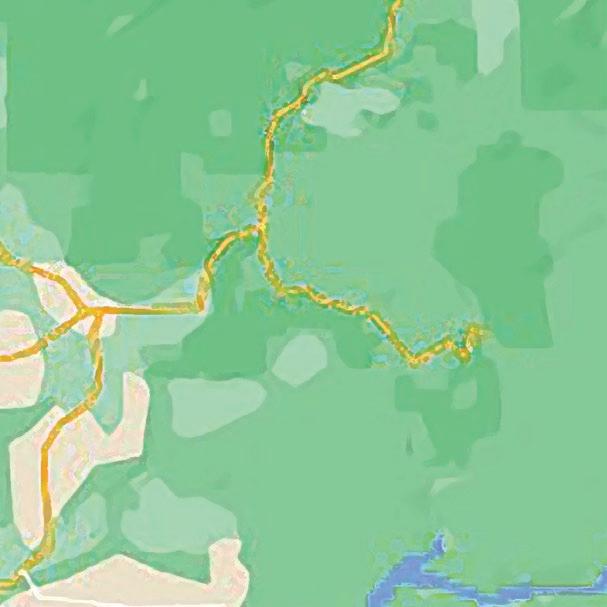
OREGON Asotin 129 Anatone Hole in the Wall ID WA SH 17 THURSDAY, MAY 19, 2022
> Elk Creek Falls

LOCATION: 50 miles east of Moscow, 70 miles northeast of Lewiston, 2 miles from Elk River. From Moscow, travel east on Highway 8, passing through Troy, Deary and Bovill (from Lewiston, take U.S. Highway 95/12 and State Highway 3 to Deary, then proceed to Bovill). Approximately 11 miles past the town of Bovill will be signs for Elk Creek Falls Recreation Area. Turn right on Forest Service Road 1452, a gravel road; in a couple of miles, the road leads to the recreation area parking lot.

WHAT YOU’LL DO: Hike primarily wide, well-groomed trails, about 3 miles, to three different falls during daylight hours starting in May (a nordic ski trail
A magical forest escape — rainbow included
By MARY STONE FOR DAYTRIPPING
The hike to Elk Creek Falls, especially if you’re coming from the arid Lewiston-Clarkston Valley midsummer, is a refreshing forest foray, complete with the magic of a rainbow.
The short hike, most of it on wide, gentle trails once part of an old wagon road, makes for a leisurely halfday, which can be rounded out with a visit to nearby Elk River where you’re likely to find huckleberry ice cream — reason enough to get out of the house.
The series of trails is well marked, no matter which of the three falls you visit first. Interpretive signs at each — upper, middle and lower — offer details about the area’s geological and human history. For example, the proliferation of green, including Western red cedar and maidenhair ferns typically seen in coastal regions, can be attributed in part to ash-fortified soil resulting from a volcanic eruption about 6500 B.C. Also keep an eye — and an ear — out for avian life. There’s a reason it’s designated an Idaho Birding Trail, which you can learn more about at idahobirdingtrail.org.
that leads to the trailhead is maintained in winter months). There is no fee.
DIFFICULTY: 2 out of 5. Some parts of the trail system are accessible to those with mobility impairments.
DON’T FORGET: Water, comfy shoes, binoculars. Drinking water is not provided at the trailhead; there is a vault toilet.
INFO: bit.ly/ElkCreekFilesHike.
NEARBY SITES OF INTEREST: The town of Elk River, approximately 4 miles from the trailhead, boasts the Elk River Lodge & General Store, which offers huckleberry ice cream seasonally. The nearby Elk Creek Reservoir is a popular fishing destination.
The three falls total more than 140 feet, according to the Nez Perce-Clearwater National Forests website, at bit.ly/ElkCreekFilesHike.
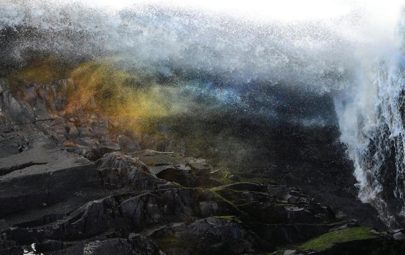
It’s at the lower falls where the midday sun creates a rainbow in the spray, where Elk Creek “plummets nearly 50 feet into a rocky pool on its way to the North Fork of the Clearwater River,” according to the sign there.
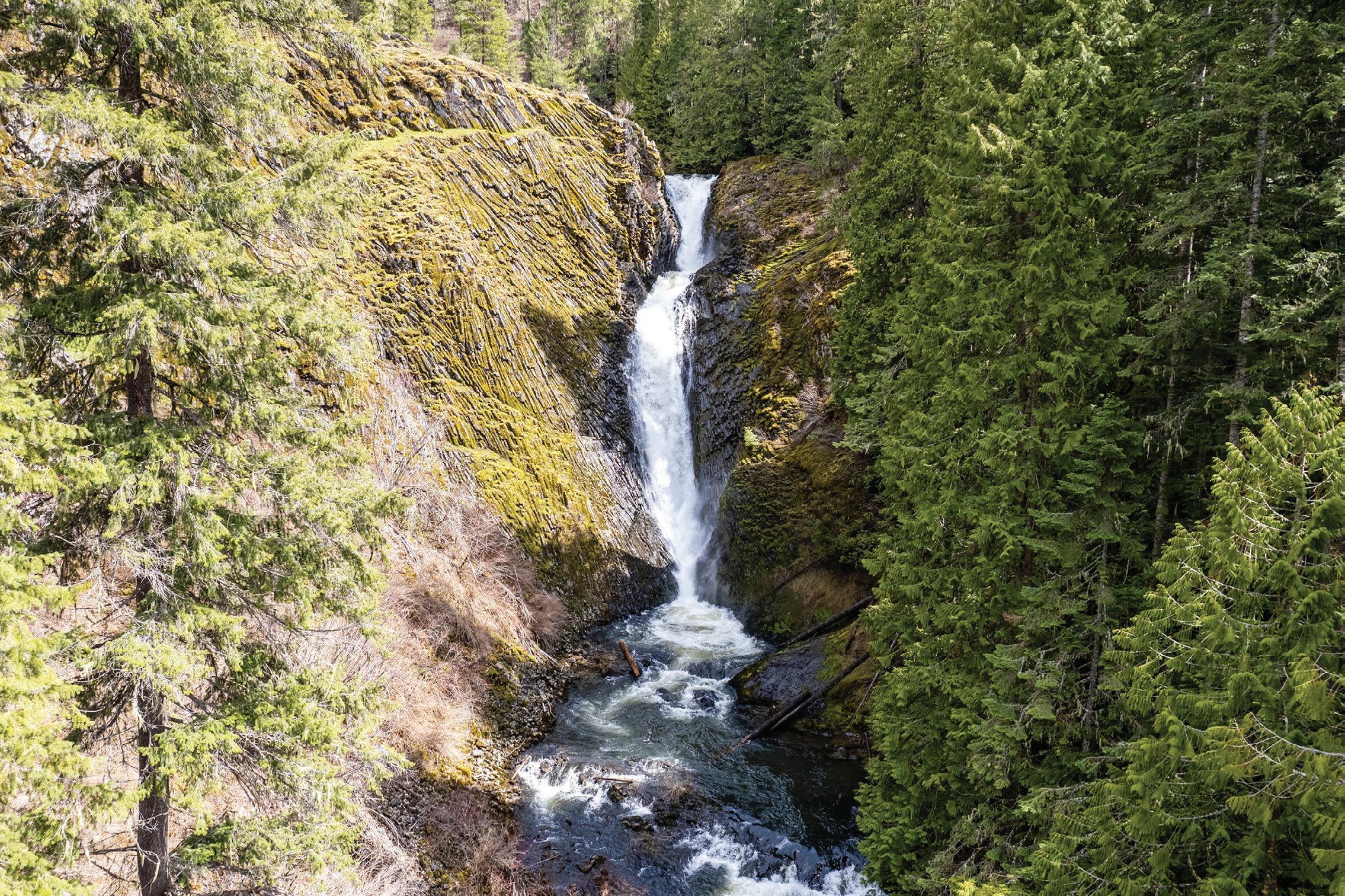
The middle falls, according to the signage there, “is the tallest waterfall in Idaho, measuring 90 feet in height, and is actually a series of two falls separated by a pool.” n
THURSDAY, MAY 19, 2022 19 DAYTRIPPING Deary Elk River Elk Creek Falls 8 Bovill 3 3 y 3
The hike to Elk Creek Falls offers enchanting views of three distinct waterfalls
Austin Johnson/For Daytripping
This image captured with a drone shows the middle waterfall of Elk Creek Falls earlier this spring. The natural attraction is comprised of three separate waterfalls totaling more than 140 feet. It’s 50 miles east of Moscow near the town of Elk River.
A rainbow is created in the spray at Elk Creek Falls.
Mary Stone/For Daytripping
August
A repository of the past, and a piece of history
Historical Museum at St. Gertrude near Cottonwood has a long history of its own
 By KATHY HEDBERG FOR DAYTRIPPING
The Historical Museum at St. Gertrude has been called one of the bestkept secrets of Idaho. Located on the bucolic grounds of the Benedictine Monastery of St. Gertrude, the museum — recently remodeled and structured around the sisters of the monastery and the early pioneers of north central Idaho — draws more than
6,000 visitors a year.
The nucleus of the museum started in 1910 when Sister Rose Hodges, a science teacher at St. Scholastica Academy in Colton, received a collection of minerals from the National Museum of Natural History, later known as the Smithsonian.
In 1931, Sister Alfreda Elsensohn, a teacher at St. Gertrude’s Academy in Cottonwood, brought the
St. Gertrude’s

THURSDAY, MAY 19, 2022 20 DAYTRIPPING
Cottonwood
Grangeville 12
12
Monastery
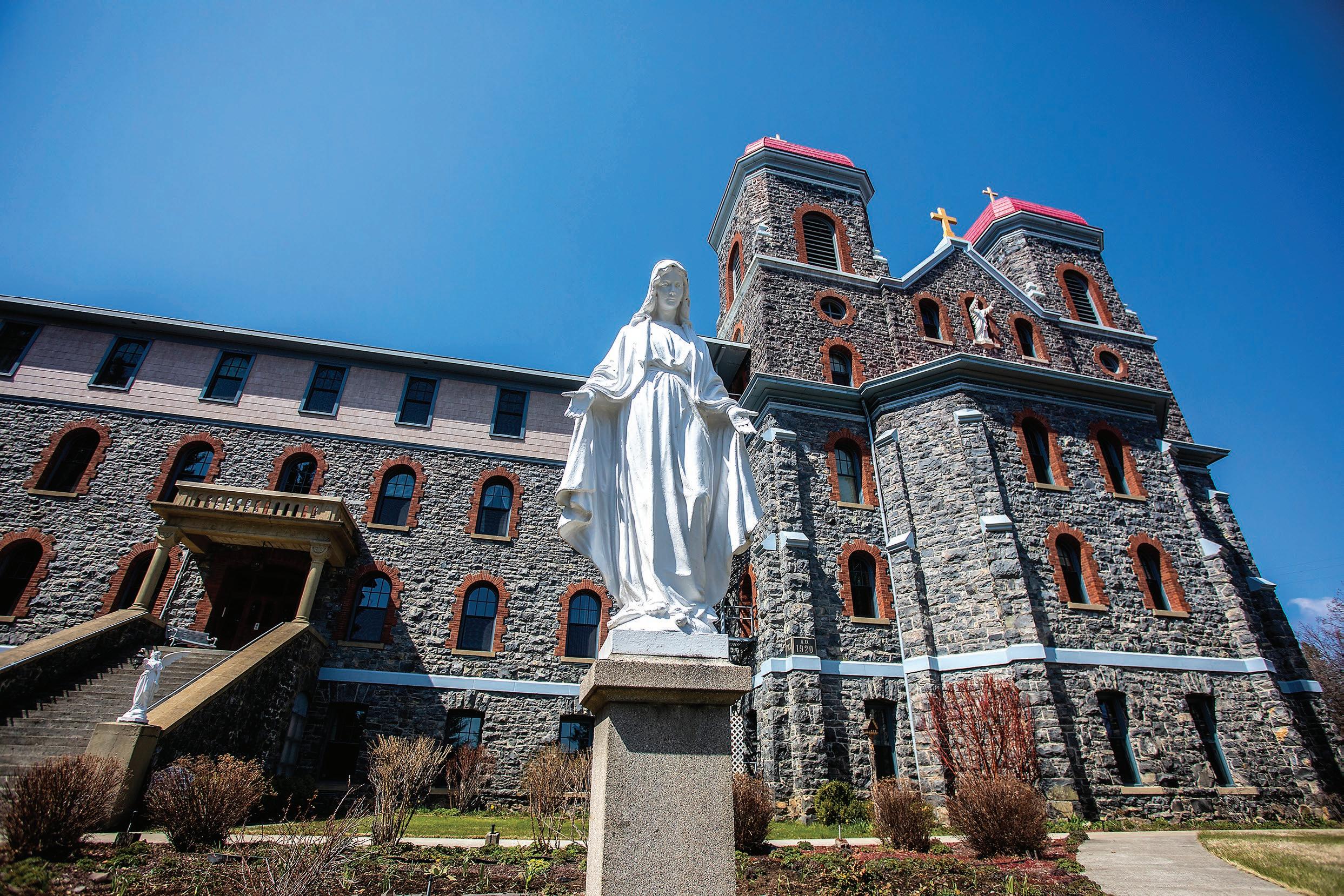
RIGHT: St. Gertrude Monastery is seen near Cottonwood recently.
Frank/ For Daytripping
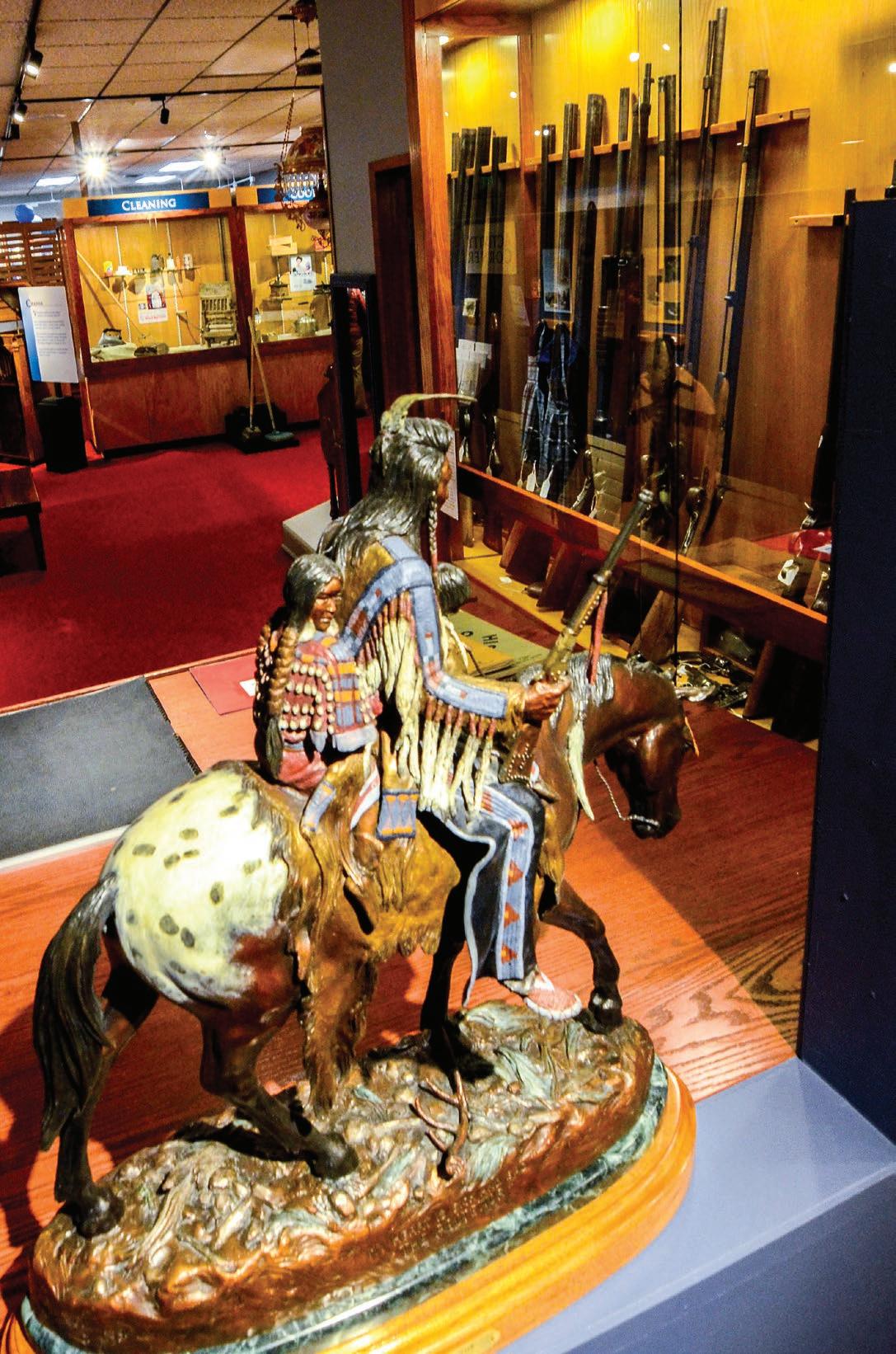
BELOW: A bronze statue by David Manuel titled “The Protector” is on display at the Historical Museum at St. Gertrude, located on the monastery campus.
> See HISTORY, Page 21
Barry Kough/ For Daytripping
> Historical Museum at St. Gertrude
LOCATION: Three miles west of Cottonwood at 465 Keuterville Road.
DIFFICULTY: 1 out of 5
OPEN YEAR-ROUND: Monday through Saturday except for certain holidays, 9 a.m. to 4:30 p.m. Closed Sundays, Memorial Day, July 4th, Labor Day, Thanksgiving and the Friday after, and Christmas Eve through New Year’s Day.
WATERING HOLES: The Keuterville Pub and Grub is located 3 miles west of the monastery on Keuterville Road and serves beer, burgers, sandwiches and salads.
ABOUT THE MONASTERY: Because of the ongoing pandemic, the historical monastery chapel is currently closed to the public. The Spirit Center, located next to the museum, is open for gatherings and retreats, and the Inn at St. Gertrude also is open for overnight guests.
FEES: Adults, $6; students 7-17, $3; children 6 and younger, free.
CONTACT: (208) 962-2050; or online at: historicalmuseumatstgertrude.org/
History
from Page 20
mineral collection to the academy and it became the start of the museum. At that time, the museum was housed in the school attic, along with other taxidermy specimens and various artifacts from Sister Alfreda’s science curriculum and collections of interest.
Finally, in 1980, a new museum was built and the ever-growing collection was relocated to its present site. Artifacts from throughout the Northwest, including the Rhoades Emmanuel Memorial collection, named after a Camas Prairie native who went on to become a world-renowned organist, expanded the museum’s offerings further.
Space was crowded and displays were jumbled together in no apparent order until 2015, when the museum obtained large grants from the Idaho State Historical Society, Idaho Humanities Council and the Laura Moore Cunningham Foundation. Under the guidance of former Idaho State Historian Keith Petersen and Mary Reed, of Moscow, the museum underwent a six-year, $100,000 redesign that tells the unfolding story of the sisters, the Nez Perce people, early pioneers and other fascinating local characters such as Polly Bemis and Buckskin Bill.
“Benedictines have always valued history and have always valued tradition,” said Sister Mary Forman, prioress of the monastery. “And one of the best ways to show that tradition and history is to actually honor the artifacts that tell the story. And that goes way back, thousands of years, doing that. So we come by this very naturally.”
TOP
Besides the exhibits, the museum also offers a visitor’s center and gift shop at the entrance to the building. Throughout the year, lecture series featuring local historians and other experts are scheduled.
The annual Raspberry Festival, held the first Sunday in August, was postponed during the COVID-19 pandemic. This year the event will be offered Aug. 7 on a scaled-back format and renamed the Raspberry Social. All revenue from that event helps support the museum’s mission of preserving the rich heritage of the Monastery of St. Gertrude, the Camas Prairie, Snake River, Salmon
n
THURSDAY, MAY 19, 2022 21 DAYTRIPPING
River and the surrounding areas.
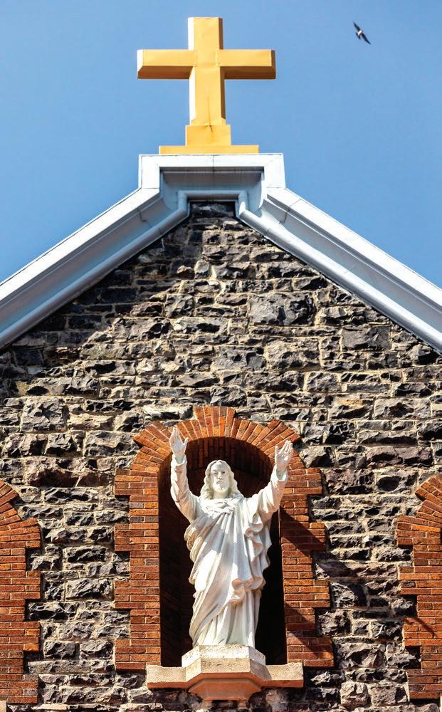
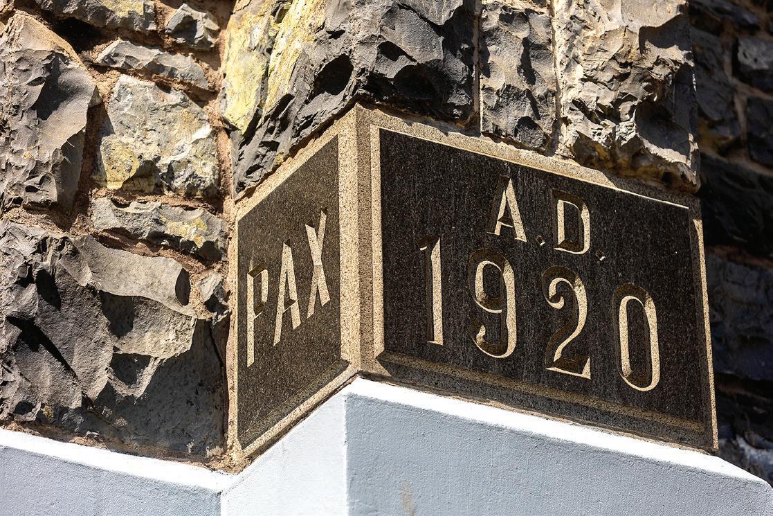
TOP LEFT: Pax A.D. 1920 is written in a stone on the outside of a wall at the St. Gertrude Monastery near Cottonwood.
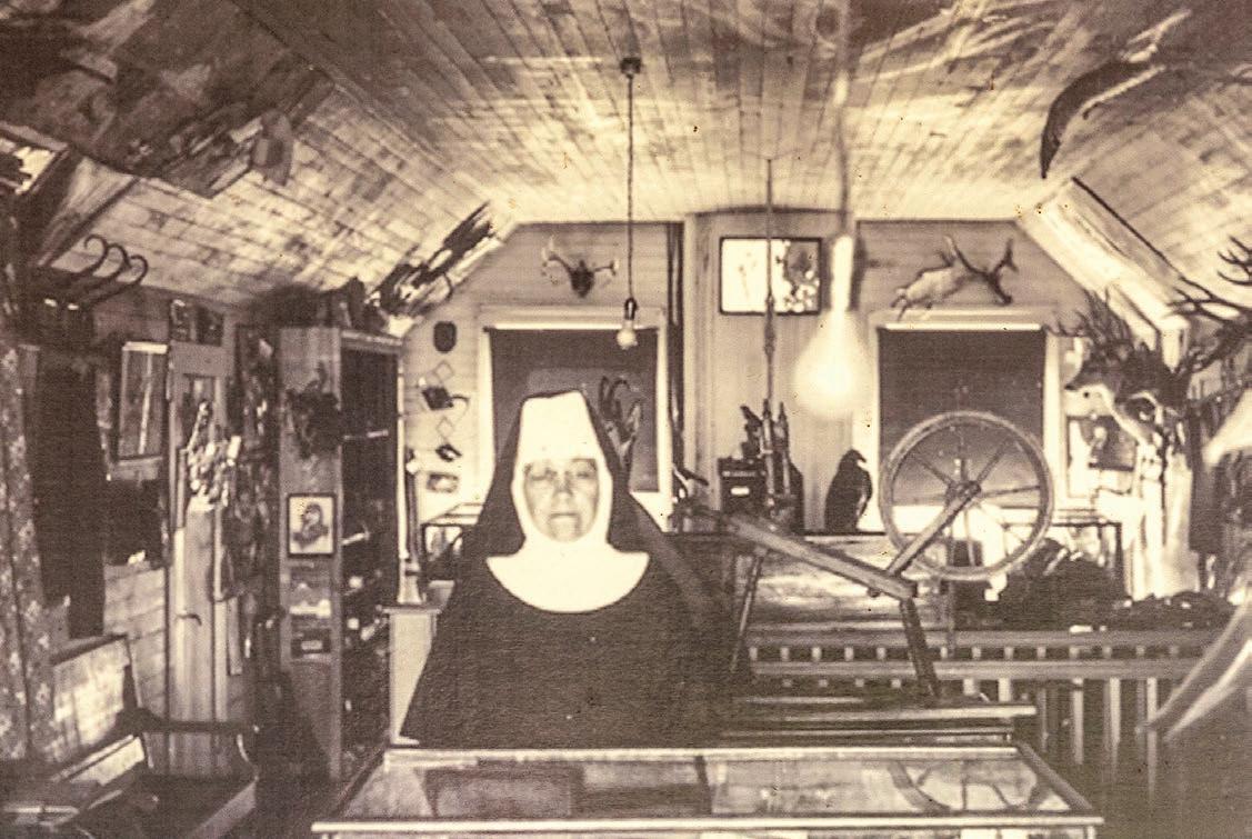
RIGHT: Sister Alfreda Elsensohn is pictured on a wall at the museum of the St. Gertrude Monastery near Cottonwood.
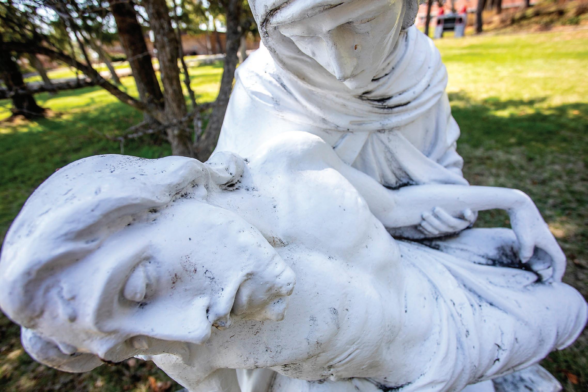
ABOVE A statue displays Jesus at the St. Gertrude Monastery near Cottonwood.
LEFT: A bird flies above the St. Gertrude Monastery near Cottonwood.
August Frank/For Daytripping, Barry Kough/For Daytripping
“Wild
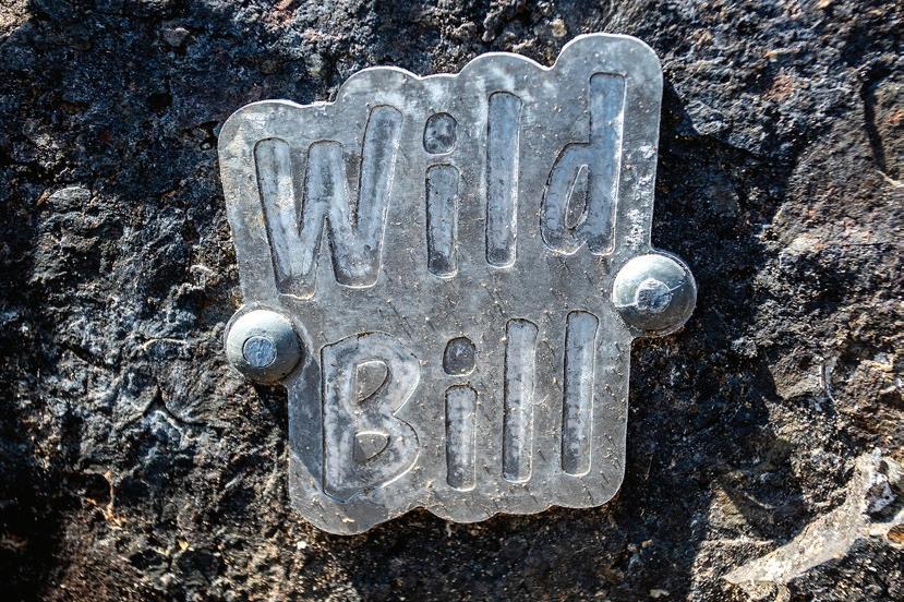
BELOW: A
August Frank/For Daytripping
One way to drive to Hells Canyon
Exploring North America’s deepest gorge requires a boat, but the drive to Pittsburg Landing is one way to get a taste of the rugged canyon
By ERIC BARKER FOR DAYTRIPPING
Hells Canyon tends to be a difficult place to reach for both sinners and the pure of heart.
You can get there by jet boat or raft. But doing so requires a jet boat or raft, the proper permits and at least a little bit of skill maneuvering a craft through whitewater.
There are no roads for motorized vehicles that run up and down the canyon and along the Snake River, so you can’t really take a scenic drive through its basalt walls and tawny hillsides.
But there are a few backcountry byways that deliver visitors to sweet spots in the heart of the canyon. Deer Creek Road is just such a route, and the sweet spot at its end is Pittsburg Landing.

It’s not exactly a short drive to reach this boat
> Pittsburg Landing

LOCATION: From the Lewiston-Clarkston Valley or the Palouse, travel south on U.S. Highway 95 past White Bird and turn right on Old Highway 95 at mile marker 222 where there are signs for Pittsburg Landing and Hammer Creek Recreation Area. Follow the road for about 1 mile, turn left and cross the bridge over the Salmon River and then take an immediate left on Deer Creek Road and follow it for 17½ miles to arrive at the landing.
WHAT YOU’LL DO: Take in the majesty of Hells Canyon, have a picnic and maybe go for a hike.
DIFFICULTY: 3 out of 5.
DON’T FORGET: Sun screen, water, snacks. It’s rattlesnake country so long pants and boots are not a bad idea if you plan to hike.
NEARBY SITES OF INTEREST: Although Pittsburg Landing is on the river, it’s not a great swimming hole. If you visit in the middle of summer and have a hankering for a dip or just to sit on a sandy beach, consider stopping at Skookumchuck Recreation Site on the Salmon River at mile marker 219.
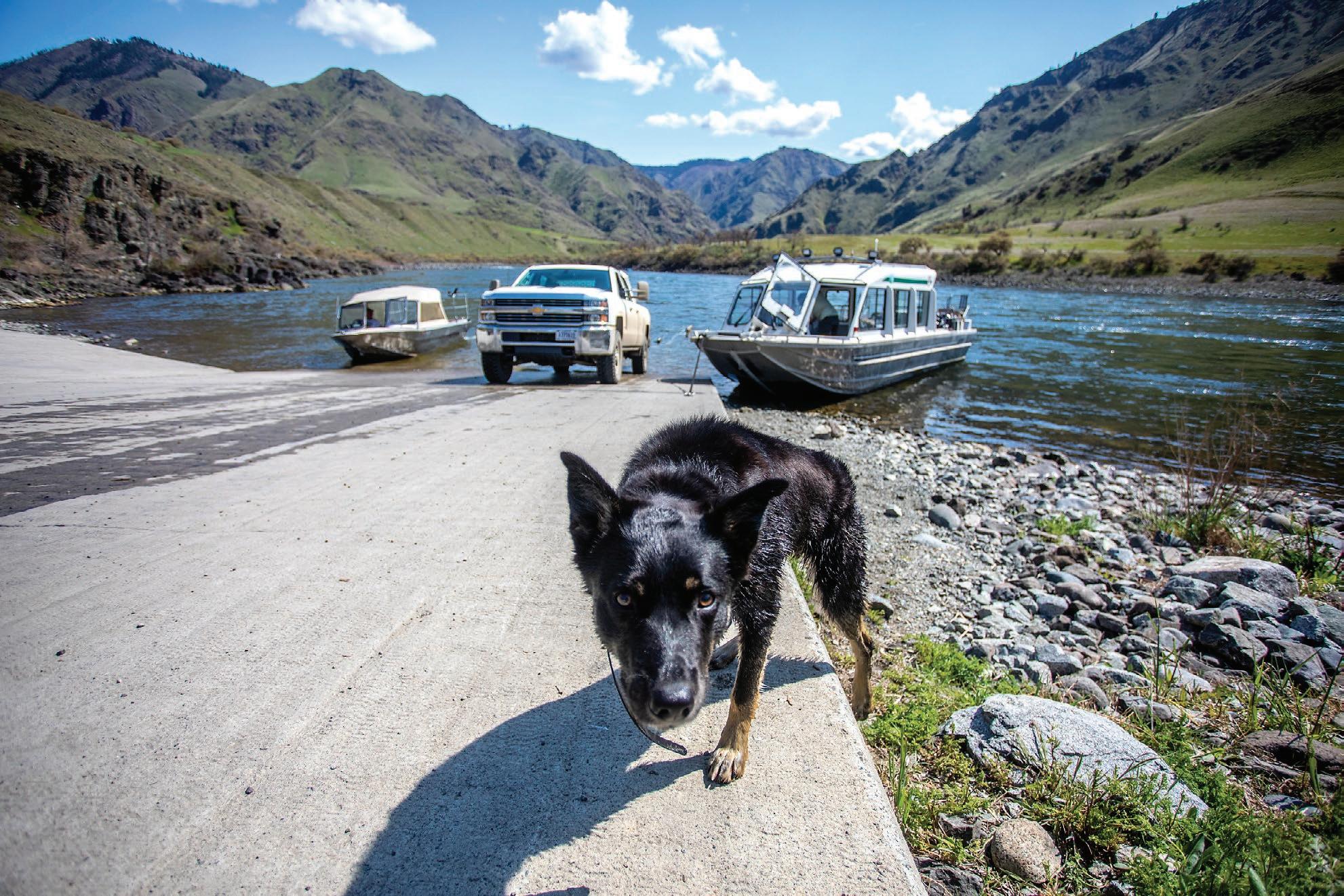
RIGHT: A dog walks along the dock in front of several boats at Pittsburg Landing on the Snake River.
small metal sign reading
Bill” is nailed to the rocks at Pittsburg Landing.
THURSDAY, MAY 19, 2022 22 DAYTRIPPING
Riggins
95 Pittsburg Landing
IDAHO White Bird
August Frank/For Daytripping
> See CANYON, Page 23
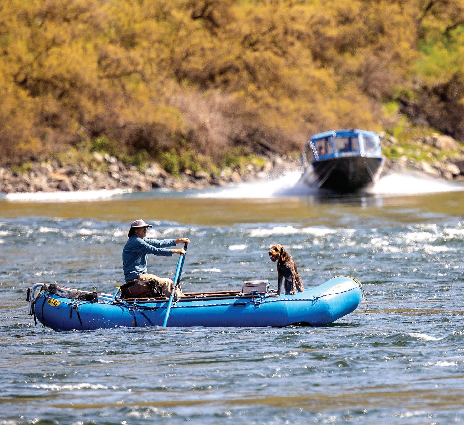
Marty Gardner paddles across the Snake River with his dog Spur at Pittsburg Landing.
Canyon

from Page 22
ramp, campground and trailhead. But the gravel road is generally in pretty good shape and the reward is a taste of the famous canyon that is the deepest gorge in North America. The canyon gets this distinction by counting the peaks of the Seven Devils Mountain

Range as part of its eastern rim.
The scenery is well worth the drive and it’s not unusual to see wildlife such as deer and sometimes elk, birds of prey and even rattlesnakes.


Deer Creek Road begins at the lower Salmon River near White Bird and Hammer Creek and climbs gently as it heads west and south, winding its way to the top of the divide separating the Snake and Salmon rivers. Just over the crest and surrounded by big ponderosa
Just Paddle it!

ABOVE: A boat approaches the ramp at Pittsburg Landing.

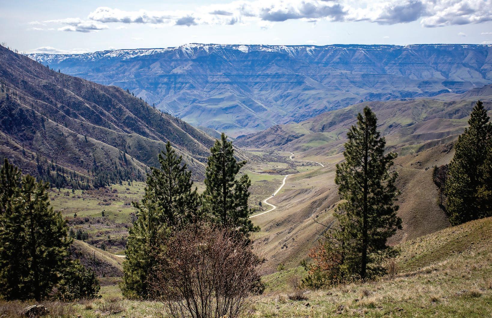
LEFT: From Pittsburg Saddle Point, snow-covered mountains can be seen in the distance, as well as the dirt road that leads to the landing.
August Frank/For Daytripping


pine trees is the Pittsburg Saddle View Point, which gives visitors their first gander at the canyon below. From there, the road that is also known as National Forest Road 493, follows Kurry Creek to the landing. It descends quickly in a series of hairpin turns but the pitch quickly becomes more gentle. The lower landing includes a campground, picnic area and boat ramp. The upper landing includes a campground and trailhead.
It is fairly open at Pittsburg Landing but those looking to experience the steep walls the canyon is known for can do so by hiking upstream toward the historic Kirkwood Ranch. It’s a 6-mile, one-way trip along the Snake River National Recreation Trail to reach the ranch that is staffed by volunteers and serves as a museum featuring the history of early homesteaders in the canyon and the much older history of Native Americans.

THURSDAY, MAY 19, 2022 23 DAYTRIPPING
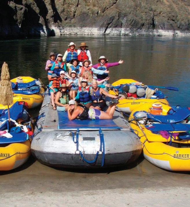
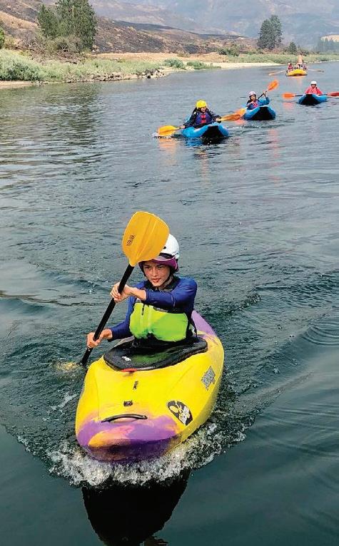
Join us on the Lower Salmon River for “Ride The Slide” available weekends in June, 2 - 3 days, then go into Rafting, and Inflatable Kayaking, and so much more... www.barkerrivertrips.com barker.rivertrips@gmail.com 208.791.1104 • 208.413.0319
611535E_22
History of the Nez Perce on full display
Nez
National
By KALI NELSON FOR DAYTRIPPING
The Nez Perce National Historical Park was established in 1965 and is made up of 38 sites, which tell the story of the Nimiipuu. The sites are spread across Idaho, Montana, Oregon and Washington, but the visitor center is located at Spalding.
Before reaching the visitor center, those traveling east from Lewiston on U.S. Highway 95/12 can find Coyote’s Fishnet, which has a historical marker near milepost 307, and the Ant and the Yellowjacket, which also has a marker just east of the Spalding Bridge. Those are both natural formations that are part of Nez Perce lore. Spalding is about 12 miles east of Lewiston, located along U.S. Highway 95 less than a mile past where the highway crosses the Clearwater River via the Spalding Bridge.
The Nez Perce National Historical Park visitor center and park headquarters are easily visible for those driving down the highway. The sites in the park include the Watson’s Store, the Spalding Presbyterian Church and the Northern Idaho Indian Agency’s cabin and agent’s residents.
The visitor center is open from 8:30 a.m. to 4 p.m.
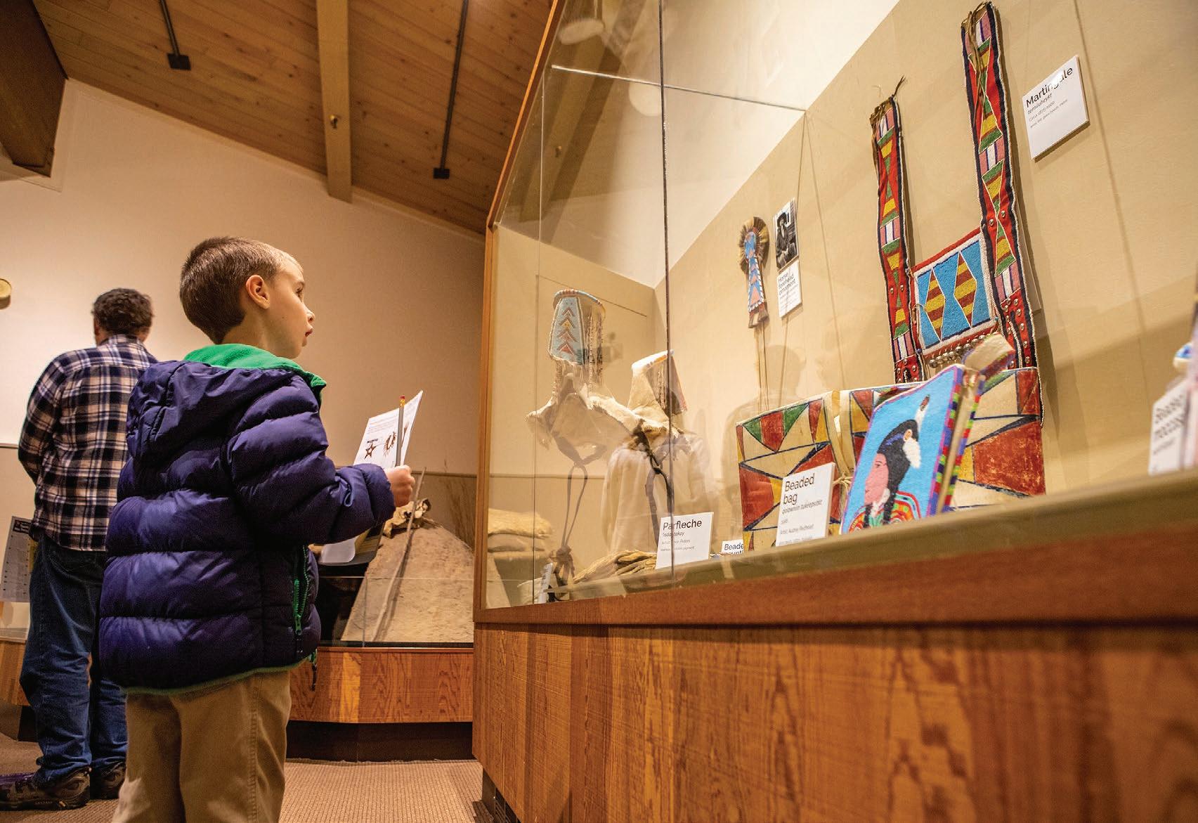
Tuesday through Saturday and has year-round showings of the park film “Of One Heart” and offers a collection of clothing, tools, weapons and ceremonial objects in the museum area. There is no fee to visit the park.
Travel a little past the historical center and cross a bridge to enjoy lunch outside at the picnic area or visit the Indian Agency cabin marker. There are two cemeteries at the Spalding site. Visitors are welcome, but are expected to follow the rules, including not standing on marked graves, not taking rubbings of the headstones, not touching the memorial items on the graves and no eating, drinking or recreational activities that are considered inappropriate.
Visitors can also walk a
number of trails around the visitor center. The trails are all 1 mile or less and can take you to places like Lapwai Creek, the Watson’s Store, the Boomgrounds and the remains of the mission.
The longest of the trails is the Old Townsite Trail, which is 1 mile long. It lies in the
grassy area below the visitor center and is a great location to see wildlife. The trail will show you two periods of occupation, the Nez Perce Indian agency and the homesteading. The agency was in use between 1860 to 1904 and the trail starts at the house of the superintendent
of the agency. This house is one of two buildings from the time standing. The homesteading can be found in clues like fruit trees, lilac bushes and an old root cellar.
The next longest trail is a quick four-tenths of a mile


> See DISPLAY, Page 25
ABOVE: Kristina Kinney, 9, of Cottownwood, works on a coloring book at the Nez Perce National Historical Park’s visitor center on U.S. Highway 95 at Spalding.
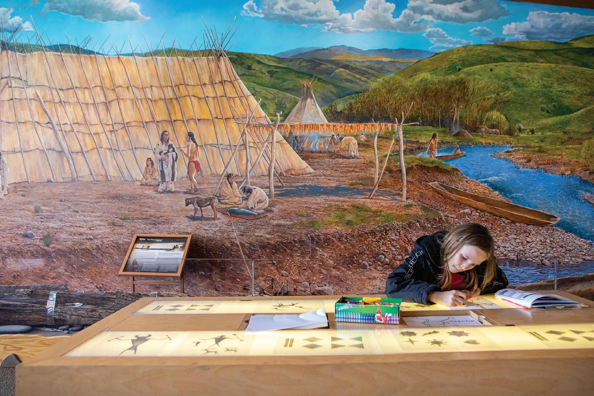
LEFT: A mother helps her daughter complete her junior ranger handbook at Nez Perce National Historical Park’s visitor center on U.S. Highway 95 at Spalding.
95
Nez Perce National Historical Park
Austin Johnson/For Daytripping Lewiston Spalding Lapwai 95
THURSDAY, MAY 19, 2022 24 DAYTRIPPING
Perce
Historical Park visitor center at Spalding is a good place to start if you’re interested in the story of Nimiipuu
Display
from Page 24
and is the Picnic Area Trail. The trail takes you through the Nez Perce village site and the Rev. Henry Spalding mission. The Idaho Legislature established the Spalding Memorial State Park in 1936 at the site of the old mission.
There are two trails coming in at two-tenths of a mile apiece: the Boomgrounds Trail and the Lapwai Creek Trail. The Boomgrounds Trail is named after a logging term for a place where wood is collected. It offers views of the Clearwater River. The Lapwai Creek Trail will lead you along the creek to the gravel bar which overlooks where the creek joins the Clearwater River.
The last trail is also the shortest, coming in at one-tenth of a mile: Watson’s Trail, which takes you off the main road, into the shade and then the Watson’s Store. The store was owned and operated by Lewis and Margaret Watson starting in 1910. It remained open until 1965. n
> Nez Perce National Historical Park visitor center
LOCATION: Located at Spalding, which is 12 miles east of Lewiston via U.S. Highway 95.
WHAT YOU’LL DO: Walk along trails to see historic stores like the Indian Agency Cabin Marker and head into the visitor center to hear about the history of the Nez Perce Tribe.
DIFFICULTY: 2 out of 5, all trails are a mile or less and most are on level ground.
DON’T FORGET: Head into the visitor center to see the museum and get more information on the area.
NEARBY SITES OF INTEREST: Coyote’s Fishnet historical marker, the Ant and the Yellowjacket historical marker, Spalding Presbyterian Church.
THURSDAY, MAY 19, 2022 25 DAYTRIPPING
Austin Johnson/For Daytripping
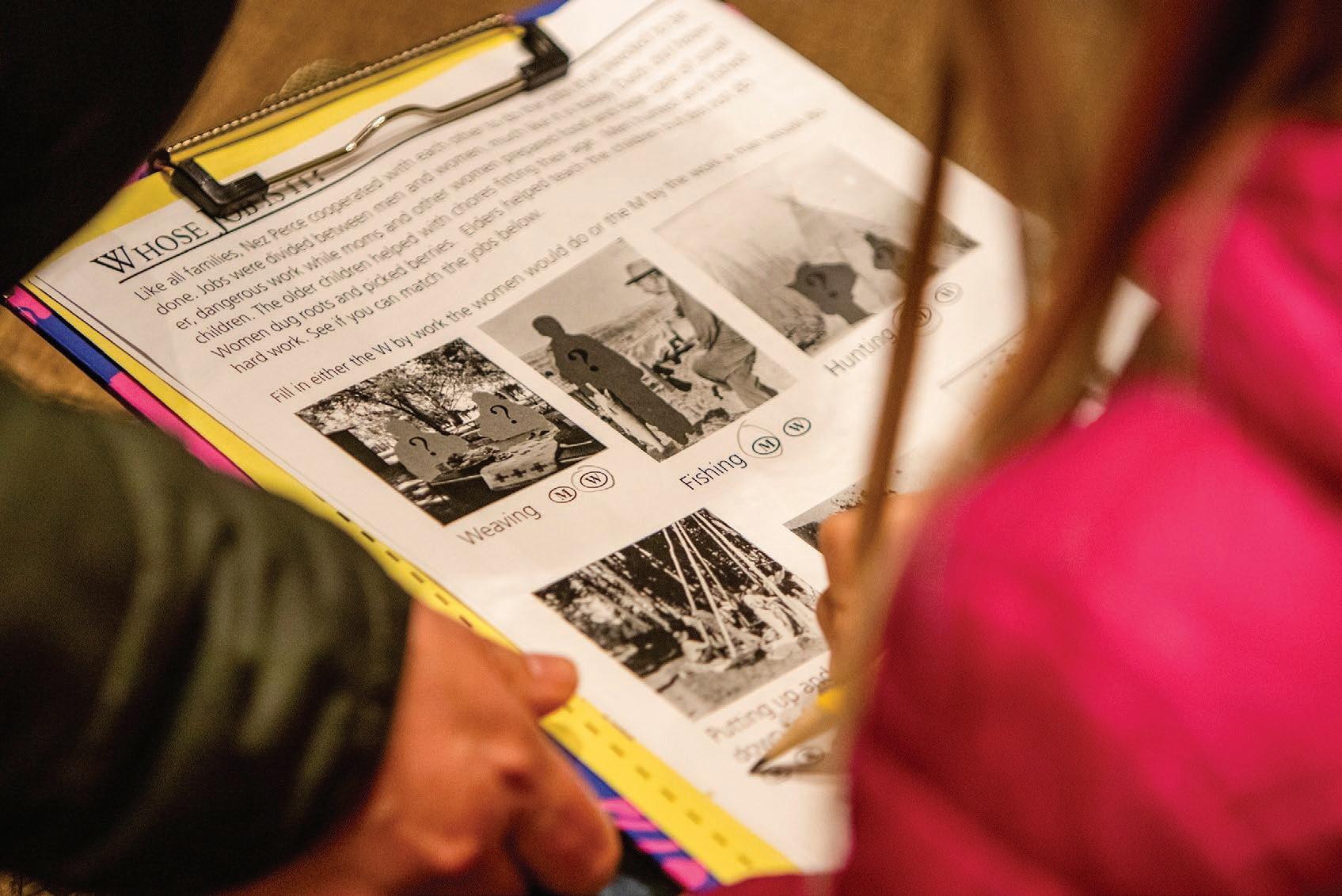
A boy works through his junior ranger handbook identifying artifacts on display in the museum at the Nez Perce National Historical Park’s visitor center along U.S. Highway 95 at Spalding.
Austin Johnson/For Daytripping
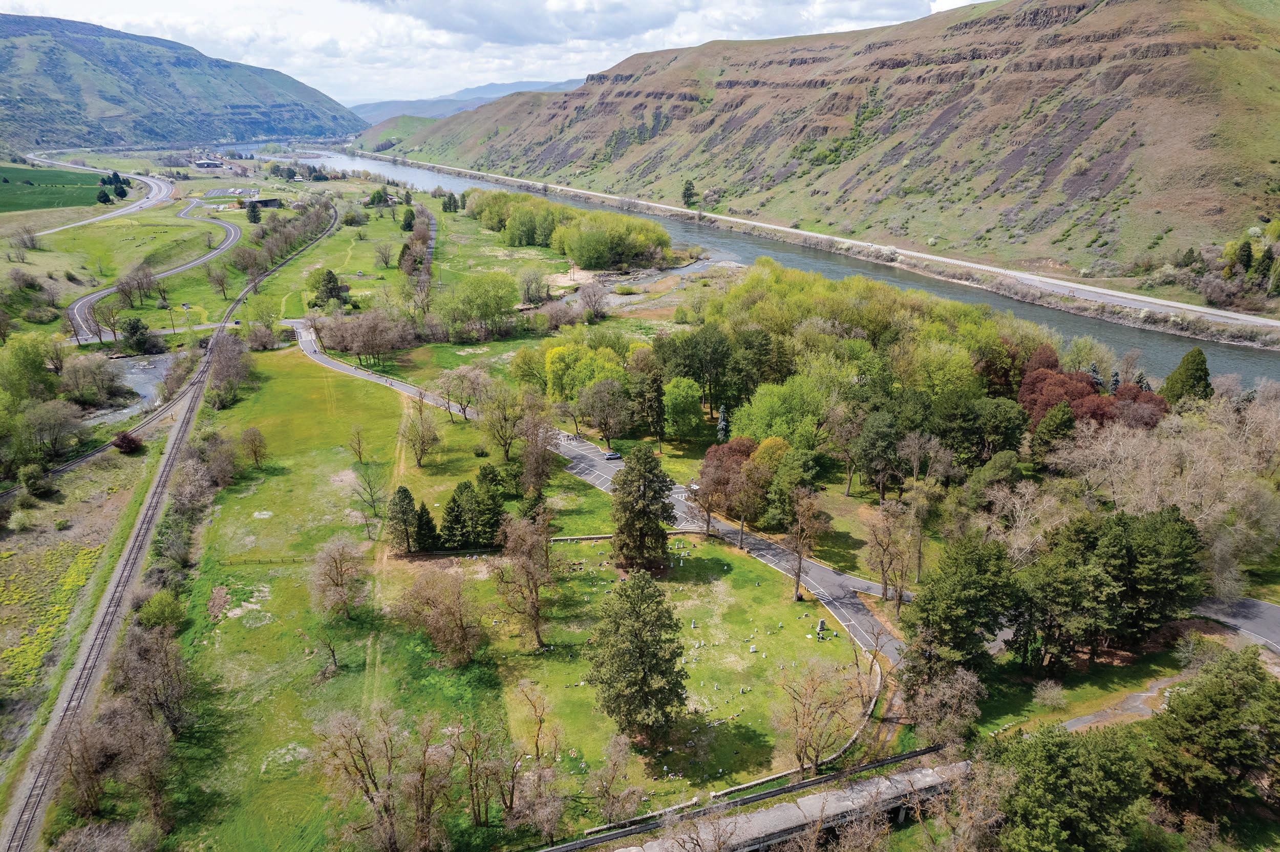
An image captured with a drone shows the Lapwai Mission Cemetery and picnic area at the Nez Perce National Historical Park’s visitor center.
Quite a view from on top of the Palouse
Steptoe Butte offers spectacular panoramic views of the region’s rolling hills
By ANTHONY KUIPERS FOR DAYTRIPPING
Any ranking of the best views of the Palouse has to include Steptoe Butte at or near the top of the list.
Certainly it has the most farreaching views. At the top of the butte, one can look in any direction and see the green, yellow and brown Palouse hills stretch endlessly to the horizon.
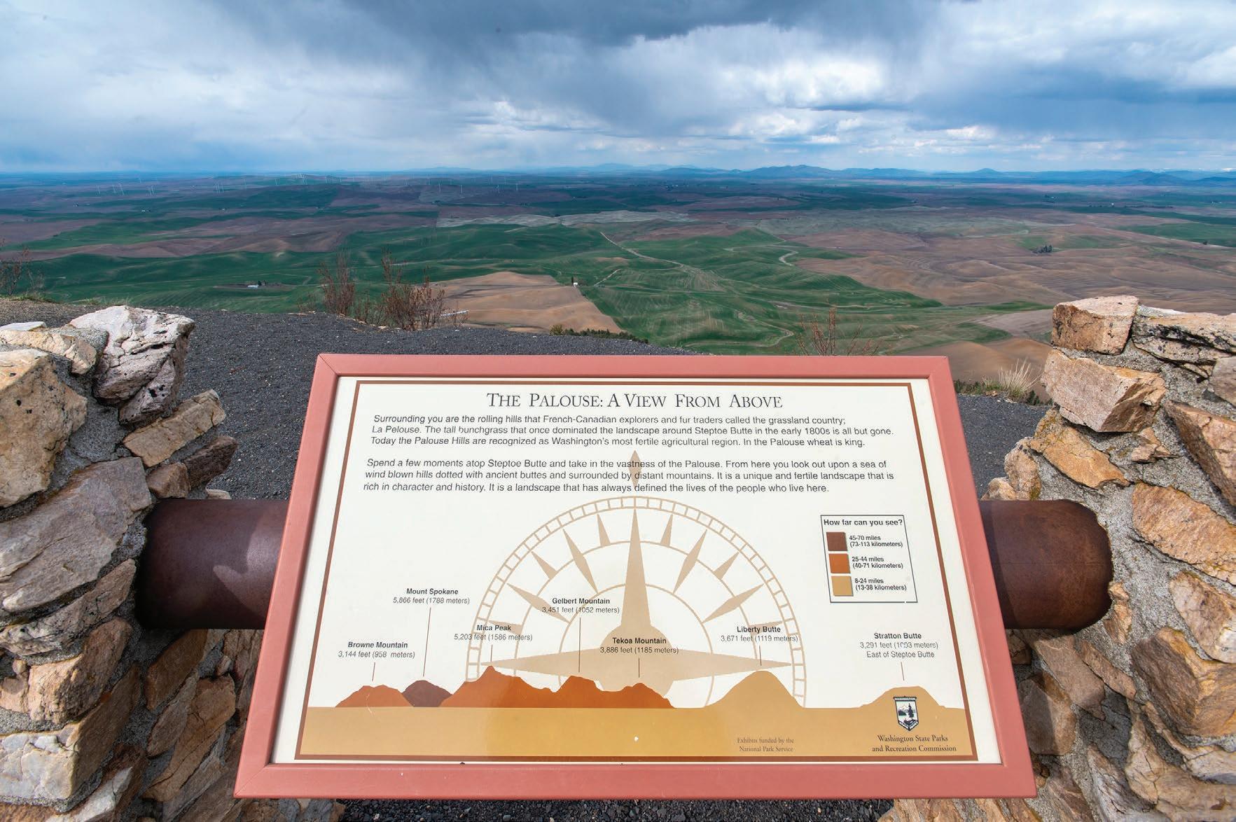
According to Washington State Parks, the eye can see 200 miles into Idaho and Oregon. On the right day, one can also look down upon hang gliders soaring through the air.
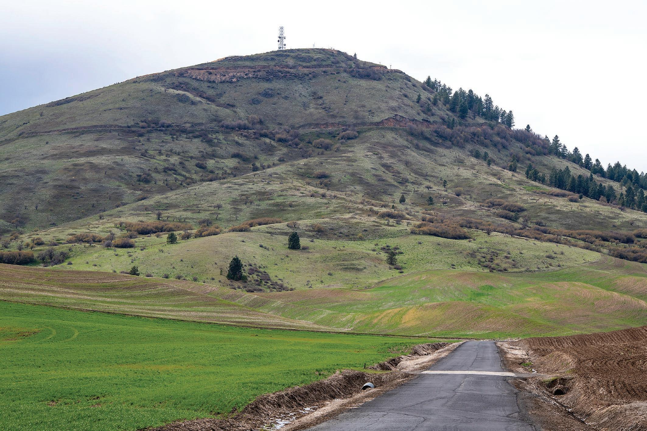
The quartzite butte in Whitman County is some of the oldest rock in the Pacific Northwest. It was known as “the power mountain” and Pyramid Peak before being renamed to Steptoe Butte to honor Col. Edward Steptoe, who fought in the nearby 1858 Battle of Rosalia.
Nearly two decades later, pioneer James S. “Cashup” Davis bought the land and built a wagon road to the summit. He built a two-story hotel on top of the butte in 1888 complete with a glass observatory and telescope.
The hotel struggled to attract guests willing to ascend the 3,612-foot summit, but Cashup and his wife Mary Ann stayed there until they died in the 1890s. The hotel later burned to the ground in 1911 because of an apparent incident with a teenager and a cigarette.
Virgil McCroskey later purchased the butte and secured the summit as a public park. He donated 120 acres to the state of Washington in 1945 and 1946. It became a formal state park on July 4, 1946.
The National Park Service designated Steptoe Butte as a National Natural Landmark in 1965.
Kent Bassett, of Bellevue, Wash.,


and Ray and Joan Folwell, of Pullman, sold a 437-acre parcel on the flanks of the butte to the Washington Department of Natural Resources last year, according to a Lewiston Tribune report. This transaction preserves the largest remaining swath of native Palouse prairie.
It is currently a day-use park with camping options that’s approximately a 35-minute drive from Pullman.
It is open from 8 a.m. to dusk, although a road and park improvement project is expected to be underway at Steptoe Butte in 2022. The park will be closed for several months during this process. n
> Steptoe Butte
ABOVE: Steptoe


Butte’s 3,612foot summit is seen from the base of Steptoe Butte State Park Road.
Once known as Pyramid Peak, it was renamed after Col. Edward J. Steptoe, who fought in the nearby 1858 Battle of Rosalia.
LEFT: A sign displays landmarks that can be seen from the summit in certain weather conditions.
Zach Wilkinson/ For Daytripping
LOCATION: From Pullman, head north on U.S. 195 for 20 miles, turn right onto Scholz Road and keep right onto Hume Road for 4 miles before turning left onto Steptoe Butte State Park.
WHAT YOU’LL DO: Camping, gazing at the panoramic Palouse view, bird-watching DIFFICULTY: 2 out of 5.
DON’T FORGET: Camera, binoculars, camping gear.
THURSDAY, MAY 19, 2022 26 DAYTRIPPING Colfax Palouse Pl 27 lfax P 272 195 Steptoe Butte ID Steptoe WA SHING TO N Oakesdale
From the ashes rises a scenic oasis
After a 1965 fire burned down a wellknown lumber mill — and nearly took the town of Winchester with it — a new state park was created
By KATHY HEDBERG FOR DAYTRIPPING
At the site of what was once one of the largest stateof-the-art lumber mills in northern Idaho sits a placid state park tucked around the former mill pond.
Winchester Lake State Park, located about 38 miles south of Lewiston, has been a popular draw for tourists since its establishment in 1969. The man-made lake formerly served as the mill pond for the Craig Mountain Lumber Co., founded in 1909 that, at its peak, produced 120,000 board feet of timber every 10 hours.
After industry shutdowns during two world wars, the mill closed for good in 1965 following a fire that nearly destroyed the town of Winchester. Planning for the mill site to be converted into a state park began the next year.
Winchester Lake State Park is surrounded by Ponderosa pine and Douglas fir and the lake is stocked with rainbow trout, catfish, perch, bass, bluegill and tiger muskie. Hiking, nordic skiing, snowshoeing and mountain bike trails circle the 100-acre lake that has an average depth of 23 feet with the deepest point of 35 feet.
There are also 46 serviced, 22 standard and three American with Disabilities Act campsites for picnickers and campers. Reservations can be made from Memorial Day through Labor Day for campsites and year-round for yurts. Canoes are also available for rent and small boats are allowed. Gas engines are not.
During the summer months, classes and programs are often available, including junior ranger programs, wolf education and research center programs and first-time adventure programs.
A small visitor’s center is located at the entrance to the park and the Museum of Winchester History is about a mile away in the town of Winchester. The museum tells the story of the frontier community carved out of heavily timbered landscape on the summer grounds of the Nez Perce people. Early photographs show the Craig Mountain Lumber Co. and the mill pond, as well as pictures of the construction of the Camas Prairie Railroad with its tunnels and trestles. Handwrought tools, clothing, household items and firefighting equipment document the struggles faced by the townspeople making a living on the edge of the Camas Prairie. n
> Winchester Lake State Park

LOCATION: 38 miles south of Lewiston. Turn west off U.S. Highway 95 onto Business Highway 95; drive 1 mile to the edge of the lake and follow the signs to 1786 Forest Road park entrance.
WHAT YOU’LL DO: Fishing, camping, picnicking, hiking, boating, bird watching.

DIFFICULTY: 1 out of 5
WATERING HOLES: Winchester Kitchen and Bar on Winchester Main Street.
PARK AMENITIES: Auto touring/scenic routes; boat ramp and launch; boat rental (nonmotorized);
charcoal grills; dump station; electricity; fire rings; firewood sales; fish cleaning station; flush toilets; group picnic shelter; indoor showers; life jacket loaner station; paddle board rental; picnic areas; swimming; vault toilets and drinking water.
FEES: $10 Idaho State Parks passport; other fees for services are available at: parksandrecreation. idaho.gov/parks/winchester-lake/fees/
CONTACT: (208) 924-7563
HOURS OF OPERATION: Day-use locations within state parks are open from 7 a.m. to 10 p.m.
THURSDAY, MAY 19, 2022 27 DAYTRIPPING
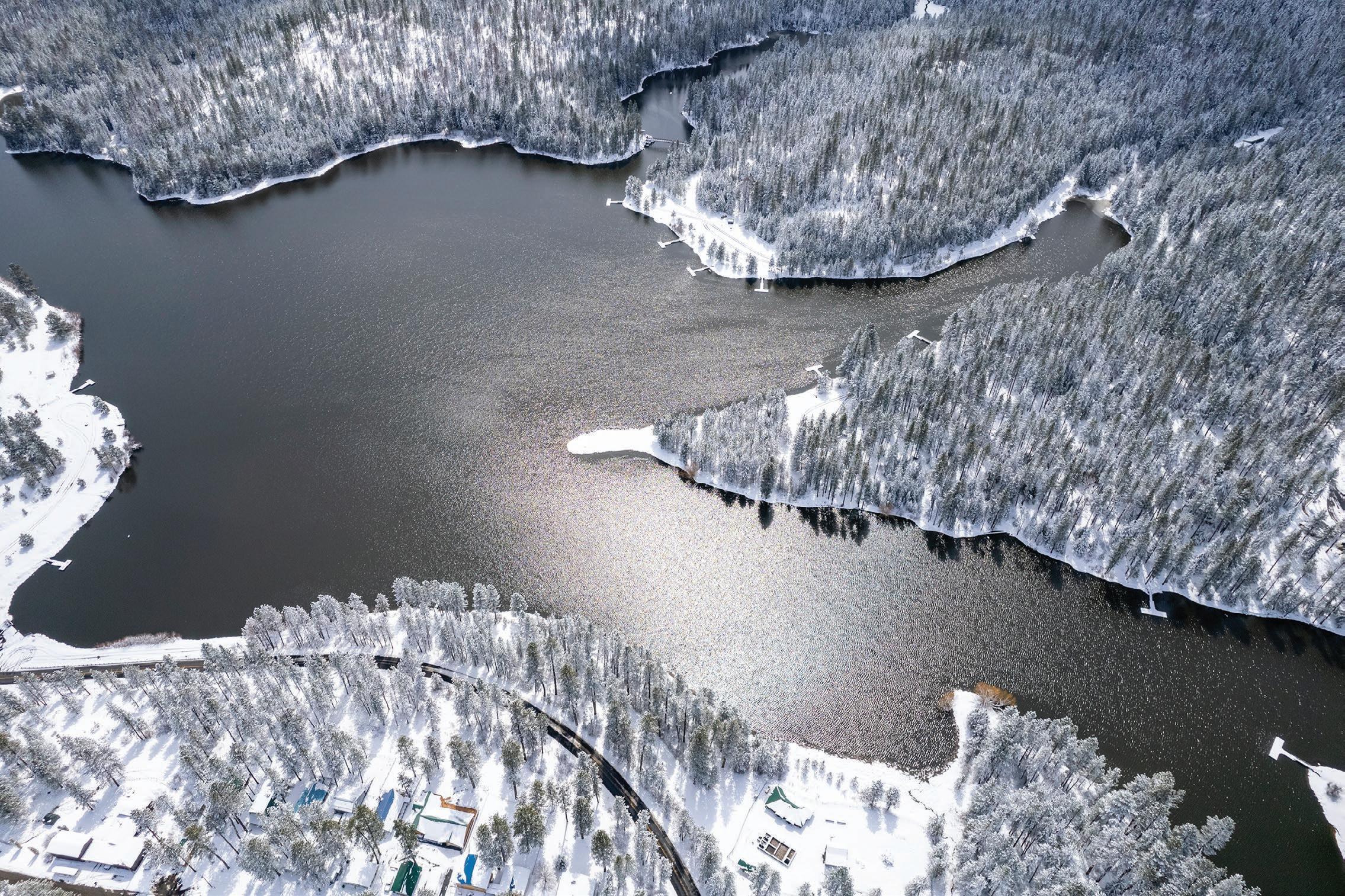
ABOVE: A photo captured with a drone shows Winchester Lake after a snowstorm April 12. The man-made lake was created in the 1960s following a fire that burned down a lumber mill.
Lewiston Winchester 95 Winchester Lake State Park 12
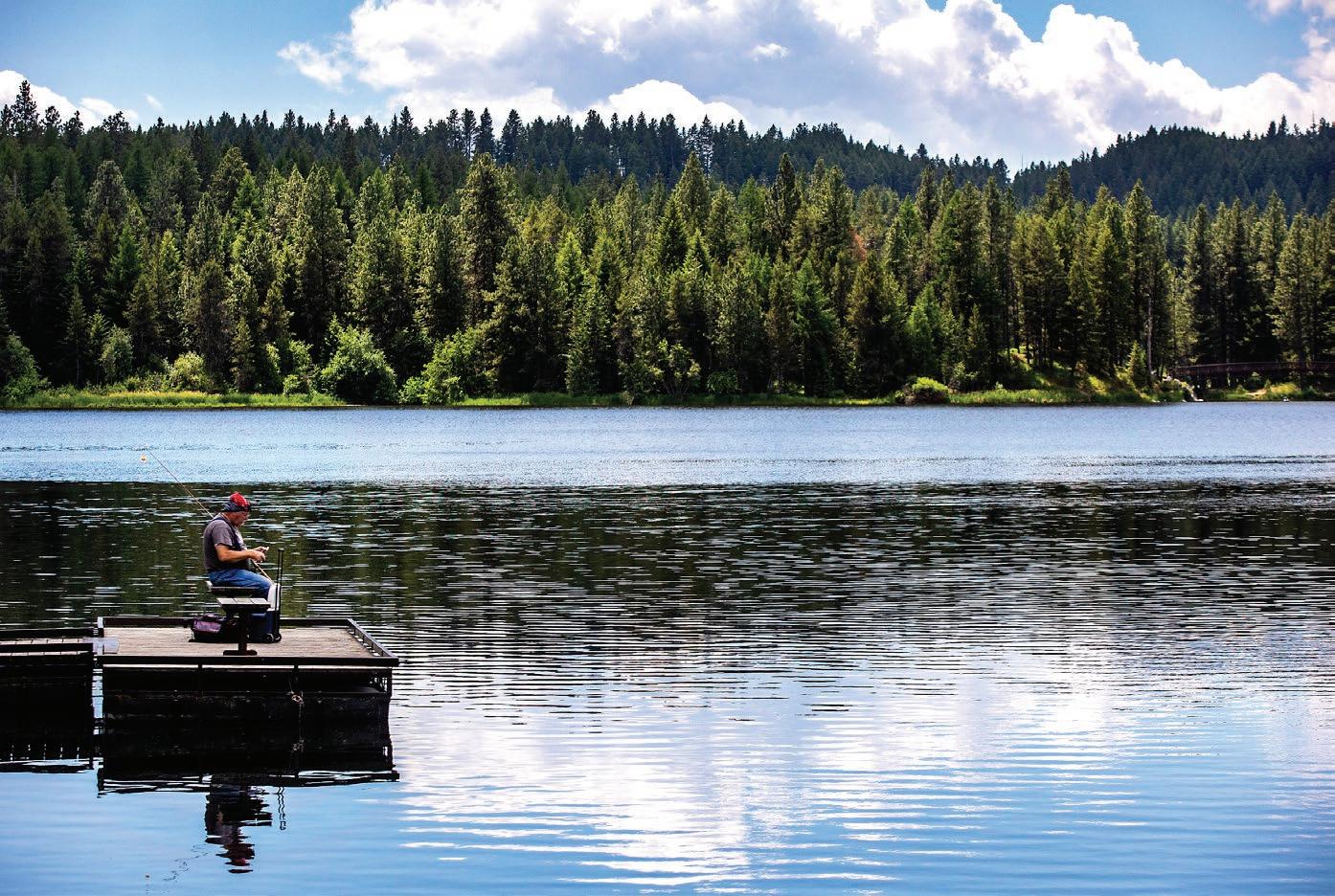
LEFT: Gregg Presnell of Lewiston enjoys a cool day of fishing at Winchester Lake with clouds drifting by overhead during the summer of 2021. Austin Johnson, August Frank/For Daytripping
History sewn in the soil of White Bird Canyon
Rugged canyon was site of the famous 1877 battle that started the Nez Perce War
 By EMILY PEARCE FOR DAYTRIPPING
On a drive not far from the Camas Prairie lies the White Bird Battlefield, a site that appeals to lovers of history and scenery.
Cruising down the steep White Bird grade of U.S. Highway 95, travelers can see miles and miles of sagebrush, native grasses and the little town of White Bird at the bottom of the canyon.
For a more adventurous journey, try the Old U.S. Highway 95 grade, which can be reached by turning off the current highway near the top of the grade. After the old grade was constructed in 1915, it was part of the
Grangeville
only north-south highway in Idaho, connecting Lewiston and many northern cities to southern towns for 60 years.
The drive on the old highway isn’t for the faint-


THURSDAY, MAY 19, 2022 28 DAYTRIPPING
August Frank/Tribune
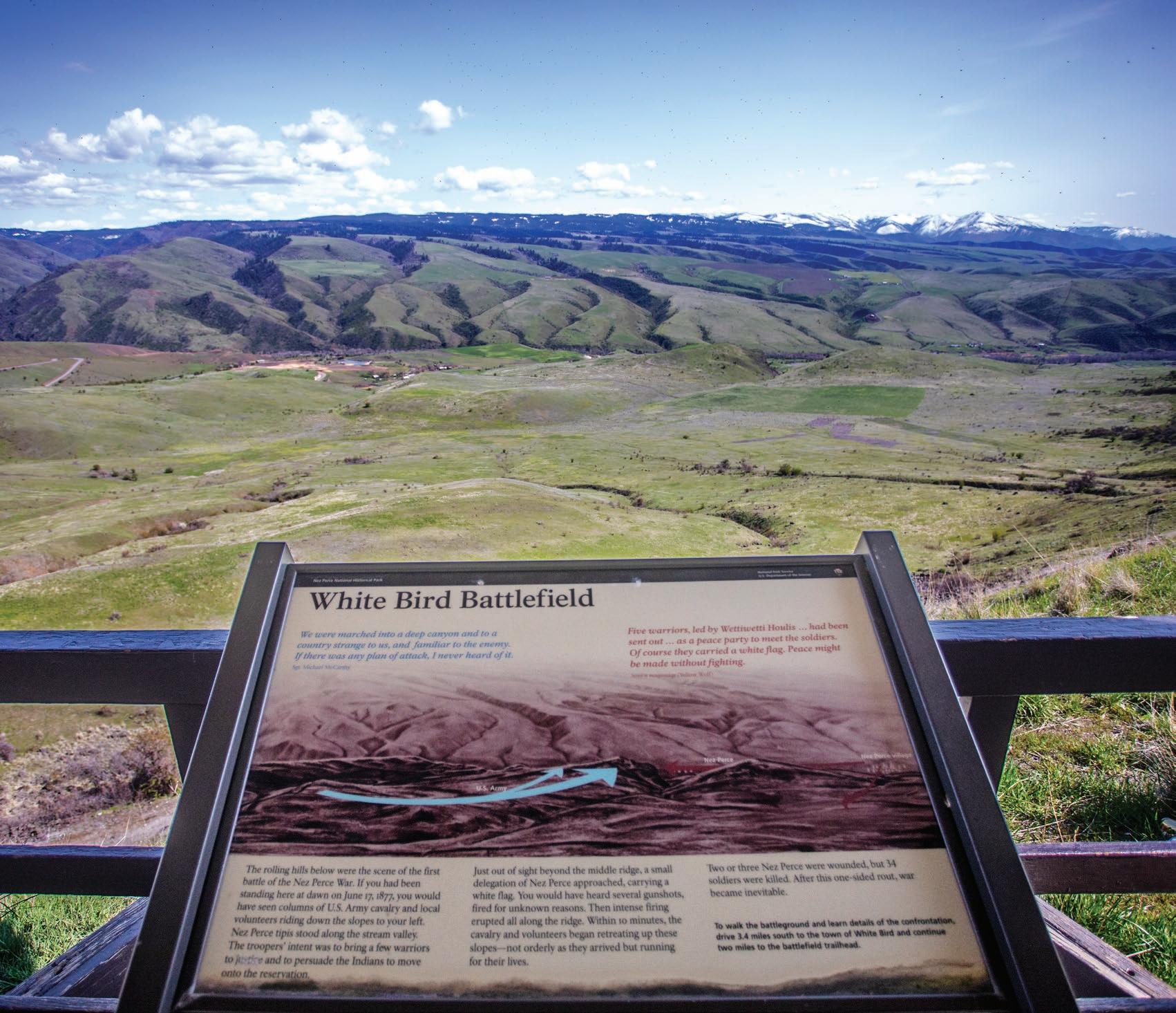
A man looks at the instructional panels at the White Bird Battlefield Overlook. The canyon was the site of the initial battle in the Nez Perce War of 1877.
August Frank/For Daytripping
The White Bird Battlefield stretches into the distance as seen from the overlook off of U.S. Highway 95.
95
95
> See SEWN, Page 29
White Bird Battlefield
White Bird
Sewn
from Page 28

hearted, with many loops, curves and lack of side railings. Putting together its many twists and turns, the pavement could make 37 complete circles, climbing 2,900 feet in 14 miles.

Located 15 minutes south of Grangeville, White Bird Battlefield sits at the bottom of White Bird Canyon. A part of the Nez Perce National Historical Park’s 38 sites, the historical site offers a view into the past.
There are two spots to view the battlefield. You can get a bird’seye view of the meadow from an overlook just off the current highway, or immerse fully at the bottom of the canyon, where you can hike around and view the landscape through the eyes of someone in 1877, fighting to keep their homeland.
Looking over the hills and valleys on the White Bird grade, many wouldn’t know the rich history these groves and mounds remember.
The hills below the overlook shelter are where the first battle of the Nez Perce War transpired, at dawn on June 17, 1877. The valley was once a part of the 17-millionacre homeland the Nez Perce Tribe lived on for thousands of years. With other uses in mind for the land, the American homesteaders saw it as an opportunity for mining, farming and logging.
In 1855, a treaty was signed
> White Bird Battlefield
LOCATION: Driving down U.S. Highway 95, 15 minutes south of Grangeville, peer out of your left-hand window. White Bird Battlefield is located on the White Bird grade, at the bottom of the canyon. Keep an eye out on the side of the road for the overlook shelter, where parking will be provided and many panels about the battlefield will be available to view. To visit the trailhead, continue driving south from the overlook and turn left on White Bird Road, then right on River Road
designating only a portion of the original land as a reservation. After gold was found on the land, the Treaty of 1863 reduced the size of the reservation by 90%. Many Nez Perce people did not understand the terms of the “Steal Treaty” and refused to leave their homeland. That’s what led to the conflict at White Bird between the U.S. Cavalry, local volunteers and the Nez Perce Tribe. Groups of U.S. Army Cavalry and volunteers formed on the left side of the valley. The forces rode down the slopes, and along the stream beyond the middle ridges stood the Nez Perce. Approaching the cavalry with a white flag in hand, a small delegation of Nez Perce people saluted. The cavalry wanted to convince the Native Americans to move onto the reservation, but the Nez Perce held their ground. Shots began to fire, erupting throughout the valley. In 10 minutes, the cavalry and volunteers began to retreat up the hills, running for their lives. Two or three Nez Perce people were wounded, and 34 soldiers were killed. Scattered across the meadow lay army guns and ammunition. Winning the fight, the Nez Perce packed up their camp and embarked on a treacherous journey. Although they had been victorious, they knew the U.S. Army would have a massive response to the battle. War was inevitable, and after the battle took place, the Nez Perce War began.
and drive until you reach the marked area.
WHAT YOU’LL DO: At the overlook, read about the history of the 1877 White Bird Battle. At the trailhead below, explore the bottom of White Bird Canyon.
DIFFICULTY: 1 to 2 out of 5
DON’T FORGET: Sunscreen, hiking shoes, sun hat, water and a camera.
NEARBY SITES OF INTEREST: Nez Perce National Historical Park visitor center in Spalding.
THURSDAY, MAY 19, 2022 29 DAYTRIPPING
August Frank/For Daytripping
The White Bird Battlefield trailhead is pictured.
Customized Insurance & Risk Reduction Strategies for navigating every stage of your life. Serving Inland Northwest Communities Since 1923 www.stonebrakermcquary.com Clarkston 616 5th Street Clarkston, WA 99403 509.758.5529 Spokane 1401 E. 57th Avenue Spokane, WA 99223 509.755.4500 Genesee 142 Walnut Street Genesee, ID 83832 208.285.1661 Craigmont 116 W. Main Craigmont, ID 83523 208.924.5232 Stonebraker McQuary is an equal opportunity employer Personal Insurance | Healthcare Business Insurance | Agriculture
Lots happening at high-mountain retreat in Oregon
Wallowa Lake has drawn visitors for ages; these days, it features both outdoor and indoor attractions
By MATT BANEY FOR DAYTRIPPING
High in the mountains of northeastern Oregon lies Wallowa Lake, a ribbon-shaped body of water people have been visiting for hundreds of years to catch a respite from the summer heat.
These days, the 1,500-acre lake is the centerpiece of a state park. And while summer is still the most popular time to visit, the park is open to campers year-round and the nearby town of Joseph, Ore., is geared toward tourism throughout the year.
Wallowa Lake State Park, located about 100 miles south of the Lewiston-Clarkston Valley, offers a wide array of outdoor activities: camping, hiking, biking, fishing, boating, swimming and wildlife-spotting. And if members of your party decide they’ve had enough nature, there are also charming dining and shopping options.
The area’s most notable feature might be the Wallowa Lake Tramway, which first opened in 1970 and is billed as the steepest gondola in America. Those who pay for tickets, which cost between $30 and $40 per person, get to ride a tram car up a ridge of Howard Mountain, gaining about 3,700 feet of elevation along the way. At the top (8,150 feet above sea level) is the Summit Grill, which, like the tramway, is open from May until early October.
There are also


some easy-to-navigate hiking trails at the top.
Most visitors to the park will end up spending time at the lake, which is fed by glacial runoff from the surrounding Wallowa Mountains. The beautiful high-mountain setting must have appealed to the Nez Perce Tribe, which had bands that lived in the area before the encroachment of white settlers.
It’s not hard to spend money at Wallowa, between the tramway, rental options, lodging and restaurants. But those looking for a cheap and simple outing can have that too, if they pack a lunch and stick to the free amenities the park offers. n
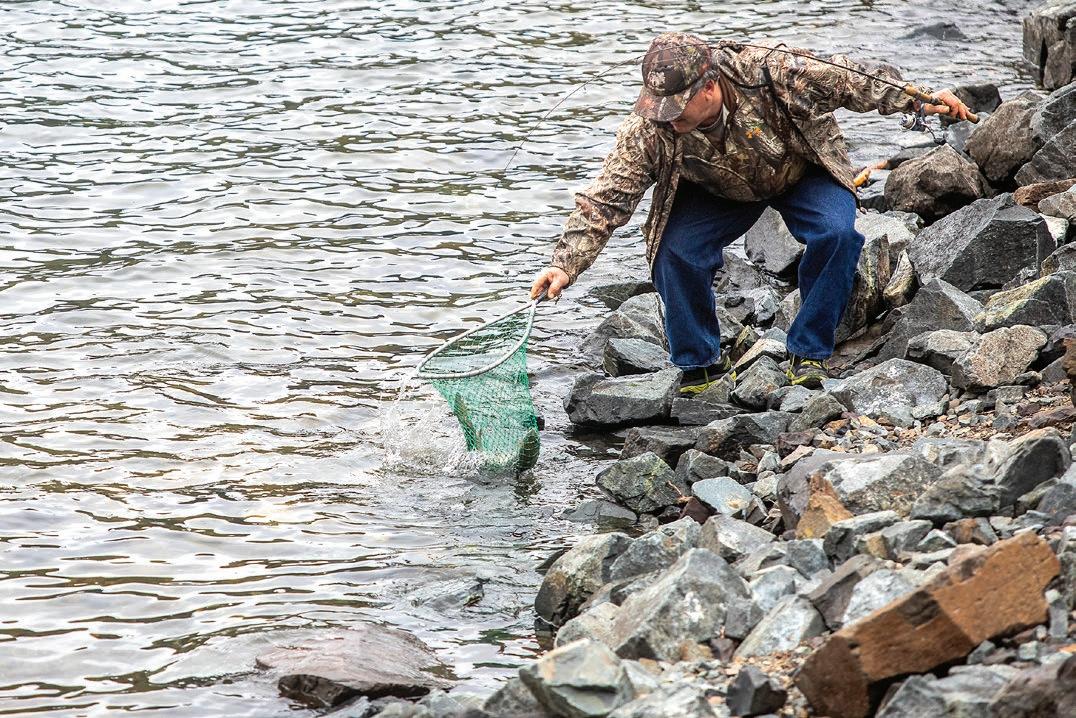
LEFT AND BELOW: Joe Jaquith, of Newberg, Ore., scoops up a rainbow trout as he fishes at Wallowa Lake outside Joseph, Ore., earlier this spring.
August Frank/ For Daytripping
> Wallowa Lake State Park
LOCATION: From the Lewiston-Clarkston Valley, travel south on State Route 129 through Asotin, Anatone and over Rattlesnake Grade. The route becomes Highway 3 at the Oregon border. At Enterprise, Ore., turn east on Highway 82, which leads to Joseph, Ore., and the park. Total drive time is about 2 hours and 15 minutes.
WHAT YOU’LL DO: Hiking, biking, fishing, boating, swimming and, if you’ve got the time, camping.
DIFFICULTY: 1 to 3 out of 5, depending on what you do. Some visitors journey here for a low-stress picnic; others work up a sweat hiking, biking or paddling.
DON’T FORGET: Water, snacks, camera, sunscreen ... and money. Even if you’re planning an economical trip, you’ll probably end up spending a few bucks.
NEZ PERCE HOMELAND: The Wallowa Valley was part of the Nez Perce Tribe’s traditional homeland and was the home of the famous Chief Joseph. Last year, the tribe acquired a property called Am’sáaxpa, or place of the boulders, that is a traditional campsite where Joseph spent time before the War of 1877.
THURSDAY, MAY 19, 2022 30 DAYTRIPPING
OREGON Joseph h 82 Wallowa Lake Enterprise Et 3 82
August Frank/For Daytripping
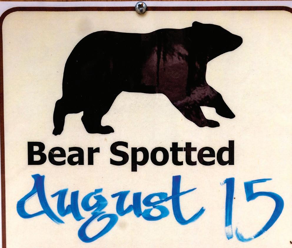
A sign near the Wallowa Lake Trailhead warns people of the last time a bear was sighted in the area outside Joseph, Ore.
Recreation abounds behind massive Dworshak
By ANGELA PALERMO FOR DAYTRIPPING
Among the trees and meadows near Orofino lies the Dworshak Dam and Reservoir, a haven for boaters, campers, hikers and anglers alike.
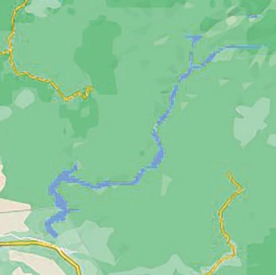
The dam, on the North Fork of the Clearwater River about 35 miles east of Lewiston, is the highest straight-axis, concrete gravity dam in North America and the largest of its type ever constructed by the Army Corps of Engineers, according to the Corps’ Northwestern Division.

The 19,000-acre reservoir extends upstream for roughly 54 miles into the Clearwater National Forest in the Bitterroot Mountains. It was created after the dam was completed in 1973.
Each summer, about 1 million acre-feet of water is released from deep below the reservoir’s surface to cool temperatures in the lower Snake River and help juvenile salmon and steelhead migrate to the Pacific Ocean.
The Army Corps of Engineers, which operates the dam, is charged with flood control, power production and providing water downstream for fish produced at the Dworshak National Fish Hatchery.
However, the fish-friendly operation lowers the reservoir by about 80 feet between July and September, cutting the summer recreation season short on the man-made lake. Those who head to the area for camping should plan to go before the end of July to avoid the muddy ring between the water and campsites, sometimes 100 feet or more.
After the Fourth of July weekend, water at Dworshak — the third tallest dam in the U.S. — can start dropping at a rate of about 2 feet per day because of the annual drawdown.
Roughly 30,000 acres of land surrounding the reservoir are used for public recreation, wildlife habitat and timber facilities. Dworshak State Park includes Freeman Creek Campground, Three Meadows Group Camp, and Big Eddy Lodge and Marina.
Many campgrounds on the reservoir are accessible only by boat. Day-use locations within the park are open from 7 a.m. to 10 p.m.
The dam’s visitor center is open five days a week during the spring, fall and winter, and seven days a week during the summer. Those seeking tour times may call the visitor center at (208) 476-1255. n
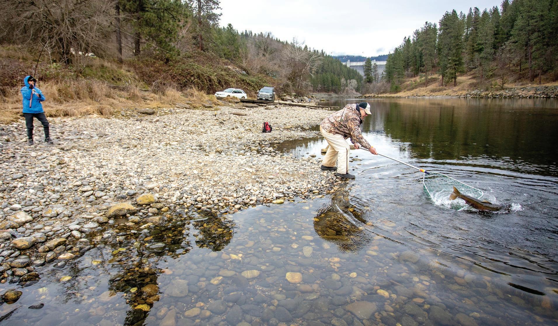
ABOVE: Marcia Trussell, left, keeps ahold of her fishing pole as Ted Mordhorst goes in with the net as they work to land a steelhead on the North Fork of the Clearwater River near Dworshak Dam in February 2021 in Ahsahka. After the steelhead swam back out, Trussell was able to bring it back into shore a second time where Mordhorst successfully netted the fish, which measured 36 inches.
Austin Johnson, August Frank/For Daytripping
LOCATION: From Orofino, travel west on Idaho Highway 7/Riverside Avenue for about 5 miles, then turn right on Viewpoint Road and drive 2½ miles to the main parking area near the top of the dam. Boat launches are available at other spots on the reservoir.
WHAT YOU’LL DO: Touring the dam, fishing, boating, camping and hiking.
DIFFICULTY: 2 out of 5.
DON’T FORGET: Fishing gear, fishing license, swimsuits, sunscreen, drinks and snacks.
NEARBY SITES OF INTEREST: Dworshak National Fish Hatchery, Nez Perce National Historic Trail.
THURSDAY, MAY 19, 2022 31 DAYTRIPPING
TOP: This photo taken with a drone shows Dworshak Dam and Reservoir near Orofino.
Elk River Orofino Headquarters 11 Dworshak Dam and Reservoir 12 >
Dam completed in 1973 created reservoir that can be enjoyed by boaters, campers, hikers and anglers
Dworshak Dam and Reservoir
Wheat fields give way to forested trails
Kamiak Butte County Park is a wooded oasis tucked into the farmland of Whitman County
 By ANGELA PALERMO FOR DAYTRIPPING
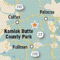
Kamiak Butte County Park boasts some of the only forested hiking trails in a region where agriculture reigns supreme. Located about 12 miles north of Pullman, the popular outdoor recreation area is designated a National Natural Landmark.
Visitors who go during springtime can see the slopes blooming with colorful wildflowers and coniferous trees. The park’s amenities include a small camping area, picnic tables, bathrooms, a playground and 4 miles of wellgroomed trails for public use.
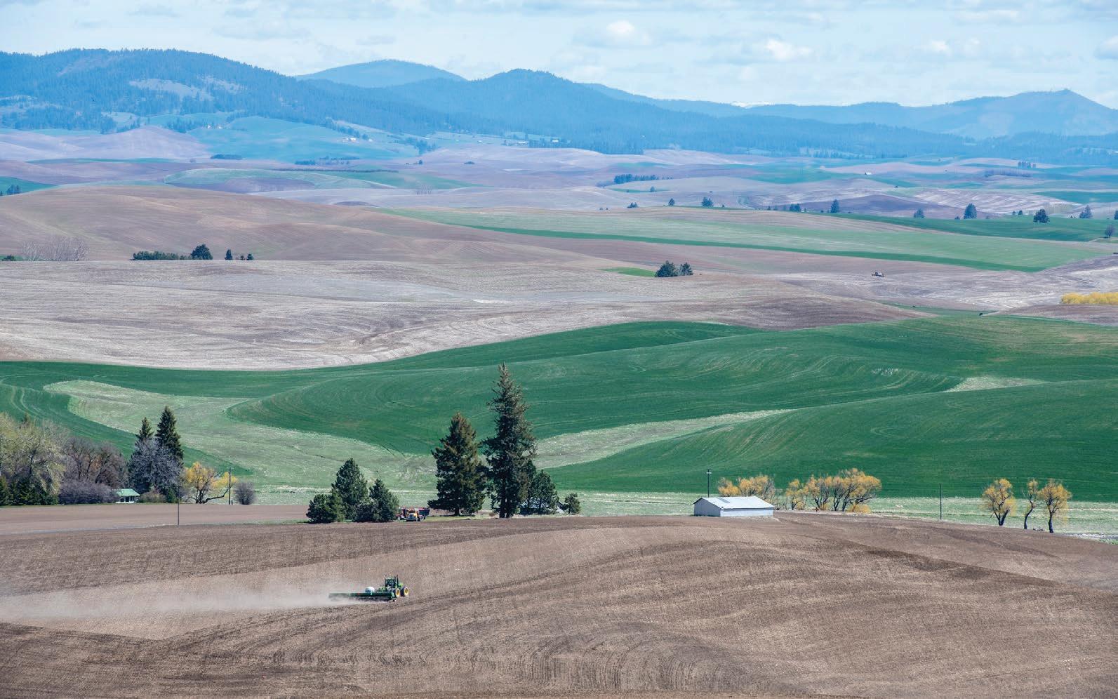
The butte’s 3,641-foot summit boasts a panoramic view of the farmland below — a rolling patchwork of green and yellow in every direction.
Hikers can wind between Douglas fir and ponderosa pine trees on a moderate 3½mile loop called Pine Ridge Trail to reach the top of the butte where a timbered ridge stands above the Palouse wheatfields east of Colfax.
There’s also a newer westend primitive trail. Dogs are welcome but must be on a leash.
In the 1987 book “100 Hikes in the Inland Northwest,” the Kamiak Butte Loop is listed as an unsung favorite, alongside other convenient trails that author Rich Landers said are so commonly used they’re often taken for granted.
While Kamiak encompasses nearly 300 acres, the entire trail can be accomplished within 1-2 hours.
With the trails and a playground, children have plenty of places to explore. The picnic area is located next to the parking lot, along with the restrooms. There are also four barbecue grills available for reservation.
Camping is allowed in designated areas only for $15 a night. There are eight camping sites available on a first-come, first-served basis. Shelter reservations should be made at least two weeks prior to visiting.
The park is gated with no access in or out from dusk until 7 a.m.
Visitors should check with Whitman County Parks, Recreation and Developmental Services Department for possible late-summer closures because of wildfire danger. n
> Kamiak Butte County Park
LOCATION: From Pullman, travel northeast on State Route 27 for about 12 miles, turn left on Clear Creek Road, continue straight on Fugate Road and then turn left on Kamiak Butte Park Road to the parking area.
WHAT YOU’LL DO: Hiking, camping, picnicking and wildlife spotting.
DIFFICULTY: 2 out of 5.
DON’T FORGET: Sunscreen, water and snacks.
NEARBY SITES OF INTEREST: Steptoe Butte State Park, about 30 minutes from Kamiak Butte County Park when traveling by car. Washington State University in Pullman.
WATERING HOLE: Paradise Creek Brewery in Pullman.
THURSDAY, MAY 19, 2022 32 DAYTRIPPING
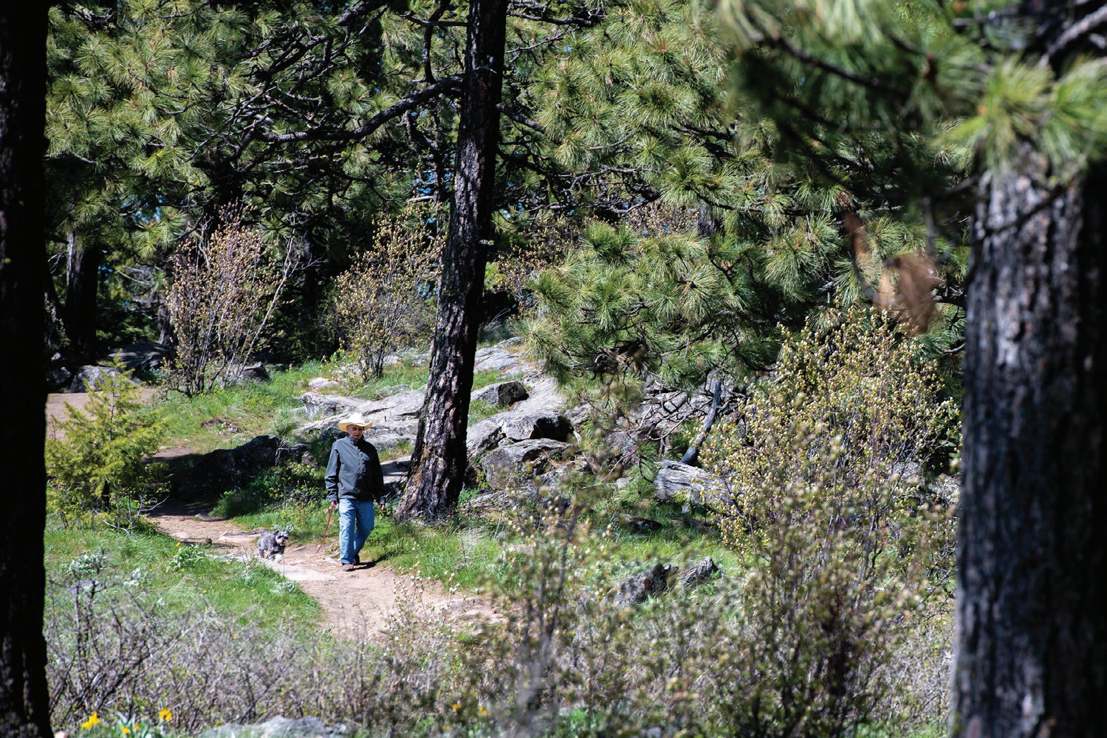
TOP: Richard Styer walks with his dog, Missy, a miniature schnauzer, along the Pine Ridge Trail at Kamiak Butte County Park.
ABOVE: Kamiak Butte County Park overlooks the rolling hills of the Palouse.
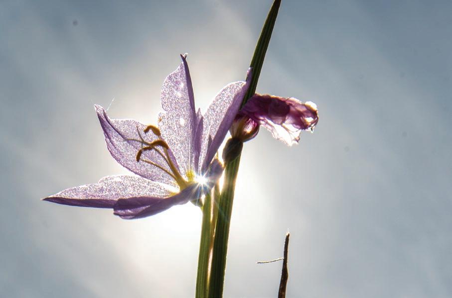
LEFT: Sunlight shines through a purple flower growing at Kamiak Butte County Park. Zach Wilkinson/For Daytripping
