1 minute read
South Gippsland Floods

FARMLAND NEAR MEENIYAN DAIRY FARM CLOSE TO FLOOD WATERS NEAR FISH CREEK

GRANNY CASHINS CREEK DALYSTON FLOOD ZONE


Most parts of South Gippsland, Bass Coast, Cardinia right through to Traralgon were hit by a deluge of rain.
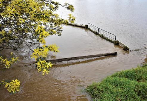
The low lying farm land areas near Powlett River and Tarwin River were severely hit with locals describing that these were the worst floods for nearly 20 years. At one stage the road to Venus Bay was cut off. Cows were huddled up on higher grounds and you almost needed a canoe or kayak to get through some farmland. At the time of writing, rain is continuing to fall heavily here in South Gippsland and one hopes that soon this will ease off and give the farmers a chance to reclaim their land from the mass of water that abounds their properties.


DALYSTON FARMING LANDS FLOODED, NOTE DESAL PLANT IN BACKGROUND FAR TOP RIGHT FARMS IN SOUTH GIPPSLAND INUNDATED WITH WATER


VAST AMOUNT OF WATER NEAR MEENIYAN TAKEN NEAR THE GREAT SOUTHERN RAIL TRAIL THE FISH CREEK ROAD UNDER WATER


THE OLD RAILWAY BRIDGE
NEAR MEENIYAN SITS IN STARK CONTRAST TO THE FLOOD WATERS THE ROAD TO TARWIN LOWER

THIS AREA IS FLOODED AT THE BEST OF TIMES, WONTHAGGI IN THE BACKGROUND TARWIN RIVER IN FULL FLOW NEAR MEENIYAN

PROBABLY A WISE MOVE NOT TO TRAVEL ANY FURTHER ON THE ROAD TO TARWIN LOWER

