
FROM GROUNDTHEUP A class exploring ways cities can mitigate and adapt to climate change while building social 12equity.weeks


Climate change is an urgent problem and cities are the place to act. CENTRAL THEME: Illustration: In New York City, more than 40 percent of land cover is green


years8 We have less than 8 years to halve carbon emissions and limit global warming to 1.5º C to avoid the worst effects of climate change. Source: IPCC, 2022
75% Together, the world’s cities are responsible for 75 percent of global carbon emissions. Source: United Nations
29% Transportation is one of the largest contributors to U.S. greenhouse gas emissionsforemissions–responsible29percentofGHGannually. Source: EPA
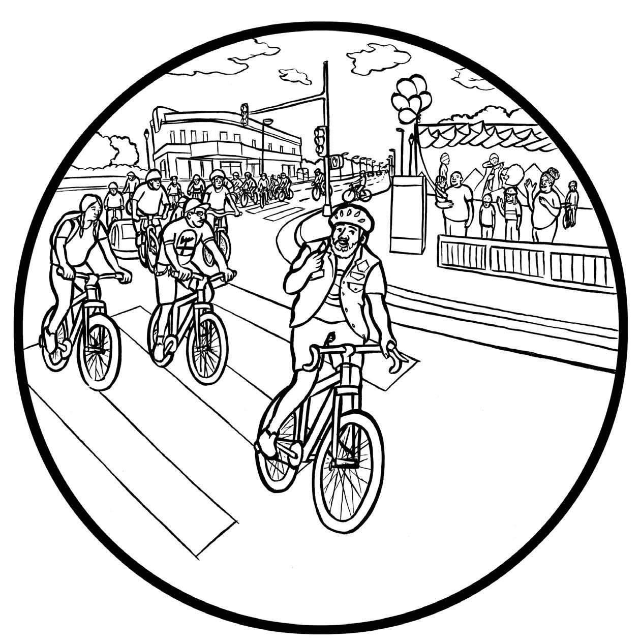
Park Avenue closed to cars during a Summer Streets event, New York City. Source: New York City Department of Transportation, 2018

Verde Landscape crew NortheastneighborhoodstreetalonginstallmembersabioswaleagreenintheCullyofPortland. Source: Living Cully, 2018

Baltimore Tree Trust plantingblockevent. Source: Baltimore Tree Trust, 2017

Literacy JusticeEnvironmentalforyouth group restores wetlands habitat at Candlestick Point Park shoreline, San Francisco Source: Victor Leung/Literacy for Environmental Justice, 2013


Often experiments need to start small and scale successes. CENTRAL THEME: Illustration: Slowing the Tenderloin's Streets through Play Street activity, as part of the Covid-19 response

SAN FRANCISCO PARKLETS ( 2021 ) Source: San Francisco Planning Department

Public spaces in the Francisco.pandemic,thedistancingallowSpacesunderDistrictMissioncreatedtheSharedProgramtoforphysicalduringCOVID-19San Source: Alison Sant, 2020

Sources; San Francisco Chronicle; Mike Anderer, Urban Alchemy
In January 2020, the number of homeless tents in the Tenderloin hovered between 100 and 150. By June 2020, there were more than 400 tents on the street.
tents400
83% Eighty-three percent of Tenderloin households do not own cars and these residents walk, bike, and take public transit instead of driving. Source: American Community Survey
residentsTenderloinrally for traffic safety on Eddy Street, San Francisco. Source: Lance Woodruff/ Dogwood + Lotus, 1988

people29 2019 twenty-nine people were killed in traffic violence in San Francisco with five of those deaths concentrated in the Tenderloin. San Francisco
In
Source: City and County of
Safe Passage corner captains help students safely cross Turk Street, San Francisco. Source: Tenderloin Community Benefit District, 2019

Author of Uneasy Peace
Patrick Sharkey
The new guardians looking out over city streets are not just public and private security guards but also residents, mobilized in new organizations specifically formed to build community life and control violence. And their presence is a crucial part of the story about how urban communities have changed over the past twenty years.”

Urban Tenderloin.cleankeepingpractitionersAlchemythestreetsinthe Source: Urban Alchemy, 2021

Urban providesAlchemytoilet and shower services for a Safe Village.Sleeping Source: Urban Alchemy, 2021

Safe Francisco.pandemic,duringunhousedprovidePractitionersUrbanhallVillageSleepingatcityhostedbyAlchemytoshelterforpeopletheCOVID-19San Source: Santiago Mejia, ©San Francisco Chronicle/Polaris, 2020

Neighbors volunteer for a community build day to create Safe Passage Park in the Tenderloin. Source: Douglas Burnham, 2021

Safe Passage Park, a block-long public Parklet in Tenderloin.the Source: Envelope, 2022


Programming publicartsactivities,physicalfreeresources,daily,SafepartnersneighborhoodbyactivatesPassageParkbringinggames,books,andintotherealm. Source: Anne Hamersky, 2022

Source: TLCBD, SFMTA, SFDPW For more information about the Tenderloin Neighborhood Safety Assessment and Plan for COVID-19 visit SFMTA.com/TLstreets SLOWING THE TENDERLOIN ’ S STREETS


Source: City of Minneapolis, Hennepin County GIS MINNEAPOLIS BIKE INFRASTRUCTURE


Midtown Greenway near Bryant Avenue South, Minneapolis Source: Hennepin County

Ton1/2 A person commuting 4 miles each way would save 1/2 ton of carbon dioxide per year by switching from driving to cycling Source: Cycling UK
The midneighborhood,Rondo-demolition to make way for the I-94 highway. Source: Minnesota Historical Society, 1956

Members of the “Committee to Paul.housingprotestingClassagainstDiscriminationEndFourthWhites"fairinSt. Source: Minnesota Historical Society, 1962

Ashwat Narayanan
Executive Director, Our Streets MPLS
Our transportation system is interconnected with every other aspect of our community and urban living. As a society, we need to afford equal opportunity to everyone and no longer allow marginalized communities to be disproportionately affected by transportation decisions.”
Memorial for George Floyd at intersectionthe of East 38th Street and Chicago Avenue, Minneapolis Source: Caroline Yang, The New York Times/Redux, 2020

26% Although Black residents make up nearly 19% of Minneapolis’ population, they account for 26% of people killed in traffic crashes. Source: City of MInneapolis
Temporary greenway created in Minneapolis.North Source: Our Streets Minneapolis, 2016

Northside Greenway pilot project Source: Hennepin County, 2016

Signs along Irving Ave. N during the Northside Greenway pilot Minneapolisprogram, Source: Bill Lindeke, 2016

Northside Greenway Now! cofounder Will Lumpkins greets riders for a community biking event. Source: Twin Cities PBS/BCBS Center for Prevention, 2019

Source: Northside Greenway Now! NORTHSIDE GREENWAY ENGAGEMENT


I’m hoping that we can be a prototype going forward for what greenways could look like, particularly because we are always coming up behind and getting the scraps. I want to be a leader in transportation and what that looks like.” Will Lumpkins Co-Founder, Northside Greenway Now!
NEW YORK CITY PILOT PROJECTS 14TH BUSWAYSTREETPILOT STREETSSUMMER 9th BIKEPROTECTEDAVENUELANE


Schwartz President, Sam Schwartz Engineering and former Traffic Commissioner, NYDOT
Sam
The urban mode of the future is not flying cars. It’s not autonomous cars. It’s not even cars. It’s bikes and shoes.”
Times Square closed to traffic reconfiguredandas a pedestrian plaza Source: Basia Kruszewska, 2009

Park Avenue closed to cars during a Summer Streets event, New York City, 2018 Source: York City Department of Transportation

A car-free busway on 14th Street in Manhattan saw a 24% improvement in travel times. Source: Alison Sant, 2022

Some
areas in New York City longmedianbetweenstrongdeserts,consideredaretransitwithacorrelationlowannualincomeandcommutetime. Source: Furman Center For Real Estate And Urban Policy; Mapnificent INCOME CORRELATED WITH COMMUTE TIME

Transit riders protest Newaffordableforfares,York Source: Todd Maisel, 2020


Higashide Author, Better Buses, Better Cities
Our transportation status quo has worsened social mobility. A long commute is one of the biggest barriers to escaping poverty.”
Steven
Cyclists using bike share in City.Brooklyn,Stuyvesant,Bedford-NewYork Source: Bedford Stuyvesant Restoration Corporation, 2017
Community Ride hosted by Black Girls Do Bike NYC, Better Bike Partnership.Share Source: Streetfilms, 2016

Community Ride hosted by Better Bike Partnership.Share Source: Bedford Stuyvesant Restoration Corporation, 2017

56% There were more than 170,000 more Citi Bike trips in StuyvesantBedford-in2016 than in 2015, and membership increased 56 percent. Source: Bedford Stuyvesant Restoration Corporation and NACTO

Systemic Racism has shaped the American urban landscape CENTRAL THEME: Illustration: Tree canopy is not equally distributed. In neighborhoods that were redlined it can be 15 20 degrees hotter on a summer day.

Until the last quarter of the twentieth century, racially explicit policies of federal, state, and local governments defined where Whites and African Americans should live.” Richard Rothstein The Color of Law: A Forgotten History of How Our Government Segregated America
LIVING WITH WATER IN NEW ORLEANS One-third of the City of New Orleans land area is wetlands, and 49% of the city lies below sea level. Source: Richard Campanella, Bienville’s Dilemma, 2008

Parts of the Seventh Ward and Gentilly district are up to four feet below sea level. RACE AND ELEVATION IN NEW ORLEANS ( 2000 ) Source: Richard Campanella, Bienville’s Dilemma, 2008

76% Orleans’s Black population made up 76 percent of Hurricane Katrina’s flood victims and accounted for 66 percent of those killed.
New
Source: Richard Campanella, Bienville’s Dilemma
inches62 New Orleans has become one of the wettest cities in the United States, with an average rainfall of 62 inches a year. Source: Richard Campanella, Bienville’s Dilemma
Community leader Angela Chalk guides the NewtheinfrastructureinstalldesignneighborhoodprocesstogreeninSeventhWard,Orleans. Source: Delaney McGuinness/Water Wise Gulf South, 2018

Volunteers install stormwater features along a demonstration block in the Seventh Ward, New Orleans. Source: Raymond Sweet/Healthy Community Services, 2020

Angela
Chalk Executive Director, Healthy Community Services
Now people can tell you about native plants, they can tell you the capacity of a cypress tree to hold water or clean the air. Everybody’s a green infrastructure specialist now.”
One-third of the City or New Orleans Land area is wetlands, and 49 percent of the city lies below sea level. NEW ORLEANS AND THE GENTILLY DISTRICT

Now, we get the opportunity to go back, to embrace water and to say, ‘New Orleans is a water city” David Waggonner, Waggonner & Ball Architecture/Environment
Jessica Dandridge Executive Director, The Water Collaborative of Greater New Orleans
Despite water being so impactful in our lives, it is not something that people understand… Just like in Louisiana, it’s mandated that we have to learn about the state’s history, it should be mandated that we have to learn about our own ecology.”
ST. ANTHONY GREEN STREETS COMMUNITY PROCESS


Youth spray paint stencil mock-ups of new green infrastructure in St. Anthony Green Streets Orleans.visioningcommunityevent,New Source: Batture, 2020

If we invest in our capacity to wrestle with the hard questions we face as a community, then we can create a set of guidelines that tell us what we should be investing in.” Aron Chang Community Engagement Lead, St. Anthony Green Streets
Verde Landscape crew NortheastneighborhoodstreetalonginstallmembersabioswaleagreenintheCullyofPortland. Source: Living Cully, 2018

Cully Park, built by Verde and Portland Parks & Recreation in Northeast Portland. Source: 2.ink Studio Landscape Architecture, 2018

Our crews came from the community. They were able to get trained on these public projects, but eventually they got to work everywhere in the city.” Ricardo Moreno Program Manager, Verde
billion2.3 In 2020, Portland’s green roofs, green streets, stormwater facilities, trees, and disconnected downspouts were managing 2.3 billion gallons of stormwater Source: Matt Burlin, Portland Bureau of Environmental Services
Guerilla signage for the Oaks Bottom Wildlife Refuge. Source: Michael Houck

Michael
Houck Co-Author, Wild in the City
Sometimes you need a little guerrilla activity when you go up against a bureaucracy that is resistant to changing policy.”
PORTLAND’S WATERSHEDS Source: Portland Bureau of Environmental Services

TABOR TO THE RIVER WATER CYCLE Source: Portland Bureau of Environmental Services

Rain Portland.RetrofitPrivateyardresidentialinstalledgardeninfrontaspartofthePropertyProgram, Source: Alison Sant, 2017

Portlanders join in an annual swim across Willamettethe River, Portland. Source: City of Portland Bureau of Environmental Services/Diane Dulken, 2017

Matt Burlin
Environmental Program Coordinator, City of Portland
When you have a river that runs right through the center of the city, it doesn’t take long for people to realize that it’s part of where they are. So, if you take care of your lawn, sidewalk, or street, plant trees, and support local initiatives to protect fish and wildlife habitat, then maybe you’ll be able to swim in the Willamette River in July!”
Philadelphia set the ambitious goal to green a third of the existing city.landscapeimperviouswithinthe Source: Steinberg et. al. for Philadelphia Parks and Recreation; City of Philadelphia POTENTIAL SITES FOR GREEN INFRASTRUCTURE


PHILDELPHIA’S PERVIOUS SURFACE GOALS When mapping sites to create pervious surfaces for andlots,includingunderusedthancityinfrastructure,greentheidentifiedmore5,600acresoflandvacantschoolyards,parks. Source: Steinberg et. al. for Philadelphia Parks and Recreation; City of Philadelphia


26% Twenty six percent of Philadelphians live below the poverty line and the city’s majority Black population is twice as likely to be considered working poor as their White neighbors. Source: Pew Trusts
Deputy Water Commissioner, Philadelphia Water Department
We’ve modified the urban landscape to a point where people don’t really know what water resources the regulatory community is trying to protect.”
Marc Cammarata
Outdoor class meets in their Philadelphia.School,JohnschoolyardgreenedattheM.Patterson Source: Jenna Stamm, courtesy of the Trust for Public Land

Police officer patrols the Lanier Playground at 29th and Tasker Streets, Philadelphia. Source: Philadelphia Evening Bulletin, Temple University Libraries, 1979


Philadelphiareopening,playgroundLaniergatheringNeighborhoodforPark Source: Philadelphia Parks and Recreation, 2018
Lanier Park opening celebration Source: Trust for Public Land, 2018

Folks came together for the first time. They got to see that although they thought there were big differences between them, there were actually many similarities. Everybody wanted safety. They wanted green space. They wanted something open and accessible for all.”
Danielle Denk Manager,
Program
TPL Parks and People Program
enjoyingwalkingNeighborhoodgroupabreak at Lanier Park Source: Trust for Public Land, 2018


Climate action is an opportunity to create more equitable and livable cities. CENTRAL THEME: Illustration: Two hundred formerly incarcerated people are employed to dismantle abandoned homes and salvage the wood they are built from in the Baltimore Wood Project

64% Between 1973-1997 there was a 64 percent decrease in Washington, DC’s tree cover. Source: Jill Jonnes, Urban Forests
From the perspective of the 30-meter resolution available at the time, one image was predominantly green, the other looked like a tornado had ripped through a majority of the nation’s capital.”
Ian Leahy
Vice President of Urban Forestry, American Forests
In 2011 Washington, DC adopted a 40% tree canopy goal. Source: Casey Trees, Washington Parks and People URBAN TREE CANOPY COVER TIMELINE

tons681,000 Achieving a 40 percent tree canopy will mean that trees in the District will sequester 547 tons of air pollutants and store 681,000 tons of carbon every year. Source: American Forests
Anthony Williams
If we can’t take care of our trees, how are we going to take care of our schools? How are we going to take care of our roads? Trees are a metaphor of public space. That’s what we’re fighting for—vital, robust public spaces.”
Former Mayor of Washington, DC
Josephine Butler
confronts Mayor Marion Washington,Barry,DC. Source: Nancy Shia, 1978

Josephine
Butler Founder, Washington Parks and People
A rock, a river, a tree a park for all people.”
participatingChildren in Washington Parks and People Community Harvest Program at the Marvin Gaye Greening Washington,Center,DC. Source: Washington Parks and People

Washington Parks and People’s DC Green Corps Cohort. Source: From the film City of Trees/Meridian Hill Pictures

Growing up, I learned all the wrong things. I get a second chance. Some people don’t, living the life I used to live.” Michael Samuels Washington Parks and People Trainee
NEW YORK CITY NATURAL AREAS In New York City, more than 40 percent of land cover is green. Source: Natural Areas Conservancy, 2018

Source: Natural Areas Conservancy NEW YORK CITY NATURAL AREAS


Volunteer planting a tree event.MillionTreesNYCat Source: New York Restoration Project/Anna Yatskevich, 2015

Tree census workers measuring trunk diameter in the Bronx, New York City. Source: New York City Department of Parks and Recreation, 2015

We had a phone answering machine, and people would call, and we’d write down their names. I developed the training, the tools, the techniques, and we put all the data into a digital tree management system. It was the first time we could actually say approximately how many trees we had.
Fiona Watt, Former Director of Central Forestry, NYC Parks
90º F Since 2010, temperatures in New York City have been above 90 degrees Fahrenheit an average of eighteen days a year, killing between two hundred and six hundred people annually. Source: National Weather Service, New York City Environmental Justice Alliance
Sarah ExecutiveCharlop-Powers,Directorofthe
Natural Areas Conservancy
There are people who think that every acre of the forest should be functioning in a pristine way, dominated by native species, with lots of big old trees and little saplings. Some folks think cities are human constructs and that people inevitably impact the nature in them. Something in the middle should be the goal. We need to balance the human experience, biological preservation, and ecosystem benefits. My feeling is that in many cases, those things are aligned.”
1937 SecurityResidentialMap Source: Johns Hopkins Sheridan Libraries

º16 On a hot day in 2018, 103 degrees Fahrenheit were measured in redlined East Baltimore. In treelined West Baltimore, street temperature was 87 – 16 degrees less. Source: Dr. Vivek Shandas, Portland State University
Baltimore Tree Trust plantingblockevent. Source: Baltimore Tree Trust, 2017
30,000 As of 2018, more than 30,000 properties in Baltimore were vacant buildings or lots. Source: City of Baltimore Department of Planning
Details BaltimorehousesabandoneddeconstructEmployeesrowinEast Source: Doug Kapustin, 2014

We have pockets in the City of Baltimore where we folkshavein those neighborhoods, there was no on ramp to that employment highway. Our job is to create the on Jeff Carroll Chief executive officer, Urban Wood Economy Details Ave,houseremovedpreparingemployeeboardsfromaonMcKeanBaltimore. (2018) (Source: Jenny Braudaway, Humanim).

800,000 Brick+Board has salvaged 1,500,000 bricks and 800,000 feet of lumber boards since inception in 2015. Source: Vibrant Cities Lab and Jeff Carroll, Humanim
BALTIMORE WOOD PROJECT DECONSTRUCTION Source: City of Baltimore, Baltimore Tree Trust, USDA Forest Service

Carroll CEO
Jeff of Urban Wood Economy
We took down more than sixty houses in that neighborhood, including thirty-five in a row on Eager Street that was turned into an urban forest. Now it’s a beautiful park with big tables for picnics, and it is planted with trees. It’s gorgeous.”

The most effective solutions are born out of the communities they serve. CENTRAL THEME: Illustration: Gentilly Resilience District in New Orleans worked with community groups to prototype green infrastructure projects

Dr. Katharyn Boyer collects eelgrass at Point San Pablo as a part of the Living project.Shorelines Source: Stephanie Kiriakopolos, Courtesy of Bay Nature, 2014


SAN FRANCISCO BAY NATURE - BASED ADAPTATION STRATEGIES The San Francisco Bay requires an estimated 100,000 acres of wetlands to provide for ecosystemshealthyand adapt to sea-level rise. Source: SFEI, SPUR, Save the Bay

SAN FRANCISCO BAY AREA COMMUNITY VULNERABILITY Source: BCDC, SFEI


BAYVIEW – HUNTERS POINT SHORELINE PARKS The India Basin shoreline is being transformed into a 64-acre network of parklands and open spaces HuntersthroughrunningBayviewPoint Source: San Francisco Recreation and Parks Department

Liz Ogbu speaking with Linda Fadeke Richardson in the NOW Hunters Point listening booth, San Francisco Source: Anne Hamersky, 2015

Jacqueline Flin, Executive director of the A. Philip Randolph Institute at the future India Basin Shoreline Park site, San Francisco Source: Alison Sant, 2020

Executive Director, A. Philip Randolph Institute
“With this park coming, there will be change.
Jacqueline Flin
Instead of pretending like that won’t happen, we want to make sure that the park is developed for the existing community to feel like the park is theirs... It’s a huge opportunity to start to address some of the social impacts that have been such a challenge to this neighborhood.”
The premise of our equitable development planning efforts around India Basin is to improve a community through a wonderful park project that strengthens the fabric of the existing community rather than threatens it.”
Phil Ginsburg General Manager, San Francisco Recreation and Park Department
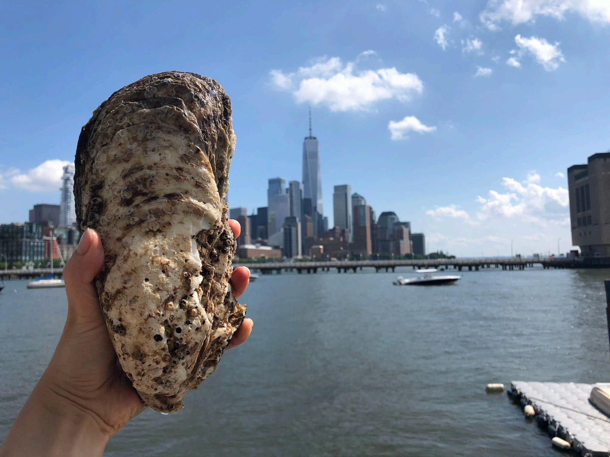
New York Harbor School YorkBridgegrowthmeasuringstudentsoysterinBrooklynPark,NewCity. Source: Benjamin Von Wong, 2017

When Europeans first arrived, they talked about there being so many seabirds that you couldn’t see the sky and so many fish you couldn’t see the surface of the water.”
Peter
Malinowski Executive Director, Billion Oyster Project
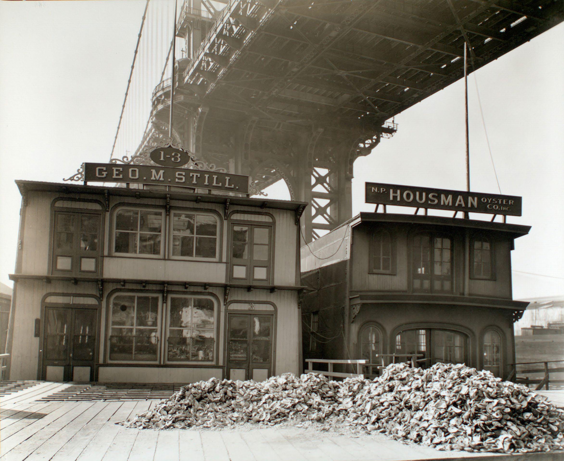
Oyster shell mounds in front of oyster houses, South Street and Pike Slip, Manhattan Source: Berenice Abbot/New York Public Library, 1937
Hudson River Foundation
Lodge
Senior Scientist,
If you go back a thousand years, I believe that oysters may have created a protective layer to the shore by reducing wave energies and changing the way that sediment moved and was trapped behind them.”
James
Billion Oyster Project City.Park,atinstallingvolunteersareefBushTerminalNewYork Source: Katie Mosher, Billion Oyster Project, 2019

Gabions filled with oyster collectedshells,from New York restaurants, are used in a restoration site near the Tappan Zee Bridge, New York Source: Rosie Cohe/Billion Oyster Project, 2018
BILLION OYSTER PROJECT REEF LIFE CYCLE Source: Billion Oyster Project

pounds8,000 Eight thousand pounds of shell per week are collected constructedusedinrestaurantsapproximatelyfromseventyandcuredagiantmoundtobeassubstrateforreefsystems. Source: Peter Malinowski, Billion Oyster Project
An Cityfoundlargestlive8.6-inch-longoyster,theoysterinNewYorkinmorethan a hundred repairspilingdiscoveredyears,onaduringtoPier 40 in Hudson River Park, New York City Source: Melissa Rex, Riverkeeper, 2018
fieldfootball1 Today, Louisiana loses one football field of wetlands approximately every hour and a half. Source: Environmental Defense Fund
people65,000 More than Louisianans65,000living below six feet are socially vulnerable, including 60,000 people of color, and have limited resources to prepare for, respond to, or recover from natural disasters. Source: Climate Central
SOUTHEST LOUISIANA LAND LOSS 1960 – 2067 It is estimated that nearly 70 percent of wetlands loss is due to the infrastructure of extraction.hydrocarbon Source: LA SAFE; Waggonner & Ball Architecture/Environment; Coastal Protection Restoration Authority, 2017
Scientists predict that by 2070 some coastal communities in Louisiana could experience flooding of at least six feet above the tideline every year. Source: Scott Olson/Getty Images, 2019

In 2017, seventy-one LA SAFE place,workshopsplanningtookinvolving as many as five hundred people. Source: State of Louisiana Office of Community Development, 2017


Aerial view of Isle de Jean sincepercentexperiencedislandLouisiana.Charles,Thehasa98landloss1955. Source: State of Louisiana Office of Community Development, 2017
UPLAND MIGRATION IN LAFOURCHE PARISH People living in settlements in South Lafourche accommodatedevelopedprototypesResilientonreceivingtoeventuallywillbepushedresettleincommunitieshigherground.housingarebeingtothem. Source: Mathew Sanders, State of Louisiana

Liz
Williams Russell Climate Justice Program Director Foundation for Louisiana
If you give people the space and time to talk about their personal experience in connection with horrifying data, because they’ve seen those changes already, they make smart decisions.”
Walk, bike or take public transit and support local advocacy groups to make streets safe for everyone. ACTIONS FOR CHANGE: Cyclists in the Twin Cities. Source: Minnesota Historical Society, circa 1940

Neighborhood Tree Corps member helps care for city street trees in Bedford Stuyvesant, Brooklyn. Source: Magnolia Tree Earth Center, Courtesy of Brooklyn Public Library, 1970
Pay attention to your watershed. Volunteer to plant trees and grow green infrastructure in your community. ACTIONS FOR CHANGE:

Get involved with local restoration projects in your city’s public parks. ACTIONS FOR CHANGE: Save the Bay activists fishing on San Francisco Bay. Source: Save the Bay, 1970s

Eloise Westbrook, resident of Bayview Hunters Point, speaks at a public meeting. Source: Joe Rosenthal/UC Berkeley Bancroft Library, 1972
Listen! We all need to be involved in efforts to make cities climate resilient and equitable. ACTIONS FOR CHANGE:

“A Look at the Human Impact of Parklets,”
“GroundplayEquitablebike share means building better places for people to ride,” National Association of City Transportation Officials, July 2016 “The Five Borough Bikeway: Critical infrastructure connecting New York City,” Regional Plan Association, June 2020 Video PBS Minneapolis: Building Health Equity: Northside Greenway on YouTube
RESOURCES
Patrick Sharkey, Uneasy Peace: The Great Crime Decline, the Renewal of City Life, and the Next War on Violence
Janette Sadik-Khan and Seth Solomonow, Streetfight: Handbook for an Urban StevenRevolutionHigashide, Better Buses, Better Cities: How to Plan, Run, and Win the Fight for Effective Transit Part 1: Reclaim the Streets Reports
Eric Klinenberg, Heat Wave: A Social Autopsy of Disaster in Chicago Evan Friss, The Cycling City: Bicycles and Urban America in the 1890s
Books

P.E. Moskowitz, How to Kill a City: Gentrification, Inequality, and the Fight for the Neighborhood Robert C. Brears, Blue and Green Cities: The Role of Blue-Green Infrastructure in Managing Urban Water Resources Video Portland Bureau of Environmental Services: Foster Floodplain Natural Area Celebration on YouTube Reports Wise 7th Ward,” Water Wise Gulf South “2020 Stormwater Management Manual,” Portland Bureau of Environmental Services, April et al., “Green2015: An Action Plan for the First 500 Acres,” PennPraxis for Philadelphia Parks and Recreation, December 2010
Part 2: Tear Up the ConcreteBooksRESOURCES
“Water
Harris2021Steinberg
Marisela B. Gomez, Race, Class, Power, and Organizing in East Baltimore: Rebuilding Abandoned Communities in America
Part 3: Plant the City
Eric Klinenberg, Palaces for the People: How Social Infrastructure Can Help Fight Inequality, Polarization, and the Decline of Civic Life Video Baltimore Wood Deconstruction on Youtube Reports “Tree Equity Score,” American Forests
Erika S. Svendsen et al., “Stewardship Mapping and Assessment Project: A Framework for Understanding CommunityBased Environmental Stewardship,” USDA Forest Service, Northern Research Station, January 2016 Mike Galvin, J. Morgan Grove, Sarah Hines, and Lauren Marshall, “The Urban Wood Workbook: A Framework for the Baltimore Wood Project,” USDA Forest Service, April 2020
BooksRESOURCES
Sonja Dümpelmann, Seeing Trees: A History of Street Trees in New York City and Berlin
Jill Jonnes, Urban Forests: A Natural History of Trees and People in the American Cityscape
Part 4: Adapt the ShorelineBooksRESOURCES Richard Rothstein, The Color of Law: A Forgotten History of How Our Government Segregated America Elizabeth Rush, Rising: Dispatches from the New American Shore Video PBS Newshour: Can students return a billion oysters to a New York harbor? On Youtube Reports Julie Beagle et al., “San Francisco Bay Shoreline Adaptation Atlas: Working with Nature to Plan for Sea Level Rise Using Operational Landscape Units,” San Francisco Estuary Institute and SPUR, April 2019 “Oyster Gardening Manual”, Billion Oyster Project, August 4, 2014 “Our Land and Water: A Regional Approach to Adaptation,” LA SAFE, last modified April 2019
SELECT VIDEOS


