
Issue 2 March 2017 BRIDGE FAILURE: WEIGHING THE ODDS CONNECTED, DYNAMIC, VIBRANT: MAKING TRANSPORT WORK THE TEN TRENDS
2017
ROAD - RAIL - AIRPORT - PORT - URBAN - UTILITY
THAT WILL SHAPE
SMARTER RAILWAYS FOR OUR GROWING CITIES


AS AUSTRALIAN INFRASTRUCTURE PROGRESSES, WE’RE PROUD TO PARTNER WITH THE CONTRACTORS
ARE LEADING
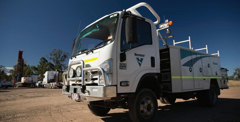
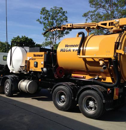
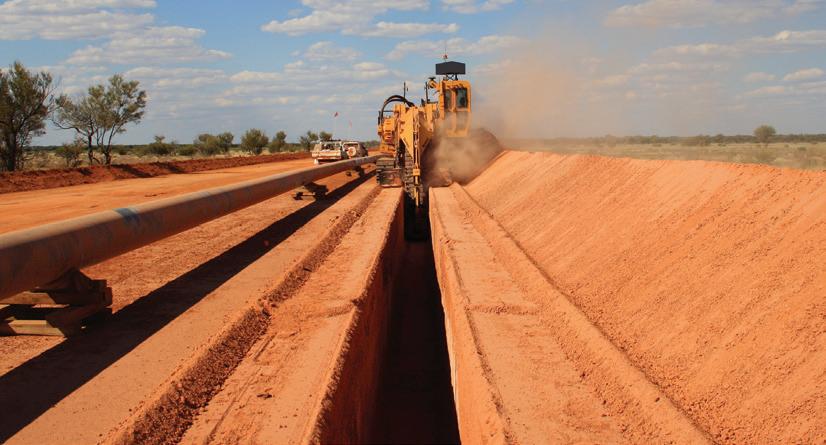
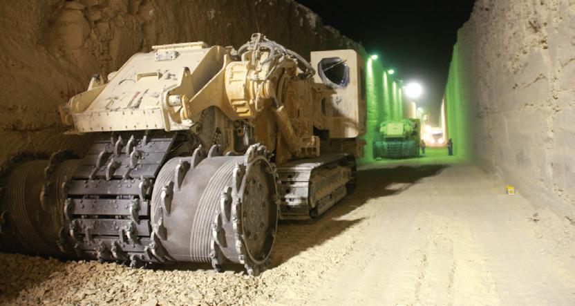
WAY. ROAD RAIL AIRPORT UTILITY VERMEER Vermeer and the Vermeer logo are trademarks of Vermeer Manufacturing Company in the United States and / or other countries. © 2015 Vermeer Australia. All Rights Reserved. CONSTRUCTION EQUIPMENT SOLUTIONS FOR AUSTRALIA’S INFRASTRUCTURE INDUSTRY / VermeerAustralia VERMEER.COM.AU | 1300 VERMEER
THAT
THE

Published by
Monkey Media Enterprises
ABN: 36 426 734 954 PO Box 1763
Preston South VIC 3072
P: (03) 9988 4950
F: (03) 8456 6720
monkeymedia.com.au info@monkeymedia.com.au infrastructuremagazine.com.au news@infrastructuremagazine.com.au
Editor
Laura Harvey
Associate Editor
Jessica Dickers
Contributing Editor
Michelle Goldsmith
Journalists
Jesse Tyler
Lauren Cella
Marketing Director
Amanda Kennedy
Marketing Associate
Mathew Walker
Marketing Consultants
Aaron White
Steven Golding
Production and Customer Service
Titian Bartlau
Senior Designer
Alejandro Molano
Designer Jacqueline Buckmaster
Publisher Chris Bland
ISSN:
EDITOR’S WELCOME
The new year may only be a few months old, but already we’ve seen new developments across the entire infrastructure sector which should embolden us for a productive year ahead.
In February, Infrastructure Australia updated its priority project list for 2017, and with it came a stern warning to our state and federal governments: invest in these critical projects now, or pay the price down the track, when costs will blow out significantly.
The newly revised Infrastructure Priority List identifies 100 major infrastructure proposals that have substantial strategic merit and national importance, featuring projects in urban centres and across the country that will improve connectivity and productivity. It now includes seven High Priority and eleven Priority Projects and the highest ever number of projects with approved business cases.
Notable inclusions on the list include a proposal to renew central Hobart through the relocation of the University of Tasmania's STEM facilities to the CBD; the Northern Road Upgrade, an important project in the Western Sydney Priority Growth Area; and the progressive upgrade of the Bruce Highway in Queensland.
Of course, as we know, it’s not just the new build projects that define this industry – the way we update our existing infrastructure has an equally important impact on the successful functioning of our society into the future.
This reality will become more and more important in 2017 and beyond, as our metropolitan populations grow significantly, placing increased demand on the services and facilities that serve these communities.
Looking beyond our own backyard, globally we’ve experienced major political upheaval in the last twelve months, and we need to be cognisant of the fact that there will be repercussions for the infrastructure industry.
Brexit, Trump, and here in Australia, the rise of independents and minor

political parties such as One Nation, highlight the fact that globally, communities are increasingly divided. Research shows the division can be attributed to factors like geographic location, employment opportunities and household income.
What impact will this have on the infrastructure sector? While the current political climate will encourage politicians to favour projects which appeal to individual communities, the challenge to us, as an industry, is to continue to champion the projects and developments focused on the “greater good” – while also easing local concerns about the value they will personally see.
It’s not a simple task – but it’s a task I believe the people of this industry are equipped to handle.
On another note, I wanted to comment on the pleasing response we’ve had to Issue 1 of the magazine. I received considerable feedback from happy readers, which is always nice, but most importantly, I’m pleased we’re providing the industry with another worthy vehicle for news, insights and opinions on infrastructure in Australia.
Our audience for Issue 2 has already grown significantly, and we’re looking forward to taking this issue to a number of events around the country, including the Austroads Bridge Conference in Melbourne from 3-6 April. I hope to meet as many of you there as possible.
Laura Harvey Editor
2 March 2017 // ISSUE 2 www.infrastructuremagazine.com.au INFRASTRUCTURE
Issue 2 March 2017
2206-7906
WEIGHING THE ODDS CONNECTED, DYNAMIC, VIBRANT: MAKING TRANSPORT WORK THE TEN TRENDS THAT WILL SHAPE 2017 SMARTER RAILWAYS FOR OUR GROWING CITIES ROAD RAIL AIRPORT PORT URBAN UTILITY
BRIDGE FAILURE:
keen to hear your thoughts
feedback on Infrastructure Drop me a line at laura.harvey@monkeymedia.com.au
call me on 03 9988 4950 to let me know what you think.
I’m
and
or feel free to
SUPPORT FROM THE GROUND UP

With Queensland and Northern Territories largest range of paving equipment, parts, service and training, Hastings Deering is committed to supporting you from the ground up.
We are focused on building relationships that extend well beyond machines. That means sharing our expertise to help you select, acquire, operate and maintain your paving equipment, then standing by your side to keep that equipment – and your business – running smoothly. Invest with confidence knowing it’s more than just parts, service and support. It’s a partnership designed to deliver more for you.
Call 1300 861 370 or visit hastingsdeering.com.au/paving


BRIDGES
VERSATILE WATERPROOFING FOR BRIDGE PROTECTION
Asset owners have long been aware that deterioration of bitumen on bridges, if left unchecked, can lead to numerous safety issues and expose the structure to costly corrosion and reduced service life.
BRIDGE TRAFFIC LOADING – THE CINDERELLA IN BRIDGE SAFETY EVALUATIONS
To avoid unnecessary bridge strengthening, everybody is looking for more accurate safety calculations.
GREENING THE GREYFIELDS
New research into how we develop our cities has highlighted the hidden potential of middle-ring suburbs, which offer significant potential for growth via urban infill.
SPATIAL DATA: CRACKING THE CODE FOR PLANNING SUCCESS
Our built environment is complex, and understanding how it functions is critical for future development.
PUTTING TECHNOLOGY TO THE TEST
As a contractor, making the initial investment in expensive technology can be a hard call.
THE SPATIAL DATA REVOLUTION IS HERE
There’s no doubt Google Maps is good for travel directions, but what if your organisation could also use online mapping tools to quickly assess where new infrastructure is required, or where existing infrastructure could be improved?
SWING
Until now, swing boom excavators haven’t been able to enjoy the benefits that GPS guidance brings to more conventional excavators, due to the fact that it’s difficult to make a GPS system work accurately on a swing boom excavator.
SMARTER RAILWAYS FOR OUR GROWING CITIES
New York, London, Tokyo – countless cities in all parts of the world showcase that well-performing metro railways can solve commuting problems that are no longer controllable with individual car traffic
ASSESSING RECORD LEVELS OF INFRASTRUCTURE: APPLICATION TIPS
The NSW Government is investing a record $73.2 billion over four years in new hospitals, schools, roads, public transport and other vital infrastructure across the state.
ARE CITIZEN JURIES THE ANSWER TO SUCCESSFUL DECISION MAKING?
It’s no secret that infrastructure decision making has often led to inefficiency and community distrust, and many communities have a lack of respect for the project selection and decision making process.
GETTING THE TRANSPORT INFRASTRUCTURE MIX RIGHT
It is time we move away from roads as a key infrastructure focus – we need to look to embrace balanced mobility oriented public transport.
AUSTRALIA’S INFRASTRUCTURE: ARE OUR PRIORITIES IN CHECK?
With so many projects competing for state and federal funding, it can be easy to wonder if our priorities are in check. Infrastructure Australia answered this very question when it released an update to the Infrastructure Priority List in February.
4 March 2017 // ISSUE 2 www.infrastructuremagazine.com.au CONTENTS
13 14 SIGNALLING, TRACKING AND CONTROL SYSTEMS
BOOM EXCAVATORS FINALLY
GPS GUIDANCE
GET
32 POLICY 36 40 44 46 SPATIAL & GIS
18 22 26 28 30


Roads are critical infrastructure, and monitoring and understanding the condition of our roads is of vital importance. Infrastructure Editor Laura Harvey caught up with Richard Wix, Technical Specialist with the Australian Road Research Board.
A TALE OF TWO RAILWAYS: WHERE DO OUR BEST INTERESTS LIE?
There’s been a lot of talk in the media about the idea of building a Very Fast Train network between Melbourne and Brisbane, but what’s not talked about enough is the impact of Inland Rail.
MULTI-DISCIPLINARY OFFERING THE ANSWER FOR EFFICIENT CONSTRUCTION
Recently established telecommunications and civil company, Accelerate Civil, has expanded into drilling after it saw a gap in the Mackay market.
DYNAMIC, VIBRANT: MAKING
In Victoria, sweeping changes are currently happening across the entire transport network. WHY ROADS OF THE FUTURE NEED TO EMBRACE DISRUPTION
In the world of infrastructure, there are very few sectors that aren’t facing significant disruption, and for the roads and pavements sector, it’s no different.
Should we be allowing international investors to take ownership stakes in our critical infrastructure?
5 www.infrastructuremagazine.com.au March 2017 // ISSUE 2 CONTENTS CONDITION MONITORING
MAINTENANCE
AND
48
ROAD REGULARS 02 EDITOR’S WELCOME 06 CONTRIBUTORS 80 ADVERTISERS’ INDEX 80 FEATURES SCHEDULE CONNECTED,
TRANSPORT
INFRASTRUCTURE WORK
62 58 NEWS MANAGING THE COLLISION OF REAL AND VIRTUAL WORLDS
we focus on the transition of our transport infrastructure to automated operation, innovators in other virtual territories have other plans. 64 Big ideas forum UNDERSTANDING WHAT LIES BENEATH OUR WHEELS
While
52 56 08 AIRPORT INFRASTRUCTURE SUPPORTS PASSENGER GROWTH 09 AUSTRALIA’S TALLEST TIMBER BUILDING TO BE CONSTRUCTED 10 PARRAMATTA LIGHT RAIL ROUTE SELECTED 11 BRINGING ASSET MANAGEMENT TOGETHER 12 NEW ROAD SAFETY INNOVATIONS TO BE TESTED 78 SOFTWARE, COMMUNICATIONS AND CONNECTIVITY TRENDS AIRPORT THE TEN TRENDS THAT WILL SHAPE INFRASTRUCTURE IN 2017 THE PEOPLE BRINGING OUR MOST COMPLEX AVIATION PROJECT TO LIFE 68 72 LOGISTICS

Eugene OBrien
Dr Norman Pidgeon
Principal, Intelligent Transport, Nous Group
Dr Norman Pidgeon is a highly experienced technology strategist, drawing on a broad span of technology management and consulting roles to specialise in the application of intelligent transport systems and solutions. For five years, he was Head of ITS for Transurban Limited, leading the development of toll-road technology and charging systems for projects in Australia and North America. Over the last eight years, as a Principal in Nous Group and now Future Reach, he has been a trusted senior advisor to transport operators and development organisations across Australia and New Zealand. As a past President of ITS Australia, he guided the organisation through a period of transition and growth. He led the bid team that won the right to hold the 23rd ITS World Congress in Melbourne in 2016.
Professor of Civil Engineering, University College Dublin
Eugene OBrien is former president of the International Society of Weigh-In-Motion and has won the cross-modal award in the EU Champions of Research competition, 2014. He is professor of Civil Engineering at University College Dublin where he has been working recently on bridge traffic loading and bridge condition monitoring. Prof. OBrien has supervised 28 PhDs to completion, published 100 journal papers, 200 conference papers and two books.

Richard Wix
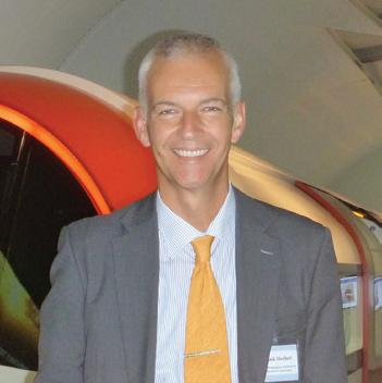
Dr Frank Heibel
Technical Advisor, Melbourne Metro and Sydney Metro
"Doc Frank", as he is known in the railway industry, is the founder and director of a leading strategic consultancy for high-performance signalling. He is responsible for planning the rollout of Automatic Train Control in Perth and also holds advisory roles for the transport megaprojects Sydney Metro and Melbourne Metro Rail. Previous roles include management of nine-figure signalling projects for mining companies Roy Hill and Fortescue and 20 years with various global signalling supply companies across three continents.
Technical Specialist, Australian Road Research Board
Richard joined the Australian Road Research Board (ARRB) in 1990 and presently holds the position of Technical Specialist in the Systems Division, where he is involved in the measurement of the functional and structural condition of pavements. His role includes identifying and integrating new technologies into ARRB’s road survey platforms to help road agencies manage their road networks better. He has a good understanding of their needs, having worked closely with several road agencies here in Australia and overseas. Richard is also a member of several international groups that help him keep up to date with the latest developments in automated pavement condition data collection technologies from around the world.

6
Contri
butors


James Stewart, Stephen Beatty and Julian Vella
KPMG Global Infrastructure
James Stewart joined KPMG in May 2011 as Chairman of KPMG’s Global Infrastructure practice. Since joining the firm, he has visited over 45 countries to discuss their infrastructure investment plans and major projects. Prior to joining KPMG, James was based in the Treasury as the CEO at Infrastructure UK (IUK) and CEO at Partnerships UK. Steve Beatty is the Americas and India Regional Leader of KPMG's Global Infrastructure business, and the Chair of KPMG's Cities Global Centre of Excellence. He is a Partner with KPMG in Canada and previously led the Canadian Infrastructure Advisory practice. Julian is the Asia Pacific Regional Leader for KPMG’s Global Infrastructure Practice. Previously, he developed and led KPMG Australia’s infrastructure practice and was a Board member of KPMG Australia for six years.
David Gainsford
Technical Director Planning and Environment Services, Transport for NSW
David Gainsford has more than 20 years of experience in environmental planning with particular expertise in assessment and transport infrastructure proposals for NSW. For the last two years, David has overseen the assessment of major infrastructure applications across the state in his role as Executive Director of Priority Projects at the NSW Department of Planning and Environment. This experience has included considering significant proposals such as Australia’s largest road project, WestConnex, and the Sydney Metro train line, which will tunnel beneath Sydney Harbour to connect commuters. David’s long-term public service experience in varied government agencies and departments, working with infrastructure, has given him detailed understanding of consulting with communities on public projects.

Luke Donnellan

Victorian Minister for Roads, Road Safety and Ports
Luke Donnellan is the Victorian Minister for Roads, Road Safety and Ports. Luke holds a Bachelor of Commerce from the University of Melbourne. After finishing university, he worked in the finance industry as a client services manager involved in tax finance and property advice. He also worked as a finance adviser as well as in marketing and strategic planning.
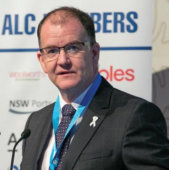
Michael Kilgariff
Managing Director of the Australian Logistics Council
Michael Kilgariff is the Managing Director of the Australian Logistics Council (ALC).
ALC is the peak national body representing the major and national companies participating in the Australian logistics industry, with a focus on national supply chain efficiency and safety. Since his appointment to the position in 2009, Michael has worked closely with industry and government to elevate the needs of freight efficiency and safety. Michael holds a degree in Economics from the Australian National University, and is a Graduate of the Australian Institute of Company Directors’ diploma and advanced diploma courses.
7

Recent data from the Bureau of Infrastructure, Transport and Regional Economics (BITRE) highlight the critical importance of Australia’s airports in supporting growth in the numbers of passengers and freight being moved by aviation.
AIRPORT INFRASTRUCTURE SUPPORTS PASSENGER GROWTH
The Australian Airport Association (AAA) CEO Caroline Wilkie said the ongoing program of investment in aeronautical infrastructure at metropolitan and regional airports was making a significant contribution to the Australian economy and the productivity of the aviation sector.
According to the Bureau of Infrastructure, Transport and Regional Economics (BITRE) latest report on domestic aviation activity for December 2016:
♦ There were 5.33 million passengers carried on Australian domestic commercial aviation during December 2016, which was a 1.1 per cent increase on December 2015
♦ For the year ending December 2016, there were 58.93 million regular passenger transport (RPT) passengers, which was a 2.5 per cent increase on the previous year
♦ Melbourne-Sydney was Australia’s busiest domestic air route in December 2016 with 731,536 passengers, the equivalent of 23,791 passengers travelling on the route every day of the month
♦ The second busiest route was Brisbane-Sydney with 406,843 passengers, followed by Brisbane-Melbourne with 311,657 passengers
♦ The biggest percentage increase in RPT passenger numbers compared to December 2015 was on the Hamilton Island-Melbourne route which grew by 23.4 per cent
♦ There were large increases on other routes, including Melbourne-Sunshine Coast (up 15.4 per cent), Ayers Rock (Uluru)Sydney (up 15.3 per cent), Hamilton Island-Sydney (up 12.8 per cent) and Ballina-Sydney (up 12.1 per cent)
The vital role of regional airports was highlighted by the fact they accounted for almost 40 per cent of total domestic passenger movements in December 2016. There were 2.06 million domestic passenger movements through regional airports for the month, which was an increase of 1.3 per cent on December 2015.
Aviation and airports also make a significant contribution to the domestic freight task, especially for the movement of high value, time sensitive goods.
Total cargo movements at Australian airports on domestic RPT flights were 40,900 tonnes which was a 22.2 per cent increase compared to December 2015.
Melbourne was the busiest airport for domestic RPT cargo in December 2016, accounting for 28.7 per cent of total cargo, followed by Sydney, Perth, Brisbane and Adelaide. More than 435,000 tonnes of cargo were carried on domestic RPT services during 2016, a 20 per cent increase on the previous year.
Fixed-wing charter operators carried 188,960 passengers in December 2016 which was a decrease of 11.5 per cent on December 2015. Perth is Australia’s busiest airport for charter activity, accounting for 39.4 per cent of all charter passengers in Australia.
March 2017 // ISSUE 2 www.infrastructuremagazine.com.au 8 NEWS
AUSTRALIA’S TALLEST TIMBER BUILDING TO BE CONSTRUCTED
Construction of the tallest timber building in Australia will go ahead in Brisbane, following a deal between developer Lendlease and the Impact Investment Group (IIG).
The building, known as 5 King, was acquired by IIG in its second commercial building acquisition in the $2.9 billion Brisbane Showgrounds redevelopment.
At a height of almost 45m, 5 King will be the tallest engineered timber building in Australia and the tallest and largest engineered timber office building by gross floor area in the world.
The innovative building will be the future home of global engineering firm Aurecon, with the company committing to lease four of the nine office floors.
Designed by architect Bates Smart and with engineering services provided by Aurecon, the ground plus nine-storey tower includes three bespoke ground level retail tenancies.
5 King will be built using a revolutionary building timber called cross laminated timber (CLT) and
glulam (glue laminated timber), which has a structural strength akin to the traditionally used concrete and steel.
The typical commercial floor plate will comprise 1,588 square metres of net leasable area (NLA), with a total area of 14,921 square metres (NLA) over ten levels.
Kylie Rampa, Lendlease’s Chief Executive Officer, Property, Australia said Lendlease was extremely proud of its partnership and collaboration with IIG and Aurecon to deliver the next generation of sustainable workplaces in Queensland.
“5 King is the latest example of high-performance workplaces setting new benchmarks in environmentally sustainable building practices.
“The office building will offer tenants the opportunity to generate significant business benefits through large, efficient floor plates that provide flexibility for a variety of modern workplace formats.”
Buildings made from engineered timber have a lower carbon footprint than other building materials as the

production process produces zero waste, and timbers are sourced from certified sustainably-managed forests.
5 King will feature exposed timber structures, and large glass areas will maximise natural daylight, while sunshades on selected facades will reduce energy consumption; further reducing the building’s carbon footprint.
Aurecon’s Queensland Regional Director Neil Barr said the use of timber to lower the carbon footprint was a medium that Aurecon had used to good effect.
“Aurecon has been closely involved in providing structural and building services engineering design for 5 King, and has taken an active role in reducing building costs through digital design and modularisation,” Mr Barr said.
“Our firm has long seen timber as a viable alternative to steel and concrete and 5 King will showcase the strength of CLT in a ten-storey building.”
5 King is due for completion in November 2018.


www.infrastructuremagazine.com.au March 2017 // ISSUE 2 9 NEWS
PARRAMATTA LIGHT RAIL ROUTE SELECTED
The preferred route for the first stage of the new 12km light rail line across Greater Parramatta has been unveiled.
The first stage of the Parramatta Light Rail – to join Westmead to Parramatta and Carlingford via Camellia – will enable commuters to travel easily to their homes, jobs, hospitals, universities, entertainment hubs, sport stadiums and leisure areas.
The rail line’s potential stops will be at Westmead, Westmead Hospital, Children’s Hospital, Cumberland Hospital, Factory Street, Fennell Street, Prince Alfred Square, Eat Street, Parramatta Square, Harris Street, Tramway Avenue, Camellia, Rydalmere, Dundas, Telopea and Carlingford.
NSW Premier Gladys Berejiklian said, “This is a project that will not just connect major parts of Greater Parramatta, but also revitalise communities and help create new ones.
“We’ve done the important planning work and are pleased we can unveil the preferred route and proposed stops, which we will now refine in consultation with the community.”
NSW Minister for Transport and Infrastructure Andrew Constance said the proposed 16 accessible stops would operate services from early morning to late at night, every seven and a half minutes throughout the day.
“Customers won’t have to wait long for a service, they’ll tap on with Opal and board with ease and comfort,” Mr Constance said.
“There’ll also be extra services for special events and we are planning for the system as a whole to be capable of carrying
10,000 people an hour.”
Stage one of the new network connects the major health precinct at Westmead to three campuses of Western Sydney University, Parramatta North, new revitalised places in the Parramatta CBD, upgraded schools, Rosehill Racecourse as well as the new Western Sydney Stadium.
Planning work for stage two of the project – from Camellia to Strathfield via Sydney Olympic Park – is being developed in collaboration with Sydney Metro West. Stage two planning work is expected to be finalised by the end of 2017.
The NSW Government has allocated $1 billion to the project from the Restart NSW and Rebuilding NSW funds.
“The Government has always said this was an initial down payment for the line, with further funds to be secured from sources including value sharing,” Mr Constance said.
Work is continuing to progress the final business case, which will be further advanced once the stop locations are confirmed following this next phase of community consultation.
“Residents, workers, businesses and the broader community are encouraged to continue playing a part in shaping how both the light rail and their neighbourhoods will look, not just today or in five years’ time, but for future generations,” Mr Constance said.
This round of community consultation will contribute towards finalising the Environmental Impact Statement (EIS) before it is placed on public exhibition in mid-2017.
March 2017 // ISSUE 2 www.infrastructuremagazine.com.au 10 NEWS
BRINGING ASSET MANAGEMENT TOGETHER

Monadelphous is a leading Australian engineering group providing construction, maintenance and industrial services to the resources, energy and infrastructure sectors. The company provides services for some of Australia’s biggest and most complex projects and facilities.
IFS, the global enterprise applications company, announced that Monadelphous, a leading Australian engineering group, has implemented IFS Applications™ for Enterprise Asset Management (EAM) and Human Resources.
Monadelphous Executive General Manager, Maintenance and Industrial Services, Zoran Bebic, said the maintenance business was very pleased with the improvements IFS had delivered to date.
“IFS has improved enterprise asset management productivity through the provision of an innovative visual work packaging solution that supports pre-planning and execution activities on a major brownfield services contract,” he said.
The IFS solution will help Monadelphous improve operational efficiency on their projects, including those in the oil and gas industry.
“In addition, it has enhanced operational efficiency around human resources deployment by streamlining labour-intensive processes with an automated solution. The solution allows allocation and resource levelling of large pools of employees across multiple engagements, resulting in improved customer delivery along with greater employee utilisation and retention rates.”
“IFS and Monadelphous have a shared focus on resources, energy, and infrastructure,” said Rob Stummer, Managing Director for IFS in Australia and New Zealand. “Our track record in the global oil and gas industry, and delivering solutions to Australian engineering, construction, mining, and energy companies, is a great foundation for a lasting and innovative partnership with Monadelphous.”
www.infrastructuremagazine.com.au March 2017 // ISSUE 2 11 NEWS // PARTNER SOLUTIONS
NEW ROAD SAFETY INNOVATIONS TO BE TESTED

The latest in road safety innovations including energy absorbing crash products, will be tested by experts at the Automotive Safety Engineering (ASE) in Lonsdale, South Australia.
ASE is producing energy absorbing products such as bollards, crash cushions and poles/tree buffers that offer improved safety for both drivers and pedestrians, by better countering vehicle impacts.
Local councils across South Australia are increasingly embracing the bollards which have been installed at numerous alfresco dining hotspots such as Norwood Parade, Hutt Street and Jetty Road Glenelg, and outside childcare centres in Salisbury.
The Department of Planning, Transport and Infrastructure (DPTI) has used energy absorbing bollards on many infrastructure projects across South Australia including the South Road Superway and North East Road and Sudholz Road Safety Improvements Project.
Energy absorbing bollards will continue to be strongly considered by the department to improve safety for road users
including on projects such as the Torrens Road to River Torrens, O-Bahn City Access and Darlington Upgrade projects.
The products have been engineered with features such as strategically slotted cellular pockets for controlled crumpling and energy absorption. They provide pedestrian protection from errant vehicles, as well as providing safety to the vehicle occupants.
South Australian Police Minister Peter Malinauskas said, “Last year we were pleased to see a reduction in SA’s road toll to a record low of 86 fatalities.
“However, every death is one death too many. Innovations that reduce the severity of crash impacts and improve protection for pedestrians are fantastic to see, and especially so when they are being produced by a local company.”
A meeting of road safety experts was held to discuss these products and was attended by representatives from VicRoads, the Institute of Public Works Engineering Australasia, the South Australian Local Government Supervisory Officers’ Association, Sakai Australia, SA Police and the RAA, among others.
March 2017 // ISSUE 2 www.infrastructuremagazine.com.au 12 NEWS // PARTNER SOLUTIONS
VERSATILE WATERPROOFING FOR BRIDGE PROTECTION
Asset owners have long been aware that deterioration of bitumen on bridges, if left unchecked, can lead to numerous safety issues and expose the structure to costly corrosion and reduced service life. Waterproof membranes are a well-known solution for protecting bridges, but they have not previously had the versatility to address these issues. However, a new product in the Australian market changes that.
Traffic, age, weather, movement and drainage are all elements that contribute to the deterioration of bitumen on bridges. Deterioration causes safety issues for drivers, particularly in wet weather, and moisture and chemicals such as oil and petrol are able to pass through cracks, which leads to corrosion if ignored.
According to Chris Bauer from Hychem, it is important to take action early to fix any damage to the bitumen and, when possible, use a protective coating to prevent future damage.
“The problem with many products on the market is that they do not have the versatility to both repair and protect bitumen surfaces on bridges,” Mr Bauer said.
“For instance, waterproof membranes are ideal for protecting bridge decks, but while they might suit pedestrian areas, most are unable to be driven on, which is where damage – due to heavy traffic – is more likely to occur.”
REPAIR AND PROTECT
Hychem recommends its Polyac BDM to asset owners wanting an innovative solution to repair and protect bitumen surfaces.
It is a liquid-applied elastomeric membrane – based on methylmethacrylate (MMA) – which is applied to protect surfaces against chemical influence, and water infiltration. System build-up can be adapted to include a puncture-resistant or trafficable wear layer to protect the waterproofing membrane.
Mr Bauer said the Polyac BDM system had all the benefits of a waterproof membrane, and could also be built up and adapted to suit a number of conditions and project needs.
“Like waterproof membranes, Polyac BDM has the benefit of being strong enough to protect bridges from the harshest weather conditions, as well as being flexible so it won’t crack when they move.
“Polyac BDM has the added benefit of being able to be built up to include additional features including trafficable wear or puncture-resistant layers.”
vehicle use.
Polyac BDM-M can be broadcasted with bauxite or quartz to create a trafficable wear layer that can be used on areas where vehicles will be driving. It has anti-skid properties, eliminating the need for other products, such as mastic asphalt, which builds up the road.
“Furthermore, Polyac BDM-M or BDM-HD can be layered to create a puncture-resistant layer to prevent damage from occurring on the road from external forces.”
It is able to be used for other applications, such as road surface repairs.
Cracks, potholes and other damage to the surface of the bitumen can be repaired with Polyac BDM by mixing it with a tarmac or concrete substrate. It is a rapid set formula with the road cleared for traffic one hour after application.
“The Polyac BDM system is a versatile system that can deliver a number of benefits to asset owners, and can also be used on concrete and steel surfaces for other applications,”
Mr Bauer said.
For more information on Polyac BDM, please contact Hychem on (02) 4646 1660.
www.infrastructuremagazine.com.au March 2017 // ISSUE 2 13 BRIDGES // PARTNER SOLUTIONS
Polyac BDM can be layered to create a waterproof trafficable wear that can withstand heavy
Polyac BDM can be used to coat a variety of surfaces including bitumen, concrete and steel.
BRIDGE TRAFFIC LOADING – THE CINDERELLA IN BRIDGE SAFETY EVALUATIONS
by Eugene J. OBrien, University College Dublin and Roughan & O’Donovan Innovative Solutions

In simple terms, a bridge is safe if the load is less than the capacity to carry it. More precisely, a bridge is safe if the probability is very small that the stresses due to load exceed the capacities to resist them. Calculating that probability is pretty straightforward on the capacity side – reliability theory is now well established. In simple terms, this means using statistical distributions for all the parameters – the strength of the steel, for example, can be represented by a distribution rather than by a single
number. This allows us to estimate the probability of failure and tends to be less conservative than conventional approaches. Generally, bridges are considered safe if the probability of failure is less than about one in a million in a given year.
Bridge traffic loading is at an earlier stage of development than capacity, but we have made a lot of progress in recent years. Over the past four or five decades, Weigh-in-Motion (WIM) has emerged – technologies of weighing trucks on the road while they are travelling at full
traffic speed. There are now extensive databases available of WIM data, some of them with tens of millions of historical truck weight records.
Some people have objected to bridge loading studies on the basis that we can control truck weights – so why don’t we just assess the bridge for the heaviest truck out there? But there are several problems with this. Hauliers regularly use trucks that are illegally overloaded – some of them massively so. So what is the heaviest truck out there? And, on longer bridges, should
14 March 2017 // ISSUE 2 www.infrastructuremagazine.com.au BRIDGES
To avoid unnecessary bridge strengthening, everybody is looking for more accurate safety calculations. But the focus is very much on evaluating strength; when there is a lot more to be gained by looking at the other side of the equation. Bridge traffic loading is the Cinderella of bridge assessment. It is poorly understood, and there are great potential savings if we can accurately quantify the conservatism in current methods of safety evaluation.

we design for the situation when the whole bridge is fully loaded with the heaviest possible trucks? This would simply not be practical.
Statisticians use return periods to quantify levels of safety. For example, the Eurocode for bridge loading specifies a return period of 1,000 years. So European bridges are designed for the level of loading that would typically be exceeded just once in 1,000 years. This is roughly equivalent to the level of loading that would be exceeded 10 per cent of the time in the 100-year life
of the bridge. For new bridges, being conservative is not expensive and it can even allow for possible future growth in the numbers and weights of trucks. For existing bridges on the other hand, conservatism is a real waste of resources as it can result in bridges being strengthened or even replaced prematurely – when they are still perfectly safe. Maybe for this reason, lower return periods are considered acceptable in assessment – 50 and 75 years are commonly assumed.
The Eurocode for bridge loading was
one of the first codes to be calibrated using WIM data. It is a regular load model – there is a uniformly distributed load and a bogie – but the values used were derived using WIM data from France. The process involved a lot of statistical calculations to find the characteristic maximum values of load effects –bending moments and shear forces – for a range of bridge types and spans. A notional load model was then found that gave a reasonable and conservative match to these characteristic values. Finding characteristic maximum load
www.infrastructuremagazine.com.au March 2017 // ISSUE 2 15 BRIDGES
The availability of WIM data means that the lives of many existing bridges can be extended.

effects involves some complicated statistics, but the principles are straightforward enough. It is usual to separate permit trucks from regular non-permit trucks. Generally, the statistical calculations are done for non-permit trucks only on the assumption that permit trucks can be well controlled. (In practice, this is not so clear, as in some countries, trucks can have a long-term permit, can travel at full highway speed without an escort and are often found to have weights well in excess of the allowable.)
It is generally not possible to synchronise WIM data with vehicle permit data so it is not possible to say with certainty whether a truck has a permit or not. However, some good work has been done on identifying “apparent permit” vehicles, i.e. vehicles whose axle configurations suggest that they should have a permit. This works well and it has been shown that nonapparent permit trucks can be identified from their axle configurations and the
corresponding characteristic maximum load effects can be found.
For short-span bridges, the governing condition is one or two trucks passing at full highway speed. While the static weight on the bridge may be less than when traffic is congested, the allowance for dynamics in most countries makes up for this and the overall effect is greater. The simplest short-span bridge case is when there are two opposingdirection lanes. In this case, the traffic in each lane is statistically independent so each lane can be considered in isolation and the final probabilities multiplied. Same-direction lanes, as would commonly occur in highways, are a much more difficult challenge as there are statistical correlations between the trucks in each lane. For example, a fast-lane truck is usually associated with a heavier (and therefore slower) truck in the adjacent slow lane. The best approach in this case is “scenario modelling”, in which scenarios involving a group of vehicles in both
lanes are extracted at random from the WIM database and stitched together to generate a multi-lane stream of simulated traffic.
For long-span bridges, the congested traffic case governs. This is particularly difficult to deal with as most WIM technologies do not operate effectively in congested traffic so finding data on vehicle weights, gaps between vehicles and the mix of cars and trucks is really difficult. Of course, assumptions can be made but traffic loading for long-span bridges is still a work in progress and current assessments are generally conservative.
In summary, the availability of WIM data has made it possible to now calculate characteristic maximum load effects in most bridges. This means that we can get a much more accurate estimate of the probability of bridge failure that takes account of the actual load on the bridge as well as its condition. The result is that the lives of many existing bridges can be extended, without compromising the safety of the network.
16 March 2017 // ISSUE 2 www.infrastructuremagazine.com.au BRIDGES
AUSTROADS BRIDGE CONFERENCE 3-6 APRIL 2017, MELBOURNE www.hychem.com.au PULLMAN MELBOURNE ALBERT PARK TRAFFICABLE MEMBRANES FOR BRIDGE DECKS
GREENING TH
by Dr Stephen Glackin, Institute of Social Research, Swinburne University of Technology and Project Leader for the Cooperative Research Centre for Spatial Information

18 SPATIAL & GIS March 2017 // ISSUE 2 www.infrastructuremagazine.com.au
A city’s middle-ring suburbs are ripe grounds for greyfield development.
E GREYFIELDS
New research into how we develop our cities has highlighted the hidden potential of middle-ring suburbs, which offer significant potential for growth via urban infill.

Imagine leafy green middle suburbs filled with old housing stock. They’re ripe pickings for developers and time-poor local government urban planners keen to stamp approval and redevelop. Many of these were once elegant communities with thriving young families and activity. In more recent times, the children have left and the housing is at the end of its life. The backyards are being in-filled with small units and an occasional high-rise, and the area is struggling to cope with public services and poor infrastructure maintenance. There is no other plan for the future.
Is this the only reality? Some of Australia and New Zealand’s middle suburbs are planning a different future that is rich in growth and regeneration in a strategically sustainable manner. This type of urban growth leads to efficient infrastructure and better communities. Greening the Greyfields is a project conceived by Professor Peter Newton (Swinburne University) and Professor Peter Newman (Curtin University) and funded by the CRC for Spatial
Information (CRCSI) in 2011. It flowed from independent research by both Professors who both identified the middle suburbs of Australian cities as the critical areas for growth via urban infill. The regeneration of the middle suburbs was presented to the Major Cities Unit at a professorial meeting in Sydney in March 2011 as a critical challenge for sustainable urban development.
The project set out to create a new way of developing cities, so these cities could house significant population increases in a sustainable fashion. The term greyfields was created by Professor Newton in his seminal 2010 paper, Built Environment, and refers to the middle suburbs of Australian cities; places where the housing stock is ageing and being replaced by newer, more intensive housing developments, that have better sustainability performance.
The volume of change in these areas is staggering, but it is not occurring in a strategic or organised fashion. Unlike greenfield (urban fringe housing developments) and brownfield (exindustrial housing development),
greyfield redevelopment occurs on small, individual lots of land, and there are many instances where planning has led to inefficient use of land and expensive, adhoc infrastructure supply. Also, unlike greenfield and brownfield developments, there is no set redevelopment model for anything other than developing individual lots.
The two Professors sought to address this problem.
Starting out with an analysis of housing and infrastructure costs for greenfield versus greyfield redevelopment, Professor Newman and Dr Roman Trubka, a Western Australian research fellow at Curtin University and CRCSI scholarship holder, demonstrated that greyfield redevelopment was far more costeffective because the infrastructure and services already existed.
A critical second stage of the research was articulated by Professor Newton, who scoped the key elements of a spatial tool designed to indicate where redevelopment was most likely to occur. With the involvement of Dr Stephen
19 SPATIAL & GIS
www.infrastructuremagazine.com.au March 2017 // ISSUE 2
Glackin, a research fellow at Swinburne University, a prototype GIS system was developed. This system allowed local government planners to identify areas that were most probably going to go through significant change in terms of housing redevelopment across whole precincts or suburbs. This tool allowed users to see where highly redevelopable dwellings would cluster; and where there could potentially be “regeneration precincts”, or areas where landowners could work together to get larger scale and more sustainable redevelopment.
The prototype software was developed into ENVISION. This is a robust online GIS tool allowing users to combine data from multiple sources and identify areas of high strategic importance and also land parcels that have a high probability of redevelopment. This tool also allows users to perform rudimentary financial analysis; comparing the development costs to median values and volumes of sales in that area. This system connects data for six Australian municipalities.
The successful uptake of this system led to interest from Christchurch City Council and the University of Canterbury in New Zealand, which saw Professor
Simon Kingham and Dr Rita Dionesio join the project. Data layers for Canterbury were introduced into the tool.
A stripped back, metro-wide, version of the tool is now available at www.greyfieldplanning.com.au.
The third stage of the research is the implementation of a 3D visualisation and analysis tool, allowing users to design and then assess a variety of precinct scenarios.
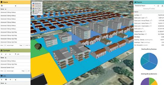
Workshops with potential end users were held in Australia and New Zealand (Perth, Melbourne and Christchurch) to determine the system’s specifications. Close stakeholder cooperation produced the ENVISION Scenario Planner (ESP) system and over 150 housing typologies, pre-assessed for embodied and operating carbon, energy use, water use, heating and cooling, stormwater capture, additional traffic produced and the capital and ongoing financial cost. Each typology was assessed for Western Australia, Victoria and New Zealand, and rotated through 360 degrees, x and y, to capture the effect of dwelling orientation. The tool allows planners and landowners to redesign potential precincts and assess the benefits of various scenarios over
business-as-usual approaches.
Expanding greyfields development
♦ The ENVISION system now has metro-wide data for Perth, with Melbourne and some major cities in New Zealand coming online shortly
♦ ESP is being is being utilised by local governments to assess the benefits of precinct-scale redevelopment, as well as being offered to the wider research community, providing the opportunity to create new, advanced housing typologies
♦ Statutory change is being discussed by the Victorian Department of Environment, Land, Water and Planning and the City of Maroondah
♦ Municipality-wide community engagement has seen greyfield precincts becoming a significant part of the housing strategy of the Victorian council of Maroondah City, and the project is poised to begin landowner engagement
♦ The greyfield tools are embedded into a new project involving transport analysis, value uplift and community engagement, adding more to urban sustainability in Sydney
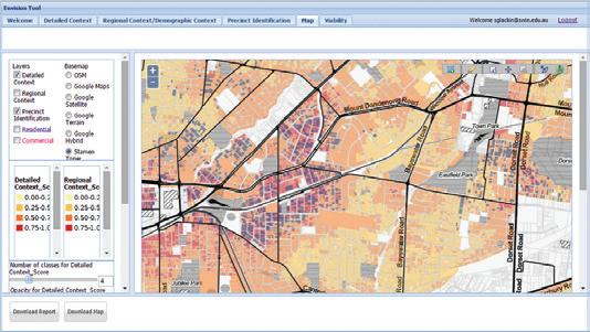
ENVISION, showing multi-criteria analysis (red to yellow, based on transport connectivity and service availability) and potential precincts (in blue).
The final stage of the research has identified and addressed many of the current barriers to these tools producing on-the-ground change. This stage examined the statutory changes and level of community engagement required to allow precincts to become a viable option for landowners. So far it has produced draft zones and overlays, which, when implemented, will allow local governments and landowners to negotiate outcomes that are mutually beneficial. It has also developed landowner engagement policies that are being rolled out in test municipalities. The research aspect of the project ended in June 2016. However, the project has now been funded for two years, which will focus on implementation. This phase will focus on applying the greyfield tools more broadly across member cities, and begin rolling out the system into other Australian and New Zealand cities. Additional work will require that infrastructural supplies combine data to produce infrastructural costing and capacity modelling into the existing housing software. ESP
March 2017 // ISSUE 2 www.infrastructuremagazine.com.au 20 SPATIAL & GIS
showing advanced typology scenario (foreground), business-as-usual redevelopment (mid-ground) and existing dwellings (background).
filled, or structures re-levelled?
All can be dangerous and cause havoc within your infrastructure operations.
You need effective and efficient solutions…you need Mainmark. With cutting-edge technology proven worldwide, Mainmark’s unique methods provide cost-effective, time-efficient solutions. We re-level and re-support concrete slabs, pavements, bridge approaches, highways, railways, airports, sea ports, culverts on roads, buildings and many other structures. We strengthen and stabilise weak ground, fill holes and voids, and revitalise ageing concrete and steel infrastructure – helping to ensure you have a safe, functioning environment.
Mainmark - Leaders in Advanced Ground Engineering and Asset Preservation Technologies.
voids
Mainmark Ground Engineering Pty Ltd ABN 55 160 982 366. Building Contractor Licences: NSW: 288848C | ACT: 2015719 | SA: BLD 269074 | VIC: CB-L 529 & DB-L 1551 | TAS: CC4676P | QLD: QBCC Act Licence No: 1316403 | Contact us now 1800 623 312 www.mainmark.com Come and talk to our experts at (ABC2017)Austroads stand 27
Do you need ground strengthened, holes and

Analysing spatial data provides unique insights for the planning of urban infrastructure.
SPATIAL DATA: CRACKING THE CODE FOR PLANNING SUCCESS
Our built environment is complex, and understanding how it functions is critical for future development. Two vital aspects of gaining this understanding and supporting decision-making are good data and good skills in spatial analysis.
Spatial data and spatial analysis has the power to transform research. Information organised in a spatial frame, along with detailed analysis, can add value and reveal patterns and stories of our real world experience. Spatial data and the use of Geographic Information Systems (GIS) are particularly powerful in representing the complexity of our real world towns and cities. Analysis using GIS can be applied across disciplines and display relationships across sectors.
GIS researchers are highly skilled and the software and data they require can be expensive and tricky to access. One
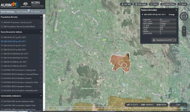
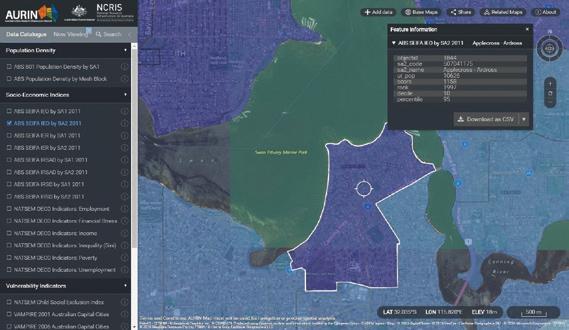
organisation working to provide access to quality data and GIS capabilities is the Australian Urban Research Infrastructure Network (AURIN). Funded by the Australian Government, they have developed the AURIN Map – a free resource for the broader community, available online at map.aurin.org.au. This online interactive map can show Australians how our suburbs compare across a range of indicators of disadvantage, including unemployment, income, access to health and financial services, education, potential mortgage stress and others.
Australia is the lucky country, but when it comes to social disadvantage, how does Applecross compare with Orange?
March 2017 // ISSUE 2 www.infrastructuremagazine.com.au 22 SPATIAL & GIS
What suburbs suck more petrol money as a proportion of income? And what level of access to public transport do they have? Are there geographic trends in level of education: do nerds of a feather flock together?
The AURIN Map unlocks a host of government and research data, and maps and visualises how and where people live and work, and a range of other sociodemographic information. The spatial data has already been mapped so users can easily “switch” layers on and off and watch the spatial story of our built environment unfold.
Anyone can use the AURIN Map, be it a family with teenagers wanting to check the public transport access of areas they’re considering moving to, a business seeking hotspots of high income but low access to financial services, or even a charity wanting to know the areas where children are at a risk of social exclusion.
But for researchers, the AURIN Map simply offers a taste of what’s possible through using the AURIN Portal. The AURIN Portal – a free resource for the academic and government research community, online at portal.aurin.org.au – is an online GIS system with direct links to data from
When Accuracy Matters
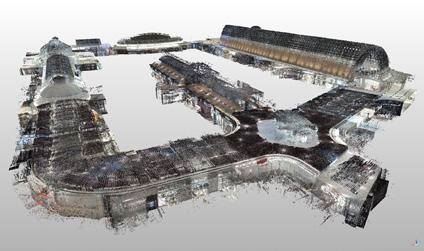
We specialise in high accuracy reality capture and high quality mobile mapping systems for the whole of your project life cycle.
We can deliver all your spatial data and point cloud capture needs using the very latest in technology.
● Terrestrial LiDAR, Mobile LiDAR, and Indoor Mobile LiDAR
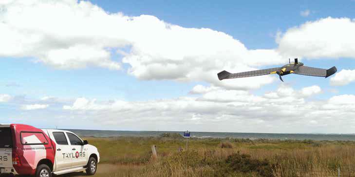
● UAV/UAS/Drone Image and Spatial Data Capture
● Virtual Reality & Augmented Reality Applications and Experiences

www.infrastructuremagazine.com.au March 2017 // ISSUE 2 23 SPATIAL & GIS www.taylorsds.com.au Melbourne | Brisbane | Christchurch | Jakarta
Comparing education and occupation levels: Orange NSW (27th percentile) – based on ABS SEIFA Index of Education and Occupation data for the year 2011.

Dr Iain Butterworth is using AURIN to help plan healthy neighbourhoods.
a broad range of institutions and organisations across many disciplines. Powerful data that is cleaned, spatialised and ready for research can be easily accessed and analysed, and all you need is an internet connection and browser.
Data includes population statistics, census data and the patterns of social trends, and how they vary geographically. The AURIN Portal provides analytical and modelling tools to analyse the data and model and test policy ideas and urban planning decisions to make our cities more liveable and more equitable. Mapping this data can help policymakers target effort and funding to the areas with highest need.
It can help researchers understand the relationships between social issues and, for example, health and educational outcomes. And it can help governments and corporations identify new business opportunities and areas to target investment from the public purse.
This is something Dr Iain Butterworth can attest to as Manager Liveability and Sustainability, Eastern & Southern Metropolitan Health, in the Victorian Department of Health and Human Services (DHHS).
“Many people might think that urban planning and health policy come together just to decide where to put hospitals,”
said Dr Butterworth. “That’s a focus on treating sickness once it emerges. I’m more interested in reducing people’s need for these services in the first instance.”
The department’s Place, Health and Liveability research partnership with the University of Melbourne has identified seven key policy domains that can help keep the whole population well. These are: transport; walkability; food; housing; public open space (including the natural environment); employment; and social infrastructure –including local access to health and community services, leisure facilities and education.
“In line with Plan Melbourne’s commitment to creating ‘Liveable Communities and Neighbourhoods’, my focus in on planning good, healthy places that keep people well and out of the acute health system.
“The AURIN Map and the other resources on the AURIN platform can help planners do this. The AURIN Map in particular is a really important development because it visualises how things like inequality or liveability influence health. And it makes this information accessible, which is helpful for engaging other stakeholders and sectors outside my own.”
March 2017 // ISSUE 2 www.infrastructuremagazine.com.au 24 SPATIAL & GIS
Currently the map includes:
♦ Population statistics from the Australian Bureau of Statistics
♦ Data on accessibility to core services (such as health, education, financial services and public transport) from the Australian Population and Migration Research Centre at the University of Adelaide
♦ Social vulnerability and unemployment data from NATSEM at the University of Canberra
♦ VAMPIRE Index data, providing a snapshot of vulnerability to financial stress from changes in petrol prices and/or mortgage interest rates

All of these resources are available through the AURIN website www.aurin.org.au, and tutorials are available to help researchers get the most out of the data and tools. Boosting GIS and spatial analysis capabilities across disciplines is ultimately improving the lives of all Australians.
Funding for AURIN has been provided by the Australian Government under the National Collaborative Research Infrastructure Strategy (NCRIS) and associated programs.


www.infrastructuremagazine.com.au March 2017 // ISSUE 2 25 SPATIAL & GIS “Very user friendly
other GIS
- NT Government “Surprisingly sophisticated, given its simple and intuitive interface.” - Mangoesmapping "Used Mappt to quickly capture assets for infrastructure asset management.” - City of Mandurah www.mappt.com.au ADVANCED MOBILE MAPPING MADE SIMPLE Expires 30/06/17. Available for annual STD & PRO licences. Second licence key emailed after purchase. BUY 1 LICENCE, GET 1 FREE WITH CODE 'INFRAFREE1'
and integrates easily with
programs.”
Comparing education and occupation levels using ABS data: Applecross WA (95th percentile).
PUTTING TECHNOLOGY TO THE TEST
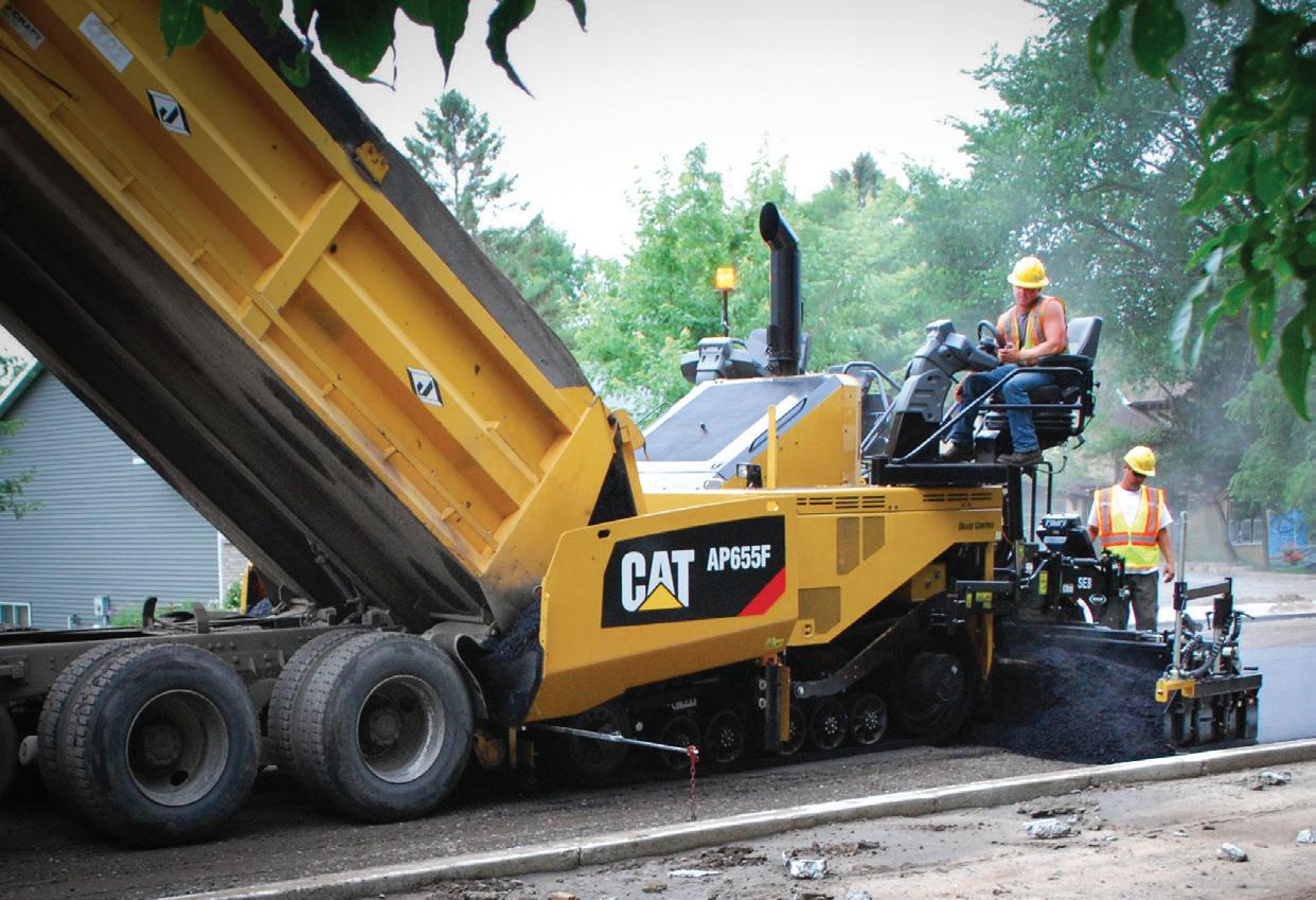
As a contractor, making the initial investment in expensive technology can be a hard call. You've heard the benefits, but you still can't justify the cost. Manufacturers however know their products and have designed these technology solutions to not only save you time, but also help you make more money.
Caterpillar Inc. recently conducted a production study at their proving grounds in Peoria, Illinois that once and for all put new technology to the test against traditional road building methods. They built identical roads side by side – one with integrated technology and one without – to measure differences in job time, man hours, machine hours and fuel burned. The goal was to give a visual demonstration to show how this technology can improve the workflow on the jobsite.
“We are always talking to our customers about the benefits of using these different technologies and there are always questions about payback,” says Karl Weiss, Vice President of Earthmoving at Caterpillar Inc. “They want to know examples of where it’s been used, but those customers who have success with the technology don’t want to show that to their competitors.”
So Caterpillar took it upon themselves to prove it, with the intention of using the production study to educate their customers on what they can expect with these technologies, why they should be using them and where they can really take time out of the work load.
They constructed two identical roadways, 122m each, and documented the process from start to finish. One roadway was constructed using traditional methods: stakes, stringlines and machines without telematics; and
the other using Cat Connect technology and grade control.
“We didn’t know how it would go, how good it would be and how much improvement we would see,” Mr Weiss said. “It surpassed our every expectation.”
INITIAL CONSTRUCTION
During the initial layout of a job, a crew of workers sets up stakes, and calculates and publishes offsets and grades. This is very labour-intensive and can take a good amount of time. On this 122m section of roadway, it took two hours.
Using Cat Connect technology and a drone to survey the site, you’re able to look at the layout and make calculations in a matter of minutes.
There are no hubs or stakes, and plans are then automatically loaded into the machines for work to begin. There are fewer people on the site, which helps to eliminate risk. This process took half the time of a traditional layout.
Earthmoving and grading can be the most labour-intensive part of a project. You have to prepare subgrade, excavation, embankment delivery and compaction. During a traditional roadbuilding process, there are a lot of people doing the work in close proximity to equipment. Workers also tend to sit idle for continued grade checking and verification. These checks are manual processes that can miss production targets while creating substantial amounts of rework.
Then, during grading, workers are spreading and finishing the grading of an aggregate base. Measurements during this process can identify inaccuracies. This can lead to time and cost overruns. Having too much material means additional passes and higher fuel consumption. Having too little material leads to more trucking hours and higher unit costs.
The entire earthmoving and layout phase using traditional methods took 24 hours on this project. If you compare that to the technology construction, you can easily see how this is where contractors can make their biggest gains.
“The heart of the success of the road building activity is the 2D and 3D grade control systems,” Mr Weiss said. “We used a Universal Total Station (UTS) on the site and then we put GPS on all the machines that had a blade on them. Some machines had 2D grade control and some had 3D grade control.”
Mr Weiss said that one of the key elements that helped halve the grading time was Slope Assist. Even if the unit was not equipped with a GPS receiver, the machine has the 2D capability to help maintain specifications.
“If you tell the dozer you want a certain side slope or grade, you can put those limits into the machine and it will set that off of the tracks. If you have a flat surface, you can build in your slope and grade without a 3D system.”
In-cab displays provide machine control and guidance, progress at a
March 2017 // ISSUE 2 www.infrastructuremagazine.com.au 26 SPATIAL & GIS // PARTNER SOLUTIONS
glance and allow grade and compaction to be checked from the cab. Not only does this keep your operators safe and less fatigued, but it also means that operators of any skill level can work efficiently on these jobsites.
Using that machine control and guidance along with intelligent compaction (IC) replaced manual processes to eliminate delays and ensure jobsite specifications were met. Excavation cuts and fills achieve elevation tolerances and density targets in the fewest number of passes.
Truck payloads can be reduced as well with wheel loader and articulated truck payload systems. These payload systems ensure accurate delivery and quantities of material to the jobsite saving time, fuel and money.
“The 3D plan that was built and loaded into the system allowed us to know the amount of aggregate and dirt that we needed to bring in,” Mr Weiss said. “Accurate material delivery and installation allowed us to avoid extra grading and compaction and we didn’t
need to bring in surveyors to look over the project with stakes and string.”
During soil compaction, the machines were equipped with IC. These machines can sense through rolling resistance how compacted the material is.
“For quality reasons, there are usually inspectors on road sites to ensure compaction,” Mr Weiss said. “They only can check in certain areas and not the entire roadways which is why sometimes we get potholes.
“With IC, the machine tells the operator where compaction has already met specifications. This saves in the number of passes an operator makes, but more importantly, we know he went over every piece of the road and it was compacted to the right level.”
The earthmoving and grading portion of the road on the technology construction section took a total of twelve hours. Half the time it took on the traditional build.
To read the full version of this article head to: www.infrastructuremagazine.com.au/2017/03/07/hastings-deering
SUPPORT FROM THE GROUND UP
With Queensland and the Northern Territory’s largest range of paving equipment, parts, service and training, Hastings Deering is committed to supporting you from the ground up. We are focused on building relationships that extend well beyond machines. That means sharing our expertise to help you select, acquire, operate and maintain your paving equipment, then standing by your side to keep that equipment – and your business – running smoothly. Invest with confidence knowing it’s more than just parts, service and support. It’s a partnership designed to deliver more for you.
Visit www.hastingsdeering.com.au/paving
www.infrastructuremagazine.com.au March 2017 // ISSUE 2 27 SPATIAL & GIS // PARTNER SOLUTIONS
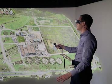
THE SPATIAL DATA REVOLUTION IS HERE
There’s no doubt Google Maps is good for travel directions, but what if your organisation could also use online mapping tools to quickly assess where new infrastructure is required, or where existing infrastructure could be improved?
What if you could use a map to quickly identify suburbs where service standards are falling, before customers complain? What if your maintenance teams could plan their routes to save travel time?
Until now, this spatial data – the geographical coordinates of roads, offices, transport networks, and utility assets – has been stored within complex geographic information systems (GIS) accessible only to mapping experts. This is all changing, now that mapping technology is being built into back office systems. This will alter the way managers make decisions and how customers interact with organisations.
SAVING TIME
Instead of relying solely on spreadsheets and charts, managers will be able to look at data on a map, allowing them to quickly spot trends and prioritise resources. Councils can already do this to see roads with reported defects, for example.
This approach will transform how maintenance is managed. For example, TechnologyOne’s spatial platform can pinpoint the location of a faulty office air-conditioner, including its floor and exact position, on a map.
The map icon also links to the unit’s technical details and maintenance history, allowing repair teams to access a full suite of information about the air-conditioner.
The technology has a wide range of applications; from water and stormwater to roads and works planning.
It allows asset owners to visually manage their networks and gain a clearer picture of the impact of work being performed on the services.
With this platform, assets can be managed spatially in the field, and crews can accurately assess the impact of taking actions across a network – such as turning off a valve in a water network or changing the sequence of traffic lights on a particular road.
Put simply, this technology allows users to better utilise asset data.
TECHNOLOGY IN ACTION
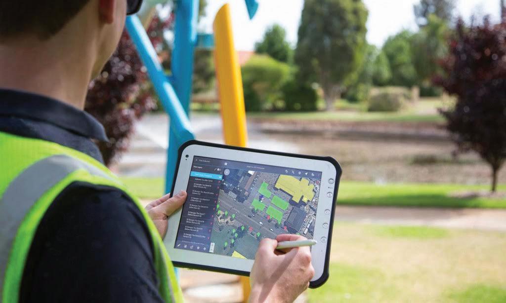
East Gippsland Water in Victoria is using TechnologyOne’s spatial capabilities to help workers pinpoint pipes. By performing a network trace on a tablet device, they can immediately see which homes or businesses would be affected by a disruption to the water supply during repairs.
This allows workers to avoid
potentially disastrous mistakes, and they don’t need to wait for someone at the office to perform these checks. This capability could be extended to the management of roads and stormwater drains in the future.
This network trace function previously wasn’t linked to property details, aerial photography, or other business data –nor was it accessible on mobile devices via the cloud.
Customers, too, will benefit from these changes. Just as they can search a retail website for the nearest store, they can use online maps to interact with an organisation. For example, local governments can allow people wishing to build or renovate to see the required planning permits for each location.
Asset owners can also use this spatial capability to monitor on a map what customers are saying via social media – making it easy to spot growing demand for infrastructure, such as a new business precinct, or a new public transport route, for example.
ONLY THE BEGINNING
The opportunity to transform business management increases as spatial data becomes more accessible. Governments are opening up their spatial data for use by third parties, while mapping initiatives are adding to the amount of available spatial data. Greater use of sensors to connect everything from offices, cars, and parking meters to the Internet of Things will also result in a flood of new spatial data.
Businesses that don’t take advantage of this data will be at a disadvantage. A great way to prepare for the future is to integrate back-office systems with spatial data, or adopt an enterprise software system that already includes this capability.
March 2017 // ISSUE 2 www.infrastructuremagazine.com.au 28 SPATIAL & GIS // PARTNER SOLUTIONS
For more information, visit www.technologyonecorp.com/products/spatial
A member of the East Gippsland Water team using TechnologyOne’s spatial capabilities to pinpoint pipes.


Digital Earth & Locate17 International Convention Centre Sydney DIGITAL TRANSFORMATION - OUR FUTURE Pop-up Café Sponsor Locate Central Sponsor Gold Sponsor Silver Sponsors Bronze Sponsors ISDE Video Competition Sponsor Media Partners Brought to you by 10TH INTERNATIONAL SYMPOSIUM ON For more infomation or to REGISTER for any of the above events visit www.digitalearthsymposium.com Workshops - Monday 3 April 2017 Market Day (Free to attend) - Tuesday 4 April 2017 Conference - 5-6 April 2017 APSEA Awards Dinner - 5 April 2017 The Marketplace Open Day is about the latest technology and services of the spatial and surveying industries available to business. There will be an opportunity to look at the future of the geospatial industry as businesses are going through digital transformation. On display will be everything from artificial intelligence and augmented reality to the Internet of Things and autonomous driving.
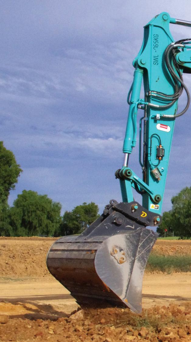
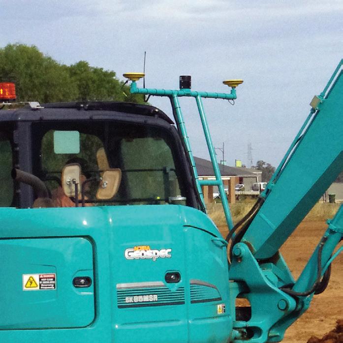
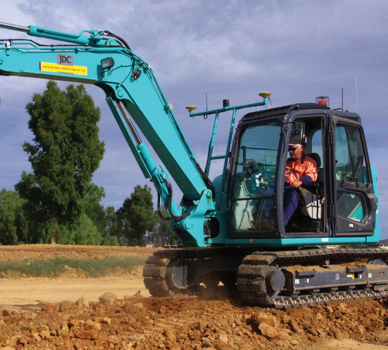
SWING BOOM EXCAVATORS FINALLY GET GPS GUIDANCE
In the past, swing boom excavators haven’t been able to enjoy the benefits that GPS guidance brings to more conventional excavators, due to the fact that it’s difficult to make a GPS system work accurately on a swing boom excavator. Previously, the continuously changing geometry of the machine has been the problem – until now.
In the Goulburn Valley, Jarvis Delahey Contractors (JDC) works mostly for local governments and subdivision developers. They know the productivity gains available from GPS guidance on conventional excavators – the company’s excavator fleet ranges from a 5t Kobelco to a 14t Sumitomo. However they find swing boom excavators best in tight spaces, so late last year they were looking to buy a new 8t Kobelco SK85 swing boom machine.
Hoping that someone in the world had developed GPS guidance for these machines, the company’s Managing Director Richard Jarvis approached C.R. Kennedy, the national distributor for Leica Geosystems products in Australia. Independently, C.R. Kennedy had been working on the swing boom problem and had already developed a concept solution that utilised GPS and a series of machine-mounted sensors. The system just needed installing somewhere and testing.
JDC quickly offered up their SK85 for some trials. And Melbourne Tractors, who were supplying the machine, provided a workshop and staff to support C.R. Kennedy with the installation. Testing proved that even with the machine at its worst working geometry, and sitting 25 per cent to the horizontal, the 3D positioning provided by the new system was well within the required tolerances.
Since JDC took delivery of the newly rigged machine they have been working it hard, and Richard Jarvis can now pass judgement.
“It’s the accuracy of the system that makes the biggest difference,” Mr Jarvis said. “On most jobs we’d usually over-excavate by about 20 per cent, just to make sure we’d got the minimum specified thickness of base or concrete. Now we excavate to the design level, so there’s less excavation and less materials required, and no rework either. The savings there are massive.
“At the same time there’s greater productivity,” said Mr Jarvis. “Adding GPS guidance to the 8t swing boom machine has lifted the machine’s productivity to something close to that of a 12t machine, without the
March 2017 // ISSUE 2 www.infrastructuremagazine.com.au 30 SPATIAL & GIS // PARTNER SOLUTIONS
The excavator arm comes close to the cab, but the GPS antenna bracket fits nicely in the gap.
capital outlay for a big machine. And the operator can take the 8t machine to the job in a tipper, instead of calling up a float,” he said.
Part of the increase in productivity is due to the system giving the operator absolute confidence that he or she is working to the design levels and alignment.
“If the client has an issue with your work, you can demonstrate quite easily with the software that you’ve done the work to the design,” Mr Jarvis said. “If something’s wrong, it’s the design that’s wrong.”
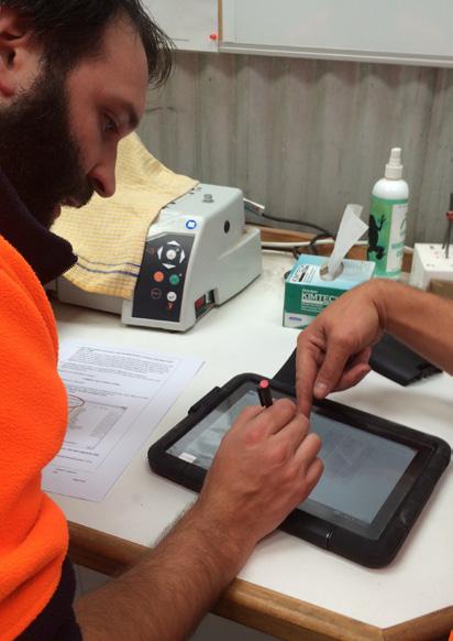
The SK85 is currently installing underground power for a subdivision. The work has to be audited to ensure the cable is at least 900mm deep and that minimum separations (horizontal and vertical) are maintained to other services. As work proceeds, C.R. Kennedy’s system records the trench invert level and alignment. And a report or log downloaded from the software satisfies the client’s auditing requirements.
Mr Jarvis said that the professionalism of C.R. Kennedy and Leica is the key to everyone’s acceptance of the downloaded reports and the job’s accuracy.
“They don’t get this stuff wrong,” Mr Jarvis said. “Everyone
has absolute confidence in their products, so we get that same confidence in our work. I love it for that,” he said.
For JDC, C.R. Kennedy’s GPS system has introduced other benefits too. Before the system was installed, the swing boom machine needed an operator, a supervisor and level checker for most jobs, but now the operator does 90 per cent of the job on his own – freeing up staff for other roles.
“A job that used to take three blokes three days, now takes one bloke just one day,” Mr Jarvis said. “That lets an operator take more ownership in his work, so he can take more pride in it too.”
Contact C.R. Kennedy Survey Solutions for more information on GPS Guidance for Swing Boom Excavators and for any other information on Machine Guidance and Attachment solutions at www.survey.crkennedy.com.au.
www.infrastructuremagazine.com.au March 2017 // ISSUE 2 31 SPATIAL & GIS // PARTNER SOLUTIONS
The GPS componentry of the swing boom system runs off C.R. Kennedy’s own SmartNetAus CORS Network.
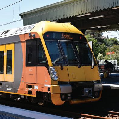
SMARTER RAILWAYS FOR OUR GROWING CITIES
 by Frank Heibel, Railway Consultancy Director
32 SIGNALLING, TRACKING AND CONTROL SYSTEMS
suburban train network will soon enjoy the benefits of Automatic Train Control.
Sydney’s

New York, London, Tokyo – countless cities in all parts of the world showcase that well-performing metro railways can solve commuting problems that are no longer controllable with individual car traffic. Australian cities are now joining the ranks of metro railways, with smart signalling solutions for better use of existing infrastructure.
33 SIGNALLING, TRACKING AND CONTROL SYSTEMS

Australians love their cars. Some of them so much that they still put up with daily commuter driving on increasingly congested road arteries into the city centre where parking comes at a premium. With daily traffic jams protracting travel times and raising stress levels, there must be a better way for the majority of city commuters.
Transport studies galore and examples from all around the world prove that passenger rail is the most effective mode for the ‘heavy lifting’ of daily commuter traffic. Not so much the traditional long-distance railways between cities, but modern, fast, frequent and efficient rapid transit systems operating inside the metropolitan boundaries. Within Southeast Asia, the metro systems in Tokyo, Singapore and Hong Kong are enviable regional benchmarks for transport efficiency and accessibility. And China not only boasts the two largest metro railway systems in the world, in Beijing and Shanghai, but also an unparalleled number of nearly 50 cities with built or planned metro railways. With metros being built in most countries in the region, including Vietnam and Indonesia, it seems obvious that Australia cannot afford to be the only major economy staying behind that trend.
PRESENT LIMITATIONS OF CITY RAILWAYS
Of course, Australian cities do have their own commuter railway systems. They are commonly called suburban and were largely built more than a century ago, with technology for signalling and controlling train movements invented around the same time. The existing suburban rail networks in Sydney, Melbourne, Brisbane and Perth all have a distinct “hub and spoke” layout, where radial lines connect residential suburbs with the city centre.
Those networks have all experienced significant patronage growth over the last decade and are rapidly reaching their current capacity limits, while substantial further growth of city populations and associated demand for rail transport have been forecast. Present capacity limits are mainly determined by the signalling system and its “fixed block” principle to keep trains safely apart from each other. This prevents collisions, but also constrains the throughput of railway lines if distances between trains are larger than necessary due to heritage signalling systems and rules.
AUTOMATIC TRAIN CONTROL
The key for migrating from the current suburban railways of our cities to contemporary metro-style operations is a better use of existing
networks, as Infrastructure Australia’s Chief Executive Philip Davies pointed out in the November 2016 issue of Infrastructure. He suggested investing in Automatic Train Control (ATC) for improving efficiency and safety of signalling systems.
The full benefits commonly attributed to ATC are provided by a technology called Communications-Based Train Control, or CBTC for insiders, which has become the worldwide de facto standard for high-capacity metro railways. More than 90 per cent of the aforementioned metro systems use this technology already, and further adoption is planned over the next few years. CBTC provides optimised integration of signalling, traffic management, trains and infrastructure, and enables large-scale improvements of the overall performance of the railway system. Trains are operated automatically, with or without supervision by a driver, and can follow each other safely at shorter intervals as short as two minutes, removing signalling as a capacity constraint of the railway. Automatic regulation of train movements increases the punctuality of services. CBTC is designed for around-the-clock operation, with redundant architecture avoiding single points of failure and minimisation of trackside equipment that can fail and delay train services.
34 March 2017 // ISSUE 2 www.infrastructuremagazine.com.au SIGNALLING, TRACKING AND CONTROL SYSTEMS
Perth is the third Australian city suitable for communications-based train control.
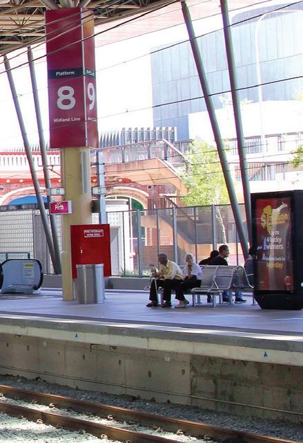
MANIFOLD PLANS FOR AUSTRALIA
The first Australian CBTC installation will be on Sydney Metro Northwest, a driverless end-to-end operation segregated from the existing network and perfectly suitable to get the most out of this technology. While service will commence in 2019 at rather modest four-minute intervals, operation under CBTC can be dialled up to twice that initial capacity to comply with future plans for Sydney Metro’s extension to Bankstown via the city centre.

Melbourne has selected CBTC for its high capacity signalling initiative, upgrading the existing network for much higher service frequencies, providing passengers with turn-up-andgo convenience. Their first operational application will be the new Metro Tunnel underneath the city centre, including its connected suburban lines from Watergardens and Dandenong. Further rollout on other line groups is already planned.
Perth is the third Australian city suitable for CBTC and could well need it since the forecast frequency demand on the busiest line sections is akin to those of the metro systems in Sydney and Melbourne. CBTC can increase the existing signalling capacity of the
busiest north-south corridor in Perth by remarkable 150 per cent, greatly relieving commuter traffic pressure along the most populated coastal spine of that longitudinal city.
The existing suburban rail networks in Sydney and Brisbane could also do with higher signalling capacity, but do not lend themselves to the application of CBTC due to their intertwined layouts frequently shared with intercity and freight trains. Better suitable in those cases is the use of another technology for ATC, the European Train Control System (ETCS), which offers interoperable products from multiple vendors and is designed for mixed passenger and freight operations rather than for conveyor belt-like metro systems. Future enhancements of the
ETCS technology over the next ten years will reduce the performance gap to CBTC, enabling trains running in intervals down to 2.5 minutes.
ATC FOR SMARTER CITIES
The widespread introduction of ATC to the rail networks in Australia’s four biggest capitals will end the times where the legacy signalling system was the foremost capacity constraint. Higher levels of automation will make train operations smarter, maximise the use of expensive railway infrastructure, benefit growing numbers of daily commuters and increase both the productivity and liveability of our beautiful cities.
And who knows, maybe a future article can start with “Australians love their trains”.
35 www.infrastructuremagazine.com.au March 2017 // ISSUE 2
safety of signalling
Automatic Train Control will improve the efficiency and
systems.

The NSW Government is investing a record $73.2 billion over four years in new hospitals, schools, roads, public transport and other vital infrastructure across the state. Infrastructure improves quality of life, making cities and regions better places to live. The NSW Department of Planning and Environment plays an important role in this, by assessing state significant developments for major infrastructure projects. These are then sent to the Minister for Planning to determine.
36 POLICY

APPLICATION TIPS ASSESSING RECORD LEVELS OF INFRASTRUCTURE:
by David Gainsford, Executive Director of Priority Projects Assessments, NSW Department of Planning and Environment
37 POLICY
Infrastructure can also promote economic growth by allowing the movement of people, resources and ideas. Roads, electricity and water allow new communities and homes to be built. Schools, parks and libraries build communities and emergency services and hospitals provide essential services. Ports and telecommunications help our economy to grow and keep us connected.
Infrastructure projects determined by the Minister and the Department in the last financial year (2015-2016) were worth $9.7 billion. There were 13 determinations made within that timeframe, which included projects such as WestConnex M4 East – a part of Australia’s largest road infrastructure project. These approved projects will generate 2,791 operational jobs and 9,706 construction jobs across NSW.
All applications are assessed by the Department on their merits, under state planning legislation, and clear NSW Government policies. These regulations, policies and guidelines allow us to assess and determine infrastructure project applications across the state, with the objective of minimising negative consequences and maximising positive opportunities.
When a government agency is interested in proposing an infrastructure project, they submit a request for Secretary’s Environmental Assessment Requirements from our Department – known as SEARs for short. The request often includes a scoping document with preliminary details about the proposed site and project.
The Department may then issue SEARs to the applicant, which provide a framework of issues and information the applicant must address when submitting a formal application known as the Environmental Impact Statement (EIS).
Community consultation is an important part of the assessment process. Once an EIS is received, the Department will arrange a public exhibition to encourage community feedback and participation. The exhibitions typically last around one month. All submissions from the public and relevant government agencies are published on the Department’s website.
The applicant must consider the issues raised during consultation and then address them in a Response to Submission (RtS) document. The RtS (another planning acronym) is also published on the Department’s website. We then begin assessing the proposal on its merits, taking all submissions, community feedback, the EIS and RtS into consideration.
Typical assessment timeframes are difficult to measure because applications and the issues that arise can vary, requiring different studies or independent expert analysis. However, once a project is determined, the Department’s assessment report is published online and relevant communities are consulted.
The Department’s assessment report makes a recommendation to the Minister, or the Minister’s delegate for determination. The Minister can refuse or approve, with or without conditions.
STANDARD SEARS AND CONDITIONS FOR CRITICAL STATE SIGNIFICANT INFRASTRUCTURE
The Minister for Planning can deem a state significant infrastructure project essential for the state for economic, environmental or social reasons. These applications are known as critical state significant infrastructure and are determined by the NSW Minister for Planning.
The Department has prepared
state significant infrastructure projects in consultation with a range of other government agencies.
The objectives of the standard SEARs are to achieve a better outcome for the community and the public at large by requesting the applicant’s EIS to focus on the most important issues that may cause the greatest impact, affect the most sensitive aspects of the environment and are usually of greatest interest or concern to the community.
Standard SEARs also provide applicants with certainty about the majority of SEARs they can expect to be issued for critical state significant infrastructure projects.
There are also standard conditions for infrastructure deemed critical by the Minister. The Department has prepared sets of standard and model conditions to help infrastructure providers understand the types of conditions likely to be applied to State significant projects if they are approved.
The Department aims to provide standard definitions and approaches to issues common to a particular industry, reduce duplication and inconsistency, and clearly explain compliance requirements for approved developments.
Standard conditions now clearly state an objective and outcome for the community, for example to mitigate noise impacts at a certain level. The approach aims to move away from conditions closely prescribing how an applicant would mitigate noise, dust, light and other impacts.

38 March 2017 // ISSUE 2 www.infrastructuremagazine.com.au POLICY
standard SEARs for critical
A focus on the objective in the standard conditions means an applicant now has more flexibility for innovative approaches in meeting the conditions. An applicant can work creatively with communities and in consultation with the Department to find ways to meet their planning obligations. All conditions are monitored by the Department’s compliance officers, who have a strong enforcement function.
UNDERSTANDING THE ISSUES
The Department encourages applicants to do their homework on the most important issues impacting specific local communities and environments when submitting an infrastructure project proposal. This will generate better engagement with local communities affected by the proposal, a smoother assessment process and better projects. Every application is different and specific issues arise particular to a project.
Currently, the NSW Government is working towards making this process more straightforward for applicants with the Environmental Impact Assessment Improvement Project, which simultaneously promotes earlier and better engagement with the community.
Initial ideas for improving the assessment of large-scale or complex projects, such as state significant development or state significant infrastructure, have been made publicly
available in a recent discussion paper.
Suggested changes put forward for discussion include: driving earlier and better engagement with affected communities; improving the quality and consistency of EIA documents; developing a standard approach for applying conditions to projects; providing greater certainty and efficiency around decision-making, including assessment timeframes; strengthening monitoring and reporting on project compliance and improving accountability of EIA professionals.
The Department is leading the ongoing consultation on this project and will be publishing a more developed proposal for further public consultation in 2017.
CUMULATIVE IMPACT ASSESSMENT
Cumulative impacts are an important consideration in the assessment of infrastructure proposals. These are impacts that result from the successive, incremental and combined effects of an activity or project when added to other past, current, planned, or reasonably anticipated future projects.
Effective assessment of cumulative impacts can lead to practical and coordinated measures that minimise impacts on surrounding communities and the natural environment. The successful management of cumulative impacts is becoming a necessity for major infrastructure projects.

39 www.infrastructuremagazine.com.au March 2017 // ISSUE 2 POLICY
part of the Department's approval process.
Community consultation is an important

40 POLICY
The City of Melbourne and Infrastructure Victoria have both used citizens’ juries in their infrastructure planning processes.

ARE CITIZEN JURIES THE ANSWER TO SUCCESSFUL DECISION MAKING?
by David Singleton, Chairman, Infrastructure Sustainability Council of Australia
It’s no secret that infrastructure decision making has often led to inefficiency and community distrust, and many communities have a lack of respect for the project selection and decision making process. For governments and developers, what’s the solution? Can citizens’ juries help ease the burden of decision making when it comes to infrastructure planning, and help to win back the trust of communities?
41 POLICY
Most infrastructure decisions involve significant expenditures and have far reaching consequences. There are usually many externalities that aren’t necessarily well captured by the solutions, and there are impacts which the chosen solution doesn’t fully alleviate. These impacts become politicised because of their high-profile nature, and they often become the focus of a significant battle between “small p" and "big P” parties as people use selection to make a point.
Take the East West Link in Melbourne. That was as much about a battle between opposing political parties as it was between alternative infrastructure solutions, or indeed between differently impacted communities.
In any sort of open process, it becomes difficult to separate the conversation about the selection process from all of this noise, and for some time now, it’s been evident that the solutions involving the community which have been used over the last 20 to 40 years (such as public meetings and focus groups) have become increasingly less trusted and less effective.
So it’s reassuring that we are seeing a move towards a process that promises to involve community representatives in an objective way, and where they feel they know and own the process – the citizens’ jury.
A citizens’ jury is a specific technique within a broader framework of deliberative democracy. Deliberative democracy was developed in 1980 by Joseph Bessette as a way of overcoming imbalances of power and conflicts between citizens and government decision-makers.
In Australia, the approach has really started to take off in recent years. We are starting to see more examples of citizens’ juries in action and it’s interesting to consider whether they are successful – are we in fact seeing tangible, positive results from their use?
In late 2014 to 2015, the City of Melbourne used a citizens' jury for the first time to develop a ten-year financial plan. It was hailed as a success by many, and led to the city looking at what other issues could be addressed with the method. The City of Melbourne then used the approach to deliberate on Melbourne’s future, using it to contribute to its Future Melbourne 2026 Plan.
In December 2016, Infrastructure Victoria tabled Victoria’s first ever state-wide, cross-sector infrastructure strategy for the next 30 years in parliament. Citizens’ juries played a major role in forming recommendations contained in this strategy.
“As part of Infrastructure Victoria’s consultation program we convened two citizen juries of around 40 people each – in Melbourne and regional Victoria between May and August 2016,” said Infrastructure Victoria’s CEO Michel Masson.
“We wanted our 30-year strategy to reflect a broad community view of what is important and infrastructure affects everybody, everyday, so it’s only right that people have a say in the decisions that will impact them over the next 30 years.
“Jury members were sought through a random selection process to ensure a representative, cross section of people were involved. We asked these juries to consider the question: What should we do to meet Victoria’s infrastructure needs?” added Mr Masson.
Each jury met for six full-day sessions over several months in order to build their understanding of the subject. In

total, jurors spent around 50 hours together. The juries also interacted between sessions via online discussion forums open only to jurors. Like a court jury, they considered evidence and heard from experts before delivering a verdict.
The reports of both juries (written wholly by the jurors) were considered by Infrastructure Victoria as key inputs into the strategy. The unedited recommendations of both juries are published on the Infrastructure Victoria website (metropolitan report, regional report).
So, was the process successful? Or is it too early to tell?
“At the end of their six sessions these reports formed an invaluable input into the draft 30-year infrastructure strategy, which was released for consultation in October 2016. Our report back to the jurors demonstrates we agreed in part or in
42 March 2017 // ISSUE 2 www.infrastructuremagazine.com.au POLICY
Citizens’ juries can help avoid protests when unpopular planning decisions are made.

principle with 192 of their recommendations. We disagreed with just 13 jury recommendations,” said Mr Masson.
Mr Masson says success didn’t solely lie in the final output from the juries.
“The juries also helped overcome the risk and perception that only the usual voices and the loudest voices are heard and it helped reassure the community about the value of their input and how their input is used.”
Helping Infrastructure Victoria facilitate this process was the New Democracy Foundation, and Executive Director Iain Walker agrees that it was a successful jury, citing specific ideas conceived by the jury around public housing, mental health and green space.
“This was just one of many examples where the citizens’ jury
process has been successful, coming up with new ideas, or finding new ways to address problems with new approaches.”
But while Mr Walker has seen many successful cases of citizens’ juries, what about the unsuccessful?
“There have been some unsuccessful ones, and we continually refine the methodology, even after the successful projects: we’re a research foundation so we capture what we learn and share that.
“So far we have found that allowing insufficient time for the process is the number one way to break the methodology.”
Despite a few blips on the radar in terms of unsuccessful juries, Mr Walker believes he can definitively say this process is – and has been – more successful than alternative ways of engaging the community.
“Simply replacing a self-selected group with a randomly selected group will get you a more representative decision. Simply allocating 40 hours instead of one hour (town hall meeting) or three minutes (survey) gets you a more considered decision. Allowing people access to a diversity of sources will always generate a better decision than a single –often skewed – source. Few contest this.
“Most importantly, our insistence that participating jurors write every word of their own recommendations has led to an immense sense of ownership and a visible public promise that it is not ‘fixed’. Every juror knows where the words in their report came from without shaping or input from government. There is no single ‘right’ decision: we are seeking to find decisions a given community trusts and can live with: that is the key strength of the methodology which is holding up even through quite extreme project tests.”
While there are many positives, citizen juries are not a cureall for government dysfunction, according to Nicholas Reece, Principal at Melbourne University, and he says cost is a major consideration.
“Citizen juries are not cheap – the City of Melbourne’s jury cost $150,000 and a major time commitment by council officers and others.”
According to Mr Masson, “There is no question that running a citizens’ jury is a significant responsibility and takes a number of resources. One of the most important considerations is organisational buy-in at all levels. This is where our process worked – our Executive, as well as staff, were all committed to participating in the process and seeing this as a real opportunity to hear from the community. Without this commitment, the juries would not be as effective. The integration of the jury into the overall consultation process is important and setting the question is just as important.”
It is reassuring to see that citizens’ juries are already playing a major part in addressing the challenges around infrastructure decision making.
Ultimately, citizens’ juries are a useful consultation tool because they allow everyday people to deeply engage on complex topics, such as infrastructure planning. There is strong evidence that jurors make final recommendations that they would not have made without that deep dive into the content and the opportunity to hear from a range of people on the topic – they make informed decisions.
By allowing ordinary people to influence our politics at every level, we are seeing a multitude of cases where the community is actually influencing the decisions their governments make.
And this is good news for everyone.
43 www.infrastructuremagazine.com.au March 2017 // ISSUE 2 POLICY
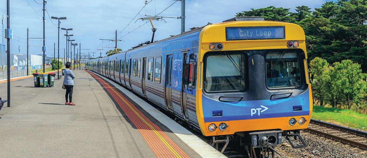
GETTING THE TRANSPORT INFRASTRUCTURE MIX RIGHT
by Phil Kajewski, Managing Director, Infrastructure (Australia Pacific), Arcadis
It is time we move away from roads as a key infrastructure focus – we need to look to embrace balanced mobility oriented public transport.
Australians have long had a love affair with their cars. They’re a status symbol; and they’re the primary means of getting to work for nearly twothirds of the population1. Indeed, as our former Prime Minister Tony Abbott once said, “The humblest person is king in his own car”.
As a result, governments have prioritised roads over public transport initiatives – a tendency that has served us well enough. Until now.
Two-thirds of Australia’s 24 million residents are currently living in capital cities; and the country’s overall population is expected to grow to 46 million by the year 2047. We will desperately need to manage the flow of up to an additional 14 million residents through our capital cities in just 30 years – not to mention tourist populations.
In addition to our rising population, younger Australians have a changing attitude to motoring. Recent research2 suggests that for millennials, the car is less a symbol of status and pride and more a symbol of adult responsibility – and that gadgets and mobile phones have replaced the car as the new status symbol.
With growing populations and changing attitudes, governments drastically need to change the way they think about how we move between locations. The reality is, unless something changes soon, Australia is at the risk of having a transport network that is ill-equipped to cope with the needs of the future population.
Infrastructure Australia’s priority list features the management of urban congestion at the very top. While this is a valid key priority, the current methods outlined can – and should – go further. Out of four high priority projects, three are road projects. Logically, we are aware roadways can only achieve so much and do not offer a viable long-term solution if developed in isolation. To establish a new transport legacy that is focused on meeting future needs through best-in-class
public transport, the infrastructure industry should seek to seize the opportunity immediately.
We need to move from a heritage of highways and freeways as the sole answer for our cities towards intelligent mass transit, with a view to not just playing catch up with global counterparts, but establishing proper leading practices and a second “golden era” of rail for Australia’s capital cities. We are slowly starting to see the beginning of this with the Metro Rail systems – but we clearly still have a long way to go.
While we are currently seeing an investment in Metro Rail from New South Wales and Victoria, the specific projects – on completion – will help us catch up with other nations rather than get ahead. At this point, our population growth outpaces other developed nations, meaning that establishing an “as good” transport network is not nearly “good” enough.
As outlined in Infrastructure Australia’s Plan, there is the reassurance that stronger investment in rail is on the agenda. The missing key to achieving the proposed reform is further commitment from the public sector and State and Territory leaders.
Roads alone will not be able to manage the projected population growth. The insufficient consideration of our public transport network now will mean residents in the future will suffer. It is now the industry’s turn, together with the public sector, to lead the development of a long-term, sustainable solution for Australia.
A holistic, considered transit network that allows for radial transport, improved commutes and access to facilities with an appropriate mix of road and rail will ultimately improve the quality of life for residents. With the right resources allocated to the research and planning of a balanced system, we can achieve a sustainable transport system, with greatly improved outcomes for the Australian population.
It has never been more important to get the transport infrastructure mix right. The time is now.
1 http://www.abc.net.au/news/2014-02-03/two-in-three-australians-drive-to-work-study-of-commuting-habit/5233950
2 http://www.sciencedirect.com/science/article/pii/S0967070X13001716
44 March 2017 // ISSUE 2 www.infrastructuremagazine.com.au POLICY // PARTNER SOLUTIONS


For more information please contact: : marketing@sydneybuildexpo.com | Phone: +61 (02) 8006 7557 30TH - 31ST MARCH HORDERN PAVILION SUPPORTING PARTNERS & MEDIA PARTNERS INCLUDE FEATURING The Australian Digital Construction & BIM Summit The Australian Sustainabilit y Summit THOUSANDs of Quality Attendees 120+ Exhibitors FREE CPD accredited Conference & Workshops CPD points accredited and issued by: CrowdReviews Buyers Guide Based On Client Reviews
AUSTRALIA’S INFRASTRUCTURE: ARE OUR PRIORITIES IN CHECK?
With so many projects competing for state and federal funding, it can be easy to wonder if our priorities are in check. Infrastructure Australia answered this question when it released an update to the Infrastructure Priority List in February.
Infrastructure Australia (IA) maintains the Infrastructure Priority List to help Australian governments make authoritative, integrated decisions and invest in projects that best meet our future infrastructure needs.
The List is informed by the data from the Australian Infrastructure Audit and extensive consultation with State and Territory governments, business and the community.
In February 2016, IA published the List alongside the landmark Australian Infrastructure Plan, which set out the nation’s long-term infrastructure reform and project investment agenda.
Since then, the Priority List has become the reference point for the most important infrastructure investments Australia needs over the next 15 years. Australia’s political leaders regularly consult the List as a source of informed analysis on our most pressing infrastructure needs, and to determine which projects should be prioritised for state and federal funding.
Through the List and our rigorous assessment framework, IA has achieved something other Western nations have long sought to achieve – an objective and evidence-based list of the projects that will deliver the best long-term outcomes for all infrastructure users.
THE IMPACT OF THE PRIORITY LIST
In the past twelve months, the Infrastructure Australia Board has positively assessed a record number of business cases for major infrastructure projects, and for this reason, the organisation has updated the List.
Projects recently assessed by IA include transformational projects such as Melbourne Metro (Victoria), Western Sydney Airport (NSW), WestConnex (NSW), Moorebank Intermodal Terminal (NSW), North–South Corridor Darlington Project (SA), Perth Forrestfield Airport Link (WA) and Inland Rail (National).
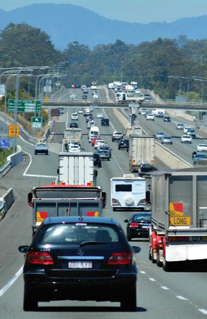
March 2017 // ISSUE 2 www.infrastructuremagazine.com.au 46 POLICY
These large-scale projects will change the shape of their respective cities and regions, and ensure that as a nation we are better equipped to meet the challenges of the future.
Other projects the Board has positively assessed, such as the M1 Pacific Motorway-Gateway Motorway Merge Upgrade (Queensland), the Bruce Highway Upgrade-Caloundra Road to
Sunshine Motorway (Queensland) and the M80 Ring Road Upgrade (Victoria) will reduce congestion on vital parts of our road network, connecting our regions, towns and cities.
NEW PROJECTS AND INITIATIVES
The List has been refreshed and now includes seven High Priority and eleven Priority Projects with a total capital value
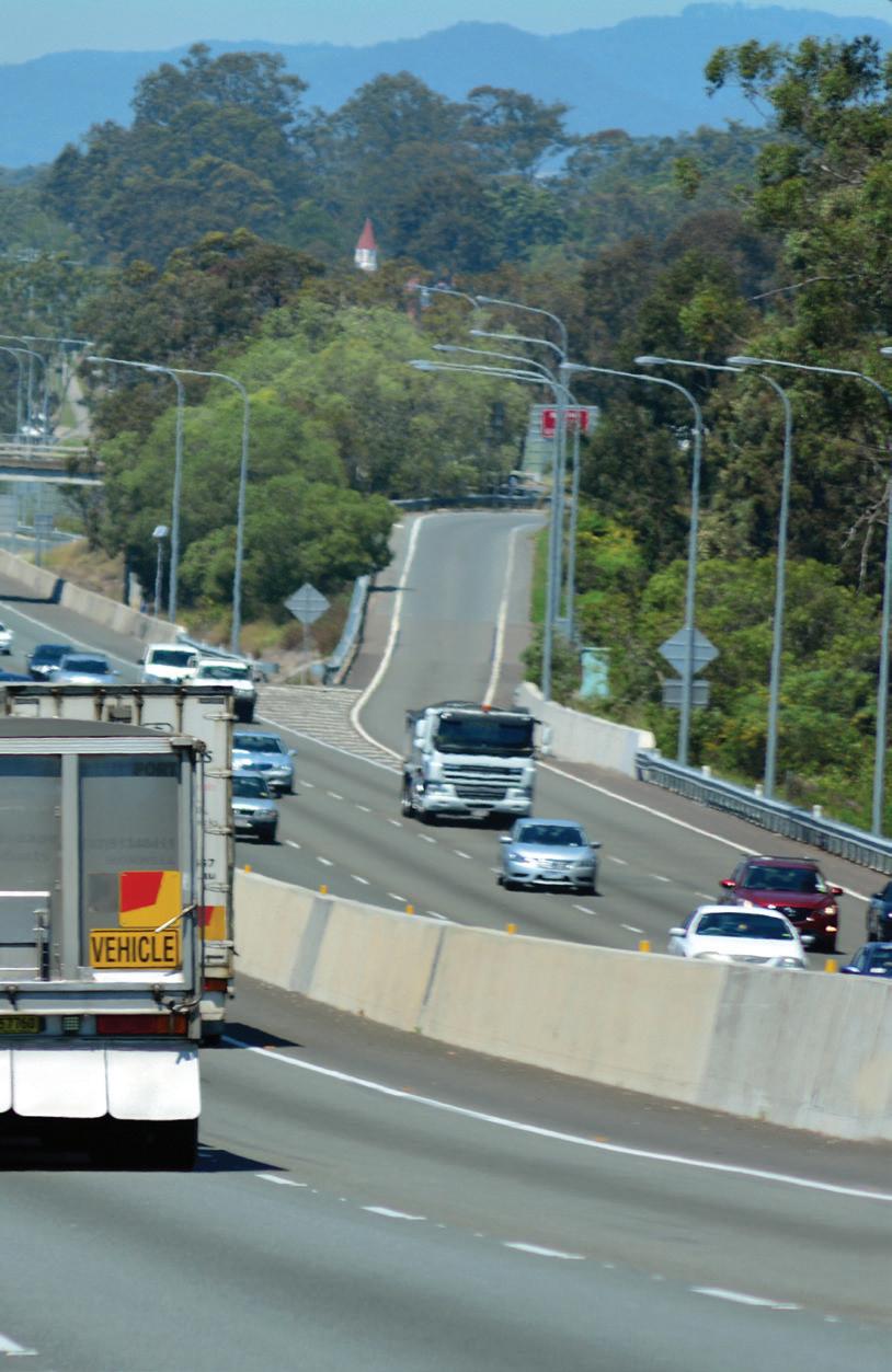
of around $60 billion. Each of these projects is underpinned by a robust business case, meaning governments and the community can have confidence the projects have strategic merit and are truly in the national interest.
The proposed relocation of the University of Tasmania’s STEM Facilities to Hobart’s CBD is one such example. Listed as a Priority Initiative in the 2016 Priority List, the business case has now been assessed by the IA Board and been moved up to a Priority Project on the revised Priority List. This project involves relocating the University’s Science, Engineering and Technology faculty to a new purpose-built facility in Hobart’s CBD. The move will drive an increase in domestic and overseas students at the University and directly support urban regeneration in Hobart.
IA has also added a project to upgrade the Northern Road (NSW) to the Priority List. The addition of this project is another important step in harnessing the expected population and employment growth in the Western Sydney Priority Growth Area.
The revised Priority List also includes 82 Initiatives. These are the infrastructure proposals identified as having the potential to address a nationally significant problem, but which require further development.
The revised High Priority Initiatives on the List includes mass transit options for Parramatta to Sydney CBD (NSW) and the remaining sections of Ipswich Motorway Rocklea-Darra (Queensland). The redevelopment of Sydney’s Central Station (NSW), Brisbane to Gold Coast Transport Corridor Upgrades (Queensland) and the Wellington Dam Water Infrastructure Development (WA) are also listed as Priority Initiatives. Each of these initiatives represent vitally needed infrastructure. The Infrastructure Australia Board looks forward to assessing high quality, fully developed business cases for these initiatives in the future.
While we are now seeing significant improvements in strategic, long-term infrastructure planning and business case development in Australia’s states and territories, there is still much work to do. IA is committed to continuing to strengthen its assessment framework to support better project selection and delivery across the country.
47 POLICY
www.infrastructuremagazine.com.au March 2017 // ISSUE 2
The IA Board has positively assessed projects including the M1 Pacific Motorway-Gateway Motorway Merge Upgrade in Queensland.
UNDERSTANDING WHAT LIES BENEATH OUR WHEELS

CAN YOU EXPLAIN WHY COUNCILS AND GOVERNMENTS NEED TO TAKE A PROACTIVE APPROACH TO ASSESSING THE CONDITION OF THEIR ROADS? WHAT ARE THE KEY BENEFITS OF A PROACTIVE, RATHER THAN REACTIVE, APPROACH?
Whether it is at the municipal, state or federal level of government, the road network is the agency’s most valuable asset. In terms of mobility, it is also the most critical – people need to get to work, school, go shopping, goods need to be distributed and so on. As such, it needs to be well managed. If road agencies take a proactive approach to assessing the condition of their roads, it will allow them to make the best use of their roads budget by making informed decisions based on the current condition of the road network. In short, being proactive saves money. It extends pavement
life by applying appropriate maintenance treatments at the appropriate point in time rather than waiting for the pavement to fail or for road users to complain. The cost of maintenance can be a magnitude lower than the cost of rehabilitation and reconstruction, so developing an effective and proactive work program will ultimately deliver efficiencies for the agency. It also enhances the driving experience and minimises road user costs by ensuring the road network is in the best condition it can be based on budgetary constraints.
CAN YOU OUTLINE SOME OF THE NEW TECHNOLOGIES AVAILABLE FOR ROAD CONDITION MONITORING? HOW DO THESE IMPROVE ON PREVIOUSLY UTILISED TECHNOLOGIES?
In recent times, we have seen the deployment of laserbased 3D systems that are capable of reproducing the
March 2017 // ISSUE 2 www.infrastructuremagazine.com.au 48
CONDITION MONITORING AND MAINTENANCE
Roads are critical infrastructure, and monitoring and understanding the condition of our roads is of vital importance. Infrastructure Editor Laura Harvey caught up with Richard Wix, Technical Specialist with the Australian Road Research Board, to learn about some of the latest technologies in road condition monitoring and assessment, and to gain a look into the future for this critical research area.

Laser-based 3D systems can now be used to monitor parameters such as cracking.
actual surface shape of the pavement from which numerous pavement condition parameters can be monitored. These parameters include cracking and other pavement distresses, transverse profiles and even the roughness and macrotexture of the surface.
The 3D systems improve on current camera-based methodologies as they are unaffected by shadows and do not require additional lighting systems – they can even operate at night. They typically measure the full lane width in which the survey vehicle is travelling, and the systems have additional smarts to allow the identification of the lane marking so that the measurements are limited to the lane surface.
One of the biggest improvements is that cracking and other defects can be automatically identified using specific algorithms rather than rated manually by a person, thereby
producing objective rather than subjective assessments. The transverse profile is also much more comprehensive, consisting of thousands of measurements across the lane compared to only a handful from survey vehicles that use a point laser system. This allows a more detailed assessment of the rut depth across the lane, which is important when trying to identify locations where ponding may occur in the wheel ruts.
www.infrastructuremagazine.com.au March 2017 // ISSUE 2 49
CONDITION MONITORING AND MAINTENANCE

Drone technology will soon be able to provide valuable insights into the condition of our roads.
However, even more exciting than the above, is the recent introduction to Australia of the traffic speed deflectometer (TSD). This device utilises Doppler laser sensors and a ten tonne load over the rear axle to assess the bearing capacity (strength) of the road at highway speeds. Therefore, for the very first time, road agencies have the ability to assess the strength of their entire road networks in a safe and costefficient manner, and several of them have already availed themselves of this technology. Further to this, ARRB has integrated a suite of additional pavement condition monitoring technologies to the TSD, including a 3D system, asset cameras and roughness and texture measurement systems, which allow the TSD to collect all the data needed to provide a full structural and functional evaluation of the road network in a single pass. It’s a “one stop shop” as far as pavement data collection goes.
With this technology, road agencies can make fully informed decisions, based on what’s happening on top of and below the surface of the pavement, at a reduced cost and determine what actions are best for their road network.
WHAT ARE THE MAIN CHALLENGES IN ASSESSING THE STRENGTH OF PAVEMENT? HOW CAN THESE BE OVERCOME?
In Australia strength measurement has traditionally been the domain of the falling weight deflectometer (FWD) and the deflectograph, and before that it was the Benkelman beam. However, these devices either operate statically or at very low speed. Therefore, when used, they require significant levels of traffic control which is very expensive (it can often be more than the cost of the actual testing itself). This is generally accepted as being part and parcel of project level work. However, the slowness of measurement and the cost of the traffic control is very limiting if an agency is interested in determining strength across their whole network, particularly if it consists of many thousands of kilometres. So the challenge is, how can I assess the strength of my entire network in a safe and cost-effective manner?
This is where a device like the TSD comes into its own. It overcomes the above limitations by operating at traffic speed, which does away with the need for extensive traffic control, and it can survey the network relatively quickly (>250km per day). Unlike the FWD, it also produces a continuous deflection measurement rather than measurements at discrete points, which are often widely spread (up to hundreds of metres when the FWD has been used for network-level assessments).
However, the TSD still has some limitations due to its size (it consists of a truck and trailer), and also the load over the rear axle which can limit access on some roads and bridges. Studies are also being undertaken to see if the outputs of the TSD can also be used for project-level work and pavement design rather than just as a screening tool.
WHAT ARE THE BENEFITS THAT COME WITH HAVING ACCESS TO LARGE AMOUNTS OF DATA ON THE CONDITION OF ROADS IN A CERTAIN SUBURB/CITY/STATE/ACROSS THE COUNTRY?
The more data you have, the greater the ability to understand what’s going on with your road network and in line with what was said previously, the better decisions you can make. This is true whether you are talking about a suburban street or a national highway. However, the type of data you collect may vary depending on the road class.
Additionally, road condition data that has been collected over time can be used in the design of pavements and to develop models to predict pavement performance, even estimating the remaining life of the pavement. This can benefit road networks throughout the country.
It also helps to supplement the pavement condition data with information on the surrounding environment. Is there adequate drainage along the roadside? If not, it can have a negative impact on the pavement. Information like this can be gathered by reviewing digital imaging from asset cameras mounted to the survey vehicle which is collected at the same time as the other pavement condition data.
However, I certainly don’t advocate collecting data for data’s sake. Data collection isn’t cheap and you need to be able to leverage the data. Therefore, a targeted approach is much more advisable. Otherwise, the money is better spent elsewhere.
WHERE DO YOU SEE ROAD ASSESSMENT TECHNOLOGIES MOVING IN THE FUTURE? WHAT CAN WE EXPECT TO SEE IN THE NEXT FIVE TO TEN YEARS?
Pavement condition monitoring technology continues to progress at a rapid pace. New systems are being developed, older ones enhanced and new uses are being found for technologies initially developed for other applications. What can be done today in terms of 3D and strength measurement didn’t seem possible a decade ago.
Developers, like ARRB, will continue to take new pavement measurement technologies and integrate them into survey platforms such as the TSD. For instance, ARRB is currently
50 March 2017 // ISSUE 2 www.infrastructuremagazine.com.au CONDITION MONITORING AND MAINTENANCE

working on integrating ground penetrating radar (GPR) into the TSD which will not only allow users to assess the strength of the pavement, but also see what is happening under the surface. This is particularly useful in areas where the pavement has been identified as being weak.
As we gain a deeper understanding of what is happening above and below the surface, we could even see the development of new, more relevant, pavement condition metrics or indices.
Terrain modelling is another relatively new development which allows you to produce a real life 3D representation of the road network, hills and valleys included, rather than just the surface of the pavement. The data can even be imported into GIS systems for analysis and design. Taking this a step further, you could combine this information with 3D point clouds, collected using LiDAR (light imaging and radar), to generate a 3D representation of the whole road corridor.
This could lead to a foray into the virtual world where you could actually walk the network and inspect the condition of the road from the confines of your office, using a virtual reality headset.
I think road assessment technologies will also become more compact, which will enable us to make better use of drones to collect pavement condition data. Maybe we could develop a lightweight 3D LiDAR system capable of creating very accurate and dense point clouds, from which we could determine the surface characteristics of a pavement. This would be particularly useful in remote or dangerous areas. It’s already being done to a certain degree, but current flight regulations limit the practicality of the technology.
Then there’s smartphones. As their computing power increases, their capability to collect pavement condition information will improve, and as there are so many of them in operation at the same time, the real-time feedback can provide input into advanced driving systems and information
to autonomous vehicles. Maybe we’ll end up with autonomous data collection systems too, using dedicated vehicles or technology fitted to the road fleet.
It won’t happen in the next five to ten years, but if we’re talking about the future, I think we could eventually end up with “living” roads. Surfaces could be comprised of nano-technologies that are capable of altering the frictional and textural properties of the road surface depending on characteristics such as weather condition and traffic flow, and provide real-time feedback to network managers. We’re already talking about self-healing roads, so it’s not too much of a stretch. But then again, maybe we won’t be driving on the roads in the future.
HOW DOES ROAD ASSESSMENT IN AUSTRALIA COMPARE WITH THE APPROACH TAKEN OVERSEAS?
In many ways the approach taken by road agencies here in Australia is similar to what is being implemented overseas. There are some differences because the majority of our sealed network is spray seal rather than concrete or asphalt which are more common in countries like the US and Europe.
However, we generally collect the same pavement condition parameters such as roughness, rutting, cracking and various other distresses, and report them in accord with international standards where they exist. Much time and effort has also been put into developing our own Australian test methods which aim to harmonise data collection and reporting throughout the country.
One major difference, compared to some other countries, is our willingness to utilise new road assessment technologies. We have a long history of doing so, going back to the 1980s, with the implementation of inertial profilometers for roughness measurement. The most recent device to be embraced by the road agencies is the TSD, so much so, that it has been necessary to obtain a second system to meet demand.
51 www.infrastructuremagazine.com.au March 2017 // ISSUE 2 CONDITION MONITORING AND MAINTENANCE
The ARRB TSD surveying the New Zealand road network, Mount Cook National Park.
TA TALE OF TWO RAILWAYS: WHERE DO OUR BEST INTERESTS LIE?
by Michael Kilgariff, Managing Director, Australian Logistics Council
There’s been a lot of talk in the media about the idea of building a Very Fast Train network between Melbourne and Brisbane, but what’s not talked about enough is the impact Inland Rail – a freight route between the two destinations – would have on our economy.
his is the story of two trains.
The first train is the Very Fast Train – a passenger train from Brisbane to Melbourne via Sydney, Canberra and some regional towns. The second is Inland Rail – a 1,700km freight line stretching from Port of Melbourne to Port of Brisbane, which links in Parkes in NSW to enable freight to travel west to Adelaide, Perth and even Darwin.
The latest development on the Very Fast Train is a proposal to build it using value capture.
The proponent claims to have secured almost 20,000ha for new development sites along the rail corridor and that they will present an unsolicited bid to Prime Minister Malcolm Turnbull within the first half of this year. The Federal Opposition has also given the project their support.
The latest on Inland Rail is that after Infrastructure Australia placed it among its top priorities based on extensive economic analysis, the project is moving
to a second phase of market testing for private sector involvement.
The four shortlisted options all involve the delivery of Inland Rail through the Australian Rail Track Corporation (ARTC), in partnership with the private sector for the design and construction.
The second phase will seek views on:
♦ Preferred delivery model of the four shortlisted options or alternatives put forward by the participants in the first phase of market testing
♦ Willingness and capacity to participate in the shortlisted options
♦ Understanding of the various risks associated with the delivery of Inland Rail
♦ Capacity to enhance the performance and value of Inland Rail, including design and operation
♦ Potential project-level procurement models for the design and construction of Inland Rail Market testing meetings are underway,

which is the next step in ensuring Inland Rail is construction ready.
The Australian Logistics Council would like to see the Federal Government commit funds to the project in the May budget so that industry can plan complementary investment in the lead up to an expected completion date.
The new line will be a faster, more efficient route that bypasses the Sydney rail network and will enable the use of double-stacked trains along its entire length.
Currently, all rail freight from Melbourne to Brisbane has to travel through the congested Sydney rail
52 March 2017 // ISSUE 2 www.infrastructuremagazine.com.au LOGISTICS
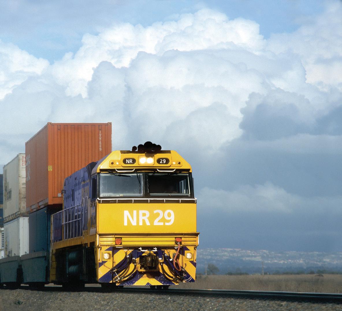
network, where passenger trains get priority. Inland Rail will reduce freight travel times from Melbourne to Brisbane to less than 24 hours.
The Melbourne-Brisbane rail link would take 100 B-Double trucks off the road for every Melbourne-Brisbane train trip. It has great safety and environmental benefits by taking large trucks off the inland route and therefore will get public support.
With a National Transport Commission report showing Australia’s domestic freight task is expected to grow 26 per cent by 2026, it is
important that we keep this freight project on track by working with all stakeholders along the corridor.
But perhaps most importantly, Inland Rail will not just provide a new North/ South rail link; it will be a catalyst for complementary private sector investments, such as fleet upgrades, new metropolitan and regional terminals and integrated freight precincts.
It is important therefore that the freight line not only have a direct connection between the Port of Melbourne and Port of Brisbane, but also that intermodal terminals be built
in Melbourne and Brisbane that are capable of dealing with both local and interstate freight.
The intermodal freight terminals developed in Melbourne, Brisbane and along the route will allow consolidation of domestic and import/export freight, which will in turn drive greater economies of scale and greater freight efficiency.
This is important economically as ALC estimates that a one per cent increase in freight efficiency will drive a $2 billion benefit to the Australian economy.
The Very Fast Train, on the other hand, will have to attract a passenger market
53 www.infrastructuremagazine.com.au March 2017 // ISSUE 2 LOGISTICS

already well-served by air, while offering longer travel time.
The difference between the two projects at the moment is that Inland Rail has gone through a rigorous, independent economic analysis which has revealed that its economic benefits would outweigh the costs. The Very Fast Train has not.
It is all very well for Very Fast Train proponents to say that there will be no cost to government, and all that is needed is “political will” to get the project going. However, projects of this size inevitably require government spending one way or the other, especially if fancy, non-independent modelling on value capture or optimistic assumptions about level of usage are not borne out.
To date all Very Fast Train proposals have failed cost-benefit analyses. If anything, the Very Fast Train case will become weaker in the light of the
approval of Sydney’s second airport.
Given how reasonably well-served passengers on the Sydney-CanberraMelbourne route are by air and road, the Very Fast Train does not look like good value for money compared to Inland Rail.
The difficulty is that there is a finite cake of infrastructure funds and of skilled labour, whether the project is public or private or a mix of them. Commitments to one large project will inevitably draw funds and labour from others. This is why Infrastructure Australia was given the task of assessing projects and assigning them a priority.
Business and taxpayers in general have a right to expect government to ensure the nation gets the best results for investment. The best way to do that is to give projects priority based on cost-benefit analysis. Often, however, roads and passenger rail get priority
because voters use them directly, and freight gets less attention, even though all businesses and people directly benefit from the efficient movement of freight.
As the logistics industry likes to point out – freight doesn’t vote.
Given the finite cake for infrastructure spending, we need to respect the role of Infrastructure Australia as the independent infrastructure umpire. This is why Malcolm Turnbull should pass the Very Fast Train proposal straight to Infrastructure Australia for a thorough cost-benefit analysis.
It would help public confidence in the development of infrastructure in Australia if reference to Infrastructure Australia was the standard response by governments to proponents of big projects.
54 March 2017 // ISSUE 2 www.infrastructuremagazine.com.au LOGISTICS
The ALC urges governments to refer Very Fast Train proposals to Infrastructure Australia for detailed analysis.


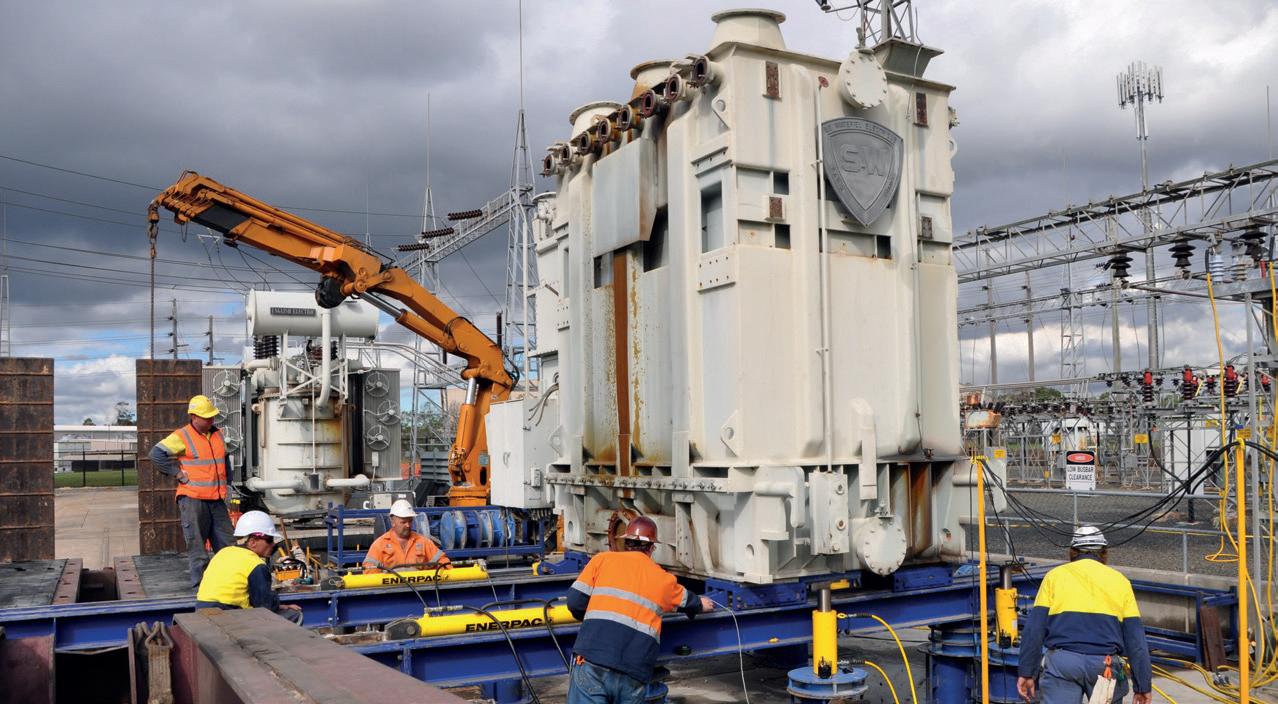
• Supply and service of high pressure hydraulics.
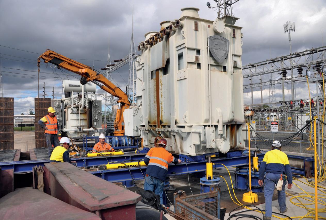
• Supply, service and annual inspection of all rigging and height safety equipment.
• Full turnkey engineering of custom lifting solutions, from concept to engineering to manufacture, commissioning and training..
• Load testing up to 100T
• PLC controlled synchronous jacking and skidding systems.


Challenger Donates a percentage of all wholesale revenue to The McGrath Foundation


MRLIFTIT.COM.AU
MULTI-DISCIPLINARY ANSWER FOR EFFICIE
Recently established telecommunications and civil company, Accelerate Civil, has expanded into drilling after it saw a gap in the Mackay market. In order to provide a fully integrated end-to-end service for clients, they purchased a suite of brand new equipment, including a directional drill, mixing system and locator.
Accelerate Civil is a new face in the drilling game but the company is a combination of two wellestablished Queensland businesses; Accelerate Communications and John Morgan Plumbing, and brings together the best of both services. Accelerate Civil Director James Buttenshaw said directional drilling was the last piece of the puzzle to be able to offer an end-to-end service.
“There are a lot of instances where a drill is needed, such as drilling under roads and creeks. Previously we would do the civil works and other contractors would have to come in and do the drilling.
“Now that we have the drilling expertise, our clients don’t have to juggle multiple companies and try to manage varying timeframes – we can do everything,” Mr Buttenshaw said.
MOVING INTO DRILLING
Accelerate Civil currently has a team of 25 across Brisbane, Townsville, Rockhampton and Mackay. Drilling services are offered in Central Queensland with a view to expand across
other regions. Mr Buttenshaw said the move into drilling had come after they saw an opening in the market and believed they could provide a more efficient service than what was already available.
“We looked at how the market was currently being serviced and thought we could do better. A lot of the things we offer –drilling, telecommunications and utility installation – all revolve around providing information back to the client. The feedback we get is that this is the number one thing our customers wish contractors would do more,” Mr Buttenshaw said.
Nigel Dobier, Vermeer’s HDD Specialist based in Townsville, North Queensland, has been working alongside Accelerate Civil since November 2016, tailoring a HDD package to suit the company and their client’s specific needs.
To assist with the collection of information, Vermeer packaged the Falcon F5 DCI Locator and Aurora Display with a Vermeer D20x22 Series 2 Directional Drill, VSK700 - 800 Vac Unit and MX125 mixing system, which has enabled Accelerate Civil to offer high-end drilling services.
“The digital bore logs and in-depth information we get from
March 2017 // ISSUE 2 www.infrastructuremagazine.com.au 56 LOGISTICS // PARTNER SOLUTIONS
OFFERING THE NT CONSTRUCTION
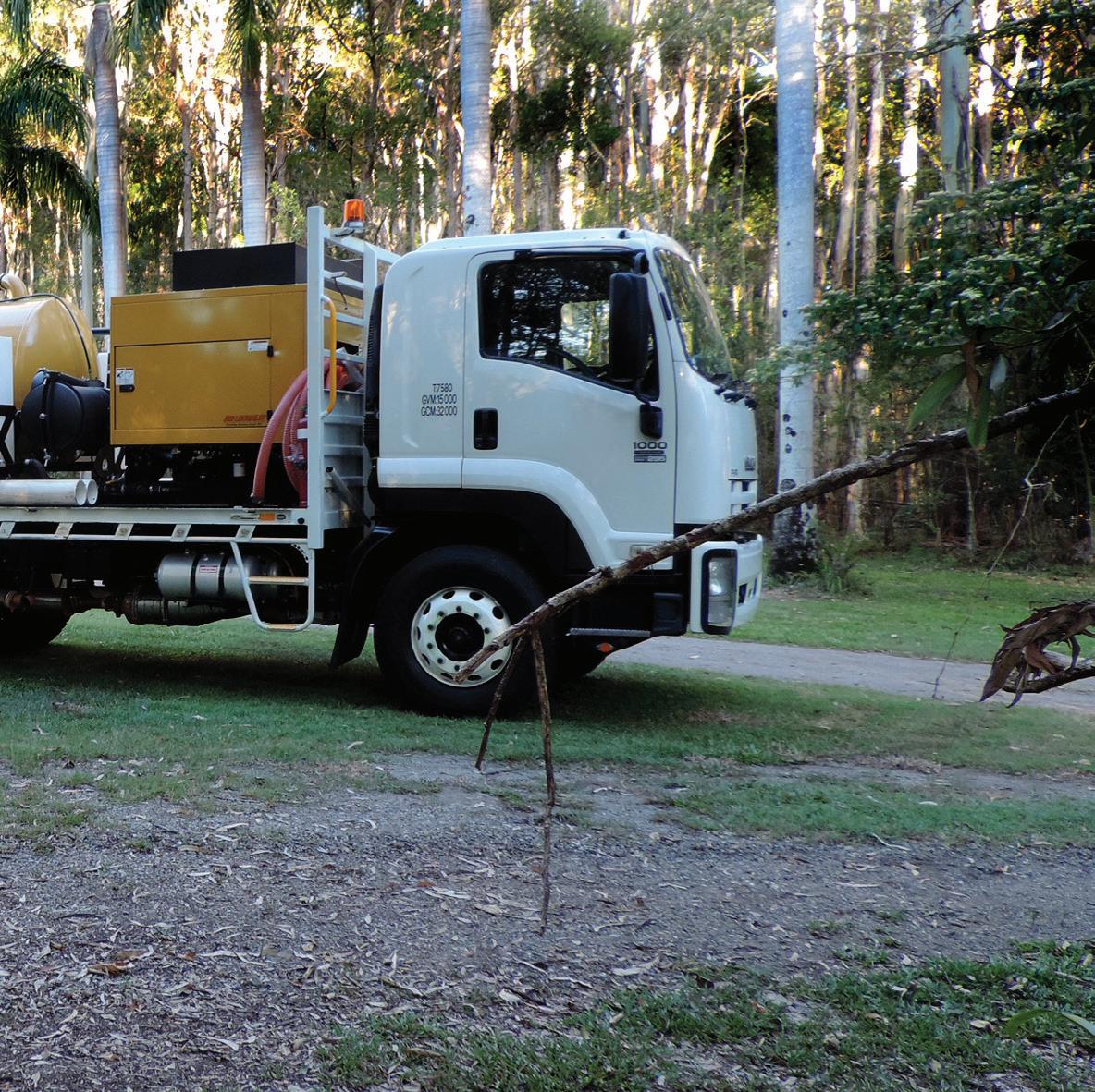
our Vermeer HDD setup allows us to drill more efficiently and collect detailed information for the client,” Mr Buttenshaw said.
“Our approach is fully integrated, as we incorporate this information into our existing cloud-based artefact systems. This puts us a cut above the rest in providing Professional As-built Artefacts Packs for our clients.”
Mr Buttenshaw said the decision to purchase from Vermeer was based on utilising the latest drilling technology and ensuring their services would be reliable.
“Investing in this much new equipment is not a standard thing given the current state of North Queensland’s economy but our decision was based around reducing risks. Having new gear gives us confidence that it won’t break down and Vermeer’s products have the latest technology which makes it easier to drill.
“Some older drills don’t allow much information to be fed back but the Vermeer Directional Drill with the Falcon F5 DCI Package has things like high-end pressure gauges so we can tell if there’s a frac out.
“We’ve already successfully completed one project using the equipment and are halfway through another. The second project
Now that we have the drilling expertise, our clients don’t have to juggle multiple companies and try to manage varying timeframes – we can do everything
is a large ring road relocation project where a highway is being built and all telecommunication services have to be relocated. We also provide services direct to Telstra and nbn now.”
BUILDING A SUCCESSFUL SERVICE
Mr Buttenshaw said his team did extensive research before making the move into drilling to be able to differentiate themselves in the region. This preparation included ensuring they had adequate support.
“As we’re new in this area, Vermeer had experts fly in from Melbourne, Sydney and the Gold Coast to train us on the equipment. This on-site and continuing support has been great and really got us started on the right foot,” Mr Buttenshaw said.
“I think the main thing for any contractor, but especially in our industry with strict timeframes and requirements, is just to do what you say you’re going to do.
“To be able to do this you need quality reliable equipment that doesn’t break down, and to have access to support quickly if there are any issues in the future.”
www.infrastructuremagazine.com.au March 2017 // ISSUE 2
57 LOGISTICS // PARTNER SOLUTIONS
In Victoria, sweeping changes are currently happening across the entire transport network –freeways are being widened, level crossings are being removed, suburban arterials are being rejuvenated – in a wholeof-system approach that is catching the eye of governments around the world.
Melbourne is rightly proud of being named the World’s Most Liveable City for the sixth year in a row. But as our boundaries stretch and our population grows, we can’t afford to be complacent.
If we are to have a connected, dynamic and vibrant Victoria tomorrow, then we’ve got to start building a world-class transport system today.
It begins with moving beyond the simple “roads versus public transport” debate. With almost 2,000 people moving here every week, it’s not an either/or option – our city needs both.
It’s why we’re building the Metro Tunnel at the same time as we're upgrading the Monash Freeway. Widening the Tullamarine Freeway as we remove 50 of our most dangerous and congested level crossings. And boosting regional rail while we also fix our suburban arterial roads.
It’s the biggest infrastructure agenda Victoria has ever seen. And we haven’t wasted a single moment in getting it going.
As you read this, CityLink is being widened from the airport through to the city and 30 kilometres of extra lanes are being added to the Monash Freeway. It's a project we've fully funded, and will mean hundreds of thousands of Victorians get home sooner.
We’re also widening the M80 from Sunshine Avenue to the Calder Freeway and building for Melbourne’s future with plans for the Western Distributor already afoot. It’s a massive build, and will provide this city’s much-needed second river crossing. Choke points like Hoddle Street and the Chandler Highway are soon to be gone.
We’re also addressing infrastructure needs where previous governments have failed to act.
We’re developing the business case to build and finally complete the Metropolitan Ring Road.
The North East Link will be kickstarted with $35 million, with community consultation and route selection to be completed by 2018.
It's work that will slash travel time on congested roads in

ROAD March 2017 // ISSUE 2 58

DYNAMIC, VIBRANT:
MAKING TRANSPORT INFRASTRUCTURE WORK
by Luke Donnellan, Victorian Minister for Roads
ROAD 59
CONNECTED,
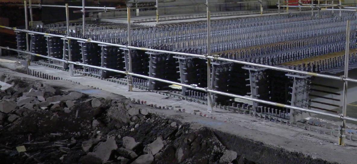
Melbourne’s north, south, and east. It will take thousands of trucks off local streets, and at long last connect the southern and eastern suburbs to Tullamarine Airport.
Each of these projects will help reduce congestion on our roads and connect people to jobs and each other, ensuring Victorians have more choices closer to home.
As an added bonus, our transport infrastructure program will create 15,000 jobs and give industry more certainty, with a ten-year pipeline of planning and infrastructure.
Of course, all of this work can’t happen in isolation. It will mean delays and disruptions for drivers and commuters. But it's something we've always been upfront about. Because even though this work causes frustration in the short-term, for our state's long-term, it’s vital.
We need to be just as forward-thinking when it comes to the way we use our existing transport network.
There are 13 million trips made each day on our road network alone. Look at the Monash M1: it carries double the number of journeys of the entire metropolitan rail system.
And every week, VicRoads is licensing 2,000 new drivers on the roads.
If we continue at the same pace, we’ll need to find capacity for another seven million journeys by 2040.
It’s a real challenge. But we’re learning a lot from intelligent freeway management. And as Victoria continues to grow, this specialised science is informing our next generation of transport improvements.
After all, we’ve got a great track record when it comes to transport innovation. We were early adopters of technologies such as adaptive traffic signalling, ramp metering and variable messaging.
And now, the rest of the world is looking to us for the next great innovation.
In Utah, trials of “the Melbourne approach” are about to start. Similarly, Canada and Japan are examining the way our system works, with hope that it can fix their own local networks.
And we do have valuable lessons to share.
Because here in Victoria, we no longer accept that
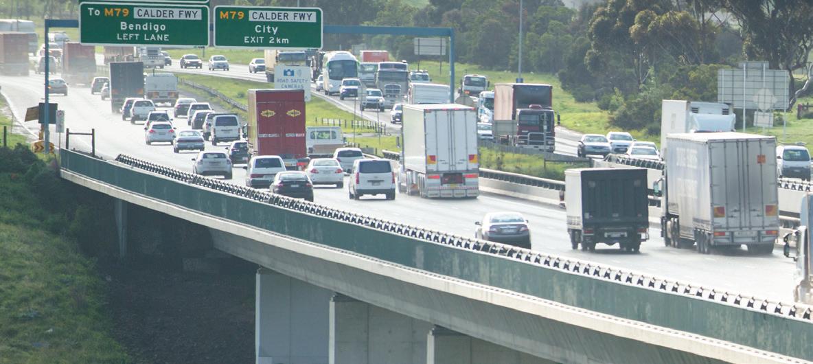
ROAD 60
March 2017 // ISSUE 2 www.infrastructuremagazine.com.au
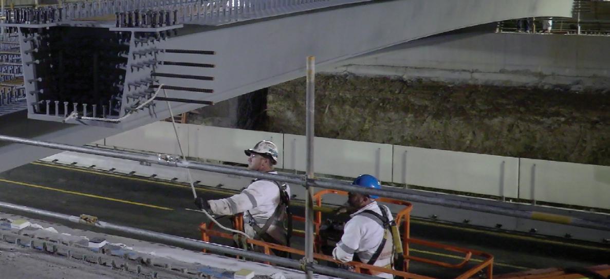
our freeways will break down in peak periods. It’s meant transforming our thinking – we’re no longer only concerned with getting cars on our freeways, but getting them off our freeways too.
Ramp metering and the use of intelligent transport systems are no longer about how we merge cars, but also how we check the next ten kilometres downstream to make sure that the whole system is stable.
And critically, we’ve learnt that you can’t manage freeways and arterials as different systems. They’ve got to be seen as one network.
So we’re embracing advances in technology and working alongside transport and industry partners to investigate creative ways to help banish congestion.
In the next year, local motorists will be able to trial an app that allows vehicles to pass through consecutive waves of green lights. It’ll mean road users can make smarter decisions through messages about traffic ahead via GPS.
That’s taking a smart approach to managing traffic, and giving drivers the power to make informed and practical decisions about their journey.
We’re also leading the way on autonomous vehicle trials, with on-road testing to begin in Melbourne this year. These trials will help us understand how autonomous vehicle technology interacts with road infrastructure, including overhead lane signals, electronic speed signs and line marking.
We’re making innovative use of Bluetooth technology, working with Australia’s top road researchers and operators to put us at the forefront of real-time traffic information for the community, and give us the data we need to manage traffic signals and respond to road incidents quickly.
At a wider level, it means we can learn even more about people’s travel patterns across every minute of the day. That’s huge: for our connectivity, productivity and economy.
It’s smart. It’s forward-thinking.
And it’s all happening in Victoria.
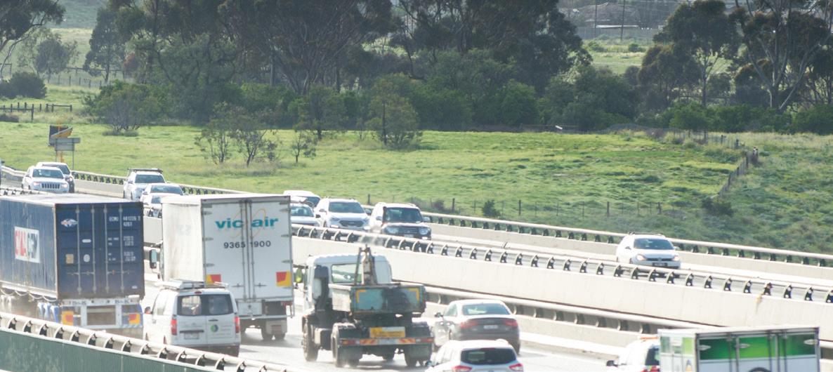
ROAD 61
www.infrastructuremagazine.com.au March 2017 // ISSUE 2
WHY ROADS OF THE FUTURE NEED TO EMBRACE DISRUPTION
In the world of infrastructure, there are very few sectors that aren’t facing significant disruption, and for the roads and pavements sector, it’s no different. Future change offers opportunities, challenges and excitement; and while the future of transport –and the role that roads play in moving people and goods – is facing unprecedented potential disruption, the roads of the future are the key to creating the economic opportunities of tomorrow.
It’s against the backdrop of all of this change that the Australian Asphalt Paving Association (AAPA) is hosting the 17th AAPA International Flexible Pavements Conference between August 13 and 16 at the Melbourne Convention & Exhibition Centre. The conference is the primary meeting of flexible pavement professionals in Australasia, attracting representatives from state road agencies, local government, industry, and academic institutions from across the world.
The theme of the 17th AAPA International Flexible Pavements Conference is “Roads of the Future –Embracing Disruption”. The aim is to help prepare the Australian flexible pavements sector for future challenges, by openly discussing the possible disruption that will come through new digital and physical environments and technologies.
The main objective is to provide a platform for the Flexible Pavement Industry and its stakeholders, suppliers and partners to share, consider and plan
for the impacts and changes and ensure the continued growth and success of the sector.
While change within an industry can be challenging, it also offers exciting new opportunities. For those in roads and pavements, new business areas include:
♦ Smart construction technologies with real-time feedback and improved process control
♦ Smarter contract arrangements encouraging innovation, while better sharing any risk and reward between contractor and road agency
♦ Improved reliability of the road network through continuous condition monitoring of road assets
♦ Efficiencies driven by innovation
♦ More flood resilient roads
♦ Smoother, safer roads and more sustainable roads
♦ Less disruption to road users when a road is worked on
♦ Enhanced safety for both road users and road workers
In implementing these new opportunities, the industry will need

March 2017 // ISSUE 2 www.infrastructuremagazine.com.au 62
ROAD
to be mindful of a number of factors.
According to Erik Denneman, Director, Technology and Leadership at the AAPA, chief among these is the heavy regulation of the construction industry.
“This regulation means that there are many barriers to innovation,” said Mr Denneman. “Government and industry will have to work together to overcome these barriers, so that the full potential of the technologies of the future can be realised in a timely manner.
“In addition to this, maintenance programs for road infrastructure require a constant and appropriate level of funding, which is another factor we need to be constantly aware of.”
New technologies will also have an increasingly important role to play in delivering the roads of the future. Moving forward, the industry will have

access to improved measurement and sensing technologies, like continuous temperature measurement behind asphalt pavers, GPS tracking of equipment, or even autonomous construction equipment. There will also be drones for process control and condition monitoring of infrastructure; and the ability to use big data for asset management, combining many types of condition assessments, such as roughness, deflection, crack detection and visual condition of pavements.
Safer forward moving (instead of reversing) heavy construction equipment will also make its way into the market.
How we manage the implementation of these new technologies across the industry will be explored by the speakers at the AAPA conference.
The keynote speakers for the conference consist of a range of invited international and local speakers, ranging from technical experts to key political players. These speakers will focus on topics including flexible pavement technology for airports, rehabilitation of failed concrete pavements, next generation bituminous surfacings, perpetual and heavy duty pavement design, smart construction and process control technology, the use of rubber derived from waste tyres in roads, resilient local and rural roads, delivering smart, safe and sustainable roads, and managing road networks in a digitally connected world.
For more information, or to book your tickets, head to www.aapa.asn.au
www.infrastructuremagazine.com.au March 2017 // ISSUE 2 63 ROAD

MANAGING THE COLLISION OF REAL AND VIRTUAL WORLDS
by Dr Norman Pidgeon, Principal, Future Reach and Immediate Past President of Intelligent Transport Systems Australia
64 March 2017 // ISSUE 2 www.infrastructuremagazine.com.au SOFTWARE, COMMUNICATIONS AND CONNECTIVITY
While we focus on the transition of our transport infrastructure to automated operation, innovators in other virtual territories have other plans.

65 www.infrastructuremagazine.com.au March 2017 // ISSUE 2 SOFTWARE, COMMUNICATIONS AND CONNECTIVITY
There is an intense focus on the power of intelligent transport systems (ITS) to enhance the safety, efficiency and productivity of our transport infrastructure. The overwhelming success of the 23rd ITS World Congress, held in Melbourne last October, demonstrates the strong global interest in harnessing the power of technology to enhance the performance of our transport networks.
An ITS World Congress is held every year, cycling through the Americas, Asia-Pacific and European regions. Year to year there are strong similarities in the themes of both presentations and exhibitions, albeit with progressive evolution from theory to practice. However, if we stand back and compare last year’s Congress with that held ten years ago in London, a stark contrast emerges.
Ten years ago, the community of ITS experts was firmly embedded in the network itself. The majority of presentations in London were to do with improved ways of planning, modelling and managing the operation of transport infrastructure, including roads, tunnels, bridges, public transport systems, tolling systems and the like. This required a growing array of controllers, sensors, cameras, dynamic message signs, communication equipment, and the list goes on. Most of it was installed in the networks by network operators in an environment that could be carefully controlled and in which standards can be agreed. There was also an element of vehicle-centred systems, such as early telematics services to enhance the operation of selected vehicle fleets, but these were less typical.
Fast forward to the 23rd Congress in October 2016 and we saw a very different picture. The engaging concept of a fully automated vehicle has taken centre stage, followed closely by the challenges and opportunities of big open data and mobility as a service. The centre of gravity has moved from the network to the vehicle and the traveller as well as the vast array of data that surrounds each. There were still several presentations on optimal network management, managed motorways and traffic signal control, but these were now in the minority in comparison with the topics associated with the planning and deployment of automated networks, connected vehicles and the mobilisation of big data.
Clearly, the rapid advancement of automated driving technologies by Google, Tesla, Uber and many of the major auto manufacturers over the last five years has triggered the shift. This has captured enormous public interest and every week brings an announcement of a new development or a target release date for a fully automated vehicle option.
Meanwhile, back in the core ITS world there has been steady progression of vehicle-to-vehicle and vehicle-to-infrastructure communication solutions, principally in the 5.9GHz band. A key driver is a major improvement in safety, as vehicles become “aware” of the state of other vehicles in the vicinity and unseen hazards ahead. The progress of efforts to achieve global consistency in standards and protocols was demonstrated at the 2016 Congress, with interoperable services to the buses that ferried participants to various demonstrations at Albert Park. Some of those demonstrations also displayed selected safety applications, for example warnings to a vehicle that there is a stationary vehicle ahead, a pedestrian on a crossing around a blind corner, or that an emergency vehicle is approaching. Industry expectation is that these technologies will converge with

66 March 2017 // ISSUE 2 www.infrastructuremagazine.com.au SOFTWARE, COMMUNICATIONS AND CONNECTIVITY

those being used for vehicle automation, leading to a vehicle that is both connected and capable of self-drive operation.
So where is this heading and what does it mean for our transport infrastructure? The underlying theme is that we can no longer assume that the network engineers have full control. With the centre of gravity moving from network management to vehicle autonomy, the role of the planner, designer and regulator has shifted from manager to facilitator. The National Policy Framework for Land Transport Technology recognises this shift, with enabling principles that are designed to foster a national policy approach. The National Transport Commission has also released for comment its policy paper on regulatory reforms for automated road vehicles. It recognises that the future is one of guidelines, a performance-based assurance regime and the removal of regulatory barriers.
Certainly there is work to be done within the infrastructure itself. At the very least, to support automated operation, consistency in road design, road signage and the nature and quality of line-marking is required. This must be at a national, and preferably an international, level. There will also be plenty of continuing debate about the extent of infrastructure that is required to facilitate vehicle-to-infrastructure communication and who should pay for it.
We also need to harness the digital infrastructure that will surround the network of the future, a topic well explored at the Congress. There is already a vast amount of information that is being collected about vehicle, traffic and individual traveller movement, and this will explode as higher levels of automation take hold. Some of the concepts of privacy and security are understood in principle, but there is a long way to go to establish a safe and fair operating regime. Data that is generated about a vehicle’s movement will be seen to be owned by either the driver, the vehicle manufacturer, the fleet operator, the network operator or the road-charging authority, depending on who you are talking to at the time.
But this discussion is still anchored in our network world, even if we have shifted our focus to the vehicle and the digital world around it. What about those other virtual domains that are already overlapping and intersecting with this ordered way of thinking? Just about every vehicle on the road today is connected in the sense that smartphone services can deliver navigation, journey-choice, weather warnings and a host of other travel-related information. The boundaries between personal smartphone service selections and vehicle-specific services are increasingly blurred as smartphone interfaces to the vehicle become commonplace.
Does this mean conventional ITS has missed the boat? Will the rollout of a “controlled” 5.9GHz infrastructure be undermined by the ubiquity of smartphone networks? Time will tell, but we can at least say that we have a wide spectrum of technology services at our disposal to support our future transport infrastructure. There will still be control rooms to manage our core transport network operations, but these will be increasingly sharing the universe with vehicle-based and personal services. The inherent challenge will be to live up to the new demands of planning, design and regulation, looking beyond today’s constraints and visualising a future that can capitalise on the combined strength of the solutions before us.
1 http://www.ntc.gov.au/about-ntc/news/media-releases/a-roadmap-of-reformfor-automated-vehicle-regulation/
67 www.infrastructuremagazine.com.au March 2017 // ISSUE 2 SOFTWARE, COMMUNICATIONS AND CONNECTIVITY
THE
TEN TRENDS THAT WILL SHAPE INFRASTRUCTURE IN 2017
by James Stewart, Global
Infrastructure
Chairman,
Stephen Beatty, Americas and India
Head
of Global Infrastructure, and Julian Vella, Asia Pacific Head of Global Infrastructure,
KPMG

Infrastructure and the way we approach it is in a state of constant evolution. Power is shifting, as are political agendas, social expectations and the impact of developing technologies. In a period of time when uncertainty is rife and institutions are weakening globally, we look to the world of infrastructure to determine how it will proceed amidst these changing circumstances.
In 2016, we led our Emerging Trends in Infrastructure report with the prediction that “no normal will become the new normal”. Since then, not much has changed. Political uncertainty continues, both in the developed and the emerging markets. Funding, as opposed to finance, remains a key challenge. The demand to get more from existing investments has only heightened.
At the same time, new trends are emerging (or, in some cases, evolving). Governments are rethinking their approach to funding and capital investment. Transparency in public sector decision making is increasing as public discourse rises. And access to new technologies is changing the way governments and investors plan and manage infrastructure.
This year, we expect a shift towards more responsible leadership, both from governments and from the private sector. And this will require the public and the private sector to rethink their approach to funding, developing and operating infrastructure. It will also require them to gain a better understanding of what their constituents, stakeholders and users actually want.
While much uncertainty remains, we believe there are ten trends that will have a significant impact on the infrastructure sector over the next twelve months. Here are our predictions for how they will play out.
TREND 1: THE CONFLUENCE OF ENERGY, TRANSPORTATION AND TECHNOLOGY SHARPENS
The traditional lines between energy, transportation and technology have been blurring for years. As governments start to think more holistically about their long-term infrastructure objectives, many are starting to recognise the
68 March 2017 // ISSUE 2 www.infrastructuremagazine.com.au TRENDS

need for a new approach.
Over the coming year, we expect governments to look for new ways to improve alignment and drive integrated planning across the three sectors. We also expect this year to bring some exciting developments and ideas that will continue to disrupt the way governments and consumers view energy, new transportation and technology. This will not only lead to a shifting of priorities (as we note in trend four), but also significant challenges as governments decide which technologies to invest in and when.
The long view
Infrastructure planning will be difficult for governments as they balance increased demand for low-carbon energy against the realities of their current energy mix. For the developing world, this will create significant opportunities to leapfrog the West. But delivering against growing demand for energyintensive technology and electric transportation will be a continuous struggle for all governments over the next decade.
TREND 2: THE POPULIST AGENDA DISRUPTS INFRASTRUCTURE MARKETS
Last year, we predicted that political and social uncertainty would rise. It seems we (like many) may have understated the extent.
What is clear is that the underlying current has shifted towards more populist agendas. And that has pushed infrastructure onto centre stage as a form of policy mitigation. We believe this will lead to three key "sub" trends for the
infrastructure sector: bigger public budgets, shifting priorities and rising protectionism.
While some of these shifts will be positive, great care will need to be taken to ensure that protectionist ideals do not diminish the value that international experience, ideas and capabilities can offer. Leaders should remember that, at its ugliest, protectionism only increases the cost of infrastructure delivery and results in lower-quality assets.
The long view
Governments will continue to put “people first” projects at the top of the agenda, thereby allowing social equality and other issues to influence infrastructure planning and shift priorities. For governments and international developers, contractors and operators, the long-term challenge will be to articulate a much clearer story about the value they plan to deliver while seeking to allay local concerns.
TREND 3: UNDERSTANDING CONSUMER BEHAVIOUR WILL BE THE KEY TO INFRASTRUCTURE PLANNING AND MANAGEMENT
Changes in the way consumers now interact with infrastructure are turning common wisdom on its head. And infrastructure planners are struggling to keep up.
69 www.infrastructuremagazine.com.au March 2017 // ISSUE 2 TRENDS
in 2017.
The globalisation of infrastructure will continue

Over the coming year, we expect governments to take a more “bottom-up” approach to infrastructure planning and development, taking the time to understand the changing demands of both current users and future generations to help shape their infrastructure agendas.
We also expect some governments to take advantage of these changes to solve some of their larger infrastructure challenges. Incentivising millennials to ride bicycles to work, for example, would respond to their desire for low-carbon, low-cost transportation. Improving access to solar generation sources in Africa would not only provide power to rural areas, it would also drive economic growth and help create a new consumer class.
The long view
While this trend may cause some consternation for planners over the next decade or so, we believe that changing consumer preferences and demographics may eventually bring demand and supply back into line. However, as the micro-decisions of consumers start to influence the macro infrastructure agenda, new areas of demand may emerge.
TREND 4: INVESTORS STARTING TO CARE ABOUT SOCIAL AND ENVIRONMENTAL IMPACTS, NOT JUST FINANCIAL RETURNS
Over the past year, we have seen increasing pressure on decision-makers to prioritise infrastructure investments that deliver greater social and environmental benefit; simply put, to become more responsible leaders.
To be clear, this is not about sacrificing returns in the pursuit of social benefit. This is about measuring and assessing the wider basket of benefits that an investment delivers to understand its true value.
The challenge will be in formulating a consistent and appropriate approach to measuring and reporting on social and environmental impacts. But over the coming year, we expect investors (public and private) to make serious efforts in this regard. And this may lead to difficult choices as stakeholders gain greater awareness of their social and environmental footprint.
The long view
Once institutional investors and governments start reporting on social and environmental benefits using a generally accepted set of measures, the pressure to deliver even greater benefits will start to rise. And as measurement and reporting
becomes more sophisticated, we expect investors to move towards achieving a true “triple bottom line”.
TREND 5: TECHNOLOGY ENABLES GREATER INFRASTRUCTURE PRODUCTIVITY AND INCREASES OBSOLESCENCE RISK
Technology is fundamentally changing how we plan, design, develop and operate our infrastructure. It is also creating growing concerns among investors about technological obsolescence.
This year, we expect infrastructure owners and operators to start focusing on developing robust technology plans, balancing the need for competitive advantage against the desire to achieve quick returns on their investments.
At the macro/society level, we expect to see entirely new technologies start to gain traction and become increasingly commercialised. At the same time, the true value of data and analytics will begin to emerge, helping to improve capacity, performance, reliability and reduce operational costs. And automation tools that eliminate human error and enhance performance will be adopted. Unfortunately, those who fail to take technological change into account will start to fall behind.
The long view
With little experience of forecasting technology trends, infrastructure planners and investors will likely continue to struggle with the longer-term challenge of understanding consumer/citizen behaviour and demand in an ever-changing technology environment. The challenge will be particularly acute in the energy and transportation sectors, where the pace of technological change seems to be picking up speed.
TREND 6: GETTING MORE OUT OF EXISTING INFRASTRUCTURE
With demand for infrastructure at an all-time high, governments around the world are now thinking about demand management and capacity enhancement. Rather than build entirely new capacity to meet ever-higher peaks, governments at all levels are now thinking about ways to smooth out the peaks instead.
In the developing world, the challenge will continue to revolve around the need for basic infrastructure. But in the mature markets, we expect infrastructure owners to focus on making smaller investments that, in turn, unlock improved performance, capacity, reliability and service delivery.
70 March 2017 // ISSUE 2 www.infrastructuremagazine.com.au TRENDS
Political uncertainty is set to have an impact on infrastructure this year.
The long view
As consumers get more (and more timely) data and information on their infrastructure, they will increasingly be able to adjust and change their usage patterns and behaviours. As infrastructure systems become more sophisticated, owners will find increased ability to adjust pricing to manage demand and more finely calibrate their operations.
In some cases, technology will allow infrastructure to be delivered at a much smaller – more personal – scale, which should also gradually reduce peak demand on existing power infrastructure in developed markets and create new power models in developing markets.
TREND 7: GOVERNMENTS LOOK TO UNLOCK THE FUNDING PARADIGM
Infrastructure pipelines around the world have remained blocked, largely because governments are still struggling to decide how to pay for the assets that must be delivered. And over the past year, governments have continued to devise innovative alternative funding sources.
We expect this year to bring renewed focus on asset "recycling" as governments focus their efforts on selling existing and profitable assets in order to help fund the development of new assets. This, however, will require governments to be clear with their populations about how the proceeds will be used.
We also expect to see governments (particularly in the less developed markets) find ways to use their own money to finance the initial development of infrastructure assets and then sell down once the project is operational and de-risked.
The long view
In the mature markets, populations will become more comfortable with the idea of asset recycling and governments will start to look deeper for less obvious, and potentially more controversial, assets to monetise. In the developing world, asset selection will be key. The long-term value is there, but strong cash flows and the ability to implement will be key.
TREND 8: CREDIT ENHANCEMENT FACILITIES GO BACK TO BASICS
While funding remains a challenge, some governments and multilateral organisations are making valiant efforts to help unclog infrastructure pipelines by developing increasingly sophisticated credit enhancement facilities and vehicles.
But few credit enhancement deals have actually been struck. The challenge seems to be that governments and multilaterals have, on the whole, been far too focused on creating “perfect” structures and not nearly focused enough on getting the deals done.
Over the coming year, however, we expect (and encourage) governments and multilaterals to recognise that – for many of these projects – their choice is to either find a way to work with the private sector or not deliver the project at all. The development of credit enhancement facilities is vitally important. But they also need to work.
The long view
Governments and multilaterals will move at different paces to simplify their financial instruments and take on more risk in order to help build the track record and capabilities of markets. This will be as much about changing culture and historic practices as structural change.
TREND 9: THE SEARCH FOR YIELD DRIVES CONVERGENCE IN THE INVESTMENT MARKET
Increased competition for “investable” infrastructure assets is driving up competition and pushing down yields. And this is driving more sophisticated investors into higher-risk markets, projects and sectors. As a result, infrastructure investment teams are starting to grow and become much more sophisticated in how they hold and manage their investments; many are developing operational capabilities. At the same time, operators are developing financial capabilities and developers are building up strategic and financial skills.
Over the coming year, we expect to see the lines blur further as the search for yield continues. Some will make the transition successfully. The risk, however, is that some may move too quickly and, in doing so, take on risks that they do not fully understand with unexpected results.
The long view
This trend will continue to have an impact on the infrastructure value chain for some time as players jockey for position and assess their capabilities. But over the longerterm, we expect lines to be re-established as players start to focus on one or two areas of expertise. So once the dust settles, don’t expect any of today’s players to look the same.
TREND 10: THE GLOBALISATION OF INFRASTRUCTURE CONTINUES
As investors, developers and, increasingly, operators expand their global capabilities and transcend national borders, there has been a significant shift towards the globalisation of the infrastructure sector.
At the same time, we have noted a relative globalisation of models and approaches as governments start to learn from each other and share best practices. This, in turn, is helping international players standardise and improve key capabilities.
In 2017, we expect this trend to continue and, in many cases, pick up speed. But we also recognise that there will be forces acting against globalisation – rising protectionism and nationalist agendas, shifting social preferences, increasing focus on "localisation", disruptive trade negotiations and other uncertainties will all attempt to dampen enthusiasm for globalisation.
The long view
The big and ultimate test for globalisation is whether it brings down costs, improves accessibility and increases value of infrastructure around the world, through improved competition and greater levels of innovation.
Ultimately, we expect that these benefits will drive governments and their populations to once again shift towards a more open and global marketplace.
To learn more about KPMG’s ten emerging trends in 2017, additional thought leadership or to connect with an infrastructure advisory professional in your country, visit kpmg.com/infrastructure or email Dane Wolfe, Senior Manager, KPMG Global Infrastructure at dmwolfe@kpmg.ca
71 www.infrastructuremagazine.com.au March 2017 // ISSUE 2 TRENDS
THE PEOPLE BRINGI COMPLEX AVIATION
Brisbane Airport’s New Parallel Runway is one of the largest infrastructure projects currently underway in Australia, and once complete, it will provide Brisbane with the most efficient runway system in the country. Here, we meet four of the project managers who are working together to bring this complex project to life.
 BEN GARNETT, DEPUTY PROJECT MANAGER – AIRFIELD WORKS, NEW PARALLEL RUNWAY
I have been with the project since well before construction began, playing various roles up until the dredging and reclamation commenced in 2013. My role during the Dredging and Reclamation Contract was Assistant Project Manager – Construction. Ultimately, my role was to oversee the construction activities associated with the contract. Given we are on the client-side, we are not actually undertaking the construction, we employ contractors who have the experience and knowledge to complete the construction. Our role is therefore more contractually focused – ensuring that what is included in the technical specifications and engineering drawings is being delivered in the field. This covers a range of disciplines from
AIRPORT March 2017 // ISSUE 2 www.infrastructuremagazine.com.au 72
Artist’s impression of the Dryandra Road underpass, part of the New Parallel Runway construction works.
NG OUR MOST PROJECT TO LIFE
engineering, construction, environment, safety and quality.
A key client activity for works on the airport is to ensure construction activities "airside" do not impact on the operation of the airport. Issues that can cause interruption to operations include the generation of foreign object debris (FOD) near runway and taxiways, machinery penetrating the airspace, delays in activities that are occupying parts of the airfield or security breaches.
I am happy to say throughout the dredging and reclamation there were no unplanned disruptions to the airfield. We also had involvement with a number of key third parties given part of the project was within their boundaries (this included Queensland Urban Utilities, Brisbane City Council and the Port of Brisbane).
My current title is Deputy Project Manager – Airfield Works, though prior to this I was the Project Manager – Phase 2 Design, meaning I held overarching responsibility for the successful delivery of the tender/procurement documents,
ensuring that the design elements included were accurate and clear.
For works associated with the New Parallel Runway (NPR) we are primarily using construct only contracts, which in simple terms means what is documented gets built, i.e. there is no design completed by the contractor. The implication of this approach is that the engineering drawings and technical specifications need to be fully developed to clearly articulate the scope to the contractor. It also means that all of the design elements need to be coordinated and fit together.
During the tender period the contractor will price the job based on the engineering drawings and technical specifications, and, as such, if something does not work, or there is an error or omission, typically it means that Brisbane Airport Corporation (BAC) is liable. Therefore, to ensure cost and program certainty, part of my role during the design phase was to monitor and critically analyse the design documentation to ensure it was complete, clear and integrated.
AIRPORT www.infrastructuremagazine.com.au March 2017 // ISSUE 2 73
If we had elected to adopt a design and construct contract, my role would have been focused on ensuring the performance requirements of the infrastructure were documented. Because the design is left to the contractor the performance requirements must be clearly communicated to ensure the client’s objectives are achieved.
THE DESIGN PROCESS
Broadly the design process that we implemented can be separated into the following stages: option assessment, concept design development, cost reduction and value engineering, and detailed design.
During the option assessment stage the major design elements are investigated and different options are identified. These options are assessed via a matrix to determine the best option to base the design on. Typically, the matrix includes criteria such as cost, whole-of-life considerations, functionality, constructability and risk.
In the concept design development stage, the preferred options are further developed and a concept design is documented (typically to a 30 per cent design development level). At this stage the concept design allows a high-level review to be undertaken to ensure the selected option achieves the desired outcomes.
During the cost reduction and value engineering stage, the design is critically analysed to determine whether any aspect of the scope can be removed/modified to achieve a cost reduction while still maintaining the functionality of the design. Finally, the purpose of the detailed design stage is to fully develop and document the design into the engineering drawings and technical specification for construction.
The NPR is the first runway to be delivered since the privatisation of Australia’s capital city airports in the late 1990s/early 2000s. Previously, major airport infrastructure design and development was led by the Commonwealth Government and its agencies. Brisbane Airport Corporation (BAC), a completely privately owned company, principally by Australian superannuation funds, will deliver Australia’s first privately funded capital city runway.
The efforts in design, management, and value engineering have contributed to the success of the NPR reaching its current stage of development and will ensure its successful delivery in 2020.
OVERCOMING CHALLENGES
One of the most significant challenges of the project relates to the ground settlement that has/will occur on our site. The project site is situated on soft soils and, as a result of the additional fill that has been placed on the site, up to two metres of settlement will occur across the site. This degree of settlement has significant implications to the design of the runway system. A runway system is designed with very specific maximum grades to ensure the safe and comfortable ride of an aircraft and its passengers. Should any "bumps", however minor, be encountered, they would be heavily felt given the speed an aircraft is travelling.
To overcome this challenge we undertook extensive geotechnical investigations to characterise the site. Working with our geotechnical consultants (Golder Associates) we utilised probabilistic assessment to determine the settlement that was likely to occur on site. Based on the settlement predictions we developed a reclamation strategy to respond to the varying ground conditions. This strategy involved the
placement of eleven million cubic metres of sand dredged from Moreton Bay, in conjunction with the engineered matrix design of 330,000 wick drains, to effectively provide the measures for ground settlement.
Another unique aspect was that we were required to obtain approvals from Federal, State and local governments. This resulted in approximately 600 approval conditions which the project had to comply with. Often the approach that is adopted in relation to environmental approvals is to “back to back” the approvals into the contract documentation. Because of the complexity of the approval conditions, BAC was concerned that the back to back approach may result in items being missed. To overcome this challenge, the NPR team developed a comprehensive approvals register which was used to track the approval conditions. The NPR team then developed a project construction environmental management plan to capture and communicate requirements to the contractors. This also had the advantage of the contractors understanding the environmental requirements at time of tender and therefore being able to accurately price the requirements.
Constructing the dredge pipeline across Luggage Point Sewage Treatment Plant (Brisbane’s largest sewage treatment plant) also introduced some key challenges. To overcome these challenges, BAC engaged with Queensland Urban Utilities (operator of the Luggage Point facility) prior to contract award to identify and document all of the requirements in relation to the works at Luggage Point. These requirements were then included in the contract documents which clearly defined the obligations that the contractor had to fulfil.
IAN DAVIES,
PROJECT MANAGER – DRYANDRA ROAD WORKS, NEW PARALLEL RUNWAY
I am the Project Manager – Dryandra Road Works for the construction phase of the NPR Project. This follows on from my previous role as Design Manager, where I was responsible for the design development for this works package. Along with my design duties for Dryandra Road I have had oversight of a number of key contract readiness activities including:

1. Development of the Master Program for the whole of NPR Phase 2 works
2. Procurement strategy and document preparation which included three phases
a. Contractor expression of interest (EOI)
b. Request for tender
c. Contract award processes
In my capacity now as BAC Project Manager for the Dryandra Road Works, I will be managing a client team of up to 20 who will ensure our contractor, McConnell Dowell, deliver this critical structural element in accordance with the performance metrics for quality of built infrastructure, management of geotechnical interface and groundwater controls, within the time and cost commitments of the contract we have signed. The decision to proceed with a "construct only" form of Contract was made very early within the delivery planning
AIRPORT March 2017 // ISSUE 2 www.infrastructuremagazine.com.au 74
stages, and hence all design and contract preparation works have been undertaken on this basis. The main impact has been the time required to fully develop and document the design, which included essential engagement with all relevant stakeholders, but principally the airport operations team, who will, upon completion, take delivery of the asset for its long term operation and maintenance.
Some of the impacts of adopting a "construct only" delivery method are summarised in the table below:
POSITIVE IMPACTS CONSTRUCT ONLY
Ensure that the Owner has clearly considered its requirements and how these may impact the form of infrastructure solution and the performance and resultant maintenance requirements within an operating airfield environment as a result of the design.
Allows the owner a greater degree of control over the resultant infrastructure design, inclusive of whole-of-life performance and operational considerations, impacts and interfaces.
Better informs the infrastructure and contract delivery requirements, and as a result, better informs industry of the resourcing and skills requirements within their respective teams/joint venture arrangements.
Improved consistency and control over geotechnical design in relation to the site ground conditions, and hence consistency of infrastructure response, across contract packages and ongoing site settlement beyond the initial contract delivery period.
Enables BAC to make required long lead decisions in relation to surcharging of the soft ground conditions in advance of contractor procurement and hence minimise the overall construction period.
Improved certainty over scope and programming of deliverables, which enables the operational planning for the new infrastructure to commence early with more confidence in the issues and responses to be managed.
NEGATIVE IMPACTS CONSTRUCT ONLY
Potentially constrains opportunity for industry to add value to the infrastructure solution. In the case of the Dryandra Road Works, this consideration was addressed within the design development and tender/ procurement planning. As a result, some scope elements were converted to design and construct contract, where the combined benefits of construction planning, risk management and construction methodology would benefit each contractor (tenderer) not being unduly constrained.
Additional time required within the overall delivery program to integrate and reflect on all required inputs within the completed and documented design.
Management of the time required to successfully document the level of detail required within the design documents. The key to this is to ensure the tender and contract documents clearly communicate the scope and delivery obligations within the contract, to ensure clarity and certainty.
UNIQUE CONDITIONS
As with most projects at Brisbane Airport, the ground conditions are rather unique due to the location of the site on the old, low-lying Brisbane River Delta. This presents some challenges in the context of building, maintaining and operating an airfield. Accordingly, the design response to these conditions has been to simplify the infrastructure and construction methods as much as possible.
The groundwater conditions are also relatively unique. The groundwater table varies continually, and can rise by up to a metre very quickly in response to rainfall events (above a trigger threshold). This poses a challenge as the underpass roads that are grade separated from the airfield taxiways will be up to three metres below the groundwater table once
operations commence. As a result, we have had to cater for strict water quality requirements associated with the management and discharge of water from the site, which is necessary to temporarily lower the groundwater during construction of the underpass structures.
Finally, the taxiway bridge structure is designed to cater for current and projected future aircraft types ensuring the linking taxiways for the new parallel system will be used for generations to come.
Challenges for this project included the interface between geotechnical design for site ground conditions, and the ongoing monitoring associated with actual response on-site of the in situ soils (being able to confidently proceed with engineering infrastructure design in parallel with the actual ground settlement occurring). The timeliness of stakeholder inputs to the design was also challenging, as was ensuring alignment of the needs from various parties whose planning and design timelines do not align with those of the project (i.e. management/mitigation of risk) with regard to scope and time interfaces.
Key elements of works to be delivered under the Dryandra Road Works in the coming months include:
♦ Sand removal from within the footprint of the construction
♦ Sand placement within nominated precincts for future infrastructure, (e.g. new fire station, airside perimeter roads, etc.)
♦ Excavation and dewatering of the underpass
♦ Ongoing dewatering activities and backfilling of the underpass
♦ Supply and installation of piles, and construction of the underpass (in situ concrete) including base slabs and walls
♦ Portions of taxiway concrete deck construction, utilities diversions and associated road works
GARRY WICKHAM, DESIGN MANAGER – AIRFIELD WORKS, NEW PARALLEL RUNWAY
Designing a new runway is an expansive yet highly specialised design endeavour. It involves the engagement of many different stakeholders comprising a number of internal areas of Brisbane Airport Corporation (BAC), as well as from across the aviation industry including airlines, Airservices Australia and the Civil Aviation Safety Authority (CASA) having input into the process.

I am the NPR Project Design Manager – Airfield Works. The main responsibilities have included preparation of the design brief; selection of the engineering design consultant, and then developing the design with their airfield design leads; coordinating the multiple internal BAC stakeholders’ design requirements and responses; and overseeing the finalisation of the airfield design product.
Since joining the project in 2014 my initial actions were to finalise the airfield planning for the project, ensuring all other major infrastructure projects on the airport with a potential design or timing interface were accounted for in the NPR planning; ensuring that projects like terminal and apron expansions at the Domestic Terminal were considered in
AIRPORT www.infrastructuremagazine.com.au March 2017 // ISSUE 2 75
detail; and participating in the development of the strategic approach for procurement of the Phase 2 works, which resulted in the “construct only” approach for three separate contracts: Seawall and Site Access, Dryandra Road Works, and Airfield Works.
The decision to develop and issue a construct only contract was based on the detailed procurement strategy established for the project. Within the context of the airfield works contract, the decision to adopt a construct only approach had impacts in the following areas:
♦ The design brief needed to be structured to support the development of a fully detailed design
♦ Management of BAC stakeholder input was crucial
♦ It was essential that BAC developed a clear understanding of the available design options and applied suitable criteria to selecting the preferred options
AIRFIELD DESIGN
There are several unique elements in the design of the airfield. The Airfield Ground Lighting (AGL) system will deliver an enhanced standard of airfield lighting, thereby facilitating enhanced safety and additional airport capacity during poor visibility conditions. The AGL is installed into the aircraft pavements and therefore the engineering design solution requires significant coordination with the pavement design engineers to ensure the long-term reliability of the aircraft pavement is not compromised. The AGL system will utilise LED lighting technology which is more energy efficient.
A modified design approach for the stormwater drainage system was also developed to eliminate the need for open drainage channels – this results in significant safety improvements by reducing bird/wildlife attraction and eliminating deep, open channels that can be a hazard to operational vehicles.
One of the key challenges in finalising the documents for release to tender is the sheer volume of documentation – that includes over 10,000 individual pages, over 2,500 pages of specification and over 1,250 construction drawings, as well as a couple of gig of data supplied in digital form.
The key challenge is to ensure that all information, written, digital and in drawing form, is consistent and integrated across all sections of the documentation, an enormous exercise in coordination, attention to detail and accuracy.
Another challenge was the fact that the Design needed to cover a diverse range of infrastructure; from the intricacies of the electronic control systems for airfield lighting to the species detail for the airfield landscaping. Wherever the contract is silent or unclear, it can lead to potential design inconsistencies or additional cost for BAC.
The selection of the final design consultant and the successful tenderer are some of the most crucial decisions for a client team, and so BAC put significant effort into the procurement and selection process to ensure the most suitable candidates were chosen for these important works.
KARYN RAINS, APPROVALS & COMMUNICATIONS MANAGER, NEW PARALLEL RUNWAY

I was part of the team founded by BAC in late 2004 to obtain the planning and environment approvals for the NPR project, and over the last twelve years I’ve held a number of different roles on the NPR project, including Assistant Project Manager and Environment Manager. My current role is Approvals and Communications Manager for the project, which I have held since construction began in 2012.
The main challenge associated with managing the approvals and regulatory requirements of such a large and complex project is being responsible for two main project disciplines: regulatory approvals and project communications. Performing both roles has required a strong commitment to developing and ensuring a good systems approach to both. With around 600 regulatory conditions placed on the project, it was necessary to capture all approvals in a single repository, determine who was best placed to implement them – BAC or contractor – and allocate responsibility accordingly in contract documentation and project management plans.
Another challenging aspect was the fact that multiple agencies from all three levels of government (Federal, State and Local) had set conditions which, from a contract perspective, were best managed as a set of seamless requirements. BAC untangled the full suite of conditions and developed performance-based requirements suitable to capture all compliance jurisdictions and incorporated them into the contractual obligations. This made it clearer and simpler for the contractor to price and implement the regulatory requirements for their part of the works.
I’ve had a number of highlights during my involvement in the NPR construction to date. These include:
1. Drawing positive comments from government, winning industry awards and receiving recognition as a global benchmark for airport developments for the environmental assessment and community engagement process undertaken to gain approval for the project in September 2007
2. Completing Phase 1 of the project with relationships with our neighbouring enterprises, BCC, QUU, Port of Brisbane, Maritime Safety Queensland and our contractors, both local and international, positively strengthened
3. Winning the 2014 Australian Engineers Excellence Award for Environment for the first phase of construction
4. Watching the shapes of drains, roads and embankments you have been looking at in drawings for many years take physical shape in the landscape
I am looking forward to the next phase of engagement with the community – sharing the progress of the project.
March 2017 // ISSUE 2 www.infrastructuremagazine.com.au 76 AIRPORT

Conference Themes:
• Constructing the Roads of the Future
• Perpetual and Heavy Duty Pavement Technology
• Next Generation Bituminous Surfacings
• Flexible Pavement Technology for (Air) Ports
• Resilient Regional and Local Government Roads
• Managing Road Networks in a Digitally Connected World
• Delivering the Smart, Safe and Sustainable Roads of the Future

A future with change offers opportunities, challenges and excitement. The future of transport and the role that roads play in moving people and goods is facing unprecedented potential disruption. At the same time, the Roads of the Future are the key to creating the economic opportunities of tomorrow.
The aim of the conference is to help prepare the Australian Flexible Pavements sector for future challenges, by openly discussing the possible disruption from new digital and physical environments and technologies.
Sponsorship opportunities are open to local and international organisations.
For details on packages and custom options please contact Rachel Black on 03 8416 5400 or visit conference.aapa.asn.au for more information
REGISTER NOW: conference.aapa.asn.au
Big ideas forum


 David Warren, Andrew Lumsden and Lizzie Knight, Partners, Corrs Chambers Westgarth
In investment, as in any other endeavour, competing with the best makes you the best.
If Australia’s investors want to be able to compete on the world stage they need to start competing with the best from overseas here at home.
The benefits of foreign investment in infrastructure are significant and the risks misunderstood.
Price: in almost every case, the investor who wins the right to build, own or operate an Australian infrastructure asset is the person who is prepared to pay the best price.
A competition open to all investors, whether domestic or foreign, is the best way to maximise the economic return for Australia. This goes directly to government’s bottom line and translates directly into better government infrastructure, better government services and lower taxes. Artificial restrictions on bidders means lower prices paid and less money for schools and hospitals.
Innovation: foreign ownership brings world’s best practice to Australia. There is no substitute for having the best of breed providing fresh thinking directly into the Australian market. Not only does it increase the productivity of the acquired asset, but the knowledge spreads to other sectors and other participants, and lifts Australia’s overall economic performance.
Mutual understanding: foreign investment builds understanding between Australians and the rest of the world. Infrastructure is a multi-decade investment that requires large teams cooperating over extended periods. Not only does this result in mutual transfer of skills but, as people change careers and take on different roles, it broadens these relationships into the wider economy. It also exposes the global investment community to the Australian market more generally and provides an opportunity to demonstrate its economic stability, transparency and deep and mature markets.
Overseas opportunities for Australians: foreign investment brings new connections, new job opportunities and innovative ways of thinking – but these are not just inbound. Foreign investment provides new channels for Australians to take their best overseas – whether as investors, exporters, workers or advisors.
Reciprocity: overseas investment opportunities in infrastructure dwarf those available in the highly competitive Australian market. Australians want access to those opportunities. If we close our doors and put up barriers to
investing in this country, we can only expect reciprocal treatment when we go overseas.
Misplaced perceptions of risk: restrictions on foreign investment appear to be based on misplaced perceptions of risk. Undeniably, infrastructure assets are critical to the Australian economy. If access were denied at the behest of a foreign government for political purposes, there is certainly a need to have effective means to restore that access. But there are well understood direct ways to achieve this which have nothing to do with ownership.
Through legislation, licensing and contracts, governments routinely preserve for themselves rights to step in to the control of critical assets in times of emergency or default by the asset owner. These rights need to be there whether the asset is Australian or foreign-owned. We do not need to give up the benefits of foreign ownership to properly manage risk. There is a better and more useful discussion on infrastructure risk to be had that is not focused on the nationality of the owner or operator.
The development of new and replacement infrastructure will be important for Australia. Australia’s lack of infrastructure is a growing risk to our prosperity. The so-called “infrastructure deficit” is real and well documented.
The world is resplendent with investment opportunities – building a silk road, new ports in South Asia, energy infrastructure in Central Asia, transport in Vietnam, high speed rail in China – there is an inexhaustible appetite for funding.
In a global market for capital, clearly the more roadblocks we put in the way of foreign direct investment, the more we aggravate the effect of the gap between our necessarily small domestic savings and global investment flows.
The fact is that higher domestic saving, surging investment at the macro level and healthy federal balance sheets have not been translated into the infrastructure investment needed to position us for the next phase of economic growth. Like many countries in our region, investment is needed in (at least) airports, roads, railways and ports. Fortunately, for the time being, there is a great deal of interest in Australian infrastructure. Australia’s national interest is well served by having a foreign investment in our infrastructure under a regime that is broadly permissive but that sensibly identifies and manages risk.
78 March 2017 // ISSUE 2 www.infrastructuremagazine.com.au
In each issue of Infrastructure, we consider some of the biggest questions when it comes to public infrastructure in Australia. We’ll be taking big ideas, key proposals and planned projects, and asking experts to debate the pros and cons of the idea in question. For Issue 2, we’re taking a look at a topic that generated significant discussion in 2017: foreign investment in Australian assets. Our experts answer the question: should we be allowing international investors to take ownership stakes in our critical infrastructure?
 Gennadi Kazakevitch, Deputy Head, Department of Economics, Monash Business School
Without appropriate consideration of security implications, foreign investment in critical infrastructure is a national security risk.
There is nothing wrong with private foreign investors acquiring an interest in privately run businesses. However, foreign investment needs regulatory safeguards. While Australia does have safeguards legislated in The Foreign Acquisition and Takeovers Act 1975, the problem is that, in 1975, the default consideration was that Australia’s foreign counterparts were similar to Australian ones. They were profit seeking portfolio investors and/or company control seeking direct investors. In either case, they would make independent business decisions. Apart from compliance with international, Australian and their home countries’ business and taxation laws, they were not reporting to or taking directions/directives from any government. Their decisions were based only on commercial factors.
This default position is now obsolete, because it ignores at least two key considerations.
The first consideration is the multiplicity of the forms ownership, and the extent of sovereign involvement in foreign companies seeking merger or acquisition in Australia. In particular, the 1975 Act does not require the Foreign Investment Review Board to look into:
♦ The proportion of a foreign government’s ownership in an investing entity
♦ The involvement of a foreign government in this entity’s decision making (particularly, through government’s representation on the board of directors of investing company)
♦ The need to take government orders that limit the investing company’s commercial independence
♦ The need to comply with legislations beyond the ones that normally regulate commercial activities
The second consideration is foreign investment assessment with regard to different countries. Since 1975, the picture of the world has dramatically changed. Economic transition in post-communist countries, market reforms in one-party controlled countries, and emerging developing market economies have created a variety of economic systems with very different sovereign involvement in running economies and companies. Therefore security risk assessment should be done with a strong consideration of the country a foreign
investor is coming from. This requires a well-structured analysis of the forms ownership, and governance of where the country’s foreign investments are coming to Australia from. Such analysis is not provided for in the current foreign investment review regime.
Therefore, foreign interest in Australian essential infrastructure should be more rigorously scrutinised. Since the early 1990s, due to privatisation and/or allowing for competitive entry, a considerable proportion of Australia’s essential infrastructure facilities have become independently owned and controlled.
This includes transport (airlines, airports, ports, railways, and automobile roads); telecommunications (telephone and internet service providers); postal services; and energy (generation and networks). In normal circumstances, it would not matter who owns or leases an infrastructure facility that is already privately owned or considered for privatisation (such as, for example, the Port of Darwin or the NSW electricity distribution network). However, in the current foreign investment environment, case-by-case security risk assessment is needed where foreign sovereign interest is involved.
The recent cases of Port of Darwin and the NSW electricity distribution network have also highlighted the lack of coordination between the state and territory, and federal levels of government. While the Northern Territory and NSW governments were driven by fiscal considerations, the federal matter of national security was not given sufficient attention. The federal involvement in otherwise state and territory matters should be agreed on with the states and territories and included in the revised legislation.
Until this is done, foreign investments in infrastructure are a national security risk.
Acknowledgement
In this piece, I have extensively used my submission to the Senate Inquiry on Foreign Investment Review Framework, publicly available at http://www.aph.gov.au/Parliamentary_Business/Committees/ Senate/Economics/Foreign_Investment_Review/Submissions
79 www.infrastructuremagazine.com.au March 2017 // ISSUE 2
FEATURES SCHEDULE
September 2017 Deadline: 28 July 2017
Tunnels When infrastructure intersects
Big data Asset inspection and drones/UAVs
Tolling Road surfacing and stabilisation
Road design Investment and financing
Pits and poles
Noise and vibration
DISTRIBUTION
and training
November 2017 Deadline: 6 October 2017
Asset management
Sustainability
High speed rail
& cloud communication
Land access Construction standards and codes
Sustainability
DISTRIBUTION
ADVERTISERS’ INDEX
Mobility
infrastructure Freight
Smart infrastructure
& heavy lifting
and risk management Concrete
DISTRIBUTION
in Action
Road
and control systems
and maintenance
communications and connectivity
80 March 2017 // ISSUE 2 www.infrastructuremagazine.com.au
March
2018 Deadline: TBC
Energy
Cranes
Safety
Safety
Skills
International Conference
Pavements National Infrastructure Summit
AAPA
on Flexible
Security
critical infrastructure
and
IoT
Excavators/earthmovers/plant
AusRail
Plus Bridges Signalling, tracking
Software,
DISTRIBUTION TBC
2017 Deadline:
marking Condition monitoring
Urban transport corridors
Spatial & GIS
June
5 May 2017
Arcadis 44 Australian Asphalt Pavement Association.................77 Build Expo 2017 45 C.R. Kennedy 30-31 Hastings Deering 3 Hychem 17 IFS Australia 11 Digital Earth & Locate17 29 Mainmark 21 Mr Lift It 55 Takor Group 25 Taylors 23 Technology One OBC Vacuworx Australia 9 Vermeer IFC-1

How do I make the most of the web, SEO, social media and content marketing to reach my customers? Visit www.monkeymedia.com.au and sign up to our newsletter to get free marketing tips for companies in the infrastructure industry www. .com.au publishers of
FROM RAIL TO ROAD WAYS, ALL MANAGED BY A SINGLE SOFTWARE SOLUTION. THAT’S THE POWER OF ONE. TechnologyOne has established a firm foothold in Australasian infrastructure, developing proven software that is applicable to a wide variety of asset-intensive sectors, and is easily accessible from any device. Simple, effective solutions. Exactly why TechnologyOne has experienced 30 years of success and 99% customer retention. TechnologyOneCorp.com
